INCHAFFRAY ABBEY, Perthshire.
Reading edition
The ruins of the Abbey of Inchaffray, the ancient Insula Missarum, stand on a wooded mound not far from Madderty Station, about six miles east of Crieff.
The abbey was founded by Gilbert, Earl of Stratherne, who succeeded his father, Earl Ferteth, in 1171, and died in 1223, and his first wife, Matildis, the daughter of William de Aubegni. Their eldest son, Gilchrist, was buried in 1198 at Inchaffray, which had been founded before that date. In 1200, when the great charter of the abbey was granted, the Earl and Countess endowed it with various churches, including St. Mechesseok of Ochterardouer and St. Beanus of Kynkell (illustrated in this volume). They declared their affection for Inchaffray, affirming “so much do we love it that we have chosen a place of sepulture in it for us and our successors, and have already buried there our eldest born.”
The abbey was dedicated to St. Mary the Virgin and St. John the Evangelist, and was a house of the canons regular of the order of St. Augustine. Although not reckoned as one of the great monasteries of
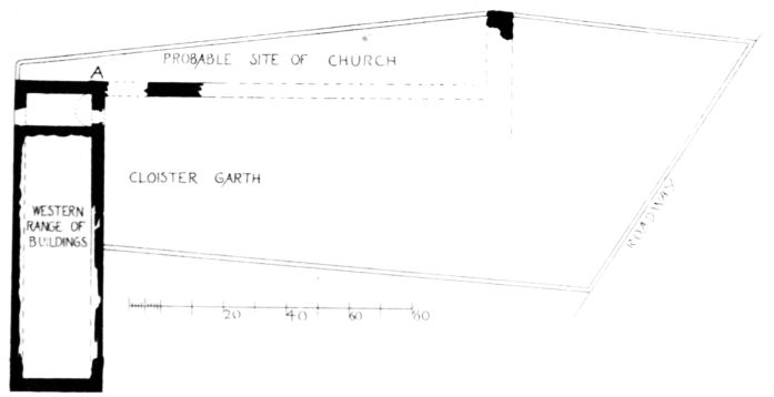
Fig. 1464.—Inchaffray Abbey. Plan.
Scotland, it was “endowed with many privileges and immunities by David and Alexander, Kings of Scotland,” but its principal benefactors were the family of the Earls of Stratherne, Earl Robert, the son (1223 and 1231) of Gilbert being particularly liberal.
Only one of the abbots, Abbot Maurice, has obtained any popular recognition in history. He it was who blessed the Scottish army at Bannockburn in 1314. Five years afterwards he was promoted to the See of Dunblane, within which diocese Inchaffray is situated.
The first head of the house was Malis, a religious hermit, in whose piety and discretion Earl Gilbert and Matildis had full confidence. At the Reformation Inchaffray suffered the usual fate. Alexander Gordon, brother of George, fourth Earl of Huntly, was made commendator in 1553. Five years later he was promoted to the See of Galloway, and shortly afterwards he was accused, by the General Assembly, of neglecting his duties, and in particular, that he had resigned Inchaffray in favour of a young child, and set divers lands in feu in prejudice of the kirk. The young child was James Drummond, son of David, Lord Drummond of Innerpeffray, in whose favour the abbey was erected into a temporal lordship.
The ruins of the abbey are situated on ground which rises slightly above the surface of the valley. This valley in ancient times was a great
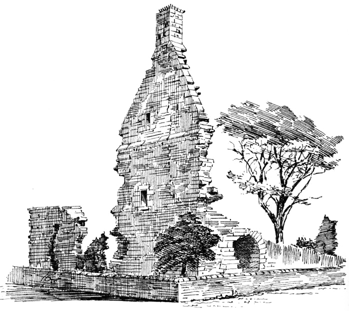
Fig. 1465.—Inchaffray Abbey. Exterior of North Gable.
marsh extending for many miles, and it was from this feature of its situation that the abbey received the name by which it was very generally known throughout the middle ages, of “Insula Missarum,” or Isle of Masses. As early as the year 1218 the monks had reclaimed a portion of this marsh, and they doubtless continued their labours; but it was not till 1696 that an Act was obtained, under the authority of Parliament, for dealing effectively with it.[206]
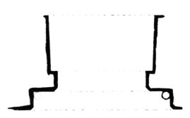
Fig. 1466.—Inchaffray Abbey.
Plan of Doorway.
The fields around the abbey are now all cultivated, and the ruins are enclosed with stone dykes, as shown by double lines on the Plan (Fig. 1464); so that the few fragments which remain are now properly protected. Within the dykes almost nothing is visible but a dense mass of trees and brushwood, with mounds of ruins in the utmost confusion. A gable at the north-west corner stands entire (Fig. 1465), with a round-arched vault adjoining, about 21 feet long by 10 feet 6 inches wide and 10 feet high. This is one of the
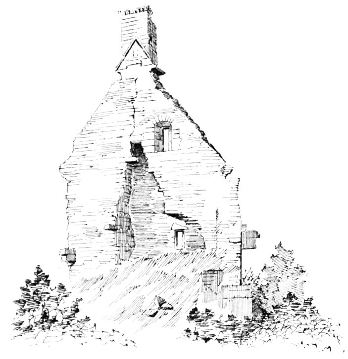
Fig. 1467.—Inchaffray Abbey. Interior of North Gable.
cellars of the western range of buildings. The walls of this range are fairly entire along their whole length for a height of 7 or 8 feet. The south end wall is also standing for about the same height. The length of this range from north to south is about 97 feet 7 inches. It is probable that the adjoining cellar to the south is entire, but the place is so covered with vegetation that little can be ascertained. The doorway entering from the cloister to the north-west cellar is undoubtedly of an early date. Not much of it remains, but enough to enable the Plan (Fig. 1466) to be made. The nook shaft, a fragment of the capital of which exists, is not later than the beginning of the thirteenth century.
The high gable adjoining (Fig. 1467) is certainly in part at least of a later date; the upper part and the chimney, with its corbelled cope, being of the sixteenth or seventeenth century. On the first floor there has been a large fireplace, the flue of which is still partly visible (see Fig. 1467). A part of the north wall of the cloister stands near the gable. This was part of the south wall of the church (see Plan), and the greater portion of the church would thus be situated outside the present enclosing dyke on the north side.
There are indications at the north-east corner of the surviving gable (at A on Plan) of a wall having extended northwards, which was probably the west wall of the church. At the junction of the south wall of the church and the wall of the western range, and at the height of about 15 feet above the ground, there still exists the corner corbel for supporting the roof of the cloister walk. We can remember when there were other corbels along the church wall also, but they have now disappeared. The part of this wall now standing is in a very precarious state. It evidently extended eastwards for about 120 feet, when it met a cross wall, now represented by a mass of rough masonry about 7 or 8 feet square (see Plan). This mass may represent one of the great piers of a central tower. There are other pieces of masonry throughout the enclosure with numerous trenches and mounds, but, owing to the rank vegetation, it is impossible to make a more satisfactory Plan than the one now given. If the place were cleared out and a judicious search made, considerable remains would doubtless be found.
The average length of the enclosure as it now stands is about 210 feet.