THE BOOK OF NATIONS Geographical, Historical, Descriptive (continued 14)
Reading edition
Christian Constantinople, on the north side of the Golden Horn, comprises Galata, Pera, and Tophâna. Galata is pre-eminently the merchant quarter, founded by a colony of Genoese merchants in 1216. The Tower of Galata, a Genoese erection, serves the same purpose as the Seraskier’s Tower on the opposite side in giving alarms of fires. A tunnelled railway drags passengers up the steep ascent to Pera.
Pera is the aristocratic quarter; here are all the embassies and consulates. The steep and badly paved Grande Rue is lined with fair if expensive shops, and has an opera house, many cafés and restaurants, besides most of the principal hotels. Turks preponderate at Tophâna, which is so named from its cannon foundry.
The magnificent palace of Dolmabagché is on the brink of the Bosphorus. Other suburbs are Kâsim Pasha, on the Golden Horn, the seat of the admiralty; Hasköi, and the picturesque village of Eyyûb.
Along the European shore of the Bosphorus are the summer resorts of Therapia and Biyukderé.
The Asiatic shore is also lined with settlements from Scutari to Candili. The new palace of Yildiz Köshki stands at the top of the hill of Beshiktâsh, beyond Pera.
The commerce of Constantinople is increasing rapidly, though most of it is in the hands of foreigners, especially of Greek and Armenian merchants. Exports are chiefly cereals, carpets, silk, wool, hides, and all kinds of refuse and waste materials such as horns, hoofs, skins, bones, old iron, etc. Several hundreds of tons of the sweetmeat known as “Turkish delight” are also sent yearly to countries of Europe and America.
The manufactures have all taken their rise during the last twenty years or so, and even now only that of cloth making has made much headway.
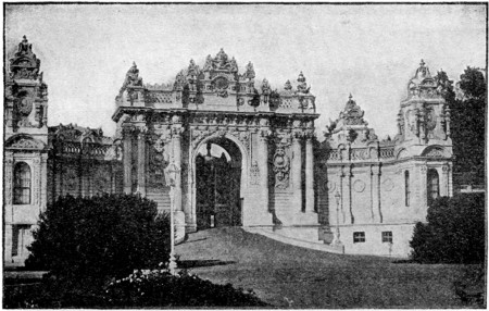
ENTRANCE TO DOLMA-BAGTCHE PALACE
This palace, on the shore of the Bosphorus, was built and inhabited by Abdul-Medjid (1839-1861), is beautifully decorated in the interior and has a splendid throne room.
History.—The Osmanlis or Ottoman Turks sprang from a small clan of the Oghuz, who assisted the Seljûk sultan of Iconium, early in the thirteenth century, to resist the Mongol avalanche.
In the fourteenth century, the Turks under Osmân or Othmân conquered the Seljûk kingdom, and became known as Osmânlis or Ottomans. By 1336 they pushed their way to the Hellespont; under Murâd I. (Amurath) they occupied Adrianople and Philippopolis, received homage from the kings of Servia and Bulgaria, and practically held all the Balkan peninsula except Constantinople, which, after much fighting, fell before Mohammed II. in 1453. In the same century they conquered Albania, Greece, and the Crimea; and in the sixteenth century Syria, Egypt, Tunis, Hungary, and South Russia, and had wars with the Russians, Persians, and Venetians.
Their star began to decline in the seventeenth century; in 1682 they were driven back from Vienna, and lost Hungary, Transylvania, and Podolia. In the eighteenth century the Russians were their most successful enemies, wresting from them the territories from the Dniester to the Caspian. Greece attained independence in 1828, though Egypt failed to throw off its allegiance. The Crimean war (1854-1857) was fought in aid of the Turks against the Russians.
The next great crisis was the Russian war of 1877-1878. The worst Armenian massacres were in 1895-1896. Turkey held her own against Greece in 1897.
Abdul Hamid was deposed and constitutional government nominally established in 1908. But unrest and intrigue still prevent settled conditions.
Until the disastrous war of 1912-1913 with the States of the Balkan League (Bulgaria, Greece, Servia, and Montenegro) the European dominions of Turkey extended westwards to the Adriatic and northwards to Bosnia-Herzegovina (Austria). Under the Treaty of London in 1913 the northwest portion of Turkey was a line drawn from Enos, in the Ægean, to Midia, in the Black Sea, thus excluding Adrianople, which had capitulated to the Bulgarians after a prolonged siege.
During the second Balkan war (Bulgaria against the other members of the Balkan States) Turkey took advantage of the military difficulties of Bulgaria and reoccupied Adrianople, thus recovering a considerable portion of the province of that name. In 1911-1912 Turkey lost the remaining portion of her African possessions through the occupation by Italy of Tripoli and Cyrenaica, which were ceded under the Treaty of Ouchy(1912).
Turkey joined forces with the Austro-Germans in November, 1914, and attacked Russia and invaded Egyptian territory. Far more important than any of the Turkish operations, however, was the attempt of England and France, in 1915, to force the passage of the Dardanelles, so as to take much needed supplies of arms and ammunition to Russia and in turn enable her to export the enormous stocks of wheat which had piled up at her Black Sea ports.
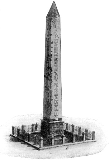
EGYPTIAN OBELISK, CONSTANTINOPLE
This Obelisk from Thebes, of rose colored granite, sixty feet high, was transported hither by Theodosius the Great, A. D. 390-395, and shows traces of bas-reliefs of that date, and Egyptian hieroglyphs thirty centuries old.
A combined English and French fleet, therefore, attempted to force the passage of the Dardanelles, battering at the Turkish forts from February 21 to March 18, when they attempted to force the Narrows, but were repulsed, with the loss of the British battleships Irresistible and Ocean, and the French battleships Bouvet and Gaulois, in addition to serious injury to a number of other warships engaged.
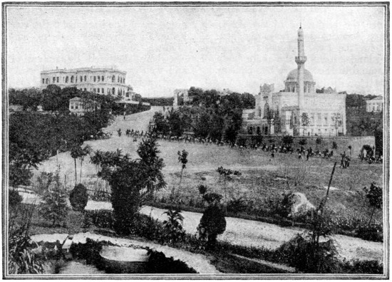
YILDIZ PALACE AND THE BEAUTIFUL HAMIDIEH MOSQUE,
in the Beshiktash suburb, some distance north of Galata. The present Sultan resides in the Palace of Yildiz.
A joint land and sea expedition was subsequently sent to accomplish what the fleets had failed to achieve.
The most desperate fighting continued there from the beginning of May. The allies employed British and French regulars—the famous Foreign Legion of France, British colonials from Australia and New Zealand, and troops from Egypt, the Soudan and North Africa—but they failed to capture the summits of the hills that command the Narrows and the great Turkish forts.
The land forces had the constant support of British and French fleets, which engaged the defenses at close range.
On May 11 the British battleship Goliath was sunk, and two weeks later a German submarine made its way through the straits of Gibraltar, succeeded in torpedoing the British battleship Triumph and the Majestic and Agamemnon.
On January 9, 1916, the British and French forces entirely withdrew from the Gallipoli Peninsula, and the attempt to force the Dardanelles was abandoned.
Internal Communications.—The railways of Turkey have made great strides in recent years. Constantinople is now in direct communication with Salonica and Monastir by means of a coastal line, and with Sophia, Nisch, and Belgrade, by means of a line passing up the Maritza Valley, through Adrianople and Philipopolis, and thence over a pass between the Balkans and Rhodope Mountains. Salonica is further united with Uskub and Mitrevitza.
The postal and telegraphic services are a long way behind those of other European countries, and foreign nations still find it necessary to maintain their own post-offices in the large towns and ports.
Bagdad Railroad.—The most important step in the industrial progress of Turkey in modern times is the concession for the construction of the Bagdad Railroad, which, when completed, will connect the Mediterranean with the Persian Gulf.
By a provisional convention, preference was given to a German company in 1903. England had a particular interest in the proposed scheme, as the line suggested would provide a short route to India; accordingly, in 1903, the British government objected to the railway being placed under German control, and discussion followed with a view to putting the line under international control. By the agreement of 1903 it was decided the German group should control forty per cent of the capital, the French, through the Imperial Ottoman Bank, thirty per cent, the Austrian, Italian, Swiss, and Turkish twenty per cent, and the Anatolian Railway ten per cent. In 1904, one hundred and twenty-four miles of the line were completed, from Konieh, through Eregli, to Bugurlu. In 1908 sanction was given to extend the line eastwards from Bugurlu across the Taurus to Adana.
The total length of the line will be one thousand five hundred and fifty miles and will run through Aintab and Berejik to Mosul, thence along the right bank of the Tigris to Bagdad.
THE CONTINENT OF NORTH AMERICA
Since the beginning of the sixteenth century America has been the general name for the two continents and adjacent islands, forming the main body of land found in the western hemisphere.
Position and Extent.—North America forms the northern section of the “New World” discovered by Columbus. It is separated from Europe by a sea nine hundred and thirty miles broad, from Asia by Bering Strait sixty miles across, and extends from the Arctic Ocean nearly to the equator.
The main mass is triangular in shape, and its outline varied by large peninsulas, broad gulfs and numerous inlets. Development of coast-line, twenty-eight thousand one hundred and thirty miles. Length, four thousand five hundred miles; breadth, three thousand one hundred miles. The area of the continental mainland is estimated at seven million one hundred and forty-six thousand six hundred and forty-one square miles; the entire area, including Greenland, the Arctic Archipelago, the West Indies, Newfoundland, and other islands, at over nine million square miles.
Islands.—It is customary to regard Greenland as a part of America, while the adjacent island of Iceland, though partially in the western hemisphere, is usually associated with Europe. The other principal American islands in the Atlantic are Newfoundland, Cape Breton, Anticosti, Prince Edward Island, Long Island, the Bermudas, the Antilles or West Indies, Joannes, Staten Island and South Georgia.
In the Pacific are the Aleutian Islands, Kadiak, the Alexander and Queen Charlotte groups, Vancouver and other British-Columbian Islands, the Santa Barbara group, Bevilla-Gigedo, the Pearl Islands, and others in the Gulf of Panama, the Galápagos, Juan Fernandez and the associated islets, Chiloe and the Chonos Archipelago. In the Arctic Ocean there are many large but unimportant islands. (See Map of Comparative Size of Islands and Table of Areas.)
Coast-line.—The coast-line of North America on the west is almost everywhere high and rocky. To the south of Puget Sound good harbors are rare, but British Columbia and Alaska have great numbers of good seaports, the coast-line being, in many places, deeply cut with high-walled fjords, or “canals,” and elsewhere sheltered by ranges of high and well-wooded islands. The Atlantic coast, north of New York Bay, is generally rocky and well sheltered with islands, and has abundance of good natural harbors; but south of the parallel of New York the coast of the mainland is almost everywhere low and sandy. Many of the best ports are formed by river-mouths, and have sandbars across their entrances. Nowhere else in the world is there any such extent of low and sandy coast as on the Atlantic and Gulf seaboards of the United States.
Surface.—The western mountain-system of North America comprises a very great number of minor ranges, mostly having a north and south direction. The main chain (Sierra Madre) cannot be said to preserve an unmistakable identity throughout. The Coast Range, the Sierra Nevada, and the Cascade Mountains are the most noted of the western parallel ranges; they all lie on the Pacific slope, and contain some of the highest of North American peaks. The elevated plateau called the Great Basin (chiefly in Utah and Nevada), contains the Great Salt Lake and several smaller bodies of strongly saline water, evidently the remains of a much larger lake which once sent its waters to the sea. The eastern or great Appalachian mountain-system has a general direction nearly parallel with the Atlantic coast-line.
North of the St. Lawrence River is seen the vast and complicated Laurentian mountain-system, which extends from the Atlantic westward to near Lake Superior.
The highest summits are Mt. McKinley, in the north; Mt. Harvard, in the Rocky mountains; Mt. Whitney, in the Sierra Nevadas; and Mt. Popocatepetl or Peak of Orizaba, in Mexico. (See Tables of Mountain Peaks.)
Rivers and Lakes.—In the Rocky Mountain region of Canada, the great rivers, Yukon, Fraser, Columbia, Saskatchewan, and Mackenzie, take their rise. Between these mountains and Hudson Bay, a girdle of vast lakes, or inland seas (Great Bear, Great Slave, Athabasca, Deer Lake, Winnipeg, and others), form a regular succession running from the Arctic Circle to Lake Superior, the first of a wonderful chain of great sea-like expansions of the Upper St. Lawrence (the others being Michigan, Huron, Erie and Ontario). North of the St. Lawrence system almost the whole country is thickly studded with lakes, which, with their connecting streams, form a network of important waterways traversable by canoes and boats.
The Atlantic slope of the United States is well supplied with water, and many of its streams afford extensive navigation. The Hudson is noted for its fine scenery; the Potomac is one of the noblest of American rivers; and important streams flowing to the Atlantic are the St. John, the Penobscot, the Kennebec, the Merrimac, the Connecticut, the Delaware, the Susquehanna, the James, and the St. John’s, nearly all navigable in their lower courses.
The chief rivers flowing to the Gulf of Mexico are the Appalachicola, the Mobile, the Pearl, the great Mississippi, the Sabine, the Trinity, the Brazos, the Colorado of Texas and the Rio Grande.
Of the many large Alaskan rivers the principal are the Yukon and the Kuskoquim. The Fraser is a swift and strong river; the great river Columbia is noted alike for its navigation, its salmon fisheries, and its enormous cataracts. The Rio Colorado, whose waters flow to the Gulf of California, traverses a desert plateau. Here nearly every watercourse runs in a deep-walled cañon, a narrow valley with precipitous sides, often of prodigious height.
In the plateau of Central America the largest lake is that of Nicaragua, nearly equal to Ontario in extent, and only one hundred and thirty-one feet above the level of the sea. (See further under the respective countries of North America.)
Climate.—Largely determined by the direction of the mountain ranges. Five climatic regions, viz., an arctic region, whose mean temperature is less than thirty-two degrees Fahrenheit; an Atlantic temperate region, extending as far as the Mississippi, with abundant rains and dense woods; an inland temperate region, dry, with steppes or prairies; a Pacific coast region, and a tropical region.
Political Divisions.—The political divisions of North America are:
(1) Danish America,[8] which includes Greenland and three small islands of the Virgin group in the West Indies.
(2) British North America, in which division we may place the Dominion of Canada, Newfoundland, Labrador, the Bermudas, the numerous British West Indian islands, and British Honduras.
(3) The United States, including the detached territory of Alaska.
(4) Mexico.
(5) The Central American republics of Honduras, Guatemala, Salvador, Nicaragua, and Costa Rica, together with Panama—unless its southern part be regarded as belonging to the South American continent.
(6) The West Indian republics of Hayti and San Domingo.
(7) The Dutch West Indies.
(See the articles on the separate states and colonies.)
THE UNITED STATES
The republic of the United States is by far the most populous, wealthy, and progressive country of all the New World.
Location and Extent.—It occupies the most valuable portion of the North American continent, the whole of it (with the exception of the territory of Alaska) lying within the temperate zone, between Canada on the north and Mexico on the south, and reaching across from the Atlantic to the Pacific Ocean.
Its boundary toward the Canadian Dominion passes through the Haro, or northern channel of the Strait of San Juan de Fuca, south of Vancouver Island, and thence along the forty-ninth parallel of latitude to Lake Superior; then midway through the center of the Great Lakes to the St. Lawrence, and down that river to the forty-fifth parallel, and an irregular boundary which separates New Brunswick from the States of New York and Maine, terminating at Passamaquoddy Bay.
In the south, the Mexican frontier runs from the Pacific coast, northward of the peninsula of California, to the Rio Grande del Norte, which it follows to the Gulf of Mexico.
From Atlantic to Pacific, the breadth of the United States is not less than twenty-five hundred miles; and from north to south the country extends nearly seventeen hundred miles.
Surface.—The surface of the United States from east to west may be divided as follows: (1) The Atlantic Plain, which extends from the coast to the Allegheny Mountains. (2) The Mississippi Valley and Great Central Plain, which extends from the Allegheny Mountains west to the Rocky Mountains. (3) The Western Highlands. (4) The Pacific slope, which extends from the Rocky Mountains to the Pacific Ocean.
Mountains and Plains.—The chief mountain systems are the Appalachian region in the east and the Rocky Mountains in the west.
The Appalachian System begins in the northern part of New England (in Maine without the appearance of regular ranges) and New York, and extends southwestward to Alabama and Georgia, being divided by the Hudson River valley and Lake Champlain, and that of the Mohawk River into three distinct sections.
A coast-plain extends from its eastern base to the Atlantic. It is narrow in Maine, where it terminates in a bold rocky coast indented by bays, and broken into projecting promontories and islands. South of Massachusetts the coast becomes lower and more sandy, and the plain grows gradually wider, with the exception of a narrow belt at New York, until in North Carolina it attains a width of two hundred miles.
In the southern part of New England it is characterized by hills, and below New York by a distinct coast region and a more elevated slope. This higher region, which is in Virginia and thence southward, is marked by a somewhat abrupt terrace, varies in altitude from a few hundred to more than a thousand feet, and is known as the Piedmont plateau. The lower coast region is seldom more than one hundred feet above the sea. It has a sandy soil, and in many places there are large swamps near the coast. Much of this swampy country is uninhabitable, but when reclaimed, as it has been in many parts of North and South Carolina, it makes valuable rice-land. Many acres of fertile agricultural land have also been secured in Florida by draining its swamps. The middle elevated region is diversified by hills and valleys, and has a productive soil. The dividing line between it and the low coast-plain marks the head of navigation of most of the streams, and also determines the sites of many important towns.
The surface of this region today is a series of parallel ranges divided by fertile valleys. The various ridges are named as follows: The Blue Ridge, which lies nearest the Atlantic; the Kittatinny Chain; the Allegheny Mountains, which lie in the western part of Virginia and the central part of Pennsylvania; the Cumberland Mountains, on the eastern boundary of Tennessee and Kentucky; the Catskill Mountains, in the State of New York, which are continued in the Sacondago Chain; the Green Mountains, in the State of Vermont; the Hudson River Highlands, and the hills of New Hampshire. There is no peak of marked elevation in the Appalachian region, the highest point being Mt. Washington, in New Hampshire, which reaches a height of nearly seven thousand feet.
Great Central Plain.—West of the Appalachian system and lying between it and the western highland is a great central valley, forming part of the continental depression which extends from the Arctic Ocean to the Gulf of Mexico. It is almost an absolute plain, rising gradually from the Gulf toward the chain of Great Lakes in the north, and toward the mountains on the east and west. The only important departure from its uniform level character is an elevation of from five hundred to two thousand feet, running from southern Missouri through northwestern Arkansas into eastern Oklahoma, and known as the Ozark Mountains.
This great valley occupies about one-half the entire area of the United States, and the fertile prairies and bottom-lands of the eastern and central portions make it the most important agricultural basin of the globe. From an irregular line west of the Mississippi River the land rises in an almost imperceptible slope till it reaches the base of the western plateau.
The Rocky Mountain System extends a distance of about two thousand miles. The system is continued in Canada. The Rocky Mountains are not a single range, but are double and sometimes threefold. These ranges are the edge of a region of plateaus and hills which extends to the coastal mountains. The chief mountain ranges belonging to the United States Rockies are the Bitter Root Mountains, the Blue Mountains, and the Big Horn Mountains in the north; the Wahsatch Mountains, the Wind River Mountains, and the White Mountains in the center; and the Sierra Madre and the Sangra de Cristo Range in the south. In the western part of the southern Rockies lies the Great Basin of Colorado, with the Wahsatch Mountains on the east and the Sierra Nevada on the west. This basin is extremely arid, has suffered much volcanic action.
The Western or Pacific System forms a part of the vast elevation which extends from the northern to the southern extremity of the western continent. In the United States it is a great plateau of four thousand to ten thousand feet surmounted by a complex system of ranges, in its widest part more than one thousand miles broad. Of this Cordilleran region the Rocky Mountains form the eastern and the Sierra Nevada and Cascade Mountains and the Coast Ranges the western border.
In the ranges of central Colorado alone nearly forty of the summits have an altitude of more than fourteen thousand feet. In the Wind River Mountains, in Wyoming, are the head-waters of the Colorado, the Columbia, and the Mississippi, the three great river-systems of the United States; and in the northwestern corner of the same state is situated the National Park, famous for its hot springs and geysers as well as for its magnificent scenery (see Yellowstone).
Between the Wahsatch Range and the lofty masses of mountains in Colorado is a region of peculiar interest, consisting of level plateaus in which the changes of elevation from one plain to another are marked by abrupt descents and steep cliffs. It is furrowed by cañons or gorges, whose sides are nearly vertical; and the bed of the Colorado is in some places more than a mile and a quarter below the surface of the plateau. (See Grand Cañon under Colorado River.)
Between the Wahsatch Range and the Sierra Nevada lies the Great Basin, an immense tract having at best but little rainfall, except upon the summits of the ranges by which it is traversed, and none of whose waters are drained to either ocean. The saline swamps, salt lakes, and sinks of Nevada indicate the former location of one of these lakes; Great Salt Lake is all that now remains of the other.
The Sierra Nevada and the Cascade Range are topographically continuous, and constitute a great mountain-wall, which so far as the height of the peaks and the grandeur of the scenery are concerned, is one of the most striking portions of the Cordilleran system. Most of the peaks of the Sierras are, however, of granite and metamorphic rock, while those of the Cascade Range are volcanic. The greatest altitude is attained with Mt. Whitney as the culminating point. The lofty character of the range is maintained throughout the greater part of California, and the sublimity of the scenery is justly celebrated. (See Yosemite Valley.)
From this point there extends northward one of the most remarkable groups of extinct or faintly active volcanoes to be found anywhere in the world: the lava overflows in this region cover an area of above two hundred thousand square miles. The most prominent peaks are Mt. Shasta, in California, and Mt. Rainier, in Washington. In three separate places rivers have cut a passage through the volcanic portion of the range. The most notable is the passage of the Columbia River in a grand cañon more than three thousand feet in depth.
The Coast Ranges of Washington, Oregon, and northern California consist of numerous and approximately parallel chains, which as a rule pitch off abruptly toward the sea, leaving no coast-plain. Between the Coast Ranges and the Sierra Nevada and Cascade Range is a series of broad valleys, occupied mainly in Oregon by the Willamette River, and in California by the Sacramento and San Joaquin. In southern California the mountains of the Coast Ranges diminish in height, but throughout their whole extent they are interspersed with picturesque and fertile valleys.
Coast.—The Atlantic coast has a length of about twelve thousand three hundred and sixty miles; the Gulf Coast of five thousand seven hundred and fifty miles, and the Pacific Coast of three thousand two hundred and fifty miles.
On the coast of the New England states there are many indentations which, though small, furnish commodious harbors. Long Island Sound adds greatly to the commercial importance of New York harbor, and farther south are Delaware and Chesapeake Bays; Albemarle and Pamlico sounds, and several small indentations, such as those which form the harbors of Charleston and Savannah. The Chesapeake Bay is the largest indentation of the Atlantic Coast and runs inland in a northward direction for more than one hundred and eighty miles, with an average breadth of about fifteen miles. From Cape Hatteras to Cape Sable, however, the coast is swampy, and, especially in Florida, fringed with lagoons. The harbors of this part of the coast are not good naturally. The coast of the Gulf of Mexico is low and very swampy, but is of special climatic and commercial importance.
The Pacific Coast of the United States has a very narrow Continental Shelf, and few bays or capes. With the exception of Puget Sound, the Bay of San Francisco, and the harbor of San Diego, there is scarcely a noticeable break in the continuity of the coast line.
Islands.—There are many small rocky islands along the coast of Maine, and on the southern New England Coast is a group to which belongs Long Island, the largest of the islands of the United States. Farther south, off the Atlantic Coast, and also in portions of the Gulf of Mexico, are many low sand-spits lying parallel to the coast and having behind them shallow channels, lagoons and swamps. On the Pacific Coast there are no islands of importance except the Santa Barbara group off the southern coast of California.
Rivers.—The rivers of the Atlantic Plain rise in the Appalachian system, and are comparatively short. In many cases they are too rapid to be of much value for navigation, but are valuable for supplying water power. These rivers almost without exception have good harbors at their mouths. The chief are: the Hudson, the Delaware, the Susquehanna, the Potomac, the James, and the Savannah.
The Great Central Plain is drained by the Mississippi-Missouri river system, the basin of which covers half the area of the United States, and is equal in area to about one-third the area of Europe.
The Mississippi rises in Lake Itasca, in Minnesota, at about fifteen hundred feet above sea-level. After flowing for about one hundred miles in an easterly direction it turns south, and is joined by numerous tributaries. The chief are: St. Peter’s River, which joins the main stream nine miles above St. Anthony’s Falls; the Missouri, which enters the Mississippi just above St. Louis; the Ohio, which joins the main river at Cairo; the Arkansas, the Wisconsin, the Illinois, and the Red River.
The Mississippi-Missouri has made a broad flood plain, varying in width from thirty to sixty miles. This plain is subject to severe inundations, for it slopes very gently away from the river bed, which is in many parts of the river above the level of the surrounding plain. The river carries a vast amount of silt, which it deposits at its mouth, thus forming a delta which stretches a series of long, narrow, tentacle-like arms seaward.
Other rivers falling into the Gulf of Mexico are the Mobile and the Rio Grande. The Mobile, which enters the gulf at the town of Mobile, is the union of the Alabama and the Tombigbee. The Rio Grande forms the boundary between Texas and Mexico.
The rivers flowing into the Pacific are comparatively short, owing to the nearness of the coast ranges to the sea. The Colorado River flows into the Gulf of California, after crossing an arid plateau. (See description below.)
The San Joaquin and the Sacramento rivers unite and flow into the harbor of San Francisco; these and the Columbia are the only important rivers entering the Pacific.
The Great Basin of California is largely an area of inland drainage. The rivers flow into lakes with no outlets to the sea.
Colorado River (Spanish for “red” or “reddish”), is a remarkable river formed by the union of the Grand and Green Rivers, and flowing through the great plateau region. Below the junction of the Green and Grand, the main affluent in Utah is the San Juan, which drains an interesting region in the southwest of Colorado and the northwest of New Mexico. In Arizona the main affluents are the Colorado Chiquito or Flax River, the Bill Williams, and the Rio Gila, all from the left. The only important affluent the Colorado receives from the right is the Rio Virgen. From the junction of the Grand and Green the general course of the stream is to the southwest through the southern part of Utah and northwestern Arizona; and it afterwards separates Arizona from Nevada and California. The lower part of its course is in Mexican territory, where it flows into the northern extremity of the Gulf of California.
The most striking features of the Colorado basin are its dryness, and the deeply channeled surface of the greater part of the country. Almost every stream and watercourse, and most of all the Colorado itself, has cut its way through stratum after stratum of rock, until now it flows in a great part of its course, at the bottom of a deep trench or cañon.
The Grand Cañon.—The main stream, for nearly four hundred miles below the mouth of the Colorado Chiquito, thus makes its way through a great plateau, forming what is called the Grand Cañon of the Colorado, the most extensive and marvelous example of the kind anywhere known.
Throughout the upper part of the great cañon the walls are from four thousand to seven thousand feet in height, and are often nearly perpendicular. Frequently they are terraced and carved into a myriad of pinnacles and towers, tinted with various brilliant colors. At some points the walls on either side rise sheer from the water; at others there is a talus of fallen rock, or occasionally a strip of fertile soil, on one or both banks. There are two main trails by which the bottom of the cañon may be reached. The Bright Angel Trail is seven miles down from the rim to the river and requires three hours for the descent. The Grand View Trail is somewhat longer and more difficult.
This over-drained river basin has an area of two hundred and twenty-five thousand square miles. The whole course of the river below the junction is about nine hundred miles; to its remotest sources it is over two thousand miles. Navigation is possible for light-draft steamers for over six hundred miles. The river is subject to vast and frequent changes of volume, and except where confined by cañon-walls, the river channel shifts to and fro in a very remarkable degree.
Hudson River, one of the most beautiful and important in America, rises in the Adirondack Mountains, four thousand three hundred and twenty-six feet above the level of the sea, where its head-streams are the outlets of many mountain-lakes. At Glens Falls it has a fall of fifty feet, and soon after, taking a southerly course, runs nearly in a straight line to its mouth, at New York City. It is tidal up to Troy, one hundred and fifty-one miles from its mouth, and magnificent steamboats ply daily between New York and Albany.
Below Newburg, sixty miles from New York, the river enters the highlands, which rise abruptly from the water to the height of sixteen hundred feet. Here historical associations add to the interest of varied scenery of singular beauty and grandeur: here was the scene of Arnold’s treason and of André’s fate; and at West Point, the seat of the United States military academy, eight miles below Newburg, are the ruins of Fort Putnam, built during the War of Independence.
Emerging from the highlands the river widens into a broad expanse called Tappan Bay, which is four and one-half miles wide and thirteen miles long. Below, on the right bank, a steep wall of trap rock, called the Palisades, rises from the river’s brink to a height of three hundred to five hundred and ten feet, and extends for nearly twenty miles to the upper portion of the city of New York.
The river from here is known as the North River, and is from one to two miles wide; and after passing between New York and Hoboken and Jersey City, it falls into New York Bay. Its whole length is about three hundred and fifty miles, and its principal tributaries are the Sacondaga, Mohawk, and Walkill.
The Hudson has valuable shad and sturgeon fisheries, and has large commercial value. It is connected by the Erie Canal with Buffalo and the Great Lakes, while the Richelieu Canal connects it with Montreal. The Hudson River Railroad, connecting New York with Albany, runs along the east bank.
The river is named for the English navigator who explored it in 1609. Robert Fulton’s first successful experiment in steamboat navigation was made on this river in 1807.
The St. Lawrence, issuing from Lake Ontario, flows northeast for some seven hundred and fifty miles—part of the way forming the boundary between Canada and the United States—and falls into the Gulf of St. Lawrence by a broad estuary. But in its widest acceptation the name includes the whole system of the Great Lakes and their connecting streams, with a total length from source to mouth of two thousand miles, and a drainage basin of five hundred and sixty-five thousand two hundred square miles. It pours more fresh water into the ocean than any other river except the Amazon.
This mighty artery rises, under the name of the St. Louis, on the spacious plateau which sends forth also the Mississippi toward the Gulf of Mexico, and the Red River of the North toward Hudson Bay. Lake Superior (six hundred and two feet above sea-level), the next link in the chain, finds its way to Lake Huron through St. Mary’s River, whose rapids have a fall of twenty and one-half feet. Below Lake Huron, which receives Lake Michigan from the south, St. Clair River, Lake St. Clair, Detroit River, and Lake Erie, maintain pretty nearly the same level (there is a fall of some eight feet, however, in Detroit River) till the river Niagara descends three hundred and twenty-six feet to Lake Ontario, which is itself still two hundred and forty-seven feet above the sea-level.
The St. Lawrence proper, with a number of lakelike expansions (such as the Lake of the Thousand Isles, of St. Francis, St. Peter, etc.), presents the character first of a river, and then of an estuary, down to the gulf. What is known as the Lake of the Thousand Islands contains about seventeen hundred islands, big and little, many of them extremely picturesque. This is a famous tourist region, with numerous hotels and other resorts as well as many fine private estates.
Prior to 1858 only vessels drawing not more than eleven feet of water could pass up the river above Quebec, but since then a channel has been made in the shallow parts of the river, three hundred feet wide and twenty-seven and one-quarter deep, which permits the passage up to Montreal of large vessels.
Between Lake Ontario and Montreal there are several rapids, which, however, may be all avoided by means of canals that have been constructed at a very great expense. Immediately above the island of Montreal, the St. Lawrence is joined by its principal auxiliary, the Ottawa, from the northwest; and a little more than half-way between this confluence and Three Rivers, the highest point of tidal influence, the Richelieu from the south brings in the tribute of Lake Champlain. Other principal tributaries are the St. Maurice, the Saguenay, and the Batiscan. The width of the St. Lawrence varies from less than one to four miles; the estuary at its mouth is above one hundred miles across. During winter the river is frozen over and navigation closed.
Lakes.—Of the Great Lakes of North America, Lake Michigan lies within the United States, and the southern shores of Lake Ontario, Lake Erie, Lake Huron, and Lake Superior are United States territory. These lakes were formed by the action of the glacier which once covered the continent as far south as the forty-second parallel, roughly speaking. They are remainders of much larger lakes and are of the utmost importance as waterways.
New England has very many smaller lakes, which are also the result of glacial action. The largest lake of the United States apart from the Great Lakes is the Great Salt Lake of Utah. The extremely low rainfall of this region and the intense evaporation consequent upon the high temperature are responsible for the salinity of the waters of the lake.
The Great Lakes.—The five Great Lakes cover a total area of over ninety thousand square miles, forming the largest collective mass of fresh water in the world.
Lake Superior.—The northern shores of Superior are mostly precipitous cliffs ranging from three hundred to one thousand feet in height. On the southeast sandy coasts prevail. The coast on the south and southwest is composed largely of sandstone cliffs, rich in iron and other metal deposits. The bed of Superior is supposed to be an ancient volcanic crater. Its depth of one thousand and eight feet represents a depression extending four hundred feet below sea-level. Superior is, therefore, distinct in origin from the other lakes of the group, whose beds represent ancient river systems and date from the glacial period. The basin of the lake, closely circumscribed by the Mississippi and Hudson Bay watersheds, receives many streams, but all of them short.
Lake Huron, the second of the Great Lakes, is bounded north, east and south by the Province of Ontario, and south and west by the State of Michigan, including Georgian Bay (five thousand six hundred and twenty-six square miles), and North Passage, one thousand five hundred and fifty-six square miles. It is connected with Lake Michigan by the Straits of Mackinac, three and one-half miles broad and one hundred and thirty-five feet deep.
The discharge of Lake Huron is about two hundred and seventeen thousand cubic feet per second. By reason of evaporation and rainfall, the level of the lake varies annually between four and five feet, but much greater local variation is caused by the strong winds. The densely wooded northeast is broken by many low islands of limestone and glacial débris. Elsewhere the shores are almost unbroken and low, except when cliffs of one hundred or one hundred and fifty feet high rise from the northeast border and afford good sites for the many Canadian towns and villages. Nearly all the harbors on this coast are protected by breakwaters.
Lake Michigan.—The area of Lake Michigan includes Green Bay on the northwestern shore, and Grand Travers Bay directly on the eastern shore. Many islands lie in the lake between these two breaks in the shore, which elsewhere is low and unbroken.
About the southern and eastern borders are immense heaps of sand which have been piled up by waves and currents, and drift inland by the winds, sometimes, as at Sleeping Bear bluffs, completely burying the heavy forests.
The level of Michigan varies, but not as greatly as does that of Huron, according to the direction and force of the winds, the changes in rainfall, evaporation, atmospheric pressure, etc. Except when caused by protracted gales blowing steadily in one direction, this variation rarely exceeds one and three-tenths feet. The lake has a lunar tide with accompanying variation of from one and one-half inches neap to about three inches spring tide, and the water is warmer than the air in winter and cooler in summer, and visibly ameliorates the climate of the shores, as may be shown in the quantity and rich quality of the Michigan fruits. Like all the Great Lakes, Michigan abounds in fish, such as whitefish and trout.
Lake Erie has a northeast and southwest direction, bounded on the entire upper shore by the Province of Ontario, and on the southern and eastern shores by Ohio, Pennsylvania and New York. At its southwestern end it is connected with Lake St. Clair by the Detroit River. At its northwestern end it discharges into Lake Ontario through the Niagara River. It is connected by the Welland Canal with Lake Ontario and by other canals with the Hudson and Ohio Rivers, making it thus a link in the waterway from east to west.
Besides the drainage from the Lake Superior system, Lake Erie receives the Grand River, the Maumee from the west, and the Sandusky and Cuyahoga from the south. The west coast is broken by the islands of Put-in-Bay.
Lake Ontario is the most eastern, with a northeast and southwest direction, like Lake Erie. It is the lowest of the Great Lakes, and has naturally the largest discharge, three hundred thousand cubic feet per second. The shores are flat, except in the Bay of Quinte, which extends on the northeast fifty miles inland. There are many harbors and flourishing ports. The waters have a surface current, due to the fact that the larger axis of the lake coincides with the direction of the prevailing westerly winds. This, added to frequent violent storms, keeps the lake from freezing, except a few miles in width along the shores.
Lake Ontario is connected with the Erie Canal and Hudson River by the Oswego Canal and with the Ottawa River by the Rideau Canal.
Great Salt Lake, in Utah, stretches along the western base of the Wahsatch Mountains, about four thousand two hundred feet above the sea, forming a principal drainage center of the Great Basin. Well-marked shore-lines on the mountains around, reaching one thousand feet higher than the present level, show that the lake had formerly a vastly greater extent; this prehistoric sea has been named Lake Bonneville. Great Salt Lake is over eighty miles long and from twenty to thirty-two broad, but for the most part exceedingly shallow. It contains several islands, the largest Antelope I., about eighteen miles long. Its tributaries are the Bear, Ogden, Jordan and Weber, the Jordan bringing the fresh waters of Lake Utah; but Great Salt Lake has no outlet save evaporation, and its clear water consequently holds at all times a considerable quantity of saline matter in solution. Several species of insects and a brine-shrimp have been found in its waters, but no fishes; large flocks of water-fowls frequent the shores.
The first mention of Great Salt Lake was by the Franciscan friar Escalante in 1776, but it was first explored and described in 1843 by Fremont.
Champlain is a beautiful lake separating the states of New York and Vermont, and penetrating, at its north end, about six miles into the Dominion of Canada. Lying ninety-one feet above sea-level, it is one hundred and ten miles long, by from one to fifteen broad, empties itself into the St. Lawrence by the Richelieu River, and has communication by canal with the Hudson. The lake, now an important trade channel, was the scene of several incidents of the French and Indian revolutionary wars; and here a British flotilla was defeated by the Americans September 11, 1814. It was discovered by Champlain in 1609, and in 1909 tercentenary celebrations of its discovery were held along its shores.
Natural Wonders.—Of the great natural wonders the chief are the Niagara Falls, the Grand Cañon of Colorado, and Yellowstone Park. The Sequoia, General Grant and Calaveras Parks—all reservations of the famous big trees, many thousands of years old, have also great scenic interest. Mt. Ranier Park, in Washington, encloses the noblest and most interesting mountain of our Pacific Coast. The chief feature of Crater Lake Park, in southern Oregon, is a lake two thousand feet deep, occupying the crater of an extinct volcano on the summit of the Cascade Range, with walls one thousand to two thousand feet high. The latest addition is Glacier Park, in northwestern Montana. It is named from its glaciers, of which there are over sixty within an area of five square miles, and contains numerous snow-capped peaks seven thousand to twelve thousand feet high. It also contains Lake McDonald, one of the most beautiful alpine lakes. Among the national monuments are the petrified forests in Arizona.
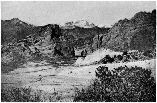
GARDEN OF THE GODS, COLORADO,
is a tract of land about five hundred acres in extent, thickly strewn with grotesque rocks and cliffs of red and white sandstone. Among the chief features are the Cathedral Spires, the Balanced Rock, etc. The Gateway of the Garden of the Gods consists of two enormous masses of bright red rock, three hundred and thirty feet high and separated just enough for the roadway to pass between.
Garden of the Gods, a region in Colorado, is noted for its view of Pike’s Peak, and its weird and grotesque rock pinnacles, needles, etc., some of which receive descriptive names such as Cathedral Spires. The region is about five hundred acres in extent, and in 1908 was presented to Colorado Springs city.
Grand Canyon.—See under Colorado River.
Mammoth Cave, in Kentucky, is eighty-five miles by railroad southwest of Louisville. The cave is about ten miles long; but it is said to require upwards of one hundred and fifty miles of traveling to explore its multitudinous avenues, chambers, grottoes, rivers and cataracts. It is the largest cavern in the world. The main cave is only four miles long, but it is from forty to three hundred feet wide, and rises in height to one hundred and twenty-five feet. Lucy’s Dome is three hundred feet high, the loftiest of the many vertical shafts that pierce through all the levels.
It is estimated that there are more than four thousand sink-holes and five hundred open caverns. Some avenues are covered with a continuous incrustation of the most beautiful crystals; stalactites and stalagmites abound.
There are several lakes or rivers connected with Green River outside the cave, rising with the river, but subsiding more slowly, so that they are generally impassible for more than six months in the year. The largest is Echo River, three-fourths of a mile long, and in some places two hundred feet wide. The air of the cave is pure; the temperature keeps at about fifty-four degrees.
Among the most striking facts which exploration has revealed are the following: there is a pit, named the Bottomless Pit, one hundred and five feet deep, besides Scylla, one hundred and thirty-five feet deep. Crevice Pit, with Klett’s Dome, which forms a part of it, is one hundred and fifty feet in total vertical measurement. Cleveland Avenue is two miles long, Silliman’s one and one-half miles and in places two hundred feet in width. Large stretches of water have been christened Dead Sea, Lake Lethe; also there are the Styx, and Roaring and Echo rivers. In the outer galleries of the cave millions of bats are congregated. There are also blind fish, crayfish, crickets, and other abnormal insect inhabitants of the cave.
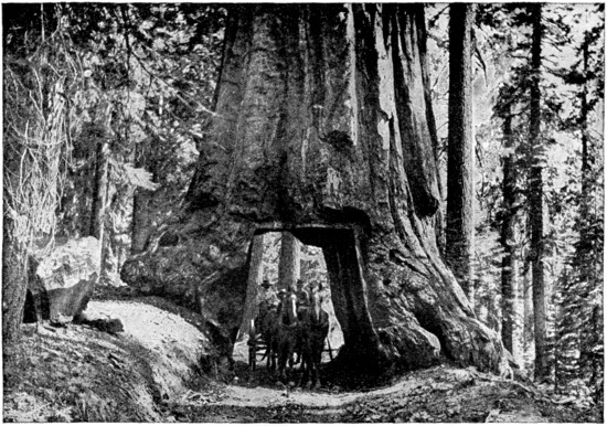
BIG TREE, CALIFORNIA
The Mariposa Grove of Big Trees (six thousand five hundred feet), so-called from its situation in Mariposa (“butterfly”) County, occupies a tract of land four square miles in area, reserved as a State Park, and consists of two distinct groves, one-half mile apart. The Lower Grove contains about two hundred and forty fine specimens of the Sequoia Gigantea, including the “Grizzly Giant,” the largest of all, with a circumference of ninety-four feet and a diameter of thirty-one feet. Its main limb, two hundred feet from the ground, is six and one-half feet in diameter. In ascending to the Upper Grove, which contains three hundred and sixty big trees, the road goes through a tunnel, ten feet high and nine and one-half feet wide (at the bottom), cut directly through the heart of a living Sequoia, twenty-seven feet in diameter. (See illustration.) About ten of the trees exceed two hundred and fifty feet in height and about twenty trees have a circumference of over sixty feet, three of these being over ninety feet. The Calaveras Grove has taller trees than any in the Mariposa Grove, but the latter has those of greatest circumference. At Santa Cruz there is a grove which contains about a score of the genuine Redwood with a diameter of ten feet and upwards. The largest is twenty-three feet across; one of the finest, named the Giant, has a circumference of seventy feet. Here is a large hollow tree in which General Fremont camped for several days in 1847. Another stump is covered with a platform, which holds twelve to fourteen people.
Niagara Falls.—See under Famous Waterfalls.
Yosemite Valley is the name of a cleft in the west slope of the Sierra Nevada, about the center of California, and one hundred and forty miles east of San Francisco. The name Yosemite is an Indian word which signifies “large grizzly bear.” This celebrated valley, noted for the sublimity and beauty of its scenery, is about six miles long and from one-half to nearly two miles in breadth, and is traversed by the Merced River. The beholder is awed and impressed by the massiveness of its mountain elevations, the nearly perpendicular granite walls, from three thousand to six thousand feet high, by which it is shut in throughout its entire length, and the grandeur of its waterfalls, which are in some respects the most remarkable in the world.
At the lower end of the valley stands the striking cliff known as El Capitan, three thousand three hundred feet high, while from near its lower corner the Virgin’s Tears Fall descends one thousand feet. But the eye turns from it to the remarkable fall opposite, happily named the Bridal Veil, which leaps from the brow of a cliff nine hundred feet high, and descends in a broad sheet of spray and finally mist, swaying in the wind and constantly changing its form of fleecy beauty. Farther up the valley are Cathedral Rock (two thousand six hundred and sixty feet), the Three Brothers (three thousand eight hundred and thirty feet), Sentinel Rock (three thousand and forty-three feet), and directly opposite it the grand Yosemite Falls. (See Famous Waterfalls.) Above the falls are the North Dome (three thousand five hundred and sixty-eight feet) and the vast Half Dome, nearly one mile (four thousand seven hundred and thirty-seven feet) high, whose summit can now be reached by a long climb. Two miles above the great falls the stream enters the main valley in two arms, coming out of two canyons. In that of the south fork is the Illilouet Fall, some six hundred feet high; in the main canyon are Vernal Fall and Nevada Fall, the latter one of the finest in the world.
(See Famous Waterfalls.)
The country surrounding the valley and constituting the National Park is a rolling and hilly region varying from eight thousand to ten thousand feet above sea-level. There is little soil or vegetation except a scattered forest growth. Small glaciers still remain near the summits of some of the adjacent mountains. Bare granite peaks rise still higher from this surface.
Yellowstone National Park comprises a tract of land originally comprising three thousand five hundred and seventy-five square miles in northwestern Wyoming, set apart by act of Congress in 1872 as a national park to preserve from destructive molestation the most wonderful group of natural features and phenomena known within the boundaries of the United States. It is readily reached over the Northern Pacific Railroad, which has a branch from Livingston to Gardiner, just outside the north park boundary, thirty-six hours’ ride from St. Paul; or it may be reached from the Oregon Short Line R. R. from the west side by a more difficult stage connection.
The whole park plateau lies between six thousand and eight thousand feet above sea-level. The mountains rise in great grandeur upon this plateau, giving evidence of their volcanic origin, though now extinct, by their form, and their rock structure, and the many evidences of pent-up heat that one sees in the hot springs and geysers for which the locality is justly famous. Twenty-four peaks rise over ten thousand feet, several over eleven thousand. Electric Peak on the border is eleven thousand one hundred and fifty-five feet. Many have been glaciated. Just outside the Teton Range peaks rise to nearly fourteen thousand feet. It is a part of the continental divide and from Two-ocean Pond the waters may flow into either the Atlantic or the Pacific. The Yellowstone, Snake and Madison rivers are fed by the waters from this area.
The surface of the park is dotted with lakes, the largest being Yellowstone Lake, standing seven thousand seven hundred and forty-one feet above sea-level, ten by twenty miles in average dimensions, the largest body at so great elevation in the United States.
The streams contain numerous falls and rapids, twenty-five of special interest, some as picturesque as the Falls of the Yellowstone, though not on such a grand scale, and some far removed from the usual routes of travel. The falls and canyons of the Yellowstone are considered among the most wonderful in the world. The canyon is cut more than two thousand feet deep into the lavas and sediments, exhibiting the most fantastic carvings of erosion, modified by an exquisite blending of colors. Into it plunges the river by two great leaps, the Upper and the Lower Falls, one hundred and twelve and three hundred and ten feet high respectively, and then flows on as a narrow ribbon scarcely more than one hundred and sixty to two hundred feet wide for twelve miles of this wonderfully beautiful chasm.
Yellowstone Park includes within its borders the largest geysers in the world. There are about seventy in all, included in six groups or geyser basins. Norris, Upper, Middle and Lower basins, ten to fifteen miles apart, are on the headwaters of the Madison, here called Five Hole River. The Upper is most active and is called the Great Geyser Basin. A group is also found at Shoshone Lake, at the head of Snake River, and another group at Heart Lake. Fifty geysers spout water and steam from thirty to two hundred and fifty feet into the air. Some spout from open bowl-shaped basins, and others have built cones or tubes by their deposits. Extinct geysers are marked by the remains of these cones, among which is Liberty Cap. Excelsior geyser is the largest of all. It has a bowl-shaped opening two hundred by three hundred feet, flows four thousand gallons of boiling hot water per minute, and throws a fifty-foot column of water and steam seventy-five feet to two hundred and fifty feet high. Giant throws a five-foot column over two hundred feet high for an hour. Old Faithful, so named because of its exceptional regularity, every sixty-four to sixty-five minutes without a failure within the memory of the oldest observers, discharges a column one hundred and fifty feet high amounting to one and a half million gallons of water at each eruption. There is every gradation in size and violence and periodicity.
In the Mammoth Hot Springs area, near the northern boundary, where there are fifty active springs within an area of one hundred and seventy acres, there is a travertine accumulation of one thousand feet. Others deposit silica in similar manner, both types aided much by algous plant growth in the mineralized warm waters. In some places sulphur has been deposited.
Nine-tenths of the whole area is forest. The tree limit varies from nine thousand four hundred to nine thousand seven hundred feet. Few of the plateau localities are bare. Pine, poplar, balsam, cedar and spruce grow abundantly and many to large size. In the spring and geyser localities the trees are often covered by deposits and buried. Whole forests have been thus entombed. Petrified trees are common. Wild animals are wholly unmolested. Deer, elk, buffalo and bear may be seen and approached near enough to photograph. Trout abound in the waters throughout.
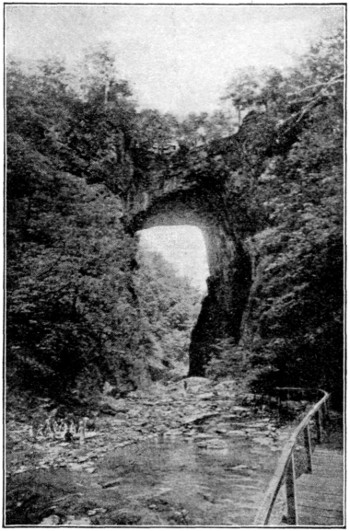
NATURAL BRIDGE OF VIRGINIA
The Natural Bridge of Virginia (one thousand five hundred feet above the sea) is a huge monolithic limestone arch, two hundred and fifteen feet high, one hundred feet wide, and ninety feet in span, crossing the ravine of the Cedar Creek. It seems to be a remnant of a great horizontal bed of limestone rock that entirely covered the gorge of the brook, which originally flowed through a subterranean tunnel. The rest of this roof has fallen in and been gradually washed or worn away. The bridge is finely situated in a beautiful amphitheater, surrounded by mountains, on land originally granted by George III. to Thomas Jefferson, who built a cabin here for the use of visitors. Among the names upon the smooth side of the archway is that of George Washington (west side, about twenty-five feet up), which was the highest of all until a student named Piper actually climbed from the bottom to the top of the arch in 1818.
The first white man to attempt an exploration of the region was a trapper named Coulter, who in 1805 traversed a part of this district. His tales were disbelieved, but were confirmed thirty years later by the discoveries of Bridger. In 1870 the first official survey was made, and in 1871 Hayden’s famous expedition revealed the glories of the Yellowstone district.
Climate and Irrigation.—The United States, stretching over such a vast area and having such great tracts of mountain and plain, must necessarily present a great variety of climate. The mean annual temperature ranges from under forty degrees to seventy-five degrees. The isotherm of fifty-five degrees mean annual temperature crosses the center of the country from east to west, passing through St. Louis. The mean annual rainfall for the whole country is about thirty inches, but there is a great difference in this respect between different parts. The rainfall is most abundant on the northwest Pacific Coast, on the Gulf Coast, and on the higher mountain ranges. On the great plains it is only ten to twenty inches, and there are large desert stretches in the Rocky Mountain region with a rainfall of less than ten inches.
Irrigation.—As far as lack of rainfall is concerned in the so-called rainless regions of the United States, this has been notably offset by great works of irrigation that have been steadily going forward. Agriculture, horticulture and vitaculture are, therefore, no longer dependent on chance but science, as the National Irrigation Congress expresses it.
Modern irrigation in the United States began in 1750 with the watering of the gardens in the hills and deserts of the coast of California by the adventurous missionaries from Mexico. Irrigation by English-speaking people had its origin in Utah one hundred years later. There the Mormons, separated by one thousand miles of untrodden desert from all cultivated land, found in irrigation their only means of escape from starvation.
In 1870 there were twenty thousand acres under irrigation, followed by a rapid development of small ditches, until in 1880 there were one million acres irrigated. Today (1917) upward of fifty million acres are included in reclamation projects, and it is estimated that there are upward of four hundred and fifty million acres still awaiting the scientific use of water.
The diversity of methods used in irrigation in the United States is remarkable. Practically every system to be found in the world can be seen in some part of the arid west. This is due to the fact that many of the irrigators have come from distant parts of the world and each seeks to introduce on his farm customs and practices of his old environments. This is particularly noticeable in California, where the Chinese irrigate their truck gardens in Chinese fashion, and Italians, Spaniards and Mexicans imitate for a time at least the practices of their forefathers.
Upward of one hundred and fifty thousand miles of irrigation canals, with reservoirs and supplementary works, have been built at a cost of more than six hundred million dollars. These projects are distributed through the States of Arizona, California, Colorado, Idaho, Kansas, Montana, Nebraska, Nevada, New Mexico, North Dakota, Oklahoma, Oregon, South Dakota, Texas, Utah, Washington and Wyoming. The most notable among them are: the Truckee-Carson Canal and Reservoir, in Nevada; the Minidoka project, in southern Idaho; that of the Uncompahgre Valley, in Colorado; the Roosevelt Dam, in the Salt River Valley, Arizona; the Klamath Reservoir, on the Oregon-California boundary; the Boisé project, Idaho; that of Yuma, on the Arizona-California boundary; North Platte, on the Nebraska-Wyoming boundary; and the gigantic Elephant Butte Reservoir, in New Mexico—the second largest in the world.
Political Divisions.—Under its present organization the United States comprises fifty-one political divisions. Of these forty-eight are states enjoying the full privileges afforded by the federal constitution. The three territories—Alaska, Hawaii and Porto Rico—all are organized but not yet admitted to statehood. The Philippines have a modified territorial government.
(See Tables appended.)
It is worthy of remark that the center of population advanced westward during the ten decades since 1790 in a nearly uniform line along the thirty-ninth parallel of latitude.
THE CENTER OF POPULATION
Census Year Approximate Location by Important Towns From Point to Point in Direct Line[9]
1790 Twenty-three miles east of Baltimore, Md. ...
1800 Eighteen miles west of Baltimore, Md. 40.6
1810 Forty miles northwest by west of Washington, D. C. 36.9
1820 Sixteen miles north of Woodstock, Va. 50.5
1830 Nineteen miles west by southwest of Moorefield, W. Va.[10] 40.4
1840 Sixteen miles south of Clarksburg, W. Va.[10] 55.0
1850 Twenty-three miles southeast of Parkersburg, W. Va.[10] 54.8
1860 Twenty miles south of Chillicothe, Ohio 80.6
1870 Forty-eight miles east by north of Cincinnati, Ohio 44.1
1880 Eight miles west by south of Cincinnati, Ohio 58.1
1890 Twenty miles east of Columbus, Ind. 48.6
1900 Six miles southeast of Columbus, Ind. 14.6
1910 In the city of Bloomington, Ind. 39.0
Public Lands.—The United States originally owned nearly all the area of the states, with the exception of the original thirteen. Homesteads have been given, or sold at a nominal price, to all bona fide settlers. Vast areas have been given to railroad companies and in aid of education. The country’s Indian wards have been provided with ample reservations. The government has established great national parks, and it has reserved more than seventy-two thousand square miles of forest land.
The following tabulations give numerous important facts concerning the states and territories:
TABLE OF STATES AND TERRITORIES OF THE UNITED STATES
Date of Admission Into Union State or Territory Origin and Meaning of Name Area and Population Motto and Meaning Settlement Where, When, By Whom Original Territory from Which Derived Capitals and Populations Chief Productions of State
1819 Alabama (Indian—Here we rest). 51,998 sq. miles. Pop. 2,138,093. Motto: Here we rest. Mobile Bay, 1702, by the French. From Louisiana, Georgia, Mississippi and Alabama territories. Montgomery: Pop. 38,136. Corn, oats, wheat, rice, cotton, sugar, iron, lumber, manufactures, potatoes.
1867 ‡Alaska (Al-ay-eska, meaning “the great country”). 590,884 sq. miles. No motto. Three Saints, 1784, by the Russians. Purchased from Russia in 1867 for $7,200,000. Juneau: Pop. 1,864. Seals, salmon, gold, copper, silver, lumber, tin, lead, coal.
1911 Arizona (Indian—Sand Hills). 113,956 sq. miles. Pop. 204,354. Motto: Ditat deus (Founded by God). Tucson, 1580, by the Spanish. From New Mexico territory. Phoenix: Pop. 11,134. Copper, gold, silver, alfalfa, fruits, live stock, wheat, barley.
1836 Arkansas (From a tribe of Indians). 53,335 sq. miles. Pop. 1,574,449. Motto: Regnat populi (The people rule). Arkansas Post, 1685, by the French. From Louisiana, Missouri and Arkansas territories. Little Rock: Pop. 45,941. Cotton, lumber, corn, oats, wheat, fruits, wool, coal, tobacco.
1850 California (From an old Spanish romance). 158,297 sq. miles. Pop. 2,377,549. Motto: Eureka (I have found it). San Diego, 1768, by the Spanish. From New Albion, Upper California. Sacramento: Pop. 44,696. Gold, silver, copper, lead, petroleum, borax, lumber, fruits, wine, olives, beet sugar.
1876 Colorado (Spanish—Red, or Ruddy). 103,948 sq. miles. Pop. 799,024. Motto: Nil sine numine (Nothing without providence). Auroria, 1859, by the Americans. From Louisiana and Mexican cession. Colorado territory. Denver: Pop. 213,381. Gold, silver, coal, copper, vegetables, fruits, live stock, wheat, beet sugar, oats, corn.
* 1788 Connecticut (Indian—Long River). 4,965 sq. miles. Pop. 1,114,756. Motto: Qui transtulit sustinet (He who transplanted still sustains). Windsor, 1636, by the English. From North Virginia, New England. Hartford: Pop. 98,915. Manufactures, woolen, cotton, notions; tobacco, iron, granite, cereals.
* 1787 Delaware (In honor of Lord De La Warr). 2,370 sq. miles. Pop. 202,322. Motto: Liberty and independence. Wilmington, 1637, by the Swedes. From New Sweden, New Netherlands, three lower counties on the Delaware. Dover: Pop. 3,720. Corn, wheat, tomatoes, fruits, manufactures, leather, iron, steel, machinery.
1791 District of Columbia (In honor of Columbus). 70 sq. miles. Pop. 331,069. Motto: Justitia omnibus (Justice to all). Rome, 1663, by the English. Ceded to government by Maryland and Virginia. Washington: Pop. 331,069. Flour mills, manufactures.
1845 Florida (Spanish—Blooming). 58,666 sq. miles. Pop. 752,619. Motto: In God is our trust. St. Augustine, 1565, by the Spanish. From Florida territory. Tallahassee: Pop. 5,018. Fruits, vegetables, tobacco, rice, cotton, lumber, turpentine, resin, fish, phosphate.
* 1788 Georgia (In honor of George II.). 59,265 sq. miles. Pop. 2,609,121. Motto: Obverse: Wisdom, justice, moderation. Reverse: Agriculture and commerce. Savannah, 1733, by the English. One of the original thirteen states. Atlanta: Pop. 154,839. Cotton, corn, rice, oats, tobacco, oysters, peaches, melons, marble, clay; cotton goods, lumber, fertilizers, tar.
... ‡Hawaii (From the native Owhyhee). 6,449 sq. miles. No motto. Honolulu, 1820, by the Americans. From Sandwich Islands. Honolulu: Pop. 52,183. Sugar, fruits, rice, coffee, hides, wool, honey, sisal.
1890 Idaho (Indian—Gem of the Mountains). 84,313 sq. miles. Pop. 325,594. Motto: Salve (Hail). Coeur d’Alene, 1842, by the Americans. From Oregon, Washington and Idaho territories. Boise City: Pop. 17,358. Gold, silver, copper, lead, lumber, flour, wheat, oats, barley, live stock.
1818 Illinois (Indian—The Men). 56,665 sq. miles. Pop. 5,638,591. Motto: National union, state sovereignty. Kaskaskia, 1682, by the French. From Northwest, Indian and Illinois territories. Springfield: Pop. 51,678. Corn, wheat, oats, potatoes, hay, live stock, wool, meat, manufactures.
1816 Indiana (Indian’s Ground). 36,354 sq. miles. Pop. 2,700,876. No motto. Vincennes, 1702, by the French. From Northwest and Indiana territories. Indianapolis: Pop. 233,650. Corn, wheat, tobacco, vegetables, fruits, wool, coal, clay, flour, machinery.
1846 Iowa (Indian—Drowsy Ones). 56,147 sq. miles. Pop. 2,224,771. Motto: Our liberties we prize and our rights we will maintain. Dubuque, 1833, by the Americans. From Louisiana, Missouri, Michigan, Wisconsin and Iowa territories. Des Moines: Pop. 86,368. Corn, wheat, oats, potatoes, hay, live stock, butter, coal, lumber, poultry.
1861 Kansas (Indian—Smoky Water). 82,158 sq. miles. Pop. 1,690,949. Motto: Ad astra per aspera (To the stars through difficulties). Leavenworth, 1854, by the Americans. From Louisiana, Kansas territory. Topeka: Pop. 43,684. Corn, wheat, hay, live stock, fruits, coal, petroleum, salt, meats, Kaffir corn.
1792 Kentucky (Indian—Dark and Bloody Ground). 40,598 sq. miles. Pop. 2,289,905. Motto: United we stand, divided we fall. Boonesboro, 1769, by the English. From Virginia. Frankfort: Pop. 10,465. Tobacco, hemp, wheat, cotton, live stock, lumber, coal, sorghum, flour.
1812 Louisiana (In honor of Louis XIV.). 48,506 sq. miles. Pop. 1,656,388. Motto: Union, justice, and confidence. New Orleans, 1718, by the French. From Louisiana, Territory of Orleans. Baton Rouge: Pop. 14,897. Cotton, corn, rice, sugar, lumber, oysters, salt, sulphur.
1820 Maine (The Main Land). 33,040 sq. miles. Pop. 742,371. Motto: Dirigo (I direct). Saco, 1623, by the English. From New England, Laconia and Massachusetts. Augusta: Pop. 13,211. Hay, grains, dairying, potatoes, wool, granite, ice, lumber, apples, paper.
* 1788 Maryland (In honor of Queen Henriette Maria). 12,327 sq. miles. Pop. 1,295,346. Motto: Fatti maschii, parole femine (Manly deeds, womanly words). St. Mary’s, 1632, by the English. From one of the original states. Annapolis: Pop. 8,609. Wheat, hay, corn, vegetables, fruits, oysters, coal, wool, canned fruits, vegetables.
* 1788 Massachusetts (The Place of Great Hills). 8,266 sq. miles. Pop. 3,366,416. Motto: Ense petit placidam sub liberate quietem (With the sword she seeks calm peace under liberty). Plymouth, 1620, by the English. From North Virginia, New England, Massachusetts Bay. Boston: Pop. 670,585. Manufactures (woolen, cotton), boots, shoes, fish, tobacco, granite, marble.
1837 Michigan (Indian—Great Lake). 57,980 sq. miles. Pop. 2,810,173. Motto: Si quaeris peninsulam amoenam, circumspice (If you seek a beautiful peninsula, behold it here). Sault Ste. Marie, 1668, by the French. From Northwest, Indiana and Michigan territories. Lansing: Pop. 31,229. Corn, wheat, oats, hay, fruits, vegetables, iron, copper, clay, lumber, manufactures.
1858 Minnesota (Indian—Cloudy Water). 84,682 sq. miles. Pop. 2,075,708. Motto: L’étoile du nord (The star of the north). St. Paul, 1838, by the Americans. From Louisiana and Northwest and Minnesota territories. St. Paul: Pop. 214,744. Corn, wheat, oats, barley, flaxseed, wool, live stock, flour, iron, lumber, dairying.
1817 Mississippi (Indian—Great River, or Father of Waters). 46,865 sq. miles. Pop. 1,797,114. No motto. Biloxi, 1699, by the French. From Louisiana and Georgia, Mississippi territory. Jackson: Pop. 21,262. Cotton, corn, wheat, oats, potatoes, rice, tobacco, oysters, shrimps.
1821 Missouri (Indian—Great Muddy). 69,420 sq. miles. Pop. 3,293,335. Motto: Salus populi suprema lex esto (The welfare of the people is the supreme law). St. Genevieve, 1755, by the French. From Louisiana and Louisiana and Missouri territories. Jefferson City: Pop. 11,850. Corn, wheat, oats, rye, cotton, swine, honey, zinc, lead, tobacco, meats.
1889 Montana (Spanish—A Mountain). 146,572 sq. miles. Pop. 375,053. Motto: Oro y plata (Gold and silver). Yellowstone River, 1809, by the Americans. From Louisiana and Nebraska, Idaho, Dakota and Montana territories. Helena: Pop. 39,165. Wheat, wool, live stock, fruit, oats, barley, lumber, copper, lead, silver, coal.
1867 Nebraska (Indian—Shallow Water). 77,520 sq. miles. Pop. 1,192,214. Motto: Equality before the law. Bellevue, 1847, by the Americans. From Louisiana, Nebraska territory. Lincoln: Pop. 43,973. Corn, wheat, oats, live stock, hay, chicory, sugar beets, fruits, potatoes.
1864 Nevada (Spanish—Snow-covered). 110,690 sq. miles. Pop. 81,875. Motto: All for our country. Genoa, 1850, by the Americans. From Upper California and Utah and Nevada territories. Carson City: Pop. 2,466. Gold, silver, copper, zinc, wool, live stock, lumber, borax.
* 1788 New Hampshire (Hampshire, England). 9,341 sq. miles. Pop. 430,572. No motto. Portsmouth, 1623, by the English. From North Virginia, New England, Laconia. Concord: Pop. 21,497. Hay, corn, potatoes, oats, apples, granite, mica, manufactures.
* 1787 New Jersey (In honor of governor of Jersey Island). 8,224 sq. miles. Pop. 2,537,167. No motto. Elizabethtown, 1617, by the Dutch. From New Netherland. Trenton: Pop. 96,815. Market garden crops, cereals, fruits, fisheries, manufactures, textiles, machinery.
1911 New Mexico (From Old Mexico). 122,634 sq. miles. Pop. 327,301. Motto: Crescit eundo (It increases by going). ... Santa Fe: Pop. 5,072. Gold, silver, fruits, vegetables, live stock, wool, lumber, copper, coal, turquoise.
* 1788 New York (In honor of Duke of York). 49,204 sq. miles. Pop. 9,113,614. Motto: Excelsior (Higher). New York, 1614, by the Dutch. From New Netherland. Albany: Pop. 100,253. Market garden crops, fruits, corn, wheat, dairying, manufactures, clothing, textiles, books, magazines, papers.
* 1789 North Carolina (In honor of Charles II.). 52,426 sq. miles. Pop. 2,206,287. Motto: Esse quam videri (To be, rather than to seem). Albemarle Sound, 1653, by the English. From Albemarle colony. Raleigh: Pop. 19,218. Cotton, corn, tobacco, wheat, shad, oysters, lumber, mining.
1889 North Dakota (Indian—Allied). 70,837 sq. miles. Pop. 577,056. Motto: Liberty and union, now and forever, one and inseparable. Pembino, 1859, by the Americans. From Louisiana, Minnesota and Nebraska and Dakota territories. Bismarck: Pop. 5,443. Wheat, oats, barley, flaxseed, live stock, wool, minerals.
1803 Ohio (Indian—Beautiful River). 41,040 sq. miles. Pop. 4,767,121. No motto. Marietta, 1788, by the Americans. From Northwest territory. Columbus: Pop. 181,548. Corn, wheat, oats, hay, potatoes, fruits, tobacco, live stock, wool, dairying, coal, petroleum, salt, iron, steel, machinery, flour.
1907 Oklahoma (Indian—Beautiful Land). 70,057 sq. miles. Pop. 1,657,155. Motto: Labor omnia vincit (Labor conquers everything). Guthrie, 1890, by the Americans. From Indian and Oklahoma territories. Oklahoma City: Pop. 64,205. Corn, wheat, oats, cotton, flax, live stock, petroleum, minerals.
1859 Oregon (Spanish—Wild Marjoram). 96,699 sq. miles. Pop. 672,765. Motto: The union. Astoria, 1811, by the Americans. From Oregon territory. Salem: Pop. 14,094. Lumber, live stock, wheat, hay, fruits, hops, wool, salmon, gold, silver, paper making.
* 1787 Pennsylvania (Latin—Penn’s Woods). 45,126 sq. miles. Pop. 7,665,111. Motto: Virtue, liberty and independence. Chester, 1638, by the Swedes. From original state. Harrisburg: Pop. 64,186. Manufactures, steel, machinery, textiles, coal, coke, petroleum, natural gas, iron, grains, wool, leather.
... ‡Philippines (In honor of Philip II.). 115,026 sq. miles. Cebu, 1565, by the Spanish. From Archipelago de San Lazaro. Manila: Pop. 250,000. Cocoa, coffee, tobacco, cotton, hemp, cocoanuts, corn, sugar, rice, timber, dyewoods.
... Porto Rico (Spanish—Rich Port). 3,435 sq. miles. San Juan, 1510, by the Spanish. Ceded by Spain. San Juan: Pop. 50,000. Coffee, sugar, tobacco, cotton, citrus fruits, bananas, pineapples, salt.
* 1790 Rhode Island (Rhodes, an island in the Ægean Sea). 1,248 sq. miles. Pop. 542,610. Motto: Hope. Providence, 1636, by the English. From Providence and Rhode Island plantations. Providence: Pop. 224,326. Manufactures, worsted, cotton, jewelry, machinery, rubber, minerals.
* 1788 South Carolina (In honor of Charles II.). 30,989 sq. miles. Pop. 1,515,400. Motto: Dum spiro, spero. Spes (While I breathe, I hope. Hope). Ashley River, 1670, by the English. From Carteret colony. Columbia: Pop. 26,319. Cotton, wheat, corn, oats, tobacco, rice, oysters, turpentine, lumber, phosphates.
1889 South Dakota (Indian—Allied). 77,615 sq. miles. Pop. 583,888. Motto: Under God the people rule. Southeast part, 1859, by the Americans. From Louisiana, Minnesota and Nebraska and Dakota territories. Pierre: Pop. 3,656. Corn, wheat, oats, flax, potatoes, live stock, wool, gold, silver, tin, dairying.
1796 Tennessee (Indian—River with the Great Bend). 42,022 sq. miles. Pop. 2,184,789. Motto: Agriculture, commerce. Fort Loudon, 1757, by the English. From North Carolina, territory south of the Ohio River. Nashville: Pop. 110,364. Corn, wheat, cotton, potatoes, tobacco, live stock, coal, iron, marble, lumber.
1845 Texas (From tribe of Indians). 265,896 sq. miles. Pop. 3,896,542. No motto. San Antonio, 1692, by the Spanish. From Mexican cession. Austin: Pop. 29,860. Cotton, corn, oats, wheat, rice, sugar, live stock, wool, fruits, lumber, petroleum, coal.
1896 Utah (Indian—Mountain Dwellers). 84,990 sq. miles. Pop. 373,351. Motto: Industry. Salt Lake City, 1847, by the Americans. From Mexican cession, Utah territory. Salt Lake City: Pop. 92,777. Gold, silver, copper, lead, coal, vegetables, fruits, sugar, wheat, oats, live stock, wool.
1791 Vermont (French—Green Mountain). 9,564 sq. miles. Pop. 355,956. Motto: Freedom and unity. Fort Dummer, 1724, by the English. From New Netherland, New Hampshire grants. Montpelier: Pop. 7,856. Hay, cereals, potatoes, lumber, marble, dairying, maple sugar, manufactures, wood pulp.
* 1788 Virginia (In honor of Elizabeth, the virgin queen). 42,627 sq. miles. Pop. 2,061,212. Motto: Obverse; Sic semper tyrannis (Ever so to tyrants). Reverse: Perseverando (By perseverance). Jamestown, 1607, by the English. From South Virginia. Richmond: Pop. 127,628. Corn, wheat, oats, tobacco, potatoes, cotton, oysters, coal, iron, cotton, manufactures.
1889 Washington (After George Washington, first president). 69,127 sq. miles. Pop. 1,141,990. Motto: Al-Ki (Bye-bye). Columbia River, 1811, by the English. From Oregon and Washington territories. Olympia: Pop. 6,996. Lumber, coal, wheat, barley, oats, fruits, salmon, live stock, minerals.
1863 West Virginia (From Virginia). 24,170 sq. miles. Pop. 1,221,119. Motto: Obverse: Montani semper liberi (Mountaineers are always free men). Reverse: Libertas et fidelitas (Liberty and fidelity). Berkeley County, 1726, by the Americans. From Virginia. Charleston: Pop. 22,996. Corn, oats, hay, wheat, fruits, cattle, sheep, lumber, coal, petroleum, natural gas, mining.
1848 Wisconsin (Indian—Wild Rushing Channel). 56,066 sq. miles. Pop. 2,333,860. Motto: Forward. Green Bay, 1745, by the French. From Northwest, Illinois, Michigan and Wisconsin territories. Madison: Pop. 25,531. Corn, oats, barley, wheat, hay, potatoes, fruits, beet sugar, dairying, iron, lumber.
1890 Wyoming (Indian—Extensive Plain). 97,914 sq. miles. Pop. 145,965. Motto: Equal rights. Cheyenne, 1867, by the Americans. From Louisiana (chiefly), Nebraska, Dakota, Idaho, and Wyoming territories. Cheyenne: Pop. 11,320. Wool, lumber, coal, copper, petroleum, minerals.
* Original Thirteen States. ‡ Organized Territories.
Cities.—In January, 1917, three cities of the United States, New York, Chicago and Philadelphia, had a population of over one million. St. Louis, Boston, Cleveland, Baltimore, Pittsburgh and Detroit had each over 500,000. Buffalo, San Francisco, Los Angeles, Milwaukee, Cincinnati, Newark, New Orleans, Washington, Minneapolis and Seattle had over 300,000. Forty-seven others had populations ranging from 100,000 to 300,000; while altogether there were one hundred and ninety-eight above 30,000.
The following table gives the approximate population of all cities in excess of 100,000.
POPULATION OF CITIES HAVING OVER 100,000 IN 1917
Cities Est. Pop. Jan. 1, 1917
Akron, Ohio 106,000
Albany, N.Y. 110,000
Atlanta, Ga. 191,000
Baltimore, Md. 590,000
Birmingham, Ala. 182,000
Boston, Mass. 757,000
Bridgeport, Ct. 150,000
Buffalo, N.Y. 469,000
Cambridge, Mass. 112,000
Camden, N.J. 105,000
Chicago, Ill. 2,498,000
Cincinnati, Ohio 411,000
Cleveland, Ohio 674,000
Columbus, Ohio 215,000
Dallas, Tex. 135,000
Dayton, Ohio. 130,000
Denver, Col. 261,000
Des Moines, Iowa 106,000
Detroit, Mich. 572,000
Fall River, Mass. 130,000
Fort Worth, Tex. 100,000
Grand Rapids, Mich. 141,856
Hartford, Ct. 145,000
Houston, Tex. 148,000
Indianapolis, Ind. 272,000
Jersey, City, N.J. 306,000
Kansas City, Mo. 298,000
Los Angeles, Cal. 504,000
Louisville, Ky. 239,000
Lowell, Mass. 111,000
Memphis, Tenn. 160,000
Milwaukee, Wis. 437,000
Minneapolis, Minn. 364,000
Nashville, Tenn. 135,000
Newark, N.J. 408,000
New Bedford, Mass. 113,000
New Haven, Ct. 150,000
New Orleans, La. 372,000
New York City 5,603,000
Oakland, Cal. 192,000
Omaha, Neb. 166,000
Paterson, N.J. 126,000
Philadelphia, Pa. 1,710,000
Pittsburgh, Pa. 580,000
Portland, Ore. 296,000
Providence, R.I. 255,000
Reading, Pa. 107,000
Richmond, Va. 157,000
Rochester, N.Y. 257,000
Salt Lake City, Utah 125,000
San Antonio, Tex. 125,000
San Diego, Cal. 100,000
San Francisco, Cal. 464,000
Scranton, Pa. 150,000
Seattle, Wash. 349,000
Spokane, Wash. 125,000
Springfield, Mass. 102,103
St. Joseph, Mo. 101,800
St. Louis, Mo. 758,000
St. Paul, Minn. 247,000
Syracuse, N.Y. 155,000
Tacoma, Wash. 108,094
Toledo, Ohio 192,000
Trenton, N.J. 110,000
Washington, D.C. 364,000
Worcester, Mass. 164,000
Youngstown, Ohio 118,000
Atlanta (ăt-lăn´tȧ), Ga. [The “Gate City”; the name Atlanta was suggested by its geographical position, immediately on the dividing ridge, separating the Gulf and Atlantic waters.]
It is situated at the base of the Blue Ridge, near the Chattahoochee River; has an elevation of over one thousand feet, and a remarkably healthful climate.
Atlanta is laid out in the form of a circle, with the Union Depot as its center. A little to the south of the old Union Station is the State Capitol, which contains a library of about sixty thousand volumes and an interesting geological collection. A little to the northwest is the New Court House; and farther to the north, beyond the railway, are the Custom House and the L. & N. Freight House, an enormous concrete structure. The City Hall, the Chamber of Commerce, the Opera House, the Carnegie Library (of white marble), the Century Building, the Empire Building, the Equitable Building, the Jewish Temple, and the First Methodist Church are notable edifices. Among the chief educational establishments are the Georgia School of Technology, the Atlanta University (for colored students), the Agnes Scott Institute, and the Clark University (colored students). The finest private houses are in Peachtree Street.
Several railroads, converging at Atlanta and leading to other important Southern cities, greatly facilitate the city’s extensive and rapidly increasing trade. It has a large export trade in tobacco, cotton, horses, and mules, its mule market being one of the most important in the United States. Its manufactures include implements, fertilizers, cotton goods, other foundry and machine products.
Atlanta was first settled in 1830. In 1843 it was incorporated as a town, and called Marthasville. In 1845 changed its name to Atlanta, and two years later secured a city charter. It was an important city in the Confederacy and the objective point of General Sherman’s campaign. The battle of Atlanta (July 22, 1864) was fought southeast of the city. In September the city was made a military camp by Sherman, and in November he left the city in flames, and started on his “march to the sea.” The city was almost entirely destroyed, but recovered rapidly after the war, and in 1878 became the capital of Georgia.
Baltimore (bôl´tĭ-mōr), Md. [The “Monumental City”; named for the proprietor of a large tract of land in Maryland, Cecil Calvert, Lord Baltimore, who settled the province in 1635.]
It is situated on an estuary of the Patapsco River, at the head of navigation, about fourteen miles from Chesapeake Bay, and is on the Baltimore and Ohio, the Philadelphia, Baltimore and Washington, and other railroads. A good harbor and fine geographical situation give Baltimore unusual trade advantages, and it has become one of the great export centers of the United States.
The city is roughly divided into two nearly equal parts by a small stream, Jones Falls, which flows entirely through the city. The portion of the city northeast of the stream is called “Old Town.” Baltimore Street is the chief longitudinal thoroughfare.
The natural center for the visitor is Mt. Vernon Place, a small square, prettily laid out and suggesting Paris in its tasteful monuments and surrounding buildings. In the middle rises the Washington Monument, a column one hundred and thirty feet high, surmounted by a colossal statue of George Washington.
At the northeast corner of the square is the handsome Mt. Vernon Methodist Episcopal Church; at the southeast corner, Peabody Institute, for the encouragement of science, art, and general knowledge.
On the south side of the square is the house of Henry Walters, connected by an overhead bridge with a new picture-gallery containing the celebrated Walters Collection, one of the finest private collections of art in America.
Charles Street, one of the chief thoroughfares of the city, leads to the north from the Washington Monument past the Union Station, near which, at the north end of the B. & O. tunnel, is the Mt. Royal Station. Following Charles Street to the south we pass (right) the First Unitarian Church and the back of the Roman Catholic Cathedral, which faces Cathedral Street. The latter is surmounted by a dome one hundred and twenty-five feet high, and contains some interesting paintings. Adjacent is the residence of the Cardinal.
Farther on Charles Street passes the Masonic Temple, intersects Baltimore Street, the chief business street of the city, and is continued to South Baltimore. In East Fayette Street, to the left, is the Court House, a handsome white marble building, and the Post Office, in front of which rises the Battle Monument, erected in 1815 in memory of the struggles of the war of 1812-1814. The interior of the Court House is adorned with admirable mural paintings. To the east of the Post Office is the City Hall, a large and handsome building, with a dome two hundred and sixty feet high.
To the south of the City Hall, in Gay Street, between Water and Lombard Streets, is the imposing new Custom House, which was damaged by the fire of 1904, but has since been repaired and completed.
A little to the west of Mt. Vernon Place, between Howard St. and Eutaw St., are the unpretentious buildings formerly occupied by Johns Hopkins University, one of the foremost institutions of learning in the country. It was endowed with over three million five hundred thousand dollars by Johns Hopkins, a Quaker. In 1902 a suburban site about two miles north of the Washington Monument was secured for this famous university, and the first of a fine group of buildings was occupied by it in 1914.
The Johns Hopkins Hospital, opened in 1889, is also due to the liberality of Mr. Hopkins, who bequeathed over three million dollars for its foundation.
Both as a scientific and charitable institution, this hospital is an important adjunct to the University; and in the completeness of its equipment and excellence of its system, it ranks with the foremost hospitals in the world. The buildings of the Medical School of Johns Hopkins University adjoin the hospital.
Druid Hill Park, a pleasure-ground of about seven hundred acres, owes its beauty in great part to the fact that is has been preserved as a private park for one hundred years before passing into the hands of the city. Its hills afford beautiful views. Druid Lake, one-half mile long, is one of the reservoirs of the city waterworks.
Baltimore is an important center of the traffic in breadstuffs, and is also the seat of extensive and varied industries—cotton and woolen goods, flour, tobacco and cigars, beer, glassware, boots and shoes, iron and steel (including machinery, car-wheels, iron bridges, stoves, furnaces, etc.), clothing, pianos, organs, and the canning of oysters. Shipbuilding has become an important development, and Sparrows Point, with its immense Bessemer steel plant, is a place of great industrial activity.
The construction of the first important line of railway in the United States was begun at Baltimore in 1828 and carried on by private enterprise, and the first telegraph line was constructed to, and the first message received in, Baltimore. In 1904 Baltimore was visited by a fire which consumed fifty million dollars’ worth of property.
SOME VIEWS IN BOSTON, MASSACHUSETTS: RIVER FRONT, PARKS AND NOTABLE BUILDINGS
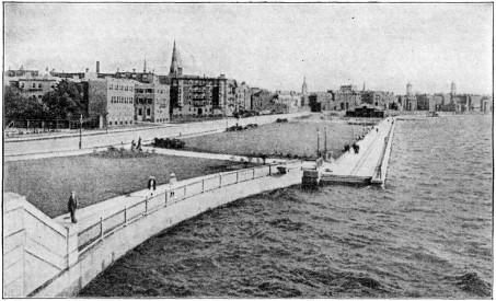
THE CHARLES RIVER EMBANKMENT
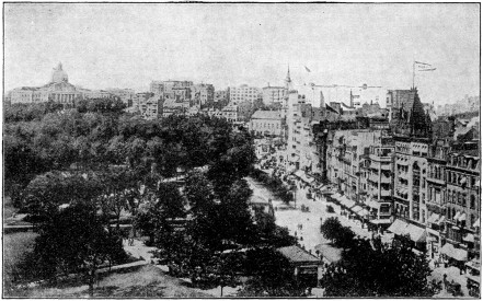
STATE HOUSE BOSTON COMMON TREMONT STREET
Boston (bôs´ton), Mass. [Called the “Hub” and “Athens of America”; name is derived from Boston, a seaport in England, originally called Botalf, or Botolph’s town.]
The capital of Massachusetts, the chief town of New England, Boston is one of the oldest and most interesting cities of the United States. Whether considered from the point of view of its educational and charitable institutions, its trade, manufactures and public buildings, its influence upon the intellectual life and literary culture of the nation, or its historic part as an inspirational center of political liberty and social reform, its record and position command attention.
In no other American city are the civic and other public buildings more closely associated with events of national importance.
CUSTOM HOUSE
TRINITY CHURCH COPLEY-PLAZA HOTEL
PIERCE BUILDING PUBLIC LIBRARY
BUNKER HILL MONUMENT
CUSTOM HOUSE
TRINITY CHURCH COPLEY-PLAZA HOTEL
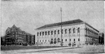
PIERCE BUILDING PUBLIC LIBRARY
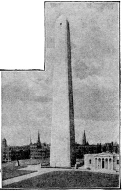
BUNKER HILL MONUMENT
Boston is situated at the head of Massachusetts Bay, about two hundred miles northeast of New York, and occupies a peninsula between the Charles River and the arm of the bay known as Boston Harbor. Originally the town was founded on three hills, Beacon, Copp’s and Fort, which, however, have been materially cut down. The metropolitan area now includes also East Boston, on Noddle’s or Maverick Island, on the other side of the harbor; South Boston, separated from the old city by an arm of the harbor; Charlestown, on the other side of the river; and the suburban districts of Brighton, Roxbury (or Boston Highlands), West Roxbury (including Jamaica Plain), and Dorchester. Boston is connected with the city of Cambridge by several bridges across the Charles. The old town is cramped and irregular, and its streets are narrow and crooked; but the new parts, especially the so-called Back Bay, formed by filling in the tide-water flats on the Charles, are laid out on a very spacious scale.
The chief retail business streets of Boston are Washington Street and Tremont Street. Among the finest residence streets are Commonwealth Avenue, Beacon Street, Marlborough Street, Mt. Vernon Street, and Bay State Road.
Boston Common, a park of forty-eight acres in the heart of the city, shaded by fine elms and other trees and crossed by many pleasant walks, has been reserved for public use since 1634 and is carefully guarded for this purpose in the charter of 1822. Just across Charles from the Common is the fine Public Garden, reclaimed from what was low-lying waste land.
That part of the Common adjoining Tremont Street and known as the Tremont Street Mall is now occupied by eight small buildings, covering the entrances to the stations of the Boston Subway, a wonderful piece of engineering that facilitates traffic by an underground system of electric cars. The subway was, in part, constructed in 1895-1898, at a cost of about four million one hundred and sixty-five thousand dollars, and since greatly extended by the expenditure of many millions more.
Near the northeast angle of the Common, on Beacon Hill, stands the State House, an imposing building surmounted by a huge gilded dome, and preceded by a Corinthian portico and a flight of steps. On the terrace in front are statues of Daniel Webster and Horace Mann. The dome is illuminated at night.
In Beacon Street, opposite the State House, is the beautiful Shaw Monument, by Saint-Gaudens, erected in honor of Colonel Shaw and his regiment, the first colored regiment raised during the Civil war.
In Pemberton Square is the new County Court House, a massive granite building in the German Renaissance style, with an imposing central hall adorned with emblematic figures. In School Street, to the left, is the City Hall, behind which is the Old Court House. In front of the City Hall are statues of Franklin and Josiah Quincy.
School Street ends at the large Old South Building in Washington Street, the most crowded thoroughfare in Boston, with many of the best shops. Following Washington Street (“Newspaper Row”) to the left, we soon reach, at the corner of State Street, the Old State House, dating from 1748 and restored as far as possible to its original appearance, even to the figures of the British lion and unicorn on the roof.
State Street, the center of financial life, leads to the east, past the Exchange Building (with the Stock Exchange) and other large office buildings, to the Custom House, a massive granite building in the shape of a Greek cross, with lofty tower.
Change Alley (now inappropriately styled “Avenue”), diverging to the left from State Street leads to Faneuil Hall, the “cradle of American liberty,” originally presented to the city in 1742, by Peter Faneuil, a Huguenot merchant, but rebuilt after a fire in 1761 and reconstructed on the original plan in 1898.
Devonshire Street leads to the right from State Street to the Government Building, a huge edifice occupying the entire block between Milk Street, Devonshire Street, Water Street and Post Office Square. The Post Office occupies the ground floor, the basement, and part of the first floor, while the rest of the building is devoted to the United States Sub-Treasury and the United States Courts.
At the corner of Washington Street stands the Old South Meeting House, built in 1729 on the site of an earlier church of wood, which lay near Governor Winthrop’s house.
Boylston Street, another important thoroughfare, diverging from Washington Street to the right, skirts the Common and Public Garden and leads to the Back Bay. At the corner of Berkeley Street (right) stands the Museum of Natural History, with a library of thirty thousand volumes and good zoological, ornithological, entomological and mineralogical collections. Opposite is the Berkeley Building, a structure of a fine commercial type. Adjacent are old buildings of the Massachusetts Institute of Technology, one of the leading institutions of the kind in the world. It now occupies a magnificent group of buildings on the Cambridge side of the Charles River, erected at a cost of ten million dollars.
Boylston Street now reaches Copley Square, which offers perhaps the finest architectural group in Boston, including Trinity Church, the Copley-Plaza Hotel, the Public Library, the New Old South Church, and a number of imposing business structures. (See illustrations.)
Trinity Church, on the east side of the square, the masterpiece of H. H. Richardson and a typical example of “Richardsonian” architecture, is deservedly regarded as one of the finest buildings in America. Its style may be described as a free treatment of the Romanesque of Central France.
The Public Library, on the west side of the square, designed by McKim, Mead & White, and erected in 1888-1895, is a dignified, simple and scholarly edifice which forms a worthy mate to the Trinity Church. Its style is that of the Roman Renaissance.
The New Old South Church, so called as the successor of the Old South Church, is a fine building in the Italian Gothic style, with a tower two hundred and forty-eight feet in height. The marbles and ornamental stone work are very fine.
Huntington Avenue, which diverges to the left from Boylston Street at Copley Square, contains many important buildings. This thoroughfare, and the district known as the Back Bay Fens, is celebrated for its cultural institutions. Among them are Mechanics Hall, Horticultural Hall, the imposing Symphony Hall, the New England Conservatory of Music, and the new Opera House—all in Huntington Avenue. Just beyond this is the New Museum of Fine Arts, a large granite edifice by Guy Lowell, admirably adapted for its ends. Farther out, at the corner of Longwood Avenue, are the extensive new buildings of the Harvard Medical School, erected at a cost of five million dollars, and equipped in the most complete and up-to-date manner.
Commonwealth Avenue, which runs parallel with Boylston Street, is one of the finest residence streets in America, with rows of trees and handsome houses. It is two hundred and forty feet wide and adorned with statues.
Beacon Street, beginning on Beacon Hill, skirting the north side of the Common, and then running parallel with Commonwealth Avenue is the aristocratic street of Boston. Its back-windows command a fine view of the Charles River.
The Back Bay, the fashionable west end district traversed by the above-named streets, was at the beginning of the nineteenth century occupied by dreary mud-flats, salt-marshes and water.
The Back Bay Fens have been skillfully laid out on the site of unsightly swamps and form the first link in the splendid chain of parks and boulevards, of which Franklin Park is the chief ornament. The chief entrances to the Fens are marked by a gateway and a fountain; and at the end of Boylston Street is a fine memorial of John Boyle O’Reilly, by D. C. French.
Fenway Court, the residence of Mrs. John L. Gardner, a building in a Venetian style, enclosing a courtyard and incorporating many original balconies, windows, and other details brought from Italy, contains a choice collection of art, which is open to the public from time to time.
Franklin Park is five hundred and twenty acres in extent and lies in West Roxbury (reached by electric car). It abounds in natural beauty and many of its drives and walks are very attractive.
The Public Park System of Boston, as a whole, is almost unique. The City Park System, with a total area of twenty-four hundred acres, forms an almost unbroken line of parks and parkways from the Public Garden to City Point, in Boston Harbor. The Metropolitan System, forming an outer line of parks, has an area of eleven thousand acres, including two large wooded reservations (Blue Hills, and Middlesex Fells), three beaches (Revere Beach, Nantasket Beach, and Lynn Beach), and the boating section of the Charles River. When completed this system will afford fifty miles of drives.
The North End of Boston, embracing the site of Copp’s Hill, now one of the poorer districts and occupied mainly by foreigners, contains some points of considerable historical interest. The Copp’s Hill Burial Ground, dating from 1660, contains the graves of Increase, Cotton and Samuel Mather. Adjacent, in Salem Street, is Christ Church, the oldest church now standing in the city (1723), on the steeple of which the signal-lanterns of Paul Revere are said to have been displayed on April 18th, 1775, to warn the country of the march of the British troops to Lexington and Concord. North Square is the center of what is known as “Little Italy.” The House of Paul Revere has recently been restored and contains some relics.