THE WYE
Reading edition
A. R. QUINTON
AMONG the many beautiful streams of Britain there is perhaps not one of which has so many and so varied charms as the River Wye. Issuing from the southern slopes of the great Welsh mountain, Plinlimmon, it begins its life as a mountain torrent, but gradually sobers down into a placid stream, flowing in a sinuous course of one hundred and thirty odd miles, and receiving many tributary streamlets before it mingles its waters with those of its big sister, the Severn, a few miles below Chepstow. Thickly dotted along its banks are picturesque ruined castles, abbeys, and manor-houses—each with its own story to tell of bygone days; quaint old towns, and at least one stately cathedral, each bearing names which often recur in the pages of history, and still retaining signs of the age when kings, barons, and Commoners, priests and laymen, struggled for supremacy.
Although there is much that is interesting and pleasing in the earlier part of its course, it is at Ross that the romantic scenery of the Wye may be said to commence. Above that town the river flows for many miles through a fairly open valley, bordered indeed with wooded hills, but with a broad expanse of meadow land between their feet and its margin. But on approaching Ross the slopes draw nearer to the brink of the stream, and for twenty miles or more the Wye flows through an almost continuous glen, carved deeply out of a lofty and undulating table-land.
The ancient town of Ross, our starting place, is chiefly built upon the slope of a hill terminating on a plateau, descending steeply to the river. Upon this plateau stands the church, with its adjoining garden, the Prospect, which commands a lovely view over the valley of the Wye; whence the graceful spire of the church forms a landmark for all the country round.
The district traversed by the Wye in the first stage of its seaward journey, from Ross to Monmouth, is an elevated upland, a region of rolling hills shelving down towards winding valleys, whose declivities become abrupt towards the margin of the main river. Near to this the hills are often scarped into cliffs and carved into ridges, but further back we have slopes and undulations, cornfields and scattered woodlands, in marked contrast with the crags and forest-clad glades near the edge of the swift and strong stream. The valley narrows after leaving Ross, but the scenery improves as we come in view of Goodrich Castle, crowning a wooded steep above the river, and Goodrich Court, also seated on an eminence. The latter is a modern imitation of a mediæval dwelling, and formerly contained the remarkably fine collection of ancient armour which has since found a home in the South Kensington Museum, and is known as the Meyrick Collection. The Castle, which is some distance beyond the Court, was in its day a fortress of formidable strength. There is little doubt that the keep was built about the period 1135-1154, in the time of King Stephen.
In the time of the civil wars it was held for the King Charles I. by Sir Henry Lingen, but was taken from him by the Parliamentarians in 1646.
WYE
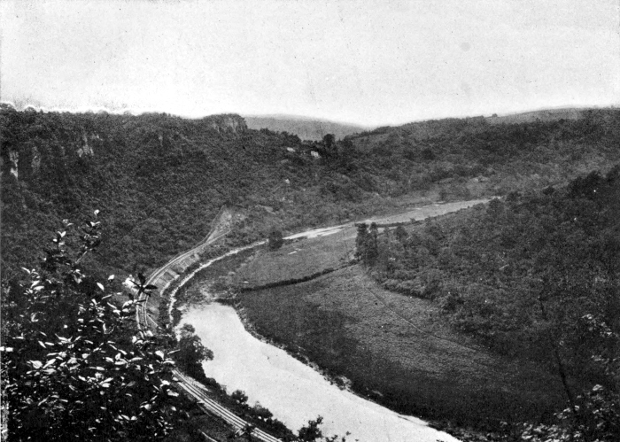
At Goodrich the river commences one of its most remarkable bends. From Goodrich Ferry to Huntsholme Ferry is little more than a mile overland, but by the river it is eight miles. The Wye sweeps round in an easterly direction after Kern Bridge is passed, then turns abruptly and flows for a mile in an opposite course, enclosing in the loop thus formed the house and grounds of Courtfield, where, in a more ancient mansion, “Wild Prince Hal” is reported to have passed the days of early childhood, under the care of the Countess of Salisbury. The pretty village of Welsh Bicknor is also passed, and then we presently come in view of the lofty Coldwell Rocks, where the river, which for a time has pursued a southerly direction, now doubles back almost upon its former course, and makes the most remarkable curve in the whole of its windings from Plinlimmon to the sea. It is far-famed Symonds’ Yat, a limestone plateau some 600 feet above the river, which here describes a huge elongated loop, so that after a course of between four and five miles it returns again to within less than half a mile of its former channel.
More extensive prospects may, doubtless, be obtained from other view points, but for a grand combination of rocks and woodlands, this spot may well take the palm. After leaving the Yat, the Wye bends round the stone hills on its right bank. On both are remarkable encampments, whilst fossil remains of hyena, elephant, stag, and other animals have been found in a cave known as King Arthur’s Cave, on the former hill.
Very lovely is the course of the river as it flows onward through steep and densely wooded slopes and presently brings us in view of a detached cluster of rocks called the “Seven Sisters.” This part of the Wye is reported to have a greater depth than any other length in its course. At the end of the reach is the beautiful level height called King Arthur’s Plain, which in the distance assumes the appearance of towers belonging to an ancient castle. The high road turns away from the river at the apex of Symonds’ Yat, but a foot-path follows the banks on either side as far as Monmouth. Shortly before reaching that town the wilder and more romantic part of the Wye ends and the river pursues a straighter and less ruffled course.
The situation of the town of Monmouth is remarkably picturesque. Beautiful hills surround it on all sides, but the valley has expanded to allow the Monnow and the Trothy to form a junction with the Wye. A curious old bridge spans the Monnow, bearing on its first pier an ancient gatehouse, one of the few survivors of a defensive work once common in England, which, though somewhat altered by being pierced with postern arches for foot-passengers, still retains the place for its portcullis and much of its ancient aspect. Formerly the town was surrounded by a wall and moat, and was entered by four gates, of which the Monnow Gate alone remains.
A short distance below Monmouth the Wye again enters a narrow glen, hardly less beautiful if less romantic, than the gorge which it has traversed on its course from Ross to Monmouth. The hills once more close in upon the river, leaving but seldom even a strip of level meadow between its margin and their slopes. The steeply wooded banks are so wild and so continuous that at times we seem to be passing through an undisturbed remnant of primeval forest. At Red Brook, however, there are signs of human activity. A pretty glen here descends from among the hills to the left bank of the Wye. By the riverside are little quays with barges alongside, and, alas, it must also be added, tall chimneys pouring forth smoke to mar the beauty of a lovely spot.
At Bigswier the river is spanned by an iron bridge, thrown lightly from bank to bank, and is of sufficiently pleasing design to harmonize with the surroundings. From this point the Wye is affected by the tide, but not to any appreciable extent, until a few miles below, in the neighbourhood of Tintern. On a hill overlooking Bigswier stand the church and castle of St. Briavels. The castle was erected soon after the Norman conquest as one of the border defenses; it stands on the edge of the ancient Forest of Dean, and saw much rough work in its early days. The old keep is in ruins, but the other portions are used as a residence.
The next village encountered, on our way down the stream, is Llandago, which nestles among gardens and orchards, and rises tier above tier on the thickly wooded hill which rises steeply from the road beside the river. Near by is Offa’s Chair—a point in the great earthwork known as Offa’s Dyke, which once extended from Tidenham, across Herefordshire and Radnorshire, to the Flintshire hills beyond Mold, and perhaps to the coast of North Wales. As the valley again slightly expands, shelving bands of sward, dotted with houses, announce that we are approaching the precincts of the far-famed Tintern Abbey. First we must pass the long and scattered village of Tintern Parva, whose pretty white cottages and pleasant gardens extend for a mile along the river’s bank, which here makes another of its sharp bends. Cunningly indeed did the monks of old choose their dwelling places. There is no spot for many a mile which so completely fulfils the requirements of quiet and seclusion with certain mundane comforts, as that which they have selected. As one gazes at this noble relic, and the winding Wye stealing past it through the hills, one must accord the first place among the classic ruins of this island, in so far as regards the beauty of its situation. Forests were near at hand to supply them with fuel without stint, and game for their table on days of feasting. The tidal river would bring the barks of merchandise to their very door, and its leaping salmon would alleviate the severity of their fast days. Chepstow, with its castle, guarded them from marauders by the sea, and they were far enough within the line of border fortresses to fear no ill from incursions from the mountains of Wales.
The plan of the foundation of the Abbey is cruciform, and what remains of the grey skeleton of the edifice affords a fine example of early Twelfth-Century work. It was founded in the year 1131 by one Walter de Clare “for the good of his soul, and the soul of his kinsmen,” and was confined to the use of monks of the Cistercian order. Two inscribed tombs in the cloisters give the names of two of the abbots, but, apart from such fragmentary scraps of information, the history of Tintern may be said to have perished with the Abbey. The scene on entering the interior, is most impressive. Vaulted roof and central tower are gone, but the arches which supported the latter are intact. The glass, of course, has long since perished with the windows, even the mullions and tracery are gone; ivy, ferns, and herbage, form a coping for the wall; the greensward has replaced the pavement of stone or tiles; but still it is hardly possible to imagine a more imposing and lovely scene than these ruins.
Between Tintern and Chepstow the scenery of the Wye assumes an entirely fresh character. As we approach the Wynd cliff, the grassy bed of the river opens out into a sort of amphitheatre, and we can trace the huge horseshoe curve swept out upon its floors by the stream, between the base of the Wynd cliff which it washes, and the mural escarpment of Bannagor and Tidenham Crags, which form the opposite boundary of this great river-trench. It is a steep climb to the top of the Wynd cliff, but the glorious prospect obtained from the summit well repays the effort. Below is the beautiful horseshoe fold of the Wye, bounded by richly-wooded slopes that sweep from the right with a curve in the form of a sickle. Where the curve ends there stands an imposing wall of rock with a reddish base, its brow of dazzling white lined with green woodland, while far away towards the coast the point where the river enters the Severn estuary, which is here broadening out on its way towards the distant sea, is faintly visible. The beautiful grounds of Piercefield lie between the Wynd cliff and Chepstow. Art has here assisted Nature, in this domain, by carrying paths through a belt of woodland, with outlooks cunningly contrived to command the best views. These grounds are thrown open to the public on certain days.
The town of Chepstow occupies the right bank of the Wye, and is built upon a slope, which descends in places rather abruptly from the general level of the surrounding country to the river’s brink. Formerly it was enclosed by walls, like Monmouth, considerable portions of which are here and there preserved, especially in the neighbourhood of the castle. One of the gates still remains in High Street. It is called the Town Gate, and was for a long time used as a prison. Chepstow Castle is approached by a gentle acclivity clothed with greensward.