THE CONGO
Reading edition
J. HOWARD REED
THE Congo is not only the largest river of the “Dark Continent,” but is second only in point of size and volume to the majestic Amazon of South America. It may, therefore, truly be called the largest river of the Old World.
On referring to the latest maps of Africa we find that the most distant source of the Congo is to be found in the River Chambeze, which rises about midway between the south end of Lake Tanganyika and the north end of Lake Nyasa, at a height of 4,750 feet above the level of the sea. Taking a south-westerly course, this stream flows for some 250 miles, until it reaches a huge depression, where it forms a lake, known to the natives by the name Bangweolo. This lake is about 115 miles long by from forty to sixty miles wide, with an area of from 6,000 to 7,000 square miles. At the south-west corner of Bangweolo the river emerges, having a width equal to that of the Thames at London Bridge, and flows northward under the name of Luapula. About 200 miles further to the north Lake Moero, with an area of about 3,500 square miles, is reached. From the north end of this lake the river again issues, flowing away generally in a northward direction.
At a point about 200 miles from Lake Moero the river, known from the lake to this point as the Luwa, is joined by another stream of much larger size, which rises some 500 miles to the south-west, and is known as the Lualaba. Both these branches of the main river, from their sources to this point, have, of course, had their volumes greatly increased by the innumerable tributary streams flowing into them from the hills and highlands on either side. The two great rivers are now united into one majestic stream, which, bearing the name of Lualaba, continues its flow in a north-north-westerly direction. A little above the point of junction the river receives, on its eastern side, the Lukuga River, which drains the surplus waters of Lake Tanganyika and its tributaries, and augments the mighty volume of the main river.
When we remember that Lake Tanganyika is 400 miles long, from twenty to forty miles broad, has an area of 12,650 square miles, and is fed by tributaries which drain about 70,000 square miles of country, we can form some idea of the enormous body of water which is added to the main stream by the Lukuga River.
About 100 miles to the north of where the Lukuga joins the Lualaba, namely, at the Arab settlement of Nyangwe, the main river is more than a mile wide, with a volume and velocity, according to Stanley, of 230,000 cubit feet of water per second. About 300 miles to the north of Nyangwe are to be found the Stanley Falls, where the river, augmented by the discharged waters of a number of important tributary streams, dashes itself madly down a series of wild rapids and terrible cataracts. These falls extend for a distance of from sixty to seventy miles. From this point the majestic river begins to turn slightly to the westward, and, continuing its course first north-west, then west, and finally south-west—in the form of a gigantic horseshoe—reaches, after a thousand miles’ uninterrupted flow, the open expanse of Stanley Pool. Between Stanley Falls and Stanley Pool the volume of the great river is still further increased by the addition of the waters of a great number of large tributary streams, many of which are themselves extensive rivers, draining many thousands of square miles of territory, and navigable for several hundred miles.
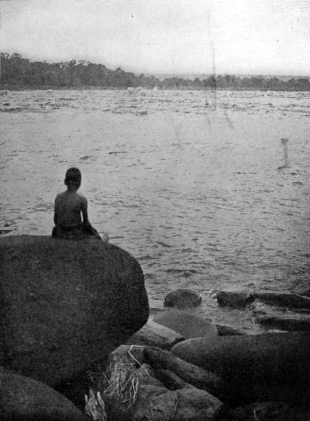
Copyright by Underwood & Underwood, N. Y.
THE CONGO
Among the great tributaries should be mentioned specially the following; the Aruwimi, noted as the scene of the terrible sufferings of the famous Emin Pasha relief expedition; the Ubangi, or Welle-Makua, which is itself a mighty river, rising away in the “Heart of Africa,” and flowing some 1,200 miles before it joins the main stream. On the south bank may be named the Lubilash or Boloko, navigable for 200 miles; the Lulongo, with its branches—the Lopori and Maringa—navigated for 500 miles by the Rev. George Grenfell; the Chuapa, with its branch, the Busera, up which Mr. Grenfell has also steamed some 500 miles. To these may be added the Kwa, which with its tributaries—the Lukenye, the Kasai, the Sankurn, the Kwango, and a number of others—adds enormously to the volume of the Congo, and affords some 1,500 miles of navigable water.
The great river from Stanley Falls to Stanley Pool has an average width of some five miles, but in places it reaches as much as sixteen miles wide, and is split up into separate channels by large islands, with which its bosom is studded. After passing through Stanley Pool the river ceases to be navigable for about 235 miles—except for one comparatively short break of eighty miles—owing to the angry cataracts known as the Livingstone Falls. Below the falls the river again becomes navigable to the Atlantic Ocean, some 110 miles distant.
The majestic river rushes with such an enormous volume into the open ocean that, for many miles out at sea, its stream can be distinctly traced, and its waters remain fresh, refusing for a long time to become contaminated by the salt of the mighty waste of waters.
The main river and its tributaries have already been explored for at least 11,000 miles. This, of course, gives a length of river banks of no less than 22,000 miles. It can be better grasped what this means when we remember that the whole coast-line of Europe, following every indentation of the shore—from the most northern point of Norway to the spot in the Black Sea where the Caucasus Mountains separate Europe from Asia—is only 17,000 miles, or 5,000 miles less than the total length of river banks past which the mighty Congo continually sweeps. To give another illustration, I may remind you that the circumference of the globe on which we live is 24,000 miles. So that the length of the banks of the Congo—so far as they are at present known—only falls some 2,000 miles short of the total girth of our planet. When the great river becomes more completely known the extent of the river’s banks may probably be found to equal, and very possibly to exceed, the earth’s circumference.
The total length of the main river—omitting the branches—from source to mouth is close upon three thousand miles, equal to the distance from Liverpool to New York.
The area of territory drained is something over 1,500,000 square miles, or equal, roughly speaking, to about one-eight of the whole continent of Africa. It exceeds the total area of India by 200,000 square miles, and would only be equalled by thirty-two Englands. It is needless to quote further figures in order to impress upon us the enormous extent and importance of Africa’s greatest waterway.
The wide-spreading arms of the Congo reach themselves out on all sides to such a distance and extent that the remote headwaters, or fountains, overlap and almost intermingle with the streams which contribute their waters to the other great rivers of the continent. On the north-west we find some of the early streams flowing almost from the same sources which supply tributaries of the Niger and the Shari. In the north-east we find the remote tributaries of the Welle-Makua almost touching those of the Bahr-el-Ghazal, which helps to swell the Nile. The headwaters of the Aruwimi, again, flow from within a few minutes’ walk of where a view can be obtained of the Albert Lake, also belonging to the Nile system. The Malagarazi River, which flows into Lake Tanganyika, and so finds its way to the Congo, rises in the same hills which gave birth to the Alexandra Nile, a western affluent to Lake Victoria. We find, also, many of the great tributaries on the southern bank of the Congo flow from highlands which also pay tribute to streams flowing to the Zambezi.
In comparison with the historic tales the Nile and Niger have to tell us, the story of the Congo is only very modern. The early history of the great river is very meagre indeed, and we search the ancient classics in vain for any mention of even its existence.
The river was, and is to this day, known to the Portuguese as the Zaire, but the actual meaning of the word is doubtful. Some consider it to simply mean river. The country through which the great river flows was known to the Portuguese as the kingdom of the Congo. The Zaire, therefore, appeared upon the early Portuguese maps as Rio de Congo, which, when translated, became, of course, on English maps, River of Congo, and finally simply Congo, as we now know it.
Although the mouth of the Congo was discovered by the Portuguese over four hundred years ago, very little was known of the geography of the river itself until our own century. Jesuit missionaries certainly settled in the kingdom of the Congo, and they doubtless collected much information from the native travellers regarding the geography of the interior.
The English geographer, Peter Heylyn, writing in 1657, speaks of the Zaire, or River of Congo, rising in Lake Zembre. After naming the rivers of the Country of Congo, he goes on to say: “This last (the Zaire), the greatest of them all, if not of all Africk also: Of which, though we have spoke already, we shall add this here, that it falleth into the Æthiopic Sea with so great violence, that for ten miles commonly, for fifteen sometimes, the waters of it do retain their natural sweetness: not intermingled nor corrupted with the Salt Sea-water: Nor can the people sail above five miles against the stream of the cataracts, or huge falls which it hath from the Mountains; more terrible and turbulent than those of the Nile.”
The great discoveries connected with the Congo have been in almost all cases the result of inquiries set on foot for other purposes, and not the outcome of direct research. This is especially the case with regard to the long and tedious wanderings of Dr. Livingstone, between the years 1866 and 1873, which terminated only in his death in the latter year. When Livingstone started upon his last and greatest expedition in 1866, it was with the idea of clearing up certain doubtful points connected with Lakes Tanganyika and Nyasa, and of establishing, if possible, the southern limit of the Nile watershed. He had no intention of working at the Congo at all, and, in fact, remarks in his journal, in a half jocular manner, that he had no desire to become “blackman’s meat” for anything less than the Nile.
Stanley’s great journey from Nyangwe to Boma made known, of course, only the main stream of the river, but it opened the way, and from that day down to the present a whole legion of travellers, both British and European, have devoted themselves to the filling in of the details. The great traveller himself shortly after discovered lakes Leopold II. and Mantumba; and so recently as 1887 explored the great Aruwimi territory, following it to its source in the neighbourhood of the Albert Lake, when engaged in his last great journey through “Darkest Africa.”
The Nineteenth Century has been what we may call the age of discovery, so far as the Congo is concerned. The geography of the river is now fairly well known, the discoveries of the past twenty years having undoubtedly transcended all possible expectations or even conceptions. The next century will in all probability be one of Congo commerce and Congo engineering. Already we find a railway some 250 miles in length, in course of construction, which, when completed, will overcome the natural difficulties of transport in the neighbourhood of the Livingstone Falls, and throw open to the world the mighty natural highway to the heart of the Continent. Already we find, in spite of the difficulties of the cataract region, that some thirty odd steamers are daily ploughing their way up and down the Congo’s giant stream. Thus has the great river begun the work of bearing the naturally rich products of the Congo basin to the coast, and of carrying the return commodities into the interior.
The work of the explorer, the trader, and the missionary is already beginning to bear fruit. In their wake will follow civilization, commerce and Christianity. Cities—centres of industry and light—will be founded, and in due time the peoples of the “Heart of Africa” will take their place in the progress of the world.