THE DANUBE
Reading edition
I. BOWES
NEXT to the Volga, the Danube is the largest river in Europe, and for volume of water and commercial importance it far exceeds that river. It is estimated that the Danube carries more water to the sea than all the rivers of France.
The river rises at the head of a pleasant little valley high up in the mountains of the Black Forest; coming tumbling down the rocks a tiny stream of clear water, and, gathering strength and volume from numerous springs and rivulets, it cuts a deep channel into the rich soil and dances gaily along, presently to be joined by the Brigach and its twin-sister, the Brege, which rise about ten miles further to the south. These are the highest sources of the mighty River Danube, the great water highway of Europe, celebrated for ages in legend and song and in ancient and modern history for important military events, and, in its flow of nearly 2,000 miles to the Black Sea, unfolding the most remarkable panoramas of natural beauty known to the geographer; whilst on its banks may be found groups of the most interesting nationalities of the world.
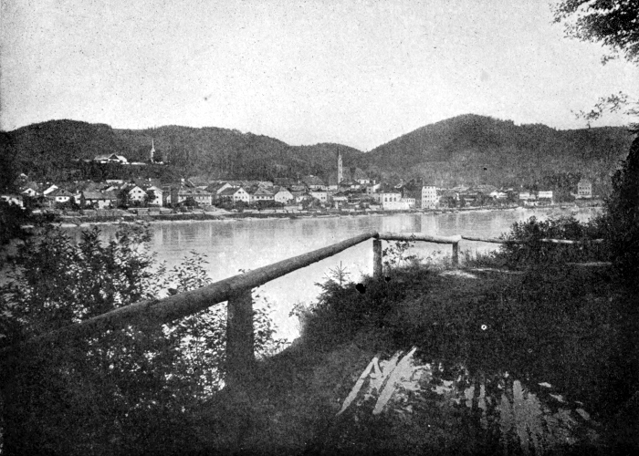
THE DANUBE
Donaueschingen, a tidy little town in the Grand Duchy of Baden, is sometimes called the source of the Danube. It is situated about a mile and a half below the point where the Brigach and the Brege join the river, which from this point is called the Donau or Danube, and it is the head of the navigation for small boats on the upper river. Between here and Ulm there are twenty-one weirs and dams, and many pleasant villages, pretty little towns, ruined castles, and princely residences; amongst the latter may be named Hohenzollern, near Sigmaringen, the seat of the Imperial family of Prussia. The scenery in the locality of the castle is of great beauty, and the town, pleasantly situated on the banks of the river, has a charming appearance.
The river below Sigmaringen flows through a broad, fertile valley, and with a quicker current, as the banks have been partially canalized; and small towns, with names of wondrous length and ponderous sound, such as Munderkingen, Kiedlingen, Reichenstein, etc., suggest places that are or have been of great importance. In the distance the great tower of the Cathedral of Ulm is seen rising up out of the low horizon. Ulm is a great military stronghold, and the old town a maze of narrow, crooked streets. The Cathedral is said to be next in size to that at Cologne, and is a fine specimen of Gothic architecture, with the highest stone tower in the world.
Below Ulm several smaller towns are passed before reaching Ratisbon, a city of 40,000 inhabitants, famous for many historical events. The Cathedral of Saint Peter is one of the architectural glories of Germany. Freight steamers, barges, tugboats, and passenger steamers abound on this part of the river. Long flat boats sixty feet long, such as we see on the Rhine, pass down to the Lower Danube, laden with grain, timber, etc.
Linz, with its 500,000 inhabitants, is an interesting town; and the river scenery, between here and Vienna, is said to rival the Rhine scenery, the hills being more varied in outline and the slopes richer in verdure.
At Vienna the river is more crowded still, and is crossed by some fine road and railway bridges; and many show sights are here, such as cathedrals, historical buildings, etc., and more than a fair share of cafés, theatres and music-halls. In this respect it rivals Paris, and, some say, exceeds it in wickedness.
After leaving Vienna, Hainburg, Kieben and Presburg (with its 50,000 inhabitants), where the Hungarian kings have for ages been crowned, are passed; then Komorn, and through the fertile plains of Hungary to Buda Pesth, a beautiful, prosperous city, with a population of 500,000. It is said that the extensive quays facing the river and the imposing buildings are the finest on the whole course of the Danube. Lower down the river the inhabitants on either bank show distinct traces of Magyar descent.
And now leaving the Hungarian territory for Servia, Belgrade with its great fortress comes in sight. Many parts of the city are Turkish in appearance, and the inhabitants are a mixture of Hungarians, Turks and Servians.
About sixty miles below Belgrade the river leaves the Hungarian plains, and at Bazias the chief hindrances to the navigation of the Danube begin and extend to Sibb, a distance of about eighty-two miles. The obstructions may be divided into four sections, viz:—No. 1. The Stenka Rapids; No. 2. The Kozla Dojke; No. 3. The Greben Section; and No. 4. The Iron Gates. The first named rapids are about 1,100 yards long; nine miles lower down the second section—about one and a half miles long—begins, and the river is narrowed from about 1,000 yards in width to about 300 and in some places 170 yards. These rapids are caused by rocks in the bed of the river, some of which are almost dry at low water, extending nearly across it, and causing sudden alterations in the currents and dangerous whirlpools and eddies.
At Greben, four miles lower down, there were formidable obstacles to be overcome, and some of the heaviest work in the undertaking had to be faced; for at this point a spur of the Greben Mountain juts out into the river, and suddenly reduces its width at low water. When the snow and ice in the upper reaches of the river melt, or in heavy rain, the river rapidly rises, and, being blocked by these obstacles, causes damaging floods in the fertile valleys of Hungary.
Below the Greben rapids the river widens out to about one and a half miles, and passing the cutting and training walls at the rapids of Jucz enters the Kazan defile, which is said to be the most picturesque part of the Lower Danube. The cliffs, of great height, approach nearer and nearer to each other, until the river is contracted to 120 yards wide.
Passing through this dark and sombre defile into the valley of Dubova, it widens to 500 metres; the mountains again approach and reduce the width to about 200 yards. The depth at these straits varies from ten metres to fifty metres. It was through this defile that Trajan, nearly 2,000 years ago, made riverside roads and towing paths in continuation of the small canals and waterways to evade the rocks and currents and to facilitate the transport of his armies and military trains for the Roman campaigns in Central Europe. The ruins of these works are a proof of the great labour expended upon them, and also of the skill in engineering possessed by the Romans in those days. The tablets engraved on the rocks, still in part visible, commemorate their heroic deeds.
Following our course down the river, at ten kilometres from the Kazan, we come to Orsova, a rather important place of call for steamers and trading-vessels; and, now that the river is navigable for larger vessels, this place is destined, from its railway communications, etc., to become a great trading centre.
At a distance of eight kilometres from Orsova, the Iron Gate, situated between Roumania and Servia begins, and is for a length of about three kilometres the largest and most dangerous obstacle on the Lower Danube. The rocks in the channel impede the current, forming dangerous eddies and cataracts.
The Prigrada Rock rises above low water with a width of 250 metres and a length of about two kilometres, stretches in a crooked line across the river to the Roumanian shore, with a narrow channel, through which vessels of light draught only can be navigated with difficulty. The river, pouring over this rock, forms dangerous whirlpools and cataracts, requiring the greatest watchfulness, care, and experience on the part of the navigator to overcome the dangers of what has well been called “The Iron Gates.” Hundreds of steamers and vessels have been wrecked in attempting this dangerous passage.
Like many other great projects many schemes had been proposed and plans for carrying them out by different authorities had been considered, but nothing definite was done until in 1888, the Hungarian Government, under rights conferred upon it by the Berlin Treaty of 1878, and the London Treaty of 1871, undertook the work of construction and administration under the conditions of the treaties which gave them the power to levy tolls on trade ships for covering the expenses of the works.
The ceremony of the inauguration took place on the 27th of September, 1896, when the Emperor of Austria, King Charles of Roumania, and King Alexander of Servia, with an immense gathering of bishops, generals and diplomatic representatives, etc., met at Orsova, and proceeded through the Iron Gates and the beautiful and romantic Kazan Pass with a procession of six vessels, which included a monitor and torpedo boat, and accompanied by a continuous discharge of artillery and the loud huzzas of the immense gathering of soldiers, visitors and inhabitants.
Below the Iron Gates the river broadens out and the scenery is tame and uninteresting, for the vast plains of Roumania extend from the foot of the hills here to the shores of the Black Sea, and the maritime and commercial aspects of the surroundings begin to manifest themselves—the river becomes more crowded with craft of all kinds as we approach the towns on the Lower Danube.
We pass Widin, and, lower down, Sistova where, in the Russo-Turkish war, the Russians crossed the river to Plevna and the Balkan passes. Thirty-five miles lower down we reach Rustchuk, the most important Bulgarian town on the river, and fast becoming a great emporium of trade, being on the main line of railway to Constantinople, viâ Varna.
We then pass Silistria and approach the longest railroad bridge in the world. This bridge crosses the Danube below Silistria, and carries the railway from Kustendji on the Black Sea into Roumania.
Braila, 125 miles from the mouth of the river, is the chief port for the shipment of produce, etc., from the grain-growing regions of Roumania and Northern Bulgaria. Here are extensive docks, grain elevators, and thousands of men of all nationalities engaged in loading steamers and sailing vessels from all countries. The British flag is everywhere present. As a commercial port the place is fast outstripping its neighbour, Galatz, fifteen miles lower down.
From Galatz to the sea, the navigation of the river, the dredging, removing of obstacles, levying of tolls, etc., is controlled by an International Commission established by treaty in 1878, since which date great improvements have been made, chiefly in the lower reaches and the Sulina mouth of the river, by the construction of groynes, revetments and cuttings to avoid the bends, and constant dredgings by powerful dredgers are carried on.