THE NILE
Reading edition
J. HOWARD REED
THE holy river—“the Jove-descended Nile”—formerly bore the name of Ægyptus. Professor Rawlinson in his History of the Ancient Egyptians, says: “The term Egypt was not known to the ancient Egyptians themselves, but appears to have been first used by the Greeks as a name for the Nile, and thence extended to the country. It is stated by some authorities that the river received its present title from Nilus, an ancient king of Thebes, who named the stream after himself.”
“Father Nile” was an object of great veneration to the ancients, and a gift of its waters was considered by them as a present fit for kings and queens. The veneration in which the river was held, of course, arose from the blessings of its annual overflow spread broadcast over its banks by fertilizing the seed of the sower, producing abundant crops for the sickle of the reaper, and thus making glad the heart of man. It is stated that the Arabs in the present day consider it a delicious privilege to slake their thirst with the salubrious and agreeable waters of the river, and I have read that they will even artificially excite thirst to indulge in the pleasure of imbibing refreshing and satisfying draughts from the “holy stream.” The general Pescennius Niger is said to have cried to his soldiers: “What! crave you for wine, when you have the water of the Nile to drink?” Homer is stated to have said, no doubt referring poetically to its regular and fertilizing overflow: “The Nile flows down from heaven.” The Egyptians say that “If Mahomet had tasted the waters of the Nile, he would have prayed God to make him immortal, that he might have enjoyed them for ever.”
The river has a total length of considerably over 3,000 miles, and is remarkable among the rivers of the world from the fact that for about the last 1,500 miles of its flow it receives no tributary—none, in fact, after the Albara or Tacazze. The consequence is that, by the time it reaches the sea, its volume is considerably reduced by evaporation, and from the large quantity of water used along its banks for irrigation and other purposes. The river is formed of two principal branches, the Bahr-el-Azrek, or Blue Nile, and the Bahr-el-Abiad, or White Nile, the latter of which is the main branch or true Nile. It receives also, as tributary rivers, the Atbara or Tacazze before mentioned, with the Sobat and Asua on the east side; and the Bahr-el-Gazelle on the west; besides other smaller and less important streams. Its waters are discharged into the Mediterranean through several mouths, the two principal of which are known as the Rosetta and Damietta mouths—the first-named being to the west and the other to the east. The principal island formed by the divisions of the river being shaped like the fourth letter of the Greek alphabet, takes the name of Delta; and the Nile is doubtless the river which first suggested what is now a technical name for all similar formations at the mouths of rivers.
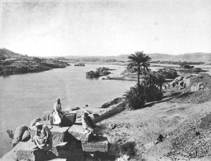
THE NILE
The rise and overflow of the Nile caused by the seasonal rains of the interior, has been for ages noted for its regularity. The rise commences about midsummer, reaches its greatest height at the autumnal equinox, and has again subsided by Christmas; leaving the land highly enriched by the fertilizing sediment of red earth brought down by the Abyssinian tributaries and deposited by the river. The land can then be worked and the crops planted. The rise and fall of the river is watched with great anxiety by the inhabitants of the Nile valley. At intervals along its banks river gauges, or nilometers, are fixed, upon which the variations of the river are duly recorded.
Nearly five centuries before the Christian era, the first great African traveller, Herodotus, writing about the Nile, said: “Respecting the nature of this river, I was unable to gain any information, either from the priests or any one else. I was very desirous, however, of learning from them why the Nile, beginning at the summer solstice, fills and overflows for a hundred days; and when it has nearly completed this number of days, falls short in its stream and retires; so that it continues low all the winter, until the return of the summer solstice.”
Seneca writes that the Emperor Nero sent an exploring expedition under two centurions with military force to explore the countries along the banks of the Astapus or White River, and to search for the Nile’s sources. They passed down the river a considerable distance until immense marshes were met with. They forced their way through, and continued their journey southward, until the river was seen “tumbling down or issuing out between the rocks.” They were then obliged to turn back and declare their mission a failure. The centurions are stated to have brought back with them a map of the districts they had passed through, for the information of the Imperial Nero.
This early expedition succeeded in penetrating about 800 Roman miles south of Meroe—that is to say, reaching three or four degrees north latitude. The place where water was seen “tumbling down from between the rocks” was probably the Fola or Mekade cataract, again discovered in our own day by the late General Gordon. The river here rushes through a narrow ravine, over and between rocks of from thirty to forty feet high. These falls are stated to be the only insurmountable obstacle to the navigation of the Nile, for vessels of considerable size, from the Mediterranean to the Albert Lake.
About seventy years later, during the Second Century, we find Claudius Ptolemy, a celebrated geographer and astrologer of Alexandria, writing about the Nile and its sources. He tells us that the “holy stream” rises some twelve degrees south of the equator, in a number of streams that flow into two lakes, situated east and west of each other; from which, in turn, issue two rivers; these afterwards unite and form the Nile. Ptolemy also mentions that in the interior of Africa were some mountains which he called “Selenes Oros”—generally translated “Mountains of the Moon.”
Following in the steps of Ptolemy, come the Arab geographers, and they are stated to have practically adopted all his theories and geographical notions.
Later on we find that the Portuguese travellers obtained a considerable amount of information regarding the geography of the interior of Africa. They appear to have had some knowledge of the existence of several large lakes in the centre of the continent, and in some of their early maps these lakes find a place.
It appears to have been known to the ancients that the Nile proper is formed of two principal branches, which join and form one river close to where the town of Khartoum (or its ruin) now stands; but beyond this, as we have seen, little authentic information has been handed down.
In the year 1770, Bruce gave his attention to the Blue Nile. He was enabled to locate the sources of that branch of the river among the mountains and highlands of Abyssinia, near Lake Dembea. In 1788, the African Association was founded, and in furtherance of its objects much information was obtained of the geography of the “Dark Continent.” In 1827, M. Linant, a French traveller, passed up the White Nile to a considerable distance above its junction with the Blue Nile branch. About the year 1840 two Egyptian naval officers headed an expedition, fitted out by Mahommed Ali, the then ruler of Egypt; they forced their way through the terrible marshes to within 3° 4″ of the equator; but were, like the expedition of the Emperor Nero, at last obliged to turn back.
In 1831, the old African Association was merged into the Royal Geographical Society, and from then, right down to the present time, our knowledge of the Nile and its sources has been perfecting itself.
While resting on the plateau land above the south-west corner of the Albert Lake, on the 25th of May, 1888, Stanley’s attention was called to a towering mountain height capped with snow, which, from where he stood, lay about fifty miles away to the south-east. Twelve months later on his homeward journey, after crossing the Semliki River, which he found flowing into the south end of the Albert Lake, Stanley found himself following a range of hills, the tops of which towering up some 19,000 feet high, were covered with perpetual snow. This melting under the action of a tropical sun, poured its volumes of water into the Semliki River at his feet, which in turn conveyed it thence to the Albert Lake and onwards to swell the torrent of Father Nile.
Stanley writes: “Little did we imagine it, but the results of our journey from the Albert Nyanza to —— where I turned away from the newly-discovered lake in 1876, established beyond a doubt that the snowy mountain, which bears the native name of Ruwenzori or Ruwenjura, is identical with what the ancients called ‘Mountains of the Moon.’
“Note what Scheadeddin, an Arabian geographer of the Fifteenth Century writes: ‘From the Mountains of the Moon the Egyptian Nile takes its rise. It cuts horizontally the equator in its course north. Many rivers come from this mountain and unite in a great lake. From this lake comes the Nile, the most beautiful and greatest of the rivers of all the earth.’”