THE JORDAN
Reading edition
ANDREW ROBERT FAUSSET
THE Jordan is two hundred miles long from its source at Antilebanon to the head of the Dead Sea. It is not navigable, nor has it ever had a large town on its banks. The cities Bethsham and Jericho on the west, and Gerasa, Pella, and Gadara to the east of Jordan produced intercourse between the two sides of the river. Yet it is remarkable as the river of the great plain (ha Arabah, now el Ghor) of the Holy Land, flowing through the whole from north to south. Lot, from the hills on the north-west of Sodom, seeing the plain well watered by it, as Egypt is by the Nile, chose that district as his home, in spite of the notorious wickedness of the people.
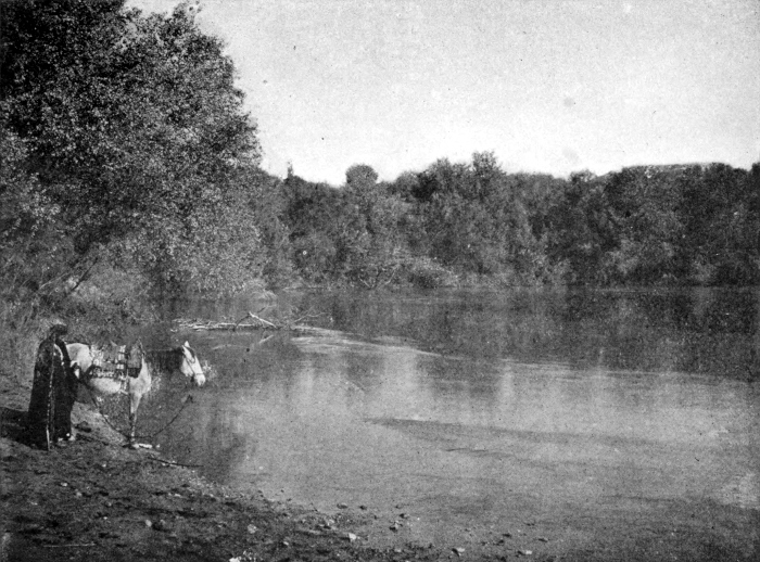
THE JORDAN
Its sources are three. The northernmost near Hasbeya between Hermon and Lebanon; the stream is called Hasbany. The second is best known, near Banias, i. e., Cæsarea Philippi, a large pool beneath a high cliff, fed by gushing streamlets, rising at the mouth of a deep cave; thence the Jordan flows, a considerable stream. The third is at Dan, or Tel el Kady (Daphne); from the north-west corner of a green eminence a spring bursts forth into a clear wide pool, which sends a broad stream into the valley. The three streams unite at Tel Dafneh, and flow sluggishly through marshland into Lake Meron. Captain Newbold adds a fourth, wady el Kid on the south-east of the slope, flowing from the springs Esh Shar. Indeed Antilebanon abounds in gushing streams which all make their way into the swamp between Banias and Huleh and become part of the Jordan. The traditional site of Jacob’s crossing Jordan at his first leaving Beersheba for Padan Aram is a mile and a half from Merom, and six from the Sea of Galilee: in those six its descent with roaring cataracts over the basaltic rocks is 1,050 feet. This, the part known to Naaman in his invasions, is the least attractive part of its course; and was unfavourably contrasted with Abana and Pharpar of his native land. From the Sea of Galilee, it winds 200 miles in the sixty miles of actual distance to the Dead Sea. Its tortuous course is the secret of the great depression (the Dead Sea being 663 feet below the lake of Galilee) in this distance.
Three banks may be noted in the Ghor or Jordan valley, the upper or first slope (the abrupt edge of a wide table land reaching to the Hauran Mountains on the east and the high hills on the west side), the lower or middle terrace embracing the strip of land with vegetation, and the true banks of the river bed, with a jungle of agnus castus, tamarisks, and willows and reed and cane at the edge, the stream being ordinarily thirty yards wide. At the flood, the river cannot be forded, being ten or twelve feet deep east of Jericho; but in summer it can, the water being low. To cross it in the flood by swimming was an extraordinary feat performed by the Gadites who joined David; this was impossible for Israel under Joshua with wives and children. The Lord of the whole earth made the descending waters stand in a heap very far from their place of crossing, viz: by the town of Adam, that is beside Zarthan or Zaretan, the moment that the feet of the priests bearing the ark dipped into the water. The priests then stood in the midst of the dry river bed till all Israel crossed over. Joshua erected a monument of twelve large stones in the river bed where the priests had stood, near the east bank of the river. This would remain at least for a time as a memorial to the existing generation besides the monument erected at Gilgal.
By this lower ford, David passed to fight Syria, and afterwards in his flight from Absalom to Mahanaim, east of Jordan. Thither Judah escorted him and we crossed in a ferry boat. Here Elijah and Elisha divided the waters with the prophets’ mantle. At the upper fords Naaman washed off his leprosy. Here too the Syrians fled, when panic-struck by the Lord.
John the Baptist “first” baptized at the lower ford near Jericho, whither all Jerusalem and Judea resorted, being near; where too, our Lord took refuge from Jerusalem, and where many converts joined Him, and from whence He went to Bethany to raise Lazarus. John’s next baptisms were at Bethabara; thither out of Galilee the Lord Jesus and Andrew repaired after the baptisms in the south, and were baptized. His third place of baptism was near Ænon and Salim, still farther to the north, where the water was still deep though it was summer, after the passover, for there was no ford there; he had to go thither, the water being too shallow at the ordinary fords. John moved gradually northwards towards Herod’s province, where ultimately he was beheaded; Jesus, coming from the north southwards, met John half-way.
The overflow of Jordan dislodged the lion from its lair on the wooded banks. Between Merom and Lake Tiberias the banks are so thickly wooded as often to shut out the view of the water.
Four-fifths of Israel, nine tribes and a half, dwelt west, and one-fifth, two and a half, dwelt east of Jordan. The great altar built by the latter was the witness of the oneness of the two sections. Of the six cities of refuge three were east, three west of Jordan at equal distances.
Jordan enters Gennesareth two miles below the ancient city Julias, or Bethsaida, of Gaulonitis on the east bank. It is seventy feet wide at its mouth, a sluggish, turbid stream. The lake of Tiberias is 653 feet below the Mediterranean level. The Dead Sea is 1,316 feet below the Mediterranean, the springs of Hasbeya are 1,700 above the Mediterranean, so that the valley falls more than 3,000 feet in reaching the north end of the Dead Sea. The bottom descends 1,308 feet lower, in all 2,600 below the Mediterranean. The Jordan, well called “the Descender,” descends eleven feet every mile. Its sinuosity is less in its upper course. Besides the Jabbok it receives the Hieromax (Yarmuk) below Gennesareth. From Jerusalem to Jordan is only a distance of twenty miles; in that distance the descent is 3,500 feet, one of the greatest chasms in the earth; Jerusalem is 2,581 feet above the Mediterranean.
Bitumen wells are not far from the Hasbeya in the north. Hot springs abound about Tiberias; and other tokens of volcanic action, tufa, etc., occur near the Yarmuk’s mouth and elsewhere. Only on the east border of Lake Huleh, the land is now well cultivated, and yields largely wheat, maize, rice, etc. Horses, cattle, and sheep, and black buffaloes (the “bulls of Bashan”) pasture around. West of Gennesareth are seen corn, palms, vines, figs, melons, and pomegranates. Cultivation is rare along the lower Jordan, but pink oleanders, arbutus, rose hollyhocks, the purple thistle, marigold, and anemone abound. Tracks of tigers and wild boars, flocks of wild ducks, cranes, and pigeons have been seen by various explorers. There are no bridges earlier than the Roman. The Saracens added or restored some. The Roman bridge of ten arches, was on the route from Tiberias to Gadara. In coincidence with Scripture, the American survey sets down three fords: that at Tarichæa, the second at the Jabbok’s confluence with the Jordan, and that at Jericho. The Jordan seldom now overflows its banks; but Lieutenant Lynch noticed sedge and driftwood high up in the overhanging trees on the banks, showing it still at times overflows the plains. The flood never reaches beyond the lower line of the Ghor, which is covered with vegetation. The plain of the Jordan between the Sea of Galilee and the Dead Sea is generally eight miles broad, but at the north end of the Dead Sea the hills recede so that the width is twelve miles, of which the west part is named “the plains of Jericho.” The upper terrace immediately under the hills is covered with vegetation; under that is the Arabah or desert plain, barren in its southern part except where springs fertilize it, but fertile in its northern part and cultivated by irrigation. Grove remarks of the Jordan: “So rapid that its course is one continued cataract, so crooked that in its whole lower and main course it has hardly a half mile straight, so broken with rapids that no boat can swim any distance continuously, so deep below the adjacent country that it is invisible and can only be with difficulty approached; refusing all communication with the ocean, and ending in a lake where navigation is impossible, unless for irrigation, it is in fact what its Arabic name signifies, nothing but a ‘great watering place,’ Sheriat el Khebir.”