THE THAMES
Reading edition
CHARLES DICKENS, JR.
ALTHOUGH scarcely any of the scenery of the Thames above Oxford is to be mentioned in the same breath with the beauties of Nuneham, of Henley, of Marlow, or of Cliveden, there is still much to attract the lover of nature who is content with quiet and pastoral landscapes and to whom the peaceful solitude through which the greater part of the journey lies, will have a peculiar charm. It is not advisable to take boat at Cricklade. For some distance below this little Wiltshire town the stream is narrow, and in dry seasons uncomfortably shallow. Travellers, therefore, who come to Cricklade, with the intention of seeing as much of the river as possible, may be recommended to take the very pretty walk of about ten miles along the towing-path of the Thames and Severn Canal to Lechlade. Here the river proper may be said to begin. Half a mile after leaving Lechlade on the right is St. John’s Lock with an average fall of three feet; and just below it is the St. John’s Bridge, with the Trout Inn on the left bank. For some distance below this stream is very narrow, and generally weedy; and, after passing Buscot Church, a couple of sharp turns brings us on the left to Buscot Lock. A couple of miles lower down is the little village of Eaton Hastings; Faringdon Hill, with its large clump of Scotch firs being a conspicuous object on the right bank and two miles further again is Radcot Bridge, distant from Oxford twenty-six miles. The next point is Old Man’s Bridge, twenty-five miles from Oxford, and after about two miles of rather monotonous travelling, we come sharp on the left to Rushy Lock and a mile further to Tadpole Bridge, twenty-two miles from Oxford, with the Trout Inn, a convenient place for luncheon. About a couple of miles from Tadpole is Ten Foot Bridge and a mile or so lower down are the village and ferry of Duxford. A mile or so below this there is considerable shoaling and half a mile further an island with Poplars, where the Berks bank should be followed. After making two or three bends, beyond this point, there is a prettily wooded bank on the right, and a short mile of capital water for rowing brings us to New Bridge from Oxford fifteen miles, which, notwithstanding its name, is of great antiquity. Another mile brings us to the bridge where was formerly Langley’s or Ridge’s Weir. About four and a half miles from New Bridge is Bablock Hithe Ferry, ten and a half miles from Oxford, below which there is a fine stream, the scenery becoming very good, with fine bold hills and the Earl of Abingdon’s woods at Wytham. After passing Skinner’s Weir, the river twists and turns about a good deal until we reach Pinkhill Lock, eight and a half miles from Oxford, with a fall of about three feet. Round a good many corners and rather more than a mile off is Eynsham Bridge. Good reaches for about three miles bring us to King’s Weir, sharp on the right, the stream to the left going to the Duke’s Lock, the junction with the Oxford Canal. Passing presently under Godstow Bridge, are seen the ruins of Godstow Nunnery and Godstow Lock, three and a half miles from Oxford, on leaving which a pretty view of the city is obtained. Three hundred yards further is Osney Lock. A little further is Folly Bridge, Oxford.
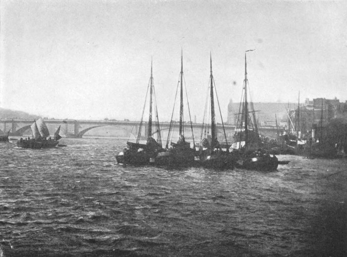
THE THAMES
The towing-path after leaving Folly Bridge, Oxford, follows the right bank. On the left are the boat-rafts and the barges of the various colleges moored off Christ Church Meadows, where in the winter, after a flood, there is sometimes capital skating. About three-quarters of a mile from Folly Bridge are the long bridges across a backwater, which reënters the Thames—in this part of its course sometimes called the Isis—half a mile below Iffley. Half a mile below Iffley is the iron bridge of the Great Western Railway, from beneath which is a very pretty view of the spires of Oxford, particularly of the tower of Magdalen College. Along the left bank for some distance is one of those grand pieces of woodland scenery for which the Thames is so renowned. The woods extend as far as the iron railway bridge, after passing which the spire of Abingdon church appears above the trees to the right. Rather more than a mile below the cottages at Nuneham is the fall on the left where the old and present channels divide. Half a mile further and sharp to the left is Abingdon Lock, average fall six feet, from London 104½ miles, from Oxford seven and one-quarter miles. The river here runs through flat meadows. The view of Abingdon, with the spire of St. Helen’s, is very pretty. Culham Lock, a good stone lock with an average fall of seven feet; Clifton Lock with an average fall of three feet; and Days Lock with an average fall of four feet six inches, are passed. A little over a mile on the left bank is Dorchester with its famous abbey church. The footpath crosses the Roman remains known as The Dyke Hills. On Sinodun Hill on the right is a fine Roman camp. Below the ferry on the right is Bensington Lock, with an average fall of six feet six inches. The country from here to Wallingford is charmingly wooded.
Wallingford, from London ninety and three-quarter miles, from Oxford twenty and three-quarter miles is a very convenient place to break the journey, and the breakfasts and ale at the “Lamb” deserve particular attention. From Cleeve Lock there is a lovely view of the hills and woods above Streatley. Goring Lock is a favourite place for campers. Further on to the right are Basildon church and village and further still, opposite the beech woods and on the brow of the hill to the right is Basildon Park. At this point a fine stretch of water runs almost in a straight line for a considerable distance; the banks on either side are well wooded, and the view up or down is one of the most sylvan on the river. Just before making the bend before Pangbourne Reach is Coombe Lodge with its beautiful park, and at the end of the chalk ridge on the right is Pangbourne, from London eighty and three-quarter miles, from Oxford thirty and three-quarter miles.
Below Whitchurch Lock a wooden bridge connects Whitchurch and Pangbourne, and at its foot is the pretty house known as Thames Bank. After leaving Mapledurham Lock on the right, there is a charming view. Caversham Bridge, the nearest point for Reading, and Caversham Lock, Sonning Lock and Sonning Shiplake Lock and Wargrave and Marsh Lock bring us distant from London sixty-six miles.
A mile from Marsh Lock we come to Henley. A handsome bridge spans the river here; the tow-path crosses to the right bank. A short half mile below greenlands on the right is Hambleden Lock. At the next bend in the river the red brick house on the right is Culham Court, and here the view up the river to the poplars and wooded hills above Hambleden is very charming. Passing Culham keep to the left bank, leaving the island known as Magpie Island on the right. Half a mile farther, on the top of the high wooded hill on the left, is a farmhouse on a site where has been a farm since Domesday Book was compiled. Two miles from the lock is Medmenham Abbey, with the Abbey Hotel, a well-known and convenient place for water-parties.
On the right bank at Hurley Lock is the village of Hurley with Lady Place, so well known in connection with Lord Lovelace in the revolution of 1688. About half a mile further is Marlow, with its graceful suspension bridge and ugly church. Three hundred yards below the bridge is Marlow Lock. Another three-quarters of a mile brings us to Cookham. Cookham Lock is the most beautifully situated on the river, just under the woods of Hedsor and Cliveden. The scenery down the next reach and past the islands is exceedingly beautiful and is generally considered the finest on the river. Not quite two and a half miles from Cookham Lock is Boulter’s Lock, from London fifty miles.
Below Maidenhead Bridge is the Great Western Railway bridge, supposed to be the largest brick bridge in the world. A mile from Maidenhead is the pleasant village of Bray. Rather more than a quarter of a mile on the left is Bray Lock. Half a mile further is Monkey Island, and here for a little distance there is a good stream. Two miles and a half from Bray Lock, on the right bank, is Surly Hall, an inn well known to Etonians. About another half mile brings us to Boveney Lock on the left. On the right is Windsor racecourse, and three-quarters of a mile down is Athens, the bathing-place of the senior Eton boys. The Great Western Railway bridge and the Brocas clump on the left are next passed, and we arrive at Windsor on the right bank and Eton on the left. The river is here crossed by an iron and stone bridge of three arches. After passing through Windsor bridge, the right bank on which is the tow-path should be kept. The rapid and dangerous stream to the left runs to the weir and the neighbourhood of the Cobbler, as the long projection from the island is called, is undesirable when there is much water in the river. Not half a mile below Windsor bridge is Romney Lock. After passing through Romney Lock, beautiful views of Eton College, the playing-fields and Poet’s walk are obtained on the left, and on the right are Windsor Castle and the Home Park. Farther down is the Victoria Bridge, one of two which cross the river at each extremity of the park, and about a mile and a half from Romney Lock is Datchet on the left bank. After the second of the royal bridges, the Albert, is passed, the right bank must be kept, and a long narrow cut crossed half way by a wooden bridge leads to Old Windsor Lock. Three-quarters of a mile from the lock, in pretty scenery, is the well-known “Bells of Ousely” tavern. Half a mile farther down Magna Charta Island, with its cottage is on the left. Runnymead is on the right bank, which should be followed to Bell Weir Lock.
The Colne enters the Thames on the left between Bell Weir Lock and Staines. Two or three hundred yards farther are Staines Bridge and the town of Staines. After Penton Hook Lock about one and three-quarter miles from Staines is Laleham and the ferry. Still keeping to the left bank, we next come to Chertsey Lock. Hence the river winds very much between flat banks to Shepperton Lock on the left. Here the Wey enters the Thames. Three-quarters of a mile below Halliford are Coway or Causeway Stakes, and immediately afterwards comes Walton Bridge which consists of four arches. On the right below is Mount Felix and the village of Walton. Half a mile on the left is a tumbling bay, whose neighbourhood will best be avoided, and half a mile below this on the right, is the cut leading to Sunbury Lock. About one and a half miles below the lock is an island, either side of which may be taken. On the right are Molesey Hurst and racecourse and on the left, Hampton. Here is a ferry, and on the left bank below the church Garrick’s Villa. Below Molesey Lock is Hampton Court Bridge, an ugly iron erection, Hampton Court being on the left and East Molesey, with the railway station, on the right. Nearly a mile below the bridge, on the right, is Thames Ditton. Passing Messenger’s Island we come to Surbiton, and nearly a mile lower down to Kingston Bridge. The next point is Teddington Lock. On the left Teddington and an almost uninterrupted line of villas extends along the bank as far as Twickenham. There is an iron foot bridge from Teddington to the lock. About a mile from the lock is Eel Pie Island, opposite which are Petersham, and Ham House, the seat of the Earl of Dysart, almost hidden among the trees. On the left is Orleans House, and down the river rises Richmond Hill, crowned with the famous “Star and Garter.” Making the bend just below the next island is, on the right bank, the ivy-clad residence of the Duke of Buccleuch. Not quite three miles from Teddington Lock is Richmond Bridge. A short distance below the Bridge is Richmond Lock, ninety-six and a half miles from Oxford and fifteen and a half miles from London. The trip is generally concluded here, the banks of the river below this point presenting little or nothing to attract the visitor.
Passing Isleworth, Sion House, the seat of the Duke of Northumberland, Brentford, Kew with its Palace, Church and Observatory, the famous Kew Gardens, Chiswick and Chiswick Eyot (famous for its swans), we arrive at Hammersmith with its long bridge, opened in June, 1887, and are practically in London. From here we note Fulham Episcopal Palace, the summer home of the Bishops of London who have been lords of the manor from an early date, Putney, Hurlingham House, Wandesworth, Battersea Park, Chelsea and its iron bridge, Vauxhall, Lambeth Palace, the London residence of the Archbishop of Canterbury, Westminster Bridge, the Houses of Parliament and Westminster Abbey, Charing Cross Railway Bridge, the Victoria Embankment with Cleopatra’s Needle, Waterloo Bridge, Somerset House, The Temple Gardens, Blackfriar’s Bridge, St. Paul’s Cathedral, Southwark Bridge, St. Saviour’s and come to London Bridge, opened by King William IV. and Queen Adelaide in 1831. Here old London Bridge stood for more than six hundred years, a quaint structure adorned “with sumptuous buildings and statelie and beautiful houses on either syde”; and at the gatehouse of the bridge the heads of traitors were exposed. On leaving London Bridge we enter the Pool, which extends to Limehouse and is divided into the Upper and Lower Pool by an imaginary line drawn across the Thames at Wapping. The Pool is always crowded with steamers, sailing-vessels and barges. On the left bank stands The Monument, commemorating the Great Fire of 1666, which began in the house of the King’s baker in Pudding Lane. Not far from it is Billingsgate Fish Market, then follows the Custom House and the massive, solemn and impressive Tower. Tower Bridge, the foundation stone for which was laid in 1886, is passed, below which begin the great docks. Wapping Old Stairs, made classic by Dibdin’s song, and Shadwell are passed before we leave the Pool and enter Limehouse Reach.
The Thames now bends to the south and we pass the great West India docks, the wall of which includes an area of nearly three hundred acres. We pass Greenwich, famous for its Hospital (the old Palace), Observatory and Park, after which the river takes a northerly course. Woolwich with its Arsenal and Barracks, Shooter’s Hill, from which a fine view of London is obtained and now the river turns south, for the Thames is a river of many windings. At length we reach Tilbury and its Docks and Gravesend, and here we are at the mouth of the river. The Midway enters the Thames between the Isle of Grain and the Isle of Sheppey and is now a muddy river with nothing beautiful on either bank. Half way across the estuary, and fifty miles from London Bridge, is the Nore Lightship, established in 1730.