XXXVI INDIANA COUNTY
Reading edition
FORMED March 30, 1803. Named for Indians; early settlers, mostly Scotch-Irish, who not only had the Indians to contend with, but also venomous reptiles and beasts of prey, with which the country abounded; near the cabin door one would hear the quick snap of the viselike jaws of the wolf, one could see the panther crouching in a tree, or the catamount glaring from a thicket. Chief industries, agriculture and coal mining; entire county is underlaid with bituminous coal of finest quality; glass and brick-making are important; electricity and natural gas solve the heating and lighting problems.
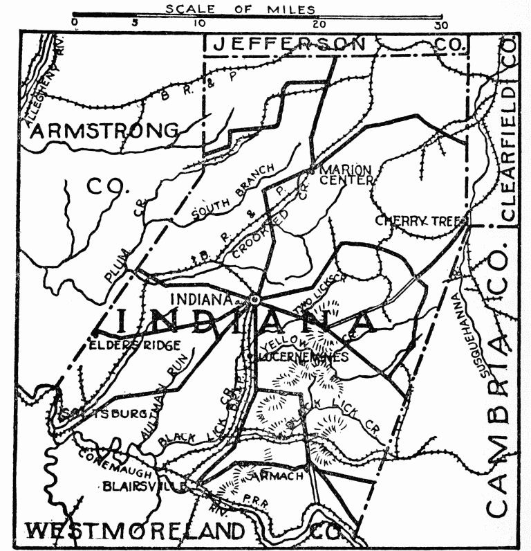
Indiana, county seat, laid out in 1805; population 7043; courthouse, in center of town, brick and gray stone, Renaissance, built, 1871, jail in same style joins it, built, 1888. Town hall, brick with Cleveland limestone trimmings, Renaissance, built, 1913, architect, H. King Conklin, Newark, New Jersey. Savings and Trust Company, white brick, Renaissance. Presbyterian Church, semi-Gothic, Hummelstone, has fine windows, one by Dodge, New York, formerly with Tiffany. United Presbyterian Church, Moorish, brick, built, 1851. State Normal School, northeast of town on high ground beautifully kept, buildings all of stone or brick, modern school construction, contains good reproductions of famous paintings and replicas of celebrated sculpture, distributed throughout the
Indiana County
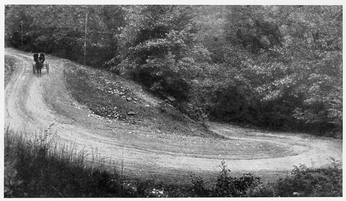
THE DEVIL’S ELBOW, EAST OF INDIANA
One of the most picturesque spots in the county
Illustration loaned by “The Indiana Progress,” Indiana
buildings as a decorative and educational element; portrait of Jane E. Leonard, principal since opening in 1875, artist, H. S. Stevenson, Pittsburgh, was given by the alumni; and interesting class windows in Leonard Hall, given by three separate graduate classes, makers, Rudy Brothers, Pittsburgh; near the borough is Devil’s Elbow, one of nature’s beauty spots.
Armstrong Spring, an old Indian camping ground, on Indian Trail, “Kittanning Path,” which passed north of the Rice Hill, west to this spring, in private property, and through normal school grounds to Kittanning, Armstrong County; over this trail Lieut. Colonel John Armstrong was sent with seven companies against Indians, at the battle of Blanket Hill, Kittanning, in 1756. Two miles west on Kittanning Pike is site of Clark’s blockhouse, first building in the county, the spring and part of old stone fort are still there, not marked.
Cherry Tree, on Susquehanna River prominent point on old purchase line, in treaty of William Penn with the Indians at Fort Stanwix, 1768, also called “Canoe Point”; from here, the Indians carried their canoes to the Allegheny River at Kittanning, sixty miles away; a direct line between these two points formed part of the boundary of lands acquired from the Six Nations. Where original Cherry Tree stood is the meeting point of Indiana, Cambria, and Clearfield counties, monument erected by county commissioners; designed by E. F. Carr & Company, Quincy, Massachusetts, unveiled 1894; Governor Beaver made the address; inscription, “This monument is erected to mark Canoe Place, the corner of the Proprietaries Purchase from the Indians by Treaty at Fort Stanwix, New York, November 5, 1768.” In the southeast is a tunnel, part of old portage railroad through spur of Alleghenies, where the Conemaugh makes a bend of two and one-half miles. Near are Aurora Falls, for sixty feet over rock and through a picturesque gorge to the Conemaugh River (Kiskiminetas) which forms southern boundary, tributary streams fall twenty to thirty feet to the mile.
Near Armagh is the old Buena Vista Furnace, one of three operated in southeast section in the early forties, relic of the early iron industry when ore was taken from the hills, melted into pig metal, and transported to the markets over the old Pennsylvania Canal. Blairsville, on proposed William Penn highway, settled, 1819, population 4391, named for John Blair of Blair’s Gap. First United Presbyterian Church, Tudor Gothic. Luzerne is said to have largest electrically equipped coal (bituminous) operations in the world, and develops power to other operations within a radius of twenty-five miles. Saltzburg, settled in 1817 by Andrew Boggs, is near site of an Indian village, beautiful Kiski Falls are here; several wells producing salt of excellent quality were put down from 1813 and later. Elder’s Ridge, academy, stone, built in 1816, was the first state vocational school in Pennsylvania. The underground railway was in active operation in Indiana County during the latter days of slavery.