III CHESTER COUNTY
Reading edition
THIRD county formed by William Penn; named for Chester, England. This is rich agricultural district; its broad well-kept farms, great gray barns, and comfortable homesteads of stone or brick, many still occupied by descendants of the original Quaker settlers; together with the gently rolling surface of the country and its many beautiful streams, all combine to give the county a character of its own, of quiet pastoral charm. Both the family names and place names indicate in a general way the character of the original settlement of the county, Birmingham, Bradford, Marlborough, and Kennett indicating the settlements of the English Quakers in the central and southern portion of the county: Tredyffrin and Berwyn, those of the Welsh in the east; while the Germans came later into parts of the north; and the Scotch-Irish Presbyterians into the southwest.
The Lincoln Highway, Lancaster Pike, enters the county at Strafford; St. Peter’s Protestant Episcopal Church, built, 1823; Eagle schoolhouse, 1772, on site of Lutheran log church, 1767, one of the cradles of the nation in education; now contains historical library and relics of the neighborhood; site, of “Spread Eagle Inn,” built, 1732, post and relay station.
Paoli, 535 feet above sea, Tredyffrin township. “The General Paoli Inn,” built by General Joshua Evans, who was elected to State Legislature, 1820; recruiting went on briskly here for War of 1812. Road southwest to West Chester, nine miles. One mile south of Paoli, colonial homestead, “Waynesborough,” birthplace of General Anthony Wayne, built, 1724, in original condition, now residence of Captain William Wayne; contains many relics of the General; Lafayette was guest here one night; marked with bronze tablet; near Paoli is Great Valley Baptist Church, second oldest in state, built by Rev. Hugh Davis, from Wales, 1722; present church, 1805; interesting burial ground. Duffrynmawr Post Office, “The Green Tree,” George King, builder and host, died 1792, native blue limestone, stopping place for Mennonites and Amish.
Malvern, terminus of the West Chester Railroad in 1833, cars were then drawn by horses; “The Warren Inn,” stopping place for Lancaster County Germans, sold to John Penn, 1776; British army quartered here before Paoli Massacre; in 1786, sold to Casper Fahnestock, member of German Mystic Community at Ephrata; three fugitive French princes were here in 1789, Louis Phillipe, Duke de Montpensier, and Count de Beaujolais.
One mile southwest of Malvern, site of Paoli Massacre, 1777; two monuments, marble, 1817, granite, 1877, same inscriptions, erected by Republican Artillerists of Chester County and citizens; here General Wayne’s company, fifteen hundred men, were surprised by a greatly superior force of British under General Grey, and charged with bayonet before they could arm for defense; Wayne saved his artillery.
Downingtown, birthplace of Jacob Eicholtz, artist.
BRONZE TABLET IN BOULDER
This is located on the farm of Dr. Thomas G. Ashton, near Willistown
Designed by Paul P. Cret
“General George Washington Inn” known as Downings, now a dwelling. Interesting colonial mansion of the Thomas family, well preserved, now, Public Library. “The Ship Tavern” one mile west, old sign perforated with bullet holes by Continental soldiers, now a residence. Old gray stone bridge across the East Brandywine, built, 1741.
Two miles north, near Guthrieville, birthplace of Thomas Buchanan Read in 1822, poet and artist; marked, bronze tablet.
On the limestone road, following Indian trail, leading from Parkesburg to Oxford and south, are Faggs Manor, six miles northeast of Oxford, classical school, established, 1739; marked, bronze tablet. St. John’s Presbyterian Church, early burial ground; Whitefield stood under the old oak trees.
An interesting early highway known as the “Street Road,” laid out in part by William Penn, has almost the directness and width of a Roman road; entering the county near Westtown, and crossing Brandywine Creek at Pocopson, to London Grove, original name, Marlborough; Street, stately old Quaker Meeting House at London Grove; wonderful oak trees.
West Chester, county seat, formed, 1786, population 11,717. In one block, High Street between Gay and Market Streets, are good specimens of the three great orders of Grecian architecture, designed by Thomas U. Walter, architect of Capitol at Washington; National Bank of Chester County, built, 1836, Doric, white marble; First National Bank, Ionic, white marble; the Court House, Corinthian, built, 1847, Pictou stone; on Court House lawn is Soldiers’ Monument to Civil War patriots, bronze figure, granite base, erected, 1915; sculptor, Harry Lewis Raul. Public Library, North Church Street, memorial to Bayard Taylor, contains interesting collection of his manuscripts; “The Story of Kennett,” his books, sketches, and other relics; also marble bust of General Anthony Wayne; sculptor, W. Marshall Swayne. The new Library of the State Normal School contains portrait of Washington by Peale, painted at Valley Forge; historic autograph letters; Indian stone relics; large herbarium; and small permanent collection of original paintings, among them works by Hugh Breckenridge and Mary Butler; annual exhibitions of modern paintings and sculpture are held; Della Robbia reproductions in auditorium; Chester County Historical Society rooms are here, containing many interesting local historical collections; addresses on subjects of local historic interest are frequently given, and published in their bulletins.
Churches noteworthy for architecture, Holy Trinity, Protestant Episcopal, South High Street, native serpentine stone, Gothic; and Westminster Presbyterian, South Church Street, tower suggests famous one of Magdalen College, Oxford. At north end of High Street, stone drinking fountain, surmounted by bronze figure of boy, sculptor, Martha J. Cornwell; placed by New Century Club. Marshall Square, a public park, contains rare collection of trees. West Chester, noted for men of repute in scientific world, was the residence of the late Dr. Joseph Trimble Rothrock; in 1893 he drew up a bill creating a Forestry Commission, to investigate and report upon the forestry conditions of Pennsylvania, this bill was passed, and in 1895 he was appointed Commissioner of Forestry.
Favorite drives, with succession of beautiful vistas, are along the East Brandywine from Downingtown south, and West Brandywine, from Mortonville south. At Mortonville, three miles southeast of Coatesville, is fine, old, gray stone bridge, with four arches, graduated in width, and rounded buttresses; built, 1826.
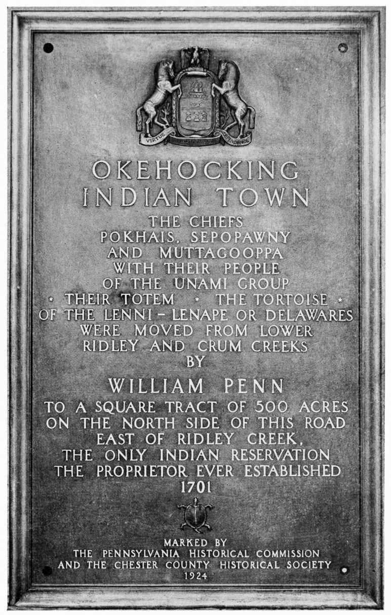
Following the stream, and crossing several picturesque wooden covered bridges, through Embreeville, a half mile east of which is Point Lookout, where sentries were posted to guard supplies for American Encampment at Valley Forge; marked by Chester County Chapter of the Daughters of the American Revolution; opposite is “Star Gazers’ Stone,” set by Mason and Dixon, 1764, in running a base line for boundary between Pennsylvania and Maryland; here they made various astronomical observations; calculated the force of gravity; and measured a degree of latitude on the earth’s surface southward; this stone was walled and marked, with bronze tablet. Several places in the vicinity, connected with the Lenni-Lenape Indians, are also marked; in County Home, grounds, grave of Indian Hannah, last of her race in this county; site of her cabin half mile south of Northbrook; Indian cemetery half mile west of Northbrook; and Indian Rock, just west of Northbrook; from the latter point the Indian chief, Checochinican, claimed that land had been reconveyed to the tribe up to source of stream, a mile on either side; these negotiations, in the picturesque language used by the chief, are among the records of the provincial assembly; Okehocking, Indian Town, has been marked by tablet.
Just east of Northbrook, birthplace of Humphry Marshall, botanist; two miles north, at Marshallton, adjoining his old home, is interesting arboretum, still containing many trees planted by him; marked with bronze tablet.
Continue drive to Lenape, amusement park, where East Branch of the Brandywine, from Downingtown, unites with western; down main stream, skirting, just above Pocopson, a beautiful spot, Dungeon Bottom; and passing several antique, covered, wooden bridges, to Chadds Ford; here the ranks of British, Hessians, and Continentals charged to and fro at Battle of Brandywine, September 11, 1777; two miles northeast, old Birmingham meeting house, used as hospital by troops, and center of some of the fiercest fighting; many points connected with the battle were marked with tablets by Chester County Historical Society, in connection with State Historical Commission, in 1915.
On State Highway, six miles west of Chadds Ford, Kennett Square, birthplace of Bayard Taylor, poet and traveler, and his later home “Cedar-Croft,” built by him, one mile south, both marked with bronze tablets; he was buried at Longwood Meeting House, about two miles east; artistic monument, a cylindrical stone; at this meeting house, of “Progressive Friends,” many prominent leaders of anti-slavery spoke before the Civil War. This region was center of anti-slavery sentiment, many of the old Quaker homesteads were stations of the so-called “underground railroad,” by which fugitive slaves were protected and carried
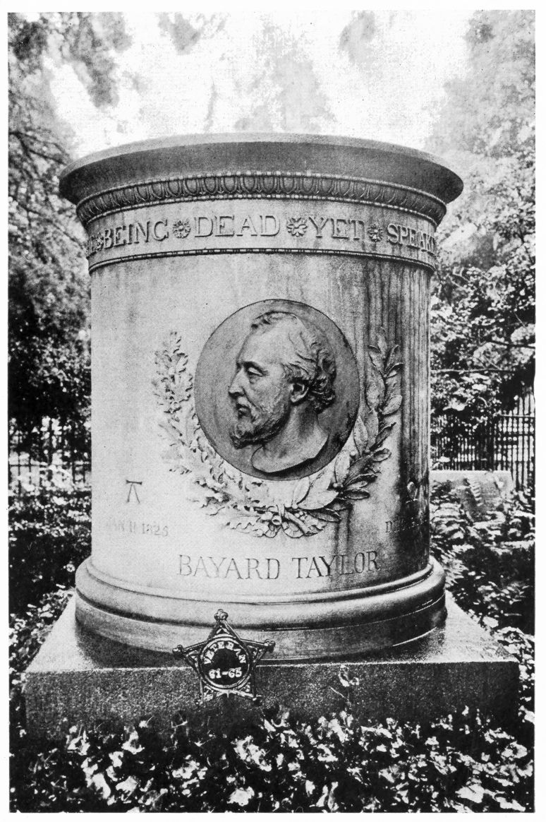
BAYARD TAYLOR MONUMENT, LONGWOOD
northward. Half mile north of Longwood Meeting House is “Pierce’s Park,” now owned by Pierre du Pont, Esq., contains wonderful trees, planted over a century ago by Samuel and Joshua Pierce, who rode on horseback to the Dismal Swamp for cypresses and brought them home in saddlebags. Mr. du Pont has recently added an unusually beautiful flower garden and conservatory; visitors admitted free on week days.
Kennett Square, Bayard Taylor Memorial Library, contains first editions of his books, his paintings, and his drawings; also busts of Bayard Taylor and John Welsh; sculptor, W. Marshall Swayne. In Advent Protestant Episcopal Church, memorial window to Bayard Taylor. Ten miles southwest, New London Academy, founded, 1743, marked by bronze tablet; here were educated three signers of the Declaration of Independence, Thomas McKean, George Reed, and James Smith, and other men of prominence.
Other places of interest, in north of county, are Valley Forge, chiefly in Montgomery County. Phœnixville, population 10,484; farthest inland point reached by British, September 21-22-23, 1777; marked by low granite monument opposite Fountain Inn. St. Peter’s Protestant Episcopal Church, stone; stained glass windows by Meyer Bros., Munich, Germany; Parish House interior designed by the late George Wattress, pure English, dark oak, with tiled floors; early Iron Industry, Phœnix Iron Company, marked, bronze tablet.
Ten miles northwest of Phœnixville is Coventryville, old Coventry Forge, 1717, earliest in county, second in Pennsylvania; Mordecai Lincoln, ancestor of Abraham Lincoln, worked here and was part owner in 1725. Warwick, Warwick Furnace, Potts and Rutter, proprietors, 1737; here was cast the first Franklin stove, and others with quaint designs and Biblical verses; cannon and cannon balls were made here for the Revolutionary Army; marked. Seven miles west of Phœnixville, at Chester Springs, is summer art school of the Pennsylvania Academy of the Fine Arts, forty acres, with buildings for studios, and lodging houses for the students; one of these buildings was used as a Revolutionary Hospital, marked; former name, “Yellow Springs,” a watering resort in colonial days.
Marking on all places has been by the Chester County Historical Society unless otherwise stated.