Volume 2 / Part 3 — CHAPTER XXXIV.
Henry Yule translation
Concerning the Island of Zanghibar. A Word on India in General.
Zanghibar is a great and noble Island, with a compass of some 2000 miles.{1} The people are all Idolaters, and have a king and a language of their own, and pay tribute to nobody. They are both tall and stout, but not tall in proportion to their stoutness, for if they were, being so stout and brawny, they would be absolutely like giants; and they are so strong that they will carry for four men and eat for five.
They are all black, and go stark naked, with only a little covering for decency. Their hair is as black as pepper, and so frizzly that even with water you can scarcely straighten it. And their mouths are so large, their noses so turned up, their lips so thick, their eyes so big and bloodshot, that they look like very devils; they are in fact so hideously ugly that the world has nothing to show more horrible.
Elephants are produced in this country in wonderful profusion. There are also lions that are black and quite different from ours. And their sheep and wethers are all exactly alike in colour; the body all white and the head black; no other kind of sheep is found there, you may rest assured.{2} They have also many giraffes. This is a beautiful creature, and I must give you a description of it. Its body is short and somewhat sloped to the rear, for its hind legs are short whilst the fore-legs and the neck are both very long, and thus its head stands about three paces from the ground. The head is small, and the animal is not at all mischievous. Its colour is all red and white in round spots, and it is really a beautiful object.{3}
** The women of this Island are the ugliest in the world, with their great mouths and big eyes and thick noses; their breasts too are four times bigger than those of any other women; a very disgusting sight.
The people live on rice and flesh and milk and dates; and they make wine of dates and of rice and of good spices and sugar. There is a great deal of trade, and many merchants and vessels go thither. But the staple trade of the Island is in elephants’ teeth, which are very abundant; and they have also much ambergris, as whales are plentiful.{4}
They have among them excellent and valiant warriors, and have little fear of death. They have no horses, but fight mounted on camels and elephants. On the latter they set wooden castles which carry from ten to sixteen persons, armed with lances, swords, and stones, so that they fight to great purpose from these castles. They wear no armour, but carry only a shield of hide, besides their swords and lances, and so a marvellous number of them fall in battle. When they are going to take an elephant into battle they ply him well with their wine, so that he is made half drunk. They do this because the drink makes him more fierce and bold, and of more service in battle.{5}
As there is no more to say on this subject I will go on to tell you about the Great Province of Abash, which constitutes the Middle India;—but I must first say something about India in general.
You must understand that in speaking of the Indian Islands we have described only the most noble provinces and kingdoms among them; for no man on earth could give you a true account of the whole of the Islands of India. Still, what I have described are the best, and as it were the Flower of the Indies. For the greater part of the other Indian Islands that I have omitted are subject to those that I have described. It is a fact that in this Sea of India there are 12,700 Islands, inhabited and uninhabited, according to the charts and documents of experienced mariners who navigate that Indian Sea.{6}
India the Greater is that which extends from Maabar to Kesmacoran; and it contains 13 great kingdoms, of which we have described ten. These are all on the mainland.
India the Lesser extends from the Province of Champa to Mutfili, and contains eight great kingdoms. These are likewise all on the mainland. And neither of these numbers includes the Islands, among which also there are very numerous kingdoms, as I have told you.{7}
Our traveller’s information is here, I think, certainly at second hand, though no doubt he had seen the negroes whom he describes with such disgust, and apparently the sheep and the giraffes.
I here omit a passage about the elephant. It recounts an old and long-persistent fable, exploded by Sir T. Brown, and indeed before him by the sensible Garcia de Orta.
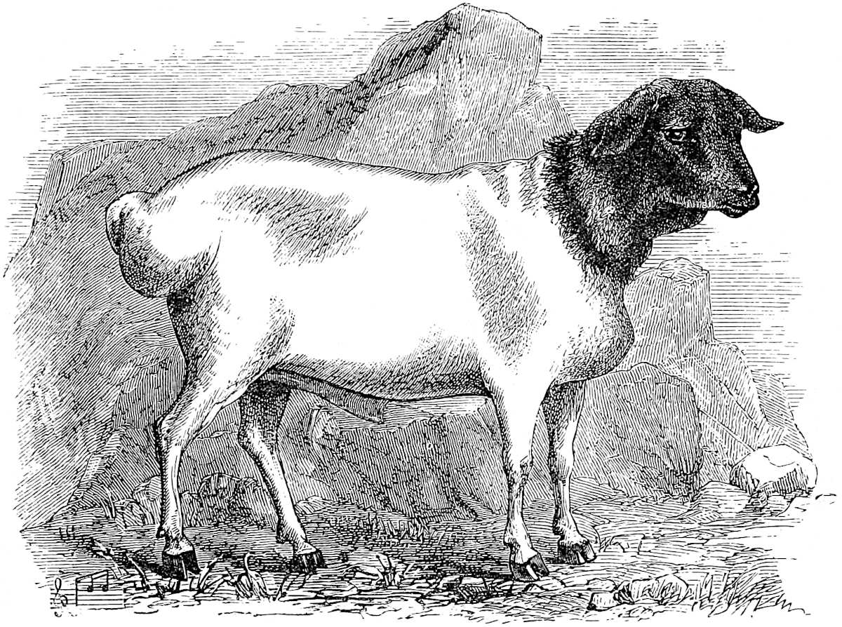
Ethiopian Sheep.
The earliest use that I can find of the terms India Major and Minor is in the Liber Junioris Philosophi published by Hudson, and which is believed to be translated from a lost Greek original of the middle of the 4th century. In this author India Minor adjoins Persia. So it does with Friar Jordanus. His India Minor appears to embrace Sind (possibly Mekran), and the western coast exclusive of Malabar. India Major extends from Malabar indefinitely eastward. His India Tertia is Zanjibar. The Three Indies appear in a map contained in a MS. by Guido Pisanus, written in 1118. Conti divides India into three: (1) From Persia to the Indus (i.e. Mekran and Sind); (2) From the Indus to the Ganges; (3) All that is beyond Ganges (Indo-China and China).
In a map of Andrea Bianco at Venice (No. 12) the divisions are—(1) India Minor, extending westward to the Persian Gulf; (2) India Media, “containing 14 regions and 12 nations;” and (3) India Superior, containing 8 regions and 24 nations.
Marino Sanuto places immediately east of the Persian Gulf “India Minor quae et Ethiopia.”
John Marignolli again has three Indias: (1) Manzi or India Maxima (S. China); (2) Mynibar (Malabar); (3) Maabar. The last two with Guzerat are Abulfeda’s divisions, exclusive of Sind.
We see that there was a traditional tendency to make out Three Indies, but little concord as to their identity. With regard to the expressions Greater and Lesser India, I would recall attention to what has been said about Greater and Lesser Java (supra, chap. ix. note 1). Greater India was originally intended, I imagine, for the real India, what our maps call Hindustan. And the threefold division, with its inclination to place one of the Indies in Africa, I think may have originated with the Arab Hind, Sind, and Zinj. I may add that our vernacular expression “the Indies” is itself a vestige of the twofold or threefold division of which we have been speaking.
The partition of the Indies made by King Sebastian of Portugal in 1571, when he constituted his eastern possessions into three governments, recalled the old division into Three Indias. The first, India, extending from Cape Gardafui to Ceylon, stood in a general way for Polo’s India Major; the second Monomotapa, from Gardafui to Cape Corrientes (India Tertia of Jordanus); the third Malacca, from Pegu to China (India Minor). (Faria y Souza, II. 319.)
Polo’s knowledge of India, as a whole, is so little exact that it is too indefinite a problem to consider which are the three kingdoms that he has not described. The ten which he has described appear to be—(1) Maabar, (2) Coilum, (3) Comari, (4) Eli, (5) Malabar, (6) Guzerat, (7) Tana, (8) Canbaet, (9) Semenat, (10) Kesmacoran. On the one hand, this distribution in itself contains serious misapprehensions, as we have seen, and on the other there must have been many dozens of kingdoms in India Major instead of 13, if such states as Comari, Hili, and Somnath were to be separately counted. Probably it was a common saying that there were 12 kings in India, and the fact of his having himself described so many, which he knew did not nearly embrace the whole, may have made Polo convert this into 13. Jordanus says: “In this Greater India are 12 idolatrous kings and more;” but his Greater India is much more extensive than Polo’s. Those which he names are Molebar (probably the kingdom of the Zamorin of Calicut), Singuyli (Cranganor), Columbum (Quilon), Molephatan (on the east coast, uncertain, see above pp. 333, 391), and Sylen (Ceylon), Java, three or four kings, Telenc (Polo’s Mutfili), Maratha (Deogir), Batigala (in Canara), and in Champa (apparently put for all Indo-China) many kings. According to Firishta there were about a dozen important principalities in India at the time of the Mahomedan conquest of which he mentions eleven, viz.: (1) Kanauj, (2) Mírat (or Delhi), (3) Mahávan (Mathra), (4) Lahore, (5) Malwa, (6) Guzerat, (7) Ajmir, (8) Gwalior, (9) Kalinjar, (10) Multán, (11) Ujjain. (Ritter, V. 535.) This omits Bengal, Orissa, and all the Deccan. Twelve is a round number which constantly occurs in such statements. Ibn Batuta tells us there were 12 princes in Malabar alone. Chinghiz, in Sanang-Setzen, speaks of his vow to subdue the twelve kings of the human race (91). Certain figures in a temple at Anhilwara in Guzerat are said by local tradition to be the effigies of the twelve great kings of Europe. (Todd’s Travels, p. 107.) The King of Arakan used to take the title of “Lord of the 12 provinces of Bengal” (Reinaud, Inde, p. 139.)
The Masálak-al-Absár of Shihabuddin Dimishki, written some forty years after Polo’s book, gives a list of the provinces (twice twelve in number) into which India was then considered to be divided. It runs—(1) Delhi, (2) Deogír, (3) Multán, (4) Kehran (Kohrám, in Sirhind Division of Province of Delhi?), (5) Sámán (Samána, N.W. of Delhi?), (6) Siwastán (Sehwán), (7) Ujah (Uchh), (8) Hási (Hansi), (9) Sarsati (Sirsa), (10) Ma’bar, (11) Tiling, (12) Gujerat, (13) Badáún, (14) Audh, (15) Kanauj, (16) Laknaoti (Upper Bengal), (17) Bahár, (18) Karráh (in the Doáb), (19) Maláwa, (Málwa), (20) Lahaur, (21) Kálánúr (in the Bári Doáb, above Lahore), (22) Jájnagar (according to Elphinstone, Tipura in Bengal), (23) Tilinj (a repetition or error), (24) Dursamand (Dwara Samudra, the kingdom of the Belláls in Mysore). Neither Malabar nor Orissa is accounted for. (See Not. et Ext. XIII. 170). Another list, given by the historian Zíá-uddín Barni some years later, embraces again only twelve provinces. These are (1) Delhi, (2) Gujerat, (3) Málwah, (4) Deogír, (5) Tiling, (6) Kampilah (in the Doáb, between Koil and Farakhábád), (7) Dur Samandar, (8) Ma’bar, (9) Tirhut, (10) Lakhnaoti, (11) Satgánw, (12) Sunárgánw (these two last forming the Western and Eastern portions of Lower Bengal).[1]