ITALY.* (continued 2)
Reading edition
Milan, the capital of Lombardy, is in every respect one of the leading cities of Italy. In population it is inferior to Naples, in commerce it is outstripped only {226} by Genoa, but in industry it is the equal of both. Its scientific and literary life entitles it, probably, to the first rank amongst the cities between the Alps and Sicily. In the most remote times Milan was an important town of the Celts, and since then the advantages of its position have given it the preponderance amongst all other cities of Northern Italy. Its power during the Middle Ages gained it the epithet of the “Second Rome.” At the close of the thirteenth century it had 200,000 inhabitants, whilst London had not then a sixth of that number. Milan stood in want of water, for it was dependent upon the feeble stream of the Olona, and its citizens created the Naviglio Grande and the Martesana, veritable rivers, which furnish a quantity of water double that of the Seine at Paris during summer. They likewise erected magnificent monuments, but most of these have perished during innumerable wars, and the aspect of Milan is now that of a modern town of Western Europe. Its most famous building, the “Duomo,” with its prodigious crowd of statues, its finely chiselled marbles and granites, must be looked upon as a marvel of architecture, though from an artistic point of view it is hardly more than an elaborately carved trinket out of all proportion. The stones for this edifice were quarried on the Lago Maggiore, near the mouth of the Toce.
The capital of Lombardy, proud of the past and confident of the future, boasts of never yielding servilely to impulses given from beyond. It has its own opinions, manners, and fashions, and anything accepted from abroad is moulded in accordance with local traditions. The other towns of Lombardy likewise maintain their local character, are proud of their traditions, and glory in the annals of the past. Como, on the beautiful lake named after it, the ancient rival of Milan, gains wealth by spinning silk and exporting the agricultural produce of the Brianza. Monza, surrounded by parks and villas, is the coronation city. Pavia, with its 525 towers, now in ruins, remembers the time when it was the residence of the Lombard kings, and proudly points to the university, one of the oldest in Europe, and to the Certosa (Chartreuse), one of the most sumptuous monasteries of Italy. Vigevano, on the other side of the Ticino, rejoices in a fine castle. Lodi, in the eleventh century, was the most powerful city of Italy next to Milan, and carried on a war of extermination with the latter; it is still a busy place. Cremona, an old republic, boasts of its torrazzo, or tower, 393 feet in height, the loftiest in Europe until Gothic cathedrals were built. Bergamo, on a hill commanding the rich plains of Brembo and Serio, produced a larger number of great men than any other town except Florence; and Brescia, the armourers’ town, more haughty still, proclaims herself to be the mother of heroes.
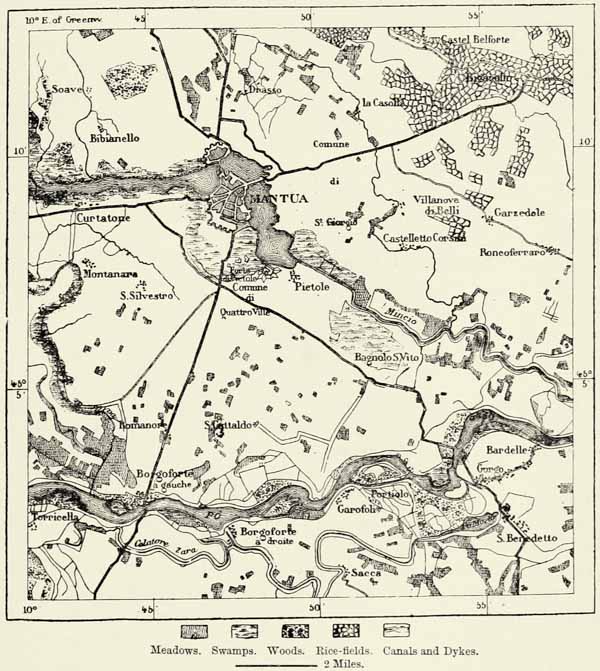
Mantua, on the Mincio, is one of the fortresses of the Quadrilateral, and can hardly be said to belong to Lombardy, though included within its political boundaries. It is essentially a military town. It has lost much of its old commerce, though Jews are more plentiful there than in any other inland city of Italy. Its swamps, woods, rice-fields, ditches, and fortified canals are productive of a degree of humidity exceptional even in Lombardy, and the inhabitants consequently eschew this ancient birthplace of Virgil. Strikingly different is the character of the towns situated in the heart of the mountains, such as Sondrio, the capital of the {227} Val Tellina, or delightful Salo, on the Lake of Garda, with its group of villas scattered amongst groves of orange-trees.72
Μ
Fig. 76.—THE LAKES AND CANALS OF MANTUA.
From the Austrian Staff Map. Scale 1 : 198,000.
The physiognomy of the large towns of Emilia, beyond the Po, offers far fewer peculiarities, for, as most of them are situated along the great Emilian highway, they have been exposed for ages to the levelling influences of travelling merchants and soldiers. Piacenza, a sorry place as a fortress, carries on an important commerce. Parma, an old ducal residence, has a rich library, a museum, and wonderful frescoes by Correggio in its churches. Reggio, another important {228} station on the Emilian highway, is famous as the birthplace of Ariosto. Modena has its museum, and the precious collection of books and manuscripts known as the Biblioteca Estense. Bologna the “Learned,” which has taken the word “Libertas” for its motto, still remains one of the most interesting of Italian cities. There are its Etruscan cemetery, its palaces and mediæval buildings, and its two leaning towers, which will most certainly come down in the end. Bologna is one of the great railway centres, carries on much commerce, and increases rapidly in population. It would have made a far better capital than Rome. Of late years the environs of the city have been frequently flooded by the Reno, and these disasters have cost Bologna its ancient epithet of “the Fat.”
Near this bustling place there are others, now stagnant, which can point only to buildings in proof that they, too, were once flourishing. Ferrara, the ancient capital of the Estes, has fallen from its high estate since the Po has deserted it, but still remains a place of some importance. Ravenna has not been deserted by the Po, but by the sea, with which it communicates now by a canal seven miles in length, and navigable for ships drawing thirteen feet of water. The town became the capital of Honorius and Theoderic the Goth, on account of the protection offered by the surrounding marshes. To the exarchs it is indebted for its curious Byzantine edifices, so rich in mosaics. As to the ancient Etruscan city of Adria, on Venetian soil, to the north of the Po, it could hardly have claimed at any period during the last two thousand years to give a name to the neighbouring sea. It lies now at a distance of fourteen miles from it, and even in the time of the Romans it must have been surrounded by lagoons or swamps, for how else can we explain its epithet of “Town of the Seven Seas?” Porto, at the foot of the Euganean Hills, may owe its name to an ancient lake or river.
Towns famous on account of their history, and still populous, are most crowded together in the southern angle of the plain, usually known as the Romagna. The towers and crenellated walls of Imola rise there on the banks of the Santerno. Lugo, the “town of the beautiful Romagnese,” occupies the centre of the district of Ravenna, and has much trade. Faenza, on the Emilian Road, is a large village rather than a town, though it has given its name to a particular kind of porcelain (faience). Forli is, next to Bologna, the most populous city of Romagna. Cesena is known for the excellence of the hemp grown in the neighbourhood. Rimini, where the Emilian Road reaches the sea, still has a few Roman ruins, including a triumphal arch. The inhabitants of the Romagna are distinguished by great energy. Their passions are violent, and as frequently lead them into crime as to deeds of heroism.73
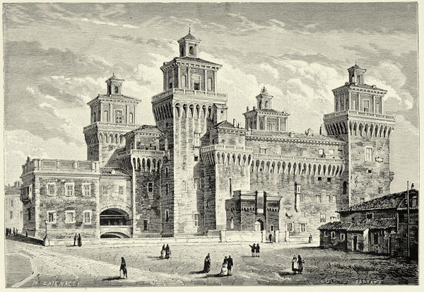
THE PALACE AT FERRARA.
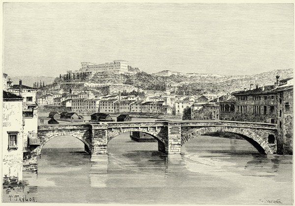
VERONA.
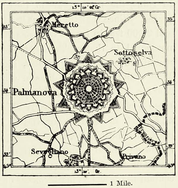
In Venetia there are several provincial towns of importance. Padua abounds in monuments of art, possesses a university, and was formerly the rival of Venice. Vicenza is embellished by the palaces erected by Palladio. Treviso and Belluno are towns of some importance, the one on the Sile, the other in the upper valley {229} of the Piave. At Udine is pointed out a mound of earth said to have been thrown up by Attila, from which he contemplated the conflagration of Aquileja. Palmanova, on the Austrian frontier, is a regularly built fortress. Verona, at the other extremity of Venetia, has played an important part in the history of Italy, but its commerce and industry have fallen into decay. It hardly fills up the space enclosed by walls and bastions, and its present population is quite out of proportion to the multitude of its public buildings dating from the Middle Ages, and the dimensions of its Roman amphitheatre, capable of seating 50,000 spectators. Amongst all the cities of Venetia it is Venice itself, the “Queen of the Adriatic,” which has suffered least in the course of ages.
Fig. 77.—PALMANOVA.
Scale 1 : 86,400.
Venice is a very ancient city. The remains of Roman buildings discovered on the island of San Giorgia, far below the present level of the sea, and therefore referred to in proof of the slow subsidence of the Venetian coast, prove to us that the mud islands of the gulf supported a population long before the invasion of the Barbarians. These half-drowned lands may have attracted the coast population at an early age, for they afforded security against attack, and offered great advantages for carrying on commerce. Nevertheless, the Venice of our time only dates from the commencement of the ninth century, when the government of this maritime republic was established upon the islands separated from the sea by the lidi, and from the mainland by estuaries and swamps. This unique position rendered Venice almost impregnable; and whilst the rest of Europe was being desolated by war, Venice sent forth its commercial and warlike expeditions to every part of the Mediterranean, established factories, and built fortresses. Not without arduous struggles, it became the most powerful and wealthiest of the commercial republics of Italy. It was largely indebted for this success to its favourable geographical position, almost in the centre of the mediæval world. Its commerce brought the Venetians into contact with nearly every nation, and they had no prejudices against foreigners. The Armenians were admitted to their city, and an alliance was made even with the Turks. At the time of the Crusades the Venetian Republic occupied the foremost position amongst the states of Europe, and its ambassadors enjoyed a vast amount of influence. This influence was sustained by enormous material forces. Venice had a navy of 300 vessels, manned by 36,000 sailors, and the riches of the world, whether obtained by legitimate commerce or by violence, were accumulated in its 2,000 palaces and 200 churches. Even one of the islets upon which the city is built would have purchased a kingdom of Asia or Africa. One of the most sumptuous cities of the West had {230} arisen upon banks of mud, inhabited formerly only by poor fishermen. The larch forests of Dalmatia had been cut down, and converted into piles upon which to build palaces. More than 400 bridges of marble joined island to island, and superb embankments of granite defended this marvellous city against the encroachments of the sea. Great achievements in the arts contributed their share in making Venezia la Bella a city without its equal.
But geographical discoveries, in which Venice itself took a leading share, undermined the power of the Italian Republic. When Africa had been circumnavigated and the New World discovered, the Mediterranean ceased to be the great commercial sea of the world. Venice was doomed to die. It no longer monopolized the road to India, and the increasing power of the Turks crippled its Eastern trade. Still, so great were its resources, that it maintained its independence for more than three hundred years after it had lost its factories, and only fell when shamefully deserted by General Bonaparte, its supposed ally.
The decadence of Venice was most remarkable during the dominion of Austria. In 1840 the city had less than 100,000 inhabitants, hundreds of its palaces were in ruins, the grass grew in its squares, and seaweeds encumbered its landing-places. Since that time it has been gradually recovering. A bridge of 222 arches and 2,000 feet in length connects it with the mainland, and its commerce, though not equal to that of Trieste, is nevertheless of considerable importance.74 The manufacture of looking-glasses, lace, and other articles has imparted fresh life to Venice, and there, as well as in other towns of the lagoons (Malamocco, Burano, Murano, and Chioggia), thousands of workmen are busy in the production of those gay-looking glass beads which find their way into every part of the world, and which in certain countries of the East and in Central Africa take the place of coin. But Venice, though less populous and active than of yore, still rejoices in its delightful climate and its bright skies. Its gaiety and fêtes are not yet things of the past, and its palaces, built in a style half Italian, half Moorish, still contain the priceless masterpieces of Titian, Tintoretto, and Paul Veronese.75
III.—LIGURIA AND THE RIVIERA OF GENOA.*
Liguria is but a narrow slip of land if we compare it with the broad plain of the Po, but it is one of the most clearly defined districts of Europe, and its inhabitants have retained many original traits. The contrast between the Podane plains and the littoral region beyond the barren Apennines is striking, but if we travel in the direction of Provence or of Tuscany the landscape changes only by degrees. The rampart of the Apennines surrounds the whole of the Gulf of {231} Genoa, and there is not a single break in it. These mountains are very different in character from the Alps, though joined to them as the branch of a tree is united to its trunk. It is not possible to tell where one chain ends and the other begins. If the main direction of the mountain is to be the criterion, the Ligurian Apennines may be said to begin at the frontier of France, near the sources of the Tinea and Vesubio; but if great height, pastures, and perennial snow are considered sufficient to constitute an Alpine region, then the Apennines only begin to the east of the Col di Tenda, for the fine summits of the Clapier, Fenêtre, and Gordalesque, to the west of that pass, attain a height of 10,000 feet. They are quite Alpine in their character, and may boast even of small glaciers, the most southerly in the mountains of Central Europe. Geologists usually draw the line where cretaceous and tertiary rocks take the place of the crystalline rocks of the Alps. But this, too, is only a conventional division, for these crystalline rocks, which constitute the crest of the Alps in the west, extend far to the east, and occasionally they break through the sedimentary formations which overlie them, and rise into summits similar to those of the Alps. Thus the granitic summits of the mountains of Spezia remind us of the mountain mass near the Col di Tenda.
Μ
Fig. 78.—THE JUNCTION OF ALPS AND APENNINES.
Scale 1 : 1,500,000
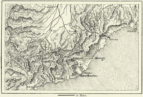
The chain of the Ligurian Apennines is by no means of uniform height, but, like that of the Alps, it consists of mountain masses separated by passes. The lowest of these passes is that to the west of Savona, named indifferently after one of the neighbouring villages, Altare, Carcara, or Cadibona. This pass is hardly more than 1,600 feet in height, and is popularly looked upon as constituting the boundary between the Alps and Apennines. The possession of this pass during war has {232} always been considered of great importance, for it commands the approaches to Genoa and the upper valleys of Piemont, and the Tanaro and Bormido, which rise near it, have often run with blood.
The Apennines to the east of this pass have an average height of 3,300 feet, and beyond the Pass of Giovi (1,538 feet), through which the road leads from Genoa to the northern plains, many summits attain a height of 4,500 feet. Several spurs, abounding in ravines, extend here to the north. The main chain, at the same time, retires from the coast, and the Pass of Pontremoli, which separates the Ligurian from the Tuscan Apennines, and through which leads the road from Parma to Spezia, is no less than thirty miles from the sea. In this eastern portion of the Genoese Apennines a spur detaches itself from the main chain, and terminates in the fine promontory of Porto Venere, a magnificent rock of black marble, surmounted formerly by a temple of Venus. This spur, which protects the Gulf of Spezia against westerly winds, has at all times constituted an obstacle to the intercourse between neighbouring peoples, not so much on account of its height, but because of its steepness. In some places the crest of the Apennines is hardly more than four miles from the sea. The slope, in such places, is exceedingly steep, and roads can ascend it only in numerous windings.77
The small width of the maritime slope of the Ligurian Apennines accounts for the absence of perennial rivers. The most considerable streams to the east of the Roya, which runs for the greater part through French territory, such as the Taggia or the Centa, only assume the appearance of rivers when the snows melt, or after heavy rains. Ordinarily they are but small streams, closed at the mouth by bars of pebbles. Between Albenga and Spezia, for a distance of 160 miles, there are only torrents, and in order to meet again with a real river we must go beyond the Gulf of Spezia. This river is the Magra, which separates Liguria from Etruria, and which, up to the epoch of Augustus, formed the boundary of Italy. Its alluvium has converted an ancient bay of the sea into a lake, and formed a beach, 1,300 yards in width, in front of the ancient Tyrrhenian city of Luni, which formerly stood on the seashore.
The want of great rivers in Liguria is compensated for to some extent by subterranean water-courses. Several springs rise from the bottom of the sea, at some distance from the shore. The springs of La Polla, in the Gulf of Spezia, are amongst the most bountiful amongst them. They have been isolated by the Italian Government from the surrounding salt water, and their water is supplied to ships.
Owing to the absence of rivers, the sterility of the soil, and the steep escarpments, this portion of the Mediterranean coast region contrasts strikingly with other parts of temperate Europe. Having reached the summit of the mountains beyond the magnificent chestnut forests at the head-streams of the Ellero, the Tanaro, and the Bormida, we look down upon a scene almost African in its character. Scarcely a blade of grass is to be seen between Nice and Spezia, and only the grass-plots, kept up at great expense in some pleasure-gardens, remind us that Piemont and {233} Lombardy are near at hand. Pines and brambles would have remained the only verdure in these Ligurian valleys and ravines if it were not for the transformation wrought by gardeners and agriculturists. Strange to say, trees do not ascend to the same height on the slopes of the Apennines as in the Alps, though the mean temperature is far higher, and at an altitude at which the beech still attains noble proportions in Switzerland we find it here stunted in growth. Larches are hardly ever seen.
The sea is as sterile as the land. There are neither shallows, islands, nor seaweeds affording shelter to fish. The cliffs descend precipitously into the sea, and the narrow strips of beach, extending from promontory to promontory, consist only of sand without the admixture of a single shell. The Genoese fishermen, therefore, resort to distant coasts, those of the “Ponente,” or west, going to Sicily, whilst those of Camogli, on the Riviera di Levanto, visit the coasts of Tuscany. This sterility of land and sea accounts for the large number of Genoese met with in other parts of the world.
But though an unfruitful country, Liguria is exceedingly picturesque. A traveller availing himself of the railway between Nice and Genoa, which follows the sinuosities of the coast and pierces the promontories in numerous tunnels, is brought within reach of the most varied scenery. At one time the line runs close to the beach, with the foam of the sea almost touching the track on the one side, while tamarisks bearing pink blossoms overshadow it from the other. Elsewhere we creep up the steep slope, and obtain a view of the cultivated terraces raised at immense labour by the peasantry, whilst the bluish sea is seen afar to the right, almost hidden by a grove of olive-trees, and stretching away until lost in the direction of Corsica. Towns, villages, old towers, villas, ship-yards, and other industrial establishments impart an almost infinite variety to the scenery. One town occupies the top of a hill, and, seen from below, its old walls and towers stand out boldly against the sky; another is built amphitheatrically, close to the strand upon which the fishermen have drawn their boats; a third is hidden in a hollow, and surrounded by vines, olive, orange, and lemon trees. A date-tree here and there imparts an oriental aspect to the landscape. Bordighera, a small place close to the French frontier, is quite surrounded by palm-trees, whose fruit, however, but rarely ripens.
The climate of Albenga, Loana, and some other places on the Genoese coast is far from salubrious, on account of the miasmata exhaled by sheets of stagnant water left behind by freshets. Even Genoa cannot boast of an agreeable climate, not because there are marshes near it, but because the southerly winds charged with moisture are caught there by the semicircle of mountains, and are made to discharge their superabundant humidity. The number of rainy days at Genoa averages 121 a year. There are, however, several towns along this coast protected by the mountains against the north, and yet out of the usual track of the moisture-laden southerly winds, whose climate is exceptionally delightful.78 Bordighera {234} and San Remo, near the French frontier, are the rivals of Mentone as regards climate; and Nervi, to the east of Genoa, is likewise a favourite place of resort, on account of its clear sky and pure atmosphere. Villas and castles rise on every promontory and in every valley of these favoured districts. For a dozen miles on either side of Genoa the coast is lined by villas. The population of the city has overflowed the walls which once confined it, and is establishing itself in populous suburbs. The long street which winds between factories and gardens, scales promontories, and descends into valleys, will continue to grow in length until it extends along the whole coast of Liguria, for the charms of the country attract men of leisure from every quarter of Europe.
Μ
Fig. 79.—GENOA AND ITS SUBURBS.
From the Sardinian Staff Map. Scale 1 : 100,000.
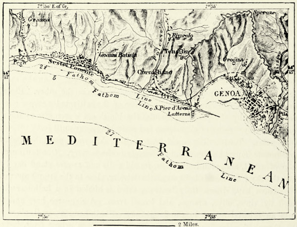
The historical development of the ancient Ligurians, who were probably of Iberian race, was largely influenced by the nature of the country they inhabited. The cultivable land being only of small extent, the superabundant population was forced to look to the sea for a livelihood, and engaged in navigation and commerce. Antium, the modern Genoa, was an “emporium” of the Ligurians ever since the time of the Romans, and its vessels frequented every corner of the Tyrrhenian Sea. In the Middle Ages the Genoese flag was carried into every part of the known world, and it was Genoa that gave birth to Christopher Columbus, whose name is inscribed upon the first page of modern history as the discoverer of America. It was a Genoese, too, Giovanni Gabotto, or Cabot, who afresh discovered the coast of North America five centuries after its original discovery by the {235} Normans. The hardy mariners of Genoa have thus navigated the seas from the most remote times. Even now they almost monopolize the navigation of the great rivers of the Argentine Republic. The Genoese likewise enjoy a high reputation as gardeners, and are met with in every large town of the Mediterranean.
Fig. 80.—VIEW OF GENOA.
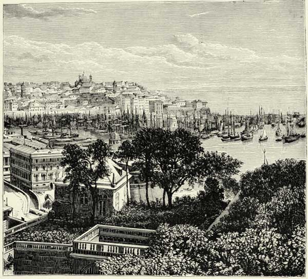
As long as the Apennines were not crossed by practicable carriage roads, Genoa possessed no advantages whatever over the other ports of Liguria, but ever since it has been placed in easy communication with the fertile plains of Lombardy and Piemont, the great advantages of its geographical position have told upon its development. Pisa was the only republic on the western coast of Italy which contested this superiority of Genoa, but was defeated after a sanguinary struggle. The Genoese possessed themselves of Corsica, the inhabitants of which were treated most cruelly; they took Minorca from the Moors, and even captured several towns in Spain, which they restored only after important commercial privileges had been granted them. In the Ægean Sea the nobles of Genoa became the proprietors of Chios, Lesbos, Lemnos, and other islands. At Constantinople the Genoese merchants were as powerful almost as the Emperor. Kaffa, in {236} the Crimea, was one of their wealthy colonies. Their factories and towers were met along every commercial high-road in Asia Minor, and even in the recesses of the Caucasus. The possession of the Black Sea gave them the command of the trade with Central Asia. These distant colonies explain the use of a few Arab, Turkish, and Greek terms by the Genoese, and though the dialect spoken by them is decidedly Italian, the intonation is French.
Nevertheless Genoa, though more powerful than Pisa, failed in wresting the command of the sea from the Venetians, who enjoyed immense advantages through their connection with Germany. Her political influence has never equalled that of Venice, nor has she produced as many men eminent in literature and art as has her Adriatic rival. The Genoese had the reputation in former times of being violent and false, fond of luxury and power, and indifferent to everything which did not enrich them. “A sea without fish, mountains without forests, men without faith, women without modesty—thus is Genoa,” was a proverb ever in the mouth of the enemies of the Ligurian city. The dissensions amongst the noble families of Genoa were incessant, but the Bank of St. George never allowed civil strife to interfere with business. Wealth flowed into the city without any cessation, and enabled its citizens to construct those palaces, marble arcades, and hanging gardens which have won for it the epithet of la Superba. In the end, however, ruin overtook the Bank, and that justly, for it had supplied princes with money to enable them to wage war, and its bankruptcy in the middle of the eighteenth century rendered Genoa politically impotent.
The capital of Liguria, in spite of its small extent, its sinuous streets, its ramparts, stairs, and dirty narrow quays, may justly boast of palaces equally remarkable for the splendour and originality of their architecture. Many of these magnificent buildings appeared to be doomed to ruin during the decay of the town, but, on the return of more prosperous times, the citizens again devoted themselves to the embellishment of their city. Genoa is the busiest port of Italy.79 Its shipowners possess nearly half the Italian mercantile marine, and three-fourths of the vessels annually built in Italy are furnished from its ship-yards. The harbour, though 320 acres in extent, no longer suffices for the hundreds of sailing vessels and steamers which crowd into it. Nor is it sufficiently sheltered against the winds, and it has therefore been proposed to construct a vast breakwater far beyond its present limits. Genoa fancies that its interests are not sufficiently attended to by the Central Government. A second railway across the Apennines is urgently demanded, in order to manage the traffic that will be created by the opening of the direct railway through Switzerland, which will place Genoa in direct communication with Western Germany.
Μ
Fig. 81.—THE GULF OF SPEZIA.
From the Sardinian Staff Map. Scale 1 : 80,000.
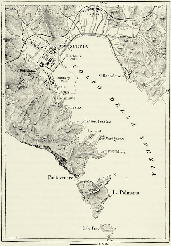
In the meantime Genoa is expanding in all directions. Its factories of macaroni, paper, silks and velvets, soap, oil, jewellery, metal-work, pottery, ornamental flowers, and other objects are ever increasing; and ovrar del Genoes—Genoese {237} industry—is a marvel now, as it was in the Middle Ages. San Pier d’Arena (Sampierdarena), to the west, has become a veritable manufacturing town. Cornigliano, Rivarolo, Sestri di Ponente with its large ship-yards, Pegli, and Voltri are populous towns, having spinning-mills and foundries. Savona, whose port was {238} filled up by the jealous Genoese, occupies the bottom of a vast bay. It has glass-works and potteries, and is connected by a railway with Turin. Elsewhere on the Riviera di Ponente the towns are crowded closely together. Such is the case with the twin cities of Oneglia and Porto Maurizio, the one built on the beach, the other on a steep hill close by, and known as the “Fountains of Oil,” because of their extensive plantations of olives. At San Remo, however, olives are more plentiful still.80
On the Riviera di Levante town joins town like pearls in a necklace. Albaro, with its charming mansion, Quarto, whence departed the expedition which took Sicily from the Bourbons, and Nervi, a health resort for persons suffering from pulmonary diseases, constitute a long-stretching suburb of Genoa, extending in the direction of Recco and Camogli, two towns abounding in shipping. The rocky promontory of Porto Fino, thus named after the dolphins which formerly frequented it, imposes an insurmountable obstacle to the further extension of Genoa in this direction. Having traversed the tunnel leading through this promontory, we reach another group of towns, viz. Rapallo, the industrious; Chiavari, a great place of trade; Lavagna, with its famous quarries of grey slates; and Sestri di Levante, a town of fishermen.
The coast beyond Sestri is but sparsely inhabited, for there bold cliffs approach the sea; but having doubled the superb cape of Porto Venere, we enter the fine Gulf of Spezia,81 with its numerous forts, ship-yards, arsenals, and other buildings. The Italian Government has been busy ever since 1861 in converting this gulf into a first-rate naval arsenal, but no sooner has a portion of the work been completed than the progress made in the arts of destruction compels the engineers to remodel it—a very costly task. Whatever future may be in store for Spezia as a military port, it has none as a commercial one, for though it affords excellent shelter to vessels, no railway connects it with the fertile countries beyond the Apennines, and its exports are limited to the produce of the valleys in its immediate vicinity. Spezia is indebted for its high rank amongst the cities of Italy to its beautiful gulf, the rival of the Bay of Naples and the roadstead of Palermo. From the summit of the marble hill above the decayed town of Porto Venere we look down upon a marvellous succession of bays and promontories, and far in the distance the mountains of Corsica rise indistinctly above the blue waters. Looking to the east, we behold the picturesque towns on the opposite side of the gulf embedded in groves of olive-trees and cypresses, the Apuanic Alps and the Apennines bounding the horizon. Right opposite is the charming town of Lerici, and to the south of it the shore upon which Byron reduced to ashes the body of his friend Shelley: no spot more appropriate for this mournful holocaust. {239}
IV.—TUSCANY.
Tuscany, like Liguria, lies on the southern slope of the Apennines, but is of far greater width, for that back-bone of Italy retreats there from the Gulf of Genoa, and stretches right across the broadest part of the peninsula to the Adriatic. Besides this there are several detached plateaux and mountain ranges to the south of the valley of the Arno.82
The Apennines of Tuscany are of very unequal height, and they are traversed by numerous low passes, which could easily be converted into carriage roads. Speaking generally, they consist of a series of elongated and parallel mountain masses, separated from each other by valleys, through which flow the head-streams of the Serchio and the Arno. The first important mountain mass of the main chain near the frontiers of Liguria, which is commanded by the Orsajo and Succiso, is thus separated by the valley of the Magra from the parallel range of Lumigiana. The chain of Garfognana, to the north of the plains of Lucca, has for its pendant the Alps of Apuana. Monte Cimone, farther east, and the other summits of the Alpe Apennina to the north of Pistoja and Prato, are attended by the parallel ridges of the Monti Catini and Monte Albano, on whose slope is the famous grotto of Monsummano, with a thermal spring. A fourth mountain mass, that which the direct road from Florence to Bologna crosses in the Pass of Futa, has likewise its lateral chains, viz. the Monte Mugello, to the south of the Sieve; the Prato Magno, encircled by the Upper Arno; and the Alps of Catenaja, between the Arno and the Tiber.83
The Apennines of Tuscany in many places attain a height of 5,000 feet, and are quite Alpine in their aspect, the upper slopes remaining covered with snow for more than half the year. They owe much of their grandeur to the precipitous slopes and fantastic profiles of the calcareous rocks which enter so largely into their composition. The forests of chestnuts, firs, and beeches which formerly clothed the whole of the range have not yet been entirely destroyed. The beautiful woods which cover the slopes of Prato Magno have impressed the mind of many a poet; and, since Milton sang the delights of Vallombrosa, the “shaded vale” has become a proverbial name for everything sweet and touching in the poetry of nature. Farther to the west the monastery of the Campo di Maldulo (Camaldoli) occupies one of the most beauteous spots in all Italy, the woods and meadows of which have been celebrated by Ariosto. From the summit above the convent both the “Tuscan and the Slavonian Sea” can be seen, as that poet tells us.
The barren escarpments and forests of the Apennines form a charming contrast to the valleys and rounded hills of Lower Tuscany, where nearly every height is {240} surmounted by the ruins of a mediæval castle; graceful villas are scattered over the verdant slopes, farmhouses stand in the midst of vineyards and pointed cypresses, and every cultivable spot is made to yield a rich harvest. Historical associations, the taste of its inhabitants, the fertility of the soil, an abundance of running water, and the sweetness of the climate all combine in making Central Tuscany one of the most privileged regions of Italy. Protected by the rampart of the Apennines against cold northerly winds, this region faces the Tyrrhenian Sea, whence blow warm and humid winds of tropical origin. The rains they bring are not excessive, thanks to the screen formed by the mountains of Corsica and Sardinia, and the happy disposition of the detached hills near the coast. The climate of Tuscany is essentially temperate, and to its equability, no less than to the natural beauty of their abode, the Tuscans owe, no doubt, much of their gaiety, their good-nature, fine taste, poetical feeling, and facile imagination.
Fig. 82.—THE GOLFOLINO OF THE ARNO, NEAR SIGNA.
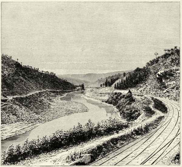
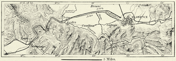
The valley of the Arno completely separates the hills of Southern Tuscany, usually known as the “Sub-Apennines,” from the principal chain of the mountains. This valley, with its defiles and ancient lake basins, may be likened to a moat {241} bounding the wall of the Apennines. The vale of Chiana, originally an arm of the sea, and then a lake, forms the uppermost portion of the zone which separates the Apennines from the hills of Southern Tuscany. Then follows the Campagna of Florence, an ancient lake basin, which it would be easy to flood again by building a dam across the defile of the Golfolina, through which the river makes its escape, and which was rent asunder by the “Egyptian Hercules.” Castruccio, the famous commander of the Luccans, actually proposed to flood the plains of Florence in the fourteenth century by constructing a dam across this defile; but happily his engineers pronounced the scheme to be impracticable, for they supposed the difference of level to amount to 288 feet, whilst in reality it is only fifty.
Μ
Fig. 83.—DEFILES OF THE ARNO.
From the Austrian Staff Map. Scale 1 : 285,000.
The Sub-Apennine hills to the south of the Arno are of rounded contours, of a gloomy grey colour, and devoid of all verdure. Whilst the Apennines consist exclusively of Jurassic and cretaceous rocks, the Sub-Apennines are of tertiary formation, their sandstones, clays, marls, and pudding-stones being pierced here and there by serpentine. Well-defined ranges can hardly be said to exist. Southern Tuscany, indeed, may be described as a table-land intersected by rivers in all directions, surmounted by irregular groups of hills, and pierced by “sinks,” which swallow up some of the rivers. The cavities of the Ingolla form one of these sinks, in which several rivulets lose themselves, to reappear lower down as the source of the Elsa Viva, one of the principal tributaries of the Arno. The most elevated hills of this Sub-Apennine region form the water-parting between the Arno, the Cecina, and the Ombrone, and in the Poggio di Montieri, a mountain abounding in copper, they attain an elevation of 3,323 feet. The Labbro (3,815 feet), Cetona (3,650 feet), and Monte Amiata (5,450 feet), to the south of the Ombrone valley, rise to a greater height, but geologically they belong already to Central Italy. The Cetona is a Jurassic outlier surrounded by recent formations. Monte Amiata, a trachytic cone, is the most elevated volcano of continental Italy. It no longer vomits lava, but numerous hot springs and solfataras prove that the volcanic forces are not yet quite extinct. The Radicofani (2,950 feet) is likewise an extinct volcano, whose lava resembles petrified froth, and can be cut with a hatchet.
Subterranean agencies must indeed be very active in Tuscany, for metalliferous {242} veins ramify in all directions, and the number of mineral springs of every description is larger than in any other part of Italy. Amongst these springs there are several of world-wide reputation, as, for instance, those of Monte Catini, of San Giuliano, and of the Bagni di Lucca. The brine springs of Tuscany are very productive; but the most curious, and at the same time most useful, springs of all are the famous lagoni, in a side valley of the Cecina, and at the northern foot of the Poggio di Montieri. From a distance dense clouds of white vapour are seen rolling over the plain, and the bubbling noise made by gases escaping through the ponds, or lagoni, is heard. These ponds contain various salts, silica, and boracic acid, which is of great value in the manufacture of china and glass, and yields a considerable revenue to Tuscany. Nowhere else in Europe, except, perhaps, in the crater of the Eolian Vulcano, is boracic acid met with in sufficient quantities to repay the labour of extracting it. In Tuscany, however, there are several other localities where it might be won with advantage, as, for instance, near Massa Maritima, to the south of the Montieri.
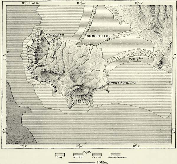
The subterranean fermentation of which Tuscany is the scene is no doubt due in a large measure to the changes which have taken place in the relative proportions of land and sea. Several isolated hills rise near the coast like islands from the sea, and these have evidently been joined to the mainland by the alluvial deposits brought down by the rivers. The Monti Serra (3,000 feet), to the east of Pisa, between the Arno and the Serchio, are almost insulated even now, for they are surrounded by swamps, and the level of the Lake of Bientina, at their eastern foot, is scarcely thirty feet above that of the Mediterranean. The heights along the coast to the south of Leghorn are not quite so isolated, but the lowland which connects them with the table-land of the interior is only of small elevation. The promontory, however, whose extremities are occupied by the towns of Populonia and Piombino (653 feet), is joined to the mainland only by a low plain of sand. The most perfect type of these ancient islands is presented to us in the superb Monte Argentaro, at the southern extremity of the Tuscan littoral, which rises boldly from the sea to a height of 2,085 feet, and is attached to the mainland by two narrow strips of land covered with pine-trees, enclosing a lake of regular shape: in the midst of it, on a fragment of the ancient beach, is built the town of Orbetello. This lake, which looks almost as if it were the work of a generation of giants, has been converted into an eel-pond, and millions of fish are caught in it every year. Towards the west of this mountain, in the direction of Corsica, lie the islands of Giglio and Monte Cristo (2,062 feet) and the rock of Formica. The island of Elba, farther north, forms a small world of its own.
The rivers of Tuscany have wrought great changes in the plains through which they flow, and along the sea-coast. Their labour has been facilitated by the nature of the soil which they traverse. The least rain converts the barren hill-slopes into a semi-fluid paste, which is carried by the rivers down to the sea. The mouth of the Arno has thus been pushed forward to the extent of seven miles in the course of a few centuries. In former times the Serchio and the Arno united before they flowed into the sea, but the Pisans diverted the former river to the {243} north, in order to rid themselves of its unwelcome deposits. Pisa, in the time of Strabo, stood at a distance of only twenty Olympian stadia from the Tyrrhenian Sea, and when the cascina of San Rossore was built, towards the close of the eleventh century, its walls were close to the beach, which is now at a distance of three miles. Extensive plains intersected by dunes, or tomboli, and partly covered with forests of pines, have been added to the land in the course of centuries. These sandy wastes have become the home of large herds of horses and half-wild cattle, and the camel has been acclimatised there, it is said, since the Crusades. These changes in the coast-line may not, however, be due exclusively to the agency of the rivers, for there exists evidence of an upheaval of the land. The building stone known at Leghorn as panchina is clearly of marine origin, and the shells which enter into its composition are still met with in the Tyrrhenian Sea.
Μ
Fig. 84.—MONTE ARGENTARO.
From the French Chart. Scale 1 : 168,000.
Μ
Fig. 85.—VAL DI CHIANA.
From the Austrian Staff Map. Scale 1 : 218,000.
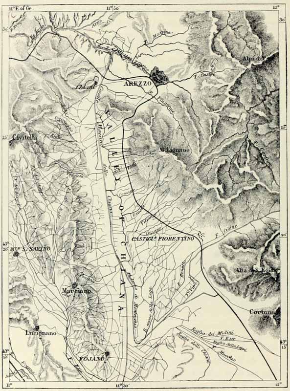
Amongst the changes effected by human agency in the basin of the Arno those referring to the Val di Chiana are, perhaps, the most important. This depression connects the basins of the Arno and Tiber, and may possibly have served as an outlet to the former river before it had opened itself a way through the {244} gorge below Florence. Formerly the water-parting between the two rivers was close to the Arno. A small portion of its drainage was carried to the Tuscan river, but by far the greater portion of the vale was occupied by stagnant pools, extending to the south as far as the latitude of Montepulciano, a distance of twenty miles. The whole of this region was a breeding-place of fever. Dante and other Italian writers speak of it as an accursed place. The inhabitants made vain attempts at drainage. The illustrious Galileo, when consulted on the subject, {245} declared that nothing could be done to mend this evil; and though Torricelli conceived that it would be possible to drain the valley, he took no steps to put his theories into practice.
Μ
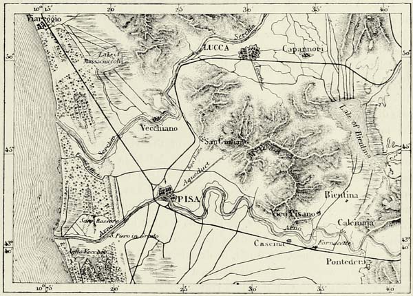
Fig. 86.—THE LAKE OF BIENTINA.
From the Austrian Staff Map. Scale 1 : 328,000.
About the middle of the eighteenth century the work of drainage was at length seriously taken in hand, directed by Fossombroni, the celebrated engineer. “Warps,” or colmate, were thrown up at the outlet of each lateral ravine between which the débris carried down from the flanks of the mountains was deposited. The swamps gradually filled up, and the soil became firm. By constructing a dam (argine) across the vale at the point chosen for the new water-parting, an outfall was created, and a line of stagnant swamps was thus converted into a pure rivulet. The valley, at one time a hotbed of fever, has now become one of the most salubrious districts of Italy. The newly won lands were at once taken possession of by agriculturists, and 500 square miles were thus added to the productive area of Tuscany. Villages, formerly inhabited by fever-stricken wretches, have become wealthy towns, and the success of this bonification, or reclamation, has been thorough. The torrents are under control now, and have already deposited 17,650 million cubic feet of alluvium over an area of 50,000 acres, as if they were intelligent workmen. The same system of drainage has been successfully applied in other parts of Italy, and particularly near Grosseto, on the right bank of the Ombrone.
Amongst the great drainage works which will evermore contribute to the glory of Tuscan engineers, the innumerable canals draining the plains of Fucecchio, {246} Pontedera, Pisa, Lucca, Leghorn, and Viareggio, each of which was formerly occupied by its lake, deserve to be noticed. One of the most difficult of these lakes is that of Bientina, or Sesto, to the east of the Pisan hills, which is supposed to have been formed by an overflow of the Serchio. In former times this lake had two effluents, one running north to the Serchio, the other south to the Arno. The outfall left nothing to be desired in ordinary times, but after heavy rains the two effluents were converted into inflowing rivers, and if the sluices had not been closed, the Arno and the Serchio would have rejoined each other in this inland sea. The Bientina, during such freshets, covered six times its ordinary area, and in order to save the fertile fields of Tuscany it became absolutely necessary to create a third effluent. The engineers conceived the happy idea of conveying this new effluent through a tunnel, passing beneath the Arno, three feet in width, into an ancient bed of that river, now supplanted by the Colombrone.
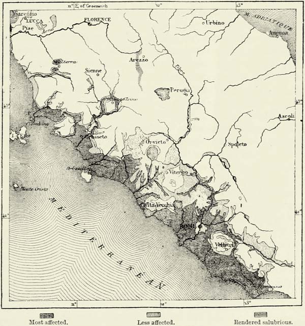
In most of these enterprises it was necessary to struggle on in spite of the miasmatic atmosphere, which hung more particularly over the littoral zone, where the fresh inland water mingles with the salt water of the Mediterranean. The blending of the two waters destroyed the fresh-water plants and animals, and the deleterious gases arising from their decomposition poisoned the atmosphere. About the middle of last century an engineer, Zendrini, proposed to construct sluices separating the fresh from the salt water. This was done, and the fevers at once disappeared. In 1768, the sluices having been allowed to fall out of repair, the miasmatic scourge immediately reappeared, and it was not until they had been repaired that the sanitary condition of the villages along the coast was improved. Twice since neglect to keep the sluices in a proper condition has been punished with the same results; but from 1821 they have been maintained in thorough order, and the sanitary condition of the country has ever since been most satisfactory. Viareggio, in the centre of this malarial district, was up to 1740 hardly more than a hamlet, avoided on account of its insalubrity, but is now a seaside town, the favourite resort of numbers of visitors.
Much has been done, no doubt, in draining the land, but there is still room for many improvements. The Maremma, a track between Piombino and Orbetello, remains one of the most insalubrious regions of Europe, in spite of what has been done by sanitary engineers. The inhabitants never reach a high age, and though they descend to the plain only when it is absolutely required for cultivating their fields, they frequently carry away with them the germs of disease. In the two summers of 1840 and 1841 no less than 36,000 persons suffered from fever amongst a total population of 80,000 souls, most of whom reside in villages built on hills, and only rarely visit the pestilential plain. In order to escape the pernicious influence of the poisonous air, it is necessary to reside constantly at an elevation of 325 feet above the sea, and even that does not always suffice, for the episcopal city of Sovana is notoriously unhealthy, though built at that height. Fevers occur frequently at a distance from the swamps, and Salvagnoli Marchetti is of opinion that they are due to the nature of the soil. The malaria is said to creep up clayey hills permeated by empyreumatic substances; it likewise {247} poisons the air of districts abounding in saline springs, and still more that near deposits of alum. Southerly winds are likewise most pernicious, and fevers rise highest in the valleys which are exposed to them. Places, on the other hand, which are fully open to the sea breeze are quite free from malaria, even if swamps are near, as at Orbetello and Piombino.
Μ
Fig. 87.—THE MALARIAL REGIONS.
From the Austrian Staff Map. Scale 1 : 2,700,00.
It is generally admitted that the coasts of Etruria did not suffer from malaria whilst the ancient Tyrrhenian cities were prosperous. The excavations made recently in connection with the railways have revealed a complete system of subterranean canals, which formerly drained the whole of the Maremmas. Populonia and other large cities, of which only a few ruins are found now, could certainly not have existed if the climate had been as unhealthy as at present. The ancient Etruscans were famous as hydraulic engineers. They embanked torrents, drained swamps, and rendered the country cultivable, but their engineering works were allowed to decay soon after they had been subjected, and the country returned to its primitive savageness. On the other hand, there are many towns {248} which were considered healthy during the Middle Ages, but are now desolated by fever. Massa Maritima, to the south-west of the Moutieri mountain, was rich and populous as long as it maintained its republican liberties; but no sooner had it been enslaved by Pisans and Sienese than its drainage works were allowed to fall into decay, and in the end it found itself reduced to the “shadow of a town.” Sanitary works carried out recently have brought back some of its ancient prosperity.
Amongst the causes which have contributed most materially towards a deterioration of the climate may be mentioned the destruction of the mountain forests and the rapid increase of alluvial lands resulting from it. The monasteries of Tuscany, which until quite recently were the owners of the fish-ponds in the Maremmas, energetically protested against the construction of embankments or other drainage works, which they conceived would interfere with their cherished Lenten food. Several of the inland towns rejoiced in the possession of some unhealthy swampy tract, to which obnoxious persons might be banished with a certainty of their dying. Even the Kings of Spain established a penal establishment at one of the most deadly spots on this coast, and banishment to Talamone, at one time a flourishing port of the Republic of Siena, was tantamount to a sentence of death.
Many attempts were made to reclaim these lands. Macchiavelli and other statesmen of Tuscany thought that the former salubrity of the climate could be restored by merely repeopling the country. Colonists were sent for from other parts of Italy, and even from Greece and Germany, but they soon succumbed to the climate. Since that time considerable progress has been made in rendering these marshy districts more salubrious. Trees have been planted, and, in combination with proper drainage, they have rendered many districts habitable which were not so formerly. Populonia is a case in point. Follonica, where there are furnaces in which the iron ores of Elba are smelted, is likewise looking up, though its inhabitants still fly the place on the approach of the fever season.
The Etruscans, or Tyrrhenians, were the ancestors of the Tuscans, and long before the dominion of the Romans they were the preponderating race of all Italy. They occupied not only the whole of the southern slope of the Apennines as far as the Tiber, but had also founded a confederation of twelve towns in the Campagna, of which Capua was the head, and as traders and pirates they held possession of the Tyrrhenian Sea, still named after them. The island of Capri was one of their most advanced outposts towards the south. The Adriatic was likewise their own, for Adria, Bologna (called Felsina by them), Ravenna, and Mantua were Etruscan colonies, and the Rhætians in the Alpine valleys were their allies, and perhaps kinsmen. But who were the Etruscans? They have been classed with Aryans, Ugrians, and Semites; with Greeks, Germans, Scythians, Egyptians, and Turks. The Etruscan inscriptions on ancient monuments, though very legible, have not hitherto been deciphered satisfactorily. If Corssen’s interpretation is accepted, their language resembled the Latin tongues; but this {249} philologist, after all, may not be entitled to be called the “Œdipus of the Etruscan sphinx.”
The most common type of the Etruscans, as transmitted to us on cinerary vases, is that of squat men, often inclining to obesity, with broad shoulders, prominent face, curved noses, broad retreating forehead, dark complexion, dolichocephalous skull, and curly hair. This type is neither Hellenic nor Italian. Amongst their monuments there are none of those curious structures known as nuraghi, which abound in Malta, Sardinia, and Pantellaria, but dolmens are numerous. The sepulchral monuments, of which many thousands have already been brought to light, prove that the arts had attained a high degree of development in ancient Etruria. The paintings in the interior of the vaults, the bas-reliefs on the sarcophagi, the vases, candelabra, pottery, and bronzes, resemble similar work produced by the genius of Greek artists. The arrangement of their dwelling-houses, though not devoid of originality, proves the intimate connection existing between the civilisations of the Etruscans and early Greeks. It was the Etruscans who initiated Rome into the arts. The Cloaca Maxima, the most ancient monument of the Eternal City, the wall named after Servius Tullius, the Mamertine prison, and, in fact, all the remains of the Rome of the kings, were their work. It was they who erected the temples, supplied the statues to deities, built the dwelling-houses, and furnished them with articles of ornament. Even the she-wolf of bronze, now in the Capitoline Museum, and a symbol of the Roman people, appears to be of Etruscan workmanship.
The Tuscans of our day differ, however, in many respects from their Etruscan ancestors. These latter, to judge from the paintings in their sepulchral cities, were an austere race. They appear, likewise, to have been a nation of cooks and gluttons. Neither of these qualities can be laid to the charge of their descendants. The modern Tuscan is of an amiable and kindly disposition, he is possessed of wit and artistic tastes, easy to move, and altogether perhaps a trifle too pliant of character. The Tuscans of the plain, but not those of the Maremmas, are the most gentle of Italians; they “live and let live,” and are exceedingly good-natured. A singular trait distinguishes them from the rest of the Italians: though brave when carried away by passion, they turn with horror from a dead body. In this we may trace the persistence of ancient superstitions, for though the Tyrrhenians concealed their tombs, the worship of the dead was the most prominent of their religious observances.
The modern Tuscans, like their ancestors, have known a time when they took the lead amongst the people of Italy, and even now they stand at the head of the nation in certain respects. After the decadence of Rome, when civilisation gravitated towards the north, the valley of the Arno became one of the great centres of the world’s activity. At that time the passage of the Alps was still difficult, but communications by sea were established between Tuscany, France, and Spain. The Apennines not only sheltered the fertile valleys opening upon the Tyrrhenian against cold northerly winds, but also against the hordes of barbarian invaders. Tuscany was, indeed, a favoured region, and its intelligent {250} inhabitants made the most of the natural advantages they possessed. “Work” was the great law of the Florentines, and all, without exception, were expected to engage in it. Whilst Pisa disputed the dominion of the sea with Genoa and Venice, Florence became the head-quarters of commerce, and its bankers extended their operations to every part of Europe.
But Tuscany was more than a commercial and industrial country. What Athens had been to the world two thousand years ago, republican Florence became during its period of prosperity, and for the second time in the history of mankind there arose one of those centres of light the reflected rays from which still illuminate our own times. Arts, letters, sciences, and political economy—everything, in fact, that is noble in this world was cultivated with an energy to which nations had been strangers for a long time. The pliant genius of the Tuscans revelled in every species of work, and amongst the names great in history Florence may fairly claim some of the greatest. Where are the men that have exercised a greater influence in the world of art and intellect than Giotto, Orgagna, Masaccio, Michael Angelo, Leonardo da Vinci, Andrea del Sarto, Brunelleschi, Savonarola, Galileo, or Macchiavelli? It was a Florentine, too, Amerigo Vespucci, who gave his name to the New World, and justly so, for it was Vespucci through whom the discoveries made by the Spaniards first became known, and who, in 1501, bestowed the name of Novus Mundus upon the newly discovered countries, whilst Columbus died in the belief that he had reached the eastern coast of Asia.
The dialect of Florence has become the polished language of the whole of Italy, and it is curious that this honour should not have been carried off by Rome. But whilst Florence cultivated the arts and sciences, and through her great writers exercised an immense influence, the city of the popes yielded herself up to the worship of the past, and its literature was written in a dead language, more or less successfully imitated from that of Cicero. The dialect of Rome never became a language like that of Florence, but Italian is nevertheless indebted to Rome for its musical pronunciation, that of the Tuscans being harsh and guttural. Hence the old proverb, “Lingua Toscana in bocca Romana.” The delicate, pure poetry breathed in the ritornelli which Tuscan peasants chant in the evening is highly appreciated by all admirers of Italian, and the influence which the fine dialect of the Florentines exercised upon the unification of Italy can hardly be overestimated. The worshippers of Dante are almost justified in saying that Italian unity dates from the day on which the great poet first expressed himself in the firm and sonorous language which he had forged out of the various dialects spoken throughout the peninsula.
The geographical position of Tuscany accounts for the influence it has exercised upon Italy and the rest of the world, whilst its topography gives us the key to the local history of the country. The Apennines and the mountains to the south of the Arno divide it into a number of separate basins, each of which gave birth to a small state or republic. At the time of the Tyrrhenians Etruria formed {251} a confederation of cities, whilst during the Middle Ages it was divided into numerous small republics, frequently at war with each other. Since that time many changes have taken place in the relative importance of the various towns, but even now most of the free cities of the Middle Ages, and even some founded by the ancient Etruscans, occupy a high rank amongst the provincial towns of Italy.
Florence (Firenze) is not one of these ancient cities of the Tyrrhenians; it is merely a Roman colony of comparatively modern origin. In the time of the Empire it was of small importance, for Fiesole, on a hill to the north, remained the leading town of the country until destroyed by the Florentines, who carried its columns and statues to their own town. The rapid growth of Florence during the Middle Ages is due to its position on the highway which connects Germany, Lombardy, and even Bologna with Southern Italy. As long as Rome was the capital of Italy travellers starting from the valley of the Tiber crossed the Apennines in the direction of Ancona and Ariminum. But after the fall of Rome, when barbarian hordes inundated the country from the north, the high-roads connecting the plains of Lombardy with the valley of the Arno rose into importance. This great military highway became simultaneously a high-road of commerce, and it was only natural that a great emporium should spring up on the site occupied by Florence. The “city of flowers” prospered, and became the marvel which we still admire. But the wealth of the growing commonwealth proved its destruction. The rich bankers grasped at political power, the Medici assumed the title of princes, and though the arts continued to flourish for awhile, public virtues decayed, the citizens became subjects, and intellectual life ceased.
Florence, as in the days of republican liberty, owes much of its wealth to the industry of its inhabitants. There are manufactories of silks and woollen goods, of straw hats, mosaics, china, cut stones (pierra dura), and other objects, all of them requiring workmen possessed of taste and manual dexterity. But neither these industries nor the commerce carried on by the town would have raised Florence above the level of other populous Italian cities. The prominent position it holds is due entirely to the beauty of its monuments, which attract to it the lovers of art from every quarter of the world. Not even Venice is equally rich in architectural masterpieces of the Middle Ages and the Renaissance. The museums of Florence “la Bella”—such as the Uffizi, the Pitti Galleries, and the Academy of Arts—are amongst the richest in Europe, and contain some of the most highly prized treasures of art; its libraries abound in curious manuscripts and rare old books. Nay, the very streets and piazzas of the town, with their palaces, towers, churches, and statues, may be likened to a huge museum. Brunelleschi’s Duomo; Giotto’s Campanilla, which was to “surpass in beauty all imagination can conceive;” the Baptistery, with its incomparable doors of brass; the Piazza della Signoria; the monastery of San Marco, now a museum; the gloomy palace of the Strozzi; and numerous other buildings of superior merit make Florence the delightful place it is. Its charms are enhanced by the beauty of the surrounding {252} country, and the traveller will always recall with pleasure the walks along the Arno, the hills of San Miniato and Belle Sguardo, and the picturesque spur upon which lie the villas and ruins of Etruscan Fiesole. Unfortunately the climate of Florence leaves much to be desired; the wind changes abruptly, and the heat in summer is overpowering. Il caldo di Firenze has become proverbial throughout Italy. Narrow streets, and to some extent the disregard of the laws of hygiene, cause the mortality to exceed that of nearly every other town on the Continent. During the Middle Ages pestilence was a frequent visitor, and Boccaccio tells us that in an single season nearly 100,000 inhabitants, or two-thirds of the entire population, were swept away by it. Targioni Tozetti contrasts the site of Empoli, a small town to the west, with that of Florence, and regrets that a project for removing Florence thither should not have been carried out, as proposed in 1260.
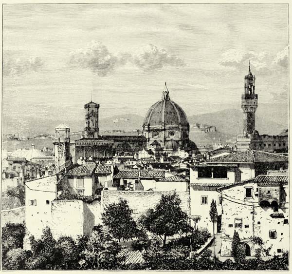
Fig. 88.—FLORENCE: THE DUOMO AND PALAZZO VECCHIO.
The only town of any importance in the upper valley of the Arno is Arezzo, an ancient city of the Etruscans, and at one time the capital of one of the most prosperous republics of the Middle Ages. The inhabitants ascribe to the “subtile {253} air they breathe the subtility of their spirits,” and indeed the list of famous men connected with the town is very long. The present Arezzo, however, is a decayed place, and lives upon the memories and the monuments of a past age. Cortona, farther south, near the Lake of Trasimeno, claims to be the most ancient city of Italy; but all traces of its former greatness have disappeared. Siena, which formerly governed the whole of the hilly tract between the Arno and Ombrone, has fallen from her high estate, not without the fault of its own citizens, who were continually quarrelling amongst themselves. Siena no longer rivals Florence in population, power, or industry, but may still compare with the city on the Arno as regards its public buildings—many of them in the Gothic style—its works of art, its quaint streets and piazzas, and its magnificent position on the slopes of three hills. Chiusa, one of the most powerful towns of ancient Etruria, is of no importance now, and only attracts antiquarians in search of its ancient tombs. The vineyards of Montepulciano, on the same side of the vale of Chiani, produce the “king of wines.” Volterra is only a small town now, interesting, however, on account of its cyclopean walls and a museum abounding in Etruscan antiquities. The environs are dreary in the extreme. Salt-works, yielding from 7,000 to 8,000 tons a year, quarries of alabaster, copper mines at Monte Catini, sulphur springs, and the famous lagoni di Monti Cerboli (see p. 242), are in the neighbourhood.
The cities at the foot of the Apennines, on the other side of the Arno, have retained their importance, for they are favourably situated for commerce. Prato, where the valley of the Arno is widest, is the centre of a rich agricultural district. The quarries of serpentine in the neighbourhood have furnished building stones for many of the most beautiful edifices of Tuscany, including the cathedral of Prato, celebrated on account of Donatello’s marvellously sculptured pulpit. Pistoja, where the railway descends from the Apennines, is a busy manufacturing town. Other towns of some importance are Pescia, Capannori, in the “garden of Italy,” and Lucca the industrious, with its celebrated pictures by Fra Bartolommeo.
The basin of the Serchio is of incomparable productiveness since its marsh lands have been brought under cultivation. From the ramparts of Lucca one of the most charming views may be enjoyed. On the one hand we have the towers and cupolas of the town, on the other fertile fields and orchards, with white houses peeping through the verdure, and distant hills surmounted by old towers. The impression made by this view is one of perfect peace. In a country so fertile and beautiful, it would seem, the people ought to be happy, and, if enthusiastic writers can be believed, such is really the case, and the peasants of Lucca and of Lower Tuscany in general enjoy advantages denied to their class elsewhere in Italy. They are farmers for the most part, but hold their land by long leases, and their share of its produce is regulated by ancient custom. The land, however, does not suffice for their wants, and they emigrate in thousands in search of work. Many of these emigrants work as grinders.
The inhabitants of the Upper Serchio valley, known as the Garfagnana, are as industrious as those near Lucca, which is the natural outlet for its produce. The slopes and spurs descending from the Apennines and Apuanic Alps are cultivated {254} in terraces. Castelnuovo, the chief town of this valley, occupies one of the most delightful spots of this picturesque district. The common people near it are said to speak the best Italian, superior even to that of the Sienese.
The valley of the Magra is far more frequented than that of Garfagnana, for the high-road from Parma to the Gulf of Spezia leads through it. In its upper portion, in the heart of the Apennines, stands the small town of Pontremoli. Its inferior portion, known as the Lunigiana, from the ancient city of Luni, is as beautiful as the parallel valley of the Serchio. At Sazana it opens upon the sea, and to the south of that charming town, where the Apuanic Alps approach close to the sea, leaving only a narrow passage of some note in history, are situated the towns of Carrara and Massa. Carrara, the “Quarry,” has replaced Luni as the place from whence the white marbles so highly esteemed by sculptors are exported, and choice blocks of which sometimes fetch £80 a cubic yard. No less than 720 quarries perforate the neighbouring hills, and about 300 of these are being worked now. The town may be likened to an agglomeration of sculptors’ studios, and its Academy has trained artists of high reputation. Massa enjoys a better climate than Carrara, but its marbles are less highly esteemed. As to the marbles of Serravezza, which are quarried in the Altissimo and other mountains of the Apuanic Alps near the town of Pietra Santa, they are in many instances as beautiful as those of Carrara. Michael Angelo highly appreciated them, and had a road constructed to facilitate access to them. The quarries and mines in the neighbourhood also yield slates, iron, lead, and silver.84
These towns at the foot of the Apuanic Alps were bound to prosper in proportion as the country increased in wealth, whilst Pisa, the great commercial republic of mediæval Tuscany, was doomed to decay, owing to the silting up of its harbour. This Porto Pisano was situated about ten miles to the south of what was then the mouth of the Arno. In 1442 its depth had been reduced to five feet, a century later only rowing boats could enter it, and soon after it was abandoned definitely. There are no traces of it now, and its very site is disputed. But though Pisa is dead—Pisa morta—the city still possesses admirable monuments of its past grandeur. It has a wonderful cathedral; an elegant baptistery; its Campo Santa, with the famous frescoes of Orgagna and Gozzoli; and a leaning tower commanding a view of the Pisan hills and the alluvial plains of the Arno and Serchio. Its commerce has dwindled away, but it is still the capital of a rich agricultural district, and its university is one of the best in Italy. It possesses, moreover, that which no change in the commercial highways can deprive it of, a mild climate, and during winter attracts numerous visitors from the north.
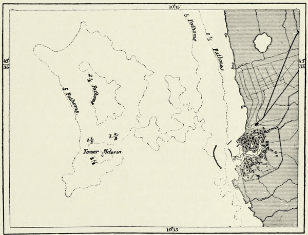
Leghorn, or Livorno, has inherited the commerce of Pisa. It is the natural outlet of the fertile districts of Tuscany, and its commerce is far more important than might be supposed from the unfavourable configuration of the coast, and is surpassed only by that of Genoa and Naples.85 Thousands of Spanish and {255} Portuguese Jews who found a refuge here have contributed in no small measure to the development of the resources of the town. From an architectural point of view, Leghorn is one of the least interesting cities of Italy, but as the outcome of human labour it is one of the most curious. Before the city could be built, the swamps which occupied its site had to be drained, and an artificial harbour had to be excavated for the protection of vessels. Numerous canals intersect the north-western portion of the town, which is known as New Venice. A huge breakwater marks the entrance to the harbour, and on a sand-bank in the offing rises the tower of Meloria, which recalls the naval engagement in which the fleet of the Pisans was destroyed by the Genoese.
Μ
Fig. 89.—THE HARBOUR OF LEGHORN.
Scale 1 : 112,000
Insular Tuscany consists of Elba and several smaller islands, which mark the site of an isthmus that formerly joined the mainland to Corsica, and contribute greatly towards the beauty of the Tuscan littoral.
Elba, once the miniature kingdom of Napoleon, is larger than all the other islands together.86 An ancient dependency of the Etruscan city of Populonia, Elba rises above the blue waters of the Tyrrhenian a picturesque group of mountains. A narrow and dangerous strait separates its steep coasts from the promontory of Piombino, where passing vessels were formerly obliged to pay toll.
The granitic heights of Monte Capanne, the eastern extremity of the island, {256} attain an elevation of 3,303 feet; the dome-shaped hills of serpentine at the other extremity are 1,600 feet in height, and the centre of the island is occupied by hills of various formations, covered with brushwood. The variety of rocks is very great, taking into account the small extent of the island. Associated with the granites and serpentine, we meet with beds of kaolin, and with marble similar to that of Carrara. Remarkable crystals and precious stones abound to such an extent, that Elba has been likened to a “mineralogical cabinet” on a vast scale.
Formerly, when the sea was infested by pirates, the inhabitants retreated to the recesses of the interior, or to the summits of steep promontories, where the picturesque ruins of ancient fortifications may still be seen. Several of the old inland villages continue to be inhabited; amongst others, that of Capoliberi, the “Mountain of the Free,” which is looked upon as a sort of acropolis. After the suppression of piracy the islanders came down to the marina, or coast, and established themselves in the towns of Porto Ferrajo, Porto Longone, Marciana, and Rio. The resources of the island are considerable, and afford plenty of occupation to fishermen, salt-makers, wine-growers, and gardeners. The inhabitants are hospitable, and, though neighbours of the fierce Corsicans, they possess all the gentleness of Tuscans.
Elba is not, however, so much noted on account of its fisheries, vineyards, salt-works, or commerce, as because of its rich deposits of iron ore. The russet-coloured cliffs of ironstone are visible from the mainland. The huge excavations made by the miners, many of whom are convicts, resemble the craters of extinct volcanoes, and the reddish brown, violet, or blackish colour of the rocks helps the illusion. Of the quantity of ore carried away from here in the course of twenty-five or thirty centuries we can hardly form a conception. The ironstone is bedded in layers, differing in colour according to the nature of the earthy ingredients, and rising into hills 600 and more feet in height, the slopes of which are covered with brushwood (macchie). Shovels and spades are the only mining tools required in clearing away these heaps of ore, of which at least 100,000,000 tons remain. By regular mining operations 500,000 tons might be obtained annually during twenty centuries. The annual produce at present hardly exceeds 100,000 tons. The ore is more particularly suited to the manufacture of steel. Loadstones abound near Capo Calamita. The mariners of the Mediterranean formerly made use of them in the construction of a primitive ship’s compass, by placing them in a piece of cork, which they allowed to float in a basin of water.
The smaller islands of the Tuscan archipelago are—Giglio, with quarries of granite; Monte Cristo, a pyramidal rock rising 2,130 feet above the sea-level; Pianosa, with an agricultural penal settlement; Capraja, with a small town built within an amphitheatre of pink-coloured granite; and Gorgona (987 feet).87 {257}
V.—THE ROMAN APENNINES, THE VALLEY OF THE TIBER, THE MARCHES, AND THE ABRUZZOS.
That portion of the Italian peninsula which has Rome for its centre may be likened to the trunk of the body, for it is there the Apennines attain their greatest height, and nowhere else to the south of the Po are rivers of equal magnitude met with.88
The main rampart of the Apennines runs parallel to the coast of the Adriatic. To the mariner, who sees these mountains rise above the verdure of the littoral region, they have an appearance of the greatest regularity. Summit rises beyond summit, one lateral chain succeeds to the other, and every one of the numerous valleys descends perpendicularly to the coast. The slope throughout is steep, and the geological strata, whether of Jurassic, cretaceous, or tertiary age, succeed each other regularly from the snow-clad summits down to the promontories of the coast. The only irregularity consists in a detached group of hills (1,880 feet) to the south of Ancona, above which the axis of the Apennines changes its direction. This region of Italy is the natural counterpart of Liguria. The position of Ancona corresponds with that of Genoa, and the coast, which extends on the one hand to Emilia, and on the other towards the peninsula of Monte Gargano, may fairly be likened to the “Rivieras” of Genoa, with this exception, that its direction is inverse. The territory between the mountains and the coast is narrow, the littoral road frequently winds round promontories, and the towns extend up the hill-sides. Still this portion of Italy is not as strongly protected by nature as Liguria. Towards the north it expands upon the plain of the Po, whilst the terraces at the foot of the main range of the Apennines afford easy access from the west. During the whole of the Middle Ages and down to our own days neighbouring states have fought for the possession of this territory, which has become known, from this circumstance, as the “Marches;” that is, the disputed frontier districts, where every town is a fortress perched on the top of a hill.
The Apennines forming the boundary between the Marches and Latium, or Rome, like those of Etruria, are grouped in separate mountain masses. The first of these commands the valley of the Tiber in the east; it extends in the north to Monte Comero (3,828 feet) and the Fumajolo, or head-stream of the Tiber, and in the south to Monte Verone (5,006 feet). Though inferior in height to other parts of the Apennines, these mountains are known as the Alpe della Luna. A gap, {258} through which passes the road from Perugia to Fano, separates them from Monte Catria (5,585 feet). At that point the Apennines bifurcate, and two parallel ranges can be traced thence for a distance of 120 miles, as far as the transverse range of the Majella (9,158 feet), which reunites them, and from which radiate the mountains of Southern Italy. These parallel chains belong to the Jurassic and cretaceous formations, and neither of them forms a water-parting, for whilst the Nera and other rivers tributary to the Tiber force themselves a passage through the western one, that on the east is broken by numerous gorges, through which rivers and torrents find their way into the Adriatic. The most considerable of these rivers is the Pescara, which rises on the plateau of the Abruzzos, where it is known as the Aterno, and traverses the eastern range where it is highest. The gorge excavated by this river is sufficiently wide to afford space for a railway joining the Adriatic to the basin of the Tiber.
The plateau of the Abruzzos, enclosed by these parallel ranges, may be looked upon as the natural citadel of Central Italy. On its western side rise the double pyramids of Monte Velino (8,157 feet); in the north Monte Vettore (8,131 feet) forms the termination of the range of the Sibillini; in the east rises the culminating point of the Apennines, a mountain covered with snow the greater part of the year, and appropriately called the “Great Rock of Italy”—“Gran Sasso d’Italia” (9,518 feet). The fact that this magnificent mountain is the highest in all Italy has been known from times immemorial. The Romans conceived they had discovered the “umbilic of Italy” in a small lake near it, upon which floated an island formed of rank vegetation. The Marsi and their allies, when they took up arms against their Roman oppressors, chose Corfinium, in its neighbourhood, for the seat of their empire, and surnamed it Italica; and there, too, the first movements which led to the resurrection of modern Italy took place. The Gran Sasso, as seen from the Adriatic, affords a magnificent spectacle. Its calcareous masses cannot boast of much beauty of profile, but this is compensated for by the fine Alpine region extending beneath its summit, which remains the haunt of bears and chamois, and where rare plants in the meadows remind us of Switzerland. Forests of beeches and pines are still met with in a few places, and are all the more appreciated as forests no longer exist in the lowland regions. This universal destruction of the forests is one of the great misfortunes of Italy. In many parts of the Roman Apennines even the soil has been washed away, and only in a few crevasses do we meet with brooms and briers.
The valleys on the western slope of the Apennines are enclosed between calcareous spurs of the main range, some of which attain a considerable elevation. The Tiber itself thus passes between two lofty mountains, rising at the lower extremity of two of these Sub-Apennine spurs, and forming a kind of triumphal gateway. These are the Soracte (2,270 feet) and Gennaro (4,162 feet). These fine mountains, with the Sabine Hills and the volcanic groups near them, form the horizon of the Roman Campagna, and their natural beauties are enhanced by the memories of art and history which attach to them.
PEASANTS OF THE ABRUZZOS.
Several ranges of hills and detached mountain groups of calcareous formation, {259} like the Sub-Apennines, border upon the shore of the Tyrrhenian Sea and the marshes which extend along it. Such are the hills, rich in alum, which are grouped around the ancient trachytic cone of the Tolfa. Such, too, are the Monte Lepini (4,845 feet), the naked crest of which has been likened to an ass’s back—schiena d’asino—and which bound the Pontine Marshes on the east. In some of the recesses of these hills there still exist forests of chestnut-trees and beeches, where the descendants of the ancient Volsci may pasture their hogs; but almost everywhere else the hill-sides are bare of vegetation, and the scorching rays of the sun have split the rocks into innumerable angular fragments. To the east of the marshes rises a summit with ten pinnacles, covered with dense shrub on the land side, but barren towards the sea, a few stunted palms excepted, which grow in the fissures of the rock. This isolated hill, a counterpart of the Argentaro of Tuscany, is the Circello (1,729 feet), famous as the residence of the enchantress Circe. The grotto where she changed human beings into animals is still pointed out there to the curious, and the remains of cyclopean walls recall the mythical age of the Odyssey. The ancient Greeks, who were but imperfectly acquainted with Italy, looked upon this dreaded promontory of Circe as one of the most important islands of the Western Cyclades.
During the glacial period the sea, in which have been deposited the chalk and other rocks composing the Sub-Apennines, was the scene of volcanic action on a grand scale. The matter ejected was heaped up in a line of volcanic cones, running in a direction nearly parallel with the Apennines and the coast of the Mediterranean. These cones are joined to each other by thick layers of tufa, which cover the whole of the plain as far as the foot of the calcareous mountains, and extend for a distance of nearly 120 miles, from Monte Amiata, in Tuscany, to the mountains of Albano, being interrupted only by the alluvial valley of the Tiber. Ponzi and other geologists are of opinion that this tufa was ejected from submarine volcanoes, carried away by the currents, and equally distributed over the depressions of the sea-bottom. No fossils have been discovered in it hitherto, which is accounted for by the presence of icebergs, which prevented a development of animal life.
This volcanic region is remarkable on account of its numerous lakes. The largest of these, that of Bolsena, was formerly looked upon as an ancient crater. This crater would have exceeded by far the largest volcanic vents met with in the Andes or in Java, for it has a circumference of twenty-five miles, and covers an area of forty-four square miles. Modern geologists, however, look upon this crateriform lake as a basin of erosion, and though it occupies the centre of a plateau formed of ashes, scoriæ, and lava, these do not form a steep edge towards the lake, as in the case of veritable craters in the same district. One of the most remarkable of these latter is that of Latera, to the west of the lake, in the centre of which rises a cone of eruption, the Monte Spignano, which has a diameter of nearly five miles.
The district of the Bolsena is likewise remarkable on account of its vertical precipices of tufa and lava. Its picturesque towns and villages are perched upon {260} bold promontories looking down on the valleys. The old town of Bagnorea occupies the extremity of an immense mole, and is joined to the new town by a giddy path, bounded by steep precipices, which timid travellers do not care to venture upon. Orvieto stands on an isolated rock resembling a fortress. Pittigliano is surrounded by precipices: by cutting away a few yards of the narrow isthmus which joins it to the rest of the plateau, access to it would be impossible to all but birds. In the Middle Ages, when nobles and towns were continually at war, the capture of one of these eyries was looked upon as a grand achievement.
Μ
Fig. 90.—THE LAKE OF BOLSENA.
Scale 1 : 457,000.
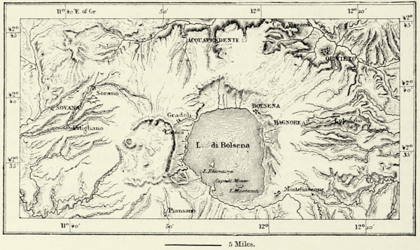
Lake Bolsena discharges its surplus waters through the Marta into the Mediterranean. The fine Lake of Bracciano, to the south of it, gives rise to the Arrone. It, too, appears to be a basin formed by a subsidence of the ground or erosion, and not a crater. The Lake of Vico, on the other hand, clearly occupies an ancient volcano, though its rampart has been gutted towards the east. Close to the lake, and within the encircling rampart, rises Monte Venere, a perfect cone, the gentle slopes of which are luxuriantly wooded. Formerly the lake surrounded this cone, but the breach through which its emissary escapes to the Tiber having gradually been deepened, the waters of the lake subsided. Tradition says that an ancient city lies at its bottom.
On crossing the Tiber we reach the beautiful volcanic group of Albano, within the great crater of which may still be traced the remains of several secondary craters, some of them occupied by lakes. The principal one of these, Monte Cavo (2,790 feet), rises in the very centre of the exterior rampart. Tradition points it out as one of Hannibal’s camps. The exterior slopes of the mountain consist of pozzuolana, small stones, and ashes, through which the torrents have dug out furrows in divergent directions. The diversity of these {261} volcanic products enables us to trace the phases of activity of this Roman Vesuvius, which was active at a much more recent epoch than the volcanoes farther north, and sent its streams of lava to the very gates of Rome.
Μ
Fig. 91.—VOLCANOES OF LATIUM.
From the Austrian Staff Map. Scale 1 : 294,000.
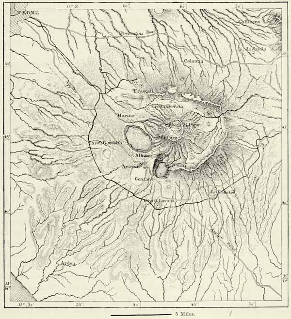
The Lake of Albano discharges its surplus waters through a tunnel 7,665 feet in length, which has been in existence for more than twenty-two centuries. The lake is famous on account of a small crab, large numbers of which are forwarded to Rome during Lent. It is the only species of this animal hitherto discovered in fresh water, and zoologists conclude from this that the crater now occupied by the lake formerly communicated with the sea, but was separated from it by slow upheavals and the ejection of volcanic products. Flint implements and vases of baked clay, discovered in the thick layers of volcanic peperino, prove that at the {262} period of the earliest eruptions the country was already inhabited by a civilised population. Some of the vases referred to are doubly precious, for they present us with delineations of the houses of that prehistoric epoch. Roman coins and clasps of bronze, discovered in the upper layers of lava, prove that these are comparatively recent. In fact, the most diverse developments of civilisation have left their traces in these ancient craters. Alba Longa and other towns of the Latins have been replaced by Roman cities; then came the castles of the popes, and of other high dignitaries of the Church; and at present these hills are one of the chief resorts of the crowds of strangers who flock to Rome from every quarter of the world. On the culminating point of Monte Cavo stood the famous temple of Jupiter Latialis, where the Latins celebrated their federal Feriæ. The last remains of this temple were swept away in 1783, to be used in the construction of a church. From its site the eye embraces a view extending to the hills of Sardinia.
The Lake of Nemi no longer reflects in its bluish waters the foliage of luxuriant trees, or the walls of that dreaded temple of Diana whose priest was only allowed to assume office after he had killed his predecessor in a duel. It, too, has its subterranean emissary, like the Lake of Albano. As to the Regillus, famed for the defeat of the Latins by the Romans, it has dried up, whilst the incrustating Lake of Tartari and that of the Solfatara, with its floating islands, are more shallow ponds, which owe their fame almost exclusively to the vicinity of Tivoli.
All these volcanic lakes are of considerable depths, whilst the lakes in the calcareous regions are shallow.89 One amongst them, that of Fucino, has been drained recently, and the same fate is in store for that of Trasimeno. Lake Fucino originally occupied an area of 104 square miles, and its surplus waters discharged themselves towards the north-west into the Salto, a tributary of the Tiber. At an epoch not known to us the dimensions of the lake became less. It no longer discharged an effluent, but its waters rose and fell according to whether the seasons were wet or dry. Occasionally they rose as much as 50 feet, and two cities, Marruvium and Pinna, are said to have been swallowed up during one of these floods. At other times it was reduced to a swamp. The ancient Romans, desirous of suppressing a hotbed of fever, and of gaining fertile soil for agriculture, attempted to drain this lake. Claudius employed 30,000 slaves for eleven years in cutting a passage through the mountains from it to the Liri. This great work was carried on under the direction of the greedy Narcissus, but it turned out a failure, for after a short time the tunnel became choked. In the thirteenth century an attempt was made to reopen this tunnel, but the drainage of the lake has only been achieved quite recently, in accordance with plans designed by M. de Montricher, and carried out at the expense of Prince Torlonia. Between {263} 1855 and 1869 a new tunnel was excavated on the site of the ancient one, and nearly 150,000,000 cubic yards of water were conveyed through it into the Liri, and thence to the sea. The whole of the ancient lake bed has been converted into smiling fields, traversed in all directions by carriage roads; houses have been erected on spots formerly covered with water; fruit and ornamental trees have been planted; and the salubrity of the country leaves nothing to be desired now. Some idea of the progress made in the art of engineering since the time of the Romans may be formed by comparing this new tunnel with the old one. The latter was 18,500 feet in length, had an average section of 12 square yards, and cost (according to M. Rotrou) £9,840,000. The new tunnel has a length of 20,680 feet, a section of 24 square yards, and cost £1,200,000.
Μ
Fig. 92.—THE ANCIENT LAKE OF FUCINO.
Scale 1 : 412,000.
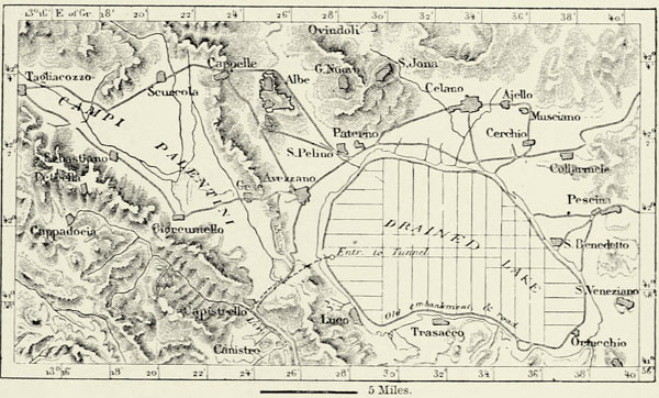
The Lake of Perugia, better known as the Lake of Trasimeno, on account of the terrible memories which attach to it, still retains nearly the dimensions which it had at the dawn of history. If this lake were to rise only a few feet, its surplus waters would find their way into the Tresa, a tributary of the Tiber; but its basin is shallow, and evaporation suffices for carrying off the water conveyed into it by its tributary rivulets. Amongst these is the famous Sanguinetto, on the banks of which the armies of Hannibal and Flaminius were engaged in battle, when,
“beneath the fray,
An earthquake reeled unheededly away.”
The lake, with its islands and charming contours, is beautiful to look upon, but the low hills surrounding it are sterile, the climate is insalubrious, its waters harbour but few fish, and the inhabitants on its shores look impatiently forward {264} to the time when the engineers will fulfil their promise of winning for agriculture 30,000 acres of fertile land now covered by the waters of the lake.
Μ
Fig. 93.—LAKE OF TRASIMENO.
From the Austrian Staff Map. Scale 1 : 250,000.
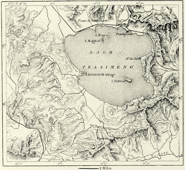
But far more urgent, on sanitary and economical grounds, are the claims of the Roman Campagna; that is, of the region lying between the Tolfa of Cività Vecchia, Monte Soracte, the Sabine Hills, and the volcanoes of Latium. Slavery and maladministration have converted a fertile region into a desert extending to the very gates of Rome. Painters are enraptured with this Roman Campagna; they admire its melancholy aspect, its picturesque ruins hidden beneath brambles, its solitary pines, its pools reflecting the purple clouds, and visited by thirsty buffaloes. True, this region, bounded by hills of bold contours, is full of grandeur and sadness; but the air that hangs over it is deadly, the soil and climate of this Agro Romano have deteriorated, and fever now reigns there supreme.
Two thousand years ago the Roman Campagna, which covers an area of 600,000 acres to the north of the Tiber, and extends from the sea to the mountains, was a fertile and carefully cultivated country. Then its inhabitants were reduced to the condition of serfs, the Roman patricians appropriated the land, and {265} covered it with villas and parks. When these magnificent residences were given up to pillage and to flames, the cultivators of the soil dispersed, and the country immediately became a desert. Since that epoch most of the Agro is held in mortmain by ecclesiastical corporations or princely families, and whilst all the rest of Europe has been making progress, the Campagna has become even more sterile and insalubrious. Swamps continually invade the lowlands, and an atmosphere charged with miasmata hangs even above the hills. Malaria has already knocked at the gates of Rome, and the fevers produced by it decimate the population of its suburbs.
Fig. 94.—THE ROMAN CAMPAGNA.
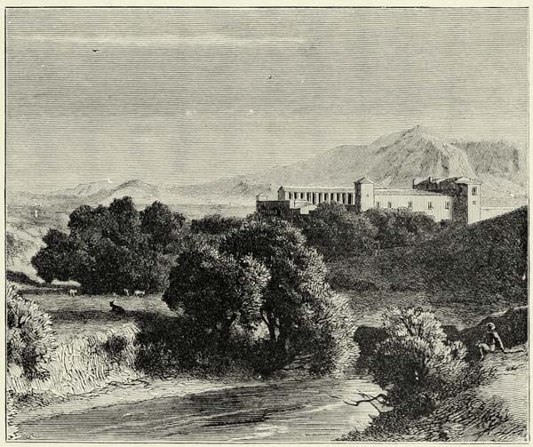
Not a village, not even a hamlet, is met with throughout this afflicted region. The only buildings are the wretched storehouses of the proprietors, whose wide domains are roamed over by herds of half-wild grey cattle, said to have been introduced into Italy by the Huns, and distinguished by immense horns, frequently suspended in the huts of the peasantry, who fancy that they keep off the “evil eye.” The soil of these neglected pastures consists of alluvium mixed with volcanic débris and marls, but only a few patches are cultivated. The farmers and labourers who engage in this labour carry their lives in their hands, and are frequently struck down by fever before they are able to regain their villages in {266} the hills. What can be done to restore to this region its fertility, salubrity, and population? No doubt it will be necessary to drain the marshes, and to plant trees capable, like the Eucalyptus, of absorbing the poisonous miasmata; and this has been done, with a considerable amount of success, since 1870, near the abbey of Tre Fontane. But, above all, it will be necessary to interest the cultivator of the soil in its productiveness. Even in the most salubrious districts of the ancient Papal dominions the population is being decimated by misery and the maladies following in its train. In the valley of Sacco, to the south-east of Rome, which abounds in cereals, vines, and fruit trees, the cultivator of the soil is restricted to a diet of maize, for proprietors and money-lenders eat up the rest of his produce.