Volume 1 — CHAPTER IX.
Reading edition
NORTH-WESTERN SUDAN.
COUNTRY WEST OF THE NILE, SOUTH OF LAT. 22° AND NORTH OF KORDOFAN.
This district readily lends itself to division for description into three sections, viz.:—
1.—Desert west of the Nile, north and west of Wadi El Gab, including Arbain road (for detailed report of which vide Appendix, Part III, Vol. II.).
2.—Wadi El Gab.
3.—Bayuda Desert.
Section 1.—Desert West of Nile, North and West of Wadi El Gab.
The country west of the Nile from Halfa to Kerma merits little description. Desert of the most arid description comes down close to the banks of the river, west of which all is uninhabited and waterless, with the exception of the few oases, for as far as is known upwards of 300 to 400 miles. The desert itself varies from hard, often stony sand or gravel-covered plains, to undulating moving sand dunes and rocky hills of lime, granite, or basalt. Remains of petrified forests are occasionally met. The amount of mineral wealth discovered in this inhospitable region is not yet definitely known.
Here and there a very limited amount of vegetation is met, at some spot where the water of one of the rare rainstorms that pass over this district has chanced to collect, but more often one may travel for miles and miles over country devoid of any vestige of animal or vegetable life.
The whole of this desert region, including the wells and oases, is uninhabited. It is, however, visited occasionally by roving bands of Hawawir and Kababish in search of natron or wild dates, as also by raiding parties of the Bedaiat, a tribe living to the north of Darfur, who only recently drove off camels grazing within 80 miles of Dongola.
The following is an extract from a report by Captain H. Hodgson, February, 1903, descriptive of the country west of the Wadi El Gab.
“Beyond the limits of the Wadi El Gab, on the western side, there seems to be a belt of country in which water is easily found, but is undrinkable. Of the two water pans I have tried, namely Murrat and Butta, the one is very bitter and the other has a distinct smell of sulphuretted hydrogen—Arabs use these waters medicinally as purgatives.
Jebel Abiad.“I reached and ascended the plateau of Jebel Abiad at what I reckon, roughly, to be 100 miles west from the river at Khandak. In 1901 I found the northern extremity of this range to be 98 miles from the river at Dongola. It is, on the eastern side, a high steep bluff, exposing the white rock (gypsum) from which it gets its name. It extends continuously from where I stood, both north and south, as far as the horizon.
“The surface of the plateau is shingle and sand; it slopes gently down on the western side.
Wadi Natrun.“I reached the Natrun valley on the 31st January. It is not literally a valley, but an undulating plain stretching south and south-west as far as the horizon. From south-east to north-east it is bounded by a high range of steep hills of black rock; from north-east to north-west by high broken rocky ground with isolated conical hills; to the west, by low gravel hills. On the distant horizon, north-west, is a high range of hills. Close under the bluff on the eastern side of the plain are two thickets of selem bushes, growing luxuriantly and suffering in places from over supply of water. This is very plentiful and near the surface, the sand being brown and damp, but it is not the best water in the valley. The southern of these two thickets is called Melani. An isolated peak in the northern centre of the plain, called Jebel Kashaf, lies at a bearing of 315° mag. from Melani. The best water, called Bir Sultan, lies 3 miles from Melani at a bearing of 278° mag. and due south of Jebel Kashaf. On the ground called Bir Sultan (which includes an area of about ¼ square mile, covered with tussocks of Halfa grass, etc.), I found three or four pans of good water, the soil below the sand being white clay. There is a small clump of date seedlings near the biggest spring.
There is plenty of evidence of natron in the valley, but the place, where most of the digging is done and where the thickest seam of natron is reported to be, is 2,400 yards from Jebel Kashaf and to the west of it, at a bearing of 310° (mag.). The diggings are in what looks like a dry salt pan left by the sea, except that the sand is very red. The method of collecting it is as follows: About 2 to 4 inches depth of sand is cleared away until the natron, a substance resembling a yellowish rock salt, is reached; the top part is usually bad, being half sand. Then there is a seam ½ to 2 inches thick, of good natron, and again below a little bad natron, and then below all sand again. Sometimes all the natron is spoilt by being mixed with sand. Near the natron diggings is a large thicket of selem bushes, and besides this and at Melani, there is a clump of date trees and selem north-east of Jebel Kashaf and another thicket of “littel” scrub, besides plenty of halfa, tamam, taklis, and halaf grass etc. A party of 400 or 500 camels could live some months in the valley on the grazing only. Good shelter can be obtained from the wind, and there are plenty of garids etc. to make tukls. Gazelle plentiful.
Arbain road.“The Arbain road lies along very high land, and anyone traversing the road during the winter months should, if possible, march with the wind, i.e., from north to south. The cold was intense, and the shelter from north wind nil, as all hills are steep on the north side and slope gradually away to the south.
“At Sultan, Lagia, and Selima this is reversed, and the hills are steep on the south side. This change in formation accounts probably for the presence of water.”
Game.This desert region is the haunt of the Addax, the rarest of Sudan antelopes. Specimens have been killed near Tundubi.
Wells and Oases.
Sheb-Nakhla district.[132]Nakhla.—Situated about 80 miles north-west of Halfa. Named after the single date palm overhanging the wells. Surrounding the hill on which this date palm stands is a narrow valley about 80 yards wide. Throughout this depression water can be obtained at a depth of 3½ to 5 feet. The water is of better quality than that of any of the neighbouring wells and is abundant. There is practically no grazing or fuel here; the latter can be obtained, however, at a distance of 2 to 3 miles.
Hassab El Gabu.—About 10 miles west (?) of Nakhla. This well is situated on the top of a circular sandhill 30 yards in diameter. Good water is found at a depth of 2 feet, as it may be almost anywhere between Nakhla and Sheb. Good grass for camels.
Bir Suleimat.—11 miles (?) from Nakhla. Good grazing. Water bitter, but plentiful.
Bir Sederi.—28 miles from Nakhla. Water bitter. Little grazing. Dom palm covered sandhills 100 yards from well.
El Haad.—33 miles from Nakhla (direction uncertain). No well, but good grazing on “Haad” grass.
Sheb.—40 miles W.S.W. of Nakhla. Is the southernmost water in the Sheb district. Well 4 feet deep and same in diameter (October, 1902). Water plentiful, but brackish and aperient. Good grazing and plenty of firewood. This is a watering place on the Arbain road.
Terfaui (I).—About 6 miles north of Sheb, situate in a small oasis in a broad wadi said to lead from the oasis of Selima to the Nile by way of Kurkur. This valley is bounded on the west by precipitous sandstone cliffs. There is a group of trees here 250 by 300 yards. Good grazing for camels. The water is drinkable. Immediately to the west of Terfaui is a pass over which the usual road to the northern oases of Beris, etc., passes. This is usually a watering place on the Arbain road.
Abu Hussein.—About 35 miles north-west of Sheb. Consists of a clump of trees and bush-covered mounds about 30 feet high. There are three more places exactly similar to Abu Hussein, two being to the eastward and one to the west. They are all about 5 miles apart and lie in a general line from east to west. Water may be found at a depth of 1½ feet at any of them, and here and there between them. Good water and plentiful. Grazing also good.
Terfaui (II).—16 miles north-west of Abu Hussein or about 50 miles north-west of Sheb. It consists of small mounds of sand covered with long green grass. Water plentiful at depth of 4 to 5 feet, grazing good, consisting of tufts of long grass, over an area of about 1 mile by ¾ mile. There used to be three dom palms here, but these were burnt down by Captain Ross in 1894 on account of the snakes which infested them.
Kassaba.—The northernmost well in the Sheb district is at Naseib, 15 miles north of Kassaba. At Kassaba the water is not good, but many old wells point to its having been much used in former days. Situated in an open plain about 26 miles N.N.W. of Sheb. A watering place on the Arbain road.
Selima Oasis.—Selima lies on the Arbain road about 78 miles south of Sheb and 55 miles west of the river at Sagiet El Abd. Halfa is about 120 miles to the north-east. It is perhaps the most important oasis in the western desert of the Sudan, as not only must caravans using the Arbain route almost necessarily stop here for water, but its dates and salt are probably of considerable value from a commercial point of view.
Mr. James Currie, who visited this oasis in October, 1901, thus describes it:—
“A most beautiful place. It would be most difficult to find without a guide, as it is really only a large hole in the desert. The descent to it is very steep indeed. There are three wells, a good many date trees, and good grass. One sees the remains of an old Christian convent, moderately well preserved, but the point of interest attaching to it is that it has apparently been built out of the ruins of something much older, to judge from the inscribed stones one notices. There are abundant salt deposits near, and a huge petrified forest, which extends further than I had time or inclination to go.”
DONGOLAWI MERCHANT.
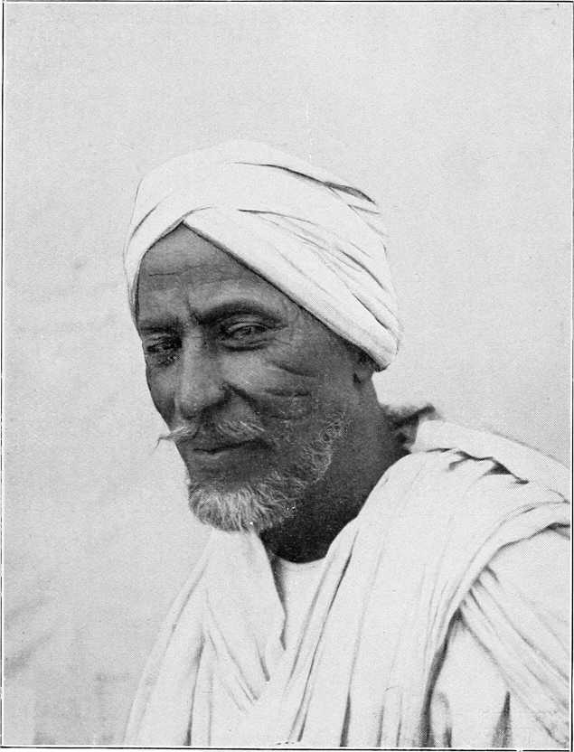
Captain H. Hodgson (February, 1903) writes with reference to this oasis:—
“Besides the old salt workings, which are capable of considerable development, there are some 2,000 fruit-bearing date trees. My estimate may not be very near, but I spent two hours with two other men counting in order to get this idea, and in this time counted 685 female trees, and covered only about one third of the ground. The trees are uncleaned with very thick undergrowth, and are being ruthlessly hacked in order to enable the Arabs (Hassanab from Kosha) to get at the fruit. Dates of the following species were collected: Kulma, Agwa, Barakawi, and Gawa. The first and second are both of considerable commercial value: the Agwa trees seem the most numerous.”
Tundubi.—For description of this oasis vide Route Report Dongola to Bir Sultan, Vol. 2. The addax is found near here.
Lagia.—Vide Route Report Dongola to Lagia, Vol. 2.
Bir Sultan.—Vide Route Report Dongola to Bir Sultan, Vol. 2.
Tura.—An oasis said to lie about 150 miles south-west of Lagia, which is approximately 160 miles north-west by west from Dongola. Here there is said to be a sulphurous lake about ½ mile long, known as Tura El Bedai. Water, if obtained from holes dug on the margin of the lake, is said to be tolerably sweet and drinkable. There are many wild date trees here, for the fruit of which the Kababish and Bedaiat have been long accustomed to fight.
Section 2.—Wadi el Gab (Kab).
The Northern Branch of the Wadi El Gab.
(By Major A. E. Turner, R.A., December, 1884.)
The northern branch of the Wadi El Gab extends from Hannek to the village of Sawāni, 20 miles due west of El Ordi, or Kasr Dongola.
It is a flat tract mostly sandy, but there are many stony plains and occasional rocky hills, as well as plains where salt and lime crop to the surface. The natives collect the salt, and carry it to the villages on the Nile, where they barter it for grain, etc. There are many wells, and round these wells the straw-built huts are congregated, forming villages; there are numerous, and some very fine, palms, both dom and date, near the wells, and these in some places mark the site of deserted villages, where the wells have dried up.
The people at the present time (1884) have very few camels,[133] except milch and young. They have sold a great many, and a good many are employed by contract between Dongola and Sarras on the west bank.
The villages are all built near the wells, and in deep reddish sand.
There is no ground for cultivation whatever, and hardly any grass (halfa or other); the trees are palms, acacias (the latter very fine and old).
Leaving Hafir and the Nile, the road leads S.S.W., crossing a plain covered with stones and shingle, with scanty mimosa shrubs; at 9 miles a low ridge is mounted, and the Wadi El Gab is visible with the village of Lagia.Lagia and its palms 5 miles distant. At 13½ miles, the ruins of three old buildings are met, one on the west, two on the south side of the road; one of the latter is a ruined convent or monastery, and its cells are visible. Many of the palms are burnt, having been destroyed by their owners who went to join the Mahdia. 4 miles S.S.W. is the village of Abu Naama.Abu Naama. Seven miles south-west the village of El Mungur.El Mungur, which has two good wells.
Two miles south-west of El Mungur is the well and village of Abu Baguga.Abu Baguga, and 1 mile south-west of it that of Abu Halfa.Abu Halfa.
After going 2 miles S.S.W., the road goes W.S.W., and a ¾ mile further lies, on the east of the road, the village of Sarari, Dukur, deserted.Sarari, now deserted, and that of Dukur on the west, also deserted. At 3 miles further, the deserted village of Ain El Bir, deserted.Ain El Bir, a mile from the road on our left (east), and just beyond it a solitary rocky hill called Mount El Kwais.El Kwais.
At 9 miles the road mounts a ridge, and then descends into a sort of circular basin about 1 mile in diameter, surrounded by low hills. On leaving this at 10 miles, I saw the village of Goz El Fugar.Goz El Fugar 1 mile to the left (east), and ¾ mile further I arrived at the village of Bayuda.Bayuda, on a sandy hill, with numerous palms; a considerable village.
After leaving Bayuda, the road goes south by east; at 1 mile on the right (west) lies the village of El Gumra.El Gumra, and 2 miles further, also on the west side, that of Zalia.Zalia; at 7½ miles a large expanse, covered with palms and acacias, with two good wells, is reached, called El Kurmotai.El Kurmotai. From this the road goes south-east for 1½ miles to the village of Sawāni, the sheikh’s own village and chief village of the Wadi Gab. Some of the huts are built of mud, but mostly of straw.
Sawāni.Sawāni is a very picturesque village with a large open space on the south side, bounded on three sides by trees, and on the fourth side lies the village.
The road to Dongola is due east; after 2 miles a low range of hills is crossed, at the east foot of which lies the small village of Um Hellal (1).Um Hellal, at ½ mile further, a flat plain with much lime; at 4½ miles (2 miles further), another village, called also Um Hellal (2).Um Hellal, on the north side, and 1 mile from the road is passed; a mile further, rocky ground is reached, which gradually rises, and 1 mile further the Wadi Gab ceases, and the road goes over bare, rocky, and broken ground to Dongola. The latter is 26 miles from Sawāni.
Wells.The wells are very good, the water is, as a rule, near the surface, and the wells are lined with stone; the depth of water did not appear to be more than a few feet.
The sheikh told me that there is no settlement of his branch of the Kababish tribe south of Khandak, and that all is desert between that end of his valley (wadi) near Khandak to within a day’s march of Debba.
Names of places. Distance in miles. Description.
Intermediate.
Hafir On the Nile.
Lagia 14 The road is in a S.S.W. direction, and is over a plain mostly covered with shingle and a few mimosa shrubs. At 9 miles, a ridge is mounted, whence the Wadi El Gab is visible. At 12 miles, the valley is reached; and at 14, the village of Lagia.
El Mungur 7 The road is S.E. for 7 miles to El Mungur.
Bayuda 10¾ The road goes S.S.W. for 2 miles; the rest of the way W.S.W.
Sawāni 9 The road goes 7½ miles S. by E., then S.E.
Dongola 26 The road due E into Dongola.
Total 66¾
Wadi El Gab.
(By Col. Colvile, Grenadier Guards, October, 1884.)
The Wadi El Gab is a sandy khor about 63 miles in length, running through the trough of a broader and rocky valley. Its general direction is north-west and south-west. It is inhabited by the Omatto section of the Kababish tribe, of which Sheikh Fadl Mula Wad Rekha is the chief. Its most southerly well is Marghum, 30 miles to the west of Khandak, and its most northerly is said to be 20 miles west of Hafir. Its only productions are wood and dates, both of which are plentiful. Its inhabitants do not appear to own any great number of camels; those to be seen at the various settlements being mostly milch nagas and their foals. Goats, which feed on the mimosa, are plentiful.
On leaving the Nile at Bakri the road at first crosses a flat sandy desert, destitute of vegetation; but after 7 miles a district is reached, thickly studded with low mimosa bushes. In the district are several Arab encampments, some of them as much as 4 hours’ journey from the nearest water. Fifteen miles from Bakri the country becomes more undulating, and the surface covered with firm gravel; and 10 miles further on, a range of hills running north and south is reached. Passing through a break in this range, the road follows for 3 miles a valley running nearly at right angles to the main one, and then strikes the track running down the Gab to the Abu Gussi-Kordofan road. Passing down a sandy valley, dotted with sand dunes, and sparsely studded with low mimosa scrub, the most southerly well, Bir Marghum, is reached, 7 miles north of the point where the valley first entered. The well is stone-lined, and the water is 20 feet below the surface and 4 feet deep. It is said that the well never runs dry; the water is good. For the next 6 miles the country continues to be scantily covered with low mimosa scrub; Bir El Ain is then reached, and the valley becomes more thickly and heavily wooded, and continues to be studded with fine acacia timber to El Sawani. Between El Ain and El Sawani are the following six wells:—
Abu Haweid. El Hudden.
El Bab. Bayuda.
El Harma. El Huffera.
They are all lined with stone, and about 4 feet of good water is found in each of them at from 3 to 4 feet below the surface. Nine miles beyond El Huffera, El Sawani, the chief settlement of this section of the Kababish, is reached. It contains many native huts and four mud dwellings. This well, like all the others (with the exception of El Marghum) is marked by a clump of palms.
The road to El Ordi, after skirting the valley for a few miles in a north-east direction, turns to the east and crosses 10 miles of broken rocky ground and low ridges. A tract of undulating ground is then reached, which extends to El Ordi. With the exception of small patches of acacia in some of the valleys, this district is wholly devoid of vegetation; it is uninhabited.
Wadi El Gab.
(By Colonel A. Hunter, C.B., D.S.O., November, 1896.)
The Gab does not realise expectation, nor fulfil the descriptions given of it. The hand and sand of destruction is everywhere visible. The wind, blowing prevalently north or north-west, rolls the sand along, the sand catches in the tamarisk bushes, in the roots and undergrowth of the palms, date and dom, till it piles over the bushes, and reaches towards the top of the palms or smothers them. The whole place has the appearance of a forest after a heavy storm: trees lying prone in all directions, but no effort is made at replanting or replacing. A few seedlings struggle into existence now and then. The sand moves on, leaving the palms crippled or dead. I have heard so much of the vegetation and grazing, and date trees, verdure, luxuriance, etc., of the Wadi El Gab—it never existed. Ruthless, and judging by events, not altogether unavoidable, neglect, has diminished the little there ever was. We know it carried a large head of camels, goats, and sheep, at least so it was supposed; but, barring goats and a few donkeys, the herds of the Kababish had to roam “for forty days in the wilderness” towards Darfur and Kordofan, and northwards to abreast Mahass and Sukkot, for their food. Water is found at from 12 to 20 feet below the surface; the Gab averages about 5 miles in breadth, patches of grass and thorn bush crop up at intervals, separated by rolling hills of rock and sand. Round the wells there are the miserable straw huts and mud houses of the tribesmen, with here and there groves of palms; no game to speak of. Gazelle exist in small numbers, and are very afraid of mankind. This is accounted for by the fact that the Arabs trap them, and hunt them with dogs, a breed of yellow greyhound. The trap is a round hoop, with thin strips of wood tied to the circumference, and the points of the strips meet at the centre, laid so that the strips make a slight cone, like the top of a basket. The gazelle browse on the thorn bushes; close to the bush the Arab puts the trap in a little hollow in the sand, cone downwards, places on the rim of the trap a running noose, to the other end of which is fastened a billet of wood. The whole is covered over with sand. The gazelle comes to feed off the sprouts of the bush; puts his foot into the noose; his foot slides through the apex of the spines of split wood; he kicks to free his foot, and so the noose tightens on his leg, and there he is, with a rope tied to his leg; he cannot kick off the rope, for the billet of wood drags the knot tight, and the trap prevents it slipping down, and the Arab then appears with his dogs, and chases the animal down.
Twelve miles west of Shemsi is Wadi El Butta, very much like the Gab in appearance. Addax and wild sheep are said occasionally to come here in summer. Water is near the surface, and is got by the animals by scraping. A curious feature is the occurrence over the whole face of the desert of patches of succulent plants and grasses which serve as food for camels and for goats.
Sawani to Bayuda, 9 miles. El Bab to Haweiya, 9½ miles.
At Haweiya, or Haweid, a number of wells, also at El Bab. They are part and parcel of one place.
Rode to El Marghum, the post occupied by the old Sheb post. I asked about these wells in the Gab, and got always the same answer. Those existing were dug by their ancestors, so long ago no one remembers, and ever since no one has been to the trouble to dig or explore for anything fresh. Well here deep, 18 or 20 feet, and stone faced.
The Wadi El Gab.
(Sir W. Garstin G.C.M.G., April, 1897.)
No account of the Dongola province would be complete without some mention of this great depression which extends through the Western Desert from Hafir to Debba, a distance of some 125 miles. It is chiefly inhabited by the Kababish tribe of Arabs, who use it for grazing their flocks; and it contains numerous wells.
It has been thought that this depression might possibly be utilised as a storage reservoir or as a means for escaping the surplus water in an excessive flood. It is very doubtful whether it could thus be made use of. The wadi appears really to come to an end a few miles north of Hafir, and the nearest point to the river to be at a distance of some 10 miles.
The lowest portions of the Wadi El Gab must be considerably lower than the level of the river in flood, but by how much it is impossible, without levels, to say.
On leaving the Nile, in the direction of this valley, the country rises rapidly for some 4 miles. It then begins to fall away from the river, in a succession of terraces, until a total of about 10 miles have been traversed. The real edge of the wadi then commences. Its width at the northern end appears to be about 5 miles. The western edge is filled up with drift sand, which is gradually covering the palm trees. A well, measured at the Oasis of Lagia, showed the water level to be some 9 feet below the ground surface. The water was sweet and of good quality.
It would be useful to have the whole of this depression carefully levelled and surveyed. The area covered by it is very large, and supposing it were possible to fill it with water, the loss from evaporation would certainly be very great.
Section 3.—“Bayuda Desert.”
General.The tract of country north of Kordofan, i.e., north of N. lat. 16° (approximately), bounded on the north and east by the Nile and on the west by the Wadi Melh has been called the Bayuda Desert, though this name is not applied to it by the Arabs.
Inhabitants.It is inhabited by nomad Arabs, viz., on the east by the Kababish, chiefly the Omatto section under Sheikh Fadl Mula Wad Rekha; in the centre by the Hawawir, of which the Sauarab is the most important sub-tribe, under Sheikh Hassan Khalifa; and on the east by the Hassania, whose headquarters are at Jebel Gilif and Jakdul. In the extreme north, in the angle formed by the bend of the Nile, are the Monasir, who are, however, a sedentary tribe. These above-mentioned nomads wander a great deal according to the grazing, on the existence or absence of which, in many cases, depends the fact of wells being open or not.
BAYUDA DESERT ARABS.
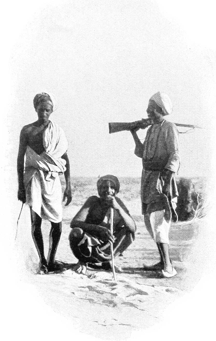
Cultivation.The Arabs cultivate their dura in certain well-known wadis, mostly in the more southern districts, according to the rainfall, which is, as a rule, not heavy, and very local, and varies considerably from year to year.
Wadi Melh.The W. El Melh is a broad shallow depression, frequently a mile or more in width, having its origin near Um Badr. It is inhabited here and there by the Kababish. It reaches the Nile at Debba, though it has long since ceased, if ever, to discharge water into that river. For further description of this wadi, vide Route Report Dongola to El Fasher, Part III. This route is now seldom, if ever, used. Vide also report on El Ein, p. 210.
Wadi Mogaddam.The next wadi of importance in this district is the Wadi Mogaddam which has its origin near Bagbag, about 60 miles south-west of Omdurman, and joins the Nile near Korti after a course of about 200 miles in length. For description of this wadi and the wells, etc., in it, vide Route Report Gabra to Korti, Part III.
Gabra.The wells of Gabra in the Wadi Mogaddam, nearly 60 miles north-west of Omdurman, are an important Arab centre, there being many wells and a good deal of cultivation in the neighbourhood. The Arabs are principally Kababish, but Geriat and Hassania also come here. Gabra is under the Governor of Khartoum, but the boundaries of Dongola, Berber, and Kordofan Provinces are all within a few miles of it.
Communications.Communications throughout this district are bad owing to scarcity of water. The principal trade routes are:—
(1) Debba-Fasher viâ the Wadi Melh (little used).
(2) Debba-El Obeid viâ Amri, Hobagi, and Haraza (used a little during rainy season).
(3) Debba-El Obeid viâ Amri, Elai, and Habisa (longer than (2) but more water).
(4) Debba to Omdurman[134] viâ Inderab, Gumr and Gabra (a good deal used).
(5) Debba to Omdurman viâ Elai and Gabra (little used).
(6) Ambugol and Merowe to Shendi (Metemma) (little used).
(7) Merowe to Berber viâ Sani (a good deal used).
(8) Merowe to Omdurman[134] viâ Hamboti and Wadi Bishara.
(9) Gabra to Korti (little used).
All the above routes except No. 8 are described in the route reports in Vol. II, and from them some idea of the country may be obtained. The traffic along No. (7) will presumably increase considerably on the completion of the Nile-Red Sea Railway.
(From the Reports of the Surveying Parties employed by Mr. G. Kilgour and Mr. Fowler, C.E., 1871-72, and other Sources.)
Northern Bayuda Desert.The track across the Bayuda Desert, from Ambugol to Shendi, is comparatively easy going, and is fairly well supplied with water; but not being a main trade route, it is little used by caravans.
There are no difficult defiles or passes.
The tract of country traversed consists of extensive plains divided by ranges of low hills. It is very unlike the sterile and rocky deserts further north, and in many places shows abundant signs of vegetation. Wadis, pastures of long coarse grass, and many clusters of trees are met with, whilst, during the rainy season, the ground is susceptible of profitable cultivation in some parts.
This route is just within the limits of the tropical rains. The wet season lasts from May to August, but rain never falls for more than 15 days in any year. Sometimes there is no rain for two consecutive years.
There are no streams, the water sinking into the sand and disappearing within 24 hours after rain has fallen.
During exceptionally hot days small whirlwinds pass in great numbers, and carry across the desert sand and fine debris in columns upwards of 150 feet in height. They have a formidable appearance, but are really almost harmless. A very large one might upset a tent, but this performance represents their maximum effect.
The Bayuda Desert is inhabited merely by wandering Arab tribes, of whom the principal are the Hawawir, Hassania, the Sauarab, the Fadnia, and the Aonia.
They subsist almost entirely by keeping flocks of sheep and goats, and by breeding camels, wandering from spot to spot to the best herbage, at such distance from the wells as enables them to water their animals. They also trap the gazelle—so plentiful in this desert; and after the rains a certain amount of ground is usually cultivated by them, and small crops are obtained.
About 4 miles above Ambugol the wadi (valley or stream course) Abu Gir debouches into the Nile; this wadi takes its rise in the Jebel Gilif about 70 miles from the Nile; water is obtainable from shallow wells along its entire course in its bed; like most of the lower portions of the Bayuda Desert, it is thickly covered with vegetation.
Vegetation.This consists principally of low “samr” bushes (spreading thorny acacia), occasional “sunt” trees (acacia arabica, 20 to 25 feet high), the milk plant (asclepia gigantea), the “marakh” (a green shrub), the “tundub” (a bush, some 15 feet high,), and “heglig” trees (20 to 25 feet high, and often with a diameter of trunk at 5 feet from the ground of 12 to 15 inches), the “mokert” (salvadora persica), and even occasionally the “dom” palm (hyphæne thebaica), of which the “dom” palm, the “usher,” and “marakh” are indicative of water close to the surface.
Firewood.Best suited for firewood are the “sunt,” the “samr,” the “tundub,” and the “heglig,” the wood of the latter, I may mention, being used as the base on which the natives twirl a dry piece of “samr” root with the object of producing fire.
Food for camels.Camels devour eagerly the younger branches of the “samr,” the succulent leaves of the marakh (camel thorn) and el gau (camel grass), both of the last-mentioned being plentiful in the Bayuda; indeed, this is a favourite district for breeding and rearing hagins (the lighter and faster class of camels).
Sheep.Sheep, of which large flocks are owned by the Hassania, Aonia, and other wandering Bedawi tribes of the Bayuda, find, during the dry season even, ample food in the grasses of the plains near Jebel Gilif; whilst the fresher shoots of the marakh and tundub, with the juicy leaves of the usher, provide sustenance for the goats.
Route from Ambugol.The readiest route from Ambugol is to strike for the desert close to the town, whence an easy slope, some 2 miles in length, rises to the desert plateau, here some 50 feet above the Nile bank. A shingly level plain is then traversed for about 3 miles, when the Wadi Abu Gir is struck, leading right up to Jebel Gilif, with an ascent of about 10 feet per mile.
The route now skirts the hill Jebel Abu Shenkawi, near to the salt diggings, and passing another clump of hills, Debba El Kebir, joins another camel route from the Nile at a point some 300 miles from Ambugol, where the Wadi Mofokakart debouches into the Wadi Abu Gir.
This other camel track, after leaving Ambugol, follows the Nile to near Korti, a distance of some 4 miles, then, turning sharply to the right, passes by the Wadi Um Marra, and crossing the ridge of Nasaib El Ruchan, at a point some 300 feet above Ambugol, descends over rather broken ground to the Wadi Abu Gir, and from this point there is but one route. At about 37 miles from Ambugol the First wells.first wells are met; these are merely holes scooped in the sand, deepened as the subterranean waters fall, until either the sides fall in, or the whole of the excavations are obliterated by the rush of water down the wadi during the rainy season.
The water is drawn from these, and all similar wells in the Bayuda, by means of a rude skin bag; it is then poured into earth cisterns, on the surface, at which the camels, sheep etc., drink. It is so pure that a small quantity of salt, fairly plentiful in this desert, is mixed with it.
The wadi at this point, about 38 miles from Ambugol, which has hitherto been flat and sandy, with gently sloping sides, becomes much broken. Small metamorphic ridges, hills, and lava-like mounds close in, and petrified wood is strewn in all directions, showing that the belt of metamorphic rock that intervenes between the lower Nubian sandstone and the extensive granite rocks is being traversed.
El Haweiyat wells.About 55 miles from Ambugol are the wells of El Haweiyat, of similar character to those described above; the plain of El Rechewa is left on the right, and quitting the Wadi Abu Gir, which turns abruptly to the left, the route crosses a curious plain, about 3 to 4 miles wide, called El Mesalima.El Mesalima. This plain is surrounded by low hills, and without vegetation; it is intersected by veins of mountain limestone, much resembling marble, and I here found fossil remains of the Saurian type.
Leaving El Mesalima, the route now crosses the plain at the southern foot of the Jebel Gilif, passing across watercourses which, in the rainy season, carry off the drainage from the mountains. These streams issue from wild gorges, and are said to drain extensive plains, 20 or 30 miles distant; a statement corroborated by the fact that they bring with them much brushwood and small timber.
After issuing from the gorges these streams wander at will, cutting constant new channels over an irregular talus of boulders and debris they bring with them; at the foot of this talus, they collect and run down defined sandy channels from 1 to 3 miles long, whose permanent character is proved by their tree-covered banks; these large channels then break up into a number of smaller diverging channels, which lose themselves in a grass-covered plain to the south, fairly covered with trees and brushwood, and about 8 miles across; this plain is said to be covered with water during the rains to a depth of 3 or 4 feet.
Abu Halfa wells.Water may be procured in any of these sandy channels by digging holes as described above; and at Abu Halfa, about 90 miles from Ambugol, are large wells of this description, at which large numbers of camels and flocks are daily watered.
After passing numerous pools of water still standing in basins worn out of the granite bed, the gorge, at a distance of some 7 or 8 miles from the entrance, widened out into a valley about ½ mile across; here there was a small lake, the edges fringed with bulrushes and dom palms, whilst the native huts, flocks, and even birds and conies showed the permanent character of the lake. I heard that many similar lakes exist in the recess of the Jebel Gilif, but the Arabs are extremely reticent on this point.
Jebel Gilif range.At about 79 miles from Ambugol the Jebel Gilif range, with its uniform precipitous face, breaks up into outlying spurs with intermediate plains. In one of these spurs, about 2 miles to the north of the route and 100 miles from Ambugol, are situate the Jakdul wells.wells of Jakdul; these consist of water-worn basins in the bottom of a granite gorge of similar character to those mentioned above. The largest of the pools is some 60 yards long and 10 yards broad, and it is stated never to have run dry.
The water is sweet, but the lower pools are much contaminated by the flocks constantly using them, and the sight of thousands of beetles issuing from the water at dusk is not inviting.
The upper pools, however, are much cleaner, and with care an ample supply of excellent water might be ensured.
No doubt there are many other reservoirs up this gorge as at Abu Halfa.
El Faar wells.To the eastward of the wells of Jakdul, and about 8 miles from the camel track, are the wells of El Faar, consisting of holes dug in a sandy water-channel similar to those of the Wadi Abu Gir.
With Jebel Gilif the granite rocks are left, and the route traverses the upper Nubian sandstone, simple and metamorphic, to the river at Shendi, or rather Metemma.
115th to 125th mile.Between the 115th and 125th mile the route crosses a belt of drift-sand hills travelling from east to west, these are of the usual type, i.e., a crescent presenting its convex side and gentle slope to the wind; up this slope the sand is driven to the apex, whence, falling over and remaining at its natural angle of repose on the concave side, the hill gradually but surely advances, the highest of the sand hills in this locality are about 13 feet high, their rate of progress depending entirely on the strength of the wind; to a camel they are no obstacle as it winds amongst them at will.
Abu Klea or Tleh wells.At 150 miles from Ambugol are the wells of Abu Klea, or strictly speaking Abu Tleh (Tleh equals a particular kind of grass), artificial pits of similar character to those already described; the water is good and rarely fails; they require of course frequent cleaning out.
Shebakat wells.At Shebakat, near the 168th mile, is a large well about 12 feet in diameter, sunk to a depth of 50 feet through the sandstone to a bed of water-bearing gravel; the water is brackish but the supply perennial.
Metemma.At 175 miles from Ambugol, Metemma is reached; the town is about 1 mile from the Nile, but the plain between is occasionally flooded. The water supply is from wells kept up by percolation from the river, and is therefore excellent.
Hence to Khartoum, as stated above, the river is navigable for nearly the entire year, vide Chap. X.
Rainy season.The rainy season in the Bayuda Desert is uncertain, as this is the extreme northern range of the tropical monsoon; there may be showers in May, but the true rains fall in June, July, or August. Some years may pass without any at all, and then a perfect deluge floods the country and refills the pools and wells.
Water.The conformation of the Jebel Gilif is such, that notwithstanding the large amount of water running off during the rains, a considerable quantity is stored at high levels, gradually finding its way into the sand-filled wadis, through permeable granite augites and diorites, of which Jebel Gilif is composed.
These wadis are crossed at intervals by spurs of trap rock, that serve the double purpose of keeping up the level of the wadi, which would otherwise rapidly degrade, and of affording, so to speak, “artesian” vents, up which the water, confined between the beds of the “Nubian” sandstone below, finds its way into the loose sand above. In Sinking wells.sinking wells, spots should be selected where the vegetation in the wadis is of a brighter hue, and where heglig and the dom palm exist. In December, 1871, water was found in many such places, never more than 15 feet below the surface. The trap dyke in the vicinity will provide any quantity of fairly bedded stone with which to line the sandy sides of the well; the way I should suggest, would be, in the first place, to dig through the sand until water be reached, and then to excavate the ground in a circle of say, 24 feet diameter, lining it with a dry stone wall 3 feet in thickness, in this should be built, at intervals, pieces of hard wood, of which there is a large quantity, in order to form a rude ladder; as soon as the water is reached, a Norton’s tube pump should be driven some 6 feet or more; this will prevent the accumulation of insect life, to be found in any open pools in the vicinity, and prevent other pollution; then, when this runs dry, the excavation should be again carried down to the lowering water level, and a well of internal diameter of 14 feet be built with a dry stone wall of say, 2 feet thick (the word in India for this form of well is “butcha”), the Norton tube driven down, and the process repeated as the waters lower. Were it possible to procure lime readily, the well might be sunk from the top, as is so habitually done in India, but the only limestone found in the Bayuda is at the plain of El Mesalima, as mentioned above.
The stone near these wells, and of which as described above, the supply will be practically unlimited, may be used in constructing defensive works, whilst there will be in their neighbourhood large quantities of fuel, and a considerable amount of bush that will serve as fodder for the camels.
A considerable quantity of sheep, milk, etc., may be procured from the neighbouring tribes.
Jebel Gilif.The Jebel Gilif presents a certain source of danger (during the expedition, 1884): this consists of, in places, an almost precipitous face of some hundreds of feet in height, at the foot is an irregular talus formed by the degradation of the face, and by the stones and boulders brought down the “khors” (ravines) with which it is intersected. These “khors” are, in many places, near their debouchure from the mountains, very narrow (in places only one camel can pass at a time), with steeply precipitous sides, the bottom being of granite rock, polished by the materials carried down in the torrents of the rainy season, and in many places half blocked up with boulders and débris. As these “khors” rise to the level of the range they widen out into valleys, well supplied with wood, water, forage, etc., where large numbers of men could be kept concealed for a considerable period.
Report on El Ein.
Situation.El Ein is situated about 130 miles from Debba up the Wadi El Melh. The general trend up the wadi is S.S.W. At El Ein on the western bank, for some 60 miles northwards and a short distance southwards, is a precipitous escarpment of rugged outline, but extremely uniform in height, known as Jebel Makakush. El Ein is a gorge in this, the northern promontory of which is surmounted by a rock of curious shape and is called El Serg.
There are two places where water is obtainable along the route from Debba to El Ein, one called Mahtul about 30 miles from Debba has two wells, and the other is Soteir another 30 miles further on. The latter is the better water, but the quantity is small. On the arrival of the writer the well had been emptied by watering a troop of camels, and his men stated there was not enough water to fill waterskins for from two to three hours. At El Ein there is good and abundant water, while grazing may be found almost anywhere along the Wadi El Melh, but from about 30 miles south of Soteir it lies only along the western side, and is much less abundant than further north.
Geology.The formation at El Ein is a series of undisturbed sedimentary beds lying horizontally, most of which are sandstones or grits. This overlies unconformably a much older series of gneisses and schists which are exposed in the lower parts of the Wadi El Melh along the foot of the Makakush escarpment a few miles north of El Ein.
The sandstone series is continuous all the way to Debba, and extends over very large tracts of the Sudan.
Mineral deposits.There are no indications of any mineral deposits of value at El Ein in any of the beds exposed.
Old workings.At several points, especially along the sides and just above the stream-bed, there are natural caves in the sandstone. For some little distance a very soft underlying bed has been weathered away undermining a harder upper one, the unsupported portions of which have broken off and fallen, or cracked and bent over, leaving open gashes. The general appearance of all this very much resembles that of an ancient shaft nearly filled up with débris, though a careful examination leaves no doubt that the phenomena are natural.
Ancient buildings.On either side of the gorge about opposite the well is a cluster of ancient houses, while on a hill some way up the gorge and on the south side are some five more.
The houses are all of similar design approximately round, and are well built, without mortar, of unhewn stone laid in courses; the walls are about 2 feet thick, and many of the stones are of great size. The doorways of most of them face down the valley, but a few are on the opposite side. Many have additional rooms built forming segments of circles.
These buildings are more substantial, and differ in other respects from those usually seen round ancient mines in the Sudan. The only implements noted were two crushing stones; these, however, have not been used for crushing quartz (the matrix in which gold usually lies), being of ordinary millstone and not hard enough for that purpose. They were in all probability only the usual stones for crushing grain.
Across the entrance to the gorge is a wall probably originally 6 to 8 feet high, but now in ruins. It is built of unhewn stones, fairly well coursed, without mortar. The sides are vertical. This runs across the flat space at the entrance to the gorge and a little way up the northern slope. The stream bed lies in a creek some 15 feet below the level of the ground on which the wall stands, and there is no evidence of this waterway ever having been blocked.
In view of this as well as of the general construction of the wall, it is impossible that the structure was a dam, but I should imagine it was probably built for defence, and the gorge was used as a place of refuge against marauding bands by a people whose flocks usually grazed in the valley below.