Volume 1 — CHAPTER VII.
Reading edition
SOUTH-WESTERN SUDAN.
THE BAHR EL GHAZAL.
1. Introductory.
Introduction.The Bahr El Ghazal was re-occupied by the troops of the Sudan Government during the winter of 1900-1901. Before their advent the most recent detailed descriptions of the country (not counting the necessarily superficial writings of the Marchand Expedition in 1898) date from pre-Dervish days (e.g., Junker, Schweinfurth, etc.). Although there has not been time or opportunity for the whole of the country to be subjected to a searching examination since 1901, still, sufficient is known to prove that great changes have taken place in the province since 1881. Roads and places have disappeared, the face of the country has in many parts completely changed, and tribes have disappeared, have been thinned out, or have emigrated to other territories.
Thus it will be found that in many particulars the detail given in the following pages will not at all bear out the descriptions by Schweinfurth and Junker of 20 years or more ago.
(For an abstract of the descriptions by these celebrated travellers, vide H.B.S. pp. 110-138.)
2. General Description.
Boundaries.The Bahr El Ghazal province is bounded on the south and west by the Congo-Nile watershed, on the north by the Bahr El Arab and Bahr El Ghazal, and on the east by the Bahr El Jebel. Its previous history and that of the occupation of this province in 1900-01 by the Sudan Government is narrated elsewhere (vide Part II, Chaps. V and VII).
The various areas.The northern boundary of the ferruginous tableland through which the western tributaries of the Nile pass from the watershed through the Bahr El Ghazal country may roughly be said to coincide with a line drawn through Rumbek and Chamamui (Chak Chak). North of this and until the sudd is reached, the country is flat, and the soil is clay, with great plains of long grass and many swamps intervening—“The Steppes” of Schweinfurth. North-west of this the country is dry and covered with bush, cut up by small khors, which are full in the rainy season. The sudd extends from Lake No to Meshra El Rek (where a base post has been established), and stretches westwards towards Chamamui, to receive the contents of the Wau, Bongo, and Bahr El Arab rivers.
The table-land.The tableland rises gradually towards the south and west to the watershed, the undulations of the surface becoming more pronounced in this direction, and the khors more defined and frequent. Granitic outcrops, rising to 400 feet in some cases, are numerous along the higher slopes of the watershed. Everywhere ironstone and crystalline rock appear above the thin layer of soil that covers them. Nevertheless, on the lower slopes and in the basins of the various khors the soil is profitable and fertile, generally of a rich copper colour with a certain amount of sandstone soil. In Telgona district and the country round, especially to the north and west, are several granitic outcrops, the seven-peaked Telgona and the conical hill of Lutu being the most remarkable. Great forests cover the country almost throughout from east to west. In the steppes of the lower level there are many grass plains, which become vast swamps in the rains. In the table-land the open plains are of no great area.
Soil and geological formation.The soil, both in the swamps and in the land liable to annual inundation, is a rich black clayey loam. In the portions further away from the rivers there is often a large mixture of sand washed down from the higher lands. Most of it is, however, very suitable for cultivation. Alluvial plains border one or both banks of all the more important rivers for a considerable distance up their courses. It is only in the upper reaches that the alluvial deposits almost disappear and that the rocky tree-clad slopes descend abruptly to the river. The soil on the higher lands is usually sandy, and clayey in depressions or near streams. It overlies a pitted, ferruginous stone or laterite, which, in its turn, rests on granite, which in places degenerates into gneiss, schists, or quartzite. These granitic rocks are, as a rule, not visible in the lower portion of the highlands, which only show abundance of ironstone, but further inland outcrops of granite become more frequent, and the country becomes more undulating, forming long, low hill ranges, or throwing up solitary granitic hills, usually rounded in outline, but occasionally more rugged in appearance.
3. Rivers and Water Supply.
Rivers.The surface of the Bahr El Ghazal country is intersected by many rivers threading their way from the watershed towards the Nile. Passing through the lower plateaux of the tableland, they are mostly fine broad rivers, with high banks and sandy bottoms, and are generally similar in formation. The Boro, Sopo, Chel, Sueh or Jur, and Rodi vary from 80 to 130 yards in breadth, and should be navigable for small craft, when in flood, for considerable distances. The current in flood is not more than 2 knots per hour. The Jur River is navigable for steamers from its mouth as far as the “Poste des Rapides” at Rafili, and probably above this point by light draught steamers to Khojali, from August till November. In the tableland and higher plateaux of the watershed, these rivers are fed by many streams running down from the slopes and hills. On the other hand, in the lower steppes to the north, the water runs up into many khors and swamps, which break away from the banks. Lower down, the banks disappear altogether, and the waters are discharged into the sudd.
Drainage of the country.The western portion of the Bahr El Ghazal is drained, at least in its more elevated portions, by several rivers running in a more or less northerly direction. These are, beginning from the east: The Rohl (Naam) River, the Jau, the Tonj River, the Jur River, with its more important branch the Wau River, the Bongo River, and the Chel River, which, not far from Deim Zubeir, unites two branches, the Kuru and the Biri Rivers. There are also less important rivers, such as the Mulmul and the Getti, which do not flow during the dry weather. The most important of all, on account of its volume of water, is the River Jur or Sueh, which, flowing from Tembura’s country past Wau, joins the Bahr El Ghazal some 20 miles below Meshra el Rek. The courses of the other rivers, whether ultimately falling into the Bahr El Ghazal itself, or first joining the Bahr Telgona or Bahr El Arab, have not yet been properly explored, and the exploration is rendered difficult by the fact that, owing to the flatness of the country in their lower courses, the water spreads all over the land and forms enormous swamps which stretch to those which join the Bahr El Ghazal itself. The Jur itself, powerful a stream as it is, does not break the rule, and the parties occupied in cutting its sudd had great difficulty in tracing the channel when crossing the swamps. According to its drainage, then, the country can be divided into three zones, viz., (a) the perennial swamps near the mouths of the rivers, (b) the somewhat raised alluvial flats further up, which are liable to inundation during the rains, and (c) the undulating plateaux or hilly country in the upper reaches.
Water supply.In the dry season water is scarce in the plains and plateaux. It is generally obtained from shallow pits and wells, seldom more than 20 feet below the surface, though it cannot always be found at that level.
4. Administration.
The Bahr El Ghazal now forms a Province under a Mudir or Governor (and Commandant) assisted by three or four British officers and inspectors. The headquarters are at Wau.
At present a line of Government posts has been established from east to west as follows:—Shambe on the Nile, Rumbek, Tonj, Wau (the headquarters), Chamamui (Chak Chak), Deim Zubeir and Telgona. A post has also recently been established at Kossinga and another at Kafi Kingi to the north-west of the province. Each of these posts consists of a small garrison, a few huts, and store-houses.
For administrative purposes the Province is divided into three Districts—“Eastern,” Headquarters at Rumbek; “Central,” Headquarters at Wau; and “Western,” Headquarters at Deim Zubeir.
5. Resources.
Ivory.The resources of the country are yet to be developed.
There is a good deal of ivory, and elephants are still very numerous in many parts, especially towards the north, where they feed on the gum tree. The natives hunt them, but do not apparently reduce the numbers to any extent.
Ivory now forms one of the chief products of the Province.
The following information regarding the forests of the Bahr El Ghazal is taken from a report by Mr. A. F. Broun, Director of Forests to the Sudan Government.
India-rubber.As regards the india-rubber, the rubber-yielding species is found to be a fairly large apocynaceous creeper, a landolphia, called “Odilo” by the Jurs, and “Ndala” by the Golos and Dinkas. Of three other similar plants, one is an apocynaceous climber (also a landolphia) called “Apwamah” by the Jurs and Dinkas and “Bi” by the Golos, nearly allied to the first; another is a large (originally epiphytic) ficus, known as “Kwel”; while the third, known generally by its Arabic name “Lulu,” is a bassia (Parkii), and the only one which belongs to the natural order, the sapotaceæ, which yields the best gutta-percha.
“Odilo” or “Ndala.”“Odilo” or “Ndala” (landolphia owariensis) is found almost entirely on the ironstone, and only in very rocky situations, such as the edges of the ironstone plateau. In such places, although by no means rare, it is by no means so well represented as its cousin the “Apwama” (or “Bi”), from which it can be recognised by its young and slightly hairy shoots, and by its fruit, which is smaller and with a sweet pulp, while that of the “Apwama” is acidulated. It is also a smaller climber than the latter. There is, apparently, no “Odilo” on the route from Wau to Deim Zubeir viâ Chak Chak, nor between the Bongo and the Chel near Deim Zubeir, but in the old days it used to be obtained in abundance from places far or near, and was purchased by Government. It is, in fact, fairly well distributed all over the Province.
The usual native method of collecting is as follows:—
A tangential slice is taken out of the bark, no special care being taken not to reach the wood, and, as the milk oozes out of the various milk vessels which have been cut through, it is taken up by the finger and spread out on the collector’s bare skin, either on the arm or over the stomach. It dries very quickly and is collected into a ball by being rolled with the hand, or into a spindle-shaped mass round a piece of twig. The rapidity with which the milk coagulates is very striking, for, five minutes after the cut is made, all that has been collected is made up into a ball and is ready for the market. This peculiarity, although in many ways it shows the excellence of the rubber, renders the clean collection a matter of great difficulty, for the wounds get covered by a film very quickly, and collection in vessels seems to be almost impossible. During the rainy season the outflow of milk is more copious.
“Apwama” or “Bi.”The other landolphia (florida), “Apwama” or “Bi,” grows under similar conditions as “Odilo.” It is however, more abundant, and grows to a larger size. It is a gigantic climber which reaches the crowns of the tallest trees. Its milky juice is much more copious than that of its cousin, but, on the other hand, it coagulates with much more difficulty. The difficulty with the collection of this latex is to obtain it pure. The bark of the creeper is coarse, and as the stems are not upright but bent in all directions, it is difficult to hang collecting bottles in such a way as to make a clean collection. The indiarubber obtained from the “Apwama” is far inferior to that which the “Odilo” produces, and has but little elasticity.
“Kwel.”The “Kwel” (Ficus platyphylla) is a large fig-tree which is found all over the province, but is most abundant in the lowlands, especially between Wau and Meshra El Rek. In appearance it is a good deal like the “Banyan” (Ficus bengalensis). Like the “Banyan,” it usually germinates on another tree, generally in a place where moisture is retained for some time, such as the fork of the stem, the axil of a palm leaf, etc. After some time it begins sending down roots, which, following the stem, ultimately reach the ground. Once this is effected the young tree grows apace, sends down fresh roots, which ultimately surround the stem of the host and finally kill it. Many such figs germinate in the axils of dead leaves on the “Deleib” which they finally fold in their embrace. The palms, being endogenous, are hard to kill, hence the not uncommon spectacle of a “Deleib” growing out of a tree. Many “Kwel” trees in the Dinka districts have become mutilated by badly done tapping. This latex, when dry, forms a resinous brittle gum, apparently of little value, as it is used by the natives to clean brass ornaments. When the tree is tapped the latex flows in abundance, pulsating somewhat like blood from a cut artery.
“Lulu.”The “Lulu” (Butyrospermum Parkii) belongs to the family of Sapotaceæ. It is common all over the ironstone country, and grows abundantly on the borders of the alluvial flats and the plateaux, especially between the Tonj and Naam rivers. The fruit of the “Lulu,” called the “Sudan date,” forms a staple food. Edible oil, greatly used in cooking, is extracted from the kernel, which resembles the horse chestnut.
Tanning products.The forests of the Bahr El Ghazal will probably some day be of great value on account of the number of trees which yield tannin. The two great families from which tannin is obtained, viz., Combretaceæ and Mimosæ, are abundantly represented, and some trees have already a reputation for their richness in tannin, viz., “Abu Surug” (Prosopis oblonga) and “Mudus” (Parkia filicoidea), the bark of which fetches a good price at Omdurman.
Timber.With some notable exceptions, the forests have suffered from fire; the trees are stunted, crooked, hollow, or generally misshapen, and fire-protection will be required to obtain better grown timber. There are, however, a few gigantic trees which have risen above the fires and would yield timber of large dimensions. The most common is perhaps Khaya Senegalensis (“Homra” Arabic name), a tree of the family of the Meliaceæ, to which mahogany and satin wood belong, and which generally gives handsome or useful timber. The bark is, not unlikely, a febrifuge, and the seed yields an oil which keeps away flies, etc., from wounds; it is used against the “serut” flies. There are also two enormous trees of the family of the Leguminosæ, viz., the “Mudus” (mentioned above), which is found abundantly near Tonj and sporadically to Wau, and the “Shande” (Jur name) (Daniellia Thurifera) which grows on the banks of the Wau River, not far from old Wau. There are several others of varying dimensions and also Bamboos, but these are not in sufficient quantities to be considered as an article of export. “Rattan” is also found near Tembura.
For further timber, etc., resources, see under Forestry, p. 157.
Wax and honey.Bees are abundant in the Bahr El Ghazal, and large quantities of honey are collected every year.
Salt.Salt is found only in the west, in the Faroge district, but is in demand everywhere.
Crops.Generally speaking, the ground is cleared in April. Crops are sown in May, and reaped in November-December. One crop a year.
Indian corn is grown extensively in the plateaux. Sown in April, it ripens in August. Sorghum dura is grown universally. The Dinkas, living near the marshes, sow this at the end of March, it ripens in October, and has a short stalk 4 feet high. Everywhere else it grows 12 feet high and ripens in December. Ground nuts and pumpkins are also universally grown, especially by the Dinkas. Simsim, telabun, dukhn, and various vegetables are met with in the habitations of other tribes. Locusts play great havoc with the crops, and the natives, especially the Dinkas, are too lazy to combat them. The crops are increasing in extent, especially in the western portion; each military post cultivates a certain amount, but it is expected that the natives will soon produce enough (bar accidents and drought) to supply the troops and any demand that may be made on them.
Minerals.Iron is very plentiful almost throughout the province, and is extensively worked (vide p. 160). A recent analysis of the iron ore gives a percentage of 47 per cent. of pure iron.
Copper is only found at the rich mines of Hofrat El Nahas, near the southern borders of Darfur. It lies in the midst of a deserted country, and has not been worked for a long time. It had not been visited by Europeans (until Colonel Sparkes’s recent journey, February, 1903), since 1876 (Purdy).[107] According to recent analysis of a specimen the ore is a silicate and carbonate, not a sulphate, of copper, containing 14 per cent. of pure metal. Although there is an immense quantity of this ore, its distance from civilisation and the obstacles to transport will render its development a matter of considerable difficulty for some time to come. In places, it sticks up in ridges above the surface.
Currency.Different tribes and districts have a fancy for various articles of barter. “Genotor” (Gianotta) beads (round, black beads with white and coloured spots) are useful anywhere. With the Dinkas, small white and red beads (“Suk-suk”) and brass wire, especially in the form of bracelets, are acceptable; but cloth only holds a steady demand on the direct routes to Government posts, where the inhabitants are thrown into contact with civilisation; it is, however, rapidly becoming more popular, and in some parts of the country is preferred to beads. Jurs like beads, brass and cloth. Golos and Bongos prefer cloth, which also obtains the best value from the Nyam Nyams. The Dinkas in the north have been in the habit of exchanging ivory for cattle with the Baggara Arabs.
6. Climate and Hygiene.
The rainy season[108] begins in April and ends in November; December, January, February, and March are the dry months, when the humidity is slight, though there is always a certain amount of dew. From the end of April till the middle of November rain falls, on the average, one day out of three, generally in very heavy showers lasting for two or three hours at a time. In the early months terrific thunderstorms accompany the showers. The shade temperature in the dry season shows an average maximum of 98° and a minimum of 59°. In the rainy season the maximum in April, May, and June averages 89°, and from July to December 85°. The minimum average during these months is 70°. During the rains the humidity is excessive, and the dews exceedingly heavy.
Sickness. Malaria.About 80 per cent. of the sickness in the Bahr El Ghazal is due to malaria. It attacks Europeans and Egyptians more severely than blacks.
The frequency and severity of this disease varies with the season and also with the locality. June and July have proved the most unhealthy months; the rainy season being then at its height. From December to March there is very little sickness. The natives state that some years are far more unhealthy than others, but this does not seem to depend upon the amount of rainfall. The most unhealthy stations are Wau, Meshra El Rek, and Tonj, all of which are built close to the river banks, whilst Rumbek and Deim Zubeir, which are some miles from a river, and watered from wells, are comparatively healthy. It is a noticeable fact that the natives never build villages near the river bank, but generally at least a mile inland; they also usually drink from wells. This is probably done to avoid mosquitoes, and therefore is a possible reason for the small amount of fever amongst them. Mosquitos cannot breed in shallow wells from which all the water is drawn several times daily. By selecting these positions for their villages they are also removed from the marsh, which is usually found on one or other bank of the river. Egyptians are more susceptible than Europeans, and the Sudanese from Khartoum more so than natives.
Varieties of fever.Although the ordinary periodic types of fever are met with, and easily combated by quinine, a malignant type is far from uncommon, and is a very serious trouble. The patient may have two or three distinct attacks of fever in one day, and often on two or three consecutive days, leaving him weak and unfit for duty. Vomiting is a common accompaniment, and sometimes continues for two days. The stomach refuses food or medicine, and quinine has to be injected subcutaneously. Drugs, however, seem to have little effect on the course of the fever. The after effects met with are anæmia, rheumatism, neuralgia, and dyspepsia. The most serious complication, however, is “blackwater fever,” which is a hæmoglobinuria, occurring in a patient saturated with malaria. The red-blood corpuscles are destroyed by the action of the malarial parasite, and the hæmoglobin thus set free is passed in the urine, giving it its characteristic port wine colour. The patient becomes terribly weak, has acute pain over the stomach, vomits frequently, and cannot retain any nourishment, the heart becomes very feeble, and death only too often follows. At present there have been as far as is known, since 1900, about eight cases, with only two recoveries; it does not appear to attack natives at all.
Guinea worm.Guinea worm is common amongst the natives and Sudanese. It has been met with all over the country, from Meshra El Rek to the Nyam Nyam country. It appears in June and July, and is often the cause of ankylosis of the joints. From observations made in 1901-02 the period of incubation would appear to be a long one—probably 10 or 12 months. At least one European has developed it.
Boils.Boils are common and appear in epidemic form, chiefly attacking the hands.
Dysentery.Dysentery in its true form has not been met with. The water supply at all stations is good.
Small-pox.Small-pox occurs occasionally amongst the natives and carries off hundreds. An outbreak occurred amongst Tembura’s Nyam Nyams in the winter of 1903-04.
Phthisis.Phthisis in all its forms is common, and is believed to be responsible for a large percentage of the mortality amongst natives. September, October and November are the months in which it is most prevalent.
Night blindness is common.
Beyond mention of the great frequency of hydrocele and hernia amongst the natives, there is nothing else that calls for special remark.
Mosquitos.Mosquitos are not very numerous on the dry plateaux of the table-land and the lower steppes during the dry season, but abound during the rainy season near the rivers. Near the sudd, and on it, they are always to be met with, but not in any quantities away from the rivers. At least two out of six specimens sent home were found to belong to malaria-bearing species.
Tsetse fly. Sleeping sickness.A species of the tsetse fly, identified as Glossina morsitans, was discovered in 1903 (April) by Major G. R. Griffith, D.S.O. Beyond its often fatal attacks on animals, it seems otherwise harmless. Sleeping sickness is unknown in the Bahr El Ghazal, though fatal cases have occurred in the Lado enclave, which adjoins it.
7. Forestry.[109]
Fires.The Bahr El Ghazal province is, unfortunately, no exception to the general rule which prevails in the Sudan. Traces of fires are clear everywhere, from the grass lands near the rivers to the innermost portions of the uninhabited forest tracts to the north-east and east of Deim Zubeir. The largest fires are started in the grass lands near the rivers in order to provide tender herbage for the cattle. These, as they sweep inland, are fed by others, which are made to clear the country near the villages, and they are then carried on until they rush on and penetrate into the forest themselves. In the forests, where the paths get overgrown with grass, travellers fire the grass, not only to clear the way, but to provide against coming unexpectedly on wild animals. Further, fires are lighted for hunting purposes. The reed rat, which lives in long grass near water, and which is generally relished for its meat, is hunted by setting fire to the grass, and the hunting of other animals, including the elephant, is accomplished in a similar manner. It is evident that before such fierce fires seedling growth is killed out; that saplings and young trees are killed or mutilated, and that larger trees themselves must suffer, especially on the outskirts of the forests. So heavy is the toll taken that more wood is destroyed each year than is produced by the increase in girth and by the birth of new trees in places respected by the fires once in a way. In other words, the capital is being eaten into, the forests are deteriorating, and, unless protected, will ultimately disappear. Apart from purely economic reasons this is a prospect which is not good to contemplate if the effect of such a denudation is considered.
Forest zones.As before mentioned, the country can be divided into three divisions, according to the amount of drainage. Each of these divisions has its own characteristic vegetation:—
Swamp vegetation.The ambach (Herminiera elaphroxylon), which in places forms dense covers, and on the upper Bahr El Ghazal almost supplants papyrus, is the only plant which may claim to form forest vegetation. It may in future be of use, owing to its lightness, in floating timber down the river.
Lands not always submerged.On the land, which is under water annually at flood time, forest vegetation is scanty, and such trees as there are are usually perched on the top of termite hills. Such are the Sarcocephalus esculentus and Mitragyne Africana (Rubiaceae), the ardeib, dabka, gughan, the small-leaved inderab, and, where the soil is poor, Euphorbia candelabrum. Large expanses of country are treeless, owing to fires and heavy felling.
Highland forests.On the higher ground the chief ones are tamarind and gughan, with sidr bushes, talh (acacia), and talh-beida forests, um shutur, zeitun (edible fruit), abu khamera and heglig, and occasionally habil.
The above trees are also found on the higher land, but generally near water or in clay soil and in smaller quantities. The highland forests, however, differ largely from those on the lower lands, there being little acacia or thorny growth. Among the largest trees are the nwana (tanning bark “mudus”) and abu surug (tanning bark), kuru, riang or bei, shanda and koba (in best parts of forest), digdig (sweet yellow flowers), homra (large tree, allied to mahogany, also called homraya or murraya), and lulu (blackish scaly bark and tufted leaves, gutta-percha tree, above described).
The quality of the forests is at present not high. The best forests are those found in the broad, uninhabited stretch between Deim Zubeir and the Bongo, but even here the frequency of fires has prevented the stock from being at all uniform. In other places, where fires are still more frequent, and where there are traces of former cultivation, the stock is of a much more patchy character, and degenerates into curtains of forest surrounding blanks, or into mere scrub composed of contorted shoots of habil, dorut, kalto, akan, grewia, etc. It is, however, satisfactory to note that, even in such fireworn areas, there are still to be seen scattered here and there enormous trees such as shande, homra, bei, nwana, etc. But at the same time it is also a fact that, except in the case of koba, which reproduces itself fairly freely, the other large trees are not at all largely represented among those of younger generations, notwithstanding the fact that most of them seed abundantly. The most that can be said of these forests is that the larger trees are very fairly represented and that with proper treatment and protection some magnificent reserves could be evolved.
Principal timber trees.Homra: enormous size, would make a fine cabinet wood. Pinkish inside, but soon turns mahogany brown; found on ironstone.
Heglig: not very tall, but 6 to 8 feet in girth. Timber durable and not liable to attack by white ants; lowlands, clayey soil.
Koba: graceful, rounded crown, flat pods, abundant, good brown building timber, much used by Jurs; highland.
Digdig: large tree, straight bole, sweet yellow flowers, leafless during the cold season, strong yellowish timber; highland.
Ardeib: grows large, timber of very old trees is beautiful, mottled black and white, much valued in cabinet trade and also for its fruit; clayey soil.
Abu surug: large, fine dark red wood, capable of good polish, used chiefly by iron smelters for charcoal, bark rich in tannin; common in highlands.
Nwana: very large and abundant, white timber, not strong, but useful for planking, seed pulp sweet and edible, bark (“mudus”) good for tanning; ironstone.
Silag: common, tall, graceful, birchlike, white timber fairly durable, much used for building, leaves probably rich in tannin; highland tree.
Gughan: ebony family, sometimes very large, fine dark brown timber which turns black on exposure, much used for gun stocks; clay soil.
Abnus: Sudan ebony (not true ebony), crooked and thinnish; scattered on rocky soil in highlands.
Zeitun: teak family, large size, white wood, not strong; lowlands or clayey soil in highlands.
Bamboo: apparently strong and good, used for rafts and roofing; line banks of khors in highlands.
Fibres.The mottled-leaved Sanseviera guineensis is found all over the portion of the province visited. It yields a strong and durable fibre. Strong jungle ropes for building are made with a species of vitis growing in the highland forests, while grewias and sterculias yield strong best fibre. In the Nyam Nyam country the bark of a fig is used as cloth.
Edible fruits.Many trees in these forests yield edible fruits, but most of them are poor and insipid, with the exception of lulu, which has a fruit, the pulp of which is not only eaten, but the kernel yields an edible oil which is said to be a good substitute for “ghee.” Klato has a not unpleasant acidulated fruit, and the fruits of both apwama and odilo are also eaten. The pods of the nwana contain a sweet farinaceous pulp; and a gardenia has a large ovoid fruit, which is not unlike a very inferior apple. The fruit of zeitun is also eaten, and when roasted and ground it makes an excellent substitute for tea.
Iron smelting.It is impossible to omit mention of a very important industry which is connected with, but would be impossible in this province without an adequate supply of fuel. Iron smelting is carried on with a certain activity by Jurs and Bongos. The ironstone and laterite, which form the upper layer of rocks over a great portion of the province, are very rich in iron[110]; and, with proper working, all the needs of the Sudan, and possibly also of Upper Egypt, could be supplied from this province. For this, however, it will be necessary to work the forest in a systematic manner in order to make sure of a continuous supply.
8. Communications and Transport.
Transport.The chief difficulty to contend with in the Bahr El Ghazal is that of transport. During the rainy season (May or June to November) since a large portion of the country is flooded, it is almost impossible to get about. Stores have, therefore, to be laid in beforehand during the dry season.
Between Meshra El Rek and Wau the direct road is practically closed from the middle of June to the middle of November, though communication by single individuals is possible by a roundabout route during this period.
Between Wau and Rumbek the road is difficult, though never entirely closed, from August to November. The same applies to the Wau-Deim Zubeir road.
Between Rumbek and Shambe (on the Nile) the road is impassable for animals from the end of April or May till early December. In October, 1903, nearly the whole of this route was actually under water.
On all the above-mentioned roads, however, carriers with light loads can get about, though with difficulty, all the year round.
As thick bush and forest prevail almost throughout, the routes everywhere are merely narrow tracks with tortuous windings, which can only be traversed in single file. When the grass grows long, high overhead in the autumn, the tracks are not easy to find. The main Government routes, however, have been much improved.
Carrier transport is the most suitable, but carriers in great numbers are not easily procurable and are never obtained from the Dinkas. The Golos, Bongos, Ndoggos and Nyam Nyams are willing to carry. The ordinary load for a man is 40 to 50 lbs. besides his own food.
Mules. Donkeys. Camels.Mules and donkeys can be used along most of the routes. Mules, especially the Abyssinian breed, answer best. Donkeys are useful but die in great numbers. Camels have been successfully employed from Shambe to Rumbek and from Meshra El Rek to Wau and Tonj river post during the dry season; but the rainy season does not agree with them, and nearly all have died. In the rainy season camels cannot move, and mules and donkeys only with difficulty. The chief causes of mortality amongst all transport animals are overwork, fly, bad roads and poisonous grasses. It is doubtful how far the climate shares in causing these losses. Practically all transport animals have to be brought into the country. Generally speaking, mules and donkeys thrive better than camels.
Oxen.Rough carts drawn by oxen are being tried, and have given good results so far. Each cart carries a load of 600 lbs. Pack oxen are slow, and require much time for grazing.
Fly.In the rainy season a fly, resembling the common horse-fly, attacks horses, donkeys, and mules, and cattle in certain rocky districts. At Wau this pest is particularly prevalent. The animals generally sicken and die in a fortnight. This fly is well known to the natives. As before stated a species of Tsetse fly has been identified on the Bongo River, vide p. 157.
River transport.Below Meshra El Rek steamers ply on the Bahr El Ghazal, but from the end of April till the end of August they are stopped at the mouth of the Jur, or even to the north of it. Light craft can generally get through to Meshra El Rek during that period, but with much difficulty.
The Jur river is now open to navigation for small steamers and light craft from August till the end of November, as far as Wau, and even to Rafili, the sudd having been cleared to a great extent from its mouth to Wau. During the rest of the year it is only navigable for about half this latter distance from the mouth. In June, in spite of rains, it is almost dry (see p. 154).
9. The Tribes of the Bahr El Ghazal.
General.The Dinkas occupy the lowlands in the north of the province, their southern limit being the edge of the table-land, where the good grazing and pasture land terminates.
On the lower slopes of the ironstone plateaux, between Rumbek and the Bongo river, there are many Jur settlements. Between the Tonj and Bongo rivers are a few villages of the Bongo tribe, which have survived the raids of the Nyam Nyams from the south. Golos, Ndoggos, and Kreich, who formerly held the country west of Wau to Deim Zubeir, have been driven further north by the same powerful tribe, and have taken refuge in the district between Wau and Chamamui, where they are now more or less under the protection of the Dinkas. South of these tribes, and separated from them by a broad belt of uninhabited forest about 100 miles wide, are the Nyam Nyams.
In the west the Mandalla tribe live in Telgona district, but the ruling classes in that district, including Sultan Nasser Andel, have Arab blood in them, introduced through their relations with the tribes of Darfur. The same may be said of the Faroge tribe, ruled by Sultan Musa, who reads and writes Arabic. To the east, on the lower slopes of the plateaux, are the Mittu, Wira, and Madi tribes.
Dinkas.The Dinkas.—There is no ruling chief, but every little district has its own head man or sheikh, and fighting frequently occurs between neighbouring districts. A man is powerful in proportion to the number of cattle he owns and the size of his family. Head men may own up to 30 or even 40 wives, but six is a fair average. The great object of the Dinka is to acquire cattle, to which they pay a kind of reverence. Owing to in-breeding the produce of cattle is not numerous. The yield of milk is insignificant. The price of a wife[111] varies from 25 to 40 head of cattle. A head man is generally succeeded by his eldest son; and in this respect the Dinkas are generally loyal. In character they are savage, deceitful, and treacherous, but their domestic ties are strong. Tending flocks and herds is the occupation of the Dinka. They are very lazy, and cultivate only small crops; but they levy taxes of corn and produce on the neighbouring Jurs and Golos.
The Dinkas are poor sportsmen. They do some fishing, chiefly with spears in the pools of rivers during the dry season, but are bad trackers and hunters of big game. Spears, long in shaft and blade, made by the Jurs, and wooden clubs of hard wood or ebony are their weapons. Tobacco is grown, chiefly for chewing, and occasionally for smoking. Most of the men carry a plug of tobacco behind the ear.
Dura crops ripen in September in the low-lying areas, being sown in May. Lubia (beans), pumpkins, and monkey nuts are also cultivated. Cow dung is used for fires. The ashes of charcoal and cow dung are rubbed in the hair, and all over the body by the cattle owners and young warriors.
The Dinkas are a tall, slim race of men, 5 feet 9 inches being a fair average height, and the women about 5 feet 7 inches. The men wear no clothing, but fantastic head-dresses decked with ostrich feathers; they are fond of beads as ornaments. The women wear numerous earrings of brass and a leather apron fore and aft. Brass bracelets are worn by both men and women; ivory bracelets by the men only. Compare also pp. 126 to 130 and pp. 132 and 144.
Jurs.The Jurs.—The Jurs are very like the Dinkas in appearance, the skin being perhaps a shade lighter, but in habits they are more civilised and peaceful. They are said to have originally been a branch of the Shilluk tribe. Their language is quite different from the Dinkas, but most of them speak and understand the language of the latter, to whom they are subservient.
Living on the northern slope of the ferruginous table-land, where ore is easily obtained from the surface, the Jurs practise iron-smelting, with small furnaces about 4 feet high from the ground. “Malots” (small hand-trowels used for turning the soil), spears, cowbells, and axes are made in this way.
Dura is cultivated extensively, but is later than the Dinka crops, ripening in November. This may be said of all the dura grown in the plateaux and higher ground away from the marshes.
The Jurs understand tracking, and are accustomed to setting rough traps for lion, leopard, and hyena.
The women, like the Dinkas, wear leather aprons, bracelets and anklets of brass or iron. A wife costs from 40 to 50 malots, or 20 or 30 sheep and goats. The men are fond of clothing.
Golos.The Golos.—The Golos are an intelligent, active race, willing to learn and to work.
The cultivation of crops is their chief occupation. Besides dura and Indian corn they grow telabun, dukhn, lubia, simsim, onions, sweet potatoes, water melons, pumpkins and “bedingan.” They keep a few sheep and many fowls, but no cattle.
The huts are well built, with ventilation between the wall and roof, and are clean both inside and outside.
“Malots” (iron hoes) are bought from the Jurs for honey, skins, labour, etc. A wife costs 40 malots.
The men are fond of clothes, and are generally clad like the Sudanese over the rest of the Sudan. They are fairly skilful weavers, using the cotton of the country, which, however, is not extensively cultivated. The women, on the contrary, are content with a bunch of leaves fore and aft, but are fond of beads.
The Golos are good sportsmen and trackers. They possess a fair number of guns, chiefly old traders and Remington rifles, but have very little ammunition. Bows and arrows and elbow knives are other weapons used.
Bongos.The Bongos.—The Bongos have the same occupations and appearance as the Golos, but are rather shorter and more thick-set.
The women wear a large circular stone on the upper lip or a wooden plug pierced through the lower.
Decimated by the Nyam Nyams and slave-traders, very few of them practise the crafts that they were formerly skilled in. Like the Jurs, they are accustomed to smelting ore and working in iron. Their dexterity in wood carving is shown in the various utensils, stools, spoons, etc., which they still make. Great attention and trouble is devoted to basket work and weaving grass mats.
The Bongos are fond of music, and play with string and wind instruments.
Ndoggos and Kreich.The Ndoggos and Kreich.—The Ndoggos and Kreich are similar to the Golos and Bongos in appearance, but not so comely as the former and not so short as the Bongos. They are slightly fairer in skin. Having formerly lived prosperously in the districts where the old Government posts were established (Deim Zubeir, Deim Bekir, Deim Idris, Wau, and Jur Ghattas), these tribes, Dinkas excepted, clearly realise the protection and other benefits accorded by a civilised Government.
Nyam Nyams.The Nyam Nyams.—The Nyam Nyams or Azande are the most intelligent, keen and well-ordered tribe in the Bahr El Ghazal province.
The tribe—covering, roughly, the south-west third of the province and a portion of the Congo Free State and Haut Ubangi to the south and west of the Nile-Congo watershed—is split up into five districts, each governed by a chief, holding absolute power, and these chiefs form two factions, which constantly quarrel.
Tembura, Zemio and Sasa make the western faction; Ndoruma and Yambio the eastern.
Colonel Sparkes, says in the account of his patrol to Tembura’s country:—
“Tembura is a shrewd, intelligent man, anxious for progress and development, and the Nyam Nyams generally are far superior to any other people I have met up here.
“Tembura’s standing army, which is quartered round him, consists of about 4,000 men, of whom 1,000 have rifles or guns of sorts, and the rest spears, bows and arrows. They look after and handle their guns exceedingly well, and have been taught a certain amount of drill by the French.
“Besides quantities of dura, the Nyam Nyams grow bananas, limes, tomatoes, sweet potatoes, sugar cane, manioc, onions, and many other sorts of vegetables. Excepting a few of the head men, they have no cattle, sheep or goats, though quantities of fowls are kept everywhere.
“Yambio has the largest number of people under him, but is the least civilised, never having been brought into direct contact with Europeans, as have the others.”
The Nyam Nyams are great hunters, and all the chiefs possess a considerable quantity of ivory. The men wear well-woven straw hats, with cock’s feathers, and loose breeches made of “Roko” bark.
The women are clad like the Golos and Bongos, but are more reserved and retiring than the latter. Both men and women dress their hair, grown long, in various styles. Beards are cultivated and are greatly admired if long.
Of cannibalism amongst the Nyam Nyams there is not much heard, but it is a fact that they eat their enemies who have fallen in battle and those who die. They eat dogs when they can get them. Schweinfurth considers this custom as allied to cannibalism.
Lighter coloured than the other tribes, they consider themselves “white men.”
Country, etc.Both Tembura and Yambio have a fine country, perhaps the cream of the Bahr El Ghazal, well watered by flowing streams, undulating, and growing many lulu, banana, and other fine trees. The country teems with many kinds of game: elephant, eland, rhinoceros, and buffalo all being numerous, the former especially so. The Nyam Nyams manufacture a white cotton cloth, similar to fine sacking. They are practically all clothed, and would probably readily purchase cloth.
Their arms are bows, arrows and spears, but both these sultans now possess a considerable number of rifles.
They were formerly, in the old Government days, converts to Islam, but they (Tembura at any rate) both now merely believe in the existence of a God, without participating in any form of religion.
Mittu, Madi and Wira.The Mittu, Madi, and Wira Tribes.—These tribes, living on the eastern border of the Nyam Nyams, resemble the Bongos, but are physically inferior to the latter. They have suffered too, in the same way as the Bongos, from the raids of the Nyam Nyams.
The Madi and Wira tribes are really sub-tribes of the Mittu, and they all speak the same Mittu dialect.
Teeth.Regarding the teeth of the different tribes:—
Jurs and Dinkas extract the lower incisors; the Nyam Nyams file the upper incisors to a point; Golos, Ndoggos, Bongos, and Belandas file the upper incisor only on the inner aspect. But many of the latter, who have been brought up in the Nyam Nyam country, have the tooth-marks of that tribe. In fact, the tooth distinction is becoming less characteristic, owing to interchanging of tribes.
10. Game.
The following is a list of the game which is to be found in the Bahr El Ghazal province:—
Elephant (numerous throughout).
Buffalo.
Eland exist in the higher plateaux, near Wau and Deim Zubeir, and the Situtunga is said to be found in the marshlands of the Jur River.
Giraffe (in eastern and north-western portions).
Rhinoceros (throughout).
Hippopotamus (in all rivers).
Roan-antelope.
Waterbuck (throughout).
Mrs. Grey’s waterbuck (Cobus Maria) (swampy grass land on banks of Jur and Bahr El Ghazal Rivers.)
Tiang.
Jackson’s hartebeeste.
White-eared cob.[112]
Bushbuck (throughout).
Reedbuck (in neighbourhood of rivers).
Oribi.
Duiker.
Wild boar.
Wart hog.
Lion (throughout, but rare).
Leopard (throughout).
Ostrich.
Comb duck.
Florican.
Great bustard.
Ground hornbill.
Guinea fowl.
Nile goose.
Partridge.
Rock fowl.
Sand grouse.
Snipe.
Spur fowl.
Spur-winged goose.
Whistling teal.
White ibis.
11. Religious Beliefs among the Natives of the Bahr El Ghazal.[113]
In making enquiries as to religious beliefs among the people here, one is met at the outset by two difficulties. The first and greater is the reticence displayed on such subjects by the natives, and the second is that the interpreter, being invariably an Arabic-speaking native who has with his Arabic acquired the Moslem faith, is liable to colour his translations with ideas of his own; partly out of shame for the beliefs he has discarded, and partly from his anxiety to tell you what he thinks you expect. Perseverance in this line of enquiry is, however, well repaid, as the primitive religions of the tribes in the Bahr El Ghazal are most interesting and suggestive.
The Dinkas, though the most difficult of all to approach on such subjects, appear to have a most elaborate list of gods and demi-gods. At the head of the Divine community are Deng-dit (Rain Giver) and Abok, his wife. They have two sons, Kûr Konga, the elder, and Gurung-dit, the younger, and a daughter called Ai-Yak.
Their devil is called L’wâl Burrajôk, and is the father of Abôk, the wife of Deng-dit. There are also other relatives.
Their story of the origin of mankind (or it may be of the Dinka tribe) is curious and poetical. Deng-dit gave to his wife, Abôk, a bowl of fat, and she and her children, softening the fat over the fire, proceeded to mould from it men and women, in the image of gods. Deng-dit warned her against L’wâl (the Shaitan), who was suspected to have ill-intentions towards Deng-dit. But Abôk forgot, and with her children went to gather wood in the forest. There L’wâl found the bowl, drank the greater part of the fat, and from the remainder proceeded to mould caricatures of men and women, with distorted limbs, mouths, and eyes. Then, fearing the vengeance of Deng-dit, he descended to earth by the path that then connected it with heaven. On discovering the result of her neglect, Abôk hastened to her husband, who, greatly incensed, started in pursuit of L’wâl. The latter, however, had persuaded the bird Atoitoish to bite asunder with its bill the path from heaven to earth, and thus escaped from the Divine wrath.
In spite of this complicated mythology, the Dinkas appear to be very indifferent to religion as an active principle in life. They are without any plan of prayer, and though they assert that their forefathers made great sacrifices to God, the present generation thinks twice about parting with a goat—to say nothing of a cow—for sacrificial purposes. Sacrifices constitute, however, their only attempts at intercourse with God. In fact, they seem to regard him not as a being likely to confer benefits, but as a destructive power to be propitiated, if possible.
The Golos also believe in male and female deities, called Umvili and Barachi, respectively. This couple is said to have originated the human race, and to be the parents of mankind. This belief is, I think, common to the Golo, N’Doggo, Shere, and Belanda tribes, and possibly also to the A-Zande or Nyam Nyams.
They have vague ideas as to future bliss for worthy, and punishment for evil, doers; the execution of the latter is entrusted to a spirit called Ma-ah, who corresponds to Shaitan, but is the servant rather than the enemy of God; some of the Golo songs in common use are of the nature of moral exhortations, directing the people to hear the voice of God.
Like the Dinkas, they do not pray to God, but attempt to appease him with sacrifices of chickens. These sacrifices are rather one-sided, as the procedure is to kill 20 chickens, cook and eat 19, and throw out the twentieth for Umvili.
Golos and Dinkas both associate the ideas of reverence and divinity with the sky, and of malignity and punishment with the bowels of the earth; pointing upwards to their gods and downwards to their devils. This association is, I believe, universal, and has probably its origin in Sun worship. The natural human instinct for religion is probably as deeply rooted in the Bahr El Ghazal as elsewhere, and manifests itself perhaps in the readiness with which these tribes embrace Islam, when they learn about it in Sudanese regiments or as servants to Moslem masters.
They would seem to offer a hopeful and legitimate field for judicious missionary work,[114] as they are far from being the savages, destitute of ideas and beliefs, that they appear on a superficial view.
12. A Short Dinka and Bongo Vocabulary.[115]
English. Dinka. Bongo.
Bad Aragj.
Beads Gwet Kira.
Boat Aryan Kobbu.
Bracelets Melang Tilu.
Bread Râb Mun.
Bring Bei Gimma.
Brother Wakmat Guma.
Buffalo Anyar Kobi.
Bull Tono Wong.
Butter Miuk-chak Dibusha.
Cloth Alad Mabiu.
Clothes ⎧ ⎨ ⎩ Bwam.
Bium.
Bum.
Come Baa Aiba.
Cow Wong.
Crocodile Anyang Hyango.
Day Akol.
Donkey Akajaa.
Dura (bread) Râb Mun.
Elephant Akôn Kiddi.
Evening Aten.
Egg Tong.
Far Amet.
Father Wadet Bukàbbada.
Fire Mach Fudda.
Giraffe Mir.
Girl Nia.
Give me Bidègin Wadi gimma.
Goat Kaiou.
Go, go on Lok Indeba.
Grass Ual Totj.
Gun Akol Kuddah.
Hippo Rau.
Horse Dunkur.
Iron Lung.
Is there? Ata-ta.
Little Akur.
Man Mutj.
Many Adjokje.
Meat (flesh) Rînk Mihi.
Milk Kyap or Tia.
Morning Miak.
Moon Paï.
Much Ajwid.
Near Atiok.
Night Akān.
Nile Warr.
Oil Miuk yum. Yabumulla.
Path Kwĕrr.
Pool Auŏl.
Porter Munkinashiel (a). Budu tukba.
Raid Kito tora.
River Kjir.
Salt Awai. Taddu.
Sheep Tup or Amāl. Minya.
Sheikh (headman) Baindit.
Star Kwel.
Spear Tong.
Start Gerùd. Tubba terch.
Stone Kur. Landa.
Stop Kâja.
Station (post) Lobai. Indebba kor.
Take Muk. Tobba.
Tobacco Tâb. Tâb.
To-day Akoli.
To-morrow Miăk.
Track Dulik. Kunga.
Tree Amat.
Village Pâuda.
I want Bei. Gimma.
Water Piu. Muni.
Wind Jur.
Wilderness Ror.
Well Jīt.
Woman Tīk.
Wood Tim. Kagga.
Where? Aiyu. Nabba.
Yesterday Koluai.
Dar Fertit.
For brief description of Dar Fertit, now partly in the Bahr El Ghazal and partly in French territory, vide p. 256. Very little is known about it definitely.
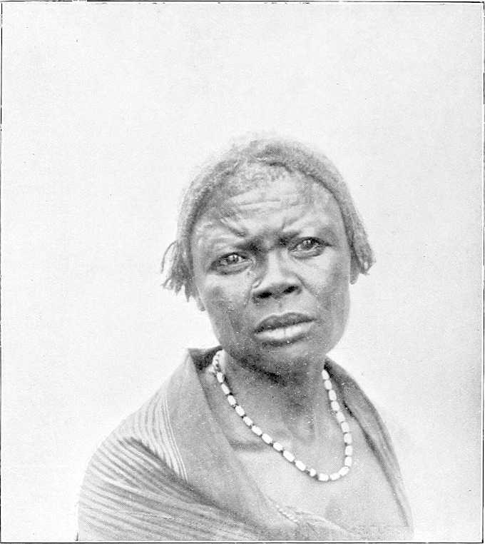
WOMAN OF DAR FERTIT.
13. Itinerary of the Bahr El Ghazal River.
Lake No—Meshra El Rek.
Place. Miles. Description.
Inter-mediate. From W. end Lake No.
Lake No — — Proceeding up-stream westwards from the junction of the Bahr El Jebel and the White Nile, Lake No is immediately entered. Lake No is known to the Arabs as the “Moghren-el-Buhur,” or the “Meeting of the Rivers.” It is situated in north latitude 9° 29′. It is a shallow expanse of water covering a good many square miles of area, and surrounded on all sides by reedy marsh. It is probably a portion of the great lake which once covered this country. Through its eastern end the Bahr El Jebel passes, and the Bahr El Ghazal enters it at its western extremity. Lake No acts as a reservoir for the waters of the sluggish streams which drain the extensive plateaux forming the watershed between the Congo and the Nile. These streams find their rise in an area lying between latitude 5° and 8° north, and longitude 24° and 30° east. The channel by which their united waters are delivered to the Nile is the Bahr El Ghazal, and from it the province through which it passes receives its name. Its chief affluents are the Rohl, the Jau, and the Tonj on the right, and the Bahr El Arab, the Bahr El Homr, and the Jur on the left. The water thus brought down fills up the depression known as Lake No, over which area the water of the Bahr El Jebel spreads. The consequence is that this lake is an expanse of water through which little or no current passes, but whose levels rise and fall with that of the Nile. The flooded area changes according to the season of the year. It forms an important reservoir for the White Nile. The actual extent of Lake No is difficult to ascertain. It has been variously estimated at from 20 to 40 square miles. These differences are probably due to the fact that the area was estimated at different periods of the year. During maximum flood the extent cannot be much less than the larger estimate, but at the period of low supply the area is much reduced, and in 1900 and 1901 could hardly have exceeded 8 square miles. In the early months of these years the surface had shrunk to very small dimensions, and more resembled a large river than a lake. The width, during the period of low Nile, is extremely variable. Thus in April, 1901, in the first mile from the White Nile, the open water surface was at times under 200 yards, and then suddenly widened out to, perhaps, 2 miles; a little further on it again contracted, and for 4 or 5 miles more varied from 300 to 600 yards. The depth, at that time, was nowhere more than 7 feet, and, in places, only 4 feet. No current at all was visible through any portion of the lake. Beyond the open water stretched a broad belt of flooded reeds. This belt was chiefly composed of “Um Suf,” with clumps of ambach. The open water itself was full of reedy islands. Lake No abounds with hippopotami and waterfowl. The former cause a good deal of trouble to the Nuer population, as they are unusually savage in this locality, and are said to make a practice of attacking any canoe or raft crossing the lake. The bank to the north of the eastern end swarms with lion and antelope of every description (January, 1903).
After passing the entrance to the Bahr El Jebel, keep to the northern channel. Open water right and a few low bushes; ant-heaps (termites), and dry ground left. Some wood. Landing possible. At 6 miles from the White Nile a continuous line of Nuer villages runs parallel to the left bank of the channel for several miles, and marks the ridge beyond which the swamping does not extend. Their average distance is some 2 miles from the river. The villages appear to be thickly populated, and the inhabitants possess large herds of cattle, sheep, and goats; they now barter their fowls, &c., with readiness.
From 7 miles above the White Nile—Bahr El Jebel junction (whilst still within Lake No) and westwards the channel is, in dry weather, reduced to 80 or 90 yards wide. In flood-time the line of the channel is not visible. This channel is by some termed the Khor El Deleb, in continuation of a khor of that name which flows into it at the western end of Lake No; but as the Bahr El Ghazal is obviously the main stream, the latter name has been applied to it here from the Bahr El Jebel junction westwards. About 10 miles west of the Bahr El Jebel mouth take southern channel, which comes in west-south-west, leave northern channel, as it closes up and comes to a dead end 5 miles on. Large village, Nuer tribe, 2 miles away left. Scrub on horizon left. Reeds, sudd, &c., both sides, and all part of Lake No.
Bahr El Ghazal 0 0 The true Bahr El Ghazal comes in close here left. Narrow mouth, 40 yards; 8 feet deep in March. Sudd seen floating down stream, 1½ miles an hour. Leave broad open channel, which bifurcates 2 miles farther on, and becomes the Deleb and Signorina backwaters, ending 18 miles up. Take northern channel, which is now the Bahr El Ghazal. The Khor Deleb, which enters the river from the south at the western point of the lake, is a wide expanse of channel 150 to 200 yards in breadth. It forms the outlet for the waters of the River Rohl, coming from the south. In summer no current at all is apparent. The Ghazal River at this point, with a width of some 40 yards, is in appearance a more insignificant stream than the other. Its depth, however, is greater, averaging 13 feet, as against 6 or 7 feet in the Deleb. The Khor Deleb was explored by Major Peake for some 18 miles above this junction. At this point it was blocked by sudd and reeds, with trees on both banks, so that further progress was impossible. It had, however, a decided stream coming through the reeds, which left the Ghazal 33 miles higher up. The transparency of the waters differs in the two channels; that of the Khor Deleb being opaque and of a whitey-grey colour, while that of the Bahr El Ghazal is clear and limpid, like that of the White Nile itself. Between the two rivers, which run parallel for some distance, is an expanse of low marsh, a foot above low- water level. This whole area must resemble a large lake when the rivers are in flood, and the aspect of the country is desolate and monotonous to an extreme degree. It is absolutely treeless; the atmosphere is damp and warm even in the winter months, and the mosquitoes are of a peculiarly venomous variety.
River Rohl or Khor Deleb 2 2
Mayyet Eléri 16 18 Proceeding up the Bahr El Ghazal, for a long way there is little change in the landscape. The low banks continue, and the stream winds about through the marshes with a very feeble velocity. At 18 miles a large khor joins the Bahr El Ghazal on the left bank. This is known as the Mayyet Eléri, and appears to come from a north-westerly direction. It is this khor which has been supposed to be the junction between the Bahr El Ghazal and the Lollé. From the slope of the country, however, it would seem that water flows from the higher land into the Bahr El Ghazal. It is possible that in flood there may be a spill in the opposite direction. This khor, although 200 yards in width, is very shallow. At 21 miles the Khor Deleb approaches to within 1,200 yards of the Bahr El Ghazal. A solitary deleb palm (mentioned by Junker) forms a fine landmark on the right bank. The Khor Deleb derives its name from this palm. The left bank of the river beyond the fringe of swamp is an extensive grass plain covered with ant-hills. These are so close together that they somewhat resemble a gigantic grave-yard. The Nuer villages are now a long way from the bank. As the river is ascended the country becomes more and more hopeless-looking. Flat grass plains extend to the horizon, and a wide band of swamp borders either side of the waterway. The channel narrows, and in places is not more than 25 yards. The depth is from 12 to 16 feet, and the turns and bends, though not as sharp as on the Bahr El Zeraf, are endless. The difference between the Bahr El Zeraf and the Bahr El Ghazal is very striking. The water of the former during the period of low supply is considerably below its banks; in the latter it is almost level with them. The rise of the former, even in ordinary flood, is not less than 6 to 6½ feet. That of the Bahr El Ghazal, on the contrary, must be very small. It is difficult to imagine that even in flood the water can rise more than 3, or at most, 4 feet over its lowest level. Even with such a rise, the area of the country under water would be enormous, and the flooding would extend for a very long distance. A few miles further up the depth of water increases to 19 feet, and in places to 25 feet. For the first time forest appears in the distance on the left, but several thousand yards away from the river. The right bank is now covered with low bush and scrub beyond the flooded line. The country bordering the Bahr El Ghazal does not have the appearance of being under water for any length of time, even in flood. In this respect, again, it differs from that traversed by the Bahr El Zeraf. It must, however, be saturated and resemble a sponge in the rainy season. There cannot be more than a very shallow film of water over these plains, or the bush and scrub would not flourish as it does; neither would ant-hills be found in such quantities. The general slope of the country is so low that the water must drain off extremely slowly.
Deleb palm 3 21
Mayyeh Nur 10 31 At mile 31 the width is 60 yards, and the reed-belt gets narrower; a very large “mayyeh,” or khor, comes in on the left bank here. This is known as the Mayyeh Nur, or the Mayyeh Mahmud Effendi. Its width near the junction is from 150 to 200 yards, and its general direction appears to be west. It is very shallow. This mayyeh is said to receive the waters of the Keilak River (Mayyeh b’ta Komandari (?)), a stream about which little is known, but which is supposed to rise in the hills of Dar Nuba. There is a wooding-station on right bank opposite the Nur. Up-stream of this junction the Bahr El Ghazal takes a more southerly direction. The two streams run for some miles parallel to one another, from 600 to 700 yards apart. The country between the two is, perhaps, 2 feet over the water. At mile 35, the first papyrus seen since leaving the White Nile is met with. From this point on, for many miles, a band of this reed fringes both edges of the water. It is never so high as on the Bahr El Jebel, nor does it grow here in such dense luxuriance as on that stream. The water surface is very narrow, often not more than 20 yards, but the depth is considerable, averaging from 15 to 19 feet. The reed-birds here are an extraordinary sight. They are to be seen in myriads and resemble a flight of locusts. The Serût fly is very bad on the Bahr El Ghazal. The ant-hills certainly form a distinctive feature of the Ghazal scenery. Nowhere else are they so large or so numerous. They are generally from 20 to 50 yards apart. At mile 49 good halting or camping ground, fairly dry; bushes and trees right. Large clump of big trees ½ mile away south. This clump is close to the stream running into Mayyeh Deleb. From here on, channel very narrow; papyrus both sides; liable to be blocked with sudd at any time; large islands of sudd are met, often taking up whole width of stream up to the junction with the Bahr El Arab, where river is much wider again. Mayyeh right: river bends sharply, channel only width of steamer, 17 feet; current very fast; numbers of owls and Balæniceps Rex seen about, also hippopotami; some wood left, 500 yards away. Large trees left, close to water, good for fuel; village on horizon right, and two Dom palms; channel opens up. At mile 53 wooding-station left. The papyrus belt gets wider as the river is ascended, and at 57 miles the forest on the left bank comes down close to the water’s edge and the river skirts it for some 2 miles. The trees are large, but the belt is only a few hundred yards wide.
Papyrus 4 35
Camping ground 14 49
Wood-station 4 53
Large tree 8 61 The scenery here is beautiful, as the ground is high and glades of fine trees are scattered about the grassy plain. Many elephants are to be seen. On the right bank is a wide marsh through which the river channel has evidently wandered at times. This is the beginning of the reach in which the Bahr El Ghazal is occasionally closed by sudd. At 61 miles, in 1880, Marno found his first block here, and in November, 1898, and April, 1899, it was blocked. Large solitary tree right bank. The channel is very narrow, deep, and winding. At present it runs under the high bank, but it is clear that it could easily be blocked at one of the many bends, and in such a case it would doubtless form a series of lagoons and mayyehs in the adjacent papyrus marsh. After leaving the left bank forest for a time the river at mile 62 again returns to it. The depth of the channel suddenly decreases to 5 feet, but soon deepens again to 10 and 13 feet. This shoal is doubtless caused by decomposed sudd which has sunk to the bottom. Such a bar is one of the frequent causes of a block. The sudd raises the bed level, and other masses floating down ground upon the obstruction and the channel is speedily closed. The Bahr El Ghazal has evidently changed its course here very recently. It is now much closer to the left bank than it was in 1899. The change has probably been caused by a block of sudd. It was near here, i.e., at mile 63, that Gessi Pasha had such a disastrous experience in January, 1880. His steamers, on descending this river, were imprisoned in the sudd for some 6 weeks, and he lost over 100 men. Had it not been for the opportune arrival of Marno in the “Bordein” none of the party could have escaped. They were on the verge of starvation and it was impossible to obtain fuel for the steamers, being cut off from the shore by an impassable swamp. These 6 or 7 miles of the Bahr El Ghazal must always be more or less dangerous, as regards possible closure by sudd, at certain seasons of the year. In 1900 and 1901 the channel was open, but in the spring of 1899 it was closed not far up-stream of this point. The channel is extremely contracted, having a width of only 12 yards and a depth of 13 feet. The course is so tortuous that it is difficult to follow all the turns. The whole of this area must, in the rainy seasons, be a reedy lake. At mile 64 the river emerges from this dreadful marsh and the width increases to 30 yards. The banks average 2½ feet above water level. The country on either side is generally higher. On the right, bush is dotted about, and the ant-hills reappear to the left in a large grassy plain. At mile 65 the river widens into a lagoon, some 400 yards broad, and a mile in length. At the up-stream end of this lagoon a large mayyeh is said by the Arabs to form the outlet of the Jau River, which is another of the tributary streams that feed the Bahr El Ghazal from the south. This channel, which is known as the Mayyeh Ahmed Arabi, runs more or less parallel to the Bahr El Ghazal for some 40 miles, taking off it at Lake Ambadi, or 88 miles from the point where the Ghazal and the Deleb join. It is often at a considerable distance from the main stream, but glimpses are to be seen of it at times. A fine tamarind-tree close to the edge of the mayyeh assists recognition of this spot. In 1899 the Bahr El Ghazal was blocked by sudd near this junction. The right bank continues to be fairly high, but the left is low and must be flooded for a long distance. The stream is now more rapid. The air in the mornings here is cool and damp, but a strong marshy smell prevails. At mile 74 wood-station left bank. Elephants, and the Euphorbia first, appear. This shrub is fairly plentiful from this point up-stream. For several miles there is little change in the conditions, but at mile 79 trees are visible on the right bank, about 1,500 yards from the river. The intermediate country is flooded. A few Dinka are occasionally met with, but no villages. The absence of human habitations on this river is very striking. Since the Nuer villages were left behind at mile 43, not a sign of life has been visible. A small but deep khor joins the river on the left bank here.
Gessi’s place 2 63
Jau River or Mayyeh Ahmed Arabi 3 66
Wood-station 8 74
8 82
False Bahr El Arab 8 90 From here for the next 20 miles good wood left. At mile 90 a large and important khor comes in, also on the left bank. This channel, which was asserted by the boatmen to be the Bahr El Arab, and which was ascended under this supposition, flows from a north-westerly direction and evidently brings water from a long distance. Later experience has proved that the Bahr El Arab is several miles further up-stream, but this khor must, nevertheless, bring down a large volume of water during the flood. It is quite possible that it forms a second mouth of the Bahr El Arab. It joins the Bahr El Ghazal through two small lakes or lagoons, the largest being about 1,000 yards long by 800 yards wide, with an island in the centre. These lakes are swarming with hippopotami. The width of this khor is much greater that than that of the Ghazal, being from 100 to 120 yards. It has a perceptible though feeble current even in April, but its depth is shallow, averaging from 4 to 5 feet. It was ascended for some 8 miles above the junction, when shoal-water prevented further progress. Its general direction is north-west, but at the furthest point reached it turns sharply to the north, and its course can be traced for a long distance, winding through the country. Even here its width is 100 yards, with wide-stretching mud-flats on either side. It runs between flat plains covered with low grass and averaging 2½ feet over the water at the river’s edge. It differs remarkably from the Ghazal in its characteristics, particularly in the absence of the reed fringe which distinguishes the main river. Its rise must be small, as the banks show no trace of flooding.
Lau 6 96 From 5 miles above the junction a succession of Dinka villages line both banks. Some of these are large and appear to be thickly peopled. The principal village is called Lau. This consists of a large collection of scattered huts, grouped together, and covering a large area. It would be interesting to explore this khor during high water and ascertain whether it really is one of the outlets of the Arab River.
To return to the Bahr El Ghazal. From the point where this khor joins it, the general course is due west and fairly straight with occasional long curves. It is bordered by a narrow strip of papyrus on either bank, and traverses a country of flat grassy plains. This river is placid and sluggish throughout its entire length, and can never approach anything like a torrent, even when in flood. It meanders along, slowly and gradually sucking away the moisture of the vast, water-logged flats through which it passes. Its width averages from 60 to 70 yards, and its mean depth is 10 feet.
Forest 4 100 At mile 100 trees and bush are found on both sides and the banks are clear of reeds and continue until mile 103, where the Bahr El Arab joins the Ghazal. This forest is known as the “Ghaba b’ta el Arab,” and is one of the few wooding-stations to be found on the river. The trees upon both banks are different from those found elsewhere. There are a few mimosas, but the bulk are very thorny trees with bright green leaves. The belt of wood is about half a mile in width, back from the river. Behind it are open spaces of grass, through which broad and shallow lagoons wind. In this plain are many large clumps of trees. Except in the depressions, the country here is certainly not flooded, even in the rainy season. The marks on the banks show that the maximum rise of the river is not more than 3 feet. The Bahr El Arab is a broad well-defined channel, from 40 to 100 yards in width, and confined between well-marked, but swampy, banks. Its direction, at the junction, is due north, but about 3 miles further up it turns more to the west and runs apparently through forest. Next to nothing is known of this river. Felkin crossed it in December, 1879, and found it, 300 miles from its mouth, 120 yards wide, with banks 15 feet above low water. He noted that in the rainy season it flooded the surrounding country. It is impossible to investigate this river, as, at some 1,300 yards above the junction, it is closed by sudd and reeds. It has no current at the mouth, and its depth is from 10 to 11 feet at low water. The water of the Bahr El Arab is singularly clear and free from sediment. Reports received in the spring of 1901 show that this river is still blocked by sudd. Immediately up-stream of the Bahr El Arab junction the Lake Kit, or Ambadi, begins. The Bahr El Ghazal traverses this lake, but from this point its nomenclature changes, and the river is known as the “Kit,” or “Keit,” by the natives, and as such is entered on many maps. At mile 105, Lake Ambadi is divided into two parts by a large grassy island, about a mile in length, the right channel being 400 yards, and the left 150 yards wide. Half-way up the right channel, the large Mayyeh Ahmed Arabi, previously alluded to, rejoins the Bahr El Ghazal. It has a width of 500 to 600 yards here. The swamps surrounding this lake are of considerable breadth, especially on the left side. They are very low and reedy, and a very small rise in the water levels must increase the flooded area enormously. It is impossible to calculate the width of the swamps on the left bank. They appear to extend for many miles from the water’s edge. Lake Ambadi has an average depth of 10 feet, in the deepest parts of the channel, but shoals rapidly on either side. It is evidently the great reservoir of the Bahr El Ghazal, receiving the waters of the swamps and the southern rivers, and slowly discharging them by means of the narrow but deep channel of the Ghazal itself. At low water it has a length of about 10 miles by an average breadth of 1 mile; in flood-time the area must be very much greater. It is a great nursery for certain of the sudd grasses, but chiefly those of the “swimming” variety. The Azolla, Utricularia, Aldrovandia, Otellia, and many other kinds are found upon its waters. The Pistia is conspicuous by its absence. Among the reeds in the swamps a certain amount of Vossia procera and Saccharum spontaneum is met with, but not in such proportion as on the Bahr El Jebel. The papyrus does not exist on this lake, nor does the ambach. Except between miles 35 and 82, the former is not found at all on the Bahr El Ghazal, and it only grows in real luxuriance between miles 65 and 77. After Lake No is passed, ambach is not found in the Bahr El Ghazal. The absence of papyrus and “um sûf” is probably the reason why the sudd in this river is so much less tenacious and is so much lighter in consistency than than that of the Bahr El Jebel. [Col. Peake, however, speaks of the sudd here as being of a “very tough and felt-like consistency.”] Lake Ambadi is the home of large numbers of the rare Balæniceps Rex. The evaporation upon the lake must be very great during the hottest months. With two large and shallow sheets of water like Lakes Ambadi and No, the amount of water discharged by the Bahr El Ghazal must be largely reduced before it reaches the White Nile.
Bahr El Arab 3 103
Lake Ambadi 1 104
Kit River 10 114 At mile 114 the lake stops and the river recommences. This is the Kit, properly so called. Its width here is from 100 to 120 yards and its depth 10 to 11 feet. The current is so feeble as to be almost imperceptible. The Bahr El Homr comes in near this point. On the 1st October, 1900, Captain Sanders found the Bahr El Homr navigable for 5 miles; after which it was blocked by sudd. Its width is 80 yards and depth, 9 feet; direction N.N.W. Col. Peake places its junction 9 miles further down-stream. It appears to have no discharge in March and April, and the water shoals so that it is impossible to explore it. For the next 3 miles the Kit has a mean width of 180 yards. The water surface suddenly narrows to a width of 20 yards, the remainder of the channel being filled by sudd. In this block are several reedy islands. The country is now a dead flat in every direction. Even on these African rivers it is rare to see an expanse giving a greater impression of flatness than does this. On all sides marshes extend, apparently to the horizon. It is quite impossible to arrive at an idea of their area. In these marshes are many large lagoons. A little further up-stream, the channel widens again from 35 to 40 yards, with a depth varying from 12 to 15 feet. Occasionally it shoals to 6 feet, or less, probably owing to sunken sudd upon the bed. Navigation at all seasons must be very difficult, as the river winds and twists through the marshes. There are no tall reeds here; nothing but floating plants, and the water is choked with masses of decayed weed. It is a hopeless morass. During stormy weather, this place is one of those where blocks are often formed. There are no signs of life anywhere, with the exception of the Balæniceps Rex, which are numerous. These horrible marshes continue for another 6 or 8 miles. Sudd islands separate the channel, in places, and the width varies greatly. At one point of this reach, viz., at mile 120, the main channel of the Kit was quite closed in March, 1900. The entire river was forced through a small opening, 10 or 12 yards wide, through which a strong stream was rushing, and in one place it was actually barred for 50 yards. The total length of the block was about 500 yards. A more loathsome-looking swamp it is difficult to imagine. The sudd in this river is very different from that of the Bahr El Jebel. It is impossible to walk on its surface, which resembles slime rather than sudd, but which is bound into a mass by vegetable matter. The chief ingredients appear to be the long trailing, swimming plants, described as found on Lake Ambadi. It is not difficult to force a way through it, but the stuff, when removed, does not float as does that on the Jebel, but sinks and decays. Three miles on, the two groups of trees called Matruk-el-Wabur (“the landing-place of steamers,” vide Junker) are passed on the left, about 2 miles from the main stream. A channel, at present blocked by sudd, leads to the landing-place. Matruk-el-Wabur is an island of dry land in a sea of swamp. When Col. Peake visited it in 1898 the remains of the former French occupation were visible. The Egyptian flag was hoisted here on the 28th September, 1898. Up-stream of this point, for another 5 miles, the Kit winds about; the width of the channel increases, averaging from 180 to 200 yards; its surface is covered by myriads of water fowl, the whistling duck being especially numerous; a few Dinka are to be seen, who have come down to the river for the purpose of fishing and hunting the hippopotamus. At mile 128 the channel bifurcates. The Kit itself runs due south, in the direction of Meshra-el-Rek. The other branch has a westerly direction, and receives the water of the Jur River, which, again, forms the outlet for the Sueh and Wau Rivers. The latitude of this junction, as observed in April, 1900, was 8° 44′ 50″ north. The water at the time was so shallow that it was impossible for the steamer to ascend the channel, the width of which was from 600 to 700 yards, with a depth of 3 feet. The water coming down this stream was of a dark amber colour, and was evidently the drainage of the marshes. A slight current was visible. The general direction of the Kit is south or south-west. Captain Sanders, who visited this place in September, 1900, found the Kit completely blocked by sudd: but Lieutenant Fell, R.N., ascended it in November of the same year, and reports that the water near the Meshra was “foul, stagnant, and very shallow.” In March, 1900, the sudd was very light, mostly floating, and easily removed. Above this junction, the expanse of water into which the Jur discharges itself has a width of 400 yards, a depth of 10 feet, and a fair velocity, even in the month of March. The marshes here are bewildering in their extent.
Matruk-el-Wabur 9 123
Mouth of Jur River 5 128
Navigability — — After 3 years’ experience, it is found to be impossible for a steamer to reach the mouth of the Jur River, and, therefore, of course, Meshra-el-Rek, from the middle of April till the middle of July. In May a steamer cannot get within 15, and in June within 35, miles of the Jur mouth. Even when free of sudd, the Jur is unnavigable, owing to its shallowness, from the first week of December to the end of July. After strenuous exertions during 2 years on the part of Lieutenant Fell and others, the Jur has has now been cleared of sudd and a channel made for steamers up to Wau, a distance of 160 miles. This enables stores, &c., to reach headquarters by water during 4 months of the year (August to November, inclusive). The sudd is, however, quick-growing and grows from the bottom. Sudd-cutting parties have, therefore, to be annually employed during the low river time to clear a channel for the flood-time. The average difference between high and low Jur is as much as 15 feet; in flood-time the current is swift and the river deep, whilst the reed beds on either side make towing impossible. Luckily a north wind helps boats along up-stream.
Meshra El Rek 25 153 (Junker made the total distance by river from Lake No to here, after 1,781 angular measurements, to be about 135 miles; but it is difficult to make out his exact point of starting.)
Meshra-el-Rek lies on a small island in a backwater—the river itself apparently starting in marsh land, and not yet having been defined. Island about a mile long and varies from 200 to 400 yards in breadth. On either side of the river marshes extend for 2 or 3 miles. Mosquitoes swarm, and, owing to the stagnant condition of the river, the water supply is very indifferent during the dry season. No natives live within about 7 or 8 miles. The station consists of straw tukls—the hospital standing on the one bit of high ground. Great difficulty in building huts, as there is no wood suitable within several miles; on the whole a most unhealthy place. High ground lies quite 5 miles beyond the marsh. The French had a fort near our present post in an even worse position.
THE BAHR EL GHAZAL.
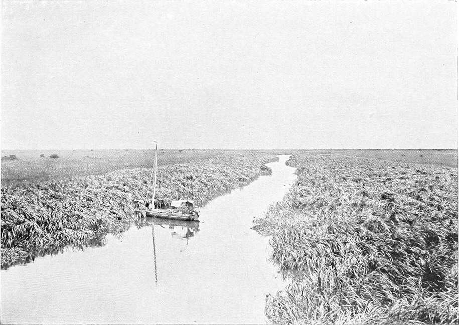
THE BAHR EL GHAZAL—MOUTH OF RIVER ROHL.