Volume 1 — CHAPTER II. (continued 3)
Reading edition
Dervish Deim 6 390 626 South of Bor, the sudd, properly so-called, disappears. The marshes are formed of a deeper layer of sand, covered with a thin surface of clay, and with streaks of clay running through them. These swamps, except in the centre of the valley, are, as a rule, well over summer water-level, and the loss of water can be as nothing compared with that north of Bor. The vegetation, too, is of a different kind, being chiefly grass, and though dense enough, is not composed of those reeds which require to have their roots under water for a great portion of the year. At mile 390 the Dervish “Deim” is visible, situated on the east bank. This is the place held for so long by the Emir Arabi Dafaalla. The spot is well chosen for defence, as the river sweeps round it on two sides. The bank all round has been cleared of bush for a long way. The “Deim” is surrounded by a mud wall forming a rectangle, of which the river forms one side. The inclosure is some 400 yards deep by 700 yards in length. The mud bank, fast disappearing, is about 4 feet 6 inches high, with an outer ditch 3 feet deep by 4 feet wide. At the corners are small watch towers, and in other places remains of loopholed houses. The Bahr El Jebel now, for many miles runs close to the east bank. It winds continually, and there are occasional loops of swamp, but as a whole it follows the high land closely.
Bor (military post) 8 398 Small military post, furnished from Mongalla. Formerly a wood station, now much cut up. Large numbers of elephants. This is to be the site of the Headquarters of the new Administrative District of Bor.
In places the bank is perpendicular down to the water’s edge, and from 6 to 8 feet high. At such points there is always great erosion. The scenery more resembles that of the Blue Nile than the White. The forest close to the river, the high banks, the profusion of creepers and undergrowth, the boils and eddies of the river along these curves, combine to form a picturesque scene, utterly different from that usually met with on the White Nile. About 22 miles south of the Deim the Dinka inhabitants are replaced by those of the Bari tribe. The difference is at once apparent. The “tukls” are untidy, crowded together, and badly built. The people seem poor and possess few cattle. They live chiefly by fishing; in April the whole population is engaged in preparing the land for cultivation, if the river allows, chiefly on the west bank. At mile 404 the river bifurcates, one channel branching off to the west, while the other, and the deeper, follows the eastern bank. These two channels reunite at mile 422. The width of the island between them is not very great, being rarely more than 800 to 1,000 yards. The west bank is now a flat grass plain, marked by swampy depressions. The river must top this in flood, but not to any depth, as the marks show that the total rise cannot exceed 4 feet. The west bank is inhabited by the Aliab tribe, a sort of cross between Baris and Dinkas, but they consider themselves quite distinct. The solitary mass known as Jebel Lado is now first visible on the south-west horizon. The river above the junction of the two channels averages 80 yards in width and 11 feet in depth. The bends and twists are never-ending, and there is hardly a straight reach in its whole length. The banks are very sandy, as are the flats which show up above the water. Occasional small islands separate the channel into two or more branches.
Tree disappeared[39] 33 431 694 There is now a decided ridge on either side of the main channel resembling that described in the White Nile. East and west of this ridge the level of the flats is lower, and in the depressions lagoons are formed and winding channels wander. The average width of the valley here cannot be more than from 5 to 7 miles. On either bank the forest line marks the high ground. On the narrow ridges above described are located a few groups of Bari huts surrounded by fields of dura. The high ground does not average more than 100 to 200 yards in width. At mile 431 a magnificent tree used to be situated on the eastern shore. It made a striking landmark, but disappeared in 1902.[39] The forest rises rapidly from the water, and at its highest point is quite 20 feet above summer level. One-and-a-half miles up stream, the river, which has followed the eastern bank for so long, now winds across in a westerly direction. In thus crossing the swamps, an excellent idea of the general section of the valley is obtained. In the centre the flats are, perhaps, 2 feet above the water; towards the sides they rise to a height of 4 feet and sometimes 4 feet 6 inches. The lower portions are marked by a series of lagoons. These marshes are only, however, swamped when the river is in flood, and even then not to any great depth, as the total flood rise is not more than 4 to 5 feet over summer level. The valley averages 8 to 10 miles in width. The forest and thick bush extend to a long distance away from the river. Progress through this forest is only possible by means of the elephant tracks, which are very numerous. At mile 438 the channel again bifurcates, the two branches reuniting 5 miles up-stream. There are so many islands and so many side channels, that it is almost, if not quite, impossible to find the whole stream contained in one single channel, and this is the case the whole way between Bor and Gondokoro. The river varies immensely in width. In places it is from 200 to 300 yards broad, and in others only 80 to 90 yards. As the Bahr El Jebel is ascended the average depth decreases, and throughout the reach between Kiro and Lado is rarely more than from 6 to 9 feet. At mile 451 the river touches the western forest edge, having traversed the marshes. The trees on this side are, as a rule, finer than those in the eastern forest. The bank, at the water’s edge, is from 3 to 4 feet high, but rises rapidly to a height of 12 to 16 feet above the water. At mile 456 used to be an Anglo-Egyptian station, 1901 (west bank), now abandoned. The scenery here is very fine, and luxuriant tropical vegetation abounds. Giant Euphorbia are a marked feature of the landscape. The whole of the banks and most of the trees are covered with a velvety-looking mass of creepers. A bluff, 10 to 12 feet high, juts out into the stream, but the action of the current is so strong that the friable soil is being rapidly eaten away. The face of this cliff is perforated by myriads of holes, made by a very beautiful and tiny species of bee-eater. These birds have rose-coloured wings with bronze-coloured bodies. They add much to the beauty of a lovely scene.
Pole west bank (April, 1903) to mark 5° 30′. 17 448 721
Western forest 3 451 726
Old Anglo-Egyptian station of Kiro. 5 456 734
(Illustrations)
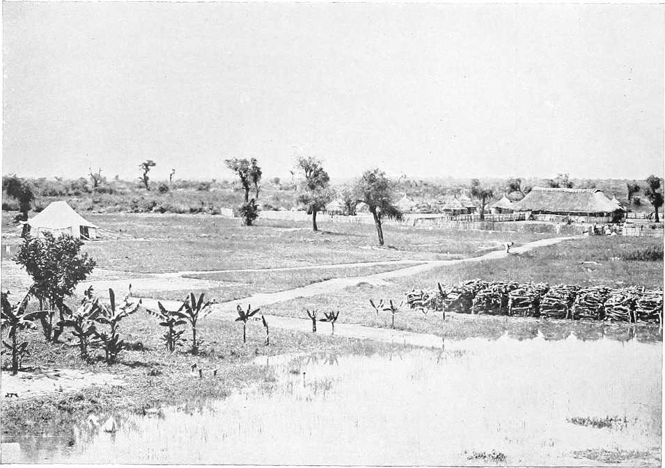
Kiro (Congo F.S.) 4 460 740 At mile 400 from Lake No, the station of Kiro, the most northerly in the Lado Enclave, is situated on the western bank. The latitude of Kiro is apparently between 5° 12′ and 5° 13′ north. The erosion caused by the river here is very great, large masses of the sheer cliff, which is 15 to 20 feet over the summer water-level, are constantly falling into the Nile. It seems probable that unless they take protective measures the Belgians will be forced to retire their houses some distance back from the water. Kiro is a picturesque-looking place. The huts are well laid out and neatly built. The cantonment is surrounded by a brick wall, with places for guns, parapet, and ditch. The Commandant’s house is a comfortable-looking structure, with a good thatched roof and a deep verandah. The forest surrounds the station. The garrison consisted in January, 1903, of some sixty-five men. It possessed a small steamer (the “Van Kerckhoven,” called after the leader of the first Congo Expedition to the Nile, 1889; the boat is clumsy and draws 4 feet of water; but having been brought in sections overland from the west coast she is entitled to respect), and several steel sailing boats. The negro soldiers differ largely in type from the inhabitants of the Nile valley. In figure they are short and squat, and some of them are much tattooed. They are recruited from the West Coast, and from the tribes in the Congo valley generally, and make excellent and very mobile soldiers. Upon an island opposite the station vegetables and paw-paw trees are grown. Beyond this there appears to be little cultivation. Kiro is extremely unhealthy in the rainy season. In two years the Belgians lost 9 Europeans and 300 natives from fever. Black-water fever is not uncommon here, and guinea-worm is a prevalent complaint. One-and-a-half miles up-stream of Kiro two fair-sized lakes are enclosed by the western forest. These evidently receive the drainage of the high land from a considerable distance. On the east bank a khor, passable for small steamers, runs north-north-east, rejoining the river just north of Kiro. From here to mile 467 the river skirts the western bank. Everywhere severe action is taking place, and many trees have fallen into the water. Three miles on another large lake opens out in the forest. At one end of it the Lado mountain forms a background, making an imposing picture. At mile 468 another bifurcation occurs. The western branch follows the forest as far as Lado, but navigation in summer by this channel is difficult. The eastern branch crosses the marshes. There are several connections between the two channels. The river now averages from 250 to 300 yards in breadth. At mile 472 the eastern forest is again reached. Here there is a good wooding station, as the trees and high land come down close to the water’s edge.
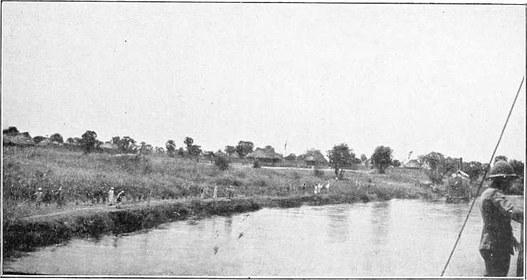
Mongalla[40] 14 474 763 Most southerly post on the Nile of Sudan Government (occupied 1901), situated on east bank. Garrison two companies. A gunboat is always stationed here, in addition to which there is usually a steamer at the disposal of the Commandant for administrative purposes. About 200 tukls. Open grassy, sandy spot; fairly healthy; 5 to 8 feet above water. Plenty of trees and bush. The Bari are the inhabitants of the district, but are few in number; few supplies. Brick houses. Proceeding up-stream, the river divides, the main channel running through swamps, and the east channel skirting the villages of Sheikh Lado, Lowala, and Yemba. The depth is rarely more than 9 feet, though there are occasional pools of 12 to 16 feet in depth. Hippopotami used to be extremely numerous and particularly obtrusive, but seem lately to have disappeared. A few huts are to be seen, chiefly on the eastern shore. Most of these have been recently constructed, as many of the Bari have migrated from the west to the east bank of the river, and have settled on Sudan territory. At mile 477 the river again leaves the east bank and crosses the swamps. The width of the valley now contracts to some 4 miles. Such a labyrinth of streams winds through these grassy flats that, without an experienced pilot, navigation would be extremely difficult, more especially as the depth of water rapidly decreases. As it is, there are so many sand banks that it is difficult to proceed at night. At mile 494 the west channel, mentioned as branching off at mile 468, rejoins the east branch, and half a mile up-stream the station of Lado is reached. At this point, with the exception of a moderate-sized inlet some 3 miles down-stream of Lado, the river is confined in one single channel.
Sheikh Lado’s village, east bank 2 476 766
Lado 19 495 796 Capital of the Lado Enclave, taken on and rebuilt in 1898. Formerly an Egyptian post, and at one time head-quarters of Emin Pasha. Situated on the bank 10 to 14 feet above river. Very well selected position, protected on the north by a broad swift running khor and 2 forts, and on the south by an impassable morass; only land approach from the west commanded by a fort. Surrounded on three sides by a rectangular parapetted enclosure, about 400 by 200 yards, one long face being open to the river. Garrison, about 15 white officers and 500 men (1904). Enclosure contains about 20 good brick straw-thatched houses, and good tukls for the men. Road leads to Rejaf (broad) and thence to Yei, Ibembo and Mbima. Native track also to Kiro. Good bamboo and some gum about Jebel Lado. Forest close by. Few or no supplies. The neighbourhood of Lado is a desolate-looking spot, not nearly so picturesque as Kiro, but, on the other hand, healthier. A flat plain with bushes stretches from the river for about 2 miles. From here the forest commences, and gradually rises to the spurs of Jebel Lado, which is some 12 miles from the station. The food for the troops has to be brought from a very long distance. In front of Lado is a low island, upon which vegetables, bananas, and castor-oil plants are grown. This island is 4 feet over low-water level at the south end, and was topped by the 1903 flood. According to the Belgian officers, the flood water contains but little sediment beyond sand, and this statement is borne out by the deposit on the flats and banks. They further state that in flood the colour of the water scarcely changes at all. There appears to be no trade whatever, but a good deal of cultivation. The ivory collected here is small. India-rubber is apparently not found within any reasonable distance of the Nile. Owing to the two years’ drought and one year’s flood, the natives on the west bank of the river had no supplies. Lado possesses a fine herd of long-horned cattle for the use of the garrison. Fever is very prevalent during the rainy months, but does not appear to be of such a deadly type as at Kiro. In April, 1901, the rains had already commenced. According to M. Renier, the month of May in this region is one of abundant daily rainfall, but this is not always the case.
Proceeding up-stream from Lado, the scenery improves. Eleven ranges of irregularly-shaped peaks are visible to the east and south-east. Most of them are covered with scrub, and round the bases the bamboo is said to grow in luxuriance. From the river bank up to these ranges extends a broad expanse of reeds and grass, bounded by a dark forest line. To the west the country rises rapidly in a series of ridges clothed with forest. The Bahr El Jebel now averages from 250 to 300 yards in width, and the depth ranges from 6 to 8 feet. Islands and side channels abound, and in flood time it must be difficult to say which is the main stream. The loss of water is comparatively small, as the grass flats are high. Numerous Bari villages on the east bank and on the islands, but few on the west bank. Further south, range upon range of hills show up in the distance, one beyond the other. These are not very high, but are of striking outline and form an agreeable change to the eye, after days passed in the dreary flatness of the Jebel marshes. The width of the valley is here about 5 miles from bank to bank. The Bari villages increase in number on the east bank as the river is ascended. Jebel Lado still dominates the western landscape, and Jebel Rejaf, a pyramidal and solitary peak, marks the point where the reefs and rapids begin. On approaching Gondokoro, navigation becomes more and more difficult as the water shoals rapidly, and the maze of channels and islands are perplexing and intricate; half a mile from Gondokoro are some bad shallows.
Gondokoro 9 504 810 At mile 504 from Lake No, the station of Gondokoro is reached. This place, on the east bank of the Bahr El Jebel, is the north frontier post of the Uganda Protectorate. Gordon gives the latitude of Gondokoro as 4° 54′ 29″ north, and the longitude as 31° 43′ 46″ east. The altitudes given by different authorities vary so much that they are not worth recording. Gondokoro, although a healthy-looking station, has a deserted and scattered appearance. The buildings, mostly of bamboo and straw with brick houses for the European staff, contrast but poorly with those of the Belgians at Lado and Kiro; the station was occupied in 1899. The Collector’s house, or Residency, is situated about 300 yards to the north of the garrison lines, and 130 yards from the river. It is built of burnt bricks, with a high thatched roof, on ground 16 feet, or more, above the river, and surrounded by a thorn zeriba. This and the M.O.’s house are raised on brick arches from the ground and surrounded by gardens and cultivation. The thorn scrub approaches to within 1000 yards of the houses. The station is situated on a high cliff, from 18 to 39 feet above the water. Much of this cliff has fallen in, and the foundations of the Austrian Mission Buildings, abandoned in 1858, are now on the extreme edge of the high bank. A few deleib palms and lime trees mark this bluff. The station extends over an area of about 1 by ½ mile. The new lines are built some 400 yards back from the river. The present huts which accommodate the small garrison are circular huts of mud and grass. There is also a police barracks containing about 25 men. The remains of Baker’s old lines are still existing. He had here a garrison of 1,500 men, but in his time the Bari was a powerful and warlike tribe. Gondokoro was, moreover, an important centre for the slave trade. Baker’s old lines consist of three rectangles, one within the other. The inner one is about 300 by 400 yards; the second, 500 by 800 yards; while the outer is, perhaps, 1,000 to 1,200 yards square. Each of these rectangles is surrounded by a mud bank about 4 feet high, with an outer ditch 4 feet deep by 6 feet broad at the top. There used to be plenty of trees, bananas, paw-paws, etc., and the station was, on the whole, a pretty one, but floods and white ants have now destroyed many of the trees. To the south and north of the station, and also 1¼ miles to the east, are large marshes, which must tend to make the place unhealthy. At times wild elephants come close to the lines. Many Bari villages are located on the river near Gondokoro. All these are on the east side. The Bari appear to be better agriculturists than are either the Dinka, Nuer, or Shilluk. They cultivate dura, ground nuts, beans, and a little tobacco; also sweet potatoes, and manioc. A small market for local produce has been established, and Bari and Luluba keep it fairly well supplied; time, it is hoped, will bring an increase in population and cultivation. The castor-oil plant grows like a weed in this locality. The average maximum flood rise of the river here over summer level is not more than 4 feet. In the flood of 1878 it rose to a height of 7·2 feet on the gauge (Chelu). The general direction of the river here is north and south, so that Gondokoro is well situated with regard to the prevailing winds. The main channel, opposite the station, is about 400 yards across, but is separated from the main land by a large island.
(For description of the river to the Albert Nyanza, vide Appendix, Vol. II.)
KIRO.
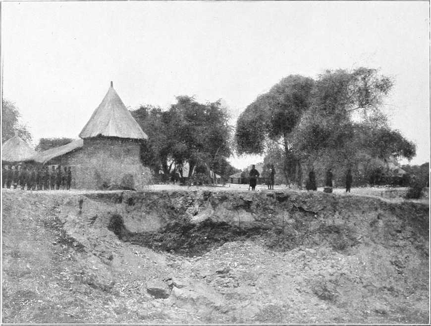
LADO.
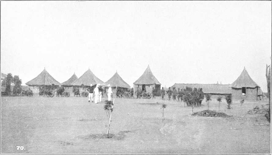
GONDOKORO.
RECAPITULATORY TABLE OF DISTANCES.
Intermediate. From Lake No.
Miles. Kilometres. Miles. Kilometres.
Hellet el Nuer 139 223 139 223
False channel (22 miles) 4 6 143 230
Bahr el Zeraf (south end) 106 170 249 401
Shambe 7 11 256 412
Abu Kuka 37 59 293 471
Kanisa 11 18 304 489
Bor 80 129 384 617
Latitude 5° 30′ 64 103 448 721
Kiro 12 19 460 740
Mongalla 14 22 474 763
Lado 21 34 495 796
Gondokoro 9 14 504 810
MONGALLA.