Volume 1 — CHAPTER II. (continued 2)
Reading edition
There are two broad khors running into the desert between Salamat and Jebel Osma. Mimosa or sûnt trees, of an unusually large size, are met with along the road. The river is free from obstruction.
If going to Abu Hamed, it is advisable to cross the Nile opposite Hebi, where the river affords great facilities for crossing and swimming animals. The island of Kan and smaller islands on the right bank may be utilized in the crossing. Lieut.-Colonel Stewart’s steamer, on its way from Khartoum, was wrecked on the island of Kan on the 18th September, 1884, and he and his party were treacherously murdered in the house of one named Othman Fakri, commonly known as Othman Amian, in the village of Hebi.
Hebi is a straggling village, composed of small mud huts, built in the rocks. There are some conspicuous palm trees on the bank of the river. The village was completely destroyed by the British troops in February, 1885. There is much cultivation in and near Hebi: dura, dukhn, barley, beans, etc., growing in luxuriance.
Old Merowe to Abu Hamed, by the Right Bank of the Nile.
(Major Hon. M. G. Talbot, R.E., October, 1897.)
General Notes.
(i.) The grazing for camels is moderate.
(ii.) The places where water can be obtained depend on the time of the year. The bed of the river is the only source of supply.
(iii.) No considerable elevation is crossed anywhere. Probably the road is never more than 100 to 150 feet above high Nile level.
(iv.) Telegraph line follows road where not otherwise mentioned.
(v.) No supplies obtainable on right bank.
Names of Places. Distances in miles. Description.
Inter-mediate. Total from Merowe.
Old Merowe Village.
J. Barkal 4 4 Two miles inland. Ancient ruined pyramids at base. Desert road from Dongola joins river here.
Kasinjar 4 8 Telegraph line crosses from left to right bank here.
Small fort.
Amrao 19 17 On leaving Kasinjar fort the road curves round with the river, but gradually recedes from it. After 2 miles of good firm sand, with thin thorny scrub, the road turns away from the river to the north-east, passing to the right of Jebel Wad El Duga, beyond which it turns N.N.E., over undulating, stony ground, draining to right. The going is good to 11 miles. At about 13 miles road passes into a shallow basin draining east, from which it emerges at 14½ miles, and begins to descend to river by a bad path down and across small khors. Reaches river at Meshra El Abiad, a good watering place, at 15¾ miles. From 11 to 14½ miles the road, though generally good, is less so than before, and passes over bits of stony ground, which would be very troublesome at night or even for a considerable body marching by day. From Meshra El Abiad road runs along river bank; good going for camels, and some grass and thorn grazing. A few huts at Amrao, where there is plenty of room to camp and some shade.
There is also a road by the river, which was used by General Hunter’s column. It is said to be bad and to take baggage camels 5 hours.
Abu Haraz 9½ 36½ Desert road leaves river at once and follows telegraph wire for 3½ miles, when latter strikes off to right to river, and continues along it to Abu Haraz. To 3½ miles road is good, in flat khor, few bushes on left, and gigantic boulders on right. Keeps on straight to 8 miles, crossing plain strewn with scattered ridges of granite boulders, and then turns slightly to right down to river at Abu Haraz, 9 miles, where there are a few ruined mud houses, and a clump of palms at 9½ miles, with camp and shade for a battalion. No water along road.
Hosh El Geruf 12 48½ For 4½ miles road winds in and out of low slaty and granitic ridges, with strip of good sand between, keeping generally near the river. It then leaves the river near Khor Abu Herejil and strikes across low slatey ridges to about 7½ miles, when it again strikes an arm of the river, dry at this season, along which it keeps for 1 mile, and then across broad, low open plateau to Hosh El Geruf. Like all the names in this part, Hosh El Geruf is applied to a strip along the river, rather than to any one spot or village. The spot referred to here is a clump of palms, at the foot of a low hill, near a little cultivation.
Salmia 14 62½ Road generally bad, quite unsuitable for wheels. It follows river at starting for 1 mile, and then, leaving it, winds up and down khors and over low rocky ridges almost the whole way. From about 8½ to 10 miles is the worst bit. Here horses should be led in single file, after that road enters sandy plain and is good to 13 miles, when it commences to cross low ridges again. At 13½ miles the river is seen for the first time and the road descends to Salmia, which consists of two or three groves of palms, with a field or two of dura and three or four houses of Monasir. Room to camp three or four battalions, with a little shade.
Dakhfili, south end 12½ 75 Road leaves river at once, and for 1¾ miles crosses stony ground strewn with boulders. It then gets on to sandy and more open ground, and is good to 3 miles when it drops down to valley of river by a bad path. Then very good sand to 4 miles, where it strikes river bank at Kamasab, just opposite Jebel Us. From here road is bad nearly to 6 miles, when a strip of good going takes it as far as Shukoka, 9 miles, where there is a little cultivation on the bank of the river and on a backwater. Southern end of Dakhfili is reached at 12½ miles, road being partly along river and never very far from it, and passing several small groups of huts. Dakhfili is a large camping ground ¾ mile long, opposite Shirri Island. It has a few palms and some large sunt trees. No cultivation to speak of.
There is another route to Dakhfili from Hosh El Geruf, which leaves the river at much the same place, and keeps straight across the desert to Dakhfili. It was much used by convoys, even at night, and is undoubtedly much better going than the Salmia route, and probably a couple of miles shorter, but there is no water along it.
El Gab, viâ Um Duema 19 94 At the north-east end of Dakhfili, road leaves the river, and after 1 mile over heavy sand and sand-covered rock, emerges into the open Khor Haweili, 500 to 600 yards wide, and bounded by low sand-covered slopes. (From this point a track leads to the river and round by it to Um Duema, distance 14 to 15 miles, bad going.) Road continues up khor to 7 miles over sand and gravel, generally very good for camels, but a little soft for men and horses. Room to march in any formation. (From here desert road continues almost straight on to El Gab, 17 miles, mostly good going, but some heavy sand for the last 3 or 4 miles.) At 7½ miles the Um Duema road strikes off to right by an easy but unfrequented path over low hills partly covered with sand, and descends by a baddish path between Ab Rumeila and Hebi at 11 miles. Road continues easy but narrow along the bank, passing Hebi, 12 miles, where there are a few houses, with some palms and a little cultivation, and Um Duema at 13 miles, which is similar to Hebi. At 14 miles, road enters sand which lasts to El Gab. It is heavy in places and bad for men and horses. El Gab is an ancient ruined post on a low rock overlooking the river. There is a small patch of cultivation and a few palms. Plenty of room to camp.
Sand continues heavy to 2½ miles, where direct road by desert leaves river and strikes it again at about 10 miles. (I did not follow this, but believe it is fairly good going.) It is possible to march along the river bank, a little longer, but the sand is heavier.
Khulla, north end direct road 16 110 Khulla is a strip of the bank some 4 miles long; no houses nor cultivation, only a few shepherds’ huts; many sunt trees and dom palms. Much room to camp and plenty of shade. The sand is piled with hillocks along the bank, and the road runs on lower ground from 100 to 600 yards from river. Northern boundary of Khulla is Khor Hamadein. This was the furthest point attained by the River Column, 1885.
Ab Tin, by river road 20 130 After crossing Khor Hamadein, road keeps due east for about 4 miles and passes through Gemmeiza, a district similar to Khulla, but not so well wooded. Low gravelly hills approach on right bank, and at several points tracks branch off to the left forming short cuts over these hills towards Ab Tin. (I did not travel by any of these, but I understand they are easy going.) The telegraph line follows one of these. At 4 miles road turns north by baddish track, heavy and stony, following river bank, and passes small village of Tibna at 6 miles. Fair but heavyish going to 10 miles, where short cuts from Khulla and telegraph line join in. Bad going to 11 miles over low, rocky ridges covered with sand; then excellent going to Ginefab, 14 miles. Then ½ mile of bad going, and 5 miles good going to Shellal Gurgurib over open ground with many sunt trees; ¾ mile more of good going to Ab Tin at 20 miles. This, though quite a small place, is the largest village that has been passed. It has a small area of cultivation and some palms.
Abu Hamed 10 140 Road good and open, though heavy in places, for 5 miles, till it strikes railway; then heavy sand with small hillocks and many dom palms and other trees to 9 miles, where road and river turn south and track gets harder. The railway station is about 1 mile north of Abu Hamed village. Residence of Mamur and headquarters of the district.
Abu Hamed.Abu Hamed used to be chiefly notable as being the point of arrival and departure of the various caravan routes which traverse the Korosko Desert, and takes its name from a highly venerated sheikh, whose tomb is here situated. The merchants were in the habit of depositing here any articles with which they did not wish to encumber themselves during their journey through the desert, and the environs of the tomb used to be surrounded by every sort of superfluous impedimenta, left by their owners to await their return, with no other protection than that afforded by the sanctity of the defunct sheikh.
Considerable plantations of acacias and doms are found in the neighbourhood of the village, which is also remarkable for the numerous “dunes” or sand hills collected by the winds from the surrounding desert.
It is a small village, utterly destitute of supplies. The sterile desert extends to the very margin of the Nile. Altitude 1,040 feet above sea level. Desert perfectly flat. Deep sand. Major-General Hunter attacked and took the place from the Dervishes on the 7th August, 1897. (Vide p. 254.) The railway reached this point from Wadi Halfa on 31st October, 1897. It is now a watering station for trains, with modern bathrooms for tourists, etc. It is the residence of the Mamur and inspector of the Monasir and Robatab Districts. It is also proposed as the junction of a branch line to Merowe.
Sub-Section (b).—Abu Hamed to Khartoum.
Little has been recorded of the actual navigation of the river and the description of its banks between Abu Hamed and Khartoum, and especially of the stretch between Abu Hamed and Berber.
Between these two latter places the desert is broken by numerous ravines and studded with acacias and “dom” palms; the river channel is full of reefs and rapids, and navigation is at all times difficult and somewhat dangerous; cultivation only exists in scanty patches, and the inhabitants are poor and few in number. The inhabitants and cultivation are, however, increasing on both banks.
Mograt Rapid.A couple of miles above Abu Hamed is the Mograt Rapid, consisting of a few miles of bad passages (at low Nile). After clearing the Mograt Rapid, the navigation of the river is unimpeded for about 32 miles, until Mero Island, opposite Abu Hashim, is reached.
Bagara Rapid.As an obstacle to navigation the Abu Hashim Rapid is unimportant, and from the Mograt Rapid there exists a reach of about 50 miles of practically open water to the rapid of Bagara.
The Nile here takes a bend to the west, and for the space of 2 or 3 miles the bed of the river is filled with masses of black rocks, in some places forming dams, over which the river roars in its swift descent (December). This rapid is passable at high Nile, but impracticable at low or even mean Nile.
The cataract of Bagara is not long, but during low or even medium water it is rather rapid.
The banks of the river present no features of interest, and the country on the eastern shore is an almost uninhabited desert, the usual “doms,” which fringe the shore being the only vegetation to be seen, with here and there a scanty patch of cultivation; but, as the Bagara Rapid is approached, an improvement takes place on the western shore.
5th Cataract.The 5th Cataract, or Shellal el Homar, 24 miles from El Bagara, is a system of tortuous rapids running through irregular dangerous rocks. It is formed by a ridge of black rocks, broken up into islands, of which the main one is termed Draka. Here there are really two distinct cataracts—one to the north, which has two rather dangerous and difficult passages, in consequence of the banks being covered with brushwood rocks and mimosa trees, which prevent the tow rope being employed; the other to the south, called Shellal el Homar. These cataracts, like those that precede them, are dangerous and impracticable during low water.
They were successfully surmounted by the gunboats of the Nile Expedition in September, 1897 (high Nile).
From the 5th Cataract, where the Dar Robatab is quitted and the Dar Berber commences, a path exists on both banks for 30 miles to the town of Berber. About half-way the nature of the soil changes from the primitive desert to sandstone, and ranges of hills formed of the latter begin to show themselves on both banks, but more prominently on the western shore, where, opposite El Hasa, the edge of a stony plateau, about 100 feet high, known as Jebel Nakam, advances to within 200 yards of the water’s edge; thence the road follows the western shore at a distance of about ¾ of a mile, the intervening land being well cultivated and acacias and “dom” palms fairly abundant.
On the right bank, although a fringe of acacias borders the Nile, cultivation is almost entirely absent except in the immediate neighbourhood of the villages, which are met at frequent intervals; and the country, after entering the sandstone formation, consists of nothing but one vast desert plain extending as far as the eye can reach.
In view of the railway running the whole way along the river bank from Abu Hamed to Khartoum the description of the itineraries along the banks is omitted. The reader who desires such is referred to N.O. (pp. 63-70).
Berber.Berber, 131 miles from Abu Hamed (for description, vide Chap. III, p. 85).
Between Berber and the Atbara (20 miles) the cultivation improves, and a fairly broad band runs parallel to the east bank of the river; the inhabitants in this reach are fairly numerous.
The current here runs at the rate of from 2 to 3½ miles per hour; but above it, where the river increases in width, a proportional decrease in the rate of the stream takes place, and it does not exceed 2 miles.
Atbara confluence.The Atbara River, at its point of junction with the Nile, has a deep, well-defined section, and a bed-width of some 400 yards; the banks are steep and high. Although the channel is dry in summer, the flood marks register a height of 25 feet above the bed. The velocity of the Atbara current in flood is so great that it forces the water of the Nile across on to the western bank. The sandbank thus formed causes considerable difficulty to navigation, and in the early spring of 1898 caused the division of the fleet of gunboats into two isolated halves, neither of which could have moved if required to the assistance of the other.
El Damer.South of the junction lies the town of El Damer, formerly celebrated for its learning and university. It is now again a town of growing importance, and is to supersede Berber as the headquarters of the Province. Railway bridge over the Atbara here. The Nile-Red Sea Railway branches off up the right bank of the Atbara, north of the bridge.
From the Atbara to Khartoum the distance, by water, is about 200 miles. On this reach the slope of the river is separated by the Shabluka Cataract into three portions. This cataract begins at some 35 miles from Khartoum, and continues as far as Wad Habashi, 55 miles further north.
The average bed-slopes are:—
From Khartoum to head of Cataract 111000
Cataract and Rapids 15500
From Wad Habashi to Atbara 112500
Between the Atbara and Shendi (86 miles) there is little variety in the river scenery.[28] The average height of the banks over the river is from 25-28 feet; the channel is broad and interspersed with many sandbanks and islands. The eastern bank is flat, and covered with a thick growth of scrub and thorn bushes; the soil is good, but the halfa grass, owing to years of neglect, has got such a hold that very considerable labour is necessary in order to remove it and render the land fit for cultivation. The western bank is lower, and the strip of cultivable land much narrower than on the eastern shore. In places, ravines or “khors” run back from the river, and these in flood must be full of water. The whole tract has a most desolate appearance; villages are few and poor; inhabitants and cattle are wanting, although a few small flocks of sheep and goats are occasionally met with; here and there a sagia is at work; but the cultivation is confined chiefly to the foreshore of the river and to the islands. At certain points low ranges of hills, such as Jebel Egerdan and Jebel Umali approach the river on either side. Fuel is fairly plentiful, and everywhere the thorn jungle has encroached and swallowed up the areas which were once under cultivation. The depopulation of this district must date from a period anterior to the Dervish rule. Sir Samuel Baker, on visiting the country in 1869, noted the deterioration and desolation which had ensued since his visit of a few years previous. He attributed this ruin to the misgovernment of the Turkish Governor-General.
The “Pyramids of Meroe” are passed about the 17th parallel; they lie close to villages named Maruga and Sur. The district here between the Atbara and the Nile was in ancient times termed the “Island” of Meroe. (See Chap. IV and Appendix D.)
Shendi.Shendi, 86 miles from Atbara mouth, situated on the right bank of the river and on rocky ground, which extends for half a mile above and below the town, was once the capital of the ancient kingdom of Meroe, and is said to have been the residence of the famous Queen of Sheba. Ismail Pasha, son of Mohammed Ali, was here burnt in his hut by the Jaalin in 1822, in revenge for his barbarities. The town and inhabitants were destroyed in 1823 by Mohammed Ali. It is now reviving considerably, and is the headquarters of the Cavalry in the Sudan; it owes its selection chiefly to the fine grazing, the gravel soil, and the level country around it.
Metemma.Four miles beyond Shendi, on the left bank, lies Metemma, the terminus of the trans-Bayuda route from Korti (vide Vol. II), used by the Desert Column in 1885. The town was not assaulted or taken by our troops on that occasion, but was the object of a reconnaissance in force, 21st January, 1885; it lay dormant until 1897, when it became the headquarters of a projected rising against the Dervishes by the Jaalin tribe. Mahmud, however, was warned in time, and exterminated the conspirators and all their belongings. Over 2,000 Jaalin were killed and the town was destroyed. It is still a deserted ruin, lying over a mile from the river, but is easily recognisable by the solitary grove of date palms which stands out as a landmark in the flat and treeless plain. Here the western desert approaches the water’s edge, but a little cultivation is carried on upon the foreshore and the large island in front of the town. The remains of five Dervish earthworks still exist upon the bank up-stream of the town, and another (masked) upon the island. One-and a half miles up-stream lies the former village of Gubat, the furthest point reached by the Desert Column in 1885.
Between Metemma and Wad Habashi the whole country appears to be deserted, and there is a complete absence of life. At one point a series of honey-combed cliffs approaches the river, and runs parallel with it for some 5 miles.
Wad Habashi.Wad Habashi (left bank), 42 miles from Shendi, was the starting point of the 1898 Omdurman Expedition. The soil here is excellent, and the land must once have been cultivated, as traces of the old water-courses are still visible. It is now covered with a dense growth of acacia jungle and halfa grass, which stretches in a thick belt for some 2 miles from the Nile.
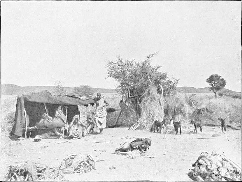
JAALIN SHEPHERD SCENE.
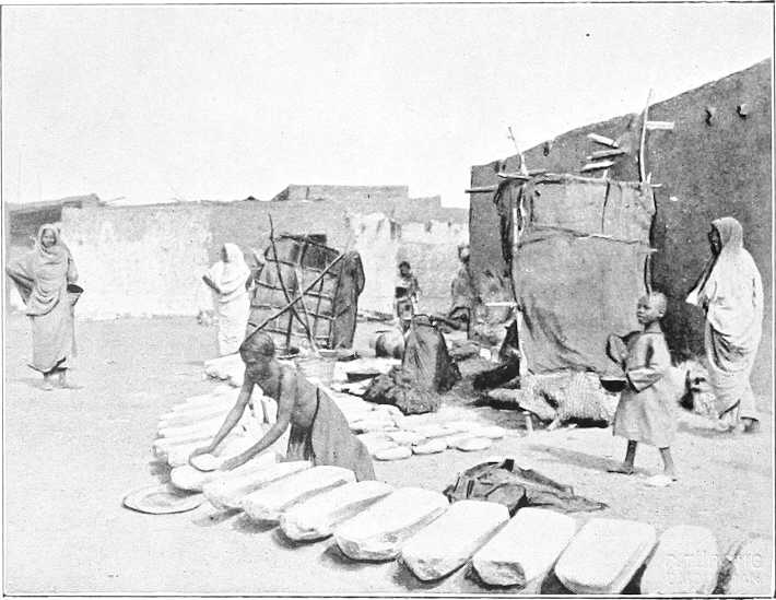
CORN GRINDING STONES, OMDURMAN.
About ½ mile inland a large and deep canal runs parallel to the river. This whole tract is entirely deserted, and, from its appearance, it seems probable that it was thrown out of cultivation prior to the rebellion of 1884. Four miles south of Wad Habashi is the boundary between the provinces of Berber and Khartoum, the limits being marked by the isolated granite hill on the east bank, known by the name of “Hagar El Asal.” From this point, the reefs forming Sixth Cataract.the tail of the Shabluka Cataract begin, and navigation at low water becomes impossible for steamers.[29] Although the actual cataract, or rapid, is only some 12 miles in length, the bad water, above and below the pass, extends for a length of some 55 miles, i.e., to Wad Ramla, or to within 35 miles of Khartoum.
In summer, i.e., if the railway is not used, this portion of the journey has either to be made in native boats, or by camel portage round the cataract. The land route is shorter than that by the river, being not more than 26 miles in length.
Wad Hamed.Five miles above Wad Habashi the former cavalry station of Wad Hamed is passed on the west bank. This place was selected as the headquarters of the Egyptian cavalry on account of the good fodder to be found in the vicinity. From here the difficulties of navigation increase; the river is split into numerous channels, and winds between picturesque islands, covered with a luxuriant growth of vegetation. Rocks and reefs appear above the water, and the swirls and eddies indicate the existence of many more below the surface. It was in this part of the rapid, on Mernat Island, that the “Bordein” steamer went aground on returning from Khartoum in 1885. Low serrated granite ridges confine the river on either side.
At the entrance of the Shabluka gorge, the channel takes a very sharp turn to the east, and the section is both deep and narrow—not being more than 200 yards in width anywhere, and in some places even less than this. The river runs between high granite hills for some 4 or 5 miles, with a very high velocity. The marks upon the rocks show that the highest flood level is not more than 7 feet above the water level of the river in March.
The northern entrance to the pass was guarded by five Dervish forts, now in ruins; four on the western and one on the eastern bank. These completely command the channel. On emerging from this gorge the river widens out, and the difficulties of navigation recommence. Reefs, rocks, and islands appear in all directions; the solitary peaks of Jebel Royan and Jebel Tyem stand out, one on either bank. At some 20 miles up-stream of the pass Wad Ramla is reached; from this point to Khartoum navigation, with care, is possible for steamers, even at lowest Nile. The country on both sides becomes more open, and many large islands are passed, most of which, notably that of Tamaniat, bear fine crops of dura. Large quantities of hay are also grown upon these islands and transported to Omdurman. The land on the east bank is good, and the cultivable strip extends for a considerable width, though covered as usual with scrub and rank grass. On the west bank the desert approaches the river closely.
Omdurman, Khartoum North, and Khartoum.
Omdurman.At 198 miles from the Atbara, the town of Omdurman is reached—the long low ridge of the Kereri hills to the north marking the scene of the battle in 1898. This town covers a large area, being some 5½ miles in length by 1 to 1½ miles in breadth. Its eastern frontage follows the river bank throughout. Two or three broad streets traverse it, but, with these exceptions, the houses are separated one from another by a network of twisting lanes. Some of the principal remaining Dervish houses, notably those of the Khalifa and Yagub, are spacious and well built. Ebony is much used in the roofs, and where the span is great, iron girders are inserted to support the roofing.
The “Beit El Amana,” or Dervish storehouse, covers a large area. Here are the old powder magazines and stores of a most miscellaneous description. The open-air mosque is simply a large inclosure, and within the “Sur,” or great wall, is packed a rabbit-warren of buildings, with narrow and winding streets. The entire town was, during the Dervish occupation, full of old cess-pits; these being merely deep holes sunk in the desert, and open to the air. These pits were probably largely responsible for the disease for which Omdurman attained such an evil reputation (Cerebrospinal meningitis), but which has now practically disappeared. The Mahdi’s tomb and Khalifa’s house, the latter still in good repair, are objects of interest for the tourist (vide pp. 266 and 252 respectively).
The town lies in a direct line 3 miles from Khartoum—but by water another mile, some 40 minutes by steamer. Very many of the houses are now deserted, but the population still numbers some 46,000. It lies on good gravel soil, and comprises, besides the old Dervish buildings above-mentioned, barracks for the garrison, which consists of 2 battalions infantry and 2 maxims. There is a large market (Suk), where a considerable trade in gum and other produce is carried on. On the sloping banks a large boat traffic is at work. Steamers and ferry boats connect the town with Khartoum. It is the residence of the sub-Governor of Khartoum Province who resides in a house built in the late Khalifa’s enclosure.
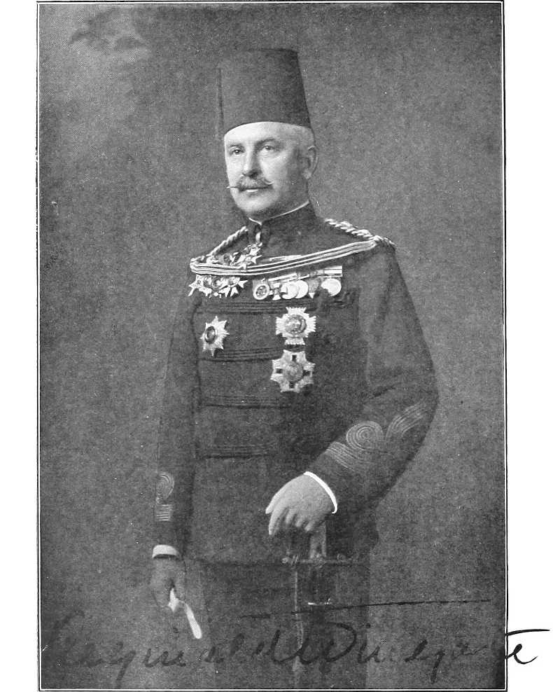
By kind permission of] [W. Crooke, Edinburgh. MAJ.-GEN. SIR REGINALD WINGATE. Governor-General and Sirdar.
Khartoum North (Halfaya).Khartoum North (lately Halfaya) is the terminus of the railway from Halfa, and lies opposite to Khartoum, on the right bank of the Blue Nile. It includes storehouses, workshops, the headquarters and the dockyard of the Steamers and Boats Department, barracks for an Egyptian garrison, consisting of infantry and artillery, Custom-house, etc., etc. Population about 2,000. A steam chain ferry, running every half-hour, connects it with Khartoum.
Khartoum. Principal towns.Khartoum, including the towns of Khartoum North (late Halfaya) and Omdurman, together with a little hinterland (vide App. G.), forms a Province by itself. It is once again the capital of the Sudan and the seat of Government, though Omdurman still is, and Khartoum North will probably become in a few years, the principal trade centre.
Khartoum (meaning elephant’s trunk—with reference to the point of land jutting out between the two Niles) is a rapidly growing town, on the left bank of the Blue Nile, just before it joins the White Nile, and is built on the site of the old town of the same name, which was so gallantly held by Gordon and destroyed by the Dervishes in 1885. Its population is now 8,500 souls, and is gradually increasing. The soil is alluvial; bank of Blue Nile about 30 feet above the river at low Nile. In 1898 the old town was found entirely deserted and in ruins.
The main buildings are the Palace (built in 1899), the seat of the Governor-General; the Government Buildings (including the local War Office and the Offices of the Sudan Government); the Nuzl or Government store, the Post and Telegraph buildings, the Mosque, the Department of Works, the Mudiria (Governor’s office), branches of the National Bank and the Bank of Egypt, the Gordon College, the British barracks (holding one battalion of British troops), houses of the chief officials, and a small town of well-built mud-brick and stone houses (including a market square, landing place, a good European hotel, club, brick kilns, Zoological Gardens, etc., etc.), which is daily increasing in size.
Barracks.At intervals along the line of the old entrenchments from east to west are the barracks occupied by the Egyptian Army which are named after Ismail, Tewfik, and Abbas Pashas.
Outside these lines are villages of mud-built and grass-roofed houses of various Sudanese tribes, whose members are employed mostly in building and in other pursuits. (Vide also Chap. V.)
Higher up the Blue Nile at Buri are the Gordon College and British barracks.
Town, etc.The town is symmetrically laid out with wide avenues planted with shady trees, and the class of buildings erected must be in strict conformity with the standard fixed for each particular quarter.
The public gardens and “Zoo” are situated at the west end of the town; these, especially the latter, have only as yet reached an embryo stage.
Garrison.The normal garrison of Khartoum consists of one battalion of British Infantry, relieved annually in October, and three battalions of Infantry of the Egyptian Army, as well as Cavalry and Artillery. (Vide p. 3.)
Market.The market at Khartoum is poor and more expensive than that at Omdurman, which is much larger and better. Meat is usually PT.3 per oke (2¾ lbs.) and dura varies from PT.25 to PT.90 per ardeb (300 lbs.) according to the season and the year.
Building and fire-wood have to be brought long distances from up the Blue and White Niles, and are consequently both expensive.
Labour is scarce and difficult to obtain owing to the many buildings, etc., at present under construction.
Rainfall.The rainfall is very variable but that of an average year is very slight;[30] rain seldom falls on more than 10 to 15 days in the year, but when it does it is generally in heavy thunderstorms, which occur at intervals from June to October, and are usually preceded by duststorms, very similar to those at Kassala. In some years heavy storms occur as early as May.
Climate.The climate is comparatively good all the year round, though in August, September, and October, and occasionally at other seasons, a certain amount of fever is prevalent.[31] Khartoum is 1,253 feet above the Mediterranean.
The hottest month, according to the monthly average maximum temperatures recorded for 1901, is April (110·66° Fahr.), and the coolest January (88·34° Fahr.). April, May and June are here, as elsewhere, as a rule, throughout the Sudan, usually the three hottest months of the year. Vide also p. 12.
The highest temperature recorded in 1901 was in July (116·6° Fahr.), and the lowest (51·8°) in December.
The wind blows from the north almost continuously from November to April, after which it varies considerably, and finally settles down in May or June to blow pretty consistently from the south until the end of October or beginning of November.
Posts and telegraphs.There is a bi-weekly mail to and from the north, weekly to and from El Obeid, Wad Medani, Goz Abu Guma, and intermediate stations on the White Nile, fortnightly to Kodok, and monthly to stations on the Upper Nile and Bahr El Ghazal.
Telegraphic communication with the following and intermediate stations: Cairo, Dongola, Merowe, Suakin, Massaua viâ Kassala, Gedaref, Gallabat, Roseires, Renk, Kodok, Taufikia and El Obeid. Telegrams to Addis Abbaba can be sent viâ Kassala and Asmara. Vide also p. 219.
Ferries, etc.A Government ferry keeps up communication with Omdurman, and a steamer runs twice daily to and from Omdurman and Khartoum North, calling at Khartoum. There is also, as before mentioned, a steam ferry from Khartoum to Khartoum North and several of the native boat ferries.
The suburbs of these three towns include an additional population of 11,000 souls.
Recapitulatory table of distances by river in section:—
Merowe to Khartoum.
Intermediate. From Merowe.
Miles. Kilometres. Miles. Kilometres.
Merowe 0 0 0 0
Foot of 4th Cataract 9 14 9 14
Head „ „ 77 124 86 138
Abu Hamed 62 100 148 238
El Bagara Rapid 55 88 203 327
Foot of 5th Cataract 24 38 227 364
Head „ „ 2 3 229 367
Berber 30 48 259 416
Mouth of Atbara 20 32 279 447
Shendi 86 138 365 585
Metemma 4 6 369 592
Foot of 6th Cataract 54 87 423 678
Head „ „ 12 19 435 697
Omdurman 41 66 476 764
Khartoum junction of Niles 3 5 479 771
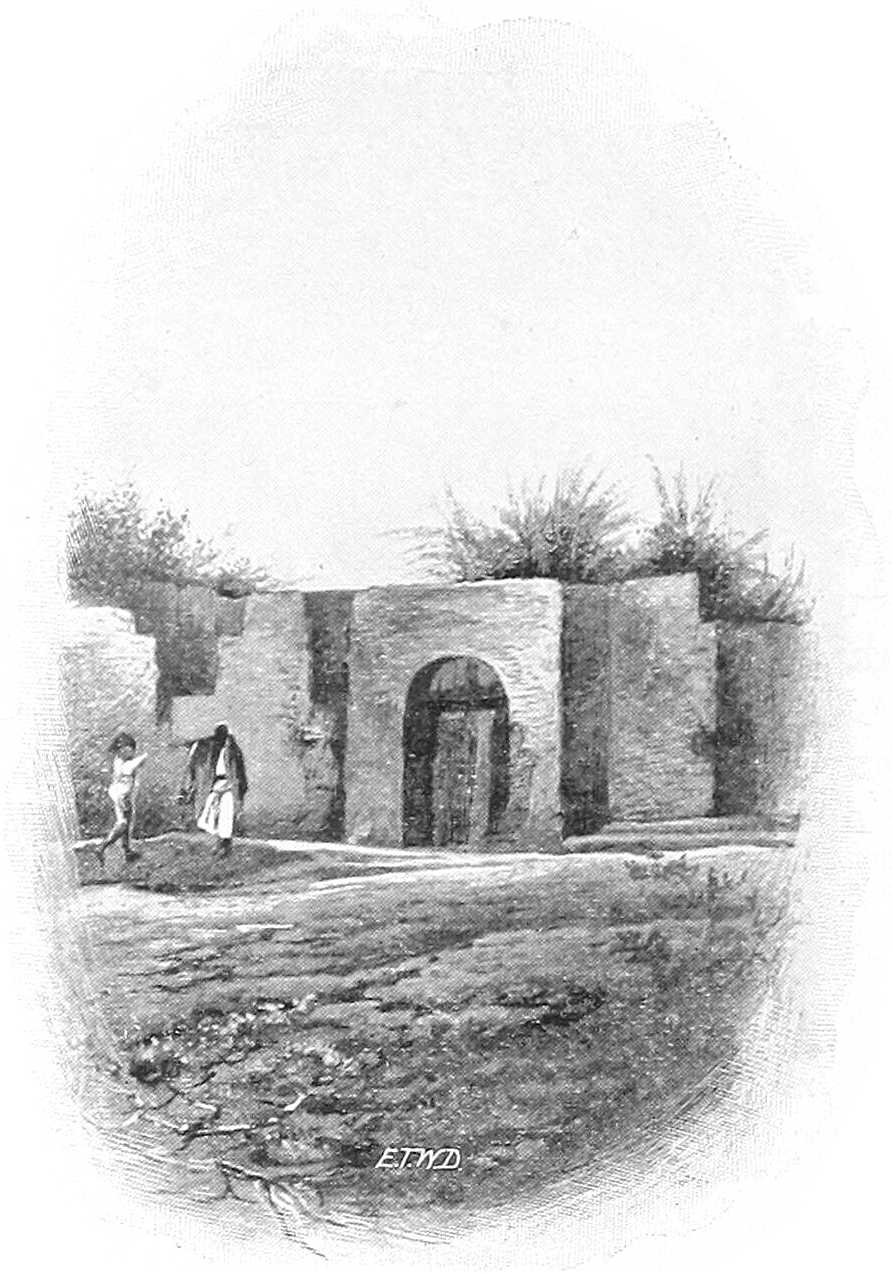
INSIDE OF OLD PALACE, KHARTOUM.
By kind permission of] [M. Venieris. KHARTOUM: LOOKING NORTH FROM THE WAR OFFICE ROOF OVER TUTI ISLAND.
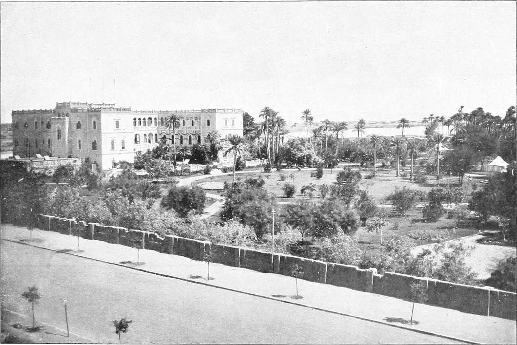
By kind permission of] [M. Venieris. THE PALACE AND GARDEN, KHARTOUM, FROM THE SOUTH-WEST.
Section (3).—Khartoum to Lake No.
Place. Miles. Kilometres. Left Bank. River and General. Right Bank.
Inter-mediate. From Omdurman.
Omdurman On the W. bank, after getting clear of the houses of Omdurman, a hard, sandy track is followed skirting the edge of the cultivation In the first 15 miles up stream of Khartoum the country on either side is low, flat, and treeless; cultivation is carried out on the mud flats, and on the islands, which appear as the water falls. The water channel is fully 2 miles wide in this reach. It is very shallow, and landing is almost impossible on account of the shelving banks. On these last, as the water falls, a crop of grass springs up, which affords grazing to large flocks of cattle and sheep. Further up stream the channel gets narrower, but it is still over a mile in width. Both banks are low and fringed with thin and low thorny jungle, and except for the isolated hills of Jebel Auli and Jebel Gurun the country is a dead flat. On leaving Omdurman the water channel at once opens out, at high Nile, to 2 or 3 miles, course for steamer close to R. bank
Left bank low, sandy, some scrub, and further on mimosa woods extending to river Right bank; several villages, low, sandy, or swampy bank.
Kalakla 8 8 Road from Khartoum passes through village Kalakla in large clump of trees and then continues on open desert sand about 2 miles from river; very good going.
Sheikh Salim 3 11 Sheikh Salim or Wad Um Meriam.
Village with high tomb in it. Road about 2 miles from river. After this it enters some low sandhills with large clump of trees on river side about ½ mile off. The first open scrub begins, which thickens as it approaches the river.
Gemmueiya district 6 17 Gemmueiya district.—A long, straggling village of that name and tribe; track passes on desert side of it some 3 miles from river; bank of river difficult of access for watering owing to mud; some bush and trees; low volcanic range to W. Well passed on right just before reaching village 30 feet deep, 7 feet diameter water good. A small tukl village just E. of hill and same name. Track as before.
Um Arda 3 20 Scrub gets thicker on R. bank.
Low flat island. About 9 miles long, trees S. end. Island banks inhabited by Jaalin and Hassania.
Haneik 7 27 S. end of El Arda island.
Jebel Auli 1 28 45 Track unchanged, sparse bush on either flank; good camping ground (at low Nile) and watering place Road runs round E. of Jebel Auli, a steep bare volcanic rock about 100 feet high. Good camping ground for a brigade or less under the mountain. Another track leads S.E. from here.
Gar El Nabi 2 30 Road runs ½ to ¾ mile from river through open bush to Gar El Nabi; village mostly destroyed.
Jebel Mandara 2 32 Jebel Mendera or Mandara. Well defined table hill 2 miles from L. bank, road passes spur of it. Bank swampy Bank sandy.
Wad El Kereil 2 34 Village to west of track Water channel 3 miles broad at high Nile; keep to right bank Road crossed by small khors and in places by cultivation in zeribas. River invisible from it.
Mohammedia 1 35 Many small islands Village; also called Wad El Kereil.
Jebel Barima or Breima (Wad Belal) 5 40 Low hill. Watering place 1½ miles from track. Latter crosses khors at intervals along route; good, some bush and trees, and sand dunes Sand and swamp alternate on both banks with trees growing into the water. Rocks appear at low Nile to W. of channel just before reaching the Jebel Road runs through sand hills ½ mile from river and then closes to river at Wad Belal; good watering place and wood station for steamers.
Abu Hagar 12 52 82 Dense scrub just before reaching El Hagar or Abu Hagar. Good camping ground ¼ mile to W. in desert. Watering place somewhat difficult of access at river; pools near desert after high Nile. For 2 miles track continues good, then becomes a single camel track, necessitating marching in file through very thick bush. The track to Homra (80 miles) and El Obeid gradually branches off S.W. from the river track Water channel 1¾ miles.
El Geteina 3 55 88 Large village divided into 2 parts, clean, good market, some “Shaduf” cultivation. Headquarters of the Geteina district. P.T.O. Country flat; Danagla Arabs. Road runs through village here about 200 yards from river. Good going, chiefly through sand dunes and scattered bush.
Salahia 4 59 El Salahia district. Swamp or cracked mud near river bank. Much dura in Wadi Sadik South of this thick thorn bush commences. From here to El Dueim (66 miles) the same scenery continues. Cultivation is limited to the islands and foreshores. As the water falls, large mud flats in the centre of the river appear. To these the people transfer their cattle and belongings, build “tukls” and set up shadufs. The soil on these flats is good, and rich crops are produced. As the majority of these islands are not exposed before the month of February, artificial irrigation for the crops is necessary. These quickly ripen under the hot sun, and are, as a rule, harvested in May. The river varies in width from 700 to 2,000 yards. The west bank throughout this reach is fringed with acacias, and, at high Nile, is flooded for a long distance as the left bank is very low and shelving E. bank open, high, and sandy. Sand hills come down to the water’s edge.
Dazira and El Debeiker 4 63 Old salt works, a mile E. of track.
El Alaga 7 70 Good camping ground and watering place. For 3 miles track leads through dura cultivation, then good road near river bank El Alaga district both banks.
El Gerazi or Garrasa 6 76 Water channel 2 to 3 miles broad for next 40 miles. Vast quantities of water birds of all sorts inhabit the Nile almost from Khartoum upwards, and large numbers of crocodiles are visible, one or more on nearly every mud bank Low sand hills with Danagla village of Gerazi to S. of them. People poor, no market. Good meshra. Road runs from here through 3 or 4 miles of dura land ½ to ¼ mile from river, then along sand hills near river to Wad Shalai.
Wad Shalai 6 82 132 Village of conical thatched houses; banks become drier; series of villages from here along right bank at 2 to 5 miles interval. Road runs for about 3½ miles through sand dunes close to river, then gradually leaves river, and passes through dura ground about 1½ miles from it.
Wad Nimr 2 84 A long straggling village and name of the district. Good watering place 5 miles S., the desert road joins the river road. Track runs some way from the river skirting the edge of the cultivation.
Wad El Zaki 5 89 Large village on top of some sand hills, pop. 400 to 500. From here 3 miles takes one to a few houses about 2 miles from the river on some sand hills called Sayif, one of three villages of that name. Road goes on over cotton soil for 4 miles, then crosses sand hill ridge for about 1 mile and descends to a plain close to river where another village, also called Sayif, is seen 2 miles inland.
El Rahawat 1 90 On left bank nearly opposite Wad El Zaki is El Rahawat watering place, good camping ground. Leaving this village the track on desert side of the cultivation should be followed. Three miles on sand dunes are passed on R., and behind them is the canal, some 20 miles long, 500 yards broad and 6 feet deep. (Feb’y.) Commencement of Tura El Khadra (Green Canal) district.
Sayif 5 95 Good meshra and ferry to other bank; good building and cultivation. The road from here to Dabasi Meshra is over cotton soil with low scrub on river side.
Tura El Suk and Zif 5 100 Four miles from river Zif village. Hashaba a mile to the E.
Dabasi Meshra, or Dobasi 6 106 Khalifa had big grain depôt here, ruins of which can still be seen. Ferry. Road runs through sand hills ½ mile from river to Dabasi.
Dabasi 1½ 107½ 173 Telegraph line to El Obeid branches off here from Dueim line at Minedrib Fair-sized village, 400 to 500 inhabitants on road. From Dabasi to Shabasha road remains close to bank, thence for next 10 miles 1 to 1½ miles distant.
Amara and Jebel Arashkol 1½ 109 175 About 10 miles west of left bank is the high rugged mass of Jebel Arashkol, with several distinct peaks. Volcanic. Chief peak named J. Abd el Daim Island Manir Long, flat, well-wooded island opposite Amara. Amara village (or Um Arda).
Shabasha 3 112 Good camping ground and excellent watering place. Village under spur from main mass of Jebel Arashkol. Track continues through cultivation. Good going A ferry connects Shabasha El Gharb with Shabasha El Sharg (on the east of the river).
Ghobeisha 9 121 The road closes to river at Meshra. Ghobeisha village. Good place for camp and watering. Road crosses open plain with high grass; cotton soil; probably under water at high Nile (?)
El Dueim 4 125 201 Town of fluctuating population of about 7,000 inhabitants; disembarking place for El Obeid. Head Quarters of the White Nile Province and residence of the Governor. El Dueim is developing into an important trade centre; large market; principal mart for export Kordofan gum. Substantial Government offices. Starting point of Sudan transport service for El Obeid. The plain all round is open and the locality is fairly healthy. Up-stream from El Dueim some fine strips of cultivation occur along the foreshore. Behind this belt grows a fringe of acacias, and beyond lies a rolling steppe. Action here 23.8.83; small Egyptian garrison repulsed Mahdists. Channel narrows to 1 mile or less Road opposite Dueim leads to Maatuk, Managil, and Wad Medani.
The east bank is covered with low bush and a little cultivation. Track leads N.E. (20 miles) to Maatuk.
Hassania Island (N. end) 5 130 Island (sometimes under water) Half a mile on Meshra Ghayafa. Good camping ground and watering place; sandhill near Meshra. Sand fairly thick; cotton soil.
Denegila 5 135 Village west of road opposite island of same name, chief village of which is Mahbale. 1½ miles further is village of Abu Gurun, north of road where it crosses track to Um Saneita. Dura crops in this district.
Um Gar 3 138 Um Gar village. Good watering place and camping ground. Track leads 5 miles to opposite Kawa, through bush and trees Um Gar Island.
Meshra El Hella 5 143 Small floating pieces of sudd begin to appear Thick bush close to river to Meshra El Hella. Road runs close to river to Kawa.
Kawa 3 146 236 Wad Abu Rul, opposite Kawa. Thick bush and trees on banks. Gum depôt belonging to Kordofan province. Large village, 500 inhabitants. Residence of British Inspector and Mamur. Wooding station for steamers. Post and Telegraph Office. Road hence to Sennar. Kawa is built on high land and bush is open all round it. Inhabitants mixture Jaalin, Hassania, and Danagla. The houses are mostly round with thatched conical roofs. Large market, neat Government offices. Boat building has been started; ferry. Track from here northwards (31 miles) to Ma’atuk.
Lakadawia — — Wooded island close by, with north end opposite, Kawa; about 4 miles long; richly cultivated with a variety of crops, comprising wheat, barley, onions, lubia, bamia, and dukhn. Above this the forest belt covers both banks of the river, and is often flooded for a great distance on either side
The road runs ½ mile from river through dura cultivation, and then over grassy plains past villages of Abu Hindi and Fum Omer to Shaggara.
Meshra Shaggara, Kenuz 8 154 Meshra and village close to river, thence past Kenuz with island opposite. The road runs ¼ to ½ mile from river. Hassan Allob on banks with village called Dabus opposite, still through dura country to Nur El Daim.
Hassan Alob and Dabus 2 156 Village.
Nur El Daeim 3 159 Large village and police station; 1 mile distant from river.
Khor Gusab (?) 1 160 Watering place. Road now leads through dense bush; river unapproachable till Um Turan.
Sheikh’s Tomb 2 162 Tomb of Sheikh Nur El Taib; three large trees, ruined mud and brick buildings and some flags mark it. Road bends due south to Shawal.
Shawal, Abu Lahm, and Aba Island (N. end) 1 163 262 Abu Lahm at point of curve North end of Aba Island. Take western channel. Island cultivated in places, some 27 miles in length, belt of trees along river’s edge, but interior only thinly wooded. Higher at south than at north end. Inhabited by a few Shilluks. From this point the character of both banks changes. The sand dunes seen lower down the river have been gradually disappearing, and black cotton soil now comes down to the water’s edge, which is fringed at low Nile by reeds, and by bunches of sudd which have floated down from the Bahr El Jebel. Beyond the fringe of are what are at high Nile grassy swamps, but at low Nile are dry and excellent grazing grounds. Behind this swampy ground is a belt of fine sant and other acacias. From here to Jebelein at low Nile thousands of sheep and goats and herds of cattle are seen grazing on either bank. These belong to the tribes living inland, where at this time of year water and grazing is scarce. Village right. Three conspicuous single hills (Jebel Tuema?) about 20 miles south-east and a fourth peaked hill rather south of these (Jebel Buyut?). Country on right open bush, slightly undulating, good sandy watering places on river.
Um Turan (?) 2 165 Watering place. Road improves; good going along bank till Fachi Shoya.
Malaha 1 166 Meshra Malaha and village Malaha; salt works. Road enters scrub; bush country to Marabia.
Marabia 8 174 Action 29.4.83; Hicks Pasha defeated Dervishes. Good camping place on high ground, where there are ruins of an old fort and brick buildings. Road leaves river, crosses a grassy plain, probably under water at high Nile, past village Torba (186) east of road, and turns towards river.
Mahdi’s Place 1 175 Large tree on river bank; ruins of mud houses.
Fachi Shoya 1 176 283 Starting point for Sherkeila and South Kordofan. Country open. Good camping and watering place. Village deserted. Base of two expeditions in 1899. The banks on both sides now begin to be fringed with reeds, the strip extending gradually in width from a few yards to 400 or 500 yards. Behind this are fine sant trees, etc.
Hesai Island 2 178 Thick trees and bush, up to 1½ miles in width, commence Between Aba Island and right bank. Mangara village on Aba Island.
El Alob 7 185 Village; track leads S.W. to Gedid (33 miles).
Zeinuba and Aba Island (S. end) 6 191 El Khema district both banks. Shilluk village at south end of Aba Island. “Manjera” (boat yard) of Zeinuba under clump of large trees.
Goz Abu Guma and Wurelat Island 1 192 309 Track leads S.W. (32 miles) to Gedid Wurelat Island, opposite Goz Abu Guma. Large grass islands make their appearance in the river (January). The eastern channel opposite Goz Abu Guma is shallow, and dries up at low Nile, when a landing has to be effected either 2 miles above the town or on the west bank of the island opposite the town. Headquarters of district of that name. Telegraph and Post Office. The telegraph line from Sennar (Blue Nile) across the Gezira reaches the White Nile here and continues southwards. East bank heavy grass with a few acacias. The east channel here is some 500 yards wide. The north and south road runs ½ to 1 mile from river. Line of villages on high ground 4½ miles from river. Good grazing; 400 inhabitants; Tukls. Little trade. Greek merchants have collecting station during the gum season on the left bank, which belongs to Kordofan.
Gum collecting station on L.B.
El Khema 7 199 Road joins river at El Khema Police Post. Many birds and monkeys.
Abbassia Gedida (Black Colony) 1 200 322 Colony of old Sudanese soldiers. East bank reed strip thinner than west.
Abu Zeid 8 208 333 Abu Zeid village. Bank continues fringed by several hundred yards of reeds. Baggara Selim country begins; sparsely inhabited, with thick bush and trees behind. Good game country begins Passage only practicable at low water. The Abu Zeid ford is a most serious obstacle to navigation. At this point, for a length of some 4 miles, the river spreads out in a broad and extremely shallow sheet, at low Nile about 1,200 yards in width. Upon the bed, masses of what are called “fresh-water oysters” collect. The broken shells form, with a shingle, a kind of “conglomerate,” almost as hard as rock, and which nothing but a specially adapted dredger could remove. In March and April, in very low years, the depth of water here is in places not more than 1 foot 5 inches to 1 foot 8 inches. The forest is very thick on both shores, and on the west a wide belt of swamp and grass renders landing very difficult. The papyrus reed is first seen at this place, and occasional ambach. Floating patches of sudd are met with in the channel, as well as many permanent large grass islands, the largest being those of Nuago and Musran. Hippopotami begin to appear in considerable numbers Police Post, east bank. Scattered trees and bush, 1 to 1½ miles in width, commence again.
Masran Island (N. end) 1 209 North end of island. East channel often much blocked with sudd; only a narrow passage of 50 yards being visible at times. Island thickly wooded Road keeps close to river bank.
Danko Shush 4 213 Shilluk village.
Azalet Rocks 9 221 Rocks across main western channel. Dangerous at low Nile.
Danko Selim 6 227 Shilluk village on Masran Island. Rocks in middle of stream; dangerous to navigation, especially at night. Here the reef runs right across the river channel, and the only method of passing safely at low water is to steer a course like the letter S. Many of the rocks are below the water surface, and their presence is only indicated by the ripples which they cause.
Meshra Zubeid 4 231 Meshra to Masran Island. Hence road winds through thick scrub, with patches of open country, to the ford at Jebelein.
Masran Island (S. end) 5 236 Shilluk village at southern point. Careful navigation necessary
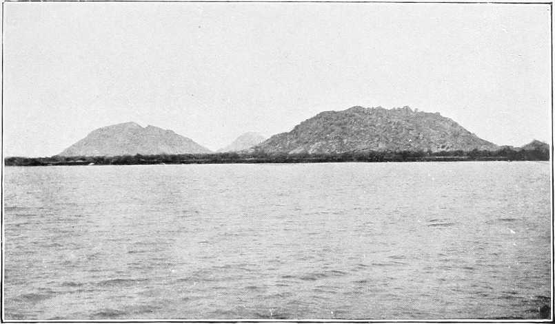
Jebelein 2 238 383 Two roads lead north-westwards from opposite Jebelein to Gedid, etc. Baggara Selim live on left bank River about 500 yards wide; rocks showing in places. Up-stream of Jebelein, for many miles, the country is most dreary and monotonous. A fringe of forest on either bank marks the higher land. Between this the river winds through reedy islands, masses of swamp grass and floating weed. A series of islands now begins. Dinka country right. The boundary between the White Nile and Upper Nile Provinces belonging itself to the Upper Nile (Kodok) Province. Jebelein is easily recognisable by the five peculiarly-shaped granite peaks which rise abruptly from the plain on the eastern shore. The highest of these peaks is perhaps 600 feet. The nearest is 1 mile from the river, and the farthest 3 miles. They form an amphitheatre of rocky hills; two distinct masses, with a third hill to the east of the northern mass. Grassy plain between north and south ridges. Village on east of south ridge. The forest on the east bank is about a quarter of a mile in width, and extremely thick. Behind it stretches an endless expanse of prickly grass, some 3 feet high, interspersed with clumps of mimosas. Lions and Tiang fairly plentiful. The soil is light and friable, and much of it must be flooded during the rainy season. One or two ravines serve as drains to this area. The ruins of Ahmed Fedil’s “Deim” are still visible here. This tract once formed part of the Dinka country, but is now quite uninhabited, most of the Dinkas having migrated to the south to escape the raids of the slave-traders. At this point the “serut” fly makes its first appearance, and remains an unwelcome guest throughout the journey to Kodok. This brown fly, which is about the size of a small wasp, has a sharp stab, and if allowed to settle speedily draws blood. Not poisonous. Road 200 to 400 yards from river. Massacre of Egyptian troops by Mahdists in 1882.
(Illustrations)
Meshra Sherif 3 241 Meshra and camping ground good; name applies to country for next 2 miles. Road runs through thickish thorn jungle; path good.
Bulli Island 6 247 North end of Bulli Island. Western channel 100 yards broad; eastern one bad. Narrow island 100 to 200 yards wide, covered with grass and rushes Path keeps close to east channel, which is nearly dry in April and May.
Debba[33] El Goda 12 259 Western channel bad Sheikh’s tomb. Large range of hills west. Pointed peak about 30 miles east. Perhaps Abu Gurud (?).
Gamus 17 276 South end of Bulli Island. Western channel about 80 yards broad.
Karshawal 2 278 Small Selim village, with old camp inland 2 miles to south-east. Selim and Dinka Meshra.
Agang 18 296 Selim and Dinka villages about 3 miles inland.
Renk 2 298 479 Thick forest on both banks. From Renk to Ahmed Agha there is no change in the monotony of the scenery. The west bank is very flat and low, and the east bank is covered with thorn jungle, plenty of trees and heavy grass Road closes to river. Headquarters of Renk District. Government offices and residence of British Inspector. Good sandy meshra, open ground for camping large force. Telegraph and Post Office. Inhabitants, Dinkas and Selim Arabs, who own sheep, goats, and the former cattle. Thick forest. Mosquitoes very troublesome here after sunset. Action here 15.9.98. Dervish “deim” bombarded and taken, and a steamer captured. Track to Gule and Roseires branches off here (vide Vol. 2).
Khor Deleib 2 300 The river is fringed with a belt of reeds on either bank, varying from 10 to 200 yards broad. Thick forest both sides. Much bird life. There is a ford across both channels here (Ahmed Fedil crossed in 1898), but it is rarely practicable except at low Nile, and not always even then. Northern end of Wad Dakona Island; take western channel. A few Shilluk villages on this island formed by White Nile and Khor Gaza El Abiad. This khor at high Nile is probably 300 to 600 yards wide, but at low Nile nowhere more than 300 yards; fordable nearly everywhere. Many wildfowl on it Road leads south-east to Khor Deleib and runs along an eastern branch of the Nile named Gaza El Abiad. Village of Sheikh Bakhit Niok (released slave from Cairo). South of here people mostly Selim Baggara, living in temporary encampments: about 1 mile inland for grazing.
Warrit, or Loingwin, and Dabba Dungit 10 310
Um Hedeida 10 320 Khor decreases till at Um Hedeida water stagnant and in small quantity (February). Elephants drink here regularly, but only at night. They pass the day about 20 miles inland in a forest of dense kittr bush which the Arabs call their “beit” or house. Track follows eastern bank of khor. Country covered with 3 feet high grass where not burnt. Scattered bush “Heglig” and “Hashab”; no cultivation.
Water reappears in khor. Selim encampments east of track.
Leungtom (D), or Domaia (or El Wat (A)) 6 326 South of Wad Dakona Island Meshra. Road approaches Nile for first time since Renk. About 1½ miles inland are villages of Kolang El Wat under Sheikh Salem Banga (also released slave from Cairo). Country fairly open. Track follows east bank of a khor. On west of track is a fringe of thick “talh.” To the east country is fairly open.
Debba El Zawia or Zawa 5 331 Dom Palms on left bank as well as on right Two islands, western channel 80 yards; shallow at low Nile Commencement of Nabagaia District. Island. Swamp grass and trees. First “dom” palms are met here.
Anok 4 335 Village of Agweim Dinkas passed about ¾ mile to east on slight elevation. Thick “talh” bush on either side of track. Village depends on river for water.
Tereiba or Allal (D) district commences.
Debba Ibrahim Sharak 9 344 Shade and good water in khor. Good midday camping ground. Jebel Ahmed Agha visible. From here on bush unpleasantly thick. Elephants and much game.
El Ragal (A) 1 345 Track branches off east to Dinka village or district of Kash Kash (10 to 20 miles from river?). Bush ceases to annoy. Elephants drink here.
Senagul (D) 4 349
Debba Abu Teiba 1 350 Two main khors, Sangeir (or Ran (D)) and Mesangeir (or Balantega (D)), from the Abyssinian hills near Kirin (?), join the river here. Difficult to cross July to November.
Meshra Meteima (Selim) 2 352 Meshra on left bank.
Jebel Ahmed Agha (or Biba (D)) 1 353 568 Western channel best; 70 yards. Matmar district commences; then Mohadan Zeraf A solitary hill, 250 feet high and 250 yards from east to west along its crest; great landmark; volcanic; a few small trees to summit; stands 2 miles from the bank. From its summit is seen a vast tract of trees and grass broken by khors and swamps. J. Ulu and Gerauit visible 60-70 miles to the east. No break in the level. Much game. Several Dinka and Selim villages in neighbourhood, but in rains the Dinkas retire inland, and the Arabs to districts north of fly limit. Dinka Sheikh Jok. Many “dom” palms around the Jebel. Water is obtainable from Khor Biba. It is 1 mile east of river, which here bends south-west. About 22 miles south-south-east of the Jebel, on the Khor Mesangeir, lies the village of Akorwen in a large grassy plain. There is a track up K. Rau to Awitong and several other Dinka rain villages. Thence track goes to J. Ulu and Gerauit, thence to Kirin or J. Jerok.
Edor Gamoia. 4 357 Much game: buffalo, etc. Shilluk village on north end of Gezira Wad Beiker Opposite this island, for about 6 miles, extends the district of Heglig or Tau.
Gamus 6 363 Shilluk village on the island. The sheikh, after whom the village is named, is a refugee from Cairo.
Dabba Marbeit or Shakab 1 364 Opposite south end of Wad Beiker. A grand game country.
Kwe 2 366 A Dinka Farik.
Alumbal 1 367 Sheikh Ajak’s village. Country round is fairly open, scattered “kittr” and “naal” grass. Both these villages are under Sheikh Salem Banga of El Wat. Track south-east to Akorwen, 22 miles.
(Illustrations)
Meshra Zeraf 1 368 Meshra on left bank also The meshra extends for about 2 miles, the road skirts the river and crosses a wide shallow khor called a “farlegh” or “rigl” by the Arabs. It is said to come from near Aturuk.
Rom or Um Gursan 4 372 Dinka village named Rom, under Sheikh Jok. The district for the next 8 miles is known by the Arabs as Um Gursan. The track from Renk to here is, as a rule, excellent, but from here to Kaka bad; passing over hard-baked, badly cracked cotton soil. Splendid game district on both banks.
Ardeib El Miriam 6 378 Ardeib El Miriam district on west bank District of Tereiti begins.
Meshra Rom or Tereiti 2 380 Telegraph line passes here. Ageir district.
Fil and Ajak Kwa El Mango. 3 383 Ageir Dinka villages. Track about 1 mile from river. Country open with patches of bush here and there. Track goes further from river; at knoll called Debba Shagerab road bends westwards and crosses a marshy (in rains) plain to Debeik, Sheikh Akol’s village, about 1 mile from river opposite Kaka.
Kaka and Debeik 11 391 634 Kaka is one of a collection of Shilluk villages spread along several miles on the left bank, 400 yards from the river. From this point southward, the villages on the western bank of the river are continuous. They cluster along the ridge and behind the forest. In front of them extends a broad belt of swamp, mostly dry at low Nile, varying in width from a few hundred yards to over a mile. Landing at any point along this reach is impossible except at low Nile. The marsh is very deep, and covered with thick grass and reeds, through which nothing but hippopotami can force their way Many grass islands block the river channel, which averages from 300 to 400 yards in width. Near Kodok these grass islands occur in constant succession, and on the west bank a double line of Shilluk villages is to be seen—the one on the edge of the swamp, and the other further inland. Landing can only occasionally be effected on either bank of the river On the eastern bank the swamp is perhaps 500 yards wide behind it the eternal belt of forest. Outside of this again stretches an endless plain of high grass dotted with clumps of trees. This side of the river is quite uninhabited, except by a few Shilluks who cross the river for the purpose of hunting or fishing. Occasional big khors run into the Nile on the eastern bank. These depressions run for many miles inland, and their banks are covered with a thick growth of thorny trees.
Ajok 8 397 Skirting an open marshy (in rains) plain on right and following line of trees on left Ajok (Dinka village) is reached. Tracks now become numerous and ill-defined; the one followed led across an open marshy (in rains) plain to the Nile, 2 miles north of Kaka Wood station.
Kurwa district 5 402 Road starts from here to Fungor (Mek Bosh-Nubawi) (41), and J. Gedir (71 miles). No landing place.
Kaka Old Wood Station (1902) 2 404 The river now curves to the west and then to the east Known as Hellet El Nyam-Nyam, close to river bank; wood station. Much game here—waterbuck, lion, cobus leucotis, &c.
El Gerab 7 411 Village. Marshy banks; a few trees The country in the bend the river forms is called Gerab El Aish (bread-bag?).
Melut 2 413 Telegraph station, Government buildings, and residence of police officer. Line crosses river to west bank. Track leads from here to Kirin, on the Abyssinian frontier.
Demtemma 3 416 Shilluk village left. Sheikhs Kodak and Tak Demtemma. Small village 700 yards from bank. Headquarters of district officer.
Sheikh Delal 2 418 Unapproachable by steamers at high Nile; a string of villages now extends, 1 to 2 miles inland, along the west bank for many miles. Sheikh Lowir (D) village two hours inland east.
Sheikh Nyekeia 31 449 His villages extend for the next 10 miles. Floating islands frequent. Western channel 200 yards Dinka villages right bank; but not so numerous as Shilluks on left bank.
Kodok[34] 10 669 459 738 Up narrow backwater on left bank. Position 9° 53′ longitude, 32° 8′ latitude. Height, according to Austin, 1,360 feet. Date palms. At low Nile a steamer cannot get up the backwater, and has to discharge on the east bank of the peninsula forming the backwater. The latter has then to be crossed in boats. Headquarters of the Province. Telegraph station and post office. Government buildings, brick stores, zinc roofed. Native village 600 yards to west, with a few shops, where small requirements, such as sardines, cigarettes, etc., can be purchased. Trade goods popular in these parts can be procured here. Garrison of two companies. Marchand’s garden, etc., kept up. His expedition arrived here June, 1898; attacked twice by Dervishes. Anglo- Egyptian expedition arrived 10.9.98. French evacuated December, 1898. Was in the old days a considerable trading station. Climate unhealthy July to October. Millions of mosquitos. Country on each bank open grassy plain, with bunches of big trees, resembling a park A track leads south from opposite Kodok to Uryong on the Sobat, about 40 miles. Three wells at Dunjol, 13 miles south. Open grassy country most of the way, up to within 7 miles of Uryong, when thick thorn bush continues to the river.
Scattered Dinka villages at intervals.
Lul 18 477 Austrian Roman Catholic Mission Station. Flourishing garden on bank. Station 600 yards inland. Staff of about five fathers and three sisters.
Taufikia 34 511 822 Station second in importance in U.N. Province. Headquarters of a Sudanese battalion; 300 inhabitants; Mamur; deleib and dom palms, also acacias; Old Government post under Ismail. Sir S. Baker’s headquarters in 1865, etc.; “Baker’s Tree” still remains. Fairly healthy site, but little trade. Country in rear marshy, but never flooded. White ants bad. Good landing place. Proposed site for a dockyard (1904).
Sobat River [The river between the Sobat mouth and Lake No has not yet been accurately surveyed. The figures given in this portion must, therefore, be accepted with caution.] 5 516 830 Village left opposite junction. Sheikh Luong River channel bends gradually due west. Average breadth at Low Nile 150 to 300 yards. Numerous islands and backwaters in places Mouth of River Sobat or Bahr El Asfar. Yellow river, 80 to 150 yards wide; well defined banks; current of cream-coloured water three miles per hour. Almost at the junction, on the left bank of the Sobat, is the (deserted) fort built in 1898. This point was reached from Abyssinia by Colonel Artomonoff and Messrs. Faivre and Potter ten days before the Marchand mission passed (vide p. 141). Seven miles up the Sobat on its north bank, and six miles across southwards from Taufikia, is the American Protestant Mission Station of Tatûg or Deleib (amid a grove of deleib palms “tuga”). Flourishing. Shilluk neighbourhood.
Finidawi — — The left bank is still studded with a chain of Shilluk villages standing about a mile from the river. The intervening space is covered with long grass, but open in places, with stunted solitary trees. Much game.
(Illustrations)
Khor Attar 1 517 Wooding station; good landing place; swampy inland. Khor running in from due south. Trees and grass, ambach, &c.
Tonga 4 521 East end of Tonga Island begins. Very low; annually covered by the flood. Width from one to two and a-half miles. At low Nile the channel separating it from the mainland is dry at the western end. The eastern part of this channel is termed the River Lolle or Fanakama. At its eastern end it is 80 yards broad and about three feet deep (in April); it is doubtful whether it is a river at all; but it has been reported to come from the Nuba hills. It was explored by Marno in 1880 for about 32 miles, and by Colonel Sparkes in 1899 for about 28 miles (stopped by sudd). A branch from the Lolle forms the western part of the channel referred to.
Gabt El Megahid 5 526 Formerly a base camp for sudd cutting parties.
Shakwa El Shilkawi 5 531 Shilluk villages—group.
Bahr El Zeraf 16 547 880 Western end of Tonga Island Mouth of the Bahr El Zeraf; 38 yards broad; little or no current; 19 feet deep (low Nile).
Maya Signora 53 600 A large lagoon (explored by M’lle. Tinné (Dutch) in 1863), over 500 yards wide, extending for some distance alongside the river. Likely place for sudd to collect. Connects with Bahr El Jebel, 13 miles up stream of Lake No.
Lake No 12 612 985 Entrance to Lake No. Mouth of the Bahr El Jebel. For description of Lake No vide p. 165.
RECAPITULATORY TABLE OF DISTANCES.
Intermediate. From Omdurman.
Miles. Kilometres. Miles. Kilometres.
J. Auli 28 45 28 45
Geteina 55 88 55 88
J. Arashkol 54 86 109 175
Dueim 16 26 125 201
Aba Island 38 61 163 262
Fachi Shoya 13 21 176 283
Goz Abu Guma 16 26 192 309
Abu Zeid 16 26 208 333
Jebelein 30 48 238 383
Renk 60 96 298 479
J. Ahmed Agha 55 89 353 568
Kaka 41 66 394 634
Demtemma 22 35 416 669
Kodok 43 69 459 738
Taufikia 52 84 511 822
Sobat River 5 8 516 830
Bahr El Zeraf 31 50 547 880
Lake No 65 105 612 985
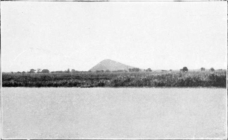
JEBELEIN.
WOODING STATION NEAR GOZ ABU GUMA.
JEBEL AHMED AGHA.
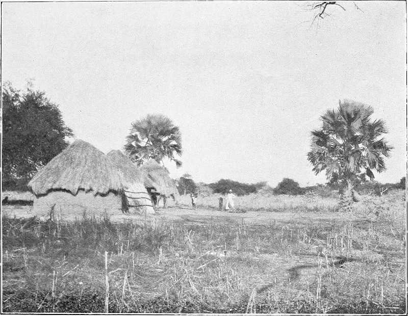
AKUNERE, SHILLUK VILLAGE.
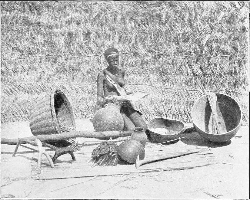
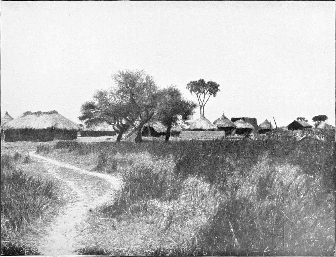
SHILLUK MAIDEN WITH HOUSEHOLD UTENSILS.
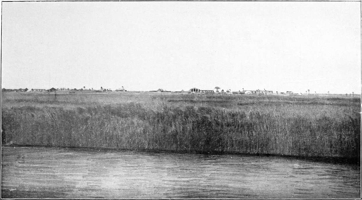
KODOK.
ROMAN CATHOLIC MISSION STATION, LUL.
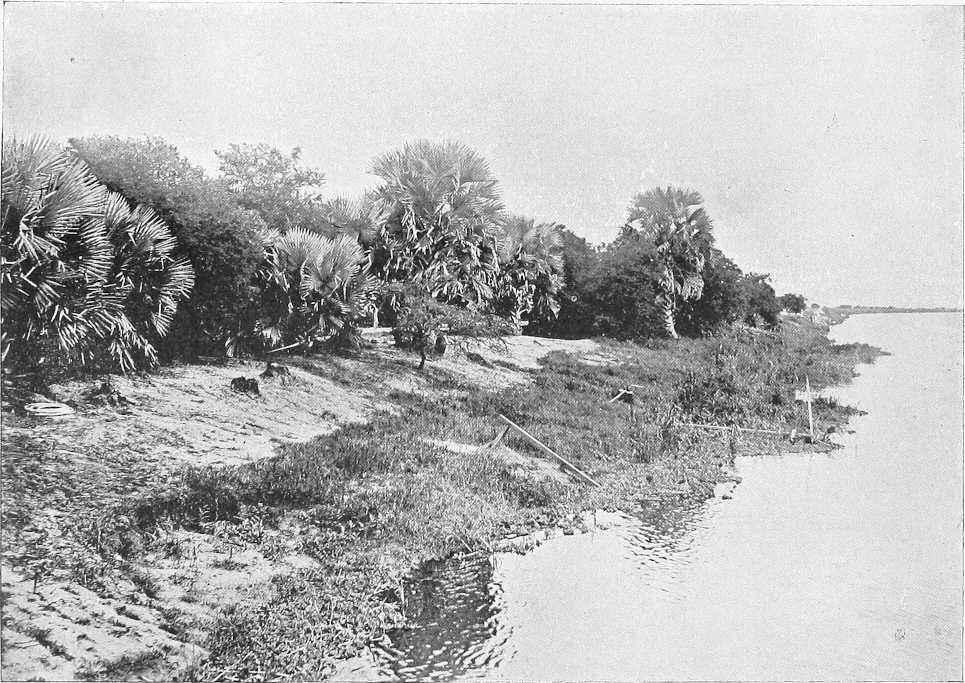
TAUFIKIA.
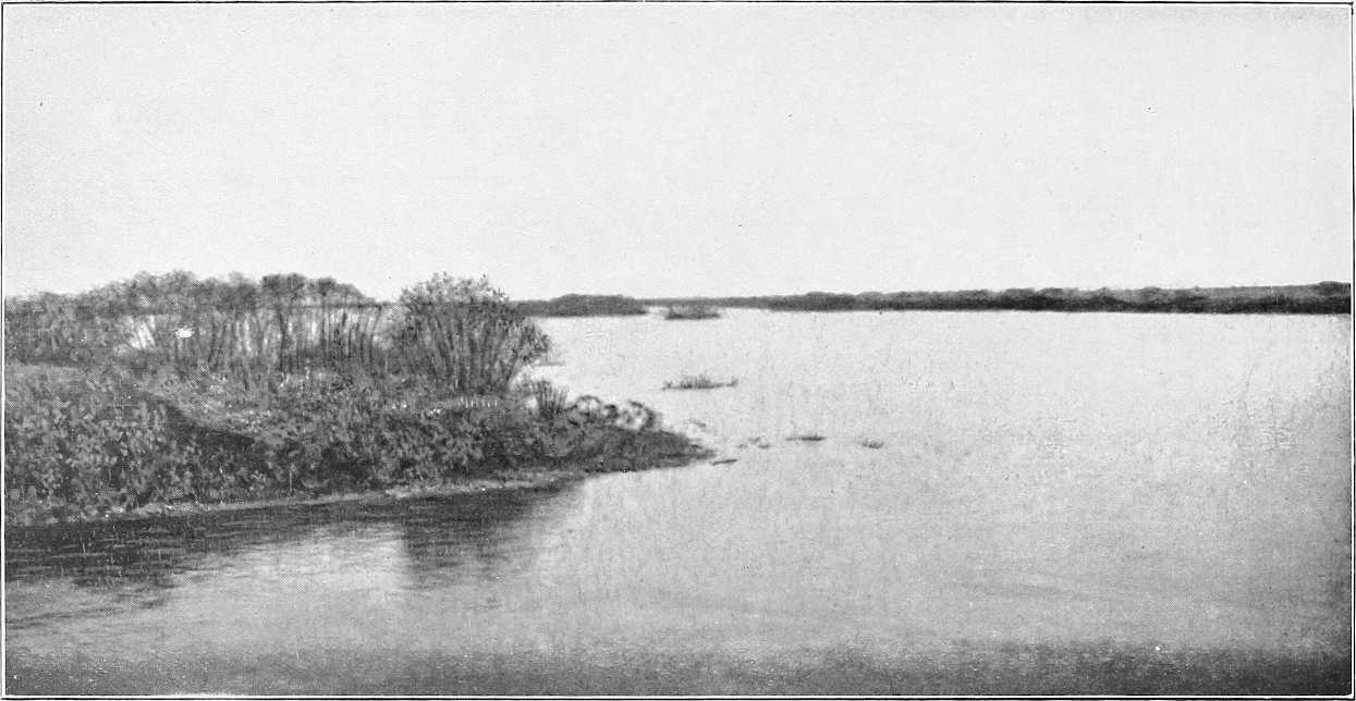
LAKE NO.
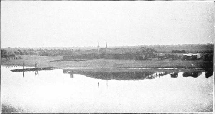
SHAMBE.
Section 4.—Lake No to Gondokoro.
Place. Miles. Kilometres. Description.
Inter-mediate. From Lake No.[32]
For description of Lake No, see page 165. For the Sudd, see Appendix B.
Bahr El Jebel — — For detailed description and maps of the Bahr El Jebel between Lake No and Gondokoro, see Sir W. Garstin’s Report (Blue Book, Egypt, No. 2, 1901, price 3s. 6d.), from which much of the following is taken; also see his Report of 1904 (price 17s.).
Ex block[35] No. 1 1 1 The entrance to the Bahr El Jebel is about 150 yards broad at the extreme east end of Lake No. The channel, turning suddenly to the south, is bounded on either side by a dense perpendicular growth of rich green papyrus swamp, in which ambach trees, and um suf and convolvulus occasionally appear. The papyrus reaches from 10 feet to 15 feet above the surface of the water (Jan.). As the steamer proceeds in its winding course, the channel varies from 70 to 100 yards, whilst the breadth of the papyrus strip varies from a few hundred yards to several miles. The solid ground (at its best only a few feet above the level of the water) on the far side of the papyrus gradually recedes, and the trees in the distance become more and more sparse, till at last they vanish altogether. Except in occasional instances, no dry land is to be seen throughout these swamps. Their extent is unknown, but, more especially to the west of the river, it must be enormous. In all probability the greater portion of the region lying between the Bahr El Jebel and Bahr El Ghazal and its tributaries is, in the rainy season, a vast marsh. To the east their area is more limited, as the country beyond the Bahr El Zeraf gradually rises into alluvial plains, covered with dense grass, and intersected by numerous swamp lines. These plains, as a whole, are above the level of the Nile when in flood. In the long island, lying within the loop formed by the Bahr El Zeraf with the main stream, there undoubtedly exists a ridge of comparatively high land. Upon this a Nuer population has settled. Except by occasional glimpses of trees, and, more rarely, of a village, it is impossible to trace this ridge. Its limits are undetermined. It is surrounded on every side by a belt of almost impassable morass. The only evidence of human beings are the grass fires on the horizon, and, except for an occasional elephant, buck, or giraffe, visible in the far distance from the top of the steamer, and a few water-birds, bee-eaters, wagtails, &c., animal life appears to have suddenly become extinct. At sunset, however, thousands of insects make their appearance, but, with the exception of the mosquito, who is always en évidence to a greater or lesser extent (worst from April to November (during the rains) and least from December to March—dry season—grass fires), they vanish after an hour or two.
„ „ 2 8 9 14
Discharge (14.4.00) 218·95 c.m. per sec. 1 10 16
Ex block No. 3 6 16 26
„ „ 4 21 37 59
„ „ 5 14 51 82
„ „ 6 4 55 88
„ „ 7 3 58 93
„ „ 8 6 63 101
„ „ 9 3 66 106
„ „ 10 1 67 108
Ex block No. 11 5 72 116 The water of the Bahr El Jebel is dark-coloured, but contains little or no sediment. The depth of the main channel varies from 20 to 24 feet at low Nile. As far as mile 40, the ridge lying between the Zeraf and the Jebel is visible on the eastern bank, at a distance varying from 500 to 3,000 yards. Trees and a few palms appear to indicate the presence of villages. From this point the ridge disappears and the swamps stretch to the horizon upon both sides of the river. The first four of the sudd blocks, cleared by Major Peake’s party, occurred within this distance. The fifth, sixth, seventh, and eighth blocks were met with between miles 50 and 63. Upstream of mile 63, the character of the marsh changes. North of this point comparatively few open lagoons are to be seen, but from here, until Hellet-el-Nuer (mile 139) is reached, these shallow lakes border the Bahr El Jebel in continuous lines. Some of them are of considerable area, as a reference to the map will show. They form nurseries for the growth of water plants, and are the chief cause of the blocks which form in the channel. Their depth rarely exceeds 3 feet. As the river is ascended, these lagoons increase in number and size. The channel often passes between two of these lakes, only separated from them by a belt of papyrus. In winter these lagoons are open spaces of water, but, with the advent of the rainy season (in the month of April), their surfaces become covered with detached masses of floating vegetation. Many of them are connected by a series of openings with the river, and their water level rises and falls with that of the latter. The loss of water, by evaporation, upon these shallow ponds, must be extremely great. It is difficult to say whether these lagoons are old courses of the Bahr El Jebel and long since filled up, or whether they are traces of the vast lake which, it is imagined, once covered this area. The latter supposition appears to be the more probable, as the channel of the river is so deep and so sharply defined that it appears hardly possible that it should have utterly disappeared. On the other hand, there is at least one instance where the river is actually in process of vanishing, i.e., between miles 143 and 165. In this reach the channel is filled with decomposed sudd to such an extent that it is difficult to trace it. It is reasonable to suppose that, unless cleared, it will, in course of time, disappear and be transformed into a series of “mayas” or lagoons. These “mayas” are constantly changing their shape. New channels burst into the river and others fill up and disappear.
„ „ 12 3 75 120
„ „ 13 4 79 127
„ „ 14 3 82 132
Discharge (1.4.01) 362 c.m. per sec. 10 92 148 The average level of the marshes, in March and April, 1901, was from 7 inches to 1 foot above the river water surface. Between mile 65 and Hellet-el-Nuer, the width of the river is very variable; in many places it is only 60 yards and in others as much as 150 yards. The general average may be taken as from 75 to 80 yards, and the mean velocity of the stream at 2 miles an hour, at low water. The depth ranges from 15 to 22 feet, but in places is as much as 28 feet. The sudd blocks 9 to 14 were met with between miles 65 and 82. At block 14, what may be termed the first series of sudd obstruction ended, and with its removal, in April, 1900, through navigation between Khartoum and Gondokoro was restored. The worst place in the river, in the way of giving trouble, was block No. 10, at mile 67.
2 deleib palms. (W.) 16 108 From this point land approaches the river on both banks, that to the east being less extensive.
3 deleib palms. (E.) 5 113
Trees 12 125 Trees 5 miles to east.
Hellet El Nuer 14 139 223 At mile 139 from Lake No, Hellet El Nuer (or Aliab Dok) is reached. It is rather a pretty landing-place with stretches of short turf; no huts or inhabitants. The latitude at this place is 8° 4′ 36″ North, and at this point the high land touches the west bank of the Jebel and stretches in a broad expanse to the horizon. The bank here is 3 feet above the water, but the land rises at a short distance from the river. This plain is evidently never swamped, even in flood. It is covered with a growth of deleib palms, Euphorbia, and bush. It commences at mile 131, and continues along the river as far as mile 144, with swampy intervals at the loops.
Captain Gage’s channel — — At Hellet El Nuer itself, a branch of some size takes off the Bahr El Jebel. This channel is not shown upon any existing maps, and was first mentioned by Captain Gage, of the 7th Dragoon Guards, in his report upon his journey through the sudd in the winter of 1899-1900. It has a width of 70 yards, of which 10 yards on either side are filled by the swamp grasses. Its average depth, at low water, is 3 feet, and its mean velocity is 2 feet per second. Its discharge, as measured in March, 1901, was 21·74 cubic metres per second. Captain Gage’s channel leaves the Bahr El Jebel at a right angle, but some 500 yards down-stream it turns in a north-westerly direction. Captain Gage followed its course for some 40 miles, but was then stopped by sudd. It seems not improbable that this channel forms a junction between the waters of the Bahr El Jebel and those of the River Naam, which discharges into the Bahr El Ghazal, through the Khor Deleib. A few miles down-stream its banks are lined by a succession of Nuer villages, and its width increases to 200 yards. It must carry a large quantity of water when in flood. At other periods of the year (January) it appears to flow into, not out of, the Bahr El Jebel.
North end[36] of false and true channels and block 15 4 143 230 Four miles further on the channel widens into a small lake, and from here[36] the true river is blocked by sudd for some 20 miles. This is termed block 15, and repeated efforts to clear it out (1901-02), owing to the total absence of current, resulted in failure. The expedition under Lieutenant Drury, 1903-04, very nearly succeeded in clearing the whole of the true channel. Both Lieutenant Drury and Sir W. Garstin later passed right through this block in 1904, the only remaining piece near the southern end of the block being fairly easily navigable. The true channel is from 16 to 20 feet deep, whilst the false channel to the west is only 4 feet to 6 feet in depth. One of the Dervish steamers, with boats containing ivory, was sunk in this part of the river, and was discovered by the 1903-04 expedition. At present navigation of the false channel is attended with considerable difficulty, and the services of a competent pilot are indispensable. The river is separated into many branches, and these cross and recross one another, forming a bewildering labyrinth of islands. At the south end of the small lake before mentioned, channels converge from all points of the compass. These are separated by low flats, covered with dense growth of papyrus.
Series of lakes 7 150 After steaming for some 7 or 8 miles through a wilderness of papyrus, a series of lakes is reached, at mile 150 from Lake No. Stiff current here. These lakes have a depth of about 4 feet at the deepest point, but shoal rapidly towards the shore. A feeble but distinct current passes through them to the north. Their breadth varies largely. Their shores are surrounded by high papyrus and their surfaces are dotted by countless small sudd islands. There are, however, indications on both sides that the high land is not very far distant. It has already been explained that the true channel, which lies to the east of these lakes, is said to skirt the dry land. On the west a line of fair-sized trees at a distance of, perhaps, 2 miles, shows that the swamps in that direction also have a limit. A very noticeable feature of these expanses of water is their lifelessness. No birds are to be seen, and hippopotami appear to avoid them altogether. At mile 163 the lakes end, and a fresh network of branching streams confront the navigator. Here, again, very careful steering and knowledge of the passage to be followed is required. Each year these channels change. What is, in one season, the deepest channel, is, perhaps, the next year impassable. For some 5 miles the river is split up into many different branches, all winding through papyrus swamp. At mile 165 the true channel of the river is reached. The change is startlingly sudden, as the depth suddenly increases from 4 to 21 feet. Instead of a twisting stream, the Bahr El Jebel again becomes a fine open river, some 80 to 90 yards in width, bounded by a high fringe of papyrus on either side. The false channel leaves the river at an angle of nearly 90 degrees. In April, 1900, the junction was blocked by sudd, but this was light and easily removed. Large shallow lagoons extend on either bank, separated from the river by a belt of papyrus. The high land to the west ends about a mile from the river, and the swamp recommences. To the east a line of palms, perhaps, 6 or 7 miles distant, not improbably indicates the banks of the Bahr El Zeraf. Above this point the Bahr El Jebel widens out for some distance. In places its breadth is as much as 200 yards, and its depth from 15 to 18 feet. The swamps continue as before. At mile 166 the high land approaches the river on the east, and runs parallel to it for some 2 miles. It is covered with bush and an occasional Euphorbia. At this point a khor joins the Nile on the west bank, bringing in a strong stream of water. Two villages (Nuer) are to be seen in the distance; these are probably Favor and Fatooah of the German map (Julius Perthes). The mean velocity now averages 1½ miles per hour. Between miles 175 and 200 the high land and bush before mentioned touches the eastern bank at intervals. At mile 187 there is a break in this ridge, and two or three channels leave the Nile to the east. These are said by the natives to be the most northerly outlets of the Bahr El Zeraf. In 1900 a fine deleib palm stood on the water’s edge at this point. This formed a landmark that could be seen for miles. It has now, unfortunately, fallen into the river. At mile 220, and again at mile 223, channels come in from the west bringing water to the Jebel. These streams may possibly be the mouths of the River Rodi, or Yei, which is supposed to join the Nile somewhere in this locality. At mile 225 the false channel, which, previous to the clearance of blocks 16 to 19, was the only navigable line, joins the river. This was the route followed by Major Peake and Lieut. Drury in 1900, in making the journey to the upper Nile. They found the passage very difficult. During the transit they bent their rudder twice, and went aground four times. From this point numerous channels join the Bahr El Jebel on both sides. Many islands, covered with ambach and papyrus, separate the stream into numerous branches, and the whole country is once more a waste of swamp. The Bahr El Jebel here is extremely narrow (25 to 30 yards), but is from 18 to 22 feet deep. The false channel in appearance far more resembles the main river than does the true one.
South end of true and false channels and of block 15 15 165 265
Land approaches east edge of channel 1 166
North channel to Bahr El Zeraf 21 187 301
Mouth of Yei (?) 33 220
North end old false channel 5 225 362
Ex block No. 16 18 243 391
„ „ 17 2 245 394
„ „ 18 ½ 245½ 395
South end of block No. 18 3½ 249 401 It is hard to imagine that this narrow, twisting stream can be the Nile. Its windings are worse than ever. A tree or a boat may be visible at a comparatively short distance ahead, and yet many miles of channel must be traversed before it is reached. The river here runs nearly due west, while the false channel follows an easterly course, passing through numerous shallow lakes, until it joins the main river again at mile 249. At mile 240 the Jebel widens out again, and more resembles a river in appearance than it did. Its average breadth is from 50 to 60 yards, and its depth is some 15 feet. Between this point and mile 248 occurred the four sudd obstructions, removed in February, 1901, by Lieut. Drury, R.N., and which were known as blocks Nos. 16, 17, 18, and 19. At mile 249 the Bahr El Zeraf takes off from the Nile, following the false channel for some distance, before branching off to the east. The width of this river at the head is about 30 yards, and the outlet is surrounded by a sea of marsh. Just up-stream of this point there is a severe bend in the Nile, which might one day give trouble. As the steamer passes, decomposed sudd rises to the surface.
Bahr El Zeraf — 249 401
Shambe 7 256 412 The general character of the landscape now changes, as land and forest are visible to the west, and at mile 253 from Lake No, the Shambe lagoon or khor is reached. This is a large lake, some 3 to 5 miles in length, and more than 1½ miles in breadth. Its depth averages 4½ feet. The post of Ghaba Shambe is situated in north latitude 7° 6′ 30″, on the west bank of its lagoon, at a distance of 1½ miles from the river. The land here is about 2 feet over the water, but rises as the forest is reached. It is a dreary-looking spot, consisting of a mud-brick house inside a mud parapet, and a nuzl, and a few “tukls” erected on the flat shore of the lake; garrison of 25 men; a Dinka village lies not far off. Shambe is now the chief Nile post of the Bahr El Ghazal province, and from here proceeds the road inland to Rumbek (116 miles), &c. The river winds round the lake for some 8 miles, separated from it by a band of marsh, about 600 yards broad. Large quantities of hippopotami. To the east the swamp stretches for a long way; at miles 255 and 256 are two other outlets of the Zeraf River. The aspect of the landscape is extremely desolate, with papyrus-covered marshes stretching in all directions. The river itself alternates between long straight reaches or easy curves, and a series of sharp twists and bends, which form a regular maze through the swamps. The water surface is covered with masses of detached plants of the Pistia (or sword grass) stratiotes. The mean velocity is 2 miles per hour; the average depth is 15 feet; and the average width from 50 to 60 yards. For many miles the same dreary scenery prevails. The river recedes a long way from the western forest, and on both sides an expanse of reeds and water extends. The width of the swamped area here cannot be less than 30 miles.
Abu Kuka 37 293 471 At mile 293 Abu Kuka, north latitude 6° 54′, is reached. The papyrus swamp ceases just north of this point. Here the forest approaches the river, and the bank is dry. The thick bush comes down to the water edge, the trees being about 1,500 yards away. The village of this name is inland, and is not visible from the river.
Kanisa 11 304 489 At miles 300 and 304, the old and new wooding stations of Kanisa are respectively situated on the west bank. Kanisa or “Heiligen Kreuz,” north latitude 6° 46′, is the site of the Austrian Mission which was located here for many years. The church and buildings were situated on the eastern bank, only a foot or two above the water, but their traces are no longer visible. A large fruit garden formerly existed on the west bank, but only two large shady trees are still alive. This Mission was abandoned in 1864 or 1865, on account of the deadly effects of the climate. The only inhabitants now are a few Dinka. The forest is very thick and consists of Sidr, other acacias, and a few Euphorbia. This forest is continuous as far as the banks of the Rohl, some 60 miles to the west.
Immediately up-stream of Kanisa, the river wanders away into the swamps as before. From this point, to mile 343, there is little to describe. The banks on both sides are very flat and rarely more than 2 feet above low water level. The papyrus now practically ends. Occasional clumps are to be seen, but nowhere in continuous masses. Tamarisk is common. The spills from the river into the marshes are very numerous, more particularly on the east bank. A line of trees on the eastern horizon, some 7 to 10 miles away, appears to mark the limits of the swamp. It is easy to see how the Bahr El Zeraf marshes are formed. At every few hundred yards the river spills into them. These spill channels are deeply cut, with vertical sides, as if dug by hand, and the amount of water discharged by them in flood must be very great. In size they vary considerably. Their average breadth is from 3 to 5 yards, but some are as much as 16 yards wide. Between miles 303 and 379, 129 spills were counted, of which 97 were on the east bank. Probably many more escaped observation.[37]
Lake Powendael 40 344 553 At mile 344 the large lagoon, known as Lake Powendael, commences on the west. The river circuits this lake for 4 or 5 miles, separated from it by a belt of swamp, varying in width from a few hundred to 2,000 yards. Lake Powendael is in many places as much as 3,000 yards in breadth, but is very shallow. Its surface is dotted with many small islands, and it is connected with the river by several inlets. Hippopotami are abundant in these parts. Both banks are now very low and flat, about 10 inches over the water. The reach of the river between Bor and Kanisa is unendurably desolate and monotonous, wandering through continual swamp for some 100 miles. At mile 360 another large lake is met with, also on the west. This sheet of water must be quite 4 miles in breadth, and the river winds round it for a long distance in a series of very sharp curves. Many natives are to be seen fishing here.
At mile 374 a welcome change appears, as a limit is at last visible to the eastern swamps, which are practically continuous from Lake No to this point. A line of villages (Dinka) stands 2 miles from the river, and behind them lies the forest. A little further up-stream these villages approach nearer, until at last, at mile 380 from Lake No, the high land on the east comes down to the river.
Bor[38] 40 384 617 Bor, north latitude 6° 12′ 46″, is a collection of Dinka villages which stretch northwards (outside the swamp) almost to the Bahr El Zeraf. The forest here stands back from the river on the east bank, but the high bank comes close to the water, except where a large backwater or lagoon passes through it for some 2,000 yards. Gordon mentioned this place as an inconvenient wooding station, but it is very handy now. A few tall deleib palms stand out as land marks. The houses of Bor are neither large nor important, but like in all Dinka villages they are well-kept, neat, and clean. The huts are circular in shape. They are plastered with mud and have conical thatched roofs. Each has a small door through which the inmates crawl. The people show no signs of shyness and appear comfortable and contented. They possess large herds of cattle. At mile 384 the river runs close under the high bank, hugging it for some distance. The land here is from 6 to 8 feet over the water, and is, of course, never flooded. The forest consists of thick bush, with a few large trees; a distinctive feature is the thicket of small deleib palms which cover the ground. Not one in 500 of these young palms appears to develop into a tree, but they form an extremely dense undergrowth. The Bahr El Jebel is now a fine stream, 80 to 90 yards wide, with a strong current. On the west the marshes stretch into space. The valley here must be quite 20 miles across.