Volume 1 — CHAPTER V.
Reading edition
CENTRAL SUDAN.
(Country between the White Nile and Abyssinia, bounded by the Blue Nile and Sobat.)
Section 1.—Gezira; Khartoum to Sennar—Goz Abu Guma Line.
General description (topographical).The area of about 7,500 square miles enclosed by the Blue and White Niles, from their junction at Khartoum to as far south as the line Sennar-Goz Abu Guma, forms the northern portion of that generally known as the “Gezira” or “El Hoi,” and contains some of the most fertile and most thickly populated districts in the Sudan. Though rather sandy in the neighbourhood of Khartoum, the soil of this flat alluvial plain gradually becomes richer and richer as one proceeds southwards, until between Mesellemia and Managil or Abud the acme of fertility is attained. The eastern half of this district is much more fertile and cultivated than the western half, a fact perhaps attributable to the fertilizing properties of the Blue compared to the White Nile. The whole of this region is so flat and free from khors, or other indications as to the direction of the drainage, that, except perhaps just south of Managil, it is impossible, without careful levelling, to define the watershed between the two rivers.
Bush of any extent and the granite hills, so common in most parts of the Sudan, are only found along its more southern, eastern, and western limits, whilst where not cultivated, the surface of the ground is usually covered with maheirib, homra, hantut, or naal grass. The entire area is definitely owned by tribes, families, or individuals, and strangers desiring to cultivate any portion can only do so on payment of rent, which is usually taken in kind.
Inhabitants.Many of the tribes, and their name is legion[74], inhabiting the interior of this district are of a semi-nomadic nature, that is to say, they cultivate and graze in the interior during the rains, and in the dry weather repair to the rivers, where not only is the watering of their flocks an easier matter and the grazing better than inland, but much ground is left by the receding Niles available for cultivation.
On both the Blue and White Niles, however, there is, in addition, a large and heterogeneous sedentary population.
Cultivation (dura).The principal cereal cultivated is, of course, dura, and a species known as “feterita” is sown as soon as sufficient rain has fallen, after which it merely requires to be kept weeded, and in two months’ time is ready for harvesting. The only drawback is that this crop is entirely dependent on the rainfall, which is often insufficient, and small banks, 1 to 2 feet high, called “taras,” are generally necessary to hold up the water in order to thoroughly flood any particular piece of land which it is desired to cultivate.
Three ardebs[75] per feddan (acre approximately) is an exceptionally good crop, but one ardeb per feddan is the ordinary yield of rain-watered land. The natives reckon a yield of 15 ardebs per ruba[75] of seed sown a very good crop for very good land in a favourable year, but 4 ardebs per ruba is about the average.
Dura shami.Shaduf or sagia-watered land on the Blue Nile yields 5 ardebs of dura shami (Indian corn) per feddan, whilst on the White Nile 3½ to 4 is an average crop. Irrigation on the former is usually by sagia, and on the latter by shaduf.
Wheat.Wheat is cultivated to a limited extent on shaduf or sagia lands, but it is too expensive to be popular with the natives. An average crop is 5 ardebs per feddan. It is sown late in November, and harvested three months later.
Cotton.Much has yet to be learnt as to the suitability of the Gezira for growing cotton. Cotton sown on the foreshore of the White Nile near Khartoum in July is irrigated by the flood, and three pickings can be made before the river becomes too low in February. Experiments so far show “Mit Afifi” to be the species best adapted to the country, but the paucity of the rainfall has so far precluded the possibility of obtaining reliable results from the experiments made. Sufficient cotton, of a quality suitable for local requirements, has, however, been grown for many years.
Water supply.The water supply during the dry season of other than the riverain population is from wells. In the rains these are supplemented by hafirs or tanks. The depth of the wells varies from 60 feet on the east of the watershed near the Blue Nile to 100 feet in the centre, where they gradually become deeper the further south one travels, until a few miles south of Managil they are as much as 200 feet deep, whilst in the pans or hollows of the west of the watershed they are often not more than 15 feet. These latter wells are peculiar, in that if used for long they become salt and thus new wells have to be constantly dug.
Many of the wells also in the north of the Gezira are salt. Nearly all villages have their own well, though occasionally water is carried for a distance of several miles.
Grazing.There is often very little grazing a few months after the rains have terminated; during the dry season, therefore, the flocks are pastured along the banks of the Niles, and in bad seasons they even cross the river into Kordofan.
During the Kharif, as the serut fly is not present north of Sennar-Shawal, many camels and flocks are brought from the south to graze north of this line.
Chief towns.El Geteina.—54½ miles by road south of Khartoum on right bank White Nile. Headquarters of Geteina District and residence of Mamur, police officer, etc. The inhabitants are chiefly Danagla and Jaalin. The Omda’s name is Sheikh Mohammed Osman Abd El Rahman, a Dongolaui. Most of the houses are built of mud. Post and Telegraph office. (Vide p. 53.)
Kawa.—132 miles by road south of Khartoum on White Nile (right bank). It is the same as El Eis of the old travellers. It has rather a large population of Danagla, Jaalin, Shaigia, and various blacks. The Omda’s name is Ismail Musa. The houses are both mud and flat-roofed, and grass “tukls.” It is the headquarters of Kawa District and residence of Mamur. Post and Telegraph office. (Vide p. 57.)
Goz Abu Guma (or Zeinoba).—Quite a newly built town of grass tukls on the White Nile, about 180 miles by road south of Khartoum. A steamer from Khartoum runs up as far as this with mails weekly. There is a post office and telegraph office. Residence of a Mamur and police officer. Inhabitants, Danagla, Jaalin, Gowama, and blacks. Omda Ahmed Mohammed El Zein, a Jaali. Practically no transport animals obtainable here. A good deal of gum is collected here from the interior of Kordofan. (Vide p. 59.)
Maatuk.—A collection of tukl villages, 22 miles north-east of Dueim and 29 miles west of Managil. The population, a large one, consists chiefly of Arakin, also Hassania and Tawal. The Omda’s name is Ibrahim Wad El Netef, an Araki.
The water supply is plentiful and good from many wells 15 to 30 feet deep. In the rains the inhabitants, to a great extent, leave the wells and live on their cultivation, drinking from hafirs or rain-water tanks. There is much rain cultivation about here in good years. Where not cultivated, the land is usually covered with scattered laot and kittr bush. Maatuk belongs to Kawa District of the Gezira Province.
Managil.—A collection of some half-dozen or more tukl villages in the centre of the most fertile part of the Gezira. It is 38 miles from Wad Medani, 50 from Dueim and 107 from Khartoum. Residence of Mamur and police officer of Managil District belonging to Gezira Province. Fair “Suk”: market days, Sundays and Wednesdays. The wells, three in number, are about 150 feet deep. There is a large mixed population here and throughout the District, which contains 43,000 inhabitants. The land just south of Managil is the most suitable in the Gezira for the cultivation of cotton. This district was handed over to his fellow Taaisha by the Khalifa Abdalla, and some of the Tagale blacks imported by them to cultivate have settled in the neighbourhood.
Segadi.—A large tukl village situated at the foot of the southern slopes of two low granite hills 50 miles south of Managil. It belongs to the Sennar Province. The Omda’s name is Torin Ahmed, of the Rufaa tribe. The population, numbering about 1,500 (?), is composed of many different tribes. Water supply is fairly good. It is about 40 miles from Goz Abu Guma and 36 from Shawal, on the White Nile.
Moya.—Another large village belonging to and 21 miles west from Sennar and about 14 miles south-east of Segadi. There are several hills in the neighbourhood, chief of which is J. Moya, about 500 feet high, from the summit of which Jebel Dali, on the road to Gule, is visible bearing 177° mag. There is a road from here to Gule and another to Wad Medani. Water supply is very bad, and, in fact, almost nil towards the end of the dry season, when the inhabitants disperse in different directions. The Omda’s name is El Imam Hadibai, and the population, which, however, varies, numbers about 1,200, chiefly Amarna, also Hameg and Gowama.
Kamlin.—58½ miles by road and 64½ miles by river from Khartoum, on left bank of Blue Nile. Present (1904) Headquarters[76] of Gezira Province and residence of Mudir. There is a large population, consisting of Danagla (several sections, but chiefly El Jeberked), Mawalads (Mogharba and Egyptian), Jaalin, and Shaigia. Houses mostly built of mud. Post and Telegraph office. The Omda’s name is Abbas Musa.
Hellet Amara (or Arbagi).—On left bank, Blue Nile, 84½ miles by road and 95 by river from Khartoum. Opposite Rufaa. There are several villages in the angle of the river which, however, are so close to one another that they may be considered as one. Houses mostly built of mud. Population chiefly Jaalin, Danagla and Batahin, under Omda El Sheikh Ali El Haj Taha, a Jaali. Amara is the headquarters of the Mesellemia District of Gezira Province and residence of a British inspector, Mamur, police officer, etc. Population of District 32,300, chiefly Halawin, who are the best cultivators in the Sudan.
Arbagi.—Arbagi, which is close to Amara, is one of the oldest sites in the Sudan, and is mentioned by the learned Ludolphus in his history of Abyssinia. It was destroyed by the Shukria early in the 19th or at the end of 18th century.
Mesellemia.—Mesellemia, from which an administrative district takes its name, is about 11 miles nearly due south of Arbagi, and about 6 miles inland from the Blue Nile (L.B.). Prior to the Mahdia it was a very large town and a great centre of trade. People are now returning and are rebuilding it. Surrounding it is some of the most fertile land in the Sudan. Residence of a Mamur and headquarters of the district.
Wad Medani.—Population about 14,000; on left bank Blue Nile, just above its junction with Rahad; about 1 mile long by ½ mile broad; large market daily, also bi-weekly, Monday and Thursday, the largest in the Sudan next to Omdurman. Founded by El Fiki Medani about 1800 A.D. Post and telegraph office. Inhabitants: Gezira sedentary tribes, principally Khawalda, Arakin, Kawahla, Jaalin, Bussalia, and Medaniim. Headquarters of Gezira Province (1905). Garrison, one battalion. Rainfall here for 12 months—March 1903 to February 1904—was 313·5 m.m. or about 12½ inches.
Senga.—Headquarters of Senga District: will probably be headquarters of Sennar Province in 1905. A large and increasing village, and next in importance to Wad Medani; left bank Blue Nile about half mile long and some distance inland; all built of straw huts except the Government buildings, which are of brick. Soil fertile, and district much wooded. Population about 1,600. Yearly increasing trade and daily market. Founded by Abdalla Wad El Hassan about 19 years ago. Inhabitants mostly Jaalin and Kenana. Post and telegraph offices.
Sennar.—Almost in ruins owing to Dervish occupation. Has lost all its former importance. Extends about ¾ mile along the river, surrounded by an old trench and embankments. There is a large mosque of red burnt bricks, in a very bad state of repair. At the time of its re-occupation in 1898, Sennar town was in ruins and uninhabited; it was made headquarters of the province till, in April, 1900, it was superseded by Wad Medani, Sennar remaining headquarters of a District. In March, 1903, the headquarters of the District were removed about 3 miles south of Sennar to Kabush on the river bank, where new buildings have been erected; people are now moving and settling between old Sennar and Kabush. Bi-weekly market Monday and Thursday. In surrounding district soil very fertile, all land cultivated by rains, except in Sennar town, which is irrigated by five sagias. Near Kabush there is thick forest along the river, known as the forest of Kabush, extending nearly up to Ereidiba. Population 350. Inhabitants: Kenana, Gawazma, Rufaa, Jaalin, Kawahla, etc.
Wad El Abbas.—Population about 1,200; right bank Blue Nile; founded about 50 years ago. Inhabitants, Jaalin and Gezira tribes, with some 300 blacks. Weekly market on Wednesdays.
Section 2.—Country South of Sennar-Goz Abu Guma Line to the Sobat.
(a) General Description.
Topography.The country between the Niles south of north lat. 13° 30′ (approximately) forms the southern portion of that known as “the Gezira” or “El Hoi,” and is, save for the riverain population of the Blue Nile and the few villages on the White Nile between Goz Abu Guma and Jebelein, practically uninhabited as far south as north parallel 12°, which is the northern limit of Dar Fung.
With the exception of the water in natural tanks at Jebels Mazmum[77] and Gerebin (which are however apt to run dry) this level plain is waterless in the driest season, though the soil is of the richest description, and beyond here and there a few isolated granite hills, the highest of which is Abu Gurud, its surface is devoid of all inequalities and undulations. Not a single khor or wadi is discernible, and except for fairly wide belts of kittr bush, especially near the two rivers and round the bases of the hills, the country is on the whole fairly open until nearing Dar Fung.Dar Fung, when dense forest commences and stretches, apparently continuously, east and west from Nile to Nile.
Owing to the scanty water supply during the dry season and the spongy nature of the soil, it is almost impossible for caravans to travel otherwise than on the few existing tracks.
South of Gule this forest of talh, hashab, soffar, etc., extends uninterruptedly to the hills of Tabi on the south-east, and to Surkum and Keili to the south. About 30 miles south of Gule khors draining the Tabi hills become frequent, and the surface of the ground becomes stony, making the going along the already narrow and much overgrown paths exceedingly bad.
Fazogli and Keili.The districts of Fazogli, Keili, and the greater part of Dul and Kirin are undulating and much cut up by watercourses, and boast far more hills than the country further west towards the White Nile. The hills in these districts are scattered promiscuously, and rise steeply from the surrounding country. They are generally covered with detached boulders and stunted trees. The plain itself is for the most part gravelly or stony, and is intersected with dry rocky khors. It is covered near the foot of the hills with a thick low growing forest, but away from the hills the bush is generally thinner. Before it has dried up, the grass among the bush would make it very difficult to leave the paths, but in the dry season there is generally no difficulty in getting through the bush, excepting at the khors. The whole of this country suffers greatly from want of water, and even where there is water in the streams near their sources, it soon disappears into the ground. Water can, however, often be found in many of the stream beds by digging.
South and south-west of Gule.South and south-west of Gule stretches an almost uninterrupted plain to the Baro and Sobat, bounded on the west by the White Nile and on the east by the hills on the Abyssinian frontier. In the central and eastern portions of this district there are a few scattered hills, such as Abuldugu, Melkan, Ulu, etc., belonging to the Burun, at each of which there is water, but in the Dinka country from Jebelein southwards along the Nile, these are conspicuous by their absence. Between north parallels 12° 30′ and 10° 30′ forest is almost continuous, however, south of 10° 30′ the country becomes gradually more open and grassy and continues so, as far as is known, up to the fringe of forest bordering the Baro and Sobat. Water, south of 10° 30′, seems comparatively plentiful, both in hafirs made by the Burun or standing in pools in khors.
The width of marsh bordering the Baro and Sobat is often much exaggerated; it seems generally not to exceed 4 to 5 miles in width along the former, and is more often much less along the latter. Fringing the marsh is a narrow belt of forest, and behind that steppe-like country, which becomes practically treeless in the region of the lower Sobat (vide Chap. VI).
Drainage.Khor Tomat, draining Beni Shangul and Fazogli is the principal khor emptying into the Blue Nile.
The more important ones emptying into the White Nile are:—
Khor Deleib, source in Jebel Tabi and mouth at Renk; Khors Rau and Balantega, mouths at Jebel Ahmed Agha, but source conjectural, and Khor Adar or Yal, which empties into the White Nile about 30 miles north of Fashoda, and possibly forms the mouth of both the Yabus and Sonka. Another theory is that the Sonka and Yabus drain into a marsh, from which a certain amount of water is believed to find its way into the Sobat near Nasser. Khor Garre drains into the Baro.
Rainfall.The rainfall over the whole of this area is heavy, especially in the more southern districts, where the rainy season may be said to extend from the end of April till the beginning of November.
Transport animals.Camels, mules, or donkeys do well throughout the whole of this district, except during the rains, when mules are probably the best. At this season the serut fly is present everywhere, and in the dry season along the Nile there is a small black fly, similar in general appearance to the common house-fly, which is excessively annoying and somewhat injurious to camels. Abyssinian horses are useful, and the ordinary Arab does well, though more delicate.
Roads.The only roads[78] known to exist, with the exception of those from Senga to Moya, and Senga to Jebelein, viâ Teigo and Jebel Dali, are described in the route reports in Vol. 2, Chap. V.
Currency.In the more northern parts of this region the ordinary Sudan currency is de rigueur, but in dealings with natives along the Abyssinian frontier Maria Theresa dollars or gold rings, obtainable at Abu Shaneina (36 Maria Theresa dollars = 1 oz. gold, approximately), are generally required, though in Fazogli, Keili, or in fact in any Arabic-speaking district, Egyptian money is as a rule readily accepted.[79] Menelek’s dollar is only very rarely seen, and his smaller coins never. The Maria Theresa dollar is not, as a rule, accepted unless the brooch on the shoulder is pretty clearly distinguishable. Amongst the Gallas salt bars form the small change (3½ bars = 1 Maria Theresa dollar).
In the Dinka country on the White Nile, giraffe or buffalo hides are the best trade goods; “gianotta”[80] and other large beads, as well as Egyptian money are also acceptable. Along the Sobat, beads (large amber, opaque white, small white, “gianotta,”[80] etc.), spear heads, axes, and fasses are all much in request. Money is becoming daily more readily taken.
Mosquitos.Mosquitos, or “Ba-uda” as they are called by the Dinkas and by many Sudanese Arabs, are very numerous in places even in the dry season along the White Nile, though here and there there are none even quite close to the water. The natives themselves, though not professing belief in the Anopheles theory, say that if one is bitten much by them they cause fever. The fact of there being a village at any spot may be accepted as sufficient guarantee that there are no, or at any rate, very few, mosquitos there. Most of the villages even in the dry season are a mile or more from the river.
Game.The following species are represented:—Elephant, buffalo, giraffe, hippopotamus, hartebeeste (Jacksonii and tora), tiang, roan-antelope, kudu, waterbuck, reedbuck, bushbuck, cobus leucotis, gazelle, oribi, lion, leopard, cheetah, etc. Specimens of Neumann’s hartebeeste are also believed to have been shot near Ahmed Agha.
IN THE DAR EL FUNG.
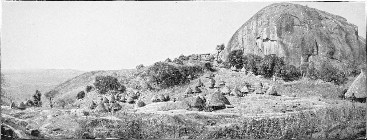
VILLAGE SCENE—BURUN COUNTRY.
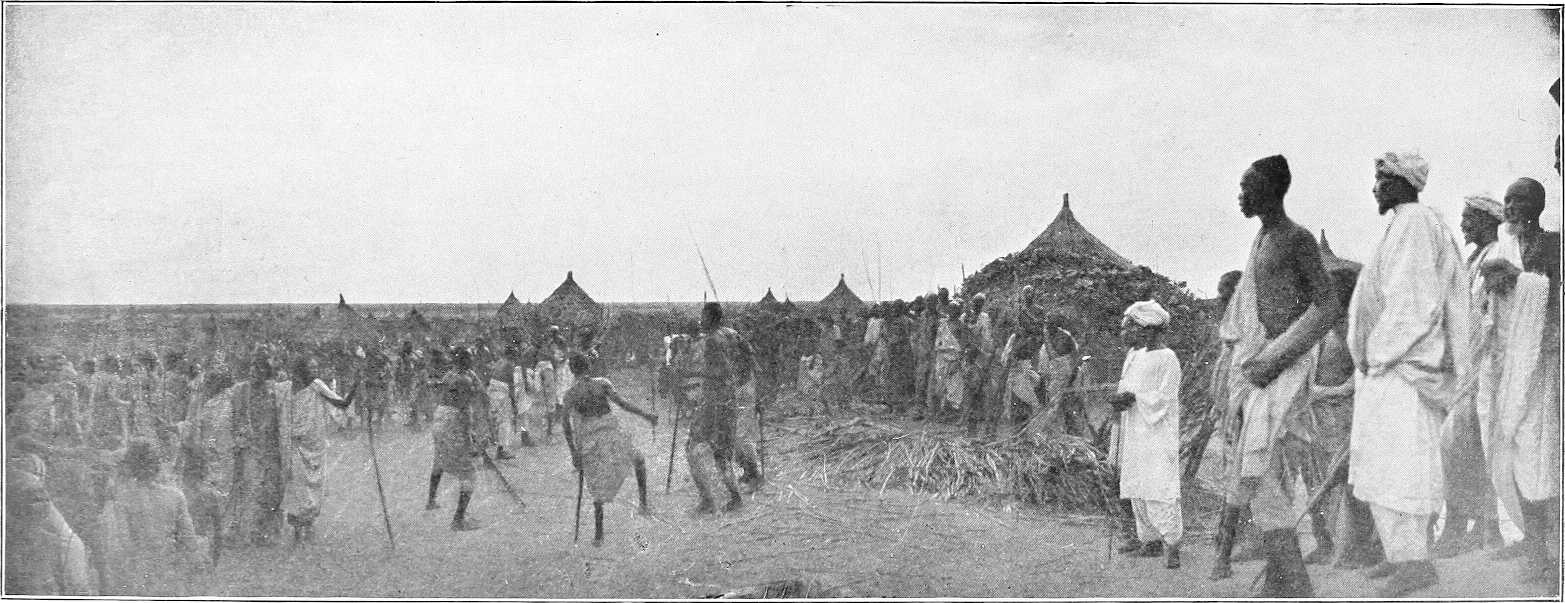
(b) Dar Fung (South of North Lat. 12°).
Boundaries.Dar Fung is now, compared to its palmy days, an unimportant district. Its boundaries are: on the north, Jebels Gereiwa and Rera; on the east, Jebel Agadi and the Fazogli district. Southwards, it extends to the Abyssinian frontier, and, including the district of Keili and the northern Burun country, extends westwards towards the Dinkas of the White Nile.
In the days when the Fung were at their best, it included Dul and Assosa etc., which now belong to Abyssinia.
J. Tabi and Ingassana.Jebel Tabi and district is included in Dar Fung. The Ingassana, now under Mek Agoda, who inhabit it, remained independent and refused to pay tribute to Idris Wad Regab or the Government until February, 1903, when the Mudir visited this district and established the headquarters of the Dar Fung District at Soda instead of Gule, without opposition. The Ingassana are seldom met without their peculiar sickle-shaped swords. They also possess curious boomerang-like throwing-sticks. They keep apparently a good deal to themselves, as complaints against them are rare. They expressed delight at coming under the ægis of the Government, and at the assurance of their future immunity from slave raids. The district of Tabi is hilly and well watered, and appears to be much more healthy than the surrounding plains. It is said to much resemble Erkowit in the Suakin district. Pigs are not uncommon in this district, and the menu of the chiefs is a varied one, dogs, horses, camels, leopards, etc., are all eaten, especially the former, with great relish. The skulls of all animals consumed are arranged in order round the enclosures of the houses.
Idris Wad Regab.Idris Wad Regab, a direct descendant of the old Fung dynasty, is now Mek or head Sheikh of Dar Fung. He is a loyal man, and is now very badly off, having suffered greatly at the hands of the Dervishes, by whom he was not recognised. Sheikh Abd El Kader is his Wakil. Adlan Wad Surur was Mek during the Mahdia; he now lives near Karkoj.
Gule used to be the chief town of Dar Fung, it is now only second in importance to Keili. It consists of three small villages situated at the foot of Jebel Idris or Gule, a granite mass about 1,000 feet high, and contains but a few hundred inhabitants, mostly Hameg, or a mixture of Hameg and the aboriginal Fung. There are generally some encampments of Dar Ageil or Selim Arabs in the vicinity.
Trade.There is a little trade with Abyssinia, but practically nothing in the shape of supplies, animals etc., are procurable here. Most of the merchants trading with Abyssinia pass through Keili.
Cultivation.There is the usual dura and simsim cultivation, but little more is grown than is required for the wants of the inhabitants.
Raids.As, prior to the demarcation of the Abyssinian frontier, the Burun were so decimated by raiding parties from Abyssinian territory, Idris Wad Regab was, in March, 1902, given rifles by the Government to protect his people. In addition to these he had a good many of his own, with which he inflicted some loss on Ahmed Fedil’s force when it marched from Dakhila to the White Nile after the battle of Roseires, December, 1898. These raids have ceased for the present owing to the capture of the principal raider, Ibrahim Wad Mahmud, in February, 1904. Vide Chap. VII, Part II, page 278.
Water supply.Water, which is obtained from several holes at the foot of the Jebel, is fairly plentiful but bad. It is said to be impregnated with lime.
Burun.
Boundaries, etc.The Burun inhabit the country between the Dinkas of the White Nile and the Abyssinian frontier from about 11° 30′ north latitude southwards to the Dinkas and Nuers of the Sobat and Baro. Those among the hills north of K. Yabus are under Mek Idris Wad Regab, of Gule, and appear to have acknowledged the suzerainty of his predecessors for probably a century before the advent of the Turks. On the K. Yabus and south of it nothing can be definitely stated as to their organisation, but they appear to be divided into a number of independent communities.
The Burun are said to be related to the Berta, but they are lighter in colour than the Berta generally are and speak a different language.
Burun near K. Yabus.Major Gwynn gives the following description of the Burun near Khor Yabus: The men, who are physically very finely built, are stark naked, and smear their heads with wet and clammy red mud.[81] They all carry long bows, wooden pointed featherless arrows, and in addition, generally a spear. Arrows are poisoned by being stuck into a certain species of tree,[82] and are pointed with notched charred wood or ebony. They have a range of 150 yards. The women are also naked, save for a small loin cloth of skin. They are good looking and attractive. The Burun dialect spoken by Idris Wad Regab’s men, but no Arabic, is understood by the Burun of the Yabus. Their word of greeting is “Moka.”
The Burun north of K. Yabus live as a rule on the scattered hills during the rains, and drink from the rainwater which collects in natural rock tanks. During the dry season, when this water is exhausted, they either descend to the plain and live on the khors, in many of which water stands in pools, or else have to carry their water for a considerable distance. Some of the hills inhabited by them are Abuldugu, Surkum, Melkan, Gum Gum, and Wadaga. K. Gemmeiza, flowing from near J. Abuldugu towards Melut, furnishes their principal water supply. They also obtain water from “Hafirs,” or ponds, which are roofed with thatch to lessen evaporation. Wells seem to be very rarely sunk. These northern Burun are now very poor, and women and children are very scarce.
The Burun, in the Garre Valley, seem more prosperous, having plenty of water and grain in their country, but both sections, especially the northern, have been most deplorably reduced by slave raids from the east. The principal raider, however, Ibrahim Wad Mahmud, as before stated, was captured by Lieutenant-Colonel Gorringe in February, 1904. The southern Burun country is still almost entirely unexplored.
Communications.The Burun seem to have little intercourse with the tribes living on the White Nile, and no regular roads to it, except perhaps from J. Gerawid to J. Ahmed Agha, seem to exist. It is intended, however, to open up roads between the western frontier of Abyssinia and the Nile, and to improve the present primitive system of water supply in this district. For report on routes, vide Chapter V. and Appendix, Vol. II.
Keili.
Boundaries.Keili, which is part of Dar Fung, is bounded on the east and south-east by the Abyssinian frontier, which divides it from Beni Shangul, Gomasha, and Dul, and on the north-east by Fazogli. Keili claims to share with Fazogli the mountains of Agaru, Kashangaru, and Ragreig, though practically the whole of Agaru belongs to the latter, and the whole of Ragreig to the former, as also does Jebel Gainshur. Jebels Kurmuk and Maiak are within the southern limits of this district, and Jebels Surkum and Abuldugu to the west also belong to it. On the north the boundary is Jebel Tabi.
Inhabitants.The Jebelawin inhabit the eastern portions of the district, and the Burun the western. For administrative purposes, this district is in the Dar Fung District.
The acting Mek of Keili is a youth of about 15 years of age. His father, Beshir Hamdan, who was much addicted to slave dealing, was arrested and deposed by Government, February, 1903.
The valley between Ragreig and Jebel Keili forms as it were an oasis, and must have a population of several thousand. It is a very pleasant spot in the dry season, but in the rains becomes more or less swampy.
Sheikh Bilburka, of the Fung inhabitants of Dul, now lives at Keili in order to avoid the exactions of the Watawit, under Abyssinian rule, similarly Sheikh Jela Abdalla, a Jaali refugee, fled from Beshir and Shanji villages in 1897, and now lives in the Arab settlement at Keili.
Language.The Jebelawin language is used at Jebel Keili. The Burun use a dialect of the Burun language similar to that of Jebel Maiak.
Cultivation, etc.In the valley between Jebels Kurmuk and Keili a great deal of dura is grown, both for local consumption and for the supply of the mountaineers in the hills near Dul. There are plenty of cattle, sheep and pigs.
Gold.Some alluvial gold is found in the khor east of Jebel Ragreig.
Water supply.Water is obtained from wells and from pools in khors, whilst on the face of Jebel Keili itself there are several springs. At Jebel Surkum there is a perennial supply of muddy water from four holes on the south side of the Jebel.
At Jebel Abuldugu there is water in the pass through which the road from Gule leads. This, however, does not last all the year round. Natives then water in the Khor Ganna, about 2 miles to the east.
Keili is the chief town of Dar Fung and is rapidly growing. It is situated at the foot and to the south of J. Keili, and is the residence of the Mek. There is also a small garrison of Sudanese regulars here from Wad Medani, as well as some mounted irregulars.
(c) Fazogli.
Boundaries.Fazogli is not included in Dar Fung, but belongs to the Roseires District; it is bounded for administrative purposes as follows:—On the north-west and west by the Hameg (Abu Gemai to Jebel El Geri), on the north by the Jebel Geri-Abu Ramla line, and from Abu Ramla its boundary runs southwards along the Abyssinian frontier to Jebel Kashangaru, thence northwards towards Jebel Agadi, Dar Fung being to the west of this line.
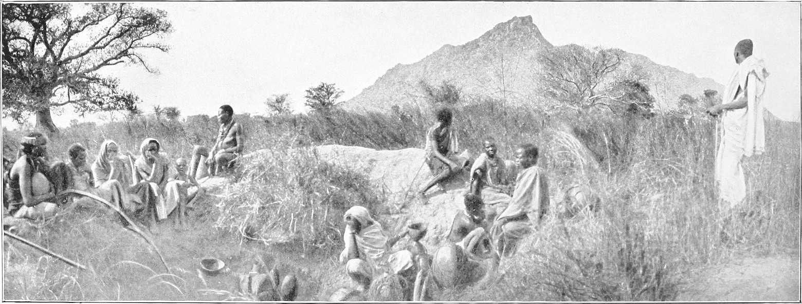
INGASSANA VILLAGE.
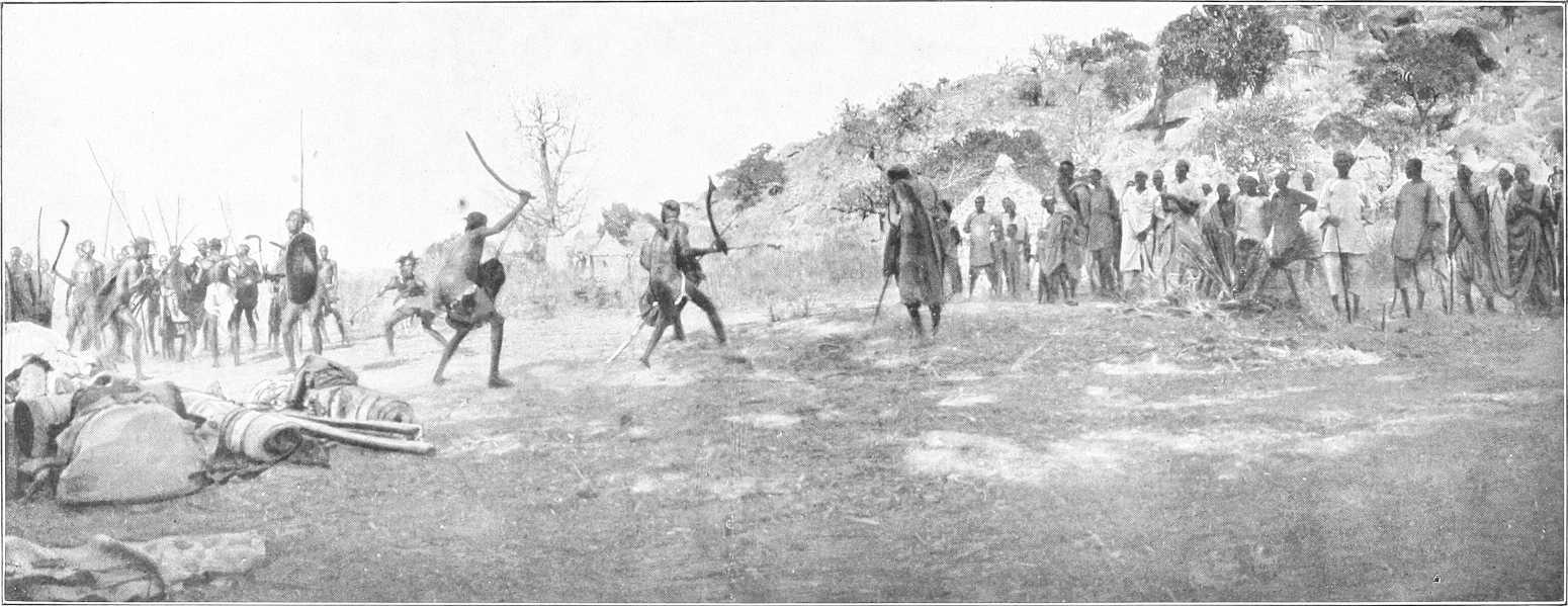
HILL SCENERY IN DAR EL FUNG.
Mek.The Mek’s name is Regab Hassan, who is surnamed Abadaro, and is a middle-aged man who appears to have a good deal of influence, but is said to be addicted to drink. He claims descent from Jaber, the first Fung conqueror of Fazogli.
Inhabitants. Jebelawin.The principal inhabitants are Jebelawin, an aboriginal race merged into the ruling Fung living at Fazogli, Kuturu, Kiri, Abu Shaneina on both banks, and Adarsi. Their villages on the Tumat and at Abu Shaneina are under Mek Khamis, a Jebelawi, but the Arabs at the latter place are under an Arab named Ali Wad Rowaa.
Elias Khamis, the former Fung ruler of the Jebelawin of Beni Shangul lives on the Tomat with a following of Sudanese refugees from Beni Shangul. Sheikh Fakir is similarly in charge of Arab refugees from the south.
Language.Arabic is understood by the Sheikhs of the district, but the rotana in use on the left bank of the Nile is that used by the Hameg of the Blue Nile, and by the Jebelawin and Berta. On the right bank, in the Fazogli district, the Gumz language is totally different.
Religion.The Sheikhs alone profess Mohammedanism; the majority of the Jebelawin are heathen.
Berta.In the hills the inhabitants are nearly all Berta; very few can talk Arabic. They are as a rule finely developed and healthy looking, but are dull and lazy to a degree. Their villages are built in the most inaccessible places; the tukls being wedged amongst great boulders. They only grow small patches of dura, and depend entirely on the rains to irrigate it. During the dry season, even for drinking, water has to be carried immense distances. A great many fowls are kept in the villages. The men in some places wash for gold in the khors.
The Berta of Jebel Falabut are under Mek Abadalla, those of Jebel Faronge are under Mek Amaka. On the latter mountain are separate villages for the Faronge sub-tribe, part of the Fadoko sub-tribe, and the Goamili, who were driven from Jebel Abdanab of late years by the rulers of Beni Shangul. The head-quarters of the Fadoko sub-tribe remain at Sarankchau, near Abdanab on the Yabus river, subject to the Sultan of Beni Shangul. Falabut and Faronge are in charge of Mek Abu Ras of Kiri.
The Berta extend westwards from the Blue Nile through Gezan to Mudeli village (Sheikh El Nur) to Jebel Sude sub-district (Sheikh Hambalha), and Khor Gasa (Mek Jibara), south and west of which the Berta have lost their independence.
Religion.The Berta, though heathen, are not averse to Mohammedanism.
Gezan.Bakurig Bugul, the successor of Gormaz, the last aboriginal Mek of Gezan sub-district, lives at Fazogli. Hassan Wad El Gharbi is the Sheikh of the Watawit at Gezan and Amora, Mek Abulang being resident chief of the Berta.
Gumz.The word “Gumz” signifies “people” in the aboriginal language, of which the various sub-tribes use distinct dialects. The Gumz, of which the Bazaroda and Kadalo are sub-tribes, are heathen, God and sun being synonymous.
Bazaroda.The Bazaroda sub-tribe is under Mek Ya Karda, grandson of Ab Zaroda. The boundaries are the Blue Nile on the south and Khor Bombode on the east. Headquarters, Hoburra. Other villages are Kambal, Yagor, Agabar, and Yarada. Though subject to Abadaro, the Mek of Gubba demanded as tribute, in 1900 and 1901, 50 ardebs of dura and 30l. worth of gold dust. Products include cotton, dura, simsim, “zaf” or dom fibre, and Adansonia bark rope, honey, gungeleis or Adansonia fruit, and gold dust from the Nile, near the mouth of the Khor Zuar.
Kadalo.El Kadalo sub-tribe, formerly peopled Jebel Dimr and Jebel Mulki, but Mek Adam, owing to a blood feud with the Fung ruler of Gubba, is now living on the Nile with his following from those hills. The rest of the Kadalo are under him, and subject to Abadaro of Fazogli. In the Samina Hills there are Kadalo at Beletamaru and Masambaga, under Mek Ahmed Wad Mohammed, surnamed El Wishari, also at Jabranza under his son Beshir Ahmed.
At Jebel Metongwe the local Mek is Mansur, and at Jebel Menze, Mek Idris.
Principal villages. Fazogli.Fazogli the residence of the Mek, is a straggling village of tukls, extending about 2 miles along a ridge of high ground running parallel to the river. This ridge is about 800 yards from the river, and the low intervening ground is given over entirely to cultivation. The ground behind Fazogli rises to the height of 1,750 feet at a distance of 2 miles, and is covered with trees.
The water supply is from the river.
Famaka.The old mudiria of Famaka is an enclosure about 120 yards square, surrounded by a stone wall, which is still in good condition. It is situated on the river bank on a solid rock, which stands in a bend of the river facing E.S.E., and about 60 feet above it, and holds a commanding view of the country to the south for miles.
It is itself, however, commanded at a distance of 800 yards by the very high ground rising behind Fazogli.
Abu Shaneina.Abu Shaneina is the most important village or town in Fazogli. It is here that the trade route from Beni Shangul strikes the Blue Nile, and it is chiefly from that quarter that any considerable increase of trade with Abyssinia can be expected. It is the headquarters of a small frontier force furnishing outlying detachments north and south of the Blue Nile. Mek Khamis is Sheikh of the Jebelawin here and Ali Wad Rowaa of the Arabs.
Kiri.Kiri is the most prosperous (1900) looking village in Fazogli, and is built on what should be a very healthy site near the river. The Sheikh’s name is Abu Ras Wad Sogheir.
Masurkum.Masurkum is on the Beni Shangul Abu Shaneina road. The Sheikh, named Bikori, is an old and infirm man, but has evidently been a strong man in his time. He suffered considerably from Dervish raids, and has lost all his cattle.
Cultivation.Dura, simsim, lubia, and tobacco are the principal crops cultivated, the former is of good quality, both Naggad and Kurgi being sown. In Gezan there is a considerable area under cultivation, but with this exception there is practically none south of a line drawn from Kiri through Jebel Kukura to Masurkum and thence up Khor Masurkum.
In the Tomat villages, west of Jebel Fazogli, the dura crop is very fine, but simsim is chiefly grown between Kiri and Fazogli.
Ground close to Tomat would undoubtedly repay cultivation, but at present the more easily cleared areas near the Nile are amply sufficient for the population.
Cattle, etc.There are comparatively few cattle and sheep in the district, the people having suffered so much from raids.
Trade.A good deal of trade is carried on with Beni Shangul and this is bound to develop.
Fazogli produces a little gold, which is found in all the khors coming from Jebel Faronge: Khor El Dahab, near Gezan, being the richest.
A good deal of coffee is imported from Abyssinia, as well as horses, mules, cattle, donkeys, and sheep.
The idea of ever tapping the trade of the Abyssinian province of Gojjam is said to be out of the question owing to the apparent impossibility of finding a trade route free from physical difficulties of an insuperable kind.
Transport.Donkeys or mules are the best transport animals all round, though camels do very well as long as their feet do not get sore. All the transport animals available for purchase, or otherwise, are those that come in from Abyssinia, and the supply is a very fluctuating one.
(d) Dinkas on the White Nile.
The Dinka country on the White Nile, extends from Jebelein southwards to about 10 miles south of Kodok, along the right bank; it is uninhabited, however, except by Nomad Selim, north of Karshawal.
The Dinkas, or Jange, as they are called by the Arabs, have no Mek like the Shilluks, but each section is separate and independent under its own sheikh, consequently, they were never able to unite to defend themselves against the depredations of slave traders and the Dervishes, who found them an easy prey. Many of their sheikhs at the present time are men who have been slaves in Cairo, and who have been repatriated either by Gordon or the present Sudan Government. Thus it is that, whilst the majority of the men are stark naked, one here and there meets a respectably dressed old man carrying a sunshade.
The women ordinarily wear a goatskin apron in front and another behind, but the unmarried girls are usually content with a string of beads.
The men mould their hair, mixed with red mud, into fantastic shapes, and sleep on a bed of cow-dung ash, with which their bodies are covered. The women do not usually thus disfigure themselves, and sleep on hide mats.
The Dinkas are remarkable for their height and slender limbs and figures. They are not, however, of such fine physique as their neighbours the Shilluks.
They are unenterprising and ignorant to a degree, and so unprogressive and rigidly conservative that any such up-to-date innovation as the introduction of donkeys[83] for transport purposes, an innovation admitted by themselves to be most desirable, is not adopted simply on the pretext that it was not the custom of their fathers and forefathers.
They consequently always walk, the men carrying long narrow bladed spears and a knob-kerry, and the women a large basket on their heads containing their food, etc.
During the dry season the Dinkas desert the hinterland of the river, and descend with their flocks and herds to live near its banks, where the now dry marshes afford excellent grazing.
The localities which they frequent mostly are Renk, El Wat, Jebel Ahmed Agha, Meshra Zeraf, Kaka (right bank), Khor Adar. There are police posts at Renk and Melut; Renk being the headquarters of the District and residence of a British Inspector.
Cultivation.On the arrival of the rains they, for the most part, retire inland, sometimes 20 or 30 miles, to their cultivation, which however, is little more than sufficient for their own requirements. The grain is stored in these cultivation villages, and is only brought to the river in the dry season in small quantities from time to time on the women’s heads.
Donkeys, and indeed any means of transport but their women’s heads are unknown. If, therefore, it is desired to purchase any dura from the Dinkas in the dry season, the would-be purchaser must be prepared to provide transport and to send it a day or so inland.
DINKA. DINKA GIRL.
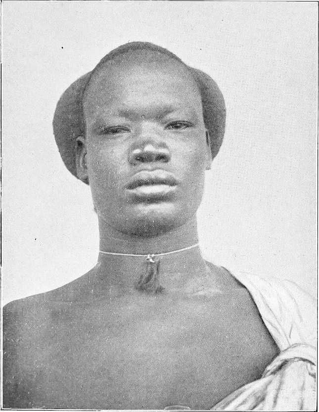
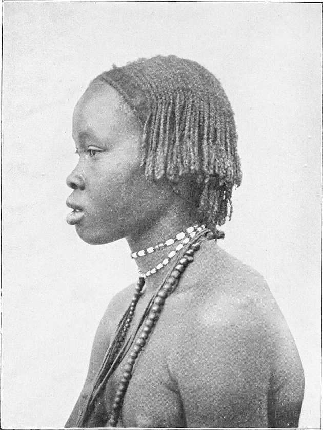
Herds, etc.The Dinkas of the White Nile, who number about 8,000, own a good many cattle and sheep, and pay tribute on them to the Government partly in kind and partly in money (1904). According to a census made in 1903, the following were the estimated numbers of their herds and flocks: cattle, 8,000; sheep, 16,000; goats, 13,000.
Though living in a grand game country they have no sporting instincts whatever, and rely on the Baggara Arabs to provide them with skins in exchange for dura. They fish to a certain extent, but are not nearly so expert as their neighbours the Shilluks, unlike whom they have no aquatic proclivities.
Religion.A certain number, owing to their having travelled to Khartoum and even Cairo as slaves, profess the Mohammedan faith, but their number is few. The remainder believe in the existence of a being who rules their destiny, and whom they call Deng. He has many forms and shapes, from the spirit of a great departed Sheikh to the more familiar personality of a favourite cow. They also believe in the possibility of transferring their spirits to a particular animal for a particular purpose and for a stated time; for instance, if an unwelcome individual is present, they annoy him in the guise of hyænas at night until he departs. (Vide also Chap. VI, Section 2 (d), and Chap. VII.)
Marriage customs.(a) Arranging Marriage.—The intending bridegroom must obtain the consent of the girl’s father or guardian, as the case may be, and settle the “maal” (purchase price). He does not necessarily pay the whole at the time, but later, if he finds the girl suits him, and does not have any dealings with other men, he pays the difference; also sometimes after paying the full “maal” he may be ordered by a village council to pay an additional “maal” if he is a rich man.
As a rule the “maal” is paid to the girl’s father or guardians a year or so before the man marries her; she remaining meanwhile in her father’s house. If during this period of “engagement” the man comes to the conclusion that the girl is not suited to him, he can terminate the engagement, and receives back his cattle. No inter-marriage of blood relations is allowed under any circumstances, on the other hand, a man may marry all or any of his late father’s widows (except of course his own mother). In this connection it is interesting to note that, if a girl is tampered with and subsequently becomes ill, it is held to be conclusive proof that she was tampered with by a blood relation, and the blood relations who could possibly have been responsible for the offence are ordered to pay a heavy fine to the girl’s father.
(b) Misconduct of a Fiancée.—If a fiancée misconducts herself, the bridegroom elect receives back all the cattle that he may have paid to the girl’s relations, but, if, on the other hand, he still chooses to marry her, he will not receive his cattle back, but will exact a “fine maal” from the man with whom the girl misconducted herself. If he does not choose to marry the girl he receives back his cattle, and the father of the girl receives the “fine maal” from the delinquent. If the man still marries the girl under these circumstances, he slaughters one of the cattle paid as “fine maal” and invites the whole village to dinner; but if he does not marry her, the girl’s father does not follow this custom of slaying the bull.
The father or guardian who receives the marriage portion of the girl does not retain the whole to himself, but it is divided according to certain rules among the relations. A man having received a marriage portion on behalf of his daughter or ward, and the girl being still only “engaged,” may not dispose of any of it, until the girl is actually married, and has entered her husband’s house.
(c) Misconduct after Marriage.—If a man has dealings with a married woman, her husband shall take a “fine maal” from the adulterer, two or three head of cattle according to the adulterer’s wealth. If the wife go wrong, the husband may cast her off, and send her back to her people, and receive back from them the “maal” he originally paid, plus the issue of the said cattle since they left his hands. If the husband go wrong, the father or guardian of the girl he has wronged will take a fine “maal” from him; his wife cannot divorce him.
(d) Divorce.—If a man maltreats his wife she may complain to her father, who may free her by paying the husband back the original “maal,” plus its issue. If the father has no cattle, he will receive his daughter into his house, and when she marries, recompense the late husband.
If a man wishes to divorce his wife, and has good grounds for wishing to do so, he will return her to her father or guardian and receive back his original “maal,” plus the issue or not, according to the circumstances of the case.
If a man divorce his wife for misconduct, and there are children of the marriage, they will remain with him.
Misconduct.(a) If a man misconduct himself with a girl he will pay to her father or relations a “maal” such as he would have paid had he wished to marry the girl in the usual way, and he must marry her. If, however, the father of the girl is not willing to marry his daughter to the man, he will not exact a full “maal” from him, but only a “fine maal” according to the man’s wealth. If a girl misconduct herself, and dies from the effects, the man responsible will pay her father eight head of cattle.
If a man misconduct himself with an engaged girl, and marries her in the place of the original fiancée he shall pay to her father the same “maal” as was paid in the first instance by the other man, and if the girl die in his house, he shall have no claim to receive back all or any of his “maal” from her father or whoever received his “maal,” but in most cases the father will pay him a proportion as a favour.
(b) Misconduct with a Blood Relation.—The man who is convicted of misconducting himself with a blood relation will pay to the girl’s father one bull and one cow-calf. The bull will be cut into two halves, and afterwards devoured at a village feast; the couple will not, of course, be allowed to marry.
Blood maal.If a man has an adopted daughter, who has been paid to him as “blood maal,” she is not allowed to marry out of her adopted father’s family, except in rare cases in which she happens to be a blood relation of her adopted family. A man thus possessing an adopted daughter, paid originally as a “blood maal,” can terminate the blood feud by paying to her father or relations a small “maal” of cattle.
Violating a “blood maal girl.”—If a man has dealings with a girl who has been paid as a “blood maal,” he shall be ordered to pay one head of cattle, which, however, can never be returned. If a man has connection with a girl who does not come under this category, he pays, as stated before, a certain “maal,” which, however, is returned to him when the girl eventually marries, together with the issue of the “maal.”
Death of a wife.If a wife die before she has been received into her husband’s house, he receives back the “maal” he has paid in advance for her. If she die after being received into her husband’s house, he does not, as a matter of course, receive his “maal” back, but the father will almost invariably pay him back half as a favour. If there are children of the marriage, the widower will not receive any cattle back.
Death of a husband.If a husband die his widow will remain with her late husband’s relations unless her own relations choose to pay back the “maal” originally received for her, in which latter case the custody of the children is generally given to her late husband’s people.
Disposal of property.If a man die and leave property, it goes to his sons, failing a son, if he leave a married daughter who has a son it goes to him. Failing any issue, his property goes to his male relations. The widow of a man will never receive his property.
History of the Dinkas of the White Nile.
This section of the Dinkas migrated from the Bahr-el-Ghazal about 130 or 150 years ago, as nearly as can be judged from various sources of information, and most of their customs, their character, and habits of daily life, are identical with the corresponding traits of the Bahr-el-Ghazal Dinkas as recorded by Schweinfurth. Some of the older Dinkas of the “Ibrahim” section, especially those whose wits have been sharpened by a visit to Cairo or Khartoum, appear to take a considerable interest in tracing back their history.
At the time of the migration, the head of the Bahr-el-Ghazal Dinkas was one Akwai Chakab. He descended into the country on the right bank of the White Nile north of the Sobat, and drove out the Arab inhabitants; these were chiefly Fung, Abu Rof, and Jaalin, the latter being also partly on the left (west) bank. No mention is made of the presence of any Baggara Arabs on the west bank. Akwai Chakab was accompanied by one Kur Deng Achuk wad Agweir, and by his own son, Deng Karuma wad Akwai. Having seized the country and installed his own people, Akwai Chakab returned to his own country in the Bahr-el-Ghazal, and left the Government of his new country in the hands of his son, Deng Karuma and Kur Deng Achuk wad Agweir. Another son of Akwai Chakab accompanied his father in the seizure of the new territories; this was Kolong wad Akwai, and to him was entrusted the command of the advance guard of the army. His orders were to push on ahead, spy out the country, and eventually attack Sennar and the El Ahamda, etc., and reinforcements would be supplied from the rear if necessary.
On the conquest of the Sudan by Mohammed Ali Pasha, the invading “Turks” did not penetrate the east bank beyond Jebel Ahmed Agha; how far south they went on the west bank is not stated. On the east bank, however, they had to fight the powerful Dinka forces from Muli (now called Renk) and did not always come off victors (Muli was at that time called by the Arabs “Hasoia”). The Dinkas, however, being forced to fall back, retreated up Khor Rau, east of Ahmed Agha, followed by the “Turks,” who came up with them, and fell on them at the Debba Mabiu. The “Turks” completely routed them, and seized and carried off their cattle, but none of their women or children. Mention is made of the “Turks” fighting with the Shilluks near Kaka. The invading army then appears to have retired from the country, leaving the Dinkas to their own devices; and they do not seem to have been troubled again for a considerable time. They were, however making mischief, and they admit that the evil days that befel them at a later date was the inevitable consequence of their own misdeeds. Strong enough to hold their own against other neighbouring tribes, they appear to have turned their attention to annoying the Government, and amongst other exploits, penetrated to Karkoj, killed Sheikh Abdallahi and some of his people, and robbed the remainder. The Governor-General of the Sudan at, or about the time of these occurrences, 1863, was Musa Pasha Hamdi, and he detailed an army under the command of Mohammed Kheir, to go into the Dinka country and wipe out the Dinkas. This was the commencement of their troubles which did not end till 1898. The first descent upon the Dinkas was in the Abialang district, otherwise known as the Dinka Ibrahim. The inhabitants fled to Jebel Gule and threw themselves under the protection of Sheikh Regab wad Idris, and paid him heavy tribute on the understanding that he would arrange matters between themselves and the Government. Regab wad Idris appears to have accepted the tribute, and then to have sent word to Sennar that the fugitive Dinkas were in his power. Thereupon a force of Egyptian soldiery was despatched from Sennar, and captured the fugitive Dinkas, whom they led off as slaves. The men were enrolled in the Nubian regiments, and the women and children sold. Orders subsequently came to release them, but a considerable number of the men were, nevertheless, kidnapped, and many remained in the regiments; of the latter, there are now several still serving in the army as more or less senior officers. On those occasions when the Dinka forces defeated the Government troops, the locality of the battle has generally been called by the Dinkas by the name of the commander of the Government troops, such as the Island of Wad Ab Kona, of which the original Dinka name, also still used, was Gasa-el-Abiad. Other instances are Wad Ab Sheiba and (Jebel) Ahmed Agha.
The result of these depredations was that the Dinkas were practically driven to exist as outlaws, living in the woods or in the inaccessible Nuer country. They never, however, lost their hold over their own country, and whenever the Government forces withdrew, they would return to the vicinity of their villages, ready to fly at a moment’s notice.
In later days, in the time of the Dervish regime, those Dinka districts which, on demand, paid up the whole of their cattle, were not further molested; on the other hand, the people south of Jebel Ahmed Agha declined to fall in with this proposal, and were consequently perpetually harried and raided, and had many of their women and children carried off, the Dinka’s first care being always to drive his cattle off to a place of safety. Since the establishment of a settled Government, the Dinkas have been returning in increasing numbers to their country, but the general complaint now is, that at the present time, hundreds, and even thousands of Dinkas are still in the service of those who seized them, or bought them in the old days, and who would, if they had an opportunity, return to their country.
(e) Selim Baggara.
The Selim Baggara, though really belonging to the left bank from opposite to Jebelein southwards nearly to Kaka, cross over to the right bank in considerable numbers during the dry season. They prefer to live amongst the Dinkas, as they rely on them principally for their grain supply, not being cultivators to any extent themselves. A good many of them are mounted on Abyssinian ponies (price 30 to 40 sheep, i.e., 3l. to 4l.) on which they hunt elephant, buffalo, and giraffe in the most fearless manner, armed only with their long broad-headed Baggara spears. The skins of these animals are readily accepted by the Dinkas in exchange for dura. The Selim are divided into two sections, Um Tarif and Walad Mahbub; the Sheikh of the former is Amin Musa,[84] and of the latter El Hag Suleiman, both live on the left bank opposite Jebelein. The tribe owns a considerable number of sheep, but little or no cattle. They cultivate to a small extent on the borders of the Gimma country, about 20 miles north-west from Jebelein.
The Arab names for places are, as a rule, quite unknown to the Dinkas, and vice versâ.
(f) Shilluks.
From Kodok south, on the right bank, to the Sobat the inhabitants are mostly Shilluks (for description of whom vide Chap. VIII.)