Volume 1 — APPENDIX B.
Reading edition
THE SUDD.
SUDDSCAPE.
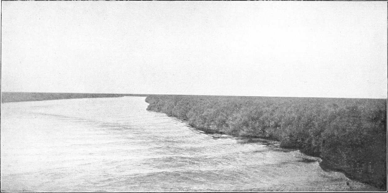
General description. (Editor.)The “sudd” (in Arabic sadd = block) is a generic name by custom applied to the huge marshes through which the Bahr El Jebel, Bahr El Ghazal, Bahr El Zeraf and the lower portion of their tributaries wind their way. It forms an irregular triangle of which the northern base extends about 200 miles west from the mouth of the Bahr El Zeraf, and the southern apex lies about Bor, 250 miles S.S.E. of Lake No. It is difficult to estimate the area of these vast marshes, but it cannot be much less than 35,000 square miles.
These marshes are formed by the expansion of the rivers mentioned over this area, and probably represent the bed of an old prehistoric lake which has to a certain extent dried up. The theory has been put forward that in those far-off days a ridge about Kodok, subsequently broken through by the river, caused the holding-up of waters in this lake, but this is hardly the place to examine this theory in detail.
Suffice it to say that a great part of this area is covered with a shallow sheet of water, over almost the whole extent of which thick reeds and swamp-grasses have sprung up. Except in the actual river channels this water is probably nowhere more than 2 to 6 feet deep.
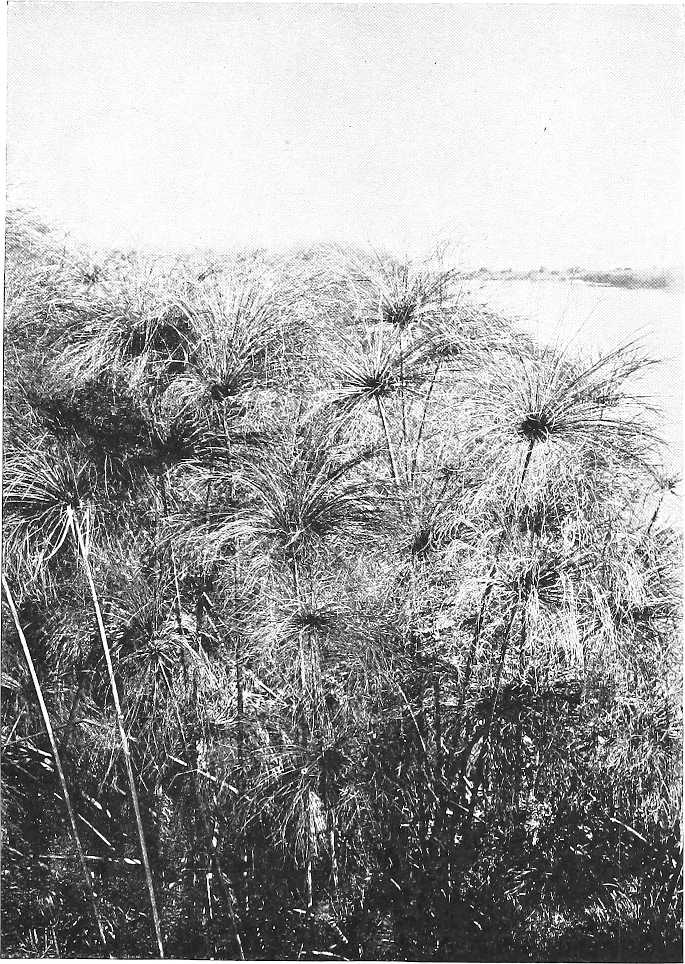
Scenery.To the eye the effect is one of a vast extent of brilliant green papyrus, feathery reeds and sword-grass, 5 to 15 feet above the water, broken by occasional patches of light ambach trees, with channels of water, pools and lagoons dotting the “swamp-scape,” and here and there a sparse tree or two on the horizon. Occasionally, and more especially towards the south, ridges, or patches of mud or solid ground are visible, Animal life.and in such parts there is much bird and animal life. In the lower (northern) reaches of the Sudd nearly all signs of life—except the brilliant little bee-eater, an occasional heron, fish-eagle, or “anvil bird,” the ubiquitous crocodile, and, of course, the insects—disappear; but in the more southerly parts are found many varieties of game.
Inhabitants.On the Bahr El Jebel, for the first 150 miles south of Lake No there are no human inhabitants visible. Thereafter occasional Dinkas and their villages are seen up to about Bor (384 miles); whilst beyond this the Bari country commences, the population as the Lado Enclave is approached being considerably thicker on the east than on the west bank. The Bahr el Ghazal swamps and banks are almost uninhabited.
Of the larger species of game, elephant, giraffe, buffalo, and many sorts of antelope, including waterbuck, Leucotis, Cobus Maria, etc., etc., are seen towards the south, whilst the hippopotamus is excessively numerous almost throughout.[228] From the reeds and mudbanks arise clouds of wildfowl, crane, geese, (black and white, and brown), storks (saddleback, black, open-billed and marabou), herons (white, grey, egret, purple, “squacco,” and “Goliath”), bustard, and the quaint balaeniceps rex (whale-headed stork), besides pelican, spoonbill, ibis, and duck of every description; and of insect life the supply is unnecessarily large throughout. This latter includes several varieties of persistent and poisonous mosquitos (from the large scarlet one to the tiny anopheles), the trumpet-headed sudd insect and other kindred grasshopper-like creatures, millions of midges and mayflies, the serût fly, moths, spiders, fireflies, etc., etc. The sudd also swarms with coarse fish, some running to a considerable size.
The true Sudd.Some confusion has been caused by the word “sudd” being applied to the whole of these marshes. As a matter of fact, the real sudd is only the obstructive floating vegetation, originated in the lagoons as described below, which is driven by force of circumstances into the river channels and there forms the block or sudd. By far the greater portion of the marshes are covered by standing reeds, papyrus and the like, which, although they cover and assist in the formation of the floating vegetation and even, when uprooted, form part of it, yet are not, strictly speaking, sudd in their original state.
Thus, the traveller who proceeds along the cleared channel from Lake No to Gondokoro will, in all probability, although in the middle of the “sudd,” see little, if any, genuine sudd at all.
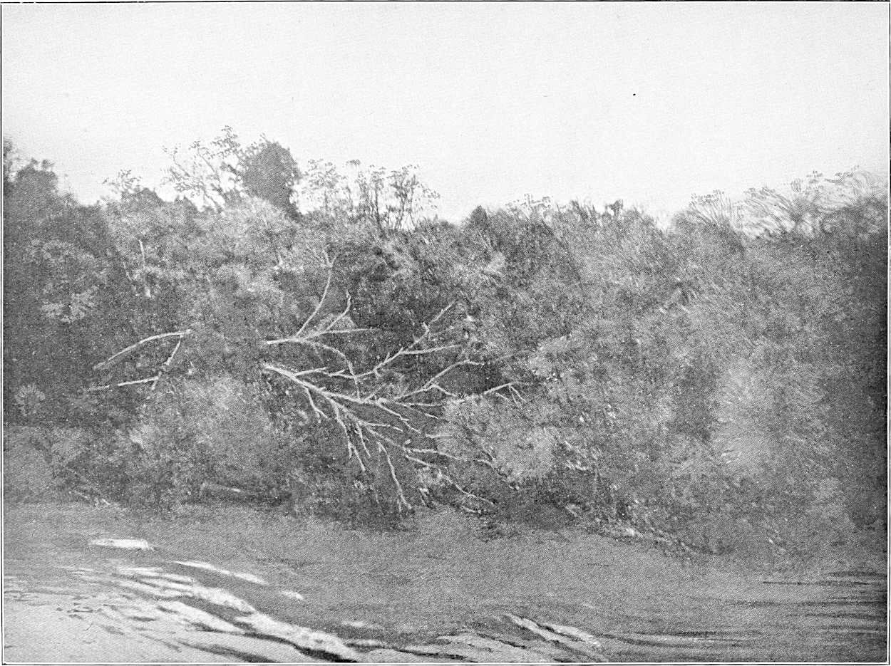
Formation of Sudd. (Sir W. Garstin.)In the Bahr El Jebel the main factors in forming sudd are the papyrus and the “um sûf.” These two, with the earth adhering to their roots, form the real obstruction. Many of the smaller swimming plants, such as the “Azolla” the “Utricularia” and the “Otellia Vallisneria” are mingled with the others, but they certainly do not play an important part in the formation of the obstacle. The ambach, too, has been unjustly accused of assisting in forming this barrier. This is not the case. This plant does not grow in any great quantity in the vicinity of the Bahr El Jebel, and its stem is so light and brittle that it would break when subjected to great pressure.
On the Bahr El Ghazal, on the contrary, the sudd is chiefly composed of the swimming plants above-mentioned. Their breeding places are Lake Ambadi and the other shallow lakes to the south.
The Ghazal sudd is much lighter in texture than that of the Jebel, and is consequently much easier to remove. At the same time, even in the former river, the sudd is at times dangerous, especially if it forms down-stream of a vessel, and if the latter has to work upon it from its up-stream end. The accident to Gessi Pasha’s expedition in 1880 proves that even the Bahr El Ghazal sudd can be an impassable obstacle under such circumstances.
Before alluding to the work done in removing the sudd, it may be as well to say a few words as to the principal causes of this remarkable barrier.
The Bahr El Jebel traverses the marshes between Bor and Lake No for some 380 miles of its course. South of Shambe the river has never been known to be blocked. On either side of the channel, in these immense swamps, extend large shallow lagoons, some of them covering a square mile or more of area. These lagoons are surrounded on every side by a luxuriant growth of aquatic plants, consisting chiefly of the papyrus and the grass known to the Arabs as the “um sûf” (the mother of wool). Both these plants grow in water, but not in any great depth. The papyrus attains a height of from 15 to 20 feet, with fibrous roots which strike deep into the ground. The “um sûf” rarely exceeds 5 feet in height, and its roots do not extend so deeply as do those of the papyrus. They are, however, very tough and difficult to break or cut through. These roots are bedded in the soil below the water, but the strong gales which blow in these regions loosen their hold to a large extent. If such a storm be accompanied by any rise of the water surface, large masses of these plants are set free from their original position, and begin to float on the surface of the lagoons. Their roots form such a tangled mass that large quantities of the earth in which they are embedded remain clinging to them. These act as ballast, and when the island of papyrus or reeds is detached and, under the influence of the wind, is set drifting about the lagoon, the weight of the earth retains the plants in their vertical position. Their roots, the moment they reach a shallow, act as anchors, and speedily strike down again into the muddy bottom of the lake. Large masses constantly change their position in this way. If the storm cease, they remain where they are. Unfortunately, at the commencement and end of the rainy season, stormy weather is the rule rather than the exception. At such seasons large areas of the marsh vegetation are in motion, driven hither and thither by the wind.
The Bahr El Jebel, where it passes through the swamps, has no banks whatever, and is, as a rule, separated from the lagoons merely by a narrow belt of papyrus. In many places it is in connection with them, and the water of the lakes flows in and out of the river, according to the level of the latter. As the stormy season in these latitudes heralds the approach of the annual rains, the rise of the river follows very speedily. The channel of the Bahr El Jebel being only of sufficient section to carry the low water supply, with the first rise in the levels the river spreads over the marshes, flooding them in all directions, and increasing the depth of water in the lagoons. It thus causes the areas of reed, already detached by the wind, to float still more easily. The continuous gales which prevail set hundreds of acres of these floating masses moving in one direction. Eventually they reach a point on the river where they are forced into the channel. Once there the current speedily carries them down-stream. Ere long their course is arrested by a projection on the edge of the channel or by a sharp bend. It may happen that an area of reed, several acres in extent, bursts into the river in a large sheet, and in such a case it must be necessarily arrested at the first point where the section is contracted. The result is that the channel is quickly blocked, though, perhaps, not at first to any great depth. Masses of weed, however, follow one another in succession, brought down by the stream. The section of the channel being reduced by the first obstruction, the velocity of the water rapidly increases, and these masses, following the easiest course, pass under the obstacle thus created. Each fresh mass arriving is sucked underneath those originally arrested, until at last the whole becomes wedged into one solid block, composed partly of earth and partly of stalks and roots of papyrus and reed, broken up by the extreme compression into an inextricable tangle. So great is the pressure applied by the water, that the surface of the block is often forced several yards above the water-level and is seamed by alternate ridges and furrows. The thickness varies greatly, according to the conditions and sections of the channel. In some cases it is not more than 4 to 6 feet, but it not infrequently obtains a thickness of 16 feet, below water, and occasionally as much as 22 feet have been observed.[229] Underneath this bar the river manages to force an outlet, but with a velocity increased proportionately to the smallness of the aperture. At the same time, the up-stream level rises, flooding the marshes in every direction, the water making use of any side channel that it can find. In time, doubtless, if left to itself, it would desert its original course, and the stream would take an entirely new direction, the original channel becoming permanently blocked. It generally, however, happens from natural causes, such as strong winds or increased heading-up of the water, that these blocks burst, and the obstacle is carried away. On such occasions a great wave passes down the channel, carrying everything before it, and sweeping away any similar blocks which may have been formed down-stream. Only in this way can the clearance of the sudd in certain years which has undoubtedly occurred be explained. Many of these blocks extend for a considerable length, some being as much as several miles long. It is easy to understand that such closures of the river channel cause not only a complete bar to navigation, but also a very serious obstacle to the free passage of the water. More than this, each block thus formed assists in the formation of others, by raising the water level up-stream, and thus assisting the flotation of further areas of papyrus and reed, much of which eventually finds its way into the river.
The movement of these great masses of weed, and the way in which they burst into the river, bears a striking resemblance to the descriptions given of an icefield when in motion. Their steady and resistless movement, the manner in which the fields break up, and the way in which they pile upon one another when an obstruction is encountered to their course, recall irresistibly what travellers relate of the action of the ice-floes when the pack is breaking up.
The sudd in this river, and in a less degree that in the Bahr El Ghazal, constitutes a very real danger to navigation. Should a steamer happen to be surrounded by it when in motion, the compression would certainly strain her framework to the risk of crushing it. Even should she escape this she will most probably be imprisoned for an indefinite time, owing to the river blocking on either side of her. During the stormy season, it should if possible always be arranged that two steamers should work in conjunction, one remaining down-stream, so as to be able to go to the assistance of the other if necessary.
As no fuel is to be met with throughout the whole length of the sudd region, a solitary steamer, if detained for some time by a block, may find herself eventually prevented from proceeding, or from making any attempt to free herself, owing to the absence of any means of generating steam in her boilers.
The Bahr El Ghazal sudd is, as has been said, of a different kind to that of the Bahr El Jebel. It is, as a rule, much lighter in consistency and easier to remove. This is doubtless due to the fact that the velocity of this river is very low, and, consequently, the pressure exerted by the water upon a block is small compared with that caused by similar conditions in the Bahr El Jebel. Again, on the Bahr El Ghazal, the papyrus and reeds do not extend on either side to any distance, nor are continuous and large lagoons close at hand. Between miles 42 and 52, up-stream of the junction with the Khor Deleib, there must, it is true, be always a risk of a block. In this reach the river passes through papyrus swamps, which are miniature editions of the Jebel marshes. Even here, however, the obstruction can hardly attain to the same solidity as in the case of the Jebel sudd, as the sluggish current of the Ghazal would fail to wedge the mass between the banks as tightly as would the rapid stream of the other river. Lake Ambadi appears to be a great nursery for the smaller varieties of the sudd plants. In the beginning of the rainy season these are carried down-stream and, as the channel wanders and twists, they form small obstructions. None of these, however, appear to be lasting, and it is rare that the Ghazal river is blocked for any length of time. It may be closed for a few months and then re-open itself. Thus in March and April, 1900, it was clear throughout its entire length, while in September of the same year it was blocked in more than one place. On this river, as on the Jebel, the sudd frequently sinks to the bottom, and decomposes, gradually raising the bed of the river. In this state it is very hard to remove.
AMBACH.
Botanical Composition.The sudd-forming plants may be classed in three divisions.[230]
The first, which contains plants whose roots descend to the river bed, is chiefly composed of the papyrus (Cyperus Papyrus), the common reed or “Bus” (Phragmites communis), and the feathery-headed grass (Saccharum Spontaneum).
The second kind is composed entirely of plants whose roots are in the water, but do not strike down to the ground or bed of river. The principal plant in this class is the “Um sûf” (Panicum pyramidale), grass, so called by the Arabs (“Mother of wool”) on account of the irritant hairs found on its leaf-sheaths which adhere to the skin of anyone touching them. In addition to the above, the wild bean (Vigna Nilotica) and creepers with purple flowers (Ipomœa) are found in profusion.
The third or last class of sudd is composed entirely of plants which swim upon the surface of the water. These form the cementing medium which binds the first two classes together.
The following are the principal components of this class:—
Pistia, a small cabbage-like plant with bright green leaves. Azolla, resembling moss in texture. Utricularia, Aldrovandia and Ceratophyllum, all resembling feathery floating streamers. The first variety has a series of small bulbs, like floats, attached to each streamer. The last is common in the canals and drains of Lower Egypt.
Otellia, a plant with big leaves and a white flower like a lily.[231] It is found everywhere in this class of sudd, and is met with at Damietta, where it is called by the Arabs “Lughmet el Kadi,” or the “Kadi’s pudding.”
In and among the above the blue-flowered creeper (Commellaria) is found.
Detail. (Mr. Broun.)Regarding the detail of the formation, the first point of interest is that all the most important sudd plants propagate themselves by means of tubular rhizomes which run along the surface of the water giving out shoots from point to point. These shoots, after developing, give out other runners which cross the others and weave themselves into them, a further consolidation being given by twiners which bind them all together.
Chief sudd plants.The most important sudd plants are, without doubt, Papyrus, “Um sûf” (Panicum pyramidale), and “Bus” (Phragmites communis).
“Um sûf” is probably the greatest source of blocks in the river courses, as it seems to thrive in deeper water than either the “Papyrus” or “Bus.” But all these give out long rhizomes. Those of the “Bus,” which is a very tall reed, extend sometimes quite 20 yards from the parent plants. These rhizomes either break away when the new shoots have developed and go to form new colonies elsewhere, or they are driven by the side of the others and gradually encroach on the river.
Among the climbers which bind the new growth (as well as the old) together, the principal are three kinds of Ipomœa, one vine and a leguminous twiner Vigna Nilotica. One of the Ipomœas (I. Reptans) deserves special mention, as it is not only a twiner, but possesses also tubular rhizomes, which enable it to float along the rhizomes of Papyrus, “Bus,” or “Um sûf,” and to knit them together as soon as they give out shoots. Among other plants which have also hollow stems are Jussiæa diffusa, which is also supplied with bunches of spine-shaped floats, and Polygonum tomentosum.
When all these floating masses are being tied together by the twiners the river brings down other plants as a packing to fill the interstices. The most common is Pistia Stratiotes, but there is also a constant supply of Ceratophyllum, Utricularia, Vallisneria and other plants of the same family; also Trapa bispinosa (the water-nut), Potomogetum, Azolla, etc. Little nooks are thus enclosed by runners from the Bus reed, the interior spaces of which are crammed with smaller plants.
It appears wonderful that with all this enormous mass of vegetation growing in these vast swamps in which no traces of human habitations can be seen, the natural decay of the plants does not gradually raise the level of the soil and force the water to keep to well-defined channels which, with the greater volume of water which they would contain would soon force for themselves a less winding course than they now follow.
Action of fires.It appears that one of the chief causes of continuation of the old order of things is fire. Sparsely inhabited as the swamps are, they are swept through from end to end by fierce fires which carry everything before them and kill nearly all the trees which attempt to gain a footing. Here and there a few Kakamut, Dôm, Deleib, Dabka or Talh have managed to spring up, but they are so scattered that they do not count. The papyrus and reeds, instead of dying a natural death and forming soil by decay, are burnt down, and what of the ashes is not blown away by the wind is carried away by the next flood. Were it not for these fires it is probable that trees of the species mentioned above would spring out more abundantly, and it would not be a difficult matter to define the banks of the channel by plantations of these or other river-side trees, such as are to be found in Ceylon, for example, lining the river, e.g., Terminalis glabra, Vitex Leucoxylon, Vateria acuminata.
Recent history of blocks and sudd-cutting. (Various.)In 1863, 1864, and 1868, heavy sudds blocked the Bahr El Jebel, and in the first mentioned year they extend to the north of Lake No.
In 1870, Sir Samuel Baker found the Bahr El Jebel closed with sudd at its mouth in Lake No. He attempted to ascend the Bahr El Zeraf but failed to reach the Upper Nile, and was obliged to return.
In 1871 he ascended the Bahr El Zeraf, and eventually forced his way into the main river near Shambe, literally lifting his boats and steamer over the intervening swamps and shallows.
In 1872 both the Bahr El Jebel and Bahr El Zeraf were closed, and in 1874 Ismail Pasha Ayub cleared away the sudd in the former river.
In 1878 Emin Pasha found it impossible to ascend the Bahr El Jebel from the south.
In 1879 and 1880 Marno (an Austrian) cleared the Bahr El Jebel of obstruction, completing his work in April, 1880.
In this same year Gessi Pasha undertook his disastrous journey in the Bahr El Ghazal, his steamer being blocked in that river for many weeks, and his expedition only being extricated by the timely arrival of another steamer under Marno, not, however, before he had lost many men.
In 1881 and 1884 the Bahr El Jebel was again closed by the sudd. During the period of Dervish rule nothing detailed was known regarding the state of the river, but in 1895 it was reported to the Intelligence Department that the White Nile was closed by the sudd. During this period the steamer “Mansurah” sank in the main channel in what is now known as the 15th block. The steamer was discovered during the Sudd operations of 1903-04.
As soon as possible after the battle of Omdurman (2nd September, 1898) steamers were sent up-stream to investigate. Major M. Peake attempted (7th October, 1898) to penetrate the Bahr El Jebel, but in vain. He steamed, however, up the Bahr El Ghazal nearly as far as Meshra el Rek. With Major Stanton he shortly afterwards steamed 157 miles up the Bahr El Zeraf, and was then stopped by shallow water.
In the following year, after a visit by Sir W. Garstin and Lt.-Col. Sparkes in the spring, operations for clearing the Bahr El Jebel were seriously undertaken, and Major Peake left Omdurman at the head of an expedition on 16th December, 1899. The party consisted of five gunboats, five English and some Egyptian officers, some British N.C.O.’s, 100 Sudanese, and a gang of 800 Dervish prisoners.
By the 27th March 1900, by means of hard and continuous labour, 14 blocks had been cleared out of 19, opening up 82 miles of river. Major Peake then avoided the remaining blocks by using side channels, arrived at Shambe, 25th April, 1900, and proceeded in clear water to Rejaf (5th May, 1900). Four (16th to 19th) out of the remaining five blocks were cleared by Lieutenant Drury, R.N., in January, 1901, and only the last one, the 15th, 22 miles long, and just south of Hellet El Nuer, still remained. It was considered, however, desirable to make renewed efforts to clear this block. Accordingly an expedition under the direction of Major G. E. Matthews was sent up in the winter of 1901-02, but did not succeed in completely opening the channel. The work of clearing this block was vastly increased owing to the entire absence of current. Nothing was done in 1902-03, but in 1903-04 Lieutenant Drury, late R.N., was again sent to renew the clearing operations. Practically no traces of Major Matthews’ work were discernible, and when, after dogged perseverance, the accomplishment of the task was well in sight the work had to be again reluctantly abandoned.
The false channel now in use is still liable to slight sudd-blocks, especially from April to June. A monthly steamer and other craft, however, keep the fairway open, as a ride, merely by their passage, and there is little or no danger of the channel being seriously blocked again.
Method of clearing.The following was the method employed by Major Peake in clearing the sudd:—
The first operation was to cut and burn the whole of the vegetation growing on the surface; this was done by a party of men with swords, fasses,[232] and axes. Immediately this was done the line to be taken up for the first channel, generally about 12 yards in length, was marked out; this was trenched by the Dervish prisoners armed with fasses, picks, axes and saws, into pieces 4 yards square. After cutting down about 1 foot from the surface the water infiltrated; the men continued cutting until, owing to the depth of the water, they were unable to get any deeper. Holdfasts of telegraph poles were then driven as far as they would go around the edge of each piece. After this a 1½ inch flexible steel wire hawser was sunk as deep as it would go by means of the pronged poles, all round the piece to be removed; the ends of it were made fast to the bullards in the bow of the gunboat, one on the starboard side and one on the port, leaving sufficient slack wire to allow the steamer to go astern some 20 to 30 yards before she got the strain; “full speed astern” was then ordered. Full speed was kept up continually if the piece showed any sign of becoming detached until it came gradually away; as soon as the piece was quite clear, one end of the hawser was cast off and the piece was allowed to float down the stream; the holdfasts were pulled out by means of a rope, one end of which was made fast to the bow of the steamer, and the other by a hitch to the end of the holdfast. If the piece showed no signs of coming away, the engines were reversed and the steamer was brought close up to the sudd and then went astern again. This was repeated again and again until the piece was detached. Some pieces were known to take as much as two hours to get away. Sometimes with very thin sudd, after it had been trenched, the steamer would be run up with her bow on to the sudd, and on going astern would carry the piece with her; also with light sudd a grapnel anchor fixed to the steamer when going astern was found sufficient to tear away the piece.
Very often the sudd will be found with its roots adhering to the bottom; this is especially the case in a year when there is a very low Nile, like 1899-1900, or close up to the banks, when the first leading channel is being widened.
In this case a grapnel or ordinary anchor sunk to the bottom of the river and then dragged along by the steamer is useful. As soon as the leading steamer has opened up the channel a sufficient length to enable her not to interfere with a steamer working behind her, another steamer is put to work, the same way as the first, to widen the channel. This is generally laborious work, as there is not much current to act on the sudd, and in consequence it takes longer to get it away.
In cutting the trenches care should be taken to cut or saw through all roots.
(For further details of the sudd, see H.B.S., pp. 4 and 207 to 213 inclusive (Dr. Junker’s account); Sir W. Garstin’s invaluable reports (Egypt Blue Books No. 5 of 1899, pp. 15 to 19, No. 2 of 1901, pp. 34 to 43, and No. 2 of 1904); Major Peake’s Reports, 1900; and Mr. Broun’s Note, 27.4.03—from all of which, besides some original work by the Editor, the above description has been compiled.)
THE BAHR EL JEBEL—PAPYRUS.