Volume 1 — CHAPTER II.
Reading edition
THE WHITE NILE.
[The reader who wishes to study in detail the whole question of the Nile Basin, its floods, discharges of rivers, schemes of irrigation, etc., etc., is referred to Sir William Garstin’s invaluable “Report on the Basin of the Upper Nile,” F.O. Bluebook, Egypt No. 2 (1904). Price 17s.]
(i.)—INTRODUCTORY.
General.The White Nile and its tributaries form the life blood of the Sudan. The great river traverses it for 2,029 miles from south to north, receiving on its course through the country the Bahr El Ghazal, the Sobat, the Blue Nile, and the Atbara.
Of these four tributaries the Bahr El Ghazal joins the Nile out of the swamps from the west, whilst the other three join it from the east, bringing down the fertilizing matter from the Abyssinian hills.
Flood.The rise of the Nile takes place during the summer, but the dates naturally vary largely at different points.
The causes of the flood are, briefly, as follows:—The rains in southern Abyssinia cause the Sobat to rise about the middle or end of April. The yellowish-white water caused by this flood reaches Kodok the last week in April. The equatorial rains cause the Bahr El Zeraf and White Nile, above the Sobat, to rise about the end of May. The effect of the first rise is felt at Halfa about the 20th May. The Blue Nile begins to rise about this time, and brings the red fertilizing flood down to Khartoum about the 20th June, and to Halfa about the middle of July. The muddy Atbara flood (June to August) rises very rapidly after the Blue Nile, and causes the flood to attain its maximum about the end of August; at this period the river is muddiest. The White Nile continues to rise slowly, and its effects (clear white water) are felt at Halfa till October, when it falls very slowly. The Blue Nile falls rapidly after the middle of September, and the Atbara has generally disappeared by October. The Sobat begins to fall at Nasser early in December.
The Bahr El Ghazal rivers rise slightly in May. These soon subside, and the main floods take place in July and August.
The above is a description of an average year. An early maximum (i.e., about the middle of August) generally means a low summer flood, and vice versâ. The flood at its height moves at about 100 miles a day (below the Atbara).[17]
The above dates vary largely in accordance with the time and amount of rainfall in the upper valleys of the rivers.
Of the flood water annually brought down by the rivers, about half now runs to waste into the Mediterranean sea. The Aswan dam regulates and utilizes this to a certain extent, but a large proportion remains over. This it is proposed to utilize in the future for irrigating the Sudan by means of flood and catchment basins; but the time is still distant when this surplus will be entirely devoted to this purpose.
Historical.Up to comparatively recent times the sources of the Nile were involved in mystery.[18] In ancient days many guesses were hazarded at their origin, some geographers maintaining that the Nile rose in the Atlas Mountains of Marocco; others were positive that the Niger formed the upper portion of the great river. During the 17th and 18th centuries it was held that the sources were to be found in the “Mountains of the Moon.” These have since been speculatively identified with the Ruwenzori Mountains between Lakes Albert and Albert Edward, and, if this theory is correct, the ancient geographers were not so far out.
It was left for Speke and Grant, in 1862, on a journey from the east coast, to discover that the great lake, now known as the Victoria Nyanza, was the main source of the White Nile. Sir Samuel Baker, in March, 1863, working up stream, discovered the Albert Nyanza; but it was not till some time afterwards that the actual course of that portion of the river, now known as the Bahr El Jebel, was mapped and traversed, Lieutenants Watson and Chippendall, R.E., being the first, under Gordon in 1874, to lay down the actual course. During the ensuing years, this, the upper portion of the river, was several times blocked with sudd, and at the re-conquest of the Sudan from the Dervishes in 1898, it was permanently blocked. An expedition under Major Peake, however, succeeded in clearing a channel in 1899-1900, and there is no likelihood of the clear channel now existing being, except quite temporarily, blocked again.
The sources of the Blue Nile, which for long was considered as the main river, were, as early as 1770, discovered by Bruce to be near Lake Tsana (Abyssinia), but to this day the actual course of the Blue Nile between Lake Tsana and Famaka (Abyssinian-Sudan border) has never been accurately laid down.
The course of the Atbara, as far up as the junction with it of the Setit, was roughly known before 1864, when Sir S. Baker made a more thorough exploration of these rivers, but the courses of the Atbara and Setit lying within the Sudan have only recently been fairly accurately laid down. The Atbara rises in the Abyssinian hills, near Chelga, where it is known as the Goang.
The Sobat was explored by Marno and Junker in the “Seventies” as far as Nasser, where there was then an Egyptian post. It was left for British officers, after 1898, headed by Captain Gamble, to explore the various narrow rivers such as the Baro, Pibor, Akobo, etc., which join the main stream from South-West Abyssinia, east of Nasser. The course of the Upper Pibor was explored by Lieut. Comyn in September, 1904, vide p. 151.
The course of the comparatively short Bahr El Ghazal river, known to the slave-traders of old times, was laid down by Petherick, Gessi, etc., in 1864-78; but the courses of the western rivers which flow into it, such as the Bahr El Arab[19] or El Homr, have not yet been even roughly determined. Those of the more southerly affluents, such as the Suei or Jur, etc., though not yet accurately fixed, have been sketched in by Junker, Marchand, etc., and the British officers in the Bahr El Ghazal since 1900.
(ii.)—GENERAL DESCRIPTION (DOWN STREAM).
Albert Nyanza to Khartoum, Bahr el Jebel.After leaving the Albert Nyanza, the White Nile (or as it is there called the Bahr El Jebel) flows for 110 miles in a deep broad arm, with scarcely any velocity or slope, past Wadelai and Dufile to Nimule, and then, after a short and troubled course, between high mountain ranges, tosses over the Fola Rapids in a channel only 50 yards broad. From here it continues in a torrent to about Rejaf. Here the river is 7 feet deep at low Nile and 15 feet at flood time, discharging between 18,000 to 60,000 cubic feet per second. The regulating effects of the great lakes are well felt here. It is here at its lowest in winter; begins to rise about 15th April, with a minimum about the end of August.
From Rejaf to Bor, 112 miles, the river is mainly in one channel with a rapid fall. From Bor to the junction with Lake No, 384 miles, the river meanders along in numerous marshy channels with a very gentle slope. The main channel always used is known as the Bahr El Jebel. In this reach are the dams of living vegetation, known as the “Sudd” (for description see Appendix B). On one stretch the true channel is still blocked with sudd, and a “false” channel, a little to the westwards, has to be used for about 20 miles.
Lake No.At the junction of the Bahr El Ghazal and the Nile in north lat. 9° 29′ is Lake No, or Moghren El Buhur,[20] a shallow expanse of water surrounded on all sides by reedy marsh and varying in size according to season, but in summer probably about 60 square miles. It forms a reservoir for the sluggish streams that drain the extensive plateau forming the water-shed between the Nile and Congo. In summer the lake and its swampy surroundings act as an evaporating basin, and the loss of water is consequently considerable. The waters here also become polluted with decaying green vegetable matter.
The Bahr El Ghazal enters Lake No at its western extremity, and the Bahr El Jebel passes through its eastern end. The Bahr El Ghazal has a feeble discharge and has no effect at any time on the volume of the White Nile.
In the stretch between Lake No and the Sobat, 81 miles, the current is slow and the channel occasionally blocked by sudd.
Sobat.During flood, the Sobat has a discharge nearly equal to that of the Bahr El Jebel above the junction. In the spring the discharge from the Sobat is feeble, and the river is then unnavigable. The soil brought down by the Sobat is light and friable.
White Nile.At the Sobat confluence the river changes its name[21] and now becomes the Bahr El Abiad or White Nile.
From this point down to Omdurman, 530 miles, it receives no more perennial affluents, but several large khors join it on the east bank between Kodok and Renk—chief of which are Khor Adar and Khor Rau.
The White Nile flows sluggishly along with a low velocity and gentle slope; its course is generally straight and its section wide and shallow, banks low, supply very constant; the colour and limpidity of its water show very little change throughout the year, and the variations between the level of high and low supply are very small, being not more than 2 to 6 feet. The depth of the river in this stretch ranges from 15 feet at low Nile to 21 feet in flood. In parts, the channel in flood time is often of immense width.
The result of 94 measurements made in June, 1862, show the mean width of the river in flood to be 1,870 yards. In many places, however, the channel is more than 2 miles wide, and in its general appearance it resembles a lake rather than a river. Its banks, more particularly the western shore, are very low, and its waters in flood spread for several miles over them. Their average height is not more than 8 to 10 feet above low water level, and the maximum difference between high and low supply is not more than 6 feet.
The river is at its lowest by the beginning or middle of April; the rainfall in the south then causes a constant and gradual rise, but the flood does not reach its maximum before the beginning of September.
The velocity of the current when in full flood is not more than 2½ to 3 miles an hour, whilst in winter this is reduced to 1½ miles an hour. The water is of an olive green or yellowish brown tinge. It owes most of its colour to the creamy-white waters of the Sobat River, called by the Arabs the Bahr El Asfar, or Yellow River.
Green water.An odd phenomenon, the source of which has not been satisfactorily explained, is the “green water,” which makes its appearance at Dueim about the middle of May. The colour is owing to the mass of minute algæ in the water, which subsequently putrify and stink, but the origin of the water has not been definitely traced. It is believed to come from the upper Sobat, or Bahr El Ghazal, and not from the Bahr El Jebel. This green water reaches Cairo towards the end of June.
Junction of the Niles at Khartoum.At Omdurman, half Nile usually occurs about the middle of July, high Nile at end of August or beginning of September, lasting about a month; half Nile end of November, lowest Nile end of April. The Blue Nile is at its lowest in May, and highest about the end of August. The result of careful measurements during the last 3 years has been to prove that when the Blue Nile is in flood, and generally when its discharge exceeds 5,000 metres cube per second, its waters hold back those of the White Nile and, owing to the increased depth in this river, due to the rise in the water levels, the volume coming from the south floods the Sudd marshes right and left of the channel and thus reduces the discharge of the White Nile by about 50 per cent.
The average difference between low and high Nile here is 22 feet (17½ to 26 feet).
Below Khartoum.The river below Khartoum flows steadily along till it reaches the 6th or Shabluka cataract (see p. 47). Below this it is not disturbed, except for the rapids of the so-called 5th or El Homar and Bagara cataracts, till it passes Abu Hamed and enters the 4th or Belal cataract some way below this point. This cataract, forming the most complicated and dangerous rapids on the Nile, is for ordinary purposes unnavigable (see p. 36). Below it there is an open stretch past Dongola to the 3rd or Hannek cataract, shortly followed by the Kajbar rapids (see p. 26). A rocky channel full of small islands and small rapids, increasing in size and importance as the river proceeds, is entered some 80 miles below Kajbar, and through the Batn El Hagar the river rumbles along till, after passing the 2nd or Amka cataract, it emerges past Halfa in a broad and steady stream which lasts till it arrives at the dam and 1st cataract (Shellal) of Aswan. From here onwards there are no further obstacles (except sand-banks and canals) till, viâ the Delta of Egypt, the Mediterranean Sea is gained.
(iii.)—RIVER DISCHARGES.
The following, taken from Sir W. Garstin’s Report above mentioned, gives a summary of results respecting discharges in the basin of the Upper Nile:—
1. The Victoria Nile.
The discharge at the Ripon Falls varies between 500 and 650 metres cube per second with a range of 1·1 metres. Downstream of the Murchison Falls the range is probably 1 metre, and the maximum and minimum discharges 1,000 and 400 metres cube per second respectively. The increase in flood is due to the rainfall throughout the catchment area of the river between these two points, while the decrease during the low season is due to the Choga Lake, which undoubtedly has a regulating effect upon the supply issuing from Lake Victoria. Lastly, the volume which enters Lake Albert by this river is generally, in flood, greater than that which leaves it by the Bahr El Jebel.
2. The Bahr El Jebel.
At Wadelai, the first discharge site, the range of the river is about 1·11 metres while the discharge varies from 550 to 950 metres cube per second. The increase brought in by the streams which feed this river between Lake Albert and Wadelai is compensated by the loss of water due to a portion of the discharge of the Victoria Nile passing south up the lake during the flood season.
At Lado, 381 kilometres, the range is 2·30 metres, and the discharge in summer averages from 600 to 700 metres cube per second. The maximum (generally attained in September) varies between 1,000 metres cube per second in a low flood, and 2,000 metres cube per second in a high one. This increase in the flood supply is due to the rainfall throughout the river valley, and to the volume added by the many important tributaries, such as the Asua, the Kit, etc., which feed the Bahr El Jebel between Wadelai and Lado.
At Bor, 559 kilometres, the loss of water in flood is some 50 per cent. of the amount passing Lado, and the discharge here can rarely, if ever, exceed 1,000 metres cube per second. This loss is due to the filling up of the entire river valley, which thus forms an immense basin or reservoir, and reduces the discharge passing to the north. This reservoir extends from Lado to the head of the Bahr El Zeraf, a distance of some 378 kilometres. As the river falls the water of this basin, with the exception of the large amount lost by evaporation, slowly filters back through the marshes into the river during the winter months, and thus maintains the constancy of supply.
Throughout the “Sudd” region the loss of water in the Bahr El Jebel, both in summer and in flood, is very considerable. By the time that Lake No (1,156 kilometres from Lake Albert, and 749 kilometres from Lado) is reached, 85 per cent. of the discharge at Lado has been lost in a high flood, and 70 per cent. in a low one. During the summer months the loss at this point varies between 50 and 60 per cent. Lastly, the discharge which enters the White Nile from the Bahr El Jebel is nearly constant at all seasons of the year, and never even in the highest flood exceeds 300 or 320 metres cube per second. The regulating effect of the great marshes is thus very apparent.
3. The Bahr El Ghazal.
The discharge of this river, as a feeder of the White Nile, may be neglected entirely. Its summer volume entering Lake No varies from 20 to 30 metres cube per second, while its flood discharge is even less, equalling from 12 to 20 metres cube per second. None of this water enters the White Nile, merely increasing the flooded area of Lake No. It, however, helps to augment the reservoir area of the main stream.
4. The Bahr El Zeraf.
This branch of the Bahr El Jebel adds to the volume of the White Nile by an amount varying from 30 to 60 metres cube per second in summer, and from 80 to 160 metres cube per second when in flood. If, however, the Bahr El Jebel is closed by “Sudd” then the discharge of the Bahr El Zaraf increases, possibly to from 300 to 400 metres cube per second during the flood season.
5. The Sobat.
This river is the main supply of the White Nile during the period of flood. The first effects of its waters are felt in May and June, while, as it does not reach its maximum until October and November, the volume of the Blue Nile having then been largely reduced, it maintains the discharge passing Khartoum to a very considerable figure. In years of good flood the discharge of the Sobat varies from 900 to 1,000 metres cube per second. In the early months of the year its discharge shrinks to very low limits, its waters being held back by those of the White Nile. When in flood the reverse is the case. The volume of the Sobat being at that time more than double that of the White Nile causes a rise in the levels of the latter upstream of the junction and holds back its water as far as Lake No.
6. The White Nile.
The discharge of this river below the Bahr El Zeraf junction varies from 300 to 500 metres cube per second according to the season of the year and the nature of the flood. It is probable that the last figure is a maximum and is never surpassed.[22] At El Dueim, 637 kilometres below the Sobat junction, the summer supply varies between 350 and 500 metres cube per second. The minimum levels are generally attained in the month of April and the first half of May. The discharge, owing to the Sobat water, gradually increases until the Blue Nile flood exceeds the volume of 5,000 metres cube per second at Khartoum. As soon as this figure is passed the discharge of the White Nile is reduced by an amount varying from 30 to 60 per cent., and this holding back continues until the Blue Nile falls again below the figure above given. This reduction of the White Nile discharge takes place in the months of August and September. As soon as the Blue Nile discharge has fallen below 5,000 metres cube per second that of the White Nile rises very rapidly, attaining its maximum in the months of November and December, when as much as from 1,500 to 1,700 metres cube per second have been recorded. This increased discharge is, of course, partly due to the Sobat, but also to the draining off of the water which has been ponded up for so long a period. It seems safe to assume that the White Nile discharge at Khartoum never under any circumstances exceeds 1,800 cubic metres per second.
To sum up:—The White Nile is at its lowest from March to May. It rises in June, is checked again in August and September, and attains its maximum during the months of November and December. Its limits in a low year are from 300 to 1,500 metres cube per second, and in one of high flood from 400 or 500 to 1,700 metres cube per second.[23]
7. The Blue Nile.
The supply of this river is chiefly derived from the drainage of the basin through which it runs and from the large tributaries which enter it downstream of the point where it issues from the Abyssinian hills. The Tsana lake has but a small influence upon its supply at any period of the year. It is at its lowest in May, when its discharge at times shrinks to nothing. It begins to rise in June and attains its maximum about the end of August. Its discharge in a year of good flood is as much as 10,000 metres cube per second, and it seems probable that in a year of exceptional flood 12,000 metres cube may pass Khartoum. In September it falls very rapidly, and during the winter months rarely discharges more than from 200 to 400 metres cube per second. The Khartoum gauges prove that a higher reading is recorded for a given flood discharge when the river is falling than is the case when the river is rising. This is probably due to the filling of the valley between Khartoum and the Shabluka Pass.
8. The Atbara.
The first water from this river reaches the Nile in the last week of June, and the maximum is usually reached in the last days of August, or in the first week of September. The Atbara generally attains its maximum before the full flood from Khartoum has arrived at the junction of the two rivers. After the maximum has been reached, the fall of the Atbara is rapid, and by the end of the year the river reverts to its summer state of a series of pools. The maximum discharge of the Atbara, measured in 1903, was 3,088 metres cube per second, but this is probably surpassed in a year of very high flood.
9. The Nile north of Khartoum.
The discharges of 1903 record a maximum of 10,500 metres cube per second in an average year. If to this be added the volume of the Atbara, a total of nearly 14,000 cubic metres per second is reached. As in 1903 the levels at both Halfa and at Cairo did not pass those of a very ordinary flood supply, it would seem probable that in very high flood a volume of quite 16,000 metres cube per second must pass Berber.
In conclusion it may be stated with confidence that the White Nile contributes practically nothing to the flood which reaches Egypt. This is entirely derived from the Blue Nile and from the Atbara. On the other hand, the supply passing Aswan during the spring and early summer is due, almost entirely, to the water of the great lakes brought down by the White Nile.
The following are the water-slopes of the two rivers, as worked out from the discharges:—
Bahr El Jebel—
At Wadelai 127000 dry season.
At Bor 112100 flood season.
At 830 kilometres from Lake Albert 122500 flood season.
At Hellet-el-Nuer 140000 flood season.
At „ „ 116500 dry season.
At Lake No 187500 flood season.
At „ 154000 dry season.
White Nile—
Above Sobat 120000 dry season.
At Dueim 1100000 when Blue Nile has fallen and the While Nile is at its maximum.
At Dueim 150000 dry season.
Blue Nile
At Khartoum 111200 flood season.
(See also footnote on p. 111, giving a short table of comparative discharges.)
(iv.)—NAVIGABILITY (UP STREAM).
Between Halfa and Khartoum (880 miles) the river may be said to be navigable throughout at high Nile.
Details are given below as to the various cataracts to be encountered, but it may be broadly said that, although difficult, it is not impossible to get boats and steamers through in the time of the flood. At low Nile most, if not all, of the cataracts are unnavigable.
Before the Nile Expedition of 1884-85 steamers and boats were taken over the 2nd cataract. During the expedition both were taken over the 3rd cataract and intervening rapids, and boats (whalers) successfully surmounted the 4th cataract. In 1897 gunboats and other steamers were hauled over the latter place, and the rocks of the 5th and 6th cataracts have never, when there was enough water, offered serious resistance to the passage of boats or steamers.
From Khartoum to Gondokoro, practically 1,100 miles, the only obstacles to navigation at any time of the year are:—
1. The Abu Zeid Ford (occasionally only), and the Azalet or Dankul Rocks near Jebelein, vide p. 59.
2. Scarcity of fuel.
3. The sudd.
4. Sand-banks.
2. Fuel.—One of the great economic questions of the Sudan which would give rise to anxiety were not the Nile-Red Sea Railway already in course of construction is the future supply of fuel. Imported coal now costs £E.4 to £E.6 per ton, and petroleum £6 to £E.11·500 per ton at Khartoum. Though a bed of lignitic coal has been discovered at Dongola, no other coal, nor even lignite, has so far been located within our boundaries. Wood therefore, is and will for some time remain the chief source of fuel supply. The large demand which arose with the development of Khartoum has caused the destruction of forest belts along the White and Blue Niles to a considerable distance from Khartoum, and although the Forest Department has now control of the fellings, the enormous demand is making inroads into the forests from which subsequent fires preclude recovery.
Wood stations for steamers are established at different points along the banks, at distances usually sufficiently near to obviate steamers taking too heavy a load, but there is a long gap between Khor Attar wood station and Kanisa (about 380 miles), which necessitates steamers carrying a large amount of firewood to enable them to cross the sudd region. As there is a heavy tax on the forests at these wood stations, the fellings are getting farther and farther away from the bank, and tramways are necessary to work the more remote portions of the forest.
3. The Sudd.—A full description of the formation of and methods of dealing with the sudd are given in Appendix B. The Nile was blocked by the sudd from 1870-4, 1878-81, in 1884, and from 1895 to 1900.
The Nile, before it flows into Lake No, appears to be a channel varying from 100 yards to a mile in width, but, from the masthead of a steamer, it would be seen that there is a sea of papyrus grass, bulrushes, and reeds on either side of this water channel, and that the real banks of the river are 4, 8, or even 12 miles distant on either side. Under all this vegetation is water, which is slowly making its way down to fill up the void caused by the absorption of the water by plants and sun. The matted vegetation which floats on the top of the water is so thick that it is possible to walk on it; and, were it not for this covering, the evaporation over such a vast area would greatly diminish the supply of water to Lower Egypt.
A considerable part of the Nuer tribe actually live on the floating mass of vegetation, fish and the stalks of a water-lily forming their only food. The surface of the water is covered by a dense tangled mass of papyrus, ambach, and other water plants, which in places grow to a height of from 15 to 30 feet.
At the rise and fall of the Nile, quantities of the grass get torn away and float down stream. If the season is unusually wet, the stream increases in bulk and rapidity, and innumerable large masses of the grass, hurried and packed by the wind, are sent floating down; these jamb in the channels and form the sudd blocks.
The channel of the river is very tortuous; at Lake No, for instance, where the Bahr El Ghazal flows into the Nile, there is a sharp turn to the east. If the water contributed simultaneously by the Bahr El Ghazal happens to be insignificant and incapable of sweeping away the floating masses, a block is the result at this point.
4. Sandbanks.—They are not as a rule any considerable obstacle, but are, of course, more troublesome at low than at high Nile, and shift about every year.
Steamers with no encumbrances, and with fuel ready cut for them to pick up, take about 12 days up stream from Khartoum to Gondokoro, and about 8 days down stream. (Record journey in 1903: 11 days up and 7 down).
The navigation up to the mouth of the Sobat is at all times easy, the Abu Zeid Ford and occasional rocks and sandbanks forming the only difficulties. The deepest channels lie usually towards the east bank. From the Sobat to Gondokoro a perfect and recent knowledge of the route is required, in order not to deviate into any of the lateral branches which are frequently met with, and which, varying from year to year, are chiefly in evidence during and after the rainy season.
There are also many sandbanks on this stretch. Between Gondokoro and Rejaf the river is rather difficult when low on account of shifting sandbanks and islands. There are a few rocks, but not dangerous, except at one point.
Between Rejaf and Bedden there is the same difficulty of shifting sandbanks and sunken rocks, which are, however, isolated and few in number, and might be blasted away. The current here is about 1½ miles an hour. At Bedden there is a bad rapid necessitating a transhipment; but from there boats can go to Kiri.
From Kiri to Labore there are awkward rapids, but the river might be utilised to a great extent. The river continues of much the same character till the junction of the Asua, when the rapids become more serious, terminating in the Fola Rapids.
The last 15 miles before reaching Nimule are quite impassable to any steamers or boats.
From here on, the river is free of any obstacles up to Lake Albert.
Between Dufile and Lake Albert the Nile is very sluggish, and papyrus islands abound in it. Breadth of channel varies.
Boats and Steamers.
The usual Nile boats are the “Nugger” and “Gayassa,” varying in capacity from 5 to 400 ardebs. The latter solidly built, with high bows, and free board, and lateen-rigged, is the Egyptian boat, whilst the former, which is found from the 2nd cataract southward, is flat, with low free board, and is roughly though solidly built without ribs. Rafts, canoes, inflated waterskins and water-tight pots are also used for individual navigation. Further up stream “dugouts” and ambach canoes are seen. Of steamers there are 10 gunboats, 21 other steamers, and 6 launches on the river, mostly stern-wheel; a few are screw, and one or two paddle. (Vide Chap. X, Part I.)
Landing Places.
From Halfa to Khartoum and from Khartoum up to Goz Abu Guma it is possible to land almost anywhere on either bank. From there up to Kodok, owing to the broad reed fringe on either bank, landing is difficult except at the following places, viz.:—Jebelein, Um Ashrin, Karshawal, Renk, Meshra Leungtom or Domaia, Meshra Zeraf, Meshra Rom, Kaka, Kaka Wood Station, Melut and Demtemma. All these, except Kaka and Um Ashrin, are on the right bank.
As Gordon states, in the stretch between Kodok and 100 miles north of it, “People do land, but it is over your knees in the rainy season,” and even if a landing is effected, progress inland is always liable to be arrested by wide and deep khors which are really branches or overspills from the main stream: these obstacles are encountered even in the dry season.
There are easy landing places in many spots between Kodok and Lake No, then nothing except Hellet Nuer, Shambe, Abu Kuka, and Kanisa for 360 miles till Bor; south of Bor the best known ones are at Kiro, Lado, Mongalla, Gondokoro and Rejaf, though elsewhere a landing can generally be effected, especially on the left bank of the western channel, which leaves the main river near N. Lat. 5° 30′. Above Rejaf one can land anywhere up to the Fola Rapids. Between Dufile and Magunga (on Lake Albert) there are five landing places.
(v.)—CLIMATE.
The rains on the Upper Nile in the equatorial regions from the Albert Nyanza to the Bahr El Ghazal last from February or March to October or the middle of November.
As one proceeds northwards the heavy rains come later; the “Kherif,” or rainy season, in the neighbourhood of Kodok, lasts, as a rule, from the middle of May to the end of October, whilst at Khartoum it may be said to be during July, August, and September. At Halfa there is no rainy season.
At Gondokoro the hot weather commences middle of November and lasts till the end of March.
Colonel Stewart states (1883):—“The rains are very heavy, lasting 10 to 12 hours at a time. From Gondokoro south to the Equator, rainy seasons increase in length, till on the Equator it may be said that rain and sunshine succeed each other in rapid succession all the year round.”
Heavy thunderstorms and rains occur at intervals during the rest of the year, especially from October to January in the hilly regions round Rejaf and the Sudd district to the north of it.
Winds.
During late autumn winds are very variable, blowing from all points of the compass. East and south-east winds at this period predominate, especially in the upper reaches. During the rest of the year the north wind, varying from north-west to north-east, is fairly constant, except during the summer rains, when the wind shifts to the south and south-east.
Temperature.
The average maximum and minimum shade temperatures on the Upper Nile during the hot months are 99° and 85° respectively, and during the rest of the year 88° and 74°. Between Khartoum and Halfa the maximum average is a good deal higher, and the minimum rather lower.
In the Sudd region and south the maximum averages about 85°, but, owing to the dampness of the district, from April to December fevers are rife, and the heat and mosquitos are difficult to bear with equanimity.
(vi.)—DETAILED DESCRIPTION OF THE NILE FROM THE NORTHERN BOUNDARY OF THE SUDAN TO GONDOKORO.
Section 1.—Halfa to Merowe.
The northern boundary of the Sudan (and of the Halfa Province), though nominally the 22nd parallel of north latitude, begins for administrative purposes on the Nile at Faras Island, 12 miles north of the point where that parallel crosses the river and 20 miles north of Halfa. Opposite Halfa the river is some 900 yards broad, and is navigable up to the foot of the 2nd cataract, 26½ miles up stream.
Beyond the 2nd cataract the river runs through the broken rocky country of Batn El Hagar, and is full of rocks and rapids which require careful steering, even for small boats at high Nile, up to the Amara rapid. Beyond this the river is fairly easy till the 3rd or Kajbar Cataract is approached. At this point the Nile again works its way through broken hilly ground covered with boulders, and from thence it is plain boating, except for sandbanks, till Merowe.
A road, or rather a fair camel track—total 228 miles from Halfa to opposite Dongola—runs along the right bank of the river, taking short cuts across bends (notably for 35 miles across the desert between Kosha and Abu Sari) all the way, but has naturally been considerably superseded by the railway. On the left bank there is also a through camel track, but it keeps further from the river and is less used than that on the other bank. (For detail, vide I.D.W.O. map No. 1489, sheets Wadi Halfa, Kosha, Dongola, Debba, and Merowe.)
The railway (3 feet 6 inches gauge) extending from Halfa to Kerma (203 miles) was started in Ismail Pasha’s time (1877), carried on nearly to Akasha in 1884-5, almost entirely destroyed by the Dervishes (1885-96) and rebuilt to provide means of transport for the Dongola Expedition in 1896. Of necessity it was rapidly and lightly laid, and it is now (1904) in a bad state of repair. Owing to the great cost which would be involved in its complete repair, it is to be abandoned (see Chapter X, Section 1).
(For administrative and economical details of the Halfa and Dongola Provinces, vide Chapters III and IX.)
N.B.—In the river table, in order to avoid fractions, as a rule only the nearest mile or kilometre is given. Kilometres, where given, are in italics: 5 miles = 8 kilometres.
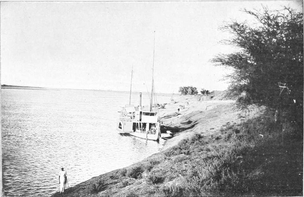
From Photo by] [M. Venieris. THE EASTERN NILE BANK, SOUTH OF HALFA.
Place. Miles. Kilometres. Left (West) Bank. River and General. Right (East) Bank.
Inter-mediate. From Halfa Camp.
Faras Island 20 32 Bare, except for a few huts and patches of cultivation. Sandy and rocky, sloping to the river Northern point of the Sudan Administration on river. River some 800 yards in width, current 1½ miles per hour at low Nile to 3 miles per hour at high Nile Cultivated in general. Palm trees. Sandy. Banks 20 feet at low Nile, 4 feet at high.
Jebel Sahaba 12 8 The 22nd parallel crosses the river at this point Jebel Sahaba, hill on R. bank.
Dabarosa 5 3 Fertile island.
Halfa 1½ 1½ Difficult approach to right bank at low Nile. Numerous sandbanks appear, varying from year to year on this stretch A commercial town of about 2,500 inhabitants, of which about 200 are Greeks. (See Chapter III, page 85.) Landing place for goods and passengers. Headquarters of Halfa Province. Terminus of S.G.R.
Halfa Camp (802 miles by river from Cairo) 1½ 0 Nearly opposite Halfa is the Quarantine Camp, on a sandy slope The best description of the river between the 2nd and 3rd cataracts (including both) is by Commander Hammill, R.N., whose report (1884) is to be found in H.S.C., Vol. I., Appendix O Headquarters of the Sudan Railway. Landing place close to officers’ mess. Bank 10 to 30 feet above river (226 miles from Shellal).
Khor Musa 5 5 The bank generally gets more rocky and broken Some additional matter, with large-scale (but inaccurate) map of the different rapids, is given in O.G.H., pp. 9-25 Fort now in ruins. Action v. Dervishes 1888. Bank broken and rocky. Huge boulders.
Foot of 2nd cataract (Shellal el Amka) 1½ 6½ 10½ The cataract, 8½ miles in length, is impassable for steamers and nearly so for any but small boats at low Nile, and only navigable with difficulty at high Nile. At high Nile it is a rumbling mass of rapids, whilst at low Nile it is a broken expanse of black rock, with shallow channels finding their way between. The Batn El Hagar (Belly of rocks) is now entered. See Hammill’s report for detail.
Abu Sir ½ 7 High cliff. Fine view of cataract The banks of the river between this point and Ginnis, where the Batn El Hagar is quitted, differ remarkably in their characteristics. The left or western bank usually presents a steep slope of loose golden sand, driven by the prevailing winds from the great Libyan Desert, varied by black crags jutting out of it and low rocky hills, while the right or eastern bank is generally rocky, free from sand, and in some places almost precipitous.
Matuka 3 10 16 Ancient Egyptian fortress of Matuka (XIIth Dynasty). Small temple to S.E. (see Murray, page 982).
Head of 2nd cataract 3 13 21 Between the head of the 2nd cataract and the foot of the Semna Rapid the Nile runs through a sterile and uninviting country, the eastern side covered with masses of black rocks, the western with mountains of yellow sand. The navigation is described as “difficult, dangerous, and tedious.”
Gemai 2 15 Used in 1884-5 as head of railway, portage for boats, &c.
Murshid 10 25
Sarras 8 33 53 Advanced post and fort of the Frontier force 1886 to 1896.
Ruin 1 34 Ancient Egyptian fort Railway here leaves the river bank and enters the rocky desert to the East.
Melik 6 40 64 Melik Island; ancient temple of Sikator I.
Semna Rapid 3 43 Semna Temple on height about 300 feet above river. Jebel Barga just behind Here a narrow ridge of gneiss forms an awkward barrier. At high Nile the river sweeps over it without perceptible diminution of width (430 yards), but at low Nile the rocks are bare save for a narrow channel, 45 yards broad and 65 feet deep, formed by erosion. (Gregory.) Kumna Temple on height about 400 feet above river.
Atiri Rapid 7 50 80 The obstructions to navigation consist of 2 “gates” about 1½ miles apart; of these the lower gate presents no difficulty. It is about 300 yards long, and steamers are able to steam up through it at “half Nile” without unloading. The upper “gate” is more troublesome to pass, the channel being obstructed by a great barrier of rocks which stretch quite 200 yards across the river, leaving at “low Nile” only a narrow gap towards the western bank. At “high Nile” another channel exists near the opposite bank. Not serious.
Ambugol Rapid 7 57 One mile long; channel near right bank. Fall 3 feet. Not difficult.
Tanjur Rapid 15 72 116 Bank low and even, desert sand up to river Extends for about 3 miles. Awkward cross currents at foot. Western channel best. “Gates” at either end straight and clear, but considerable rush of water. Difficult rapid altogether Bank high and precipitous, much broken up.
Jebel Alimula 2 74 Road passes to west of J. Alimula and by a precipitous track cutting off bend to Sonki.
Sonki 3 77
Omka 2 79 Bank low and fairly level Slight rapid, not serious Range of hills recedes from river bank low and even.
Hammam 5 84 135 Hot spring (sulphur) for rheumatism, etc.
Akasha 1 85 137 Easy rapid. Ridge of rocks extends across river. Western channel best At the village of this name the railway touches the river for the first time since Sarras. Macdonald’s advanced brigade occupied this, April, 1896. Headquarters of District and residence of Mamur.
Kulba 8 93 150 Late boundary (1903) between Halfa District and Dongola Province River begins to open out.
Dal Cataract 5 98 158 Bank low and even. Village here and on adjoining islands. On one island is a Mameluke fort, whence good view obtainable Broken water about 4 miles, numerous islands with high cliffs, difficult rapid, careful pilotage required—low ridges and rocks well covered at high Nile. Channel by right bank till half-way up, and then cross to left. Total width of river about 1,500 yards. Fall of 5 feet Bank higher than opposite one, evenly undulating. Becomes gradually cultivated. Jebel Dal, 4 miles to the east, tall conical hill, 1,973 feet.
Sarkamatto 6 104 167 Desert road here leaves river for a short cut of 19 miles S.W., to Sakiet El Abd The river from here to Amara, 16 miles on, is in parts full of small islands, but offers no difficulty Cultivated tract, dominated in its upper portion by Jebel Firket, 1,880 feet. The action of 6.7.1896 took place to the south of this hill, and a mile north of Firket village. The railway, after short cut from Akasha, here comes close to the river, and follows it through Mograka to Kosha, where it turns sharp to the south, following for the first 12 miles the desert road to Abu Sari. Seven miles to the east lies Jebel Idris, 1,720 feet, and 6 miles E.S.E. of the latter rises the mass of Jebel Hamra, 2,368 feet.
Jebel Firket 1 105
Firket Village 2 107 172 3 miles inland is a hill, 1,490 feet, name doubtful Action here between E.A. and Dervishes: 7.6.96.
Sarghun 4 111 Island near east bank.
Kosha 2 113 182 Road leaves river here for Selima Oasis The channel here turns in a wide curve to the west. Native boats take 8-10 days from here to Dulgo at high Nile with fair wind. Headquarters of District and residence of Mamur.
From Kosha onwards both the river banks become more and more cultivated, and are divided into districts varying from 1 to 4 or 5 miles in length, each containing one or more villages: gaps between districts in uncultivated parts.
All these districts consist of a greater or lesser amount of cultivated or uncultivated ground, together with a varying number of palm trees and huts. Each district is under a headman, and groups of them form the various sub-Districts, each under a Police Officer, a varying number of which go to make up a District; and out of these is formed the Province.
Only the more important sub-Districts will be mentioned in the River Itinerary.
Place. Miles. Kilometres. Left Bank. River and General. Right Bank.
Inter-mediate. From Halfa Camp.
Ginnis 2 115 185 At actual high Nile the river is navigable without difficulty from Kosha to Dongola and above; but a fortnight later it will be impossible to pass the Kaibar and Hannek cataracts, except in small boats The action of Ginnis of 30.12.1885 was fought on the slopes to the west of the village. Bank mostly low and even. Palm trees; more cultivation.
Amara Rapid 3 118 Desert sand comes right down to river Insignificant except at low Nile; caused by ridge of broken rocks crossing river bed.
Arneti 5 123 Island 3 miles long, lying in curve, which river here makes to the south.
Sagiet El Abd 4 127 Desert road arrives from N.E. across curve. Here a desert road strikes west to Selima (75 miles) and the Arbain road.
Yabri and Sai Island 3 130 North end of Sai Island. West channel unsurveyed, keep in east channel.
Koyeka 5 135 217 Open desert, almost flat for many miles Koyeka district; tomb of Sheikh Idris. Ground gradually rises to E.
Jebel Abud 5 140 South end of Sai Island Abud district. Jebel Abud 1,598 feet, 4 miles inland.
Suarda 2 142 228 Capture here of Dervish stores by Cavalry after Firket. Rich district.
Gurjan Tau 14 156 Ancient temple.
Koya 8 164 264 Desert road leads due south 28 miles (no water) to rejoin the Nile at Fakir Benti. Proposed route for railway, 1871 Channel here turns sharp to the east and after 10 miles curves S.E.
Abu Sari 15 179 288 Islands become more frequent, and the channel turns again definitely to the south Desert road from Kosha (36 miles without water, excellent going), reaches river here.
Dalgo 12 191 307 Large and important district. Railway here rejoins river from Kosha. Hd. Qrs. of the Mahas District
Kaibar Cataract (Kajbar, Kagbar) 12 203 325 Banks even and low, but rocky Thick (450 yards) low ridge of black granite here crosses the river, 1,200 yards wide here. Difficult even for small boats at low Nile; it presents practically no difficulty at high Nile Banks low. Palm trees. The railway here crosses the river and takes a short cut to Kerma.
4 207 Channel bends sharp to west Desert road cuts across S.W. to Abu Fatma (18 miles).
Arduan 5 212 Arduan Island. Rocky. 9 miles by 4. South channel narrow and unnavigable. Keep to left bank.
Fakr Benti 10 222 Fakr Benti River winds through broken, rocky country.
Jebel Alibersi and Jebel Sadek 6 228 Jebel Alibersi, overlooking river Jebel Sadek, 1,220 feet, 3 miles inland.
Shaban Rapids and 3rd or Hannek Cataract 1 229 368 Banks low and generally even and cultivated Four miles of broken water; keep to east channel except during highest Nile. 7 to 9 different rapids, the one at the foot being the worst. Not serious at high Nile. Fall, 18 feet altogether. The numerous islands are fertile. Bank broken by low ridges of boulder granite.
Hannek 2 231 Village.
Simit Island 2 233 Large island, 3 by 1½ miles. Keep to west channel.
Badin Island 8 241 Country becomes much flatter Island 6 miles by 1. Keep to east channel.
Abu Fatma 2 243 391 Rocky and enclosed. The desert road which left the river at mile 207 here rejoins it. British Garrison here 1885. Boundary between Halfa and Dongola Provinces.
Kerma (Rest house) 3 246 396 The Nile between here and Dongola becomes unnavigable for steamers from March to June. There is at other times a fortnightly postal steamer between Kerma and Merowe; this runs all the year round from Dongola to Merowe Terminus of the railway. Transport to Dongola is continued by land at low Nile, and by steamer at high Nile. P.T.O. Chief market day Weds.
Hafir (Rest house) 2 248 British camp here Summer, 1885. Action here 20.9.1896. Egyptian Army crossed from right to left bank. Market on Saturdays Village of Kerma.
Argo Island (Rest house) 4 252 405 North end of Argo Island, perhaps the richest soil in the Sudan. Thickly populated and highly cultivated. The head man is called the Melik (King) of Argo. The east channel is narrow and navigable for 3 months only. Numerous fertile islands in west channel. Hd. Qrs. of a District There are 8 or 10 small villages on E. bank behind Argo Island; cultivation carried on chiefly for the “Demera” crop.
Zawerat 19 271 Highly cultivated South end of Argo.
Chief ferry between W. Bank and S. end of Island, where boats can always be found
Dongola (Rest house) 9 280 450 Better known to the natives as El Ordi. Lies 2 miles to the north of the older pre-mahdist town. Former capital of the Province. British garrison there Mar.-July, 1885. 1,000 inhabitants. Post and telegraph office, residence of a British inspector, and Headquarters of District and residence of Mamur. The old forts and earthworks built by Mustafa Pasha Yawar are still to be seen stretching round the town Numerous sandbanks, sometimes causing difficulty in landing. A large island now lies opposite the town.
Between Dongola and the foot of the 4th cataract the river runs through a plain. Banks low almost throughout; no obstacles to navigation except sand banks at low and half Nile. From Dongola to Ambugol there is a broad strip of cultivation on one or other bank, rarely on both at the same time. From Ambugol the cultivated land gradually increases in extent; both banks are cultivated, and the Dar Shaigia is richer and better cultivated than any district south of the Fayum; the vegetation here is quite tropical in character, and all the islands are cultivated. Between Belal and Abu Hamed there is little cultivation, except in the Monasir (El Salamat) country. There are numerous villages on either bank, and the mud houses are all whitewashed and of a better class than those below Dongola, generally a short distance behind the cultivated strip. The weather is variable in October; before reaching Debba the north wind is sometimes lost. Debba to Abu Hamed is a warmer district than the country below and above these places. Prevailing winds from the north; native boats have to be towed between the two places named. The banks themselves are good for towing, but difficulties arise as the river falls. The most serious obstacles are the Sagias, which in some cases are only 50 to 100 yards apart.
Govt. Mosque, about 60 permanent shops and 3 or 4 flour mills
Irtidi 1 281 Village. Good road alongside river and telegraph line From Dongola to Debba the river is shallow, but clear of any serious obstructions all the year round. A few isolated rocks appear at low Nile.
Khannag 2 283 Village.
Sheikh Sherif 1 284 Small village, ¾ of a mile from river. Intervening space highly cultivated. The road from Dongola runs over alluvial soil at some distance from the river, on the outskirts of the cultivation The east bank is desert sand, and almost entirely uncultivated.
Kajatti 5 289 Name disappearing. Large tomb east of road. Few scattered huts.
Ordi El Monfok 1 290 Ruined village; good grazing Name disappearing.
Kasr Wad Nimiri 1 291 A stone ruin on a mound overlooking the river. The gravel ridge, which has skirted the road all the way, here comes down to the river. From the last station the river banks are lined with palms and the ground covered with coarse grass Islands of Lebab, Ab Turki, and Derer. Lebab Island is also spoken of as “Geziret Ashraf,” and was the birthplace of the Mahdi.
Sahaba 5 296 Rocky ridge widens out; good camping ground; gradually coming under cultivation.
Akri 4 300 Stone village.
Teit, Taetti 1 301 483 A stone village over a mile in length, situated a ¼ of a mile from the river. Between it and the river is a narrow strip of cultivation. The best camping ground is to the south of the village.
Saati Beshir 3 304 Domed tomb. Hills within 500 yards of river.
Urbi 5 309 A large village built where the hills leave the river, leaving a good open space for camping Island of same name opposite village very highly cultivated.
Sori 4 313 A long scattered village on the river bank. A strip of cultivation runs along the river; there is, however, a break in it just north of the large tomb. This is a suitable place for a camp.
Sali 4 317 The hills, which had widened out opposite Sori, here come nearly down to the river, leaving room for a shallow camp. A small scattered village with strip of cultivation. The road from Urbi to this place runs over a sandy plain with scattered mimosa Malwad opposite south end of Sali.
Khandak (Rest house) 3 320 Headquarters of District, and residence of Mamur. Built on a stony mound overlooking the river. Eight and a half hours’ steaming from Dongola (October). The town could be easily defended against a force coming down river or across the desert from the west. Broken mud wall on west and north sides. Old sun-dried brick fort in middle of town on the bank; good storage, accommodation for 200 men (British); commands town and approaches. Also 4 well-built brick houses in the town, capable of housing 300 men. Town of mud huts clean and well built. Market day on Saturday. Four hundred and forty sagias in the district, each representing 4 families. Much wood in the district. Road west into desert to Marghum, etc. Remains of many churches
Shebatut, or Shabadud 1 321 About 20 houses, 400 yards from river, at foot of low hills. Cultivation on banks 200 yards wide. Good space between cultivation and village. Best camping ground at south end of village. This spot was extensively used as a camping ground during the Nile Expedition. Light Camel Regiment here, Spring of 1885
Dambo 2 323 Fifteen houses ½ mile from the river; no cultivation. Good camping ground east of village; mimosa scrub. Banks shelving; compact village, 40 houses; good landing; numerous palms and acacias
Goled Bahri and Gibli 6 2 329 331 Three groups of huts extending over 1 mile, ¾ mile from river. Situated in broad alluvial plain, running down to river. Monday market; mass of cultivation; 2¾ hours’ steam from Khandak; considerable supply of wood, the mimosa trees growing to a great height. On leaving El Goled, the road runs at some distance from the river across a rich alluvial plain (cultivated) Komi Island (cultivated) East bank gradually becomes more inhabited and cultivated.
Wad Abbas 3 334 Nani Island Desert road leads east from Wad Abbas to near Merowe. (76 miles.)
Rumi 2 336 Villages Bahri and Gibli Rumi Island 2 miles on Stone ruins 2 miles inland to north-east.
Bakri 4 340 On nearing this place the ground becomes more sandy and covered with mimosa scrub. It extends for over 1 mile, amidst palms and cultivation. All supplies plentiful. Good camping ground to south. Saturday market.
El Khelaiun, or Kheleiwa 4 344 From Bakri to this spot (which consists only of a poor hut or two) the river banks have been lined with coarse grass, outside of which is a strip of sand dunes and mimosa, with the road outside this. Cultivation here takes the place of the grass. Sand dunes still continue. Site of old Christian church. Stones with Greek inscriptions found Commencement of highly cultivated Latti district, 3 to 4 miles broad, with numerous villages, e.g., Amentogo, Arab Hag, Kodokol, and Megabda. Quantities of date palms and wood.
Kankalab 1 345 Village of 30 tukls, on a high bank overlooking a broad strip of cultivation, which intervenes between it and the river. Good camping ground 1 mile south River shallow. Former site of Ghaddar Island District narrows down as hills approach river from north-east to Ghaddar, etc.
Old Dongola, locally pronounced “Tóngălo” 6 351 564 Dongola Gharbi. Well cultivated, many trees; shelving banks and good landing. A long, scattered village, separated from the river by a broad strip of cultivation. Between the village and the desert is a tract covered with mimosa and “dead sea fruit.” Fairly well wooded. Wednesday market Baja Island Old Dongola, on the right bank, is a deserted town of ruined mud houses, containing not more than 30 able-bodied men. The people live in the island of Hamur, a little higher up stream, and in the cultivated districts on the west bank; much wood in surrounding country; 422 sagias. It is built on a rocky height, overlooking the river and the desert to the east. It is capable of easy defence, and might be held by a very small force. In rear of the town are the ruins of a once strong fort. Severe sand storms are frequent. There is one mosque built over an old Christian church commanding the river, village, and surrounding country. Cliffs, old sandstone, 30-70 feet high.
El Ghaba 4 355 A small village with a clump of trees. There is a break in the cultivation here, and space on the river for good camping ground. Markets Tuesdays and Fridays Tangussi Island, very fertile; 8 miles long. Narrow east channel Fertile stretch opposite Tangussi.
Abu Gussi 1 356 Was an important village, with road striking south-west to Omdurman and El Fasher. British Garrison, 1885. Now deserted; river eating away banks and cultivation Good landing west bank. On leaving Abu Gussi, the river changes its course to nearly east and west. The left bank to Debba is highly cultivated, and a little vegetation is visible on the right bank.
Giref 4 360 The country between Abu Gussi and Debba is hard, sandy going, with low hills on the right hand, and broad patches of cultivation on the left. A desert road to Mahtul, 40 miles, here leaves the river.
Karad or Kurot 9 369 Just north of Debba; 45 sagias; steep banks. Good landing for all boats. General Brackenbury’s brigade was quartered here during the spring of 1885 Argi Island Argi district, cultivated.
Debba (Rest house) 2 371 596 Consists of old field works of 430 yards perimeter, enclosing a few huts. Was garrisoned in 1884 by 250 Bashi Buzuks. Headquarters of the District, and residence of Mamur. Wheat, barley, dura and wood procurable from neighbouring cultivated districts. A direct road to Omdurman starts from here viâ Abu Gerad. The position is excellent, the fort being surrounded on the south by an open sandy plain, covered by slight bush, and abutting on the river on the north, where there is a good landing place, steamers and heavily laden boats being able to come close alongside. Cultivation along the banks of the river recommences about a mile distant, east and west of the fort. The Wadi Melh, a dry shallow valley, debouches on to the plain, where its course is lost in the sand. By following up the course of this valley, the old and now little used Kordofan caravan road is joined, leading to Bir Mahtul and El Obeid. A commercial centre (formerly) for ivory and gum from, and for European merchandise for Kordofan and Darfur. Geological formation, Nubian sandstone, acted on by heat, and metamorphosed on the surface. Petrified wood is found in great quantities River here 750 yards wide; course south-east and north-west. Various cultivated islands such as Gira (373), Tambanarti (382), Ganeti (391, keep to north bank), Jigarnarti (397), and Husseinarti (404), dot the river hereabouts Right bank bare as a rule, with cultivated patches at intervals. Ruined castle at Abkor (380).
Abu Dom 16 387 623 The road passes over sand and some slight sandhills while passing Abu Dom. An important village of about 300 men; the houses are scattered along the edge of the sand; there are 30 water-wheels and a few palms. Cultivation: dura, wheat, Indian corn. Market on Wednesdays. The most southerly point on the river before reaching Berber. A more northerly course is then taken. The left bank continues most rich in cultivation; wood abounds. Next districts in order: Abu Kleiwat, Jura (with ruins of Coptic church, road makes short cut to east), Artimoga, Fakrin Koti, Mansur Koti River channel now curves, and runs south-west and north-east. Easy navigation to foot of 4th Cataract. East bank becomes more cultivated. Districts of Affat, Abseit, Nizezi, Neriko and Difar. Rest house at Affat.
Hetani or Tani 16 403 Rocky Hill Jebel Taraka 1 mile to south; outlying spurs from J. El Nob 5 miles to south. Old castle (Galat Hatani) 1 mile on, in ruins, with rock well. Narrow road, camels single file, was held by Emir Heddai against Mudir of Dongola, in 1884
— 6 409 Camp of General Dormer’s Brigade, 1885. Bush gets thinner, road descends to— Kori and Takar districts. Bank fairly cultivated. Districts El Bar, El Barsa, Karafab (420).
Ambugol 4 413 665 Large village, standing ½ mile back. Open country around. Branch road to Korti. Metemma road starts from here. Friday market. The river bank from here to Merowe is well wooded throughout, and the road during the whole distance runs over a sandy plain sparsely covered with mimosa scrub El Arag, Hajeir, Magal, Bakhit, with hill and ruins (431). Low rocky hills in distance.
Gowari 2 415 A compact village of many houses. The road from Ambugol runs over an alluvial plain sparsely covered with mimosa scrub. No cultivation along the river banks, and the ground is everywhere favourable for camping. A few palms to the south of the village.
Korti[24] (Rest house) 1 416 670 Two villages: one on the river, and one 1 mile inland. Palms, mimosa, and cultivation along the river. A low sand ridge runs parallel to the river, at a distance of 1 mile from it. Sunday market. Steep banks, 15 feet high. Advanced base of Nile Expedition, 1884-5. River banks now mostly cultivated, including thick mimosa scrub in parts. Road to Jakdul and Metemma starts from here. The W. Mogaddam joins the Nile here. Headquarters of Mamuria.
Ghoreiba 3 419 Fifty well-built houses. No cultivation between here and El Basa, 3 miles on. Passing Usli (426) arrive at—
Gureir 12 431 Scattered village, extending for nearly 8 miles. River banks deeply cultivated almost its entire length. Good camping grounds are to be found on the water’s edge just before the village is entered from the south, and at its northern extremity, and at a point 6 miles from its southern end. The cultivation lies on the low ground formed by mud deposits at the salient angles of the river, the village being situated on the original bank; the water is consequently only accessible at the re-entrant angles. Saturday market.
Hannek or Korti district 1 432 Districts of Korei, Arak, and Tangassi Abu Rannat Island (436) 3 miles long Large village of mud huts. Much wood of considerable size. Then come Magashi, El Zoma, Tulbenab, and Kajabi.
Tangassi 9 441 710 A large scattered village with deep cultivation in a salient angle of the river. Tuesday market, the most important in province and well known throughout the Sudan. Police post.
El Debeiba 2 443 Small village with wide strip cultivation Desert sandstone rock comes down to the right bank, forming cliffs 40 to 60 feet high, extending for about 2½ miles along the bank.
Abu Dom Sanam (site of ancient town of Napata) 3 446 A scattered village at the confluence of the Khor Abu Dom with the Nile. The cultivation runs a considerable distance inland along the Khor, which delivers a considerable stream during the rainy season. Surrounded by dense vegetation and trees. A road from here joins the Dugiyet-Berber road. Supplies of all kinds plentiful.
Merowe (capital) 1 447 719 Merowe. Headquarters of province and residence of the Governor. It is practically on the site of the 1896 camp of Abu Dom Sanam. The town has yet to be built. At present it only consists of about 30 houses, including offices, telegraph, etc. Old village of Merowe. Advanced post during summer of 1885, under Commander Julian Baker, R.N.
Will be terminus of the branch line from Abu Hamed. From Affat to Merowe boats will have to be towed by tugs, as they are unable to navigate this bit of river against wind and stream.
Desert road to S.E. to Jakdul
RECAPITULATORY TABLE OF DISTANCES.
Intermediate. From Halfa.
Miles. Kilometres. Miles. Kilometres.
Faras Island — — 20 32
Halfa Camp 20 32 — —
Foot of 2nd Cataract 6½ 10½ 6½ 10½
Head of „ „ 6½ 10½ 13 21
Akasha 72 116 85 137
Kosha 28 45 113 182
Dalgo 78 125 191 307
Kaibar Cataract 12 19 203 325
Third (Hannek) Cataract 26 42 229 368
Dongola 51 82 280 450
Debba 91 146 371 596
Korti 45 72 416 668
Merowe 31 50 447 719
Section 2.—Merowe to Khartoum.
Sub-Section (a). Merowe to Abu Hamed.
The distinguishing feature of the river between Merowe and Abu Hamed is the difficulty of navigation, and also of communications along either bank. A variety of rapids, mostly impassable except at high Nile, form the 4th Cataract, which extends practically from Belal to Shirri, a distance of about 67 miles, whilst there are little or no cultivation or supplies, except in patches on either bank. This (Rapids) portion of the river was ascended in whale boats by most of the River Column in 1885, and the right bank was traversed by General Hunter’s flying column in 1897, when proceeding to attack Abu Hamed. Otherwise it is not now generally in use for communications,[25] owing to these obvious difficulties. A telegraph line now connects Merowe with Abu Hamed.
[The reader who may wish for further detail than that given below is referred to “N.O.” 1st and 2nd editions (1897 and 1898), which give some additional reports by slightly different routes.]
Remarks on the Shaigia Cataracts.
(Lieut. Poore, R.N., October, 1884.)
The prevailing winds are north-easterly and boats can rarely use their sails, excepting occasionally at high Nile when a southerly wind may blow for a few days.
Boats leaving Ambugol for Abu Hamed invariably have to tow the whole way.
The pilots state the average passage of a nugger[26] from Merowe to Abu Hamed as being from 35 to 40 days, but they appear to perform the journey in parties of about 10 boats, in order to supply their own hauling labour, thus considerably increasing the time of passage.
Nuggers generally leave Debba on the trip to Abu Hamed 20 days before high Nile and try to time their arrival at Abu Hamed as soon as possible after the river begins to fall.
Steamers should not leave Merowe for Abu Hamed later than 10 days after high Nile.
Nuggers should not leave Merowe for Abu Hamed later than 15 days after high Nile.
There are men in the village of Bela at the foot of the Gerendid Cataract and in a few of the villages near Merowe who are acquainted with the different cataracts, but would seem to be more useful as guides to point out the different channels than as pilots, their knowledge of boats or nuggers seeming very limited.
It would be advisable to take pilots for the cataracts from the rais of nuggers.
Supplies between the cataract of Gerendid and Abu Hamed are very scanty, a few scattered patches of date palms, wheat and dura constituting all cultivation.
Between the different cataracts the banks appear to be rocky and badly adapted for towing. The stream is swift with frequent sharp bends and the river studded with rocks and small islands.
Confusion may arise from the custom of the pilots and natives in continuing the terms east and west as regards the river banks after the river has turned to the northward at Ambugol; the right bank being invariably termed the east and vice versâ without reference to the direction of the river. Thus, between Ambugol and Abu Hamed, a wind which is termed by the pilots south-westerly is in reality north-easterly.
Report on Passage of 4th Cataract by Nuggers and Gayassas.
(Captain W. Doran, August, 1897.)
The following is a report on the river between Kassingar and Amari, together with remarks on points that have come under my observation:—
Nuggers with a strong favourable wind can get up to Meshra El Abiad, but there is a strong current below Meshra El Abiad for about 3 or 4 miles, and the track (on the right bank) is rocky, or much obstructed by sunt trees.
Meshra El Abiad presents no great difficulty. About 50 men will pull a nugger of 200 ardebs through in half an hour.
For about 3 miles after leaving Meshra El Abiad, the channel on the right bank presents no difficulty, though the stream is strong, and the banks steep and covered with sunt bushes, which at high Nile will impede towing.
About 5 miles from Meshra El Abiad the banks become rocky, and rapids are met with; the water being very bad, and rocks numerous. I crossed this rapid, which is about a mile in length, and extends to just below the village of Shebabik, in half a gale. Otherwise, I should think the passage would be difficult, as the rocks on the right bank are very steep, and without a strong wind portage would probably be necessary. From Shebabik village, by following a channel on the right bank past the village of Abu Haraz, good water is met with for about 6 miles, till the cataract of Halfaya is reached.
From Halfaya to the village of Amari, a distance of about 2 miles, the river is very difficult, tortuous, and rocky, towing being necessary throughout.
From Amari, I am informed, the river is not difficult.
It must be understood that these remarks refer to the river as I found it. Any rise or fall may make difficult places easy, and vice versâ.
I would venture to make the following suggestions for future river convoys:—
1. That only boats of 150 ardebs should be sent up at present. Large boats are unwieldy, cause great delay, break ropes, and run the risk of losing stores. For example, one of my boats of 300 ardebs took 4 hours to get up a place which boats of 150 ardebs crossed in an hour. It broke two ropes, and was nearly wrecked on several occasions, besides being always a source of delay to the rest of the convoy. The exertion caused to the men in hauling these heavy boats is very great, much greater than that of hauling two boats of half the capacity.
2. Each convoy should consist of not more than 20 boats under a British officer, and should have with it two companies (200 men) of an Egyptian battalion to haul the boats over the cataracts, and in the ordinary stream when the wind is unfavourable. If the water proves easy beyond this place, Amari, these men might return to Merowe from here by return convoy. Men who are good swimmers should be selected, if possible, and, as the work entails great exertion on the men—most of them having to stand work in the water all day—the companies should be relieved after one or two trips.
Unless considered necessary for safety, these men should not bring arms or ammunition with them, except just sufficient for a small guard, as these have to be portaged across bad places, causing delay.
The large cooking pot, “kazan,” is not suitable for these occasions, as men are often separated on islands from the rest of the convoy at night time, and are unable to get their proper food after a hard day’s work. Something of the Flanders kettle type would be better.
3. Each convoy should be provided with four strong hemp ropes of at least 200 fathoms each, in addition to the smaller ropes carried by each boat. These latter should be inspected before the convoy starts.
A small boat of about 50 ardebs would also be most useful to enable the officer in charge of the convoy to go up and down his convoy, and also to assist in the portage of stores from the nearer boats when they get stuck in shallow places or rocks.
Report on the Passage of Gunboats from Merowe to Abu Hamed, 9th to 29th August, 1897 (vide 1489, Merowe and Abu Hamed Sheets.)[27]
(Commander Colin Keppel, R.N.)
To Kasinjar on right bank, river broad, navigation simple. No obstacles. Thence to Kenisha, navigation easy.
At Meshra El Abiad there is a difficult, narrow passage between two rocky islands, with a very sharp turn. Water very rapid, which continues until Um Deras Island is reached.
N.B.—The cataract marked on the official map as El Dermi was not recognisable at this time of the year.
Um Deras Island is practically at the foot of what is termed the Gab El Abd, or 4th Cataract, it was from thence that a course by the left bank was followed by the river column in 1884-85. This channel was found to be so difficult and dangerous at high Nile, it was decided to examine the channel by the right bank. This was found to be more easily navigable for steamers at this time of the year. It should, however, be noted that this channel, though navigable for steamers at high Nile, and undoubtedly the only channel to be followed with safety at that time, would be impassable at any other time of the year. As at low Nile, many parts of it are dry.
From Um Deras Island to the point marked Khor Abu Herejil (north bank) (A),[27] no great difficulties are encountered.
At this point all guns, ammunition stores, and heavy gear of every description were taken out of the steamers and portaged to the camp of El Bana, a distance of about 2 miles.
The following arrangements were then made for passing the steamers over this cataract:—
A wire hawser was fastened round the ship. Two hawsers were then led out of the steamer, one for hauling, and other to serve as a guy to steady her, and to prevent her bow from being taken round by the force of water.
About 600 yards up-stream, at the junction of a smaller channel (B), these hawsers were slipped, and the steamer reached the southernmost point of the next bend (C).
From this point to a point 1,100 yards up-stream (D) the greatest difficulties were met with, owing to the necessity of passing ropes on to the island 300 yards up-stream (E). As many men as could swim had to cross over to this island. The steamer was then hauled up to the southern end of the island.
The rope had now to be passed from the island (E) to point (D).
At point (D) the haulage became very difficult, as the river thence, for 600 yards, to point (G), in mid-stream, is intersected by isolated rocks, upon which it was necessary to have groups of men in order to pass the rope from one rock to another. From point (G) the hawser was then led to the mainland. Guy ropes were used throughout.
After passing the rock marked (G) powerful steamers, of the “Zafir” class, were able to steam, without further haulage, to El Bana, but otherwise it was necessary to use ropes for hauling up to El Bana.
On leaving El Bana, the channel on the right bank was followed, and though the water was rapid in places, rushing between numerous small islands, no great difficulty was encountered until arrival at the foot of the Geridu (Geriddo) Rapids (3¼ miles up). Here it was necessary to tie up to the bank in order that each steamer might pass over the rapid separately.
It will be seen that the channel takes a very sharp turn here (between points A and B); a large volume of water rushes with considerable force between an island (440 yards long, with a rock at the west end) and the south bank (a promontory on the south bank), where a rope was attached to a rock, and then gradually eased off to let the bow go round.
From Geridu to Hosh El Geruf the channel is devoid of obstacles.
The channel taken was by the right, until El Shwadiyat was reached, whence it crosses to the left bank and continues thus as far as Rakabat El Gamal; here the river becomes a maze of small islands. The channel continues by the left (?) bank of Dulka Island (known by the natives as Dirbi), smaller islands being left on the starboard side.
The current thence became very strong, and continued so until Kirbekan Rapids was reached.
At the bottom of these rapids the steamers were stopped, but the cataract, after examination, having been considered passable without haulage, each steamer went over it separately, in order to prevent any risk of one hampering another.
The main stream was then followed as far as Uss Rapids; here the volume of water was very great. From the top of Uss Rapids the channel followed was by the left bank as far as Sherari Island, whence it passes by the right bank of that island, and thence between it and Shirri Island to the right bank of the river.
The river now becomes very broad, and navigation is practicable on either bank from Salamat to Hebi. From Hebi to Abu Selem the channel is by the left bank. In Huella Rapids there was a strong rush of water.
The river now becomes much intersected by small islands, and, though navigation is not very difficult, skilful pilotage is necessary.
Wood was found in the following places:—
El Bana. Salamat.
Hosh El Geruf. Abu Selem.
Uss village. Left bank, just below Mograt Island.
Itinerary (Left Bank) from Abu Dom Sanam to opposite Hebi (or Hebba)
(Major Slade, R.A., February, 1885.)
Names of Places. Distances in miles. Description.
Inter-mediate. Total from Merowe.
El Dueim 3 3 A small scattered village; a large white-domed tomb makes it visible for some distance.
Sagag 1 4 A compact hamlet, mostly of straw huts, ¼ mile from the river. The banks, which for the last 4 miles have been bare, here become studded with palms.
Gereif 1 5 A collection of wells and sagias from which the ground is cultivated. The uncultivated ground is covered with coarse grass. A low range of hills here touches the south of the road.
Nurri 2 7 This village extends a considerable distance inland. Near it, to the south of the road are 11 pyramids. Soon after leaving them the alluvial ground over which the road has hitherto passed gives place to sand.
Belal 1 8 A large well-built village. The road here runs close to the river between small patches of cultivation and a track of very broken rocky ground, which comes to within ¼ mile of the river. This stony tract is about 50 feet above the alluvial ground. At the east end of the village a break in the cultivation leaves room for a small camp on the river bank.
Khor-el-Sorawi 3 11 A dry watercourse, 20 yards wide. It shows signs of out-pouring a considerable stream in the rainy season. 1 mile further to the east the river makes a sharp bend to the north-east, the edge of broken ground continuing to run in an easterly direction. The road takes an intermediate course across a plain of firm gravel which lies between the rocks and the river.
Kanisa 1 12 A small village ½ mile to the north of the road, at the foot of a small rocky hill, in an angle of the river.
El Dugaiyet 1 13 A scattered village. The broken ground here again comes to within ½ mile of the river. There is a good camping ground on the river bank near the village. The road to Bir Sani and Berber here branches off. It runs at first over very rocky ground. There are said to be 90 islands in the river between this place and Belal. The cultivation of the district is for the most part on these islands.
Hamdab 5 18 A very long village with a fair amount of cultivation. The road from Dugaiyet runs between the broken ground and thick bush. Just before reaching Hamdab the rocky ground opens out considerably at the mouth of the Khor El Shungui. A good camping ground on the river bank. The road described from Hamdab onwards was followed by part of River Column, 1885.
Dates, dura, cotton, dukhn, and barley grown. The road to Berber leaves the river about 2 miles below Hamdab, crossing the rocky ground at a point marked by two solitary dom palms.
Good camping ground for a large force, commanded by rocky ridge, 400 yards from river.
Jebel Kulgeili 4 22 The road as far as Jebel Kulgeili skirts the belt of cultivation, which is interspersed with a few native houses. It is commanded the whole way by a low ridge of rocks, at a distance from the river varying from 50 to 500 yards.
Jebel Kulgeili, 400 feet high, commands the surrounding country for a distance of several miles. The direct desert road to Berti (19 miles) leaves the river at the foot of this hill.
The road, after leaving Kulgeili, becomes rocky and much cut up by ravines and sandy khors, gradually becoming more difficult as the islands of Auli are approached. The river between Hamdab and Auli is quite open, and free from broken water.
Auli 8 30 At Auli the cataract of Terai commences; but it is not difficult. There are several houses and much cultivation on the islands and on the left bank. Good camping grounds are to be found.
El Kabur 3 33 Cultivation extends along the road, broken at times by rocky and barren ground. At El Kabur, which is situated at the end of the nest of islands which forms the 4th or Edermi Cataract, there is scanty cultivation and a few houses.
From Auli to El Kabur by water the boat channel follows the right bank. There is one difficult gate, about two-thirds of the way up, at which heavy stores have to be portaged. The country to the east of the road along the left bank is very rocky and broken, and nearly impracticable for cavalry.
Kabeinat (ruined forts) 1 34 The road leaves the river at El Kabur and follows the bed of a sandy khor until an old ruined fort built upon a rocky prominence commanding the river is reached. The rocky and broken ground skirts the river between El Kabur and Kabeinat, and is impracticable for cavalry. Opposite this ruined fort there is another of a similar kind. The river between these two forts is very narrow, and forms the commencement of the Kabeinat Cataract.
Mushani ridge 5 39 The road skirts the river bank; but although the country is more open than that previously travelled it is broken at parts by rocky ridges and deep ravines. Much acacia and many dom palms are found.
Kabeinat Cataract presents no difficulty to navigation, and although the current is rapid, no broken water offering serious impediments to the passage of boats, is met with until the Gab El Abd Gate, 2 miles above the ruined forts, is reached. Here there is a direct fall of water which, however, can be avoided by going over to the right bank. From this point to Mushani ridge, which may be called the upper end of Gab El Abd Cataract, the river presents most serious difficulties. Tracking from rocks and islands has invariably to be resorted to, and at low Nile it is doubtful whether even light boats could be taken up this part of the river.
Mushani Ridge commands the country to the north-east as far as the distant hills overlooking Berti. The ridge runs at right angles to the river, and the rocks and boulders in which it terminates come down close to the left bank of the river. There is but little cultivation along this part of the river, except on the islands of Umderas and Amri, the former of which is passed just after leaving Kabeinat, and at the village of Shebabik on the right bank opposite the lower end of Umderas Island.
Warrak 1 40 There is a large tomb and a few detached huts at this point, with a certain amount of cultivation, very good camping grounds, much mimosa, and many dom-palm trees.
The cataract of Um Hababoa is here met with, lying between Kandi Island and the left bank. It is very difficult, and it is supposed, from the remains of wreckage found lying about, it was near this point that Ismail Pacha abandoned his boats in 1820.
This cataract can be avoided at high Nile by going between the islands of Amri and Kandi, the passage between which islands was nearly dry in February, 1885.
A track leads from Warrak to Berti, across rocky and broken ground; but it is not much shorter than that generally followed.
Gamra 2 42 The road skirts the river through considerable cultivation, mostly dukhn. At Gamra, which is opposite the upper end of Kandi Island, there are several native huts, and good camping grounds can everywhere be found.
The river between Warrak and Gamra is not difficult; but there is a very swift current, and tracking is necessary at certain points from the left bank.
One mile beyond Gamra the road leaves the river to avoid the rocky kopjes which command the foot and mark the commencement of the Rahami Cataract. It strikes the river again 2 miles below Berti. It is very rocky, and much cut up by deep khors and ravines.
A broad, sandy khor leaves the river 1½ miles above Gamra, and runs away to the east until lost in the desert.
By following this khor until it strikes the Kulgeili-Berti road, the mountains and rocky country overlooking Berti can be avoided, and Berti entered at its upper end.
The river between the foot of Rahami Cataract and Berti offers most serious obstacles to navigation. The boat channel lies along the right bank.
Berti 6 48 Berti is a scattered village extending over a length of 2 miles. It is situated mostly on an island which, however, forms part of the mainland at low Nile. The cultivation is very rich and plentiful, and barley, dura, cotton, wheat, beans, dates, and dukhn grow in great abundance. This is the boundary between Dongola and Berber Provinces.
The lower end of the village is situated in rocky ground, but the larger portion lies in the open.
The direct road from Jebel Kulgeili enters near the house of Suleiman Wad Gamr, about half-way up the village.
Berti is the head-quarters of the Monasir tribe, and is on the boundary between Berber and Dongola Provinces.
The island of Ishashi is passed just before reaching Berti, and is very richly cultivated.
Jebel Kirbekan 8 56 Between Berti and El Kirbekan there are several pieces of broken water, but nothing worthy of the term “cataract” is to be met with until opposite Dulka Island, where the cataract of Ragabat El Gamal obstructs the river; it is not difficult. Boni Island lies on the right side of the river, abreast of and overlapping Dulka Island, and between it and the right bank the cataract of Abu Sayal is situated. It is impassable at low Nile. In the centre of Boni Island, and in prolongation of the Kirbekan ridge, is a remarkable round-topped mountain, which can be seen for several miles before Boni Island is reached.
On leaving the belt of cultivation at Berti, the track leaves the river and winds through a mass of rocks and boulders until it again strikes the river opposite a small island, on which are the remains of a ruined castle (Castle Camp of River Column); distance from Berti, 6 miles. Scant cultivation and a good camping ground for a small force are here to be found.
After leaving the bank opposite the ruined castle, the track again quits the river and follows the bed of a sandy khor, interrupted in parts by belts of rocks and boulders until the river is again struck opposite Dulka Island (6½ miles from Castle Camp), where there is a good camping ground amidst patches of cultivation. One and a half miles beyond this point the long razor-backed hill, running at right angles to the course of the Nile, and known as Jebel Kirbekan (300 feet), is situated. It completely blocks the road, but can be easily turned by marching round its south-west extremity.
The action of 10.2.85 took place here.
El Kirbekan (village) 4 60 On leaving Jebel Kirbekan, the track follows the bed of a sandy khor, much broken in places by rocks, &c., for 4 miles, when the village of El Kirbekan, at the lower entrance of the Shukuk Pass, is reached. Here there are a few mud houses, palm trees, and some scant vegetation; barley, dura, and dukhn.
The Wadi El Arku, which breaks up into several outlets on nearing the river, comes out at this point, and it is here that the direct road to Abu Egli (78 miles), viâ the Jura Wells (48 miles), leaves the river.
Shukuk Pass (south end) ½ 60½ The Shukuk Pass is entered immediately after leaving El Kirbekan. The track leaves the river, and follows the bed of a sandy khor, completely commanded by rocky heights varying from 20 feet to 100 feet, until Jebel Shukuk (350 feet) is reached. This mountain, with its conspicuous marble tops, marks the half-way through the Pass.
Leaving Jebel Shukuk on the left-hand side, the track inclines towards the river, the Pass becomes narrower and more difficult, and at places it is impossible for more than one loaded camel to pass at a time. The track at this point is nearly impracticable, and it is with the greatest difficulty that even horses can keep their footing.
Shukuk Pass (north end) 7½ 68 The Shukuk Pass terminates suddenly opposite the upper end of Uss Island, and at the commencement of Shoar Island, on which latter island there are many small villages, and much cultivation.
The Shukuk Pass can be turned by leaving the river at El Kirbekan, striking into the desert and skirting the whole block of mountains through which the pass runs. This is an easy half-day’s camel ride, but there is no water along the road.
Capt. Maxse says (1897) the pass is 7 miles long; there is water at each end, and the going is good, with the exception of ½ mile at the south-west entrance, and ¾ mile at the north-east exit.
During that first ½ mile at the entrance the roadway is narrow and intricate, the path being strewn with quantities of small loose locks and boulders. These could be cleared away. The labour thus expended would greatly facilitate all subsequent movements of troops and transport.
The ¾ mile of exit could similarly be much improved by manual labour. A little blasting would help still more here.
There is, however, 100 yards of pathway at the bottom of a deep cutting, which would defy ordinary appliances. Still there is room for a loaded camel, and the removal of loose stones would make even this bit easy.
The interior of the pass is mostly a broad, level, sandy khor, varying in width from 5 yards to 200 yards.
Should the pass be held by a stubborn foe, it can be turned without difficulty from the east.
The river between El Kirbekan and the end of the Shukuk Pass is clear and free from obstacles, though it flows at times between steep and rocky banks.
Just as the upper end of Uss Island is reached, a small rapid has to be passed which is not, however, very difficult.
Both north and south of the Shukuk Pass there are numerous drawings of a rough description representing cattle, monkeys, and dogs, probably the same period as those at Murrat—2nd and 3rd century A.D. (Major Sir H. Hill, Bart.).
Salamat 12 80 On debouching from the Shukuk Pass, the country commences to open out, and the hills to recede further from the river. The track follows the bank, which now commences to become more generally cultivated. Just before coming abreast of Shoar Island, the track ascends a rocky plateau, from the summit of which the first view of Jebel Osma is obtained.
The Island of Sherrai follows Shoar Island, but it is very barren and rocky. One mile up this island the cataract of Tuari is passed. It is very difficult, and the river is here much broken by rocks and shallows.
After passing Tuari Cataract the cultivation increases still more, and sagias and groups of date palms occur at frequent intervals along the bank. The fertile and densely populated Island of Sherri succeeds that of Sherrari.
The track continues along the bank of the river, deviating occasionally to avoid clusters of rocks on a khor, until Salamat, opposite the upper end of Sherri Island, is reached.
It is at this point that the cataract of Um Deras is placed on the official maps, but no impediment to navigation exists.
Salamat, the principal village in the Monasir country, is a long straggling village of fairly-built mud huts, the principal of which belong to Suleiman Wad Gamr and his uncles, Omar and Abu Bakr. The country is very rich and there are several large groups of palm trees.
The desert comes down to the bank of the river on the right bank, just above Salamat.
The track, after leaving Salamat, follows the bank of the river until Jebel Osma is reached, 3 miles
Opposite Hebi, or Hebba 8 88 Leaving this solitary mountain on the left, a detour of 1 mile is made, where the river is again struck. A broad sandy khor runs at the foot of Jebel Osma. The bank is now followed until abreast of the village of Hebi, situated on the right bank. The road is good throughout. Patches of rich cultivation are constantly met with, near groups of huts built in the rocks and boulders, which are left on the right-hand side.