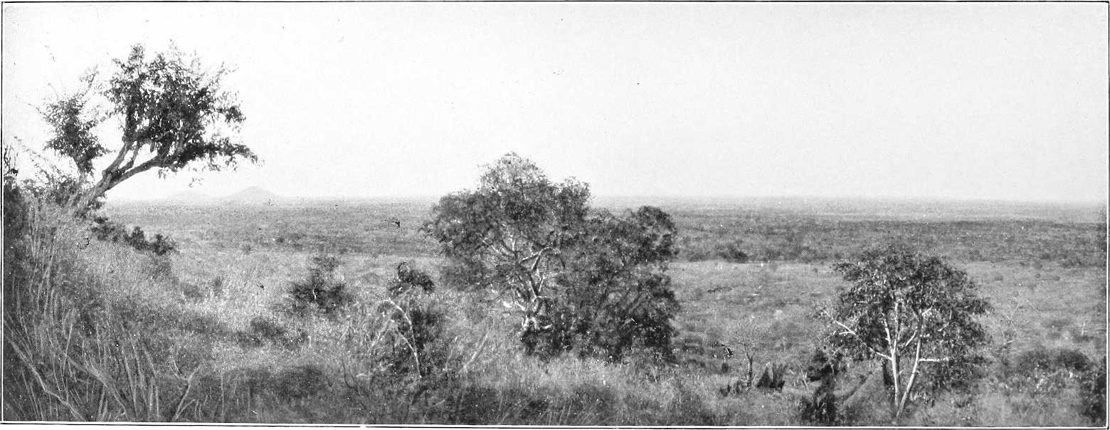
Volume 1 — CHAPTER IV.
Reading edition
CENTRAL EASTERN SUDAN.
(Country between the Nile and Abyssinia, bounded by the Atbara and the Blue Nile.)
Section 1.—Country between the Atbara and the Niles—from El Damer Southwards to Abu Haraz-Sofi Line.
General description.The vast tract of country from the junction of the Atbara with the Nile southwards to about the line Abu Haraz-Sofi, bounded on the east and west by these rivers, and on the south-west by the Blue Nile, has been generally called by cartographers “the Island of Meroe”; this name in reality, however, has long ceased to be applied to it locally, and is quite unknown to the Arabs of the present day. By the latter it is divided into four districts. The northern one, forming the triangle El Damer, Adarama, Shendi, is called El Daheira (the high stony ground). The western district, including Shendi, Halfaya, Geili, and Abu Deleig, is known as El Karaba; south and south-east of this the country north of the Blue Nile from Khartoum North to Abu Haraz is called Sharg El Adeik; whilst the whole of the eastern portion from Adarama southwards, bounded on the west by Um Hatab, El Hawad, Geili, and Galaat Arang, forms the well-known El Butana grazing district.
El Daheira.The northern or El Daheira district is, as its name denotes, a sandstone plateau generally bare, level, and desert-like. On the west, there are considerable ranges of sandstone hills. The soil, which is more sandy than further south, is, as a rule, poor and unfertile, except in the wadis, a few of which are usually cultivated in favourable years, and are generally marked by stunted selem and kittr bush. El Karaba and Sharg El Adeik.Further south, in the El Karaba and Sharg El Adeik districts, there is much more land suitable for cultivation, though even here it is generally seen in the wadis only, notwithstanding that the rainfall is markedly heavier. Selem, kittr, samr, sayal, and tundub trees grow plentifully, though they are rarely thick enough to obstruct free passage through them, and homra and maheirib grass are everywhere to be met. In the two last-named districts wells are comparatively numerous, though often excessively deep, occasionally as much as 250 feet, and the water rather salt.
In El Karaba, saltworks are frequently seen. Hafirs or tanks for holding up rain water, many of which are said to have been made by the ancients, are here particularly numerous compared to other parts of the Sudan, and are quite a distinctive characteristic of this part of the country.
El Butana.The region known as “El Butana” is wonderfully open and flat, indeed, so much so, that, as a rule, not a single tree or bush is visible for miles, except along an occasional wadi. These, as a rule, drain northwards, and, as elsewhere in this part of the country, are usually the localities selected for cultivation, though the soil, generally speaking, is here richer than in the other districts.
The great product of El Butana is, however, Hantut grass and Siha plant, both particularly good for camels, and thus during the rains it was, and is still to a lesser extent, customary for camel-owning Arabs from all parts of the Sudan to visit this district for grazing. Water at this time of year, being comparatively plentiful, the Arabs are not tied down to the very limited number of wells existing in the dry season, and are thus free to wander far and wide wherever it suits them. A month or two after the cessation of the rains the grass becomes dry, weather-beaten, and broken, and the greater part of this region is then bare and desolate.
Though the Shukria are probably the rightful owners of this district, yet the Debania (Gedaref), Abu Rof, Kenana, Kawahla (Blue Nile), and other tribes were always accustomed to graze here gratuitously, though without, it seems, the permission of the owners, who apparently were not strong enough to effectively resist this invasion. An arrangement has now been made by the Government assigning specified areas to the various tribes for grazing purposes.
Wells.The principal localities, and, in fact, the only known wells where the Nomad Arabs congregate during the dry season, are given below. At all these places the Arabs live by families in small groups of dom-mat tents.
I. Um Hatab.—About 30 miles east of Kabushia, 10 wells, 36 feet deep, less in the rains. Arabs here are Fadnia, Kawahla, and Jaalin, under Sheikh Mohammed Suleiman. Belongs to Shendi District of Berber Province. Last wells on road from Gedaref to El Damer. It is just outside the north-west limits of El Butana.
II. Um Shedida.—Some 30 miles east of Um Hatab. 30 wells, 36 feet deep. Arabs and Sheikh same as Um Hatab, belong to Berber province. Situate in north of El Butana.
III. Bir Ambasa.—Between Abu Deleig and Um Hatab, is said to be 300 feet deep, water plentiful. However, no Arabs live here, presumably on account of the great depth of well and consequent labour in drawing water. It is said to have been dug by the Ancients (infidels), and to have inscriptions on it, though this appears open to doubt.
Bir Geheid about 20 miles east of Ambasa and on the eastern side of El Hawad—a very large well, 30 feet in diameter and 330 feet deep. No water at present and well partially filled in. Said also to have been built by the Ancients.
IV. Debbaghat.—16 wells, 60 feet deep, in Khor Jegjegi. Lies about 6 miles E.N.E. from Abu Deleig. Arabs, Jaalin, Ahamda, Batahin, under Hassan Nimr, a sub-Sheikh under Mohammed Suleiman. It belongs to Berber Province.
V. Isnabir.—23 miles east of Abu Deleig, on road from Goz Regeb to that place. Arabs, Batahin, under Sheikh Mohammed Talha, belonging to Gezira Province. Wells contained little water in April, 1900.
VI. Abu Deleig.—84 miles by road E.N.E. from Khartoum. 50 wells, 30 to 70 feet deep, extending for some miles in the Wadi Jegjegi. Headquarters of the Batahin and residence of Sheikh Mohammed Talha. Other tribes here are Mogharba, Hassania, Jaalin, etc.
Abu Deleig belongs to Gezira Province, and there is a Mamur, Police Officer, and Police Post here.
Up to February, 1898, Abu Deleig was always held by a Dervish force, latterly under the command of Abd El Rahim Wad Abu Dugal. This post was surprised by Irregulars from Kassala in February, 1898, who in turn, however, were themselves surprised on their way back to Kassala and suffered severely.
VII. Geili.—About 25 miles due south of Abu Deleig. About 30 wells, 100 to 150 feet deep, situated around a flat topped granite hill about 250 feet high, on the summit of which is the tomb of Bint El Mek, a daughter of one of the Fung kings and wife of one of the early Shukria sheikhs. Arabs, Batahin and Mogharba, belonging to Gezira Province. There are ancient carvings here on the south side of the hill. (Vide also “Route Report Khartoum North to Kassala” Vol. II, Chap. IV).
VIII. Um Rueishid.—50 miles south-east of Abu Deleig on the road from Kassala to Khartoum, three wells, 100 feet deep in the dry season. They are the westernmost wells in the Kassala Province. Arabs Shukria, Mogharba, and Awaida, under Shiekh Ali Wad El Had.
IX. El Geleita.—12 miles north of Um Rueishid, on Goz Regeb-Abu Deleig road. Eight wells, 70 feet deep, water plentiful, Arabs mostly Shukria. Belongs to Kassala Province.
X. Shag (El Walia).—12 miles east of El Geleita, first water after leaving Goz Regeb, on Abu Deleig road. Four wells, 70 to 100 feet deep. Inhabitants chiefly Shukria, few Mogharba, etc. Belongs to Kassala Province.
XI. El Sofeiya.—72 miles rather north of west from Asubri. 20 wells, 100 feet deep, water plentiful. Arabs same as at Um Rueishid. Residence of Ahmed Mohammed Abu Sin, wakil of Head Sheikh of Shukria in the Kassala Province.
XII. Rera.—About 10 miles south of El Sofeiya, 10 wells, 100 feet deep. In the eastern and highest ridge, of which there are several close by, there are two or three rock tanks containing water. Arabs, Shukria, Mogharba, Awaida, etc., under Ali Wad El Had, of Kassala Province. 48 miles south of Rera is the well of El Adeid a few miles south of J. Tawal. Water is scarce in the dry season, and only a few Shukria are found here.
XIII. El Sadda.—22 miles south-east of Rera, 20 wells, 90 feet deep, ¼ mile west of south end of J. El Sadda, a low ridge running north and south; Arabs and sheikh same as at Rera. From here a road leads to Gedaref, which lies about 90 miles S.S.E. No water on the road except during rains at Hafir El Igl.
Cultivation.The Arabs cultivate considerably in favourable years, when dura can be purchased at PT.25, or even less per ardeb. As before stated, the wadis known locally as “Atmurs” are the localities selected for cultivation; the chief of these being El Hawad (12 miles east of Abu Deleig), which extends probably some distance to the south, and northwards it trends towards the Nile at Kabushia. It receives the water of Khor Jegjegi. “Hemeisi” and “Feterita” dura are the crops most generally grown.
Herds, etc.All these Arabs own large numbers of sheep and goats, but cattle and camels are now comparatively scarce, owing to the depredations of the Dervishes. The Shukria camels are remarkable for their size and carrying capacity, but are not, as a rule, suitable for fast work.
Riverain population.Along the left bank of the Atbara, from El Damer to Goz Regeb, the Arabs are chiefly Nomad Bisharin and Jaalin. There are few permanent villages south of Adarama.
Atbara.Amid the ruins of Goz Regeb live the few survivors of the former inhabitants under Sheikh Gaffa Ageil. South of Goz Regeb are Shukria, under Amara Abu Sin, who has a permanent village at Gandaua, a few miles north of Asubri.
In the neighbourhood of Fasher are the Lahawin, a tribe which formerly belonged to the White Nile.
Nile.Along the Nile (right bank), from El Damer to Khartoum North, there is a considerable and much mixed riverain population, for the most part living in mud-built villages, and cultivating with both sagias and shadufs. The chief tribes are Jaalin, Ababda, Shaigia, Hassania, Mogharba, Aonia, etc.
Villages on the Nile. (R.B.)El Damer.—Population about 700; Jaalin, etc. This town was formerly famous for its University and learning. It suffered much during the Mahdia, but its population and prosperity is now rapidly increasing, and there is quite a good market; principal trade, dom-mats, baskets, etc., and salt. A few caravans come here direct from Gedaref. There is a railway station here. It will be the capital of the Berber Province in 1905.
Kabushia.—26 miles down the river from Shendi. Population about 250, Shaigia and Jaalin; Awaida, Aliab, and Fadnia Nomads come here for grazing and cultivation. There is a comparatively large market.
The ruins of the ancient Meroe are situated about 4 miles to the north, and there are traces of an old temple at El Bagarawia. There are 25 pyramids (Tarabil) about 5 miles north-east. Some of these pyramids were examined in 1903, but little of interest was discovered. (Vide Appendix D.)
Shendi.—Population about 500, majority Shaigia and a few Jaalin also Nafiab, Awaida, and Ababda. Headquarters of the Egyptian Cavalry: four squadrons, also one field artillery battery. Railway workshops and good railway station. Headquarters of Shendi District and residence of a British Inspector, Mamur, etc. Post and telegraph offices. Excellent climate. Houses of mud. There is a good market, but not to be compared with that of former days, when Shendi was an important place and had 7,000 inhabitants. The town was once the capital of the ancient kingdom of Meroe, and is said by some to have been the residence of the Queen of Sheba. Bruce says the women of Shendi were noted as being the most beautiful in the Sudan. It was here that Ismail Pasha, son of Mohammed Ali, Khedive of Egypt, was burnt in his hut by Mek Nimr, in 1822, in revenge for his barbarities. To avenge Ismail’s death the town and inhabitants were destroyed in 1823 by order of Mohammed Ali. The Nimr family are now in poor circumstances.
There is excellent grazing along the banks of the river at almost all seasons of the year.
Shendi was occupied by Major T. Hickman with the 15th Egyptian Battalion on 26th March, 1898, after a short fight.
Government steam engines have been erected here with a view to cultivation by the Supply Department of the Army. The natives here have learnt to appreciate such agricultural implements as iron sagias and ploughs of English pattern, and are anxious to acquire them.
Wad Ban Naga.—There is a railway station here about 24 miles from Shendi. Sauarab and Aonia Arabs, and others, such as Deshiab Batahin, Ababda, and Hassania, come here for grazing. It belongs to the Shendi District, of the Berber Province. For the antiquities in the neighbourhood vide Appendix D.
Geili.—Situated on right bank of Nile, 28 miles north of Khartoum North, is the residence of Zubeir Pasha and his following, who belong mostly to the Gemaab tribe, a branch of the Jaalin. There are also Batahin and Hassania here. There is a railway station at Wad Ramla, 1½ miles to the north.
Villages on the Blue Nile. (R.B.)Khartoum North.—On the right bank of the Blue Nile immediately opposite Khartoum. The name applies to several small detached villages, such as Gubbat Khojali, Hellet Hamad, etc. The inhabitants consists of Jaalin, Shaigia, Mahas, Mogharba, Khojalab, etc., under Omda Mohammed Osman Ibrahim. (For description see Chap. II, p. 49.)
Eilafun.—On right bank Blue Nile, 19½ miles by road from Khartoum. A very neatly-kept village of Mahas and Shaigia, under Omda Mohammed Abd El Kader. It belongs to Kamlin district of Gezira Province. There is a mosque here, as to the Khalifaship of which there are frequent squabbles.
About 7 miles east of Eilafun is the village of Um Dibban, the abode of the three brothers, sons of the famous religious Sheikh El Obeid, the powerful and fanatical Mahdist leader who defeated Mohammed Ali Pasha at Um Dibban in September, 1884, and who was the first Dervish Commander to besiege Khartoum. They have a private mosque here, and though primarily a religious family, they aspire to considerable temporal power.
Rufaa.—Situated on the right bank of Blue Nile, 95 miles by land, by river 104 miles, from Khartoum. The population of the town and surrounding district numbers 30,000, and is mainly composed of Shukria Arabs. Others are Batahin, Sherafa, Jaalin, Mogharba, etc. There is one Greek trader here who carried on business here throughout the Mahdia. The houses are mostly grass tukls. No post or telegraph office. Nearest is at Kamlin.
Routes.
Route reports referring to the principal caravan routes are given in Vol. II, Chap. IV. There is also a caravan route from Gedaref, viâ El Sadda, Rera, Abu Deleig, and Um Hatab to El Damer. Caravans, however, usually strike the Nile at Kabushia after leaving Um Hatab. From Kabushia a track leads due east to Adarama.
Section 2.—Gedaref and District.
Practically the whole of the region enclosed between the Rivers Rahad and Atbara from a point some miles north of the town of Gedaref, southwards to Khor Seraf Said on the Gallabat road, an area containing more than 11,000 square miles, is comprised in the Gedaref District. This large tract of country, like other parts of the Sudan, is now greatly under populated. The inhabitants of the district are estimated at about 25,000 (1904).
The whole of the northern portion of this area is generally flat and open and devoid of bush, but here and there, particularly to north-east and south of the town of Gedaref, it is undulating and rather hilly. As these hills extend further south, the whole country becomes gradually enveloped in forest, which, though it yields a good deal of gum, is practically uninhabited, waterless, and for the most part unexplored, and bears few signs of former inhabitants.
In the rains, the surface of the ground, whether open or forest, is covered with grass 3 to 5 feet, and in places 15 feet, in height, which, until burnt, is exceedingly annoying to the traveller, should he be on foot or riding a mule or a donkey.
Generally speaking, the whole country is fertile, and only needs inhabitants and a minimum of labour to render it reproductive; water, though now scarce, would probably not prove to be an insuperable difficulty.
Historical.In pre-Mahdist days, Gedaref and district, including the old Gedaref or Suk Abu Sin, was a fertile and populous spot. Its cornfields supplied a large portion of the Sudan, both to the north and west, and it was, in short, prosperous. It was devastated by the Dervishes in 1885, and the garrison captured. Abu Anga and later Ahmed Fedil were appointed Emir of the district. In 1898, it was seized by a small column from Kassala under Colonel Parsons, after a hazardous and successful fight, a few miles outside the town, and though subsequently twice attacked by Ahmed Fedil, held its own until relieved by a force from the Nile. (Vide p. 267.)
Gedaref Town.
The town of Gedaref is situated partly on an under-feature emanating from some low hills, rather more than 100 feet high, half-a-mile to the east, and partly on the plain which lies below the general level of the surrounding country on three sides, and on the fourth, slopes away very gradually westwards.
This plain, which extends for some miles in all directions, especially to the west and north-west, is devoid of trees of any description, and being practically all rich black cotton soil, there is really an almost unlimited extent of land available for cultivation during the rains.
The quasi-European quarter of the town consists of one street of shops, built of brick, about 200 yards long, and, with the exception of a few other brick houses and the Government buildings, the whole of the remainder of the town consists of grass tukls.
Trade.The principal traders are Greeks, but these are few, and so far trade has not reached the expectations formed of it, owing chiefly to want of railway communication with this part of the Sudan.
There is a fair gum trade, but the quality of Hashab is hardly equal to that of Kordofan. Otherwise, besides the usual imports, consisting of cotton goods, sugar, etc., and the export of a certain amount of dura, dukhn, and simsim, and coffee from Gallabat, into other districts of the Sudan, trade at present has not reached large proportions, but is improving.
It is a notable fact that in the Eastern Sudan a well-to-do native never travels without his coffee, after imbibing which he professes to be ready for anything; in the Gezira and Kordofan, coffee does not seem to be nearly so generally drunk.
There is a little trade with Walkait, viâ the Setit, but this at present is insignificant.
Population.The inhabitants of Gedaref, estimated in 1904 at 5,500 souls, are a heterogeneous collection of Shukria, Debania, Takruris, and every kind of black. The Baggaras sent here to colonise after their defeat at Omdurman have now mostly been disseminated in the district, and what Abyssinians were originally found here have for the most part returned to their homes.
The old name of the town, “Suk Abu Sin,” is now inapplicable, as the Shukria have so decreased in numbers and wealth during the Mahdia as to be comparatively insignificant. Abu Sin is the family name of the leading Shukria family.
Water supply.The water supply is from wells partly cut through rock; it is good but not plentiful. Efforts are being made to improve the supply.
Garrison.The garrison usually consists of one company of the Sudanese battalion at Kassala, which also furnishes a detachment at Gallabat. There is always an Egyptian Mamur present, and usually a British Inspector for at least six months in the year. In addition, there is generally a small detachment of the Arab battalion here.
Cultivation.There are many excellent gardens, growing the usual Sudan vegetables, and in addition, figs, limes, custard apples, and dates; the latter are remarkable in that the trees bear two separate crops during the year.
As above-mentioned, a rain-crop of dura, dukhn, simsim, etc., is very extensively cultivated on the surrounding fertile plain; a certain amount of cotton is also grown for local use; this, and the cereals, are capable of considerable development; but this must await the advent of a railway. It should, however, be borne in mind that rain-watered cotton does not produce so fine a staple as that grown on irrigated land. All cotton grown here finds a ready sale at Gallabat to the Abyssinians.
The characteristic dura of Gedaref is a red species called “Kurgi,” which produces a very white flour. There is very little “Naggad” or early dura sown; its place is taken by dukhn, which, with simsim, is harvested at the end of October, whereas the “Kurgi” is not ripe until February. Simsim, or Sesame, as a rule does particularly well in this district. As all crops are dependent on the rainfall, they naturally vary considerably and in direct accordance with it. In 1899 they were almost a complete failure. The crops were attacked in 1902-03 by a disease called “Asal,” a species of blight, so called as it produces a formation strongly resembling honey (Arabic “Asal”).[62]
Rains.The rains begin in June and last on till October.[63] As the surrounding country is cotton soil, dust does not precede the storms as at Kassala, but judging from the dilapidated appearance of the town, when revisited on their cessation, the rainfall must be considerable in a favourable year.
Unless actually seen, it is difficult to picture the difference between Gedaref before and Gedaref immediately after the rains. By May, the surface of the ground surrounding the houses and environs of the town has become clean and bare, and many of the grass tukls have been rebuilt and appear almost toy-like, so spick and span are they. However, in October the whole place has the appearance of a wreck, houses are tumbling down, the neat new tukls are discoloured and distorted, and every square foot of ground, right up to the houses, not already planted with dura, at this time fully 12 feet high, is overgrown with the rankest of tall Aada grass, which is even higher, and through which the by-streets of the town are mere tunnels little more than 2 feet wide, and along which it is difficult to find one’s way about without a guide.[64]
Climate.At this season (September and early October) there is a good deal of malarial fever in a year of good rainfall. The natives of the place seem to some extent inoculated with it, though those from the more northern districts are readily affected.
From December to May the climate is perfectly healthy.
Wood.There is no building wood, and little fire wood within 15 to 20 miles.
Posts and telegraphs.There is a post and telegraph office, and a weekly camel post to Kassala, Gallabat, and Wad Medani. Telegraph also connects with these places.
Serut fly.As the serut fly is present at Gedaref during the rains, all camels are removed about the end of May, and other animals are kept in tukls as far as possible.
Transport animals.In the dry weather camels are the best transport, both for travelling along the roads or going across country over the cotton soil, should it be necessary, but, in the latter case, they will sooner or later suffer from sore feet.
Limited numbers of camels are obtainable for hire or purchase during the winter months. Mules are only occasionally brought here. As many as 50 donkeys can usually be bought without much difficulty, price £E.2 to £E.3. The little Abyssinian donkey, price about £E.2, which is the best for that country, is also generally procurable.
Game.Ariel, gazelle, bustard, quail, and a few snipe and teal are to be found in the neighbourhood at certain seasons. For game in other parts of this district, vide under Gallabat.
Villages.Beyond Gedaref itself and the villages in its neighbourhood there are few others worth mentioning. Sofi, on the Atbara, is a largish Jaalin village under Sheikh Taib El Nimr. It was here that Sir Samuel and Lady Baker spent the rains of 1869 (vide “Nile Tributaries of Abyssinia”).
At Abu Gulud, between Sofi and Doka, and other villages in this neighbourhood a large quantity of grain is usually grown. Asar is the headquarters of the Debania tribe, now much reduced in numbers, and the residence of their Nazir Sheikh Wad Zaid.
On the Rahad the principal villages are Mafasa and Hawata. The former is the headquarters of the Mamur of this (Radah) district. Upstream of Hawata there are few inhabitants at present.
Section 3.—Gallabat and District.
General.The comparatively small area (about 1,200 square miles) bounded on the west by the River Rahad, on the north by Khor Seraf Said, the southern boundary of Gedaref Province, and on the east and south by the Abyssinian frontier, comprises the district of Gallabat. Practically the whole of this region is thickly wooded with talh, soffar, ebony, silag, ardeib, hashab, baobab, bamboo, and other trees, of which some attain considerable size; the central and south eastern portions are hilly, as is Gadabi and some of the country to the east of the Atbara.[65] In the vicinity of the town of Gallabat there are perennial streams of running water, but the greater part of the province is dependent on wells for its water supply.
Town.Gallabat town, called by the Abyssinians Matemma, is situated at the foot of a steep slope on the left bank of the Khor Abnaheir, which here constitutes the boundary with Abyssinia, and is about 5 miles from the Atbara which flows to the north and north-east.
Historical.The town has for a very long time been considered as forming an important trade centre on the Sudan-Abyssinian frontier, and the latter people used to lay claim to it. It was in consequence an almost constant source of feuds and fighting during the greater part of the last century between the Abyssinians and the Turks, and later with the Dervishes. It was formerly celebrated for its slave mart, and drove a prosperous trade. (Vide “Cradle of the Blue Nile,” vol. 2, p. 168.)
It was attacked by the Dervishes under Zeki Tumal in 1886, and sacked. Three years later King John of Abyssinia, burning with fury at the sack of Gondar by the Mahdists, collected his warriors and fought a tremendous battle here, with, it is asserted, 80,000 to 100,000 on either side, on 9th March, 1889. The Abyssinians, who outnumbered the Dervishes, at first were successful, but just as the Dervishes, on the following day, were giving way on all sides a stray shot wounded and subsequently killed King John. This completely reversed the situation, and the Abyssinians turned and fled (vide p. 258.)
Its occupation by the Dervishes naturally resulted in the ruin of its trade, and this is only now beginning to revive. Robbers are, however, rife inside the Abyssinian frontier, and owing to that and other reasons, the revival is slow. The Anglo-Egyptian flags were hoisted at Gallabat on 7th December, 1898, by Colonel Collinson, C.B. The Abyssinian flag was then already flying on the fort.
Gallabat is said, before the Mahdia, to have been a comparatively large and busy trade centre. Looking at it now, it is difficult to believe that it can ever regain its pristine wealth and importance. The town, such as it is, with the exception of the Zabtia, etc., is built entirely of grass tukls. On the top of the slope overlooking the town there still remains the old Dervish fort built by Zeki Tumal. From here a very fine view is obtained away to the hills beyond the Atbara, and on a clear day one can see the mountains surrounding Lake Tsana. The hill pointed out as that on which King John was wounded lies 3 miles south-east, and that near which his body was captured is visible 10 miles further off.
Inhabitants. Takruri.The inhabitants are almost entirely Takruris,[66] originally from Darfur. The ancestors of these people, on arrival at Gallabat on their way back to Darfur after visiting Mecca in the 18th century, realised they had found a better land and settled here, where they have remained ever since. They possess curious jagged throwing-knives, which their ancestors are said to have brought from the Upper Congo.
In 1899 the population of the province, which was carefully assessed, numbered 2,200 souls, of which about 700 were living in the town itself. In 1901, it was estimated to be 2,670, and it has since increased to 3,800 in 1904.
These Takruris are as a rule poor, but industrious and fairly good cultivators. They also collect a good deal of honey. This they find with great dexterity by means of a bird, whose note they are exceedingly quick at detecting. Honey and water is always proffered to the thirsty traveller, though a liquor called “Asalia,” a kind of “Um Bilbil” or “Merissa,” is the drink they prefer themselves.
Trade.Neither the import nor export trade with Abyssinia has as yet attained much importance. Coffee is one of the chief imports; this is about PT.70 per 100 lbs., and is of very good quality. The remainder are mostly unimportant native requirements, such as bees-wax, shatta (red pepper), tobacco, etc., which are brought in in small quantities; also a good many cattle, horses, mules and donkeys. This import of live-stock constitutes the bulk of the trade.
There is a growing export trade both in raw locally-grown cotton as well as in Manchester goods.
Half the customs receipts go to Abyssinia. In 1902 the total amounted to £E.720 and in 1903 to £E.805.
Cultivation.Most of this district is fertile, but there is little land cultivated around the town of Gallabat, as the natives have discovered other spots in the forest where, owing to the particular kind of grass that grows, less labour is necessary to prepare the land for sowing.
Most of the cultivation lies about 15 miles north-west of Gallabat, where there are a good many villages, chief of which are Wallak and Basunda. Though, as a rule, the grass is almost everywhere burnt as soon as dry (November and December), yet the grass on a piece of land which it is intended to cultivate is most carefully preserved until the arrival of the ensuing rains. Then, and not till then, when the young grass has sprouted, the dry grass is fired, and the old and new are destroyed together; the ground is now clear and ready for sowing without further trouble, and thus cultivation is carried on with a minimum of labour. As the country is mostly forest, of course clearings have occasionally to be made. Two crops of dura are raised—“Naggad” and “Kurgi”—also a good deal of dukhn, which is ready for harvesting by the middle of October. Cotton is said to grow well, and in 1901 there were 800 acres of it under cultivation; this was four times as much as in the preceding year. It is expected that several thousand acres will be under cotton cultivation in 1905-6.
A few lime trees are now all that remain of the beautiful gardens which existed formerly on the banks of the Khor Abnaheir. The Dervishes are said to have ruthlessly cut down the fruit trees for building wood.
Garrison.The garrison is usually a detachment furnished by the company of the Sudanese or Arab Battalion at Kassala. There are also the usual civil police.
Rains.The rains begin here earlier and are much heavier[67] than at either Gedaref or Kassala. After the end of April heavy rain storms become pretty frequent and last till September or October. During this season the roads are very bad for travelling. The serut fly appears when the new vegetation has sprung up.
Climate.The same as Gedaref. Healthy, December to June; unhealthy, during the remainder of the year.
Water supply.The main water supply is from the Khor Abnaheir, which averages 5 yards wide and 2 feet deep, but varies considerably according to the time of year, and becomes stagnant and foul towards the end of the dry season. There are also some small springs near the fort, the water from which, at this season, is more wholesome.
Trade routesRoads lead from here to Chelga and Gondar, Kwara, Dunkur, Roseires, Rahad, and Gadabi. (Vide Vol. 2).
Telegraph offices.There is a telegraph and post office at Gallabat.
Transport animals.Camels are the most suitable transport animals, unless the Abyssinian frontier is crossed, when mules or donkeys become desirable; for the journey to either Gondar or Kwara they are indeed indispensable.
When the Dervishes sacked Gondar, their transport consisted chiefly of camels, but very few are said to have survived or even to have reached there.
Camels are hardly ever procurable at Gallabat. No number of mules, donkeys and horses can be relied on unless plenty of notice is given, when the Abyssinians would probably readily supply a limited number.
Currency.British, Egyptian, or Turkish money is not as a rule accepted by the Abyssinians, who require to be paid in Maria Theresa dollars, which they value at PT.10½, but the Sudan Government at not more than PT.9½.
Game.From El Damer to the line Roseires-Gallabat all the game mentioned under “Kassala” is found, with the exception of ibex, oryx, wild sheep, and klipspringer, and in addition rhinoceros and tiang (Damaliscus Senegalensis); bohor, or reedbuck, and Gazella rufifrons are common in places.
Section 4.—Country between Blue Nile, Dinder, and Rahad, with Description of these Rivers.
General description.The country between the Blue Nile and the Rahad and Dinder Rivers is at present (1904) practically uninhabited south of the village of Durraba on the Dinder, which is about the same latitude as Karkoj on the Blue Nile.
Before the Mahdia, villages extended along both the Rahad and Dinder to nearly as far south as the Abyssinian frontier. Now, however, though inhabitants are slowly returning, there are but few villages even north of the Karkoj-Durraba line.
Tribes.The country lying south of the latitude of Sennar being infested with the serut fly during the rainy season, the inhabitants, who are principally Kenana, Kawahla, Rufaa El Sharg, and Agaliin, are semi-nomadic; that is to say shortly before the commencement of the rains many of them trek with their camels, cattle, horses, etc., northwards across the Rahad to the well-known El Butana grazing district (see p. 103), in order to escape the fly, whilst only a few remain behind to cultivate their dura, simsim, and cotton.
The whole of this country as far south as the Abyssinian frontier, in the vicinity of which the hills commence, is perfectly flat and covered with bush or forest of varying density, with here and there open spaces, often many miles in extent. The bush is thickest in the vicinity of the river banks and thickest of all along the Rahad.
The trees and bush most usually seen are talh, hashab, kittr, sayal, kurmut, heglig, laot, sunt, sidr, etc.
El Agab Abu Gin.El Agab Abu Gin, Nazir of the Rufaa El Sharg Arabs, is in charge of all the country bordering the Dinder and Rahad (left bank) from the latitude of Sennar southwards. His residence is at Abu Hashim on the Dinder (left bank). Of the other villages occupied by his people the principal are Durraba, Bandana, Gileidat, and Lueisa.
Communications.From the villages of Wad El Abbas and Sheikh Talha, both on the Blue Nile, roads lead to Gileidat and thence southwards along the Dinder to Durraba, beyond which point there is no regular road. From Senga and Karkoj, roads lead, viâ Abu Hashim and Deberki on the Dinder, to Hawata on the Rahad. South of this, as far as the Roseires-Abu Ramla track, the country may be said to be roadless and, owing to the cotton soil and bush, travelling across country is a trying operation for man or beast. There is a good road up the right bank of the Blue Nile from Wad Medani to Famaka.
Khor Um Degul, or Agaliin, or Mehara, which lies between the Blue Nile and Dinder, and joins the latter near Deberki, was formerly thickly populated and cultivated by the Agaliin; it was, however, until 1902, quite deserted. A few villages are now said to be springing up along it, and wells are being opened. There are many talh and hashab gum trees in its vicinity.
North of Sennar-Gileidat villages are more numerous along the Rahad, Dinder and Blue Nile, though there is no great extent of cultivation.
Game.In this district, or rather in the southern portion of it, the following species are found:—Elephant (Abyssinian variety, with small tusks), buffalo, rhinoceros, giraffe, roan, kudu, waterbuck, tora hartebeeste, tiang, reedbuck, ariel, gazelle, oribi, bushbuck, warthog, bush pig, lion, leopard, hippopotamus, crocodile, etc.
ON THE BLUE NILE.
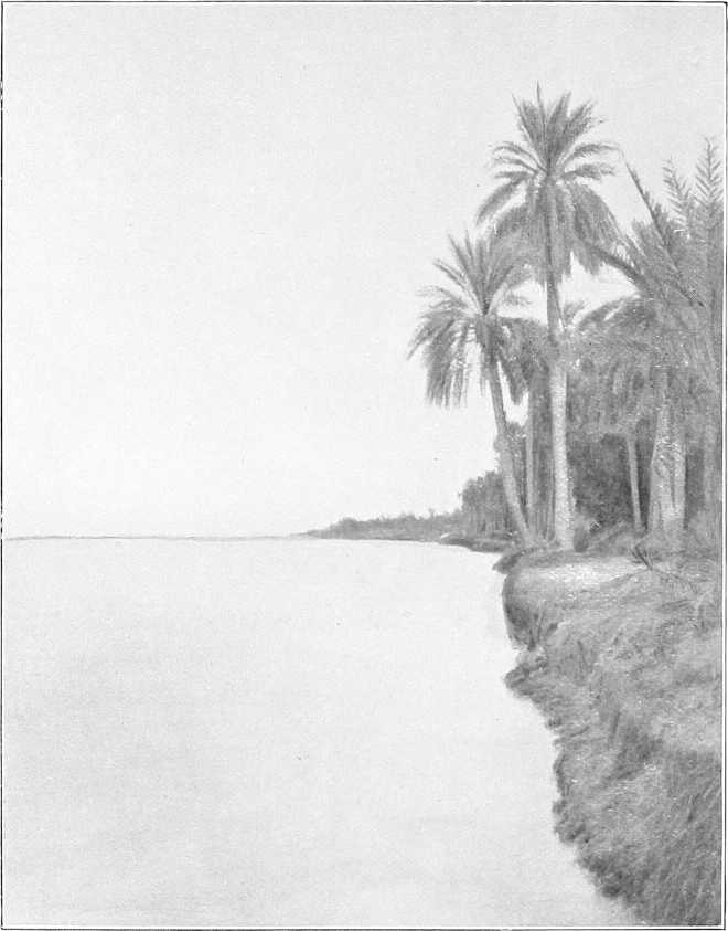
The Blue Nile.[68]
General description.The Blue Nile rises in the Abyssinian mountains about 60 miles south of Lake Tsana (altitude of Lake Tsana, 4,800 feet). Its source was discovered by Bruce in the year 1760. After flowing northwards into the lake at its south-west corner, it finds an exit[69] again to the south-east, and, after making a big bend to the east, it curls round to the south and flows in a north-westerly direction towards the Sudan, which it enters near Famaka, after a course of some 500 miles. Altitude at Famaka, 1,700 feet (approx.).
Throughout the whole of this upper portion of its course, which has never been explored, it is believed to flow in a series of rapids over a rocky bed and often between high cliffs, and for the most part through the most precipitous and rugged country. Here it is known as the Abai, whereas, as soon as it reaches the plains of the Sudan, its name at once becomes “Bahr Azrak” or Blue Nile.
Until comparatively recently the Blue Nile was considered by the Abyssinians to be the main stream of the Nile, and they, several centuries ago, fully realised the value of attempting, or threatening, to deprive Egypt of her water supply by the construction of a dam at the outlet of lake Tsana or possibly elsewhere. A mission to study the possibilities of this lake was recently sent from Egypt, and the investigation showed that it is by far the most suitable site on the Blue Nile for the construction of a storage reservoir which, though its benefit to Egypt would be slight, would be of the greatest value to the Sudan.[70]
Length, width, &c.The length of the Blue Nile, from the point near Famaka, where it enters the Sudan, to its junction with the White Nile at Khartoum, is estimated at approximately 460 miles, which makes its total length about 1,000 miles.
The average width of channel throughout its course in the Sudan is 550 yards.
Although in the northern reaches the width increases, it is rarely more than 800 yards wide at any point.
Banks.The average height of the banks over low-water level is from 26 to 30 feet for the first 150 miles up-stream from Khartoum. Further south they are higher, and average over 33 to 39 feet above low-water level. The difference in level between flood and low-water is 20 to 23 feet. In the first quarter of the year, the river is reduced to a succession of deep pools, connected by very shallow reaches. Even native boats can with difficulty navigate the distance between Sennar and Khartoum during this season. The Blue Nile is at its lowest in April, but during the latter half of May the first or false rise begins. The real rise begins in June, and the maximum height is attained in August. In the latter half of September it begins to fall rapidly.
Navigability. Cataract.Navigation is simple enough at high Nile. As far up-stream as Roseires, 405 miles above Khartoum, the river is navigable by the ordinary Nile steamers from the middle of June till the end of November. Just above Roseires, however, there is a cataract about 6 miles long. This cataract has never been navigated by steamer, but it is said that previous to 1881, sailing boats passed regularly up and down it. Rafts occasionally navigate it successfully on their way down stream. During the last two years a small launch and a few sailing boats have been passed up and down, but there is a dangerous reach for sailing boats above the cataract.
During November and December the water falls rapidly, and sandbanks appear in quantities, the rush of water through the narrow channels being very great. The worst part of the river is near Abdin and Sennar, but there is little rock anywhere. The water for 5 miles below Roseires is bad, and in places dangerous from rock. Steamers with barges lashed alongside, at the end of December in most years, can get through, except at one point some 20 miles south of Sennar, near Abdin, where a reef of rocks extends almost entirely across the river. Steamers have to be steadied over this place by ropes in December, and the barges passed up and down by ropes.
Discharges.[71]Sir W. Garstin calculates the average discharge of the river at Khartoum to be:—
At low-water (May) 200 metres cube per second.
In flood (August) 11,000 „ „ „
Velocity.The velocity of the stream is very great: even in February it is not less than 3 miles an hour, while in full flood it must be considerably over 6 miles an hour. In winter the water is very clear, and of a beautiful limpid blue. In flood, being charged with the scourings of the Abyssinian mountains and forests, it is heavily charged with deposit, and the water is of a deep chocolate colour. The Blue Nile is considered the chief fertilizing agent of Egypt.
ON THE BLUE NILE.
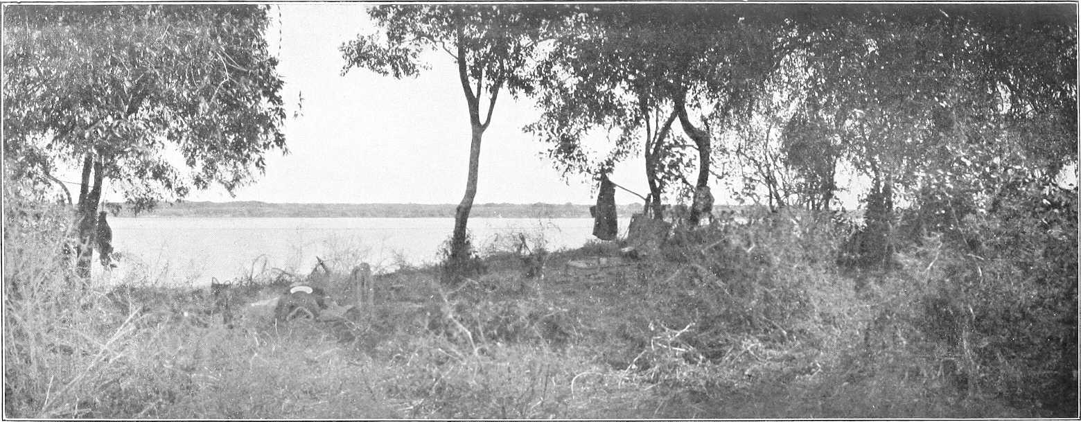
FOREST SCENERY, WEST BANK, UPPER BLUE NILE.
Country along the banks.From Khartoum to Sennar the country is uninteresting; banks flat, vegetation and population considerable, here and there cultivation by sagias, crops mostly dura.
South of Sennar the thorn jungle along the banks becomes very dense, and at high Nile dips into the water; often the only way to get through it is by hippopotamus paths, though the roads on both banks have been cleared and there are meshras at frequent intervals.
Speaking generally, the further south one goes the steeper and higher the banks become, the channel of the river being worn away by the rush of water. The country on the right bank is mostly jungle, with little cultivation and few villages.
Between Wad Medani and Sennar the jungle on the left bank runs in a strip of one or two miles in breadth; west of this strip are the cultivation and villages, which extend right across to the White Nile. Near Wad Medani the cultivation is continuous, and one marches for miles through dura fields.
As one proceeds south, the cultivation becomes less general, until south of Senga, where it is mostly confined to strips along the river bank, and a certain amount round villages a few miles inland. South of Senga the jungle is replaced by forest, large tamarind trees, etc., with thick undergrowth, and open marshes extend along the banks, which, in the dry season, afford excellent grazing. The grass, which grows to a height of 8 to 10 feet in the rains, dies rapidly as the rain ceases, and throughout November and December the natives burn enormous tracts of the dry grass. These grass fires, intended to improve the grazing as well as to enable people to get about the country, are, as may be imagined, exceedingly detrimental to the forest trees, which become distorted and stunted. The forest on both banks of the Blue Nile south of Senga is chiefly composed of acacias of several varieties, laot, tamarisk, kittr, hashab, talh, soffar, and sidr. A few kakamut, tebeldi, dom palms, and sycamores are also to be seen in these forests.
Climate.The months of December, January, and February are cool and healthy. March, April and May are hot. The rainy season begins in May and lasts till the end of October.[72] August, September, and October are very hot and damp. The drenching rains cool the air temporarily, but the subsequent heat is moist and enervating. On the upper reaches at Sennar, Karkoj, and further south, as the vegetation and foliage increase in density, so does malarial fever abound in proportion for at least a month after the rains have ceased. September and October are probably the worst months.
In October, frequent heavy thunderstorms occur with torrential rain; they are, however, very local. Heavy dew at night. The storms get less frequent as the month goes on, and are over before November, after which the climate gradually improves. The north wind blows fitfully during November and December, and the nights are cold, but the temperature by day is very high until late in December, particularly south of Karkoj. Serut fly.The “serut fly” practically appears and disappears with the rains, and is scarce in October, except in certain places. Its northern limit is Sennar. Mosquitoes are bad at all stations at night during August, September, and October.
Cotton.Cotton is cultivated by the natives on the Blue Nile either on the foreshore of the river or inland on ground found by experience to be suitable in a good rainy season.
On the Dinder the only crop raised is the rain crop. This is sown in July after the heavy rains have commenced at the same time as dura, etc. The foreshore sowing takes place simultaneously with that of other foreshore crops, i.e., about December, after the river has fallen, according to the state of the Nile and the height of the submerged banks thus cultivated.
Both rain and foreshore crops begin to be ready for picking 4 months after sowing. There are usually three pickings, the last being the worst, as by that time the plants, which during winter are neglected, are invariably suffering from drought.
In a good year one feddan (acre) of rain-watered land will produce 400 to 1,000 lbs. of unginned cotton. The species of cotton generally sown on the Blue Nile and Dinder are “Abu Hareira,” “Belwa,” and “Mumtaz.” The two former, usually sown on the foreshore, are the old native kinds, whilst the latter, sown as raincrop, was introduced by Mumtaz Pasha from Egypt in the days of the Old Government. The “Abu Hareira” and “Belwa” kinds last 3 years, but the “Mumtaz” only one.
On the Blue Nile, the most favourable land for cotton cultivation is said to be from Sennar southwards to Abu Naama; on the Dinder, the land above Deberki and Abu Rakhis is considered best. Good cotton (irrigated), however, was grown at Wad Medani last year (1903-1904) on the Government experimental farm; 6¾ kantars[73] being actually grown on 1,000 square metres, or a ¼ feddan, giving an average yield of 27 kantars (2,700 lbs.) per feddan.
Principal towns.Roseires.—On the right bank; residence of a British Inspector and Egyptian Mamur. Post and telegraph office; communication by ferry with left bank. There is usually a garrison of one company, under a British officer, furnished by the battalion at Wad Medani. A gunboat is also stationed here. The population is increasing, chiefly Hameg and Sudanese tribes. The market is kept open all the year round, and most ordinary requirements can be obtained here. For rainfall, vide footnote on preceding page.
Karkoj.—On the right bank is an unimportant village, formerly residence of a British Inspector and Mamur, and the headquarters of the District, which has, however, now been moved to Senga. Population about 1,000, mostly Jaalin. The market, which is a poor one, is held on Wednesdays and Saturdays. There is no post or telegraph office here. Senga is the telegraph office.
Senga.—Left bank. (Vide Chap. V, p. 119.)
Sennar.—Left bank. (Vide Chap. V, p. 119.)
Wad El Abbas.—On the right bank; was founded about 50 years ago. The population numbers about 1,200, and consists chiefly of Jaalin, with a mixed lot of Gezira Arabs, as well as about 300 Sudanese.
There is a weekly market on Wednesdays.
Wad Medani.—Left bank. (Vide Chap. V, p. 119.)
For principal towns between Wad Medani and Khartoum (vide Chaps. IV and V).
Game.See under “Country between Blue Nile and Rahad,” p. 109.
Tributaries of Blue Nile.With the exception of the Dinder and the Rahad, there are in the Sudan no other important affluents of the Blue Nile, with the exception of perhaps the Khor Tomat, which joins the main stream near Famaka. This is dry, except during and shortly after the rainy season. Water, however, is easily obtained by digging in its bed.
Dinder. General.The River Dinder rises in the Abyssinian mountains to the south-west of Dunkur, and after flowing for about 50 miles through very mountainous country it enters the plains of the Sudan and flows for about 200 miles in a north-westerly direction until it joins the Blue Nile (right bank) about 40 miles above the town of Wad Medani.
Bed.Its bed near Dunkur, where it leaves the mountains, is rocky and stony, and about 100 yards wide. It was here found (June, 1901) to be 3 feet deep, with a rapid current, and for several months in the rainy season it must be difficult to ford.
Throughout its course in the Sudan its bed, which is sandy and free from rocks a few miles below where it crosses the frontier, is much less winding than that of the Rahad and rarely exceeds 200 yards in width. Its tendency is to become narrower in its lower reaches, and at its mouth it is not more than 120 yards wide.
Upstream of the old site of El Haj the river is wider and shallower and banks lower than in the inhabited area. Even in the old days there were few or no permanent villages above El Haj, but only temporary grazing encampments.
Banks.Its banks are steep and generally about 15 feet high. They are, as a rule, rather higher than the adjacent country, which, when the river is full, becomes flooded and marshy. These marshes were formerly extensively planted with cotton, which is said to have been of good quality; its cultivation is now being encouraged as far as the limited population admits.
Forests.The forests along the banks of the Dinder are of better quality and less dense than those of the Rahad; sunt, kakamut, haraz, sidr, hashab, talh, babanus, etc., are plentiful.
Navigability.The Dinder has been navigated by steamer as far up-stream as Deberki, about 120 miles from its mouth. Large sailing boats ascend it as far as El Safra. Of course, this is only possible whilst the river is in flood during, perhaps, three months in the year, and owing to the wooded banks and southerly wind it is very difficult for sailing boats. In the dry season water stands in pools. There is little doubt, however, that like the Rahad it is navigable in flood to the Abyssinian border.
Flood.The flood arrives at the junction with the Blue Nile about the last week in June. This is rather earlier than the Rahad flood, owing to the later commencement of the rains in Northern Abyssinia, and possibly partly due to the Dinder not being so excessively tortuous as the Rahad. Both Dinder and Rahad bring down large quantities of fertilising matter.
Tributaries.None of much importance.
Rahad. General.The Rahad rises in Abyssinia in the mountainous region between Lake Tsana on the East and Kwara to the west. It takes, at first, a northerly direction, but after entering the Sudan it flows generally north-west in an extraordinarily winding bed to its junction with the Blue Nile, almost opposite the town of Wad Medani.
Width.Its width probably nowhere exceeds 100 yards, and is frequently not more than 60; in places it is only 30 yards wide. It loses much of its water by “spills” known as “Maya,” and is a much more imposing-looking river above than below Hawata.
Banks.The banks, especially the right, are steep and high, sometimes as much as 40 feet above the bed at low water. They differ from those of the Dinder in that only the left bank is liable to be flooded, and that only at a few places, and consequently do not lend themselves to cultivation to the same extent.
Forest.Belts of dense kittr bush and other jungle grow along its banks. In the lower reaches there are many fine sunt trees, and further inland talh, heglig, etc. Bordering its upper reaches are heglig, silag, khashkhash, ardeib, tebeldis, gemmeiz, etc.
Villages.There are few villages at present above Hawata (right bank), and consequently there is no regular path, though the bush has been to a certain extent cleared. Travelling along the river above Shammam, though practicable, is a difficult operation, more especially before the grass is burnt.
Flood.The flood reaches the Blue Nile about the first week in July, and water ceases to flow at the mouth by the end of November. High water is said to last 90 days from about mid-July.
Navigability.The river, when in flood, is navigable for small steamers throughout, but its comparatively narrow bed, combined with very sharp and frequent bends, militate against successful navigation by sailing boats.
Mr. Armbruster navigated the river in the stern-wheeler Amara from its mouth to Meshra Abid (420 miles) in August, 1904. On the way down stream navigation was only effected with considerable difficulty and serious damage to the steamer, owing to the rate of the current—6 miles per hour at Abid and 3 miles per hour at Sherif Yagub—as well as to the extreme sharpness of the bends, at which there were often rocks and large overhanging trees.
Table of Distances on the Blue Nile.
Place. Intermediate. Total from Khartoum.
Miles. Kilometres. Miles. Kilometres.
Khartoum (Palace) 0 0 0 0
Soba 14 22½ 14 22½
Eilafun 4 6½ 18 29
El Masid 20 32 38 61
Kamlin 23 37 61 98
Rufaa 33½ 53 94½ 151
Abu Haraz 23 37 117½ 188½
Mouth of Rahad 5 8 122½ 197
Wad Medani ½ 1 123 198
Mouth of Dinder 40 64 163 262
Wad El Abbas 30 48 193 310½
Sennar 20 32 213 342½
Senga 53 85 266 428
Karkoj 21 34 287 462
Abu Naama 22 35½ 309 497½
Roseires 73 117½ 382 615
Famaka 52 83½ 434 698½
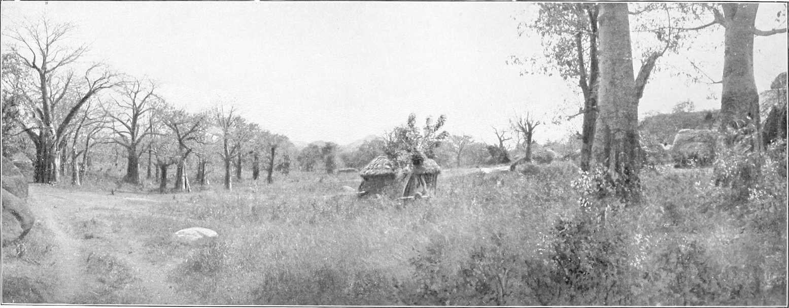
VILLAGE IN THE SOUTHERN GEZIRA.
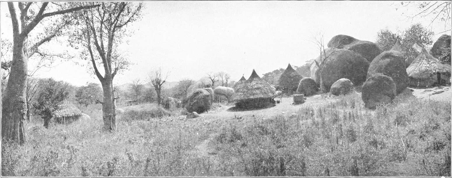
LANDSCAPE, SOUTHERN GEZIRA.