Chapter II · (continued 2)
Reading edition
Meanwhile Arnold, amid the snows, was audaciously seeming to keep up the siege of Quebec in his little camp, three miles from the town. Small-pox was beginning to make inroads on his little army, scarce at some periods exceeding five hundred effective men. Wooster finally came from Montreal on the first of April, and assumed command. For the influence intended to soothe and gain the Canadians to pass from the courtly Montgomery to the rigid and puritanical Wooster was a great loss, and it soon became manifest in the growing hostility of the people of the neighboring country. It was by such a pitiful force that Carleton allowed himself to be shut up in Quebec for five months.
This was the condition of affairs when a commission, consisting of Benjamin Franklin, Samuel Chase, and Charles Carroll, was sent by Congress, with delegated powers, to act with prompter decision on the spot.[488] They reached Albany early in April, and found Thomas, from Boston, already there. So the two generals, Schuyler and Thomas, pushed on ahead of the commissioners, and, with the reinforcements now setting towards Canada, before and behind them, it seemed as if a new vigor might be exerted upon the so far disastrous Northern campaign. Thomas directed his course to Quebec, while the commissioners went to Montreal, where they found the most gloomy apprehensions existing, and were soon convinced that, without hard money and troops, Canada must be relinquished. Franklin returned to Philadelphia to impress this upon Congress, while Schuyler was at his wits' ends to find men, provisions, and money to send forward, till Congress should act.
Washington, by this time in New York with the troops which had forced the evacuation of Boston, yielded to the orders of Congress, and sent Sullivan of New Hampshire with a brigade, carrying money and provisions, to reinforce the wretched army in Canada, thereby diminishing, with great risk, his own force to less than 5,000 men. Thomas had at this time reached Quebec (May 1), where he found, out of the 1,900 men constituting the beleaguering army, only about a thousand not in hospital, and scarcely five hundred of these were effective troops. It was necessary to do something at once, for the breaking ice told the American general that a passage was preparing for a British fleet, which was known to be below. Plans for an assault on the town miscarried, and while Thomas was beginning to remove his sick preparatory to a retreat, three British men-of-war appeared in the basin. They landed troops, and gave Carleton an opportunity to hang upon the rear of the retreating invaders, and pick up prisoners and cannon. He did not pursue them far.[489]
Near the same time a force of British and Tories, coming down the river from Ontario, had fallen upon Arnold's outpost at Cedar Rapids, above Montreal, and had captured its garrison. Thus disaster struck both ends of the American line of occupation. The force under Thomas was withdrawing to the Sorel, when Burgoyne, with large reinforcements, landed at Quebec. Up the Sorel the Americans retreated, joined now by the troops under Thompson, which Washington had earlier sent from New York. Thomas[490] soon died (June 2) of small-pox at Chamblée; and Wooster being recalled, Sullivan, who now met the army, took the command, and pushing forward to the mouth of the Sorel, prepared to make a stand. He soon sent a force under Thompson towards Three Rivers, to oppose the approaching British, now reaching 13,000 in number, either at Quebec or advancing from it,—a number to confront, of which apparently Sullivan had no conception. This general himself possessed hardly more than 2,500 men, for Arnold, instead of reinforcing him, as directed, had left Montreal for Chamblée. The action at Three Rivers, of which the cannonading had been heard at the Sorel, proved a disastrous defeat. It was followed by the British vessels pushing up the river, and as soon as they came in sight Sullivan broke camp and also retreated to Chamblée, followed languidly by Burgoyne. Here Sullivan joined Arnold, and the united fugitives, of whom a large part were weakened by inoculation, continued the retreat to the Isle-aux-Noix, thence on to Crown Point, where early in July the poor fragmentary army found a little rest,—five thousand in all, and of these at least one half were in hospital.[491]
DUNMORE'S SEAL.
From a plate in Valentine's N. Y. City Manual, 1851.
We may glance now at the progress of events to the southward. In Virginia, Dunmore, the royal governor, hearing of Gage's proclamation proscribing Hancock and Adams, feared that he might be seized as a hostage, and took safety on board a man-of-war in Yorktown harbor. Events soon moved rapidly in that quarter.[492] Patrick Henry, perhaps a little unadvisedly, was made commander of their militia.[493] In due time, from his floating capitol, Dunmore issued his proclamation granting freedom to slaves of rebels,[494] and had directed a motley crew of his adherents to destroy the colonial stores at Suffolk, and this led to a brisk engagement at the Great Bridge (December 9, 1775), not far from Norfolk, in which the royalists were totally defeated.[495] The destruction of that town, now under the guns of the royal vessels, soon followed, on the first of January, 1776.[496]
On the 27th of February, 1776, the Scotch settlers of North Carolina, instigated by Martin, the royal governor, and under the lead of their chief, Macdonald,[497] endeavored to scatter a force of militia at Moore's Creek Bridge, but were brought to bay, and compelled to surrender about half of a force which had numbered fifteen or sixteen hundred.[498]
Early in 1776 the task was assigned to Clinton, who had in January departed from Boston, as we have seen, to force and hold the Southern colonies to their allegiance, and Cornwallis, with troops, was sent over under convoy of Sir Peter Parker's fleet, to give Clinton the army he needed. The fleet did not reach North Carolina till May. In March, Lee, while in New York, had wished to be ordered to the command in Canada, as "he was the only general officer on the continent who could speak and think in French." He was disappointed, and ordered farther south.[499] By May he was in Virginia, ridding the country of Tories, and trying to find out where Parker intended to land.[500] It was expected that Clinton would return north to New York in season to operate with Howe, when he opened the campaign there in the early summer, as that general expected to do, and the interval for a diversion farther south was not long. Lee had now gone as far as Charleston (S. C.), and taken command in that neighborhood, while in charge of the little fort at the entrance of the harbor was William Moultrie, upon whom Lee was inculcating the necessity of a slow and sure fire,[501] in case it should prove that Parker's destination, as it might well be, was to get a foothold in the Southern provinces, and break up the commerce which fed the rebellion through that harbor.
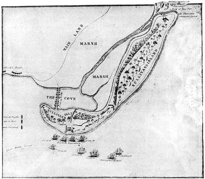
FORT MOULTRIE, 1776.
Reduced from the plan in Johnson's Traditions and Reminiscences of the Amer. Revolution in the South (Charleston, S. C., 1851). It shows that the rear portion of the fort had not been finished when the attack took place. The same plate has an enlarged plan of the fort only. See the maps in Drayton's Memoirs of the Amer. Rev. in the South (Charleston, 1821, two vols.), ii. 290, which is similar to Johnson's Ramsay's Rev. in S. Carolina, i. 144, which is of less area; and that in Gordon's Amer. Revolution, iii. 358. These are the maps of American origin. Lossing (ii. 754) follows Johnson.
The people of Charleston had been for some time engaged on their defences, and "seem to wish a trial of their mettle", wrote a looker-on.[502] The fort in question was built of palmetto logs, and was unfinished on the land side. Its defenders had four days' warning, and the neighboring militia were summoned. On the 4th of June the hostile fleet appeared,[503] and having landed troops on an adjacent island, it was not till the 27th that their dispositions were made for an attack.
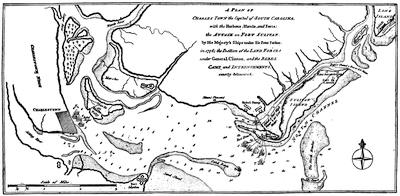
ATTACK ON CHARLESTON, 1776.
From Political Mag. (London, 1780), vol. i. p. 171,—somewhat reduced. Carrington notes (p. 176), as dated Aug. 31, 1776, and belonging to the North Amer. Pilot: "An exact plan of Charleston and harbor, from an actual survey, with the attack of Fort Sullivan on the 26th June, 1776, by his Majesty's squadron, commanded by Sir Peter Parker." Cf. no. 37 of the American Atlas (Faden's), and the Amer. Military Pocket Atlas, 1776, no. 5. Mr. Courtenay, in the Charleston Year Book, 1883 (p. 414), gives a folded fac-simile of a broadside map, A plan of the Attack on Fort Sullivan ... with the disposition of the King's land forces, and the encampments and entrenchments of the rebels, from the drawings made on the spot. Engraved by Wm. Faden, by whom it was published Aug. 10, 1776. The dedication to Com. Parker is signed by Lieut.-Col. Thomas James, royal regiment of artillery, June 30, 1776. It has a corner plan of the "Platform in Sullivan's Fort", by James, on a larger scale. Appended to the map are a list of the attacking ships, and extracts from Parker's and Clinton's despatches. The channel between Long and Sullivan's islands is given as seven feet in the deepest part. The original MS. of this Faden map is in the Faden Collection in the library of Congress (no. 41), where is also a MS. map of Charleston and its harbor, a topographical drawing, finished in colors (no. 40). Cf. Plan de la Barre et du hâvre de Charlestown d'après un plan anglois levé en 1776. Rédigé au dépôt général de la marine [Paris], 1778. (Brit. Mus. Maps, 1885, col. 764.)
These are the different English maps. In the same Charleston Year Book, p. 478, is an account of the successive forts on the same spot. A view of Charleston is in the London Mag. (1762, p. 296), and one by Thomas Leitch, engraved by S. Smith, 1776, is noted in the Brit. Mus. Map Catal., 1885, col. 764.
Their ships threw shot at the fort all day, which did very little damage, while the return fire was rendered with a precision surprising in untried artillerists, and seriously damaged the fleet,[504] of which one ship was grounded and abandoned.
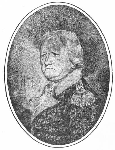
WILLIAM MOULTRIE.
From the copperplate in his Memoirs of American Revolution, on far as it related to States of N. and S. Carolina and Georgia. Compiled from most authentic materials, the author's personal knowledge of various events, and including an Epistolary Correspondence on Public Affairs, with Civil and Military Officers, at that period. (New York, 1802, two volumes.) The likeness in the National Portrait Gallery (New York, 1834) is Scriven's engraving of Trumbull's picture.
There is a portrait in the cabinet of the Penna. Hist. Soc., no. 58. See the paper on General Moultrie in South Carolina in Appleton's Journal, xix. 503, and Wilmot G. Desaussure's Address on Maj.-Gen. William Moultrie, before the Cincinnati Society of South Carolina, 1885.
The expected land attack from Clinton's troops, already ashore on Long Island, was not made. A strong wind had raised the waters of the channel between that island and Sullivan's Island so high that it could not be forded, and suitable boats for the passage were not at hand.[505] A few days later the shattered vessels and the troops left the neighborhood, and Colonel Moultrie had leisure to count the costs of his victory, which was twelve killed and twice as many wounded. The courage of Sergeant Jasper, in replacing on the bastion a flag which had been shot away, became at once a household anecdote.[506]

CRITICAL ESSAY ON THE SOURCES OF INFORMATION.
THE earliest attempt with any precision to enumerate the various sources of information upon the whole series of military events about Boston during 1775 and 1776 was by Richard Frothingham, in the notes of his Siege of Boston (1849), where, in an appendix, he groups together the principal authorities. Later than this, Barry (Massachusetts, iii. ch. 1), Dawson (Battles, vol. i.), and others had been full in footnotes; but the next systematized list of sources was printed by Justin Winsor in 1875, in the Bulletin of the Boston Public Library. This last enumeration was somewhat extended in the Bunker Hill Memorial, published by the city of Boston,[507] and still more so by the same writer in his Handbook of the American Revolution, Boston, 1879. It is condensed in the Memorial Hist. of Boston, iii. 117.
Salem, because of a little alleged pricking of bayonets when Leslie's expedition was harassed there in February, 1775, has sometimes claimed to have witnessed the first shedding of blood in the war. The principal monograph on the subject is C. M. Endicott's Account of Leslie's retreat at the North Bridge in Salem, on Sunday, Feb. 26, 1775 (Salem, 1856).[508] Early resistance to British arms, and even bloodshed in the act, had undoubtedly occurred before the affair at Lexington, and writers have cited the mob at Golden Hill,[509] in New York, and the massacre at Westminster, in the New Hampshire Grants, when an armed body of settlers arose against the authority of the king, as asserted in favor of the jurisdiction of New York in March, 1775.[510]
The precipitation of warfare, however, can only be connected with the expedition to Lexington and Concord. Every stage of the affair has been invested with interest by discussion and illustration. The ride of Paul Revere to give warning has grown to be a household tale in the spirited verse of Longfellow; but, as is the case with almost all of that poet's treatments of historical episodes, he has paid little attention to exactness of fact, and has wildly, and often without poetic necessity, turned the channels of events. In literary treatment, the events of Lexington and Concord form so distinct a group of references that they can be best considered in a later note (A), as can also the sources of information respecting the fight at Bunker Hill (B).
Of the siege of Boston, the chief monograph is Frothingham's, already referred to. Other contributions of a monographic nature are the address and chronicle of the siege by Dr. George E. Ellis in the Evacuation Memorial of the City of Boston (1876); W. W. Wheildon's Siege and Evacuation of Boston and Charlestown (Boston, 1876, pp. 64); and the chapters on the siege in Dawson's Battles of the United States, vol. i., and Carrington's Battles of the Revolution (1876).[511]
Among the general historians, Bancroft has made an elaborate study of the siege, devoting to it a large part of his vol. viii. (orig. edition), and all the histories of the United States, Massachusetts, and Boston necessarily cover it.[512]
The principal of the later British historians is Mahon, in his Hist. of England, vol. vi. Lecky (England in the Eighteenth Century, ii. ch. 12), while he goes little into details, gives an admirable account of the two respective camps. The Life of Burgoyne, by Fonblanque, is the fullest of the biographies of the actors on the British side.
On the American side, the lives of leading officers all necessarily yield to those of Washington,[513] whose letters, as contained in vol. iii. of Sparks's ed. of his Writings, can well be supplemented by those of Reed, then his secretary.[514] Of the contemporary general historians, Gordon and Mercy Warren were familiar with the actors of the time. The Journals of the Continental Congress and of the Provincial Congress of Massachusetts follow the development of events, and show how in some ways the legislation shaped them.[515] Contemporary records and comments are garnered in Almon's Remembrancer, Force's Archives, Niles's Principles and Acts of the Revolution, and Moore's Diary of the Amer. Revolution. The life and daily routine of both camps are to be traced in abundant orderly books, diaries, and correspondence, of which the register is given in the notes (C and D) following this essay.
Of the Canada expedition, in its combined movements by the Kennebec and Lake Champlain, the authorities for detail may well be reserved for later notes (G and H), but for comprehensive treatment references may be made to the general historians and a few special monographs. As respects the campaign in general, the only considerable special study is Charles Henry Jones's History of the Campaign for the Conquest of Canada in 1776 (Philad., 1882). The book does not profess, however, to follow the movements before the death of Montgomery, nor to touch at all the coöperating column of Arnold before it had united with the other. A principal interest of its writer is, furthermore, to chronicle the share of Pennsylvanians in the campaign. The study is therefore but an imperfect one, and the author gives the student no assistance in indicating his sources. The reader most necessarily have recourse, then, for a survey of the whole campaign, to such general works as Bancroft's United States (vol. viii.), Carrington's Battles (p. 122), and other comprehensive and biographical works.[516]
The political aspects of the movement on Canada arise in the main from the mission of the Commissioners of Congress to the army, and their efforts to affect the sympathies of the Canadians. The sources of this matter are also traced in a subsequent note.[517]
NOTES.
A. Lexington and Concord.—The details of Revere's connection with the events of the 18th and 19th April are not altogether without dispute. Revere's own narrative was not written till 1798,[518] and was printed in the Mass. Hist. Soc. Collections, vol. v., but not so accurately as to preclude the advisability of reprinting it in the same society's Proceedings, Nov., 1878. Richard Devens's nearly contemporary account of the signal lanterns is printed in Frothingham's Siege of Boston, p. 57.[519] The traditional story of the other messenger of that eventful night is told in H. W. Holland's William Dawes and his ride with Paul Revere.[520]
In a book which was published at Boston in 1873 as Historic Fields and Mansions of Middlesex, but whose title in a second edition, in 1876, reads Old Landmarks and Historic Fields of Middlesex, Mr. Samuel Adams Drake follows (ch. xvi.-xviii.) the route of the British troops from Lechmere Point to Concord and back to Charlestown, pointing out the localities of signal events in the day's course.
The provincial congress ordered depositions[521] to be taken of those who had participated in the events of the day, with a main purpose of establishing that the British fired first at Lexington. These were signed in several copies. One set of them, accompanied by a request from Warren to Franklin to have them printed and dispersed in England, was entrusted to Capt. John Derby, of Salem, who took also a copy of the Essex Gazette, in which an account of the fighting was printed, and sailed in a swift packet for England four days after Lieutenant Nunn, bearing Gage's despatches, had sailed from Boston (April 24). Derby reached Southampton on the 27th of May, and was in London the next day.[522] London had been stirred three weeks before with rumors of a bloody day with Gage's troops,[523] and now two days later the government felt called upon to announce they had no tidings; whereupon Arthur Lee, who, since Franklin had sailed for America, had succeeded to his place as agent of Massachusetts, and had received the papers, made a counter-announcement that the public could see the affidavits at the Mansion House.[524] The tidings spread. Hutchinson communicated the news to Gibbon, and he recorded it in a letter, May 31.[525] On the 5th of June Horace Walpole wrote it to Horace Mann. On the 7th, Dartmouth spoke of the "vague and uncertain accounts of a skirmish, made up for the purpose of conveying misrepresentation."[526]
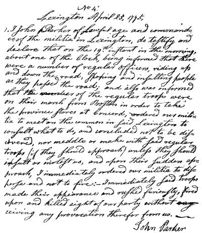
LEXINGTON DEPOSITION.
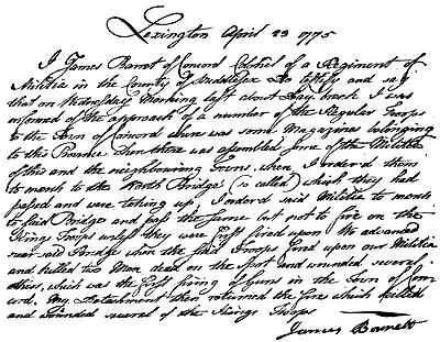
Fac-simile of the original in the Arthur Lee Papers in Harvard College library. The fac-simile on the opposite page, relating to the action at Concord, is reproduced from an original in the same collection of papers.
On the same day the friends of America, forming the Constitutional Society, met at the King's Arms in Cornhill, and raised a subscription of £100, to be paid to the widows and families of the provincials who had been killed.[527] On the 8th another vessel reached Liverpool, confirming the news, but giving no particulars. Finally, on the 10th, the official report of Gage, with the statements of Percy and Smith, reached the government.[528]
Meanwhile, both sides at home had been busy with circulating their pleas of vindications. The provincial congress at once despatched messengers south,[529] and the Rev. William Gordon, an Englishman settled in Jamaica Plain, drew up (May 17, 1775) for the patriots their authoritative Account of the Commencement of hostilities;[530] and various other contemporary accounts on the provincial side have come down to us,[531] and of importance among them are the narratives of the ministers of Lexington and Concord, the Reverends Jonas Clark and William Emerson.[532]
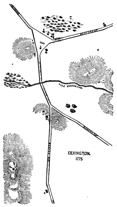
LEXINGTON, 1775.
After a plan in Hudson's Lexington, p. 173. The British approached from Boston up the road, past the Munroe Tavern, still standing (C), past Loring's house and barn (I J); and opposite Emerson's house (H) they sighted, looking beyond the meeting-house (L), the Lexington militia, under Capt. John Parker, drawn up along the farther side of the triangular green, in front of the houses of Daniel Harrington (E) and Jonathan Harrington (D, still standing) (who was one of the killed), which were separated from each other by a blacksmith's shop (G). The house on the opposite side of the common (F) was Nathan Munroe's (still standing), and on the third side was Bucknam's Tavern (B, still standing), where Parker's company was mostly assembled when the order was given to form on the common. When the minute-men scattered, most of them ran across the swamp; but some fled up the Bedford road, in the direction of the Clarke House (A), still standing, where Adams and Hancock had spent the night, but from which they were now hurrying towards Burlington for better protection.
On the return of the British from Concord, they met Percy's column on the road between Munroe's Tavern and Loring's. Percy now kept the provincials at bay by planting his field-pieces at M and N, while some of the wounded were carried into the tavern, which is still standing. The buildings (I J) were set on fire and burned down. Balls from Percy's cannon have been dug up since in the town. One went through the meeting-house (L). Several of these balls are preserved. While Percy was halting, General Heath arrived among the provincials and assumed the command. Cf. the plans in Josiah Adams's Address at Acton; Moore's Ballad History of the Revolution.
There are views of the Clarke House in Hudson's Lexington, 430; Drake's Landmarks of Middlesex, 364-368; Lossing's Field-Book, i. 523; and of the Munroe Tavern in Hudson, part ii. p. 161.
The Memoirs of General Heath are, of course, of first importance; for he was on the ground soon after Percy took the command on the British side.[533]
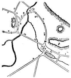
CONCORD, 1775.
This follows a plan in Hudson's Lexington, p. 191. The British approached from Lexington by the road (1), and halted in the middle of the town (3). The provincials, who were assembled by the liberty-pole (2), retired along the road (5) by the Rev. William Emerson's house [Hawthorne's "Old Manse"], and across the North Bridge (between 5 and 8) to the high land (6), where they halted, and where reinforcements from the neighboring towns reached them. Colonel Smith, the British commander, now sent out two parties to seek for stores. One, which went by the road (4) to the South Bridge, found little. The other followed the road (5) by the North Bridge, and passing beneath the provincials at 6, turned to their right, and took the road (5) to Colonel Barrett's house, where they destroyed some cannon and other stores. This second party had left a detail at the North Bridge to secure their retreat by that way, for the road (10) did not then exist. The provincials, after the party bound to Colonel Barrett's passed on, descended from 6 to the North Bridge, when the detail defending it, who were near 8, recrossed the bridge. Here the first firing took place, and some were killed on both sides, the river being between the combatants. The British detail now retired towards the centre of the town, the Americans following them across the bridge, but immediately dispersing without military order. While thus scattered, the British party, returning from Barrett's house, recrossed the North Bridge without molestation, and rejoined the main body at the centre of the town. Here the British, after destroying other stores and delaying for about two hours, formed for the return march towards Lexington, the main body following the road (2), while a flanking party took the ridge of high land (2).
Cf. also the plans in Frothingham's Siege of Boston, 70.
A few days after the 19th, John Adams tells us[534] he rode along "the scene of action toward Lexington for many miles, and inquired of the inhabitants the circumstances." He gives us no particulars, but what he learned was not calculated to diminish his ardor in the cause.[535]
The accounts on the British side are almost equally numerous, including the official reports of Gage, Percy, and Smith, already referred to. General Gage sent (April 29)[536] to Gov. Trumbull, of Connecticut, a statement, which was printed at the time in a handbill as a Circumstantial Account, and he refers to it "as taken from gentlemen of indisputable honor and veracity, who were eye-witnesses of all the transactions of that day."[537]
In 1779 there was printed at Boston a pamphlet containing General Gage's instructions to Brown and De Bernière,[538] from a MS. left in Boston by a British officer, to which is appended an account of the "transactions" of April 19, with a list of the killed, wounded, and missing,[539] and in 1775 there was printed at London a contemporary summary in The Rise, Progress, and Present State of the Dispute.[540]
The question of firing the first shot at Lexington was studiously examined at the time, each side claiming exemption from the charge of being the aggressor, and Frothingham[541] and Hudson[542] collate the evidence. It seems probable that the British fired first, though by design or accident a musket on the provincial side flashed in the pan before the regulars fired.[543] That some irregular return of the British fire was made seems undeniable, though at the time of the semi-centennial celebration certain writers, anxious to establish for Concord the credit of first forcibly resisting the British arms, denied that claim on the part of the neighboring town. The controversy resulted in Elias Phinney's Battle of Lexington, published in 1825,[544] with depositions of survivors, taken in 1822; and Ezra Ripley's Fight at Concord, published in 1827.[545] The parts borne by the men of other towns have had their special commemorations.[546]
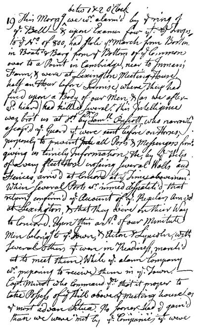
PART OF EMERSON'S RECORD IN HIS DIARY, APRIL 19, 1775 (from Whitney's Literature of the Nineteenth of April).
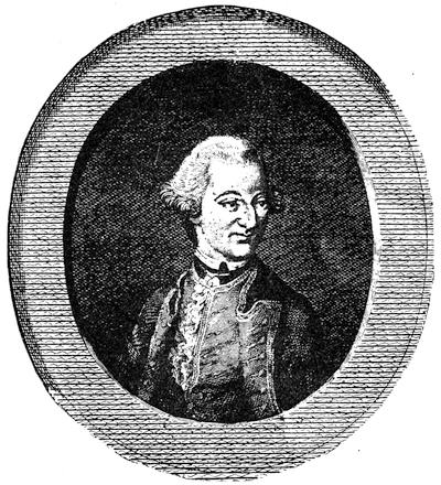
PERCY.
From Andrews's Hist. of the War, Lond., 1785, vol. ii. A portrait engraved by V. Green is noted in J. C. Smith's Brit. Mezzotint Portraits, ii. 576. Cf. also Evelyns in America, 304; Memorial Hist. of Boston, iii. 57, 58; "Percy family and Alnwick Castle" in Jewitt's Stately Homes of England. In the Third Report of the Hist. MSS. Commission there are (1872) various papers of the Percy family touching the American war. Some of these papers have been procured from England by the Rev. E. G. Porter, of Lexington. Several letters of Percy, addressed to Bishop Percy, sold not long since at a sale of the Bishop's MSS., were bought by a London dealer, and are now in the Boston Public Library. They are quoted from in this and other chapters. On July 30, 1776, a picture of Percy was placed in Guildhall, London, by the magistrates of the city and liberties of Westminster, in token of his services in America. Cf. also Doyle's Official Baronage, ii. 670.
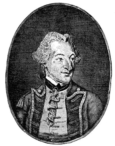
PERCY.
From Murray's Impartial Hist. of the present War, i. 382.
B. Battle of Bunker Hill, June 17, 1775.—There are four sufficient authorities for tracing all that is known respecting the battle of Bunker Hill, even to minute particulars, especially with respect to the testimony of those who, from nearness to the event, or from opportunity, are best entitled to be considered in the matter. The earliest master of the literature and records of the fight was Richard Frothingham, who through life was identified with the story of Bunker Hill, and who has on the whole, in his Siege of Boston and in his Life of Joseph Warren, given us the amplest details.[547] His latest gleanings were included in The Battlefield of Bunker hill: with a relation of the action by William Prescott, and illustrative documents. A paper communicated to the Massachusetts Historical Society, June 10, 1875, with additions. (Boston: printed for the author. 1876. 46 pp.)[548]
In June, 1868, Henry B. Dawson, in a special number of the Historical Magazine, entered into an elaborate collation of nearly all that had been published up to that time, making his references in footnotes, which serve as a bibliography of the subject.[549]
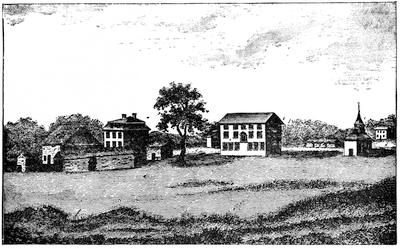
LEXINGTON GREEN.
From the Massachusetts Magazine (Boston, 1794). Four views (12 X 18 inches, on copper) of different aspects of the day's fight were drawn by Earl, a portrait painter, and engraved by Amos Doolittle shortly afterward. They are reproduced in the centennial edition of Jonas Clark's Narrative; in Frank Moore's Ballad History; in Potter's American Monthly, April, 1875; in Antique views of ye Town of Boston; and separately, with an explanatory text, by E. G. Porter, as Four Drawings of the Engagement at Lexington and Concord (Boston, 1883). The view of the attack on Lexington Green was drawn from Daniel Harrington's house (see plan), and was reduced by Doolittle himself for Barber's History of New Haven. (W. S. Baker's Amer. Engravers, Philad., 1875, p. 45.) It has also been redrawn several times by others. See Lossing's Field-Book, i. 421, 524; Hudson's Lexington, p. 183; the Centennial edition of Phinney, etc.
Earl and Doolittle were soldiers of a New Haven company, which reached Cambridge a few days after the fight.
There is a view of Concord taken in 1776 in the Massachusetts Mag., July, 1794, which is reproduced in Whitney's Literature of the Nineteenth of April.
There is an early but fanciful picture of the "Journée de Lexington" in François Godefroy's Recueil d'Estampes representant les different événemens de la guerre qui a procuré l'indépendence aux États Unis de l'Amérique.
An account of Jonathan Harrington, the last survivor of the fight, is in Potter's Amer. Monthly, April, 1875, and in Jones's New York during the Revolution, i. 552.
In fiction, mention need only be made of Cooper's Lionel Lincoln, and Hawthorne's Septimus Felton.
In 1875 there was an exhibition of relics of the fight at Lexington, and some of them are still retained in the library hall. A printed list of them was issued in 1875. A musket taken from a British soldier was bequeathed by Theodore Parker to the State of Massachusetts, and now hangs in the Senate Chamber. Cf. Hist. Mag., iv. 202 (July, 1880).
In 1875 Justin Winsor published first in the Bulletin of the Boston Public Library a bibliographical commentary on all printed matter respecting the battle, grouping his notes by their affinities; and this was enlarged in the Celebration of the Centennial Anniversary of the Battle, published by the city of Boston in 1875; and still further augmented in a section of his Handbook of the American Revolution (Boston, 1879).
In 1880 James F. Hunnewell, in his Bibliography of Charlestown and Bunker Hill (Boston), grouped everything alphabetically under such main headings as monographs, maps and plans, contemporary newspapers, American statements, British accounts, French accounts, anniversaries. His enumeration is more nearly exhaustive than Mr. Winsor's, though this may still supplement it in some particulars.
The earliest printed accounts which we have of the battle are in the newspapers, and of these a full enumeration is given by Mr. Hunnewell.[550]
What may be called the official statements on the American side were speedily placed before the public, but, strange to say, neither of the two officers who have been held to have directed the conduct of the Americans vouched for any of the early accounts. From Putnam we have nothing. Prescott made no statement, which has come down to us, earlier than in a letter addressed to John Adams, Aug. 25, 1775,[551] though he is said to have assisted the Rev.
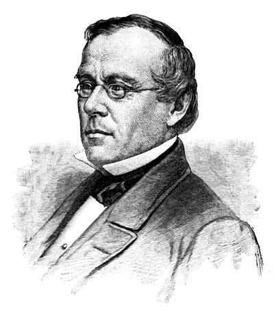
RICHARD FROTHINGHAM.
After a steel plate kindly furnished by Mr. Frothingham's son, Mr. Thomas Goddard Frothingham. There is a memoir of Mr. Frothingham, by Charles Deane, in the Mass. Hist. Soc. Proceedings, Feb., 1885, and separately. Mr. Frothingham was born Jan. 31, 1812, and died Jan. 29, 1880. Remarks made to the society at the time of his death are in the Proc. (Feb., 1880), xvii. 329. Cf. R. C. Winthrop's Speeches (1878, etc.), p. 125.
Peter Thacher in a narrative which was prepared within a fortnight, Thacher himself having observed the fight from the Malden side of Mystick River.[552] This Thacher MS. was made the basis of the account which the Committee of Safety, by order of the provincial congress, prepared for sending to England.[553] There have been preserved a large number of letters and statements written by eye-witnesses or by those near at hand, some of them conveying particulars essential to the understanding of the day's events, but most adding little beyond increasing our perceptions of the feelings of the hour.[554]
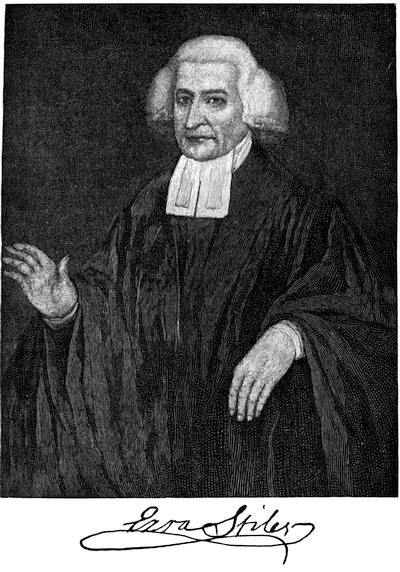
After the painting belonging to Yale College. Cf. photograph in Kingsley's Yale College, i. 102; engravings in Hollister's Connecticut, i. 234, and Amer. Quart. Reg., viii. 31, 193; and memoir in Sparks's Amer. Biog., xvi. 3, by J. L. Kingsley.
To these may be added various diaries and orderly-books, which are of little distinctive value.[555] There are other accounts, written at a later period, in which personal recollections are assisted by study of the recitals of others, and chief among them are the narrative in Thacher's Military Journal (Boston, 1823), where the account is entered as of July, 1775, and chapter xix. of General James Wilkinson's Memoirs (1816), embodying what he learned in going over the field in March, 1776, with Stark and Reed. Col. John Trumbull saw the smoke of the fight from the Roxbury lines, and gave an outline narrative in his Autobiography (1841).[556] The account in General Heath's Memoirs (Boston, 1798) is short.[557] A few of the earlier general histories of the war were written by those on the American side who had some advantages by reason of friendly or other relations with the actors.[558] Of the still later accounts, Frothingham and Dawson have already been referred to for their bibliographical accompaniments. The diversity of evidence[559] respecting almost all cardinal points of the battle's history has necessarily entailed more or less of the controversial spirit in all who have written upon it, but for thoroughness of research and a fair discrimination combined, the labors of Frothingham must be conceded to be foremost. Dawson is elaborate, and he reveals more than Frothingham the processes of his collations, but his spirit is not so tempered by discretion, and an air of flippant controversy often pervades his narrative. Of the more recent general historians it is only necessary to mention Bancroft[560] and Carrington. The former gave to it three chapters in his original edition, in 1858, which, by a little condensation, make a single one in his final revision, but without material change.[561] The account in Carrington[562] is intended to be distinctively a military criticism.[563]
The troops of Connecticut[564] and New Hampshire[565] were the only ones engaged beside those of Massachusetts.
The question of who commanded during the day has been the subject of continued controversy, arising from the too large claims of partisans. Though there is much conflict of contemporary evidence, it seems well established that Col. William Prescott commanded at the redoubt, and no one questioned his right. He also sent out the party which in the beginning protected his flank towards the Mystick; but when Stark, with his New Hampshire men, came up to strengthen that party, his authority seems to have been generally recognized, and he held the rail fence there as long as he could to cover the retreat of Prescott's men from the redoubt. Putnam, the ranking officer on the field, Warren disclaiming all right to command, withdrew men with entrenching tools from Prescott, and planned to throw up earthworks on the higher eminence, now known as Bunker Hill proper, and near the end of the retreat he assumed a general command, and directed the fortifying of Prospect Hill. It is not apparent, then, that any officer, previous to this last stage of the fight, can be said to have had general command in all parts of the field. The discussion of the claims of Putnam and Prescott has resulted in a large number of monographs, and has formed a particular feature in many of the general accounts of the battle, the mention of some of which has for this reason been deferred till they could be placed in the appended note.[566]
A list of officers in the battle, not named in Frothingham's Siege, is given in the N. E. Hist. and Geneal. Reg., April, 1873; and an English list of the Yankee officers in the force about Boston in June, 1775, is in Ibid., July, 1874. The Lives of participants and observers add occasionally some items to the story.[567]
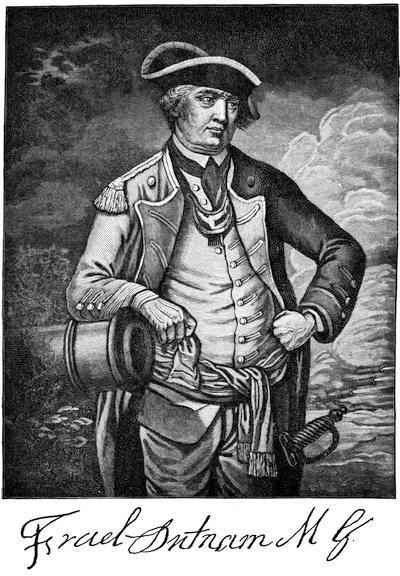
This follows the reproduction of an engraving in J. C. Smith's Brit. Mezzotint Portraits, p. 1716, which is inscribed: Israel Putnam, Esq., Major-General of the Connecticut forces, and Commander-in-chief at the engagement on Buncker's-Hill, near Boston, 17 June, 1775. Published by C. Shepherd, 9 Sepr 1775. J. Wilkinson pinxt. (Cf. Mass. Hist. Soc. Proc., xix. 102.) There is a French engraving, representing him in cocked hat, looking down and aside, and subscribed "Israel Putnam, Eqre., major général des Troupes de Connecticut. Il commandait en chef à l'affaire de Bunckes hill près Boston, le 17 Juin, 1775." Col. J. Trumbull made a sketch of Putnam, which has been engraved by W. Humphreys (National Portrait Gallery, N. Y., 1834) and by Thomas Gimbrede.
Cf. portraits in Murray's Impartial Hist. (1778), i. 334; Hollister's Connecticut; Irving's Washington, illus. ed., i. 413; and Geschichte der Kriege in und ausser Europa (Nürnberg, 1778).
For lives of Putnam, see Sabin, xvi. no. 66,804, etc. For his birthplace, see Appleton's Journal, xi. 321; Miss Larned's Windham County, Conn. Cf. B. J. Lossing in Harper's Monthly, xii. 577; Evelyns in America, 273; R. H. Stoddard in Nat. Mag., xii. 97.
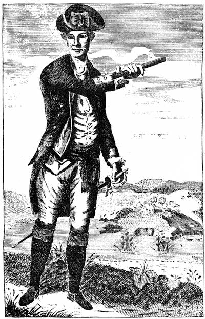
JOSEPH WARREN.
After a copperplate by J. Norman in An Impartial Hist. of the War in America (Boston, 1781), vol. ii. p. 210. The best known picture of Warren is a small canvas by Copley, belonging to Dr. John Collins Warren, of Boston, which has been often engraved, and is given in mezzotint by H. W. Smith in Frothingham's Life of Warren. The picture in Faneuil Hall is painted after this, and Thomas Illman has engraved that copy. A larger canvas by Copley, painted not long before that artist left Boston for England, is owned by Dr. Buckminster Brown, of Boston, and was engraved for the first time in the Mem. Hist. of Boston, iii. 60, where will be found accounts of various contemporary prints and memorials of Warren (pp. 59, 61, 142, 143), including his house at Roxbury, the manuscript of his Massacre Oration, etc. Cf. Frothingham's Warren, p. 546; Hist. Mag., Dec., 1857; Loring's Hundred Boston Orators, p. 67; Mrs. J. B. Brown's Stories of General Warren; Life of Dr. John Warren; the Warren Genealogy; Mass. Hist. Soc. Proc., Sept., 1866. The earliest eulogy was that by Perez Morton in 1776 (Loring's Hundred Boston Orators, 327; Niles's Principles and Acts, 1876, p. 30), and the earliest memoir of any extent was that by A. H. Everett, in Sparks's Amer. Biography (vol. x.). There are reminiscences in the N. E. Hist. and Geneal. Reg., xii. 113, 234, which were based by Gen. William H. Sumner on some letters published by him in 1825 in the Boston Patriot, when, as adjutant-general of the State, he arranged for the appearance of the Bunker Hill veterans in the celebration of that year, and derived some reminiscences from them respecting Warren's appearance and action during the fight. All other accounts of Warren, however, have been eclipsed by Frothingham's Life of Warren (Boston, 1865). In the Boston Medical and Surgical Journal (June 17, 1875), Dr. John Jeffries (son of the surgeon of the British army who saw Warren's body on the field) published a paper on his death. Cf. also R. J. Speirr in Potter's Amer. Monthly, v. 571; Frothingham's Warren, pp. 519, 523; Barry's Massachusetts, i. 37, and references.
The grateful intentions expressed by the Massachusetts House of Representatives (April 4, 1776), by the Continental Congress (April 8, 1777; Sept. 6, 1778; July 1, 1780,—see Journals of Congress), and by the Congress of the United States (Jan. 30, 1846,—Mass. Hist. Soc. Proc., ii. 337), have never been carried out. Benedict Arnold manifested a special interest in the welfare of Warren's children (N. E. Hist. and Geneal. Reg., April, 1857, p. 122). The Freemasons erected a pillar to his memory on the battlefield in 1794, which disappeared when the present obelisk was begun in 1825. There is a view of the pillar in the Analectic Mag., March, 1818, and in Snow's Boston, 309. Cf. Mass. Hist. Soc. Proc., xiv. 65. A statue of Warren, by Henry Dexter, was placed in a pavilion near the obelisk in 1857. Cf. G. W. Warren's Hist. of the Bunker Hill Monument Association; Frothingham's Warren, p. 547.
Among the anniversary discourses upon the battle, a few will bear reading. The earliest was by Josiah Bartlett in 1794, published by B. Edes, in Boston, the next year. Daniel Webster made a famous address at the laying of the corner-stone of the monument in 1825, which can be found in his Works, i. 59. (Cf. Analectic Mag., vol. xi.; A. Levasseur's Lafayette en Amérique, Paris, 1829.) The same orator, at the completion of the monument in 1843, embodied little of historical interest in his Address. (Works, i. 89.[568]) Alexander H. Everett's Address in 1836 was subsequently inwoven in his Life of Warren. The Rev. George E. Ellis began his conspicuous labors in this field in his discourse in 1841. Edward Everett spoke in 1850 (Orations, etc., iii. p. 3), and Gen. Charles Devens, at the Centennial in 1875, delivered an oration, which was published by the city of Boston. The most noteworthy address since that time was that of Robert C. Winthrop at the unveiling of the statue of Colonel William Prescott, June 17, 1881.[569] This statue, of which an engraving will be found in the Mem. Hist. of Boston (iv. 410), stands near the base of the monument.[570]
We turn now to the accounts on the British side. The orderly-books of General Howe are preserved among Lord Dorchester's (Carleton's) Papers in the Royal Institution, London. Sparks made extracts from them, now in no. xlv. of the Sparks MSS. in Harvard College library. Extracts relating to the dispositions for the day of the battle, and for subsequent days, are given by Ellis (1843) p. 88.[571] Cf. Mag. of Amer. Hist., 1885, p. 214. The more immediate English notes and comments on the battle can be best grouped in a note.[572]
During 1775 there were two English accounts, aiming at something like historical perspective. One of these was, very likely, by Edmund Burke, and was in the Annual Register (p. 133, etc.). The other was An Impartial and Authentic Narrative of the Battle fought on the 17th of June, 1775, between his Britannic Majesty's Troops and the American Provincial Army on Bunker's Hill near Charles Town in New England. The author was John Clark, a first lieutenant of marines. He gives a speech of Howe to his men, representing that it was delivered just as he advanced to the attack, but this and much else in the book are considered of doubtful authenticity.[573]
In 1780 there appeared in the London Chronicle some letters by Israel Mauduit, which were republished the same year as Three letters to Lord Viscount Howe: added, Remarks on the battle of Bunker's Hill (London, 1780), which in a second edition (1781) reads additionally in the title, To which is added a comparative view of the Conduct of Lord Cornwallis and General Howe. There was among the Chalmers' MSS. (Thorpe's Supplemental Catal., 1843, no. 660) a writing entitled Some particulars of the battle of Bunker's Hill, the situation of the ground, etc. (8 pp., 1784), which Chalmers calls a "most curious paper in the handwriting of Israel Mauduit, found among his pamphlets, Jan. 23, 1789."
In 1784 William Carter's Genuine Detail of the Royal and American Armies appeared in London. Carter was a lieutenant in the Fortieth Foot, and his book was seemingly reissued in 1785, with a new title-page. (Brinley, no. 1,789; Stevens, Bibl. Amer., 1885, nos. 80, 81; Harvard Coll. lib., 6351.16.)
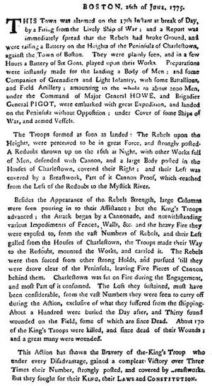
Note.—The fac-simile on this page is of a handbill, printed in Boston, giving the tory side of the fight at Bunker Hill,—after an original in the library of the Mass. Hist. Society.
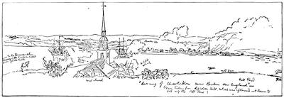
Note.—This sketch of Bunker Hill Battle, made for Lord Rawdon, follows a tracing of the original belonging to Dr. Emmet of New York, furnished to me by Mr. Benson J. Lossing. A finished drawing from this sketch is given in the Mem. Hist. of Boston, vol. iii. Cf. Harper's Mag. xlvii., p. 18. The spire in the foreground is that of the West Church, which stood where Dr. Bartol's church, in Cambridge Street, Boston, now stands, showing that the sketcher was on Beacon hill, 138 feet above the water. The smoke from the frigate to the right of the spire rises against the higher hill where Putnam endeavored to rally the retreating provincials. This hill is 110 feet above the water, and about one mile and a half distant from the spectator. One hundred and thirty rods to the right of this summit is the crown of the lower or Breed's Hill, where the redoubt was, which is 62 feet above the sea. Dr. Emmet secured this picture and another of the slope of the hill, taken after the battle, and showing the broken fences (Mem. Hist. of Boston, iii. 88), at the sale of the effects of the Marquis of Hastings, who was a descendant of Lord Rawdon, then on Gage's staff (Harper's Monthly Mag., 1875). The earliest engraved picture of the battle is one cut by Roman, which was published the same year, and appeared also in Sept., 1775, on a reduced scale, in the Pennsylvania Magazine. It has been reproduced in Frothingham's Centennial: Battle of Bunker Hill (1875), in Moore's Ballad History, and in other of the Centennial memorials. In 1781 a poem by George Cockings, The American War (London), had a somewhat extraordinary picture, which has been reproduced in Gay's Pop. Hist. U. S., iii. 401, by S. A. Drake, and others. In 1786 Col. John Trumbull painted his well-known picture of the battle, which has been often engraved. (Cf. Trumbull's Autobiography; N. E. Hist. and Geneal. Reg., xv.; Tuckerman's Book of the Artists; Harper's Magazine, Nov., 1879.) Trumbull claimed that the following figures in his picture were portraits: Warren, Putnam, Howe, Clinton, Small, and the two Pitcairns.
In the Mass. Magazine, Sept., 1789, there is a view of Charlestown, showing Bunker's and Breed's hills, with their original contours. It is reproduced in Mem. Hist. Boston, iii. 554, with a note upon other early views. Frothingham (Siege, p. 121) gives one from an early manuscript which closely resembles the topography of the Rawdon sketch; and again (Centennial, etc.) another which is in fact the perspective sketch of the town at the edge of Price's view of Boston (1743), converted into a panoramic picture (Mem. Hist. of Boston, ii. 329).
The Gentleman's Mag., Feb., 1790, has a view of Charlestown, with the tents of the British army on the hill, taken after the battle, and from Copp's Hill. It shows the wharves and ruins of the town. (Cf. note in Mem. Hist. Boston, iii. 88.)
The account of the loyalist Jones (N. Y. during the Rev., i. 52) has his usual twist of vision, though he is severe on Gage for "taking the bull by the horns" in making an attack in front.
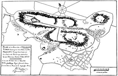
CHARLESTOWN PENINSULA, 1775.
Sketched from a plan by Montresor, showing the redoubt erected by the British, after June 17, on the higher eminence of Bunker Hill. The original is in the library of Congress, where is a plan on a large scale of this principal redoubt.
The long list of general histories on the British side, detailing the events of the battle, begins with Murray's Impartial Hist. of the War (London, 1778; Newcastle, 1782), and is made up during the rest of that century by the Hist. of the War published at Dublin (1779-85); Hall's Civil War in America (1780); The Detail and Conduct of the Amer. War (1780); Andrews's Hist. of the War (1785, vol. i. 301,—quoted at length by Ryerson, Loyalists, i. 461); Stedman, Hist. Amer. War (London, 1794, vol. i. 125). The best of the later historians is Mahon (Hist. of England, vi.), who was forced to admit, when pressed upon the question, that the American claims of victory, which he says they have always held, appear only in the reports of later British tourists (vol. vi., App. xxix.). Lecky, in his brief account (England in the Eighteenth Century, iii. 463), makes an intention of Gage to fortify the Charlestown and not the Dorchester heights the incentive to the American occupation of the former. Edw. Bernard's History of England (London) has a curious "View of the Attack on Bunker's Hill, with the burning of Charlestown."
Something confirmatory, rather than of original value, can be gained from the histories of various regiments which took part in the battle, as detailed in the series of Historical Records of such regiments.[574]
The battle almost immediately found commemoration in British ballads (Hist. Mag., ii. 58; v. 251; Hale's Hundred Years Ago, p. 7), and the slain were commemorated in elegiac verses, as in M. M. Robinson's To a young lady, on the death of her brother, slain in the late engagement at Boston (London, 1776). The same year there appeared at Philadelphia The Battle of Bunker's Hill, a dramatic piece in five acts, in heroic measure, by a gentleman of Maryland.
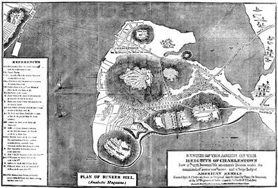
Note.—The references in the corner of this cut, too fine to be easily read in this reduced fac-simile, are as follows:—
"A A. First position, where the troops remained until reinforcements arrived.
B B. Second position.
C C C. Ground on which the different regiments marched to form the line.
D D. Direction in which the attack was made upon the redoubt and breastwork.
E E. Position of a part of the 47th and marines, to silence the fire of a barn at E.
F. First position of the cannon.
G. Second position of the cannon in advancing with the grenadiers, but stopped by the marsh.
H. Breastwork formed of pickets, hay, stones, etc., with the pieces of cannon.
I I. Light infantry advancing along the shore to force the right of the breastwork H.
L L. The "Lively" and "Falcon" hauled close to shore, to rake the low grounds before the troops advanced.
M M. Gondolas that fired on the rebels in their retreat.
N. Battery of cannon, howitzers, and mortars on Copp's Hill, that battered the redoubt and set fire to Charlestown.
O O O. The rebels behind all the stone walls, trees, and brush-wood, and their numbers uncertain, having constantly large columns to reinforce them during the action.
P. Place from whence the grenadiers received a very heavy fire.
Q. Place of the fifty-second regiment on the night of the 17th.
R. Forty-seventh regiment, in Charlestown, on the night of the 17th.
S. Detachments in the mill and two storehouses.
T. Breastwork thrown up by the remainder of the troops on the night of the 17th.
Note. The distance from Boston to Charlestown is about 550 yards."
Its author is said to be Hugh Henry Brackenridge, and the frontispiece, "The Death of Warren", by Norman, is held to be the earliest engraving in British America by a native artist (Hunnewell, p. 13; Brinley, no. 1,787; Sabin, ii. 7,184; xiv. 58,640). In 1779 there was printed at Danvers, America Invincible, an heroic poem, in two books: a Battle at Bunker Hill, by an officer of rank in the Continental army (Hunnewell, p. 13). In 1781 an anonymous poem was published in London, known later to be the production of George Cockings, and called The American War, in which the names of the officers who have distinguished themselves during the war are introduced (Brinley, no. 1,788; Hunnewell, p. 14). Of later use of the battle in fiction, it is only necessary to name Cooper's novel of Lionel Lincoln and O. W. Holmes's Grandmother's Story of Bunker Hill Battle (Mass. Hist. Soc. Proc., 1875, p. 33).
The chief enumerations which have been heretofore made of the plans of the battle of Bunker Hill are by Frothingham, in Mass. Hist. Soc. Proc., xiv. 53; by Hunnewell in his Bibliog. of Charlestown, p. 17; and by Winsor in the Mem. Hist. of Boston, iii. (introduction). The earliest rude sketches are by Stiles in his diary (Dawson, p. 393), and one formed by printer's rules in Rivington's Gazetteer, Aug. 3, 1775 (Frothingham's Siege, p. 397, and Dawson, p. 390). Montresor, of the British engineers, very soon made a survey of the field, and this was used by Lieutenant Page in drawing a plan of the action, which he carried to England with him when, on account of wounds received while acting as an aid to Howe, he was given leave of absence (Mass. Hist. Soc. Proc., June, 1875, p. 56). In the Faden collection (nos. 25-30) of maps in the library of Congress there are Page's rough and finished plans, drawn before the British works on the hill were begun, and also plans by Montresor and R. W., of the Welsh Fusiliers. Page's plan, as engraved, was issued in London in 1776, and called A Plan of the Action at Bunker's Hill.[575]
Page's, however, was not the first engraved. One "by an officer on the spot" was published in London, Nov. 27, 1775, called Plan of the battle on Bunker's Hill. Fought on the 17th of June, which was issued as a broadside, with Burgoyne's letter to Lord Stanley on the same sheet. The central position of the Americans is called "Warren's redoubt." This is reproduced in F. Moore's Ballad History of the Revolution.
Another contemporary British plan—discovered probably "in the baggage of a British officer", after the royal troops left Boston in March, 1776, but not brought to light till forty years later, when it was mentioned in a newspaper in Wilkesbarre, Penn., as having been found in an old drawer—was one made by Henry de Bernière, of the Tenth Royal Infantry, on nearly the same scale as Page's, but less accurately.
It was engraved in 1818 in the Analectic Magazine (Philad., p. 150), and a fac-simile of that engraving is annexed. The text accompanying it states that its general accuracy had been vouched for by Governor Brooks, General Dearborn, Dr. A. Dexter, Deacon Thos. Miller, John Kettell, Dr. Bartlett, the Hon. James Winthrop, and Mr. [Judge] Prescott. General Dearborn and Deacon Miller thought the rail fence too far in the rear of the redoubt, having been really nearly in the line of it. Judge Winthrop and Dr. Bartlett thought the map in this particular correct. There was the same division of belief regarding the cannon behind the fence, Dearborn and Miller believing there were none there, Brooks and Winthrop holding the contrary. Other witnesses represented to the editor of the Magazine that there was no interval between the breastwork and the fence, but that an imperfect line of defence connected the redoubt with the Mystick shore, as represented in Stedman's (Page's) map.[576]
In the Portfolio (March, 1818) General Dearborn criticised the plan (Dawson, p. 406), and, using the same plate in his separate issue of his comments, he imposed in red his ideas of the position of the works, and this was in turn criticised by Governor Brooks.[577] Mr. G. G. Smith made a (plan) Sketch of the Battle of Bunker Hill by a British Officer (Boston, 1843), which grew out of the plan and the comments on it. Bernière's plan was also used by Colonel Swett as the basis of the one which he published in his History of the Battle of Bunker Hill (1828, 1826, 1827), which has been frequently copied (Ellis, Lossing, etc.). The latest attempt to map the phases of the action critically is by Carrington in his Battles of the Revolution (p. 112), who gives an eclectic plan. Plans adopting the features of earlier ones are in the English translation of Botta's War of Independence, Grant's British Battles (ii. 144). A plan of the present condition of the ground, by Thomas W. Davis, superposing the line of the American works, is given in the Bunker Hill Monument Association's Proceedings (1876). A map of Charlestown in 1775 with a plan of the battle was prepared and published in 1875 by James E. Stone. A plan of the works as reconstructed by the British, and deserted by them in March, 1776, is given in Carter's Genuine detail, etc. (London, 1784), which is reproduced in Frothingham's Siege, p. 330. Other MS. plans of their works on both hills are in the Faden maps in the library of Congress.
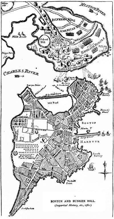
Before the war closed a plan was engraved by Norman, a Boston engraver, which is the earliest to appear near the scene itself. This was a Plan of the town of Boston with the attack on Bunker's Hill, in the peninsula of Charlestown, on June 17, 1775 (measuring 11-1/2 × 7 inches), which is, however, of no topographical value as respects the action. It appeared in Murray's Impartial History (1778), i. p. 430, and in An Impartial History of the War in America (Boston, 1781, vol. i.), and a reduced fac-simile of it is annexed.[578]
C. The American Camp.—A variety of journals and diaries have been preserved, the best known of which is that of Dr. Thacher, a surgeon on Prospect Hill.[579]
The daily life of the Cambridge camp is best seen in the letters sent from it, and foremost in interest among such are those of Washington.[580] From the Roxbury camp there are letters of General Thomas in the Thomas Papers, where is one of Dr. John Morgan, the medical director. Several from Jedediah Huntington are preserved in the Trumbull Papers, and are printed in the Mass. Hist. Soc. Coll., xlix.[581] The principal letters from the Winter Hill camp are those of General Sullivan,[582] and a few have been printed written at the Prospect Hill camp.[583]
Something of the spirit prevailing in Watertown, where the Provincial Congress was sitting, can be seen in the letters of James Warren and Samuel Cooper.[584]
There are in the library of the Amer. Antiq. Soc. at Worcester several orderly-books of the siege,[585] and others are preserved elsewhere.[586]
D. The British Camp.—The condition of Boston during the siege must be learned from various sources. The Boston News-Letter was still published, but numbers of it are very scarce for this period, and no other of the Boston newspapers continued to be published in the town.[587] It was a convenient vehicle for the British generals, and any morsel of news likely to be distasteful to the patriots, like the intercepted correspondence of Washington and John Adams, was pretty sure to reach the American lines through its columns. The correspondence of the generals is preserved in the British Archives and in the papers at the Royal Institution (London), and occasionally some few letters, like those of Percy in the Boston Public Library, have been found elsewhere. It is charged that Gage's papers were stolen in Boston.[588] Some new glimpses were got when Fonblanque published his Life of Burgoyne.[589] The best accounts of the succession of events in the town and the daily life are found in Dr. Ellis's "Chronicles of the Siege",[590] and in Mr. Horace E. Scudder's "Life in Boston during the Siege", a chapter in the Memorial Hist. of Boston, vol. iii.,[591] which may be consulted (p. 154) for various sources respecting the details of the privations and amusements of the people and the garrison, and of the vicissitudes of its buildings and landmarks.[592] An account of the British works in Boston is given in Frothingham's Siege of Boston, and the Mem. Hist. Boston, iii. 79. The current record of the outposts, etc., is noted in Moore's Diary of the Rev., 109, etc. Carrington (Battles, 154) refers to a MS. narrative of experiences in the town by one Edw. Stow. Some of the correspondence of the Boston selectmen with Thomas, at Roxbury, is in the Thomas Papers. It is, however, to the diaries, letters, and orderly-books which have been preserved that we must go for the details of life in the beleaguered town.[593]
E. Boston Evacuated.—The letters of Washington[594] best enable us to follow the movements, but they may be supplemented by other contemporary accounts.[595]
Howe's despatch to Dartmouth, dated Nantasket Roads, is in Dawson, i. 94.[596] His conduct of the siege is criticised in A view of the evidence relative to the Conduct of the American War (1779). Contemporary dissatisfaction was expressed in an ironical congratulatory poem published in London (Sabin, iv., 15,476).
One Crean Brush,[597] acting under orders of Howe, endeavored to carry off the merchandise from the stores of the town, so far as he could, on a vessel put at his disposal. Howe's proclamation in his favor is in fac-simile in the Mem. Hist. of Boston, iii. 97. Brush's vessel was later captured by Manly (Evacuation Memorial, 166). Similar experience in trying to escape with his merchandise was suffered by Jolley Allen, as portrayed in his Account of a part of his sufferings and losses, ed. by C. C. Smith, given in Mass. Hist. Soc. Proc., Feb., 1878, and separately. Allen's narrative was reprinted in the spelling of the original MS. in An Account of a part of the sufferings and losses of Jolley Allen, a native of London, with a preface and Notes by Mrs. Frances Mary Stoddard (Boston, 1883). An inventory of the stores left by the British is in the Siege of Boston, 406.[598] In the cabinet of this society is a handbill adopted by the freeholders of Boston, Nov. 18 [1776?], calling upon all who had suffered in property in Boston since March, 1775, to report the same to a committee.[599]
Washington's instructions (April 4, 1776) to Ward are in the printed Heath Papers, P. 4. The Mass. legislature, April 30, 1776, ordered beacons to be set at Cape Ann, Marblehead, and Blue Hill, ready to be fired in case of the enemy's reappearing, which was for a long time dreaded. Ward writes to Washington of his measures in progress.[600]
The correspondence of John Adams and John Winthrop (Mass. Hist. Coll., xlv.) shows constant anxiety lest the defences should not be prepared in case of need.[601]
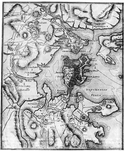
SIEGE OF BOSTON, 1776.
The westerly half of the map in the octavo atlas of Marshall's Washington, which is a reduction of the map in the earlier quarto atlas (1804). It is reproduced in the French translations of Marshall and of Botta.
The cut on the title of the present volume represents one side of the medal given by Congress to Washington, to commemorate his raising the siege of Boston.[602]
F. Maps of the Siege of Boston.—Plans of Boston and its neighborhood, including its harbor, for the illustration of the siege of Boston, are numerous, and the account of them given in the Mem. Hist. of Boston (iii., introd.) is in the main followed in the present enumeration, which divides them into those of American, English, French, and German origin, and adheres as far as possible to the order of publication in each group.
The earliest American is the 1769 (or last) edition of what is known as Price's edition of Bonner's map of Boston, which had done service since 1722 by successive changes in the plate, this last issue showing Hancock's Wharf, and "Esqr. Hancock's seat" on Beacon Street.[603] This map sufficed for local use till the events of 1775 induced new interest in the topography, when the earliest response came from Philadelphia, where C. Lownes engraved A new plan of Boston Harbour from an actual survey, for the Pennsylvania Magazine. It presented a reminder of the great event of the year in its "N. B. Charlestown burnt, June 17, 1775, by the Regulars." There is another Draught of the Harbour of Boston and the adjacent towns and roads, a manuscript, dated 1775, among the Belknap Papers, i. 84, in the cabinet of the Mass. Hist. Society. The same Pennsylvania Magazine, the next month (July, 1775), gave as engraved by Aitkins A new and correct plan of the town of Boston and Provincial Camp. The town seems to be taken from a plan which had appeared in the Gentleman's Magazine (London) the previous January; but in one corner was added a plan of the circumvallating lines of the besieging army.[604] Later in the season two other plans were made, showing the American lines, which were not published, however, till long after. One is given in Force's American Archives, 4th series, vol. iii.,[605] and the other was made by Col. John Trumbull, in Sept., 1775, which was published in his Autobiography in 1841.[606] Of about the same time is another very small Plan of Boston and its environs, showing the circumvallating lines, which is in one corner of a large Map of the Seat of Civil War in America, engraved by B. Romans, and dedicated to Hancock. There is also, in the library of the Mass. Hist. Society, a rude plan of the harbor and vicinity, showing the positions of the provincials, which are reckoned at 20,000, while the royal forces are put at 8,000. I find no other American plan till Norman's, in 1781, reproduced on another page; and not another till The Seat of the late War at Boston appeared in the Universal Asylum and Columbian Magazine, July, 1789, p. 444, but this is a rather scant map of the country as far inland as Worcester. Gordon had the year before this given a map in his American Revolution (London, 1788) based on English sources; but it has been the foundation of most of the eclectic maps since published in this country.[607]
In 1822 a Mr. Finch printed in Silliman's Journal an account of the traces then remaining of the earthworks of the siege, both American and British.[608] There is an enumeration of the different sections of the lines, within and without Boston, in the Mem. Hist. Boston (vol. iii. 104).[609]
The earliest English plan of this period is one called A plan of Boston and Charlestown from a drawing made in 1771, which occupies the margin of a larger map, engraved for The Town and Country Magazine in 1776, later to be mentioned. The Catalogue of the King's Maps (British Museum) shows a colored plan of Boston and vicinity (1773) in the centre of a large sheet, with marginal views (later to be described).
In 1774 a Plan of the town of Boston made part of a Chart of the Coast of New England, which appeared in the London Magazine, April, 1774, and in The American Atlas, issued by Thomas Jefferys in London, in 1776. This map seems to be the model of a New and accurate Plan of the town of Boston, which is engraved in the corner of A Map of the most inhabited part of New England, by Thomas Jefferys, Nov. 29, 1774, usually also found in The American Atlas (1776, nos. 15 and 16). This map is found with the date 1755, even after changes of a later date had been made in the plate.[610] The original map has also a marginal plan of Boston harbor (Mass. Hist. Soc. Proc., September, 1864).
The earliest English map of 1775 is one which appeared in the Gentleman's Magazine (January, 1775), though it is dated Feb. 1, 1775. It shows the town and harbor.[611]
In the June number of the Gentleman's Magazine is a "map of the country one hundred miles round Boston, in order to show the situation and march of the troops, as well provincial as regulars, which are now within sight of each other, and are hourly expected to engage."
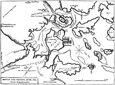
In June, 1775, was also made a not very accurate map of the town and its environs, which was published in London, Aug. 28, to satisfy the eagerness for a map of the region to which the news of the battle of Bunker Hill had turned all eyes. It is to be found in the first volume of Almon's Remembrancer, and is reproduced herewith. A few weeks after the fight at Charlestown there was probably made in Boston the MS. plan of Boston and circumjacent Country, showing the present situation of the king's troops and the rebel intrenchments. It is dated July 25, 1775, and is owned by Dr. Charles Deane.[612]
The largest chart which we have of Boston harbor of this period is dated August 5, 1775, and was the work of Samuel Holland, the surveyor-general of the Northern colonies, who was for some years employed on a coast survey.[613] It takes in Nahant, Nantasket, and Cambridge, and was based principally on the surveys of George Callendar (1769).[614] When Des Barres included it in his Atlantic Neptune (part iii., no. 6, 1780-1783), he marked in the besieging lines, and dated it Dec. 1, 1781, and in this state Des Barres also used it in his Coast and Harbors of New England.[615]
A map showing thirty miles round Boston, and bearing date Aug. 14, 1775, is in the king's library (British Museum), and is signed by M. Armstrong. It has marginal statistical tables, and in the upper right-hand corner is a plan of the "action near Charlestown, 17 June, 1775."[616] There is among the Force maps in the library of Congress the MS. original of the map (sketched herewith as Boston and Charlestown, 1775), which is called A Draught of the Towns of Boston and Charlestown and the circumjacent country, shewing the works thrown up by his Majesty's Troops, and also those by the Rebels during the campaign of 1775. N. B. The rebel entrenchments are expressed as they appear from Beacon Hill.
On August 28th the British town-major in Boston, James Urquhart, licensed Henry Pelham to make a Plan of Boston with its environs. It was engraved in aquatints in London, on two sheets, and not published till June 2, 1777. Dr. Belknap, who was much troubled to find a correct plan of the town for this period, thought Pelham's was the best.[617]
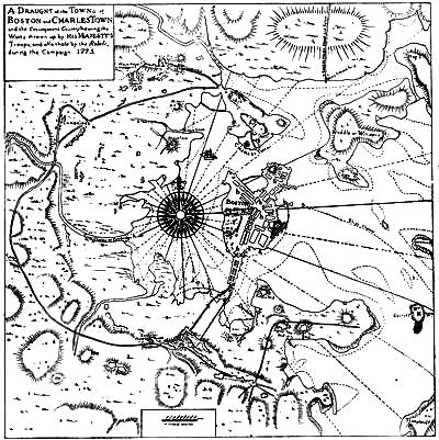
BOSTON AND CHARLESTOWN, 1775.
There are among the Faden MSS. in the library of Congress two MS. maps. One is probably the best plan of Boston itself of this period, and the other the best of those of the vicinity.[618] They represent the conditions of 1775, though they were not engraved and published by William Faden in London till Oct. 1, 1777, and Oct. 1, 1778, respectively. They are both, in the main, after a survey by William Page, of the British engineers. The first is called A Plan of the Town of Boston, with the Intrenchments, etc., of his Majesty's forces in 1775, from the observations of Lieut. Page and from the plans of other gentlemen. It gives the peninsula only, with a small portion of Charlestown, and was again issued in Oct., 1778.[619] The second is Boston, its environs and harbour, with the Rebels' works raised against that town in 1775, from the observations of Lieut. Page, and from the plans of Capt. Montresor. It includes Point Alderton, Chelsea, Cambridge, and Dorchester, and there is a copy in the library of the Mass. Hist. Society.
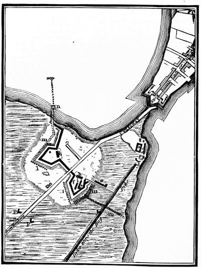
BRITISH LINES ON BOSTON NECK, 1775-76.
This is from Page's Plan of the Town of Boston, published in London in 1777, and is accompanied by the following Key:—a, redoubt; b, block-house for cannon; c, six 24-pounders, 2 royals; d, four 9-pounders; e, six 24-pounders; f, left bastion; g, right bastion; h, h, guard-houses; i, i, traverses; k, k, magazines; l, l, abattis; m, m, m, routes-du-pols; n, block-house for musketry; o, floating battery, 2 guns; p, p, fleches, 1 sub. and 20 men. The building beyond the outer lines and near the edge of the upland is Brown's house, the scene of skirmishes during the siege (Mem. Hist. of Boston, iii. 80; Heath's Memoirs). The narrowest part of the neck was at the present Dover Street where it intersects Washington Street. The foundations of the main works at this point were laid bare in digging a drain in March, 1860. The outer works were just within Blackstone and Franklin squares. There are views of these lines in the Faden Collection in the library of Congress, dated August, 1775, probably the original of the engraved views which accompany Des Barres' coast survey, and of which there are reproductions in the Mem. Hist. of Boston, iii. 80. Cf. also Frothingham's Siege, p. 315. The same Faden Collection has a pen-and-ink plan of the lines, dated Aug., 1775 (no. 37 of the Catal.).
During the summer of 1775, John Trumbull, then an aid to General Spencer, crawled up, under cover of the tall grass, near enough to the British lines to sketch them; but a continuance of the hazardous exploit was soon rendered unnecessary by the desertion of a British artilleryman, who brought with him a rude plan of the entire work. So Trumbull says in his Autobiography, p. 22. Washington, on comparing this surreptitious sketch with the deserter's plan, found them so nearly to correspond that Trumbull thinks his own future promotion probably arose from it. Trumbull's sketch and the memorandum of the deserter "from the Welsh fusileers" seem to have been the basis of a careful drawing of the British lines, prepared apparently at headquarters in Cambridge, as it bears the handwriting of Washington's aid, Thomas Mifflin, an explanatory table of the armament in the works. This found its way into that portion of the Papers of Arthur Lee which went to the Amer. Philosophical Society in Philadelphia, and from it a reduced heliotype is given in the Mem. Hist. of Boston, iii. p. 80. Washington sent a copy of the plan, nearly duplicate, to Congress, and this is given in Force's Amer. Archives, 4th ser., i. p. 29, and is reproduced on a smaller scale in Wheildon's Siege and Evacuation of Boston, p. 34. (Cf. Mass. Hist. Soc. Proc., April, 1879, p. 62.) There are two other American drawings of the lines, of less importance. One is in the Pennsylvania Magazine for Aug., 1775, and is called An exact plan of Gen. Gage's lines on Boston Neck in America, July 31, 1775. The other is a small marginal view of The Lines thrown up on Boston neck by the ministerial army, making part of the Seat of the Civil War, by Romans. A rude powder-horn plan is noted in the Mass. Hist. Soc. Proc. (Nov., 1881), xix. 103. One of the Faden MS. plans shows a proposed star redoubt at a point outside the lines.
In October, 1775, an "Engineer at Boston", Lieut. Richard Williams, made and sent over to England a plan showing the "redoubt taken from the rebels by General Howe", the British camp on the higher summit of Bunker Hill, together with the American lines at Cambridge and Roxbury. In London it was compared with "several other curious drawings", from which additions were made, when it was published by Andrew Dury, March 12, 1776, as engraved by Jno. Lodge for the late Mr. Jefferys, and called Plan of Boston and its environs, showing the true situation of his Majesty's Army, and also those of the rebels.[620] In the same month (Oct., 1775) a Plan of Boston, with Charlestown marked as in ruins, appeared in the Gentleman's Magazine (p. 464). Another Map of Boston and Charlestown, by an English officer present at Bunker Hill, was published in London, Nov. 25, 1775. The last map made during the British occupation of Boston was An accurate map of the Country round Boston in New England, published by A. Hamilton, Jr., near St. John's Gate, Jan. 16, 1776, appearing in the Town and Country Magazine. It measures 11-1/2 × 12-1/2 inches, and extends from Plymouth to Ipswich, and inland to Groton and Providence.
The evacuation of Boston in March, 1776, removed the centre of interest elsewhere, but there was for some time an apprehension of the return of the British for a naval attack; and while the Americans were fortifying the harbor, the English were publishing in London several maps of its configuration. The earliest was a Chart of Massachusetts Bay and Boston Harbour, published April 29, 1776. With the date changed to Dec. 1, 1781, it was subsequently included by Des Barres in the Atlantic Neptune, and in the Charts of the Coast and Harbors of New England, 1781.[621] Another Chart of Boston Bay, whose limits include Salem, Watertown, and Scituate, following Holland's surveys, was published Nov. 13, 1776, and later appeared, dated Dec. 1, 1781, in the Atlantic Neptune, and in the Coast and Harbors of New England. A chart of the harbor, with soundings, was also included in the North American Pilot for New England (London, 1776), showing a solitary tree on the peninsula marked "Ruins of Charlestown." There was a second edition of the Pilot in 1800. A small plan of the harbor is also in the margin of Carrington Bowles's Map of the seat of war in New England (London, 1776).
The first eclectic map was that published by Gordon in his Amer. Revolution (London, 1788), which he based on Pelham's map for the country, and Page's for the harbor.[622]
The French maps published in Paris were almost always based on English sources. Such were the Carte de la baye de Baston (no. 30), and Plan de la ville de Baston (no. 31), in Le Petit Atlas maritime, vol. i., Amérique Septentrionale, par le S. Bellin, 1764. There are several other French maps without date, but probably a little antedating the outbreak of hostilities. Such are a Plan de la ville et du port de Boston, published by Lattré in Paris;[623] and a small map, Plan de la ville de Boston et ses environs, engraved by B. D. Bakker. An engraved map, without date, is in the British Museum, called Carte des environs de Boston, capitale de la Nlle Angleterre en Amérique.[624] It carries the coast from below Plymouth to above the Merrimac. There is in the Poore collection of maps in the Mass. State Archives a Carte de la baye de Baston (marked Tome i. no. 30).
The only dated map of this period is a Carte du porte et havre de Boston, par le Chevalier de Beaurain (Paris, 1776). The corner vignette shows a soldier bearing a banner with a pine-tree. Frothingham, who reëngraved this picture, could find no earlier representation of the pine-tree flag.
The English (1774) map of the "most inhabited part of New England" was reproduced "after the original by M. Le Rouge, 1777", under the title of La Nouvelle Angleterre en 4 feuilles; and it was again used in the Atlas Ameriquain Septentrional, à Paris, chez Le Rouge (1778), repeating the map of Boston, with names in English and descriptions in French. Another reproduction from the English appeared in the Carte particulière du Havre de Boston, reduite de la carte anglaise de Des Barres par ordre de M. de Sartine (1780). It belongs to the Neptune Americo-Septentrional, publié par ordre du Roi.
There is among the Rochambeau maps (no. 14), in the library of Congress, a Plan d'une partie de la rade de Boston, done in color, about eight inches wide by sixteen high, showing the forts and giving an elaborate key.
There is a curious map of Boston and its harbor, with names in Latin, but apparently of German make, Ichnographia urbis Boston and Ichnographia portus Bostoniensis, which make part of a larger map, perhaps the Nova Anglia of Homann of Nuremberg. The Geschichte der Kriege in und ausser Europa, published also at Nuremberg in 1776 (erste theil) has a map of Boston. Of the same date (1776), and belonging to the Geographische Belustigungen für Erläuterung der neuesten Weltgeschichte (Zweytes Stück), published at Leipsic, is a Carte von dem Hafen und der Stadt Boston, following the French map of Beaurain even to reproducing the group with the pine-tree banner. It embraces a circuit about Boston of which the outer limits are Chelsea, Cambridge, Dorchester, Long Island, Deer Island, and Pulling Point.
G. The Capture of Ticonderoga, 1775.—It is in dispute who planned and who conducted the capture of Ticonderoga. On Feb. 21, 1775, Col. John Brown had suggested it to Warren (Force's Archives). Arnold made a statement of the post's defenceless condition to the Committee of Safety in Cambridge, April 30, 1775 (Mass. Archives, cxlvi. p. 30; Amer. Bibliopolist, 1873, p. 79). On the 2d of May he was given a money credit and munitions, and on the 3d he was definitely instructed to organize his party (Mass. Archives, cxlvi. p. 39). It is claimed that some purpose of acting on the suggestion of Brown prompted in part, at least, the Massachusetts provincial congress to appoint early in April a committee to proceed to Connecticut and the other New England colonies. Whether it was by their instigation, by certain movements in Connecticut, or by the direct agency of Arnold that the plan was formed, it is difficult to say. It is also claimed that the plan grew out of a conference with the Massachusetts delegates to the Philadelphia Congress, when, on their way, they stopped at Hartford and held a session with Governor Trumbull and his council (Force's Archives, ii. 507; Wells's Sam. Adams, ii. 298). Bancroft and the Connecticut antiquaries find the beginning rather in the impulses of one Parsons, who had just returned from Massachusetts, and had got from Benedict Arnold, whom he met on the way, a statement of the plunder to be obtained there, and, without any formal consent of the governor and council, proceeded in the organization of a committee in Connecticut (Bancroft, orig. ed., vii. 338; final revision, iv. 182). Official sanction was first evoked when Massachusetts, a few days later, commissioned Arnold (Mass. Archives, cxlvi. 130, 139; American Bibliopolist, 1873, p. 79; N. Y. Hist. Soc. Proc., 1844, p. 14). The Connecticut antiquaries have mainly set forth the claims of their colony for leadership of the affair in the papers which constitute vol. i. (pp. 163-185) of the Conn. Hist. Soc. Collections, in which is the journal of Edward Mott,[625] the chairman of the Connecticut committee, edited by J. H. Trumbull.[626]
The part taken in the movement in Western Massachusetts arose from confidence reposed in Brown and others of Pittsfield, by the Connecticut men who passed through that town on their way to the New Hampshire Grants.[627] Brown had, during the previous winter, notified the Massachusetts committee that Ticonderoga would receive the attention of Ethan Allen and Green Mountain boys as soon as the outbreak came. The credit which attaches to this commander is complicated by the relations which Arnold bore to the final capture, and has in turn given rise to controversy. The most comprehensive examination of the question on the Vermont side is L. E. Chittenden's Addresses before the Vermont Historical Society, Oct., 1872 (published at Rutland by the society), and at the unveiling of Allen's statue at Burlington, July 4, 1873. We have Allen's own statements in his Narrative of his captivity, etc.[628]
Dawson thinks that the merit of originating the active measures cannot be taken from Benedict Arnold, and in his chapter (Battles of the United States, i. ch. 2) on the subject traces minutely the sources of each step in the progress of events, and in his Appendix (p. 38) prints the protest (May 10th, p. 38) of the Connecticut committee against Arnold's interference and Arnold's report (May 11th, p. 38) to the Massachusetts Congress.[629] There are some of the current reports preserved in Moore's Diary of the Amer. Revolution (i. pp. 78-80), and the account, which ignores Arnold, of the Worcester Spy (May 16th) is given in the Amer. Bibliopolist (1871, p. 491). There are other contemporary accounts in the American Archives (vols. ii. and iii.); a journal by Elmer is in the New Jersey Hist. Soc. Proc., vols. ii. and iii.; a Tory account in Jones's New York during the Revolutionary War (vol. i. pp. 47, 546), with a letter of May 14th.[630] Narratives by Caldwell and Beaman are in the Historical Magazine, August, 1867, and May, 1868, respectively.[631]
H. The Canada Campaign, 1775-1776.—Washington in New York, June 25th, entrusted to Schuyler the command in the North (Lossing's Schuyler, i. 330; Jones's N. Y. during the Rev. War, 58), and Congress issued (May 29, 1775) an address to the Canadians (Journal of Congress; Pitkin's United States, i. App. 19). In August it was reported that this address was left at the door of every house in Canada. Schuyler reached Ticonderoga July 18th (Lossing's Schuyler, i. ch. 21; Palmer's Lake Champlain, ch. 6; Irving's Washington, ii.), and pushed on to the foot of Lake Champlain in September (Lossing, i. ch. 23).
Among the early reports, inducing the project of invading Canada, were the letters of Maj. John Brown (Aug. 14, 1775) and Ethan Allen (Sept. 14th) respecting the condition of the Canadians (Sparks's Corresp. of the Rev., i. 461, 464). There are other letters on the state of Canada at this time in the N. H. Prov. Papers, vii. 515, 547, 561-62, 569. The Schuyler Papers, with the letters which they contain of Montgomery, Arnold, Wooster, and Sullivan, are a main source of information respecting the whole campaign.[632]
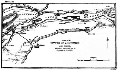
FROM THE ATLAS OF WILKINSON'S MEMOIRS.
A modern eclectic map is given in Carrington's Battles, 171. The most considerable contemporary map for the illustration of the movements during the Revolution in Canada is one published by Jefferys, in 1776, of the Province of Quebec, from the French Surveys and those made by Capt. Carver and others after the War, with much detail of names, plan of Quebec and heights of Abraham, Montreal and isles of Montreal (27 x 19 inches). On Feb. 16, 1776, Sayer and Bennett published in London A new map of the Province of Quebec according to the royal proclamation of 7 Oct., 1763, from the French surveys, corrected with those made after the war by Captain Carver and other officers in his majesty's service. There was a French reproduction of it in Paris in 1777, included in the Atlas Ameriquain (1778), called Nouvelle Carte de la Province de Quebec selon l'édit du Roi d'Angleterre du 7 8{bre}, 1763, par le Capitaine Carver, traduites de l'Anglois, à Paris chez le Rouge, 1777.
Jefferys also issued in 1775 An exact Chart of the River St. Lawrence from Fort Frontenac to Anticosti (37 X 24 inches), which is usually accompanied by a Chart of the Golf of St. Lawrence, 1775(24 X 20 inches). North Amer. Pilot, nos. 11, 20, 21, 22. There is in the Geschichte der Kriege in und ausser Europa [Nuremberg], 1776, a "Karte von der Insel Montreal und den Gegenden umher", following a plan by Bellin.
A map of Canada in 1774 is embraced in Mitchell's Map of the British Colonies, and in Wright's ed. of Cavendish's Debates in the Commons (1774) on the Canada bill, London, 1839. There are other maps in the American Atlas and Hilliard d'Auberteuil's Essais.
Schuyler's health preventing his taking the field in person, the interest in the campaign centres in Montgomery up to the time of his death.[633] We have despatches of his (Nov. 3, 1775) on the capture of St. Johns,[634] on the taking of Chamblée,[635] and on the capitulation of Montreal,[636] with his letters from before Quebec (Sparks, Corresp., i. 492, etc.). A letter from one of his aids at this time (Dec. 16, 1775) is in Life of George Read, p. 115.
The principal Life of Montgomery is that by J. Armstrong, in Sparks's Amer. Biography (i. p. 181), which may be supplemented by other minor accounts.[637]
The connection of Benedict Arnold with the Campaign is illustrated in his letters, beginning with those before he left the column advancing by Lake Champlain, and then following his progress on the expedition to coöperate by the Kennebec route, which Washington proposed to Schuyler in a letter of Aug. 20, 1775 (Sparks's Washington, iii. 63). On Sept. 14th Washington sealed his instructions to Arnold (Sparks, iii. 86; Dawson, 113; Henry's Journal, ed. 1877, p. 2). It is said that the route to be taken was suggested to Arnold by the journal of an exploration in that direction by Montresor in 1760.[638] That engineer had, by order of General Murray, made a survey of this route in 1761.[639] There are maps to illustrate Arnold's route in the Atlantic Neptune, London Mag., 1776, Marshall's Atlas to his Washington, and in the 1877 edition of Henry's Journal.[640] All the general histories and a few biographies and local records necessarily cover the story.[641] Arnold himself is the best contemporary authority.
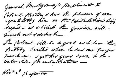
CAPITULATION OF ST. JOHNS.
Fac-simile, slightly reduced, of the reproduction in Smith's Amer. Hist. and Lit. Curios., 2d series, p. xl., from the original in the collection of Ferdinand J. Dreer, of Philadelphia.
A number of his letters respecting the expedition are in Bowdoin College library,[642] and they and others will be found in print in the Maine Hist. Soc. Collections (1831), vol. i. 357, etc., and in Sparks's Corresp. of the Revolution, i. 46, 60, 88, 475, etc.[643] His journal of his progress is unfortunately rather meagre, and covers but a few weeks, Sept. 27 to Oct. 30, 1775. The original manuscript was left by Arnold at West Point when he fled, and extracts from it are printed in S. L. Knapp's Life of Aaron Burr, 1835; it is now owned by Mr. S. L. M. Barlow, of New York, and a copy, made from it when owned by Judge Edwards, of New York, is in the Sparks MSS. (lii. vol. ii.).
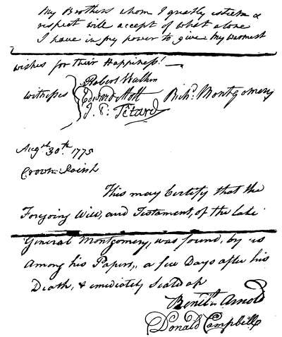
CONCLUSION AND ATTESTATION OF MONTGOMERY'S WILL.
Cf. Harper's Mag., vol. lxx. p. 356.
Various other journals of the actors in the expedition have been preserved.[644]
Arnold's letters at the Point-aux-Trembles and before Quebec are in Sparks's Corresp. of the Rev. (i. App.), together with those addressed to Wooster,[645] Schuyler, and Washington after the failure of the assault on Quebec, Dec. 31, 1775.[646]
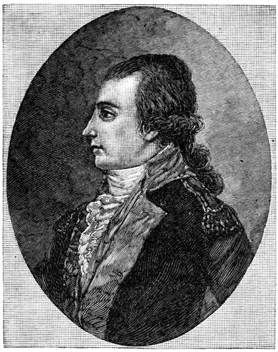
MONTGOMERY.
After the only original portrait preserved at Montgomery Place, and representing him at about twenty-five. Cf. Harper's Mag., lxx. p. 350; Irving's Washington, illus. ed., vol. ii.
The study of Trumbull's well-known picture of "The Death of Montgomery" is on a card less than four inches square, now owned by Major Lewis, of Virginia, and is marked "J. Trumbull to Nelly Custis, 1790" (Johnston's Orig. Portraits of Washington, p. 72).
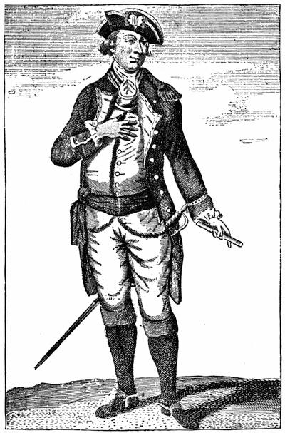
MONTGOMERY.
From An Impartial History of the War in America, vol. i. p. 392 (Boston), engraved by J. Norman. Cf. the engraving in Murray's Impartial Hist. of the Present War, ii. 193. Neither of these copper-plates are probably of any value as likenesses. They show the kind of effigy doing service at the time.
The great resource for original material on the siege of Quebec, beside the letters given by Sparks and Lossing, are in the gatherings of 4 Force's Archives, vols. iv., v., and vi.; Almon's Remembrancer, vol. ii.; N. Y. Col. Docs., viii. 663, etc.; and in a large number of diaries and other contemporary records, which may readily be classed as American or British, with a few emanating from the French Canadians.[647]
On Jan. 19, 1776, a report was made in Congress that the army in Canada be reinforced (Secret Journals, i. 241).
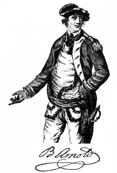
From an engraving of full length in An Impartial Hist. of the War in America, Lond. 1780, p. 249. A mezzotint similar to this was published in London, 1776, as "Col. Arnold, who commanded the provincial troops sent against Quebec" (J. C. Smith, Brit. Mez. Portraits, iv. 1714-1717). The portrait in profile, by W. Tate,—a handsome face,—was engraved in line by H. B. Hall in 1865, and etched by him in 1879 for Isaac N. Arnold's Life of B. Arnold. Cf. Jones's Campaign for the Conquest of Canada, p. 168. Other portraits of Arnold are given later in the present volume.
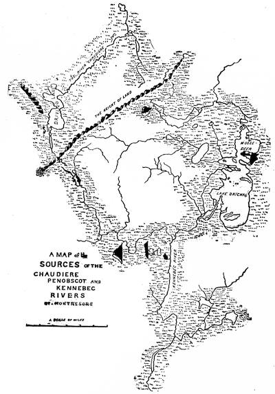
MONTRESOR'S MAP.
Sketched from the original (1760) among the Peter Force maps in the Library of Congress. There is a copy in the library of the N. E. Hist. and Geneal. Society.
In April Arnold returned to Montreal, and Wooster took command before Quebec,[648] to be superseded by General Thomas, who reached the camp May 1st. Upon Carleton's being reinforced, Thomas began to retreat.[649] Burgoyne arrived with additional troops in June (Fonblanque's Burgoyne, 211). The affair at the Cedars took place May 19, 1776.[650] The movement against Three Rivers had been begun by orders of Thompson, who was in command upon the death of Thomas (June 2d), and remained so for a few days till Sullivan arrived.
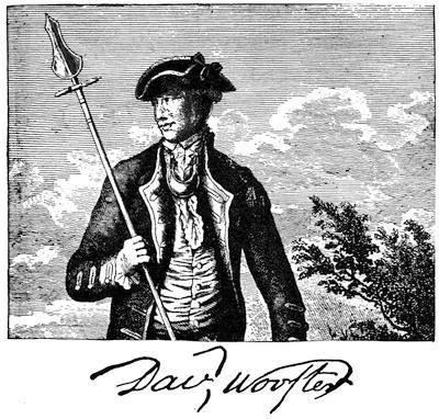
From An Impartial History of the War in America, Lond., 1780, p. 400, where the cut represents his full length. Cf. prints published in London in 1776 (Brit. Mez. Portrait, by J. C. Smith); Hollister's Connecticut, i. 390; Jones's Campaign for the Conquest of Canada, 28; Geschichte der Kriege in und ausser Europa (Nürnberg, 1778).
Smith, in the St. Clair Papers, i. 17, collates the authorities on this movement,[651] calling in question the statements given by Bancroft.
Sullivan's Irish precipitancy and over-confidence did not mend matters as the retreat went on, and raised delusive hopes which were more welcome than Arnold's gloomy views.[652]
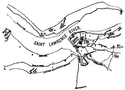
SIEGE OF QUEBEC, 1775-76.
Sketched from a manuscript plan noted in the Sparks Catalogue (p. 208), which belongs to Cornell University, and was kindly communicated to the editor. The original (18½ × 15 inches) is marked as "on a scale of 30 chaines to an Inch", and is signed "E. Antill ft." in the corner. Mr. Sparks has marked it "Siege of Quebec, 1776." It is endorsed on the outside, "Genl Arnold's plan of Quebec, with ye Americans besieging it, ye winter of 1776." It bears the following Key: "H, Headquarters. A, A, A, advanced guards. B, B, B, main guards. C, C, C, quarter guards. D, Capt. Smith's riflemen. E, cul-de-sac, where the men-of-war lay, F, governor's house. G, where all materials are carried to build our batteries, out of view of the town. I, lower town. K, the barrier, near which General Montgomery fell. K L, the dotted line shews the route the troops took under the general, thro' deep snow without any path." The dotted line in the river marks the extent of ice from the shore, and in the open stream are the words: "(Unfrose) Ice driving with ye Tide." The roads are marked by broken lines – – – – – – –. The position of patrols are marked by the letter P.