Chapter VIII · (continued 2)
Reading edition
On the 21st of June the masts of the advanced ships of the English were first seen, and one of the fire-ships was ineffectually sent against them. There was a difficult passage between the north shore of the river and the lower end of the Island of Orleans; but the English fleet managed to pass it without loss, much to the disappointment of the French, who had failed to plant a battery on the side of Cape Tourmente, whence they could have plunged shot into the passing vessels. Past the dangers of the stream, the English landed their army on the island,[1169] less than 9,000 in all, for Wolfe could count little on the sailors who were needed for the management of the fleet.[1170]
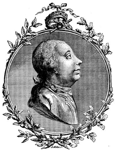
GENERAL JAMES WOLFE.
From an engraving in John Knox’s Hist. Journal of the Campaigns in North America (1757-1760), London, 1769. An engraving from Entick is given in the preceding chapter. There is a head of Wolfe in London Mag. (1759), p. 584.
J. C. Smith, in his Brit. Mezzotint Portraits, notes four different prints (vol. ii. 783; iii. 1027, 1345, the last by H. Smith, engraved by Spooner; and iv. 1750), but he does not reproduce either.
Parkman (Montcalm and Wolfe, ii.) gives a picture of Wolfe in early youth—weak enough in aspect—which follows a photograph from an original portrait owned by Admiral Warde.
Wright, in his Life of Wolfe, gives a photograph of the same. See Ibid., p. 604, for an account of various portraits and memorials.
The common picture representing him standing and in profile is engraved in Parkman’s Historical Handbook of the Northern Tour; in the Eng. ed. of Warburton’s Conquest of Canada, etc.
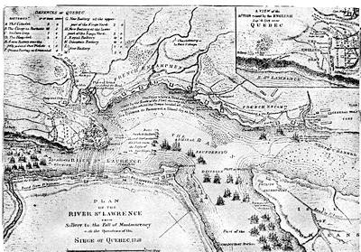
SIEGE OF QUEBEC, 1759.
Reproduced from the map in Miles’s Canada, called “Plan of the St. Lawrence River from Sillery to the Fall of Montmorency, with the operations of the siege of Quebec, 1759,” which has a corner “View of the action gained by the English, Sept. 13, 1759, near Quebec.” This map is a reduction of one engraved by Jefferys, and dedicated to Pitt, entitled “Authentic plan of the River St. Lawrence from Sillery to the Fall of Montmorenci, with the operations of the siege of Quebec, under the command of Vice-Admiral Saunders and Major-General Wolfe, down to the fifth of September, 1759, drawn by a captain in his Majesty’s navy.” The sideplan is called “View of the action gained by the English Sept. 13, 1759, near Quebec, brought from thence by an officer of distinction.” This was also inserted by Jefferys in his History of the French Dominion in America, London, 1760, p. 131. The same map is given in Entick’s General Hist. of the Late War, London, 1770 (3d ed.), iv. 107; and a similar one is in the American Atlas. Jefferys repeats this map in his General Topography of North America and the West Indies, London, 1768 (no. 18), and adds another (no. 21), called “A correct plan of the environs of Quebec and the battle fought 13 Sept., 1759,” which is accompanied by a superposed “second plate,” showing the disposition of the forces on the Plains of Abraham. This plan had already appeared separately in Journal of the siege of Quebec, to which is annexed a correct plan of the environs of Quebec, and of the battle fought on the 13th September, 1759, together with a particular detail of the French lines and batteries, and also of the encampments, batteries, and attacks of the British army, etc. Engraved from original survey by Thomas Jefferys [London, 1760], 16 pp. (Carter-Brown, iii. no. 1,276.)
The maps given in James Grant’s British Battles, ii. 91, and in Cassell’s United States, are seemingly based on Jefferys’.
The London Magazine for 1759 has a plan of Quebec (Apr.) and of the siege (Nov.), with a map of the river (Sept.); and for 1760, a view of the taking of Quebec (p. 280), and a view of the town from the basin (p. 392).
There is a large folding plan, showing the fleet and the landing of the boats, in Mante’s Hist. of the Late War, 1772, p. 233. Alfred Hawkins published at London, in 1842, A Plan of the Naval and Military Operations before Quebec, accompanied by an engraving of West’s “Death of Wolfe.” (H. J. Morgan, Bibliotheca Canadensis, no. 179.)
In the Atlantic Neptune (Additional Plates, no. 1) is a plan of three sheets, called “A plan of Quebec and environs, with its defences and the occasional entrenched camps of the French, commanded by the Marquis of Montcalm, showing likewise the principal works and operations of the British forces under the command of Maj.-Gen. Wolfe, during the siege of that place, 1759.” It is accompanied by a key. In the same, Part ii. no. 16, there is a map of the St. Lawrence from Quebec to the gulf, which shows the region of Quebec on a large scale.
Among existing MS. plans of Wolfe’s attack may be noted one in the Faden Collection of maps in the library of Congress (E. E. Hale’s Catal. of the Faden Maps); others in the Catal. of the King’s Maps (Brit. Mus.), ii. 220, under date of 1755, 1759, 1760; also Brit. Mus. MSS., no. 15,535; and Additional MSS., no. 31,357; this last is a large plan in four sheets. Parkman (ii. 440) refers to a large MS. plan, 800 feet to an inch, belonging to the Royal Engineers, which was made by three engineers of Wolfe’s army, and of which he says that he possesses a fac-simile. In his Montcalm and Wolfe (ii. 200) he gives an eclectic plan; and other plans are in Lemoine’s Picturesque Quebec, p. 301 (being Jefferys’ on a small scale); Bancroft’s United States, orig. ed., iv. 315, etc., repeated in vol. i. of his Hist. of the Amer. Revolution (English edition).
A plan was published at Amsterdam in 1766.
Dussieux, in Le Canada sous la domination Française, gives a map of the siege, “D’après un manuscrit Anglais du Dépôt de la Guerre.”
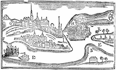
PLAN OF THE CITY OF QUEBEC.
From Father Abraham’s Almanac (by Abraham Weatherwise, Gent.), 1761. Key: A, the west part of the Island of Orleans, on which General Wolfe landed. B, Point Leveé, on which one grand battery was erected. C, Wolfe’s camp to the east of Montmorency Falls. D, the river St. Charles. E E E, the river St. Lawrence, with some of the English ships going up. F, the lower town, to the right of which is a cross (in the middle of the passage to the upper town), and a man kneeling before it, saying his Ave Maria. G, the upper town and passage to the castle. H, Montcalm’s camp and entrenchments, to the west of Montmorency Falls, from whence he marched when Wolfe recrossed the river to Point Leveé, in order to get above the city, where they luckily met, and fought it out bravely. I, Montmorency Falls and Saunders’ ships playing upon the town.
This cut has interest as a contemporary sketch for popular instruction.
He knew also that he must place little reliance on the cannon of the ships, for the high rocks and bluffs of the defences were above the elevation which could be given to the guns, and a broad stretch of mud-flats kept the vessels from a near approach to that portion of the French camp which was low and lay nearest the St. Charles. Cape Diamond, the promontory of Quebec, so jutted out that Wolfe could not inspect at present the banks of the river above the town.
Montcalm had determined on a policy of wearing out his assailants,—and he came very near doing it,—and when a gale sprang up he hoped that its power of devastation would be his best ally. When he saw that fail, he tried his fire-ships; but the British sailors grappled them and towed them aground, where they were harmless.
Wolfe’s next movement was to occupy Point Levi, opposite the city,[1171] whence he showered shot and shell into the town, and drove the non-combatants out. The French tried to dislodge him, but failed. The English army was now divided by the river, and ran some risk of attack in detail. Montcalm, however, was not tempted; nor was he later, when Wolfe next landed a force below him, beyond the Montmorenci, and began to entrench himself, though the English general was interrupted in the beginning of this movement by an attack of Canadians, who had crossed the Montmorenci by an upper ford. The attack was not persisted in, however, and Wolfe was soon well entrenched. The cannonading was incessant. Night after night the sky was streaked with the shells from the vessels, and from each of Wolfe’s three camps.
The dilatory policy of Montcalm soon began to tell on his force, and then weariness and ominous news from Bourlamaque and Pouchot hastened the desertion of his Canadians. Wolfe tried to affect the neighboring peasantry by proclamations more and more threatening, and felt himself obliged at last to enforce his authority by the destruction of crops and villages.
On the 18th of July, in the night, the “Sutherland” and some smaller vessels pushed up the river beyond the town, while a fleet of boats was dragged overland back of Point Levi and launched above, out of gun-shot from the town. A force was sent by a détour to operate with them. Thus Wolfe, in defiance of the French general, had made a fourth division of his troops, each liable to separate attack. The English vessels above the town made descents along the north shore, and took some prisoners, but did little else. The French made their final attempt with a huge fire-raft, but it was as unsuccessful as the earlier ones.
Wolfe now determined to provoke Montcalm to fight, and under cover of a cannonade from Point Levi and from some of his ships[1172] he landed a force from boats beneath the precipice at the lower end of the French camp. An additional body at the same time crossed by a ford, in front of the falls of Montmorenci, which was traversable at low tide. The impetuosity of the grenadiers, who were in advance, not waiting for support, and a tempest which at the moment broke over them, convinced the quick eye of Wolfe that the attempt was to fail, and he recalled his men. The French let them retire in good order, and began to think their Fabian policy was to be crowned with success. Wolfe was correspondingly shaken and rebuked the grenadiers. He began to think, even, that the season might wear away with no better results, and that he should have to abandon the campaign.
There was one plan yet, which might succeed, and he sought to push more ships and march more troops above the town. Murray, who now took command at that point, began to raid upon the shore, but with poor success. Montcalm sent Bougainville with 1,500 men to patrol the shore, and incessant marching they had, as the English by water flitted up and down the river with the tides, threatening to land. The English restlessness was too oppressive, however, for the French camp at Beaufort, which felt that its supplies from Three Rivers and Montreal might be cut off at any moment by an English descent. Desertions increased, and rapidly increased when in August the French got decisive and unfavorable news from Lake Champlain and Ontario. The French fearing an approach of Amherst down the St. Lawrence, Quebec was further weakened by the despatch of Lévis to confront the English in that direction. By the end of August there were no signs of immediate danger at Montreal, and the French took heart.
Wolfe was now ill,—not so prostrate, however, but he could propose various new plans to a council of his brigadiers, but his suggestions were all rejected as too hazardous. They recommended, in the end, an attempt to gain the heights somewhere above the town, and force Montcalm to fight for his communications. Wolfe was ready to try it; but it was the first of September before he was able to undertake it.[1173] He saw no other hope, slight as this one was. The letter which Amherst had sent to him by the Kennebec route had just reached him, and he felt there was to be no assistance from that quarter. On the 3d of September he evacuated the camp at Montmorenci, Montcalm being prevented from molesting him by a feint which was made by boats in front of his Beaufort lines. Other troops were now marched above Quebec, and when Wolfe himself joined Admiral Holmes, who commanded that portion of the fleet which was above the town, he found he had almost 3,600 men, beside what he might draw from Point Levi, for his adventurous exploit. The French were deceived, and thought that the English were to go down the river, as indeed, if the scheme to scale the banks failed on the first attempt, they were. Bougainville’s corps of observation was increased, and it was its duty to patrol a long stretch of the river shore.
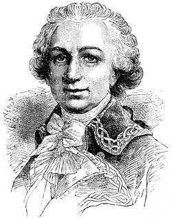
BOUGAINVILLE.
After a cut in Bonnechose’s Montcalm, 5th ed., 1882, p. 138.
Wolfe with a glass had discovered a ravine,[1174] up which it seemed possible for a forlorn hope to mount, and the number of tents at its top did not indicate that there was a numerous guard there to be overcome. Robert Stobo, who had been a prisoner in Quebec after the fall of Fort Necessity, had recently joined the camp, and his biographer says that his testimony confirmed Wolfe in the choice, or rather directed him to it.[1175] While the preparations were going on, the English ships perplexed Bougainville by threatening to land troops some distance up the river, near his headquarters; and by floating up and down with the tide, the English admiral kept the French on the constant march to be abreast of them.
The plan was now ripe. Wolfe was to drop down the river in boats with the turn of the tide, having with him his 3,600 men, and 1,200 were to join him by boat from Point Levi. As night came on, Admiral Saunders, who commanded the fleet in the basin below Quebec, made every disposition as if to attack the Beauport lines, and Montcalm thought the main force of the British was still before him.
As the ships opposite Bougainville began to swing downward with the tide, the French general took pity on his weary men, and failed to follow the moving vessels. This kept the main part of his troops well up the river. This French general had, as it happened, informed the shore guards and batteries towards the town that he should send down by water a convoy with provisions, that night, which was to creep along to Montcalm’s camp under the shadow of the precipice. Wolfe heard of this through some deserters, and he seized the opportunity to cast off his boats and get ahead of the convoy, in order that he might answer for it if hailed. He was hailed, and answered in the necessary deceitful French. This quieted the suspicion of the sentries as he rowed gently along in the gloom.
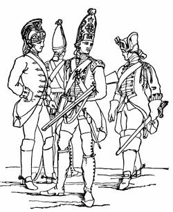
BRITISH SOLDIERS.
Reduced fac-simile of a cut in J. Luard’s Hist. of the Dress of the British Soldier, London, 1852, p. 95. This shows a heavy and light dragoon and two guardsmen of about the time of Wolfe’s attack, 1759. The cap of the guardsmen is of German origin, and was in general use by the English grenadiers of this period. The heavy dragoon is on the right. The one on the left is a light dragoon of the 15th regiment. The breeches are of leather; the coat is of scarlet.
As it happened, the Canadian officer, Colonel de Vergor, who commanded the guard at the top of the ravine, where Wolfe’s advanced party clambered up, was asleep in his tent, and many of his men had gone home, by his permission, to hoe their gardens. The English forlorn hope made, therefore, quick work, when they reached the top, as they rushed on the tents. Their shots and huzzas told Wolfe, waiting below, that a foothold was gained, and he led his army up the steeps with as much haste as possible. While the line of battle was forming, detachments were sent to attack the batteries up the river, which, alarmed by the noise, were beginning to fire on the last of the procession of boats. The celerity of the movement accomplished its end, and the French were driven off and the batteries taken.
Sheer good luck, quite as much as skill and courage, had at last placed Wolfe in an open field, where Montcalm must fight him, if he would save his communications and prevent the guns of Quebec, in the event of its capture,[1176] being turned upon his camp.
Not a mile from Quebec, and fronting its walls, Wolfe had formed his final line, but he had turned its direction on the left, and there the line faced the St. Charles. In the early morning he saw the French form on a ridge in front of him, when some skirmishing ensued, as also in his rear, where a detachment sent by Bougainville began to harass him. With a foe before and behind, quick and decisive work was necessary.
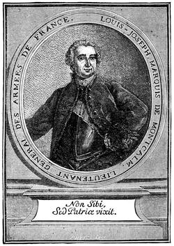
MONTCALM.
After a portrait, “une gravure du temps,” in Charles de Bonnechose’s Montcalm et le Canada Français, 5th ed., Paris, 1882. Cf. the likeness in Daniel, Nos Gloires, ii. 273, and in Martin, De Montcalm en Canada.
The portrait given in Parkman (Montcalm and Wolfe, vol. i.) is after a photograph from an original picture, representing him at 29, now in the possession of the present Marquis de Montcalm. Cf. the likeness in Higginson’s Larger Hist. of the United States, p. 190.
Montcalm, whom Admiral Saunders had been deceiving all night, hurried over to Vaudreuil’s headquarters in the morning to learn what the firing above the town meant. From this position he saw the seriousness of the situation at once. The red coats of the British line were in full view beyond the St. Charles. He hastened across the bridge, and was soon on the ground, bringing the regiments into line as they came up. But all the help he had a right to expect did not come. Ramezay made excuses for not sending cannon. Vaudreuil kept back the left wing at Beaufort, for fear that Saunders meant something, after all.
Montcalm’s impetuosity, now that it was unshackled, could not brook delay. It would take time to concert with Bougainville an attack on the front and rear of the British simultaneously, and that time would give Wolfe the chance to entrench and bring up reinforcements, if he had any. So the decision in Montcalm’s council was for an instant onset.
It was ten o’clock when Wolfe saw it coming. He advanced his line to meet it, and when the French were close upon them the fire burst from the English ranks. Another volley followed; and as the smoke passed away, Wolfe saw the opportunity and gave the word to charge. As he led the Louisbourg grenadiers he was hit twice before a shot in the breast bore him to the ground. He was carried to the rear, and as he was sinking he heard those around him cry that the enemy was flying. He turned, praised God, and died.[1177]
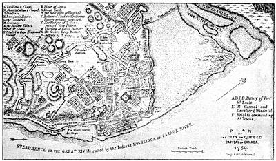
QUEBEC AS IT SURRENDERED, 1759.
After a plan in Miles’s Hist. of Canada, p. 363, which is mainly the same as the large folding map by Jefferys, published Jan. 15, 1760, which also makes part of the Hist. of the French Dominion in America, London, 1760, and of his General Topog. of North America and the West Indies, London, 1768, no. 19. There is another plan in the Nouvelle Carte de la Province de Québec selon l’edit du Roi d’Angleterre du 8 Sepbre, 1763, par le Capitaine Carver et autres, traduites de l’Anglois, à Paris, 1777. One is annexed to Joseph Hazard’s Conquest of Quebec, a poem, London, 1769; and another to Lemoine’s Picturesque Quebec, 1882. Cf. Mag. of Amer. Hist., Apr., 1884, p. 280.
Richard Short made some drawings of the condition of Quebec after the bombardment, which were engraved and published in 1761.
The French plans of Quebec of this period, to be noted, are those of Bellin in Charlevoix, viz.: Plan du bassin de Québec et de les environs, 1744 (vol. iii. p. 70); Plan de la ville de Québec, 1744 (Ibid., p. 72); and Carte de l’isle d’Orléans, et du passage de la traverse dans le Fleuve St. Laurent, 1744 (Ibid., p. 65); beside the plan of Quebec in Bellin’s Petit Atlas Maritime, vol. i., 1764.
In vol. lxiv. of the Shelburne MSS. there are various plans of the fortifications and citadel, made after the surrender. Edw. Fitzmaurice reported on these in the Hist. MSS. Commission’s Fifth Report, p. 231.
Such books as Hawkins’s Picturesque Quebec and Lossing’s paper in Harper’s Magazine, xviii. 176, give pictures of most of the points of historical interest in and about the town. Cf. J. M. Lemoine’s “Rues de Québec,” in the Revue Canadienne, xii. 269.
Various views connected with the siege of Quebec are given in Picturesque Canada, Toronto, 1884, showing the present condition of Wolfe’s Cove and the ascent from it (pp. 25, 47), the martello towers (p. 27), as well as the monuments to commemorate Wolfe and Montcalm (pp. 27, 46).
Montcalm, mounted, borne on by the panic, was shot through the breast just before he entered the town, and was taken within to die.
Part of the fugitives got into Quebec with their wounded general; part fled down the declivity towards the St. Charles, and, under cover of a stand which some Canadian bushrangers made in a thicket, succeeded in getting across the river to the camp, where everything was in the confusion which so easily befalls an army without a head. It was necessary for the English to cease from the pursuit, for Townshend,[1178] who had come to the command (Monckton being wounded), feared Bougainville was upon his rear, as indeed he was. When that general, however, found that the English commander had recalled his troops, and was forming to receive him, he withdrew, for he had only 2,000 men,—probably all he could collect from their scattered posts,—and seeing the English were twice as many, he did not dare attack. So Townshend turned to entrenching, and working briskly he soon formed a line of protection, and had a battery in position confronting the horn-work beyond the St. Charles, which commanded the bridge.
Vaudreuil was trying to get some decision, meanwhile, out of a council of war at Beaufort. They sent to Quebec for Montcalm’s advice, and the dying man told them to fight, retreat, or surrender. The counsel was broad enough, and the choice was promptly made. It was retreat. That night it began. Guns, ammunition, provisions,—everything was left. The troops by a circuitous route flocked along like a rabble, and on the 15th they went into camp on the hill of Jacques Cartier, thirty miles up the St. Lawrence.
The morning after the fight, the tents still standing along the Beaufort lines were a mockery; for Ramezay knew that Vaudreuil had gone, since he had received word from him to surrender the town when his provisions failed.
Bougainville was still at Cap Rouge, and undertook to send provisions into Quebec. Lévis had joined Vaudreuil at Jacques Cartier,[1179] and inspired the governor with hope enough to order a return to his old camp. On the evening of the 18th the returning army had reached St. Augustine, when they learned that Ramezay had surrendered and the British flag waved over Quebec.
Preparations for the departure of the fleet were soon made, and munitions and provisions for the winter were landed for the garrison, which under Murray was to hold the town during the winter. The middle of October had passed, when Admiral Saunders, one of his ships bearing the embalmed body of Wolfe, sailed down the river. Montcalm lay in a grave, which, before the altar of the Ursulines, had been completed out of a cavity made by an English shell.[1180]
The winter passed with as much comfort as the severe climate and a shattered town would permit. There were sick and wounded to comfort, and the sisters of the hospitals devoted themselves to French and English alike. A certain rugged honesty in Murray won the citizens who remained, and the hours were beguiled in part by the spirits of the French ladies. There was an excitement in November, when a fleet of French ships from up the river tried to run the batteries, and seven or eight of them which did so carried the first despatches to France which Vaudreuil had succeeded in transmitting. There was rough work in December, in getting their winter’s wood from the forest of Sainte-Foy, for they had no horses, and the merriment of companionship, checkered with the danger of the skulking enemy, was the only lightening of the severities of the task. Deserters occasionally brought in word that Lévis was gathering and exercising his forces for an attack, so vigilance was incessant. Both sides preserved the wariness of war in onsets and repulses at the outposts, and the English usually got the better of their enemies. Captain Hazen and some New England rangers merited the applause which the regular officers gave them when they buffeted and outwitted the enemy in a series of skirmishes.
By April it became apparent that Lévis was only waiting for the ice in the river to break up, when he could get water carriage for his advance. Murray knew that the enemy could bring much greater numbers against him, for his 7,000 men of the autumn, by sickness and death, had been reduced to about 3,000 effectives, and the spies of Lévis kept the French general well informed of the constant weakening of the English forces.
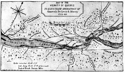
CAMPAIGN OF LÉVIS AND MURRAY.
This follows a map in Miles’s Hist. of Canada, p. 427; also in Lemoine’s Picturesque Quebec, p. 419.
The French placed their cannon and stores on the frigates and smaller vessels which had escaped up the river in the autumn, and with their army in bateaux they started on the 21st April for the descent from Montreal. With the accessions gained on the way, by picking up the scattered garrisons, Lévis landed between eight and nine thousand men at Cap Rouge, and advanced on Sainte-Foy. The English at the outposts fell back, and the delay on the part of the French was sufficient for Murray to learn of their approach. He resolved to meet them outside the walls. It must be an open-field fight for Murray, since the frozen soil still rendered entrenching impossible in the time which he had. He led out about three thousand men, and at first posted himself on the ridge, where Montcalm had drawn up his lines the year before. He pushed forward till he occupied Wolfe’s ground of the same morning, when, with his great superiority of cannon, he found a position that gave him additional advantage, which he ought to have kept. The fire of the English guns, however, induced Lévis to withdraw his men to the cover of a wood, a movement which Murray took for a retreat, and, emulous of Wolfe’s success in seizing an opportune moment, he ordered a general advance. His cannon were soon stuck in some low ground, and no longer helped him. The fight was fierce and stubborn; but after a two hours’ struggle, the greater length of the enemy’s line began to envelop the English, and Murray ordered a retreat. It was rapid, but not so disordered that Lévis dared long to follow.
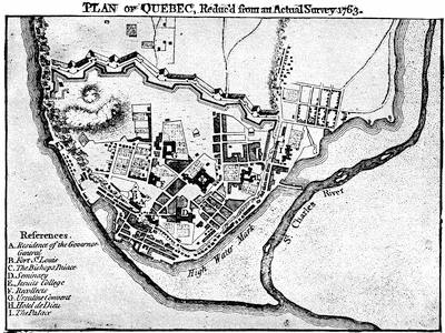
QUEBEC, 1763.
From A set of plans and forts in America, reduced from actual surveys, 1763, published in London.
The English had lost a third of their force; the French loss was probably less. Murray got safely again within the walls, and could muster about 2,400 men for their defence.[1181] There was sharp work, and little time left further to strengthen the walls and gates. Officer and man worked like cattle. A hundred and fifty cannon were soon belching upon the increasing trenches of Lévis, who finally dragged some artillery up the defile where Wolfe had mounted, and was thus enabled to return the fire.
Both sides were anxiously waiting expected reinforcements from the mother country. On the 9th of May a frigate beat up the basin, and to the red flag which was run up at Cape Diamond she responded with similar colors. It was ominous to Lévis, for he felt she was the advanced ship of a British squadron, as she proved to be. It was a week before others arrived, when some of the heavier vessels passed up the river and destroyed the French fleet. As soon as the naval result was certain, Lévis deserted his trenches, left his guns and much else, with his wounded, and hastily fled. This was in the night; in the morning the French were beyond Murray’s reach.
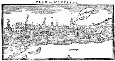
VIEW OF MONTREAL.
A sample of the popular graphic aids of the day, which is taken from Father Abraham’s Almanac, 1761 (Philadelphia). “Key: A, river St. Lawrence; B, the governor’s house and parade; C, arsenal and yard for canoes and battoes; D, Jesuits’ Church and Convent; E, the fort, a cavalier, without a parapet; F, the Parish Church; G, the nunnery hospital and gardens; H, Sisters of the Congregation, and gardens; I, Recollects’ convents and gardens; K, the Seminary; L, the wharf.”
Cf. view and plan published in London Mag., Oct., 1760. Parkman (ii. 371) refers, as among the king’s maps in the Brit. Mus., to an east view of Montreal, drawn on the spot by Thomas Patten. Cf. Lossing’s Field-Book of the Revolution, i. 179.
Their loss of cannon and munitions was a serious one, and the stores from France which might have replaced them were already intercepted by the English cruisers. Vaudreuil and Lévis made their dispositions to defend Montreal, their last hope; yet it was not a place in itself capable of successful defence, for its lines were too weak. It soon became evident that it was to be attacked on three sides; and the French had hopes that so dangerous a combination of armies, converging without intercommunication, would enable them to crush the enemy in detail.
Amherst was directing the general advance on the English side. He kept the largest force with him, and passed from Oswego, across Ontario, and down the St. Lawrence. If Lévis sought to escape westward and hold out at Detroit, Amherst intended to be sure to intercept him. He had about 11,000 men, including a body of Indians under Johnson. Near the head of the rapids he stopped long enough to capture Fort Lévis, now under Pouchot, and because they could not kill the prisoners, three fourths of Johnson’s Indians mutinied and went home. Amherst now shot the rapids with his flotilla, not without some loss, and on September 6th he reached Lachine, nine miles above Montreal.
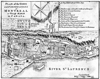
MONTREAL.
From A set of plans and forts in America, reduced from actual surveys, 1763, published in London. There is a plan of Montreal, and of Isle Montreal in a Carte de la Province de Quebec ... par le Capitaine Carver, etc., traduites de l’Anglois, à Paris, 1777. The isle of Montreal as surveyed by the French engineers is mapped in the London Mag., Jan., 1761.
Meanwhile, the other commanders had already approached the city so near as to open communication with each other. Murray had sailed up the river with about 2,500 men, but was soon reinforced by Lord Rollo with 1,300 others from Louisbourg. The English had some skirmishes along the banks, but Bourlamaque, who was opposing them, fell back with a constantly diminishing force, as the Canadians, despite all threats and blandishments, deserted him. Murray was ahead of the others, when he stopped just before reaching Montreal, and encamped on an island in the river. He was not without apprehension that he might have to bear the brunt of an attack alone.
Bougainville, meanwhile, was trying to resist Haviland’s advance at the Isle-aux-Noix, for this English general now commanded on the Champlain route. The two sides were not ill-matched as to numbers; but the English advance was skilfully conducted, and the French found themselves obliged to retreat down the river and unite with Bourlamaque. It was now that Haviland, pushing on, opened communication by his right with Murray, and both stood on the defensive, waiting to hear of Amherst’s approach above the town.
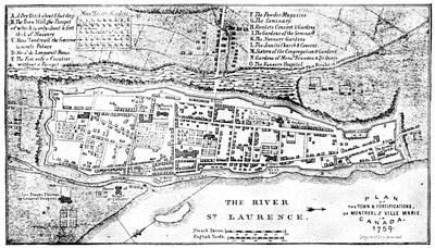
MONTREAL, 1758.
Follows a plan in Miles’s Hist. of Canada, p. 297. It is mainly the same as the large folding map by Thomas Jefferys, published Jan. 30, 1758, and making part of the Hist. of the French Dominion in America, London, 1760, p. 12. This last is in the F. North Collection in Harvard College Library, vol. iii. no. 22; and was again used by Jefferys in his General Topog. of No. America and the West Indies, London, 1768, no. 22.
These other plans belonging to the 18th century may be noted:—
MS. plans of 1717 and 1721 recorded in the Catalogue of the Library of Parliament, Toronto, 1858, p. 1618, nos. 58 and 59.
Map of 1729, made by Chaussegros de Léry, in the Paris Archives.
Carte de l’isle de Montreal et de ses environs, par N. Bellin, 1744, in Charlevoix, i. p. 227, and reproduced in Dr. Shea’s edition of Charlevoix; as well as the plan of the town, in Charlevoix, ii. 170.
A MS. plan of 1752, giving details not elsewhere found, is noted in the Library of Parliament Catal., p. 1620, no. 81.
A plan of 1756, and one of 1762 by Patten, engraved by Canot, are marked in the Catal. of the King’s Maps (Brit. Mus.), ii. 54.
A plan of Montreal and its neighborhood by Bellin, in his Petit Atlas Maritime, 1764.
The delay was brief. Amherst, advancing from Lachine, encamped before Montreal, above it, while Murray ferried his men from the island and encamped below. What there was left of the force which opposed Haviland withdrew across the river into the town, and Haviland’s tents dotted the shore which the French had left. The combined French army now numbered scarce 2,500; Amherst held them easily with a force of 17,000.
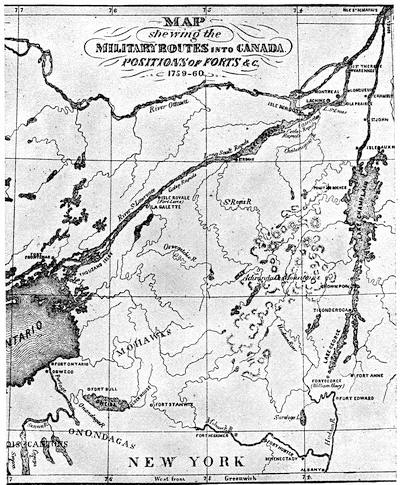
ROUTES TO CANADA, 1755-1763.
Follows map in Miles’s Hist. of Canada, p. 293.
Other contemporary maps showing the country, brought within the campaigns about Lakes Champlain and Ontario, are the following:—
A chorographical map of the country between Albany, Oswego, Fort Frontenac, and Les Trois Rivières, exhibiting all the grants by the French on Lake Champlain, which was included by Jefferys in his General Topog. of North America and the West Indies, London, 1768. It is, in fact, the northerly sheet of Jefferys’ Provinces of New York and New Jersey, with part of Pensilvania, drawn by Capt. Holland. The same General Topography, no. 32, etc., contains also in Blanchard and Langdon’s Map of New Hampshire (Oct. 21, 1761) a corner map, showing “The River St. Lawrence above Montreal to Lake Ontario, with the adjacent country on the west from Albany and Lake Champlain.”
Vaudreuil saw there was no time for delays, and at once submitted a plan of capitulation. A few notes were exchanged to induce less onerous conditions; but Amherst was not to be moved. On September 8th the paper was signed, and all Canada passed to the English king; the whole garrison to be sent as prisoners to France in British ships.
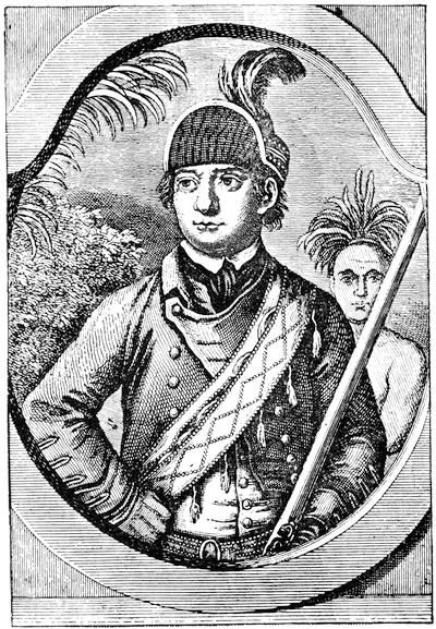
ROBERT ROGERS.
From the Geschichte der Kriege in und ausser Europa, Elfter Theil, Nürnberg, 1777. This follows a print published in London, Oct. 1, 1776, described in Smith’s Brit. Mezzotint Portraits, and in Parkman’s Pontiac, i. p. 164.
This stipulation was adhered to, and during the autumn the principal French officers were on their way to France. The season for good weather on the ocean was passed, and the transportation was not accomplished without some wrecks, accompanied by suffering and death. Vaudreuil, Bigot, Cadet, and others found a dubious welcome in France after they had weathered the November storms. The government was not disposed that the loss of Canada should be laid wholly to its account, and the ministry had heard stories enough of the peculations of its agents in the colony to give a chance of shifting a large part of the responsibility upon those whose bureaucratic thefts had sapped the vitals of the colony. Trials ensued, the records of which yield much to enable us to depict the rotten life of the time; and though Vaudreuil escaped, the hand of the law fell crushingly on Bigot and Cadet, and banishment, restitution, and confiscation showed them the shades of a stern retribution. They were not alone to suffer, but they were the chief ones.
The war was over, and a new life began in Canada. The surrender of the western posts was necessary to perfect the English occupancy, and to receive these Major Rogers was despatched by Amherst on the 13th of September. On the way, somewhere on the southern shore of Lake Erie,[1182] he met (November 7) Pontiac, and, informing him of the capitulation at Montreal, the politic chief was ready to smoke the calumet with him. Rogers pushed on towards Detroit.[1183] There was some apprehension that Belêtre, who commanded there, would rouse his Indians to resist, but the French leader only blustered, and when (November 29) the white flag came down and the red went up, his 700 Indians hailed the change of masters with a yell; and it was with open-eyed wonder that the savages saw so many succumb to so few, and submit to be taken down the lake as prisoners. An officer was sent along the route from Lake Erie to the Ohio to take possession of the forts at Miami and Ouatanon; but it was not till the next season that a detachment of the Royal Americans pushed still farther on to Michillimachinac and the extreme posts.[1184]
English power was now confirmed throughout all the region embraced in the surrender of Vaudreuil.

CRITICAL ESSAY ON THE SOURCES OF INFORMATION.
THE ninth volume of the N. Y. Col. Docs. richly illustrates the French movements near the beginning of the century to secure Indian alliances.[1185]
A number of papers from the archives of the Marine, respecting the founding of Detroit (1701), is given by Margry (Découvertes, etc.) in his fifth volume (pp. 135-250), as well as records of the conferences held by La Motte Cadillac with the neighboring Indians (p. 253, etc.). These papers come down to 1706.[1186]
The contracts made at Quebec in 1701 and later, respecting the right to trade at the straits, are given in Mrs. Sheldon’s Early Hist. of Michigan (N. Y., 1856, pp. 93, 138). In Shea’s Relation des affaires du Canada, 1696-1702 (N. Y., 1865), there is a “Relation du Destroit,” and other papers touching these Western parts.[1187]
Mrs. Sheldon’s Early History of Michigan contains various documents on the condition of the colony at Detroit and Michilimackinac.[1188]
On the attack on Detroit in 1712, made by the Foxes, in which, as confederates of the Iroquois, they acted in the English interest, we find documents in the N. Y. Col. Docs., ix. pp. 857, 866; and the Report of Du Buisson, the French commander, is in W. R. Smith’s Hist. of Wisconsin, iii. 316.[1189]
The report of Tonti, on affairs at Detroit in 1717, is given by Mrs. Sheldon (p. 316).
In Margry’s Découvertes et Établissements des Français dans l’Amérique Septentrionale (vol. v. p. 73) is a “Relation du Sieur de Lamothe Cadillac, capitaine en pied, ci-devant commandant de Missilimakinak et autres postes dans les pays élorgnés, où il a été pendant trois années” (dated July 31, 1718).
In the third volume of the Wisconsin Historical Collections there are other documents among the Cass papers.[1190]
There is in another chapter some account of preparations at Boston for the fatal expedition of 1711, under Admiral Sir Hovenden Walker, with its contingent of Marlborough’s veterans.[1191] An enumeration of the forces employed was printed in the Boston Newsletter, no. 379 (July 16-23, 1711), and is reprinted in what is the authoritative narrative, the Journal or full account of the late expedition to Canada, which Walker printed in London in 1720,[1192] partly in vindication of himself against charges of peculation and incompetency. The failure of the expedition was charged by constant reports in England to the dilatoriness of Massachusetts in preparing the outfit. Walker does not wholly share this conviction, it is just to him to say; but Jeremiah Dummer, then the agent of the province in London, thought it worth while to defend the provincial government by printing in London, 1712 (reprinted, Boston, 1746), a Letter to a noble lord concerning the late expedition to Canada,[1193] in which he contended that this expedition was wisely planned, and that its failure was not the fault of New England. There is another tract of Dummer’s to a similar purpose: A letter to a friend in the country, on the late expedition to Canada, London, 1712.[1194] Palfrey[1195] says that he found various letters and documents among the British Colonial Papers, including a “Journal of the expedition, by Col. Richard King.”[1196]
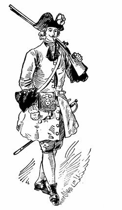
FRENCH SOLDIER, 1710.
After a water-color sketch in the Mass. Archives: Documents collected in France, vi. p. 1. The coat is red, faced with blue.
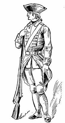
FRENCH SOLDIER, 1710.
After a water-color sketch in the Mass. Archives: Documents collected in France, viii. p. 1. The coat is blue, faced with red. Cf. sketches in Gay’s Pop. Hist. United States, ii. 545.
——————————————————
We have the French side in Charlevoix (Shea’s),[1197] with annotations and references by that editor. Walker, in his Journal, gives a rough draft in English of a manifesto intended to be distributed in Canada. Charlevoix gives the French into which it was translated for that use.[1198]
The recurrent interest taken, during Alexander Spotswood’s term of office (1710-1722) as governor of Virginia, in schemes for occupying the region beyond the mountains is traceable through his Official Letters, published by the Virginia Historical Society in 1882-5.[1199]
The journey of Spotswood over the mountains in 1716 is sometimes called the “Tramontane Expedition;” it was accomplished between Aug. 20 and Sept. 17.[1200]
At the time when Spotswood was urging, in 1718, that steps should be taken to seize upon the Ohio Valley,[1201] James Logan was furnishing to Gov. Keith, to be used as material for a memorial to the Board of Trade, a report on the French settlements in the valley (dated Dec., 1718).[1202]
Previous to 1700 the Iroquois had scoured bare of their enemies a portion, at least, of the Ohio country; but during the first half of the last century, the old hunting grounds were reoccupied in part by the Wyandots, while the Delawares centred upon the Muskingum River, and the Shawanoes, or Shawnees, coming from the south, scattered along the Scioto and Miami valleys,[1203] and allied themselves with the French. The Ottawas were grouped about the Sandusky and Maumee rivers in the north.[1204]
Respecting the Indians of the Ohio Valley we have records of the eighteenth century, in a Mémoire on those between Lake Erie and the Mississippi, made in 1718.[1205]
Among the Cass MSS. is a paper on the life and customs of the Indians of Canada[1206] in 1723, which has been translated by Col. Whittlesey.[1207]
A report (1736) supposed to be by Joncaire, dated at Missilimakinac, is called, as translated, “Enumeration of the Indian tribes connected with the government of Canada.”[1208]
Conrad Weiser’s notes on the Iroquois and the Delawares (Dec., 1746) have been also translated.[1209]
An account of the Miami confederacy makes part of a book published at Cincinnati in 1871, Journal of Capt. William Trent from Logstown to Pickawillany in 1752, edited by Alfred T. Goodman, secretary of the Western Reserve Hist. Soc. It includes papers from the English archives, secured by John Lothrop Motley.[1210] In 1759 Capt. George Croghan made “a list of the Indian nations, their places of abode and chief hunting.”[1211]
The subject of the dispersion and migrations of the Indians of the Ohio Valley has engaged the attention of several of the Western antiquaries.[1212] The most exhaustive collation of the older statements regarding these tribal movements is in Manning F. Force’s lecture before the Historical and Philosophical Soc. of Ohio, which was printed at Cincinnati in 1879 as Some Early Notices of the Indians of Ohio. “In the latter half of the seventeenth century, after the destruction of the Eries in 1656 by the Five Nations,” he says, “the great basin, bounded north by Lake Erie, the Miamis, and the Illinois, west by the Mississippi, east by the Alleghanies, and south by the headwaters of the streams that flow into the Gulf of Mexico, seems to have been uninhabited except by bands of Shawnees, and scarcely visited except by war parties of the Five Nations.” He then confines himself to tracing the history of the Eries and Shawnees. He tells the story of the destruction of the Eries, or “Nation du Chat,” in 1656; and examines various theories about remnants of the tribe surviving under other names. The Chaouanons of the French, or Shawanoes of the English (Shawnees), did not appear in Ohio till after 1750. Parkman[1213] says: “Their eccentric wanderings, their sudden appearances and disappearances, perplex the antiquary and defy research.” Mr. Force adds to the investigations of their history, but still leaves, as he says, the problem unsolved. The earliest certain knowledge places them in the second half of the seventeenth century on the upper waters of the Cumberland, whence they migrated northwest and northeast, as he points out in tracking different bands.
The claim of the English to the Ohio Valley and the “Illinois country,” as for a long series of years the region east of the upper Mississippi and north of the Ohio was called,[1214] was based on a supposed conquest of the tribes of that territory by the Iroquois in 1672 or thereabouts. No treaty exists by which the Iroquois transferred this conquered country to the English, but the transaction was claimed to have some sort of a registry,[1215] as expressed, for instance, in a legend on Evans’ map[1216] (1755), which reads: “The Confederates [Five Nations], July 19, 1701, at Albany surrendered their beaver-hunting country to the English, to be defended by them for the said Confederates, their heirs and successors forever, and the same was confirmed, Sept. 14, 1728 [1726], when the Senecas, Cayugaes, and Onondagoes surrendered their habitations from Cayahoga to Oswego and six miles inland to the same for the same use.” The same claim is made on Mitchell’s map[1217] of the same year (1755), referring to the treaty with the Iroquois at Albany, Sept., 1726, by which the region west of Lake Erie and north of Erie and Ontario, as well as the belt of land from Oswego westward, was confirmed to the English.[1218]
Not much is known of the Indian occupation of the Ohio Valley before 1750,[1219] and any right by conquest which the Iroquois might have obtained, though supported at the time of the struggle by Colden,[1220] Pownall,[1221] and others,[1222] was first seriously questioned, when Gen. W. H. Harrison delivered his address on the Aborigines of the Ohio Valley.[1223] He does not allow that the Iroquois pushed their conquests beyond the Scioto.
The uncertainty of the English pretensions is shown by their efforts for further confirmation, which was brought about as regards westerly and northwesterly indefinite extensions of Virginia and Pennsylvania by the treaty of Lancaster in 1744 (June 22-July 4).[1224]
In 1748 Bollan in a petition to the Duke of Bedford on the French encroachments, complains that recent English maps had prejudiced the claims of Great Britain.[1225] Since Popple’s map in 1732, of which there had been a later edition, maps defining the frontiers had appeared in Keith’s Virginia (1738), in Oldmixon’s British Empire (1741) by Moll, and in Bowen’s Geography (1747).
There is in the Penna. Archives (2d series, vi. 93) a paper dated Dec., 1750, on the English pretensions from the French point of view. On the English side the claims of the French are examined in the State of the British and French Colonies in North America, London, 1755.[1226]
J. H. Perkins, in the North American Review, July, 1839, gave an excellent sketch of the English effort at occupation in the Ohio Valley from 1744 to 1774, which later appeared in his Memoir and Writings (Boston, 1852, vol. ii.) as “English discoveries in the Ohio Valley.” His sketch is of course deficient in points, where the publication of original material since made would have helped him.
The rivalry in the possession of Oswego and Niagara, beginning in 1725, is traced in the N. Y. Col. Docs. (ix. 949, 954, 958, 974), and in a convenient form an abstract of the French despatches for 1725-27 is found in Ibid., ix. 976, with a French view (p. 982) of the respective rights of the rivals.[1227]
There had been a stockade at Niagara under De Nonville’s rule, and the fort bore his name; but it was soon abandoned.[1228] The place was reoccupied in 1725-26, and the fort rebuilt of stone.[1229]
In 1731 the French first occupied permanently the valley of Lake Champlain,[1230] but not till 1737 did they begin to control its water with an armed sloop, and to build Fort St. Frederick.[1231]
Beauharnois’ activity in seeking the Indian favor is shown in his conference with the Onondagas in 1734 and in his communications with the Western tribes in 1741.[1232] The condition of the French power at this time is set forth in a Mémoire sur le Canada, ascribed to the Intendant Gilles Hocquart (1736).[1233]
In 1737 Conrad Weiser was sent to the Six Nations to get them to agree to a truce with the Cherokees and Catawbas, and to arrange for a conference between them and these tribes.[1234]
The expedition to the northwest, which resulted in Vérendrye’s discovery of the Rocky Mountains in Jan., 1743, is followed with more or less detail in several papers by recent writers.[1235]
The first settlement in Wisconsin took place in 1744-46 under Charles de Langlade.[1236]
The Five Years’ War (1744-48) so far as it affected the respective positions of the combatants in the two great valleys was without result. The declaration of war was in March, 1744, on both sides.[1237]
In 1744 the Governor of Canada sent an embassy to the Six Nations, assuring them that the French would soon beat the English.[1238]
In 1744 Clinton proposed the erection of a fort near Crown Point, and of another near Irondequot “to secure the fidelity of the Senecas, the strongest and most wavering of all the six confederated tribes.”[1239]
The scalping parties of the French are tracked in the N. Y. Col. Docs., x. 32, etc., with the expedition against Fort Clinton in 1747 (p. 78) and a retaliating incursion upon Montreal Island by the English (p. 81).
In 1745 both sides tried by conferences to secure the Six Nations. In July, August, and September. Beauharnois met them.[1240] Delegates from Massachusetts, Connecticut, and Pennsylvania convened under the New York jurisdiction at Albany, in October, 1745, and did what they could by treaty to disabuse the Indian mind of an apprehension which the French are charged with having raised, that the English had proposed to them to dispossess the Iroquois of their lands.[1241]
Upon the abortive Crown Point expedition of 1746,[1242] as well as the other military events of the war, we have Memoirs of the Principal Transactions of the last War between the English and French in North America, London, 1757 (102 pp.).[1243] It is attributed sometimes to Shirley, who had a chief hand in instigating the preparations of the expedition. This will be seen in the letters of Shirley and Warren, in the R. I. Col. Rec., v. 183, etc.; and in Penna. Archives, i. 689, 711, as in an Account of the French settlements in North America ... and the two last unsuccessful expeditions against Canada and the present on foot. By a gentleman. Boston, 1746.[1244]
A letter of Col. John Stoddard, May 13, 1747, to Governor Shirley, showing how the Six Nations had been enlisted in the proposed expedition to Canada, and deprecating its abandonment, is in Penna. Archives, i. 740; as well as a letter of Shirley, June 1, 1747 (p. 746).
A letter of Governor Shirley (June 29, 1747) respecting a congress of the colonies to be held in New York in September is in Penna. Archives, i. 754; and a letter of Conrad Weiser, doubting any success in enlisting the Six Nations in the English favor, is in Ibid., p. 161.
Clinton (November 6, 1747) complains to the Duke of Bedford of De Lancey’s efforts to thwart the government’s aims to secure the assistance of the Six Nations for the invasion of Canada.[1245]
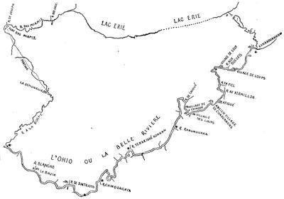
BONNECAMP’S MAP, AFTER THE KOHL COPY.
In February, 1749-50, a long report was made to the Lords Commissioners of the Treasury on the expenses incurred by the colonies during the war for the attempts to invade Canada. It is printed in the New Jersey Archives, 1st ser., vii. 383-400. The annual summaries on the French side, 1745-48, are in N. Y. Col. Docs., x. 38, 89, 137.
A stubborn fight in 1748 with some marauding Indians near Schenectady is chronicled in Pearson’s Schenectady Patent, p. 298.
In 1749 came Céloron’s expedition to forestall the English by burying his plates at the mouths of the streams flowing into the Ohio. A fac-simile of the inscription on one of these plates has been given already (ante, p. 9).[1246]
While Céloron was burying his plates, and La Galissonière was urging the home government to settle 10,000 French peasants on the Ohio, the kinsmen of Washington and others were forming in 1748 the Ohio Company, which received a royal grant of half a million acres between the Monongahela and the Kenawha rivers, on condition of settling the territory;[1247] “which lands,” wrote Dinwiddie,[1248] “are his Majesty’s undoubted right by the treaty of Lancaster and subsequent treaties at Logstown[1249] on the Ohio.” Colonel Thomas Cresap was employed to survey the road over the mountains,—the same later followed by Braddock.
Of the subsequent exploration by Christopher Gist, in behalf of the Ohio Company, and of George Croghan and Montour for the governor of Pennsylvania, note has been taken on an earlier page.[1250] A paper on Croghan’s transactions with the Indians previous to the outbreak of hostilities has been printed.[1251] Referring to the Ohio region in 1749, Croghan wrote: “No people carry on the Indian trade in so regular a manner as the French.”[1252]
Reference has already been made (ante, pp. 3, 4) to the movement in 1749 of Father Piquet to influence the Iroquois through a missionary station near the head of the rapids of the St. Lawrence, on the New York side, at the site of the present Ogdensburg. The author of the Mémoires sur le Canada, whence the plan of La Présentation (ante, p. 3)[1253] is taken, gives an unfavorable account of Piquet.[1254]
The new French governor, Jonquière, had arrived in Quebec in August, 1749. Kalm[1255] describes his reception, and it was not long before he was having a conference with the Cayugas,[1256] followed the next year (1751) by another meeting with the whole body of the Iroquois.[1257] His predecessor, La Galissonière,[1258] was busying himself on a memoir, dated December, 1750,[1259] in which he shows the great importance of endeavoring to sustain the posts connecting Canada with Louisiana, and the danger of English interference in case of a war.
William Johnson, meanwhile, was counteracting the French negotiation with the Indians as best he could;[1260] and both French and English were filing their remonstrances about reciprocal encroachments on the Ohio.[1261] Cadwallader Colden was telling Governor Clinton how to secure (1751) the Indian trade and fidelity,[1262] the Privy Council was reporting (April 2, 1751) on the condition of affairs in New York province,[1263] and the French government was registering ministerial minutes on the English encroachments on the Ohio.[1264]
What instructions Duquesne had for his treatment of the Indians on the Ohio and for driving out the English may be seen in the N. Y. Col. Docs., x. 242.
Edward Livingston, in 1754, writing of the French intrigues with the Indians, says, “They persuade these people that the Virgin Mary was born in Paris, and that our Saviour was crucified at London by the English.”[1265]
The English trading-post of Picktown, or Pickawillany, at the junction of the Great Miami River and Loramie’s Creek, was destroyed by the French in 1752.[1266] This English post and the condition of the country are described in the “Journal of Christopher Gist’s journey ... down the Ohio, 1750, ... thence to the Roanoke, 1751, undertaken on account of the Ohio Company,” which was published in Pownall’s Topographical Description of North America, app. (London, 1776). Gist explored the Great Miami River.[1267]
Parkman[1268] tells graphically the story of the incidents, in which Washington was a central figure, down to the retreat from Fort Necessity.[1269] The journal of Gist, who accompanied Washington to Le Bœuf,[1270] is printed in the Mass. Hist. Coll., xxv. 101.[1271]
The Dinwiddie Papers (vol. i. pp. 40-250) throw full light on the political purposes and other views during this interval. Parkman had copies of them, and partial use had been made of them by Chalmers. Sparks copied some of them in 1829, when they were in the possession of J. Hamilton, Cumberland Place, London, and these extracts appear among the Sparks MSS. in Harvard College library as “Operations in Virginia, 1754-57,” accompanied by other copies from the office of the Board of Trade, “Operations on the Frontier of Virginia, 1754-55.”[1272]
The Dinwiddie papers later passed into the hands of Henry Stevens, and are described at length in his Hist. Collections, i. no. 1,055; and when they were sold, in 1881, they were bought by Mr. W. W. Corcoran, of Washington, and were given by him to the Virginia Historical Society, under whose auspices they were printed in 1883-4, in two volumes, edited, with an introduction and notes, by R. A. Brock.[1273]
Very soon after Washington’s return to Williamsburgh from Le Bœuf, his journal of that mission was put to press under the following title: The Journal of Major George Washington, sent by the Hon. Robert Dinwiddie, Esq., his Majesty’s Lieutenant-Governor and Commander-in-Chief of Virginia, to the Commandant of the French forces in Ohio; to which are added the Governor’s letter and a translation of the French Officer’s answer, Williamsburgh, 1754. This original edition is so rare that I have noted but two copies.[1274] It has been used by all the historians,—Sparks, Irving, Parkman, and the rest.
Sparks[1275] says he found the original sworn statement of Ensign Ward, who surrendered to Contrecœur, in the Plantation Office in London, which had been sent to the government by Dinwiddie. The French officer’s summons is in De Hass’s West. Virginia, p. 60, etc.
There is another journal of Washington, of use in this study of what a contemporary synopsis of events, 1752-54, calls the “weak and small efforts” of the English.[1276] It no longer exists as Washington wrote it. It fell into the hands of the French at Braddock’s defeat the next year (1755), and, translated into French, it was included in a Mémoire contenant le précis des faits, avec leurs pièces justificatives pour servir de réponse aux Observations envoyées par les ministres d’Angleterre dans les cours de l’Europe.[1277] There were quarto and duodecimo editions of this book published at Paris in 1756;[1278] and the next year (1757) appeared a re-impression of the duodecimo edition[1279] and an English translation, which was called The Conduct of the late ministry, or memorial containing a summary of facts, with their vouchers, in answer to the observations sent by the English ministry to the Courts of Europe, London, 1757.[1280] Sparks says that the edition appearing with two different New York imprints (Gaine; Parker & Weyman), as Memorial, containing a summary of the facts, with their authorities, in answer to the observations sent by the English ministry to the Courts of Europe, was translated from a copy of the original French brought by a prize ship into New York. He calls the version “worthy of little credit, being equally uncouth in its style and faulty in its attempts to convey the sense of the original.”[1281] Two years later (1759) the English version again appeared in London, under the title of The Mystery revealed, or Truth brought to Light, being a discovery of some facts, in relation to the conduct of the late ministry.... By a patriot.[1282]
This missing journal of Washington, and other of these papers, are given in their re-Englished form in the second Dublin edition (1757) of a tract ascribed to William Livingston: Review of the military operations in North America from the commencement of the French hostilities on the frontiers of Virginia in 1753 to the surrender of Oswego, 1756 ... to which are added Col. Washington’s journal of his expedition to the Ohio in 1754, and several letters and other papers of consequence found in the cabinet of General Braddock after his defeat.[1283]
There is also in this same volume, Précis des Faits, a “Journal de compagne de M. de Villiers (en 1754),” which Parkman[1284] says is not complete, and that historian used a perfected copy taken from the original MS. in the Archives of the Marine.[1285] The summons which Jumonville was to use, together with his instructions, are in this same Précis des Faits. The French view of the skirmish, of the responsibility for it, and of the sequel, was industriously circulated.[1286] On the English side, the London Magazine (1754) has the current reports, and the contemporary chronicles of the war, like Dobson’s Chronological Annals of the War (1763) and Mante’s Hist. of the Late War (1772), give the common impressions then prevailing. Sparks, in his Washington (i. p. 46; ii. pp. 25-48, 447), was the first to work up the authorities. Irving, Life of Washington, follows the most available sources.[1287]
The Indian side of the story was given at a council held at Philadelphia in December, 1754.[1288] The transaction, in its international bearings, is considered as Case xxiv. by J. F. Maurice, in his Hostilities without Declaration of War, 1700-1870, London, 1883.
For the battle of Great Meadows and surrender at Fort Necessity,[1289] the same authorities suffice us in part, particularly Sparks;[1290] and Parkman points out the dependence he puts upon a letter of Colonel Innes in the Colonial Records of Pennsylvania, vi. 50, and a letter of Adam Stephen in the Pennsylvania Gazette (no. 1,339), 1754, part of which he prints in his Appendix C.[1291] The provincial interpreter,[1292] Conrad Weiser, kept a journal, which is printed in the Col. Rec. of Penna., vi. 150; and Parkman found in the Public Record Office in London a Journal of Thomas Forbes, lately a private soldier in the French service, who was with Villiers.[1293] That the French acted like cowards and the English like fools is given as the Half-King’s opinion, by Charles Thomson, then an usher in a Quaker grammar-school in Philadelphia, and later the secretary of Congress, in his Enquiry into the Causes of the Alienation of the Delaware and Shawanese Indians, London, 1759,—a volume of greater rarity than of value, in Sargent’s opinion.[1294]
A map of the most inhabited part of Virginia, drawn by Joshua Fry and Peter Jefferson in 1751, as published later by Jefferys, and included by him in his General Topography of North America and the West Indies, 1768 (no. 53), shows the route of Washington in this campaign of 1754.
In Pittsburgh, 1854, was published Memoirs of Major Robert Stobo of the Virginia Regiment,[1295] with an introduction by Neville B. Craig, following a copy of a MS., procured by James McHenry from the British Museum. The publication also included, from the Pennsylvania Archives, copies of letters (July 28, 1754), with a plan of Duquesne which Stobo sent to Washington while himself confined in that fort as a hostage, after the capitulation at Fort Necessity, as well as a copy of the articles of surrender.[1296] These letters of Stobo were published by the French government in their Précis des Faits, where his plan of the fort is called “exact.”
The most extensive account of the battle of Monongahela and of the events which led to it is contained in a volume published in 1855, by the Pennsylvania Historical Society, as no. 5 of their Memoirs, though some copies appeared independently. It is ordinarily quoted as Winthrop Sargent’s Braddock’s Expedition.[1297] The introductory memoir goes over the ground of the rival territorial claims of France and England, and the whole narrative, including that of the battle itself (p. 112, etc.), is given with care and judgment. Then follow some papers procured in England for the Penna. Historical Society by Mr. J. R. Ingersoll. The first of these is a journal of Robert Orme, one of Braddock’s aids, which is no. 212 of the King’s MSS., in the British Museum.[1298] It begins at Hampton on Braddock’s arrival, and ends with his death, July 13. It was not unknown before, for Bancroft quotes it. Parkman later uses it, and calls it “copious and excellent.” It is accompanied by plans, mentioned elsewhere. There is also a letter of Orme, which Parkman quotes from the Public Record Office, London, in a volume marked America and West Indies, lxxiv.[1299]
It will be remembered that Admiral Keppel,[1300] who commanded the fleet which brought Braddock over, had furnished four cannon and a party of sailors to drag them. An officer of this party seems to have been left at Fort Cumberland during the advance, and to have kept a journal, which begins April 10, 1755, when he was first under marching orders. What he says of the fight is given as “related by some of the principal officers that day in the field.” The diary ends August 18, when the writer reëmbarked at Hampton. It is this journal which is the second of the papers given by Sargent. The third is Braddock’s instructions.[1301]
The Duke of Cumberland, as commander-in-chief, directed through Colonel Napier a letter (November 25, 1754) to Braddock, of which we have fragments in the Gent. Mag., xxvi. 269, but the whole of it is to be found only in the French version, as published by the French government in the Précis des Faits. Sargent also gives a translation of this, collated with the fragments referred to.
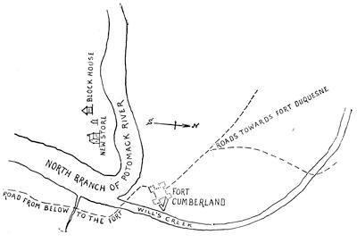
FORT CUMBERLAND AND VICINITY.
Reduced—but not in fac-simile—from a sketch among the Sparks maps in the library of Cornell University, kindly submitted to the editor by the librarian. The original is on a sheet 14 × 12 inches, and is endorsed on the back in Washington’s handwriting, apparently at a later date, “Sketch of the situation of Fort Cumberland.”
Parkman had already told the story of the Braddock campaign in his Conspiracy of Pontiac,[1302] but, with the aid of some material not accessible to Sargent, he retold it with greater fulness in his Montcalm and Wolfe (vol. i. ch. 7), and his story must now stand as the ripest result of investigations in which Bancroft[1303] and Sparks[1304] had been, as well as Sargent, his most fortunate predecessors, for Irving[1305] has done scarcely more than to avail himself gracefully of previous labors. The story as it first reached England[1306] will be found in the Gentleman’s Mag., and, after it began to take historic proportions, is given in Mante’s Hist. of the Late War in North America, London, 1772, and in Entick’s General History of the Late War, London, 1772-79.[1307] Braddock himself was not a man of mark to be drawn by his contemporaries, yet we get glimpses of his rather unenviable town reputation through the gossipy pen of Horace Walpole[1308] and the confessions of the actress, George Anne Bellamy,[1309] which Parkman and Sargent have used to heighten the color of his portraiture. He did not, moreover, escape in his London notoriety the theatrical satire of Fielding.[1310] His rise in military rank can be traced in Daniel MacKinnon’s Origin and Hist. of the Coldstream Guards, London, 1833. His correspondence in America is preserved in the Public Record Office; and some of it is printed in the Colonial Records of Penna., vi., and in Olden Time, vol. ii.[1311] His plan of the campaign is illustrated in N. Y. Col. Docs., vi. 942, 954.[1312] Of the council which he held at Alexandria with Shirley and others, the minutes are given in the Doc. Hist. New York, ii. 648.[1313]
From Braddock’s officers we have letters and memoranda of use in the history of the movement. The Braddock orderly books in the library of Congress (Feb. 26-June 17, 1755) are printed in the App. of Lowdermilk’s Cumberland, p. 495. The originals are a part of the Peter Force Collection, and bear memoranda in Washington’s handwriting. His quartermaster-general, Sir John St. Clair, had arrived as early as January 10, 1755, to make preliminary arrangements for the march, and to inspect Fort Cumberland,[1314] which the provincials had been building as the base of operations.[1315]
From Braddock’s secretary, Shirley the younger, we have a letter dated May 23, 1755, which, with others, is in the Col. Rec. of Penna., vi. 404, etc. Of Washington, there is a letter used by Parkman in the Public Record Office.[1316] Of Gage, there is a letter to Albemarle in Keppel’s Life of Keppel, i. 213, and in the Mass. Hist. Soc. Coll., xxxiv., p. 367, is a statement which Gage prepared for the use of Chalmers. A letter of William Johnston, commissary, dated Philadelphia, Sept. 23, 1755, is in the Eng. Hist. Review (Jan., 1886), vol. i. p. 150. A letter of Leslie (July 30, 1755), a lieutenant in the 44th regiment, is printed in Hazard’s Penna. Reg., v. 191; and Ibid., vi. 104, is Dr. Walker’s account of Braddock’s advance in the field. Livingston, in his Rev. of Military Operations, 1753-56, gives a contemporary estimate.[1317] Other letters and traditions are noted in Ibid., iv. pp. 389, 390, 416.[1318] The depositions of some of the wagoners, who led in the flight from the field, are given in Col. Rec. of Penna., vi. 482.[1319]
The progress of events during the preparation for the march and the final retreat can be gleaned from the Dinwiddie Papers. Sargent found of use the Shippen MSS., in the cabinet of the Penna. Hist. Society. A somewhat famous sermon, preached by Samuel Davies, Aug. 17, 1755, before an independent troop in Hanover County, Va., prophesying the future career of “that heroic youth Col. Washington,”[1320] shows what an impression the stories of Washington’s intrepidity on the field were making upon observers. The list of the officers present, killed, and wounded, upon which Parkman depends, is in the Public Record Office.[1321]
The news of the defeat, with such particulars as were first transmitted north, will be found in the New Hampshire Provincial Papers, vi. 413, and in Akins’ Pub. Doc. of Nova Scotia, 409, etc. The shock was unexpected. Seth Pomeroy, at Albany, July 15, 1755, had written that the latest news from Braddock had come in twenty-five days, by an Indian a few days before, and it was such that, in the judgment of Shirley and Johnson, Braddock was at that time in the possession of Duquesne. (Israel Williams MSS., i. p. 154.) Governor Belcher announced Braddock’s defeat July 19, 1755. New Jersey Archives, viii., Part 2d, 117. In a letter to his assembly, Aug. 1 (Ibid., p. 119), he says: “The accounts of this matter have been very various, but the most authentic is a letter from Mr. Orme wrote to Gov. Morris, of Pennsylvania.”
Governor Sharp’s letters to Lord Baltimore and Charles Calvert are in Scharf’s Maryland (i. pp. 465, 466).
The Rev. Charles Chauncy, of Boston, embodied the reports as they reached him (and he might have had excellent opportunity of learning from the executive office of Governor Shirley) in a pamphlet printed at Boston shortly after (1755), Letter to a friend, giving a concise but just account, according to the advices hitherto received, of the Ohio defeat.[1322]
Two other printed brochures are of less value. One is The life, adventures, and surprising deliverances of Duncan Cameron, private soldier in the regiment of foot, late Sir Peter Halket’s. 3d ed., Phila., 1756 (16 pp.).[1323] The other is what Sargent calls “a mere catch-penny production, made up perhaps of the reports of some ignorant camp follower.” The Monthly Review at the time exposed its untrustworthiness. It is called The expedition of Maj.-Gen’l Braddock to Virginia, ... being extracts of letters from an officer, ... describing the march and engagement in the woods. London, 1755.[1324]
Walpole[1325] chronicles the current English view of the time.
There was a young Pennsylvanian, who was a captive in the fort, and became a witness of the preparation for Beaujeu’s going out and of the jubilation over the return of the victors. What he saw and heard is told in An Account of the Remarkable Occurrences in the life and travels of Col. James Smith during his captivity with the Indians, 1755-59.[1326]
Let us turn now to the French accounts. The reports which Sparks used, and which are among his MSS. in Harvard College library, were first printed by Sargent in his fourth appendix.[1327] These and other French documents relating to the campaign have been edited by Dr. Shea in a collection[1328] called Relations diverses sur la bataille du Malangueulé [Monangahela] gagné le 9 juillet 1755, par les François sous M. de Beaujeu, sur les Anglois sous M. Braddock. Recueillies par Jean Marie Shea. Nouvelle York, 1860 (xv. 51 pp.).[1329]
Pouchot[1330] makes it clear that the French had no expectation of doing more than check the advance of Braddock.
The peculiar difficulties which beset the politics of Pennsylvania and Virginia at this time are concisely set forth by Sargent in the introduction of his Braddock’s Expedition (p. 61), and by Parkman in his Montcalm and Wolfe (vol. i. p. 329). Dulany’s letter gives a contemporary view of these dissensions.[1331]
The apathy of New Jersey drew forth rebuke from the Lords of Trade.[1332] Scharf[1333] describes the futile attempts of the governor of Maryland to induce his assembly to furnish supplies to the army.
The belief was not altogether unpopular in Pennsylvania, as well as in Virginia, that the story of French encroachments was simply circulated to make the government support the Ohio Company in their settlement of the country, and Washington complains that his report of the 1753 expedition failed to eradicate this notion in some quarters.[1334] In Pennsylvania there were among the Quaker population unreconcilable views of Indian management and French trespassing, and similar beliefs obtained among the German and Scotch-Irish settlers on the frontiers of the province, while the English churchmen and the Catholic Irish added not a little to the incongruousness of sentiment. The rum of the traders among the Indians further complicated matters.[1335] This contrariety of views, as well as a dispute with the proprietary governor over questions of taxation, paralyzed the power of Pennsylvania to protect its own frontiers, when, following upon the defeat of Braddock, the French commander thrust upon the settlements all along the exposed western limits party after party of French and Indian depredators.[1336] Dumas, now in command, issued orders enough to restrain the barbarities of his packs, but the injunctions availed nothing.[1337] Washington, who was put in command of a regiment of borderers at Winchester, found it impossible to exercise much control in directing them to the defence of the frontiers thereabouts.[1338] Fears of slave insurrection and a hesitating house of burgesses were quite as paralyzing in Virginia as other conditions were in Pennsylvania, and the Dinwiddie Papers explain the gloom of the hour.
For the Pennsylvania confusion, the views of the anti-proprietary party found expression in the Historical Review of the Constitution and Government of Pennsylvania, a “hotly partisan and sometimes sophistical and unfair”[1339] statement, inspired and partly written by Franklin, the leader in the assembly against the Penns.[1340] While the quarrel went on, and the assembly was neglecting the petitions of the borderers for the organization of a militia to protect them, the two parties indulged in crimination and recrimination, and launched various party pamphlets at each other.[1341] The Col. Records of Penna. (vol. vi.) chronicle the progress of this conflict. We get the current comment in Franklin’s letters,[1342] in the histories of Pennsylvania, and in such monographs as Edmund de Schweinitz’s Life and Times of David Zeisberger (Philad., 1870),—for the massacre at Gnadenhütten brought the Moravians within the vortex, while the histories[1343] of the missions of that sect reiterate the stories of rapine and murder.
Patience ceased to be a virtue, and a “Representation”[1344] to the House was finally couched in the language of a demand for protection. The assembly mocked and shirked; but the end came. A compromise was reached by the proprietaries furnishing as a free gift the money which they denied as a tax on their estates, and Franklin undertook to manage the defence of the frontiers, with such force and munitions as were now under command.[1345]
Any history of the acquisition of lands by the English, particularly by Pennsylvania, shows why the Indians of the Ohio were induced at this time to side with the French.[1346]
Pownall, in his treatise[1347] on the colonies, classified the Indian tribes by their allegiance respectively to the English and French interests.[1348] It is claimed that the Iroquois were first allured by the Dutch, through the latter’s policy of strict compensation for lands, and that the retention of the Iroquois to the English interests arose from the inheritance of that policy by their successors at Albany and New York.[1349]
Braddock’s instructions to Shirley for the conduct of the Niagara expedition are printed in A. H. Hoyt’s Pepperrell Papers (1874), p. 20. This abortive campaign does not occupy much space in the general histories, and Parkman offers the best account. The Massachusetts Archives and the legislative Journal of that province, as well as Shirley’s letters, give the best traces of the governor’s efforts to organize the campaign.[1350] Some descriptive letters of the general’s son, John Shirley, will be found in the Penna. Archives, vol. ii.[1351] The best contemporary narratives in print are found in The Conduct of Shirley briefly stated, and in Livingston’s Review of Military Operations.[1352]
The main dependence in the giving of the story of the Lake George campaign of 1755 is, on the English side, upon the papers of Johnson himself, and they are the basis of the Life and Times of Sir William Johnson,[1353] which, being begun by William L. Stone, was completed by a son of the same name, and published in Albany in 1865, in two volumes.[1354] The preface states that Sir William’s papers, as consulted by the elder Stone, consist of more than 7,000 letters and documents, which were collected from various sources, but are in good part made up of documents procured from the Johnson family in England, and of the Johnson MSS. presented to the N. Y. State library by Gen. John T. Cooper.[1355] An account of Johnson’s preparatory conferences with the Indians (June to Aug., 1755) is printed in N. Y. Col. Docs., vi. 964, etc., and in Penna. Archives, 2d ser., vi. 267-99.[1356] On the 22d of August Johnson held a council of war at the great carrying place,[1357] whence on the 24th he wrote a letter,[1358] while Col. Blanchard, of the New Hampshire regiment, a few days later (Aug. 28-30) chronicled the progress of events.[1359]
The account of the fight (Sept. 8), which Johnson addressed to the governors of the assisting colonies, was printed in the Lond. Mag., 1755, p. 544.[1360]
The sixth volume of the New York Col. Docs. (London documents, 1734-1755) contains the great mass of papers preserved in the archives of the State;[1361] but reference may also be made to vols. ii. 402, and x. 355. The Mass. Archives supplement them, and show many letters of Shirley and Johnson about the campaign.[1362] In the Provincial Papers of New Hampshire, vol. vi., there are various papers indicating the progress of the campaign, particularly (p. 439) a descriptive letter by Secretary Atkinson, dated Portsmouth, December 9, 1755, and addressed to the colony’s agent in London. It embodies the current reports, and is copied from a draft in the Belknap papers.[1363]
The jealousy between Massachusetts and New York is explained in part by Hutchinson.[1364] The Massachusetts assembly complained that Johnson’s chief communication was with New York, and, as was most convenient, he sent his chief prisoners to the seaport of that province, while they should have been sent, as the assembly said, to Boston, since Massachusetts bore the chief burden of the expedition.[1365] It was also complained that the £5,000 given by Parliament to Johnson was simply deducted from the appropriation for the colonies.[1366]
The jealousy of the two provinces was largely intensified in their chief men. Shirley did not hide his official eminence, and had a feeling that by naming Johnson to the command of the Crown Point expedition he had been the making of him. Johnson was not very grateful, and gained over the sympathy of De Lancey, the lieutenant-governor of New York.[1367]
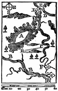
DIESKAU’S CAMPAIGN.
Fac-simile of the map in the Gentleman’s Mag., xxv. 525 (Nov., 1755), which is thus explained: “The French imagined the English army would have crossed the carrying place from Fort Nicholson at G [B in southeast corner?] to Fort Anne at F, and accordingly had staked Wood Creek at C to prevent their navigation; but Gen. Johnson, being informed of it, continued his route on Hudson’s River to H. The French marched from C to attack his advanced detachments near the lake. The dotted lines show their march. A, Lake George, or Sacrament. B, Hudson’s River. C, Wood Creek. D, Otter Creek. E, Lake Champlain. F, Fort Anne. G, Fort Nicholson. H, the place where Gen. Johnson beat the French. H C, the route of the French.”
A copy of the map used by Dieskau on his advance, and found among his baggage, as well as plans of the fort at Crown Point, are among the Peter Force maps in the Library of Congress. A MS. “Draught of Lake George and part of Hudson’s river taken Sept. 1756 by Joshua Loring” is also among the Faden maps (no. 19); as is also Samuel Langdon’s MS. Map of New Hampshire and the Adjacent Country (MS.), with a corner map of the St. Lawrence above Montreal, including observations of Lieut. John Stark.
Parkman received copies of the journal of Seth Pomeroy from a descendant, and Bancroft had also made use of it. A letter of Pomeroy, written to headquarters in Boston, is preserved in the Massachusetts Archives, “Letters,” iv. 109. He supposed himself at that time the only field-officer of his regiment left alive. The papers of Col. Israel Williams are in the Mass. Hist. Soc. library,[1368] and give considerable help. The campaign letters of Surgeon Thomas Williams, of Deerfield, addressed chiefly to his wife (1755 and 1756), are in the possession of William L. Stone, and are printed in the Historical Magazine, xvii. 209, etc. (Apr., 1870).[1369] The French found in the pocket of a captured English officer a diary of the campaign, of which Parkman discovered a French version in the Archives of the Marine.
The Rev. Samuel Chandler, who joined the camp at Lake George in October as chaplain of a Massachusetts regiment, kept a diary, in which he records some details of the previous fights, as he picked them up in camp, giving a little diagram of the ambush into which Williams was led.[1370] In it are enumerated (p. 354) the various reasons, as he understood them, on account of which the further pursuit of the campaign was abandoned. Johnson’s chief of ordnance, William Eyre, advised him that his cannon were not sufficient to attack Ticonderoga.[1371] Parkman speaks of the text accompanying Blodget’s print[1372] and the Second Letter to a Friend as “excellent for information as to the condition of the ground and the position of the combatants.” Some months later, and making use of Blodget, Timothy Clement also published in Boston another print, which likewise shows the positions of the regiments after the battle and during the building of Fort William Henry.[1373]
There are three contemporary printed comments on the campaign. The first is a sequel to the letter written by Charles Chauncy on Braddock’s defeat, which was printed at Boston, signed T. W., dated Sept. 29, 1755, and called A second Letter to a Friend; giving a more particular narrative of the defeat of the French army at Lake George by the New England troops, than has yet been published, ... to which is added an account of what the New England governments have done to carry into effect the design against Crown Point, as will show the necessity of their being helped by Great Britain, in point of money.[1374] This and the previous letter were also published together under the title Two letters to a friend on the present critical conjuncture of affairs in North America; with an account of the action at Lake George, Boston, 1755.[1375]
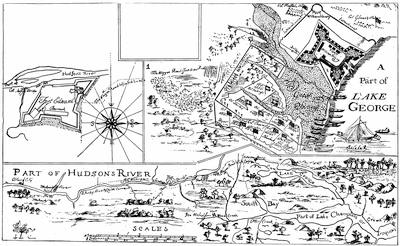
NOTE.
The sketch on the other side of this leaf follows an engraving, unique so far as the editor knows, which is preserved in the library of the American Antiquarian Society. It is too defective to give good photographic results. The print was “engraved and printed by Thomas Johnston, Boston, New England, April, 1756.”
The key at the top reads thus: “(1.) The place where the brave Coll. Williams was ambush’d & killed, his men fighting in a retreat to the main body of our army. Also where Capt. McGennes of York, and Capt. Fulsom of New Hampshire bravely attack’d ye enemy, killing many. The rest fled, leaving their packs and prisoners, and also (2.) shews the place where the valiant Col. Titcomb was killed, it being the westerly corner of the land defended in ye general engagement, which is circumscribed with a double line, westerly and southerly; (3.) with the sd double line, in ye form of our army’s entrenchments, which shows the Gen. and each Col. apartment. (4.) A Hill from which the enemy did us much harm and during the engagement the enemy had great advantage, they laying behind trees we had fell within gun-shot of our front. (W.) The place where the waggoners were killed.”
On the lower map is: “The prick’d line from South bay shews where Gen. Dieskau landed & ye way he march’d to attack our forces.”
The two forts are described: “Fort Edward was built, 1755, of timber and earth, 16 feet high and 22 feet thick & has six cannon on its rampart.”
“This fort [William Henry] is built of timber and earth, 22 feet high and 25 feet thick and part of it 32. Mounts 14 cannon, 33 & 18 pounders.”
The dedication in the upper left-hand corner reads: “To his Excellency William Shirley, esq., Captain general and Govr-in-chief in and over his Majesty’s Province of the Massachusetts Bay in New England, Major General and Commander-in-chief of all his Majesty’s land forces in North America; and to the legislators of the several provinces concerned in the expeditions to Crown Point,—this plan of Hudson River from Albany to Fort Edward (and the road from thence to Lake George as surveyed), Lake George, the Narrows, Crown Point, part of Lake Champlain, with its South bay and Wood Creek, according to the best accounts from the French general’s plan and other observations (by scale No. 1) & an exact plan of Fort Edward & William Henry (by scale No. 2) and the west end of Lake George and of the land defended on the 8th of Sept. last, and of the Army’s Intrenchments afterward (by scale 3) and sundry particulars respecting ye late Engagement with the distance and bearing of Crown Point and Wood Creek from No. 4, by your most devoted, humble servant, Timo. Clement, Survr. Havel. Feb. 10, 1756.”
The second is William Livingston’s Review of the military operations in North America from ... 1753 to ... 1756, interspersed with various observations, characters, and anecdotes, necessary to give light into the conduct of American transactions in general, and more especially into the political management of affairs in New York. In a letter to a nobleman, London, 1757.[1376]
The third is, like the tract last named, a defence of the commanding general of all the British forces in America, and is said to have been written by Shirley himself, and is called The Conduct of Major-General Shirley, late General and Commander-in-Chief of his Majesty’s forces in North America, briefly stated, London, 1758.[1377]
Dwight, in his Travels in New England and New York (vol. iii. 361), and Hoyt, in his Antiquarian Researches on the Indian Wars (p. 279), wrote when some of the combatants were still living. Dwight was the earliest to do General Lyman justice. Stone claims that the official accounts discredit the story told by Dwight, that Dieskau was finally shot, after his army’s flight, by a soldier, who thought the wounded general was feeling for a pistol, when he was searching for his watch.[1378]
Daniel Dulany, in a MS. Newsletter after the fashion of the day, gives the current accounts of the fight.[1379]
The story of the fight had been early told (1851) by Parkman in his Pontiac, revised in his second edition;[1380] and was again recast by him in the Atlantic Monthly (Oct., 1884), before the narrative finally appeared in ch. ix. of the first volume of his Montcalm and Wolfe.[1381]
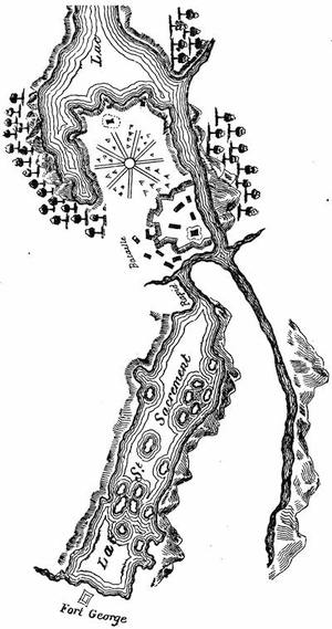
FORT GEORGE AND TICONDEROGA.
After an inaccurate plan in the contemporary Mémoires sur le Canada, 1749-1760, as published by the Lit. and Hist. Soc. of Quebec (réimpression), 1873, p. 98. The French accounts often call Fort William Henry Fort George. Cf. the map in Moore’s Diary of the Amer. Revolution, i. p. 79.
The Catal. of the King’s Maps (Brit. Mus.), i. 424, shows a drawn map of the fort at the head of Lake George, under date of 1759, and (p. 425) another of the lake itself.
On the French side, the official report of Dieskau[1382] was used by Parkman in a copy belonging to Sparks, obtained from the French war archives, and this with other letters of Dieskau—one to D’Argenson, Sept. 14; another to Vaudreuil, Sept. 15—can be found in the N. Y. Col. Docs., vol. x. pp. 316, 318 (Paris Documents, 1745-78),[1383] as can the reports of Dieskau’s adjutant, Montreuil (p. 335), particularly those of Aug. 31 and Oct. 1, which, with other papers, are also preserved in the Mass. Archives, documents collected in France (MSS.), ix. 241, 265.[1384] The report made by Vaudreuil,[1385] as well as his strictures on Dieskau, is preserved in the Archives de la Marine, as is a long account by Bigot (Oct. 4, 1755),—both of which are used by Parkman. Cf. also the French narratives in the Penna. Archives, 2d ser., vi. 320, 324, 330. There is also in this same collection (p. 316) a Journal of occurrences, July 23 to Sept. 30, 1755, which is also in the N. Y. Col. Docs., x. p. 337, where are other contemporary accounts, like the letter of Doreil to D’Argenson (p. 360) and those of Lotbinière (pp. 365, 369). The Mémoires of Pouchot is the main early printed French source; though there was a contemporary Gazette, printed in Paris, which will be found in the N. Y. Col. Docs., x. p. 383.
A paper in the Archives de la Guerre is thought by Parkman to have been inspired by Dieskau himself, and, in spite of its fanciful form, to be a sober statement of the events of the campaign. It is called Dialogue entre le Maréchal de Saxe et le Baron de Dieskau aux Champs Elysées.[1386] Some of the events subsequently related by Dieskau to Diderot are noticed in the latter’s Mémoires (1830 ed.), i. 402.
Henry Stevens, of London, offered for sale in 1872, in his Bibliotheca Geographica, no. 553, a manuscript record of events between 1755 and 1760, which came from the family of the Chevalier de Lévis. It purports to be the annual record of the French commanders in the field, beginning with Dieskau, for six successive campaigns. Stevens, comparing this record of Dieskau with such of the papers as are printed in the N. Y. Col. Docs., where they were copied from the documents as they reached the government in France, says that the latter are shown by the collection to have been “cooked up for the home eye in France,” and that “we lose all sympathy for the unfortunate Dieskau.” Stevens refers particularly to two long letters of Dieskau, Sept. 1 and 4, sent to Vaudreuil.[1387]
The feeling was rapidly growing that the next campaign should be a vigorous one. Gov. Belcher (Sept. 3, 1755) enforces his opinion to Sir John St. Clair, that “Canada must be rooted out.”[1388] The Gentleman’s Magazine printed papers of similar import.
In November, 1755, Belcher had written to Shirley, “Things look to me as if the coming year will be the criterion whereby we shall be able to conclude whether the French shall drive us into the sea, or whether King George shall be emperour of North America.”[1389] In December, Shirley assembled a congress of governors at New York, and laid his plans before them.[1390] When Shirley returned to Boston in Jan., 1756, the Journal of the Mass. House of Representatives discloses how active he was in preparing for his projects.[1391] Stone[1392] portrays the arrangements.
To Stone,[1393] too, we must turn to learn the efforts of Johnson to propitiate the Indians,[1394] in which he was perplexed by the movements in Pennsylvania and Virginia against the tribes in that region.[1395] The printed contemporary source, showing Johnson’s endeavors with the Indians, is the Account of Conferences, London, 1756, which may be complemented by much in the Doc. Hist. N. Y., vols. i. and iv. Thomas Pownall published in New York, in 1756, Proposals for securing the friendship of the Five Nations. As the campaign went on, Johnson held conferences at Fort Johnson, July 21 (of which, under date of Aug. 12, he prepared a journal), and attended later meetings at German Flats, Aug. 24-Sept. 3, and again at Fort Johnson. These will be found in the Penna. Archives, 2d ser., vi. 461-496;[1396] and in the same volume, pp. 365-376, will be found the conference of deputies of the Five Nations, July 28, 1756, with Vaudreuil, at Montreal.[1397]
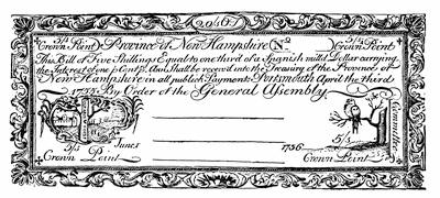
CROWN POINT CURRENCY OF NEW HAMPSHIRE.
From an original bill in an illustrated copy of Historical Sketches of the Paper Currency of the American Colonies, by Henry Phillips, Jr., Roxbury, 1865,—in Harvard College library.
The early events of the year, like the capture of Fort Bull,[1398] find illustrations in various papers in the Doc. Hist. N. Y., vol. i. 509, and N. Y. Col. Docs. x. 403, with some local associations in Benton’s Herkimer County.
The centre of preparation for the campaign during the winter was in Boston, and Parkman[1399] shows the methods of military organization which the New England colonies, with some detriment to efficiency employed. He finds his material for the sketch in the manuscripts of the Mass. Archives (“Military”), vols. lxxv. and lxxvi., and in equivalent printed papers in R. I. Colonial Records, v., and N. H. Provincial Papers, vi. The latter colony issued bills this year, as they had the previous season, called Crown Point currency, in aid of the expedition, a fac-simile of one of which is annexed.[1400]