Chapter VIII
Reading edition
THE STRUGGLE FOR THE GREAT VALLEYS OF NORTH AMERICA.
BY JUSTIN WINSOR,
The Editor.
THE death of Frontenac[1097] and the peace of Ryswick (September, 1697) found France in possession of the two great valleys of North America,—that of the St. Lawrence, with the lakes, and that of the Mississippi, with its affluents.[1098] In 1697 the Iroquois were steadfast in their adherence to Corlear, as they termed the English governor, while they refused to receive French missionaries. In negotiations which Bellomont was conducting (1698) with the Canadian governor, he tried ineffectually to induce a recognition of the Five Nations as subjects of the English king.[1099] Meanwhile, the French were omitting no opportunity to force conferences with these Indians, and Longueil was trying to brighten the chain of amity with them as far west as Detroit, where in July, 1701, La Motte Cadillac began a French post. Within a month the French ratified at Montreal (August 4, 1701) a treaty with the Iroquois just in time to secure their neutrality in the war which England declared against France and Spain the next year (1702). So when the outbreak came it was the New England frontiers which suffered (1703-4),[1100] for the Canadians were careful not to stir the blood of the Iroquois. The French jealously regarded the English glances at Niagara, and proposed (1706) to anticipate their rivals by occupying it. When, in 1709, it was determined to retaliate for the ravages of the New England borders, the Iroquois, at a conference in Albany[1101] (1709), were found ready to aid in the expedition which Francis Nicholson tried to organize, but which proved abortive. Already Spotswood, of Virginia, was urging the home government to push settlers across the Alleghanies into the valley of the Ohio.[1102] But attention was rather drawn to the petty successes in Acadia,[1103] and the spirit of conquest seethed again, when Sir Hovenden Walker appeared at Boston,[1104] and a naval expedition in the summer of 1711 was well under way to capture the great valley of the St. Lawrence. Stupidity and the elements sent the fleet of the English admiral reeling back to Boston, leaving Quebec and Canada once more safe. The next year (1712) the distant Foxes tried to wrest Detroit from the French; but its garrison was too enduring. France had maintained herself all along her Canadian lines, and she was in fair hopes of gaining the active sympathy of the Iroquois, when the treaty of Utrecht (1713) brought the war to a close.
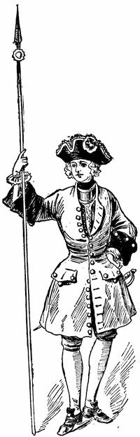
FRENCH SOLDIER (1700).
After a water-color sketch in the Mass. Archives: Documents collected in France, v. p. 271. The coat is red, faced with brown.
The language of this treaty declared that the “Five Nations[1105] were subject to the dominion of England.” The interpretation of this clause was the occasion of diplomatic fence at once. The French claimed a distinction between the subjectivity of the Indians and domination over their lands. The English insisted that the allegiance of the Five Nations carried not only their own hereditary territory, but also the regions of Iroquois conquests, namely, all west of the Ottawa River and the Alleghany Mountains to the Mississippi River.[1106] The peace of Utrecht was but the prelude to a struggle for occupying the Ohio Valley, on the part of both French and English. Spotswood had opened a road over the Blue Ridge from Virginia in 1716, and he continued to urge the Board of Trade to establish a post on Lake Erie. Governor Keith, of Pennsylvania, reported to the board (1718) upon the advances of the French across the Ohio Valley, and the English moved effectually when, in 1721, they began to plant colonists on the Oswego River. By 1726 they had completed their fort on the lake, and Montreal found its Indian trade with the west intercepted. Meanwhile, New York, Pennsylvania, and Virginia strengthened their alliance with the Iroquois by a conference at Albany in September, 1722, and in 1726 the Indians confirmed the cession of their lands west and north of Lake Erie.
When Vaudreuil, in 1725, not long before his death (April 10) suggested to the ministry in Paris that Niagara should be fortified, since, with the Iroquois backing the English, he did not find himself in a position openly to attack them, the minister replied that the governor could at least craze the Indians by dosing them with brandy. Shortly afterwards the commission of his successor, Beauharnois, impressed on that governor the necessity of always having in view the forcible expulsion of the Oswego garrison. In 1727 the French governor tried the effect of a summons of the English post, with an expressed intention “to proceed against it, as may seem good to him,” in case of refusal; but it was mere gasconade, and the minister at home cautioned the governor to let things remain as they were.
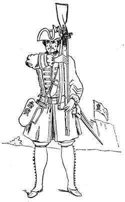
BRITISH INFANTRY SOLDIER (1725).
Fac-simile of a cut in Grant’s British Battles, i. p. 564.
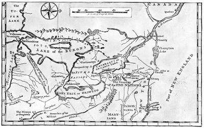
Note To Annexed Map.—In the N. Y. Col. Docs., ix. 1021, is a fac-simile of a map in the Archives of the Marine and Colonies, called Carte du lac Champlain avec les rivières depuis le fort de Chambly jusques à Orangeville [Albany] de la Nouvelle Angleterre, dressé sur divers mémoires. It is held to have been made about 1731. There is in the Doc. Hist. N. Y., vol. i. p. 557, a Carte du lac Champlain depuis le fort Chambly jusqu’au fort St. Frederic, levée par le Sr. Anger, arpenteur du Roy en 1732, fait à Quebec le 10 Oct., 1748,—Signé de Lery.
Nicolas Bellin made his Carte de la rivière de Richelieu et du lac Champlain in 1744, and it appeared in Charlevoix’s Nouvelle France, i. 144, reproduced in Shea’s ed., ii. 15. There is also a map of Lake Champlain in Bellin’s Petit Atlas Maritime, 1764.
There were surveys made of Lake Champlain, in 1762, by William Brassier, and of Lake George by Captain Jackson, in 1756. These were published by order of Amherst in 1762, and reproduced in 1776. (Cf. American Atlas, 1776.) The original drawings are noted in the Catal. of the King’s Maps (Brit. Mus.), i. 223. The Brassier map is also given in Dr. Hough’s edition of Rogers’s Journals. The same British Museum Catalogue (i. 489) gives a drawn Map of New Hampshire (1756), which shows the route from Albany by lakes George and Champlain to Quebec. Cf. the Map of New Hampshire, by Col. Joseph Blanchard and Rev. Samuel Langdon, engraved by Jefferys, and dated 21 Oct., 1761, which shows the road to Ticonderoga in 1759.
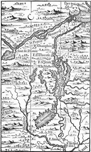
FROM POPPLE’S BRITISH EMPIRE IN AMERICA, 1732.
A few years later a sort of flank movement was made on Oswego, as well as on New England, by the French pushing up Lake Champlain, and establishing themselves in the neighborhood of Crown Point (1731), where they shortly after built Fort St. Frederick. The movement alarmed New England more than it did New York.
The French persisted in seeking conferences with the Six Nations,—as they had been called since the Tuscaroras joined them about 1713,—and in 1734 succeeded in obtaining a meeting with the Onondagas. They ventured in 1737 to ask the Senecas to let them establish a post at Irondequot, farther west on Lake Ontario than Oswego. The Iroquois would not permit, however, either side to possess that harbor. For some years Oswego was the burden of the French despatches, and the English seemed to take every possible occasion for new conferences with the fickle Indians.
The most important of these treaties was made at Lancaster, Pennsylvania, in 1744, when an indefinite extent of territory beyond the mountains was ceded to the English in the form of a confirmation of earlier implied grants. A fresh war followed. The New Englanders took Louisbourg,[1107] but New York seemed supine, and let French marauding parties from Crown Point fall upon and destroy the fort at Saratoga without being aroused.[1108] Oswego was in danger, but still the New York assembly preferred to quarrel with the governor; and tardily at best it undertook to restore the post at Saratoga, while the Albanians were suspected of trading clandestinely through the Caughnawagas with the French in Canada. Both sides continued in their efforts to propitiate the Iroquois, while a parade of arming was made for an intended advance on Crown Point and Montreal. Governor Shirley, from Boston, had urged it, since a demonstration which had been intended by way of the St. Lawrence had to be given up, because the promised fleet did not arrive from England. To keep the land levies in spirits, Shirley had written to Albany that he would send them to join in an expedition by the Lakes, and had even despatched a 13-inch mortar by water to New York.[1109] Before the time came, however, the rumors of D’Anville’s fleet frightened the New Englanders, and they thought they had need of their troops at home.[1110] It was some time before Governor Clinton knew of this at Albany, and preparations went on. Efforts to enlist the Iroquois in the enterprise halted, for the inaction of the past year had had its effect upon them, and it needed all the influence of William Johnson, who now first appears as Indian commissioner, to induce them to send a sufficient delegation to a conference at Albany.
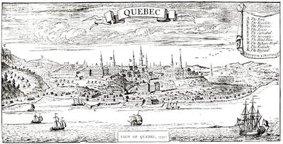
VIEW OF QUEBEC, 1732.
From Popple’s British Empire in America. It is repeated in fac-simile in Cassell’s United States, p. 372; and in Gay’s Pop. Hist. U. S., iii. 307. Cf. The view from La Potherie in Vol. IV. p. 320; also reproduced in Shea’s Charlevoix, vol. v. Kalm described the town in 1749 (Travels, London, 1771, ii. p. 258). See views under date of 1760 and 1761, noted in the Cat. of the King’s Maps (Brit. Mus.), ii. 220. Cf. De Lery’s report on the fortifications of Quebec in 1716, in N. Y. Col. Docs., ix. 872.
The business still further dragged; the withdrawal of New England became in the end known, and by September 16 Clinton had determined to abandon the project, and the French governor had good occasion to twit old Hendrick, the Mohawk chief, when he ventured with more purpose than prudence to Montreal in November.[1111]
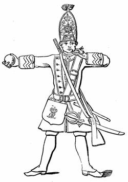
BRITISH FOOTGUARD, 1745.
This sketch of a footguard, with grenade and match, is taken from Grant’s British Battles, ii. 60. Cf. Mag. of Amer. Hist., i. 462; and the uniform of the forty-third regiment of foot (raised in America), represented from a drawing in the British Museum, in The Century, xxix. 891.
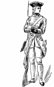
FRENCH SOLDIER, 1745.
After a water-color sketch in the Mass. Archives: Documents collected in France, viii. p. 129. The coat is red, faced with blue; the breeches are blue.
Early the next summer (June, 1747) the French had some experience of a foray upon their own borders, when a party of English and Indians raided upon the island of Montreal,—a little burst of activity conspicuous amid the paralysis that the quarrels of Clinton and De Lancey had engendered. Shirley had formed the plan of a winter attack upon Crown Point, intending to send forces up the Connecticut, and from Oswego towards Frontenac, by way of distracting the enemy’s councils; but the New York assembly refused to respond.
The next year (1748) the French, acting through Father Picquet, made renewed efforts to enlist Iroquois converts, while Galissonière was urging the home government to send over colonists to occupy the Ohio Valley. A number of Virginians, on the other hand, formed themselves into the Ohio Company, and began to send explorers into the disputed valley. In order to anticipate the English, the French governor had already despatched Céloron de Bienville to take formal possession by burying lead plates, with inscriptions, at the mouths of the streams.[1112]
For the present, there was truce. The treaty of Aix-la-Chapelle, entered upon in May, and signed in October (1748), had given each side time to manœuvre for an advantage. Picquet established a new barrier against the English at La Presentation, where Ogdensburg now is;[1113] and in 1749 Fort Rouillé was built at the present Toronto.[1114]
The Virginians, meanwhile, began to push their traders farther and farther beyond the mountains. The Pennsylvanians also sent thither a shrewd barterer and wily agent in George Croghan, and the French emissaries whom he encountered found themselves outwitted.[1115] The Ohio Company kept out Christopher Gist on his explorations. Thus it was that the poor Ohio Indians were distracted. The ominous plates of Céloron meant to them the loss of their territory; and they appealed to the Iroquois, who in turn looked to the government of New York. That province, however, was apathetic, while Picquet and Jean Cœur, another Romish priest, who believed in rousing the Indian blood, urged the tribes to maraud across the disputed territory and to attack the Catawbas. William Johnson, on the one side, and Joncaire, on the other, were busy with their conferences, each trying to checkmate the other (1750); while the English legislative assemblies haggled about the money it cost and the expense of the forts. The Iroquois did not fail to observe this; nor did it escape them that the French were building vessels on Ontario and strengthening the Niagara fort (1751).
While Charles Townshend was urging the English home government (1752) to seize the Ohio region forcibly, the French were attacking the English traders and overcoming the allied Indians, on the Miamis. Virginia, by a treaty with the Indians at Logstown, June 13, 1752, got permission to erect a fort at the forks of the Ohio; but the undertaking was delayed.
In the spring of 1753 Duquesne, the governor of Canada, sent an expedition[1116] to possess by occupation the Ohio Valley, and the party approached it by a new route.[1117] They landed at Presquisle, built a log fort,[1118] carried their munitions across to the present French Creek, and built there another defence called Fort Le Bœuf.[1119] This put them during high water in easy communication by boat with the Alleghany River. French tact conciliated the Indians, and where that failed arrogance was sufficient, and the expedition would have pushed on to found new forts, but sickness weakened the men, and Marin, the commander now dying, saw it was all he could do to hold the two forts, while he sent the rest of his force back to Montreal to recuperate. Late in the autumn Legardeur de Saint-Pierre arrived at Le Bœuf, as the successor of Marin. He had not been long there, when on the 11th of December a messenger from Governor Dinwiddie, of Virginia, with a small escort, presented himself at the fort. The guide of the party was Christopher Gist; the messenger was George Washington, then adjutant-general of the Virginia militia.[1120] Their business was to inform the French commander that he was building forts on English territory, and that he would do well to depart peaceably. Washington had been made conscious of the aggressive character of the French occupation, as he passed through the Indian town of Venango, at the confluence of French Creek and the Alleghany River, for he there had seen the French flag floating over the house of an English trader, Fraser, which the French had seized for an outpost of Le Bœuf, and there he had found Joncaire in command.[1121] Washington had been received by Joncaire hospitably, and over his wine the Frenchman had disclosed the unmistakable purpose of his government. At Le Bœuf Washington tarried three days, during which Saint-Pierre framed his reply, which was in effect that he must hold his post, while Dinwiddie’s letter was sent to the French commander at Quebec. It was the middle of January, 1754, when Washington reached Williamsburg on his return, and made his report to Dinwiddie.
The result was that Dinwiddie drafted two hundred men from the Virginia militia, and despatched them under Washington to build a fort at the forks of the Ohio. The Virginia assembly, forgetting for the moment its quarrel with the governor, voted £10,000 to be expended, but only under the direction of a committee of its own. Dinwiddie found difficulty in getting the other colonies to assist, and the Quaker element in Pennsylvania prevented that colony from being the immediate helper, which it might from its position have become.
Meanwhile, some backwoodsmen had been pushed over the mountains and had set to work on a fort at the forks. A much larger French force under Contrecœur soon summoned them,[1122] and the English retired. The French immediately began the erection of Fort Duquesne.
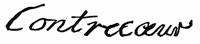
While this was doing, Dinwiddie was toiling with tardy assemblies and their agents to organize a regiment to support the backwoodsmen. Joshua Fry was to be its colonel, with Washington as second in command. The latter, with a portion of the men, had already pushed forward to Will’s Creek, the present Cumberland. Later he advanced with 150 men to Great Meadows, where he learned that the French, who had been reinforced, had sent out a party from their new fort, marching towards him. Again he got word from an Indian—who, from his tributary character towards the Iroquois, was called Half-King, and who had been Washington’s companion on his trip to Le Bœuf—that this chieftain with some followers had tracked two men to a dark glen, where he believed the French party were lurking. Washington started with forty men to join Half-King, and under his guidance they approached the glen and found the French. Shots were exchanged. The French leader, Jumonville, was killed, and all but one of his followers were taken or slain.
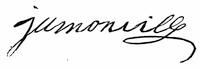
The mission of Jumonville was to scour for English, by order of Contrecœur, now in command of Duquesne, and to bear a summons to any he could find, warning them to retire from French territory. The precipitancy of Washington’s attack gave the French the chance to impute to Washington the crime of assassination; but it seems to have been a pretence on the part of the French to cover a purpose which Jumonville had of summoning aid from Duquesne, while his concealment was intended to shield him till its arrival. Rash or otherwise, this onset of the youthful Washington began the war.
The English returned to Great Meadows, and while waiting for reinforcements from Fry, Washington threw up some entrenchments, which he called Fort Necessity. The men from Fry came without their leader, who had sickened and died, and Washington, succeeding to the command of the regiment, found himself at the head of three hundred men, increased soon by an independent company from South Carolina.
Washington again advanced toward Gist’s settlement, when, fearing an attack, he sent back for Mackay, whom he had left with a company of regulars at Fort Necessity. Rumors thickening of an advance of the French, the English leader again fell back to Great Meadows, resolved to fight there. It was now the first of July, 1754. Coulon de Villiers, a brother of Jumonville, was now advancing from Duquesne. The attack was made on a rainy day, and for much of the time a thick mist hung between the combatants. After dark a parley resulted in Washington’s accepting terms offered by the French, and the English marched out with the honors of war.[1123]
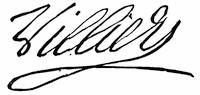
The young Virginian now led his weary followers back to Will’s Creek. It was a dismal march. The Indian allies of the French, who were only with difficulty prevented from massacring the wounded English, had been allowed to kill the cattle and horses of the little army; and Washington’s men had to struggle along under the burdens of their own disabled companions. Thus they turned their backs upon the great valley, in which not an English flag now waved.
Appearances were not grateful to Dinwiddie. His house of burgesses preferred to fight him on some domestic differences rather than to listen to his appeals to resist the French. He got little sympathy from the other colonies. The Quakers and Germans of Pennsylvania cared little for boundaries. New York and Maryland seemed slothful.[1124] Only Shirley, far away in Massachusetts, was alive, but he was busy at home.[1125] The Lords of Trade in London looked to William Johnson to appease and attach the Indians; but lest he could not accomplish everything, they directed a congress of the colonial representatives to be assembled at Albany, which talked, but to the liking neither of their constituents nor of the government in England.[1126]
Dinwiddie, despairing of any organized onset, appealed to the home government. The French king was diligently watching for the English ministry’s response. So when Major-General Braddock and his two regiments sailed from England for Virginia, and the Baron Dieskau and an army, with the Marquis of Vaudreuil[1127] to succeed Duquesne as governor, sailed for Quebec, the diplomates of the two crowns bowed across the Channel, and protested to each other it all meant nothing.
The English thought that with their superiority on the sea they could intercept the French armament, and Admiral Boscawen was sent to hover about the Gulf of St. Lawrence. He got only three ships of them,—the rest eluding him.
The two armies were to enter the great valleys, one of the St. Lawrence, the other of the Ohio, but not in direct opposition. Dieskau was hurled back at Lake George; Braddock on the Monongahela. We must follow their fortunes.
In February, 1755, Braddock landed at Hampton, Virginia, and presently he and Dinwiddie were living “in great harmony.” A son of Shirley of Massachusetts was serving Braddock as secretary, and he was telling a correspondent how “disqualified his general was for the service he was employed in, in almost every respect.” This was after the young man had seen his father, for Braddock had gone up to Alexandria[1128] in April, and had there summoned for a conference all the governors of the colonies, Shirley among the rest, the most active of them all, ambitious of military renown, and full of plans to drive the French from the continent. The council readily agreed to the main points of an aggressive campaign. Braddock was to reduce Fort Duquesne; Shirley was to capture Niagara. An army of provincials under William Johnson was to seize Crown Point. These three movements we are now to consider; a fourth, an attack by New Englanders upon the Acadian peninsula, and the only one which succeeded, is chronicled in another chapter.[1129]
Braddock’s first mistake was in moving by the Potomac, instead of across Pennsylvania, where a settled country would have helped him; but this error is said to have been due to the Quaker merchant John Hanbury. He cajoled the Duke of Newcastle into ordering this way, because Hanbury, as a proprietor in the Ohio Company, would profit by the trade which the Virginia route would bring to that corporation. Dinwiddie’s desire to develop the Virginia route to the Ohio had doubtless quite as much to do with the choice. While plagued with impeded supplies and the want of conveyance as he proceeded, Braddock chafed at the Pennsylvanian indifference which looked on, and helped him not. He wished New England was nearer. The way Pennsylvania finally aided the doomed general was through Benjamin Franklin, whom she had borrowed of New England. He urged the Pennsylvania farmers to supply wagons, and they did, and Braddock began his march. On the 10th of May he was at Will’s Creek,[1130] with 2,200 men, and as his aids he had about him Captains Robert Orme and Roger Morris, and Colonel George Washington. Braddock invested the camp with an atmosphere little seductive to Indian allies. There were fifty of them present at one time, but they dwindled to eight in the end.[1131] Braddock’s disregard had also driven off a notorious ranger, Captain Jack, who would have been serviceable if he had been wanted.
On the 10th of June the march was resumed,—a long, thin line, struggling with every kind of difficulty in the way, and making perhaps three or four miles a day. By Washington’s advice, Braddock took his lighter troops and pushed ahead, leaving Colonel Dunbar to follow more deliberately. On the 7th of July this advance body was at Turtle Creek, about eight miles from Fort Duquesne.
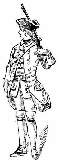
FRENCH SOLDIER, 1755.
After a water-color sketch in the Mass. Archives: Documents collected in France, vol. ix. p. 425. The coat is blue, faced with red.
Parkman (vol. i. 368), speaking of the troops which came with Dieskau and Montcalm, says that their uniform was white, faced with blue, red, yellow, or violet, and refers to the plates of the regimental uniforms accompanying Susane’s Ancienne Infanterie Française. Parkman (i. p. 370) also says that the troupes de la marine, the permanent military establishment of Canada, wore a white uniform faced with black. He gives (p. 370, note) various references.
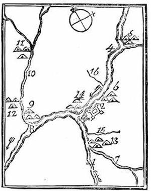
FORT DUQUESNE AND VICINITY.
From Father Abraham’s Almanac, 1761. Key: 1, Monongahela River; 2, Fort Du Quesne, or Pittsburgh; 3, the small fort; 4, Alleghany River; 5, Alleghany Indian town; 6, Shanapins; 7, Yauyaugany River; 8, Ohio, or Alleghany, River; 9, Logs Town; 10, Beaver Creek; 11, Kuskaskies, the chief town of the Six Nations; 12, Shingoes Town; 13, Alleguippes; 14, Sennakaas; 15, Tuttle Creek; 16, Pine Creek. The arrows show the course of the river.
A “Plan of Fort le Quesne, built by the French at the fork of the Ohio and Monongahela in 1754,” was published by Jefferys, and is included in his General Topography of North America and the West Indies, London, 1768. I suppose this to be based upon the MS. plan noted in the Catal. of the King’s Maps (Brit. Mus.), ii. 184. Cf. the plan (1754) in the Memoirs of Robert Stobo, Pittsburgh, 1854, which is repeated in Sargent’s Braddock’s Exped., p. 182, who refers to a plan published in London in 1755, mentioned in the Gentleman’s Mag., xxv. P. 383. Stobo’s plan is also engraved in Penna. Archives, ii. 147, and the letters of Stobo and Croghan respecting it are in Penna. Col. Rec., vi. 141, 161. Parkman refers (i. 208) to a plan in the Public Record Office, London, and (p. 207) describes the fort as does Sargent (p. 182). See the plan in Bancroft, orig. ed., iv. 189, and Gay’s Pop. Hist. U. S., iii. 260.
Duquesne was finished in May, 1755. Cf. Duquesne’s Memoir on the Ohio and its dependencies, addressed to Vaudreuil, dated Quebec, July 6, 1755, and given in English in Penna. Archives, 2d ser., vi. 253. M’Kinney’s Description of Fort Duquesne (1756) is in Hazard’s Penna. Reg., viii. 318; and letters of Robert Stobo, who was a hostage there after the surrender of Fort Necessity, are in Col. Rec. of Penna., vi. 141, 161. Cf. notice of Stobo by L. C. Draper in Olden Time, i. 369. Parkman also refers to a letter of Captain Hazlet in Olden Time, i. 184.
Sargent says (p. 184) that in 1854 the magazine was unearthed, which at that time was all remaining visible of the old fort. (Hazard’s Penna. Register, v. 191; viii. 192.) There is a view of the magazine in John Frost’s Book of the Colonies, N. Y., 1846.
The enemy occupying the fort consisted of a few companies of French regulars, a force of Canadians, and about 800 Indians,—all under Contrecœur, with Beaujeu, Dumas, and Ligneres as lieutenants. They knew from scouts that Braddock was approaching, and Beaujeu was sent out with over 600 Indians and 300 French, to ambush the adventurous Briton.
As Braddock reached the ford, which was to put him on the land-side of the fort, Colonel Thomas Gage, some years later known in the opening scenes of the American Revolution,[1132] crossed in advance, without the opposition that was anticipated. Beaujeu had intended to contest the passage, but his Indians, being refractory, delayed him in his march.
Gage, with the advance, was pushing on, when his engineer, laying out the road ahead, saw a man, apparently an officer, wave his cap to his followers, who were unseen in the woods. From every vantage ground of knoll and bole, and on three sides of the column, the concealed muskets were levelled upon the English, who returned the fire. Beaujeu soon fell.[1133] Dumas, who succeeded in command, thought the steady front of the redcoats was going to carry the day, when he saw his Canadians fly, followed by the Indians, after Gage had wheeled his cannon upon the woods. A little time, however, changed all. The Indians rallied and poured their bullets into the massed, and very soon confused, British troops.
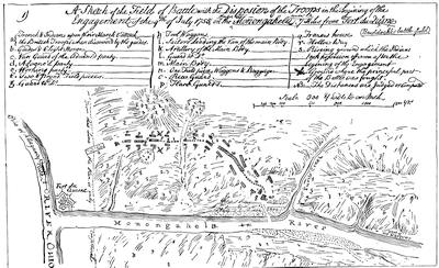
Braddock, when he spurred up, found everybody demoralized except the Virginians, who were firing from the tree-trunks, as the enemy did. The British general was shocked at such an unmilitary habit, and ordered them back into line. No one under such orders could find cover, and every puff from a concealed Indian was followed by a soldier’s fall. No exertion of Braddock, or of Washington, or of anybody, prevailed.[1134] The general had four horses shot under him; Washington had two. Still the hillsides and the depths of the wood were spotted with puffs of smoke, and the slaughter-pen was in a turmoil. Young Shirley fell, with a bullet in his brain.[1135] Horatio Gates and Thomas Gage were both wounded. Scarce one Englishman in three escaped the bullets. The general had given the sign to retreat, and was wildly endeavoring to restore order, when a ball struck him from his horse. The flight of the survivors became precipitous, and when the last who succeeded in fording the river stopped to breathe on the other side, there were thirty Indians and twenty Frenchmen almost upon them. The French, however, pursued no farther. They had enough to do to gather their plunder, while the Indians unchecked their murderous instincts as they searched for the wounded and dying Britons. The next morning a large number of the Indians left Contrecœur for their distant homes, laden with their booty. The French general feared for a while that Braddock, reinforced by Dunbar, would return to the attack. He little knew the condition of his enemy. The British army had become bewildered fugitives. Scarce a guard could be kept for the wounded general, as he was borne along on a horse or in a litter. When they met Dunbar the fright increased. Wagons and munitions were destroyed, for no good reason, and the mass surged eastward. The sinking Braddock at last died, and they buried him in the road, that the tramp of the men might obliterate his grave.[1136] Nobody stopped till they reached Fort Cumberland, which was speedily turned into a disordered hospital. The campaign ended with gloomy forebodings. Dunbar, the surviving regular colonel, instead of staying at Cumberland and guarding the frontier, retreated to Philadelphia, leaving the Virginians to hold Cumberland and its hospitals as best they could.
By the death of Braddock Shirley became the ranking officer on the continent, and we must turn to see how the tidings of his new responsibilities found him.
The Massachusetts governor was at Albany when the bad news reached him, and Johnson being taken into the secret, the two leaders tried to keep it from the army. Shirley immediately pushed on the force destined for Fort Niagara, at the other end of Lake Ontario; while Johnson as speedily turned the faces of his men towards Lake George. Shirley’s army found the path to Oswego, much of the way through swamp and forest; and the young provincials sorrowfully begrimed their regulation bedizenments, assumed under the king’s orders, as with the Jersey Blues they struggled along the trail and tugged through the watercourses. It was easier to get the men to their destination than to transport the supplies, and many stores that were on the way were abandoned at the portages when the wagoners heard the fearful details from the Monongahela. Short rations and discouragements harried the men sorely. The axe and spade were put in requisition, and additional forts were planned and constructed as the army pursued its way. Across the lake at Fort Frontenac the enemy held a force ready to be sent against Oswego if Shirley went on, for the capture of Braddock’s papers had revealed all the English plans. Shirley put on a brave face, with all his bereavement, for the death of his son, with Braddock, was a heavy blow. A council of war, on the 18th of September, determined him to take to the lake with his bateaux as soon as provisions arrived. He had now got word of Dieskau’s defeat,[1137] and he tried to use it to inspirit the braves at his camp. It seemed to another council, on the 27th, that the attempt to trust their river bateaux on the lake was foolhardy, and so the purpose of the campaign was abandoned. At the end of October he left the garrison to strengthen the forts, and returned to Albany. He did not get much comfort there. Johnson showed no signs of following up the victory of Lake George, and as late as November Shirley was still at Albany, where he had received his new commission, advising a movement on Crown Point for the winter;[1138] and in December he was exciting the indignant jealousy of Johnson[1139] by daring to instruct him about his Indian management, for Johnson had now been made Indian superintendent.[1140] Shirley had despatched these orders from New York, where he was laying before a congress of governors his schemes for a new campaign.
We need now to see how Dieskau’s defeat had been the result of the third of the expeditions of the campaign just brought to a close.
Before the arrival of Braddock, Shirley had begun (January, 1755) arrangements for an attack on Crown Point,—a project confirmed, as we have seen, by the council at Alexandria, where William Johnson, whom Shirley had already named, was approved as the commander. Johnson, as a young Irishman of no military experience, had been sent over twenty years before by his uncle, Sir Peter Warren, the admiral, to look after some lands of his in the Mohawk Valley. Settling here and building a house, about ten years earlier than this, he had called it first Mount Johnson, though when it was fortified, at a later day, it was usually called Fort Johnson.[1141] It was the seat of numerous conferences with the Indians, over whom Johnson gained an ascendency, which he constantly turned to the advantage of the English.
The provincials who assembled, first at Albany and then at the carrying place between the Hudson and Lake George, were mostly New Englanders, and a Connecticut man, General Phineas Lyman, was placed second in command. The French were not without intelligence of their enemy’s purpose, derived, as already said, from the captured papers of Braddock. So Dieskau, who had come over, as we have seen, with reinforcements, was ordered to Lake Champlain instead of Oswego, as had been the original intention.
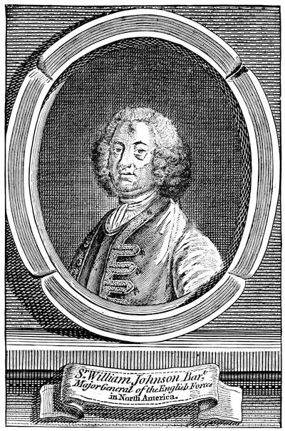
SIR WILLIAM JOHNSON.
From a plate in the London Mag., Sept., 1756; which is also the original of prints in the Doc. Hist. N. Y., ii. 545, and in Hough’s Pouchot, i. 181. Cf. also Stone’s Life of Johnson; Simms’s Trappers of N. Y.; Perry’s Amer. Episc. Church, i. 331; Entick’s General Hist. of the Late War (London, 1765); J. C. Smith’s Brit. Mezzotint Portraits, iii. 1342 (by Adams, engraved by Spooner).
Johnson found among those who joined his camp some who knew much better what war was than he did: such were Colonel Moses Titcomb and Lieutenant-Colonel Seth Pomeroy, of Massachusetts; and Colonel Ephraim Williams, who had just made his will, by which the school was founded which became Williams College. He also was a Massachusetts man, as was Israel Putnam by birth, though now a Connecticut private. The later famous John Stark was a lieutenant of the New Hampshire forces. There were also others in command who knew scarce more of war than Johnson himself, and such was Colonel Timothy Ruggles, of a Massachusetts regiment, who was a college-bred lawyer and an innkeeper, destined to be president of the Stamp Act congress.
At the carrying place Lyman began a fort, which was named after him, but all preparations for the campaign proceeded very leisurely, the fault rather of the loosely banded union and hesitating purpose that existed among the colonies which had undertaken the movement; and matters were not mended by a certain incompatibility of temper existing between Johnson and Shirley, now commander-in-chief.
Leaving a garrison at Fort Lyman, the main body marched to the lake, to which Johnson had, out of compliment to the king, given the name of George. Meanwhile Dieskau had pushed up in his canoes to the very head of Lake Champlain, and had started through the wilderness to attack Fort Lyman. An Indian brought the news to Johnson, and Ephraim Williams and Hendrick, the Mohawk chief, were sent out to intercept the enemy. Dieskau, gaining information by capturing a messenger bound to Fort Lyman, and finding his Indians indisposed to assail a fort armed with cannon, turned towards the lake. Scouts informed him of the approach of the party under Williams, and an ambush was quickly planned. The English scout was badly managed, and fell into the trap. The commander and Hendrick were both killed. Nathan Whiting, of Connecticut, extricated the force skilfully, and a reinforcement from Johnson rendered it possible to hold the French somewhat in check. Could Dieskau have controlled his savages, however, he might have followed close enough to enter the English camp with the fugitives. As he did not, Johnson was given time to form a defence of his wagons and bateaux, mixed with tree-trunks, and when the French came on the English fought vigorously behind their barricade. Johnson was wounded and was borne to his tent. Lyman brought the day to a successful issue, and at its end his men leaped over the breastworks and converted the defeat of the French into a rout.
Meanwhile, a part of Dieskau’s Canadians and Indians had broken away from him, and had returned to the field where Williams had been killed, in order to strip the slain. There, near a pond, known still as Bloody Pond,[1142] a scouting party from Fort Lyman attacked them and put them to flight.[1143]
The French, routed by Lyman, were not followed far, and in gathering the wounded on the field Dieskau was discovered. He was borne to Johnson’s tent, and the English commander found it no easy task to protect him from the vengeance of the Mohawks. He was, however, in the end taken to New York, whence he sailed for England, and eventually reached France, but so shattered from his wounds that he died, though not till several years afterwards.
The defeat of the French had taken place on the 8th of September, and an active general would have despatched a force to intercept the fugitives before they reached their canoes, at the head of Lake Champlain; but timidity, the fear of a fresh onset, or a dread of a further tension of the weakening power of the army induced Johnson to tarry where he was, and to erect a fort, which in compliment to the royal family he named Fort William Henry, while in a similar spirit he changed the name of the post at the carrying place from Fort Lyman to Fort Edward. Of Lyman he seems to have been jealous, and in writing his report on the fight he makes no mention of the man to whose leadership the success was largely due. In this way Lyman’s name failed to obtain recognition in England, while the commander received a gift of £5,000 from Parliament and became Sir William Johnson, Baronet.
If Lyman’s advice had been followed, Ticonderoga might have been seized; but the French who reached it had so strongly entrenched themselves in a fortnight that attack was out of the question, and though Shirley, writing from Oswego, urged an advance, nothing was done. A council of war finally declared it inexpedient to proceed, and on the 27th of November Johnson marched the main part of his army southerly to their winter quarters.
British and French diplomates finally ceased bowing to each other, while their ships and armies fought together, and in May and June (1756), respectively, the two governments declared a war which was now nearly two years old.[1144] The French at once sent the Marquis de Montcalm, now about forty-four years of age, to succeed Dieskau. With him went the Chevalier de Lévis and the Chevalier de Bourlamaque as the second and third in command, and Bougainville as his principal aide-de-camp. By the middle of May the French general was in Quebec, and soon proceeded to Montreal to meet Vaudreuil, who was not at all pleased to share the responsibility of the coming campaign with another. The French troops were now divided, being mainly placed at Carillon (Ticonderoga), Fort Frontenac, and Niagara, and these posts had been during the winter severally strengthened,—Lotbinière[1145] superintending at Ticonderoga, Pouchot at Niagara, and two French engineers at Frontenac.
Already in February the French, by sending a scouting party, had captured and destroyed Fort Bull, a station of supplies at the carrying place on the way from Albany to Oswego; but the intervening time till June was spent in preparation. Word now coming of an English advance on Ticonderoga, Montcalm proceeded thither, and found the fort of Carillon, as the French termed it, which was now completed, much as he would wish it.
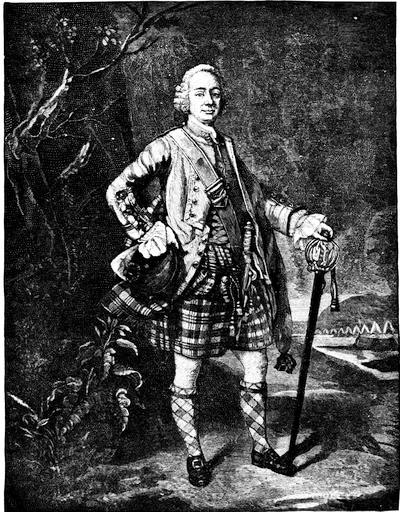
LOUDON.
This follows a painting by Ramsay, engraved by Spooner, which is reproduced in J. C. Smith’s Brit. Mezzotint Portraits, p. 1343.
Shirley, on his part, was preparing to carry out such of the lordly plans which he had suggested at New York as proved practicable. He would repeat the Niagara movement himself, with a hope of better success. For the command in the campaign on Lake Champlain he named Gen. John Winslow, and the New England colonies eagerly furnished the troops.
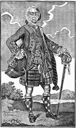
LORD LOUDON.
From a print in the London Magazine, Oct., 1757. Cf. the full-length portrait in Shannon’s N.Y. City Manual, 1869, p. 767, given as a fac-simile of an old print.
The eastern colonies and the Massachusetts governor were not fully aware how the cabal of Johnson and De Lancey, the lieutenant-governor of New York, against Shirley was making head with the home government, and so were not well prepared for the tidings which came in June, while Shirley was in New York, that Colonel Webb, Major-General Abercrombie, and the Earl of Loudon were to be sent over successively to relieve Shirley of the chief command.[1146]
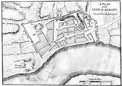
ALBANY.
From A set of plans and forts in America, reduced from actual surveys, 1763, published in London. (Copy in Harvard College library,—5325.67.) A map of the region about Albany and Schenectady, from Sauthier’s map (1779), is given in Pearson’s Schenectady Patent (1883), p. 290. Cf. Mag. of Amer. Hist. Feb., 1886.
While Winslow was employed in pushing forward from Albany his men and supplies, French scouting parties constantly harassed him. Col. Jonathan Bagley was making ready sloops and whale-boats at Lake George; and the English were soon as active as the French in their scouting forays, Capt. Robert Rogers particularly distinguishing himself.
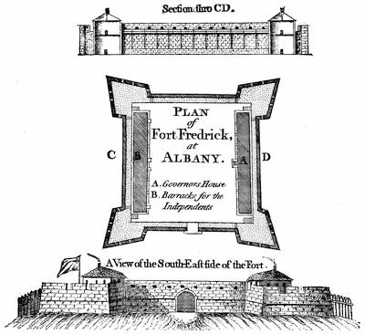
FORT FREDERICK AT ALBANY.
From A set of plans and forts in America, reduced from actual surveys, 1763, published in London. An old view of the fort is given in Holden’s Queensbury, p. 313. There is an early plan of Albany and its fort (1695) in Miller’s Description of the Province and City of New York, of which a fac-simile is given in Weise’s Albany, pp. 257-8. The Catal. of the King’s Maps, i. 13 (Brit. Mus.), shows a MS. plan of Albany of the 18th century. There is a plan dated 1765 in the Annals of Albany, vol. iv. 2d ed.
Mrs. Grant’s Memoirs of an American Lady gives a picture of Albany and its life at this time, which may be compared with the description in Kalm’s Travels. (London, 1771, vol. ii. p. 98; also in Annals of Albany, vol. i. 2d ed., 1869.) Parkman (i. p. 319), who sketches the community from these sources, speaks of Mrs. Grant’s book as “a charming book, though far from being historically trustworthy;” while it affords a “genuine picture of colonial life.” Grahame (United States, ii. 256) considers the picture of manners “entirely fanciful and erroneous.”
Mrs. Grant herself says “I certainly have no intention to relate anything that is not true;” yet it must be remembered that she wrote in 1808, forty years after she, a girl of thirteen, had left the country. The book was published at Edinburgh in 1808; again in 1809, also in New York and in Boston the same year; in London in 1817, and again in New York in 1836 and 1846. The last edition is one printed at Albany in 1876, with notes by Joel Munsell and a memoir by Gen. J. G. Wilson. Cf. Munsell’s Bibliog. of Albany; Lossing’s Schuyler (1872), i. 34; Tuckerman’s America and her Commentators, p. 171.
The most extensive repository of historical data respecting Albany is in Joel Munsell’s Annals of Albany (1850-59), 10 vols. Vol. i. to iv. were issued in a second edition, 1869-71. (See Vol. IV. p. 435.)
Johnson, who had now got his commission as sole Indian superintendent, was busily engaged in conferences with the Six Nations, whom he secured somewhat against their will to the side of the English. He extended his persuasions even to the Delawares and Shawanoes. Some of these tribes were coquetting, however, with Vaudreuil at Montreal, and it was too apparent that nothing but an English success would confirm any Indian alliance.
Shirley also carried out a plan of his own in organizing a body of New England whalemen and boatmen for the transportation service, who, being armed, could dispense with an escort. These were placed under the command of Lieut.-Col. John Bradstreet. In May, before Montcalm’s arrival, a party had been sent by Vaudreuil to cut off the communications of Oswego, and Bradstreet encountered and beat them.
This was the state of affairs in June, 1756, when Abercrombie and Webb arrived with reinforcements, and Pitt was writing in England, “I dread to hear from America.”[1147] Shirley went to New York and received them as well as Loudon, who followed the others on the 23d of July. The new governor proceeded to Albany, and countermanded the orders for the Niagara expedition, and stirred up the New Englanders by promulgating a royal direction which in effect made a provincial major-general subordinate to a regular major.[1148]
Affairs were stagnating in the confusion consequent upon the change of command, and Albany was telling other towns what it was to have foreign officers billeted upon its people. Not till August did some fresh troops set off for Oswego, when apprehension began to be felt for the safety of that post. It was too late. The reinforcement had only reached the carrying place when they heard of the capture of the forts.
Montcalm had suddenly returned from Ticonderoga to Montreal, and had hastened to Niaouré Bay (Sackett’s Harbor), where Villiers was with the force which had escaped Bradstreet’s attack. Here Montcalm gathered about three thousand men, and then appeared without warning before the entrenchments at Oswego. Fort Ontario was soon abandoned by its defenders, and gave Montcalm a place to plant his cannon against the other fort, while he sent a strong force by a ford for an attack on the other bank. Colonel Mercer, the commander, was soon killed by a cannon-shot from Ontario. The enemy’s approach in the rear discouraged the garrison, and they surrendered. Montcalm did what he could to prevent a slaughter of the prisoners, which was threatened when his Indian allies became infuriated by the rum among the plunder.[1149]
While the French were destroying what they could not remove, and were later retiring to Montreal, Webb, who commanded the relief which never came, fell back to German Flats, and orders were sent to Fort William Henry to suspend preparations for a movement down the lake.[1150]
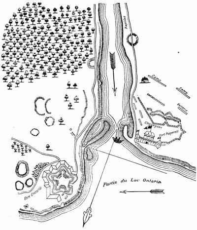
THE FORTS AT OSWEGO.
After a plan in the contemporary Mémoires sur le Canada, 1749-1763, as published in 1838 by the Lit. and Hist. Soc. of Quebec, and (réimpression) 1873, p. 77. It is also reproduced in Dr. Hough’s transl. of Pouchot, i. 65, and in Doc. Hist. of N. York, i. 482.
There was a contemporary English draft of the forts “Ontario and Oswego,” published in the Gentleman’s Mag., 1757, which is reproduced in Dr. Hough’s Pouchot, i. 64, and in the Doc. Hist. N. York, i. 447, 483, where will be found various papers relating to the first settlement and capture of Oswego, 1727-1756.
The Catal. of the King’s Maps (Brit. Mus.), ii. 118, shows a plan made in 1756 for Gov. Pownall, and others of dates 1759, 1760, 1762, 1763, with a view in 1761.
In the New York Col. Docs., ix. p. 996, is what is called a plan of the mouth of the Chouaguen, showing the English redoubt,—an outline sketch found by Brodhead in the Archives de la Marine at Paris. Martin, De Montcalm en Canada, p. 35, gives a plan, “D’après un MS. du dépôt des Colonies” in Paris.
Parkman speaks (Montcalm and Wolfe, i. 416) of the published plans and drawings of Oswego at this time as very inexact. There is a French description of the country between Oswego and Albany, 1757, in Doc. Hist. N. Y., vol. i.; cf. also N. Y. Col. Docs., x. 674. Another map showing the communication between Albany and Oswego is given in Mante’s Hist. of the Late War, London, 1772, p. 60.
A view of Oswego, looking towards the lake between the high banks, appeared in the London Magazine (1760), p. 232. It has been reproduced on different scales in Smith’s Hist. of N. York, 4o, Lond. 1767; Doc. Hist. New York, i. 495; Hough’s transl. of Pouchot, i. 68, Gay’s Pop. Hist. U. S., iii. 49; Clark’s Onondaga, P. 353; The Century, xxviii. 240.
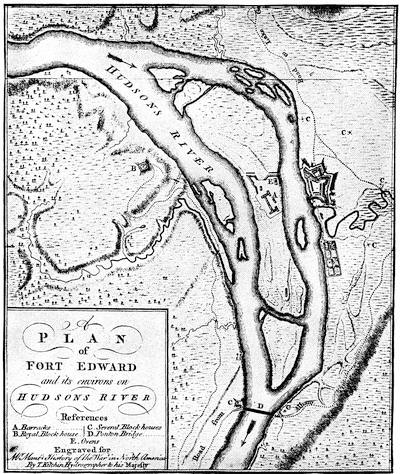
FORT EDWARD.
From Mante’s Hist. of the Late War, London, 1772. The Catalogue of the King’s Maps (Brit. Museum), i. 336, shows various drawn plans of the fort, dated 1755; and another of the same date, marked no. 15,535, is among the Brit. Mus. MSS. John Montresor’s Journal at Fort Edward, in 1757, is in N. Y. Hist. Soc. Coll., 1881, p. 148. He gives a profile of the work (Ibid., p. 36).
Montcalm was soon back at Carillon, watching Winslow’s force at Fort William Henry, while the rest of Loudon’s army was divided between Fort Edward and Albany. Neither opponent moved, and, leaving garrisons at their respective advanced posts, they retired to winter quarters. The regulars were withdrawn to Boston, Philadelphia, and New York; and not a little bad blood was produced by Loudon’s demand for free quarters for the officers.[1151]
The French had the advantage in Indian allies; and during the autumn and winter the forays of the prowling savage and the adventurous scout over the territory neighboring to Lake George and Lake Champlain were checked by the English as best they could. Foremost among their partisans was the New Hampshire ranger, Robert Rogers, whose exploits and those of the Connecticut captain, Israel Putnam, fill a large space in the records of this savage warfare.
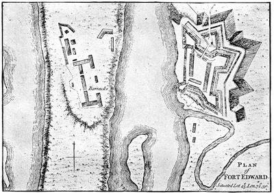
FORT EDWARD.
From A set of plans and forts in America, reduced from actual surveys, 1763, published in London. Cf. the plan in Lossing’s Field-Book of the Revolution, i. p. 95.
The campaign of the next year (1757) opened in March with an attempt to surprise Fort William Henry. The French under Rigaud came up on the ice, 1,600 strong, by night. The surprise failed. They burned, however, two sloops and some bateaux. The next day they summoned Major Eyre, the English commander, but he felt that his four hundred men were enough to hold the fort, and declined to surrender. Rigaud now made a feint of storming the work, but it was only to approach the storehouses, saw-mill, and other buildings outside the entrenchments, which he succeeded in firing, and then withdrew.
Montcalm, when he heard the details, was not over-pleased; and if he had had his way, De Lévis or Bougainville would have led the attack. As it was, Rigaud was a brother of the governor, and Vaudreuil was tenacious of his superiority. The news broke in upon a round of festivities at Montreal, stayed only by Lent. At this season Montcalm prayed, as he had before feasted, with no full recognition of the feelings which Vaudreuil entertained for him. But the minister in France knew it, and he was not, perhaps, so ready to doubt the numbers of the English, exaggerated in Vaudreuil’s report, as he was the prowess of the Canadians in comparison with the timidity of Montcalm and his regulars, which was also reported to him. In Montreal, however, the mutual distrust and dislike of the governor and the general were cloaked with a politeness that was not always successful, when they were apart, in keeping their feelings from their neighbors.
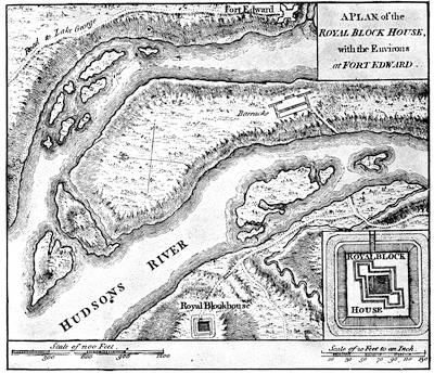
ENVIRONS OF FORT EDWARD.
From A set of plans and forts in America, reduced from actual surveys, 1763, published in London.
Loudon had resolved on attacking Louisbourg, with the aid of a fleet from England.[1152] Withdrawing a large part of the force on the northern frontier, he departed for Halifax, where everything miscarried. But before he returned to New York, crestfallen, the French had profited by his absence.
The English general had left the line of the approach by the lakes from Canada to be watched by Webb, who was at Fort Edward, while Col. Munro, with a small force, held Fort William Henry, at the head of Lake George. This was the most advanced post of the English, and the opportunity for Montcalm had come.
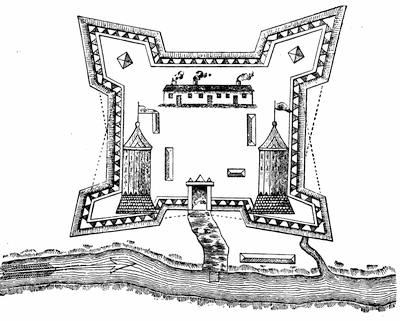
FORT ST. JEAN.
After a plan in the contemporary Mémoires sur le Canada, 1749-1760, as published by the Lit. and Hist. Soc. of Quebec (réimpression), 1873, p. 95. Kalm describes the fort in 1749. Travels, London, 1771, ii. 216.
At Montreal the French general was gathering his Indian allies from points as distant as Acadia and Lake Superior. He pushed forward his commingled forces, and they rallied at Fort St. John on the Sorel. On again they swept in a fleet of bateaux and canoes to Ticonderoga. They were prepared for quick work, and Montcalm set an example by discarding the luxuries of personal equipments.
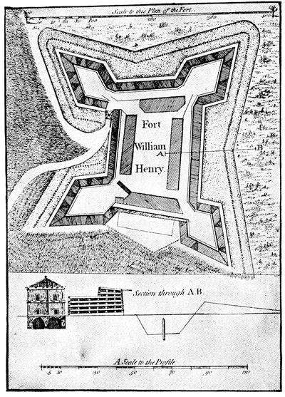
FORT WILLIAM HENRY.
From A set of plans and forts in America, reduced from actual surveys, 1763, published in London. A plan of this fort is in the Brit. Mus. MSS., no. 15,355, and various plans of 1756 and 1757 are noted in the King’s Maps (Brit. Mus.), ii. 475. Plans are also given in Martin’s Montcalm et les dernières années de la colonie Française au Canada, and in Hough’s ed. of Pouchot, p. 48.
A sketch of the fort preserved on a powderhorn is engraved in Stone’s Life of Johnson, i. p. 553, and in Holden’s Queensbury, 306.
At the portage, and before launching his flotilla on Lake George, Montcalm held a grand council, and bound his Indian allies by a mighty belt of wampum. Up the smaller lake the main body now went by boat, but some Iroquois allies led De Lévis, with 2,500 men, along its westerly bank. The force on the lake disembarked under cover of a point of land, which hid them from the English.
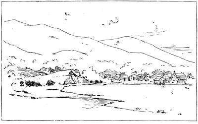
THE SITE OF FORT WILLIAM HENRY, 1851.
From a sketch made in 1851. The fort was on the bluff at the left, now the position of the Fort William Henry hotel. Montcalm’s trenches were where the modern village of Caldwell is built, seen beyond the water. The way to the entrenched camp started along the gravelly beach in the foreground, towards the spectator.
The extent of the demonstration was first made known to Munro when the savages spread out across the lake in their bark canoes. Montcalm soon pushed forward La Corne and De Lévis till they cut the communications of the English with Fort Edward, and then the French general began his approaches from his own encampment. When he advanced his lines to within gun-shot of the ramparts, he summoned the fort. Munro declined to surrender, hoping for relief from Webb; but the timid commander at Fort Edward only despatched a note of advice to make terms. This letter was intercepted by Montcalm, who sent it into the fort, and it induced Munro to agree to a capitulation.
On the 9th of August the English retired to the entrenched camp, and the French entered the fort. Munro’s men were to be escorted to Fort Edward, being allowed their private effects, and were not to serve against the French for eighteen months. Montcalm took the precaution to explain the terms to his Indian allies, and received their seeming assent; but the savages got at the English rum, and, with passions roused, they fell the next day upon the prisoners. Despite all exertions of Montcalm and the more honorable of his officers, many were massacred or carried off, so that the line of march became a disorderly rout, beyond all control of the escort, and lost itself in the woods. Not more than six hundred in a body reached Fort Edward, but many others later straggled in. Another portion, which Montcalm rescued from the clutch of the Indians, was subsequently sent in under a strong escort.
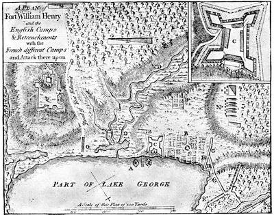
ATTACK ON FORT WILLIAM HENRY.
From A set of plans and forts in America, reduced from actual surveys, 1763, published in London.
Key.—A, dock. B, garden. C, Fort William Henry. D, morass. E, French first battery of nine guns and two mortars. F, French second battery of ten guns and three mortars. G, French approaches. H, two intended batteries. I, landing-place of French artillery. K, Montcalm’s camp, with main body. L, De Lévis’ camp, with regulars and Canadians. M, De la Corne, with Canadians and Indians. N, where the English first encamped. O, bridge over morass. P, English entrenchments, where Fort George later stood.
Cf. the plans in Parkman’s Montcalm and Wolfe, i. 494, and in Palmer’s Lake Champlain, p. 73, based on this, and the reproduction of it in Bancroft’s United States, orig. ed., iv. p. 263. There is a rough contemporary sketch given in J. A. Stoughton’s Windsor Farms, 1884, showing the lines of the attacking force, and endorsed, “Taken Oct. 22, 1757, by John Stoughton.” There is another large plan of the attack preserved in the New York State Library, and this is given in the N. Y. Col. Docs., x. 602. Martin, De Montcalm en Canada, p. 81, gives a “Plan du siège de Fort George [William Henry was often so called by the French] dressé par Fernesic de Vesour le 12 Septembre, 1757,” preserved in the Dépôt des Fortifications des Colonies, no. 516, at Paris.
The French destroyed the fort, throwing the bodies of the slain on the fire which was made of its timber, and, lading their boats with the munitions and plunder, they followed the savages, who had already started on their way to Montreal.
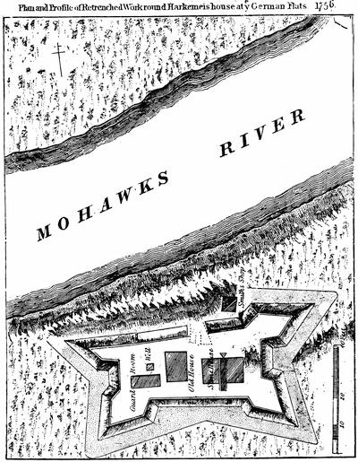
FORT AT GERMAN FLATS.
After a plan in the Doc. Hist. New York, ii. 732. In Benton’s Herkimer County, p. 53, is also a “plan and profile of the entrenched works round Harkemer’s house at ye German Flats, 1756.” Cf. Set of Plans, etc., no. 13.
Loudon reached New York on the last of August,[1153] but he had already heard of the Lake George disaster from a despatch-boat which met him on the way. On landing he learned from Albany that Montcalm had retired. Webb, who was much perplexed with the hordes of militia which all too late began to pour in upon him, was now bold enough to think there was no use of retreating to the passes of the Hudson. The necessity of allowing the Canadians to gather their crops, as well as Montcalm’s inability to transport his cannon, had influenced that general to retreat. At Montreal he learned the stories of the fiendish cruelty practised upon their prisoners by the Indians who had preceded him, and who had not been restrained by Vaudreuil,—so Bougainville said; for the governor’s policy of buying some of the captives with brandy led to the infuriation which wreaked itself on the rest.
The campaign closed in November with an attack on the post at German Flats, a settlement of Palatine Germans, by a scouting body of French and Indians under one of Vaudreuil’s Canadians, Belêtre. Everything disappeared in the havoc, which a detachment sent by Colonel Townshend from Fort Herkimer, not far off, was powerless to check. Before Lord Howe, with a larger force from Schenectady,[1154] could reach the scene, the French had departed.
The winter of 1757-58 at Montreal and Quebec passed with the usual official gayety and bureaucratic peculation. The passions of war were only aroused as occasional stories of rapine and scalps came in from the borders. Good hearty rejoicing took place, however, in March, over the report that a scouting party from Ticonderoga had encountered Rogers, and that the dreaded partisan had been killed and his followers annihilated. The last part of the story was too true, but Rogers had escaped, leaving behind his coat, which he had thrown off in the fray, and in its pocket was his commission, the capture of which had given rise to the belief in his death. Meanwhile, on the English side a new spirit of control was preparing to give unaccustomed vigor to the coming campaign. In England’s darkest hour William Pitt had come to power, thrown up by circumstances. He was trusted in the country’s desperation, and proved himself capable of imparting a momentum that all British movements had lacked since the war began. He developed his plans for America, and made his soldiers and sailors spring to their work. Loudon was recalled. The provincial officer was made the equal of the regular, by conferring upon him the same right of seniority by commission. The whole colonial service felt that they were thereby made equal sharers of the honors as well as of the burdens of the times. Pitt put his finger upon the three vulnerable gaps in the French panoply. He would reach Quebec by taking Louisbourg; and singling out a stubborn colonel who had shown his mettle in Germany, he made him Major-General Amherst, and sent him with a fleet to take Louisbourg, as we may see in another chapter.[1155] Circumstances, or a mischance in judgment, made him retain Abercrombie for the Crown Point campaign, but a better decision named Brigadier John Forbes to attack Fort Duquesne. It belongs to this place to tell the story of these last two campaigns.
In June, Abercrombie had assembled at the head of Lake George a force of 15,000 men, of whom 6,000 were regulars. Montcalm was at Ticonderoga with scarce a quarter as many; but Vaudreuil was tardily sending forward some scant reinforcements under De Lévis. The French general got tidings early in July of the embarkation in England, but had done nothing up to that time to protect his army, which was lying on the peninsula of Ticonderoga, mainly outside the fort. In fact, he was at a loss what to do; no help had reached him, and the approaching army was too numerous to hope for success. He thought of retreating to Crown Point, but some of his principal officers opposed it. He now began a breastwork of logs on the high ground before the fort, and, felling the trees within musket range, he covered the ground with a dense barrier.

All the while, the English were in a heydey of assurance. Pitt was waiting anxiously in London for the first tidings. Abercrombie, now a man of fifty-two years, did not altogether inspire confidence. His heavy build and lethargic temperament made lookers-on call him “aged.” There was, however, a proud expectation of success from the vigorous, companionable Earl Howe, the brigadier next in command, whom Pitt hoped to prove the real commander, because of the trust which Abercrombie put in him. On the 5th of July the immense flotilla, which bore the English army and its train, started down Lake George. To a spectator it completely deadened the glare of the water for miles away. The next morning at daybreak the army was passing Rogers’ Slide, whence a French party under Langy watched them. By noon it had disembarked at the extreme north end of Lake George, and near the river conducting to Ticonderoga they built an entrenchment, to protect their bateaux. Rogers, with his rangers, was sent into the woods to lead the way, while the army followed; but the denseness of the forest soon brought the column into confusion. Meanwhile, the French party under Langy, finding the English had got between them and their main body, endeavored to pass around the head of the English column, and, in doing so, got equally confused in the thickness of the wood, and suddenly encountered that part of the English force where Lord Howe and Major Putnam were. A skirmish ensued, Howe fell,[1156] and the army was practically without a head. Rogers, who was in advance, turned back upon Langy, and few of the Frenchmen escaped.
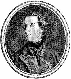
LORD HOWE.
From an engraving in Entick’s Hist. of the Late War, 3d ed., 1765, vol. iii. p. 209. For the impression made by Howe’s character on the colonists, see Mrs. Grant’s American Lady, Wilson’s ed., p. 222.
In the morning Abercrombie withdrew the army to the landing. Bradstreet, with his watermen, having rebuilt the bridges destroyed by the French, the original intention of skirting the river on the west was abandoned, and the army now started to follow the ordinary portage across the loop of the river, which held the rapids. The French had already deserted their positions at either end of this portage. At the northerly end, near a saw-mill, the English general halted his army. He was at one base-corner of the triangular peninsula of which Ticonderoga was the apex. He had now to encounter, not far from the fort, the entrenchment which Montcalm was busily constructing out of the forest-trees which had been laid along its front as by a hurricane. Scorning all measures which might have spared his army great losses, and thoughtless of movements which could have intercepted Montcalm’s reinforcements,[1157] the English general undertook, from the distant mill, to direct repeated assaults in front. His soldiers made a deadly push through the entanglements of the levelled trees and against the barricade, behind which the defenders were almost wholly protected. He could have done nothing to help Montcalm so much. The stores of the French were sufficient for eight days only, and the chief dread of the French general was that Abercrombie would cut his communications with Crown Point.
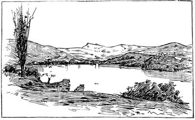
TICONDEROGA, 1851.
After a sketch made in 1851. The ruins of Ticonderoga and the landing-wharf are seen on the right. The high hill on the left is Mount Defiance, on whose side Johnson and his Indians were posted during Abercrombie’s attack. At its base is the outlet leading to Lake George. The ruins in the foreground are a part of Fort Independence.
As it was, De Lévis, with a considerable force, arrived in the night. Sir William Johnson and some Indians opened fire in the morning across the river from the sides of Mount Defiance; but accomplished nothing, and took no further part in the day’s work. About noon the attack began in front, and all day long—now here, now there—the French repelled assaults which showed prodigies of valor and brought no reward. Some rafts, with cannon sent by Abercrombie to enfilade the French line, were driven back by the guns of the fort. At twilight the cruel work ceased. Abercrombie had lost nearly 2,000 men, and Montcalm short of 400.
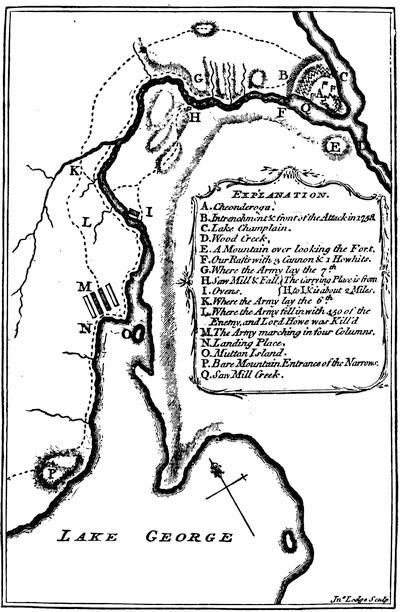
ABERCROMBIE’S ATTACK ON TICONDEROGA, 1758.
From Almon’s Remembrancer, London, 1778, where it is called “Sketch of Cheonderoga or Ticonderoga, taken on the spot by an English officer, in 1759.”
A plan of the approaches and attack by Lieut. Meyer, of the 60th regt., is given in Parkman, ii. p. 94. Cf. other plans in Bancroft, orig. ed. iv.; Palmer’s Lake Champlain, p. 79, etc.
Montcalm was still anxious. He knew that Abercrombie had cannon, and had not used them. The most natural thing in the world for the English general would be to occupy the night in bringing the cannon up. In the morning Montcalm sent out to reconnoitre, and it was found that the English, still 13,000 strong, had reëmbarked, and all the signs showed the great precipitancy of their flight.
The French general could well rejoice, but he exaggerated his enemy’s strength to 25,000 and their losses to 5,000, which last was considerably more than the victor’s whole force.
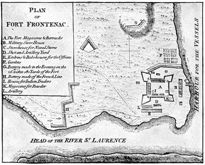
FORT FRONTENAC.
From A set of plans and forts in America, reduced from actual surveys, 1763, published in London. The fort was at the modern Kingston, Canada. There is a view or plan of it in Mémoires sur les affaires du Canada, 1749-60, p. 115.
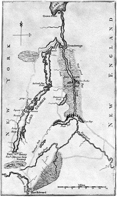
Note.—The annexed map is from Mante’s Hist. of the Late War, Lond., 1772. A map of the lake, from surveys made in 1762, is given in Parkman, i. 285. It is also reproduced in De Peyster’s Wilson’s Orderly Book.
Holden (Hist. Queensbury, 302, 303) mentions several MS. maps of Lake George of this period, preserved in the State Library at Albany. A map of the military roads (1759) from the Hudson to Lake George is given in Ibid., p. 341.
There is in the N. Y. Col. Docs., x. 721, a sketch map copied from an original in the Archives de la Guerre at Paris, called Frontiers du lac St. Sacrement, 1758, 8 Juillet. It shows Lake Champlain from below Crown Point, together with Lake George and the country towards Albany, marking the routes, forts, etc.
Cf. the section giving Lake George in Jefferys’ Map of the most inhabited part of New England, published November 29, 1755, and contained in his General Topography of North America and the West Indies, Lond., 1768, no. 37; and the separate map of Lake George, 1756, in Sayer and Bennet’s American Military Pocket Atlas, 1776. This I suppose to be the survey made in 1756 by Captain Jackson, of which a tracing is given in F. B. Hough’s ed. of Rogers’s journals, Albany, 1883. The map in Gay’s Pop. Hist. U. S., iii. 284, is a modern one.
Views of historic interest on Lake George, by T. A. Richards, are given in Harper’s Mag., vii. 161.
Abercrombie apparently magnified beyond belief an enemy whom he had not seen, and went up the lake in trepidation, lest he should be pursued. Safe on his old camping-ground at the head of the lake, he made haste to entrench himself, while Montcalm, lucky to escape as he did, prepared for a new campaign by rebuilding his lines. So the two armies still watched each other at a safe distance.[1158]
Montcalm for a while tried to harass the English communications with Fort Edward, by sending out his leading partisan, Marin; but Rogers was more than his match, and gave the English general some grains of comfort by his successes. Putnam, however, was captured and carried to Canada. Meanwhile, much greater relief came to the army’s spirits in September when the news of Bradstreet’s success at Fort Frontenac reached them.
A council of war had forced Abercrombie to give Bradstreet 3,000 men, and with these he made his way to Oswego, whence, towards the end of August, his whale-boats and bateaux pushed out upon the lake, and in three days he was before Frontenac. The fort quickly surrendered. Bradstreet levelled it, ruined seven armed vessels, put as much of the plunder as he could carry on two others, and returned to Oswego unmolested. Here he landed his booty, destroyed the vessels, and the French naval power on Ontario was at an end. He began his march for Albany, and, passing the great carrying place where Brigadier Stanwix was building a fort for the protection of the valley, left there a thousand men for its garrison. In October Amherst came overland from Boston, with some of his victorious regiments from Louisbourg. It was too late for further campaigning; and each side left garrisons at their camps, and retired to winter quarters.
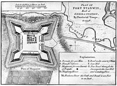
FORT STANWIX.
From A set of plans and forts in America, reduced from actual surveys, 1763, published in London. The Catal. of the King’s Maps (Brit. Mus.), ii. 354-55, shows drawn plans (1758, 1759, 1764) of Fort Stanwix, built by I. Williams, engineer.
A large map of the neighborhood of Fort Stanwix is in the Doc. Hist. New York (iv. p. 324), with a plan of the fort itself (p. 327), accompanied by a paper on the history of the fort. A map of the siege of the fort, presented to Col. Gansevoort by L. Flury, is given with a plan of the modern city of Rome superposed, in Dr. Hough’s ed. of Pouchot, i. 207. Cf. the chapter on Fort Schuyler (Stanwix) in Bogg’s Pioneers of Utica, 1877. The fort was originally called Fort Williams. It was begun on July 23, 1758, by Brig.-Gen. John Stanwix. Cf. note on Stanwix in N. Y. Col. Docs., vii. 280.
There is in Harvard College library a copy of a MS. journal of Ensign Moses Dorr, from May 25 to Oct. 28, 1758, including an account of the building of Fort Stanwix. The original MS. was in 1848 in the possession of Lyman Watkins, of Walpole, N. H.]
The destruction of Frontenac and the French fleet on Ontario had cut off Fort Duquesne from its sources of supply, and to the substantial, if not brilliant, success of Brigadier John Forbes[1159] we must now turn. It is a story of a stubborn Scotch purpose. Forbes had no dash, and purposely dallied with the forming and marching of his army to weary the Indian allies of the French, and to secure time to gain over all of the savages that he could. The English general got upon his route by June, but soon fell sick, and was carried through the marches in a litter; but he breasted every discomfort and harassing complexity of the details, which he had to manage almost in every particular, with a courage that might have done credit to a man in vigor. He had made up his mind to open a new road over the mountains more direct than Braddock’s. Lieutenant-Colonel Henry Bouquet, a Swiss officer of the Royal Americans, sustained him in this purpose; but Washington argued for the older route,—not without inciting some distrust, for Forbes was not blind to the rival interests of Pennsylvania and Virginia, and suspected that Washington was influenced by a greater loyalty for his colony than for the common cause.
Forbes did not fail, however, to recognize the young Virginian’s merit in the kind of warfare which was before them; and there exists in Washington’s hand a plan of a line of march for forces in a forest, with diagrams for throwing the line into order of battle, which Forbes had requested him to make.[1160] Braddock’s defeat was not lost on Forbes, and in his marches and preparations he availed himself of all the arts of woodcraft and partisanship which Washington could teach him. He did not, nevertheless, have a very high opinion of the provincials in his train, and, with the exception of some of their higher officers, they were, no doubt, a sorry set. As he pushed on he established fortified posts for supplies; but all the help he ought to have got from his quartermaster-general, Sir John Sinclair, stood him in poor stead, for that officer was “a very odd man,” and only added to his general’s perplexities. The advice of Washington about taking the other route had so far unsettled Forbes’s faith in him, that, though he told his subordinates among the advance to consult with the Virginia colonel, it might not be best, he suggested, to follow his advice. While the march went on he had little success in attaching some Cherokees and Catawbas, for they stayed no longer than the gifts held out. An occasional scout brought him intelligence of the enemy, and he felt that their numbers were not great, and that the weariness of delays would drive the Indian allies of the French into desertion,—as it did.
At Raystown he built Fort Bedford, to protect his supplies, and pushed on to Loyalhannon[1161] Creek, and there founded his last depot, fifty miles away from Duquesne.
In August Forbes was planning for a general convention with the Indians at Easton. The treaty of the previous year had secured the Delawares and Shawanoes, and a further conference had been held with them in April.[1162] Sir William Johnson was bullied, as Forbes says, into bringing into the compact the eastern tribes of the Six Nations, while other influences induced the Senecas and the western tribes also to join, despite the labors of Joncaire to retain them in the French interests. The chief difficulty was to inspire the Ohio Indians with a distrust of the French; while the failure of French presents, thanks to British cruisers on the ocean, was beginning to dispose them for a change. A Moravian brother, Christian Frederick Post, was sent to the tribes on a hazardous mission, and his confidence and fearlessness carried him through it alive; for he had to confront French officers at the conferences, one of which was held close by Fort Duquesne. As a result of his mission, the convention of the allied tribes which met the English at Easton in October decided confidently to send a wampum belt, in the name of both the whites and the red men, to the Ohio Indians, and Post, with an escort, was commissioned to bear it, the party setting out from Loyalhannon. It became a struggle for persuasion between the English messenger and a French officer, who again confronted Post and offered the Indians a belt of wampum of his own. The French won the young warriors; but Post impressed the sages of the Indian councils, and the old men carried the day. The overtures of peace from the English were accepted, and this happened notwithstanding that the garrison of Duquesne had but just badly used a reconnoitring party of the English under Major Grant, of the Scotch Highlanders.
It was a success of forest diplomacy that encouraged and rendered despondent the respective sides. The French scouting parties were hanging about Loyalhannon, while the little army at Duquesne kept dwindling under the prospect of famine, now that Bradstreet’s raid on Frontenac had checked their supplies. A rough and weltering October made the bringing up of provisions very difficult for the English, and their weakening general found his time, on his litter, disagreeably spent, as he says, “between business and medicine;” but in early November he himself reached Loyalhannon. He would have stopped here for winter quarters, but scouts brought in word that the French were defenceless; so a force was hurriedly pushed forward in light order, which, when it reached Turkey Creek, heard a heavy boom to the west. It was the explosion of the French mines, as the garrison of Duquesne blew up the fort and fled.
Forbes hutted a portion of his troops within a stockade, which he called Pittsburg, and early in December began his march eastward. The debilitated general reached Philadelphia, but died in March. Few campaigns were ever conducted so successfully from a litter of pain.
The winter of 1758-59 was an unquiet one in Canada. Vaudreuil and Montcalm disputed over the results of the last campaign, and the governor was doing all he could to make the home government believe that Montcalm neither deserved, nor could profit by, success. All his intrigue to induce the general’s recall only resulted in the ministry sending him orders to defer to Montcalm in all matters affecting the war.
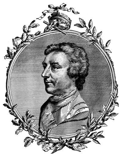
GENERAL AMHERST.
From an engraving in John Knox’s Historical Journal of the Campaigns in North America (1757-60). London, 1769. There is also an engraving in Entick’s Hist. of the Late War, iv. 129.
Reynolds painted three likenesses of Amherst, and sketched a fourth one, begun May, 1765, and finished February, 1768, which gave his army in the background, passing the rapids of the St. Lawrence. This was engraved in mezzotint by James Watson. (Hamilton’s Engraved Works of Reynolds, pp. 1, 163; J. C. Smith’s Brit. Mezzotint Portraits, London, 1878-83, iii. 1008, and iv. 1488; Mass. Hist. Soc. Proc., vii. 101; Catal. Cab. M. H. Soc., p. 45.) Amherst was born in 1717, and died in 1797.
There was never more need of strong counsel in Canada. The gasconade of Vaudreuil had reached the limit of its purpose. The plunder by officials, both of the people and of the king, was an enormity that could not last much longer. It seemed to the wisest that food and reinforcements, and those in no small amounts, could alone save Canada, unless, indeed, some kind of a peace could be settled upon in Europe. To claim help and to learn, Bougainville and Doreil were sent to France. Nothing they said could gain much but what was easily given,—promotion in rank to Montcalm and the rest. They represented that the single purpose which now animated the English colonies was quite a different thing from the old dissensions among them, the existence of which had favored the French in the past. The demand in Europe was, however, inexorable; and all that France could promise was a few hundred men and a campaign’s supplies of munitions.
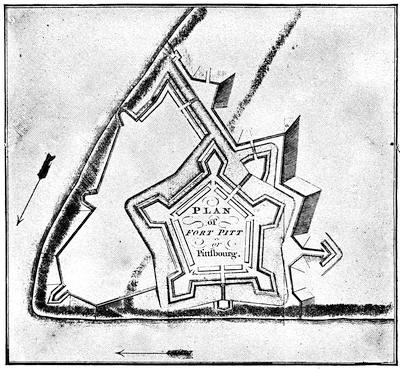
FORT PITT OR PITTSBOURG.
From Mante’s Hist. of the Late War, London, 1772, p. 158. Cf. also the plan in Egle’s Pennsylvania, p. 98; and the corner sketch of the plate in Bancroft, United States (orig. ed.), iv. 189.
In the spring of 1759 Bougainville came back with the little which was precious to those who had nothing, as Montcalm said. But the returning soldier brought word of the great fleet which England was fitting out to attack Quebec, and that fifty thousand men would constitute the army with which Canada was to be invaded. Vaudreuil could hardly count twenty thousand men to meet it, and to do this he had to reckon the militia, coureurs de bois, and Indians. If the worst came, Montcalm thought he could concentrate what force he had, and retreat by way of the Ohio to the Mississippi, and hold out in Louisiana.[1163]
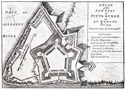
NEW FORT AT PITTSBURGH.
From A set of plans and forts in America, reduced from actual surveys, 1763, published in London.
On the English side matters looked encouraging. Amherst, a sure and safe soldier, without any dash, was made commander-in-chief, and was to direct in person the advance over the old route from Lake George,[1164] while at the same time he took measures to reëstablish Oswego and reinforce Duquesne. To the latter point General Stanwix was sent, where in the course of the summer he laid out and strengthened a new fort, called after the prime minister. Fort Pitt was not, however, wholly secure till success had followed Brigadier Prideaux’s expedition to Niagara, the reduction of which was also a part of Amherst’s plans. Prideaux seated Haldimand at Oswego, and made good its communications with the Mohawk Valley. It was an open challenge to the French, and after Prideaux had proceeded to Niagara, Saint-Lac de la Corne came down with a force from the head of the St. Lawrence rapids to attack Haldimand, but the English cannon sent the French scampering to their boats, and the danger was over.
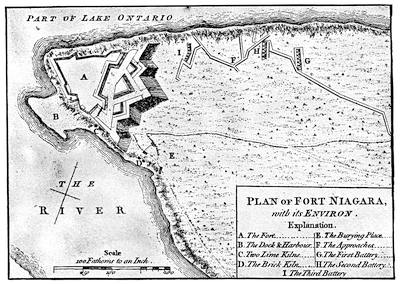
FORT NIAGARA.
From A set of plans and forts in America, reduced from actual surveys, 1763, published in London. This same plan is given in Doc. Hist. N. Y., ii, p. 868, and in Hough’s edition of Pouchot’s History of the Late War, ii. p. 153. There is another plan on a large scale, showing less of the neighboring ground, in the latter book, i. p. 161, and in N. Y. Col. Docs., x. p. 976.
A plan of Fort Niagara, 1759, is noted among the Brit. Mus. MSS., no. 15,535; and in the King’s Maps, ii. 92, are plans of the fort dated 1766, 1768, 1769, 1773, and a view of the falls in 1765.
O’Callaghan, in the Doc. Hist. of New York, ii. 793, gives a map of the Niagara River, 1759, showing the landing place of Prideaux and the path around the cataract. For the track of the Niagara portage, see O. H. Marshall’s “Niagara Frontier,” in Buffalo Hist. Soc. Publ., ii. 412-13.
At Niagara, in the angle formed by the lake and the Niagara River, stood the strong fort which Pouchot had rebuilt. It had a dependency[1165] some distance above the cataract, commanded by Joncaire; but that officer withdrew from this outwork on the approach of Prideaux, and reinforced the main work. It was the same Joncaire who had formerly resisted successfully, but of late less so, the efforts of Johnson to secure the alliance to the English of the Senecas and the more westerly tribes of the Six Nations; and now Johnson with a body of braves was in Prideaux’s camp. The English general advanced his siege lines, and had begun to make breaches in the walls of the fort, when new succor for the French approached. Their partisan leaders at the west had gathered such bushrangers and Indians as they could from Detroit and the Illinois country, and were assembling at Presquisle and along the route to the Monongahela for a raid on the English there, in the hopes of recapturing the post. They got word from Pouchot of his danger, and immediately marched to his assistance, under Aubry and Ligneris.
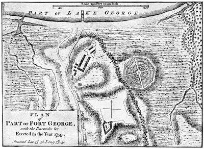
FORT GEORGE.
From A set of plans and forts in America, reduced from actual surveys, 1763, published in London. This plan is reproduced in De Costa’s Hist. of Fort George. For the ruins of the fort and the view from them, see the cuts in Lossing’s Field-Book of the Rev., i. 112; and Scribnner’s Monthly, Mar., 1879, p. 620.
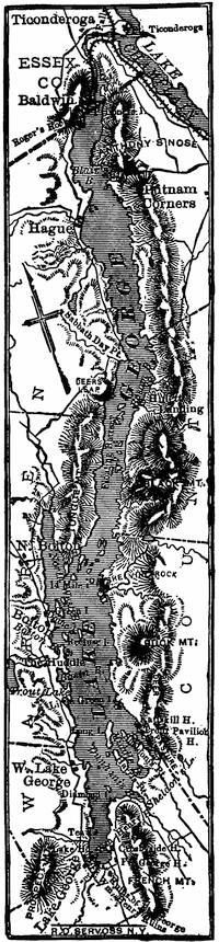
LAKE GEORGE.
Early in the siege, Prideaux had been killed by the bursting of one of his own shells, and the command fell on Johnson, who now went with a part of his force to meet the new-comers, already showing themselves up the river. He beat them, and captured some of their principal officers, while those who survived led the panic-stricken remainder to their boats above the cataract. Thence they fled to Presquisle, which they burned. Here the garrisons of LeBœuf and Venango joined them, and the fugitives continued on to Detroit, leaving the Upper Ohio without a fighting Frenchman to confront the English.
On the same day of the defeat, negotiations for a surrender of Fort Niagara began, and Pouchot, being convinced of the reverses which his intending succorers had experienced, finally capitulated. Johnson succeeded in preventing any revengeful onset of his Indians, who had not forgotten the massacre of William Henry.
The extreme west of Canada was now cut off from the central region, which was threatened, as we shall see, by Amherst and Wolfe, and Vaudreuil could have little hope of preserving it. To press this centre on another side, Amherst now sent General Thomas Gage to succeed Johnson in the command of the Ontario region, and, gathering such troops as could be spared from the garrisons, to descend the St. Lawrence and capture the French post at the head of the rapids. Gage had little enterprise, and was not inclined to undertake a movement in which dash must make up for the lack of men, and he reported back to Amherst that the movement was impossible.
When this disappointment came to the commander-in-chief he was at Crown Point,—but we must track his progress from the beginning.
At the end of June, Amherst had at Lake George about 11,000 men, one half regulars. He set about the campaign cautiously. He had fortified new posts in his rear, and began the erection of Fort George at the head of the lake, of which only one bastion was ever finished. On the 21st of July he embarked his army on the lake, and, landing at the outlet, he followed the route of Abercrombie’s approach to Ticonderoga during the previous year. The disparity of the opposing armies was much like that when Montcalm so successfully defended that post; but Bourlamaque, who now commanded, had orders to retire, and was making his arrangements. Amherst brought up his cannon, and protected his men behind the outer line of entrenchments, which Bourlamaque had abandoned. On the night of the 23d, Bourlamaque escaped down the lake, but a small force under Hebecourt still held the fort, which kept up a show of resistance till the evening of the 26th, when the remaining French, leaving a match in the magazine, also fled. In the night one bastion was hurled to the sky, and the barracks were set on fire.
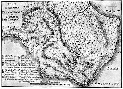
TICONDEROGA.
From A set of plans and forts in America, reduced from actual surveys, 1763, published in London. Various plans and views are noted in the Catal. of the King’s Maps (Brit. Mus.), ii. 395. Cf. plans in Palmer’s Lake Champlain, 85; Lossing’s Field-Book of the Rev., i. 118, and views and descriptions of the ruins in Lossing, i. 127, 131; Watson’s County of Essex, 112. Lieut. Brehm’s description of the fort after its capture is in the N. E. Hist. and Geneal. Reg., 1883, p. 21.
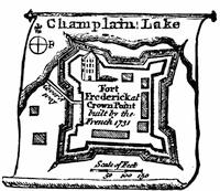
CROWN POINT.
From a small vignette on a map by Kitchin of the Province of New York, in the London Magazine, Sept., 1756. There is a similar map in the Gentleman’s Mag., vol. xxv. p. 525.
Various MS. plans and views of Crown Point are noted in the Catal. of the King’s Maps (Brit. Mus.), i. 277, under date of 1759. The Brinley Catal., ii. 2,939, shows a MS. “Plan of Crown Point Fort, March, 1763,” on a scale of 90 feet to the inch.
There was published in Boston in 1762 a Plan of a part of Lake Champlain and the large new fort at Crown Point, mounting 108 cannon, built by Gen. Amherst. (Haven’s Bibliog., in Thomas, ii. p. 560.) Cf. the plans, nos. 24, 25, in Set of plans, etc. (London, 1763).
For the ruins of Crown Point, see Lossing, Field-Book of the Revolution, i. 150-152; Watson’s County of Essex, pp. 104, 112. These are a part, however, of the fort built by Amherst. Kalm describes the previous fort (Travels, London, 1771, ii. 207), and it is delineated in Mémoires sur les affaires du Canada, p. 53.
Amherst began to repair the works, with his army now succumbing somewhat to the weather,[1166] and was about advancing down the lake, when scouts brought in word that Bourlamaque had also abandoned Crown Point. So Amherst again advanced. He knew nothing of the progress Wolfe was making in his attack on Quebec by water, but he did know that it was a part of Pitt’s plan that success on Lake Champlain should inure to Wolfe’s advantage, and this could only be brought about by an active pursuit of the enemy down the lake. Amherst was, however, not a general of the impetuous kind, and believed beyond all else in securing his rear. So he began to build at Crown Point the new fort, whose massive ruins are still to be seen, and sent out parties to open communication with the Upper Hudson on the west and with the Connecticut River on the east.
The French, as he knew, were strongly posted at Isle-aux-Noix, in the river below the lake, and they had four armed vessels, which would render dangerous any advance on his part by boat. So Captain Loring, the English naval commander, was ordered to put an equal armament afloat for an escort to his flotilla.
Bourlamaque, meanwhile, was confident in his position, for he knew that, in addition to his own strength, Lévis had been sent up to Montreal with 800 men to succor him, if necessary, and all the militia about Montreal was alert.
Amherst, on his part, was anxious to know how the campaign was going with Wolfe. In August he sent a messenger with a letter by the circuitous route of the Kennebec, which Wolfe received in about a month, but it helped that general little to know of the building going on at Crown Point. Amherst then tried to pass messengers through the Abenaki region, but they were seized. Upon this, Major Rogers was sent with his rangers to destroy the Indian village of St. Francis, which he did, and then, to elude parties endeavoring to cut him off, he retreated by Lake Memphremagog to Charlestown, on the Connecticut, enduring as he went the excruciating horrors of famine and exhaustion.
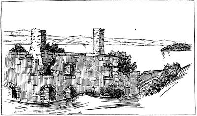
CROWN POINT, 1851.
From a sketch made in 1851, showing in the foreground a slope of the embankment, with part of the ruins of the barracks, the lake beyond, looking to the north.
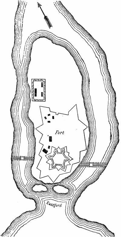
ISLE-AUX-NOIX.
After a plan in the contemporary Mémoires sur le Canada, 1749-1760, as published by the Lit. and Hist. Soc. of Quebec (réimpression), 1873, p. 154. See the view in Lossing’s Field-Book of the Rev., i. 167.
It was near the middle of October when Loring pronounced the armed vessels ready, and Amherst embarked; but the autumn gales soon convinced him that the risks of the elements were too great to be added to those of the enemy, and after his demonstration had caused the destruction of three of the enemy’s vessels, and one had reached their post on the Richelieu River, the English general, still ignorant of Wolfe’s luck, withdrew to Crown Point, and gave himself to the completion of its fortress.
We must now turn to the most brilliant part of the year’s work. This was the task assigned to General Wolfe, who had already shown his quality in the attack on Louisbourg the previous year.[1167] Late in May he was at Louisbourg, with his army under three brigadiers, Monckton, Townshend, and Murray, and the fleet of Saunders, who had come direct from England, combined with that of Holmes, who had been first at New York to take troops on board. A third fleet under Durell was cruising in the gulf to intercept supplies for Quebec, but that officer largely failed in his mission, for all but three of the French supply ships eluded him, and by the 6th of June, when the last of Wolfe’s fleet sailed out of Louisbourg, Quebec had received all the succor that was expected.
The French had done their best to be prepared for the blow. Their entire force at Quebec was congregated in the town defences and in a fortified camp, which had been constructed along the St. Lawrence, beginning at the St. Charles, opposite Quebec, and extending to the Montmorenci, and on this line about 14,000 men, beside Indians, manned the entrenchments. A bridge connected the camp with Quebec, and a boom across the St. Charles at its mouth was intended to stop any approaches to the bridge by boats; while earthworks along the St. Charles formed a camp to fall back upon in case the more advanced one was forced. Beside the 106 cannon mounted on the defences of the city, there were gun-boats and fire-ships prepared for the moment of need. In the town the Chevalier de Ramezay commanded a garrison of one or two thousand men. Montcalm had his headquarters[1168] in the rear of the centre of the entrenched line along the St. Lawrence, and Vaudreuil’s flag was flying nearer the St. Charles.