Chapter VII
Reading edition
THE WARS ON THE SEABOARD: THE STRUGGLE IN ACADIA AND CAPE BRETON.
BY CHARLES C. SMITH,
Treasurer of the Massachusetts Historical Society.
ALL through its early history Acadia, or Nova Scotia, suffered from the insecurity to life and property which arose from its repeated changes of masters. Neither France nor England cared much for a region of so little apparent value; and both alike regarded it merely as debatable ground, or as a convenient make-weight in adjusting the balance of conquests and losses elsewhere. Nothing was done to render it a safe or attractive home for immigrants; and at each outbreak of war in the Old World its soil became the scene of skirmishes and massacres in which Indian allies were conspicuous agents. Whatever the turn of victory here, little regard was paid to it in settling the terms of peace. There was hardly an attempt at any time to establish a permanent control over the conquered territory. In spite of the capture of Port Royal by Phips in 1690, and the annexation of Acadia to the government of Massachusetts in 1692, it was only a nominal authority which England had. In 1691, the French again took formal possession of Port Royal and the neighboring country. In the next year an ineffectual attempt was made to recover it; and this was followed by various conflicts, of no historical importance, in different parts of this much-harassed territory. In August, 1696, the famous Indian fighter, Captain Benjamin Church, left Boston on his fourth eastern expedition. After skirting the coast of Maine, where he met with but few Indians and no enemies, he determined to proceed up the Bay of Fundy. There he captured and burned Beaubassin, or Chignecto, and then returned to St. John. Subsequently he was superseded by Colonel John Hathorne, a member of the Massachusetts council, and an attack was made on the French fort at Nachouac, or Naxoat, farther up the river; but for some unexplained reason the attack was not pressed, and the English retreated shortly after they landed. “No notice,” says Hutchinson in his History of Massachusetts Bay, “was taken of any loss on either side, except the burning of a few of the enemy’s houses; nor is any sufficient reason given for relinquishing the design so suddenly.”[889] By the treaty of Ryswick in the following year (1697) Acadia was surrendered to France.
The French were not long permitted to enjoy the restored territory. In May, 1704, Church was again placed in command of an expedition fitted out at Boston against the French and Indians in the eastern country. He had been expressly forbidden to attack Port Royal, and after burning the little town of Mines nothing was accomplished by him. Three years later, in May, 1707, another expedition, of one thousand men, sailed from Boston under command of Colonel March. Port Royal was regularly invested, and an attempt was made to take the place by assault; but through the inefficiency of the commander it was a total failure. Reëmbarking his little army, March sailed away to Casco Bay, where he was superseded by Captain Wainwright, the second in command. The expedition then returned to Port Royal; but in the mean time the fortifications had been diligently strengthened, and after a brief view of them Wainwright drew off his forces. In 1710 a more successful attempt for the expulsion of the French was made. In July of that year a fleet arrived at Boston from England to take part in a combined attack on Port Royal. In pursuance of orders from the home government, four regiments were raised in the New England colonies, and sailed from Boston on the 18th of September. The fleet numbered thirty-six vessels, exclusive of hospital and store ships, and on board were the four New England regiments, respectively commanded by Sir Charles Hobby, Colonel Tailer, of Massachusetts, Colonel Whiting, of Connecticut, and Colonel Walton, of New Hampshire, and a detachment of marines from England. Francis Nicholson, who had been successively governor of New York, Virginia, and Maryland, had the chief command. The fleet, with the exception of one vessel which ran ashore and was lost, arrived off Port Royal on the 24th of September. The garrison was in no condition to resist an enemy, and the forces were landed without opposition. On the 1st of October three batteries were opened within one hundred yards of the fort; and twenty-four hours afterward the French capitulated. By the terms of the surrender the garrison was to be transported to France, and the inhabitants living within cannon-shot of Port Royal were to be protected in person and property for two years, on taking an oath of allegiance to the queen of England, or were to be allowed to remove to Canada or Newfoundland.[890] The name of Port Royal was changed to Annapolis Royal in compliment to the queen, and the fort was at once garrisoned by marines and volunteers under the command of Colonel Samuel Vetch, who had been selected as governor in case the expedition should prove successful. Its whole cost to New England was upward of twenty-three thousand pounds, which sum was afterward repaid by the mother country. Acadia never again came under French control, and by the treaty of Utrecht (1713) the province was formally ceded to Great Britain “according to its ancient limits.” As a matter of fact, those limits were never determined; but the question ceased to have any practical importance after the conquest of Canada by the English, though it was reopened long afterward in the boundary dispute between Great Britain and the United States.
By the treaty of Utrecht, France was left in undisputed possession of Cape Breton; and in order to establish a check on the English in Nova Scotia, the French immediately began to erect strong fortifications at Louisbourg, in Cape Breton, and invited to its protection the French inhabitants of Acadia and of Newfoundland, which latter had also been ceded to Great Britain. Placentia, the chief settlement in Newfoundland, was accordingly evacuated, and its inhabitants were transferred to Cape Breton; but such great obstacles were thrown in the way of a voluntary removal of the Acadians that very few of them joined their fellow countrymen. They remained in their old homes, to be only a source of anxiety and danger to their English masters. At the surrender of Acadia to Great Britain, it was estimated by Colonel Vetch, in a letter to the Board of Trade, that there were about twenty-five hundred French inhabitants in the country; and even at that early date he pointed out that their removal to Cape Breton would leave the country entirely destitute of inhabitants, and make the new French settlement a very populous colony, “and of the greatest danger and damage to all the British colonies, as well as the universal trade of Great Britain.”[891] Fully persuaded of the correctness of this view, the successive British governors refused to permit the French to remove to Canada or Cape Breton, and persistently endeavored to obtain from them a full recognition of the British sovereignty. In a single instance—in 1729—Governor Phillips secured from the French inhabitants on the Annapolis River an unconditional submission; but with this exception the French would never take the oath of allegiance without an express exemption from all liability to bear arms. It is certain, however, that this concession was never made by any one in authority; and in the two instances in which it was apparently granted by subordinate officers, their action was repudiated by their superiors. The designation “Neutral French,” sometimes given to the Acadians, has no warrant in the recognized facts of history.
Meanwhile the colony remained almost stationary, and attracted very little notice from the home government. In August, 1717, General Richard Phillips was appointed governor, which office he retained until 1749, though he resided in England during the greater part of the time. During his absence the small colonial affairs were successively administered by the lieutenant-governor of Annapolis, John Doucette, who held office from 1717 to 1726,[892] and afterward by the lieutenant-governors of the province, Lawrence Armstrong (1725-1739) and Paul Mascarene (1740-1749). Phillips was succeeded by Edward Cornwallis; but Cornwallis held the office only about three years, when he resigned, and General Peregrine Thomas Hopson was appointed his successor. On Hopson’s retirement, within a few months, the government was administered by one of the members of the council, Charles Lawrence, who was appointed lieutenant-governor in 1754, and governor in 1756.
In 1744 war again broke out between England and France, and the next year it was signalized in America by the capture of Louisbourg. Immediately on learning that war had been declared, the French commander despatched a strong force to Canso, which captured the English garrison at that place and carried them prisoners of war to Louisbourg. A second expedition was sent to Annapolis for a similar purpose, but through the prompt action of Governor Shirley, of Massachusetts, it failed of success. Aroused, no doubt, by these occurrences, Shirley formed the plan of capturing Louisbourg; and early in January, 1745, he communicated his design to the General Court of Massachusetts, and about the same time wrote to Commodore Warren, commanding the British fleet in the West Indies, for coöperation. His plans were favorably received, not only by Massachusetts, but also by the other New England colonies. Massachusetts voted to raise 3,250 men; Connecticut 500; and New Hampshire and Rhode Island each 300. The chief command was given to Sir William Pepperrell, a wealthy merchant of Kittery in Maine, of unblemished reputation and great personal popularity; and the second in command was Samuel Waldo, a native of Boston, but at that time also a resident of Maine.[893] The chief of artillery was Richard Gridley, a skilful engineer, who, in June, 1775, marked out the redoubt on Bunker Hill. The undertaking proved to be so popular that the full complement of men was raised within two months. The expedition consisted of thirteen armed vessels, under the command of Captain Edward Tyng, with upward of two hundred guns, and of about ninety transports. They were directed to proceed to Canso, where a block house was to be built, the stores landed, and a guard left to defend them. The Massachusetts troops sailed from Nantasket on the 24th of March, and reached Canso on the 4th of April. The New Hampshire forces had arrived four days before; the Connecticut troops reached the same place on the 25th. Hutchinson adds, with grim humor, “Rhode Island waited until a better judgment could be made of the event, their three hundred not arriving until after the place had surrendered.”[894]
The works at Louisbourg had been twenty-five years in construction, and though still incomplete had cost between five and six millions of dollars. They were thought to be the most formidable defences in America, and covered an area two and a half miles in circumference. A space of about two hundred yards toward the sea was left without a rampart; but at all other accessible points the walls were from thirty to thirty-six feet in height, with a ditch eighty feet in width. Scattered along their line were six bastions and three batteries with embrasures for one hundred and forty-eight cannon, of which only sixty-five were mounted, and sixteen mortars. On an island at the entrance of the harbor was a battery mounted with thirty guns; and directly opposite the entrance of the harbor was the grand battery, mounting twenty-eight heavy guns and two eighteen-pounders. The entrance to the town on the land-side was over a draw-bridge defended by a circular battery mounting sixteen cannon. It was these strong and well-planned works which a handful of New England farmers and fishermen undertook to capture with the assistance of a small English fleet.
Pepperrell was detained by the ice at Canso for nearly three weeks, at the end of which time he was joined by Commodore Warren with four ships, carrying one hundred and eighty guns. The combined forces reached Gabarus Bay, the place selected for a landing, on the morning of the 30th of April; and it was not until that time that the French had any knowledge of the impending attack. Two days later the grand battery fell into Pepperrell’s hands through a fortunate panic which seized the French. Thus encouraged, the siege was pressed with vigor under very great difficulties. The first battery was erected immediately on landing, and opened fire at once; but it required the labor of fourteen nights to draw all the cannon and other materials across the morass between the landing-place and Louisbourg, and it was not until the middle of May that the fourth battery was ready. On the 18th of May, Tyng in the “Massachusetts” frigate captured a French ship of sixty-four guns and five hundred men, heavily laden with military stores for Louisbourg. This success greatly raised the spirits of the besiegers, who, slowly but steadily, pushed forward to the accomplishment of their object. Warren’s fleet was reinforced by the arrival of three large ships from England and three from Newfoundland; the land-gate was demolished; serious breaches were made in the walls; and by the middle of June it was determined to attempt a general assault. The French commander, Duchambon, saw that further resistance would be useless, and on the 16th he capitulated with the honors of war, and the next day Pepperrell took possession of Louisbourg.
By the capitulation six hundred and fifty veteran troops, more than thirteen hundred militia, and other persons, to the number in all of upward of four thousand, agreed not to bear arms against Great Britain during the war, and were transported to France in fourteen ships. Seventy-six cannon and mortars fell into the hands of the conquerors, with a great quantity of military stores and provisions. The number killed on the side of the French was three hundred, and on the side of the English one hundred and thirty; but subsequently the latter suffered heavily by disease, and at one time so many as fifteen hundred were sick from exposure and bad weather. Tidings of the victory created great joy in New England, and the news was received with no small satisfaction in the mother country. Pepperrell was made a baronet, Warren an admiral, and both Shirley and Pepperrell were commissioned as colonels. Subsequently, after a delay of four years, Great Britain reimbursed the colonies for the expenses of the expedition to the amount of £200,000.
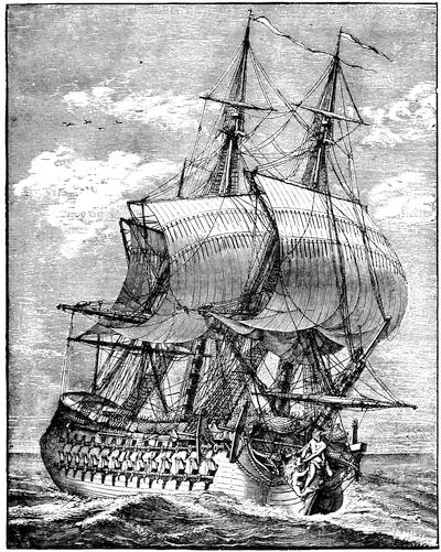
A FRENCH FRIGATE.
[After a cut in Paul Lacroix’s XVIIIme Siècle, p. 129.—Ed.]
The capture of Louisbourg was by far the most important event in the history of Nova Scotia during the war, and the loss of so important a place was a keen mortification to France. As soon as news of the fall of Louisbourg reached the French government, steps were taken with a view to its recapture and to the punishment of the English colonists by destroying Boston and ravaging the New England coast. In June, 1746, a fleet of eleven ships of the line, twenty frigates, thirty transports, and two fire-ships was despatched for this purpose under command of Admiral D’Anville; but the enterprise ended in a disastrous failure. Contrary winds prevailed during the voyage, and on nearing the American coast a violent storm scattered the fleet, driving some of the ships back to France and others to the West Indies, and wrecking some on Sable Island. On the 10th of September D’Anville cast anchor with the remaining vessels—two ships and a few transports—in Chebucto; and six days later he died, of apoplexy, it is said. At a council of war held shortly afterward it was determined to attack Annapolis, against the judgment of Vice-Admiral D’Estournelle, who had assumed the command. Exasperated, apparently, at this decision, he committed suicide in a fit of temporary insanity. This second misfortune was followed by the breaking out of the small-pox among the crews; and finally after scuttling some of the vessels the officer next in command returned to France without striking a single blow. In the spring of the following year another expedition, of smaller size, was despatched under command of Admiral De la Jonquiere; but the fleet was intercepted and dispersed off Cape Finisterre by the English, who captured nine ships of war and numerous other vessels.
Meanwhile, and before the capture of Louisbourg, the French had made an unsuccessful attempt on Annapolis, from which the besieging force was withdrawn to aid in the defence of Louisbourg, but they did not arrive until a month after its surrender. In the following year another army of Canadians appeared before Annapolis; but the place seemed to be so strong and well defended that it was not thought prudent to press the attack. The French accordingly withdrew to Chignecto to await the arrival of reinforcements expected from France. While stationed there they learned that a small body of New England troops, under Colonel Noble, were quartered at Grand Pré, and measures were speedily adopted to cut them off. The attack was made under cover of a snow-storm at an early hour on the morning of the 4th of February, 1747. It was a complete surprise to the English. Noble, who was in bed at the time, was killed fighting in his shirt. A desperate conflict, however, ensued from house to house, and at ten o’clock in the forenoon the English capitulated with the honors of war.[895] This terminated active hostilities in Nova Scotia, from which the French troops shortly afterward withdrew. By the disgraceful peace of Aix la Chapelle (1748) England surrendered Louisbourg and Cape Breton to the French, and all the fruits of the war in America were lost.
After the conclusion of peace it was determined by the home government to strengthen their hold on Nova Scotia, so as to render it as far as possible a bulwark to the other English colonies, instead of a source of danger to them. With this view an advertisement was inserted in the London Gazette, in March, 1749, setting forth “that proper encouragement will be given to such of the officers and private men, lately dismissed his Majesty’s land and sea service, as are willing to accept of grants of land, and to settle with or without families in Nova Scotia.” Fifty acres were to be allotted to every soldier or sailor, free from the payment of rents or taxes for the term of ten years, after which they were not to be required to pay more than one shilling per annum for every fifty acres; and an additional grant of ten acres for each person in a family was promised. Larger grants, with similar conditions, were to be made to the officers; and still further to encourage the settlement of the province the same inducements were offered to “carpenters, shipwrights, smiths, masons, joiners, brickmakers, brick-layers, and all other artificers necessary in building or husbandry, not being private soldiers or seamen,” and also to surgeons on producing certificates that they were properly qualified. These offers were promptly accepted by a large number of persons, but apparently by not so many as was anticipated.
In the following May Edward Cornwallis, then a member of Parliament, and uncle of the first Marquis of Cornwallis, was appointed captain-general and governor in chief, and at once embarked for Nova Scotia with the new settlers. On the 21st of June he arrived in Chebucto harbor, which all the officers agreed was the finest harbor they had ever seen; and early in July he was joined by the transports, thirteen in number, having on board upward of twenty-five hundred immigrants. The shores of the harbor were wooded to the water’s edge, “no clear spot to be seen or heard of.”[896] But by the 23d of the month more than twelve acres were cleared, and preparations were made for building. A month later the plan of the town was fully laid out, and subsequently a line of palisades was erected around the town, a square fort was built on the hill, and a space thirty feet wide cleared outside of the defensive line. By the end of October three hundred houses had been completed, a second fort had been built, and an order had been sent to Boston for lamps to light the streets in the winter nights. Halifax, as the new town was called, had already begun to wear the appearance of a settled community; and in little more than a year its first church was opened for religious services. From the first, the growth of Halifax was strong and healthy; and it soon became a place of considerable importance. So early as 1752 the number of inhabitants amounted to more than four thousand. Stringent rules were adopted to insure public order and morality; and very soon the governor and council proceeded to exercise legislative authority.[897] But their right to do this was expressly denied by the law officers at home.[898] Accordingly, in the early part of 1757 a plan was adopted for dividing the province into electoral districts, for the choice of a legislative body, and was sent to England for approval. Some exceptions, however, were taken to the plan; and it was not until October, 1758, that the first provincial assembly met at Halifax, nineteen members being present.
In the mean time, in 1755, occurred the most memorable and tragic event in the whole history of Nova Scotia. Though England and France were nominally at peace, frequent collisions took place between their adherents in Nova Scotia and elsewhere in America. Early in 1755 it was determined to dispossess the French of the posts which they had established on the Bay of Fundy, and a force of eighteen hundred men was raised in New England, for that purpose, under Lieutenant-Colonels Scott and John Winslow. The chief command of the expedition was given to Colonel Robert Monckton, an officer in the English army. The first and most honorable fruits of the expedition were the capture of the French forts at Beauséjour and at Gaspereau, both of which surrendered in June. A few weeks later Winslow became a chief instrument in the forcible removal of the French Acadians, which has given his name an unenviable notoriety. It was a task apparently at which his whole nature relucted; and over and over again he wrote in his letters at the time that it was the most disagreeable duty he had had to perform in his whole life. But he did not hesitate for a moment, and carried out with unfaltering energy the commands of his superior officers.
For more than a generation the French inhabitants had refused to take the oath of allegiance to the king of England, except in a qualified form. Upon their renewed refusal, in July, 1755, it was determined to take immediate steps for their removal, in accordance with a previous decision, “to send all the French inhabitants out of the province, if they refused to take the oath;” and at a meeting of the provincial council of Nova Scotia, held July 28th, “after mature consideration, it was unanimously agreed that, to prevent as much as possible their attempting to return and molest the settlers that may be set down on their lands, it would be most proper to send them to be distributed amongst the several colonies on the continent, and that a sufficient number of vessels should be hired with all possible expedition for that purpose.”[899] Accordingly orders were sent to Boston to charter the required number of transports; and on the 11th of August Governor Lawrence forwarded detailed instructions to Lieutenant-Colonel Winslow, commanding at Mines, and to Major John Handfield, a Nova Scotia officer, commanding at Annapolis, to ship off the French inhabitants in their respective neighborhoods. As the crops were not yet harvested, and there was delay in the arrival of the transports, the orders could not be executed until the autumn. At that time they were carried out with a sternness and a disregard of the rights of humanity for which there can be no justification or excuse. On the same day on which the instructions were issued to Winslow and Handfield, Governor Lawrence wrote a circular letter to the other English governors in America, expressing the opinion that there was not the least reason to doubt of their concurrence, and his hope that they would receive the inhabitants now sent “and dispose of them in such manner as may best answer our design in preventing their reunion.” According to the official instructions five hundred persons were to be transported to North Carolina, one thousand to Virginia, five hundred to Maryland, three hundred to Philadelphia, two hundred to New York, three hundred to Connecticut, and two hundred to Boston.
On the 4th of September Winslow issued a citation to the inhabitants in his immediate neighborhood to appear and receive a communication from him. The next day, he recorded in his journal, “at three in the afternoon, the French inhabitants appeared, agreeably to their citation, at the church in Grand Pré, amounting to four hundred and eighteen of their best men; upon which I ordered a table to be set in the centre of the church, and, having attended with those of my officers who were off guard, delivered them by interpreters the king’s orders.” After a brief preamble he proceeded to say, “The part of duty I am now upon is what, though necessary, is very disagreeable to my natural make and temper, as I know it must be grievous to you who are of the same species. But it is not my business to animadvert, but to obey such orders as I receive, and therefore without hesitation shall deliver you his Majesty’s orders and instructions.” He then informed them that all their lands, cattle, and other property, except money and household goods, were forfeited to the Crown, and that all the French inhabitants were to be removed from the province. They were, however, to have liberty to carry their money and as many of their household goods as could be conveniently shipped in the vessels; and he added, “I shall do everything in my power that all those goods be secured to you, and that you are not molested in carrying them off, and also that whole families go in the same vessel, and make this remove, which I am sensible must give you a great deal of trouble, as easy as his Majesty’s service will admit, and hope that in whatever part of the world you may fall you may be faithful subjects, a peaceable and happy people.”[900] Meanwhile they were to remain under the inspection of the troops. Toward night these unhappy victims, “not having any provisions with them, and pleading hunger, begged for bread,” which was given them, and orders were then issued that for the future they must be supplied from their respective families. “Thus ended the memorable 5th of September,” Winslow wrote in his journal, “a day of great fatigue and trouble.”[901]
Shortly afterward the first prisoners were embarked; but great delay occurred in shipping them off, mainly on account of the failure of the contractor to arrive with the provisions at the expected time, and it was not until November or December that the last were shipped. The whole number sent away at this time was about four thousand. There was also a great destruction of property; and in the district under command of Winslow very nearly seven hundred buildings were burned. The presence of the French was nowhere welcome in the colonies to which they were sent; and they doubtless experienced many hardships. The governors of South Carolina and Georgia gave them permission to return, much to the surprise and indignation of Governor Lawrence;[902] and seven boats, with ninety unhappy men who had coasted along shore from one of the Southern colonies, were stopped in Massachusetts. In the summer of 1762 five transports with a further shipment of these unfortunate people were sent to Boston, but the General Court would not permit them to land, and they were ordered to return to Halifax.[903]
The removal of the French Acadians from their homes was one of the saddest episodes in modern history, and no one now will attempt to justify it; but it should be added that the genius of our great poet has thrown a somewhat false and distorted light over the character of the victims. They were not the peaceful and simple-hearted people they are commonly supposed to have been; and their houses, as we learn from contemporary evidence, were by no means the picturesque, vine-clad, and strongly built cottages described by the poet. The people were notably quarrelsome among themselves, and to the last degree superstitious. They were wholly under the influence of priests appointed by the French bishops, and directly responsible to the representatives of the Roman Catholic Church at Quebec. Many of these priests were quite as much political agents as religious teachers, and some of them fell under the censure of their superiors for going too much outside of their religious functions. Even in periods when France and England were at peace, the French Acadians were a source of perpetual danger to the English colonists. Their claim to a qualified allegiance was one which no nation then or now could sanction. But all this does not justify their expulsion in the manner in which it was executed, and it will always remain a foul blot on the history of Nova Scotia. The knowledge of these facts, however, enables us to understand better the constant feeling of insecurity under which the English settlers lived, and which finally resulted in the removal and dispersion of the French under circumstances of such heartless cruelty.
In May of the following year, war was again declared between France and England; and two years later Louisbourg again fell into the hands of the English. In May, 1758, a powerful fleet under command of Admiral Boscawen arrived at Halifax for the purpose of recapturing a place which ought never to have been given up. The fleet consisted of twenty-three ships of the line and eighteen frigates, beside transports, and when it left Halifax it numbered one hundred and fifty-seven vessels. With it was a land force, under Jeffery Amherst, of upward of twelve thousand men. The French forces at Louisbourg were much inferior, and consisted of only eight ships of the line and three frigates, and of about four thousand soldiers. The English fleet set sail from Halifax on the 28th of May, and on the 8th of June a landing was effected in Gabarus Bay. The next day the attack began, and after a sharp conflict the French abandoned and destroyed two important batteries. The siege was then pushed by regular approaches; but it was not until the 26th of July that the garrison capitulated. By the terms of surrender the whole garrison were to become prisoners of war and to be sent to England, and the English acquired two hundred and eighteen cannon and eighteen mortars, beside great quantities of ammunition and military stores. All the vessels of war had been captured or destroyed; but their crews, to the number of upward of twenty-six hundred men, were included in the capitulation. Two years later, at the beginning of 1760, orders were sent from England to demolish the fortress, render the harbor impracticable, and transport the garrison and stores to Halifax. These orders were carried out so effectually that few traces of its fortifications remain, and the place is inhabited only by fishermen.
A year after the surrender of Louisbourg a fatal blow was struck at the French power in America by the capture of Quebec; and by the peace of Paris, in February, 1763, the whole of Canada was ceded to Great Britain. The effects of this cession, in preparing the way for the independence of the principal English colonies, cannot easily be overestimated; but to Nova Scotia it only gave immunity from the fear of French incursions, without in the slightest degree weakening the attachment of the inhabitants to England.

CRITICAL ESSAY ON THE SOURCES OF INFORMATION.
IN recent years much attention has been given to the study of Acadian history by local investigators, and important documents for its elucidation have been obtained from England and France, and the provincial archives have been put in excellent order by the commissioner of public records. To his intelligent interest in the subject we are indebted for one of the most important contributions to our knowledge of it, his Selections from the Public Documents of the Province of Nova Scotia.[904] This volume comprises a great mass of valuable papers illustrative of the history of Nova Scotia in the eighteenth century, systematically arranged. The first part consists of papers relating to the French Acadians, 1714-1755; the second part, of papers relating to their forcible removal from the province, 1755-1768; the third, of papers relating to the French encroachments, 1749-1754, and the war in North America, 1754-1761; the fourth, of papers relating to the first settlement of Halifax, 1749-1756; and the last part, of papers relating to the first establishment of a representative assembly in Nova Scotia. Mr. Akins has added a sufficient number of biographical and other notes, and has inserted a conveniently arranged Index.
Next in importance to this volume are the publications of the Nova Scotia Historical Society, which was formed in 1878, and incorporated in 1879. Since that time it has printed four small volumes of Collections, comprising many valuable papers. Of these the most important is the journal of Colonel Winslow at the time of the expulsion of the Acadians, printed (vol. iii. p. 114) from the original manuscript in the possession of the Massachusetts Historical Society. There are also (vol. i. p. 119) the diary of the surgeon, John Thomas, at the same time,[905] beside a journal of the capture of Annapolis in 1710, a history of St. Paul’s Church, Halifax, and other papers of historical interest and value. The fourth volume contains a Memoir of Samuel Vetch, the first English governor of Nova Scotia, with illustrative documents, and the journal of Colonel John Winslow, during the Siege of Beauséjour, in 1755.[906]
Another work of great authority, as well for the later as for the early history of Nova Scotia, is Murdoch’s History of Nova Scotia.[907] Written in the form of annals, it is somewhat confused in arrangement, and a reader or student is under the necessity of picking out important facts from a great mass of chaff; but it is a work of wide and thorough research, and should be carefully studied by every one who wishes to learn the minute facts of Nova Scotia history.
The early history of Nova Scotia, from its first settlement down to the peace of Paris in 1763, is treated with much fulness by James Hannay in a well-written narrative, which is not, however, entirely free from prejudice, especially against the New England colonies.[908] But, for thoroughness of investigation and general accuracy of statement, Mr. Hannay must hold a high place among local historians. Fortunately his labors are well supplemented by Duncan Campbell’s History of Nova Scotia,[909] which was, indeed, published at an earlier date, but which is, however, very meagre for the period when Acadia was a French colony.
Beside these, there are several county and town histories, of which the best is Dr. Patterson’s History of Pictou.[910] It is a work of diligent and faithful research, gathering up much traditional knowledge, and especially full in details respecting the origin and later fortunes of Pictou Academy. There are also a considerable number of local histories in manuscript in the archives of the Nova Scotia Historical Society.

AUTHORITIES
ON THE FRENCH AND INDIAN WARS OF NEW ENGLAND AND ACADIA, 1688-1763.
By the Editor.
A. King William’s War.—This was begun Aug. 13, 1688. A truce was concluded by Captain John Alden at Sagadahock, Nov. 19, 1690. (Hutchinson’s Massachusetts, i. 404; Mass. Hist. Collections, xxi. p. 112, from the Hutchinson papers.)
Pike and Hutchinson’s instructions for making a truce, Nov. 9, 1690, are given in James S. Pike’s New Puritan (p. 128), and (p. 131) the agreement at Wells, May 1, 1691.
Sewall (Letter Book, p. 119) writes Aug. 1, 1691, “The truce is over and our Indian war renewed. The enemy attempted to surprise Wells, but were disappointed by a party of ours [who] got into the town but about half an hour before.”
Submission and agreement of eastern Indians at Fort William Henry, in Pemaquid, Aug. 11, 1693. (Mass. Archives, xxx. 338; Mather’s Magnalia; New Hampshire Provincial Papers, ii. 110; Johnston’s Bristol, Bremen, and Pemaquid, p. 193.)
Accounts of the French capturing vessels in Massachusetts Bay (1694-95), correspondence between Stoughton and Frontenac (1695), and various plans for French expeditions to attack Boston (1696-97, 1700-1704), are in Collection de manuscrits relatifs à l’histoire de la Nouvelle France (Quebec, 1884), vol. ii.
A bill to encourage the war against the enemy is in the Mass. Archives, xxx. 358. Details of Church’s expedition in 1696 to Nova Scotia are given in Murdoch’s Nova Scotia, i. 233. Cf. also J. S. Pike’s Life of Robert Pike, the New Puritan.
Nicholas Noyes, New England’s Duty and Interest to be a Habitation of Justice and a Mountain of Holiness, an election sermon, Boston, 1698 (Sabin’s Dictionary, xiii. no. 56,229; Haven’s list in Thomas’s History of Printing, ii. p. 343; Carter-Brown, ii. 1,546), has in an appendix (pp. 89-99) an account of a visit of Grindall Rawson and Samuel Danforth to the Indians within the province, in 1698.
Submission of the eastern Indians at Pejebscot (Brunswick), Jan. 7, 1699. (New Hampshire Hist. Soc. Coll., ii. 265; N. H. Provincial Papers, ii. 299; E. E. Bourne’s Wells and Kennebunk, ch. xv.; Mass. Archives, xxx. 439.)
Submission of the eastern Indians, Sept. 8, 1699. (Mass. Archives, xxx. 447.)
Various documents concerning the making of a treaty with the eastern Indians, 1700-1701, are also in Mass. Archives, vol. xxx.
The events of this war are covered in Cotton Mather’s Decennium Luctuosum, an history of remarkable occurrences in the long war ... from 1688 to 1698, Boston, 1699. (Sibley’s Harvard Graduates, iii. p. 67.) It was reprinted in the Magnalia.
A detail of the sources on the different attacks and fights of this war is given in Vol. IV. of the present work, pp. 159-161.
B. Queen Anne’s or Governor Dudley’s War.—One of the first acts of the ministry of Queen Anne was to issue a declaration of war against France, May 15, 1702, opening what is known in Europe as the “War of the Spanish Succession.” Governor Dudley in June, 1703, went to Casco, to avert by a conference the Indian participancy in the war, if possible. Campbell, the Boston postmaster, in one of his Public Occurrences says that Dudley found the Indians at the eastward “two thirds for peace, and one third for war.” (Mass. Hist. Soc. Proc., ix. 495.) These latter were the more easterly tribes, who came under French influence, and in Aug., 1703, Dudley issued at Boston a broadside declaration against the Penicooke and eastern Indians. (Haven’s list, p. 351.) Plunder and massacre along the frontier settlements at the eastward soon convinced the people of New England that they must prepare for another murderous war. (Cf. “Indian Troubles on the Coast of Maine,” documents in Maine Hist. Coll., iii. 341.)
The first organized retaliatory assault was the maritime expedition to the Bay of Fundy, led in 1704 by Col. Benjamin Church.
Church’s own part in this expedition is set forth in the Entertaining Passages,[911] where will be found Governor Dudley’s instructions to Church (p. 104). John Gyles, who in his youth had been a captive among the French and Indians, when he learned to speak French, served as interpreter and lieutenant.[912] Church’s conduct of the expedition, which had promised much and had been of heavy cost to the province, had not answered public expectation, and crossed the judgment of such as disapproved the making of retaliatory cruelties the object of war. This view qualifies the opinions which have been expressed upon Church’s exploits by Hutchinson (Hist. Mass., ii. 132); Williamson (Hist. Maine, ii. 47); and Palfrey (Hist. N. Eng., iv. 259). Hannay (Acadia, 264) calls Church “barbarous.” It is his own story and that of Penhallow which have given rise to these opinions.

Church’s instructions had not contemplated the risks of an attack on Port Royal, and in ignorance of this Charlevoix accuses the assailants of want of courage, and Dr. Shea, in editing that writer,[913] stigmatizes the devastations as “inhuman and savage,” and refers to a French account in Canada Documents[914] (III. ii. pp. 648-652) called “Expeditions faites par les Anglois de la Nouvelle Angleterre au Port Royal, aux Mines et à Beaubassin de l’Acadie.”
The French early the next year, under Subercase, inflicted similar devastation upon the Newfoundland coast, though the forts at St. John resisted an attack. There is an original account by Pastour de Costebelle, dated at Plaisance, Oct. 22, 1705, in the possession of Dr. Geo. H. Moore, which has been printed in the Mag. of Amer. Hist., Feb., 1877. Charlevoix (Shea’s translation, iv. 172) naturally relishes the misery of these savages better than he does the equally brutal business of Church.
Palfrey (iv. 269) found in the British Colonial Office a paper dated Quebec, Oct. 20, 1705, containing proposals for a peace between New England and Canada, in which Vaudreuil[915] suggested that both sides should “hinder all acts of hostility” on the part of the Indians.
Cf. for this attempted truce and for correspondence at this time between Dudley and Vaudreuil, Collection de manuscrits relatifs à l’histoire de la Nouvelle France (Quebec, 1884), vol. ii. pp. 425-28, 435-40, 452.
The Abenakis continuing to disturb the borders,[916] Dudley planned an attack on Port Royal, which should be carried out, and be no longer a threat;[917] and Subercase, then in command there, was in effect surprised in June, 1707, at the formidable fleet which entered the basin. Inefficiency in the English commander, Colonel March, and little self-confidence and want of discipline in his force, led to the abandonment of the attack and the retirement of the force to Casco Bay, where, reinforced and reinspirited by a commission of three persons[918] sent from angry Boston, it returned to the basin, but accomplished no more than before.[919]
These successive disappointments fell at a time when the two Mathers were defeated (through Dudley’s contrivances, as was alleged) in the contest for the presidency of Harvard College. This outcome made for Dudley two bitter and unscrupulous enemies, and any abuse they might shower upon him gained a ready hearing in a belief, prevalent even with fair people, that Dudley was using his own position for personal gain in illicit trade with Acadia. There have been reprinted in the second volume of the Sewall Papers three testy tracts which grew out of this conjunction of affairs. In them Dudley is charged with the responsibility of these military miscarriages, and events are given a turn which the careful historian finds it necessary to scrutinize closely.[920]
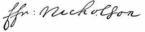

Palfrey (iv. 273) pictures the universal chagrin and details the efforts to shift the blame for the failure of this expedition. Charlevoix gives a pretty full account, but his editor claims that the English chroniclers resort to vagueness in their stories. In some copies of Diéreville’s Relation du voyage du Port Royal de l’Acadie (Amsterdam, 1710) there is an appendix on the 1707 expedition, taken from the Gazette of Feb. 25, 1708.[921]
Events were tending towards a more strenuous effort at the reduction of Acadia. Jeremiah Dummer, in London, had in 1709 presented a memorial to the ministry arguing that the banks of the St. Lawrence belonged of right to New England.[922] It is printed in The Importance and Advantage of Cape Breton, London, 1746.[923] In April, 1709, the home government despatched orders to the colonies[924] for an extended movement on Montreal by way of Lake Champlain, and another on Quebec by water,—the latter part of the plan falling to the lot of Massachusetts and Rhode Island, who were promised the coöperation of a royal fleet and a force of veterans.[925] Colonel Vetch, who was a prime mover in the proceeding, brought the messages of the royal pleasure, and was made the adjutant-general of the commander, Francis Nicholson; but the promised fleet did not come, and the few king’s ships which were in Boston were held aloof by their commanders, and a project to turn the troops, already massed in Boston, against Port Royal, since there was no chance of success against Quebec unaided, was abandoned for want of the convoy these royal ships might have afforded.[926] Nicholson, the companion of Vetch, returned to England,[927] and the next year (1710) came back with a small fleet, which, with an expeditionary force of New Englanders, captured Port Royal,[928] and Vetch was left governor of the country.[929]
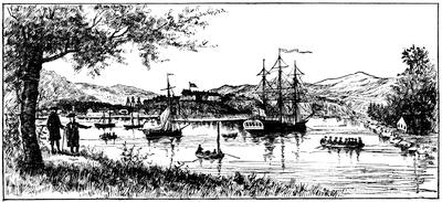
ANNAPOLIS ROYAL.
One of Des Barres’ coast views (in Harvard College library).
The key of the fort at Annapolis, taken at this time, is in the cabinet of the Mass. Hist. Society. (Cf. Catal. Cab. M. H. Soc., p. 112; Proceedings, i. 101.)
Col. William Dudley under date of Nov. 15, 1710, sent to the Board of Trade a communication covering the journal of Col. Nicholson during the siege, with correspondence appertaining, and these papers from the Record Office, London, are printed in the Nova Scotia Hist. Soc. Collections, i. p. 59, as (p. 64) is also a journal from the Boston News-Letter of Nov. 6, 1710. Sabin (ix. no. 36,703) notes a very rare tract: Journal of an Expedition performed by the forces of our Soveraign Lady Anne, Queen, etc., under the command of the Honourable Francis Nicholson in the year 1710, for the reduction of Port Royal in Nova Scotia, London, 1711. A journal kept by the Rev. Mr. Buckingham is printed from the original MS., edited by Theodore Dwight, in the Journals of Madam Knight and Rev. Mr. Buckingham (New York, 1825).[930]
The war was ended by a treaty at Portsmouth, July 11, 1713. (Mass. Archives, xxix. p. 1; N. H. Hist. Soc. Coll., i. p. 83; N. H. Prov. Papers, iii. 543; Maine Hist. Soc. Coll., vi. 250; Penhallow, 78; Williamson’s Maine, ii. 67.)
There was a conference with five of the leading eastern Indians at Boston, Jan. 16, 1713-14, and this treaty is in the Mass. Archives, xxix. 22. A fac-simile of its English signatures is annexed. Another conference was held at Portsmouth, July 23-28, 1714; and this document is also preserved. (Mass. Archives, xxix. 36; Maine Hist. Soc. Coll., vi. 257.)
Dr. Shea (Charlevoix, v. 267) says that no intelligent man will believe that the Indians understood the law-terms of these treaties, adding that Hutchinson (ii. 246) admits as much.
The papers by Frederick Kidder in the Maine Hist. Soc. Collections (vols. iii. and vi.) were republished as Abnaki Indians, their treaties of 1713 and 1717, and a vocabulary with an historical introduction, Portland, 1859. (Field, Indian Bibliog., no. 829; Hist. Mag., ii. p. 84.) It gives fac-similes of the autographs of the English signers and witnesses; and of the marks or signs of the Indians.
A later conference to ratify the treaty of 1713 was published under the title of Georgetown on Arrowsick island, Aug. 9, 1717.... A conference of Gov. Shute with the sachems and chief men of the eastern Indians, Boston, 1717. (Harvard Col. library, no. 5325.24; Brinley, i. no. 431.) This tract is reprinted in the Maine Hist. Soc. Coll., iii. 361, and in the N. H. Prov. Papers, iii. 693. See further in Penhallow, p. 83; Niles, in Mass. Hist. Coll., xxxv. 338; Hutchinson, ii. 199; Williamson’s Maine, ii. 93; Belknap’s New Hampshire, ii. 47; Shea’s Charlevoix, v. 268; Palfrey’s New England, iv. 420.
Shute was accompanied to Arrowsick by the Rev. Joseph Baxter, and his journal of this period, annotated by Elias Nason, is printed in the N. E. Hist. and Geneal. Reg., Jan., 1867, p. 45.
Of chief importance respecting this as well as other of the wars, enumerated in this section, are the documents preserved in the State House at Boston. The Mass. Archives, vol. xxix., covers Indian conferences, etc., from 1713 to 1776; vol. xxxiv. treaties with the Indians from 1645 to 1726; and vols. xxx. to xxxiii. elucidate by original documents relations of all sorts with the Indians of the east and west, as well as those among the more central settlements between 1639 and 1775.
The chief English authority for Queen Anne’s and Lovewell’s wars is The History of the wars of New England with the eastern Indians, or a narrative of their continued perfidy from the 10th of August, 1703, to the peace renewed 13th of July, 1713; and from the 25th of July, 1722, to their submission, 15th December, 1725, which was ratified August 5th, 1726. By Samuel Penhallow. Boston, 1726. The author was an Englishman, who in 1686, at twenty-one, had come to America to perfect his learning in the college at Cambridge, designing to acquire the Indian tongue, and to serve the Society for the Propagation of the Gospel among the Indians. Trade and public office, however, diverted his attention, and he became a rich tradesman at Portsmouth and a man of consideration in the public affairs of New Hampshire. His book is of the first value to the historian and the object of much quest to the collector, for it has become very rare. Penhallow died Dec., 1726, shortly after its publication. It has been reprinted in the first volume of the N. H. Hist. Society’s Collections, and again in 1859 at Cincinnati, with a memoir and notes by W. Dodge.[931]
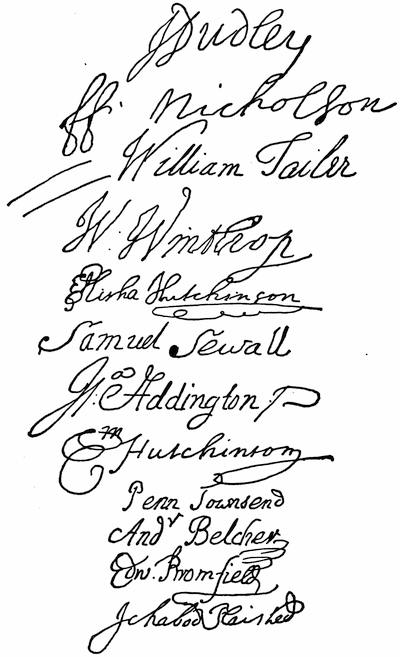
SIGNERS OF THE CONFERENCE. (January 16, 1713-14.)
A more comprehensive writer is Samuel Niles, in his French and Indian Wars, 1634-1760. Niles was a Rhode Islander, who came to Harvard College the first from that colony to seek a liberal education, and, having graduated in 1699, he settled in Braintree, Mass., in 1711, where he continued till his death in 1762. Palfrey (vol. iv. 256) has pointed out that Niles did little more than add a sentence, embody a reflection, and condense or omit in the use which he made of the Memorial of Nathaniel Morton, the Entertaining Passages of Church, the Indian Wars of Hubbard, the Magnalia of Mather, and the History of Penhallow; so that for a period down to about 1745, Niles is of scarcely any original value.
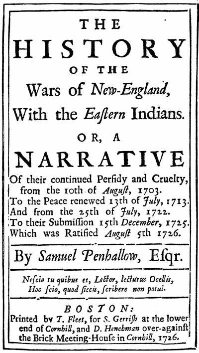
Fac-simile from a copy in Harvard College library.
John Adams (Works, x. 361), who knew the author, lamented in 1818 that no printer would undertake the publication of his history. The manuscript of the work was neglected till some time after 1830 it was found in a box of papers belonging to the Mass. Hist. Society, and was subsequently printed in their Collections, vols. xxvi. and xxxv.[932]
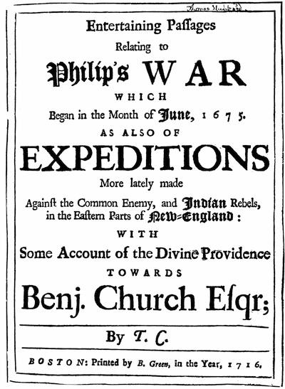
Fac-simile slightly reduced from the copy in Harvard College library.
There are two other important contemporary printed accounts of this war.
Col. Benjamin Church furnished the memoranda from which his son Thomas constructed a book, very popular in its day, and which was published in Boston in 1716, as Entertaining Passages,[933] etc.
Cotton Mather, on the restoration of peace, reviewed the ten years’ sorrows of the war in a sermon before the governor and legislature, which was published as Duodecennium Luctuosum—the History of a long war with Indian savages and their directors and abettors, 1702-1714.[934]
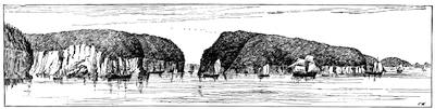
GUT OF ANNAPOLIS.
Note.—The above cut represents the entrance to the Annapolis basin, as it would appear to a spectator at the position corresponding to the letter B in the words “Baye Françoise” in the northwest corner of the map on the opposite page. It follows on a reduced scale one of the coast scenes made by the British engineers to accompany the hydrographic surveys, published by Des Barres, just before the American Revolutionary War, and which frequently make part of the Atlantic Neptune. A modern drawing of the view looking outward through the gut is given in E. B. Chase’s Over the Border (Boston, 1884), where will be found a view of the old block house in Annapolis (p. 64), which stood till 1882.
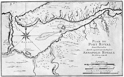
The map (on the opposite page) is by the royal (French) engineer Nicolas Bellin, and was published by Charlevoix in his Histoire de la Nouvelle France, and is reproduced in Dr. Shea’s translation of Charlevoix, v. p. 170; and on a reduced scale in Gay, Pop. Hist. U. S., iii. p. 125. A MS. plan (1725) is noted in the Catalogue of the King’s Maps in the British Museum, i. p. 38; as also are other plans of 1751, 1752, 1755. One of date 1729 by Nathaniel Blackmore is plate no. 27 in Moll’s New Survey of the Globe. One of 1733 is in the North collection of maps in Harvard College library, vol. ii. pl. 11. One of 1779, after a manuscript in the Dépôt des Cartes in Paris, is no. 11 in the Neptune Americo-Septentrional. This Bellin map may be compared with the draughts of the basin made in the early part of the preceding century by Lescarbot, published in his Histoire de la Nouvelle France (1609), and by Champlain as given in his Voyages du Sieur de Champlain Xaintongeois (1613),—both of which maps are produced in the present History, Vol. IV. pp. 140, 141.
There is on a previous page a view of the town and fort of Annapolis at the upper end of the basin. Various papers respecting Annapolis Royal, as it was called after coming into English possession, can be found in the Belknap Papers (MSS.) in the library of the Massachusetts Historical Society, including letters from Governor Richard Phillips, Lieutenant-Governor John Doucett, and Paul Mascarene. The history of Nova Scotia so much centres in Annapolis, previous to the founding of Halifax, that all the histories of Acadia and Nova Scotia tell the story of the picturesque and interesting region in which the town is situated. (Cf. Vol. IV. p. 156.)
Jacques Nicolas Bellin, the maker of the opposite map, as he was of all the maps given by Charlevoix, was born in Paris in 1703, and died in 1772. He was one of the principal hydrographers of his time in France, and was the earliest to hold a governmental position in the engineer department of the Marine. He has left a large mass of cartographical work, chiefly given on a large scale in his Neptune Français (1753 in folio) and his Hydrographie Française (1756 in folio). The same, with other maps reproduced on a smaller scale, constitute his Petit Atlas Maritime (1764, five volumes in quarto). All of these publications contain maps of American interest, and in 1755 he printed a special contribution to the study of American cartography, Mémoires sur les cartes des côtes de l’Amérique septentrionale.
The uneasy disposition of the times upon the conclusion of the peace may be followed in Gov. Shute’s letter to the Jesuit Father Rasle, Feb. 21, 1718 (Mass. Hist. Coll., v. 112); in the conference with the Penobscots[935] and Norridgewocks, at Georgetown, Oct. 12, 1720 (Mass. Archives, xxix. 68); and in the letter of the eastern Indians (in French) to the governor, July 27, 1721 (Mass. Hist. Coll., xviii. 259).
C. Lovewell’s or Gov. Dummer’s War.—There are documents from the Penhallow Papers relative to the Indian depredations at the eastward in the N. E. Hist. and Gen. Register, 1878, p. 21. Some of them antedate the outbreak of the war. Charlevoix (Shea’s ed., vol. v. 268) tells the story of the counter-missions of the French and English; and the Indians, incited by the French, made demands on the English, who held some of their chiefs as hostages in Boston. (Mass. Hist. Coll., 2d ser., viii. 259; N. Y. Col. Docs., x. 903; Kip, Jesuit Missions, 13.) The seeming truce with the Abenakis was further jeopardized by the act of seizing (Dec., 1721) the younger Baron de St. Castin, when he was taken to Boston for examination. After a detention of five months he was set at liberty.[936] A more serious source of complaints with the Indians before the war was the attempt to seize Father Rasle in Jan., 1722, by an expedition sent to Norridgewock under Col. Westbrook, but in the immediate charge of Capt. Harmon. (N. Y. Col. Docs., ix. 910; Rasle in Kip, 15.) Rasle was warned and escaped, but the party found letters from Vaudreuil in his cabin, implicating the Quebec governor as having incited the increasing depredations of the Indians.[937]
The war began in the summer of 1722. Gov. Shute made his declaration, July 25, 1722 (Mass. Archives, xxxi. 106), and the Rev. Benjamin Wadsworth, at the Thursday lecture, Aug. 16, made it the subject of his discourse. (Brinley, i. no. 429.)
In March, 1723, Col. Thos. Westbrook made a raid along the Penobscot. (Mass. Hist. Coll., xxii. 264; N. Y. Col. Docs., ix. 933.)
Capt. Jeremiah Moulton, under orders of Col. Westbrook, made a scouting expedition in the early summer of 1723, and dated at York, July, 4, his report to Lieut.-Gov. William Dummer, which is printed in the Maine Hist. and Genealog. Recorder, i. p. 204. (Cf. Penhallow, 96; Niles in Mass. Hist. Coll., xxxv. 345; Williamson, ii. 120.) In 1723 there was an Indian raid on Rutland, in which the Rev. Joseph Willard and two children were killed, and two others were carried off. (Cf. Israel Loring’s Two Sermons, Boston, 1724, cited in Brinley, i. no. 1,928.)
A conference was held at Boston, August 22, 1723, of which there is a printed account among the Belknap Papers (MSS.), in the Mass. Hist. Soc. library.
On the 21st July, 1724, there was another conference with the Indians held at St. Georges fort. (Mass. Archives, xxix. 154.)
In Aug., 1724, Moulton and Harmon were sent to make an end of Rasle’s influence. They surprised the Norridgewock settlement, and Rasle was killed in the general slaughter. The opposing chroniclers do not agree as to the manner of his death. Charlevoix (Shea’s ed., v. 279) says he was shot and mutilated at the foot of the village cross. The English say they had intended to spare him, but he refused quarter, and had even killed a captive English boy in the confusion. His scalp and those of other slain were taken to Boston.[938]

In Nov., 1724, Capt. John Lovewell and two others had petitioned to be equipped to scour the woods to the eastward after Indians, and, the legislature acceding (Nov. 17) to their request, Lovewell enrolled his men and made three campaigns in quick succession. The journal of his second expedition (Jan.-Feb., 1724-5) is in the Mass. Archives, vol. lxxxvi., and is printed by Kidder in the N. E. Hist. and Geneal. Reg., Jan., 1853, and in his Expeditions of Capt. John Lovewell. It was on the third of these expeditions, May 9, 1725, that Lovewell encountered the Indians near a pond in Fryeburg, Maine, now known as Lovewell’s pond, upon whose wood-girt surface the summer tourist to-day looks down from the summit of the Jockey-Cap. Their leader was killed early in the action, which lasted all day, and only nine of the English who remained alive were unwounded when the savages drew off.
The news reached Boston on the 13th of May. Kidder gives the despatches received by the governor, with the action of the council upon them. On the 17th an account was printed in the Boston Gazette, which is also in Kidder. The day before (May 16) the Rev. Thomas Symmes, of Bradford, who had gathered his information from some of those who had escaped, delivered a sermon in that town, which, when printed with an “historical preface or memoirs of the battle at Piggwacket,” became popular, and two editions were printed at Boston during the same year. Both editions are of the greatest rarity. The first is called: Lovewell lamented, or a Sermon occasion’d by the fall of the brave Capt. John Lovewell and several of his valiant company in the late heroic action at Piggwacket. Boston, 1725.[939] The other edition was entitled: Historical memoirs of the late fight at Piggwacket; with a sermon occasion’d by the fall of the brave Capt. John Lovewell and several of his valiant company.... The second edition, corrected. Boston, 1725.[940] A third edition was printed at Fryeburg, with some additions, in 1799. The narrative, but not the sermon, was later printed in Farmer and Moore’s Historical Collections, i. 25. At Concord (N. H.), in 1861, it was again issued by Nathaniel Bouton, as The original account of Capt. John Lovewell’s Great Fight with the Indians at Pequawket, May 8, 1725.[941] Mr. Frederic Kidder, in N. E. Hist. and Geneal. Reg.,[942] Jan., 1853 (p. 61), printed an account of Lovewell’s various expeditions, with sundry documents from the Massachusetts Archives, which, together with the second edition of Symmes, were later, in 1865, embodied in his Expeditions of Capt. John Lovewell and his encounters with the Indians, including a particular account of the Pequauket battle.[943] This is a faithful reprint of the Symmes tract, while those of Farmer and Moore, and of Bouton, introduce matters from other sources. The bibliography of Symmes’s sermon is traced in Dr. S. A. Green’s Groton during the Indian Wars, p. 134.
The relations of the French to the Abenaki war during 1724-25 are shown in various documents printed in the N. Y. Coll. Docs., vol. ix., as when the French ministry prompts the governor of Canada to sustain the savages in their struggle with the English (p. 935); a memoir is registered upon their condition (p. 939); Intendant Begon reports on the war (p. 941); other letters are written (p. 945); and the ministry again counsel the governor to instigate further hostilities (p. 956).
A journal of a scout by Westbrook, beginning June 23, 1725, is among the Belknap Papers (MSS.).
Four eastern sagamores came to Boston, Nov. 10, 1725 (Mass. Archives, xxix. 191; Murdoch’s Nova Scotia, i. 429), and a treaty with them was signed Dec. 15, 1725, known as “Dummer’s treaty” (Mass. Archives, xxxiv.), which was ratified at Falmouth, Aug. 6, 1726. (Mass. Archives, xxix. 230; xxxiv. See also Penhallow, 117; N. H. Hist. Coll., i. 123; N. H. Prov. Papers, iv. 188; Niles in Mass. Hist. Coll., xxxv. 360; Williamson, ii. 145, 147; Palfrey, iv. 443.)
This treaty was separately printed under the title of Conference with the Indians at the ratification of peace held at Falmouth, Casco Bay, by Governour Dummer, in July and August, 1726. Boston, 1726, pp. 24. It was reprinted in 1754. (Cf. Brinley, i. 432, 434; Harvard College library, 5325.32.)
There was another Indian treaty at Casco Bay, July 25, 1727. (Mass. Archives, xxix. 256.) In Akins’s Pub. Doc. of Nova Scotia is a fac-simile of a copy of this treaty, attested by Dummer, evidently made to be used by Cornwallis in 1749, in negotiating another treaty. (Cf. N. H. Hist. Coll., ii. 260, where the treaty is printed; and the explanation of the Indians in N. Y. Col. Docs., ix. 966.)
This treaty of 1727 was separately printed as Conference with the Eastern Indians at the further ratification of the peace, held at Falmouth, in Casco Bay, in July, 1727. Boston, 1727, pp. 31. It was reprinted in 1754. (Cf. Brinley, i. 433, 434.)
Cf. also Conferences of Lieut.-Gov. Dummer with the Eastern Indians in 1726 and 1727. Boston, 1754. For the treaties of 1726-27, see also Maine Hist. Coll., iii. 377, 407; N. H. Prov. Papers, iv. 255-258; Palfrey, iv. 444.
There is in the Mass. Archives (xxix. 283) the document which resulted from a conference with the Eastern Indians in the council chamber in Boston, Dec. 9-Jan. 15, 1727-28.
Dr. Colman’s memoir of the troubles at the eastward in 1726-27 is in the Mass. Hist. Coll., vi. 108. (Cf. Mass. Hist. Soc. Proc., x. 324.)
The French were disconcerted by the treaty of 1727, as sundry papers in the N. Y. Col. Docs., vol. ix., show. They reiterate their complaints of the English encroachments on the Indians’ lands (p. 981); observe great changes in the Abenakis since they made peace with the English (p. 990); and the king of France tells the Canadians he does not see how the Indians could avoid making the treaty with the English (p. 995).[944]
The letters of caution, which Belcher was constantly writing (1731-1740) to Capt. Larrabee, in command at Fort George, Brunswick, indicate how unstable the peace was. (N. E. Hist. & Gen. Reg., Apr., 1865, p. 129.) The continued danger from French intrigue is also shown in Colman’s memoir, etc., in Mass. Hist. Coll., vi. 109, and in the repeated conferences of the next few years: Conference of his Excellency Governor Belcher with the chiefs of the Penobscot, Norridgewock, and Ameriscoggin tribes at Falmouth, July, 1732. Boston, reprinted at London. (Haven in Thomas, ii. p. 428; Carter-Brown, iii. 482; Harv. Coll. lib., 5325.33; Brinley, i. no. 435.)
A Conference held at Deerfield, the 27th of August [to Sept. 1], 1735, by his Excellency, Jonathan Belcher, and Ountaussoogoe and others, etc. [Boston, 1735]. (Brinley, i. no. 437.) This tract is reprinted in the Maine Hist. Coll., iv. 123.
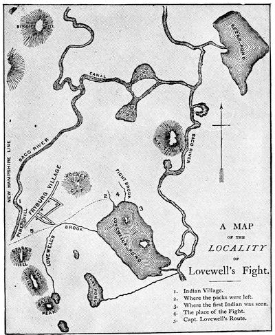
LOVEWELL’S FIGHT. From the map in Bouton and Kidder.
Conference with the Penobscots at the council chamber in Boston, June, 1736. (Mass. Archives, xxix. 317.)
The nine Penobscot chiefs who held this conference were lodged with one John Sale in Boston, who renders an account of his charges for twenty-four days’ entertainment of them, which is suggestive. He charges for three half-pints of wine, per day, each; for twelve pence worth of rum per day, each; for 120 gallons of cider; for damage done in breaking of sash doors, frames of glass, China bowl, double decanter, and sundry glasses and mugs; for two gross of pipes and tobacco; for candles all night; for showing them the rope-dancers; for washing 49 of their “greasy shirts;” and “for cleaning and whitewashing two rooms after them.” The following “memorandum” is attached: “They eat for the most part between 50 and 60 pounds of meat per day, beside milk, cheese, etc. The cider which they drank I sold for twelve shillings per quart. Besides, they had beer when they pleased. And as for meat, they had the best, as I was ordered.”
Conference with the Penobscots and Norridgewocks, June 28-July 6, 1738. (Mass. Archives, xxix. 336.)
Conference with the Penobscots at the council chamber in Boston, Aug. 25-Sept. 2, 1740. (Mass. Archives, xxix. 364.)
Conference with the Penobscots, Dec. 3, 1741. (Mass. Archives, xxix. 376.)
“Projets sur la prise de l’Acadie, 1741.” (Parkman MSS. in Mass. Hist. Soc., New France, i. p. 1.)
Conference held at the Fort at St. George in the County of York, the 4th of August, 1742, between William Shirley, Governor, and the Chief Sachems and Captains of the Penobscott, Norridgewock, Pigwaket or Amiscogging or Saco, St. John’s, Bescommonconty or Amerescogging and St. Francis tribes of Indians, August, 1742. (Carter-Brown, iii. no. 703; Brinley, i. no. 440. Cf. Williamson, ii. 209.)
D. King George’s, Shirley’s, or Five Years’ War.—France had declared war against England, Mar. 15, 1744 (Coll. de Manuscrits, Quebec, iii. p. 196), and the capitulation of Canso had taken place, May 24. (Ibid., iii. p. 201.) In July, 1744, Pepperrell and others, including some chiefs of the Five Nations, met the Penobscots at St. Georges and agreed to join in a treaty against the Cape Sable Indians. The Penobscots did not keep the appointment. War was declared against the Cape Sable and St. John’s Indians, Oct. 19, 1744. The General Court of Massachusetts offered a reward for scalps; and a proclamation was made for the enlistment of volunteers, Nov. 2, 1744. (Mass. Archives, xxxi. 506, 514; printed in W. W. Wheildon’s Curiosities of History, Boston, 1880, pp. 107, 109.)
The most brilliant event of the war was impending.
The French had begun the construction of elaborate defences at Louisbourg in 1720. A medal struck in commemoration of this beginning is described in the Transactions (1872-73, p. 75) of the Literary and Historical Society of Quebec.

It has always been open to question from whom came the first suggestion of the expedition of 1745. The immediate incentive seems to have been a belief, prompted by the reports of prisoners released from Canso, that Louisbourg could be captured, if attacked before relief could reach it from France. Judge Robert Auchmuty, of Roxbury, developed a plan for the capture in the Gentleman’s Magazine for July, 1745,—the same number in which was also printed the news of the attack and capture. When the paper was reprinted in a thin folio tract shortly afterwards, he or some one for him emphasized his claim to the suggestion in the title itself as follows: The importance of Cape Breton to the British Nation, humbly represented by Robert Auckmuty [sic], Judge, &c., in New England. N. B. Upon the plan laid down in this representation the island was taken by Commodore Warren and General Pepperill the 14th of June, 1745. London, 1745.[945]

It is claimed on behalf of William Vaughan that he suggested the expedition to Governor Wentworth, of New Hampshire, who in turn referred him to Governor Shirley. An anonymous tract, published in London in 1746, The Importance and Advantage of Cape Breton truly stated and impartially considered,[946] often assigned to William Bollan, and believed by some to have been inspired by Vaughan, says that Vaughan had “the honor of reviving, at least, if not of having been the original mover or projector,” of the expedition, since it is claimed that Lieutenant-Governor Clarke, of New York,[947] had suggested the attack to the Duke of Newcastle as early as 1743. Douglass (Summary, etc., i. 348) says that Shirley was taken with the “hint or conceit” of Vaughan, “a whimsical, wild projector.” Hutchinson says that Vaughan “was called the projector of the expedition,” and Belknap accords him the priority in common report.[948] When Thomas Prince came to dedicate his sermon, preached on the Thanksgiving day following the triumph, he inscribed it to Shirley as the “principal former and promoter of the expedition;” but the language hardly claims the origination, though Shirley was generally recognized as the moving spirit in its final determination.[949]
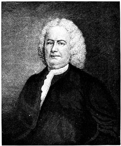
PEPPERRELL.
After a painting, now owned by Mrs. Anna H. C. Howard, of Brooklyn, N. Y., and which has descended from Pepperrell. (Cf. Penna. Mag. of Hist., iii. p. 358.) This likeness, painted in London in 1751 by Smibert, is also engraved in Parsons’ Life of Pepperrell, in Drake’s Boston, and in the N. E. Hist. and Geneal. Reg., Jan., 1866, where Dr. Parsons gives a genealogy of the Pepperrell family. There is in the Memorial Hist. of Boston (ii. 114) an engraving after an original full-length picture in the hall of the Essex Institute at Salem,—artist unknown. See also Higginson’s Larger History, p. 188.
A sword of Pepperrell is shown in the group of weapons engraved in Vol. III. p. 274. (Cf. Catal. Cab. Mass. Hist. Soc., p. 123; Proc. Mass. Hist. Soc., v. 373; and Parsons’ Life of Pepperrell.) Views of the Pepperrell mansion at Kittery, where considerable state was kept, are given in Parsons (p. 329), and in a paper on Pepperrell by J. A. Stevens in the Mag. of Amer. History, vol. ii. 673. Cf. also Lamb’s Homes of America (1879), and Appleton’s Journal, xi. 65.
The earliest account of this mettlesome enterprise, which showed special research and opportunities, was that of Dr. Belknap in his History of New Hampshire, which was written in 1784, less than forty years after the event, and when he might have known some of the participants. The most important of the Pepperrell Papers had fallen into his hands, and he made good use of them, after which he deposited them in the cabinet of the Massachusetts Historical Society, where they now are, bound in two volumes, covering the years 1699-1779, but chiefly concerning the Louisbourg expedition.
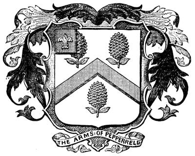
PEPPERRELL ARMS.
This cut of the Pepperrell arms is copied from one in the Mag. of Amer. Hist., Nov., 1878, p. 684.
With them in the same depository are the Belknap Papers, three volumes,[950] as well as a composite volume, Louisbourg Papers, devoted entirely to the expedition.[951] Others of the scattered papers of Pepperrell have since been found elsewhere. Dr. Usher Parsons, in his Life of Pepperrell,[952] beside using what Belknap possessed, sifted a mass of papers found in an old shed on the Pepperrell estate. This lot covered the years 1696-1759, and some of them were scarcely legible. The mercantile letters and accounts among them yielded little, but there was a smaller body of Pepperrell’s own letters and those of his correspondents, which proved of more or less historical value.
Unremitting search yielded gain to Dr. Parsons in other directions. Some manuscripts coming from a Kittery house into the hands of Capt. Luther Dame, of Newburyport, were reported upon by Col. A. H. Hoyt in the New England Hist. and Geneal. Reg. (Oct., 1874, p. 451), in a paper afterwards reprinted by him, separately, with revision; but they throw no considerable light upon the Louisbourg siege. They would add little to what Parsons presents in chronologically arranged excerpts from letters and other records which make up his account of the expedition.[953]
Of all other contemporary accounts and aids, most, so far as known, have been put into print, though George Bancroft quotes a journal of Seth Pomeroy,[954] not yet in type; and there are papers which might still be gleaned in the Mass. Archives. There are in print the instructions of Shirley, and a correspondence between Pepperrell and Warren (Mass. Hist. Collections, i. 13-60); letters of Wentworth and Shirley on the plan of attack, and other letters of Shirley (Provincial Papers of New Hampshire, vol. v. pp. 931, 949, etc.); and many others of Pepperrell, Warren, Shirley, etc. (Rhode Island Colonial Records, vol. v.). The Colonial Records of Connecticut (vol. ix.) for this period give full details of the legislative enactment regarding the part that colony bore in the expedition; but the absence of most of the illustrative documents from her archives during that interval deprives us, doubtless, of a correspondence similar to that which is included in the Rhode Island printed Records.
Shirley’s letters to Governor Thomas, of Penna., respecting the preparations for the Louisbourg expedition, are in Penna. Archives, i. 667, etc.
Stray letters and documents of some interest, but throwing no essential light upon historical events, are found in the N. E. Hist. and Geneal. Reg., v. 88; xii. 263; xix. 225, etc.
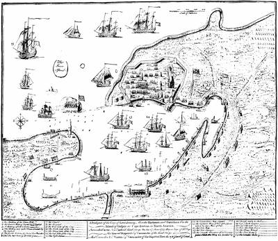
Various accounts of the siege, of no great extent were published soon after its close. Chief among them was an Accurate journal and account of the proceedings of the New England land forces, during the late expedition against the French settlements on Cape Breton to the time of the surrender of Louisbourg, Exon, 1746 (40 pp.). The manuscript of this journal was sent to England by Pepperrell to his friend Capt. Henry Stafford; and as printed it was attested by Pepperrell, Brig.-General Waldo, Col. Moore, Lieut.-Col. Lothrop, and Lieut.-Col. Gridley.[955] This journal was printed, with some curious verbal differences, as an appendix to a Letter from William Shirley, Esq., to the Duke of Newcastle, with a Journal of the Siege of Louisbourg, London, 1746. It was by vote of the legislature, Dec. 30, 1746, reprinted in Boston, once by Rogers and Fowle, and again by J. Draper.[956] An account by Col. James Gibson, published in London in 1745, as a Journal of the late siege by the troops of North America against the French at Cape Breton,[957] contained a large engraved plan of the siege, of which a reduced fac-simile is annexed.[958] The narrative was edited in Boston in 1847 by Lorenzo D. Johnson, under the misleading title A Boston merchant of 1745. Other diaries of the siege, of greater or less extent, have been printed, like Wolcott’s,[959] in the Collections (vol. i.) of the Connecticut Historical Society; Curwen’s in his letters (Hist. Collections Essex Institute, vol. iii. 186), and in his Journal, edited by Ward (p. 8); Craft’s journal (Hist. Coll. Essex Inst., iv. p. 181); that of Adonijah Bidwell, the chaplain of the fleet (N. E. Hist. and Geneal. Reg., April, 1873); and the folio tract entitled A particular Account of the taking of Cape Breton by Admiral Warren and Sir William Pepperell, with a description of the place ... and the articles of capitulation, By Philip Durell, Esq., Capt. of his majesty’s ship “Superbe.” To which is added a letter from an officer of marines, etc., etc., London, 1745. Durell’s account is dated June 20, 1745, in Louisbourg harbor. Douglass gives the force by sea and land before Louisbourg. Summary, etc., i. 350.
A list of the commissioned officers of the expedition, drawn from the Belknap Papers, is edited by Charles Hudson in the N. E. Hist. and Geneal. Reg., Oct., 1870.[960] In Ibid., April, 1868, a list of 221 names of the common soldiers had been printed; but in July, 1871, a much longer enumeration is made out by Mr. Hudson from the Pepperrell papers, the Council Records, and other sources. Potter in the N. H. Adj.-General’s Report, ii. (1866, pp. 61-76), afterwards published as Mil. Hist. of N. H., gives the New Hampshire rolls of Louisbourg soldiers.
On the occasion of a Thanksgiving (July 18, 1745) in Boston, two sermons preserve to us some additional if slight details. That of Thomas Prince, Extraordinary events the doings of God and marvellous in pious eyes, Boston and London, 1745 (Harv. Coll. lib., 4375.42 and 43), is mainly reprinted in S. G. Drake’s Five Years’ French and Indian Wars, p. 187; and that of the Rev. Charles Chauncy, the brother-in-law of Pepperrell, Marvellous Things done by the right hand and holy arm of God in getting him the victory, was printed both in Boston and London.[961]
The capture of Louisbourg and the question of the disposition of the island at the peace led to several expositions of its imagined value to the British Crown, among which may be named:—
The importance and advantage of Cape Breton considered, in a letter to a member of Parliament from an inhabitant of New England, London, 1746. (Brinley, no. 69.) This is signed “Massachusettensis.”[962]
Two letters concerning some farther advantages and improvements that may seem necessary to be made on the taking and keeping of Cape Breton, London, 1746. (Carter-Brown, iii. no. 822.)
The importance and advantage of Cape Breton, truly stated and impartially considered. With proper maps, London, 1746. (Carter-Brown, iii. no. 823.) The maps follow those of Bellin in Charlevoix. Its authorship is usually ascribed to William Bollan. (Sabin, ii. 6,215.)
The great importance of Cape Breton demonstrated and exemplified by extracts from the best writers, French and English, London, 1746. This is a plea against the surrender of it to the French. It is dedicated to Governor Shirley, and contains Charlevoix’s map and plan. (Carter-Brown, iii. no. 821.)
An accurate description of Cape Breton, Situation, Soil, Ports, etc., its Importance to France, but of how much greater it might have been to England; with an account of the taking of the city by the New England forces under General Pepperell in 1745, London, 1755.
Memoir of the principal transactions of the last war between the English and French in North America, from 1744 to the conclusion of the treaty at Aix-la-Chapelle, containing in particular an account of the importance of Nova Scotia and Cape Breton to both nations (3d ed., London, reprinted, Boston, 1758.)
Douglass (Summary, etc.), the general historian nearest the time, was an eager opponent of Shirley, and in his account of the expedition he ascribes to good luck the chief element in its success. He calls it “this infinitely rash New England Corporation adventure, though beyond all military or human probability successful.” (Summary, etc., 1751, ii. p. 11.) “Fortified towns are hard nuts to crack, and your teeth have not been accustomed to it,” wrote Benjamin Franklin from Philadelphia to his brother in Boston. (Franklin’s Works, vii. 16.)[963]
Accounts of the expedition enter necessarily into the more general narratives, like those of Hutchinson (Mass. Bay); Chalmers (Revolt, etc.); Minot (Massachusetts); Gordon (Amer. Rev.); Marshall (Washington); Bancroft (United States); Grahame (United States); Williamson (Hist. of Maine); Murdoch (Nova Scotia, ii. ch. 5); Haliburton (Nova Scotia); Stone (Sir Wm. Johnson, vol. i.); Palfrey (Compendious Hist. of New England, iv. ch. 9); Bury (Exodus of the Western Nations, ii. ch. 6); Gay (Pop. Hist. United States); Drake (Boston). The Memorial Hist. Boston (ii. 117) and Barry’s Massachusetts (ii. 140, etc.) give numerous references. Joel T. Headley has a popular narrative in Harper’s Monthly, xxviii. p. 354. Garneau (Hist. du Canada, 4th ed., ii. 190) offers the established French account. Cf. Lettre d’un habitant de Louisbourg contenant une relation exacte de la prise de l’Ile Royale par les Anglais, Quebec, 1745. (Sabin, x. no. 40,671.)[964]
The present condition of the site of Louisbourg is described by Parsons (Life of Pepperrell, 332); by Parkman (Montcalm and Wolfe); by J. G. Bourinot in his “The old forts of Acadia” in Canadian Monthly, v. 369; and in the Canadian Antiquarian, iv. 57.
Maps, both French and English, showing the fortifications and harbor of Louisbourg are numerous.
Both editions of Charlevoix’s Histoire de la Nouvelle France, the duodecimo in six volumes, and the quarto in three volumes issued in 1744, the year before the siege, have plans of Louisbourg and its fortifications, and the same are reproduced in Dr. Shea’s translation of Charlevoix. They are the work of Nicholas Bellin, and to the same draughtsman belongs Le Petit Atlas Maritime, 1764, in the volume of which devoted to North America, there are other (nos. 23, 24) plans of the harbor and fortifications.
Following French sources is a Plan des fortifications de Louisbourg, published at Amsterdam by H. de Leth about 1750. A “Plan special de Louisbourg” is also to be found on the map published by N. Visscher at Amsterdam, called “Carte Nouvelle contenant la partie de l’Amérique la plus septentrionale.”
Among the French maps is one “levé en 1756,” after a plan of Louisbourg, preserved in the Dépôt des Cartes de la Marine in Paris. This appeared in 1779 in the Neptune Americo-Septentrional, “publiée par ordre du Roi;” and another, dated 1758, “levé par le chev. de la Rigaudiere,” was accompanied by a view, of which there is a copy in the Mass. Archives; Docs. collected in France, Atlas, ii. 5. In this last (composite) Atlas (ii. nos. 44, 45) are maps of the town and harbor, and a large plan of the fortifications, marked “Tome i. no. 23,” which can probably be identified.
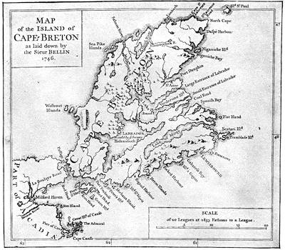
CAPE BRETON, 1746.
Reduced fac-simile of the “Map of the Island of Cape Breton as laid down by the Sieur Bellin, 1746,” annexed to The Importance and Advantage of Cape Breton, truly stated and impartially considered, London, 1746. A general map of the island of Cape Breton, with Bellin’s name attached, is found in the several editions of Charlevoix and in the Petit Atlas maritime, par le S. Bellin, 1764. The earliest more elaborate survey of this part of the coast was the one published by J. F. W. Des Barres, in 1781, in four sheets, The South East Coast of Cape Breton Island, surveyed by Samuel Holland. A map by Kitchen was published in the London Mag., 1747.
Richard Gridley,[965] of Massachusetts Bay, who was present as an officer of the artillery, made a plan of the fortifications after the surrender, and this, called a Plan of the City and Fortifications of Louisbourg from surveys made by Richard Gridley in 1745, was engraved and published by Jefferys, in 1758, and was used by him in his History of the French Dominions in America, London, 1760 (p. 124), and in his General Topography of North America and the West Indies, London, 1768 (no. 25).[966]
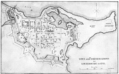
GRIDLEY’S PLAN AS REDUCED IN BROWN’S CAPE BRETON.
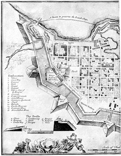
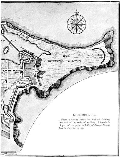
LOUISBOURG, 1745.
From a survey made by Richard Gridley, lieut.-col. of the train of artillery. A fac-simile of part of the plate in Jeffery’s French Dominions in America, p. 125.
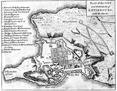
LOUISBOURG (Set of Plans, etc.)
Gridley’s surveys have been the basis of many of the subsequent English plans. The draught reduced from Gridley in Richard Brown’s History of the Island of Cape Breton (London, 1869) is herewith given in fac-simile, and is understood by the following key:—
A. Dauphin bastion and circular battery. B. King’s bastion and citadel. C. Queen’s bastion. D. Princess’ bastion. E. Bourillon bastion. F. Maurepas bastion. G. Batterie de la Gréve.
1, 1, etc. Glacis. 2, 2, etc. Covered way. 3, 3, etc. Traverses. 4, 4, etc. Ditch. 5, 5, etc. Parapet. 6, 6, etc. Ramparts. 7, 7, etc. Slopes of same. 8, 8, etc. Places of arms. 9, 9, etc. Casemates.
10, 10, etc. Guard houses. 11, 11, etc. Wooden bridges.
12. Governor’s apartments. 13. Church. 14. Barracks. 15. Powder magazine. 16. Fortification house. 17. Arsenal and bake-house. 18. Ordnance. 19. General storehouse. 20. West gate. 22. East gate. 23. Gates in quay curtain (b. b. b.). 24. Parade. 25. Nunnery. 26. Hospital and church.
a. a. Palisade, with ramparts for small arms.
c. c. Picquet (raised during the siege).
Another plan of an early date is one, likewise annexed, which appeared in A set of plans and forts in America, reduced from actual surveys, 1763, and published in London.[967] The plan which George Bancroft added to his History of the United States, in one of the early editions, was used again by Parsons in his Life of Pepperrell.
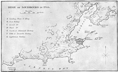
FROM BROWN’S CAPE BRETON.
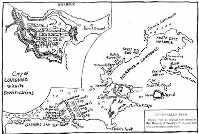
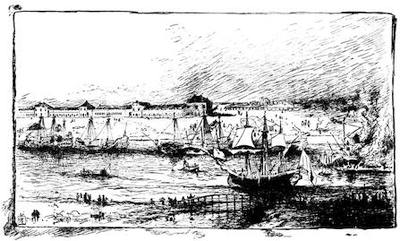
VIEW OF LOUISBOURG.
A reduced sketch from a painting owned by Mrs. Anna H. C. Howard of Brooklyn, N. Y., which came to her by descent from Sir William Pepperrell. The canvas is very dark and obscure, and the artist may have missed some of the details, particularly of the walls along the shore. The point of view seems to be from the northwest side of the interior harbor, near the bridge (seen in the foreground), which spans one of the little inlets, as shown in some of the maps. This position is near what are called “Hale’s Barracks” in the draft of the town and harbor on the preceding page. The dismantled ships along the opposite shore are apparently the French fleet, while an English ship is near the bridge.
The following letter describes the present condition of the ground:—
Boston, June 4, 1886.
My dear Mr. Winsor,—It gives me great pleasure to comply with your request, and to give my recollections of Louisburg as seen in September last.
The historical town of that name, or rather the ruin of the old fortress, lies perhaps three miles from the modern town, which is a small village, situated on the northeasterly side of the bay or harbor. The inhabitants of the neighborhood live, for the most part, by fishing and other business connected with that branch of industry, eking out their livelihood by the cultivation of a rocky and barren soil. The road from the village to the old fortress runs along the western shore of the bay, passing at intervals the small houses of the fishermen and leaving on the left the site of the Royal Battery, which is still discernible. This was the first outpost of the French taken at the siege, and its gallant capture proved subsequently to be of the greatest service to the English. From this point the ruins of the fortress begin to loom up and show their real character. Soon the walls are reached, and the remains of the former bastions on the land side are easily recognized. This land front is more than half a mile in length, and stretches from the sea on the left to the bay on the right, forming a line of works that would seem to be impregnable to any and all assaults. From its crown a good idea can be gained of the size of the fortifications, which extend in its entire circuit more than a mile and a half in length, and inclose an area of a hundred and twenty acres, more or less. The public buildings within the fortress were of stone, and, with the help of a guide, their sites can easily be made out. The burying-ground, on the point of land to the eastward, where hundreds of bodies were buried, is still shown; and the sheep and cattle graze all unconscious of the great deeds that have been done in the neighborhood. Taken all in all, the place is full of the most interesting associations, and speaks of the period when the sceptre of power in America was balancing between France and England; and Louisburg forms to-day the grandest ruin in this part of the continent.
Very truly yours,
Samuel A. Green.
It follows an English plan procured by Mr. Bancroft in London, and closely resembles the sketch owned by a descendant of Pepperrell, and herewith given. Haliburton in his History of Nova Scotia gives a similar plan, as well as a draught of the harbor. The plan of the town and the vicinity which is given by Brown in his Cape Breton is also reproduced herewith. The earliest of the more elaborate charts of the harbor is that published by Des Barres in Oct., 1781. We find a rude sketch of the Island battery in Curwen’s Journal as edited by Ward (Boston, 4th ed. 1864), which was sent by that observer from Louisbourg, July 25, 1745. A reproduction of this sketch, herewith given, needs the following key:—
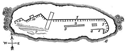
PLAN OF ISLAND BATTERY.
“The embrasures in the front are not more than three feet above the ground.
1. Fronting mouth of harbor: 22 embrasures; 21 guns, 36 and 48 pounders.
2. Barracks.
3. Sally-ports.
4. Wall framed of timber, and covered with plank, and filled with stone and lime, in which is an embrasure with a 48 pounder.
5. Wall, defended with two small swivels.
6. The place at which whale-boats might easily land 500 men.
7. One entire rock, perpendicular on the face, and absolutely impossible to be climbed.
8. Piquet of large timber, fastened by iron clamps, drilled into the solid rock.
9. Commandant’s apartment, five feet high.
10. The gate under the wall, about four feet wide, formed like a common sally-port; not straight, but made an angle of 160 degrees. Ten men can prevent ten hundred making their way; this wall has but four guns and two swivels.
“I paced the island, and judged it to be about 56 yards wide and 150 long at the widest part, nearly.”
There is in the Collections of the Maine Hist. Soc. (viii. p. 120) a life of Lieut.-Col. Arthur Noble, who, by order of Brigadier Waldo, led on May 23 the unsuccessful attack on this battery.
The Catalogue of the king’s maps in the British Museum (vol. i. 718, etc.) shows plans of the town and fortifications (1745) in MS. by Durell and Bastide; others of the town and harbor (1755) by William Green; with views by Bastide (1749), Admiral Knowles (1756), Ince (1758, engraved by Canot, 1762), and Thomas Wright (1766).
Jefferys also published in copperplate A view of the landing of the New England forces in the expedition against Cape Breton, 1745. (Carter-Brown, iii. p. 335.) A copy of this print belongs to Dr. John C. Warren of Boston.
Three months after the fall of Louisbourg there was another treaty with the eastern Indians, Sept. 28-Oct. 22, 1745. (Mass. Archives, xxix. 386.) The renewed activity of the French is shown in the N. Y. Col. Docs., x. p. 3.
A little later, Dec. 12, 1745, Shirley made his first speech to the Massachusetts Assembly after his return to Boston, and communicated the King’s thanks for “setting on foot and executing the late difficult and expensive enterprise against Cape Breton.”[968]
The next event of importance in the Acadian peninsula was the attack of the French upon an English post, which is known as the “battle of Minas.”
The English accounts (Boston Weekly Post Boy, March 2 and 9, 1747), which give the date Jan. 31, old style, and the French (official report), Feb. 11, new style, are edited by Dr. O’Callaghan with the articles of capitulation, in the New Eng. Hist. and Geneal. Reg., April, 1855, p. 107. For general references see Haliburton’s Nova Scotia, ii. 132; Williamson’s Maine, ii. 250; Hannay (p. 349) and the other histories of Nova Scotia.
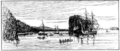
ENTRANCE OF MINES BASIN.
One of Des Barres’ coast views 1779. (In Harvard College library.)
Douglass (Summary, etc., i. 316) says: “Three companies from Rhode Island were shipwrecked near Martha’s Vineyard; two companies of New Hampshire went to sea, but for some trifling reason put back and never proceeded. The want of these five companies was the occasion of our forces being overpowered by the Canadians at Minas with a considerable slaughter.”
CAPE BAPTIST.
One of Des Barres’ coast views, marked A view of Cate Baptist in the entrance into the basin of Mines, bearing W. by N., two miles distant. (In Harvard College library.)
The French account of these transactions of the command of Ramezay is in a “Journal de la compagne du détachement de Canada à l’Acadie et aux Mines en 1746 et 1747” (June, 1746, to March, 1747). It is in the Parkman MSS. in the Mass. Hist. Society, New France, i. pp. 59-153. For the attack at Minas in particular see the “Relation d’une expédition faite sur les Anglois dans les pays de l’Acadie, le 11 Fév., 1747, par un détachement de Canadiens,” dated at Montreal, 28 Sept., 1747, and signed Le Chev. de la Corne. (Ibid., pp. 155-163.) Cf. also N. Y. Col. Docs., x. 78, 91.
The treaty of Aix-la-Chapelle, Oct., 1748, was proclaimed in Boston, May 10, 1749, and a reprint of it issued there.
Shirley (June 3, 1749) writes to Gov. Wentworth that he had agreed with nine Indian chiefs, then in Boston, to hold a conference at Casco bay, Sept. 27. (N. H. Prov. Papers, v. 127.)
Meanwhile the English government, in pursuance of an effort to anglicize the peninsula,[969] had planned the transportation to Nova Scotia of an equipped colony under Edward Cornwallis, which arrived at Chebucto harbor in the summer of 1749, and founded Halifax. A treaty with the Indians was held there Aug. 15, 1749. (Mass. Hist. Coll., ix. 220.) There is a full-size fac-simile of the document in Akins’s Public Doc. of Nova Scotia. It was in confirmation of the Boston treaty of Dec. 15, 1725, which is embodied in the new treaty.
Another treaty with the eastern Indians was made at Falmouth, Oct. 16, 1749. (Mass. Archives, xxix. 427; xxxiv.; Mass. Hist. Coll., ix. 220; N. H. Hist. Soc. Coll., ii. 264; Williamson’s Maine, i. 259, taken from Mass. Council Records, 1734-57, p. 108; Hutchinson, iii. 4.)
This treaty was proclaimed in Boston, Oct. 27. Cf. Journal of the proceedings of the commissioners appointed for managing a treaty of peace at Falmouth, Sept. 27, 1749, between Thomas Hutchinson, John Choate [and others], commissioned by Gov. Phips, and the eastern Indians, Boston [1749]. (Brinley, i. no. 441; Harv. Col. lib. 5325.39.) This tract is reprinted in Maine Hist. Coll., iv. 145.
There was another conference with the Penobscots and Norridgewocks, Aug. 3-8, 1750. (Mass. Archives, xxix. 429.)
A tract to encourage emigration to the new colony at Halifax was printed in London in 1750, and reprinted in Dublin: A genuine account of Nova Scotia, to which is added his majesty’s proposals as an encouragement to those who are willing to settle there. Cf. the German tract: Historische und Geographische Beschreibung von Neu-Schottland, Franckfurt, 1750. (Carter-Brown, iii. no. 935.) Counter-statements not conducive to the colony’s help, appeared in John Wilson’s Genuine narrative of the transactions in Nova Scotia since the settlement, June, 1749, till Aug. 5, 1751 ... with the particular attempts of the Indians to disturb the colony, London, 1751. (Carter-Brown, iii. no. 966.)