THE STORY OF LAKE CHELAN
Reading edition
Chelan is the largest and most beautiful of our mountain lakes. The lake itself is most attractive, and the basin in which it lies has had an interesting history, so that it is well worth study.
Notwithstanding the beauties of this lake, it is not widely known, for it is situated far away from the main lines of travel, in a remote cañon of the Cascade Range. Fortunately the lake and the rugged mountains about it have been included in a forest reserve, so that they will be kept in all their wild natural beauty.
The Columbia River, in its crooked course across the state of Washington, follows for some distance the junction of the vast treeless plateau of the central portion and the rugged, forest-clad slopes of the Cascade Range. We have already learned how the plateau grew to its present extent through the outpouring of successive floods of lava which swept around the higher mountains like an ocean.
Many cañons furrow the eastern slope of the Cascade Range, and terminate in the greater cañon of the Columbia at the edge of the lava. One of these cañons, deeper and longer than the rest, has been blocked by a dam at its lower end. Beautiful Lake Chelan lies in the basin thus formed. It begins only three miles from the Columbia River, but winds for sixty miles among the rugged and steep-walled mountains, terminating almost in the heart of the range.
The lake can be reached either by crossing the mountains from Puget Sound, over a wet and difficult trail, or by ascending the Columbia River from Wenache, the nearest railroad station. The trip can be made from the latter point either upon the stage or river steamer. The wagon road is very picturesque, winding now under lofty cliffs with the river surging below, now along the occasional patches of bottom land where in July the orchards are loaded with fruit.
The first sight of Lake Chelan is disappointing, for at the lower end, where the wagon road stops, there is little to suggest the remarkable scenery farther back in the mountains. Rolling hills, covered with grass and scattered pine trees, slope down to the lake, while here and there farmhouses appear.
One cannot help asking at the first view what there is about Lake Chelan which has made it, next to Crater Lake, the most noted body of water upon the Pacific slope of the continent. But wait a little. Either hire a rowboat and prepare with blankets and provisions for a camping trip about the shores; or if the time is too short for carrying out that plan, take the little steamer which makes tri-weekly trips to the hotel at the head of the lake. Long before you reach the upper end you will begin to appreciate the grandeur of the lake scenery in its setting of steep-walled mountains.
Little of Lake Chelan can be seen at one time, for its course among the mountains to the west is a very crooked one. The noisy steamer leaves the town at the foot of the lake and in the course of ten miles steeper slopes begin to close in upon us. Many little homes are scattered along this portion of the lake, wherever there is a bit of land level enough to raise fruit and vegetables.
Now the mountains become more rugged and rise more steeply from the water's edge. The steamer is very slow; it takes all day to make the sixty miles, but no one is sorry. Occasionally the whistle is sounded and the boat heads in toward the land, where some camping party is on the lookout for mail or a supply of provisions.
FIG. 58.—LOOKING DOWN ON LAKE CHELAN
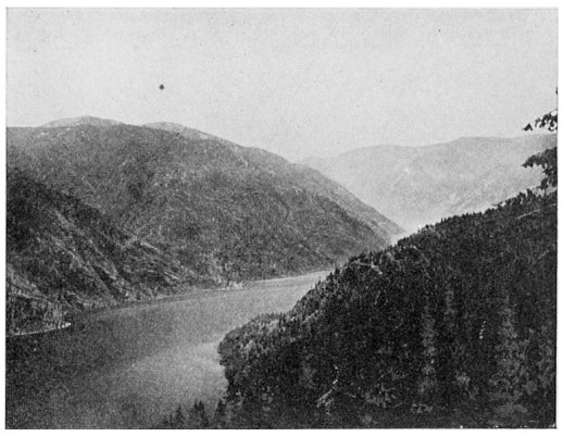
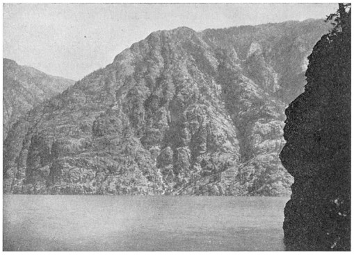
The lake averages less than two miles in width, and seems all the narrower for being shut in between gigantic mountains. For some miles we pass under the precipitous cliffs of Goat Mountain, where formerly numerous herds of mountain goats found pasturage.
At every bend in the lake the views become more grand and inspiring. Here is a dashing stream, roaring in a mad tumble over the boulders into the quiet lake—a stream which has its source perhaps a mile above, in some snow-bank hidden from sight by the steep, rocky walls. Next a waterfall comes into view, pouring over a vertical cliff into the lake. Occasionally snow-clad peaks appear, but only to disappear again behind the near mountains. What pleasant spots we notice for camping by the ice-cold streams! They are full of brook trout, while larger fish are to be found in the lake.
At the head of this body of water there is a little hotel for the accommodation of visitors, and the Stehekin River, which is steadily at work filling up the lake, hurries past its doors. Since the melting of the glacier which once filled the cañon, the river has built a delta fully half a mile out into the water.
The lake has the appearance of filling an old river valley or cañon. Perhaps the latter is the better name because the bed is so narrow and deep. This cañon winds among the mountains just like other cañons in which rivers are flowing, but it has no outlet at the present time. In some way a dam has been formed, and the cañon, filling with water to the top of the dam, has become a lake.
Soundings have shown that the water is fourteen hundred feet deep; that is, a little more than a quarter of a mile. With the exception of Crater Lake, in Oregon, this is the deepest body of water in the United States. It is also interesting to note that the bottom of the lake is fully three hundred feet below the level of the ocean.
How could a river cut a channel for itself so far below the ocean level? Rivers cannot do work of this kind unless they have a swift current; moreover, as they empty into the ocean, their beds must be above sea level. Some people think that the great glacier, which certainly at some time occupied the depression in which the lake lies, dug out the cañon. This glacier was over three thousand feet in thickness, for the rocks are grooved and polished to a height of nearly two thousand feet above the surface of the water. It is, nevertheless, improbable that the glacier did anything more than deepen and widen the cañon somewhat. It was certainly made, as we at first supposed, by a river which flowed through it at some remote period. At that time the land of our Pacific coast must have stood many hundred feet higher than it does now.
FIG. 59.—GOAT MOUNTAIN, NORTH SHORE OF LAKE CHELAN
The surface of Lake Chelan is a little more than three hundred feet above the bed of the Columbia River, which flows through a deep cañon only three miles distant. If we could remove the dam of glacial boulders and gravel at the lower end of the lake, the water would be lowered only three hundred feet. The lake would not be drained, for it is very much deeper. Now here is another puzzle for us: the bottom of the lake is more than one thousand feet below the level of the Columbia. We shall have to go still farther back into the past to get a satisfactory explanation this time.
Hundreds of thousands of years ago there was no plateau filling central Washington, and no Columbia River crossing it. The Cascade Range stood where we see it to-day, and the region of the plateau was a broad valley, toward which flowed the streams that had already cut cañons upon the eastern side of the range. These streams probably united in a river emptying westward into the Pacific by a course now unknown. The shores of the ocean were farther west than at present, for the land stood higher.
The cañon of Lake Chelan was made by a river of this period, which through many long years gradually deepened and enlarged its channel. The river worked just as we see rivers working at the present time, for throughout all the history of the earth rivers have not changed their habits. Then came the long period of volcanic eruptions. Our Northwest was flooded by fiery lava, which built up the Columbia plateau and buried under thousands of feet of rock the old river valley into which the cañon of Chelan emptied.
Then streams of water began to flow over the plateau from the higher mountains above the reach of the lava. These streams formed the Columbia River, which sought the easiest way to the sea, and finally excavated a cañon for hundreds of miles. In a portion of its course the river came close to the edge of the Cascade Range. The ancient cañon of Lake Chelan had been dammed up by the lava, and a lake occupied a portion of the former bed of the river. The Columbia could not cut its channel deep enough to drain the lake, and there it remained.
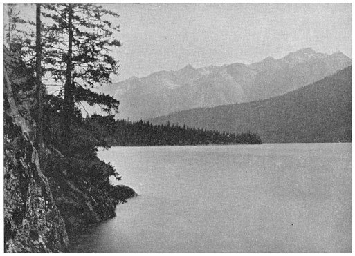
FIG. 60.—LOOKING DOWN LAKE CHELAN FROM THE UPPER END
Then another change came: the climate grew cold and heavy snows gathered upon the Cascade Range. The snow did not all melt during the summers, but went on increasing from year to year. The masses of snow moved gradually down the mountain slopes, growing more and more icy until they became true glaciers.
In this manner it came about that a river of ice occupied the cañon in which the old lake lay, and, displacing its waters, scraped and ground out the bottom and sides. The moving ice deposited the waste material at the lower end of the cañon, where it joined the Columbia River, the cañon of which was also occupied by a glacier coming from farther north. When the glacier began to retreat up the Chelan cañon, it left a great mass of rock débris, forming a dam between its basin and the Columbia. After the ice had disappeared, water collected in the cañon above the dam, and the narrow, deep lake was formed, enclosed within granite walls.
As the snows melted, forests spread over the mountains, the bear, deer, and mountain goats came back again, while the streams, bringing down earth and rocks, began their work of filling up the lake. This task they will succeed in accomplishing some day unless something unforeseen happens to prevent. A valley, composed partly of meadow and partly of boulder-covered slopes, will then have taken the place of the lake.