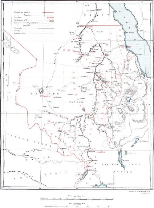
Volume 2 — Gondokoro and neighbourhood. (Vide also end of Chapter II in Vol. I.)
Reading edition
By Captain Dugmore, 1901.
Country.Near Gondokoro the country is perfectly flat and 30 feet above the river, covered with borassus palm near the station, sidr, sunt, and a few tamarinds and sycamore. Due E. lie the hills of Belinian (about 11 hours’ march). The surface soil is sandy and the sub-soil clay. There are many very fertile islands in the Nile covered with cane-like reed, very like papyrus. Natives prefer to live on and cultivate these islands, as they are not subject to white ants, grasshoppers, caterpillars, and blight, with all of which cultivation has to contend on the mainland. Flocks of small birds do great damage to grain crops. At high Nile these islands are subject to inundation; the natives then go over to the mainland.
The station now occupied at Gondokoro occupies the site of the old Egyptian post—a good many of the old trenches and parapets still exist. The old buildings, &c., have long ago fallen into the river, which is said to be twice (?) as wide now as it was in Baker’s time. Baker’s old camp (“Ismailia”) is in a swampy, low-lying piece of ground, about 2 miles N. of the old Egyptian station. Two date palms, 11 lemon trees, and two custard apple trees, still remain at Gondokoro.
Rain percolating and the river washing away cause continual falls of the bank.
Garrison.One company of Uganda Rifles (Sudanese), under a British Captain, Lieutenant, and Sergeant-Instructor. A small number of Police or Constabulary have been added, and are under the control of the Civil Authority, viz.: a Collector.
Supplies.At present nearly all stores, ammunition, and clothing, come from Mombasa, India, and England, viâ Kampala. Food is obtained by purchase from the natives.[46]
Natives grow red dura and maize chiefly, also a small amount of semsem, telabun, ful (ground nut), and lubia (small pea or bean). The ground nut does particularly well in the sandy soil. The sweet potato requires irrigation, and the natives do not take kindly to such laborious work.
Climate.The climate is fairly good, the rainy season at its commencement being the worst time of the year. Temperature:—
Average maximum during the hot months is 99° in the shade.
„ minimum „ „ 85° „
„ maximum during the rest of the year is 88° in the shade.
„ minimum „ „ 74° „
Seasons.Hot weather commences middle of November and lasts till end of March. Rains commence (or should do so) last week in March and last till middle of June, they commence again middle of July and last till middle of October.
The rains are erratic, there being sometimes a drought and sometimes too much rain.
Products.Dura, maize, semsem, ground nuts, beans, and fish. A small quantity of ivory. Salt from the left bank. Ostrich feathers from the Latuka. (N.B.—According to recent game regulations, it is forbidden to buy feathers unless it can be shown that they were pulled from a tame bird.)
Cattle.In the Nile province generally, the goats and sheep are small (much smaller than those of the Sudan), and have little to recommend them. The cattle (the few that are left) are also small, but are good milkers on the whole.
Game.Elephant, hippopotami and rhinoceros plentiful, especially the two former, a few zebras and giraffe, hartebeeste (? Jackson’s), waterbuck, bush buck, cobus Thomasi (Uganda cob), and dig-dig abound. Buffalo and warthog may be met with. Lion, leopard, and wild cat are fairly plentiful. (N.B.—During the dry weather months the game is found near the river in quantities; when the grass is high and there is water inland, it is not so easy to see much). Guinea fowl, greater and lesser bustard, quail snipe, ducks, geese, and other waterfowl and partridges are nearly always to be shot.
(a.)—GONDOKORO to WADELAI.
By Captain Dugmore, 1901.
Place. Miles. Description.
Inter-mediate. Total.
Gondokoro — — A good road, though apt to be swampy in the rains.
River Kit 12 12 Cross River Kit; a sandy river about 180 yards wide, which is easily crossed except after very heavy rain (it subsides quickly). On the E. Lokoya’s chain of hills, about 11 hours march; greatest height about 1,500 feet. Road through dense thorn scrub, sidr very plentiful. Soil changes after passing Kit to a clayey formation in places, and stones and rocky kopjes become abundant. A rose quartz, very similar to the Rhodesian gold-bearing quartz in appearance, is plentiful. Most of the kopjes appear to be of volcanic origin. Ground rises in undulating folds from the Kit to opposite Dufile.
Fort Berkeley 10 22 From Fort Berkeley (= Bedden—abandoned), two roads lead S., one inland on the high ground for use during the wet season.
Adam Madi 8 30 The river road follows the river as far as Adam Madi’s,[47] and is used when no water is obtainable on upper road. Fine scenery, very rocky ground, sandy; plentiful remains of old Bari villages. Near Adam Madi’s-beautiful park-like country, with very large timbers, both tamarind and (?) sycamore. Country now becomes more hilly and is more thickly populated.
The Khor Um or Uma is the real southern boundary of the Bari tribe, but the district is supposed to extend to the
Khor Assua 69 99 Khor Assua (mouth 94 miles from Gondokoro measured along the river) and, consequently, includes a few villages of Madi and Shuli tribes.
The road used to go some little way from the river to Affuddu (a few miles S. of Nimule, now abandoned), but since the occupation of Nimule, the road from Adam Madi’s almost follows the course of the river, which flows through high, almost precipitous banks.
Nimule 17 116 Garrison at Nimule, two companies of Sudanese (124 strong each), and the same number of British officers each as at Gondokoro. Is headquarters of Nile military district, situated on N. bank of Unyama river at its junction with the Nile. Between Nimule and Wadelai the road is good.
Lamogi, in the Shuli country, 16 miles W. of Fatiko, and 50 miles S.S.E. of Nimule, is now abandoned; rains about 9 months in the year.
Wadelai 77 193 Wadelai, on the right bank, is the head-quarters of the Nile Province Civil Administration, some police or constabulary are posted here. River only 200 yards wide here. There is a road from here to Fajao (Murchison Falls), 46 miles, not used now.
As one goes S., the climate generally becomes cooler than at Gondokoro. It should also be healthier, but there has been a lot of sickness among the British officers in the past, perhaps due to bad quarters. Country S. of Khor Assua is more fertile and much more thickly populated than the Bari district.
Note.—See also report by Mr. F. Pordage, Public Works Department, Uganda, in Uganda Intelligence Report, No. 15; and Handbook of Uganda, pp. 52-57.
(b.)—GONDOKORO to WADELAI.[48]
Place. Miles and Hours.[49] Description.
Intermediate. Total.
Miles. Hours. Miles. Hours.
Gondokoro — — — — Path good.
Laung 11 3½ 11 3½ Path good, river Gomoro (Kit) is at times bad to cross.
Camp 13 4½ 24 8 Path good.
Camp 15 5 39 13 Path good.
Fagiri 12 4 51 17 Path good; rocky in places. Large village; considerable supplies of food.
Keri 13 5 64 22 Path bad for 2 miles, remainder good.
Arabu 16 5½ 80 27½ Path very bad.
Junction Camp 13 4½ 93 32 Path bad. River Assua difficult to cross. When in flood about 80 yards wide and 14 feet deep, with a swift current; when not in flood the river is fordable. Crossing is at all times dangerous on account of the numerous crocodiles.
Nimule 14 4½ 107 36½ Path good. River Unyama at times bad to cross.
Zaipi 18 4 125 40½ Path good.
Boreli 10 4 135 44½ Path good.
Acho 16 5½ 151 50 Path good. River Zoka at times bad to cross.
Pranga 16 6 167 56 Path good.
Avoi 13 4 180 60 Path good. River Chorr is at times bad to cross.
Wadelai 19 6 199 66
Note.—A small supply of food can usually be supplied at each of the above camps, with the exception of the Junction Camp. Water is obtainable at all camps. At many places fish can be bought. Trade goods are brass, wire, small white beads, candles, matches, bottles, and some cloth. Tarbushes are much appreciated by the chiefs. Hippo. abound in the Nile, and elephants between Nimule and Gondokoro. Lions are seen occasionally.
See also reports by Col. Coles, D.S.O., “Nimule to Gondokoro, and Gondokoro to Nimule,” in Uganda Intelligence Report, No. 19.
The following short account of the country between Nimule and Gondokoro is given by Sir C. Eliot (July, 1902), from Geographical Journal, December, 1902:—
“Immediately after Nimule begin the rapids, which render the river unnavigable up to Bedden, about 30 miles above Gondokoro. This latter station and Nimule are connected by two roads, neither of them good. One keeps close to the Nile, and was impracticable when I made the journey, as it was under water owing to recent rains;[50] the other runs further inland. It cannot be said to offer adequate means for communicating between two Government stations, or for the transport of any sort of goods. For a great part of its course is obstructed by marshes, thorn bushes, or grass 6 feet high; but here and there it passes through pleasant open meadows, studded with large trees. Part of it consists of precipitous paths cut in the rock, and it is crossed by many rivers, at least three of which, the Assua, the Karpata (?), and the Kit (or Kiti), present serious obstacles to foot passengers when in flood, as I found them. The first is crossed on rafts made of ambach, a very light wood. The natives show considerable skill in guiding these rafts across the torrent, but the passenger or load is generally half submerged. The two other rivers have to be crossed by wading, and are about 4 feet deep. The Kit was about 150 yards wide. The whole journey took me 7 days, that is to say, 6 night camps. The distance is between 110 and 120 miles.”
THROUGH COMMUNICATIONS WITH MOMBASA.
(Compiled from Official Publications, &c.)
Plenty of notice must be given by the intending traveller, in order to secure the use of porters, boats, mules, and carts.
Nimule to Butiaba.From Nimule onwards the traveller can generally make use of Government boats. Between Nimule and Wadelai ([51]93 miles) the usual craft is a small steel rowing boat, and from Wadelai to Butiaba ([51]72 miles), (the Uganda Government Depôt on the E. shore of Lake Albert), a large steel boat which goes best under sail. The usual time occupied between Nimule and Butiaba is 10 to 12 days up stream, and 5 to 8 days down stream. A steam launch will shortly be placed on the river between these points.
Butiaba to Kampala.At Butiaba is a pier and landing stage. From Butiaba viâ Hoima to Kampala, 157 miles (telegraph), the road is fairly suitable for driving. The distance has been done in 4½ days, but the usual time taken is 8 days (driving) to 12 days (marching, with porters). The Stages are:—
Miles. Miles. Miles.
1. Wachi 6 2. Kajura 9 3. Hoima[52] 13
4. Kigonna 10 5. Kikonda 8½ 6. Yilo 17
7. Kigoma[53] 9 8. Kiboga 5½ 9. Kisingo 9½
10. Kative 15½ 11. Kabula Mnbiro 9 12. Nkvanuna 11
13. Kikandwa 13½ 14. Kisimbiri 11 15. Kampala 9½
Most of the main roads pass through Kampala.
Kampala to Entebbe.From Kampala to Entebbe, the capital, situated on the Victoria Nyanza, is 23 miles along a good cart road.
Entebbe to Port Florence.From Entebbe there is a fortnightly steamer across the lake to Kisumu, or Port Florence, the terminus of the railway to Mombasa. The crossing takes 2 to 3 days per steamer, and up to 10 or 15 days by sailing dhow.
Port Florence to Mombasa.From Port Florence to Mombasa there is a weekly train (or more)—fare, 109½ rupees; the distance, 584 miles, is traversed in about 2¼ days.
There is a monthly service from Mombasa, both by British India and by German steamers.
Recapitulation.
Journey. Days. Transport.
Gondokoro to Nimule 7 to 8 March on foot. Carriers.
Nimule to Wadelai 6 „ „
„ „ 6 to 8 Row-boat.
Wadelai to Butiaba 4 to 6 Sailing boat.
„ „ 3 Steam launch.
Butiaba to Kampala 4 to 8 Mule cart.
„ „ 10 to 12 March. Carriers.
Kampala to Entebbe 1 Mule cart.
„ „ 2 March. Carriers.
Entebbe to Port Florence 2 to 3 Steamer.
„ „ „ 8 to 15 Sailing boat.
Port Florence to Mombasa 2½ Train.
Record possible, Gondokoro to Mombasa: 25½ days.
140.—ROADS in the LADO ENCLAVE.
Roads.A road runs from Kiro to Rejaf direct, at some distance from the river bank, with a branch road to Lado.
The road from Rejaf as far as Faraji—170 miles to the S.W.—is about the same width as a good English high road. It has many bridges over streams, small khors, &c. They are made of wood and are not at all strong. There is a project to run automobiles[54] over this road, but the bridges are not at present (June, 1903) strong enough. One automobile will probably run between Rejaf and Yei station (94 miles), and another from Yei to Dongu (62 miles), as there is no bridge over the Yei. The Yei and Dongu are 40 to 60 yards broad and very deep during the rains.
There are some parts of the road which are worse than others, and it is proposed to have small stations at which bullocks will be kept in order to pull the automobiles over them.
There are rest-house stations every two or three hours the whole way from Rejaf to Dongu and Ibembo (v. below). At each of these stations there are houses for Europeans, and at a great number of them bananas, pawpaws, fowls, eggs, &c., are now obtainable.
Vegetables, bananas, &c., are being planted at all the stations.
Each station is in charge of one or more soldiers.
Loka or Loki.Loka (called also Gumbiri).—Four days (62 miles) from Rejaf. A white officer in charge, and one or two N.C.O.’s. Surrounded by a wooden stockade. About six good brick buildings with grass roofs.
Yei.Yei.—Close to the Nile-Congo watershed. Two days (37 miles) from Gumbiri. Large fortified station, but not yet completed, situated on high ground, from which good view of the surrounding country is obtained. A far larger station than Lado. About ten white officers and a doctor. None of the Belgian Nile stations in any way compare with this one. All white men’s houses are outside the fortifications. About 12 good brick buildings with grass roofs; very healthy.
Aba.Aba.—Three days (32 miles) from Yei. Wooden stockade. Four brick houses and a large one being built for the Commandant. The latter outside stockade. One white officer and one N.C.O.
Faraji.Faraji.—Four days (38 miles) from Aba, on left bank of River Dongu. Brick wall about 6 feet high. Ditch outside; earth from ditch thrown up against the wall. Good brick buildings. Three white officers.
Dongu, &c.Dongu.—Five or six days from Faraji; at junction of Rivers Dongu and Kibali. Brick buildings.
Stations beyond Dongu, towards the Congo, on the automobile road, are:—
Niangara.
Surunga.
Amadi.
Bomokandi.
Mbima.
Buta.
Ibembo.
A road also leads from Mbima to Jabbir and Gembele.
Bofaki.Bofaki, or Wando.—Important post, and garrison. Healthy. Large rubber and coffee plantations.
Rejaf.Rejaf: on the Nile.—Small post. Bullock carts take 20 days along the sandy road from Yei; usual time 7 days by march route.
Dufile.Dufile.—Small post. There is a railway-track ready made from here to Stanleyville on the Congo; not ready for traffic yet.
At all the posts mentioned there are cattle, fowls, bananas, vegetables, &c.
Mails leave Lado for Ibembo on the 1st and 15th of every month.
From Rejaf a road is being made to New Dufile, thence to Mahaji. This road is joined at Kaji Kaji, about 60 miles S. of Rejaf, by a road from Loka.
From Yei a road runs down the Yei River to Amadi.
LONDON: PRINTED FOR HIS MAJESTY’S STATIONERY OFFICE, BY HARRISON AND SONS, ST. MARTIN’S LANE.
THE ANGLO-EGYPTIAN SUDAN