AMERICAN ENCYCLOPEDIA (continued 31)
Reading edition
In the evening of the 18th, some heavy pieces of grounded ice to which the bow halser of the Hecla was fastened, fell off into the water, snapping the rope without injuring the ship. Nevertheless, as every alteration of this kind must materially change the centre of gravity of the whole mass, it was thought prudent to move the Hecla out of her harbor to the place where the Griper was lying, lest some of the bergs should fall upon her deck and crush or sink her.
On the 20th and 21st, the young ice formed to such a degree, as to cement together all the loose ice about the ships; nor did it thaw on either of those days, though the sun shone clearly upon it for several hours. The main body remained close and firm in every direction. The same state of things obtained on the 22d, and in the morning of the 23d, the young ice was an inch and a half thick. A breeze springing up from the westward put it in motion, so that by noon the ships were able to warp out and proceed eastward. In a short time, however, the ice closed so firmly around them that they became wholly unmanageable, and received many blows, more severe than any they had received before. After having drifted with the ice six miles, they were made fast to some grounded ice.
The situation in which the ships were now placed, and the shortness of the navigable season, caused great anxiety. Judging from the experience of 1819, it was reasonable to conclude that about the 7th of September, was the limit beyond which the ships could not keep the sea with any degree of safety or prospect of success; but being thoroughly impressed with the idea that it was incumbent on him to make every possible effort, Captain Parry determined to extend this limit to the 14th of September, before which date the winter would have set in. The prospect was not very encouraging, even with this extension; they had only advanced sixty miles this season, and the distance to Icy Cape was yet between eight and nine hundred miles, supposing them to find a clear passage. The provisions, too, were so far reduced in quantity, that by no means could they be made to hold out longer than till April, 1822, and the deficiency of fuel was even more apparent. These and other minor considerations, induced Captain Parry to ask the advice and opinions of his officers relative to the expediency of returning to England. They all agreed that any attempt to penetrate farther westward in their present parallel, would be fruitless, and attended with loss of time that might be more profitably employed elswhere. They advised that the vessel should run back along the edge of the ice, in order to look for an opening that might lead toward the American continent, and after a reasonable time spent in the search, to return to England. This advice agreeing with his own opinions, Captain Parry resolved to comply with it.
On the twenty-fourth the ships moved again, and found less ice as they advanced, so that when, on the morning of the 27th, they cleared the east end of Melville Island, the navigable channel was not less than ten miles wide. A constant look-out was kept from the crow’s nest for an opening to the south, but none occurred. The weather was hazy, so much so that they were again obliged to steer the ships one by the other. As they proceeded, several islands hitherto unknown, were discovered, but no opening was seen in the ice, and when they had, on the 30th, reached longitude 90 degrees, they became satisfied that there was no possibility of effecting their object, and Captain Parry, therefore, conceived it to be his duty to return forthwith to England, in order that no time might be lost in following up his discoveries, if his government should deem fit to do so.
The Hecla arrived at the Orkney Islands on the 28th of October; and the Griper on the first of November. Thus did they return from a voyage of eighteen months duration, in good health and spirits, with the loss of only one man.
Second Voyage.—The discoveries made by the expedition under Captain Parry in 1819–20, being believed to afford a strong presumption of the existence of a Northwest Passage to the Pacific Ocean, the British government commanded that another attempt should be made to discover it. The Hecla having been found well adapted to this kind of service, the Fury, a ship of precisely the same class, was selected to accompany her. Captain George F. Lyon was appointed to command the Hecla, and Captain Parry, whose efforts had made him justly celebrated, was commissioned to command the expedition.
Some alterations in the interior arrangements of the vessels, such as were suggested by the experience of Captain Parry, were made. Among these was an apparatus for melting snow, which was found very useful, and was so little in the way that it could not even be seen. Cots and hammocks were substituted for the former bed places, and some improvements were made in the manner of victualing the ships.
In his official instructions, Captain Parry was directed to proceed into Hudson’s Strait, till he should meet the ice, when the Nautilus Transport, which was placed at his disposal, was to be cleared of its provisions and stores. He was then to penetrate westward, till he should reach some land which he should be convinced was a part of the American continent, at some point north of Wager River. If he reached the Pacific, he was to proceed to Kamschatka; thence to Canton or the Sandwich Islands, and thence to England, by whatever route he might deem most convenient.
Accordingly, in the beginning of April, 1821, the three vessels sailed from England. Nothing worthy of note occurred till they met with the ice in Davis’ Strait, where the vessels were moored to an iceberg, and the Nautilus was unladen. This done, she parted company on the 1st of July, and sailed for England, while the Fury and Hecla stood towards the ice, which they reached a little before noon, and ran along its edge, keeping as much to the westward as possible.
On the 24th they reached the Savage Islands, and landed on one of them. They are many—all exhibiting the same appearance of utter sterility. That on which they landed was from six to eight hundred feet above the level of the sea. Here they noticed the same appearances of an Esquimaux camp as had been seen at Melville Island, with a few pieces of fir, which proved that the savages, in these parts, were not in want of wood, since they could afford to leave it behind them. Hares and several species of birds were seen on this island.
As soon as the exploring party returned on board, all sail was made to the westward, the sea being now nearly free from ice. The next day the hills on the coast of Labrador were seen. Thus they kept on till the 31st, discovering islands as they proceeded. On the afternoon of this day, an Esquimaux oomiak was seen coming from the shore of Salisbury Island, under sail, accompanied by eight kayaks. In this boat were sixteen persons, of which two were men, and the rest women and children. In dress and personal appearance, these people did not differ from the Esquimaux last seen, but their behavior was far less offensive.
On the first of August, the ships kept on westward between Nottingham Island and the north shore, which is fringed with small islands. This channel is about twelve miles wide. In the course of the morning, some Esquimaux came to the ships from the main land, bringing oil, skin dresses, and walrus’ tusks, which they exchanged for any trifle that was offered. They also offered toys for sale, such as models of canoes, weapons, etc. Here, for the first time, the navigators saw the dresses of the savages lined with the skins of birds, having the feathers inside.
Having run forty miles in the night without seeing any ice, they came the next morning to a pack so close as to prevent their farther progress. The ships received very heavy blows, and with considerable difficulty got clear of it. They ran along the edge several miles to the northward, in search of an opening; but finding none, they stood back to the southwest, to try what could be done in that quarter.
The expedition being now about to enter upon ground hitherto unexplored, it became necessary for Captain Parry to decide on the route he should pursue with most advantage; and after mature deliberation, he came to the resolution to attempt a direct passage of the Frozen Strait, though he greatly feared the loss of time that would be the consequence of a failure.
After contending with the ice for several days, on the 11th, the ship succeeded in getting to the northern land, and a party of the officers landed upon a small rock, or islet, a mile and a half from the shore.
Soon after the party returned on board, a fresh gale from the north compelled them to make the ships fast to the largest floe near, in order not to lose much ground. The gale moderated about noon, and they cast off from the floe and made sail. They made considerable progress till evening, when the ice closed round them again. After sunset on the 13th, they descried land to the westward, which they believed to be a part of the continent. Yet they continued closely beset, and on the 15th the Hecla drifted back with the ice, out of sight of her consort. This was partly owing to the extraordinnry refraction upon the horizon, which apparently diminished and distorted objects, at no great distance, in a wonderful manner. On the next day, however, the Hecla hove in sight, and upon which the Fury set sail and beat through the channel. On the morning of the 17th, the weather being too foggy to move, parties from both ships went on shore, to examine the country and to procure specimens of its natural productions.
As soon as the weather cleared up, they returned on board, and sailed to the northeast, where alone they had any chance of finding an outlet. Having ascertained the continuity of land round this inlet, they gave it the name of the Duke of York’s Bay. It was now certain that the object of the expedition could not be effected in that direction; and they therefore sailed back, through the narrow channel by which they had entered, with the intention of seeking an opening further north, without delay.
It would be tedious to tell of every obstacle that hindered or delayed the ships. They pursued their intended course along the shore, when the wind and weather permitted; and when unavoidably detained, they landed. Among other places, they landed at Repulse Bay, in latitude 66 deg. 30 min. and longitude 86 deg. 30 min. From all indications, the water through which they had been sailing, was the imperfectly known Frozen Strait; and Captain Parry resolved to keep along the land to the northward, and examine every bend or inlet, which might appear likely to afford a practicable passage to the westward.
Sailing on the 23d along the northern shore of Frozen Strait, it was observed that the land appeared in one place to consist of islands only, behind which no land was visible. This part of the coast appeared to Captain Parry so favorable to the accomplishment of his enterprise, that he resolved to examine it more closely. Having beat up to the mouth of an opening that seemed practicable, he found the greater part of the channel filled with a body of ice, rendering examinations in ships or boats impossible. The only means, therefore, of exploring it were, to despatch a party by land. Captain Lyon undertook this service, accompanied by five persons, furnished with a tent and four days’ provision. The ships were anchored to await his return a mile from the shore. The flood tide came out of this inlet, a circumstance that materially strengthened their hopes of success.
Captain Lyon first landed on an island, and then crossed a strait to a steep point. Thence proceeding northward to a hill, he found the strait continuous, and returned to the ships. On this short journey, he passed the remains of a great many Esquimaux habitations. The result of Captain Lyon’s excursion was to convince all concerned, that a communication existed here between Frozen Strait and a sea to the northward and eastward of it, and Captain Parry determined to explore it as far as possible.
After drifting about some time in the ice, and more than once narrowly escaping shipwreck, measures were taken to survey this part of the Frozen strait; but little knowledge was gained by all their efforts. On the 1st of September, the prospect of getting northward, was by no means encouraging; and they were, from time to time, beset with ice, and drifted back. On the 3d, they found that after a laborious investigation, which had occupied a whole month, they had returned to nearly the same spot where they had been on the 6th of August, near Southampton Island.
On the 1st of October, rain fell, which immediately freezing, made the decks and ropes as smooth as glass. For several days the thermometer had been below the freezing point, and sometimes as low as 20 deg. at night, which change, together with the altered aspect of the land, and the rapid formation of young ice near the shores, gave notice of the approach of winter. The commencement of this dreary season in these regions may, indeed, be dated from the time when the earth no longer receives and radiates heat enough to melt the snow which falls upon it.
On the 8th the young ice on the surface began to give them warning that the navigation of those seas was nearly eneed for the season. When the young ice has acquired the thickness of half an inch, and is of considerable extent, a ship must be stopped by it, unless favored by a strong and fair wind; and even when making progress, is not under the control of the helmsman, depending mostly on the thickness of the ice on one bow or the other. Boats cannot be employed in such situations with much effect.
When to these difficulties were added the disadvantage of a temperature near zero, and twelve hours of daily darkness, Captain Parry became convinced that it was expedient to place the ships in the most secure situation that could be found, rather than run the risk of being permanently detached from the land by attempting to gain the continent. Accordingly a canal was sawed into a harbor on the south side of a small island, to which the name of Winter Island was given, and the ships were warped to their winter stations. Thus ended their operations for the season, after having explored a portion of coast six hundred miles in extent, one half of which belonged to the continent of America.
The arrangements for passing the winter comfortably were pretty much the same as those which had been made at Melville Island, with some improvements, suggested by former experience. The theatre was better fitted than before, and a school was established for the benefit of such of the crews as might wish to learn to read and write. The lower deck of the Fury was fitted for a church, and the companies of both ships attended during the winter. The men were sent to walk on shore for exercise, whenever the weather was favorable; and finger-posts were erected in various parts of the island, to prevent them from losing their way.
On the 11th of December, the weather being tolerably clear, stars of the third magnitude were visible to the naked eye at forty minutes past eight, and those of the second magnitude till a quarter past nine, which may give some idea of the degree of light at this period. The twilight was, of course, very long, and the redness of the sun’s rays might be seen more than three hours after its setting.
On the 13th, the thermometer fell to 31 deg., being the lowest temperature yet experienced. Rising on the 17th to 5 deg., the play of The Poor Gentleman was performed. On Christmas eve the theatre was again put in requisition, and the next day was celebrated to the utmost extent their means would allow. Among the luxuries of the Christmas dinner were a few joints of English roast beef, which had been preserved expressly for the occasion, the first and last ever eaten in Frozen Strait.
The same occupations, that had employed them at Melville Island served to beguile the time this winter. Nothing material occurred till the first of February, unless the circumstance of seeing a white bear may be accounted so.
On the first of February, a number of Esquimaux were seen coming toward the ships over the ice, and the appearance of huts was discovered on the shore with a telescope. Captains Parry and Lyon, with three or four others, set out to meet the natives who were slowly approaching, to the number of twenty-five. As the officers advanced, they stood still, awaiting their approach. They had no arms, but carried only a few strips of whalebone, which they had brought for a peace-offering, and which the gentlemen immediately purchased for a few small nails and beads. There were several women and children with the party, and the behavior of all was quite peaceable and orderly. They were all handsomely dressed in deerskins, and some had double suits.
However quiet these savages were, they did not exhibit the slightest signs of apprehension or distrust. As soon as some understanding was established, the officers expressed a wish to visit their huts, and the Esquimaux readily complying, they all set out together. The savages were greatly astonished on the way, to see a large dog, belonging to the whites, fetch and carry; and the children could scarcely contain their joy when Captain Lyon gave them a stick to throw, and the dog brought it back to them. An infirm old man, who supported himself with a staff, which he much needed, was left behind by his companions, who took no notice of his infirmities, but left him to find his way as he might, without reluctance or scruple.
An intercourse was kept up between the ships and the Esquimaux, as long as the latter remained there, which was until the 23d of May, when they set off with all their goods and chattels, including a parting gift from Captain Parry.
The caulking of the bows being now completed, the ships were released from the ice by sawing around them; an operation which made them rise in the water six inches and a half, in consequence of the buoyancy occasioned by the winter’s expenditure.
An increased extent of open water appeared in the offing, Captain Lyon again departed, accompanied by nine persons, with a tent, fuel, and provisions for twenty days. Each individual was furnished with a light sledge, to draw his provision and baggage, which might weigh about an hundred pounds. Their instructions were, after gaining the continent to proceed along the coast and examine it, and to make observations respecting the tides and the natural productions of the country.
He set out on the 8th of May, and rested on the 9th at a low, rocky point, which he called Point Belford. Proceeding northward, he had given the following names successively to different parts of the coast, viz: Blake’s Bay, Adderly’s Bluff, Palmer Bay, Point Elizabeth, and Cape William; when, finding his provision and fuel half expended, he judged it prudent to return.
Flocks of birds now began to give token of returning summer, and, on the 25th, some Esquimaux, who came from an encampment to the westward, reported having seen a great many reindeer. Yet at the close of May it was a matter of general regret that there was little prospect of the departure of the ice, and that few indications of a thaw had been observed. The navigators could not fail to remember that at Melville Island, though so much farther north, the season had, on the same day two years before, advanced full as far as now at Winter Island. The parts of the land which were most bare were the smooth, round tops of the hills, on some of which were little pools of water. There were also, on the low lands, a few dark, uncovered patches, looking, in the snow, like islets in the sea. Vegetation seemed striving to commence, and a few tufts of saxifrage oppositifolia, when closely examined, discovered some signs of life. Such was the state of things on shore: upon the ice, appearances were as unpromising. Except in the immediate vicinity of the ships, where from incessant trampling, and the deposit of various stores upon the ice, some heat had been absorbed artifically, there was no perceptible sign of dissolution on the upper surface, where six or seven inches of snow yet remained on every part. In these circumstances, Captain Parry resolved to try what could be done to release the ships by cutting and sawing. Arrangements were, therefore, made for getting everything on board, and for commencing this laborious work.
The operation began on the 3d of June, and was completed in sixteen days, by severe and persevering labor. In the meanwhile, Nature seemed unwilling to lend our mariners any aid: the dissolution of the ice was so slow as scarcely to be perceptible. However, it was so weakened by the cut made, that the first pressure from without effected a rupture, so that a favorable breeze only was needed, to enable the ships to put to sea. On the 2d of July, the wind, for the first time, became fair, and the ships sailed.
Winter Island is ten miles and a half in length, from north-west by north, to south-east by south, and its average breadth from eight to ten miles. It is what seamen call rather low land; the height of the south-east point, which was named Cape Fisher, out of respect to the chaplain and astronomer, being seventy-six feet, and none of the hills above three times that height. The outline of the land is smooth, and in the summer, when free from snow, presents a brown appearance. Several miles of the north-west end of the island are so low and level, that when the snow lay thick upon it, our travelers could only distinguish it from the sea by the absence of hummocks of ice.
The basis of the island is gneiss rock, much of which is of a gray color, but in many places also the feldspar is so predominant as to give a bright and red appearance to the rocks, especially about Cape Fisher, where also some broad veins of quartz are seen intersecting the gneiss; and both this and the feldspar are very commonly accompanied by a green substance, which appeared to be pistacite, and which usually occurs as a thin lamina adhering strongly to the others. In many specimens these three are united, the feldspar and quartz displaying tolerably perfect crystals. In some of the gneiss small red garnets are abundant, as also in mica-slate. In lumps of granite, which are found detached upon the surface, the mica sometimes occurs in white plates, and in other specimens is of a dirty brown color. There are several varieties of mica-slate, and some of these have a brilliant metallic appearance, like silver; those which are most so, crumble very easily to pieces. The most common stone next to those already mentioned is lime, which is principally schistose, and of a white color. Many pieces of this substance, on being broken, present impressions of fossil-shells, and some have also brown waved lines running quite through them. Nodules of flint occur in some masses of lime, but they are not common. Iron pyrites is found in large lumps of black stone, tinged externally with the oxyde of iron: it is here and there met with in small perfect cubes.
Sailing northward along the coast, the ships were soon stopped by the ice. While they remained stationary, a party of natives was discovered on shore, who proved to be their neighbors of Winter Island. They were cordially greeted by the officers and seamen as old acquaintances, and loaded with presents. On leaving the ships, one of them sent Captain Parry a piece of seal skin as a present, without the least prospect or expectation of a return. We mention this trifling incident, merely because it was the first and only undeniable proof of gratitude observed among these people.
Slowly and painfully our navigators pursued their course northward, always with difficulty and often with great danger. On the 12th of the month, they discovered the mouth of a considerable river, and Captain Parry went on shore to examine it. The water was fresh, and the stream varied in breadth from four hundred yards to the third of a mile. After ascending a mile and a half, the Captain heard the roar of a waterfall. At the mouth, the banks of the river were about two hundred feet high, but here they rose much higher, and the water ran on a more elevated level. As Captain Parry proceeded inland, he found the stream rushing with great fury over two small cataracts. Then turning a right angle of the river, he perceived a greater spray, occasioned by a very magnificent fall. Where the stream begins its descent it is contracted to the breadth of one hundred and fifty feet, the channel being worn in a solid bed of gneiss rock. After falling about fifteen feet, at an angle of thirty degrees, the river is again narrowed to forty yards, and as if collecting its strength for a great effort, is precipitated ninety feet, in one unbroken mass. A cloud of spray rises from the cataract, surmounted by an uncommonly vivid rainbow. The basin which receives the fall is circular and about four hundred yards in diameter, rather wider than the river immediately below. Above the cataract, the stream winds in the most romantic manner imaginable among the hills, with a smooth and unruffled surface. To this beautiful water-course Captain Parry gave the name of Barrow’s River. Its entrance is in latitude 67 deg. 18 min. 05 sec., and longitude 81 deg. 25 min. 20 sec.
The next day large herds of walrusses were seen upon the drift ice, and all the boats were sent to kill some for the sake of the oil. The sportsmen found them lying huddled together, piled upon one another. They waited quietly to be shot, and were not greatly alarmed even after one or two volleys. They suffered the people to debark on the ice near them, but on their near approach displayed a somewhat pugnacious purpose. After they got into the water three were struck with harpoons and killed. When first wounded, they were quite furious: one of them resolutely attacked Captain Lyon’s boat, and injured it with his tusks. Those which remained uninjured surrounded the wounded animals, and struck them with their tusks; whether to assist their escape, or with a hostile intention, cannot be ascertained. Two of the animals killed were females, and one weighed over fifteen hundred pounds, which was not considered an uncommon bulk. The strength of the walrus is very great. One of them being touched with an oar, seized it with his flippers, and snapped it with the utmost ease. Many of these animals had young ones, which, when assailed, they carried off, either between their flippers or on their backs. They were most easily killed with musket-balls, even after being struck with the harpoon, as their skins are so tough as to resist a whaling lance.
On the 15th, the ships reached Igloolik, for the situation of which we refer our readers to the map. Here they found a new band of Exquimaux, who proved to be the acquaintances and relatives of those of Winter Island. These people dwelt not in snow huts, but in tents, made of the skins of the walrus and seal, the former shaved thin enough to allow the transmission of light. They were clumsily made, and supported by a kind of tent-pole, constructed by tying bones or deer’s horns together. The edges of the tents were kept down by placing stones upon them. To keep the whole fabric erect, a thong was extended from the top to a large stone at the distance of a few yards. These abiding places had little appearance of affording comfort or convenience.
From these people Captain Parry learned that he had unquestionably been coasting the continent. He then determined to attempt to penetrate a large inlet, stretching west-ward from Igloolik, which, at the time of his arrival, was closed by a fixed barrier of ice, and which he named The Strait of the Fury and Hecla. We shall not follow the navigators in their arduous but unsuccessful efforts to penetrate west-ward at this point, as we have already alloted more space to their adventures than consists with our intended limits. Suffice it to say, that after persevering in the attempt till the 30th of September, they found themselves as far from the attainment of their object as at first. The cold weather then setting in, they were compelled to lay the ships up at Igloolik.
One important point was settled, however, beyond the possibility of doubt. Finding his researches ineffectual by water, Captain Parry undertook to explore the Strait of the Fury and Hecla by land. He found it continuous, and pursued his journey far enough to see the open sea beyond, thus proving the existence of a passage at this point, though it was then, and probably ever will be, closed by an insurmountable barrier of ice. Besides this result of his endeavors, the position of Cockburn Island, and indeed of all the lands adjacent to Igloolik, was ascertained, and correctly laid down on the map.
Besides the Esquimaux found at Igloolik, our friends had the society of the savages of Winter Island, who rejoined them shortly after their arrival. We are sorry that we cannot relate the adventures and observations of this winter, as they are extremely entertaining; but as they are not important in their nature, we trust to be excused for omitting them.
Igloolik is a low island, ten miles long and six broad, and exhibits the same appearance of sterility as the adjacent continent, excepting in places which have been inhabited by the natives. There, the accumulation of animal substances has produced a luxuriant vegetation. In some parts there are spots several hundred yards in extent, covered with bright green moss. The whole land seems to be composed of innumerable fragments of thin schistose limestone, some of which contain the impressions of fossil remains, while others present the cellular structure usually found in madreporite. The interior is almost an entire swamp; but there are rising grounds, which, with the remains of Esquimaux habitations upon them, are excellent landmarks.
East of Igloolik is a group of small islands called by Captain Parry Calthorpe Islands. Like almost all the land in this vicinity, they are low, but their geology differs from that of Igloolik, and resembles that of Winter Island, being composed of gneiss. Two of this group, however, are high and rugged. From the top of one of these there is a view of the adjacent shores.
The entrance of the Strait of the Fury and Hecla is about three miles wide, and is formed by two projecting headlands between which the tide rushes with great velocity. The south shore is high, but of gradual ascent, perfectly smooth and composed of beautifully variegated sand-stone. Beyond the entrance the land is bold and mountainous. Captain Parry, who it will be remembered explored the southern shore of the Strait, states the hills to consist of gray gneiss and red granite, rising, in some instances, a thousand feet above the level of the sea. In some places he saw slate, and in others sand-stone. He has left no positive data, by which we may determine the length of this Strait; but as he was rather more than a day in accomplishing the distance on foot, by a circuitous route, we may conclude that it does not exceed fifteen or twenty miles. From the point where his journey terminated he saw a continuous sea to the westward, open and unobstructed save by ice and by one small island.
There are several islands in the Strait of the Fury and Hecla. On one of these (Liddon Island) abundance of beautifully veined clay iron-stone was found. The other minerals were asbestos, crystals of carbonate of lime, and a great variety of sand-stone, of which the island is formed.
Amherst Island is flat, and on the northern part is formed of black slate, with strong indications of coal. This part of the island is utterly bare of vegetation. In a low cliff of black and rugged slate there is a beautiful and romantic grotto. The water oozing through the sides and roof, has formed the most brilliant stalactites, which form a splendid contrast with the shady part of the ebon grotto behind. The other part of the island is of clay and limestone, on which there is a very scanty covering of shriveled grass and moss.
The winter in Igloolik was spent like the preceding one, in amusements on board ship, and intercourse with the Esquimaux.
On the 9th of August the ships ran out of their harbor, where they had been detained three hundred and nineteen days. They were so embarrassed by the ice, that little use could be made of their sails; nevertheless, by the 30th of the month they passed Winter Island, having been carried three degrees by the drift in which they were beset. On the 9th of October, they made the Orkney Islands, and on the 10th reached Lerwick in Shetland, where they were received with many congratulations on their safe return.
Third Voyage. The British Government having resolved to fit out a third expedition, under Captain Parry, the Hecla and Fury were made ready for sea, the latter under the command of Captain Hoppner, and sailed from England on the 16th of May 1824. They were to attempt the northwest passage at Prince Regent’s Inlet. Having crossed the Atlantic without any material adventure, they made the bay of Lievely in Disko Island on the 5th of July.
Sailing up Baffin’s Bay, on the 17th the ships came to ice, and after many obstructions, only penetrated seventy miles to the westward. Here they encountered a hard gale, and sustained several shocks that would have crushed any ship of ordinary strength. They reached Lancaster’s Sound on the 10th of September. The winds not being favorable, the ships made small progress, and on the 13th the crews had the mortification to perceive the sea ahead covered with ice, in attempting to penetrate which they were soon immovably beset. Nevertheless, the exertions of Captain Parry and his coadjutor were unremitting.
The officers landed at one place, a little east of Admiralty Inlet. The vegetation was, as usual in those regions, very scanty. With great exertion and extreme difficulty, the expedition reached Port Bowen in Prince Regent’s Inlet, on the 27th, where, by the middle of October, Captain Parry deemed it advisable to lay up the ships for the winter. Several journeys inland proved the country to be exceedingly broken and rugged; so much so that the researches of the explorers were of necessity confined to a very limited extent.
About midnight on the 27th of January, a brilliant display of the Aurora Borealis was observed. It broke out in a single compact mass of yellow light, appearing but a short distance above the land. This light, notwithstanding its general continuity, sometimes appeared to be composed of numerous groups of rays, compressed laterally, as it were, into one, its limits to right and left being well defined and nearly vertical. Though always very brilliant, it constantly varied in intensity; and this appeared to be produced by one volume of light overlaying another, as we see the darkness of smoke increase when cloud rolls over cloud. While some of the officers were admiring the exceeding beauty of the phenomenon, they were suddenly astonished at seeing a brilliant ray shoot down from the general mass between them and the land, thence distant about three thousand yards.
The principal animals seen were bears, foxes, hares and mice, but no deer or wolves. These appeared but rarely, and the same may be said of the feathered creation. In July, a canal was sawed in the ice, and the ships were towed to sea. Captain Parry hoped to sail over to the western shore of the inlet, but he had only made eight miles in the intended direction, when he was stopped by the ice. As no opening appeared in that quarter, he determined to try to cross more to the northward. The most he gained was some knowledge of the character of the shores.
On the 30th of July, the ships being beset close to the land, a hard gale brought the ice close upon them. The Hecla received no damage but the breaking of two or three hawsers; but the Fury was forced on shore. She was heaved off again, with little injury, but this was but the commencement of her misfortunes. On the 1st of July, she was again nipped, and so severely strained as to leak a great deal. As the tide fell, her stern, which was aground, was lifted several feet, and the Hecla also remained aground. No place was found where the Fury might be hove down to repair the damage, as the shore was everywhere lined with masses of grounded ice. The ships were again made to float, but it was found, notwithstanding incessant labor on board the Fury, that four pumps constantly going could hardly keep the water under. In these circumstances the only harbor that could be found was formed by grounded masses of ice, within which the water was from three to four fathoms deep at low tide.
On the night of the 2d, the ice came in with great violence, and again forced the Fury on shore. The strength and number of the Hecla’s hawsers only saved her from sharing the same fate. In the meanwhile the crew of the Fury were completely exhausted by labor, and their hands had become so sore by the constant friction of the ropes that they could no longer handle them without mittens. In this situation it was determined to land the stores and provisions of the vessel, in order that she might undergo a complete repair.
Accordingly anchors were carried to the beach, by which the grounded icebergs that formed the harbor were secured in their position, thus enclosing a space just sufficient to admit both ships. In this position a great part of the Fury’s stores were landed. The injury was found to be more severe than had at first been supposed; indeed, it appeared that the compactness of her fabric had alone saved her from sinking. Nevertheless, no exertion was spared to render her seaworthy again, though the daily pressure of the ice was another, and a very great disadvantage.
In spite of every effort, it was found impossible to save the Fury, and the Hecla was greatly endangered in the attempt. She was compelled to leave the land and drift about among the ice, to avoid being forced on shore. On returning, Captain Parry found that the Fury had been driven farther on the beach than before, and nine feet of water were in her hold. Her keel and bottom were more injured than ever. The first glance satisfied Captain Parry that the vessel could never return to England. By and with the advice of a council of his officers, therefore, he decided to leave her to her fate, and as his provisions would barely suffice for another twelvemonth, to return home. In pursuance of this resolution the Hecla reached Sheerness on the 21st of October. On the eastern shore of Prince Regent’s Inlet is Cape Kater, the most southern point attained by the ships in this expedition. It is in latitude 71 deg. 53 min. 30 sec. and longitude 90 deg. 03 min. 45 sec.
SIR JOHN FRANKLIN.
This intrepid navigator was born at Spilsby, in Lincolnshire, in the year 1786. In 1800, he went as a midshipman, on board the Polyphemus; and, in 1802, proceeded with Captain Flinders, to New Holland, in the Investigator, from which vessel, on its arrival at Port Jackson, in July, 1803, he was removed, as supernumerary master’s-mate, to the Porpoise storeship, and was shortly afterwards wrecked on a coral reef. He then joined the Bellerophon, in which he was engaged at the battle of Trafalgar; and, some time after, was appointed an acting lieutenant of the Bedford, in which he accompanied the royal family of Portugal from Lisbon to South America; and, returning to Europe, assisted at the blockade of Flushing, where he continued till 1814, when the Bedford was ordered out as part of the expedition against New Orleans, where he greatly distinguished himself by his skill and valor. In 1815, he was made first lieutenant of the Forth; and, in January, 1818, was appointed to the command of the Trent brig, then about to accompany Captain Buchan on a voyage to Spitzbergen; and, on his return, he offered to undertake a journey to the North Pole, from the shores of the former, by traveling in sledge-boats across the ice.
In the early part of 1819, he was selected to head an expedition, over land, from Hudson’s Bay, to the Arctic Ocean; and having embarked at Gravesend, on the 23d of May, arrived at the former place on the 30th of August; and, on the 9th of September, began to ascend the streams between York Factory and Cumberland House, a journey of six hundred and ninety miles, which he performed in about six weeks, having been nearly killed by an accident, which he thus relates:—‘In the afternoon, whilst on my way to superintend the operations of the men, I had the misfortune to slip from the summit of a rock into the river, betwixt two of the falls. My attempts to regain the bank were, for a time, ineffectual, owing to the rocks within my reach having been worn smooth by the action of the water; but, after I had been carried a considerable distance down the stream, I caught hold of a willow, by which I held until two gentlemen came in a boat to my assistance.’ From Cumberland House he proceeded along the snow, to Fort Chepywan, where he arrived on the 26th of March, 1820, after having walked eight hundred and fifty-seven miles, with a weight on his ancles, the whole distance, of nearly three pounds; and in the course of which, he describes the cold to have been so severe, that ‘the tea froze in the tin pots before it could be raised to the mouth, and even a mixture of spirits and water became thick by congelation.’ On the 29th of July, he arrived at Fort Providence, whence he proceeded to the Yellow Knife River, and directed his course towards the Polar Sea, through a country never before visited by a European; wintering, on his way thither, at Fort Enterprise, near the head of the Copper Mine River, where he remained, in a hut built by the Canadians, till the end of June, 1821; during which time, he wrote great part of his journal, and in which year he was made a commander.
On the 7th of July, he reached the westerly part of the Copper Mine River; a few days afterwards, traversed the Copper Mountains, and pitching his tent beneath them, sent forward in advance, his two Esquimaux interpreters, to inform their countrymen of his approach, and of the object of his expedition. After reconnoitering the mouth of the Copper Mine River, and giving to one of the neighboring promontories the name of Cape Hearne, he embarked in a canoe, on the 21st of July, and ‘commenced the navigation of the Arctic Ocean, with a voyage before him of not less than one thousand two hundred geographical miles; Fort Churchill, on the western shore of Hudson’s Bay, being the nearest spot at which he could hope to meet with a civilized being.’ The tempestuous weather, however, the shortness of his provisions, and the fears of the Canadians, who were unwilling to proceed further, compelled him to land at Cape Flinders. Hence he proceeded along the coast to Point Turnagain, now called the Duke of York’s Archipelago; and having carried his researches so far as ‘to favor the opinion of those who contend for the practicability of a north-west passage,’ he, on the 25th of August, terminated his survey of the coast, at the mouth of Hood’s River, where he left, in a box, an account of his proceedings, for the information of Captain Parry, who was then exploring the Arctic Sea in an easterly direction.
On the 31st of August, Captain Franklin, having broken up his canoes to make smaller ones, commenced his return to Fort Chepywan, where he arrived in July, 1822, after one of the most appalling and disastrous journeys ever recorded. During the time it occupied, his principal food was tripe de roche, leather, and boiled bones; three of his companions died of cold and hunger, and two were murdered, and devoured unconsciously by the remainder. The nights, in addition to the danger attending them from the frequency of the wolves, were so chilly, that the tents of himself and his party were, every morning, surrounded with snow to the height of three or four feet; and the blankets that covered their bed so hardened with frost that it was with difficulty they could be folded. Several times Captain Franklin fainted from fatigue, and the ice on which he kept continually falling, prevented him from traveling at the rate of more than two or three miles per day; often had he to wade up to his waist through water, where the temperature was scarcely above the freezing point; and, on one occasion, he was upset in his canoe, and only prevented, by clinging to a rock, from being dashed to pieces in the cataracts of the rapids. The following extract from his journal, will give some idea of the sufferings he endured:—‘A partridge being shot, the feathers were torn off, it was held to the fire a few minutes, and then divided into six portions. I and my companions ravenously devoured our shares, as it was the first morsel of flesh either of us had tasted for thirty-one days; unless, indeed, the small gristly particles which we found occasionally adhering to the pounded bones may be termed flesh.’ The delivery of Captain Franklin and his party from the death with which hunger, fatigue, and disease daily threatened them, was owing to the assistance of some Indian hunters, who came to them in their last stage of despair. ‘They treated us,’ says the captain, ‘with the utmost tenderness, gave us their snow-shoes, and walked without any themselves, keeping by our sides that they might lift us when we fell. They prepared our encampment, cooked for us, and fed us as if we had been children: evincing humanity that would have done honor to the most civilized people.’
On his arrival in England, Captain Franklin was made a post-captain; he married, in August, 1823, the daughter of William Penden, Esq., architect of the king’s stables at Brighton; and, at the end of the same year, submitted to Lord Bathurst ‘a plan for an expedition over-land to the mouth of the Mackenzie River, and thence, by sea, to the north-western extremity of America; with the combined object, also, of surveying the coast between the Mackenzie and Copper Mine Rivers;’ an expedition which he was permitted to superintend, upon his showing to government, that ‘in the proposed course, similar dangers to those of the former over-land expedition were not to be apprehended.’
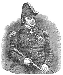
CAPTAIN SIR JOHN FRANKLIN, K. H. C.
Accordingly, on the 16th of February, 1825, he embarked at Liverpool, having undergone ‘a severe struggle between the feelings of affection and a sense of duty,’ in taking leave of his wife, whose death, then hourly expected, took place six days after his departure. On the 29th of June, he arrived at the Methye River, and, in the following August, at the left bank of the Mackenzie, whence he proceeded to the mouth of that river, and, shortly after, found salt water; in commemoration of which, he landed on an island which he had discovered, and hoisted on a pole a silk union-jack, sewed and given him by his wife, ‘under the express injunction that it was not to be unfurled before the expedition reached the sea.’ On leaving this island, which he called Garry’s, and where he had deposited, beneath a signal-pole, a letter for Captain Parry, he commenced his ascent of the Great Bear Lake River, on the banks of which he remained till the summer of 1826, when, in spite of many dangers and obstacles, he proceeded to about half-way between Mackenzie River and Icy Cape, in latitude 70 deg. 26 min. N., and longitude 148 deg. 52 min. W.; at which point he calculated he could not with safety proceed further. His feelings at being compelled to return, he thus expresses in his journal: ‘It was with no ordinary pain that I could now bring myself even to think of relinquishing the great object of my ambition, and of disappointing the flattering confidence that had been reposed in my exertions. But I had higher duties to perform than the gratification of my own feelings; and a mature consideration of all things, forced me to the conclusion that we had reached that point, beyond which perseverance would be rashness, and the best efforts must be fruitless.’
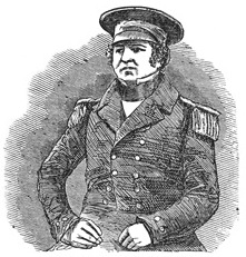
CAPTAIN CROZIER. (“TERROR.”)
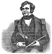
COMMANDER FITZJAMES. (CAPTAIN—“EREBUS.”)
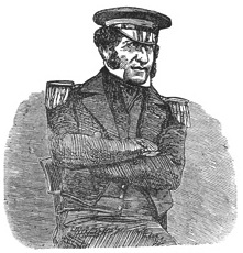
LIEUT. GRAHAM GORE. (COMMANDER.)
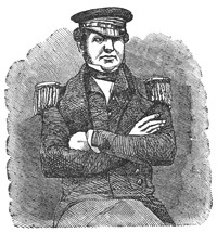
LIEUT. FAIRHOLME.
On the 1st of September, 1827, Captain Franklin arrived at Liverpool, from New York, where he had received every mark of attention both public and private; and, in the same year, he was presented by the Geographical Society of Paris, with their annual gold medal, value twelve hundred francs, and also elected a corresponding member of that institution. In November, 1828, he married a second time; in the following year had the honor of knighthood conferred upon him, and also the degree of D. C. L. by the University of Oxford; and, in 1830, he was appointed commander of the Rainbow. In both expeditions to the Arctic Sea, Captain Franklin was accompanied by Dr. Richardson, a journal of whose discoveries is appended to the former’s second narrative, which, as well as that containing an account of his first voyage, combines the most intense interest with the most valuable information, and is written with great spirit, elegance, and accuracy. In the course of his perilous journey, by sea and land, Captain Franklin evinced a contempt of personal danger in the pursuit of his enterprise, and a degree of kind-heartedness to, and consideration for, those who accompanied him, that has rendered him equally the pride of his friends, and an honor to his country.
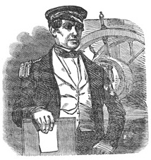
LIEUT. H. T. D. LE VESCONTE.
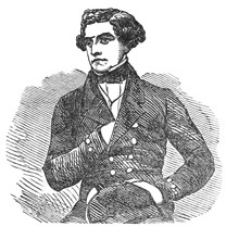
LIEUT. DES VŒUX. (MATE.)
On the 19th of May, 1845, Sir John sailed from England in search of the North West Passage. He had two vessels, the Erebus and Terror; the crews, officers, and men numbered one hundred and thirty-eight. On the 26th of July, sixty-eight days afterwards, they were seen by a whale ship, moored to an iceberg near the centre of Baffin’s Bay. No special anxiety was entertained respecting them until the beginning of 1848, for Franklin had intimated that the voyage would probably continue for three years, and that they might be the first to announce their own return. But as month after month passed away without any tidings, an anxious and painful sympathy sprung up in the public mind, and the British government determined that a search for the missing vessels should be made, in three different quarters, by three separate expeditions fitted out for that purpose.
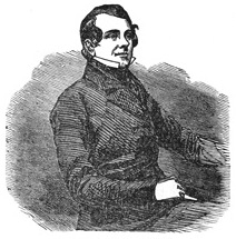
S. STANLEY. (SURGEON.)
C. H. OSMER. (PURSER.)
One quarter, the region known as Boothia, was beyond the scope of these expeditions, and Lady Franklin determined to organize an expedition to explore that region. She appropriated all the means under her control, and a subscription supplied the deficiency. The Prince Albert, a vessel of ninety tons burthen, was fitted out at Aberdeen, and Captain Forsyth, of the Royal Navy, offered his gratuitous services as commander. At about the same time, Mr. Henry Grinnell, a wealthy merchant of New York, fitted out, at his own cost, two vessels,—the Advance and the Rescue,—and dispatched them to the Arctic Seas to aid in the search for Sir John. An exceedingly interesting narrative of the voyage has been published by Dr. Kane, the surgeon, naturalist and journalist of the expedition.
Time passed on, and all the vessels of the various expeditions returned to port without any tidings of the lost ones. In May, 1853, Mr. Grinnell again fitted out the Advance for the purpose of continuing the search, if necessary, for two years. She had a company of seventeen persons, under the command of Dr. Kane. She has been absent for over two years, and fears are entertained for the safety of her noble commander and his brave companions.
Subsequent to the departure of the Advance, the fate of Sir John Franklin and his crew was ascertained. They had perished of hunger and hardships, in attempting to reach the settlements of the Hudson’s Bay Company, by an overland journey from the Arctic Seas. Relics of the ill-starred voyagers were discovered by some agents of the company in the possession of the Esquimaux Indians. These relics consisted of philosophical instruments, watches, rings, spoons, etc., bearing the initials of Sir John and his companions. These had been picked up by the Indians at the place where the navigators had so miserably perished.
TRAVELS IN AFRICA.—PARK, DENHAM, CLAPPERTON, LANDER, AND OTHERS.
The vast continent of Africa, measuring 5000 miles in length, and about 4700 in its greatest breadth, and the area of which is calculated at 12,000,000 square miles, or nearly one-fourth of the entire land area of the globe, has presented greater obstacles to human enterprise than any other equal portion of the earth’s surface. The peculiar physical condition of Africa has operated as one cause of her isolation from the rest of the world. The other portions of our earth situated under the tropics consist generally either of sea, or of narrow peninsular tracts of land, the clusters of islands blown upon the sea-breeze. Africa, on the other hand, presents scarcely one gulf or sea-break in its vast outline. A consequence of this compact geographical shape of a continent, the greater part of which is within the torrid zone, is its subjection, throughout its entire extent, to the unmitigated influence of the sun’s heat. All that is noxious in climate we are accustomed to associate with Africa. Here stretching out into a boundless desert, where for days the traveler toils amid burning sands under a stifling sky—there covered with dense and swampy jungle, breathing out pestilence, and teeming with all the repulsive forms of animal life, the African continent seems to defy the encroachments of European civilization. And although, probably, our ideas of these African horrors will be modified by more accurate knowledge, enough seems ascertained to prove that the lying open of interior Africa to the general flood of human influence will be among the last achievements of the exploring spirit of our race.
Notwithstanding the difficulties which lie in the way, Africa has at all times been an object of curiosity and interest to the inhabitants of the civilized parts of the earth; and scientific zeal, the desire of extending traffic, and even the mere thirst for adventure, have prompted many expeditions for the purpose of exploring its coast and making discoveries in its interior. The ancients appear to have acquired much knowledge of Africa, which was afterwards lost, and had to be reacquired by the moderns for themselves. The African coasts of the Mediterranean and the Red Sea were not only familiar to the ancient geographers, but were inhabited by populations which performed a conspicuous part in the general affairs of the world, and ranked high in the scale of civilization—the Egyptians, Carthaginians, etc. Nor, if we may believe the evidence which exists in favor of the accounts of the circumnavigation of Africa by ancient navigators, were the other coasts of the continent—those, namely, which were washed by the Atlantic and the Indian Ocean—unvisited by northern ships. Regarding the interior of Africa, too, the knowledge possessed by the ancients, although very meagre in itself, was nearly as definite as that possessed by their modern descendants, until within a comparatively recent period. As far as the northern borders of the Great Desert, their own personal observation might be said to extend; and respecting the wandering tribes of black and savage people living farther to the south, they had received many vague notices. The Nile being one of the best-known rivers of the ancient world, its origin and course were matters of great interest, and the African geography of the ancients, in general, may be said to consist of speculations respecting this extraordinary river. The first mention made of the other great African river, the Niger, is by Ptolemy, who lived seventy years after Christ. Ptolemy believed that this river discharged itself ultimately into the Nile; others, however, did not admit this conclusion, and acknowledged that the real course of the Niger was a mystery.
Such are some of the more prominent points in the ancient geography of Africa. How wild and inacurate must have been the notion entertained respecting the shape and total extent of the African continent, may be judged from the fact, that one geographer describes it as an irregular figure of four sides, the south side running nearly parallel to the equator, but considerably to the north of it! Others, again, held forth the fearful picture of Central Africa as a vast burning plain, in which no green thing grew, and into which no living being could penetrate; and this hypothesis of an uninhabitable torrid zone became at length the generally received one.
The invasion of Africa by the Arab races in the seventh century wrought a great change in the condition of the northern half of that continent. Founding powerful states along the Mediterranean coasts, these enterprising Mohammedans, or Moors, as they were called, were able, by means of the camel, to effect a passage across the Desert which had baffled the ancients, and to hold intercourse with the negroes who lived on its southern border along the banks of the Niger and the shores of Lake Tchad. In some of the negro states the Arabs obtained a preponderance, and with others they carried on an influential and lucrative commerce. The consequence was a mixture of Moorish and negro blood among the inhabitants of the countries of Central Africa bordering on the Great Desert, as well as a general diffusion of certain scraps of the Mohammedan religion among the negro tribes. Hence it is that, in the innermost recesses of interior Africa at the present day, we find the negroes partly professing Paganism, partly Mohammedanism, but all practicing ceremonies and superstitions in which we observe the Pagan spirit with a slight Mohammedan tincture.
It was not till the fifteenth century that the career of modern European discovery in Africa commenced. The Portuguese, leading the van of the nations of Europe in that great movement of maritime enterprise which constitutes so signal an epoch in the history of modern society, selected the western course of Africa as the most promising track along which to prosecute discovery; their intercourse with the Moors having made them aware that gold and other precious commodities were to be procured in that direction. In the year 1433, Cape Bojador was passed by a navigator called Gilianez; and others succeeding him, passed Cape Blanco, and, exploring the entire coast of the Desert, reached at length the fertile shores of Gambia and Guinea. The sudden bending inwards of the coast line at the Gulf of Guinea gave a new direction and a new impulse to the activity of the Portuguese. Having no definite ideas of the breadth of the African continent, they imagined that, by continuing their course eastward along the Gulf, they would arrive at the renowned country of the great Prester John, a fabulous personage, who was believed to reign with golden sway over an immense and rich territory, situated no one could tell where, but which some contended could be no other than Abyssinia. The Portuguese, while prosecuting their discoveries along the African coast, did not neglect means for establishing a commercial intercourse with those parts of the coast which they had already explored. Settlements or factories for the convenience of the trade in gold, ivory, gum, different kinds of timber, and eventually also in slaves, were founded at various points of the coast between Cape Verd and Biafra. Various missionary settlements were likewise founded for the dissemination of the Roman Catholic faith among the natives.
The chimera of Prester John was succeeded by the more rational hope of effecting a passage to India by the way of Southern Africa. This great feat, accordingly, was at length achieved by Vasco de Gama, who, in 1497, four years after the discovery of America by Columbus, persisted in his course to the south so far as to double the Cape of Good Hope, and point the way northward into the Indian Ocean. By his voyages and those of his successors, the eastern coast of Africa, from the Cape of Good Hope through the Mozambique Channel to the Red Sea, was soon defined as accurately as the western coast had been by the voyages of his predecessors; and thus the entire outline and shape of the African continent were at length made known. This great service to science and to the human race was rendered, it ought to be remarked, by the Portuguese, who may be said to have conducted the enterprise of the circumnavigation of Africa from its beginning to its end; and this is perhaps the greatest contribution which the Portuguese, as a nation, have made to the general fund of human knowledge.
The outline of Africa having thus been laid down on the maps, and the extent of its surface ascertained, the attention of discoverers was next turned to its interior. The efforts made by the Portuguese to explore Nigritia in search of Prester John have been already alluded to; but it was by the other nations of Europe, especially the English, the French, and the Dutch, who, on the decline of the Portuguese power, began to compete with each other in this field of enterprise, that the greatest advances were made in the knowledge of geography of the various parts of Africa, and of the races which inhabit it. For these last two hundred years, discoverers and travelers of various nations have been adding to our information respecting this vast continent; and in consequence of their joint labors, some in one part, some in another, we are now able to form an idea, very general, it must, be admitted, but still tolerably distinct, of Africa and its inhabitants. In presenting a summary view of the progress of African discovery, from the period of the final circumnavigation of the continent, and its correct delineation in outline, down to the present time, it will be advantageous to take up its various divisions in the following order:—Western Africa, Southern Africa, Eastern Africa, Central Africa or Nigritia, and Northern Africa, including the Great Desert.
Western Africa.—The shores of Western Africa, especially those which border the Gulf of Guinea, have retained to the present time the distinction which they acquired at the period of their discovery by the Portuguese, of being the market which European ships visit for African commodities.
The Portuguese, as we have already mentioned, where the first to plant factories along this coast, from the southern termination of the Great Desert to Congo, and other maritime districts south of the equator. Allured by the profits of the slave trade, other European nations hastened to occupy stations on the same coast; and towards the end of the eighteenth century, the number of European forts and factories round the Gulf of Guinea were said to be forty in all; of which fifteen belonged to the Dutch, fourteen to the English, four to the Portuguese, four to the Danes, and three to the French. Deriving its principal commercial importance from the trade in negroes, which this chain of forts was intended to guard, Western Africa has, since the abolition of the slave trade, fallen considerably out of view. According to the best information, however, that has been obtained, ‘the territory is in the possession of a number of petty states, many of which compose aristocratic republics, turbulent, restless, licentious, and generally rendered more depraved by their intercourse with Europeans.’
Proceeding from north to south, let us briefly notice the various countries of the western coast, with the tribes which inhabit them. The most northerly is Senegambia, the name applied to the district watered by the two rivers Senegal and Gambia, commencing from the Desert, and extending as far as the Grain Coast. According to Mungo Park, this territory is inhabited by four tribes—the Feloops, the Jaloffs, the Foulahs, and the Mandingoes. In all these tribes, part are Mohammedans by profession; but the great body of the people are Pagans, called by their Mohammedan brethren Kafirs, or infidels, and practicing the Fetish form of worship; that is, the worship of inanimate objects. The Feloops were described by Park as a gloomy and revengeful race, but honorable and faithful in their dealings with friends; the Jaloffs as an active and warlike people, with jet-black skins, but among the most handsome of the negroes, divided into several principalities, and excelling in the manufacture of cotton cloth; The Foulahs—a race of more importance in Africa than Park imagined—as of a tawny complexion, with soft silky hair and pleasing features, much attached to a pastoral life; and the Mandingoes, who are by far the most numerous people in this part of Africa, as of a mild, sociable, and obliging disposition, the men commonly above the middle-size, well-shaped, strong, and capable of enduring great labor, the women good-natured, sprightly and agreeable.
The tract of country adjoining Senegambia on the south, and stretching along the Gulf of Guinea, from the Grain Coast to the Bight of Biafra, has been named Upper Guinea, and includes, besides the colonies of Sierra Leone, Liberia, and Ivory and Gold Coasts, so noted for their unhealthiness, three native states—namely, Ashantee, Dahomey, and Benin. Our information respecting these negro kingdoms is derived from the discoveries of various travelers, among whom may be mentioned Mr. Norris, who undertook a journey to the court of the king of Dahomey in 1772, with the hope of making arrangements beneficial to English trade; Mr. Bowditch, who took part in a mission for a similar purpose to the king of Ashantee in 1817; and Captain Adams, who visited Benin at a later period.
Ashantee is described as a hilly country, well watered by numerous streams, and covered almost entirely with that rich vegetable luxuriance, the labor of removing which, it has been observed, is as severe for the agriculturist as the opposite labor of fertilizing barren lands. The Ashantee negro clears the land by means of fire—thus both removing the rank vegetation, and spreading the soil with a rich manure, which yields two crops a year. Besides innumerable kinds of fruit and flowers, and all the giant trees of the tropics, the productions are sugar, tobacco, maize, rice, yams, and potatoes. All kinds of tropical animals likewise swarm in Ashantee. The human inhabitants of the whole region or empire are estimated at three millions, and though possessing, in a marked degree, some of the worst negro characteristics, they are, upon the whole, more advanced than most of the African tribes, not only practicing a regular and tolerably skilled agriculture, but showing considerable ingenuity in several mechanical arts—as dyeing, tanning, pottery, weaving, and the manufacture of instruments and ornaments out of gold, iron, etc. They are also cleanly, and well clad, and pay some attention to the building and decoration of their houses. Their government is an absolute monarchy, or nearly so; the classes of society under the monarch being cabocees or nobles, gentry, traders, and slaves. Polygamy is allowed, but no one but the king possesses many wives. The royal number of wives is said to be precisely 3333, who, however, act also in other capacities; as bodyguards, etc. The most horrible of the Ashantee customs is that of sacrificing a number of persons on the death of every man of rank, the number of victims being regarded not only as indicating the dignity of the deceased in this world, but as determining his rank in the next. The belief in a future state is one of the strongest of their religious ideas. Regarding the origin of mankind, they, as well as other negro tribes of the Guinea Coast, have the following singular tradition:—The Great Spirit, they say, having created three white men and women, and as many black, offered the blacks the first choice of two articles which he held in his hand, one of which was a calabash, the other a sealed paper. The blacks chose the calabash, which contained gold, iron, and all the choice products of the earth; in consequence of which the negro race to this day possess these blessings in abundance: while the sealed paper falling to the share of the whites, has conferred on them a higher gift of knowledge, wherewith the contents of the calabash may be turned to account. This admission of the superiority of the whites on the part of the Ashantees appears also in their belief that the good negroes become white in the future state. No part of Africa, or even of the world, is believed to be richer in gold than Ashantee.
The kingdom of Dahomey, situated eastward from Ashantee, resembles it in the general aspect of the soil, and in many other particulars. It appears to be a recent negro state, formed by the conquest of a number of tribes by a powerful race from the interior. The government of the Dahomans, like that of the Ashantees, is an absolute monarchy; but the Dahoman king seems to be still more despotic in practice than his Ashantee neighbor. When, in obedience to some superstitious freak, he wishes to send a message to some of his deceased relatives in the other world, he delivers the message to some attendant negro, whose head is immediately cut off, as a means of forwarding him to his destination; and if the monarch has forgot any part of his communication, he immediately adds a postscript by a second messenger. The bloody custom of sacrificing a number of victims on the occasion of a great man’s funeral is practiced at Dahomey as well as Ashantee. The Dahomans have similar religious beliefs with the Ashantees: their principal object of worship, appropriately enough, is the tiger. Of late years some improvement is said to have taken place in the habits of this fierce African race.
Passing from Upper Guinea, of which Ashantee and Dahomey are the principal territories, we come next to Lower or South Guinea, which extends from the Bight of Benin to the commencement of Southern Africa, and includes the provinces or districts of Loango, Congo, Angola and Benguela. The whole of this tract of coast presents the aspect of a country degraded and deteriorated by intercourse with Europeans, to a condition worse than its original negro barbarism. Here, more than three centuries ago, the Portuguese established themselves partly as missionaries of Christianity, and partly as traders in slaves; and while their efforts in the former capacity, directed as they are by the most absurd and wretched bigotry, produced almost no beneficial effect, the curse of the slave traffic which they imported has adhered to the country with a tenacity which all the rigors of modern philanthropy cannot overcome. It is from these coasts that the exportation of negroes is said to go on at the present time more busily than it did before the abolition of the slave trade. The characteristics of the coast, and of the population which inhabit it, are determined by the brutal traffic of which it is the scene. It is impossible, within our limits, to give a description of the whole line of shore, of the small port-towns scattered along it, with their motley population of negroes, mulattoes, and slave-dealing Portuguese; or of the negro districts in the interior, where the natives fight and kidnap each other to supply the demand for slaves on the coast.
Southern Africa. Occupied with their commerce on the coasts of Western Africa, the Portuguese scarcely give a thought to the southern extremity of the continent, the aspect of which was less promising; and accordingly, for a century and a half after the famous voyage of Vasco de Gama, the district round the cape of Good Hope remained a blank waste to Europeans. The prudent and enterprising Dutch, however, having embarked in the East India trade, soon discovered the importance of the cape as a commercial station, and in the year 1650 they founded Cape Town, the capital of Cape Colony, the most flourishing of all the European settlements in Africa. Encroaching, without the least scruple, on the territories of the natives, the Dutch extended their possessions so as to include an area of upwards of 120,000 square miles, some spots of which were cultivated and planted with vines, or laid out in corn-fields, but the greater part of which was converted into immense grazing farms. Under the Dutch the natives suffered dreadfully, numbers of them being reduced to bondage, and others driven into the interior to find subsistence as they best could. In 1795 the colony was taken by the English; it was again restored to the Dutch in 1800; a second time, however, it was taken by the English, to whom it was finally ceded in the year 1815, and is now, accordingly, an English possession. Both before and after the cession of Cape Colony to the British, various travelers have undertaken journeys among the tribes inhabiting this extremity of Africa; and no accounts are more full and interesting than those of the various missionaries, who, since the beginning of the present century, have employed themselves in the arduous task of carrying the doctrines of Christianity into the heart of the native tribes. The native tribes of Southern Africa are two in number—the Hottentots and the Caffres; the former, so far as not extirpated, inhabiting the tract of country adjacent to Cape Colony on the western coast, and the other the tract adjacent to the colony on the eastern coast.
Of the Hottentots of the colony and its vicinity, it is said that they have ‘become noted and almost proverbial for presenting man in his lowest estate, and under the closest alliance with the inferior orders of creation. It must, indeed, be admitted that they take particular pains to render their external appearance the most hideous that the human body can possibly present. Grease is poured over their persons in copious streams, which, being exposed to the perpetual action of smoke, forms on their skin a black and shining cake, through which the native color, a yellowish-brown, is scarcely perceptible. Grease in Africa forms the chief distinction of rank—the rich besmearing themselves with fresh butter, while the poorer classes are obliged to tear the fat from the bowels of slaughtered animals. They assign as a reason for this singular practice, an effect which has been readily admitted by judicious travelers—namely, that such a coating has, in this climate, a most salutary influence in defending them from the rays of the sun, and in averting many cutaneous disorders. Nature seems to have aided the task of disfiguring them, by covering the head with irregular tufts of hard and coarse hair, and causing singular prominences, composed of fat, to jut out in parts where they are least ornamental. Nor do their habits of life present anything to redeem this outward deformity. Their kraals or villages, consist of a confused crowd of little conical hovels, composed of twigs and earth, in which large families sit and sleep without having room to stand upright. The fire in the middle fills these mansions with thick smoke, the floors being deeply covered with every species of filth. At festivals, when an ox or a sheep is killed, the Hottentots rip open the belly, tear out the entrails, which they throw on the coals, and feast on them before the animal is completely dead. Yet they are a friendly, hospitable race, living together in the greatest affection and harmony. The sluggish and senseless stupidity with which they have been so generally taxed, seems to have been in a great measure produced by their degrading subjection to the Dutch boors.’ It has been asserted that the Hottentots are destitute of all ideas of religion; but this is not correct. It is ascertained that they believe in a Supreme Being, as well as in an inferior spirit of malignant nature; and that they practice certain superstitious rites, such as are usual among savages.
Such is the description given of the Hottentots as they were under the Dutch rule. Since the Cape came into the possession of the British, they have not been treated with the same neglect and cruelty as they experienced from the Dutch, who used to prohibit Hottentots, equally with dogs, from entering their places of worship; still, with some exceptions, arising from the beneficial effects produced in some places by the missionaries, the account seems to remain substantially true. Immediately to the north of the colony, and on the borders of the Snewburg or Snowy Mountains, are the Bosjesmans, or Bushmans, the most savage and degraded of all the South Africans. They were visited in 1797 by Mr. Barrow, private secretary to Lord Macartney, with the view of ascertaining whether friendly relations might not be entered into with them, to prevent their incursions upon the farms of the Europeans.
Mr. Barrow, at the same period, crossed the frontier which divides the colony from the country of the Caffres, and made acquaintance with this race, differing widely in almost all respects from their neighbors the Bushmans. He found them a handsome and spirited people, of frank and generous deportment, leading a roaming pastoral life, and possessing numbers of cattle, in the rearing of which they seemed proficient.
Before the commencement of the present century, little more was known respecting the original inhabitants of Southern Africa than what we have thus generally indicated. But in 1801, two gentlemen, Messrs. Trutter and Somerville, made an excursion to a considerable distance beyond the districts of the Bushmans and the Caffres, whom Mr. Barrow had visited, and discovered a large river, now called Orange River, flowing westward into the Atlantic. The banks of this river they found inhabited by a pastoral tribe called the Koranes; and the information they received from this people inducing them to continue their journey still farther to the north, they at last reached what not a little surprised them—a city or town of two or three thousand houses, very neatly built, and well-arranged. The name of this city was Lattakoo; and the accounts which the travelers brought back of it to the Cape, and of the friendliness with which they had been received by the Boshuanas, who were then the prevalent tribe, induced the government to send Dr. Cowan and Lieutenant Denovan to continue the discovery, and, if possible, make their way past Lattakoo, so as ultimately to reach Mozambique on the east coast. The issue of this expedition was unfortunate. The travelers reached Lattakoo in safety, but were killed at a distance of eleven days’ journey beyond it. The same route was afterwards pursued by Dr. Henry Lichtenstein, who added considerably to the knowledge then possessed of this part of Africa. But the most enterprising traveler in these regions was Mr. John Campbell, a missionary, who, animated with an eager desire to spread Christianity among the rude Hottentots and Caffres, undertook a journey for that purpose in 1813. He reached Lattakoo, made known the object of his visit to Mateebe, king of the Boshuanas, and, after some importunacy, obtained leave to establish a missionary station in the capital. Having succeeded in the object of his expedition, Mr. Campbell returned, but made a second journey to Lattakoo in 1820. He found the missionary establishment in active operation, but little progress had been made in converting the natives, who manifested the most profound indifference on the subject of religion. Mr. Campbell now penetrated beyond Lattakoo, and came among tribes till then unknown, some of them showing a considerable advance in the arts of life, inhabiting neat villages, cultivating the ground, smelting iron and copper, and manufacturing various implements. He also came upon the borders of an immense desert, which, from its appearance, and the information which he was enabled to collect respecting it, he thought entitled to be named the Southern Sahara, as rivaling in extent the Great Northern Desert. Whether, as he was led to imagine, this Desert stretches from the tropic of Capricorn, where he saw its extremity, to the equator, is a point which can only be settled by farther discovery; but the supposition does not appear probable.
Subsequently to Mr. Campbell’s journey, these regions have been visited by other travelers, who have made us better acquainted with the tribes of the South Cape, by giving us details of their customs and manner of life. The latest of these is Mr. Robert Moffat, likewise a missionary. The general conclusion, from the accounts of these various travelers, seems to be, that the southern extremity of Africa is inhabited by two principal races—the Hottentots, who, both physically and intellectually, are far inferior to the average of mankind; and the Caffres, a bold and savage, but promising race, resembling in their general features the natives of other parts of Africa, and divided into a number of tribes, who inhabit villages scattered through the country which borders on the Southern Desert.
While describing the inhabitants of Southern Africa, we have left the general features of the country itself undescribed. The following passage will supply the deficiency:—‘Southern Africa consists,’ says a writer, ‘of a most strange assemblage of mountains and plains, of spots lovely and picturesque beyond description, and gifted with inexhaustible fertility, and of seemingly boundless plains, where barrenness reigns so completely paramount, that the very principle of vegetation appears to be extinct. At a certain distance from the colony we enter upon regions over which the clouds of ignorance—almost the only clouds one meets with—-still brood. We traverse large rivers, which rise no one knows where, and envelop their exits in equal obscurity. Ranges of mountains also, with appellations uncouth, and hiding no one knows what treasures of the animal and vegetable kingdoms in their unvisited recesses, sweep before us along the verge of the horizon, dim, blue, and shadowy, like so many fragments of fairyland. And if the great outlines of the landscape be original and bold, the filling up and coloring are no less so. Everything upon which the eye rests has the appearance of having been cast in a mould nowhere else made use of in the system of nature. Among the terrestrial animals, what bulk and fantastic formations! How numerous and strikingly contrasted are the groups that present themselves! In their character and habits what extremes seem to meet! How unspeakably lavish seems to be the waste of vitality! Yet who will dare to say that, in this prodigious outpouring of animal life, there is a single creature that does not enjoy and adorn the scene on which it moves? If there be anything we should be disposed to think out of place, it is the stunted representatives of humanity, who, under the name of Bushmen, roam in indescribable misery and degradation over those sublime savannahs. To a man of imagination, nothing more inspiring can be conceived than climbing one of the breezy peaks overlooking that strange wilderness, at the moment that the dawn is busily unfolding all its varied features. From every tree the heavy dewdrops pour like rain; streams of white mist, smooth and glassy as a tranquil river, float slowly down the valleys, reflecting from their surface the trees, and cliffs, and crags on either hand. Here, through openings between feathery mimosas, weeping-willows, and tall trembling reeds, we catch a glimpse of some quiet lake, the haunt of the hippopotamus; while a herd of graceful purple antelopes are seen drinking on its further margin. There, amidst thick clumps of camel-thorn, we behold a drove of giraffes, with heads eighteen feet high, browsing on the tops of trees. Elsewhere, the rhinoceros pokes his long ugly snout from a brake; while the lion, fearless in the consciousness of his own strength, parades his tawny bulk over the plain, or reclines, in sphinx-like attitude, beneath some ancient tree.’
Eastern Africa. With the exception of the countries bordering on the Red Sea—Egypt, Nubia, and Abyssinia—which cannot be included in so general a survey as the present, the eastern coast of Africa is undoubtedly the least-known portion of the whole circuit of the continent. The tract of country extending from the northern extremity of Caffreland to Cape Guardafui, and including the states or territories of Sofala, Mozambique, Zanguebar, and Ajan, was early visited by the Portuguese in their voyages to India; and in the course of the sixteenth century, various settlements were planted in it by them, similar to those which they planted along the Guinea Coast. The most conspicuous difference was, that here the ruling race were not pure negroes, but men of Arabic descent, and vehement Mohammedans. It was from these that the Portuguese wrested the immense line of coast-territory which they once held in this part of Africa, and of which they made Mozambique the capital. On the ruin of the Portuguese power in India, their settlements in Eastern Africa declined; the Arabs and blacks reconquered a great portion of their ancient territory; and it is now merely by sufferance that the once-powerful Portuguese retain a footing on the coast at all. What they do possess, however, they guard with the utmost jealousy; and they testify extreme aversion to the intrusion of any other European nation into those territories where they once lorded it so proudly. Mr. Salt, who visited Mozambique in 1808, found it to contain a population of less than three thousand, of whom only five hundred were Portuguese. ‘The rural population of this part of Africa,’ says Mr. Macculloch, ‘is in the most degraded state; and although the soil be naturally rich and productive, the culture of cotton, indigo, sugar, and other articles of commerce is wholly neglected. Rice, millet, and manioc are raised almost without labor, furnishing, with cocoa-nuts, almost the entire food of the slaves. The commerce of Mozambique has greatly decreased, in consequence of our exertions to suppress the traffic in slaves; but although much diminished, the slave trade is still carried on to a considerable extent both with Brazil and Arabia. These slaves, who are chiefly of the tribe of the Monjores, and brought from the centre of the continent, a distance of forty or forty-five days’ journey from the colony, are procured from the native merchants in exchange for salt, shells, tobacco, coarse cloths, etc. Goods costing about two dollars, will bring in, as far as the case may be, either a slave or an elephant’s tusk, weighing from sixty to eighty pounds of ivory. Hippopotamus’ tusks, gold dust, Columbo-root, gums, and amber, are the other chief exports.’
From these few particulars, which include nearly all that is known of this part of Africa, it will appear that, with the exception of the infusion of the Mohammedan and Arabic element, which is here very strong, it bears a close resemblance to the corresponding portion of the western coasts. There are at the same impediments, arising from climate, to the acquisition of much knowledge of the country by Europeans, who, at best, are unable to penetrate farther than a few miles into the interior. It appears probable, indeed, that the last portion of the coast of Africa to be thoroughly explored will be these sites of the declining Portuguese colonies.
Central Africa. Under the general name of Central Africa may be included the whole of the interior of the continent south of the Great Desert. This immense extent of country may be divided into two parts—Southern Central Africa, lying between the tropic of Capricorn and the equator; and Northern Central Africa, called also Souden, or Nigritia, lying between the equator and the Great Desert. The former is as yet totally unknown and unexplored; and before our information respecting it can be at all authentic and accurate, two most difficult expeditions must have been made, which have not yet been so much as proposed—one from the Cape of Good Hope northwards as far as the Mountains of the Moon, the other transversely across the continent from Congo to Zanguebar or Mozambique. At what future period the spirit of enterprise may achieve these two journeys it is impossible to tell.
Northern Central Africa, or Nigritia, has, on the other hand, been penetrated by travelers, who have advanced into it from all directions. From the earliest times this part of Africa attracted attention, as being the country through which the famous Niger flowed, on whose banks the great city of Timbuctoo, of the wealth of which vague accounts had reached the shores of the Mediterranean, was reputed to be situated. To ascertain the course of this river, and to reach this celebrated negro city, were the leading objects of all who engaged in the enterprise of African discovery. In the year 1618, an English company was formed for the purpose of opening up a communication with Timbuctoo, and not long afterwards a similar company was formed in France. For a century and a half the two nations continued to compete with each other in the enterprise: the English trying to make their way up the river Gambia, which they imagined to be the outlet of the Niger; the French, on the other hand, persevering along the Senegal, which seemed to them more likely to be identical with the Niger. Much useful information was acquired in these successive voyages respecting Western Africa; but no intelligence was obtained of the site of the great city of the negroes. It was clearly ascertained, however, that neither the Senegal nor the Gambia could be identical with the Niger, supposing the traditionary accounts of that river to be true. Three distinct opinions respecting this river began to be entertained. Some said that there was no Niger at all, such as the ancients had described it, but that some river, branching off into the Senegal and Gambia, was alluded to. Others believed that the ancient accounts of the Niger as a river flowing towards the east was-correct, and that it was to be considered one of the upper branches of the Nile. A third party maintained that the supposition of the Niger being identical with the Nile was untenable, considering the immense breadth of the continent, and that the true Niger was some stream rising in the interior of Africa, and flowing into the sea at some point of the western coast farther south than the Senegal and the Gambia. A subsequent modification of this opinion was, that the Niger did not flow into the sea at all, but terminated in some great marsh or lake in the interior of Africa, resembling the Caspian Sea.
Such was the state of information, or rather of doubt, with respect to the course of the Niger, when, in the year 1788, a number of spirited men of science, including Lord Rawdon, Sir Joseph Banks, the bishop of Landaff, Mr. Beaufoy, and Mr. Stuart, formed themselves into an association for the purpose of prosecuting this and other questions of African geography to an issue. No sooner had the society been formed, than it commenced its labors. The first travelers, however, whom it sent out were cut off by death. One of them, Major Houghton, ascended the Gambia, and never returned; it was afterwards ascertained that he had been killed by the Moors in the interior. It was at this juncture that the celebrated Mungo Park presented himself to the society. Born in the county of Selkirk, in Scotland, in the year 1771, and having been educated for the medical profession, Park had just returned from a voyage to the East Indies in the capacity of assistant-surgeon on board one of the East India Company’s vessels, when he offered his services to the association through Sir Joseph Banks. After due inquiry into Mr. Park’s character and qualifications, they were accepted. This was in 1793; but he did not depart on his expedition till the summer of 1795. His instructions were, on his arrival in Africa, ‘to pass on to the river Niger either by the way of Bambouk, or by such other route as should be found most convenient —that he should ascertain the course, and, if possible, the rise and termination of that river—that he should use his utmost exertions to visit the principal towns or cities in its neighborhood, particularly Timbuctoo and Houssa—and that he should be afterwards at liberty to return to Europe either by the way of the Gambia, or by such other route as, under all the then existing circumstances of his situation and prospects, should appear to him to be most advisable.’
The ship in which Park sailed reached the African coast in the latter end of June 1795, and on the 5th of July the traveler took up his residence in the house of an English settler in the village of Pisania, situated on the northern bank of the Gambia, at a considerable distance from the coast. After remaining here about five months, preparing for his journey into the interior, and acquiring information respecting the western parts of Africa, Park launched upon his perilous enterprise on the 2d of December 1795. For three months he toiled on in a north-westerly direction, passing through various negro kingdoms, and numberless towns and villages, almost everywhere received with kindness and respect, although the cupidity of some of the negro sovereigns stripped him of most of the articles of value he had brought along with him, as a tax for allowing him to pass through their dominions. For a detailed account of all his adventures during the journey, we must refer to his own narrative, which has long and justly been regarded as one of the most interesting and best-written books in the English language. Suffice it to say, that after having pushed on till he found himself near the southern borders of the Great Desert, and when ‘fancy had already placed him on the banks of the Niger, and presented to his imagination a thousand delightful scenes in his future progress,’ a cruel accident came to delay, and, as it seemed, utterly to prevent, the fulfillment of his ‘golden dream.’ In this part of Africa he found that the Moors, or men of Arab blood, were the ruling race, domineering over the negroes in the most insolent manner; and while from the negroes, almost universally, he experienced kind treatment, the Moors he describes as the most barbarous and tyrannical of the human race. Accordingly, after entering the countries which, from their proximity to the Great Desert, were under the thraldom of the Moors, he proceeded with greater caution than he had found it necessary to adopt in passing through the countries inhabited by a pure negro population. His caution, however, was of no avail; on the 7th of March, 1796, he was carried away captive by a Moorish chief to Benown, a village on the margin of the Desert, where he was detained for nearly three months, enduring incredible hardships from the cruelty of his keepers, who persecuted him both as a stranger and as a Christian.