Part 2 — CHAPTER VII. (continued 2)
Reading edition
Denonville thought that he had made a successful stroke; but he was over sanguine. After this his power seemed to wane, and his prestige went down. Dongan was savage when he heard of the imprisonment of McGregory and Rooseboom, and wrote a sharp letter demanding their return. Denonville refused, and upbraided him for having assisted the savages. He thought better of his resolution as his anger cooled, however, and in a few weeks released his prisoners.
Dongan called a conference of the Iroquois, and told them to receive no more Jesuit missionaries into their towns. He called them British subjects, and said that they should make no treaties with the French without asking leave of King James. The humbled Indians promised obedience.
Hitherto, Dongan had not succeeded in getting his king to recognize the Iroquois as his subjects. On the 10th of November, 1687, however, a warrant arrived from England authorizing the Governor to protect the Five Nations, and to repel the French from their territory by force of arms, should they attack the villages again. The commissioners appointed, in accordance with the terms of the neutrality treaty signed at Whitehall, had the boundary question before them. Both French and English claimed the Iroquois, and the matter was assuming a serious aspect. News came in August, 1688, to Denonville, that the subject of dispute would receive prompt and satisfactory settlement.[703]
Meanwhile, the French Governor made several overtures to obtain peace with the Iroquois; but their demands were greater than his pride could grant. Dongan’s hand was seen in every proposition formulated by the savages. Father Vaillant was sent to Albany to try and obtain easier conditions, but the effort was vain; and the Iroquois absolutely refused to make peace or grant a truce until Fort Niagara was razed, and all the prisoners restored. These terms were exasperating; but when Denonville learned that Dongan had been recalled by King James, his spirits rose, and he felt as if a great load were removed. The governments of New York, New Jersey, and New England became one administration, and Sir Edmund Andros was named governor over all. So far as Denonville was concerned, he was no better off than before, for the new Governor insisted on all of Dongan’s old demands being satisfied, and actually forbade peace with the Iroquois on any other basis.
The state of Canada at this time, 1688, was most deplorable. Disease had broken out, and the mortality was fearful. Before spring, ten only, out of a garrison of one hundred men at Niagara, survived the scourge. The provisions had become bad, and prowling Senecas prevented any of the inmates of the fort from venturing out to look for food. Fort Frontenac’s garrison was also sadly diminished, and the distress throughout the country, from famine and disease, was very great. To add to the Governor’s troubles, the fur-trade had languished. Bands of Iroquois menaced the unfortunate settlers. The fields were untilled; danger lurked in every bush, and destitution, gaunt and grim, abounded everywhere. Peace must be had at any price, if the colony would live, and Denonville resolved to make it. He had become unmanned by his trials, and though he still had a force of fourteen hundred regulars, some militia, and three or four hundred Indian converts, he hesitated to venture on war. He wrote to the Court for eight hundred more troops, and the King sent him three hundred. Then he made up his mind to fight. He planned a campaign against the Iroquois which he hoped would break their power. He proposed to divide his army into two sections, with one of which he might crush the Onondagas and Cayugas, and with the other the Mohawks and Oneidas. He asked the King for four thousand troops, and the Bishop backed his demand with an earnest prayer; but France could not spare them, and the Governor was left to his own resources. He fell back on the arts of the diplomat, and invited the wily old chief Big Mouth, to a council at Montreal. The savage consented to come, despite his promises to the English, and presently he appeared before Denonville at the head of twelve hundred warriors. He addressed the Marquis haughtily, and said that he would make peace with the French, but the terms would not include their allies: the Iroquois must be left free to attack them when and how they would. Denonville, like De la Barre on a former occasion, dared not refuse, and the red allies of the Governor were again abandoned to their fate. A declaration of neutrality was drawn up June 15, 1688, and Big Mouth promised that deputies from the whole Confederacy should proceed to Montreal and sign a general peace.
A chief of the Hurons named Kondiaronk, or the Rat, heard of the treaty about to be made. Should it be ratified, it meant the destruction of his own tribe. He took steps to prevent it, and with a band of trusty savages intercepted the Iroquois deputies on their way to Montreal, at La Famine, and attacked them. One chief was killed, a warrior escaped with a broken arm, and the rest were wounded and taken prisoners. The Rat told his captives that Denonville had informed him that they were to pass that way, and when the captives replied that they were envoys of peace, the crafty Huron assumed an injured air, liberated them all save one, and giving them guns and ammunition, told them to go back to their people, and avenge the treachery of the French. They departed, breathing vengeance against Onontio. The wounded Iroquois who had been in the mêlée escaped, however, learned a different story at Fort Frontenac, where he was well received, and hastened to Onondaga charged with explanations. The Iroquois pretended to be satisfied, and Denonville believed them; but ere long he was terribly undeceived. From one pretext and another, the treaty was not signed.
And now occurred one of the direst and blackest tragedies in the annals of New France. During the night and morning of the 4th and 5th of August, 1689, some fourteen or fifteen hundred Iroquois landed at Lachine. A tempest was raging at the time, and taking advantage of the storm and the darkness, they crept noiselessly up to the houses of the sleeping settlers, and, yelling their piercing war-whoop, fell upon their defenceless and surprised victims. The houses were fired, and the massacre of the inmates which followed was swift and frightful. Few escaped; men, women, and children were indiscriminately slain in cold blood. It is estimated that more than two hundred persons were butchered outright, and one hundred and twenty were carried off as prisoners and reserved for a fate worse than death. Women were impaled, children roasted by slow fires, and other horrors were perpetrated. Three stockade forts, Rémy, Roland, and La Présentation, respectably garrisoned, were situate in the vicinity of this bloody deed. Two hundred regular troops were encamped less than three miles away. Their officer, Subercase, was at the time in Montreal, some six miles from his command. A fugitive from the massacre alarmed the soldiers, and then fled to Montreal with his terrible news. Flying victims of the tragedy were seen at intervals pursued by Iroquois, but the presence of the file of soldiers prevented them from following up their prey. It was far into the day when Subercase returned, breathless, from Montreal. He hastily ordered his troops to push on, and, reinforced by one hundred armed settlers and several men from the forts, marched towards the encampment of the Indians. Most of the latter were helplessly drunk by this time, and Subercase could have killed many of them easily; but just as he was about to strike, Chevalier de Vaudreuil appeared upon the scene, and by orders of Denonville commanded the gallant officer to stand solely on the defensive. In vain Subercase protested; but the orders of his superior could not be gainsaid. The troops were marched back to Fort Roland, a great opportunity for revenge was lost, and the fatal pause cost the French very dearly. The next day the savages were early on the alert. Eighty men hurrying from Fort Rémy to join Vaudreuil were cut to pieces, and only Le Moyne, De Longueil, and a few others succeeded in making their way through the gate of the fort which they had just abandoned. The Indians continued their fiendish work. They burned all the houses and barns within an area of nine miles, and pillaged and scalped, without opposition, within a circle of twenty miles. The miserable policy of Denonville completely paralyzed the troops and inhabitants, and they allowed the Iroquois to remain in the neighborhood until they had surfeited themselves with slaughter, though with a little determined effort they could readily have driven them off. At length the savages withdrew of their own accord, and as they passed the forts they called out loud enough for the inmates to hear, “Onontio, you deceived us, and now we have deceived you.”
Other troubles overtook the colony: the rebellion broke out in England; war was declared between Britain and France, in the midst of which Denonville was recalled, and brave, chivalrous Frontenac, now in his seventieth year, crossed the seas again, his past conduct forgiven by King Louis, to administer for a second time the affairs of Canada.
It was in the autumn of 1689, and by evening, that Frontenac was received at Quebec with fireworks and jubilations. His passage had been long, and the season was too far advanced to render it practicable to organize an attack on New York by sea and land, in accordance with secret instructions which he had received on leaving France;[704] so the condition of affairs in Canada at once engaged his attention. These were far from cheerful. Frontenac hastened to Montreal, only to meet the garrison of Fort Frontenac, which had abandoned and partially destroyed the works, and were withdrawing under Denonville’s orders. In every direction the settlements were in terror of the stealthy Iroquois; and even the tribes of the lakes, having found under Denonville’s policy that little dependence could be placed in the support of the French, were showing signs of revolt. Frontenac had induced a council of the Iroquois; but his proposition for peace was only met by the revelation of their alliance with the tribes of Michillimackinac. The French Governor acted promptly: he despatched a force, accompanied by the astute Nicholas Perrot, to endeavor to prevent any overt act on the part of the Ottawas.
Meanwhile, to punish the English and to impress the savages, Frontenac sent out three expeditions. The first, from Montreal, fell suddenly upon Schenectady, then the farthest outpost of the English in New York, and perpetrated a fearful massacre. The invaders retired, not without pursuit, leaving some prisoners in the hands of the English, who learned from them that Frontenac designed to make a more formidable attack in the spring. Schuyler, of Albany, appealed to Massachusetts for help; but the New England colonies soon had a sharper appeal for their own defence. Towards the end of January, Frontenac’s second expedition had left Three Rivers, and two months later it fell suddenly upon Salmon Falls, a settlement on the river dividing Maine from New Hampshire, where the force plundered and killed whom they could, and retreated so as to intercept and join the third of the French parties, which had left Quebec in January, and was now on its way to attack Fort Loyal, at the present Portland. After a vigorous resistance, Captain Sylvanus Davis, a Massachusetts man, who commanded the English, surrendered that post upon terms which were not kept. Murder and rapine followed, as in the other cases, while Davis and some others were led captive to Canada. Frontenac received the New Englander kindly, who was still in his power when another and more famous New Englander appeared before Quebec with a fleet, in pursuance of a part of a plan of attack on New France which the English were now bent on making in retaliation. At a congress in May, 1690, held in New York, the scheme was arranged. A land force under Fitz-John Winthrop was to march from Albany to Montreal. It fell (as we shall see) by the way, and disappeared. A sea-force was to sail from Boston and attack Quebec at the same time. This for a while promised better.
During the previous year the Boston merchants had lost ships and cargoes by French cruisers, which harbored at Port Royal.[705] Another chapter tells the story of the reprisals which the aroused New Englanders made, and how Sir William Phips had returned with captives and booty to Boston, just after the Massachusetts Government had begun to make preparations to carry out their part of the campaign as planned in New York. There is no test of soldiership like success, and the adventitious results of the Port Royal expedition stood with the over-confident and unthinking for much more than they signified, and Phips of course was put in command of the new Armada. Money was borrowed, for recurrent frontier wars had drained the colonial treasuries. England was appealed to; but she refused even to contribute munitions of war. So with a bluff and coarse adventurer for a general, with a Cape Cod militia-man in John Walley as his lieutenant, with a motley force of twenty-two hundred men crowded in thirty-two extemporized war-ships, and with a scant supply of ammunition, the fleet left Boston Harbor in August, 1690.
Meanwhile Frontenac at Quebec had, during the winter, been constructing palisades in front of the inland side of the upper town, and leaving the work to go on, had gone up in the early summer to Montreal, to be elated by the arrival of a large fleet of canoes bringing furs from the upper lakes. All this indicated to Frontenac that his policy of reclaiming to the French interest the tribes about Michillimackinac was working successfully, and he rejoiced. While here, however, he got news of Winthrop’s force coming down Lake Champlain. It turned out that the English did nothing more than to frighten him a little by the sudden onset of a scouting party under John Schuyler, which fell upon the settlement at La Prairie, and then vanished.
Suddenly again word came of a rumor of a fleet having sailed from Boston to attack Quebec. Frontenac made haste to return to that town, and was met on the way by more definite intelligence of the New England fleet having been seen in the river. When he reached Quebec, not a hostile sail was in sight. He was in time, and his messengers were already summoning assistance from all distant posts.
In coming up the river, Phips had captured two vessels, so that the fleet which two or three days after Frontenac’s arrival slowly emerged into the basin of Quebec counted thirty-four vessels to the anxious eyes of the French. Phips’s prisoners had told him that there were not two hundred men in the works; Frontenac knew that his reinforcements had already made his garrison about twenty-seven hundred men.
Phips promptly sent a summons to surrender. His messenger was blindfolded and tumbled about over the barricades, to impress him with the preparations of defence. Frontenac disdained to take the offered hour for consideration, and sent back his refusal at once. Phips dallied with councils of war till he heard the acclamations with which the Governor of Montreal was received, when he brought several hundred additional men to the garrison. Walley was at last landed with a force of twelve or thirteen hundred, who experienced some fighting, which they conducted courageously enough, but without result, and suffered much from the inclemency of the weather. Without waiting for the land troops to reach a position for assaulting the town, Phips moved up his ships, and began a bombardment, wholly ineffectual, and drew a return which damaged him so considerably, that, after renewing it the following day, he finally drew off. There was another delay in rescuing Walley and his men, who were at last re-embarked under cover of the night. The fleet now fell down the river, stopped to repair, and then made their way back to Boston, straggling along for several months, some of the vessels never reaching home at all. The miseries of mortification and paper money were all that New England had to show for her bravado.[706]
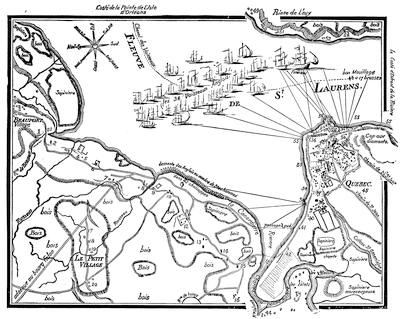
Attack on Quebec.
To Frontenac the success of his defence was a temporary relief, so far as the English were concerned, though the New England cruisers continued to intercept his supplies in the Gulf. But the Iroquois wolves began to prowl again. Taunted by their savage allies for their inertness, the English and Dutch of Albany once more raided towards Montreal, under Peter Schuyler, and, inflicting more damage than they received, successfully broke through an ambuscading force on their retreat. All this irritated Frontenac. He prayed his King for help to destroy New York and Boston; and when a false report reached him that ten thousand “Bastonnais” had sailed to wreak their revenge for Phips’s failure, he set vigorously to work strengthening the vulnerable points of his colony. He varied his activity with continued expeditions against the Iroquois, whether strolling or at home, striking particularly against the Mohawk towns; and he protected a great fleet of canoes which in the troublous times had been kept back in the upper country, and now brought credit and hope to the lower settlements in an ample supply of furs.
But during all this turmoil with public foes, Frontenac was having his old troubles over again with the Bishop and the Intendant. Outward courtesy and secret dislike characterized their intercourse, and discord went in the train of the Bishop as he made his pastoral tours among a people bound in honor and reverence to the Governor.
The reader must turn to another page[707] for the struggle with the “Bastonnais” which Frontenac was watching meanwhile in Acadia; but this did not divert his attention from the grand castigation which at last he was planning for the Iroquois. He had succeeded, in 1694, in inducing them to meet him in general council at Quebec, and had framed the conditions of a truce; but the English at Albany intrigued to prevent the fulfilment, and war was again imminent. Both sides were endeavoring to secure the alliance of the tribes of the upper lakes.[708] These wavered, and Frontenac saw the peril and the remedy. His recourse was to attack the Iroquois in their villages at once, and conquer on the Mohawk the peace he needed at Michillimackinac. It was Frontenac’s last campaign. In July, 1696, he left Montreal with twenty-two hundred men. He went by way of Fort Frontenac, crossed Lake Ontario, landed at Oswego, and struggled up its stream, and at last set sails to his canoes on Lake Onondaga. Then his force marched again, and Frontenac, enfeebled by his years, was borne along in an arm-chair. Eight or nine miles and a day’s work brought them to the Onondagas’ village; but its inhabitants had burned it and fled. Vaudreuil was sent with a detachment, which destroyed the town of the Oneidas. After committing all the devastation of crops that he could, in hopes that famine would help him, Frontenac began his homeward march before the English at Albany were aroused at all. The effect was what Frontenac wished. The Iroquois ceased their negotiations with the western tribes, and sued for peace.
Meanwhile the crowns and diplomats of England and France had concluded the Peace of Ryswick in 1697. Frontenac got word of it from New York as early as February of 1698, and a confirmation from Louis in July. There were still some parries of diplomacy between the old French soldier and the English governor at New York, the Earl of Bellomont, each trying to maintain the show of a paramount authority over the Five Nations. But Frontenac was not destined to see the end. In November he sickened. His adversary, Champigny, mollified at the sight, became reconciled to him, and soothed his last hours. On the twenty-eighth he died, in the seventy-eighth year of his age, and New France sincerely mourned her most distinguished hero.

CRITICAL ESSAY ON THE SOURCES OF INFORMATION.
A LARGE portion of the manuscript sources of this chapter may be found in the invaluable collection of papers relating to New France in the Archives of the Marine and Colonies, the Archives Nationales, and the Bibliothèque Nationale in Paris; and in the office of the Provincial Registrar at Quebec. The archives of New York, Massachusetts, and Canada have made extensive transcripts from these documents, as follows:—
1. Correspondance Officiele, first series, vols. i.-v. There are transcripts from the Paris documents copied in France for the State of New York, and translations of them all are in the ninth and tenth volumes of the Documents relating to the Colonial History of the State of New York.[709]
2. Correspondance Officiele, second series, vols. ii., iv.-viii. These papers exist in manuscript, and have not been translated into English. Copies are in the Library of Parliament, Ottawa, and in the Archives Office of the Quebec Government.
3. A collection of papers made by an agent of Massachusetts at Paris, relating chiefly to Acadian matters, contains also a good deal about Frontenac. They were copied afterward in Boston on an order from the Quebec Government, and are in the keeping of the Registrar at Quebec. The Quebec administration intends publishing these papers.[710] [They have since been published.]
The original Register and Proceedings of Council, in several volumes, remain in very fair condition in the archives of the Quebec Government. The first, a folio bound in calf and indexed, bears two titles, the first of which is, Registre des Insinuations du Conseil Supérieur de 1663 à 1682, ninety-six pages. It begins with the King’s edict creating the Superior Council, dated April 1, 1663, and ends with the “Procès Verbal” of the Superior Council concerning the Redaction of the Code Civil, or ordinance of Louis, April 14, 1667.
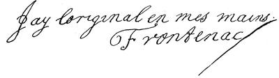
The second title is, Jugements et Délibérations du Conseil Souverain de la Nouvelle France, 1663 à 1676, two hundred and eighty-one pages. It begins with an arrêt of the Superior Council ordering the registration of the King’s edict of April 1, 1663, creating the Superior Council for New France, to be held at Quebec; and ends with an interlocutory judgment, dated Dec. 19, 1676, upon a petition of François Noir Roland, complaining of his curate for refusing him absolution. This book, or register, is authenticated by the certificate of the Governor, Comte de Frontenac, on the first page, as follows:—
“Le Présent Régîstre du Conseil Souverain contenant trois cens soixante et seize feuillets a été ce jour paraphé ne varietur par premier et dernier, par nous Louis de Buade de Frontenac Chevallier Comte de Palluau, Conseiller du Roy en ses Conseils, Gouverneur et Intendant Général pour sa Majesté, en la Nouvelle France, Québec le quinzième Janvier Mille six cents soixante et quinze.”
“Frontenac.”
The entries in general throughout this end of the book are authenticated by the Governor, Bishop, Intendant, councillors, or Clerk of the Council; and the last, or two hundred and eighty-first leaf, is signed by Duchesneau, Intendant, and by Dupont, Member of the Council. Its general contents consist of a variety of orders, regulations, ordinances, judgments, civil and criminal, of the Superior Council, licitation, and adjudications of Crown estates, representations to the King and his ministers upon various subjects. There are four following volumes of this register in the archives at Quebec bearing the dates 1677 to 1680, 1681, 1681 to 1687, and 1688 to 1693, respectively. Each of these contains interesting details of Council proceedings during the first administration of Frontenac, the time of La Barre and Denonville, and during Frontenac’s second term.
The Édits et Ordonnances, vol. iii., contain copies of the commissions of Frontenac, La Barre, and Denonville.
For particulars concerning the youth of Frontenac, his family and marriage, see Parkman’s Appendix, where, among other sources, are named the journal of Jean Héroard, physician to the court, part of which is cited in Le Correspondant of Paris for 1873; Pinard, Chronologie Historique-Militaire; Les Mémoires de Sully; Table de la Gazette de France; Mémoires de Philippe Hurault (in Petitot); Jal, Dictionnaire Critique, Biographique, et d’Histoire, article, “Frontenac;” Historiettes de Tallemant des Réaux, ix. (ed. Monmerqué); Mémoires de Mademoiselle de Montpensier, vols. i.-iii.; and Mémoires du Duc de Saint-Simon.[711]
At Frontenac’s death we have an Oraison funèbre du Comte de Frontenac, par le Père Olivier Goyer, preached from the text: “In multitudine videbor bonus et in bello fortis.” A copy of this eulogy, containing a running commentary on its sentiments strongly adverse to the views of the orator, is preserved in the Seminary of Quebec. These comments, selections from which will be found in Parkman’s Count Frontenac and New France under Louis XIV., pp. 431-434, are, the Abbé Casgrain informs me, from the caustic pen of the Abbé Charles Glandelet, who came to Canada in 1675, and labored half a century in the Seminary. He was first theologian, superior, and confessor of the Ursulines, and died at Three Rivers at the advanced age of eighty years.
In considering the early printed books pertaining to our subject, we find them copious; but unfortunately we can scarcely account many of them trustworthy historical authorities, since prejudice and partisanship characterize them for the most part. The contests of the period greatly developed antagonisms, and it was not easy at the time to resist their influences. When we collate the writings of these contemporaries, we find a great lack of unity and sympathy, and this often extends to matters of trifling import. While thus in many ways these books fail of becoming satisfactory chronicles, as expressions of current partisan feeling they often throw great light on all transactions; and it is fortunate that in their antagonisms they give rival sentiments and opposing narratives, from which the careful student, with the help of official and other contemporary documents, may in the main satisfy his mind. Foremost among these early narratives is the Premier Établissement de la Foy dans la Nouvelle France of the Père Le Clercq: of this, however, as well as of the works of Hennepin and La Hontan, Tonti, and Marquette, an examination is made in another chapter.[712]
Of the more general early narratives, we must give a prominent place to a book which ranks as a respectable authority, and is frequently quoted,—Bacqueville de la Potherie’s Histoire de l’Amérique Septentrionale depuis 1534 jusqu’à 1701, Paris, 1722, four volumes. It is particularly useful in studying the relations of Frontenac and Callières, but as a contribution upon the condition of the Indians at that time it has its chief value.[713]
The Histoire du Canada of the Abbé Belmont, superior of the Seminary of Montreal during 1713 and 1724, is a short history of affairs from 1608 to 1700. The Literary and Historical Society of Quebec printed, about 1840, in their Collection de Mémoires, a small edition of the work from a manuscript copy in the Bibliothèque Nationale of Paris. It is very scarce, and copies are held at high prices, but the Society intend reissuing it shortly. Its general accuracy has not been questioned, and the views expressed are evidently the outcome of careful consideration.
The general history of the administrations of Frontenac, De la Barre, and Denonville is exhaustively treated by Father Francis-Xavier de Charlevoix; and the first place in time and importance among the contributions to the general history of Canada, of a date earlier than the present century, must be given to this Jesuit’s Histoire et Description Générale de la Nouvelle France, avec le Journal Historique d’un Voyage fait par l’Ordre du Roi dans l’Amérique Septentrionale, which was issued at Paris in 1744.[714] Shea says: “Access to State papers and the archives of the religious order to which he belonged, experience and skill as a practised writer, a clear head and an ability to analyze, arrange, and describe, fitted him for his work.” Parkman, whose studies have made him a close observer of Charlevoix’s methods, speaks of his “usual carelessness.”
Charlevoix arrived in Canada in September, 1720, on an expedition to inspect the missions of Canada. His purpose took him throughout the limits of New France and Louisiana, and by the Illinois and the Mississippi to the Gulf. His work is commensurate with his opportunities; his faults and errors were those of his order; and his religious training inclined him to give perhaps undue prominence to the ecclesiastical side of his subject; and though the character of Frontenac suffers but little at his hands, some of the prejudice which Charlevoix bestows upon the Recollects necessarily colors his judgment in matters where the Governor came in contact with the Jesuits.
The Abbé La Tour, not a very trustworthy authority, wrote Mémoires sur la Vie de M. de Laval, premier Évêque de Québec in 1761,—a small book which is worth looking into, though not with the object of accepting all its statements. Frontenac is bitterly attacked, his faults magnified, and many serious charges are preferred against him. But one volume, however, was published,—a thin book of a few pages, bearing the imprint of Jean Frederick Motiens, Cologne, 1761. The second volume was never printed. The copy of vol. i. which the Abbé Vemey possessed has this note in the latter’s handwriting: “L’Abbé de la Tour de Montauban, author of this Life, of which the first volume only has been published, promised me a manuscript copy of the second volume; but he did not keep his word. Owing to the unfair manner in which Bishop St. Vallier was treated in the second volume, his family objected to its publication.” The first volume ends with the year 1694. A second edition was published at Paris in 1762.[715]
A useful work, which should not be lost sight of in the consideration of this period, is L’Histoire de l’Hôtel Dieu de Québec, de 1639 à 1716, by the reverend mother, Françoise Juchereau de St. Ignace, printed in Paris in 1751. It is rich in facts and incidents, and especially valuable as an authority on the missionary activity of the time, and on the attempt made by the clergy to evangelize the savages. A supplementary work, prepared with great care and thoroughness from original documents, and bearing the same title, has been written by the Abbé H. R. Casgrain. It is brought down to 1840, and was published at Quebec in 1878. The Abbé is one of the most industrious of the French-Canadian writers, and his book is full of interesting details and notes.[716]
In the third series of Historical Documents published under the auspices of the Literary and Historical Society of Quebec in 1871, is a paper entitled “Recueil de ce qui s’est passé en Canada au sujet de la guerre, tant des Anglais que des Iroquois, depuis l’année 1682.” It contains a good account of the Lachine massacre, the truthfulness of which may be accepted. The author accompanied Subercase to the scene.[717]
In a collection entitled, Bibliotheca Americana: Collection d’ouvrages inédits ou rares sur l’Amérique, with the imprint of Leipsic and Paris, appeared the Mémoire sur les Mœurs, Coustumes, et Réligions des Sauvages de l’Amérique Septentrionale, par Nicolas Perrot, publié pour la première fois par le R. P. Tailhan, de la Compagnie de Jésus, 1864. Considerable importance is attached to this memoir by Charlevoix, La Potherie, Ferland, and others, who frequently quote it in their narratives. Harrisse (no. 833) says that this work seems to have been written day by day from 1665 to the death of Perrot, who was an eye-witness of events under the administration of De la Barre, Denonville, and Frontenac. Colden gives a part of the narrative in his History of the Five Indian Nations, London, 1747.[718]
It remains to characterize the chief general works of our own time, which indicate the great interest with which modern research has invested the story of New France. The French-Canadians generally accept François-Xavier Garneau as their national historian, and his Histoire du Canada well entitles him to that consideration. He began writing his history in 1840, and published the first volume in Quebec in 1845, the second in 1846, and the third, treating of events down to 1792, in 1848. A new edition, revised and corrected, and brought down to 1840, appeared at Montreal from Lovell’s press, in 1852, and a third edition at Quebec in 1859.[719] In 1882 the fourth edition, edited by his son,[720] was issued at Montreal by Beauchemin & Valois. It is enriched by many valuable notes, and has a recognized place as a work of conspicuous merit.
The ecclesiastical history of Canada is particularly illustrated by the Abbé J. B. A. Ferland in his Cours d’Histoire du Canada, 1534-1759, Quebec, 1861 and 1865, two volumes. The author died while the second volume was passing through the press, and the completing of the publication devolved upon the Abbé Laverdière, one of the ablest scholars in the Canadian priesthood. Ferland had access to many documents of great interest, and his work shows judgment and a skilful handling of the rich store of materials within his reach.[721]
The Histoire de la Colonie Française en Canada, with maps, by the Abbé Faillon, a Sulpitian priest of very great ability, was projected on an extensive plan. The author visited Canada on three separate occasions, spending several years in the country, and made the most of his opportunities in gathering his material, not only there, but from the archives of the Propaganda at Rome and from the public offices in Paris. The result was a work of high value; but it must be read with a full perception of the author’s intention to rear a monument to commemorate the labors and trials of the Sulpitians of Montreal.
Parkman[722] thus speaks of him: “In all that relates to Montreal I cannot be sufficiently grateful to the Abbé Faillon, the indefatigable, patient, conscientious chronicler of its early history; an ardent and prejudiced Sulpitian; a priest who three centuries ago would have passed for credulous, and withal a kind-hearted and estimable man.”
Three volumes only appeared, the first two in 1865, and the third in 1866. The latter deals with events covered by a small portion of the period discussed in this chapter. M. Faillon’s death at Paris in 1871 prevented further publication; but he has left in manuscript enough prepared material to complete the work as far as the conquest of 1759-1760. The book was published anonymously, according to the custom of the Congregation of St. Sulpice.[723]
It is, however, to an American of Puritan stock that the story we are illustrating owes, for the English reader certainly, its most conspicuous recital. Two volumes of Francis Parkman’s series of France and England in North America concern more especially the period covered by the administrations of Frontenac, De la Barre, and Denonville; these are his Frontenac, and New France under Louis XIV. (Boston, 1877), and his La Salle, and the Discovery of the Great West (Boston, 1879); but the consideration of the last of these belongs more particularly to another chapter. Of Parkman as an historian there has been a wide recognition of a learning that has neglected no resource; a research which has proved fortunate in its results; a judgment which, though Protestant, is fair and liberal;[724] a critical perception, which in the conflict of testimony keeps him accurate and luminous; and a style which has given his narrative the fascinations of a romance.
John Dennis wrote a tragedy,—Liberty Asserted,—which was acted in London in 1704, in which Frontenac was made a character, together with an English governor and Iroquois chief. Betterton acted in it. A romantic picture of the period is furnished in an amusing novel by M. Joseph Marmette, formerly of Quebec, but now of Paris, entitled François de Bienville. Frontenac figures as one of the principal characters in the story. Frontenac’s expeditions against the Iroquois were made the subject of a poem by Alfred B. Street,—Frontenac: or, the Atotarho of the Iroquois. London and New York, 1849.
M. T. P. Bedard, of the Archives department, has a paper in the Annuaire de l’Institut Canadien, nos. 7 and 8, 1880, 1881, which discusses the first and second administrations of the Count, and sheds some light on the social and political aspects of the country between 1672 and 1698, the year in which Frontenac died.

EDITORIAL NOTES.
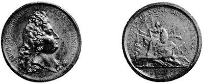
THE QUEBEC MEDAL.
This is engraved from a copy kindly lent by W. S. Appleton, Esq., of Boston. See Mass. Hist. Soc. Proc., xi. 296, and Shea’s Charlevoix, iv. 190, and his Le Clercq, ii. 329. See the “Historic Medals of Canada,” in the Quebec Lit. and Hist. Soc. Transactions, 1872-1873, p. 73.
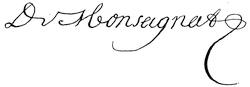
A. Frontenac’s Second Term.—Mr. Parkman has accompanied his narrative[725] of the attempt on Quebec in 1690 with an indication of the sources of the story. Besides the despatches of Frontenac and the Relation of Monseignat (both printed in the New York Colonial Documents, vol. ix.), there is an account taken by vessel to Rochelle, which is without place or date, and was probably there printed. It is entitled, Relation de ce qui s’est passé en Canada, à la descente des Anglais à Québec, au mois d’Octobre, 1690, faite par un Officier (Harrisse, no. 168; Carter-Brown, vol. ii. no. 1,426), and contains Phips’s summons to Frontenac (also given in Mather’s Magnalia, and repeated by Parkman, Frontenac, p. 266), and Frontenac’s verbal answer.
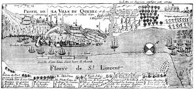
PLAN OF ATTACK ON QUEBEC, 1690.
Fac-simile of an engraved plan in La Hontan’s New Voyages, London, 1703, vol. i. p. 160. It was re-engraved for the French edition of 1705.
The copy of Phips’s summons sent to Paris by Frontenac is indorsed by him to the effect that he retained the original. The Mercure de France also issued an “Extraordinaire,” with an account (Harrisse, no. 166,) and another brief Relation de la levée du siége de Québec (Harrisse, no. 167) was printed at Tours. La Hontan, Le Clercq, La Potherie, and Juchereau (L’Hôtel Dieu), give other accounts contemporary, or nearly so, and their testimony has been availed of by Charlevoix (cf. Shea’s ed., iv. 169) and the later writers, like Garneau.
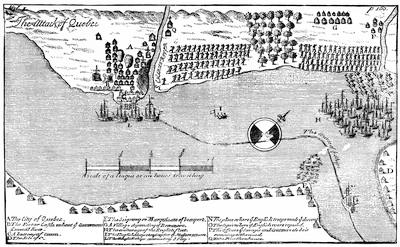
ATTACK ON QUEBEC, 1690.
Fac-simile of the engraving in La Hontan’s Mémoires, La Haye, 1709, vol. ii. p. 14. It was re-engraved for the 1715 edition.
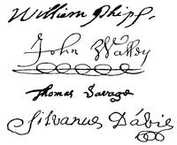
On the English side, besides a contemporary bulletin issued in the Publick Occurrences, Boston, Sept. 25, 1690 (given in Hist. Mag., August, 1857), two participators in the expedition left narratives,—one of which by John Walley is printed in Hutchinson’s Massachusetts, i. app. no. xxi., which concerns chiefly the land forces; and the other was by the officer second in command of the militia, and is entitled, An account of the late action of the New Englanders, under the command of Sir William Phips, against the French at Canada, sent in a letter from Maj. Thomas Savage, of Boston, in New England (who was present at the action), to his brother, Mr. Perez Savage, in London. London, 1691. This quarto tract is in Harvard College Library; it was reprinted in the Mass. Hist. Coll., xiii. 256.
In the same Collections, third series, i. 101, is the diary of Captain Sylvanus Davis, who was at the time a captive in Quebec; cf. also Johnston’s Bremen, Bristol, and Pemaquid. An original journal of the expedition is said to have been intrusted to Admiral Walker at the time of his venture in 1711, and to have been lost in one of his ships (Walker’s Journal, p. 87). Phips’s side of the story is doubtless told amid the high laudation of Cotton Mather’s Life of Phips; some light is thrown upon the times in Dummer’s Defence of the Colonies; and various tokens of the preparations for the expedition are preserved in the Hinckley Papers, vol. iii, in the Prince Library.
Somewhat later we have the story in some of its aspects in Colden’s Five Nations; later still, in Hutchinson’s Massachusetts Bay, vol. i.; again, in part, in Belknap’s New Hampshire; while the chief modern writers who have preceded Parkman, on the English side, have been Palfrey’s New England, iv. 51; Barry’s Massachusetts, ii. 79; Bowen’s “Life of Phips,” in Sparks’ American Biography; and Warburton, in his Conquest of Canada, chap. 14.
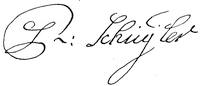
Of the supporting Winthrop expedition from Albany, we have the French accounts in La Potherie (iii. 126), and in the New York Colonial Documents, ix. 513. The recently published Winthrop Papers (iv. 303-324) throw considerable light through the letters of Fitz-John Winthrop on the preparations which were made; and they give also his reasons for the expedition’s failure, and through his Journal, with which the one printed in the New York Colonial Documents, iv. 193, may be compared. Parkman’s Frontenac (p. 257) and Shea’s Charlevoix (iv. 145) note the authorities; and the New York Colonial Documents (iii. 727, 752) and Doc. Hist. N. Y. (ii. 266, 288) yield other light than that already mentioned. The Journal of Schuyler’s raid to La Prairie is given in the Doc. Hist. N. Y., ii. 285, and in the publications of the New Jersey Historical Society, vol. i.

Concerning the minor episodes of this second term of Frontenac’s government, both Parkman and Shea indicate the essential authorities. On the destruction of Schenectady, the letter of Monseignat and other papers in the Doc. Hist. of New York, vol. i. 297, etc. (where authorities are cited), and a letter of Schuyler and his associates in the Massachusetts Archives, printed in the Andros Tracts, are of the first importance. Cf. also M. Van Rennsselaer’s paper in N. Y. Hist. Soc. Proc., 1846, p. 101, and the same Society’s Fund Publications, ii. 165; a letter from Governor Bradstreet, in the N. E. Hist. and Geneal. Reg., ii. 150; and the contributions in Munsell’s Albany. French accounts are in Le Clercq (Shea’s edition, ii. 292); Potherie, ii. 68; N. Y. Col. Docs., ix. 466; and English accounts in Smith’s New York, p. 66; Colden’s Five Nations (1727), p. 114.
On Schuyler’s raid by way of Lake Champlain in 1691, the French side is still to be gathered from La Potherie, with help from Belmont, Histoire du Canada, and from the Relation of 1682-1712, and from the despatches of Frontenac and Champigny. Schuyler’s own Journal and other documents, French and English, are in the N. Y. Colonial Documents, vol. iii.; Parkman (p. 294) examines the question of the number of the forces engaged, and Shea, Charlevoix, iv. 202, gives references.

On the expedition against the Mohawks, led by Mantet, Courtemanche, and La Noue, we have more various accounts. Parkman gives a graphic recital, and his notes show he has used all the sources. The French authorities, besides the letter of Callières to the home government, are the Relation de ce qui s’est passé de plus remarquable en Canada, 1692-93; the Relation de ce qui s’est passé en Canada au sujet de la Guerre, 1682-1712; while citations of original journals, etc., are in Faillon’s Vie de Mdle. Le Ber, and of course we have La Potherie (iii. 169) and Belmont. The N. Y. Col. Docs., vol. ix., contain important material, including a “Narrative of Military Operations in Canada;” and Major Peter Schuyler’s report is in vol. iv. of the same collection. Colden, in his Five Nations, p. 142, wrote while the actors were still living. There was a tract on the expedition issued in London the same year, which is of such rarity that the copy in the Carter-Brown Library (Catalogue, vol. ii. no. 1,446, with fac-simile of title; also Harrisse, no. 171) is the only one known to me, and from it Sabin, in 1868, reprinted it. It is entitled, A Journal of the late actions of the French in Canada, with the manner of their being repulsed, by his Excellency Benjamin Fletcher, Governor of New York, etc. By Coll. Nicholas Reyard [should be Beyard] and Lieutenant-Coll. Charles Lodowick.

The reader must turn to the chapter on Acadia for the authorities for such other expeditions as come within the alleged limits of that province and the neighboring English settlements.
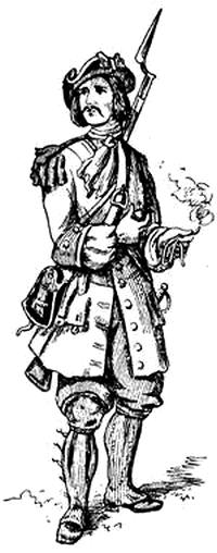
A CANADIAN SOLDIER.
This sketch of the costume of a grenadier de St. Louis, Compagnie canadienne, is taken from the Mass Archives: Documents Collected in France, iii. 3.
On Frontenac’s last raid,—the attack upon the Onondagas, in 1696,—we must naturally find our chief information from the French, for the English at Albany were not ready to advance till the French had done their work and had gone. Frontenac and Callières each despatched accounts to Paris; and besides the Relation, 1682-1712, already referred to, we have the Relation de ce qui s’est passé en Canada,—a manuscript preserved in the library of the Literary and Historical Society of Quebec (see Parliamentary Library Catalogue, 1858, p. 1613); the Relation, 1696, which Shea has printed, and of course the accounts in La Potherie, iii. 270, and Charlevoix (Shea adds references in his edition, vol. v.), and the papers in the Doc. Hist. of N. Y., i. 323, and the N. Y. Col. Docs. iv. 342. Parkman’s narrative (Frontenac, chap. xix.) is clearly put and exemplified.
B. General Documentary Sources Of Canadian History.—Harrisse prefaces his Notes pour servir à l’histoire, à la bibliographie et à la cartographie de la Nouvelle France et des pays adjacents, 1545-1700, Paris, 1872, with an account of the sources of early Canadian history, and of the repositories of documentary material in Paris, etc. He states that the French Government refused access to their archives to an agent of the Historical Society of Quebec in 1835, and that a similar refusal was made in 1838; but that in 1842 General Cass, then United States Minister, succeeded, in behalf of the State of Michigan, in securing about forty cartons for publication; and ten years later the Parliament at Quebec obtained copies of documents, which now (1872) form a series of thirty-six folios,—not embracing, however, the papers of the early discovery, which were withheld.
Louis P. Turcotte, in his address on Les Archives du Canada (Quebec, 1877), says that the first inventory of the public archives of Canada was published in 1791; that it shows the subsequent loss of important documents; that the first steps were taken to procure copies from the European archives in 1835, which were not successful at the time; and that the better results made by the State of New York (1841-1844) were accordingly availed of. In 1845 the Canadian agent, M. Papineau, secured other copies in France; and in 1851-1852 M. Faribault added twenty-four volumes of transcripts to the collection, now in the library at Ottawa; and sixteen volumes have been added since. M. Turcotte pays a tribute, for his zeal and industry in preserving early Canadian records, to M. Jacques Viger, whose efforts have been since supplemented by the labors of l’Abbé Verreau, who has formed a large library of copies of manuscripts and printed books. M. Verreau was in 1873 sent by the Canadian Government to Europe to make additional collections.
The Catalogue of the Library of the Canadian Parliament, made by Gérin-Lajoie, and published in 1858, gives (p. 1448) an account of the manuscript collections at that time in the possession of the Canadian Government at Toronto, and now transferred to Ottawa, and divides them thus:—
First series.—Copies of copies made by Brodhead for the State of New York, from the archives at Paris, seventeen volumes, with six additional volumes, drawn at second hand in the same way from the Colonial Office in London. These copies were made before the Brodhead collection was printed. Kirke, in his First English Conquest of Canada, London, 1871, says: “The papers in the Record Office [London] relating to Canada, Acadia, or Nova Scotia, and Newfoundland are numerous and continuous from 1621 to 1660, with the exception of the period from 1640 to 1649, during which years we find no papers.”
Second series.—Copies obtained in Paris by Faribault, and made under Margry’s direction; twelve volumes, giving the official correspondence of the governors, 1637-1727. These are enumerated in the Catalogue.
Third series.—Copies of official correspondence relative to Canada, 1654-1731; twelve volumes, likewise arranged by Margry, and also enumerated in the Catalogue.
Fourth series.—A transcript of Franquet’s “Voyages et mémoires sur le Canada, 1752-53,” and other documents mentioned in the Catalogue.
Fifth series.—Maps, copied by Morin, and enumerated on pp. 1614-21 of the Catalogue.
Cf. Collection de Mémoires et de Relations sur l’histoire ancienne du Canada, d’après des manuscrits récemment obtenus des archives et bureaux publics en France, Quebec, 1840; and the Transactions of the Literary and Historical Society of Quebec, 1870-71, and 1871-72. The Collection contains Belmont and the Report attributed to Talon. Cf. Magazine of American History, iii. 458, in the Quebec Society.
The Lettres, instructions et mémoires de Colbert, publiés par Clément, Paris, 1865, vol. iii., second part, contain various important papers,—like the instructions as intendant of Talon, March 27, 1665; of De Bouteroue, April 5, 1668; Duchesneau, May 30, 1675; those to Gaudais in 1663, and to Courcelles in 1669: besides letters to Frontenac, April 7, 1672; June 13, 1673; May 17, 1674; April 22, 1675; May 10, 1677; March 21, 1678; Dec. 4, 1679; April 30, 1681 (pp. 533, 557, 574, 585, 594, 622, 631, 641, 644): others to Talon, Feb. 11, 1671; June 4, 1672 (pp. 511, 539); to Duchesneau, April 15, 1676; April 28, 1677; May 1, 1677; May 15 and 24, 1678; April 30, 1679 (pp. 605, 614, 619, 632, 635, 638); with one to l’Évêque de Petrée, May 15, 1669 (p. 451). Margry (i. 247) gives some of the correspondence of Frontenac and Colbert, 1672-1674, relative to the pushing of Recollect missionaries farther west; and in Clément’s Histoire de Colbert, Paris, 1874, vol. i. last chapter, there is an exposition of Colbert’s colonial policy.
Mr. Ben: Perley Poore was appointed by the Governor of Massachusetts, in May, 1845, to select and transcribe such documents in the French archives as he might find to bear upon the early history of Massachusetts and the relations of New England with New France. His report to the Governor, Dec. 28, 1847, accompanied by letters from John G. Palfrey and Jared Sparks, telling the story of his work, constitutes Senate Doc., no. 9 (1848), Mass. Documents. His transcripts, covering papers from the discovery to 1780, fill ten volumes in the Archives of the State, and are accompanied by two volumes of engraved maps. Mr. Poore, under the auspices of the Massachusetts Historical Society, and with the pledge of Colonel William P. Winchester to assume the expense if necessary, had already a year earlier begun his work. M. Davezac was at that time chef des archives of the Marine, and the confusion which Brodhead, the agent of New York, had earlier found among the papers had disappeared under the care of the new custodian. From other departments as well as from other public and from private sources, Mr. Poore increased his collection, and added to it water-color drawings and engraved prints of an illustrative nature; but unfortunately many of the documents cited are given by title only, and the blank pages left to be filled are still empty. It is these papers which have been copied within a year or two for the Government of the Province of Quebec.
The manuscript collections of Mr. Parkman are very extensive, and are still in his house; the more important of his maps, however, have been transferred to the College Library at Cambridge, and these have been sketched elsewhere in the present volume. The Editor is under great obligations to Mr. Parkman for unrestricted access to his manuscripts. They consist of large masses of miscellaneous transcripts, with a few original papers, and so far as they come within the period of the present volume, of the following bound series:—
I. Acadia, in three volumes. These are transcripts made by, or under the direction of, Mr. Ben: Perley Poore, and in considerable part supplement the collection made by Mr. Poore for the State of Massachusetts.
II. Correspondance officielle, in five volumes, coming down to 1670, being transcripts from the French archives.
III. Canada, in eight volumes, covering 1670-1700, being transcripts from the French archives, and supplementing Brodhead’s Colonial Documents of New York, vol. ix.
C. Bibliography.—Harrisse’s Notes, etc., is the latest of the general bibliographies of the history and cartography of New France; and this with his Cabot constitutes a complete, or nearly so, indication of the sources of Canadian history previous to 1700. Charlevoix in 1743 prefixed to his Nouvelle France a list of authorities as known to him, and characterized them; and this is included in Shea’s translation. Of the modern writers, Ferland and Faillon in their introduction each make note of their predecessors. The work of G. B. Faribault, Catalogue d’ouvrages sur l’histoire de l’Amérique, et en particulier sur celle du Canada, avec des notes, Quebec, 1837, containing nine hundred and ninety-six titles, besides maps, etc., has lost whatever importance its abounding errors left for it formerly. There is a biographical sketch (1867) of Faribault in the Abbé Casgrain’s Œvres, vol. ii. Cf. Morgan’s Bibliotheca Canadensis, p. 118. H. J. Morgan’s Bibliotheca Canadensis, Ottawa, 1867, includes the writers on Canadian history who have published since the conquest of 1759.
From this book and other sources the following enumeration of the various general histories of Canada, compendious as well as elaborate, and including such as cover a long interval in a general way, is taken:—
Excepting one volume of a projected History of Canada, by George Heriot, published in London in 1804, and which was an abridgment of Charlevoix, the earliest of modern works is The History of Canada from its first Discovery to 1796, by William Smith, published in Quebec in 1815. The author was a son of the historian of New York.
There was published in Paris in 1821, in a duodecimo of 512 pages, a sketchy compendium by D. Dainville,—Beautés de l’histoire du Canada, ou époques remarquables, traits intéressans, mœurs, usages, coutumes des habitants du Canada, tant indigènes que colons, depuis sa découverte jusqu’à ce jour.
In 1837 Michael Bibaud published at Montreal a Histoire du Canada sous la domination Française. A second edition was published in 1845. In 1844 appeared his Histoire du Canada et des Canadiens sous la domination Anglaise. This author also published a Bibliothèque Canadienne, a monthly magazine, which for several years gathered and preserved considerable documentary material.
Between 1845 and 1848 the work of Garneau, mentioned in the preceding chapter, was printed, which became the basis of Bell’s adaptation in 1866.
In 1851 a comprehensive compendium by W. H. Smith,—Canada [West]: Past, Present, and Future,—in two volumes, was published at Toronto.
Brasseur de Bourbourg’s Histoire du Canada; de son Église et de ses missions, published in Paris in 1852, is characterized in the Note on the Jesuit Relations, following chap. vi.
A popular History of Canada from its first Discovery to the Present Time, by John MacMullen was published at Brockville in 1855 and 1868.
L. Dussieux’s Le Canada sous la domination Française was published at Paris in 1855, and a new edition in 1862.
F. M. N. M. Bibaud’s Les Institutions de l’histoire du Canada (to 1818), Montreal, 1855, is a concise narrative.
Between 1861 and 1865, and in 1865-1866, were published the works of Ferland and Faillon, of which note is made in the preceding chapter.
John Boyd’s Summary of Canadian History was issued at Toronto in 1860, and many editions since.
In 1863 Boucher de la Bruère, fils, published a brief survey,—Le Canada sous la domination Anglaise.
Alexander Monro’s History, Geography, and Statistics of British North America was published at Montreal in 1864.
William Canniff’s History of the Settlement of Upper Canada, with special reference to the Bay Quinté, appeared at Toronto in 1869. This book was undertaken under the auspices of the Historical Society of Upper Canada, which was established at St. Catharines in 1861.
At Montreal, in 1872, appeared Henry H. Miles’s History of Canada under the French régime (1535-1763), with Maps, Plans, and Illustrative Notes.
Andrew Archer’s History of Canada was published in 1875 at London.
John Harper’s History of the Maritime Provinces was issued at St. John, N.B., in 1876.
Charles R. Tuttle’s Short History of Canada, 1500-1878, appeared in Boston in 1878.
F. Teissier’s compendious historical sketch of Canada under the French, 1562-1763, appeared at Limoges,—Les Français au Canada. It is not dated, but is recent.
The series of monographs by Mr. Parkman is spoken of elsewhere.
An important work is now publishing: Histoire des Canadiens-Français. 1608-1880. Origine, Histoire, Réligion, Guerres, Découvertes, Colonization, Coutumes, Vie Domestique, Sociale et Politique, Développement, Avenir. Par Benjamin Sulte. Ouvrage orné de portraits et de plans. Montreal. 1882-1883.
THE GENERAL ATLASES AND CHARTS
OF THE
SIXTEENTH AND SEVENTEENTH CENTURIES.
BY THE EDITOR.
THE general atlases at this time becoming familiar to Europe were unfortunately made up on a thrifty principle, little conducive to keeping the public mind abreast of current discovery,—so far as America, at least, was concerned,—and very perplexing now to any one studying the course of the cartographical development of American geography. Dates were sedulously erased with a deceitful purpose (which is not yet gone into disuse) from plates thus made to do service for many years, and united with other dated maps, to convey an impression of a like period of production.
Bestelli e Forlani’s Tavole moderne di Geografia de la maggior parte del mondo, Roma, 1558-80, with seventy-one large maps, including three maps of the world, and three of America, is reputed the best atlas which had been constructed up to that date. Sets vary much in their make-up.[726]
Perhaps the prototype of the modern atlas can be best found in the Theatrum orbis terrarum of Ortelius, issued in the first edition at Antwerp in 1570, of which an account has been given elsewhere.[727] His portrait is on a later page.
In 1597 appeared the earliest special atlas of America in the Descriptionis Ptolemaicæ Augmentum of Cornelius Wytfliet, which was reissued the same year with its errata corrected.[728] It had nineteen maps, which were also used in the second edition, issued in 1598. A fac-simile of the title of 1597 is given on the next page.[729]

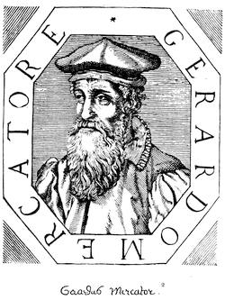
This is a fac-simile of a cut in Lorenzo Crasso’s Elogii d’ Huomini letterati, Venice. 1666. There’s a portrait of him at sixty-two in the 1584 edition of Ptolemy, the second of Mercator’s own editing. It is engraved by Francis Hoggenberg. The engraving in the 1613 edition of Mercator’s Atlas represents Mercator and Hondius seated at a table, and is colored. There is said to be an engraving in the 1618 edition of Ptolemy, but it is wanting in the Harvard College copy. Cf. fac-similes of old prints in Raemdonck’s Mercator, in C. P. Daly’s address on The Early History of Cartography, and in Scribner’s Monthly, ii. 464. There is another portrait of Mercator in J. F. Foppens’ Bibliotheca Belgica, Bruxelles, 1739.
Reference has been made elsewhere to the conspicuous work of Gerard Mercator, which was a sort of culmination of his geographical views, in his great mappemonde of 1569.[730] Then after giving his attention to a closer study of Ptolemy and to the publication of an edition of the great Alexandrian geography, with a revision of Agathodæmon’s charts, but without any attempt to make them conform to the newer knowledge, he set about the compilation of a modern geographical atlas (applying this word for the first time to such a collection, though modern usage has somewhat narrowed the meaning as he applied it); and he had published two parts of it, when he died, in December, 1594,—the second part having appeared at Duisburg in 1585, and the third in 1590. Shortly after his death, a son, Rumold Mercator, published in 1595, at Dusseldorf, part i., and prefixed to it a Latin biography of his father, by Walter Ghymm, which is the principal source of our knowledge of his career.[731] The son Rumold died in 1600, and in 1602, at the expense of the estate, the three parts of the Atlas were united and published together, making what is properly the earliest edition of the so-called Mercator Atlas. It had one hundred and eleven maps and a Latin text. It is very rare, for Raemdonck says he has met with but two copies of it. Up to this time it had contained no American maps. A map of America, as one of the four quarters of the globe, was called for in part iii.; but Raemdonck (p. 257) says he has never seen a copy of that part which has it.
Mercator’s maps were followed, however, pretty closely in Mathias Quad’s or Quadus’s Geographisch Handtbuch,[732] Cologne, 1600, which contained a map of the world and another of North America, with some other special American maps; and such were also contained in the Latin version called Fasciculus geographicus, Cologne, 1608, etc.
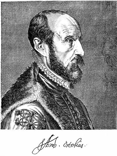
This is a fac-simile of an engraving in J. F. Foppens’s Bibliotheca Belgica, 1739, vol. i. p. 3. There is another engraving in Lorenzo Crasso’s Elogii d’huomini letterati, Venice, 1666.
In 1604 Mercator’s plates fell by purchase into the possession of Jodocus Hondius,[733] of Amsterdam, who got out a new edition in 1606,[734] to which he added fifty maps, including a few American ones; and thus began what is known as the Hondius-Mercator Atlas. The text was furnished by Montanus,[735] and the new maps were engraved by Petrus Kærius, who also prepared for Hondius the Atlas minor Gerardi Mercatoris in 1607.[736]
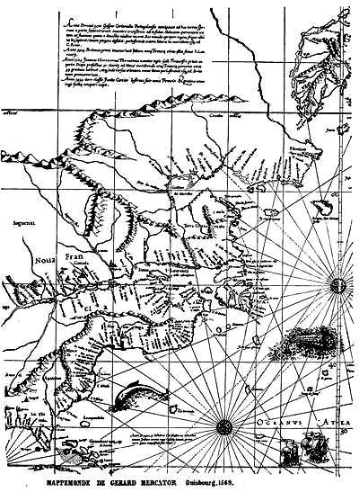
MAPPEMONDE DE GERARD MERCATOR Duisbourg. 1569.
After the death of Jodocus Hondius, Feb. 16, 1611, Heinrich Hondius (b. 1580; d. 1644) and Johannes Jannsonius (d. 1666) completed the Atlas; and what is known as the fourth edition (1613) contains portraits of Mercator and the elder Hondius. In this there were ten American maps, and for several editions subsequently there were 105 of Mercator’s maps and 51 of Hondius’. Such seemingly was the make-up of the seventh edition in 1619 (though called fourth on the title); but there is much arbitrary mingling of the maps observable in many copies of these early editions.
The same Latin text and its translations appeared in the several editions down to 1630, when what is called sometimes the eleventh edition appeared with 163 maps (105 by Mercator, 58 by Hondius); but I have noted copies with 184 maps, of which ten are American, and a copy dated 1632, with 178 maps. Raemdonck does not venture to enumerate all the Latin editions of Hondius and Jannsonius; but he mentions those of 1612, 1613, 1616, 1623, 1627, 1628, 1630, 1631.
In 1633 a marked change was made in the Mercator-Hondius Atlas. There was a new Latin text, and it was now called the Atlas novus, and made two volumes, containing 238 newly engraved maps (only 87 of Mercator’s remaining, while Hondius added 151, including 10 new maps of America). The French text was issued the same year, but it added details not in the Latin, and in the general description of America is quite different.[737] The German text also appeared in 1633; but it had—at least in the copy we have noted—only 160 maps, and of these 6 were American. The Dutch text is dated usually in 1634.
In 1635 the English text appeared with the following title: Historia Mundi; or, Mercator’s Atlas.... Lately rectified in divers places, and also beautified and enlarged with new mappes and tables by the studious industry of Iudocus Hondy. Englished by W. S., London;[738] and of this there was a second edition in 1637. The only map showing New France is a general one of America, which is no improvement upon that of the 1613 edition.
The English market was also supplied with another English version, published much more sumptuously, in two large folios, at Amsterdam in 1636, with the title, Atlas; or, a Geographical Description of the Regions ... of the World, represented by New and Exact Maps. Translated by Henry Hexham. Printed at Amsterdam by Henry Hondius and John Johnson.[739] The American maps are in the second volume, where the map of the two Americas is much like the world-map in vol. i. There is no part of New France shown in the special maps, except in that of “Nova Anglia, Novum Belgium, et Virginia,” where lying west of the Lac des Iroquois (Ontario) is a single and larger “Grand lac.”
A still further enlargement of the Mercator-Hondius Atlas novus took place in 1638, when it appeared in three imperial folio volumes, with 318 maps, 17 of which are special maps of America.[740] It was now more commonly known as Jannson’s Atlas,—this publisher being a son-in-law of Jodocus Hondius,—and it went on increasing till it grew to eight volumes, to which were added a volume “Orbis Maritimus” (1657), a second on the ancient world, a celestial atlas for a third, and an “Atlas Contractus,” or résumé, for the fourth; making twelve in all.[741]
At this time there was a rival in the Atlas of Blaeu, of which the reader will find an account in chapter ix. of the present volume, to be supplemented by the present brief statement.
Willem Jannson Blaeu was born in 1571, and died in 1638, and, with his sons Jean and Cornelis, devoted himself with untiring assiduity to his art. In 1647 the number of their maps reached one hundred. In 1655 their Atlas had reached six volumes, and contained 372 maps. In this year (1655) the Blaeu establishment issued separately the American map, Americæ nova Tabula, with nine views of towns and representations of native costumes, accompanied by four pages of text. The Latin edition of 1662-63, Atlas major, sive cosmographia Blaviana, had 586 maps, of which the collection in the Carter-Brown Catalogue (ii. 900) shows 23 in vol. xi. to belong to America.[742]
The Blaeu establishment was burned in 1672, and most of the plates were lost. Those which were saved passed into the hands of Frederic de Witt, who put his name on them, and they continued to be issued thus inscribed in the Blaeu Atlas of 1685, etc.; and when De Witt’s business fell to Covens and Mortier, the inscriptions were again altered.[743]
A French atlas began a little later to attract attention, and ultimately made the name of its maker famous in cartographic annals. It was begun in 1646 by Nicolas Sanson d’Abbeville, who in 1647 was appointed Royal Geographer of France, and held that office till his death.[744] The volume of his Atlas, containing fifteen American maps, and entitled L’Amérique, en plusieurs Cartes nouvelles et exactes, was published by the author in Paris without date, but probably in 1656, though some copies are dated in 1657, 1658, and 1662.[745]
The elder Sanson, having been born in 1600, died in 1667, leaving about four hundred plates to his sons, who kept up the name,[746] and their stock subsequently fell to Robert Vaugondy, who has given a notice of the Sansons in his Essai sur l’Hist. de la Géog., as has Lenglet Dufresnoy in his Méthode pour étudier la Géographie.[747]
A new Dutch atlas, that of N. Visscher, called Atlas minor, sive Geographia compendiosa, appeared at Amsterdam about 1670. It contained twenty-six maps, and had three American maps; but the number was increased in later editions.[748] In 1680 it appeared in two volumes with 195 maps, 10 of which were American, and plates by Jannson, De Witt, and others, were included. It is not easy to discriminate among various composite atlases of this period, the chief cartographers being made to contribute to various imprints. Another Atlas minor, novissimas Orbis Terrarum Tabulas complectens, is likewise of this date (1680), and passes under the name of S. Wolfgang, with maps by Blaeu, Visscher, De Witt, and others. This usually contains nineteen American maps. Other atlases have the name of Frederic de Witt, who, as we have seen, got possession of some of Blaeu’s plates. The first example of his imprint appeared about 1675, at Amsterdam, with a printed index calling for 102 maps. Another edition (? 1680) is indexed for 160 plates, contained in two volumes of maps, and a third of charts.[749] Another small German atlas, the Vorstellung der gantzen Welt, of J. U. Muller, was published at Ulm in 1692, which had eighteen small American maps; and towards the close of the century the Atlas minor of Allard obtained a good popularity. The pre-eminent name of Delisle, just becoming known, marked the opening of a new era in cartography, which is beyond the limits of the present volume.
Some notice should be given of another class of atlases, the successors of the portolanos of the sixteenth century, and the beginning of the later science of hydrography. In these the Dutch were conspicuous; and many of their subsequent charts trace back to the larger pascaart of the North Atlantic which Jacob Aertz Colom published at Amsterdam about 1630.[750] Among the earliest of the regular Zee-Atlases was that of Theunis Jacobsz, published in Amsterdam about 1635, which has a chart showing the American coast-line from Nova Francia to Virginia. Of large importance in this direction was the Arcano del Mare of Robert Dudley, issued at Florence in 1646-1647, of which mention has been made in other chapters in this and in the preceding volume. Another of the Amsterdam Coloms—Arnold Colom—published his Zee-Atlas about 1650, which contains six American coast-charts, and sometimes appears with a Latin title, Ora maritima Orbis universi, and is of interest in the historical study of our American coast-lines, improving as he does the preceding work of Jacobsz. Later editions of Colom, dating the charts, appeared in 1656 and 1663.[751] Of about this same date (1654) is a pascaart, published at Amsterdam, which seems to have been the joint business project of Frederic de Witt, Anthony and Theunis Jacobsz, and Gulielmus Blaeu. The world-map in it is dated 1652, and is doubly marked “C. J. Visscher” (Claes Jannson Visscher) and “Autore N. J. Piscator” (Nicolas Joanides), as the Latin equivalent of the same person. It shows the Atlantic coast from Labrador to Brazil. The first edition of Hendrick Doncker’s Zee-Atlas ofte Water-Waereld appeared at Amsterdam in 1659, and is particularly useful for the American coasts. New maps were added to it in the edition of 1666; but the Nieuwe Groote vermeerderde Zee-Atlas of 1676, though still called Doncker’s, is based on Colom, and has Colom’s six American charts. Additional American and other charts were added to the 1697 edition; while a set of still larger charts constitute Doncker’s Nieuw Groot Zeekaert-boek of 1712.[752]
The Zee-Atlas of Van Loon, with its forty-five double charts, appeared in 1661.[753] It is in parts reproduced from Blaeu, De Laet, and Jannson. Its numbers 46 and 47 show the coast from Newfoundland southwards. P. Goos, in his Lichtende Colomme, Amsterdam, 1657, had touched the Arctic coasts of America; but in his Zee-Atlas of 1666 he gave in excellent manner eleven charts of the coasts of both Americas, out of the forty-one charts in all. These were all repeated in the edition of 1668-1669, and in the French edition, Atlas de la Mer, 1673. Other Dutch editions, with some changes, followed in 1675 and 1676. It was issued with an English text at Amsterdam in 1670.
Frederic de Witt, who had earlier appended to his Atlas a section of maritime charts, published his Zee-Atlas in 1675, which contained twenty-seven charts, eight of which were American; and in 1676 Arent Roggeveen issued his well-known navigator’s chart-book, which in English is known as The Burning Fen (1676), and which also has a Spanish dress (1680). It gives in successive charts the whole eastern coast of the two Americas, on a large scale. Johann van Keulen, who had published a chart of the coast from Nantucket to Trinidad in 1680, issued a Zee-Atlas in 1682-1687, based in part upon Van Loon, enlarging it in successive issues, so that in the edition of 1694 it had 146 charts, of which 38 were American. A later edition in 1734 contained 12 large folded charts of American coasts.[754]
Near the close of the century we come to the earliest of the French marine atlases, the Neptune Français, which Jaillot published in its enlarged form in 1693; but not till a Suite du Neptune Français was issued in 1700 did any charts of American coasts make part of it. This contained eleven on America, professing to be based on Sanson’s drafts.
THE MAPS OF THE SEVENTEENTH CENTURY,
SHOWING CANADA.
BY THE EDITOR.
[Detailed maps of the Upper Lakes and the Mississippi Basin, as well as those produced by Hennepin, though connected with this period, are made the subject of separate treatment elsewhere in the present volume. The general atlases are treated in the next preceding pages.]
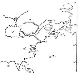
MOLINEAUX, 1600.
The key is as follows:
1. Discovered by Cabot.
2. Bacalaos.
3. C. Bonavista.
4. C. Raso.
5. C. Britton.
6. I. Sables.
7. I. S. John.
8. Claudia.
9. Comokee.
10. C. Chesepick.
11. Hotorast.
12. La Bermudas.
13. Bahama.
14. La Florida.
15. The Gulfe of Mexico.
16. Virginia.
17. The Lacke of Tadenac, the bounds whereof are unknowne.
18. Canada.
19. Hochelague.
Except for the supposed inland sea, much the same configuration of Nova Francia is given in the map of not far from this date which Hondius made to illustrate Drake’s voyage, and of which a fac-simile is given in the Hakluyt Society’s edition of The World Encompassed. The same general character belongs to the Hondius map in the 1613 edition of Mercator; while in the same book the Orbis Terræ compendiosa Descriptio is very nearly of the original Mercator and Ortelius type, which is also closely followed in a second map, America, sive India nova, per Michælem Mercatorem. Another map of the same date is in Megiser’s Septentrio Novantiquus, Leipsic, 1613.
IN the notes at the end of chapter ii. we followed the cartography of New France down to the opening of the seventeenth century. We saw in the map of Molineaux (1600) an indication of a great inland sea, as the prototype of the Great Lakes; but the general belief of the period, just as Champlain was entering on his discoveries, is well shown in the map, “Americæ sive Novi Orbis nova Descriptio,” which appeared in Botero’s Relaciones universales, published at Valladolid in 1603.[755]
The Spanish and the Dutch only repeated, but hardly with as much precision, what the map in Botero had shown;[756] and we only get approximate exactness when we come to the map of Lescarbot in 1609, of which sections are given in the present and in other chapters.[757] Champlain’s first map was made in 1612, and his second in 1613,[758] both of which appeared in Les Voyages du Sieur de Champlain, Paris, 1613. Between the issue of these 1612 and 1613 maps of Champlain and his greater one in 1632, the cartography of New France is illustrated by several conspicuous maps. Those of Hondius and Mercator, so called, of the same year were of course unaffected by the drafts of Champlain. We begin to notice some effects of Champlain’s work, however, in several of the Dutch maps; in that of Jacobsz, or Jacobsen, of 1621, for instance, of which account will be found on another page.[759] Maps by Jodocus Hondius and Blaeu represent a number of streams flowing from small lakes uniting to form the St. Lawrence. One by Jannson, in 1626, nearly resembles for the St. Lawrence region that portion of a “new and accurate map of the world, 1626,” which makes part of Speed’s Prospect of the most famous Parts of the World.
In 1625 the Pilgrimes[760] of Purchas introduces us to two significant maps. One is that which Sir William Alexander issued in his Encouragement to Colonies in 1624, and was reproduced by Purchas, calling it “New England, New Scotland, and New France.” The essential part of it is given in Vol. III. chap. ix. The other is that called “The North Part of America,” ascribed to Master Briggs.
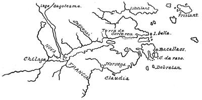
BOTERO, 1603.
In the original edition of De Laet’s Nieuwe Wereldt,[761] published in 1625, we have a map of North America; but in the 1630 (Dutch) edition we find a special map of New France, which was repeated in the (Latin) 1633 edition. Harrisse[762] is in error in assigning the first appearance of this map to the 1640 French edition.
Champlain’s great map appeared in his 1632 edition.
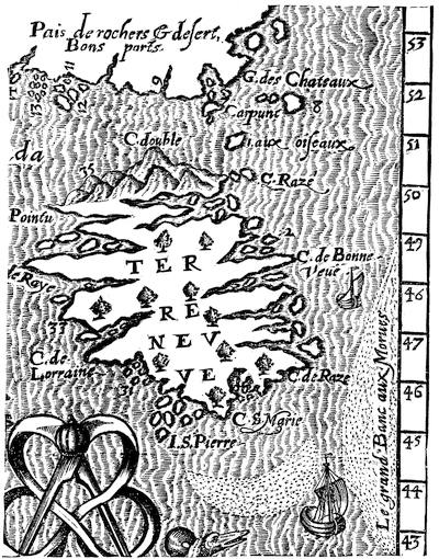
NEWFOUNDLAND, 1609.
Part of Lescarbot’s map. There is in the Kohl Collection, in the State Department at Washington, a map of the mouth of the St. Lawrence River of about this date, copied from one in the Dépôt de la Marine at Paris. Kohl also includes a map by Joannes Oliva, copied from a manuscript portolano among the Egerton Manuscripts in the British Museum, which purports to have been made at Marseilles in 1613. Its names and legends are Italian and Latin; and the map, while inferior to Hakluyt’s map, bears a strong resemblance to it. It is much behind the time, except as respects the outline of Newfoundland, which seems to be more accurately drawn than before. This island was still further to be improved in Mason’s map of 1626. Oliva seems to have been ignorant of Lescarbot’s book.
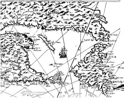
EASTERLY PORTION OF CHAMPLAIN’S 1612 MAP.
These fac-similes of the 1612 map are made from the Harvard College copy. There are other fac-similes in the Boston and Quebec editions; and one by Pilinski (fifty copies at 40 francs) was made in Paris in 1878. Sabin’s Dictionary, p. 478, says: “The copies vary in the maps. Mr. Lenox’s copy differs from that in the New York Historical Society. Sometimes in one map there are more references than in the others, and the spelling of the references varies. The large map is usually in two parts, and is very often wanting or defective.” Harrisse, nos. 306-318, enumerates the proper maps of this 1613 edition. The title of the 1613 edition speaks of this map: “La première servant à la navigation, dressée selon les compas, qui nordestent, sur lesquels les mariniers navigent.”
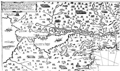
WESTERLY PORTION OF CHAMPLAIN’S 1612 MAP.
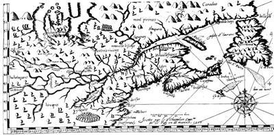
PART OF CHAMPLAIN’S 1613 MAP.
The title of the 1613 edition speaks of this map as being “en son vray Meridien, avec ses longitudes et latitudes: à laquelle est adjousté le voyage du destroict qu’ont trouvé les Anglois, au dessus de Labrador, depuis le 53e degré de latitude, jusques au 63e én l’an 1612, cerchans un chemin par le nord pour aller à la Chine.”
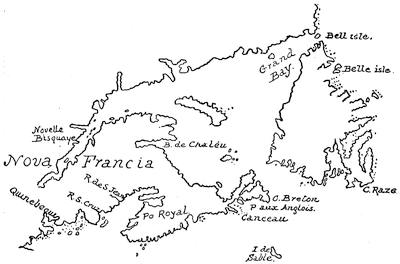
AMERICÆ SEPTENTRIONALIS PARS (Jacobsz, 1621).
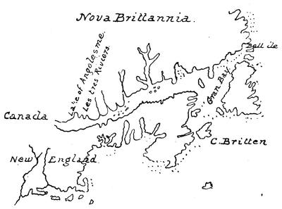
BRIGGS IN PURCHAS, 1625.
It will be observed that Champlain had reached, in his plotting of the country east of the Penobscot, something more than tolerable accuracy. Farther west, proportions and relations were all wrong. The country between the St. Lawrence and the Gulf of Maine is much too narrow. The Penobscot is made almost to unite with the more northern river; and this error is perpetuated in the Dutch maps published by Blaeu, and Covens and Mortier many years later. The placing of Lake Champlain within a short distance of Casco Bay was another error that the later Dutch cartographers adopted in one form or another. Lake Ontario is not greatly misshapen; but Erie is stretched into a strait, while beyond a distorted Huron a “grand lac” is so placed as to leave a doubt if Superior or Michigan was intended.
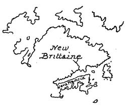
SPEED, 1626.
Notwithstanding this pronounced belief in large inland seas, and the publication of the belief, the notion did not make converts in every direction. Two years later (1634) a map of Petrus Kærius, and even his other map, which appeared in Speed’s Prospect of the most famous Parts of the World, published in London, gave no intimation of Champlain’s results. The same backwardness of knowledge or apprehension is apparent in the map which accompanies the Amsterdam edition of Linschoten in 1644; in that of the world, dated 1651, which appeared in Speed’s 1676 edition; in the map in Petavius’s History of the World, London, 1659; and in two maps of N. I. Visscher, both dated 1652, which make the St. Lawrence River rise in the neighborhood of the Colorado. We might not expect the Zee-Atlas of Van Loon to give signs of the inland lakes; but it is strange that the map “Americæ nova descriptio,” ignoring the great interior waters, was used in editions of Heylin’s Cosmographie, in London, from 1669 to 1677.
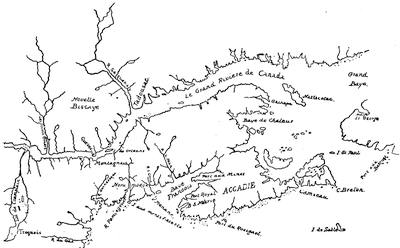
NOVA FRANCIA ET REGIONES ADJACENTES (De Laet).
Cf. another section of De Laet’s map in chap. viii. De Laet was much better informed than Champlain regarding the relative position of Lake Champlain to New England; and he placed it more in accordance with the English belief, as expressed by Thomas Morton, New English Canaan (Adams’s edition, p. 234), who speaks of Lake Champlain as being three hundred miles distant from Massachusetts Bay,—a distance somewhat in excess. De Laet’s map is also given in Cassell’s United States, i. 240.
Some of the Dutch cartographers were not so inalert. Johannes Jannson in his America septentrionalis, and even Visscher himself in his Novissima et accuratissima totius Americæ Descriptio give diverse interpretations to this idea of the inland seas. The draft in the Hexham English translation (1636) of the Mercator-Hondius atlas is not much nearer that of Champlain.
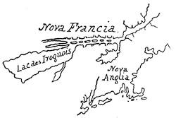
JANNSON.
Harrisse (Notes, etc., nos. 190, 191) refers to two charts of the St. Lawrence of 1641 which are preserved in Paris, and are known to be the work of Jean Bourdon, who came to Quebec in 1633-34. Perhaps one of these is the same referred to by Kohl, as dated 1635, and in the Dépôt de la Marine, of which a copy is in the Kohl Collection in the State Department at Washington. Harrisse also (no. 324) refers to a Description de la Nouvelle France,—a map published by Boisseau in Paris in 1643.
The map in Dudley’s Arcano del Mare (Florence, 1647), called “Carta particolare della terra nuova, con la gran Baia et il Fiume grande della Canida: D’America, carta prima,”[763] presents a surprise in making the St. Croix River connect the Bay of Fundy with the St. Lawrence; and Dudley seems to have had very confused notions of the sites of Hochelaga and the Saguenay. The annexed sketch is much reduced.
The same transverse strait appears in Carte générale des Costes de l’Amérique, published at Amsterdam by Covens and Mortier. A treatment of the geographical problem of the lakes which had more or less vogue, is shown in Gottfried’s Neue Welt, 1655, in a map called “America noviter delineate;” and this same treatment was preserved by Blaeu so late as 1685.
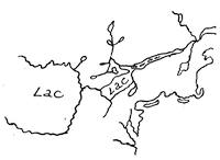
VISSCHER.
A most decided advance came with the map, Le Canada, ou Nouvelle France, of Nicolas Sanson in 1656,[764]—a far better correlation of the three lower lakes than we had found in Champlain, with an indication of those farther west.[765] Contemporary with Sanson was the English geographer Peter Heylin, whose map, as has already been noted, betrays no knowledge of Champlain. His Cosmographie in Four Books appeared in 1657,[766] and the second part of the fourth book relates to America, and is accompanied by the map in question. The contemporary Dutch maps of Jannson, Visscher, and Blaeu deserve little notice as contributions to knowledge.[767]
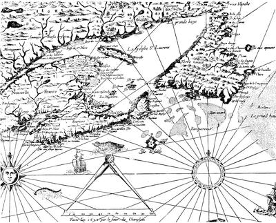
EASTERLY PORTION OF CHAMPLAIN’S MAP 1632.
The great map of 1632, by Champlain, has been reproduced full size in the Quebec edition of his works, and also in the Prince Society edition. A fac-simile, somewhat reduced, is given in O’Callaghan’s Documentary History of New York, vol. iii. Another, full size, was made by Pilinski in 1860, and published by Tross, of Paris (thirty-six copies, and of date, 1877, fifty copies at 40 francs). Field calls it “imperfect.” Brunet, however, says it has “une admirable exactitude.” The copy of the 1632 edition in the Bibliothèque Nationale lacks this map. The Harvard Le Mur copy has no map (Field, Indian Bibliography, no. 268).
Sabin (no. 11,839) says that the map here copied (the original of which is in the Harvard College “Collet” copy) belongs properly to the copies having the Le Mur and Sevestre imprints, and has the legend, “Faict l’an 1632 par le Sieur de Champlain;” while the proper Collet map is smaller, and is inscribed, “Faict par le Sieur de Champlain, suivant les Mémoires de P. du Val, en l’Isle du Palais.” The earliest copy, however, which I have found of the map thus referred to bears date 1664, and is called Le Canada, faict par le Sr. de Champlain, ... suivant les Mémoires de P. du Val, Géographe du Roy. This map appeared with even later dates (1677, etc.), preserving much of the characteristics of the 1632 map, though stretching the plot farther west, and at a time when much better knowledge was current. Harrisse, nos. 331, 348; but cf. no. 274. Kohl, in the Department of State Collection, has one of date 1660.
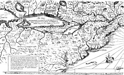
WESTERLY PORTION OF CHAMPLAIN’S 1632 MAP.
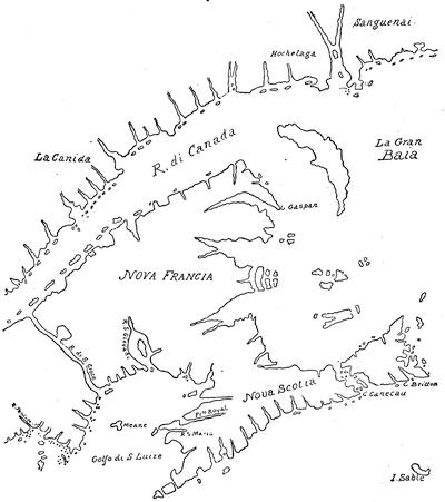
DUDLEY, 1647.
Of the map of Creuxius, made in 1660 and published in 1664, a fac-simile of a part is annexed.[768] For the eastern parts of the country reference may be made to the map Tabula Novæ Franciæ, of about 1663, given in the chapter on Acadie.[769]
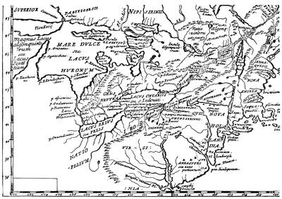
CREUXIUS, 1660.
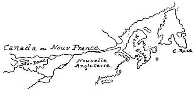
CARTE GÉNÉRALE OF COVENS AND MORTIER.]
One of the volumes of the great Blaeu Atlas of 1662, America, quæ est Geographiæ Blavianæ Pars quinta, very singularly ignored all that the cartographers of New France had been long divulging, and the same misrepresentation was persistently employed in the later Blaeu Atlas of 1685, which contained in other American maps a variety of notions equally erroneous, and which had been current at a period very long passed.
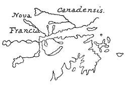
GOTTFRIED, 1655.
The map in Montanus’s De Nieuwe en Onbekende Weereld, 1670, “per Jacobum Meursium,” not the same as the “Novissima et accuratissima totius Americæ Descriptio” of John Ogilby’s great folio on America, 1670, and later years, seems to be substantially N. Visscher’s map of the same title, issued in Amsterdam in the same year.[770]
The maps of Hennepin (1683-1697) form a part of a special note elsewhere in the present volume; and the map accompanying Le Clercq’s Etablissement de la Foy, 1691, is also reproduced in Shea’s translation of that book.[771] It makes the Mississippi debouch on the Texas shore of the Gulf of Mexico, as many of the maps of this period do.
Maps of a general character, indicating a knowledge of the interior topography of America, sometimes expanding, and not seldom retrograde, followed rapidly as the century was closing, of which the most important were the maps of Amérique septentrionale (1667, 1669, 1674, 1685, 1690, 1692, 1695), by the Sansons, and the Roman reprint of it in 1677,[772] as well as La Mer du Nort of Du Val in 1679,[773] Sanson’s Le Nouveau Mexique, of the same year, which extends from Montreal to the Gulf;[774] the North America of the English geographer, William Berry (1680);[775] the Partie de la Nouvelle France of Hubert Jaillott (1685);[776] and the same cartographer’s Amérique septentrionale of 1694, and Le Monde of 1696; the Carte Generalle de la Nouvelle France[777] (1692) engraved by Boudan; the Amérique septentrionale of De Fer (1693); the marine Cartes (1696) of Le Cordier;[778] the New Sett of Maps published by Edward Wells in London in 1698-99; and finally the Amérique septentrionale of Delisle.[779] The maps of La Hontan (1703-1709) are the subject of special treatment in another note.
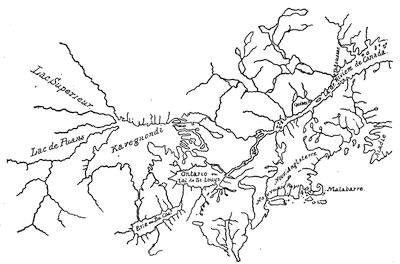
SANSON, 1656.
This is the same map, whether with the imprint, “Paris, chez Pierre Mariette, 1656,” or “Chez l’Autheur” in his America en plusieurs Cartes, 1657, though the scale in the former is much larger.
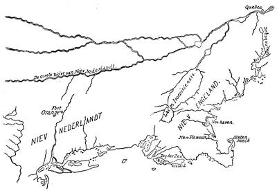
BLAEU, 1662 AND 1685.
Cf. a section in Cassell’s United States, i. 312.
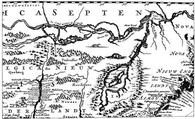
NOVI BELGII TABULA, 1670.
From Ogilby’s America, p. 169.
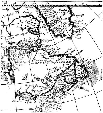
OGILBY’S MAP, 1670.
If we run through the series of maps here sketched, we cannot but be struck with the unsettled notions regarding the geography of the St. Lawrence Valley. Beginning with the clear intimation by Molineaux, in 1600, of a great body of interior water, which was the mysterious link between the Atlantic and the Arctic seas, and finding this idea modified by Botero and others, we see Champlain in 1613 still leaving it vague. The maps of the next few years paid little attention to any features farther west than the limit of tide-water; and not till we reach the great map which accompanied the final edition of Champlain’s collected voyages in 1632 do we begin to get a distorted plot of the upper lakes, Lake Erie being nothing more than a channel of varying width connecting them with Lake Huron. The first really serviceable delineation of the great lakes were the maps of Sanson and Du Creux, or Creuxius, in 1656 and 1660. Here we find Lake Erie given its due prominence; Huron is unduly large, but in its right position; and Michigan and Superior, though not completed, are placed with approximate accuracy. This truth of position, however, was disregarded by many a later geographer, till we reach a type of map, about the end of the century, which is exemplified in that given by Campanius in 1702.
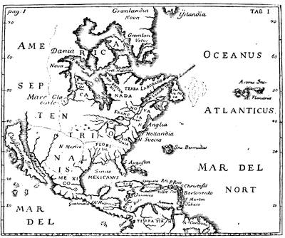
FROM CAMPANIUS, 1702.
A water-way which made an island of greater or less extent of the peninsula which lies between the St. Lawrence and the Atlantic, appeared first in 1600 on the Molineaux map, and was repeated by Dudley in 1647; but on other maps the water-sheds were separated by a narrow tract. So much uncertainty attended this feature that the short portage of the prevailing notion was far from constant in its position, and on some maps seems repeated in more than one place,—taking now the appearance of a connection on the line of the St. Croix, or some other river of New Brunswick; now on that of the Kennebec and Chaudière; again as if having some connection with Lake Champlain, when a misconception of its true position placed that expanse of water between the Connecticut and the Saco; and once more on the line of the Hudson and Lake George.