Part 2 — FOOTNOTES:
Reading edition
The following table, compiled from Dr. Gould’s report, is extracted from the “General Account of Kentucky” in my Reports of Progress of Kentucky Geological Survey, new series, Frankfort, Kentucky, 1877, vol. ii. p. 387:—
TABLE OF MEASUREMENTS OF AMERICAN WHITE MEN COMPILED FROM REPORT OF THE SANITARY COMMISSION, MADE FROM MEASUREMENTS OF THE UNITED STATES VOLUNTEERS DURING THE CIVIL WAR. BY B. A. GOULD.
Key to table; A - Mean weight in pounds. B - Mean circumference around forehead and occipit. C - Proportion of tall men in each 100,000.
Mean Height. A Mean Circumference of Chest. B C
Nativity. No. of men. Height in Inches. Full inspiration. Inches. After each inspiration.
New England 152,370 67.834 139.39 36.71 34.11 22.02 295
N. Y., N. J., Penn. 273,026 67.529 140.83 37.06 34.38 22.10 237
Ohio, Indiana 220,796 68.169 145.37 37.53 34.95 22.11 486
Mich., Mo., Illinois 71,196 67.822 141.78 37.29 34.04 22.19 466
Seaboard Slave States ... ... 140.99 36.64 34.23 21.93 (*)600
Kentucky, Tenn. 50,334 68.605 149.85 37.83 35.30 22.32 848
Free States west of Miss. R. 3,811 67.419 ... 37.53 34.84 21.97 184
British Maritime Provinces 6,320 67.510 143.59 37.13 34.81 22.13 237
Canada 31,698 67.086 141.35 37.14 34.35 22.11 177
England 30,037 66.741 137.61 36.91 34.30 22.16 103
Scotland 7,313 67.258 137.85 37.57 34.69 22.23 178
Ireland 83,128 66.951 139.18 37.54 35.27 ... 84
Germany 89,021 66.660 140.37 37.20 34.74 22.09 106
Scandinavia 6,782 67.337 148.14 38.39 35.37 22.37 221
* Slave States, not including Kentucky and Tennessee.
“On the 7th of May, 1864, the Kentucky Brigade marched out of Dalton 1140 strong. The hospital reports show, that, up to September 1, 1,850 wounds were taken by the command. This includes the killed; but many were struck several times in one engagement, in which case the wounds were counted as one. In two battles over 51 per cent of all engaged were killed or wounded. During the whole campaign there were not more than ten desertions. The campaign ended with 240 men able to do duty; less than 50 were without wounds.”
[See Vol. II. on the bibliography of Galvano—Ed.]
Among the English authors Hakluyt should be particularly mentioned. He speaks in the Dedication of his Divers Voyages (Hakluyt Society’s ed., p. 11) of Verrazano having been “thrise on that coast” [the American], and of an “olde excellent mappe which he gaue to king Henrie the eight;” giving also a representation of Lok’s map, made “according to Verazanus plat.” In his Discourse on Westerne Planting, first published by the Maine Historical Society in 1877, he says (pp. 113, 114): “There is a mightie large olde mappe in parchemente, made, as yt shoulde seme, by Verarsanus ... nowe in the custodie of Mr. Michael Locke;” and again, of “an olde excellent globe in the Queenes privie gallory at Westminster, which also semeth to be of Verarsanus makinge.”
Herrera condenses the account of the voyage from the letter published by Ramusio; De Barcia (Ensayo chronologico para la historia general de la Florida, 1723) also gives it. This latter identifies Verrazano with the corsair, Juan Florin. Dr. Kohl gives an interesting account of Verrazano’s voyage, with a valuable Appendix on maps, in the eighth chapter of his Discovery of Maine.
The Normans and Bretons probably sailed to the banks of Newfoundland before Cabot made Prima Vista. An early mention of their voyages is that of the Gran Capitano Francese of 1539, found in Ramusio (Raccolta, 1556, iii. 359), where they are spoken of as frequenting the northern parts thirty-five years before, and giving a well-known headland its present name of Cape Breton. [This “gran capitano” is held by Estancelin in his Navigateurs Normands to be Jean Parmentier of Dieppe, and Pierre Crignon is named as the writer of the somewhat confused routier and narrative given in Ramusio. Cf. Shea’s Charlevoix, i. 132; Major’s Early Voyages to Terra Australis, Introduction; and Murphy’s Verrazzano, p. 85. Harrisse (Cabots, p. 249) also discusses the question of the Capitano’s identity.—Ed.] Ramusio also (iii. 359) refers to Jean Denys and the pilot Gamort, of Rouen, who sailed to Newfoundland in a ship of Honfleur about the year 1506. Ramusio (iii. 359) also mentions that Thomas Aubert of Dieppe voyaged thither in the “Pensée” in 1508.
Gosselin shows that in 1508 other ships sailed to Newfoundland, and that they were generally of a tonnage from sixty to ninety tons. “I cite, among others,” he says, “‘Bonne-Aventure,’ Captain Jacques de Rufosse; the ‘Sibille’ and the ‘Michel,’ belonging to Jehan Blondel; and then the ‘Marie de Bonnes Nouvelles,’ equipped by Guillaume Dagyncourt, Nicolas Duport, and Loys Luce, associated citizens, the command of the ship being given to Captain Jean Dieulois” (Documents, etc., p. 13). In view of those cases, which appear to be a few of many, how poor is the appearance of that scepticism which has so long led writers to look askance at the statements of Ramusio concerning Aubert and the “Pensée”! The records of Normandy and Brittany are doubtless rich in facts relating to obscure points of American history.
[There is in Mr. Parkman’s Collection (vol, i. p. 89), among the copies made for him in France by Mr. Poore, a map of the St. Lawrence Gulf, with the route of Cartier in 1534 pricked out. The map is signed N. B.; and I suppose it to have been made by Bellin, the map-maker who supplied Charlevoix with his maps. Faillon (Histoire de la Colonie Francaise, i. 523) argues that all three of the Relations as we have them were the work of Cartier himself. Ramé gives a copy of an ancient register at St. Malo, said to be in Cartier’s hand, which preserves the names of his companions.—Ed.]
There is, however, no good proof of these charges. At the time when Roberval is represented as contending with Cartier, the former must have been in Canada. We have no proof of any conflict of authority. Facts recited in the present chapter do not appear to have been known to Mr. Bancroft. Kohl (Discovery of Maine, p. 343) appears to have known nothing beyond what is found in Hakluyt with reference to the meeting at St. John’s. Parkman (Pioneers of France, p. 202, edition of 1882) says that Roberval sailed for Canada in April, 1542, and that, soon after reaching St. John’s, “he descried three other sail rounding the entrance to the haven, and with wrath and amazement recognized the ships of Cartier.... The Viceroy ordered him to return; but Cartier escaped with his vessels under cover of night, and made sail for France.” See also Gay’s Popular History of the United States, i. 188; and, on these voyages, Biographie des Malouins célèbres, Paris, 1824; St. Malo illustré par ses marines, by Cunat, Paris, 1857; Biographie Bretonne, by Livot, Vannes, 1858. Also, D’Avezac’s edition of the voyage of 1545, Paris, 1863, f. xiii. This author does not appear to have known that Roberval sailed in 1541, instead of 1542. Hatton, in his Newfoundland, London, 1883, p. 14, also goes very wide of the mark.
[The appellation of New France, according to Parkman (Pioneers of New France, p. 184), was earliest applied, just succeeding the voyage of Verrazano; and the Dutch geographers, he says, are especially free in the use of it, out of spite to the Spaniards. Faillon, in his Histoire de la Colonie Française, i. 511, errs in tracing its earliest use to Cartier’s second Relation, where, writing in the third person, he says, “aux terres neuves, par lui [nous?] appellées Nouvelle France.” Shea, in his Charlevoix, ii. 20, finds the “Nova Gallia” of the globe of Euphrosynus Ulpius (1542) as early a use as any of those which he records. Charlevoix himself had not traced it back of Lescarbot (1609).—Ed.
“La mort aussi n’a point craint son effroy, Ses gros canons, ses darts, son feu, sa fouldre, Mais l’assaillant l’a mis en tel desroy, Que rien de luy ne reste plus que poudre.”
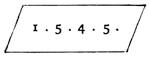
It is signed “Nous Jehan allefonsce et Paulin Secalert.” Underneath is the date. “Paulin” might, perhaps, be read “Raulin.” The first line of every page is in red, the initials forming grotesque human faces. The work abounds in flourishing capitals, and the text is difficult to decipher. The maps are rude sketches, intercalated to illustrate the text, and washed with yellowish, reddish, and greenish tints. The islands are chiefly in gold, though some are red and green. At the end of the volume is a map of France with the royal arms. On a map of England is a rude representation of London. There are also four pages of plans and diagrams, relating chiefly to London and Bordeaux. The legends on the maps are written in a brown tint, much faded, though upon the whole the volume is in a good state of preservation. Cf. “L’hydrographie d’un découvreur du Canada,” in Margry’s Navigations Françaises.
This is a description of Cape Cod and the neighboring coasts, which, in the verse of Maillard, appear in the same way:—
“Ils ont chasteaux et villes quilz decorent Et le Soliel et la lune ilz adorent En ce pays leur terre est labouree Non terroy hault mais assez temperee Dicy la coste ainsy comme jai sceu Au susseroest elle tourne aussy au su Plus de cent lieux et jusque au cap va terre Qui se congnoist en une haulte terre Qui a vne isle en terre basse grande Et troys ou quatre isleaux a sa demande Et de ce cap a lisle se dit.”
Harrisse says that Maillard based his description upon the manuscript of Allefonsce, and not on the printed work, saying that the former was “begun in 1544 and finished in 1546;” whereas the manuscript itself shows that it was “finished the 24th day of November, 1545.” It is also said that Francis I., for whom Maillard wrote, died March 31, 1547, while the Voyages avantureux did not appear until 1559, which seems to have been the case; yet the verses agree with the printed work instead of the manuscript of Allefonsce, and bear no relation to the manuscript other than that borne by the book. We speak here, of course, only of that part of Maillard’s performance given in Jean et Sébastien Cabot. In several cases Maillard makes a point not in the book; as, for instance, where (line 131) he says of the Norumbega peltry,—
“De maint marchant bien cherement requise;”
but this statement is not found in the manuscript of Allefonsce itself. That Maillard wrote these verses describing our coast after the corresponding portion of Voyages avantureux had been composed, might seem to be indicated by the fact that the substance of a line omitted after line 28 is found in the prose version of 1559, as follows: “Tous le gens ceste terre ont queue,” which is an allusion to the old story told in the manuscript of Allefonsce, who says that towards the north, “in some of these regions are people with pig’s tails and faces,”—a statement which the printed work reduces so as to read, “All the people of this land have queue.” This was overlooked by the poet or transcriber.
The connection between Maillard’s work and the printed narrative is curious, for the two pieces show a common origin, while two different writers, independently of one another, could not have produced two versions so much alike; though it should be noted that at line 138 Maillard spoils the sense by writing “vne isle,” instead of “une grand ville,” as in the printed book,—unless, indeed, he intended to discredit the story of the “great city” of Norumbega, which Allefonsce in his manuscript simply styles “une ville.” There is no necessity for supposing that Maillard ever saw the manuscript of Allefonsce. He may have used the manuscript of the printed volume of 1559, if it was in existence in the time of Francis. It certainly was written March 7, 1557, when the printing was authorized. It is a curious fact that in 1578 one Thomas Mallard, or Maillard, published an edition of Allefonsce at Rouen: Les voyages avantvreux dv Capitaine Iean Alfonce, Sainctongeais: Contenant les Reigles & enseignmens necessaires a la bonne & seure Nauigation. Plus le moyen de se gouuerner, tart enuers les Barbares, qu’autres nations d’vne chacune contrée, les sortes de marchandises qui se trouuent abondamment à icelles: Ensemble, ce qu’on doit porter de petit prix pour trocquer avec iceux, afin d’en tirer grand profit. A Rouen, chez Thomas Mallard, libraire: pre le Palais deuant l’hostel de ville, 1578. Evidently Jehan Maillard, the poet, had some unexplained connection with the volume that appeared in 1559.
“‘By the people of Canada and Hockeloga it was said, That here is the land of Saguenay, which is rich and wealthy in precious stones.’”—Hakluyt, iii. 236.
Blundeville in his Exercises (p. 431) gives a description of Mercator’s globes and of that “lately set forth by M. Molinaxe; and [p. 515] of Sir Francis Drake his first voyage into the Indies.” He also describes various universal maps and cards of his day, noting their cartographical peculiarities, like those of Vopellio (p. 754), Gemma Frisius (p. 755), Mercator (p. 756), etc.
There are papers relating to the English claim to Canada urged at this time (1630-1632) among the Egerton manuscripts,—see British Museum Catalogue, no. 2,395, folios 20-26.—Ed.]
There is a translation of this 1604 book in Purchas’s Pilgrimes, part iv. A synopsis, “Navigation des François en la Nouvelle France dite Canada,” is given in the preface of the Mercure François, 1609, by Victor Palma Cayet (Harrisse, no. 395), which is found separately, with the title Chronologie septenaire de l’Histoire de la Paix entre les Rois de France et d’Espagne, 1598-1604, and of various dates,—1605, 1607, 1609, 1612 (Carter-Brown Catalogue, vol. ii. no. 32; Stevens, Bibliotheca Historica, 1870, no. 2,456).
A letter of Champlain to the King on the discovery of New France, and other documents, are included in L. Andiat’s Brouage et Champlain (1578-1667), Documents inédits, Paris, 1879. It is an “Extrait des Archives historiques de la Saintonge et de l’Aunis, t. vi. (1879); “seventy-five copies were printed.—Ed.]
There are copies of the 1619 date in the Lenox and Massachusetts Historical Society libraries, and of the 1620 date in the Carter-Brown and Lenox libraries, and in the Library of Congress.
The same engraved title and the text belong to the edition of 1627, which has a new printed title, and the Epistle and Preface reset. Copies of this date are in Harvard College, Carter-Brown, and Lenox libraries, and one was sold in the Brinley sale (no. 75). See the Jesuit Relations printed by the Lenox Library, p. 4; Sabin, vol. iii. no. 11,838. Stevens’s Nuggets prices a copy at £4 4s.—Ed.]
Some of the copies known have a passage at the end of the first paragraph on page 27, which was held to be a reflection on Richelieu, in saying that statesmen or princes might not understand the sailing of a ship, and this led to the cancelling of sheets Dij and Diij (Stevens’s Nuggets, vol. i. no. 511; Field, Indian Bibliography, no. 268). One of these copies is in the Lenox Library; and one with, and another without, the passage are in the Carter-Brown Library (vol. ii. nos. 382 and 383).
Harrisse (nos. 50, 51) says that Champlain was at the date of this publication in Canada, that the book was doubtless made up by a compiler, and that the record of 1631 was furnished from another source than Champlain. Whoever arranged it abridged, omitted, and extended with an author’s license. Mr. O. H. Marshall believes that the book and the map never passed under Champlain’s supervision (Mag. of Amer. Hist., i. 5, 6).
This issue of 1632 was reissued in 1640, with a new title, and of this date there are copies in the Lenox and Carter-Brown libraries. Sabin says that Mr. Lenox suggests that this 1640 edition probably consists of rejected copies of the 1632 edition, since the cancelled, and not the substituted, leaves are in it, and these bear the marks of having been cut through with a sharp instrument (Sabin, vol. iii. no. 11,840, who says that Mr. Lenox contributed most of his data on the Champlain bibliography). Leclerc in 1878 advertised a set of the four dates (1604, 1613, 1620, and 1632), bound uniformly, for 6,000 francs.—Ed.]
Champlain (Samuel). Brief discours des choses plus remarquables que Samuel Champlain de brouage a reconnues aux Indes Occidentales Au voiage qu’il en a faict en Icelles en Lannee mil vciiijxx xix. et en Lannee mil vjcj. comme ensuit. (1599-1601). In-4, mar. violet. 15,000 francs. Manuscrit original et autographe orné de 6z dessins en couleur.
Faillon, Histoire de la Colonie Française, i. 78, spoke of it as being then (1865) at Dieppe (in the cabinet of M. Féret, “ancien maire de Dieppe”) and unpublished; but in 1859 the Hakluyt Society had printed an English translation of it, as noted in the text, with fac-similes of the drawings (Field, no. 269). There were accounts of the manuscript published in the Hist. Magazine, vii. 269; and in the Transactions of the Lit. and Hist. Soc. of Quebec, in 1863. It is now in the Carter-Brown library.—Ed.]
One of the best accounts for the English reader of Champlain and his associates will be found in Parkman’s Pioneers of France in the New World. Summaries are given in Guerin’s Navigateurs Français, p. 249; Ferland’s Histoire du Canada, book ii.; Miles’s Canada, chaps. 5-10; Warburton’s Conquest of Canada, etc.—Ed.]

It may also be seen in Lescarbot’s Histoire de la Nouvelle France, and an English translation is in Williamson’s History of Maine, i. 651-654, and Harris’s Voyages (1705), i. 813; cf. Harrisse, Notes sur la Nouvelle France, nos. 14, 15, 27. In the Massachusetts Archives; Documents Collected in France, i. (p. 435), is a copy of De Monts’s proposition to the King, Henry IV., dated Nov. 6, 1603, with the King’s remarks (p. 445), and the “Lettres Patentes expediées en faveur de M. de Monts,” signed by the King at Paris, Dec. 18, 1603. These letters-patent made him lieutenant-general of Acadia (40° to 46° N. lat.) for ten years; and by an ordinance (p. 451) all persons were prohibited to trade within his government; and (p. 453) the King orders all duties to be remitted on merchandise sent home by De Monts. Cf. Faillon, Colonie Française, au Canada, i.; and Guerin, Les Navigations françaises.
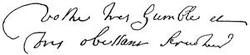

[Lescarbot was in the country with De Monts, and again with Poutrincourt in 1606-7. Charlevoix calls his narrative “sincere, well-informed, sensible, and impartial.” The third book covers Cartier’s voyage; the fourth and fifth cover those of De Monts, Poutrincourt, Champlain, etc.; while the sixth is given to the natives. The first edition (1609) is very rare. Rich in 1832 priced it at £1 1s. Recent sales much exceed that sum: Bolton Corney, in 1871, £27; Leclerc, no. 749, 1,200 francs, and no. 2,836, 450 francs; Quaritch, £40; another London Catalogue, in 1878, £45. Cf. Harrisse, Notes sur la Nouvelle France, nos. 16 and 17; Sabin’s Dictionary, no. 40,169; Ternaux-Compans, Bibl. Amér. no. 321; Faribault, pp. 86-87. There are copies in the Carter-Brown (Catalogue, ii. 87) and Murphy collections.
This edition, as well as the later ones, usually has bound with it a collection of Lescarbot’s verses, Les Muses de la Nouvelle France, and among them a commemorative poem on a battle between Membertou, a chief of the neighborhood, and the “Sauvages Armor-chiquois.”
The later editions of the history were successively enlarged; that of 1618 much extended, and of a different arrangement. The edition of 1611 is priced by Dufossé, 580 francs. There are copies in the Library of Congress, and in the Murphy and Carter-Brown (Catalogue, ii. 117) collections; cf. Harrisse, no. 23.
The edition of 1612 was the one selected by Tross, of Paris, in 1866, to reprint. There are copies in the Astor and Harvard College Libraries; cf. Harrisse, no. 25; Field’s Indian Bibliography, no. 917; Brinley Catalogue, no. 103. It seems to be the same as the 1611 edition, with the errata corrected.
The edition of 1618 contains, additionally, the second voyage of Poutrincourt; and entering into his dispute with the Jesuits, Lescarbot takes sides against the latter. This edition is severally priced by Leclerc, no. 2,837, at 850 francs; by Dufossé, at 950 francs. Rich had priced it in 1832 at £1 10s. There are copies in the Library of Congress and in the Carter-Brown (Catalogue, ii. 201) Collection; cf. Harrisse, no. 31; Field’s Indian Bibliography, no. 915. Some authorities report copy or copies with 1617 for the date.
It is somewhat doubtful if more maps than the general one and another appeared in the original 1609 edition; Sabin and the Huth Catalogue give three. In the 1611 edition there is reference in the text to three maps; but another map (Port Royal) is often found in it, and the 1618 edition has usually the four maps. The Huth Catalogue says that no map belonged to the English edition; the map found in the Grenville copy, as in the Massachusetts Historical Society copy, belonging to the French original. Sabin, however, gives it a map. The general map is reproduced in Tross’s reprint, in Faillon’s Colonie Française au Canada, and in the Popham Memorial; and a part of it in the Memorial History of Boston, i. 49. The Catalogue of the Library of Parliament (Canadian), 1858, p. 1614, shows two maps of the St. Lawrence River and gulf, copied from originals by Lescarbot in the Paris archives.
Among the other productions of Lescarbot is the La Conversion des Sauvages qui ont été baptistes dans la Nouvelle France cette anne 1610, avec un recit du Voyage du Sieur de Poutrincourt, which Sabin calls “probably the rarest of Lescarbot’s books;” cf. Harrisse, no. 21. Another tract, published in Paris in 1612—Relation derniere de ce qui c’est passe au voyage du Sieur de Poutrincourt en la Nouvelle France depuis vingt mois en ça, supplementing his larger work—has been reprinted in the Archives curieuses de l’Histoire de France, vol. xv. In 1618 he printed a tract—Le Bout de l’an, sur le repos de la France, par le Franc Gaulois—addressed to Louis XIII., urging him to the conquest of the savages of the west; Sunderland Catalogue, no. 4,933, £10, 10s. It is translated in Poor’s Gorges in the Popham Memorial, p. 140.
Another nearly contemporary account of the De Monts expedition is found in Cayet’s Chronologie Septenaire 1609 (Sabin’s Dictionary, vol. iii. no. 11,627) a precursor of the Mercure Française, which for a long while chronicled the yearly events. Cf. an English version from the Mercure in Magazine of American History, ii. 49.
Lescarbot’s account of the natives may be supplemented by that in Biard’s Relation. Hannay (chap. ii.) and the other historians of Acadia treat this subject, and Father Vetromile, S. J., at one time a missionary among the present remnants of the western tribes of Acadia, prepared an account of their history, which was printed in the Maine Hist. Coll., vol. vii.; and in 1866 he issued the Abnakis and their History. He died in 1881, and his manuscript Dictionary of the Abenaki Dialects is now in the archives of the Department of the Interior at Washington; Proceedings of the Numismatic Society of Philadelphia, 1881, p. 33; cf. also Maurault, Histoire des Abênaquis. Williamson, History of Maine, vol. i. ch. xvii., etc., enlarges on the tribal varieties of the Indians of the western part of Acadia, and (p. 469) on the Etechemins, or those east of the Penobscot; and later (p. 478), on the Micmacs or Souriquois, who were farther east. Williamson’s references are useful.
Shea, in his notes to Charlevoix, i. 276, says: “Champlain says the Kennebec Indians were Etechemins. Their language differed from the Micmac. The name Abenaki seems to have applied to all between the Sokokis and the St. John; the language of these tribes, the Abenakis or Kennebec Indians, the Indians on the Penobscot and Passamaquoddy, being almost the same.”—Ed.]
This volume is a translation of books iv. and vi. of Lescarbot’s larger work; but it has been noted as a curious circumstance that the author’s name does not appear on the titlepage, and is nowhere mentioned in the volume. There are two copies in the library of the Massachusetts Historical Society: one in the general library contains Lescarbot’s map, and has manuscript notes by the late Rev. Dr. Alexander Young; the other copy, in the Dowse Library, formerly belonged to Henri Ternaux-Compans. It is without the map, but contains the Preface and Table of Contents, which are not in the copy first mentioned. It is from the same type, but has a slightly different titlepage and imprint; the Dowse copy purporting to be published at London by George Bishop, and bearing the date 1609. It was a common practice of the printers of that time to sell copies of the same work with different titlepages, each containing the name of the bookseller who bought the printed sheets.
[This version was made at the instance of Hakluyt, and published with the express intention of showing, by contrast, the greater fitness of Virginia for colonization. Cf. Bibliotheca Grenvilliana; Huth Catalogue, iii. 839; Sabin, x. 40,175; Crowninshield Catalogue, no. 398; Griswold Catalogue, no. 436; Field’s Indian Bibliography, no. 916; Harrisse, no. 19. Rich priced it in 1832 at £2 2s.; a copy in the Bolton Corney sale, in 1871, brought £37. There are other copies in the libraries of Congress, New York Historical Society, Harvard College, and in the Carter-Brown Collection (Catalogue, ii. 102); cf. Churchill’s Voyages, 1745, vol. ii. Erondelle’s version is also given in Purchas, vol. iv. A German version, abridged from the 1609 original, appeared at Augsburg in 1613, called Gründliche Historey von Nova Francia. There is a copy in the Library of Congress, and in the Carter-Brown Collection (Catalogue, vol. ii. no. 154). Cf. Harrisse, no. 29; O’Callaghan Catalogue, no. 1,374; Brinley Catalogue, no. 105; Sabin’s Dictionary, x. 40,177. Koehler, of Leipsic, priced this German edition in 1883 at 120 marks.—Ed.]
[Some copies have the imprint, “Chez Claude Barbin,” as in the Harvard College copy. There are other copies in the Library of Congress and in the Carter-Brown Collection (Catalogue, ii. 1,078). Sabin (vol. v. no. 19,615) says it should have a map; but Harrisse (nos. 136, 137) says he has found none in eight copies examined. Cf. Stevens’s Bibliotheca Historica (1870), no. 562; O’Callaghan Catalogue, no. 767, both without the map; cf. Harrisse, no. 102. Charlevoix says of Denys, “he tells nothing but what he saw himself.” There is a copy of a Dutch version (1688) in Harvard College Library.—Ed.]
[This volume is said to have been drawn up by Charles Townshend (Bancroft, original ed., iv. 100), and is fuller than the corresponding work previously issued in Paris under the title, Mémoires des Commissaires du Roi et de Ceux de sa Majesté Britannique sur les Possessions et les droits respectifs des deux Couronnes en Amerique. 4 vols. 4to. Paris, 1755. Another edition of this last appeared the next year in 8 vols. 12mo, and again in three thick but small volumes at Copenhagen in 1755 (Carter-Brown Catalogue, vol. iii. no. 1074, etc.). The English edition above named contains the English case (both in English and French), signed W. Shirley and W. Mildmay, and dated at Paris, Sept. 21, 1750; and the French, signed by La Galissonière and De Silhouette, and dated the same day. Then follows the English memorial of Jan. 11, 1751, with the French reply (Oct. 4, 1751), and the English rejoinder (Jan. 23, 1753). In these papers the maps cited and examined are the English maps of Purchas, Berry, Morden, Thornton, Halley, Popple, and Salmon, the Dutch maps of De Laet and Visscher, and the French maps of Lescarbot, Champlain, Hennepin, De Lisle, Bellin and Danville, De Fer (1705) and Gendreville (1719). The rest of the volume is made of “Pièces Justificatives” brought forward by each side. There were maps accompanying these respective editions, setting forth the limits as claimed by the two sides, and marking by lines and shadings the extent of the successive patents of jurisdiction which follow down the region’s history. Jefferys and Le Rouge were the engravers on the opposing sides. John Green was the writer of the Explanation accompanying the Jefferys map. There was another edition in English of the case, printed at the Hague in 1756, under the title, All the Memorials of Great Britain and France since the Peace of Aix-la-Chapelle.
The contemporary literature of the controversy is extensive, and it all goes over the historical evidence in a way to throw much light, when separated from partisanship, on the history of Acadia. It may be said to have begun with a work mentioned by Obadiah Rich, A Geographical History of Nova Scotia, London, 1749 (Sabin, Dictionary of Books Relating to America, vol. xiii. no. 56,135), of which a French translation was published also in London (Carter-Brown Catalogue, vol. iii. no. 1,064), and a German one the next year.
Jefferys printed in 1754, The Conduct of the French with regard to Nova Scotia, from its First Settlement to the Present Time; and this appeared in a French version in London (Conduite des François) in the same year, with notes said to be written by Butel-Dumont.
The next year, Dr. William Clarke, of Boston, also reviewed the historical claims from the discovery of Cabot, in his Observations ... with regard to the [French] Encroachments, Boston, 1755,—a tract also reprinted in London. There may be likewise noted Pidansat de Mairobert’s Discussion summaire sur les anciennes limites de l’Acadie, printed at Basel, 1755 (Carter-Brown Catalogue, vol. iii. no. 1,035); Moreau’s Mémoire, Paris, 1756; and Jefferys’ Remarks on the French Memorials, London, 1756. The last has two maps, setting forth respectively the French and English ideas and claims of the various occupancies and settlements under grant and charter; the French map is reduced from the original of the commissioners, and it may also be found in the Atlas Ameriquain published at this time. At a later period, when the identity of De Monts’ St. Croix became an international question, the folio Correspondence relating to the Boundary between the British Possessions in North America and the United States of America, under the Treaty of 1783, was presented to Parliament July, 1840, and included an historical examination of the question, with maps and drafts from Lescarbot’s, Delisle’s, and Coronelli’s maps. Cf. in this connection Nathan Hale’s review of the history in the North American Review, vol. xxvi. In Shea’s edition of Charlevoix, i. 248, there is a note on the various limits assigned by early writers to Acadia.—Ed.
[Mr. Slafter devotes a section of his monograph to the bibliography of his subject. Alexander’s tract, Encouragement to Colonies, which was printed in London in 1624 (some copies in 1625), and of which the unsold copies were reissued in 1630 as The Mapp and Description of New England, is printed entire by Slafter. The book is rare. Stevens, Nuggets, no. 59, prices it at £21; cf. Sabin’s Dictionary, nos. 739, 740. The map which accompanied both editions is given by Slafter, and in part in Vol. III. of the present work, and has been reproduced elsewhere, as Slafter (p. 124) explains. Hazard, Collections, i. 134, 206, prints some of the documentary evidence, and the British Museum Catalogue of Manuscripts shows that the Egerton Manuscripts, 2,395, fol. 20-26, also touch the subject. In further elucidation, see Thomas C. Banks, Statement of the Case of Alexander Earl of Stirling, London, 1832, and his Baronia Anglia Concentrata, 1844, and the various expositions of the claims to the earldom in the several works referred to by Slafter, p. 115; and also Rogers, Memorials of the Earls of Stirling and House of Alexander, i. chaps. iv. and v. Mr. Slafter subsequently enlarged his statement regarding the Copper Coinage of the Earl of Stirling, and issued it as a tract with this title in 1874. Mr. C. W. Tuttle reviewed Mr. Slafter’s labors in N. E. Hist. and Geneal. Reg., 1874, p. 106.—Ed.]
[Some later works deserve a word. Moreau’s L’Acadie Françoise covers the interval, 1598-1755, and draws upon the Paris archives.
Rameau’s Une Colonie féodale en Amérique: L’Acadie, 1604-1710, published at Paris in 1877, is called by Parkman (Boston Athenæum Bulletin, where his comments appear far too seldom) “a rather indifferent book, carelessly written; containing, however, some facts not elsewhere to be found about certain small settlements.” In the New York Nation, nos. 652, 666, is a review, with Rameau’s rejoinder.
James Hannay’s History of Acadia, St. John, N. B., 1879, is a well-compacted piece of work, somewhat unsatisfactory to the student, however, through the absence of authorities. In his preface he pays a tribute to the annals of Murdoch, and says he has attempted “to weave into a consistent narrative the facts which Murdoch had treated in a more fragmentary way.”—Ed.]
In the Jesuit Relations of 1647-48 is the following: “On its shores [Green Bay] dwell a different people of an unknown language,—that is to say, a language neither Algonquin nor Huron. These people are called the Puants, not on account of any unpleasant odor that is peculiar to them, but because they say they came from the shores of a sea far distant toward the west, the waters of which being salt, they call themselves the ‘people of the stinking water.’”
The Sieur Radisson was the son of Sebastien and Madeleine Hayet Radisson. The St. Croix River of Minnesota is so called because as La Sueur says a Frenchman of that name was drowned in the stream. Before the year 1700 it is on the maps marked Madeleine, perhaps in compliment to Radisson’s mother.
A mémoire (1667) sur l’état présent du Canada, probably by Talon, is in Faribault’s Collection de Mémoires sur l’histoire ancienne du Canada, Quebec, 1840. Faillon (vol iii. part iii.) enlarges upon the zeal of Louis XIV. for the colony. The Bishop of Quebec meanwhile had his apprehensions. He warns the home government against allowing Protestants to come out. “Quebec is not very far from Boston,” he says, “and to multiply the Protestants is to invite revolution.” Massachusetts Archives: Documents Collected in France, ii. 233.—Ed.]
At the conclusion of his note to Frontenac, he alludes to the disaster which happened a quarter of an hour before his arrival at the point from which, in September, 1672, he had departed, in these words: “I had avoided perils from savages, I had passed forty-two rapids, and was about to land, with full joy at the success of so long and difficult an enterprise, when, after these dangers, my canoe upset. I lost two men and my box (cassette) in sight of, at the door of, the first French settlements which I had left almost two years before.”
Marquette conveys the impression that Joliet returned with him to Green Bay in September, 1673; but when, in a few weeks, he went back to the Illinois country between Chicago and Lake Peoria, he found several Frenchmen trading with the Indians, and among others mentions La Taupine, or Pierre Moreau, who in 1671 was with Joliet at Sault Ste. Marie. Near one of the upper tributaries of the Illinois on Joliet’s map appears Mont Joliet. May Joliet not have traded in this vicinity during the winter of 1673-1674, and may not Taupine and others have been his associates?
1. By Green Bay, Lake Winnebago, and the Fox River to the Wisconsin, thence to the Mississippi,—the route of Joliet.
2. By the Chicago River, at the southwest of Lake Michigan, to the Illinois, thence to the Mississippi. This appears in the earliest maps of Joliet and Marquette, and is displayed in the great 1684 map of Franquelin, of this part of which Parkman gives a drawing in his La Salle, which with various later ones is repeated in Hurlbut’s Chicago Antiquities.
3. By the St. Joseph River, at the southeast corner of Lake Michigan, to the Kankakee, and so to the Illinois. This was La Salle’s route.
4. By the St. Joseph’s River to the Wabash (Ouabache); thence to the Ohio and Mississippi.
5. By the Miami River from the west end of Lake Erie to the Wabash; thence to the Ohio and Mississippi.
A paper by R. S. Robertson in the American Antiquarian, ii. 123, aims to show that this last portage was known to Allouez as early as 1680, and had perhaps been indicated by Sanson in his map of Canada as early as 1657. It would seem to have been little frequented, however, because of the danger from the Iroquois parties, but was reopened in 1716. Regarding La Salle’s connection with this portage, see a letter by Mr. Parkman quoted by Baldwin in his Early Maps of Ohio, p. 7, and letters of La Salle in Margry’s Découvertes, etc. Cf. H. S. Knapp’s History of the Maumee Valley from 1680, Toledo, 1872 (P. Thomson’s Bibliography of Ohio, no. 681). The southern shore of Lake Erie was the latest known of all the borders of the great lakes.
Margry in his fifth volume has two papers on the routes of these early explorers,—“Postes de la route des Lacs au Mississipi (1683-1695),” and “Postes dans les Pays depuis le Lac Champlain jusqu’au Mississipi (1683-1695).” The series of the Great Lakes show the following heights above tide-level at New York: Ontario, 247 feet; Erie, 573 feet; Huron and Michigan, 582 feet; Superior, 602 feet. The Mississippi at St. Paul is 80 feet above Superior.
There are some papers by J. P. Jones on the earliest notices of the Missouri River in the Kansas City Review, 1882.
The book should have a map entitled Carte nouvelle de la Louisiane et de la Rivière de Mississipi ... dressée par le Sieur Joutel, 1713. A section of this map is given in the Magazine of American History, 1882, p. 185, and in A. P. C. Griffin’s Discovery of the Mississippi, p. 20.
In 1714 an English translation appeared in Paris, as A Journal of the last Voyage perform’d by Monsr. de la Sale to the Gulph of Mexico, to find out the Mouth of the Mississipi River; his unfortunate Death, and the Travels of his Companions for the Space of Eight Hundred Leagues across that Inland Country of America, now call’d Louisania, translated from the Edition just publish’d at Paris. It also had a folding map showing the course of the Mississippi, with a view of Niagara engraved in the corner. Cf. Harrisse, no. 751; Lenox, in Historical Magazine, ii. 25; Field, Indian Bibliography, no. 808; Menzies, no. 1,110; Stevens, Historical Collections, vol. i. no. 1,462; Carter-Brown, vol. iii. no. 55; Brinley, no. 4,498 (with date 1715). There are copies in the Boston Public, the Lenox, and Cornell University libraries. This 1714 translation was issued with a new title in 1719 (Carter-Brown, vol. iii. no. 244; Field, no. 809), and was reprinted in French’s Historical Collections of Louisiana, part i. p. 85. A Spanish translation, Diario historico, was issued in New York in 1831. Dumont’s Mémoires historiques sur la Louisiane, Paris, 1753, with a map, was put forth by its author as a sort of continuation of the Journal published by Joutel in 1713.
Shea speaks of Hennepin’s Nouveau Voyage as “a made-up affair of no authority.” It is translated in French’s Historical Collections of Louisiana, part i. p. 214; in the Archæologia Americana; and of course in Shea’s Hennepin; cf. Western Magazine, i. 507.
A few miscellaneous references may be preserved regarding La Salle and the Western discoveries:—
The paper by Levot in the Nouvelle biographie générale; one by Xavier Eyma, in the Revue contemporaine, 1863, called “Légende du Meschacébé;” Th. Le Breton’s “Un navigateur Rouennais au xviie siècle,” in the Revue de Rouen et de Normandie, 1852, p. 231; a section of Guerin’s Les navigateurs Français, 1846, p. 369; the Letters of Nobility given to La Salle, printed by Gravier in his Appendix, p. 360; where is also his Will (p. 385), dated Aug. 11, 1681, which can also be found in Margry, and translated in Magazine of American History, September, 1878 (ii. 551), and in Falconer’s Discovery of the Mississippi; a picture of his 1684 expedition, by Th. Gudin, in the Versailles Gallery; a paper on the discoveries of La Salle as affecting the French claim to a western extension of Louisiana, in the Journal of the Royal Geographical Society, xiii. 223; paper by R. H. Clarke in the Catholic World, xx. 690, 833; “La Salle and the Mississippi,” in De Bow’s Review, xxii. 13. Gravier has furnished an introduction (69 pages) on “Les Normands sur le Mississipi, 1682-1727,” to his fac-simile edition (1872) of the Relation du voyage des dames Ursulines de Rouen à la Nouvelle Orléans (100 copies) of Madeleine Hachard, following the original printed at Rouen in 1728 (Maisonneuve, Livres de fond, 1883, p. 30).
Of the Grand Voyage of 1632, there are copies in Harvard College and Carter-Brown libraries, and in the Library of Congress. Other copies were in the Crowninshield (no. 949), Brinley (no. 143), and O’Callaghan (no. 2,046) sales. Harrisse (Notes, etc., no. 53) says that after the Solar sale, where it brought 320 francs, it became an object for collectors; and Dufossé, in 1877, priced it at 550 francs; Ellis & White, the same year, at £42; Quaritch, at £36; Rich, fifty years ago, said copies had brought £15. Cf. Field, no. 1,341. This book was also reprinted by Tross in 1865.—Ed.]
The original edition of the Établissement had two varieties of title, one bearing the author’s name in full, and the other concealing it by initials. It is very rare with either title, but copies can be found in the Carter-Brown Library (see Catalogue, no. 1,413), and in the Sparks Collection at Cornell University (see Sparks Catalogue, no. 1,482). Dr. Shea notes other copies in Baron James Rothschild’s library at Paris, and in the Abbé H. Verreau’s collection at Montreal. Mr. Stewart tells me there are copies in the libraries of Laval University, of the Quebec Government, Of the Literary and Historical Society of Quebec, and of Parliament, at Ottawa. The Leno Library has a copy of what seems the same edition, with the title changed to Histoire des colonies françoises, Paris and Lyons, 1692. Mr. Lenox (Historical Magazine, January, 1858), following Sparks and others, claimed that the 1691 edition was suppressed; but Harrisse (Notes, etc. p. 159) disputes this in a long notice of the book, in which he cites Œuvres de Messire Antoine Arnould, Paris, 1780, xxxiv. 720, to the contrary. Le Clercq’s book should have a map, “Carte generalle de la Nouvelle France,” which is given in fac-simile in vol. ii. of this translation. It includes all North America, except the Arctic regions, but, singularly, omits Lake Champlain.
President Sparks wrote in his copy: “An extremely rare book.... It is peculiarly valuable as containing the first original account of the discoveries of La Salle by two [Recollect] missionaries who accompanied him. From this book, also, Hennepin drew the account of his pretended discovery of the Mississippi River.” See the bibliographical notice in Shea’s Discovery and Explorations of the Mississippi Valley, p. 78. Sparks, in his Life of La Salle, first pointed out how Hennepin had plagiarized from the journal of Father Membré, contained in Le Clercq. See further in Shea’s Mississippi Valley, p. 83 et seq., where Membré’s journal in Shea’s translation from Le Clercq was printed for the first time, and the note on Hennepin, following chap. viii. of the present volume. Harrisse, Notes, etc., p. 160, points out what we owe to this work for a knowledge of La Salle’s explorations. Cf. Parkman’s La Salle; Field’s Indian Bibliography, no. 903, with a note touching the authorship; Brunet, Supplement, i. 810, noting copies sold,—Maisonneuve, 250 francs; Sóbolewski, 150 thalers; Tross (1873), 410 francs; Dufossé, 600 francs; Le Clercq, no. 2,833, 1,500 francs.
The bibliographers are agreed that others than Le Clercq were engaged in the Établissement, and that the part concerning Frontenac was clearly not by Le Clercq. Charlevoix says Frontenac himself assisted in it; and it is Shea’s opinion that extraneous matter was attached to Le Clercq’s account of the Recollect missions, to convert the book into an attack in large part on the Jesuits.—Ed.
“Plan de Québec, et de les environs, en la Nouvelle France, Assiegé par les Anglois, le 16 d’Octobre, 1690, jusqu’au 22 du dit mois qu’ils sen allerent, apprés avoir este bien battus, par Mr. Le Comte de Frontenac, gouverneur general du Pays.
“Les noms des habitans et des principaux Endroits de Quebec.
1. Maison Seigneurial de beauport. 2. pierre parent le Perre. 3. Jacque parent le fils. 4. aux R. P. Jesuistes. 5. pierre parent le fils. 6. la vefve de mathieu choset. 7. michel huppé. 8. Mr. de la Durantaye, Conseiller. 9. la vefve de paul chalifou. 10. Mr. de Vitray, Conceiller. 11. François retor. 12. Mr. denis. 13. Estienne lionnois. 14. Mr. Roussel. 15. Jean le normand. 16. Jean landron, ou est la briqueterie. 17. Joseph rancourt. 18. André coudray. 19. Jean le normand. 20. Mr. de St. Simeon. 21. le petit passage. 22. Le fort St. Louis, ou loge Mr. le comte de frontenac. 23. ntre dame, et le Seminaire. 24. hospice des R. P. Recolletz. 25. les R. P. Jesuistes. 26. les Ursulines. 27. l’hospital. 28. les filles de la Congregation. 29. Mr. de Villeray, premier Conseiller. 30. batterie de huict pieces. 31. Le Cul de Sac, ou les barques, et petits vaisseaux hivernent. 32. platte forme ou est une batterie de 3 p. 33. Place ou est le buste du Roy, pozé sur un pied d’estal, en 1686, par Mr. de Champigny, Intendant. 34. Mr. de la Chesnays. 35. autre batterie de trois pieces. 36. autre batterie de trois pieces. 37. le Palais ou logent l’Intendant, le greffier du Conseil Souverain, et ou sont aussy les Prisons. 38. boulangerie a Mr. de la Chesnays. 39. la Maison blance a Mr. de la Chesnay. 40. moulin a Mr. de la Chesnays. 41. moulin au Roy. 42. moulins aux R. P. Jesuistes. 43. Maison a Mr. Talon, autrefois Intendant du Pays. 44. Ntre. dame des anges. 45. Vincent poirié. 46. L’Esuesché, a Mr. de St. Vallier. 47. Jardin de Mr. de frontenac. 48. Moulin a Mr. du Pont, ou est une batterie de trois pieces. 49. louis begin. 50. Jacque Sanson. 51. Pesche aux R. P. Jesuistes. 52. pierre Leyzeau. 53. Mathurin choüet, ou est un four a chaux. 54. batterie de trois pieces pour deffendre le passage de la petitte Rre. 55. Canots, pour la decouverte pendant la nuit.
Par le sr de Villeneuve ingénieur du Roy.”
Harrisse, Notes, etc., no. 243, cites this plan, and, no. 244, refers to a map of a little different title by Villeneuve, preserved in the Dépôt des Fortifications des Colonies at Paris. Leclerc, Bibliotheca Americana, no. 2,652, notes another early manuscript copy of this plan (Harrisse’s no. 243) in a collection of maps of the 18th century, which he prices at 800 francs. He calls the plan “tres belle carte manuscrite et inédite,” not aware of the reduced engraving of it issued by Van der Aa, of which there is a copy in a collection of maps (no. 50) formed by Frederick North, and now in Harvard College Library.
Charlevoix describes it as containing “undigested and ill-written material on a good portion of Canadian history.” Cf. Field, Indian Bibliography, no. 66; Carter-Brown Catalogue, vol. iii. no. 319; Brinley Catalogue, no. 63; Sabin, Dictionary of Books relating to America, from its Discovery to the Present Time, vol. i. no. 2,692; Stevens, Historical Collections, vol. i. no. 1,313. It usually brings about $10; a later edition, Paris, 1753, four volumes, is worth a little less.
German and English writers have disputed over the claim for the invention of what is known as Mercator’s projection. The facts seem to be that Mercator conceived the principle, but did not accurately work out the formula for parallelizing the meridians and for spreading the parallels of latitude. Mead, on The Construction of Maps (1717), charged Mercator with having stolen the idea from Edward Wright, who was the first to publish an engraved map on this system in his Certaine Errors of Navigation, London, 1599. It seems, however, clear that Wright perfected the formula, and only claimed to have improved, not to have invented, the projection. Raemdonck (p. 120) gives full references.
Nicolas Sanson, in office, 1647-1667. P. Duval, 1664-1667. Adrien Sanson, first son of Nicolas, 1667. Guillaume Sanson, second son, 1667. Jean B. d’Anville (b. 1697; d. 1782), 1718. Guillaume Delisle (b. 1675; d. 1726), 1718. Jean de Beaurain (b. 1696; d. 1771; publications, 1741-1756), 1721. Le Rouge, 1722. Philip Buache (publications, 1729-1760), d. 1773. Roussel, 1730. Hubert Jaillot, 1736. Bernard Jaillot, 1736. Robert de Vaugondy (b. 1688; d. 1766), 1760.
A Géographie universelle, avec Cartes, was published under Du Val’s name in Paris in 1682. Another French atlas, A. M. Mallet’s Description de l’Univers, Paris, 1683, in five volumes, contained 683 maps, of which 55 were American; and the century closed with what was still called Sanson’s Description de tout l’Univers en plusieurs Cartes, 1700, which had six maps on America.
Some good supplemental work has been done by the local historical societies, like the Long Island (Historical Magazine, viii. 187), Ulster County, and Buffalo societies.—Ed.]
Sixteen, 1603-1678, obtained in Holland; forty-seven, 1614-1678, procured in England; seventeen, 1631-1763, secured in Paris. Brodhead’s New York, i. 759; Westminster Review, new series, iii. 607.
Asher, Essay, p. xlviii, says of Brodhead’s mission: “We must, however, regret that, tied down by his instructions, he took a somewhat narrow view of his search, and purposely omitted from his collection a vast store of documents bearing on the history of the West India Company.”
The documents as published were divided thus: Vol. i. Holland documents, 1603-1656. Vol. ii. Ibid., 1657-1678. Vol. iii. London documents, 1614-1692. Vol. iv. Ibid., 1693-1706. Vol. v. Ibid., 1707-1733. Vol. vi. Ibid., 1734-1755. Vol. vii. Ibid., 1756-1767. Vol. viii. Ibid., 1768-1782. Vol. ix. Paris documents, 1631-1744. Vol. x. Ibid., 1745-1774.
In the Introduction to vol. iii. Mr. Brodhead gives an account of the condition of the English State-Paper Office in 1843.—Ed.]
See Dr. De Witt’s paper on the origin of the early settlers in N. Y. Hist. Soc. Proc., 1847, p. 72. Various notices of the early families are scattered through O’Callaghan’s notes to his New Netherland, and embodied in the local histories; but genealogy has never been so favorite a study in New York as in New England.—Ed.]
The old narrative of Ivan Bardsen, which it is supposed was used by Hudson as a guide, is given in Rafn’s Antiquitates Americanæ, in Purchas’s Pilgrimes, in the appendix of Asher’s Hudson, and the English of it is given in De Costa’s Sailing Directions of Hudson (reviewed in the Historical Magazine, 1870, p. 204), which is accompanied by a dissertation on the discovery of Hudson River. Cf. also Major’s Introduction to the Zeni Voyages, published by the Hakluyt Society.
Moulton, in his New York, gives a running commentary on Hudson’s passage up the river. See also the conclusions of Gay in the Popular History of the United States, i. 355. We learn the most of this voyage from Purchas’s Pilgrimes (also N. Y. Hist. Soc. Coll., 1809, vol. i.), whose third volume contains the accounts by Hudson and his companions; and in the Pilgrimage there is a chapter on “Hudson’s Discoveries and Death,” which is mainly a summary of the documents in the Pilgrimes. This is reprinted by Asher in his Henry Hudson the Navigator (Hakluyt Society), where will also be found, page 45, what is known as Juet’s Journal, March-November, 1609 (also in Purchas, iii. 581; Munsell’s Annals of Albany, and in 2 N. Y. Hist. Soc. Coll., i. 317; also cf. ii. 367), with extracts from Lambrechtsen’s New Netherland, who used material not otherwise known, and from De Laet’s Nieuwe Wereld, and in the Appendix a bibliography of the voyage. De Laet used Hudson’s own journals (April 19, 1607-June 21, 1611), which are not now known and what De Laet gives of the third voyage is supposed to be Hudson’s own report. Asher, p. 167-172, claims that the matter given by Van der Donck and not found elsewhere was fabricated to support the Dutch claim. The controversial papers of Dawson and Whitehead, in the Historical Magazine, 1870, touch many of the points of Hudson’s explorations. Brodhead’s New York and O’Callaghan’s New Netherland give careful studies of this voyage. The latest developments, however, did not serve Biddle in his Cabot; nor Belknap in his American Biography; nor R. H. Cleveland in Sparks’s American Biography; nor Miller in the N. Y. Hist. Soc. Coll., 1810. The chief Dutch authority is Emanuel van Meteren, of whose work mention is made later in the text. (Cf. Asher’s Hudson, p. xxv; compare also a Collection of Voyages undertaken by the Dutch East India Company, London, 1703, p. 71.)—Ed.]

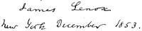
[This extremely rare book was first used by Brodhead (i. 381, note). It should have a portrait by Cornelius Visscher, which has been reproduced in Amsterdam by photolithography. Mr. Lenox paid $300 for the copy noted in Field’s Indian Bibliography, no. 1,615. There are also copies in the Carter-Brown (ii. 803) and Murphy collections, and one was sold in the Brinley sale, no. 2,717; cf. Asher, no. 336; Trömel, no. 279; Muller (1872), no. 1,109, and (1877) no. 3,414, 240 florins, not quite perfect; Huth, ii. 424; O’Callaghan, no. 778. Extracts from the book were translated in 2 N. Y. Hist. Soc. Coll., i. 243; and all the parts relating to America by H. C. Murphy, in Ibid., iii. 9; and this translation, with an Introduction, was privately reprinted by Mr. Lenox (250 copies), in 1853.]
[See O’Callaghan, ii. 90, 111; Brodhead, i. 506; Asher, no. 5; Brinley, ii. 2715; Huth, iii. 1031; Muller, 1877, p. 196, for 140 florins; Harrassowitz, cat. no. 61, book no. 87, for 125 marks; Carter-Brown Catalogue, ii. 698. Brodhead found in Holland the copy now in the New York Historical Society’s library. Mr. H. C. Murphy translated it for 2 N. Y. Hist. Coll., ii. 251, with an Introduction, and this, with Murphy’s translation of Breeden Raedt, was in 1854 privately reprinted, 125 copies, by Mr. Lenox, with a fac-simile of the map of the Hudson from the Zee-Atlas of Goos. See an extract from this map given on a later page.—Ed.]
[This work is perhaps the rarest and now the most costly of the early books on New York. Stevens (Historical Collection, nos. 200, 1,395) says, “Copies for the last forty years have usually sold for £12 to £21.” It is priced in Muller (1872 edition, nos. 1,079-81, 1877 edition, nos. 955, 956), 150 florins; in Leclerc (no. 866), 200 francs. Field (Indian Bibliography, no. 1,592) gives some reasons for supposing there was a third edition in 1656. (Cf. Asher, no. 7; Brinley, ii. 2,718; Carter-Brown, ii. 801, with supplement, no. 811; also no. 814; O’Callaghan, no. 2,315; Sabin, v. 482; Huth, v. 1514; Trömel, nos. 280, 281.) There is a view of New Amsterdam in the first edition which is not in the second. O’Callaghan, New Netherland, ii. 551, has a note on Van der Donck’s life and family. His book has been translated by General Jeremiah Johnson in the N. Y. Hist. Soc. Coll., 1841; see also second series, i. 125.—Ed.]
[The general Indian Bibliography of T. W. Field must be held to indicate the sources of information regarding the condition of the natives at the time of the Dutch occupation. Bolton, in his West Chester County (1848), endeavors by a map to place the Indian tribes as they occupied the territory bordering the southern parts of the Hudson. Dunlap, New York, i. 20, gives a map showing the territory of the Five Nations. Dr. O’Callaghan translated in 1863 a paper in the State archives, entitled A Brief and True Narration of the Hostile Conduct of the Barbarous Natives towards the Dutch Nation, dated 1655, and gave the Indian treaty of 1645 in an appendix. Fifty copies only were printed (Field, no. 1,147). Judge Egbert Benson published in 1817, 1825, and in the N. Y. Hist. Coll., vol. vii., an essay on the Dutch and Indian names, of which a copy, with his manuscript additions, exists in Harvard College Library.
The most important of the works of the last century is Cadwallader Colden’s History of the Five Nations, originally printed at New York in 1727. The second and third editions were printed in London, and the English editors gave additions without distinguishing them. The best issue is the fourth, printed in New York in 1866, exactly following the 1727 one, and enriched with notes by John G. Shea, who gives also its bibliographical history. (Field, no. 341.) The first place among recent books on this confederacy must be assigned to Lewis H. Morgan’s League of the Iroquois. (Field, no. 1,091.) There is more or less illustrative of the early state of the Indians in Ketchum’s Buffalo (1864), for the Five Nations, as described in Field, no. 824; in Benton’s Herkimer County (1856), for the Upper Mohawk tribes. See also J. V. H. Clark’s Onondaga (1849), praised by Field, no. 323; A. W. Holden’s Queensbury (1874), for those of the northern parts; and in E. M. Ruttenber’s Indian Tribes of Hudson River (1872). Field, no. 1,334.—Ed.]
Mr. Shea speaks of this “as the only account by a foreigner of that time,” not then being aware of the letter written eighteen years earlier by the Rev. Jonas Michaelius, the first Reformed minister in New Netherland. This manuscript, dated Aug. 11, 1628, “from the island Manhattans,” was priced in Muller’s 1877 Catalogue, no. 2,121, at 375 florins. H. C. Murphy printed an English version of it privately at the Hague in 1858; also in O’Callaghan’s Doc. Hist. of N. Y., vol. ii. It had originally appeared in the Kerkhistorisch Archief, Amsterdam, 1858. Cf. Carter-Brown Catalogue, ii. 339. Muller issued a fac-simile of it in 1876, accompanied by the Dutch transcript and Murphy’s version, giving it a preface, and printing only a hundred copies. Muller, Books on America, 1877, no. 2,122, and 1872, no. 1,053, where the original is said to be in the library of Dr. Bodel Nyenhuis at Leyden, who had bought it at the historian Koning’s sale in 1833. “Mr. Koning probably found it in the archives.” The letter is addressed to Adr. Smoutius, minister in Amsterdam. Historical Magazine, ii. 191.—Ed.]
[The book, being cheap at the time, was widely circulated, and most copies have disappeared, as is usual with such books. (Brodhead, i. 527.) Muller, 1877, nos. 312 and 2,265, prices it at 225 florins. (Cf. Asher, no. 6; Brinley, ii. 2,716; Trömel, no. 258; O’Callaghan, ii. 90, 111; Carter-Brown Catalogue, ii. 721.).—Ed.]
[The book is very scarce. “I have found only three copies in twenty years,” said Muller in 1872, “and sold my last at two hundred florins.” He also refers to the further development of the writer’s liberal and economical ideas in Vrije Politijke Stellingen, Amsterdam, 1665. Muller, Books on America, 1872, no. 1,111; Brodhead, New York, i. 699; Trömel, no. 312; Asher’s Essay, no. 13; Carter-Brown, ii. 926.—Ed.]
Algemeene Wereldt Beschrijving door A. P. De la Croix, Amsterdam, 1705. Algemeene Weereld Beschrijving nae de rechte verdeeling der Landschappen, Plaetsen, etc., in ’t Fransch beschreeven door den Heer A. Pher. De la Croix, Aerdryks Beschrijver des Konings van Frankryk,—“General Description of the World,” by A. P. De la Croix. “General Description of the World according to the Correct Division of Countries, places, etc.,” written in French by A. Pher. De la Croix, Geographer to the King of France.
[This work, covering the years 1621-1632, was first brought to light by Brodhead (New York, i. 46), who has given an abstract of it in 2 N. Y. Hist. Soc. Coll., ii. 355. (Cf. Doc. Hist. N. Y., iii. 27.) It contains the earliest reports on New Netherland printed at Amsterdam. It is described in Muller, Books on America, 1872, no. 1,745, and was first noticed by Asher, Essay, no. 330; Carter-Brown, ii. 276.—Ed.]

Newe vnd warhaffte Relation von deme was sich in den West vnd Ost Indien vonder Zeit an zugetragen, dass sich die Navigationes der Holleandischen vnd Engländischen Companien daselbsthin angefangen abzuscheiden. Muenchen, 1619 (by Nicolai Elend).
Samuel Clarke, A Geographical Description of all the Countries in the known World, London, 1657.
A Book of the Continuation of Foreign Passages; That is, the Peace between this Commonwealth and the Netherlands, 1654, London, 1656, printed by M. S. for Thomas Jenner.
Richard Blome, Isles and Territories belonging to his Majestie in America, 1673, and The present State of his Majesties Isles and Territories in America, 1687.
Daniel Denton, A Brief Description of New York, formerly New Netherland, London, 1670. [See the notes to chap. x. of Vol. III.—Ed.]
[Dr. O’Callaghan’s New Netherland is divided thus: Book i., 1492-1621; ii., 1621-1638; iii., 1639-1647. He also printed a few copies of the Register of New Netherland, 1626-1674, giving the names of the pioneers. John G. Shea printed an account of O’Callaghan in the Magazine of American History, v. 77. The Catalogue of his library, sold in New York December, 1882, represents a collection rich in works in the fields of his special studies.—Ed.]
Much credit is due to Mr. Joel Munsell for his efforts to increase interest in the study of American affairs, and particularly for his labors upon the history of Albany and its neighborhood. He died in 1880. (Cf. Historical Magazine, x. 44; xv. 139, 270; N. E. Hist. and Geneal. Reg., 1880, p. 239.) He gives an account of his method and results in issuing historical monographs in small editions, in Historical Magazine, February, 1869, p. 139. His Annals of Albany appeared in ten volumes, from 1850 to 1859 (pp. 27-36 of vol. i. were never printed); his Collections on the History of Albany, four volumes, 1865-1871. See N. E. Hist. and Geneal. Reg., 1868, p. 104. He published in 1869 J. Pearson’s Early Records of Albany and the Colony of Rensselaerswyck, 1656-1675, translated from the Dutch, with notes; and Wm. Barnes’s Early History of Albany, 1609-1686, was privately printed by him in 1864, with a map of Albany, 1695. On the early Dutch history of this region, see also General Egbert L. Viele’s “Knickerbockers of New York two centuries ago,” in Harper’s Monthly, December, 1876; a paper on the Van Rensselaers in Scribner’s Monthly, vi. 651; and some landmarks noticed in B. J. Lossing’s Hudson River, p. 124, etc.—Ed.]
Modern eclectic maps, showing the Dutch claims and possessions, may be seen in Brodhead’s New York (according to the charters of 1614 and 1621); in Bancroft’s United States, ii. 297; in Ridpath’s United States (showing the various European colonies in 1655); and in Lamb’s New York, i. 218 (the same).—Ed.]
Whereas many kingdoms and countries prosper by means of navigation, and parts of the West Indies have gradually been occupied by the English, French, and Dutch, it seems to me that the Crown of Sweden ought not to forbear to make also its name known in foreign lands; and therefore I, the undersigned, desire to tender my services to the same, to undertake, on a small scale, what, by God’s grace, should in a short time result in something great.
In the first place, I have proposed to Mr. Peter Spiring to make a voyage to the Virginias, New Netherland, and other regions adjacent, certain places well known to me, with a very good climate, which might be named Nova Suedia.
For this expedition there would be required a ship of 60, 70, or 100 läster [120, 140, or 200 tons], armed with twelve guns, and sufficient ammunition.
For the cargo, 10,000 or 12,000 gulden would be needed, to be expended in hatchets, axes, kettles, blankets, and other merchandise.
A crew of twenty or twenty-five men would be wanted, with provisions for twelve months, which would cost about 3,400 gulden.
In case the Crown of Sweden would provide the ship with ammunition, with twelve soldiers, to garrison and hold the places, and likewise furnish a bark or yacht, for facilitating trade, the whole [additional] expense might come to about 1,600 gulden,—one half of which I myself will guarantee, Mr. Spiring assuming the other half, either on his own account or for the Crown, the same to be paid at once, in cash.
As to the time of sailing, the sooner we start the better; for, although trade does not begin till spring, by being on the spot in season, we can get on friendly terms with the savages, and induce them to collect as many furs as possible during the winter, and may hope to buy 4,500 or 6,000 beaver skins, thus acquiring a large capital from so small a commencement, and the ability to undertake more hereafter.
The Crown of Sweden might favor the beginners of this new enterprise with a charter, prohibiting all other persons from sailing from Sweden within the limits of Terra Nova and Florida for the space of twenty years, on pain of confiscation of ship and cargo. And as it often happens that French or Portuguese vessels are met with on the ocean, authority should likewise be granted to capture such ships, and bring them as lawful prizes to Sweden. Also, it should be conceded that all goods of the Company for the first ten years be free of duty both coming in and going out.
And, as the said land is suited for growing tobacco and various kinds of grain, it would be well to take along proper persons to cultivate these, who might at the same time be employed as garrison.
In addition, the advantages to be derived from the enterprise in course of time by the Crown of Sweden could be indicated orally by me, if I were called to Sweden to give a more detailed account of everything. However, that shall be as the gentlemen of the Government see fit.
This is designed briefly to serve your Excellency as a memorandum. I trust your Excellency will write an early answer from Sweden to my known friend [Blommaert?], whether the work will be undertaken, so that no time be lost, and others anticipate an enterprise which should bring so great profit to the Crown of Sweden.
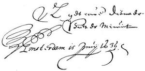
Herewith wishing your Excellency bon voyage, I remain Your Excellency’s faithful servant, Pieter Minuit. Amsterdam, June 15, 1636.
Sw. Rikes Gen. Handels Compagnies Contract, dirigerat til Asiam, Africam och Magellaniam, samt desz Conditiones, etc. Stockh. år 1625. Cited by Acrelius.—Der Reiche Schweden Genera. Compagnies Handlungs Contract, Dirigiret naher Asiam, Africam, Americam, vnd Magellanicam. Samt dessen Conditionen vnnd Wilköhren. Mit Kön. May. zu Schweden, vnsers Aller-gnedigsten Königs vnd Herrn gnediger Bewilligung, auch hierauff ertheilten Privilegien, in öffentlichen Druck publiciret. Stockholm, 1625. 4to, title, and 7 unnumbered pages. A copy is in the Carter-Brown Library. Translated into English in Doc. Col. Hist. N. Y., xii. 2 et seq.
Uthförligh Förklaring öfwer Handels Contractet angåendes thet Södre Compagniet uthi Konungarijket i Swerighe. Stält igenom Wilhelm Usselinx, Och nu aff thet Nederländske Språket uthsatt på Swenska, aff Erico Schrodero. Tryckt i Stockholm, aff Ignatio Meurer, Åhr 1626, 4to. —Auszführlicher Bericht über den Manifest; oder Vertrag-Brieff der Australischen oder Süder Compagney im Königreich Schweden. Durch Wilhelm Usselinx. Ausz dem Niederländischen in die Hochdeutsche Sprache übergesetzt. Stockholm, Gedruckt durch Christoffer Reusner. Anno MDCXXVI. 4to. The German version contains Usselinx’s interesting “voorrede” to the Netherlanders, dated at Stockholm, Oct. 17, 1625, in the original Dutch (not given in the Swedish edition), reprinted in the Dutch Octroy ofte Privilegie, and reproduced in the corrected Auszführlicher Bericht of the Argonautica Gustaviana. Cf. Muller’s Books on America (1872), no. 1,143, for a comparison of the Swedish edition and the Dutch Octroy ofte Privilegie. The only copies of these books known to the writer are in the Library of Congress.
Octroy eller Privilegier, som then Stormägtigste Högborne Furste och Herre, Herr Gustaf Adolph, Sweriges, Göthes och Wendes Konung, etc. Det Swenska nysz uprättade Södra Compagniet nädigst hafwer bebrefwat. Dat. Stockholm d. 14 Junii, 1626. Cited by Acrelius.—Octroy und Privilegium so der Allerdurchläuchtigste Groszmächtigste Fürst und Herr, Herr Gustavus Adolphus, der Schweden, Gothen und Wenden König, Grosz-Fürst in Finnland. Hertzog zu Ehesten und Carelen, Herr zu Ingermanland, etc. Der im Königreich Schweden jüngsthin auffgerichteten Süder-Compagnie allergnädigst gegeben und verliehen. Stockholm, gedruckt bey Ignatio Meurern. Im Jahr 1626. Reprinted in Johannes Marquardus’s Tractatus Politico-Juridicus de Jure Mercatorum et Commerciorum Singulari, vol. ii. pp. 545-52, Frankfort, 1662. An English translation is given in Doc. Col. Hist. N. Y., xii. 7 et seq.
Octroy ofte Privilegie soo by den alderdoorluchtigsten Grootmachtigen Vorst ende Heer Heer Gustaeff Adolph, der Sweden Gothen ende Wenden Koningh, Grootvorst in Finland, Hertogh tot Ehesten ende Carelen, Heer tot Ingermanland, etc., aen de nieuw opgerichte Zuyder Compagnie in’t Koningrijck Sweden onlangs genadigst gegeben ende verleend is, Mitsgaders een naerder Bericht over’t selve Octroy ende Verdragh-brief door Willem Usselincx. In’s Gravenhage, By Aert Meuris, Boeckverkooper in de Papestraat in den Bybel, anno 1627. 4to. Besides the Octroy it comprises a Dutch version of Usselinx’s Uthförligh Förklaring. Cf. Asher’s Essay, no. 41 and pp. 82, 83.
Kurtzer Extract der vornemsten Haupt-Puncten, so biszher weitläufftig und gründlich erwiesen, und nochmals, jedermänniglich, unwiedersprechlich für Augen gestellet sollen werden. In Sachen der neuen Süder-Compagnie. Gedruckt zu Heylbrunn bey Christoph Krausen, Anno 1633. Mens. Aprili. Reprinted in Marquard’s Tractatus, vol. ii. 541-42.
Instruction oder Anleitung: Welcher Gestalt die Einzeichnung zu der neuen Süder-Compagnie, durch Schweden und nunmehr auch Teutschland zubefördern, und an die Hand zunehmen; derselben auch mit ehestem ein Anfang zumachen. Gedruckt zu Heylbrunn bey Christoph Krausen. 1633. Mense Aprili. Reprinted in Marquard’s Tractatus, vol. ii. pp. 542-45.
Ampliatio oder Erweiterung des Privilegii so der Allerdurchläuchtigste Groszmächtigste Fürst und Herr, Herr Gustavus Adolphus, der Schweden, Gothen und Wenden König; Grosz-Fürst in Finnland, Hertzog zu Ehesten und Carelen, Herr zu Ingermannland, etc. Der neuen Australischen oder Süder-Compagnie durch Schweden und nunmehr auch Teutschland, allergnädigst ertheilet und verliehen. Gedruckt zu Heylbrunn, bey Christoph Krausen. Im Jahr 1633. Mense Aprili. Reprinted in Marquard’s Tractatus, vol. ii. pp. 552-55.
Argonautica Gustaviana, das ist: Nothwendige Nach-Richt von der Neuen Seefahrt und Kauffhandlung, so von dem Weilandt Allerdurchleuchtigsten Groszmächtigsten und Siegreichesten Fürsten unnd Herrn, Herrn Gustavo Adolpho Magno; ... durch anrichtung einer General Handel-Compagnie ... vor wenig Jahren zu stifften angefangen: anjetzo aber der Teutschen Evangelischen Nation ... zu unermesslichem Nutz und Frommen ... mitgetheilet worden.... Gedruckt zu Franckfurt am Mayn, bey Caspar Rödteln, im Jahr Christi 1633. Mense Junio. Folio. It comprises: a Patent oder öffentlich Auszschreiben wegen dieses Vorhabens, signed by Axel Oxenstjerna, June 26, 1633 (3 pp.); an Extract etlicher vornehmen Haubtpuncten (2 pp.); the Octroy und Privilegium of Gustavus Adolphus (8 pp.); the Ampliatio (4 pp.); Formular desz Manifest, reproducing with slight variations the Manifest, and Usselinx’s Auszführlicher Bericht, in Niderländischen Sprach gestellet, vor diesem bereit in eyl in Teutsch übergesetzt, anitzo aber nach dem Niderländischen mit allem fleisz übersehen, an vielen Orten nach Notturfft verbessert und mit Summarischen Marginalien bezeichnet (56 pp.); and, finally, Usselinx’s appeal to the Germans, entitled Mercurius Germaniæ, with the Instruction, and some Nothwendige Beylagen (51 pp.). It has been reprinted in Marquard’s Tractatus, vol. ii. pp. 373-540. Cf. Muller’s Books on America (1872), no. 1,136; (1877) no. 179; and a note in the preceding chapter.
Ampliation oder Erweiterung von dem Octroij und Privilegio, der newen Süyder-Handels Compagnia, durch Last und Befehl von die Deputirten der löblichen Confæderirten Herren Ständen, der vier Ober-Cräysen zu Franckfurth, anzustellen verordnet, den 12 December, Anno 1634. Gedruckt zu Hamburg, durch Heinrich Werner, im Jahr Christi 1635. A copy is bound with that of the Argonautica Gustaviana in the Harvard College Library.