Chapter II · (continued 2)
Reading edition
When Cabral in 1500 sighted the shores of Brazil, he gave the name of Terra Sanctæ Crucis to the new-found region,—the land of the Holy Cross; and this name continued for some time to mark as much as was then known of what we now call South America, and we find it in such early delineations as the Lenox globe and the map of Sylvanus in 1511.[575] It will be remembered that in 1502, after what is called his third voyage, Vespucius had simply named the same region Mundus Novus.
Thus in 1507 there was no general concurrence in the designations which had been bestowed on these new islands and coasts; and the only unbroken line which had then been discovered was that stretching from Honduras well down the eastern coast of South America, if Vespucius’ statement of having gone to the thirty-second degree of southern latitude was to be believed. After the exploration of this coast,—thanks to the skill of Vespucius in sounding his own exploits and giving them an attractive setting out,[576] aided, probably, by that fortuitous dispensation of fortune which sometimes awards fame where it is hardly deserved,—it had come to pass that the name of Vespucius had, in common report, become better associated than that of Columbus with the magnitude of the new discoveries. It was not so strange then as it appears now that the Florentine, rather than the Genoese, was selected for such continental commemoration. All this happened to some degree irrespective of the question of priority in touching Tierra Firme, as turning upon the truth or falsity of the date 1497 assigned to the first of the voyages of Vespucius.
The proposing of a name was easy; the acceptance of it was not so certain. The little tract had appeared without any responsible voucher. The press-mark of St.-Dié was not a powerful stamp. The community was obscure, and it had been invested with what influence it possessed by the association of Duke René with it.
This did not last long. The Duke died in 1508, and his death put a stop to the projected edition of Ptolemy and broke up the little press; so that next year (1509), when Waldseemüller planned a new edition of the Cosmographiæ introductio, it was necessary to commit it to Grüninger in Strasburg to print. In this edition Waldseemüller first signed his own name to the preface. Copies of this issue are somewhat less rare than those of 1507. It is a little tract of thirty-two leaves, some copies having fourteen, others fifteen, lines on the back of the folding sheet.[577] The Lenox Library has examples of each.
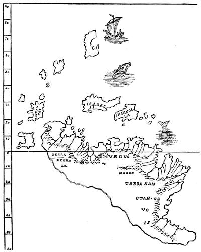
THE LENOX GLOBE.
A section of the drawing given by Dr. De Costa in his monograph on the globe, showing the American parts reduced to a plane projection, and presenting the name of Terra Sanctæ Crucis. There is another sketch on p. 123.
There are other copies in the Carter-Brown (Catalogue, vol. i. no. 40), Barlow, and Harvard College libraries. Another is in the Force Collection, Library of Congress, and one was sold in the Murphy sale (no. 681). The copy which belonged to Ferdinand Columbus is still preserved in Seville; but its annotations do not signify that the statements in it respecting Vespucius’ discoveries attracted his attention.[578] It was this edition which Navarrete used when he made a Spanish version for his Coleccion (iii. 183) D’Avezac used a copy in the Mazarine Library; and other copies are noted in the Huth (i. 356) and Sunderland (Catalogue, vol. v. no. 12,920) collections. The account of the voyages in this edition was also printed separately in German as Diss buchlin saget wie die zwē ... herrē, etc.[579]
While the Strasburg press was emitting this 1509 edition it was also printing the sheets of another little tract, the anonymous Globus mundi,[580] of which a fac-simile of the title is annexed, in which it will be perceived the bit of the New World shown is called “Newe welt,” and not America, though “America lately discovered” is the designation given in the text. The credit of the discovery is given unreservedly to Vespucius, and Columbus is not mentioned.[581]
The breaking up of the press was a serious blow to the little community at St.-Dié. Ringmann, in the full faith of completing the edition of Ptolemy which they had in view, had brought from Italy a Greek manuscript of the old geographer; but the poet was soon to follow his patron, for, having retired to Schlestadt, his native town, he died there in 1511 at the early age of twenty-nine. The Ptolemy project, however, did not fail. Its production was transferred to Strasburg; and there, in 1513, it appeared, including the series of maps associated ever since with the name of Hylacomylus, and showing evidences in the text of the use which had been made of Ringmann’s Greek manuscript.
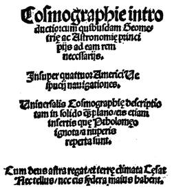
TITLE OF THE 1509 (STRASBURG) EDITION.
We look to this book in vain for any attempt to follow up the conferring of the name of Vespucius on the New World. The two maps which it contains, showing the recent discoveries, are given in fac-simile on pages 111 and 112. In one the large region which stands for South America has no designation; in the other there is supposed to be some relation to Columbus’ own map, while it bears a legend which gives to Columbus unequivocally the credit of the discovery of the New World. It has been contended of late that the earliest cartographical application of the name is on two globes preserved in the collection of the Freiherr von Hauslab, in Vienna, one of which (printed) Varnhagen in his paper on Apianus and Schöner puts under 1509, and the other (manuscript) under 1513. Weiser in his Magalhâes-Strasse (p. 27) doubts these dates.[582] The application of the new name, America, we also find not far from this time, say between 1512 and 1515, in a manuscript mappemonde (see p. 125) which Major, when he described it in the Archæologia (xl. p. 1), unhesitatingly ascribed to Leonardo da Vinci, thinking that he could trace certain relations between Da Vinci and Vespucius. This map bears distinctly the name America on the South American continent. Its connection with Da Vinci is now denied.
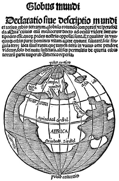
TITLE OF THE 1509 (STRASBURG) EDITION.
Not far from the same time a certain undated edition of the Cosmographiæ introductio appeared at Lyons, though no place is given. Of this edition there are two copies in the British Museum, and others in the Lenox and Barlow collections; but they all lack a map,[583] which is found in a copy first brought to public attention by the bookseller Tross, of Paris, in 1881,[584] and which is now owned by Mr. C. H. Kalbfleisch, of New York. Its date is uncertain. Harrisse (Bibl. Amer. Vet., no. 63) placed it first in 1510, but later (Cabots, p. 182) he dated it about 1514, as Tross had already done. D’Avezac (Waltzemüller, p. 123) thinks it could not have been earlier than 1517.[585]
The chief interest of this map to us is the fact that it bears the words “America noviter reperta” on what stands for South America; and there is fair ground for supposing that it antedates all other printed maps yet known which bear this name.
At not far from the same time, fixed in this instance certainly in 1515, we find America on the earliest known globe of Schöner.[586] Probably printed to accompany this globe, is a rare little tract, issued the same year (1515) at Nuremberg, under the title of Luculentissima quædā terræ totius descriptio. In this Schöner speaks of a “fourth part of the globe, named after its discoverer, Americus Vespucius, a man of sagacious mind, who found it in 1497,” adopting the controverted date.[587]
Meanwhile the fame of Vespucius was prospering with the Vienna coterie. One of them, Georg Tanstetter, sometimes called Collimitius, was editing the De natura locorum librum of Albertus Magnus; and apparently after the book was printed he made with type a marginal note, to cite the profession of Vespucius that he had reached to fifty degrees south, as showing that there was habitable land so far towards the Southern Pole.[588]
Joachim Watt, or Vadianus, as he was called in his editorial Latin, had in 1515 adopted the new name of America, and repeated it in 1518, when he reproduced his letter in his edition of Pomponius Mela, as explained on another page.[589] Apian had been employed to make the mappemonde for it, which was to show the new discoveries. The map seems not to have been finished in time; but when it appeared, two years later (1520), in the new edition of Solinus, by Camers, though it bore the name of America on the southern main, it still preserved the legend in connection therewith which awarded the discovery to Columbus.[590] Watt now quarrelled with Camers, for they had worked jointly, and their two books are usually found in one cover, with Apian’s map between them. Returning to St. Gall, Vadianus practised there as a physician, and reissued his Mela at Basle in 1522, dedicating it to that Dr. Faber who had been the teacher of Ringmann in Paris eighteen years before.[591]
In 1522 Lorenz Friess, or Laurentius Phrysius, another of Duke René’s coterie, a correspondent of Vespucius, published a new edition of Ptolemy at the Grüninger press in Strasburg, in which the fame of Columbus and Vespucius is kept up in the usual equalizing way. The preface, by Thomas Ancuparius, sounds the praises of the Florentine, ascribing to him the discovery “of what we to-day call America;” the Admiral’s map, Tabula Terre Nove,[592] which Waldseemüller had published in the 1513 edition, is once more reproduced, with other of the maps of that edition, re-engraved on a reduced scale. The usual legend, crediting the discovery to Columbus, is shown in a section of the map, which is given in another place.[593] Phrysius acknowledges that the maps are essentially Waldseemüller’s, though they have some changes and additions; but he adds a new mappemonde of his own, putting the name America on the great southern main,—the first time of its appearing in any map of the Ptolemy series. A fac-simile is annexed.
There is thus far absolutely no proof that any one disputed the essential facts of the discovery by Columbus of the outlying islands of Asia, as the belief went, or denied him the credit of giving a new world to the crowns of Aragon and Castile, whether that were Asia or not. The maps which have come down to us, so far as they record anything, invariably give Columbus the credit. The detractors and panegyrists of Vespucius have asserted in turn that he was privy to the doings at St.-Dié and Strasburg, and that he was not; but proof is lacking for either proposition. No one can dispute, however, that he was dead before his name was applied to the new discoveries on any published map.
If indeed the date of 1497, as given by the St.-Dié publication, was correct, there might have been ground for adjudging his explorations of the mainland to have antedated those of Columbus; but the conclusion is irresistible that either the Spanish authorities did not know that such a claim had been made, or they deemed the date an error of the press; since to rely upon the claim would have helped them in their conflict with the heirs of Columbus, which began the year following the publication of that claim, or in 1508 and continued to vex all concerned till 1527; and during all that time Vespucius, as has been mentioned, is not named in the records of the proceedings. It is equally hard to believe that Ferdinand Columbus would have passed by a claim derogating from the fame of his father, if it had come to him as a positive assertion. That he knew of the St.-Dié tract we have direct evidence in his possession of a copy of it. That it did not trouble him we know also with as much confidence as negative testimony can impart; for we have no knowledge of his noticing it, but instead the positive assertion of a contemporary that he did not notice it.
The claim for Vespucius, however, was soon to be set up. In 1527 Las Casas began, if we may believe Quintana, the writing of his Historia.[594] It is not easy, however, to fix precisely the year when he tells us that the belief had become current of Vespucius being really the first to set his foot on the main. “Amerigo,” he tells us further,[595] “is said to have placed the name of America on maps,[596] thus sinfully failing toward the Admiral. If he purposely gave currency to this belief in his first setting foot on the main, it was a great wickedness; and if it was not done intentionally, it looks like it.” Las Casas still makes allowances, and fails of positive accusation, when again he speaks of “the injustice of Amerigo, or the injustice perhaps those who printed the Quattuor navigationes appear to have committed toward the Admiral;” and once more when he says that “foreign writers call the country America: it ought to be called Columba.” But he grows more positive as he goes on, when he wonders how Ferdinand Columbus, who had, as he says, Vespucius’ account, could have found nothing in it of deceit and injustice to object to.
Who were these “foreign writers?” Stobnicza, of Cracow, in the Introductio in Claudii Ptholomei cosmographiā, which he published in 1512, said: “Et ne soli Ptolomeo laborassem, curavi etiam notas facere quasdam partes terre ipsi ptolomeo alijsque vetustioribus ignotas que Amerii vespucij aliorumque lustratione ad nostram noticiam puenere.” Upon the reverse of folio v., in the chapter “De meridianis,” occurs: “Similiter in occasu ultra africam & europam magna pars terre quam ab Americo eius reptore Americam vocant vulgo autem novus mundus dicitur.” Upon the reverse of folio vii. in the chapter “De partibus terre” is this: “Non solū aūt pdicte tres ptes nunc sunt lacius lustrate, verum & alia quata pars ab Americo vesputio sagacis ingenii viro inventa est, quam ab ipso Americo eius inventore Ameriḡem si a americi terram sive americā appellari volunt cuius latitudo est sub tota torrida zona,” etc. These expressions were repeated in the second edition in 1519.
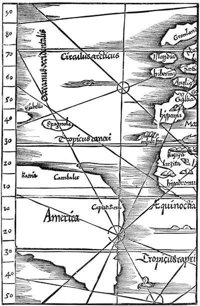
LAURENTIUS FRISIUS, IN THE PTOLEMY OF 1522 (westerly part.)
Apian in 1524 had accepted the name in his Cosmographicus liber, as he had in an uncertain way, in 1522, in two editions, one printed at Ratisbon, the other without place, of the tract, Declaratio et usus typi cosmographici, illustrative of his map.[597]
Glareanus in 1529 spoke of the land to the west “quam Americam vocant,” though he couples the names of Columbus and Vespucius in speaking of its discovery. Apian and Gemma Phrysius in their Cosmographia of the same year recognize the new name;[598] and Phrysius again in his De principiis astronomiæ, first published at Antwerp in 1530, gave a chapter (no. xxx.) to “America,” and repeated it in later editions.[599] Münster in the Novus orbis of 1532 finds that the extended coast of South America “takes the name of America from Americus, who discovered it.”[600] We find the name again in the Epitome trium terræ partium of Vadianus, published at Tiguri in 1534,[601] and in Honter’s Rudimentorum cosmographiæ libri, published at Basle in the same year. When the Spanish sea-manual, Medina’s Arte de navegar, was published in Italian at Venice in 1544, it had a chart with America on it; and the De sphæra of Cornelius Valerius (Antwerp, 1561) says this fourth part of the world took its name from Americus.
Thus it was manifest that popular belief, outside of Spain, at least,[602] was, as Las Casas affirms, working at last into false channels. Of course the time would come when Vespucius, wrongfully or rightfully, would be charged with promoting this belief. He was already dead, and could not repel the insinuation. In 1533 this charge came for the first time in print, so far as we now know, and from one who had taken his part in spreading the error. It has already been mentioned how Schöner, in his globe of 1515, and in the little book which explained that globe, had accepted the name from the coterie of the Vosges. He still used the name in 1520 in another globe.[603] Now in 1533, in his Opusculum geographicum ex diversorum libris ac cartis summa cura & diligentia collectum, accomodatum ad recenter elaboratum ab eodem globum decriptionis terrenæ. Ioachimi Camerarii. Ex urbe Norica, ... Anno XXXIII,[604] he unreservedly charged Vespucius with fixing his own name upon that region of India Superior which he believed to be an island.[605]
In 1535, in a new edition of Ptolemy, Servetus repeated the map of the New World from the editions of 1522 and 1525 which helped to give further currency to the name of America; but he checks his readers in his text by saying that those are misled who call the continent America, since Vespucius never touched it till long after Columbus had.[606] This cautious statement did not save Servetus from the disdainful comment of Gomara (1551), who accuses that editor of Ptolemy of attempting to blacken the name of the Florentine.
It was but an easy process for a euphonious name, once accepted for a large part of the new discoveries, gradually to be extended until it covered them all. The discovery of the South Sea by Balboa in 1513 rendered it certain that there was a country of unmistakably continental extent lying south of the field of Columbus’ observations, which, though it might prove to be connected with Asia by the Isthmus of Panama, was still worthy of an independent designation.[607] We have seen how the Land of the Holy Cross, Paria, and all other names gave way in recognition of the one man who had best satisfied Europe that this region had a continental extent. If it be admitted even that Vespucius was in any way privy to the bestowal of his name upon it, there was at first no purpose to enlarge the application of such name beyond this well-recognized coast.
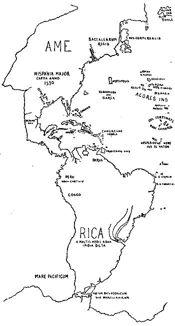
MERCATOR, 1541.
This is the configuration of Mercator’s gores (for a globe) reduced to Mercator’s subsequently-devised projection.
That the name went beyond that coast came of one of those shaping tendencies which are without control. “It was,” as Humboldt says,[608] “accident, and not fraud and dissensions, which deprived the continent of America of the name of Columbus.” It was in 1541, and by Mercator in his printed gores for a globe, that in a cartographical record we first find the name America extended to cover the entire continent; for he places the letters AME at Baccalaos, and completed the name with RICA at the La Plata.[609] Thus the injustice was made perpetual; and there seems no greater instance of the instability of truth in the world’s history. Such monstrous perversion could but incite an indignation which needed a victim,—and it found him in Vespucius. The intimation of Schöner was magnified in time by everybody, and the unfortunate date of 1497, as well as the altogether doubtful aspect of his Quattuor navigationes, helped on the accusation. Vespucius stood in every cyclopædia and history as the personification of baseness and arrogance;[610] and his treacherous return for the kindness which Columbus did him in February, 1505, when he gave him a letter of recommendation to his son Diego,[611] at a time when the Florentine stood in need of such assistance, was often made to point a moral. The most emphatic of these accusers, working up his case with every subsidiary help, has been the Viscount Santarem. He will not admit the possibility of Vespucius’ ignorance of the movement at St.-Dié. “We are led to the conclusion,” he says, in summing up, “that the name given to the new continent after the death of Columbus was the result of a preconceived plan against his memory, either designedly and with malice aforethought, or by the secret influence of an extensive patronage of foreign merchants residing at Seville and elsewhere, dependent on Vespucius as naval contractor.”[612]
It was not till Humboldt approached the subject in the fourth and fifth volumes of his Examen critique de l’histoire et de la géographie du nouveau monde that the great injustice to Vespucius on account of the greater injustice to Columbus began to be apparent. No one but Santarem, since Humboldt’s time, has attempted to rehabilitate the old arguments. Those who are cautious had said before that he might pardonably have given his name to the long coast-line which he had tracked, but that he was not responsible for its ultimate expansion.[613] But Humboldt’s opinion at once prevailed, and he reviewed and confirmed them in his Cosmos.[614] Humboldt’s views are convincingly and elaborately enforced; but the busy reader may like to know they are well epitomized by Wiesener in a paper, “Améric Vespuce et Christophe Colomb: la véritable origine du nom d’Amérique,” which was published in the Revue des questions historiques (1866), i. 225-252, and translated into English in the Catholic World (1867), v. 611.
The best English authority on this question is Mr. R. H. Major, who has examined it with both thoroughness and condensation of statement in his paper on the Da Vinci map in the Archæologia, vol. xl., in his Prince Henry the Navigator (pp. 367-380),[615] and in his Discoveries of Prince Henry, chap. xiv. Harrisse in his Bibl. Amer. Vet., pp. 65, 94, enumerates the contestants on the question; and Varnhagen, who is never unjust to Columbus, traces in a summary way the progress in the acceptance of the name of America in his Nouvelles recherches sur les derniers voyages du navigateur Florentin. In German, Oscar Peschel in his Geschichte des Zeitalters der Entdeckungen (book ii. chap. 13) has examined the matter with a scholar’s instincts. The subject was followed by M. Schoetter in a paper read at the Congrès des Américanistes at Luxemburg in 1877; but it is not apparent from the abstract of the paper in the Proceedings of that session (p. 357) that any new light was thrown upon the matter.
Professor Jules Marcou would drive the subject beyond the bounds of any personal associations by establishing the origin of the name in the native designation (Americ, Amerrique, Amerique) of a range of mountains in Central America;[616] and Mr. T. H. Lambert, in the Bulletin of the American Geographical Society (no. 1 of 1883), asks us to find the origin in the name given by the Peruvians to their country,—neither of which theories has received or is likely to receive any considerable acceptance.[617]
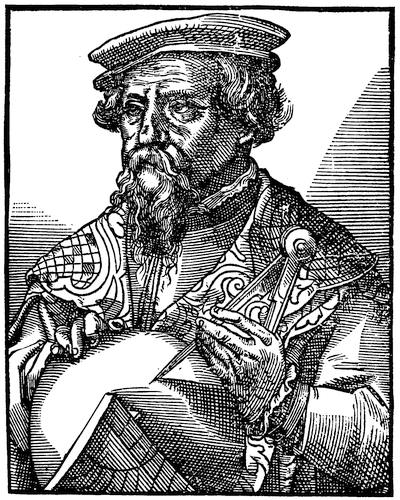
APIANUS (from Reusner’s Icones, 1590, p. 175).
THE BIBLIOGRAPHY
OF
POMPONIUS MELA, SOLINUS, VADIANUS, AND APIANUS.
BY THE EDITOR.
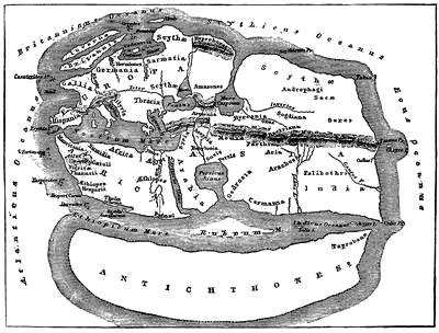
POMPONIUS MELA’S WORLD.
Reduced after map in Bunbury’s Ancient Geography (London, 1879), ii. 368.
OF Pomponius Mela we know little beyond the fact that he was born in Spain, not far from Gibraltar, and that he wrote, as seems probable, his popular geographical treatise in the year 43 A.D.[618] The editio princeps of this treatise was printed in 1471 at Milan, it is supposed, by Antonius Zarotus, under the title Cosmographia. It was a small quarto of fifty-nine leaves. Two copies have been sold lately. The Sunderland copy (no. 10,117) brought £11 5s., and has since been held by Quaritch at £15 15s. Another copy was no. 897 in part iii. of the Beckford Catalogue. In 1478 there was an edition, De situ orbis, at Venice (Sunderland, no. 10,118); and in 1482 another edition, Cosmographia geographica, was also published at Venice (Leclerc, no. 456; Murphy, no. 2,003; D’Avezac, Géographes Grecs et Latins, p. 13). It was called Cosmographia in the edition of 1498 (Bibl. Amer. Vet., Additions, no. 8; Huth, iv. 1166); De orbis situ in that of Venice, 1502; De totius orbis descriptione in the Paris edition of 1507, edited by Geofroy Tory (A. J. Bernard’s Geofroy Tory, premier imprimeur royal, Paris, 1865, p. 81; Carter-Brown, i. 32; Muller, 1872, no. 2,318; 1877, no. 2,062).
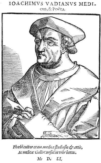
VADIANUS.
Fac-simile of a cut in Reusner’s Icones (Strasburg, 1590), p. 162.
In 1512 the text of Mela came under new influences. Henry Stevens (Bibliotheca geographica, p. 210) and others have pointed out how a circle of geographical students at this time were making Vienna a centre of interest by their interpretation of the views of Mela and of Solinus, a writer of the third century, whose Polyhistor is a description of the world known to the ancients. Within this knot of cosmographers, John Camers undertook the editing of Mela; and his edition, De situ orbis, was printed by Jean Singrein at Vienna in 1512, though it bears neither place nor date (Stevens, Bibliotheca geographica, no. 1,825; D’Avezac, Géographes Grecs et Latins, p. 14; Leclerc, no. 457; Sunderland, no. 10,119). Another Mela of the same year (1512) is known to have been printed by Weissenburger, presumably at Nuremberg, and edited by Johannes Cocleius as Cosmographia Pomponii Mele: authoris nitidissimi tribus libris digesta: ... compendio Johannis Coclei Norici adaucta quo geographie principia generaliter comprehēduntur (Weigel, 1877, no. 227; there is a copy in Charles Deane’s library). In 1517 Mela made a part of the collection of Antonie Francino at Florence, which was reissued in 1519 and 1526 (D’Avezac, p. 16; Sunderland, nos. 10,121, 10,122).
Meanwhile another student, Joachim Watt, a native of St. Gall, in Switzerland, now about thirty years old, who had been a student of Camers, and who is better known by the latinized form of his name, Vadianus, had, in November, 1514, addressed a letter to Rudolfus Agricola, in which he adopted the suggestion first made by Waldseemüller that the forename of Vespucius should be applied to that part of the New World which we now call Brazil. This letter was printed at Vienna (1515) in a little tract,—Habes, Lector, hoc libello, Rudolphi Agricolæ Junioris Rheti ad Jochimum Vadianum epistolam,—now become very rare. It contains also the letter of Agricola, Sept. 1, 1514, which drew out the response of Vadianus dated October 16,—Agricola on his part referring to the work on Mela which was then occupying Vadianus (a copy owned by Stevens, Bibliotheca geographica, no. 2,799, passed into the Huth Library, Catalogue, v. 1506. Harrassowitz has since priced a copy, Catalogue, List 61, no. 57, at 280 marks).
The De situ orbis of Mela, as edited by Vadianus, came out finally in 1518, and contained one of the two letters,—that of Vadianus himself; and it is in this reproduction that writers have usually referred to its text (Harrisse, Bibl. Amer. Vet., no. 92; Murphy, no. 2,004; Leclerc, no. 458; Sunderland, no. 10,120; Graesse, v. 401; Carter-Brown, i. 55). Camers also issued at the same time an edition uniform with the Aldine imprint of Solinus; and this and the Mela are often found bound together. Two years later (1520) copies of the two usually have bound up between them the famous cordiform map of Apian (Petrus Apianus, in the Latin form; Dienewitz, in his vernacular). This for a long time was considered the earliest engraved map to show the name of America, which appeared, as the annexed fac-simile shows, on the representation of South America. There may be some question if the map equally belongs to the Mela and to the Solinus, for the two in this edition are usually bound together; yet in a few copies of this double book, as in the Cranmer copy in the British Museum, and in the Huth copy (Catalogue, iv. 1372), there is a map for each book. There are copies of the Solinus in the Carter-Brown, Lenox, Harvard College, Boston Public, and American Antiquarian Society libraries (cf. Harrisse, Notes on Columbus, p. 175; Bibl. Amer. Vet., no. 108; Murphy, no. 2,338; Trübner, 1876, £15 15s.; Weigel, 1877, 240 marks; Calvary, 1883, 250 marks; Leclerc, 1881, no. 2,686, 500 francs; Ellis & White, 1877, £25). The inscription on the map reads: “Tipus orbis universalis juxta Ptolomei cosmographi traditionem et Americi Vespucii aliosque lustrationes a Petro Apiano Leysnico elucbrat. An. Do. M.D.XX.” Harrisse (Bibl. Amer. Vet., Additions, no. 68) cites from Varnhagen’s Postface aux trois livraisons sur Vespucci, a little tract of eight leaves, which is said to be an exposition of the map to accompany it, called Declaratio et usus typi cosmographici, Ratisbon, 1522. The map was again used in the first complete edition of Peter Martyr’s Decades, when the date was changed to “M.D.XXX” (Carter-Brown, i. 94; Bibl. Amer. Vet., no. 154; Kunstmann, Entdeckung Amerikas, p. 134; Kohl, Die beiden ältesten General-Karten von Amerika, p. 33; Uricoechea, Mapoteca Colombiana, no. 4). Vadianus meanwhile had quarrelled with Camers, and had returned to St. Gall, and now re-edited his Mela, and published it at Basle in 1522 (Bibl. Amer. Vet., no. 112; Murphy, no. 2,004**; Carter-Brown, i. 590; Leclerc, no. 459).
In 1524 Apianus published the first edition of his cosmographical studies,—a book that for near a century, under various revisions, maintained a high reputation. The Cosmographicus liber was published at Landshut in 1524,—a thin quarto with two diagrams showing the New World, in one of which the designation is “Ameri” for an island; in the other, “America.” Bibliographers differ as to collation, some giving fifty-two, and others sixty leaves; and there are evidently different editions of the same year. The book is usually priced at £5 or £6. Cf. Harrisse, Notes on Columbus, p. 174; Bibl. Amer. Vet., no. 127, and Additions, p. 87; Carter-Brown, i. 78; Huth, i. 39; Murphy, no. 93; Sabin, no. 1,738. There is an account of Apianus (born 1495; died 1551 or 1552) in Clement’s Bibliographie curieuse (Göttingen, 1750-1760). It is in chapter iv. of part ii. of the Cosmographicus liber that America is mentioned; but there is no intimation of Columbus having discovered it. Where “Isabella aut Cuba” is spoken of, is an early instance of conferring the latter name on that island, after La Cosa’s use of it.
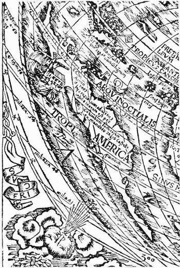
PART OF APIANUS’S MAP, 1520.
There are fac-similes of the entire map in the Carter-Brown Catalogue, i. 69, and in Santarem’s Atlas; and on a much reduced scale in Daly’s Early Cartography. Cf. Varnhagen’s Jo. Schöner e P. Apianus: Influencia de um e outro e de varios de seus contemporaneos na adopçăo do nome America; primeiros globos e primeiros mappas-mundi com este nome; globo de Waltzeemüller, e plaquette acerca do de Schöner, Vienna, 1872, privately printed, 61 pp., 100 copies (Murphy Catalogue, no. 2,231; Quaritch prices it at about £1). A recent account of the history of the Vienna presses, Wiens Buchdruckergeschichte (1883), by Anton Mayer, refers to the edition of Solinus of 1520 (vol. i. pp. 38, 41), and to the editions of Pomponius Mela, edited by Vadianus, giving a fac-simile of the title (p. 39) in one case.
Santarem gives twenty-five editions of Ptolemy between 1511 and 1584 which do not bear the name of America, and three (1522, 1541, and 1552) which have it. Cf. Bulletin de la Société de Géographie de Paris (1837), vol. viii.
In 1529 a pupil of Apianus, Gemma Frisius, annotated his master’s work, when it was published at Antwerp, while an abridgment, Cosmographiæ introductio, was printed the same year (1529) at Ingoldstadt (Sabin, no. 1,739; Court, no. 21; Bibl. Amer. Vet., nos. 148, 149, and Additions, no. 88. There is a copy of the abridgment in Harvard College Library).
The third edition of Mela, cum commentariis Vadiani appeared at Paris in 1530, but without maps (cf. Carter-Brown, i. 97; Muller, 1877, no. 2,063; Bibl. Amer. Vet., no. 157); and again in 1532. (Sunderland, no. 10,124; Harrassowitz, list 61, no. 60).
It is not necessary to follow, other than synoptically, the various subsequent editions of these three representative books, with brief indications of the changes that they assumed to comport with the now rapidly advancing knowledge of the New World.
1533. Apianus, full or abridged, in Latin, at Venice, at Freiburg, at Antwerp, at Ingoldstadt, at Paris (Carter-Brown, i. 591; Bibl. Amer. Vet., nos. 179, 202, and Additions, no. 100; Sabin, nos. 1,742, 1,757. Some copies have 1532 in the colophon). Apianus printed this year at Ingoldstadt various tracts in Latin and German on the instruments used in observations for latitude and longitude (Stevens, Bibliotheca geographica, no. 173, etc). Vadianus, in his Epitome trium terræ partium, published at Tiguri, described America as a part of Asia (Weigel, 1877, no. 1,574). He dated his preface at St. Gall, “VII. Kallen. August, M. D. XXXIII.”
1534. Apianus in Latin at Venice (Bibl. Amer. Vet., Additions, no. 106). The Epitome of Vadianus in folio, published at Tiguri, with a map, “Typus cosmographicus universalis, Tiguri, anno M. D. XXXIIII,” which resembles somewhat that of Finæus, representing the New World as an island approaching the shape of South America. The Carter-Brown copy has no map (cf. Huth, v. 1508; Leclerc, no. 586, 130 francs; Carter-Brown, i. 112; Weigel, 1877, no. 1,576; Bibl. Amer. Vet., no. 189). An edition in octavo, without date, is held to be of the same year. It is usually said to have no map; but Quaritch (no. 12,475) has advertised a copy for £4,—“the only copy he had ever seen containing the map.” The Huth Catalogue, v. 1508, shows a copy with twelve woodcut maps of two leaves each, and four single leaves of maps and globes. The part pertaining to America in this edition is pages 544-564, “Insulæ Oceani præcipuæ,” which is considered to belong to the Asiatic continent (cf. Stevens, 1870, no. 2,179; Muller, 1872, no. 1,551; 1877, no. 3,293; Weigel, 1877, no. 1,575).
1535. Apianus, in Latin, at Venice (Sabin, no. 1,743; Bibl. Amer. Vet., no. 202). Vadianus, in Latin, at Antwerp. (Bibl. Amer. Vet., 209; Huth, v. 1508; Court, no. 360).
1536. An edition of Mela, De situ orbis, without place and date, was printed at Basle, in small octavo, with the corrections of Olive and Barbaro. Cf. D’Avezac, Géographes Grecs et Latins, p. 20; Sunderland, no. 10,123; Weigel (1877), p. 99.
1537. The first Dutch edition of Apianus, De cosmographie rā Pe Apianus, Antwerp, with woodcut of globe on the title. The first of two small maps shows America. It contains a description of Peru. Cf. Carter-Brown, i. 121; Muller (1875), no. 2,314.
1538. Mela and Solinus, printed by Henri Petri at Basle with large and small maps, one representing the New World to the east of Asia as “Terra incognita.” Cf. Harrassowitz (1882), no. 91, p. 2, 60 marks; D’Avezac, p. 21.
1539. An edition of Mela, De orbis situ, at Paris (Sunderland, no. 10,124). Apianus’s Cosmographia per Gemmam Phrysium restituta, in small quarto, was published at Antwerp by A. Berckman. A globe on the titlepage shows the Old World. It has no other map (Carter-Brown, i. 124; Sabin, no. 1,744; Bibl. Amer. Vet., nos. 229, 230).
1540. An edition of Mela, issued at Paris, has the Orontius Finæus map of 1531, with the type of the Dedication changed. The Harvard College copy and one given in Harrassowitz’ Catalogue (81), no. 55, show no map. Cf. Leclerc, no. 460, 200 francs; Harrisse, Bibl. Amer. Vet., no. 230, Additions, nos. 126, 127, 460; Court, no. 283; Rosenthal (1884), no. 51, at 150 marks. An edition of Apianus in Latin at Antwerp, without map; but Lelewel (Moyen-âge, pl. 46) gives a map purporting to follow one in this edition of Apianus. Cf. Carter-Brown, i. 125; Bibl. Amer. Vet., no. 230; Sabin, no. 1,745.
1541. Editions of Apianus in Latin at Venice and at Nuremberg. Cf. Bibl. Amer. Vet., nos. 235, 236; Sabin, nos. 1,746, 1,747.
1543. Mela and Solinus at Basle (D’Avezac, p. 21).
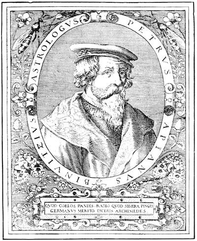
APIANUS.
This follows a fac-simile of an old cut given in the Carter-Brown Catalogue, i. 294.
1544. An edition of Apianus in French at Antwerp, with a map, which was used in various later editions. Cf. Sabin, no. 1,752; Carter-Brown, i. 592; Bibl. Amer. Vet., no. 253.
1545. Apianus, in Latin, at Antwerp, with the same map as in the 1544 French edition. Cf. Carter-Brown, i. 135; Bibl. Amer. Vet., no. 262; Muller (1875), no. 2,365 (1877), no. 158; Sabin, no. 1,748.
1548. Apianus in Spanish, Cosmographia augmentada por Gemma Frisio, at Antwerp, with the same folding map. Cf. Bibl. Amer. Vet., no. 283; Sabin, no. 1,753; Carter-Brown, i. 147; Dufosse, no. 10,201, 45 francs; Quaritch (1878), no. 104, £6 6s.; Cat. hist. Brazil, Bibl. Nac. do Rio de Janeiro, no. 3. Apianus in Italian at Antwerp, Libro de la cosmographia de Pedro Apiano, with the same map. The Epitome of Vadianus, published at Tiguri, with double maps engraved on wood, contains one, dated 1546, showing America, which is reproduced in Santarem’s Atlas. Cf. Carter-Brown, i. 151; Bibl. Amer. Vet., nos. 170, 464, Additions, no. 104.
1550. Apianus in Latin at Antwerp, with map at folio 30, with additions by Frisius; and folios 30-48, on America (cf. Carter-Brown, i. 154; Bibl. Amer. Vet., no. 298; Murphy, no. 94; Sabin, no. 1,749; Muller, 1875, no. 2,366). Some bibliographers report Latin editions of this year at Amsterdam and Basle.
1551. Editions of Apianus at Paris, in Latin and French, with a folding map and two smaller ones,—a reprint of the Antwerp edition of 1550. The language of the maps is French in both editions (Court, no. 20). Clement (Bibliothèque curieuse, i. 404) gives 1553 as the date of the colophon. An edition of Mela and Solinus (D’Avezac, p. 21).
1553. Editions of Apianus in Latin at Antwerp and Paris, and in Dutch at Antwerp, with mappemonde and two small maps. Cf. Carter-Brown, i. 174, 594. Some copies have 1551 in the colophon, as does that belonging to Jules Marcou, of Cambridge. There is a copy of the Paris edition in the Boston Public Library, no. 2,285, 58.
1554. An abridged edition of Apianus, Cosmographiæ introductio, Venice. A copy in Harvard College Library.
1556. An edition of Mela, at Paris (Sunderland, no. 10,125).
1557. An edition of Mela, as edited by Vadianus, at Basle (D’Avezac, p. 21).
1561. A Dutch edition of Apianus, at Antwerp, without map. Cf. Carter-Brown, i. 597; Sabin, no. 1,754.
1564. An octavo edition of Vadianus’ Mela (D’Avezac, p. 21). A Latin edition of Apianus at Antwerp, with mappemonde.
1574. Latin editions of Apianus at Antwerp and Cologne, with a folding mappemonde (Carter-Brown, i. 296, 297; Sabin, no. 1,750).
1575. Spanish and Italian texts of Apianus published at Antwerp, with mappemonde, and descriptions of the New World taken from Gomara and Girava. Cf. Carter-Brown, i. 302; Sabin, no. 1,756; Clement, Bibliothèque curieuse, i. 405.
1576. Mela, as edited by Vadianus (D’Avezac, p. 21). With the Polyhistor of Solinus, published at Basle. The Harvard College copy has no map of America. Cf. Graesse, v. 402.
1577. Henri Estienne’s collection in quarto, containing Mela (D’Avezac, p. 24).
1581. Apianus in French, at Antwerp, with a folding mappemonde (p. 72). The part on America is pp. 155-187 (Murphy, no. 95).
1582. An edition of Mela edited by A. Schottus, published at Antwerp, with map by Ortelius (Sunderland, no. 10,126).
1584. The Cosmographia of Apianus and Frisius, called by Clement (Bibliothèque curieuse, i. 404) the best edition, published at Antwerp by Bellero, in two issues, a change in the title distinguishing them. It has the same map with the 1564 and 1574 editions, and the section on “Insulæ Americæ” begins on p. 157. Cf. Carter-Brown, i. 354, no map mentioned; Sabin, no. 1,751.
1585. An edition of Mela in English, translated by Arthur Golding, published at London as The Worke of Pomponius Mela, the Cosmographer, concerning the Situation of the World. The preface is dated Feb. 6, 1584, in which Golding promises versions of Solinus and Thevet. There is a copy in the Library of the Massachusetts Historical Society.
1592. A Dutch edition of Apianus, published at Antwerp (Sabin, no. 1,755).
1595. An edition of Mela, as edited by Vadianus, published at Basle (D’Avezac, p. 21).
1598. A Dutch edition of Apianus, published at Amsterdam, with folding map. Cf. Carter-Brown, i. 521; Muller (1877), no. 164.
1605. Mathias Bonhomme published an edition of Mela and Solinus (D’Avezac, p. 21).
1609. A Dutch edition of Apianus, printed at Antwerp, with mappemonde (Carter-Brown, ii. 76; Sabin, no. 1,755). Bonhomme’s edition of Mela and Solinus, reissued (D’Avezac, p. 21).
1615, etc. Numerous editions of Mela appeared subsequently: 1615 (Vadianus), Basle, 1619, 1625, 1626, 1635; at Madrid, 1642, 1644, in Spanish; Leyden, 1646, in Latin; and under different editors, 1658, 1685, and 1700, and often later.