HIGHWAYS AND TRAILS
Reading edition
TOUR 1
(Winnipeg, Man., Can.)—Pembina—Grand Forks—Fargo—Wahpeton—(Watertown, S. Dak.). US 81.
Canadian boundary to South Dakota Line, 256.5 m.
N. P. Ry. parallels route between Canadian border and Joliette; G. N. Ry. between Hamilton and Fargo; Milwaukee R. R. between Fargo and South Dakota Line. Winnipeg-Fargo route of Northwest Airlines parallels route between Canadian border and Fargo. Graveled roadbed except about 31 m. bituminous-surfaced. Accommodations of all types in principal towns.
US 81 crosses North Dakota along its eastern boundary from the Canadian to the South Dakota border, and passes through the rich low valley of the Red River of the North, a wide level plain that was once the bed of the great prehistoric Lake Agassiz. The route parallels the Red River to Wahpeton, and the Bois de Sioux River between that city and the South Dakota Line. Constantly in sight to the left of the road are the heavily wooded river banks, but except for crossing several timbered tributaries the route runs through almost unbelievably flat green fields, broken here and there by an occasional farmstead.
During the early settlement of this region the Red River provided transportation into the newly opened Northwest, and beside its course slow-moving trains of creaking oxcarts preceded the steamboat into the new land. It was in the Red River Valley that the first white settlements in the State were made. Here in the last quarter of the nineteenth century flourished the bonanza farms—those huge land tracts entirely devoted to the growing of wheat that earned for this valley the title of "the bread basket of the world." Today the Red River Valley produces many other crops—potatoes, sugar beets, alfalfa—in addition to wheat. Its natural endowments of rich soil and good rainfall combine with the man-made facilities of transportation to constitute the most prosperous section of North Dakota.
US 81 crosses the Canadian border 64.5 m. S. of Winnipeg, Can.
PEMBINA (Chippewa, highbush cranberry), 3 m. (792 alt., 551 pop.), named for the berries that lend their flaming color to the nearby woods in autumn, is the cradle of North Dakota white settlement. Here, at the confluence of the Red and Pembina Rivers, the earliest trading posts and the first white colony in the State were established. Charles Chaboillez, representing the North West Co., built the first fur post on North Dakota soil on the south bank of the Pembina River within the present site of Pembina in 1797-98. Rudely constructed and of short duration, it had already disappeared when Alexander Henry, Jr., also of the North West Co., came up the Red River in 1800. The following year he built a post on the north side of the Pembina, and in the same year both the XY and the Hudson's Bay Co. opened posts at the mouth of the river. The three competing companies, with their free rum and unscrupulous trading, brought about a lawless social condition in the new settlement. Drinking bouts and brawls were continuous as the Indians were plied with liquor by the conscienceless traders, who excused their conduct on grounds of competition.
It was during this time that the first child of other than Indian blood was born on North Dakota soil. The child was not white, but Negro, the daughter of Pierre Bonza, Henry's personal servant. The first white child in the State was born at Henry's post in 1807, the illegitimate son of the "Orkney Lad", a woman who had worked at the post for several years in the guise of a man. Her imposture was not generally known until the birth of her child, after which a collection was taken up and she and the child were sent back to her home in the Orkney Islands.
During the middle of the nineteenth century Pembina was the rendezvous for white and metis hunters, and the town was the starting point for the great Pembina buffalo hunts (see Side Tour 5A).
The fur trade brought some white settlers to this area, but it was not until 1812 that systematic colonization was attempted. In that year William Douglas, Earl of Selkirk, brought a group of dispossessed Scottish peasants to the Red River Valley to farm under an agreement with the Hudson's Bay Co. Untrained for the rigors of frontier life, and persecuted by the fur traders of the rival North West Co. who did not want settlers in their lucrative area, many of the Selkirk colonists moved to Canada in 1818 after establishment of the international boundary defined Pembina as United States soil. The next 30 years saw a slow influx of settlers into the Red River Valley and by 1851 Pembina had become a fairly important river port. In that year Norman Kittson, a fur trader, was named postmaster, the first in North Dakota; and Charles Cavileer, for whom the town and county of Cavalier were later named (see Tour 5), was appointed collector of customs at Pembina. Cavileer became postmaster in 1852, and, as under his influence newcomers arrived to farm, the fur trade declined and there developed the first permanent agricultural community in the State.
Pembina appears from a distance more like a grove of trees than a town. Most of its buildings are old, reflecting the rococo architecture of an earlier day.
On the Red River at the eastern end of Rolette St. is Masonic Park, where a marker commemorates the site of the first Masonic lodge in the State, organized at Pembina in 1863. Each year, both on July 1, which is Dominion Day (the Canadian holiday similar to the U. S. Independence Day) and on July 4, the flag of the United States and the Canadian Union Jack fly together from the park flagpole, a practice illustrating the neighborliness of the border States and Provinces. The Canadian flag is a gift of the Masonic Grand Lodge of Manitoba.
The highway crosses the Pembina River, which in dry seasons is likely to appear more like mud than water. Left on the highway is Pembina State Park (good water, firewood, kitchens, and tables), which includes the site of the Chaboillez trading post.
A bridge over the Red River connects Pembina with St. Vincent, Minn., situated on US 59 (see Minn. Tour 17).
At 4 m. is the PEMBINA AIRPORT (R), airport of entry operated by the Northwest Airlines. It is on part of the former military reservation of Fort Pembina, established in 1870. The reservation was turned over to the U. S. Department of the Interior in 1895 and sold at public auction. The fort was situated a mile and a half S. of the city of Pembina on the Red River.
JOLIETTE, 14.5 m. (796 alt., 100 pop.), is a French-Canadian community named for Joliette, Quebec.
At 16.4 m. is the junction with ND 44, a graveled highway and an alternate route of shorter distance between Joliette and Manvel (see below).
Left on ND 44 is BOWESMONT, 8.6 m. (794 alt., 125 pop.), named for William Bowes, the first storekeeper. It lies on the level land just W. of the Red River, its treeless streets more like a western North Dakota prairie town than the usual Red River Valley village. The story is told that Bowes won the opportunity to name the town in a game of cards. Bowesmont was first built on the banks of the river, but settlers experienced great hardships when the stream overflowed its banks each spring, and the buildings were moved.
Near Bowesmont in the spring of 1860 occurred an event illustrative of the hardships suffered by the missionaries to this region. The Rev. Joseph Goiffon, assistant at the Pembina Catholic Mission, returning from a trip to St. Paul, left his party behind in an effort to reach the mission in time to conduct a certain Mass. A driving rain had been falling and this suddenly turned to a swirling snowstorm. In a short time the ground was covered with six or seven inches of snow, and the driving wind made it impossible for him to continue. The blizzard did not abate, and in two days his horse had died from exposure and his own legs had frozen so that he was unable to walk. For five days he remained on the prairie, living on the flesh of his horse, until the storm subsided and a passer-by heard his feeble cries for help. It was found necessary to amputate parts of both legs, but in spite of this he returned to the Pembina mission, and was later transferred to St. Paul and Mendota, where he served until his death in 1910.
DRAYTON, 18.5 m. (800 alt., 509 pop.), first known as Hastings Landing, was given its present name by settlers who came west from Drayton, Ont., Canada. In contrast with its neighbor Bowesmont, Drayton is situated directly in the timber on the banks of the Red. Its 42-acre city park is unusual in that it lies in another State, across the river in Minnesota. The bridge leading to the park is also unusual; it is a drawbridge, built in 1911, when the high stage of the Red aroused hope of reviving steamboating. After the bridge had been completed the river stage fell, and has never risen, so that the draw has not been lifted since it was built.
Drayton is an active sports town, especially interested in curling, and 10 teams compete in the large enclosed rink each winter.
Left on ND 44 to ACTON HALL, 29.5 m., a community building.
On ND 44 to the junction (R) with a graveled road, 36.5 m. In a triangle formed by the junction is a CRUCIFIX. On a base of natural boulders, in summer the clear, marble-like whiteness of the cross and canopied figure stands out in contrast with the green of the surrounding countryside.
At 50 m. is the junction with US 81 (see below).
HAMILTON, 24.5 m. (830 alt., 151 pop.), also a Canadian settlement, is named for Hamilton, Ont. The oldest State bank in North Dakota, organized in 1886, is operated here. The Pembina County Fair, established in 1894, is held here (June or July) each year. In Hamilton is the junction with ND 5 (see Tour 5).
In GLASSTON, 31.5 m. (843 alt., 70 pop.), named for Archibald Glass, first postmaster, and ST. THOMAS, 37 m. (846 alt., 595 pop.), named for St. Thomas, Ont., are the homes of many retired farmers. The latter is also a potato and sugar-beet shipping center.
AUBURN, 46.5 m. (848 alt., 50 pop.), was larger than its neighbor GRAFTON, 52.5 m. (833 alt., 3,136 pop.), until the latter became a railroad junction. Named by early settlers for Grafton County, N. H., Grafton is on the Park River in the center of a rich farming area. It was the first city in this part of the Northwest to maintain a municipal light plant, and had the first public library in North Dakota, established by a women's club in 1897. A Spanish-American War Memorial, one of the few in the State, is on the Walsh County Courthouse grounds. On a hill W. of the town is the Grafton State School for the feeble-minded. Opened in 1904, the institution in 1937 had 778 inmates and a faculty and staff of 110. The grounds, including the school farm, cover 20 acres.
Left from Grafton on ND 17, a graveled highway, to the junction with ND 18, 10 m.
Right on this highway 8.5 m. is HOOPLE, (901 alt., 325 pop.), one of the largest primary potato-shipping points in the State. More than a thousand carloads of Red River Valley potatoes are loaded here each year. The town is named for Allen Hoople, an early settler. U. S. Senator Lynn J. Frazier, former Governor of the State (1917-1921), lives on a farm NE. of here.
On ND 17 is PARK RIVER, 16.5 m. (1,000 alt., 1,131 pop.), on the Park River, probably named by early explorers for the buffalo parks along the stream. The Indians had no weapons which were effective on buffalo at long range, so they constructed corrals of brush into which the animals could be herded for killing. Whenever possible these corrals, which the first white explorers called buffalo parks, were built near the bank of a river or edge of a hill so that the buffalo would charge over the edge and be killed or badly injured in the crushing fall. The Walsh County Agricultural and Training School, secondary vocational institution, is located in the town. In Park River are offices of the South Branch Park River Project of the Soil Conservation Service, which has a demonstration area of 51,000 acres in central Walsh County on which contour farming and wind strip cropping are practiced. Sinclair Lewis, the novelist, owns a farm 1 m. S. of Park River, which he has never seen.
William Avery Rockefeller, father of John D. Rockefeller, the late oil magnate, lived on a Park River farm for some time. In 1881 an elderly man who gave his name as Dr. William Levingston homesteaded on a quarter section of land just E. of the town, where he lived each summer for 15 years. He later purchased an adjoining quarter, but the deed to this land was in the name of Pierson W. Briggs, a son-in-law of William Rockefeller and then purchasing agent for the Standard Oil Company. In 1895 George W. Towle, former Park River banker, who transacted much of Dr. Levingston's business, saw a picture of the senior Rockefeller in a copy of McClure's Magazine, and recognized it as that of his former client, Levingston. William A. Rockefeller was not a doctor, but sold patent medicines and acted as a cancer specialist.
MINTO, 63 m. (826 alt., 565 pop.), originally settled by Canadians and named for an Ontario town, is now a Czech and Polish settlement. The Feast of St. Wenslaus, September 28, and Czechoslovakian Independence Day, October 28, are occasions of festivity. Minto is situated on the Forest River. There is a park by the stream S. of the town (swimming pool, recreational area, and campgrounds.)
ARDOCH, 69 m. (830 alt., 110 pop.), also named for an Ontario town, is now predominantly Polish. Lake Ardoch, a large artificial lake constructed as a water conservation and migratory waterfowl project, adjoins the town on the E.
At 80.5 m. is the second junction with ND 44 (see above).
MANVEL, 81.5 m. (826 alt., 183 pop.), is named for Gen. A. A. Manvel of the G. N. Ry. Originally known as the Turtle River station, it was one of six stops on the Fort Abercrombie-Fort Garry trail in the 1860's. The stage station was a crude log hut, roofed first with prairie sod and later with a thatch of weeds when the rain washed the sod away. The hut had one window and one door. Cooking was done on a fireplace made of clay dobes or hand-made bricks. For meals, served on an improvised table, the traveler paid 50 cents, and for the same price he had the privilege of sleeping on the dirt floor. These stations were comfortable, however, in the coldest weather, with great fires roaring in the fireplaces to warm and cheer the traveler.
At 92.5 m. is the junction with a graveled road.
Left on this road to the GRAND FORKS SILVER FOX FARM, 2 m. (visitors allowed Jan. 1-June 1; arrange with manager). About 200 pair of foxes are kept at the farm each winter.
Left at 93 m. is a stone memorial marking a point on the old RED RIVER OXCART TRAIL between St. Paul, Minn., and Fort Garry (Winnipeg), Canada. During the late summer and fall most of the traffic through the region was on this trail. It was first used by traders at Fort Garry to transport furs to St. Paul. The exact route is not known today, but it is believed to have run through Grand Forks on 3rd St., turned S. at the present corner of S. 3rd St. and Minnesota Ave., whence it followed approximately the route of US 81 to the Lincoln Park golf course. Here it is believed to have turned E. toward the river, which it followed to Frog Point (Belmont, see below), and thence up the valley. Mr. and Mrs. Charles Cavileer, pioneer settlers at Pembina, made a romantic honeymoon journey to St. Paul on this trail in 1840.
At 93 m. is the junction with a graveled road.
Left on this road to the NORTHERN PACKING COMPANY PLANT (open), 0.3 m., which in its 15-year existence (1937) has purchased more than $20,000,000 worth of livestock.
At 93.5 m. (R) is the NORTH DAKOTA STATE MILL AND ELEVATOR (open weekdays 9-5; conducted tours), a State-owned plant. A product of the Nonpartisan League's industrial program, this institution has played an important role in State politics since its opening in 1922. As early as 1915 the Society of Equity and the Equity Exchange had attempted to establish a State-owned elevator, but had failed, and this failure hastened the formation of the Nonpartisan League. By 1919 the league was strong enough in the legislature to establish its industrial program, part of which was a State mill and elevator. The State Industrial Commission governs the mill and elevator. Managership is generally considered a political plum. Whether or not the mill is a paying venture is a perennially hotly debated question. Its opponents, taking into consideration the original cost of the mill, an amount in excess of $3,000,000, cannot see how it will ever pay for itself, while those who favor its operation maintain that it makes a profit, and assert further that the creation of a market within the boundaries of the State is of invaluable benefit to the farmers. Salesmen for the State sell the mill's product in eastern States, and one of the accusations repeatedly hurled at the mill manager during political campaigns is that Dakota Maid Flour retails at a lower price in the East than in North Dakota.
A State law requires all official State documents to be stamped "Buy 'Dakota Maid' Flour."
The mill and elevator consists of six steel-and-concrete fire-proof buildings. The mill proper has three storage wings, and contains three mills, each with a daily capacity of 1,000 bbl. The elevator, equal in height to the average 12-story skyscraper, has a capacity of 1,659,600 bu. Thirty-two storage tanks each have a capacity of 50,000 bu. The elevator is operated independently of the mill, which buys in the open market and pays a rental to the elevator for storage space. In addition to Dakota Maid Flour the mill manufactures cereals, oatmeals, and poultry feeds.
GRAND FORKS, 94.5 m. (834 alt., 17,112 pop.) (see Grand Forks)
Points of Interest: University of North Dakota, Wesley College.
At N. 16th St. and Skidmore Ave. N. is the junction with US 2 (see Tour 6).
At 105.5 m. is the junction with ND 15, a graveled highway.
Right on this road is THOMPSON, 2 m. (972 alt., 273 pop.), the center of a large potato-farming area.
At 116.5 m. is the junction with a graveled road.
Right on this road is REYNOLDS, 2 m. (915 alt., 351 pop.), named for Dr. Henry Reynolds, an early settler and temperance apostle. The town is on the Grand Forks-Traill County line and many of the residents have their business places in one county and their homes in the other.
At 121.5 m. is the junction with a graveled spur.
Right on this spur is BUXTON, 1 m. (935 alt., 410 pop.), a Scandinavian town named for Thomas Buxton, a business associate of Bud Reeves, the town site owner. Reeves, active in State politics, was one of the leaders in the drive to obtain funds for maintenance of State colleges after veto of the appropriation bill in 1895 (see Side Tour 1A). When Reeves campaigned for election to Congress on the Democratic ticket in 1894 he traveled over the State in what was probably the first house trailer ever used here, and one of the first used in the region. He had a log cabin built on wheels, and in this he visited every part of the State, a large cowbell attached to the cabin announcing his arrival in each town. No mean patriot, during his speeches he had with him on the platform the American flag and a live eagle.
Several important personages have been residents of Buxton, including two Governors of the State, R. A. Nestos (1877-) and A. G. Sorlie (1874-1928); U. S. Senator A. J. Gronna (1858-1922), one of the six members of the Senate who opposed entrance of the United States into the World War; and Dr. Lila M. O'Neale (1886-), anthropologist and ethnologist who has engaged in research work in Guatemala under the auspices of the Guggenheim Memorial Foundation, and is now a faculty member at the University of California.
At 123.5 m. is the junction with a dirt road.
Right on this road is BELMONT, 11.5 m., a ghost town which in the 1870's was a booming river port known as Frog Point. It was named by Capt. Sam Painter, one of the first Red River pilots, on an early trip down the river, probably in 1860. Finding the shores almost covered with frogs, he is said to have erected a rude sign reading "Frog Point", and through the rise and fall of the town which grew up there the name remained. In 1871 the Hudson's Bay Co. established a trading post on the point. A year later, because of the fall of the river, Frog Point became head of navigation, and in short order was a rendezvous for boatmen, trappers, hunters, teamsters, and drifters, all living in tents or hastily constructed buildings. Teamsters hauling freight overland from the S. in their heavy, eight-horse, high-wheeled "jumpers", and trappers and Indians with their catches, here boarded the Hudson's Bay Co. steamer International, and James J. Hill's Selkirk. The town, cut from the woods on the bank of the Red, and towered over by tall oaks, became a wilderness metropolis, and its reputation spread to Europe. In England it was believed by many to be a city of broad avenues and tall spires, second in size only to Liverpool, and filled with the hum of industry. Foreign visitors, traveling to Fort Garry, looked eagerly for this Red River capital, and even their disillusionment on seeing the little backwoods city could not dim its reputation. In its streets rough, rugged, heavy-booted woodsmen, rivermen, and trappers thundered up and down the wooden walks, and many a citizen was hastily despatched by their 44's. Heavy-jowled saloonkeepers, slim-fingered sleek gamblers, and gay dance-hall girls were all a part of the mushroom town.
Nature brought downfall to the Point as quickly as she had elevated it to importance. The river fell lower still, and Frog Point lost its position as head of navigation. Many of its inhabitants departed as swiftly as they had come. Fire wiped out a number of buildings which were never rebuilt. Trade dwindled and storekeepers shut up shop. Some 20 years later, with the river level again up, the town revived as a grain-shipping center, but the flood of 1897 ruined grain elevators and their contents, and within a short time the bustle of the town again faded into the past. Today the Hudson's Bay Co. building, which houses a farm implement shop, is all that remains of the early affluence. The present population of the hamlet, which is not even an organized village, is 33.
CUMMINGS, 124.5 m. (935 alt., 84 pop.), named for Henry Cumings, an early G. N. employee who helped build the railroad, is principally a Scandinavian community. Originally spelled with one "m", its name was misspelled so consistently that the Post Office Department legitimized the misspelling by inserting the second "m."
At 129.5 m. is the junction with ND 7, a graveled highway (see Side Tour 1A).
HILLSBORO, 132.5 m. (907 alt., 1,317 pop.), named for James J. Hill, the "Empire Builder" of the G. N. Ry., was platted in 1880 on the attractive Goose River. A bitter fight for the Traill County seat was prominent in the early history of the town. Neighboring Caledonia, on the Red River, had been the county seat since organization of Traill County in 1875, but the routing of the G. N. Ry. through Hillsboro gave that young city aspirations, and in 1890 it came forward as a contender for the county seat. The campaign grew heated, and Caledonia citizens carried arms and posted guards around their village. To lead their defense they organized a committee, whom Hillsboro residents dubbed Tigers of the Jungle and Irreconcilables. The Tigers imported Col. W. C. Plummer, a widely known professional standard bearer who had served as campaign speaker in many parts of the country, and whom James G. Blaine once called "one of the three best political speakers in the United States." The colonel became the leading figure in the county seat fight. He was an impressive speaker, and the floods of oratory he loosed in behalf of Caledonia were greatly enjoyed by his listeners. The majority of them, however, apparently remained impervious to his arguments—when the votes were counted Hillsboro enjoyed a 1,291 to 218 majority.
Woodland Park, a 25-acre recreational and tourist camp area in the northern part of town, contains a log cabin, originally built at Belmont, in which are an old-fashioned loom once used in weaving the homespun clothing of a pioneer family, and other relics of pioneer days.
Right from Hillsboro on a graveled highway to STONY POINT, 1.5 m., site of a camp used by pioneers freighting their supplies overland from Fargo during early settlement of the region. The camp site, situated on a sandy ridge left by the recession of glacial Lake Agassiz, is marked by a large, pointed boulder 20 ft. in diameter, which once served as a landmark. In early days it was believed, from the manner in which the rock was situated in the earth, that it might have dropped from the sky.
South of Hillsboro are many well-built farmsteads—some of which were once part of bonanza farms—and four peaceful villages which in bonanza days were busy wheat centers, but now lie quietly basking in their memories.
GRANDIN, 146 m. (898 alt., 172 pop.), is the largest of these towns. It was named for J. L. Grandin, one of the two Tidioute, Pa., brothers who bought 99 sections of Red River Valley land and farmed them under the bonanza system. Dividing their land into 1,500-acre farms, each with a superintendent and a foreman, they harvested their first crop in 1878. They had 14,000 acres under cultivation near Grandin, and 6,000 at Mayville. Before the advent of the railroad the wheat raised on their land was hauled on barges towed by the steamers Grandin and Alsop to Fargo, a distance of 90 m.—overland Grandin is 35 m. from Fargo. The Grandin farm was one of the earliest practical users of the telephone, although whether the first in the State was installed on this or the Dalrymple farm (see Tour 8) is in dispute.
GARDNER, 154.5 m. (891 alt., 108 pop.), named for the town site owner, was founded in 1880 when the surrounding territory was being developed as wheat country, but was not incorporated village until 1929.
ARGUSVILLE, 161.5 m. (889 alt., 115 pop.), is believed to have received its name from the Daily Argus, Fargo newspaper published at the time of the town's founding in 1880.
HARWOOD, 169 m. (892 alt., 82 pop.), was named for A. J. Harwood, a prominent Fargo real estate dealer who bought all the town sites between Fargo and Grand Forks when the G. N. Ry. was built.
At 179.3 m. is the junction with a graveled road.
Right on this road to HECTOR AIRPORT, 0.5 m., a U. S. Department of Commerce A-1 field, land for which was donated by Martin Hector, pioneer Fargo banker, in 1931. The buildings include a city hangar of laminated truss-arch construction, completed in 1936 under the Works Progress Administration.
FARGO, 181 m. (907 alt., 28,619 pop.) (see Fargo).
Points of Interest: North Dakota Agricultural College, Veterans' Hospital, Dovre Ski Slide.
At Front and 13th Sts. is the junction with US 10 (see Tour 8).
The WILD RICE RIVER, which the route crosses at 188 m., was named for the wild grain which formerly grew on its banks. Near here, in a battle between the Sioux and Chippewa in 1807, Tabashaw, a Chippewa chief, was slain while avenging the death of his eldest son, who had been killed a short time before by the Sioux.
At 189 m. is the junction with a dirt road.
Right on this road is HOLY CROSS CEMETERY, 0.3 m., one of the first cemeteries in the State, established in 1862. The first burial here is said to have been that of a priest who had been beheaded by an Indian. Another victim of frontier tragedy whose body rests here was Archibald Montrose, a young English nobleman who came to America to establish a home. He was found frozen within a few rods of his own door during a blizzard in 1871. His devoted young wife ordered a covered shelf built on the outside wall of their cabin beneath her bedroom window, and had his coffin placed there. In the spring, when the ground had thawed sufficiently to permit the digging of a grave, she unwillingly consented to the burial of her husband's body. Soon afterward their baby daughter, born after the father's death, died also, and the mother, her mind affected by the grief of her bereavements, joined them in the nearby burial ground. For many years a large wooden cross marked the spot where Montrose died.
WILD RICE, 191 m. (909 alt., 35 pop.), is the center of a French-Canadian farming community.
HICKSON, 196 m. (915 alt., 100 pop.), is named for the Ole Hicks family who were early farmers in the vicinity.
At 198.5 m. is the junction with ND 46, a graveled highway.
Right on this highway to a bridge crossing the SHEYENNE RIVER, 9 m. On the bridge a tablet has been placed reading: "Sibley Trail 1863. Sibley's Indian Expedition crossed the Sheyenne at this point Aug. 20, returning from the Missouri to Fort Abercrombie."
At 9.5 m. is the junction with a graveled spur.
Right on this road to KINDRED, 1 m. (948 alt., 429 pop.), a tree-shaded town named for F. E. and W. A. Kindred, surveyors who platted the town site and later were large landholders in the vicinity. The community is principally Scandinavian. An interesting Collection (open by arrangement) of European museum pieces and Indian artifacts is owned by Hjalmer Rustad of Kindred, and is kept at his home.
ND 46 traverses a low range of sandy hills, the western rim of glacial Lake Agassiz. At 19 m. is the junction with a dry-weather dirt road. Left on this road at 26.5 m., just across the river to the SHEYENNE RIVER PARK (central building of native logs, spring-fed swimming pool, five picnic areas, cabins, and camp sites), under development (1938) as a recreational center by a Federal land utilization project. The park includes an area of unusual scenic attraction. A road winds along the heavily wooded river bottom, and side roads and graveled trails lead out of the valley to the sand dunes which stretch away to the S. The great plain here was deposited in glacial days, when the rushing Sheyenne, then a large stream carrying the sediment-laden waters of the melting ice sheet, flowed into Lake Agassiz. As the lake retreated the sand was left to the winds, which pushed and whipped it into dunes that dip away toward the horizon. Hummocks of trees and shrubs appear like green islands in this wide sea of dull brown. In some places, to combat the moving sand, elm and oak bark has been laid lengthwise in the road to preserve the trail.
CHRISTINE, 204.5 m. (926 alt., 204 pop.), has a population 95 percent Scandinavian. When Christine Nilsson, the noted Swedish operatic soprano, appeared in the United States in 1873, she was honored by American Scandinavians, who named this town for her. A Collection (open by arrangement) of pioneer implements, including spinning wheels, brass kitchen utensils, and relics from Fort Abercrombie, is owned by Dr. M. U. Ivers.
ABERCROMBIE, 212.5 m. (935 alt., 242 pop.), is a typically peaceful small town on the banks of the Red River. The air of serenity which lies over its tree-lined streets and substantial homes is in decided contrast with the bustling activity of the settlement which surrounded the pioneer post of Fort Abercrombie, first Federal fort in North Dakota, built in 1858. It was named for Lt. Col. John J. Abercrombie, officer in charge of its erection. The most westerly outpost of the settlers' advance during the 1860's, Fort Abercrombie became the gateway to the Dakotas. From here expeditions set out to the unexplored plains of the Northwest, and trains of settlers left by oxcart and covered wagons to seek homes on the prairie beyond.
It was between Fort Abercrombie and Fort Garry that the first steamboat to ply the waters of the Red River of the North carried passengers and freight. Built in Georgetown in 1859, the Anson Northrup, named for its owner, who hauled the machinery overland from the Mississippi River, made its maiden trip to the Canadian post the same summer.
Because of its position on the outskirts of the white settlement, Fort Abercrombie was particularly vulnerable to Indian attacks, and during the Minnesota uprising of 1862 was besieged for five weeks by the hostile Sioux. The first attack, September 3, was repulsed with the loss of one man. At the close of this encounter the defenders discovered that only 350 rounds of rifle ammunition remained—- a supply had been ordered in the spring but had not arrived. The ingenuity of the garrison was exercised; canister shells for the 12-pound howitzers contained balls which fitted the rifles, so the women in the fort were put to work opening the canisters. The makeshift ammunition served its purpose well.
The fort had no stockade; consequently, after the first attack, the defenders threw up around the entire fort a cordwood breastwork 8 ft. high. In the meantime messengers had slipped through the Indian lines to summon aid from Fort Snelling at Minneapolis. On September 6 a force estimated at 400 warriors again attacked the fort, but was driven back after a long fight in which two soldiers were killed and many wounded. The Indians made no more determined attacks on the fort, but continually harassed the beleaguered settlers with desultory sniping until the arrival of a detachment of 350 infantrymen from Fort Snelling relieved the garrison September 23.
In November of the same year 10 acres of the fort reserve were enclosed by a heavy oak-log stockade with blockhouses at three corners, and about the same time a larger garrison was stationed at Abercrombie. It was from this enlarged post that the Sibley expedition set forth to punish the Sioux the following summer (see History). The enlarged garrison was maintained until the abandonment of the fort in 1877. During the 1870's Fort Abercrombie was the point from which trails led W. to Forts Totten, Ransom, Wadsworth, and Garry, and many a train of home seekers or gold seekers spent a few days there before embarking on the hazardous trip through Dakota.
Fort Abercrombie in 1870 was the scene of a treaty between the Chippewa and Sioux, concluded through the influence of Father J. B. Genin, a Roman Catholic priest. After this treaty the eastern part of the Territory was comparatively free from fear of Indian attacks.
Fort Abercrombie State Park, on the eastern edge of the town, preserves 7 acres of the original 7 sq. m. of military reservation. The park lies along the river, and its natural beauty makes it a pleasant recreation center. An old cabin in the park houses a collection of early-day relics. Nearby stands a Red River oxcart whose wooden wheels once creaked over the old river trail before the days of railroads and highways.
DWIGHT, 224 m. (959 alt., 104 pop.), was named for Jeremiah W. Dwight, head of a large bonanza farm company organized here in 1879, and was the home of John Miller, first Governor of North Dakota. Miller was superintendent of the Dwight Farm and Land Company, which operated 27,000 acres, and was established with a cash capital of $150,000. The Miller Residence (private), former home of the family, is R. of US 81 in the southeastern corner of the village.
At 227.5 m. is the junction with ND 13, a graveled highway.
Right on this road is MOORETON, 7 m. (966 alt., 147 pop.). Here is the headquarters farm of F. A. Bagg, one of the largest landowners in the Red River Valley. He maintains three airplanes in a hangar on his farm and supervises his holdings by air.
WAHPETON (Sioux, village of the leaves), 233 m. (969 alt., 3,176 pop.), is at the confluence of the Bois de Sioux (Fr., forest of the Sioux) and Ottertail Rivers, where the two streams meet to form the Red River of the North. From 1871 to 1893 the town was known as Chahinkapa (Sioux, top of the trees), an old Indian name given this area by the Sioux who, coming from the W. to fight the Chippewa, would here see the tops of the trees appear over the level prairie.
Alexander Faribault, for whom Faribault, Minn., was named, has told of visiting the present site of Wahpeton in 1810 when 3,000 Indians were encamped and engaged in hunting buffalo and drying the meats for food. At that time the grasslands along the Red River were black with bison, who summered on the grazing lands here, and wintered on the uplands of the Missouri Slope W. of the Missouri River.
That politics was a momentous vocation when Wahpeton was a young county seat is indicated in this political advertisement in an 1880 issue of the Richland County Gazette:
"Republicans of Richland County, please remember and vote for me on election day. Come old and young, father and son, one and all and vote for me. Do not look on money or on the rich man but on an honest man. I have come to this lovely country and have made my happy home and I will be a good citizen of Richland County. You know I am a candidate for County Treasurer of Richland County. Come and spend the whole day on election day and vote for me. We are all brothers and sisters. It makes no difference whether a man is rich or poor, if he is honest; then he is a good man. Come all and see me on election day, in our nice town of Wahpeton."
The Richland County Courthouse here, built in a modified Classic style with a cupola, is considered a good example of the official buildings in this State. The first floor exterior is of Kettle River sandstone, with upper stories and dome of Bedford limestone. Across the street from the courthouse is the Leach Public Library, a light-colored brick and sandstone building presented to the city in 1923 by Mr. and Mrs. O. A. Leach, Wahpeton residents since 1896. The library contains 14,000 volumes.
In the northern part of Wahpeton are the State School Of Science and the U. S. Indian School. The science school is a vocational institution and junior college with a trades educational program that has received recognition outside the State. Near the entrance to the landscaped campus is a cast bronze life-size bust of the Norwegian poet-dramatist Henrik Ibsen, the work of Jacob Fjelde, distinguished Norwegian sculptor who made his home in Minneapolis from 1877 until his death in 1896. Another portrait of Ibsen in Como Park in St. Paul, Minn., is also the work of Fjelde; these are said to be the only statues of Ibsen in the U. S. The bust at Wahpeton was a gift to the city and Richland County from the Norwegian people of the county, and was unveiled at ceremonies held on Norwegian Independence Day, May 17, 1912. The figure stands on a tapering rough-hewn 8-foot granite pedestal.
The Indian school consists of 40 red-brick buildings housing 300 students, mainly Sioux and Chippewa from reservations in North and South Dakota and Minnesota. In addition to academic work through the ninth grade, vocational training in farm methods is taught the boys, while the girls receive instruction in home economics and sanitation.
Chahinkapa Park, in the northeastern part of Wahpeton, lies between the high banks of the old bed of the Red River and the present channel, its inviting woods cut off from the mainland by meandering lagoons. Improvements and recreational facilities (swimming pool, playgrounds, athletic field) by Federal agencies were completed under the Works Progress Administration (1937).
Wahpeton was the home of the late U. S. Senator Porter J. McCumber, who gained national recognition for his work on the Fordney-McCumber Tariff Bill.
The route leaves Wahpeton by way of 2nd St., and for 5 m. follows a winding course parallel to the Bois de Sioux. This portion of the highway runs over a trail used in 1823 by the military expedition of Maj. Stephen H. Long sent to establish the Canadian boundary, and still later as a freight route between St. Cloud, Minn., Fort Abercrombie, and Pembina in the 1860's and 1870's.
FAIRMOUNT, 247.5 m. (985 alt., 611 pop.), named for Fairmount Park in Philadelphia, Pa., was platted in 1887 until which time it was known as Michigan Settlement because many of its settlers came from that State. Of interest in the town is the widely known Sermon in Stone, an obelisk erected in St. Anthony's Roman Catholic churchyard by Rev. G. C. Bierens. Stones and ores, some semiprecious, have come from all parts of the world to be patterned into this bright-colored shrine. The Ten Commandments, Faith, Hope, and Charity, the Trinity, the Sacraments, and many other abstractions are symbolized in stone.
Father Bierens is an authority on bird life in the Red River Valley, and operates a U. S. Biological Survey Bird Banding Station (1937), one of the few in the State. Since he began the work in 1928 he has banded more than 10,000 birds, never less than 1,000 a year, and as many as 70 species in one season, not including field and shore or water birds. In April 1935 he banded the first European starling caught in North Dakota.
At the F. P. Nelson store in Fairmount is a Collection (open by arrangement) of Indian artifacts and of firearms, including a Chinese gun made in 1526.
Right from Fairmount on ND 11, a graveled road, is HANKINSON, 11 m. (1,068 alt., 1,400 pop.), named for R. H. Hankinson, town site owner. Here are the Convent and Academy of the Sisters of St. Francis, the mother house of the order in the United States. This order was established in Germany in 1241. The convent and academy, founded in 1927-29, are housed in a three-story Renaissance-style building of tapestry brick trimmed in Indiana limestone. In a niche over the entrance is a statue of St. Francis, carved in Danube limestone by the Joseph Mueller Art Institute of Munich, Germany, and donated to the order.
South of Fairmount the distant Coteau des Prairies is visible (R). Back in these hills, which form part of the watershed between the Gulf of Mexico and Hudson Bay, live the Sioux Indians of the Sisseton Reservation, a triangular section of which juts into the State from South Dakota.
At 256.5 m. US 81 crosses the North Dakota Line, 106 m. N. of Watertown, S. Dak. (see S. Dak. Tour 10).
SIDE TOUR 1A
Junction US 81—Mayville—Portland—Hatton. ND 7 & 18.
Junction with US 81 to Hatton, 27 m.
G. N. Ry. branch line parallels route between Mayville and Hatton.
Graveled roadbed entire route.
Accommodations in principal towns.
This short route traversing a fertile farming area twice crosses the Goose River, which the French Canadians who first explored it called Rivière Aux Outardes (River of the Geese), because of the great number of wild geese that nested on its banks. The route proceeds along the western edge of glacial Lake Agassiz. The rich, black soil—a sandless, clayey silt, peculiar to western States and locally known as gumbo—becomes a muggy, sticky mass when wet. Before the era of graveled highways, travel was virtually impossible after even the lightest rainfall, as wagon or automobile wheels became clogged with the heavy, gummy earth; even today this is true on unimproved roads.
ND 7 branches W. from US 81 (see Tour 1) 5 m. S. of Cummings.
MAYVILLE, 12 m. (891 alt., 1,199 pop.), was named for May Arnold, first white child born in the Hudson's Bay Co. trading post established near the present town site in the early 1870's. It is a small, tree-shaded, staid college town on the banks of the Goose River. First settled in 1881, it was moved to the railroad which was built through here in 1883. In that year Mayville and Portland conspired to win the county seat for a new town, Traill Center, platted midway between the two older towns, planning that if their candidate won the election the three towns would merge into one city. So brisk was the campaign that the ballots cast outnumbered the legal voters, and Traill Center won 2,011 to 450. The election was contested, however, and while the case was in litigation the Territorial legislature transferred the two western tiers of townships in Traill County to Steele County. This lost Traill Center its strategic position and with it the county seat.
Mayville State Teachers College, in the northern part of the town, founded in 1889, held its first classes in 1893. When Gov. Roger Allin in 1895 vetoed funds for operating the colleges in North Dakota, enterprising citizens kept the schools open by popular subscription. Bud Reeves, wealthy Minneapolis man who pioneered at Buxton and later became a political figure in the State (see Tour 1), was one of the leaders in the drive for funds to support the schools. In one day he collected $2,000 from heads of large Minneapolis grain firms.
On the college campus is a log cabin built in 1879 and used as the first schoolhouse in the Mayville area.
Alm's Park, on the eastern edge of the city, is a tourist park and camp; Island Park, in the western part, is a recreational center. Railroad Park, E. of the Great Northern depot, contains a tall marble pillar on which is a bronze plaque bearing a relief of Bjornstjerne Bjornson, famed Norwegian author. The plaque is the work of Paul Fjelde, who once attended the Valley City Teachers College (see Tour 8).
In Mayville is the home of Rev. and Mrs. A. M. West, parents of the etcher Levon West (1900-), who has also won recognition for photography under the pseudonym of Ivan Dmitri.
At the western end of the long business street of PORTLAND, 14.5 m. (987 alt., 500 pop.), is the gravel ridge of Campbell's Beach, second hump of sand laid down in prehistoric times by the retreating waters of Lake Agassiz. Portland has four producers and consumers cooperatives—an oil company, elevator, creamery, and store. Across the street from a large Lutheran church in the western part of the town stand the now unused buildings of Bruflat Academy, one of the first private educational institutions in the State, established by the local Lutheran Church in 1889. Portland and vicinity were first settled in 1871, and the place became a boom town when the railroad arrived in 1881.
At 19 m. is the junction (R) with ND 18, a graveled highway on which the route proceeds N.
At 24 m. is the junction with a county dirt road.
Left on this road to the THORVAL STAVENS FARM, 1 m., where the success story of an outstanding but nevertheless typical Norwegian immigrant family is told by the buildings ranging from the lowly sod house of Hans Anderson Stavensbraaten, who homesteaded here in 1870, to the 15-room home and the airplane hangar of his grandson, Thorval Stavens. The original family home and its contents are preserved as a Museum. Across the road is the first school in the district, built in 1879.
HATTON, 27 m. (1,085 alt., 804 pop.), named for Frank Hatton, Third Assistant Postmaster General when the town was founded in 1882, is at the southern end of the Elk River Delta, a rich, fertile deposit laid down in ancient times as the waters of the melting glacier flowed into Lake Agassiz.
Hatton was the birthplace and boyhood home of Col. Carl Ben Eielson (1897-1929), pioneer Alaskan aviator. Eielson left the University of Wisconsin to enlist in the Army Air Service in 1916. Following the World War he barnstormed in North Dakota and neighboring States in a plane purchased for him by friends in the vicinity of Hatton. In 1922 he went to Alaska where he pioneered in aviation and flew the first air mail in the Territory. His experience as an Arctic flyer drew the attention of the English explorer Sir Hubert Wilkins, and in 1928 the pair made their flight across the top of the world from Point Barrow to Spitzbergen. When Wilkins gave his attention to the Antarctic, Eielson piloted him on several flights over that continent. He returned to Alaska in 1929 and late that year was killed while attempting to save the passengers and cargo of the ice-bound ship Nanuk off North Cape, Siberia. He had already made one trip to the ship, bringing back six passengers and part of the fur cargo, when a fierce storm took its toll. Eielson and his mechanic, Earl Borland, crashed, and it was more than a month before their bodies were found in the wreckage of their plane. Eielson's body was returned with honors to Hatton, where it was interred in the family plot, marked with an unpretentious stone. In the City Hall is the Alaskan, a plane he used in his explorations with Wilkins in 1926, and at the Elmer Osking Home is a collection of the many medals he received. A part of the fin of the Hamilton all-metal plane in which he died is displayed in the museum of the State historical society (see Bismarck).
TOUR 2
(Brandon, Man., Can.)—Hansboro—Cando—Minnewaukan—Jamestown—Edgeley—Ellendale—(Aberdeen, S. Dak.). ND 4 & US 281.
Canadian boundary to South Dakota Line, 253 m.
Branch of G. N. Ry. parallels route between Cando and Churchs Ferry, branch of N. P. Ry. between Brinsmade and Jamestown, Midland R. R. between Jamestown and Edgeley.
Graveled roadbed entire route except for 3 m. dirt grade from Canadian boundary to Hansboro.
Accommodations in principal towns.
South of the international boundary the route traverses an uneven terrain formed by mighty glaciers as they retreated across the region during the ice age. It passes Devils and Arrowood Lakes and crosses the pleasant wooded valleys of the Sheyenne and James Rivers. Between the groves and farmhouses along the way are thousands of acres of open fields and grasslands. Brown and black in spring, these soon turn green with the crops of wheat, oats, barley, corn, and cultivated grasses grown in this diversified farming area. The southern part of the route passes through some of the best pheasant-hunting country in the State, while grouse and duck are also plentiful.
ND 4 crosses the Canadian boundary, 0.0 m., 8 m. S. of Cartwright, Man., Canada.
HANSBORO, 3 m. (1,595 alt., 176 pop.), is named for Henry Clay Hansbrough, the first Representative (1889-91) sent to Congress from North Dakota, and later U. S. Senator (1891-1909). The town is a port of entry, and the U. S. customhouse is here.
At 15 m. is the junction with ND 5 (see Tour 5), a graveled highway, which between this point and 20 m. is identical with ND 4.
ROCK LAKE, 21 m. (1,548 alt., 279 pop.), is on the southern end of the long, narrow, fresh-water lake of the same name. The U. S. Biological Survey has created a migratory waterfowl sanctuary by constructing a large, earthfill dam on the lake just NE. of town. Overflow from the water impounded will be sufficient to raise the levels of a number of smaller lakes in the area. At Rock Lake is a junction (L) with ND 5 (see Tour 5).
At 35 m. is a junction with a county road.
Left on this road to SNYDER LAKE, 3 m., a recreational center (swimming and picnicking facilities).
CANDO, 44.5 m. (1,486 alt., 1,164 pop.), received its name at a county commissioners' meeting in 1884, when, during the heat of an argument over the selection of the Towner County seat, P. P. Parker, chairman of the board, called out above the confusion, "There has been much talk about our not having power to locate this county seat where we see fit. But we'll show you that we can do it. And furthermore, just to show you what we can do, we'll name this county seat 'Can-do.'"
Left from Cando on ND 17, a graveled highway, to a DUNKER (Dunkard) COLONY, 8 m. (about 100 members), the first settlement of this religious organization in the State. The sect, known officially as the German Baptist Brethren, originated in Germany in 1708. Shortly thereafter its members began to come to Pennsylvania, whence they spread westward. The group at Cando was brought in by the G. N. Ry. in 1894 to aid in colonizing the land along their route. The practices and tenets of the Dunkers (Ger., those who dip or immerse) are similar to those of the Baptists. Older members still retain many of the early customs of plain dress, no jewelry or other adornment, simple living, and no form of insurance; the women wear the small lace prayer cap for church attendance. A harvest festival in early October has become an outstanding holiday of the church life.
MAZA, 53.5 m. (1,463 alt., 70 pop.), is the center of a wheat-producing and stock-raising community. The derivation of the name of the town is not definitely known, but is believed to have been from maize, the Indian word for corn.
At 54 m. is the junction with a graveled county road.
Left on this road is LAC AUX MORTES (Fr., lake of the dead), 4.5 m., named by French trappers who visited the region in the early 1860's. Indian tradition says that one winter during a severe smallpox epidemic the dead were so numerous that the trees were filled with bodies. Fire destroyed the woods a few years later. At the present time (1938) the lake is nearly dry.
At 59 m. is the junction with US 2, which unites with US 81 between this point and 66 m.
Between BRINSMADE, 72 m. (1,560 alt., 199 pop.), named for a noted Congregational minister, the Rev. S. Brinsmade, of Beloit, Wis., and MINNEWAUKAN (Sioux, spirit water), 84 m. (1,458 alt., 480 pop.), the road makes several sharp, right-angle turns, necessitating cautious driving. Minnewaukan, the Benson County seat, during its early years stood on the western shore of Devils Lake, and there was a steamboat landing on the eastern edge of town, where the Benson County fairgrounds now stand. The shore line of the lake has receded, however, and for many years the water has not reached within several miles of this point.
South of Minnewaukan the road skirts land that was the bed of Devils Lake when that body of water was truly an inland sea, and crosses drift prairie, from which the chain of high morainic hills bordering Devils Lake is visible (L) in the distance, and reaches the pretty valley of the SHEYENNE RIVER, named for the Cheyenne (Sioux, people of alien speech) Indians. Early explorers misspelled the name, changing C to S—an error that aids in distinguishing this river from the Cheyenne of South Dakota. In crossing the stream here the route descends into the valley over terraces cut by glacial waters thousands of years ago.
SHEYENNE, 105.5 m. (1,476 alt., 417 pop.), on the river, originally was a mile and a half from its present site, and was moved when the survey for the N. P. Ry. was made.
NEW ROCKFORD, 116 m. (1,533 alt., 2,195 pop.), on the James River approximately 25 m. from its source, was first called Garrison, later Rockford, and still later, with the coming of the N. P. Ry., New Rockford. It is the Eddy County seat and the home of Ole H. Olson, a Governor of the State (1934).
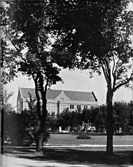
LAW BUILDING, UNIVERSITY, GRAND FORKS
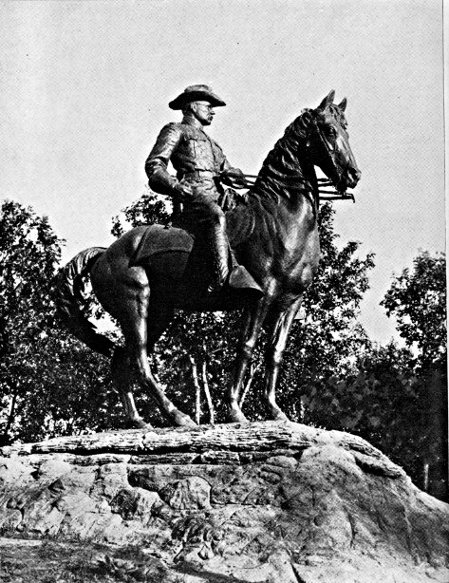
ROOSEVELT MONUMENT, MINOT
BARLOW, 124 m. (1,537 alt., 322 pop.), was named for its founder, F. G. Barlow, who as a member of the first North Dakota Legislature (1889) fought the Louisiana Lottery bill (see History).
CARRINGTON, 132.5 m. (1,579 alt., 1,717 pop.), is named for M. D. Carrington, who platted the city in 1882, and gave sites for the school, churches, and Foster County Courthouse. It has a 10,000-volume Municipal Library in the City Hall on Central Ave. and 1st St. N. On the western side of town is a landscaped and well-equipped tourist camp. Here is a junction with US 52 (see Tour 7), which unites with US 281 between this point and Jamestown.
MELVILLE, 142 m. (1,597 alt., 50 pop.), was originally laid out as New Port, but because of a disagreement over the price of the site the railway company moved the town one-half mile W. and called it Melville.
At EDMUNDS, 149 m. (1,594 alt., 100 pop.), is the junction with a graveled county road.
Left on this road to ARROWOOD LAKE, 6 m., the largest of the chain of three lakes through which the James River flows. Before white settlement the Indians came here from great distances to obtain Juneberry shoots for their arrow shafts. On the southeastern shore is a CCC Camp, and on the western shore the buildings of the Arrowood Migratory Refuge. This reserve is highly valued by the Biological Survey as a summer breeding ground, and is an important feeding place for pelicans.
PINGREE, 155 m. (1,547 alt., 266 pop.), was named for Hazen Senter Pingree, who, with a rack and wagon and a team of oxen, came to Dakota Territory in 1880 to start a potato plantation. His venture was a failure, so he went to Michigan, where he became an important shoe manufacturer, was made mayor of Detroit, and twice served as Governor of the State (1897-1900).
BUCHANAN, 163 m. (1,546 alt., 150 pop.), was named for its founder, James A. Buchanan, a prominent early settler.
South of Buchanan the route continues over rolling terrain toward the valley of the James River, a steep-sided, flat-bottomed trough, approximately a mile wide.
JAMESTOWN, 176 m. (1,405 alt., 8,187 pop.) (see Tour 8).
Points of Interest: Jamestown College, State Hospital for the Insane, Fort Seward State Park.
At 5th Ave. and 3rd St. is the junction with US 10 (see Tour 8).
The area L. of the route here was once the scene of one of those devastating prairie fires that terrorized and impoverished the early farmers of the Plains States. This blaze, which began Sept. 25, 1888, swept the entire region from near Jamestown to LaMoure.
"A heavy and smoke laden atmosphere and a sky streaked with a dull red reflection of burning grass proclaimed the fierce raging of prairie fires north, south and west of the city last night," reported the Jamestown Daily Alert.... "For at least 40 miles in width the fire burned off every vestige of grass unprotected by breaks. One could hardly recognize the charred land the next day. Thousands of bushels of grain were burned and many men lost all they had, grain, buildings and stock."
EDGELEY, 215 m. (1,565 alt., 821 pop.), was named by Richard Sykes, once owner of the site, for his former home in England. It is the meeting point of an N. P. Ry. branch line, a branch of the Milwaukee R. R., and the Midland main line.
From Edgeley to the South Dakota Line, the hills of the Missouri Plateau loom (R) in the distance.
At 237 m. is a junction with a graveled county road.
Left on this road to WHITESTONE HILL BATTLEFIELD STATE PARK, 16 m., where Gen. Alfred Sully and his command met a band of Sioux Indians on the evening of Sept. 3, 1863, in the most severe engagement fought on North Dakota soil since the coming of the white man. A granite monument 25 ft. in height, bearing the figure of a mounted cavalryman, has been erected about three-fourths of a mile NW. of the site of the battle. Reinterred about the base of the monument, each with an appropriate marker, are the remains of the soldiers who died here. Generals Sully and Sibley had been sent out from Minnesota to punish the Indians who had taken part in the Minnesota Massacre of 1862. Sully was to move up the Missouri, while Sibley marched W. across the country. When Sully, delayed by low water, arrived in the neighborhood of present Bismarck, where he was to meet Sibley, he found the latter had given up the idea of the proposed meeting and started on the return journey to Minnesota. He also discovered that the Sioux, who had fled over the Missouri upon Sibley's approach, had now recrossed to their old hunting grounds on the James River. He immediately set out in pursuit, and overtook them in a three-day march. The Indians retreated while the soldiers, on higher ground, poured in a murderous fire. Sully's casualties were 34 men wounded and 19 killed, while the Indian loss was estimated at 150. It is now believed that the Sioux encountered here did not take part in the Minnesota Massacre. The perpetrators of the massacre were known to have fled W., however, and it was natural for the soldiers to regard any Indians they met as enemies.
ELLENDALE, 248 m. (1,448 alt., 1,264 pop.), named for Ellen Dale Merrill, wife of a Milwaukee R. R. official, is the Dickey County seat. At the end of Main St. on the eastern edge of the trim little town, attractively arranged on a well-kept campus, are the six brick buildings of the State Normal and Industrial School, a teachers college and vocational institution. When it opened its doors in 1889 it offered the first free course in manual training in the United States.
At 253 m. US 281 crosses the South Dakota Line, 35 m. N. of Aberdeen, S. Dak. (see S. Dak. Tour 11).
TOUR 3
(Virden, Man., Can.)—Westhope—Minot—Washburn—Bismarck—Linton—(Pierre, S. Dak.). US 83.
Canadian boundary to South Dakota Line, 278.5 m.
Soo Ry. branch parallels route between Max and Bismarck, N. P. Ry. main line between Bismarck and Sterling, N. P. branch roughly parallels between Sterling and Linton, Milwaukee R. R. branch between Linton and Strasburg.
Graveled roadbed except for about 75 m. bituminous-surfaced.
Accommodations in principal towns.
South of the Canadian boundary US 83 follows a southwesterly course across the flat fertile bed of glacial Lake Souris, over the central Drift Prairie and the hilly upland of the Coteau du Plateau du Missouri, crossing the South Dakota Line near the center of the boundary.
Most of the area is diversified dry-farming country, where the emerald blades of young grain in summer blend with the green and blue of flax and the verdant stalks of growing corn. As the crops mature the chief tones of the landscape gradually change to amber and gold, until after harvest the fields are covered with tawny, violet-shadowed stubble, dotted with the dull taupe of Russian thistle. Along the Mouse River and the Missouri, the timberland is a vivid green in summer, and in autumn becomes a fantasy of fall color in which yellows, ochers, scarlets, and copper all strive for dominance.
US 83 crosses the Canadian border 8 m. S. of Coulter, Man., Canada. Here is a customhouse.
WESTHOPE, 6 m. (1,508 alt., 521 pop.), is a port of entry to Canada. It was named by an official of a G. N. Ry. town site company, who expected exceptional agricultural prosperity for the town. Far to the L., beyond the level prairie that is the bed of the great prehistoric lake, are the blue shadows outlining the Turtle Mountains (see Tour 5).
At 12.5 m. is the junction with ND 5 (see Tour 5), which unites with US 83 to 29.5 m.
MINOT, 66.5 m. (1,560 alt., 16,099 pop.) (see Minot).
Points of Interest: Minot State Teachers College, Roosevelt Park and Zoo.
At 2nd St. and 4th Ave. SW. is the junction with US 2 (see Tour 6) and US 52 (see Tour 7).
South of Minot the route is over level drift prairie, gradually rising to a ridge of hills at 85 m. This is the HEIGHT OF LAND, the northern rim of the Plateau du Missouri, which is the watershed between the Gulf of Mexico and Hudson Bay, and also marks the farthest advance of the last glacier. In addition to its geologic interest, the elevation commands a view northward almost to the Canadian border.
MAX, 96 m. (2,100 alt., 500 pop.), a Russo-German community, was named for the eldest son of an early settler.
At 109 m. is the junction with ND 37 (see Side Tour 3A).
COLEHARBOR, 118 m. (1,900 alt., 153 pop.), derives its name from the unsuccessful attempt to make this a river shipping point for lignite coal, which is mined in this vicinity.
UNDERWOOD, 126 m. (2,020 alt., 488 pop.), is the center of a large diversified farming area. The railway conductor for whom it was named, in appreciation of the honor, donated a bell to the school. The town has a circulating library, begun by a 72-year-old man, Edward Erickson, who bound newspaper and magazine stories into books. With these he began his collection, and by the time of his death in 1932 his work, together with donations, had resulted in a library of 8,000 volumes, most of them now available to the public at the office of the Underwood News.
WASHBURN, 143 m. (1,731 alt., 753 pop.), McLean County seat, on the eastern bank of the Missouri River, is named for Gen. W. D. Washburn of Minneapolis, who was instrumental in its development. One of the earliest Missouri boat landings was established at Washburn, and the town was an important trading post in pioneer days. Where the waterworks stand NW. of the city is the Site of a Sioux-Arikara Battle fought on May 22, 1869; it resulted in the death of Swift Runner, young Ree chieftain. On E. Main St. stands the Log Cabin of Joseph Henry Taylor (open by arrangement; inquire at Leader office), trapper, hunter, and author, who built the house near Painted Woods (see Side Tour 3B) in the early 1870's. He established a woodyard there, and also became the first postmaster of the settlement; the post office was a hole cut in the trunk of an oak tree. Taylor printed his books in his own shop, writing the stories as he set the type by hand. His books include Frontier and Indian Lives and Kaleidoscopic Lives, both reflecting the somewhat florid literary style of the time, but nevertheless giving a colorful and engrossing picture of the frontier of his day.
Right from W. Main St. in Washburn on a well-marked country road to FORT MANDAN STATE PARK, 14 m., site of Fort Mandan on the north bank of the big bend in the Missouri. Here the Lewis and Clark expedition spent the winter of 1804-5 with the friendly Mandan Indians. It was here that Sakakawea, or Bird Woman, a young Shoshone Indian girl, joined the expedition which she helped to guide to the Pacific (see Bismarck). Warring Sioux destroyed the buildings of the fort in 1805, and the ever changing river channel has altered the landscape so that it is impossible to identify the exact site (see Tour 10). Near the markers that have been erected are the trenches of unidentified expeditions.
At 150.5 m. is the junction with a county dirt road (see Side Tour 3B).
WILTON, 160 m. (2,152 alt., 1,001 pop.), named for Wilton, Maine, is on the McLean-Burleigh County line and is the center of a Ukrainian settlement. These people come from Galicia, a province of the former Austro-Hungarian Empire, and found work in the lignite mines which at that time were just opening here. One group arrived in 1897 and a second two years later. Many old customs are preserved, including folk dances performed in picturesque, brightly colored costumes by both old and young people. The Ukrainians are fond of flowers and their homes usually have beautiful gardens, in which they can be seen working in the early hours of summer days.
On opposite sides of the highway at the northern end of town are two unusual churches, both focal points of the Ukrainian settlement. SS. Peter and Paul Greek Catholic Church (R) has two steeples topped with fourchée crosses. It is of the Greco-Slavonic branch of the Greek Church. The Russian Orthodox Greek Catholic Church (L) belongs to the Russo-Greek branch; a cruciform building, it has three steeples, each bearing the Greek schismatic cross of papal design, symbolizing the Trinity, with the lowest member set obliquely to denote that the church does not recognize the authority of the Pope. Both churches use the Julian calendar and have similar services and holidays.
A bird-banding station established in Wilton in 1931 by Mrs. W. H. Gray under the U. S. Biological Survey banded 5,805 birds of 86 species in its first five years.
Left from Wilton via Main St. to the second largest LIGNITE STRIP MINE of the Truax-Traer Co., 2 m. Formerly one of the largest underground lignite mines in the world (see Tours 5 & 7), in 1934-35 it yielded 185,381 tons of coal.
BISMARCK, 184.5 m. (1,672 alt., 11,090 pop.) (see Bismarck).
Points of Interest: State Capitol, Liberty Memorial Building, State Historical Society Museum, Roosevelt Cabin.
At 6th St. and Main Ave. is the junction with US 10 (see Tour 8), which unites with US 83 between this point and STERLING, 209.5 m. (1,807 alt., 110 pop.).
MOFFIT, 219 m. (1,738 alt., 130 pop.), is on the west shore of Long Lake, now under development by the U. S. Biological Survey as a migratory waterfowl refuge. The town is named for the Moffit family, who were the first settlers.
As HAZELTON, 233 m. (1,975 alt., 446 pop.), is neared it has the appearance of an oil town, due to its numerous windmills which a forerunner of the modern high-pressure salesman succeeded in selling in the community. The town is named for Hazel Roop, the daughter of the town site owner.
South of Hazelton the route enters a Russo-German farming area. The odd, brilliant colors of some of the houses and farm buildings are characteristic of the taste of these people. Diagonal stripes of alternating bright colors form a favorite decorative scheme for barn and granary doors. Since the American influence has made itself felt, however, many gaily painted buildings have been dimmed by coats of conservative white or buff paint.
TEMVIK, 242.5 m. (1,925 alt., 75 pop.), is a small Russo-German settlement.
LINTON, 251 m. (1,706 alt., 1,192 pop.), was named for George W. Lynn, an early settler. Protected by high, flat-topped hills, the town is in a valley at the confluence of Beaver and Spring Creeks. The most prominent building in town is the Emmons County Courthouse, of modern design, constructed of North Dakota brick. Hand carving on the spandrels above the first floor windows depicts the story of progress in Emmons County. Several of the public buildings in Linton, including the hospital and the Episcopal church, are constructed of native sandstone quarried a short distance from the town. Seeman's Park (picnicking, swimming, camping) on Beaver Creek, named for L. D. Seeman, its donor, is a recreation and tourist camp.
Right from Linton on an improved county dirt road to the junction with an unimproved road, 0.5 m.; L. on this prairie road, unsuitable for trailers, to what appears to be an almost perfect specimen of an INDIAN TURTLE EFFIGY MOUND, 1.5 m. The road passes directly over the turtle's back, and from the top of the mound the outlines of the head to the E. and the tail to the W. are clearly visible.
STRASBURG, 262 m. (1,800 alt., 695 pop.), gets its typically German name from a German settlement in Russia whence many of its settlers came. It marks the dividing line between the Russo-German and Dutch settlements of this vicinity. Both racial groups make up the population of the town, which is the center of a large grain and dairy area. Rising from the compact little village is the double spire of the Roman Catholic church, which is attended by the largest rural Catholic congregation in the State. The feast day of SS. Peter and Paul (June 29) is an annual occasion for celebration.
South of Strasburg the route passes through territory settled by Hollanders, and the landscape is dotted with their neat, well-kept farms. Although many of them are American-born, the native tongue is retained in their homes. The Dutch Reformed Church forms the focal point in their communities; many of their children attend college at Holland, Mich., and members of the settlement annually go to Michigan for the Holland Tulip Festival.
HULL, 270.5 m. (1,800 alt., 50 pop.), is one of the Dutch communities, named for Hull, Iowa.
At 272.5 m. is the junction with ND 11, a graveled highway.
Left on this highway is HAGUE, 5 m. (1,899 alt., 125 pop.), named for The Hague in the Netherlands. In a level farming area, it is one of the market towns for the Dutch settlements, although its population is principally Russo-German. The Roman Catholic church is the outstanding building of the community.
US 83 crosses the North Dakota-South Dakota boundary at 278.5 m., 141 m. N. of Pierre, S. Dak. (see S. Dak. Tour 12).
SIDE TOUR 3A
Junction US 83—Garrison—Nishu—Elbowoods—Shell Creek—Van Hook—Stanley. ND 37 & 8, county and reservation roads.
Junction with US 83 to US 2, 117 m.
Dry-weather, dirt, reservation roads most of route. Gravel 28 m. W. of junction with US 83, and 28 m. between Van Hook and Stanley.
Limited accommodations on reservation.
ND 37, which runs through the Fort Berthold Indian Reservation, branches W. from US 83 (see Tour 3) midway between Max and Coleharbor.
GARRISON, 7 m. (1,920 alt., 1,024 pop.), named for nearby Garrison Creek, was formerly the center of a large wheat area, and is now a primary turkey market. Lignite is mined in the surrounding country.
At 20 m. is the junction with ND 28 and a county graveled highway. Straight ahead on the county highway to a small store and filling station, where is the junction with an unimproved dirt road, 29 m.; L. to enter the FORT BERTHOLD INDIAN RESERVATION at 33 m. Established in 1870 with an area of more than 2,000,000 acres, it has now been reduced to 625,000. The region is principally rugged and broken—typical Badlands, best suited for grazing, although the eastern portion of the reservation contains some good farming land. The population figures for 1936 list 600 Arikara, 711 Hidatsa, and 337 Mandans (although few of the latter are of pure blood), remnants of the three agricultural Indian tribes that once occupied the Missouri River Valley.
At 38 m. is the junction with a dirt road, not suitable for trailers.
Left on this road to the junction with another dirt road, 3 m.; R. on this road to another junction at 4 m.; L. to another junction at 5 m.; R. to a fence gate, 5.8 m.; R. through the gate, pass a small farmhouse to the SITE OF FORT BERTHOLD, 6 m. Above the river bottoms, overlooking a bend in the Missouri's course, are the ruins of a trading post built in 1845 by Bartholomew Berthold, a Tyrolese. He had traded in the river country for many years, and his success at this new fort named for him made it one of the most important Missouri River posts. Harassed by the warlike Sioux, the Hidatsa Indians left their village at the mouth of the Knife River and came to live at Fort Berthold, where, because of the bend in the river, they named their new home Like-a-fish-hook Village. The Mandan Indians later joined the Hidatsa at this site. From the first the history of Fort Berthold is a tale of many assaults by wandering parties of Sioux. In 1864 a portion of the second Sully expedition was sent to protect the outpost, and the following year Fort Berthold became a military post. It was garrisoned until 1867, when Fort Stevenson, 12 m. E., replaced it. The rough-hewn log buildings which Berthold and his men erected were later replaced by frame buildings, the dismantled remains and cellars of which are all that mark the site today.
The Graves of Son-of-the-Star and White Shield, famed Arikara chiefs, are marked by a cement monument about 250 yd. NW. of the fort site. Both chiefs were friendly to the white men and helped them in their conquest of the region. Son-of-the-Star was head of the Arikara tribe during the trying times with the Sioux in 1876, and through his reputation for gentleness and a lofty sense of justice stood high in the estimation of both red and white leaders. The two graves are sacred to the Arikara Indians.
A few yards SW. of the monument are the graves of more than 100 Indians of the reservation who served as scouts or enlisted as soldiers with the U. S. Army since the founding of the reservation in 1870. The white marble slabs marking the individual graves stand in precise rows as an army quietly at salute. Each Memorial Day the American Legion posts of Elbowoods (Indian) and Garrison (white) hold joint services here.
At 39 m. is the junction with a dirt road, rutted and winding; not suitable for trailers.
Left on this road to the MISSOURI RIVER, 2 m., known to the Mandans as Mata (division between two parts of land), and to the Hidatsa as Anati (navigable water filled with earth). A ferry (65c per car, 10c per person) crosses the river. Here in the area adjacent to the route live the Mandan Indians. Left to BEAVER CREEK STORE, 6 m., a tiny trading post known locally as Ree. Right to the JAMES HOLDING EAGLE FARM, 12 m., typical of the modern Mandan home, and far removed from the earth lodges used by the Indians a century ago.
About 200 ft. L. of the farm is a circular depression believed by the Mandans to be the SITE OF GRANDMOTHER'S LODGE. Grandmother, according to legend, is The-Woman-Who-Never-Dies. She built her home on the first bench of the river, and on the bottom land below planted her vast cornfield, which the deer and blackbirds helped her cultivate. She now lives in the moon, where prayers for favorable weather for crops are addressed to her.
Within the hollow of the lodge site is what appears to be an ordinary granite boulder. Beneath its edges are often found coins of large and small denominations, given as offerings for good crops. The Mandans say that many offerings are left by members of the Crow tribe of Montana, distantly related to the Hidatsa. It is told that an earth girl married the Man-From-the-Sky and went to live with him, but became homesick for the earth, and attempted to leave the sky on a cord of buffalo hide. Her husband discovered her hanging by the cord, and, angered by her infidelity, threw a boulder at her. The rock crushed her to earth, and today lies where it fell, in the circle of Grandmother's Lodge.
At 39.8 m. is NISHU (Arikara, arrow), community center of the Arikara (Ree) tribe. The few buildings of the community are scattered across the level land between the river lowlands and the hills to the N. Of particular interest is the circular log dance hall or Medicine Lodge. At the appropriate seasons of the year are held the ancient tribal ceremonies pertaining to the successful conduct of agricultural and personal pursuits. In front of the medicine lodge is the boulder which plays a prominent part in the annual cedar-tree ceremonial, a New Year ritual usually held sometime in August. The cedar and the boulder represent the Grandfather and Grandmother of the tribe, and the tree is left standing beside the boulder until spring, when it is decorated with children's moccasins and placed on the ice of the Missouri. When the ice goes out the tree is borne downstream, to carry greetings from the Arikara to their old village sites down the river. Other ceremonials of religious significance include the Mother Corn ritual, the sage dance of thanksgiving, and medicine ceremonies. Since they are seasonal, no set date can be given for these occasions (usually open to public). Arikara beadwork and other articles of handicraft are sometimes available at the store in Nishu.
At 40 m. the route turns R. and follows the only telephone line on the reservation. The steep rolling country is occupied mainly by the Arikara. Their farm homes are usually white frame buildings, although occasionally there is a poorer log house. There are few barns on these farms; the Indians seldom have milk cows, and they let their horses run on the range throughout the entire year.
At 54 m. is the junction with ND 8, a graded dirt road; straight ahead on this is SACRED HEART MISSION, 54.5 m., a Roman Catholic church and mission school established in 1889.
Left from the mission on a road lined with towering cottonwoods is ELBOWOODS, 0.5 m. (1,770 alt., 135 pop.), agency headquarters for the reservation. Its name is derived from the elbow bend of the timber belt along the Missouri at that point. The town centers about the square of agency lawn. Most of the population is white. The town was settled in 1891 when the agency was established. In addition to its regular governmental functions, the agency operates a non-profit flour mill and conducts an experimental farm to educate the Indians in modern agricultural methods. Despite this, many Indians lease their farming lands to white people. What is now the Government School was built in 1876 as the Congregational mission, the first on the reservation.
Just SW. of the town are the Indian Fairgrounds where three-day celebrations, with rodeos and tribal dances, are held each year (July or Aug.).
ND 8 at 55 m. passes SCATTER VILLAGE, a little group of filling stations and garages that grew up around the approach to the highway bridge across the Missouri.
At 56.5 m. is the junction (R) with a dirt reservation road, on which the route continues.
Left on ND 8 to FOUR BEARS BRIDGE, 1 m., the bridge with 19 names. When it was built, the Mandans wished it named for their chief Four Bears, subject of many paintings by the artist Catlin who visited this section more than a century ago. The Hidatsa wished it named for their chief Four Bears, who died a few years before the bridge was built. Because of these tribal jealousies it was decided to name the southern end of the bridge for the Mandan chief, and the northern end for the Hidatsa chief. At each end of the span is a plaque bearing the names of chiefs of both tribes given as associate titles to the bridge: for the Mandans there are Charging Eagle, Red Buffalo Cow, Flying Eagle, Black Eagle, and Waterchief; for the Hidatsa, Poor Wolf, Porcupine, Crow Paunch, Big Brave, Crow-Flies-High, Big Hawk, and Old Dog. This arrangement proved unsatisfactory to the Arikara, and a partial compromise was effected by adding the names of five of their chiefs, Bear Chief, Son-of-the-Star, White Shield, Peter Beauchamp, Sr., and Bobtail Bull, as associates.
The dirt reservation road proceeds NW. along the river lowlands, enters a reservation timber reserve at 60.5 m., and skirts the eastern wooded shore of the Missouri before rising again to the benchland. At 68 m. is a store and filling station. The route now passes through the area occupied by the Hidatsa, also known as the Minitari or Gros Ventres (Fr., big bellies). Their homes are much like those of the other two tribes. The Hidatsa and the Crow Indians of Montana at one time were a single tribe. During a period of want one winter in the eighteenth century, a buffalo was killed by the tribe, and the animal satisfactorily divided until they came to the stomach. The division of this organ led to a quarrel which split the group, and one faction moved W. and became the Crow tribe.
SHELL CREEK, 79 m., is the Hidatsa community center. A few stores, a dance hall, a handful of dwellings, and the central agency experimental farm make up the town.
At 82 m., N. of Shell Creek, is the reservation boundary.
North of the boundary is VAN HOOK, 89 m. (1,843 alt., 372 pop.), named for a teamster who served the railroad surveyors. It is one of the trade points adjacent to the reservation and has the only creamery in the vicinity, a $20,000 cooperative plant. Here is a junction with ND 8.
North of Van Hook on ND 8 is BELDEN, 104 m. (2,250 alt., 25 pop.), the center of a settlement of Finnish people who homesteaded here in 1903-4. The Finnish tongue is used in most of their homes, and they also have the sauna or steam bath without which no Finnish community is complete. The peculiar European three-cornered head scarf is still worn by many of the women. Most of the people have been naturalized and are greatly interested in political trends. About one-third of them are members of the United Farmers and Workers League of America, an organization professing communistic doctrines. The radical views and intensive political activity of these members of the community have earned it a reputation as the communistic center of North Dakota.
At 117 m. is the junction with US 2 at STANLEY (see Tour 6).
SIDE TOUR 3B
Junction US 83—Junction US 10. County dirt and graveled roads, "The River Road."
Junction with US 83 to junction with US 10, 35 m.
Dry-weather dirt road except for 6 m. gravel between 29 m. and US 10.
Drive carefully as route is hilly with many curves. Route parallels Missouri River.
The River Road between Washburn and Bismarck approximates the overland freighter trail established in the early 1870's between the end of the Northern Pacific Railway at Bismarck and Fort Buford near the mouth of the Yellowstone.
Lewis and Clark, when they came up the Missouri River on their history-making expedition in 1804-5, sent outriders along this side of the river. Along much the same route the freighter trail was established in 1873 when the Northern Pacific brought to Bismarck goods destined for Forts Stevenson, Berthold, and Buford, and this soon became the main-traveled highway for soldiers, traders, and later for ranchers and settlers. Today ruts cut into the prairie by heavily laden wagons, plodding ox teams, and flying hoofs of couriers' horses are still visible in many places along the road.
The route is one of the most attractive in the State as it follows the winding, wooded course of the Missouri where the high hills and buttes along the river's edge contrast with the green meadows and wooded lowlands of the river bottom. This region was once the home of three Missouri Valley Indian tribes—Mandan, Hidatsa, and Arikara—and the route passes three Mandan village sites.
The route branches W. from US 83 (see Tour 3) 10 m. N. of Wilton on a county dirt road.
At 2 m. is the junction with a dirt road.
Right on this road to WILDWOOD LAKE, 1 m., in an old channel of the Missouri. The permanent summer camp of the Missouri Valley Area Council, Boy Scouts of America, is on the eastern shore of the lake.
At 13 m. a large farmhouse and a decrepit log hut with a sod roof (L) mark the site of Painted Woods Post Office, one of the early Missouri River settlements. Between the old post office and the river are the PAINTED WOODS, so named by the Indians. According to legend, the woods were a neutral ground between hostile tribes until a Mandan girl fell in love with a Yanktonai Sioux warrior. She planned to leave her people and go with him, but her kinsmen slew him in her embrace; as she knelt by his bier, avenging Yanktonai arrows pierced her. The two tribes began a bitter warfare. The bodies of the lovers were placed in the branches of a tree in the woods, and the tree soon withered and became white and bleached, like the bones in its branches. Yanktonai warriors, coming to the woods to paint their faces and prepare for battle, boastfully portrayed their victories on the tree, and in retaliation the Mandans painted the surrounding trees with war paint to mock their enemy.
At 19 m. is the junction with a dirt road.
Right on this road to HALF MOON MANDAN INDIAN VILLAGE SITE (also known as the Larson site), 1 m., unusual in that a ditch, still visible, apparently divided the site in two parts and yet offered no means of defense. A sunken area in the site may have been the village square, and the circular hollows of the earth lodges are still visible in some places despite cultivation of the vicinity.
SQUARE BUTTES, early landmarks, raise their flat-topped heights across the river near the Larson site, and dominate the landscape for the next 10 m. Their odd beauty, contrasting with the graceful slopes of surrounding hills, has appealed to both red men and white. George Catlin, the artist and explorer who spent eight years in this region more than a century ago, painted a good oil of the Square Buttes.
At 22 m. is the junction with a trail (L).
Up the steep bluffs here to DOUBLE DITCH INDIAN VILLAGE STATE PARK. Archeologically designated as the Burgois site, it is also known to the Indians as the ancient Village of Yellow Clay. The inner ditch of the two from which the site receives its name is still traceable in its entire course. The journals of the early French explorer, Verendrye, tell that the village was surrounded by a rampart and protected by an 18-foot palisade and a ditch 18 ft. wide and 15 ft, deep. The cup-shaped depressions of the earth lodges, still visible, are as large as 40 ft. in diameter. Excavations made here by the Peabody Museum, Harvard University, disclosed fine specimens of agricultural implements, religious pieces, and artifacts of warfare. Positions of human skeletons found in the excavations indicate that shallow burial was the custom of the Mandans occupying the site.
At 33 m. the River Road passes through PIONEER PARK. On the flood plain of the Missouri, between Burnt Creek and the road, a picnic and camp ground (rustic shelters, tables, benches, chairs) has been built among the towering cottonwood trees.
At 33 m. is a junction with a winding gravel road.
Left on this road to the top of the sheer bluffs to LOOKING VILLAGE, 0.5 m., Mandan site named for Chief Looking. Now part of Pioneer Park, the village is known as the Ward site, and several of the earth lodges have been reconstructed under a CCC project. The natural defenses of this village were exceptional. On a level, circular summit almost completely cut off from the surrounding benchland, its eastern side was well protected by a ditch, still visible, and a wall. To the N., where the hill is less steep, a ditch and wall were also means of protection.
Built-in log steps and a graded path lead up a round knoll overlooking the river. On the western slope of this formation is a large granite boulder believed to be a petroglyph, or picture rock, of some religious significance. Close observation of the rock will reveal many small, round impressions that may be a form of rock-writing known as cup sculpture. From this point, and from the parking spaces near the Indian village site, is a beautiful view up and down the Missouri.
At 34 m., almost in the long shadows of the railroad bridge, Burnt Creek drains into the Missouri. A story related by Joseph Henry Taylor in his writings tells that, in the summer of 1863, 24 white people, including a woman, a small girl, and a baby, were killed here by the Sioux, and nearly $90,000 in gold dust strewn on the banks of the river. The white people had spent the winter mining at Bannock, Mont., and were returning east with their gold carried in belts and hidden in holes drilled in their flat-bottomed mackinaw boat. Stopping at Fort Berthold on their journey down the Missouri, they were warned by the trader, F. F. Gerard, that it was unsafe to continue until a large group was ready to make the trip through the territory occupied by the hostile Sioux. Thinking Gerard only wished to sell them supplies at high prices, the party disregarded his advice. This was shortly after General Sibley had pursued the Sioux across the Missouri. The Indians, however, following the departure of the military forces, had returned to the east side of the river, as game was more plentiful there, and a party was camped on Burnt Creek. The ever changing Missouri had cut a long sand bar near the creek mouth, forming a narrow, shallow channel between the shore and mid-river. On this bar an old Sisseton was fishing as the white men's boat floated into sight. In a gesture of friendliness the old man waved the boat away from the shallow channel, but his motion was mistaken for a signal, and the white men shot him. Indian women bathing at the river's edge ran screaming to their camp, bringing the warriors. The party of whites had a small cannon on board, and with it killed many of the Indians. The recoil of the cannon fire, however, sank the boat in the shallow water, and after the leader of the white party had been shot the Sioux swarmed on board and disposed of the others. They found the gold dust, but, thinking it only yellow clay, scattered it on the sands. It was several days later that Gerard heard of the massacre and sent a party of 10 Mandans, headed by his brother-in-law Whistling Bear, to recover the gold. They scooped up approximately $70,000 worth in a coffeepot found in the boat, for which Gerard gave a fine horse and a few small presents to Whistling Bear, and a feast to his helpers. The gold thought to be hidden in the hull of the boat was never recovered, although several attempts were made by fortune hunters in later years.
At 35 m. is the junction with US 10 (see Tour 8) just L. of Liberty Memorial Bridge, 1 m. W. of Bismarck (see Bismarck).
TOUR 4
(Moosejaw, Sask., Can.)—Ambrose—Belfield—Amidon—Bowman—(Belle Fourche, S. Dak.). US 85.
Canadian boundary to South Dakota Line, 264.5 m.
G. N. Ry. branch line roughly parallels route between Alexander and Watford City.