HIGHWAYS AND TRAILS (continued 3)
Reading edition
LEEDS, 135 m. (1,514 alt., 725 pop.), with a predominantly Scandinavian population, was established in 1884. It has paved streets and a park (swimming pool). Because many stockholders in the G. N. Ry. were Englishmen, several of the towns along the railroad, including Leeds, were given names of English towns. One of the first newspapers in this region, the Leeds News, founded in 1903, boosting the new community in the customary manner, lauded it with this characteristic humor: "A man died and entered heaven. On his first walk about his new abode he noticed several men fettered in ball and chain. His inquiry of a passer-by brought the reply, 'They came from Leeds, N. Dak., and if they weren't chained they'd go back.'"
Left from Leeds on a county dirt road to LAKE IBSEN, 2 m., named for Henrik Ibsen, Norwegian poet and dramatist. It is said that about 1858 a peace agreement between the Sioux and Chippewa Indians was made at this lake, a treaty well observed by both tribes. Small islands in the lake were known to explorers of the region as Petites Isles Aux Mortes (Fr., small islands of the dead), owing to the fact that the Indians had buried many victims of a devastating smallpox epidemic here. They placed their dead on scaffolds, the wooden frames of which were visible from the lake shores.
YORK, 142.5 m. (1,612 alt., 250 pop.), is another town with an English name and a predominantly Scandinavian population.
KNOX, 150 m. (1,605 alt., 177 pop.), is named for John Knox, the Scottish religious reformer.
PLEASANT LAKE (good camping, tourist accommodations, spring water), 155 m., is a small tree-fringed body of water which was called Broken Bones Lake by the Indians who camped on its shores to dry their buffalo meats. They broke the buffalo bones to remove the marrow, which they sewed into sacks of skin and preserved for winter use. Evidences of an Indian burial ground are found on a hill to the N. These burials are not in mounds, and the only excavations are those made accidentally by farmers plowing the land.
At 156 m. is the railway station of PLEASANT LAKE (1,603 alt., 33 pop.), where tribal dances were performed on the town site by a group of Indians as recently as 1883. Some of the settlers feared that the ritual was a war dance, but the Indians did no harm.
At 163.5 m. is the junction with ND 3, a graveled highway. At this crossroads is a stone cairn marking the GEOGRAPHIC CENTER OF NORTH AMERICA. In 1931 the U. S, Geological Survey determined that the geographic center of the continent is in Pierce County, N. Dak., and the marker at the highway junction is in the approximate center of the county. The survey states, "The geographic center of an area may be defined as that point on which the surface of the area would balance if it were a plane of uniform thickness, or in other words, the center of gravity of the surface.... It would not be feasible, therefore, to specify for such a large irregular area as that of North America the exact section, township and range in which the geographic center lies." Some years before 1931 Pierre, S. Dak., claimed to be the approximate center of the continent, based on the fact that two lines drawn from corner to corner of a map of North America intersected near Pierre.
Right on ND 3 is RUGBY, 1 m. (1,562 alt., 1,512 pop.), Pierce County seat, named for Rugby, England. It was platted in July 1885 and the first train arrived a month later. In the City Hall is a museum (open weekdays, 9-5) containing, among other things, Indian artifacts found in the county and Spanish-American War relics. Ellery Park and the tourist camp are in the western part of town. Rugby was the home of the late N. P. Lindberg, who is said to have originated the slogan, Say It With Flowers. It is said that in the course of a talk made at a national florists' convention in Chicago he remarked, "In North Dakota we say it with flowers." His words caught the fancy of his fellow delegates, who adopted them as a slogan. His florist shop and greenhouse, now operated by a son-in-law, are in the eastern part of town.
TUNBRIDGE, 168.5 m. (1,509 alt., 15 pop.), and BERWICK, 174.5 m. (1,484 alt., 100 pop.), are small hamlets R. of the route. Although the latter town has a name of English origin, the Berwick Post, which suspended publication several years ago, was published partly in German for the large community of Russo-Germans living S. of the town.
TOWNER, 183 m. (1,478 alt., 622 pop.), named for Col. O. M. Towner, one of the first ranchers in McHenry County, is the county seat. It lies in a bend of the SOURIS (Fr., mouse) RIVER, so named by French explorers for the numerous field mice found in the river basin. The river itself lies on a level plain that was at one time the bed of glacial Lake Souris, of which the stream is now the only remnant. Fully three-fourths of McHenry County is on this plain, once principally cattle country, now devoted to diversified farming.
During ranching days in the 1880's the country was a rough frontier populated by an odd assortment of personalities. Among these were two English peers, each of whom acquired a ranch near Towner, built a large home, and settled down to the serious business of living lavishly on remittances from home. The community was excited when one of the men had a visit from his sister, a countess prominent in women's suffrage work in the British Isles, who arrived on a special train. The other exile also had a caller from home, an elderly woman who arrived unexpectedly to find him occupied with the entertainment of a houseful of guests. She departed without seeing him or even getting out of her carriage. Not long afterwards both Englishmen took their leave.
Towner is the junction with ND 14, a graveled highway, which unites with US 2 between this point and 188 m.
1. Left from Towner on a graveled county road to the SCHULTZ HEREFORD RANCH, 1.8 m., where registered Hereford cattle and Belgian horses are bred. Situated on the timber-flanked banks of the Mouse, the ranch has an air of early-day friendliness. Its huge barns and corrals reflect the large-scale ranching of pioneer days joined with the efficiency of a modern business—a combination typical of the present-day stock raising industry in the State.
2. Right (N) from Towner on a graveled county road to a GOVERNMENT NURSERY, 1.5 m., where experimental work in connection with the shelterbelt project is conducted.
3. Right from Towner on ND 14 is BANTRY, 14 m. (1,469 alt., 150 pop.). Left from Bantry on ND 17, a graveled highway, to the LONG TURKEY RANCH, 20.5 m. At the age of six weeks the young turkeys are sent out on the 320-acre range in flocks of 700, and attain their full bone growth during the summer months. A few weeks before fall marketing the flocks are driven in to the ranch and the birds confined in large pens where they are fattened for market. More than 2,000 turkeys are shipped from the Long ranch annually.
At 188 m. is a junction with ND 14.
Left on this graveled highway to the junction with a dirt road, 1.5 m.; R. here to the EATON DAM, 3.3 m., which irrigates 6,800 acres of meadowland. This water adds to the productivity of the heavy native grasses from which many hundreds of tons of hay are cut each year. At the close of the haying season the river bottoms are dotted with hundreds of small, mound-like haystacks resembling huge grain shocks in a field of giant wheat. In the time between haying and fall the grasses attain a second growth, and cover the meadowlands around the stacks with a luxurious green carpet that contrasts with the dingy brown of the autumnal stubblefields through which the Souris courses.
At 196.5 m. (L) are the DENBIGH REFORESTATION PROJECT HEADQUARTERS. The feasibility of growing trees in poor, sandy soil and semiarid climate is being tested on a 640-acre tract by the Northern Plains branch of the Lake States Forest Experimental Station. The results secured will serve as a guide for work in similar areas of other States.
GRANVILLE, 207 m. (1,513 alt., 450 pop.), named for Granville M. Dodge, G. N. Ry. civil engineer, is in a level agricultural area W. of the sand hills bordering the Mouse River. A condition common in homesteading days drew this worried comment from the Granville Record in 1904: "It is a great wonder this country has advanced and is developing as rapidly as it is with so many old bachelors who do not improve their places and so many old maids holding down claims. It ought to cause a blush of shame to mount the face of every bald-headed old bachelor in the vicinity."
At 216 m. is NORWICH (1,529 alt., 100 pop.), named by the G. N. Ry. town site company for an English town.
West of SURREY, 222.5 m. (1,627 alt., 125 pop.), the route begins the gradual descent to a second crossing of the Mouse River. In the distance to the W. and S. of the river, the hills rise to the Missouri Plateau.
MINOT, 230.5 m. (1,557 alt., 16,099 pop.) (see Minot).
Points of Interest: Minot State Teachers College, Roosevelt Park and Zoo.
At Valley St. and 4th Ave. SE. is the junction with US 52 (see Tour 7), which unites with US 2 at 236.5 m. At 4th Ave. and 2nd St. SW. is the junction with US 83 (see Tour 3).
Just W. of Minot is the (L) HIGH STEEL TRESTLE (120 ft.) of the G. N. Ry., spanning Gassman Coulee. Early one morning in the 1880's a high wind blew down the wooden bridge which then stood here, and only the quick work of an engineer prevented an entire train from plunging into the deep coulee.
At 236.5 m. is the junction with US 52 (see Tour 7). A large tourist camp is L. The highway here makes an abrupt ascent to the level Missouri Plateau.
All towns along the route W. of Minot are populated principally by Scandinavians.
DES LACS, 245.5 m. (1,932 alt., 205 pop.), is named for Des Lacs River and Lake (see Tour 7). The little town received publicity in 1922 when it elected a complete ticket of women officials. One eastern newspaper wrote a glowing description of a campaign torchlight parade around the city hall and told of the enthusiasm which the men of the town felt over the winning ticket; but a writer for a women's magazine, sent out to look over the situation, was forced to report that there was no city hall, and that "the men were not so enthusiastic now, perhaps because they did not like to have their own backyards cleaned up."
LONETREE, 249.5 m. (2,002 alt., 36 pop.), was named by the railroad company for the one tree that was there when the rails were laid. This little town figured prominently in the Burlington-Minot battle for the seat of "Imperial Ward" County in 1888, turning the election for Minot (see Minot).
BERTHOLD, 253.5 m. (2,089 alt., 511 pop.), is the center of a certified seed potato raising area. In the late 1880's it was the nearest railhead to Fort Berthold on the Indian reservation to the S., hence its name.
At 262 m. the terrain becomes more rolling and from here to the Missouri River the route traverses the ALTAMONT MORAINE, a range of hills lying on the eastern portion of the Missouri Plateau, and marking the farthest advance of the western lobe of the last or Dakota Glacier.
TAGUS, 265 m. (2,189 alt., 136 pop.), was named for a rancher named Taguson.
Left from Tagus on an unimproved dirt road to CARPENTER LAKE (swimming), 6 m.
BLAISDELL (L), 273 m. (2,264 alt., 100 pop.), was named for Alfred Blaisdell, a settler who later became secretary of state of North Dakota.
PALERMO (L), 280.5 m. (2,201 alt., 205 pop.), is the namesake of a city in Sicily.
Right from Palermo in the rolling hills of the glacial moraine N. and E. of the town are several small lakes containing heavy deposits of sodium sulphate (see Side Tour 4A).
STANLEY, 288 m. (2,253 alt., 936 pop.), is named for one of the first homesteaders in the area. The Mountrail County Courthouse (R), topped by a cupola, is at the northern end of town. Stanley is on a nearly level plateau, while both to the N. and to the S. the terrain is more rolling. There is a junction here with ND 8, a graveled highway (see Side Tour 3A). In 1906 the Stanley Sun, a usually conservative newspaper, joined other papers in the State in telling of the wonderful fertility of North Dakota soil: "... the most productive soil on earth, insomuch that if you stick a nail in the ground at night, it will grow into a crowbar before morning."
ROSS, 296.5 m. (2,292 alt., 108 pop.), was named by the railway company. In 1902 a group of 20 Moslem families from Damascus, Syria, filed on homesteads SE. of Ross, and since 1909, when the Federal Government withdrew its objection to their naturalization, many of them have become citizens. They are Americanized in dress, although the women have a penchant for highly colored clothes. Many Old Country foods are still used; one Syrian dish especially well-liked consists of durum wheat boiled, sun-dried, ground, and screened, and stewed with meats and vegetables or sweet oils. The dried grain is ground in a large horse-powered machine resembling a coffee mill.
In 1929 this colony built a basement mosque, and each Friday a member of the congregation conducts services. Each person carefully washes his hands and feet before entering the temple; the sexes are segregated during prayer. During Ramadan—the ninth month according to the Mohammedan calendar, which is lunar—the people fast for 30 days, taking food only after dark; the month ends with a feast. The wedding ceremony of the group is unusual, for the bride is not present. Before the wedding she selects two witnesses to act in her behalf, who state the amount of money to be exchanged between the bridegroom and her parents—the bridegroom gives the parents this amount and they return the same amount to him. During the wedding ceremony the bride retires to another room; the father places his hand in that of the bridegroom, a large kerchief is placed over the clasped hands, and a member of the congregation reads the service. It is a custom of these people to shake hands at any chance meeting, no matter how recently they have met.
At 298.5 m. is the junction with a graveled road.
Left on this road is SANISH (Arikaran, real people), 23 m. (1,820 alt., 463 pop.), lying in a valley between bluffs bordering the eastern bank of the Missouri River. Spanning the Missouri here is the Verendrye Bridge, completed in 1927, the third highway bridge built across the river in the State. The site was known to the Indians from the earliest times as the Old Crossing because it was used as a ford by the large buffalo herds in their annual migrations. Adjoining Sanish on the S. is VERENDRYE NATIONAL MONUMENT, in which is Crow Flies High Butte, named for an Hidatsa Indian chieftain. On this butte is a monument dedicated to the Verendryes, who are believed to have visited one of the agricultural Indian tribes here on their exploratory trip into present North Dakota in 1738. The site discovered near Menoken in 1936, however, may be more definitely established as the village they visited (see Tour 8).
MANITOU (Chippewa, the Great Spirit), 302.5 m. (2,282 alt., 24 pop.), founded when the G. N. Ry. built through the territory in 1887, today consists of only a consolidated school, a store, and an elevator.
WHITE EARTH, 310.5 m. (2,099 alt., 240 pop.), founded in 1891, probably was named for the fine, white, clayey sand which has washed down into the White Earth River valley. It overlies the Laramie formation, which is exposed in many places on the sides of the valley, 150 ft. deep here. While diversified farming predominates in the vicinity, traces of the old West are still found on a few small ranches along the White Earth River between the route and the Missouri River to the S.
TIOGA (Iroquois, beautiful valley), 321.5 m. (2,241 alt., 435 pop.), was founded in 1902.
RAY, 335 m. (2,271 alt., 621 pop.), named for Al G. Ray, chief special agent for the G. N. Ry. when the town was established in 1902, is scattered on level land along the railroad right-of-way. It was one of the first towns in the United States to adopt a commission form of city government (1910).
1. Right from Ray on a graveled county road to the WILLIAM SIMPSON FARM HOME, 8 m., where there is an unusual Collection (open) of South African oddities, collected by Simpson, a Scotchman, who during several years there obtained animal skins, beads, heads, and horns from the natives.
2. Left from Ray on a dirt graded county highway to the junction with another road, 10 m.; L. here to the first Well and Derrick of the Big Viking Oil Company, on the Nesson Flats, 17 m., a level bench just above the Missouri River opposite the mouth of TOBACCO GARDEN CREEK (see Tour 10). Interest in a prospective oil field here led to a 40-day $25,000 survey and the expenditure of $195,000 in test well drilling by the Standard Oil Company of California in 1937. More than 200,000 acres in oil leases were taken up in the vicinity, and the company plans (1938) to expend another $200,000 before completing the test drilling.
Opposite Nesson Flats near the mouth of Tobacco Garden Creek an attack upon a river steamer was made by a Sioux war party July 7, 1863. The Sioux, goaded to hostility by repeated violations of treaties and corrupt handling of annuity goods by governmental agencies, had met the Robert Campbell at Fort Pierre, S. Dak., to ask for the goods due them. When Samuel M. Latta, Indian agent in charge of distribution of the boat's cargo—a newcomer in the Indian service, arrogant and none too scrupulous—withheld one-third of the goods, the Indians vowed to follow the boat up the river to Fort Benton, its destination. For 600 miles they harassed the steamer, pouring shots into it at every vantage point, attacking the crew at each woodyard, and making life miserable for all on board.
At that time the river at the mouth of Tobacco Garden Creek was quite narrow, and the Indians chose this spot for a massed attack. Joseph LaBarge, captain of the Robert Campbell, realizing the hazards of steaming through this point, made his boat fast to the opposite bank to prepare for a parley. The Sioux sent word that they wanted no trouble, only the annuity goods due them. Latta, however, refused to give up the goods, and suggested sending a yawl ashore to negotiate with the Indians. The Sioux consented, provided Latta came ashore. He, in turn, agreed to go, but when the yawl was ready he became conveniently ill in his cabin.
The yawl went ashore and had hardly landed when the Indians, angered by Latta's perfidy, attacked the crew. Three were killed and another wounded before the crew of the steamer opened fire, killing 18 Indians and 20 horses. The slain white men were buried next day on a bluff opposite the mouth of the Little Muddy Creek, where the city of Williston now stands (see below).
WHEELOCK, 342 m. (2,387 alt., 115 pop.), named for Ralph W. Wheelock, an editorial writer on the Minneapolis (Minn.) Tribune in the early 1900's, is the highest point of elevation on the G. N. Ry. in North Dakota.
Left from Wheelock on an improved dirt road to the junction with an unimproved dirt road, 5 m.; L. here 3 m. to HUNGRY GULCH, a pleasant ravine on Tobacco Garden Creek. From the base of one hill bubbles a spring of clear water, and level areas under clumps of trees invite picnic spreads on the banks of the creek. Along the stream is a deposit of "fool's gold", or pyrite, which in 1902 had gold prospectors agog in anticipation of wealth. The story is told that, in the rush to stake claims here, James Moorman, on whose land the "strike" was made, was the only person to benefit. He made a substantial profit selling the hungry prospectors his small stock of flour, in the form of pancakes, at exorbitant prices. When the supply was exhausted and appetites still were not satisfied, Moorman told them he would peel bark from the trees for them to eat. The ravine has since been known as Hungry Gulch.
South of the junction with unimproved road to SEVEN MILE HILL, 7 m., a large, fairly level elevation over which passed the old trail used by fur traders, soldiers, and travelers between Bismarck and Williston. Blue Buttes, prominent peaks in the Badlands across the Missouri, are visible in the SE. on a clear day; N. and E. is an expanse of prairie; and to the S. and W. the Missouri, with its wooded banks and lowlands, winds to the horizon. Near the foot of the hill is Cusac Springs Farm (R), where a skirmish apparently unrecorded in military annals—possibly between Indians and soldiers—took place near a spring. Rifle pits are still visible, and rifle shells and human bones have been found in them.
EPPING, 348.5 m. (2,224 alt., 183 pop.), named for Epping, in England, lies on the southern slope of one of the many rolling hills of the prairie.
Left from Epping on a graveled county road, formerly US 2, to the EPPING-SPRINGBROOK DAM, 5 m., largest earthfill dam in the State. Constructed as an FERA and WPA project, it was completed in 1936. This bulwark on Stony Creek has created a lake covering 180 acres, which, including a strip of land around the water, will be made into a State park devoted entirely to recreation. A six-inch pipe will make a flow of water available for a limited amount of irrigation below the dam.
At 358 m. the tableland of the Missouri Plateau comes to an abrupt end, and the highway descends into the valley of LITTLE MUDDY CREEK. From the top of the hill leading into this valley there is a panorama of level land dotted with farmhouses, and in the distance to the L. are the Missouri River and Williston.
At 359 m. is the junction with an unimproved private road.
Right on this road to the OASIS GARDENS, 0.5 m., a private truck farm where irrigation has been successfully employed.
At 361 m. is the junction with US 85 (see Tour 4), a graveled highway. US 2 and 85 are one route to 375.5 m.
At 367.5 m. is the junction with a graveled driveway.
Left on this driveway to the twin artificial lakes known as LAKE MINNEKOSH (Sioux, twin waters), 0.3 m. These lakes, built under a Federal project, are formed by dammed springs (sand beaches, diving towers, bathing houses).
WILLISTON, 370.5 m. (1,861 alt., 5,106 pop.), was named by James J. Hill, builder and first president of the G. N. Ry., for his friend S. Willis James of New York City, who was one of the stockholders in the company. The James Memorial Library, cor. 1st Ave. W. and 7th St., is a gift of the James family.
A large residential district and an active business section form the city, which is Williams County seat and the trade center for a large agricultural area in northwestern North Dakota and northeastern Montana. It lies on a gravelly terrace between the lowlands of the Missouri River and the hills and prairies. The river, which at one time flowed at the foot of Main St. and now has cut its channel nearly a mile to the S., has played a prominent part in the history of the locality. Up it came Lewis and Clark in 1805 on their historic expedition to the Pacific coast. In 1832 the Yellowstone, first steamboat to navigate the upper Missouri, passed the site, and by 1860 several boats were plying the stream. For 20 years after the gold strike in Montana in 1863 and 1864 the river was the major channel of communication to the Northwest.
The first white settler in the vicinity was Robert Matthews, employed by the post traders at Fort Buford to cut hay for the cavalry horses. In the 1870's he established himself some distance below the present town, near where Stony Creek flows into the Little Muddy. Here he kept a stock of goods for sale, and often hired crews of woodcutters to supply the demand for fuel for the steamboats. A post office known as Little Muddy was established on his ranch.
Although Matthews was the first permanent settler in the immediate Williston area, the first white man to settle in Williams County outside a trading or military post was George Grinnell. Born in Maryland, he served as a spy for Gen. Philip H. Sheridan in the Army of the Potomac, was honorably discharged, and in 1865 accompanied a military wagon train from Fort Snelling, Minn., to Fort Berthold. The next year found him established as a "woodhawk", furnishing fuel to the steamboats, near the mouth of Dry Fork Creek, where he operated a sawmill until advised that he was on Government property. Part of each year he hunted along the Missouri, and for a time in 1875 was with a party of gold seekers in the Musselshell country of Montana.
It was common practice of the period for hunters, traders, or trappers to select a "woman of convenience" from among the Indians. In many instances these women were mistreated and even held in contempt by the very men who took them from their tribes. Grinnell was one of these men. In his earlier days along the Missouri he lived with a pure-blooded Indian woman, later discarding her for an educated and talented half-breed, Josephine Manuri. One bitter cold winter day Josephine's small son had wandered from the house and been lost. Several men were ready to search for the youngster but Grinnell, wishing to show his contempt for his wife, threatened to kill the first man to go after him. In the group was George Newton, buffalo hunter and pioneer Williston businessman, who replied, "Then you've got me to kill," and went out and brought the child back to his mother.
One day in 1888, coming from his saloon where he had been drinking heavily, Grinnell began to abuse his wife, who ran from him to a nearby field where several men were plowing. Too drunk to pursue her on foot, he mounted his horse and followed her to the field where, in an attempt to strike her with the butt of his pistol, he fell from his horse, carrying his wife down with him. The two struggled for several minutes, none of the bystanders daring to interfere for fear of his gun. Suddenly Grinnell relaxed and lay quiet. He was in the habit of wearing around his neck a long leather watch thong with a sliding knot, and in the struggle his wife had clung to this thong and strangled him. After ascertaining that Grinnell was dead one of the onlookers remarked, "Let's go get a drink," and they all retired to his saloon, leaving the body as it was. Later a coroner's jury at Williston absolved the woman of all blame in the death of her husband with the unique verdict that Grinnell "... came to his death through an act of Almighty God, by the hand of His agent, Josephine Grinnell."
With the coming of the railroad Williston was moved to higher ground farther W. It was only a tent colony and a few log cabins when the rails were laid into it in 1887, and it was said to have had a saloon on each corner of its one business block, with seven or eight others between. The late Joseph Stroud, pioneer Williston merchant, related that on the occasion of his first visit to the new town he was attracted by a large crowd of men on the street, engaged in rolling a man over a barrel. Inquiring of a bystander as to the cause of the man's accident, he was informed that the victim had taken a drink of water by mistake.
By 1900 a steady influx of homesteaders into the Williston area had begun, and by 1910 the most desirable lands in the surrounding territory had been settled. Williston's population of 5,000, which has fluctuated little in the last 20 years, was attained by 1915.
An important factor in the rapid growth of the city was the location here of the division headquarters of the G. N. Ry. The roundhouse, car repair shop, and huge ice house require the services of a large force of men. The railroad stockyards E. of the city accommodate 93 carloads of livestock, and have loading equipment for 23 cars; many trainloads, of western sheep and cattle are fed in transit annually. On several occasions a million bushels of grain have been handled at Williston in a year. The city is an important primary turkey market, and thousands of birds are shipped to holiday markets each year.
The Farmers Educational and Cooperative Union of America has entitled Williston the Cooperative City of North Dakota. The Farmers Union Cooperative Creamery, rated as the largest enterprise of its kind in the State, has its modern plant on W. Broadway. On W. 2nd St. (US 2 and 85) is the Farmers Union Oil Co. Plant, which maintains a wholesale department for oils, tires, and binder twine, and has a tractor and farm machinery repair division. On W. 1st St. is the Farmers National Warehouse Corp. Building, a concrete elevator with 217,000 bu. capacity, said to be the largest cooperatively owned primary grain warehouse in the United States. Newest of the cooperatives is the Poultry Plant on W. 2nd St. at the outskirts of the city.
In Recreation Park, between 2nd and 3rd Aves. W. and 4th and 5th Sts. W., are playground facilities, a bandstand, and a number of cages of wild animals and birds; the larger animals are kept in Westlawn Park, in the northwestern part of the city. Harmon Field (baseball diamond, football gridiron, cinder track, swimming pool), at the northern end of Main St., was built under the Civil Works Administration. Two annual events in Williston are the Old Fiddlers Contest (Jan.), and the Upper Missouri Band Tournament (1st wk. in June).
Left from Williston on E. Broadway on a graveled Scenic Highway, following the route of the old overland trail between Bismarck and Fort Buford (see Side Tour 3B), to the junction with a graded dirt highway at 2.5 m.; R. here across CRAZY MAN'S COULEE, 3 m. One day in the early 1880's Robert Matthews (see above), the first settler in the region, was seated on the steps of his ranch house just W. of the ravine when he saw a man, dressed in skins and with hair falling to his shoulders, come out of the thickets in the coulee. Matthews knew that no one lived in the country for miles around, and was interested in learning his identity. When the man saw the ranch buildings, however, he started away, broke into a run, and disappeared into the brush along the creek running through the ravine. About a year later a man similarly dressed, perhaps the same person, came out of the brush and repeated the performance of the previous year. Matthews remarked to his wife, "That is surely Crazy Man's Coulee over there. That's the second wild man who has come out of it."
Left from Crazy Man's Coulee 1.5 m. on an unimproved dirt road to MEDICINE LODGE SPRING (R), in the coulee farther to the E. An early homesteader bottled and sold the mineral water of the spring. However, the Indians had discovered its health-giving qualities many years before, and used to come long distances to camp here. One of their favorite camping places was MEDICINE LODGE HILL, visible about 1 m. N. of the spring, from whose height signal fires could be seen in all directions, and from which game or enemies could easily be sighted. Atop the hill are traces of Indian rings.
Southeast from Crazy Man's Coulee on the Scenic Highway to a junction at 5.5 m.; L. to 11.5 m.; R. to 13.5 m.; L. to 15.5 m.; R. to the Babcock Farm, 19 m. Right here on an unimproved trail to the Harm Arends place on SPANISH POINT, 22 m.
A short distance from the Arends farm is LAKE JESSIE (boating, fishing, swimming), an oxbow lake formed by the changing channel of the Missouri. The woods offer many natural camping places; the Upper Missouri District of the Great Plains Area, Boy Scouts of America, maintains a summer camp for boys here. Spanish Point was first known as the Spanish Woodyard, from the fact that two Mexicans in 1868 started selling fuel here to the steamers plying between St. Louis and the Montana gold fields. The Mexicans were joined by other woodcutters, and for a time the group prospered. A murder, two deaths at the hands of Indians, and other disasters, however, took their toll, and by 1870 the log cabin and stockade were deteriorating, and in a short time the river had washed away all traces of the woodyard.
West of Williston the MISSOURI RIVER (L) is bordered on the near side by timbered bottomlands, and on the far side by high, steep buttes.
At 375.5 m. is the junction (L) with US 85 (see Tour 4), and at 387.5 m. is the junction with a county graveled road (see Side Tour 6B). The route crosses the Montana Line at 390.5 m., 132 m. E. of Glasgow, Mont. (see Mont. Tour 2).
SIDE TOUR 6A
Devils Lake (city)—Camp Grafton—Devils Lake—Fort Totten Indian Agency—Sully's Hill National Game Preserve—Devils Lake (city). ND 20, ND 57, and Indian Service roads.
Devils Lake to Devils Lake, 33 m.
Graveled roadbed.
No accommodations along route.
This circular route from the city of Devils Lake along the beautifully wooded southern shore of the lake passes the homes of the Sioux and Chippewa Indians near the Fort Totten Agency, and many points connected with Indian life and legend.
ND 20 branches S. from US 2 in DEVILS LAKE, 0.0 m. (see Tour 6).
South of the city is level farming land, once the bed of a shallow glacial sea of which DEVILS LAKE, 5 m., is a remnant. The name is the white man's misinterpretation of the Sioux name Minnewaukan, mystery, or spirit water. Approximately 30 m. by 10 m., the lake is narrow and extremely irregular, with many little bays and peninsulas, and is surrounded by high morainic hills which, particularly along the southern shore, are heavily wooded. The clear water is strongly impregnated with sulphite, sodium carbonate, lime, magnesium, and iron—much like the water of oceans. It has been calculated that at the time of origin several thousand years ago the lake had a depth of 56 ft. A fall of 21 ft. is shown between that time and the Government land survey of 1883, and a further fall of more than 26 ft. in the half century since. At the time of the survey fish were plentiful in the lake, and each spring in the early 1880's the settlers caught them with pitchforks and took them away by the wagonload. In 1888, for some reason never clearly explained, the fish disappeared from the lake, and by 1909 the water level had fallen so far that commercial shipping on the lake was discontinued (see Tour 6). The sudden recession of the lake is attributed to the lack of ground and surface water in North Dakota, and has constituted a strong argument for the proposed Missouri River diversion project which would store water from the Missouri and divert it for use in the eastern part of this State and South Dakota, and in western Minnesota.
Many legends concerning Devils Lake have been handed down by the Indians. One tells of two Indian braves who were talking and smoking on the shore, when one of them idly thrust his knife into a large log lying on the water's edge. The log slid into the lake, and the men saw that it was a huge sea monster. Some say this serpent still lives in a hole in the bottom of the lake, and can be seen at times; that the water rises and boils when he comes out of his lair; that he leaves the lake at night to sleep on the shore.
Another story relates how a victorious party of Sioux warriors, who had attacked the Chippewa against the advice of Owanda the Seer, were swallowed up by the lake as they returned across its surface from the battle.
Phantom ships are the subject of a number of stories told by both white people and Indians. Under proper atmospheric conditions the waters of the lake throw off a vapor through which birds swimming on the surface can be seen from a distance highly magnified and resembling ships moving on the lake.
At 5 m. is a junction with a graveled road.
Right on this road is LAKEWOOD PARK (cottages can be rented; due to low water level, lake unsuitable for bathing here (1938); band concerts, dancing, baseball, and boating), 1 m., (1,460 alt., 200 pop.), on an attractive arm of the lake known as Creel's Bay. The settlement grew up about a Chautauqua movement which was inaugurated in 1892, continued for more than 35 years, and became the third largest in the country (1911). During Chautauqua season in the early days steamboats, including the Minnie H. (see Tour 6), made daily excursions to points of interest on the lake. The Chautauqua association had its own railway from the park to Devils Lake, and on some occasions special trains were run on all lines leading into the city. The point is still a popular summer resort.
At 6 m., at the "Narrows" of the lake, which is now only about 400 ft. wide, is a junction with a graveled road.
Right on this road to CAMP GRAFTON, 2.5 m., where field training of the North Dakota National Guard has been conducted annually since 1904. Named for Lt. Col. Gilbert C. Grafton, who died in the World War, the camp covers about 6 of the 180 sq. m. that once composed the Fort Totten military reserve. Two-week maneuvers are held in June, usually early in the month, with 21 units, totaling approximately 1,100 troops, participating. The high light of the training events is Governor's Day, the second Sunday of the period, when the camp is put on dress parade for inspection by the chief executive of the State, who is commander in chief of its armed forces.
At 6.5 m. on ND 20 is a junction with ND 57, now the tour route.
Left on ND 20 to the junction with a graveled county road, 10 m.; R. here is TOKIO, 10.8 m. (1,501 alt., 112 pop.), near the center of the original Fort Totten Indian Reservation.
Right from Tokio 1.5 m. on a county dirt road to the DEVIL'S HEART, highest point in the Devils Lake area. For the Sioux it was a traditional meeting place to discuss war, hunting, or other ventures, and their name for it, in translation, means center of the region. Any promise made by an Indian on this hill is said to be sacred, and must be conscientiously fulfilled. Father J. B. Genin, one of the earliest missionaries to the Indians of this region, erected a cross on the crest of the hill March 4, 1868, and at the same time announced that Devils Lake was to be known as St. Michael's Lake, but the change was never popularly adopted, and lake and town still bear the ancient mystic Indian name. From the top of Devil's Heart there is an excellent panorama of the entire lake region.
South from Tokio on the county graveled road to a junction at 11 m.; R. to 12.3 m.; L. to WOOD LAKE (tourist and camping facilities; boating, fishing supplies), 13.3 m., a small wooded body of water. Fishing is good during open season (May 15-Nov. 1 for perch, June 5-Nov. 1 for crappie). In June and July a boys' camp is operated here by the Devils Lake Boy Scouts. On the northwestern shore is the Benson County Park (picnicking and camping), a 40-acre tract improved under the Works Progress Administration in 1937.
Between its junction with ND 20 and Fort Totten, ND 57 winds along the lake shore at the foot of the high, tree-clad range, and is known as the Burtness Scenic Highway, in honor of O. B. Burtness of Grand Forks (1884-), who as a Congressman from North Dakota (1921-27) was influential in obtaining funds for construction of the road.
At 11.3 m. on ND 57 is a junction with a trail.
Left on this trail to the SKI SLIDE, 0.5 m., of the Lake Region Ski Club. Each year (Feb.) riders from all parts of the United States participate in the tournament held here.
At 13.3 m. is a MONUMENT TO FATHER JEROME HUNT, who served St. Michael's Mission (see below) almost 40 years. With the help of a young Indian, Ignatius Court, whom he sent to the office of the Devils Lake News to learn the art of printing, he published a small newspaper, two prayer books, and Bible stories, all in the Siouan language.
FORT TOTTEN, 14 m. (1,470 alt., 1,250 pop., including town and reservation), with its uniform white agency buildings primly facing a central square, was originally a military post established in 1867 as a step in the plan to place the Indians of the region on a reservation. The reservation, named for Gen. Gilbert Totten, then Chief, Engineer Corps, U. S. Army, was established through a treaty in 1867 with the Sisseton, Wahpeton, and Cut-Head Sioux. On July 17, 1867, Gen. A. H. Terry, commander of the Department of Dakota, arrived on the southern shore of Devils Lake with three companies of the Thirty-First U. S. Infantry, to establish the post. The original fort was of logs, and still stands half a mile S. of the brick buildings that replaced it in 1868. The bricks for the fort were made on the reservation, and, with the exception of present Fort Lincoln (see Tour 8), built much later, this is considered the best-built fort in the history of North Dakota.
Principally used as troops' winter quarters, the post sometimes had as many as five companies and at other times only one. Fort Totten troops acted as escorts for surveyors of the N. P. Ry. and for the International Boundary Line Commission, and participated in various campaigns in Dakota and Montana, returning to the fort for the winter.
Although the Indians of the region were usually quite peaceable, there was occasional trouble with them, particularly on the route to Fort Stevenson along the Missouri (see Tour 10). This trail constituted the main channel of transportation and communication for Fort Totten in its early days. An anonymous poem describes what is said to have been an actual occurrence (although the date given is not correct) in which Josh Murphy and Charlie Reynolds—General Custer's scout on the Black Hills expedition, who died with Custer at the Little Big Horn (see History)—are carrying the mail into Fort Totten.
"It was in the spring of sixty-four, Just a little while ere the war was o'er, That 'twas mine the mail bags to transport From Stevenson Pass to Totten fort; Through the rugged passes the route to take O'er the mountains that frown on Devils Lake; Those canyons alive with skulking crews Of the Chippewas and the savage Sioux; But my heart felt light and my arm felt strong For brave Josh Murphy rode along."
Josh is shot by Indians and begs his companion to prevent them from taking his scalp. Charlie lifts the dying man to his saddle and Josh's pony dashes into the night.
"We sought for Josh and we struck his trail In the dew damp notes of the scattered mail; And we found him at last, scarce a pistol shot From the picket wall of the fort he sought. There he proudly lay with his unscalped head On the throbless breast of his pony—dead! And the route from the pass to the cedared hill Is known as the 'Deadman's Journey' still."
The garrison was withdrawn from Fort Totten in 1890, and the mission school, which had been conducted by the Grey Nuns of Montreal since 1874, was consolidated with the Indian Industrial School and housed with the agency offices in the fort buildings. Approximately 1,000 Sioux and a small number of Chippewa—many of both tribes are now of mixed blood—are under jurisdiction of the agency. At the school here the boys are taught dairying, gardening, carpentry, shoe repairing, steam and electrical engineering, baking, and tailoring; and the girls, sewing, laundering, cooking, and housekeeping.
At the auditorium (last wk. Feb.) is held the annual Midwinter Fair. Another annual fair is held (1st wk. Sept.) on the fairgrounds adjoining the agency on the NW. To both of these a few Indians bring handicraft work for sale; elsewhere such work is scarce, though beadwork and certain primitive musical instruments—flutes of red cedar, whistles of bone, large drums, tom-toms, rattles, and string bells—can be obtained at some of the homes.
The reservation, with its wooded hills and ravines, and its numerous lakes, is a beautiful region. Originally covering 360 sq. m., it has been reduced to 137,000 acres. The land is allotted in 60-acre tracts to a family, and some farming is done. The economic status of the Indians here is poor, however.
At Fort Totten is the junction (L) with a graveled Indian Service road, from this point the tour route.
Right from Fort Totten on ND 57 to the INDIAN RESETTLEMENT TRACT (R), 0.5 m., where the Government has constructed 13 new homes for the Indians.
At 2 m. on ND 57 are the DEVIL'S EARS, two long hills through which the highway runs. A man passing between these hills loses his mind, according to Indian legend, but regains it as soon as he comes out of the valley. The Indians are reluctant to discuss these hills with strangers; for while their pre-Christian philosophy included no devils, the hills were believed to have some connection with the Great Mystery or Great Spirit.
On the graveled Indian Service road is the 800-acre SULLY'S HILL NATIONAL GAME PRESERVE, 15.5 m. (no admission charge; picnic shelters, playgrounds, pure water, camping facilities; vehicles not allowed within fenced area). Trees and shrubs cover the hills of the park almost to their peaks, and tiny lakes dot the valleys, making this a beautiful spot. The park and its highest point, Sully's Hill, are named for Gen. Alfred H. Sully, to commemorate his Indian expeditions into North Dakota. A high woven-wire fence encloses small herds of buffalo, elk, and deer, also wild fowl. Some of the animals are quite tame, and amuse visitors with their antics. More than 14,000 people visited the park in 1935.
The DEVIL'S TOOTH (L), 17 m., a boulder about 6 ft. high and 5 ft. square at the base, resembles a tooth with its roots extending upward. This rock is greatly revered by the Indians, who tell that an Indian mother wandered over the hill one day carrying her child, and disappeared. Searchers, looking for her in vain, found this large stone, which had not been here before, and concluded it was the spirit of the woman and child. The stone has since had a reputation of connection with evil spirits. Gifts are often left here by Indians when a relative has died, but it is said that other Indians sometimes appropriate these offerings. It is an old custom for an Indian to give away part or even all of his possessions after the death of a loved one.
At 19 m. L. on a graveled Indian Service road.
At 21 m. (R) is small, attractive COURT LAKE (charge of 10c per day or 25c per wk. for use of bathing beach), named for Ignatius Court, the Indian who helped Father Hunt print a Siouan newspaper in the early days of St. Michael's Mission, and who served for many years as official interpreter at the Fort Totten Agency.
At 21.8 m. is a junction with a graveled Indian Service road (L), now the route.
Right on this road is ST. MICHAEL, 2 m. (1,470 alt., 180 pop.), at the foot of Mission Hill, which affords a good view of the surrounding country. Here is St. Michael's Mission, established in 1874 by the Grey Nuns order of the Roman Catholic Church, through the efforts of Maj. William H. Forbes, first Indian agent on the reservation. At the mission lived and worked Father Jerome Hunt (see above). The old mission church is still standing.
Left from the St. Michael junction to ND 57 at 22.5 m.; R. here to Devils Lake, 33 m.
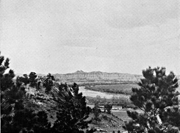
RABBIT'S EARS NEAR AMIDON
Photo by Russell Reid
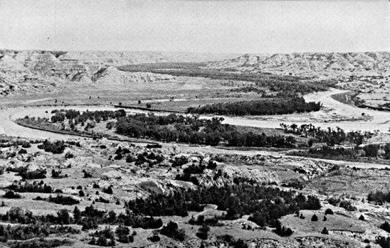
GRAND CANYON OF THE LITTLE MISSOURI
Photo by Hugh W. Hempel
SIDE TOUR 6B
Junction US 2—Buford—Fort Buford State Park.
Junction with US 2 to Fort Buford State Park, 9.5 m.
Unmarked graveled road 8.5 m., unimproved road 1 m.
No accommodations.
The remains of Fort Buford, at the end of this route, evoke memories of the once feared Indian chieftains Sitting Bull, Gall, and Joseph, and of the notable military leaders Gen. Hugh E. Scott and Gen. William H. Hazen.
The route, an unmarked gravel road, branches S. from US 2 (see Tour 6) 17 m. W. of Williston. At 8 m. is BUFORD (1,950 alt., 52 pop.), a little village named for the old fort. At 8.5 m. is the junction with an unimproved road; L. here.
On the SITE OF FORT BUFORD, 9 m., a stone powder house and the regimental headquarters buildings still stand; the military cemetery is to the S.
In 1828 John Jacob Astor's American Fur Co. built its principal post on the upper Missouri, Fort Union, 3 m. up the Missouri from the mouth of the Yellowstone, a few hundred yards E. of the present Montana Line. For almost 40 years Fort Union was the most important trading post in the Dakotas. Unfortunately, the traders at the post were more interested in getting furs cheaply than in preserving the morale of the Indians of the region. Whiskey, although prohibited, flowed freely. Quarrels between the Indians and the white men were frequent. Conditions were so bad in 1864 when Gen. Alfred Sully made a visit to the post following his campaign against the Sioux (see Tour 8 and Side Tour 8D), that he recommended Government control of the trading posts if peace were ever to be made with the Indians. Upon his recommendation, therefore, Fort Buford was established in June 1866 opposite the mouth of the Yellowstone. Fort Union was dismantled and its materials were brought here for use in building the new post.
Because of its strategic position, the new fort, named for Gen. John Buford, who distinguished himself at Gettysburg, commanded the water routes to the Northwest, and for more than 25 years was one of the country's vital Army posts. The fort was garrisoned partly by ex-Confederate soldiers, prisoners of war who had been paroled on oath that they would not again bear arms against the Union and on agreement to enlist for service in the outposts of the West. It played an active part in the settlement of the Indian troubles, and in establishing the Indians upon the reservations.
When Chief Joseph and his Nez Perce followers from Oregon finally surrendered in the Bear Paw Mountains of Montana in 1877 after leading their pursuers a merry 2,000-mile chase through the Rockies for more than a year, he was brought to Fort Buford before being placed on a reservation in Washington. Sitting Bull and his band of Sioux, after their flight into Canada in a vain attempt to avoid confinement on the reservation, also came to Fort Buford in 1881, and it was before the regimental headquarters building, the southernmost of the group now standing, that the chief surrendered. Gall had preceded him by a few months, also coming to Fort Buford to give himself up.
Telegraphic connections with Fort Lincoln were established in 1873, and a wagon road, used until 1881, connected Fort Buford with the Custer post and with the railroad, which at that time ended in Bismarck. It followed the eastern side of the Missouri, and is still in use in some places (see Side Tour 3B). Except for goods sent by steamboat, all supplies and mail were freighted over this road.
Fort Buford was sold at public auction in 1895. The 20-room residence of the commanding officers was purchased by John Mercer, who maintained it as a museum until its destruction by fire in 1937.
South of the old buildings is FORT BUFORD STATE PARK, 9.5 m., including the military Cemetery of the Fort. The unkept graves, some marked with marble slabs, some with wooden markers on which the inscriptions have lost all legibility, are sunken and overgrown with grass.
About a quarter of a mile SE. of the buildings by the river, in the 1830's and 1840's, stood a trading post known first as Fort William and later as Fort Mortimer. When William Sublette and Robert Campbell built Fort William in 1833, they found themselves treated as intruders by the monopolistic American Fur Co. post at Fort Union. The policy of the American Fur Co., in its fight against competition, was to try every kind of tactics, from rate wars to the instigation of killings by the Indians. On a typical occasion a band of Blackfeet Indians, coming to trade, was met by a procession from Fort Union headed by a band in full uniform, with the traders following, bearing articles of barter. That day the impressionable aborigines traded at Fort Union. Another time a Fort William expedition to the Crow Indians was robbed of everything including horses by marauders believed to have been sent by the neighboring post.
The power of liquor as an article of trade was unbelievably great. Charles Larpenteur, who was at Fort William, tells in his memoirs of going into an Indian camp in weather so cold that his mules froze to death in the shelter provided for them, and obtaining 180 buffalo robes for 5 gal. of alcohol, which sufficed to make everyone in the camp drunk twice. The use of liquor was a sore point between Fort Union and Fort William, for although it was illegal in Indian country Sublette had been able to get a supply into Fort William, while every similar effort at Fort Union had been defeated. Larpenteur describes the opening of trade at Fort William thus: "The liquor trade started at dark, and soon the singing and yelling commenced. The Indians were all locked up in the fort, for fear that some might go to Fort Union, which was about two and one-half miles distant. Imagine the noise. Five hundred Indians with their squaws, all drunk as they could be, locked up in that small space." (The stockade was 150 ft. by 130 ft.) "The debauch continued during that entire night and well into the next day ... Indians in stupor from drink lay in every direction."
Competition grew keen. Beaver skins, which ordinarily were worth $3, brought as much as $12. It was the policy of the American Fur Co., however, to buy out its competitors if it could not frighten them out. Accordingly, after a year of bitter rivalry, an agreement was reached whereby Sublette and Campbell sold Fort William to the Astor concern and moved W., leaving the profitable upper Missouri valley trade to Fort Union.
In 1842 a new post, called Fort Mortimer, was built by Fox, Livingston & Co. a short distance back from the bank at the Fort William site. The new traders did not long survive the competition of Fort Union, and in 1846 found it expedient to sell out to the American Fur Co. Some 12 years later an adobe trading post was erected here, but little is known of it other than that it was abandoned in 1858 and was finally torn down in 1866, its materials being used in the building of Fort Buford.
TOUR 7
Carrington—Minot—Bowbells—Portal—(Regina, Sask., Can.). US 52.
Carrington to Canadian border, 241.5 m.
Soo Ry. roughly parallels entire route.
Graveled roadbed except 38 m. bituminous-surfaced between Velva and Foxholm.
Accommodations in principal towns.
US 52, pursuing a diagonal course northwest across the State, provides a direct route between the Canadian Rockies and the Middle West. It traverses a diversified farming area, and passes through the fertile Souris River valley and the treeless valley of the Des Lacs River. In the green panorama of spring the prairie grasslands, dotted with small grazing herds of white-faced Herefords or black and white Holsteins, alternate with tilled fields. By late summer tones of yellow dominate the landscape, which after the harvest is left a scarred, grimy tan.
At CARRINGTON, 0.0 m. (see Tour 2), is the junction with US 281 (see Tour 2).
At 9 m. on US 52 is the junction with ND 30, a graded dirt road.
Left on this road to the HAWKSNEST, 9 m., a high, flat-topped hill with well-timbered slopes rising 400 ft. above the surrounding plain. Near its top is a crystal-clear spring. It was named in 1873 by a party of surveyors who saw a great number of hawks swarm from the trees. On top of the hill is a large serpentine mound. After the coming of the white man the hill was a camping place for Sioux Indians traveling between Fort Totten and Fort Yates. They called the hill Huya Wayapa ahdi (where the eagle brings something home in his beak). According to Indian legend a large band of Sioux once camped near the hill but were unable to ascertain the whereabouts of a war party of Chippewa which they suspected to be near. One of the Sioux, however, observed that an eagle flying into the trees carried in its mouth what appeared to be a piece of meat cut with a knife. From the direction in which the eagle had flown the Sioux were able to find the enemy. The legend is silent on the outcome of the warriors' meeting.
Left from the Hawksnest 3 m. to CAMP KIMBALL HISTORIC SITE, where Sibley camped July 22 and 23, 1863. It was from this point that the expedition moved SW. to engage in the Battle of Big Mound (see Tour 8).
SYKESTON, 13 m. (1,233 alt., 327 pop.), a German community named for Richard Sykes, who platted the town in 1883, is on the banks of the Pipestem River and artificial Lake Hiawatha. Sykes Park provides good camping. Buffalo favored this vicinity as a grazing spot before the coming of settlers, but the semiannual hunting expeditions of the metis (see Side Tour 5A) destroyed many, and after the cattlemen arrived only an occasional specimen was sighted. The library of an Inverness, Scotland, home is adorned with the head of what was probably the last buffalo killed in this vicinity. A party of guests at the Sykes ranch in 1881, including Ewen Grant of Inverness, learned that a buffalo was grazing with the Sykes cattle, and in the exciting chase to bag the animal Grant had the good fortune to despatch him.
FESSENDEN, 36 m. (1,610 alt., 738 pop.), named for Cortez Fessenden, surveyor general of Dakota Territory from 1881 to 1885, was originally settled by a group of Welsh farmers, though the population is now predominantly Scandinavian. Fessenden was platted in 1893, and in the election of 1894 was named Wells County seat. Its citizens journeyed by teams and wagons in the still hours of the night to Sykeston, first county seat, seized the county records, and hauled them to the new location. Each year (March) Fessenden holds an agricultural exposition culminating in the coronation of an Alfalfa Queen.
HARVEY, 59.5 m. (1,596 alt., 2,157 pop.), named for Col. James S. Harvey, a former director of the Soo Line, is on the banks of the Sheyenne River. It is a division point on the Soo, and is the largest town on the route with the exception of Minot.
Right from Harvey on ND 3, a graveled road, to junction with a dirt road at 4 m.; R. on this road to BUTTE DE MORALE, 7 m., an ancient landmark rising 300 ft. above the surrounding prairie. It was to this vicinity that the metis, or French-Indian half-breeds, came in the 1840's on their buffalo-hunting expeditions (see Side Tour 5A). It is said that on one occasion a party of 1,390 people with 824 wagons and 1,200 animals camped here and slaughtered 250 buffalo in a single day. In 1853 the surveying expedition of Gov. I. I. Stevens passed the hill, and in 1862-63 Capt. James L. Fisk led two expeditions of Montana gold seekers through the vicinity.
MARTIN, 72.5 m. (1,589 alt., 211 pop.), known in early days as Casselman, was later renamed for a Soo official in order to avoid confusion with other towns of similar names. A group of Rumanians from Regina, Sask., settled here in 1893, but the population is now predominantly German, as is that of ANAMOOSE (from Chippewa uhnemoosh, dog), 80.5 m. (1,620 alt., 495 pop.).
DRAKE, 89 m. (1,634 alt., 644 pop.), named for an early settler, Herman Drake, is on the watershed between the Mouse and Sheyenne Rivers in a diversified farming and dairying area. A small railroad center, it has become a wholesale distribution point; a $20,000 cooperative creamery is operated here.
Northwest of Drake the route traverses rolling tree-dotted hills that begin to slope toward the Mouse River valley.
BALFOUR, 97 m. (1,613 alt., 197 pop.), named by the town site company, and VOLTAIRE, 116 m. (1,587 alt., 61 pop.), believed to have been named for an early settler, are both young villages incorporated in 1929.
The road makes an abrupt descent into the flat, trough-like Mouse River valley at VELVA, 122 m. (1,511 alt., 870 pop.), which is at the southwestern point of the loop of the river, near a camp site of the Sully expedition of 1865. The park-like little town is on the flood plain of the river which flows through it. First known as Mouse River Post Office, it was given its present name after organization of the town site in 1891-92. A park in the northern part of the town offers recreational facilities, and contains the First Dwelling in Velva, a log hut built in 1885.
1. Right from Velva on a dirt road winding down the Mouse River valley is VERENDRYE, 11 m. (1,554 alt., 100 pop.). First known as Falsen, the town was given its present name in honor of Pierre de la Verendrye, earliest known white explorer in the region. Right from the town pump 0.5 m. to the globular masonry DAVID THOMPSON MEMORIAL, erected by the G. N. Ry. in 1925 on a high point overlooking the river valley. On the base of the monument is the inscription: "1770—David Thompson—1885, Geographer and Astronomer passed near here in 1797 and 1798 on a scientific and trading expedition. He made the first map of the country which is now North Dakota and achieved many noteworthy discoveries in the northwest." Thompson made his explorations while an employee of the North West Fur Co.
2. Left from Velva on a graded dirt road to a junction with another graded road at 4 m.; R. here to another junction at 8 m.; L. here to a STRIP MINE which is one of the larger lignite operating units in the United States, 10 m. Here, in order to reach a vein of coal averaging 14 ft. in thickness, great shovels strip the 40-to 50-feet overburden and pile it into fantastic high mounds and ridges resembling the work of a giant mole. Nearby is a small community of some 40 homes of miners.
Northwest of Velva the route follows the foot of the hills bordering the valley to SAWYER, 128.5 m. (1,525 alt., 206 pop.), believed to have been named for a Soo Ry. official.
MINOT, 144 m. (1,557 alt., 16,099 pop.) (see Minot).
Points of Interest: Minot State Teachers College, Roosevelt Park and Zoo.
At Valley St. and 4th Ave. SE. is a junction with US 2 (see Tour 6), which unites with US 52 to 150 m. At 4th Ave. and 2nd St. SW. is the junction with US 83 (see Tour 3).
Left of the junction at 150 m. is a large tourist camp.
BURLINGTON, 152 m. (1,590 alt., 150 pop.), named for Burlington, Iowa, under the North Dakota Rural Rehabilitation Corporation became the scene of the State's first Subsistence Homestead Project. Here, in the wooded valley at the confluence of the Mouse and the Des Lacs Rivers, a model village of comfortable homes arose (1937) to replace the former dwellings of the miners who have part time employment in the lignite mines of the vicinity. When completed the project will provide homes and irrigated garden-land for more than 50 families. The cost to each owner, including land, house, barn, garage, and chicken and hog houses, will be approximately $3,500. A concrete dam and bowl spillway on the Des Lacs River will irrigate more than half the 600 acres included in the project.
A camp fire unwittingly built upon an outcropping of lignite at Burlington in the spring of 1883 is credited with first having acquainted pioneers here with the possibilities of developing the fuel on a large scale. Three men camped at the fork of the Mouse and Des Lacs Rivers were surprised one morning to find their camp fire of the previous night still burning. Upon investigation they learned that their wood fire had ignited a blackish mineral—lignite—in the earth beneath it. All lignite mines in the Burlington vicinity are underground (open on application at mine office in Burlington).
Northwest of Burlington the route follows the Des Lacs River valley to FOXHOLM, 163 m. (1,657 alt., 200 pop.), named for Foxholm, England, and CARPIO, 171.5 m. (1,696 alt., 344 pop.), which touches the hills on both sides of the narrow valley. One story has it that Carpio was named by the wife of one of the railroad officials; another that the name was suggested by the fact that the first post office was a freight car on which was posted the sign "P. O."
Right from Carpio on a graveled county road to the UPPER SOURIS MIGRATORY WATERFOWL PROJECT, 7 m., one of the largest of its type being undertaken in North Dakota by the U. S. Biological Survey. Here a marshland along the Mouse River has been purchased and a large dam constructed to impound a lake 26 m. long. A series of smaller dams farther down the river will control the flood waters of the Souris and will aid in restoring the marshes to suitable breeding and nesting grounds for migratory waterfowl. The low, chalky white, red-roofed buildings E. of the dam are Project Headquarters.
Left from the dam on a gravel road to the CP RANCH, 14 m., which maintains one of the few buffalo herds in the Northwest. Thirty-five shaggy-coated bison range in a 700-acre pasture, appearing at the ranch buildings twice daily for water. A large herd of Hereford cattle is also kept here.
DONNYBROOK, 181 m. (1,760 alt., 259 pop.), named by its founders for Donnybrook, Ireland, is at the foot of the hills bordering the western side of the Des Lacs valley.
At 189 m. the route passes S. of DES LACS LAKE, a remnant of a glacial stream, now divided into three parts and drained by the Des Lacs River. The U. S. Biological Survey has a large migratory waterfowl project in progress on the lower lake, and as the road winds along the eastern shore the nesting islands and several dams built by the survey are visible.
KENMARE, 197 m. (1,799 alt., 1,494 pop.), believed to have been named by the wife of a Canadian Pacific Ry. official for a community in Ireland, lies on a hillside facing Middle Des Lacs Lake. In the steep sides of the lake valley nearby are a number of lignite mines.
Opposite Kenmare are the Administration Buildings of the Des Lacs Lake Migratory Waterfowl Project—low white structures with red tile roofs.
At Kenmare the highway leaves the valley for the Drift Plain, which stretches away to the E. to meet the flat bed of glacial Lake Souris, beyond which lie the Turtle Mountains. To the W. against the horizon rises the eastern edge of the great Missouri Plateau topped by the Altamont Moraine, the height of land between the Missouri and Souris Rivers.
At 202 m. is the Junction with ND 5, a graveled highway (see Tour 5). US 52 and ND 5 are one route to 234 m.
At 209 m. the highway dips into a large cut to cross UPPER DES LACS LAKE, which, despite present dry conditions, was once the scene of steamboating. In early days it was navigable across the Canadian border near Northgate, and grain from points in Canada and along the lake in North Dakota was shipped via the water route to Kenmare for transshipment by rail to eastern markets. The years of continued subnormal rainfall in this region have left the upper lake dry in places.
BOWBELLS, 214 m. (1,961 alt., 695 pop.), named by English stockholders of the Soo Line for the famous Bow Bells in St. Mary-le-Bow Church in London, is the Burke County seat. Almost treeless, its squat appearance blends into the flat terrain, with the tall water tower, the only notable feature of the town, visible for miles on the level prairie.
FLAXTON, 226.5 m. (1,940 alt., 423 pop.), was given its present name because the town site was a field of flax when application for a post office was made.
At 234 m. is a junction with ND 5 (see Tour 5).
PORTAL, 241.5 m. (1,954 alt., 512 pop.), is an important international port of entry, hence its name. It is an airport of entry, and also a division point on the Soo, much of the traffic to the Canadian Northwest passing through its custom offices. The U. S. Custom and Immigration House (for custom regulations see Information for Travelers), on Boundary and Railway Aves., is a two-story brick building in Colonial style. A large canopied driveway at the front of the building permits inspection of three automobiles at once. The Canadian custom offices are directly across the avenue, which is bisected by the international boundary. Portal is the home of many sports enthusiasts, and most of its games have an international aspect. Unusual in sports is the international golf course, on which in August 1934 a young Portal golfer, George Wegener, made an international hole-in-one, driving from the eighth tee, which is in Canada, 125 yd. into the cup on the ninth green, in the United States. The curling club here is also international, being composed of both Canadian and United States citizens in the border cities of Portal and North Portal. They play this winter sport in a specially constructed domed building.
US 52 crosses the Canadian Line at the customhouses in the city of Portal, 30 m. S. of Estevan, Sask.
TOUR 8
(Minneapolis, Minn.)—Fargo—Valley City—Jamestown—Bismarck—Mandan—Dickinson—(Glendive, Mont.). US 10.
Minnesota Line to Montana Line, 368 m.
N. P. Ry. and Northwest Airlines parallel route across State.
Paved or bituminous-surfaced roadbed except 73 m. graveled.
Accommodations chiefly in towns.
US 10, rising steadily toward the foothills of the Rocky Mountains, with a gain of 1,852 feet in altitude in crossing the State, traverses the three main topographic divisions of North Dakota (see Natural Setting), from the low, flat Red River Valley, across the rolling Drift Plain and out upon the Missouri Plateau. Near the end of the route are the strange and beautiful Badlands.
Most of the country along the road is cultivated, and in the fields the cycle of farming operations—plowing, seeding, cultivating, harvesting—repeats itself as the seasons progress. During the growing season, stretching far across the flat plains and over the sloping hills, the varying greens of the grains blend with the blue flax fields and the invading yellow patches of mustard. In the fall the prairies have a somber, peaceful air as their tawny stubblefields and newly plowed black acres await the first snowfall. When winter comes the never-ending expanse of white is broken by the dark pattern of roads and an occasional lead-colored clump of trees, bare and shivering in the wind, while at the distant horizon the whiteness unites with the pale blue of clear winter skies.
West of the Red River Valley trees are few except along the rivers. Yet, according to legend, this country was once heavily forested—until Paul Bunyan, the master woodsman, had his men log it off, just before his famous fight with his foreman, the Bull of the Woods, on top of the bottom of the Mountain That Stood on Its Head. As a matter of geologic fact, the area traversed by the route has been largely treeless since the gradual cooling of the climate, incident to the ice age, destroyed the tropical plant and animal life which once were profuse here.
FARGO, 0.0 m. (907 alt., 28,619 pop.) (see Fargo).
Points of Interest: North Dakota Agricultural College, Veterans' Hospital, Dovre Ski Slide.
At Front and 13th Sts. is the junction with US 81 (see Tour 1).
WEST FARGO (R) (907 alt., 127 pop.) and SOUTHWEST FARGO (L) (907 alt., 800 pop.), 5 m., suburbs of Fargo, are the center of North Dakota's meat-packing industry. An Armour & Co. Plant (open; tours at 9:30 & 11 a.m., 1 & 3 p.m. Mon.-Fri., 10:30 a.m. only on Sat.; no children under 10) and a large livestock market employ the majority of the residents of these two young villages, incorporated in 1931 and 1937 respectively. Armour's plant, housed in a four-story brick building, employs more than 400 people. Connected with it is the Union Stockyards where representatives of commission firms buy livestock from North Dakota farmers. Included in the yards is an exchange building which houses offices of the company, dealers, and commission firms, and State and Federal agencies supervising market operations.
At 12 m. is the junction with a graveled county highway.
Right on this highway is MAPLETON, 1 m. (904 alt., 195 pop.), one of the oldest towns in the State, organized about 1870. It is named for the Maple River which flows through it, one of the many meandering tributaries of the Red.
At 20 m. is the junction with ND 18, a graveled highway.
Right on this road is CASSELTON, 2 m. (936 alt., 1,254 pop.), named for Maj. G. W. Cass (1810-1888) of Minneapolis, stockholder in the N. P. Ry. and proponent of the railroad nursery that propagated the poplar trees that today line the streets. It was the boyhood home of William Langer (1886-), Governor of the State (1933-1934; 1937-1939) and a storm center in Nonpartisan League politics (see History).
During the bonanza farm era (see Agriculture and Farm Life) Casselton was headquarters of the huge Dalrymple farm, which made it a metropolis of the Red River Valley. One of the earliest practical uses of the telephone in the United States, and what may have been the introduction of the instrument into this State (see Tour 1), was made in 1876 on the Dalrymple farm. Oliver Dalrymple had taken advantage of low prices occasioned by the panic of 1873 to buy 100,000 acres of Red River Valley land owned by the N. P. Ry. and had set out to demonstrate that the land was valuable for farming. The first year he seeded 1,280 acres and harvested 32,000 bu. of wheat. By 1878 he was farming 13,000 acres and by 1895, 65,000 acres. His land was divided into subfarms, each with a superintendent and foreman, and all using the most modern farm equipment obtainable. Dalrymple, on a visit to the Philadelphia Centennial in 1876, became interested in the newly invented telephone, and at the close of the fair purchased several of the instruments for installation on his subfarms and headquarters farm at Casselton.
Among the churches in Casselton is one maintained by a small group of Moravians, a German religious sect that came to the State during the early years of settlement.
On ND 18 at 18 m. to the D. H. HOUSTON FARM, where the principle of the roll film camera was developed. Houston, a native of Wisconsin, had already invented one camera when he homesteaded in North Dakota in 1869. Although he acquired 6,000 acres of land and became one of the early bonanza farmers, he continued his experiments in photography, and in 1881 developed the principle of the roll film camera, selling his patent to George Eastman. It has been said that Houston named his device "kodak" for North Dakota, but the generally accepted story is that Eastman himself coined the word because he desired a catchy, easily remembered name that could be used in any language. Houston's inventive interests included agricultural improvements, and in the 1880's he developed an improved bluestem wheat which, producing four to five bushels more per acre than other varieties, was soon in great demand throughout the Wheat Belt. He also patented improvements on the disc plow.
At 26.5 m. is the junction with a graveled road.
Right on this road is WHEATLAND, 2 m. (991 alt., 300 pop.), a quiet, pretty village named for the vast wheat acreage formerly seeded on the bonanza farms in the area.
At 30.5 m. the highway passes over a noticeable rise of land. This is Herman Beach, the western shore of ancient Lake Agassiz, which in glacial times covered 100,000 sq. m. and lay over the eastern portion of the State, reaching from Lake Winnipeg in Canada to Lake Traverse in South Dakota. It is estimated that when this gravelly ridge was formed by the waves of the lake, the water at the present site of Fargo was 175 ft. deep.
BUFFALO, 37.5 m. (1,201 alt., 242 pop.), is named for Buffalo, N. Y.
Left from Buffalo on a graveled highway is ALICE, 11 m. (1,124 alt., 169 pop.), named for a relative of a railroad superintendent.
At the Multz Cafe is a Collection of Indian Artifacts (open).
At 40.5 m. is BUFFALO CREEK HISTORIC SITE (R). A marker reads: "August 16, 1863. General Sibley marched over this spot with 3,400 soldiers on his return after driving the Indians across the Missouri River."
TOWER CITY, 43.5 m. (1,169 alt., 435 pop.), in a grove of trees, is named for Charlemagne Tower (1848-1924), a Philadelphia capitalist and diplomat, who owned much land in the vicinity. He made the foundation plantings of the trees of the city and also donated the first books to the local public library. In 1886 Baptist leaders selected this city as the site of a proposed church college to be named Tower University. Excavations had actually begun, with the expectation that Tower would be its benefactor to the extent of $100,000. Because of some misunderstanding of the preliminary arrangements, however, the endowment fund was not forthcoming. Tower offered the use of a school building, but the school, being unable to continue without financial assistance, closed its doors two years later.
At 48.5 m. is the junction with ND 32, a graveled highway.
Right on this highway is ORISKA, 0.5 m. (1,267 alt., 183 pop.), once the center of a wide wheat-growing area. The name is believed to have been that of the heroine of an old book of western poems.
At 5 m. on ND 32 to CAMP ARNOLD HISTORIC SITE, where in 1863 the Sibley expedition made one of its many overnight camps.
At 56 m. is the junction with a graveled road.
Left on this road to CAMP SHEARDOWN HISTORIC SITE, 3 m., another stopping place of the Sibley column. A few rifle pits dug for camp protection are still visible, and a bronze tablet marks the site. No engagement took place here, the rifle pits being evidence of Sibley's precautions against Indian attack.
VALLEY CITY, 58.5 m. (1,220 alt., 5,268 pop.), seat of Barnes County, lies sheltered and hidden in the deeply wooded Sheyenne River valley. Originally known as Worthington, it was given its present name when incorporated as a city in 1881.
The city's first settlers came with the N. P. Ry. in 1872, but Jay Cooke & Co., financiers of the railroad, crashed in the Nation-wide panic of 1873, and the next five years brought a suspension of business and immigration. From 1878, however, the city had a steady growth; today it is the center of a large area of diversified farming, with flour milling and the processing of dairy products the chief industries. One notable asset of the city is a municipal light plant which supplies electrical energy at the lowest rates prevalent in the State, and provides an excellent street-lighting system without taxation. The studios and transmitter of KOVC, Valley City, are at 312 5th Ave.
On an attractive campus at the southern end of 5th Ave. is the Valley City State Teachers College, established in 1890. In 1895 Gov. Roger Allin vetoed the State appropriations for the university and colleges, and, like Other State educational institutions, the Valley City college was kept open by popular subscriptions for the biennial period. One of the outstanding alumni of the school is Paul Fjelde, a former student of Lorado Taft, who was commissioned to do the bust of Abraham Lincoln that North Dakota presented to Norway in 1914. A copy of this work has been placed in the auditorium of the college.
Near the college campus on 1st St. is City Park, which contains recreational facilities and a small zoo. Chautauqua Park (swimming pool, playgrounds, large auditorium) is in the northeastern part of the city.
In the Barnes County Courthouse, 6th St. bet. 3rd and 4th Aves., is a small museum which includes the Indian collection of Vernon Gale, an amateur archeologist. Among his exhibits are several stone hearts, which have been found only in the valley of Spiritwood Lake (see below).
The N. P. Ry. High Bridge, known as the "Hi-Line", casts its long shadow across the river valley N. of Chautauqua Park. Including the approaches, it measures 1 m., a long railroad trestle for its height, which is 148 ft. above the water level of the Sheyenne.
Right from Valley City on Chautauqua Blvd., which becomes a graveled road leading to a spot still known as ASHTABULA, 17 m., the name of a post office once operated here. A ford in the Sheyenne at this point, Sibley's Crossing, was used by Capt. James Fisk's immigrant trains to the Montana gold fields in 1862 and 1863, and twice by the Sibley military expedition in 1863, and later was on the Fort Ransom-Fort Totten trail. Deep ruts of wagon trains are still visible and can be traced across the valley.
At Valley City is a junction (L) with ND 1, a graveled highway (see Side Tour 8A), which unites with US 10 to 63.5 m., where ND 1 (see Side Tour 8B) branches R.
On US 10 at the western end of the city is Pioneer Park (R), where an outdoor amphitheater has been built. The park also contains a small frame schoolhouse, typical of the pioneer period, which was moved from its site four miles west of the city.
SANBORN, 70.5 m. (1,443 alt., 343 pop.), named for J. N. Sanborn, a Fargo pioneer, was at one time a booming trade center, and seemed destined to become important, until two severe blows retarded its growth. First, in 1880, after a hot campaign, it lost the county seat election to Valley City; and then, in 1882, the county treasurer, whose bond had been furnished by the businessmen of the town, absconded with the county moneys, including a special fund for the erection of a courthouse. Among the early settlers of Sanborn was I. W. Barnum, brother of P. T. Barnum of circus fame.
ECKELSON, 75.5 m. (1,472 alt., 100 pop.), was named for A. O. Eckelson, a N. P. Ry. civil engineer of the 1870's, and was first platted a mile E. of its present site. Because of the steep incline of the railroad at that point, however, trains were unable to stop and the town had to be moved to more level ground.
SPIRITWOOD, 82.5 m. (1,475 alt., 267 pop.), is named for the lake 16 m. NW.
At 93.5 m. is the junction with ND 20, a graveled highway.
Right on this highway to the junction with a county graveled road, 10 m.; R. here to SPIRITWOOD LAKE (bathing beaches, boathouses, cottages, golf course, and two pavilions on the southern shore), 16 m., an attractive resort in a wooded valley. It is known to the Sioux as Minneskaya (water with white foam on top). According to an Indian legend, a grief-stricken girl plunged into its waters to join her drowned lover, and her spirit still resides in the lake.
On the northern shore of the lake the State Game and Fish Commission maintains an Aviary where Mongolian pheasants are confined for breeding purposes. Eggs are hatched on nearby farms and the poults are then returned to the aviary for distribution throughout the State.
In the vicinity of Spiritwood Lake have been found several heart-shaped stones marked with a small cross, probably representing a star. This is the only locality in the State where these stone hearts have been found, and archeologists believe they are the product of the early Indians. Specimens are on display at the State historical society museum (see Bismarck) and in the Vernon Gale Collection (see Valley City above).
JAMESTOWN, 95.5 m. (1,405 alt., 8,187 pop.), Stutsman County seat, lies in the fertile valley of the winding James River, described as the longest unnavigable river in the world. The story is told that the stream received its name from a French-Indian hunter-trapper who, having lost his way, was overcome with joy upon discovering the little river and gave it his own name—Rivière de Jacques.
The first settlement at Jamestown was made in the fall of 1871, when a corps of five or six N. P. Ry. engineers spent the winter here in order to be in readiness for work in the spring. Soldiers from Fort Ransom (see Side Tour 8A) acted as a guard for the engineers, and in June a military post, Fort Cross (later Fort Seward), was established. During the summer settlers and businessmen came to the community, and a brisk trade was carried on with the 500 railroad workers and the 3 companies of soldiers stationed at the fort.
On Sept. 13, 1872, the first train to enter Jamestown crossed the river into the city. Less than a month later construction crews, incensed because of unpaid wages, stopped work, and even began tearing up the newly laid tracks. Soldiers from the fort quickly quelled North Dakota's first strike.
Railroads played an important role in Jamestown's inception and growth. At one time there were prospects that two other railroads besides the N. P. would come into the city, and hope was high that the place would become an important railroad center. Although these plans did not fully materialize, one of the new roads, the Midland Continental, did make the city its home office. Financed by English capital, the Midland began to build in 1913, with plans for a line connecting Winnipeg, Man., with the Gulf of Mexico. The World War intervened, foreign support was withdrawn, and operations ceased after completion of only 70 m. of road, from Edgeley to Wimbledon.
The first church services here were held in a schoolhouse, and a pioneer tells of how these meetings were faithfully attended by an old Indian "clad in great dignity and an old nightshirt." Jamestown's first church, the Presbyterian, was erected in 1881. The first resident Roman Catholic priest arrived the same year, and resided in a rectory that measured 14 x 22 ft. Although there were many places in the State where Catholic church services had long been held, Jamestown in September 1889 became the first seat of the diocese of North Dakota.
In 1879 a group of local businessmen organized the James River Navigation Co. Of their first steamer, the Belle of Richmond, the St. Paul Pioneer Press said, "The craft is composed of a steam-whistle, an engine the size of a teakettle and a little boat under it." Ice put a stop to river navigation that fall, and in May the following year the initial trip of a new boat that had been built during the winter proved unsuccessful.
The fertile James River Valley land has produced such bountiful crops that between 1875 and 1900 farmers often paid for their lands in two years. A writer of that time says that "though North Dakota didn't have granite bluffs and waterfalls for its beauty, a land that would yield twice its cost in the first year would look rather beautiful to most men."
Maxwell Anderson (1888-), Pulitzer Prize playwright (1933), and Curtis D. Wilbur (1867-), Secretary of War in President Coolidge's cabinet, once attended school in Jamestown.
The two leading institutions of Jamestown overlook the city from the river bluffs on both sides of town. To the SE. is the State Hospital For The Insane, with its handsome buildings and beautifully landscaped grounds, a little city within its 2,000 acres of farm land.
Jamestown College, on high bluffs (L) on the northeastern edge of the city, is the oldest, and only private, college in North Dakota. Founded by the Red River Presbytery in 1883, it was the first school in the State to offer normal school training for teachers. A plan for construction in semi-Gothic style has been followed, with the result that the buildings present a pleasing and uniform campus group.
On the campus is Voorhees Chapel, one of the finest college chapels in the Midwest; it is built of reinforced concrete, Bedford stone, and mat-faced Menominee brick. The interior is constructed with huge hammer beams of Gothic type, and there are two high Gothic windows. The chapel is also used for musical and dramatic performances, as the intent of the institution is to make this building the center of college life and associations.
Klaus Park, at the southwestern edge of the city, with entrances on Elder and Willow Aves., consists of 26 acres of heavily wooded land lying between the James River and Pipestem Creek. It was donated to the city by the heirs of Anton Klaus, prominent pioneer affectionately known as "the father of Jamestown." An outdoor swimming pool is supplied with warm artesian water. Preserved in the park is one of the original millstones used in Jamestown's first flour mill built by Anton Klaus in 1879.
Nickeus Park (equipped playgrounds), at the northern end of 5th Ave., is in a loop of the James River. It was donated to the city as a memorial to a pioneer Jamestown attorney, by Mrs. Fannie B. Nickeus, his widow.
City Park (municipal tourist camp, ball park, fairgrounds, and tennis courts), at the southern end of 4th Ave., consists of a 52-acre tract along the wooded James River. The Park Auditorium, completed in 1936 as a WPA project, is a domical building, the design of its facade carried out in the straight lines and angles of modern architecture. Constructed with laminated truss-type arches which support the entire roof load, the auditorium has 25,000 sq. ft. of floor space unobstructed by supporting columns. Its acoustics is excellent, owing to the vaulted shape of the roof and the absorbing quality of the timbers in the arches.
KRMC, Jamestown's radio broadcasting station, has its studios in the Gladstone Hotel building at 412 Front St. W.; its transmitter is just across the James River S. of the city.
The Alfred Dickey Library, corner 5th Ave. S. and Pacific St. W., is built of red Hebron (N. Dak.) brick. Its style shows a Byzantine influence.
The Site of Fort William H. Seward is indicated by a marker on US 281 at the foot of the bluffs on the northwestern outskirts of the city. The post, named for President Lincoln's Secretary of State, was abandoned in 1877, and in 1925 the N. P. Ry. donated the site, which is on the bluffs SW. of the marker, as a State park.
Left from Jamestown 2 m. on Monroe St. to HOMER STATE PARK, a five-acre tract along the James River that was the site of an unidentified skirmish between white men and Indians.
ELDRIDGE, 103.5 m. (1,538 alt., 100 pop.), named for a pioneer family, is the most westerly town on the route lying within the Central Lowland of the Interior Plains. Between Eldridge and WINDSOR, 112.5 m. (1,839 alt., 110 pop.), whose name was suggested by that of Windsor, Ont., there is a rise of 300 ft., which marks the division between the Central Lowland and the Great Plains. The Missouri Plateau, as this section of the Great Plains is called, extends beyond the western border of the State. As the route continues into the plateau, the altitude rises slightly to the village of CLEVELAND, 116 m. (1,849 alt., 273 pop.),—named for Cleveland, Ohio—only to fall away gradually and then rise once more in topping the Altamont Moraine (see below.)
MEDINA, 124 m. (1,791 alt., 407 pop.), named for Medina, N. Y., has a strongly Russo-German population. It was originally known as Midway for its position halfway between Jamestown and Steele, and during the first two decades of the century was an important commercial point in the area.
At 126 m. is the junction with ND 30, a graveled highway.
Left on this highway to the junction with a graded dirt road, 12 m.; R. here to the junction with another dirt road, 17 m.; R. to another junction, 18 m.; and L. to Lake George, commonly known as SALT LAKE (swimming), 19 m., because of its heavy impregnation with natural salts. It is said to be one of the deepest lakes in the State. The southern shore has an excellent sand beach. Northeast of the lake are fresh-water springs; here, on land controlled by the Biological Survey through an easement, dikes and dams have been built to create a fresh-water feeding and nesting ground known as the Lake George Migratory Waterfowl Project. On the southern shore is Streeter Memorial Park, a World War memorial.
At 132 m. are CRYSTAL SPRINGS LAKES. A cairn (L) houses a spring (good water). The lake offers fine opportunity to study varieties of shore birds, as the marshes of the spring-fed waters provide attractive breeding places. CRYSTAL SPRINGS, 132.5 m. (1,777 alt., 69 pop.), is named for the neighboring lakes.