NAME-PLACES IN THE DURHAM DALES By William Morley Egglestone
Reading edition
WHEN Julius Cæsar conquered Britain, he found the island peopled by Celts—a branch of the great family of nations called the Aryan, or Indo-European, which spread over the world from Central Asia. The Western branches, which rolled in successive waves over Europe, included the Celts, who, according to the Greek traveller Pytheas, were in the fourth century before the Christian era quite at home in Britain, for he there saw growing in the fields corn which the farmers took in sheaves to the barns, in which were threshing-floors.
In Weardale, situated in the western and mountainous part of the county of Durham, and surrounded by brown and heath-clad fells, the ancient Briton lived in the limestone caves, and hunted in the oaken forests. In the Wear Valley, near Hamsterley, and about seven miles east of Stanhope, there is a remarkable relic of the ancient Britons. This ancient fortification—like many other works constructed by the Britons of old, such as the Dene Holes of Essex and the Cliff Castles—has its name, and is called The Castles. The treasure of Heatheryburn Cave, at Stanhope, consisted of bone knives and pins, boar tusks, bronze and jet ornaments, spearheads and bronze celts, with prehistoric human skulls, showing considerable activity of the natives who manufactured and formed the various rude implements. Apart from these landmarks, there have come down to us in names of places the Celtic roots the ray and the tay, which we find in Lang Tay, the name of a small but long tributary stream of water in Burnhope; and in Reahope, a tributary hope to Stanhope, and which empties its waters into Stanhope Burn, a tributary of the River Wear.
The Roman power seems to have been extended to Weardale, for the two Roman altars found at Bolihope and Eastgate, and the denarii found at Westgate, prove that this lead-mining dale was well known to those ruling and wall-building people.
Soon after the Romans left, the Anglo-Saxons—including the Jutes, the Saxons, and the English—established themselves along the eastern coast of Britain, and these tribes of the Teutonic family took a firm grasp of the land, and planted the roots of the English nation.
Though little more in the early Saxon period than a dense forest, in which wild animals and ancient Britons found shelter, Weardale ultimately became an Anglo-Saxon district, influenced by the blending of the Scandinavian element in dialect and names of places, owing to its proximity to the Danelagh on the south, and the Norwegian settlement in Cumberland on the west. The whole of the Palatinate appears to have remained Saxon through the Danish rule except the northern banks of the Tees. We know little of Weardale at this period. Situated amidst mountains, and lying next the Strathclyde, it was probably as much Celtic as Saxon; but the division of counties, however, was made in 953 by the Saxon Edred, or Eadred, and the Weardale people would know their county, for, on the bleak and heather-clad fell of Burnhope, the limits of the Palatinate is marked by a pile of stones, called "eade stones"—evidently King Eadred’s stones—the boundary established by that Saxon monarch. Weardale and Teesdale, however, under the power of the Normans, were destined to be turned into desolate wastes; yet, as we shall see, the Saxon names of places survived the desolation of fire and sword.
If we examine the names of places in the Bishopric of Durham a century or so after the Danish rule had ceased and the Norman rule had been established, we shall find a large percentage of Saxon suffixes. In the Boldon Buke, A.D. 1183, there are some 151 names of manors, wards, vills, etc., in which, with a few other names in charters of about the same period, we have 45 endings, or suffixes, in 175 names of places. The Anglo-Saxon test-word, ton, figures in no less than 34 of these principal names of places: as Darlington, a settlement of the Deorlings; Stockton, the stockaded town; Haughton, the haugh town; Morton, the moor town; Norton, the north town; Essington, the home or settlement of the Essings, as the Herrings gave a name to Herrington. Of the other Saxon suffices we have: ley 25, burn 14, don 8, worth 6, ford and ham 5 each; and the Celtic hope, common in the Anglo-Saxon North, occurs 8 times. Thus, 8 endings take up 105 of the names of places in Boldon Buke, the remaining 70 names having 37 endings. The Danish test-words, by and thorpe, only occur once each—Killerby and Thorp. These names do not show that the Vikings made permanent settlements north of the Tees. In Teesdale we find in Domesday Book, A.D. 1086, Lontune, Mickleton, Lertinton, and Codrestune, having the Saxon ending tun or ton; but though the names of these places were English, the places themselves were, or had been, belonging to a Dane, for they were then in the hands of Bodin, and had formerly been Torfin’s—a person named from the Scandinavian god Thunder, or Thor. Hundredestoft and Rochebi have the Danish toft and by, and, like many other names, such as Thorsgill and Balders Dale, point to the influence and power of the Scandinavians and their heathen worship in the neighbouring dale of the Tees.
In the five northern counties, Worsaae returns Danish-Norwegian place-names in the following order: Westmorland 158, Cumberland 142, Durham 23, Northumberland 22, and Yorkshire in its three Ridings 405. The ending by occurs 167 times in Yorkshire, and thorpe 95 times; whilst 7 of each are ascribed to Durham, and but 1 of the latter only to Northumberland. Yorkshire, however, on a closer inquiry, shows over 250 names of places containing the element by, and over 160 of that of thorpe, the former predominating in the North and West, and the latter in the East and West Ridings. Of the 83 names ending in the Norwegian test-word thwaite, as mentioned by Worsaae, 80 occur in the northern district, Yorkshire 9, Lancashire 14, Westmorland 14, and in Norwegian Cumberland 43, whilst there are no thwaites in Durham or Northumberland. The evidence adduced from names of places thus goes to prove that the Angles of Durham and Northumberland, though under the yoke of the Danes during the ascendancy of the Scandinavian power, have, from their first settlement, continued on their adopted soil through all the vicissitudes incident to the descents of the Britons from the western mountains, the inroads of the Picts and Scots, the ravages of the Vikings, and the subduing marches of the powerful William of Normandy.
Northumbria, as of old, may be divided into two provinces in respect to its place-names—Deira, the district of the Danes, and Bernicia, the district of the Angles, the central boundary-line being the River Tees. The Norse beck and Anglo-Saxon burn distinctively mark this line between these districts in the upper reaches of the valleys of the Wear and Tees. The mountain-range from Burnhope Seat, at the western confines of Durham, eastward to Paw Law Pike, forms the south division between the parishes of Stanhope in Weardale and Middleton in Teesdale. The principal tributaries of the Tees, on the south of this ridge, are becks, whilst those on the Wear side are burns. In Weardale, at the north-western extremity, Scraith Burn and Langtay Burn contribute to Burnhope Burn. On the Tees side, rising within half a mile or so of the above burns, Ashgill Beck contributes its waters to Harewood Beck. Farther eastward we have Harthope Burn on the Weardale side, and Harthope Beck, which runs into Langdon Beck, on the Teesdale side, both streams rising on Harthope Fell, and within a few yards of each other.
Continuing eastward, we find several becks on the southern border of the county of Durham. In 1672 a Teesdale stream was named Raygill Burn, having the Celtic ray, the Norse gill, and the Saxon burn. In the adjoining parish of Wolsingham, in the Wear valley, nearly all the tributaries are named becks in the Ordnance map, but these are, with one or two exceptions, originally all burns. In an old document of Queen Elizabeth’s time we find in this parish, Wascrow Burn, Westerharehope Burn, Hadderly Clough Burn, Houselop Burn, Bradley Burn, Collier Beck and Ells Beck. There do not appear to be more than two becks in this parish, Ells Beck and Holbeck, the latter a small runner near Holbeck House, the home of the Craggs family, one of whom was the Right Hon. James Craggs, Secretary of State.
In the Wolsingham names of streams that of Wascrow is generally now called Waskerley; its real name, however, appears to be Westcrau, from crau, a crag or rock, and west; or its adjectival component might be wæs, water. Houselop is Ouselhope, the hope of the Ousel or Ouse, Welsh wysg, Erse uisge, water. Ouse is a common river name.
Having so many Anglo-Saxon names of places in the eastern part of the Bishopric of Durham, it is natural to suppose that the settled families of the Angles would send offshoots along the banks of the Wear, up into the dale where the river had its source. Wolsingham—the Saxon metropolis of Weardale, for its ancient manor included the whole of the Wear valley westward—is the ham or home of the sons or descendants of a family of Franks, represented in Kemble’s English settlement names in Wælsingas, and in the German Walasingas, a family who probably settled in the South of England and sent their sons to the North, for Durham, according to Taylor, contained no original Anglo-Saxon settlements.
East of Wolsingham but a few miles is Witton, the ton, or town of witness, Anglo-Saxon witena-gemot. North of Weardale lie Hunstanworth and Edmundbyres, so the dale of the Wear is surrounded by towns having the Anglo-Saxon suffixes, ton, ham, and worth, except the Danish byre of St. Edmund.
Along the banks of the Wear, three miles west of Wolsingham, is situated the village of Frosterley. Here early settlers appear to have had an abode on the banks of the river. The present name of the village is evidently derived from the forest or foresters of the Bishops of Durham, who resided here to manage the great forest westward, but the Scandinavian personal name, Frosti, is worthy of consideration. There appears, however, to have been a far earlier settlement here. A very small enclosure near the river-side is named Bottlingham, but not a vestige of a settlement remains, and the name of the small plot of ground is all that is now left. Bolihope, a tributary valley to the Wear, and which empties its burn into the river a hundred yards or two below the place under consideration, was called, in Bishop Bec’s time, Bothelinghopp. In these two names we have the hope and the ham of some Anglo-Saxon settlers, named Pottel, which by the law of interchange might become Bottel. Bodvulf, who died in 655, was canonized, having founded the monastery of Ikano. This saint’s relics were dispersed, hence several churches are dedicated to St. Botolph, and Bottlebridge is St. Botolph’s bridge. The old chapel at Frosterley was, according to tradition, dedicated to St. Botolph, and close to the chapel site there is Bot’s Well, a name which would appear to confirm the local tradition in respect to the dedication.
Stanhope, too, with its Anglo-Saxon initial syllable stan, a stone, and Celtic hope, had an older settlement in all probability than the present town, which takes its name from the adjoining Hope, which is full of rocks or stones. At the west end of Stanhope town there is a small stream called Allerton Burn, which gathers its waters near Allerton Riggs, lying north-west of Stanhope. The stream joins the Hope Burn, near Stanhope Hall, but where is Allerton? which is, or was, the ton or town beside the allers or alders, or more probably the enclosed place of some Saxon named Alder or Ealder, from Anglo-Saxon ald, old, and hari, warrior. The site of this place was most likely near Allerton Bridge at Stanhope Hall, and this old hall residence—the seat of the Fetherston-halghs, from the days of King Stephen—probably represents the spot which we are in search of; it occupies a tongue of land between the confluence of the Allerton and Stanhope Burns.
Seven hundred years ago, persons bearing the Saxon names of Osbert, Ethelred, Meldred, Goda, Aldred, Collan, and others, held lands at Stanhope, and did service under the Bishops of Durham.
Considering the close proximity of the principal Danish settlement in England, that of Yorkshire, it would not be surprising if an inquiry into local names of places revealed the fact that the followers of Odin’s prophetic raven had left a footprint of some value in the Durham dales. The most remarkable, if not unique, footprint of the adventurous Northmen is preserved in the word thing, pronounced ting, which in names of parishes and places points out the localities where the Vikings, in their days of rule, held their outdoor national assemblies, and promulgated their national laws.
When the daring Northmen touched the shores of England, subdued in the year 867 Northumbria, and set up Inguar, the first Danish King, as ruler, they brought with them, and implanted, their traditions and customs.
In Weardale there is a Thimbleby Hill, on the south side of the Wear, opposite Stanhope, and if the Danes were in this dale for the purpose of assembling a thing or council, this hill is the one above all others which they would have chosen. It has on the top a considerable flat, and it overlooks Stanhope Town on the north, commands a most excellent view down the valley eastward, and up the valley westward, whilst to the south lies a rising heath-covered ridge. The position of the hill would at once recommend itself to the Danes, who always took care to have their national courts held in places which would be free from surprise; and it is possible that Shield Ash represents the shealings of ash bows, erected for the accommodation of those attending the court. Stanhope is in Darlington Wapentake, which word is Danish, and each wapentake had its court or thing. Presuming that the Danes held a council at Stanhope, they do not appear to have established themselves to any extent; but, as we find the Danish toft, as in Toft Well, and a place in Bolihope, named in Hatfield’s Survey Turpenstanes, the boundary stones of Thorfinn, a Danish personal name, and that in A.D. 1183 persons holding the Scandinavian names of Russell, Thore, Arkil, and a son of Turkill, held lands at Stanhope, it would not be a matter of surprise if a Danish council did take place in Weardale, which is situated so close to the Danish district, and which was under the rule of the first Danish King in England.
One of the most striking instances of the Norwegian element in Weardale, is what was fifty or sixty years ago the "national" winter sport of the dale. This was skeeing, the national sport of Norway. Within the memory of a few of the oldest inhabitants no snowy winter passed in Weardale without this sport being practised to its full extent.
In the mountainous district of Weardale, one of the most important North of England rivers is cradled, and into this isolated highland dale the Celtic name of the Durham river has penetrated. Almost all the English rivers have retained the names given to them by the Celts, and avon, dur, esk, rhe, and don, are Celtic roots repeated, over and over again, in names of streams, not only in England, but on the Continent. In the name Nent Water, in Cumberland, we have the simple name "water," and the Cymric nant, a hollow or valley formed by water—a common name in Wales. Writers mention Nant Lle as+ the vale of Lle; Nant Gwyrfai, the vale of fresh water; Nant Frangon, the beavers’ hollow or ravine; and Pennant, the head of the valley. The little village Nenthead, on the western slope of Killhope, is the head of the valley. From the root dwr, water, and the frequently occurring Celtic gwent, an open region, comes Derwent, the name of the stream on the north of Weardale, and of various other rivers in England. The local pronunciation, however, in the district of Derwent is Darwen, which suggests dwr and gwen, the clear water.
The River Wear is formed by the joint streams of Killhope and Burnhope Burns, which meet at Wearhead village. Its course through the dale is rapid, receiving many tributaries from the hopes. On reaching Auckland it takes a north-easterly course. "And now," says Camden, "the river, as though it proposed to make an island, compasseth almost on every side the chief city of this province standing on an hill, whence the Saxons gave it the name Dunholm. For as you may gather out of Bede, they call an hill dun, and a river island holme." The Wear, which enters the sea at Sunderland, was called Vedra by Ptolemy, Wirus by Bede, and in Bishop Pudsey’s time (1153-94) the name was written Were, the same as we find in Hatfield, 1380, Holinshed 1577, and Camden 1604. The latter form is the proper modern spelling up to about the last century, when Were became Wear, the present form of the name of St. Cuthbert’s stream. Ferguson, on the authority of Pott, gives the Sanscrit ud, udon, water, from which comes the German wasser, English water, as the root of Ptolemy’s Vedra.[8] Wirus suggests the Celtic gwyrhe, rapid water. Perhaps gwy or wy, water, and garw or arw, rough, form the roots. The former root enters into the names of several rivers, as the Wye, Edwy, Elwy, and others. In all the forms of spelling the river-name of Durham the letter "r" is conspicuous. It is the principal one in arw, which enters into the names of several streams—the Ayr, Are, Aire, Arre, being variations of this widely diffused root. The Welsh rhe, rapid, with gwy, may show equal claim to notice as first mentioned—namely, gwyrhe. Omitting the initial g in the first, and the middle letter in the second, root, we have wyre.
A hope is a small opening running up to the mountain ridges as a tributary to a main stream. From the burns again branch out grains, which, fed by springs, issue from brocs. The cleugh, gill, and sike, contribute their waters generally to the burns, whilst a well may come from a dene, and empty into the main stream. The western dales of Durham are pre-eminently dales of hopes. This word is the Celtic hwpp, a slope or hollow between hills—a little dale in which a stream of water gathers. These openings at the sides of the dale may very properly be termed places of refuge, places of shelter for animals, such as the deer, and in these days we find sheep located in the various hopes, where they have their heft—a locality to which they become attached; Anglo-Saxon hæft, from the having a holding or place. The Norse hop is a place of shelter or refuge. An inquiry into the Bishop’s possessions of game in Weardale, nearly three hundred years ago, particularly mentioned forests, parks, hopes and pastures. The place-name hope is common throughout the hilly parts of Durham, Northumberland, Yorkshire, and Derbyshire. In the neighbouring parish of Wolsingham there are Harehope, Ouselhope, and Thornhope; in Allendale Swinhope, Sinderhope, Ellershope, and Mohope; the Boldon Buke records in the Bishopric, Ayleshope, Rokehope, Cazhope, Refhope, Horsleyhope, Histeshope, Baldingehope, Burnhop, and Roueleiehope; and in Teesdale we have Egleshope and Hudeshope. In Weardale we have the Hope, sometimes called Stanhope Hope, probably to distinguish it from the town of Stanhope.
In Weardale there are sixteen hopes, distinguished in name by some characteristic feature, as represented in their respective initial components.
Burnhope and Killhope, with Wellhope, are the three vales which contribute their streams to form the Wear at Wearhead. The initial components burn, kil and wel, are all Anglo-Saxon, meaning water, and have been given according to the custom of the early settlers. From the head of the River Wear, the hopes, striking into the hills encircling the head of the dale, are those out of which come water. Burnhope is the hope of the burn, Anglo-Saxon burne, a stream; Killhope is from Anglo-Saxon keld, a fountain; we have also Icelandic keld, Danish kilde, Norse kill, a fountain or brook; Wellhope from Anglo-Saxon wyl, wel, a well or fountain—hence they are all the hopes of water. Kil is the Scotch and Irish word denoting a church, and if the situation had been favourable, and had there been any evidence of a St. Godric having been located here, as at Wolsingham, we might have had the hope of the kil, kirk, or church, but in Camden we find Kelhop and Welhop. Leland, at an earlier date, gives Kelhope and Welhop, and Holinshed Kellop. Brocket says keld is a word used in Yorkshire, Westmorland, and Cumberland, for a well or spring. Taylor gives kell and well as synonymous terms for a place from whence water flows. We read in Simeon of Durham of the Scots, in A.D. 1070, having marched through Cumberland and devastated Teesdale and the parts bordering; then they came to the place called in English, Hundredeskelde—that is, "the hundred springs." Barnard Castle water-supply comes from a place called Spring Keld.
One of the Bishopric knights at the Battle of Lewis was Sir Henry Merley, of Herkeld, in Witton; and Besanskeldes is a Boldon Buke place-name. We thus have, at the western confines of the county of Durham, the hopes of water, and which pour forth their streams to form the main river of the historic county of Durham.
Ireshope, Middlehope, and Westernhope, derive their initial components from their position. Middlehope occupies a central position in the forest. The first tributary burn to the Wear after its formation is, of course, the most western one, Ireshope, from Erse iar, the west. Snowhope, sheltered under the southern hills, retains patches of its winter covering long enough, no doubt, to have warranted its name—Snawhope, as it was formerly written, Anglo-Saxon snaw, Danish snee, German schnee, Belgic sneeuw—a name given to many mountains subject to being covered in winter, as Snafell in Iceland, Sneekoppe in Bohemia, Sneeuw Bergen at the Cape of Good Hope, Snee Hatten in Norway, Snafell in the Isle of Man, and Snowdon in Wales. In respect to Ireshope, there is the Anglo-Saxon yrfe, erfe, irfe, inheritance, from the root ar; Old English ear, earth, as the Aryan races were the tillers of the ground. There is also a root ar applied to rivers, as the Ayr, Are, and Aire: Welsh araf, gentle; Gaelic ar, slow; Celtic arw, violent—some of which might apply.
Stanhope and Rookhope are characteristic names in a district of stone and rock. In the Boldon Buke and Hatfield’s Survey we have Stanhope, Rokhop, and in the times of Bishop Beck, Stanehop, and Stanhop. The first components in these names are from Anglo-Saxon stan, German stein, Icelandic sten, Danish steen, a stone; and Gaelic roc, a mass of stone. The district is full of stones, as the many stone fences which net the whole of the inlands and the higher lands to the moors testify. From Boltsburn village the Rookhope stream runs over successive edges of limestone and freestone, and culminates in a grand display by leaping over several picturesque linns at Eastgate.
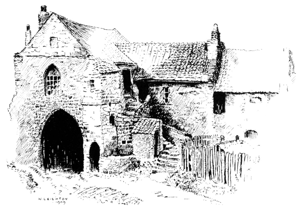
The Kepier Hospital.
Two of the place-names, Harthope and Swinhope, carry us back to the wild beasts of the forest. One was the lodging-ground or resort of the hart or stag, Anglo-Saxon heort; and the other gets its initial component from Anglo-Saxon swin, swyn, a swine; Old German suin, traceable back to the Sanskrit su. The boar tusks found in Heatheryburn Cave, and the Roman altar at Stanhope Rectory, testify to Weardale being the abode of boars. The local word aswin, obliquely, Welsh asswyn, does not apply to this place-name. A far more probable etymology is the Celtic swyn, holy. Charnock is of opinion that the several rivers named "swine" or "swin" may be from this root.
Bolihope, the name of a considerable subvalley on the south of Frosterley and Stanhope, is interesting, if not so easily explained. The name is evidently associated with the district of Frosterley, where the stream from Bolihope enters the Wear. At this village we have as place-names Bottlingham and Bot’s Well, and the ancient chapel is said to have been dedicated to St. Botolph. Bishop Beck granted to Walter Berington twenty-seven acres of land in Bothelinghopp. The initial component would suggest the Anglo-Saxon botel, botl, botles, an abode, mansion, or dwelling; also Norse botl, German buttel. Leo, however, says that very few Anglo-Saxon names of places are united with this word. Bolton was formerly written Bodeltune. This, however, does not appear to be the etymon of the name in question, as botel and ham, both Saxon for a dwelling, would not be found in one name. A large number of names of places have the Saxon patronymic ing, which often forms the medial syllable, such as Wolsingham, Darlington, Easington, Washington, Heighington, and, if the medial syllable of the name under consideration be the Saxon patronymic, then it is an Anglo-Saxon place-name—the home of the sons of some Saxon named Bottel. Bot is a Scandinavian personal name, but we find the Saxon Byttingas and Potingas, Liber Vitæ, Bota, and Frisian Botte. The personal name Pottel—which by the law of interchange of initial letters might become Bottel—would explain that the hope and the ham were belonging to the son of some Saxon settler of this name, as elsewhere mentioned.
Boltshope is a small offshoot from Rookhope. Bolt, as an iron-door bolt, is from Anglo-Saxon and Danish bolt, German bolgen, from the root bole, round as the bole of a tree. The Anglo-Saxon bold, bolt, originally búld, búlt, means a house or dwelling, an abode; Danish bolig; and we have mention made in Hatfield of Bold Shell in Rookhope. Boltsburn is the village of the Rookhope Valley, and is situated at the foot of Boltshopeburn. At the top of the hope is Bolts Law, which is probably the place earliest named, and in all probability is from a personal name. Bold Shield would not be from the Anglo-Saxon bold, an abode, but is evidently Bold’s shield, the shield, or home, of Bold, as the eminence might be the law of Bold or Bolt.
Dene is from the Celto-Saxon den, a deep, wooded valley; Anglo-Saxon den, dene, denn. The best specimen of this kind of valley in the county of Durham is probably Castle Eden Dene, a wooded, narrow valley near the sea. Its name is interesting, and contains the ancient and modern spelling. Its earliest name was evidently Eden, from ea or e, water, and den, a wooded valley; and this becoming a proper name, a second den was added—namely, Eden Dene, which gives us water-dene-dene. We have also in the north Hesleden, Deneholm, and Hardwick Dene.
Burn, grain, broc, are allied. The first of these may be said to be as pure Weardale as Saxon. Whilst the Norse beck crowds the banks of Teesdale, it does not exist in Weardale. Burn spreads from this dale northward through Durham, Northumberland, and Scotland. Beck is as foreign to Weardale as the Danish test-word by and the Norwegian thwaite, though all the three names crowd around, close to the very hills on the south and west of the dale of the Wear. Within the bounds of Stanhope parish the Wear is fed by several tributary burns. These streams receive or are formed at the head by grains, and the grains are fed by springs from the brocks. Brock is from Anglo-Saxon broc, brece, to break forth—the place where the water first breaks through the earth—hence brook, literally water running through the earth. A brock is a little hollow a few feet wide, formed by water breaking through the ground, and washing out a miniature valley. The moors of Weardale and surrounding district abound with these broken places, which are mostly known to shepherds and game-shooters. They exist on the top of the fells, where they are the only natural shelters. Platey Brock, on Chapel Fell, receives its name from an exposed plate or shale bed. To show how numerous these places are, I will mention that on Burnhope Moor there are also Coldberry Brocks, Limestone Brocks, Highfield Brocks, Wester Langtayhead Brocks, Todsyke Brocks, Lodgegill Brocks, Scraith Head Brocks, Browngill Brock, Cocklake Brock, Sally-Grain Brocks, Lang Brock. To the above may be added the better-known names of Black Brocks, or Moss Brocks, in Burnhope, and Welhope Brocks.
Grain, Icelandic grein, is a division, a branch, as the grain of a fork; Danish green, a branch, a bough. Generally the branches at the head of a burn are distinguished by north and south, and east and west grains; and sometimes by name, as Sally Grain in Burnhope, and Jopla Grains in Bolihope. "East Graine under Craggs" is in Bolihope. At Harthope Head there are the east and west grains, which meet and form the burn. In addition to the sixteen hopes previously mentioned, from twelve of which flow the principal tributary burns to the Wear, there are some thirty secondary streams, named burn, Anglo-Saxon burne, a bourn, stream, brook, river, and which are distinguished by the names of the hope, or place, from which they flow, or from some other characteristic feature or condition.
Sowen Burn, near Stanhope, is a very characteristic specimen, the adjectival component being the Old English sounen, sound, the noisy burn, or, rather, the sounding burn.
Fine Burn, in Bolihope, is so named owing to the stream being a line of boundary. The words "fine," "confines," "finish," "finis," mark the end, and the above stream is the boundary between the parishes of Stanhope and Wolsingham. The Roman camp, ad fines camps, is situated close to the border-line between England and Scotland.
In Rookhope Smails Burn implies the small burns—Anglo-Saxon smala, small—two little runners rendered somewhat historic in the days of Border broils, as we find in the old ballad of Rookhope Ryde. In the same district we have Red Burn, and Over Red Burn. Red is from Anglo-Saxon read, rud; Danish röd, red, the red stream; or the Celtic rhyd, a ford; whilst over is from the Anglo-Saxon ofer, a shore, or ofer, over, above or higher—hence High Redburn.
Yeky Burn is from Anglo-Saxon æc, eac, oak, the stream of the oaks. There are two Heathery Burns, one associated with the noted cave at Stanhope. Old spelling hetherie, hetherye, hethery, from heath, Anglo-Saxon hæth, Scotch heather.
The name well is given to a large number of tiny streams in Weardale. Dutch wellen, Anglo-Saxon wel, a fountain of water, and in Saxon names of places, wel, wyl, and well often occur.
Kelhope and Welhope are literally the hopes out of which water wells. The source of the latter is named Wellheads. At the head of smaller wells there are springs, places where water springs out—Anglo-Saxon springan—hence we have such names as Spring Wells, Whitewell Spring, White Wells, White Springs.
Ludwell is the people’s well, Anglo-Saxon leod, people. This water springs out of a cave in the great limestone, where, in olden times, the Weardale folks might have congregated, for the Saxon prefix shows it to have been the well of the people, like Ludlaw, the people’s hill, suggesting the days of village communities, and the days of superstition when wells were in many cases held sacred. These were generally iron wells—locally, haliwells. There are many wells known as holywells in this district, some of which are also termed spa-wells. This term is from the bath town, Spa, in Belgium, derived from espa.
Of other wells proper, we might mention Sunderland Well, Hunterley Well, Huntshield Well, Black Dene Well, Carrbrow Well, Earnwell; Anglo-Saxon earn, ern, an eagle—the eagle’s well. Several names of places in England are from the eagle. Toft Well, east of Stanhope, is the well in the toft or field, and the initial in Totley Well is probably from toft. Bot’s Well, at Frosterley, is supposed to be that of St. Botolph, to which saint, the old chapel, close by the well, was dedicated. Poppet Well is a curious name, and is probably "coppet," from cop, a head. The adjectival component in Duntert Well is evidently the same as in Dunter Linn, at Eastgate. Boutes Well is Bolts Well, as in Boltsburn. Berry Well is apparently the well of the mountain, Anglo-Saxon beorg, beorh, a hill, a mountain. At Newhouse there is a Bank Spring, and at Westgate a Spring Bank, indicating at each place a bank and a spring of water. Cuthbert’s Spring, near Westgate, is in honour of the patron saint of Durham, and it is no wonder that we find the name of St. Cuthbert associated with names of places. On Harthope Moor, and close to the road, is an excellent spring called Jenny’s Meggie, and at Frosterley a spring is called Meggie.
Cleugh, gill, and sike are associated with water. We have in the parish of Stanhope, in round numbers, 30 cleughs, 10 gills, and 70 sikes. Cleugh is from the Anglo-Saxon clough, a cleft down the side of a hill; Danish kloft; Norwegian kliufa, to split—a narrow ravine more like a cleft in the hill than a water-worn valley. Yearn Cleugh, written earne in 1666, is the eagle’s haunt, or that of the falcon, the latter being once reared in Weardale for the purpose of the Bishop’s hunt.
In 1666 we find mention of Addercleugh, the adder being frequently found in Weardale. Whick Cleugh—in 1595 written Weekerclough—is probably from the Anglo-Saxon wic, a marsh, but more probably from wice, the mountain ash, or rowan-tree, well known in the dale, and also known as the wich-elm.
Gill is from the Norse gil, a mountain chasm, a glen or fissure in the hillside. For this name we are indebted to the Norwegians, who peopled the neighbouring county of Cumberland. The best-known places of this class are Aller Gill, Lodge Gill, and Dry Gill, as being associated with habitations and lead mines. The first is the gill of the alders. In Burnhope there is Lodge Gill, a well-known name owing to a once famous lead-mine being there situated. The name very probably originated from some forest animal lodging there, as we find Lodge Field, Anglo-Saxon logian, to place, put, lodge—the field where probably deer were lodged in the forest-hunting days of the princely Bishops of Durham.
In Burnhope, a lead-mine in 1666 was called Hesley Gill—the hazel gill. In Witton Gill we may have a very important place-name, for here may be the gill of the witness—the spot where the inhabitants met, similar to the meetings held in primitive times at particular stones. Leo says: "By the names Wittan-ig, Wittan-mor, Wittan-mær, and Readan-stan, we are informed of those national and provincial meetings for self-government which have always characterized our race." Anglo-Saxon witan, to know; Icelandic vita; German wissen, to know. The Witena gemot Bosworth explains as "the assembly of the wise, the supreme council of the nation." Edred the Saxon King held a witan at Ginge, in the parish of West Hendred, Berks, and there is a Witan Dyke at Worthe in Hants, whilst in our valley there is the village of Witton-le-Wear. Mirke Gill in Bolihope is the dark gill from the Anglo-Saxon myrc, Icelandic myrk, dark. It is curious to notice how the Danish and Saxon cleugh, the Norwegian gill, and the Anglo-Saxon burn, are intermixed in Rogerley-Gill-Burn, Willowgreen-Burn-Gill, and Stock-Gill-Cleugh; but such are many names of places, for if the term burn was not understood by a Norwegian settler, he would add his own term, gill; if this was not sufficiently clear to a Saxon, burn would be added to convey his own meaning of a mountain-stream, and in a similar manner the various races of mankind have stratified and built one upon another the various components of place-names which are ethnological and historical landmarks too invaluable not to be closely investigated.
Sike or syke is a very common local name. It is from Anglo-Saxon sic, sich, Icelandic sikje, Norse siki. Sullivan says a sike is the drainage of a marsh, and that all sikes were once marshes. Natural productions have given names to several sikes, as the marshy hollows were the homes of trees, grasses, and animals; hence we have Rowantree Sike, where there is an excellent ironstone mine; Saugh Sike, two Aller Sikes, Rushy Sike, Bents Sike, Moss Sike, and Birk Sike. Where we find trees we find birds, so we have Hawk Sike, Hawk Sikes near Stanhope, and Snipe Sike. Todd Sike is where the fox haunted, and Goat Sike wants no explanation. Chisholm Sike, Anglo-Saxon ceosel, ceosl, gravel, sand, the sike by the gravelly or sandy holm. In Teesdale there is a Whey Sike, in Burnhope a Whoe Sike, and in Ireshope a Hoe Sike. In Middlehope there is Scar Sike, the sike of the rock. Anglo-Saxon carr, Danish skær, Swedish skar, a projecting or prominent rock, a cliff—as Scarborough, Scarthwaite, Scarcliff, and Scarsdale, written in Doomsday Book, Scarnesdele. At Middleton on the Tees there is a place called Skears, and scarr, skarr, skire, are forms found in place-names. Whetstone Sike is where the whetstone sill is exposed.
A linn is a deep or still pool, from the Celtic llyn, water, a lake, flood; Anglo-Saxon hlynna, a brook. In the North of England, however, a linn is understood to be a cascade or cataract, evidently owing to the waterfall being a more attractive feature in a river scene than the linn or pool, which is always found at the bottom of a fall. In Scotland a lin, lyn, is described as a cataract, and in a secondary sense the pool below. In Ireland lin is a pool; and the Icelandic form of the word is lind. The most attractive linns in Weardale are Linnkirk, on Shittlehope Burn, near Stanhope—a romantic spot where there is a tiny waterfall and a cave close by in the great limestone; the Dunter Linn and Holm Linn at Eastgate; and the Linny—a waterfall on the Harthope Burn, near St. John’s Chapel. The Danish dundre is to make a noise like thunder, and the Scotch dunder has the same meaning. The Saxon Donar is the god of thunder, hence Dunter Linn is that which makes a great noise.
Kern is from the Anglo-Saxon cyrn, cyrin, cerene; Danish kjerne, a churn; Icelandic kirna; Scottish kirn. The primary meaning appears to be to turn, the act of turning, allied to quern, the ancient mills for grinding corn. Kern-holes, found in the bed of rivers, are holes worn out by the churning motion of water mixed with sand. On Chapel Fell there is a watery hole called Jackson’s Kern, owing to one Jackson being accidentally drowned in it whilst coming from Middleton; but this might be cairn, a heap of stones. In Burnhope Burn, at Six-dargue, a deep hole in the stream is called Kern Pool.
Pool, Anglo-Saxon pol, Welsh pwll, Icelandic pollr. There are in the Wear and its tributaries a large number of pools which have names. Holm Pool is the pool by the holm, and Wash Pool very probably was a place where the good wives washed their linen in the days when spinning, weaving, and various other methods of manufacturing household requisites were in full operation. Winn Pool, from the Anglo-Saxon winn, gewin, contest, struggle, to win—the pool where the meeting of the waters cause a fight, and struggle, as it were, to win.
The eale and ealand are our isle and island, and are the names given in Weardale to alluvial land on the margins of the main river. In the river and place-names Greta, Ea, Eamont, Batters-ea, Aldern-ey, Pont-eland, ea or a represents water or a river. Bishop Egelwin, 1069, "after having, with all his people, passed three months and some days at Ealande, returned to the church of Durham," according to the Saxon writers. In the Boldon Buke we find in a charter of Bishop Flambard—“R. Biscop greteth well all his thanes and drenghs of Ealandscire and Norhamscire." In Wolsingham parish we find in Hatfield’s Survey, Papworth-ell, Small-eys, and in the same record Catherine of the Ele is mentioned. The names of places containing the Anglo-Saxon root ea, in the parish of Stanhope, are about a dozen.
In 1380, according to Hatfield, the parson of Stanhope held the Frith, and a place parcellum del Ele, containing one acre. In 1608, in a list of lands held by the rector of Stanhope, we find "one close called ‘The Parson Ele.’" A few hundreds of yards eastward, just below the Butts, we have Bond Eale, a stretch of land subject to be flooded, and formerly held by bond tenants, who had to perform services in connection with the land, such as thatching and carrying the running gear for Stanhope corn-mill.
Thomas Morgan, by will dated 1641, left for charitable purposes amongst other lands: "One parcel of arable ground in ye said Frosterley lying and being at ye west end of ye same town in a place there called Hudse Eale, and one acre and a rood of ground lying and being in ye said Frosterley in a place called ye Mille Eale, and all other my lands and tenements with ye said appurtenances in Frosterley aforesad—Barnes Eale—excepted."
A mile and a half west of Eastgate we have, between Hunterley Well and Parkhouse Pasture, the interesting Cammock Eale, locally called "Cammo Keel," for the derivation of which we have the adjectival component from the Celtic cam, crooked, and the ending og, diminutive, Celtic ock—hence the little crooked isle.
Holm is akin to ealand. Taylor says: "The suffix in the name Durham is properly not the Saxon ham, but the Norse holm; and Dunelm—the signature of the Bishop—reminds us also that the Celtic prefix is Dun, a hill-fort, and not Dur, water. In the Saxon Chronicle the name is correctly written Dunholm." Holm is also Anglo-Saxon, and is described by Bosworth as "a river island, a green plot of ground environed with water—hence holmes."
Holmside, in the county of Durham, and Midge Holm, Holmwath, and Yallow Holm, are names of places by the river in Teesdale.
By the Wear, at the west end of Rogerley Park, is situated Burry Holm. In the year 1583 Thomas Blacket, Esq., of Woodcroft, demised to Peter Maddison, gent., three closes of land being part of Woodcroft estate; one close was on the west side of the low pasture, and another close of meadow was called "Buiri Holme." It might be the holm of the burdock (Arctium Lappa), or the berry holm from Anglo-Saxon berie, berige, a berry, or the bere holm or place where barley grew, Anglo-Saxon bere, barley. Again, the spear plume-thistle (Cnicus lanceolatus), called in Scotland the bur-thrissil, might flourish here, or the burtree, the common elder (Sambucus nigra).
The names flask, swang, bog, and wass, indicate wet land, and are kindred terms to a certain extent. Those accustomed to travel on the highlands of Weardale will be familiar with lands denominated boggy, swampy, swangy, marshy. The term wass may be considered obsolete, and that of flask nearly so.
In Hatfield’s Survey there were in Bolihope lands called the Wasses and Seggefeldland. Wass is from the Anglo-Saxon wæs, water, and segg from the Anglo-Saxon segg, seeg, a reed or sedge, which commonly grows on wet land.
A pasture in Killhope, between Low Moss and the Rush, was some thirty years ago called the Flask. Langtay Flask is in Burnhope, and a lead-mine here was known by that name 200 years ago. In the bailiffs’ roll under Queryndon, we find in Hatfield, lands called fennes, flasskes, and a place called Atthillswang. In Quesshowe there was le Flaske. At Framwelgate, Broom cum le Flassh, at Cotam les flaskes.
Bog, Gaelic bog, Irish bogach, marsh, morass, quagmire, needs little explanation. Riggy Bogs, Boghouse, White Bog, and Bog Hole, are amongst names of places in the dales.
Den, from the Celto-Saxon, is a deep wooded valley, and has already been considered under valleys. The most important denes are Easter Black Dene and Wester Black Dene.
Hot Hill is no doubt the wooded hill, but Hotts has another derivation, and appears to be from hut, an abode or sheltered place. Another name, hurst, pure German, a thick wood, is confined, as far as Weardale is concerned, to Shield Hurst.
The termination shaw, a thicket or small wood, is frequently met with in place-names. The Danish skov is a wood or forest, Icelandic skogr; the Anglo-Saxon scua, scuwa is a shade, the same as the Swedish skugga. Anglo-Saxon sceaga seems to mean shaggy wood. In the Hatfield’s Survey, a place in Bolihope is called Watteshawe—a wet wooded place. Near Allergill we have Birkshaw, the place shaded by birch-trees. In Shittlehope there are two places on the expanding moorlands called Bashaw and Mogshaw. The former was probably the badger shaw or wood. In the latter we have an important root, the Erse magh, Welsh maes, a plain. Taylor gives magh as a Gadhelic test word, and says that it is found in more than a hundred Irish names of places.
The various place-names embracing mea, may, are from the same root, and probably Migg Clos, held by the parson of Stanhope in 1380, is a kindred name. A place on the south side of Bolihope is named Harnshaw—written in 1614 Hornyshawe, and in 1666 Harnshaw—from Anglo-Saxon hyrne, hirne, an angle or corner, a resemblance to a horn—hence the hyrne shaw would be the horn-shaped wood. Ramshaw, particularly known for its well, is evidently the ram wood, Anglo-Saxon ram, ramm, a ram; but some authorities derive ram from raven. These etymological conclusions give us a broad birch, a horn-shaped and a wet wood, a wood on a plain, and a wood frequented by the ram and the badger.
Wood, Anglo-Saxon wudu, wode, woodland, enters into a few local names, as Bradwode or Broadwood.
In Rookhope there is a Foul Wood, a lead-mine so named over two hundred years ago. Its name is evidently from the Anglo-Saxon ful, rotten, the same as Foul Sike was the impure watercourse. In 1401 Roger Thornton leased a lead-mine in Weardale at a place called Old Wode Clough.
In field, ley, and ridding, we have indications of clearings in the forest—places where cattle might feed. In Weardale there are some thirty leys, numerous fields but very few riddings. The latter word is from Anglo-Saxon hreddan, to rid; hredding a ridding; Danish rydde, to clear, grub up; rydning, clearing. The Weardale people are familiar with rid-up, a house; rid-out, a quarry; and similar terms. It is different from the riding, from Anglo-Saxon thri, thry, three; thridda, the third; thrithing, a third part of a province, as in the Yorkshire Ridings. Five hundred years ago John Migg held at Stanhope four acres of land in the Ridding, Robert Todd held j Ridding over an acre, and Alexander Brancepath held five acres and one rod in the Riddying. In Queen Elizabeth’s time Michael Fetherstonhalgh of Stanhope Hall purchased of Follinsby a parcel of ground called Pathemairidding. In Path-mairidding we have the ridding on the plain over which there was a path.
Ley, lea, lee, lay, is an open place, a pasture or field where cattle may lie; from the Anglo-Saxon leah, leag, lege, lea, leah; from licgan, liggan, to lie. The lea was an opening or forest clearing where cattle might be depastured, but where a good deal of woodland might exist. Gray, in the opening lines of his beautiful "Elegy," sings—
"The lowing herd winds slowly o’er the lea."
This terminal occurs in over twenty names of places in Boldon Buke. In Weardale there are five names of places having this suffix which are very important, as they give names to extensive stretches of land, and very probably the adjectival components may all be derived from personal names. These are Frosterley, Bishopley, Rogerley, Horsley, and Brotherlee.
On the hill north of Eastgate is situated Bewley, where once a cross existed, and in former days a watch for invaders was kept here. This place-name is probably more correctly Bewdley. In 1380 and 1590 it was written Bowdlye, and may be derived from the Anglo-Saxon bige, biga, bigan, a turning, corner, bending, angle, the ley, or field, on the bend or bow of the hill, the bowed ley.
Amongst the highest hills in Weardale are Fendrith Hill, Knoutberry Hill, Noon Hill, St. Cuthbert’s Hill, and Horseshoe Hill. Hill, hyl, hyll, is Anglo-Saxon, Norse holl, a name given to large and small elevations. One of these hills is named after the patron saint of the Bishopric of St. Cuthbert. Like Outberry Plain on the southern ridge, Knoutberry Hill on the north, evidently derived its name from the cloud-berry, Rubus Chamæmorus, which grows on the Weardale fells. In 1614, however, it was written Nookhill. Fendrith was written in 1539 Fenrake. The word rake is common in Weardale, and means to walk or range, or the extent of the walk—hence a sheep-rake, Swedish reka, to travel, journey. A fen is land covered with mud, a morass—hence the Fenrake was the district covered by a large morass. The hill known as the Horseshoe might be so shaped, or the suffix may be shaw, a wood—the wood of Horsa.
Amongst hills of lesser elevations than the five abovementioned are Billing Hills, where the Scots camped in 1327; Scaud Hill, in Burnhope, from the Anglo-Saxon sceawian, scewian, to look; Batable Hill, debatable land; Scrog Hill, Anglo-Saxon scrob, scrobb, a shrub, the hill of shrubs; Dun Hill, Ancient British dun, a height or hill fort (Gaelic dun, as Dun Fell, in Teesdale). Dod Hill and Dodder Hill are mountains with rounded summits, as Dodd Fell, in the Lake District. Cross Hill, in Stanhope, is where an ancient cross stood. We had a Paper Hill and a Poperd Hill, which were the hills where the priests preached. We have hills known or distinguished as hard, long, windy, slate, black, green, white, gold, quarrel (quarry), hungry (poor), stony, great, low, etc. Animals contribute their names, as in Hog Hill, Lamb Hill, Plover Hill, Fairhills (Norse faar, sheep), and Cowshill, the hill where cows congregated.
Law, Anglo-Saxon hlaw, hlæw, rising ground, an elevation, a hill. In the south it is low, as Ludlow, the people’s hill. Killhope Law is 2,206 feet above sea-level, Collier Law 1,692, Bolts Law 1,772, and Pow Law and the Three Laws are the names of other hills in the district.
Seat, Anglo-Saxon set, a sitting; sæta, settlers, inhabitants. The root sæte, set, or seta, enters into several names of places in England, some of which are county towns, as Dorset, Somerset; Old Norse setr, a seat. The Norwegian seter is a pasture or mountain-side—Burnhope Seat, Dora’s Seat, and Raven’s Seat. One was the settlement of a person named Raven, or Rafn; the other that of Dora, or Dore. In 1614 we find Dorry Sette. Bishop’s Seat was the place where the lords of the Bishopric settled when hunting in Weardale Forest. Another name is Laverock Seat, evidently Leofric’s Seat, modernized into Lark-seat.
Head, Anglo-Saxon head, heafod, a head. In a district full of undulating lands and small valleys there are several places deriving their names from being the top or head, or finished part of something, as Lanehead, Wearhead, Dalehead, Sidehead, Nag’s Head, Lamb’s Head, and others.
Rig, rigg, Anglo-Saxon rig, hrycg, and various other forms; Danish ryg; Icelandic hriggr, a ridge, a back. Stangend Rigg is 2,075 feet above sea-level.
Plain and pike are sufficiently expressive—the one a broad stretch of land, and the other a peak or pointed eminence. Five Pikes are near Paw Law Pike, a south-eastern boundary point on the hills. Ireshope Plains is a euphonious name; and Bewdley Plain, Sedling Plain, Outberry Plain, may be mentioned in the list.
Moor, fell, common, are well-known terms. Anglo-Saxon mor is waste-land, a moor, a heath; Danish mor is a moor, or morass; we have Killhope, Burnhope, and Wellhope Moors. Fell is Old Norse. All the Weardale moorlands are called fells. Chapel Fell is 2,294 feet above sea-level; A common is a tract of unenclosed pasture or outside land on which the tenantry of the inlands have a common right, or right of common for their sheep.
Bank, band, brae, and brow, are common in place-names, as Brook Bank, Owsen Bands, Whitfield Brow, etc. Batts, low, flat ground near water; Anglo-Saxon bæth, a bath, land subject to be soaked with water. Berry, as Knoutberry Hill, Bleaberry, and Snodberry, are from the Anglo-Saxon beorg, beorh, a hill. Cut, cove, as Cove’s Houses; crooks, as Milncrook, Seggecrok, Crawcrook, are found. Also end, as Hill End; and edge, as White Edge, Band Edge. Flat, green, and ground, are also found in several place-names, as Barnflat, Willow Green, and Trodden Ground. In the Boldon Buke we have Pelhou, Quesshow, and Dunhow, from haw, Anglo-Saxon hæge, a hedge.
Haugh is a common name in Northumberland for low-lying grounds close to rivers. It is frequently met with on the Tyne, but it is not so common on the Wear. Worsaae returns haugh in no other county than Northumberland, to which he ascribes ten, the haugh, or how, being given as the Scandinavian haugh, a hill; but the haugh of the Borderland is low-lying and sheltered meadow-land close to the winding rivers. In 1380, at Stanhope, there was a Castle Hogh, known as the Castle Haugh until within fifty years ago. There is a haugh at Softly, and a haughing-gate at Eastgate. There are various haughs in and about Blanchland, and it might appear that Weardale, where it is very rare, formed the southern boundary. But there are, however, three haughs in the West Riding.
Hooks, height, hole, and howl. We have Fairy Holes—caves in the limestone—Foxholes, Brockholes, and Catholes, as names of places; Hole House, Clay Holes, and many others. Cuthbert Heights is from St. Cuthbert. Knot, loc, lake, land, as the Knotts, the Locks, Cocklake, and the Lands. Mea, Welsh maes, Erse magh—a plan—is very common in the Durham dales. In Teesdale there is Flushy Mea, Sow Mea; and, in Weardale, Broad Mea, Mea Sike, Pitty Mea, Rimea, and others. Mound, moss, nook, rake, pit, and pot, occur in many names.
Side, a Saxon word, Icelandic sida, the edge, a hillside, enters into a number of names of places, as Fell Side, Kirk Side, with siders, as Cuthbert Siders; and also sedeing, a sideling or sloping. Slack, spot, wick, wham, clints, crag, carr, scar, are amongst other words forming place-names.
Habitations and enclosures have their special names.
When the Angles and Saxons arrived in our island they planted settlements in fertile districts. By the margins of some meandering river, which had already been named by the earlier Celtic race, the Saxon families located themselves and established homes, many of which are now large towns. The forest growth was cleared, and, with that love of home characteristic of the Saxons, a portion of the cleared land was enclosed, guarded, or protected, with the tines of forest growth—the tines or twigs of the wood; hence tun occurs in 137 Anglo-Saxon names of places in the 1,200 taken from Kemble’s Charters. This termination became to mean, not the tines or twigs alone, nor yet the hedges of which they were made, but the whole enclosure or estate was the tun or ton of some person; or the ton otherwise distinguished, as Stockton, the stockaded town; Middleton, the middle town; Willington, the town of the family of Willing—sons of Will. Other terminations indicate Saxon homes, as ham, worth, stoke, stow, fold, bury. In the Boldon Buke we find the Danish toft; and the universal description of small holdings in Hatfield’s Survey is a toft and a croft. We also find in primitive days the villagers holding dales of land—land divided into long, narrow strips or divisions, each villager knowing his own strip. When Weardale was more under cultivation, it was customary for the inhabitants to take in land from the moors; hence we find the place-name intake, locally intak. And at a later period still, when Acts of Parliament dealt with the division of moorlands, we got the name allotment, abbreviated to lotment and lot—the allotted land.
Acre is mentioned, as in Farnacres, in the Boldon Buke; and in later surveys are Longacre and Etheredacres. Barn, berry, beeld, byre, and by, bower, cave, castle, chesters, close, croft, dale, and darg—as six darg, from Anglo-Saxon dæg-weorc, day’s work. Fold, farm, faw, frith, gate, garth, hot, ing, ham, kirk, lodge, park, meadow, pry, shield, stead, ton, and wall, are common in the dales of the county of Durham.
Amongst the names referring to buildings we have cross, as Killhope Cross and Edmundbyres Cross. Stone crosses to guide the wayfarer were once erected at these places. Brig is from bridge, whether built of stone or wood. Currock, a pile of stones erected on the moors or fells as a landmark. Peth and lonnon and way are also common names. And all these have their adjectival component, as Lodge Field, Leases Park, Mill Houses, Pry Hill, Old Faw, Shield Ash, Watch Currock, etc.