Chapter X · RETURN TO THE BORDER RANGES—ΘΆΛΑΤΤΑ, ΘΆΛΑΤΤΑ!
Reading edition
At this season of the year the traveller is warned to beware of the blizzards which render formidable the crossing of the Kop Pass. The name of that pass is pronounced with a certain degree of terror in the bazars and coffee-houses of Erzerum. Each winter brings its catalogue of disasters to man and beast, buried in the driving snow on those bleak heights. Nor is it easy to perform the passage in a single day from Erzerum, waiting in the city for a favourable occasion. The Kop is situated about forty miles west of the provincial capital; and the barrier upon which it is placed—the wall on the north of Erzerum—can scarcely be surmounted at a more adjacent point while it is covered by the snows. For it is only the continual plying of caravans across a pass which, in this latitude and at so great an elevation above the sea, renders it practicable all the year round. Caravans have chosen the Kop, and there is nothing left to the traveller but to acquiesce in their choice. It was therefore decided to make our first day’s stage at the village of Ashkala, on the banks of the Euphrates, a stage of over thirty miles, and thence, on the following day, should the weather be favourable, to take the ascent of the range.
We set out at eleven o’clock on the morning of the 6th of February—a dim winter’s day, when the sun was struggling with the grey mists spread over the face of land and sky. The thermometer registered no less than 20° of frost (Fahrenheit); plain and mountain were completely covered with deep snow. Even the road scarcely revealed a patch of brown soil, and was distinguishable only by the parallel dints of the ditches in the foreground of the white expanse. But the city was conspicuous on the lowest slope of the southern barrier, where the vaulted summits and bold convexities of that lofty wall of mountain sweep into the lake-like plain. There it lay, a sombre mass, from which projected into the murky atmosphere the outline of a tower, the needle forms of minarets. On its either flank, in a wide half-circle, the chain of heights advanced into the open, more elevated and less contracted towards the north-east, declining but more adjacent on the west. In both directions, the opposite horns of this bay of snow-clad eminences appeared to touch the answering parapet in the north—west and east in a long, straight line, fretted by the shapes of cones and humps, stretched the barrier of that still distant range. The point of apparent intersection between the two outlines are, in fact, the open doors of the plain. In the north-east it is the inlet which leads towards Olti, known as the Gurgi Boghaz: in the west the valley which receives the Kara Su.
Our course was directed towards Ilija, a village of above-ground houses at the foot of the western promontory, near some hot springs. The summer road to Erzinjan diverges towards the west shortly after you have left Erzerum. It is taken across the horn of heights, up a partial opening, which, however, was barely visible. The view across the plain and along the summits of the northern barrier extends from the Deveh Boyun and the distant heights of Kargabazar to the Kop mountain in the west. Several individual heights may be distinguished from their fellows: Sheikhjik, a beautiful cone, north-west of Erzerum; then Akhbaba, a cockscombed outline, and next Jejen, a symmetrical peak. The flat-topped, broad-shouldered mass, which closes the series, is the Kop, beneath whose shadow lies the pass.
In the village of Gez—a cluster of houses, partly Mohammedan and partly Armenian—we made a stay of twenty minutes, and said farewell to some of our friends, who had driven out to meet us in a sledge. Sleighing is much in favour during the winter, both among rich and poor. Little black specks come gliding over the snow-field in the neighbourhood of the town. Taking shape, they are seen to consist sometimes of a lean hack drawing a couple of longitudinal logs, placed upon skates; or a graceful car, drawn by a pair of high-stepping horses, brushes past you at a rapid trot. Near Ilija we crossed a stream of warm water, which proceeded to follow us on our right hand; and at three o’clock we had reached the spot near the extremity of the promontory where the Kara Su might be expected to enter the narrows.
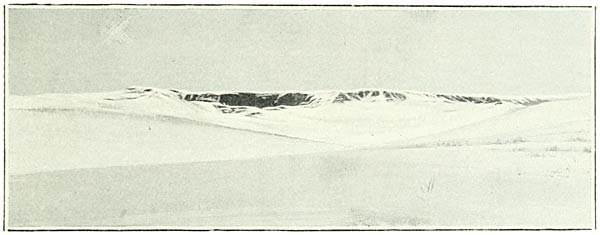
Fig. 170.
February 7.—We had left Ashkala (5520 feet) at half-past eight, with the promise of a perfect day; for the vapours had become collected into shining masses, and the sun was mounting into a clear, blue sky. Just before losing the landscape of the plain, I stopped to take a photograph of the summit-formation of a spur from the northern range (Fig. 170). I was struck by the resemblance of the flat edge of this eminence to the outworks of the Bingöl plateau. A little later we entered a side valley through which flowed a small and partially ice-bound stream. Proceeding up it a short distance on a northerly course, we arrived at eleven o’clock in the pretty alpine village of Pirnakapan. Beyond this Mussulman hamlet, which is graced by a grove of willow trees, the valley becomes a gorge. So steep are the crags which overhang it that in many places they were free from snow. We were now at a level of about 6000 feet, and, as it were, about to take the ascent. The rocks of this region are highly folded, and consist of serpentines and limestones weathered to various hues. Two partridges were seated fearlessly on one of the ledges a few yards from where we rode. The actual climb begins a little further on, where the scene opens and you stand at the bottom of the towering wall. There is situated among the snows the Southern Kop Khan, from which the start is made. You see the chaussée winding in a long series of spirals to a lofty gallery of the range. It covers a distance between Pirnakapan and the pass of about 7½ miles.
To that gallery, which is nearly as elevated as the pass, we proceeded to follow a much shorter track. In half-an-hour we had gained the position after a valiant escalade, and the camera was at once brought to bear. But our enemy was, alas! the sun, an inexpugnable adversary, shedding his rays from just the quarter which we wished to embrace. Regretting the absence of the resourceful Wesson, I was obliged to turn the instrument towards the east-south-east. In that direction we commanded the upper valley of the Euphrates (Fig. 171); but we were robbed of a picture of the important landscape in the south.
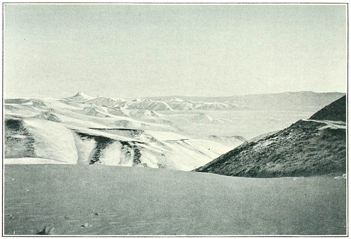
Fig. 171. Looking East-South-East from near the Kop Pass.
It was a little after noon; the mountains streamed with light, and only above the deeply-seated river valley a heavy mass of vapour hung. All the summits which are seen on this side of that vapour belong to the block of mountain on the north. The conical peak on the left of the illustration is the beautiful Jejen Dagh. Beyond the mist, the distant heights are those of the southern border in the neighbourhood of Erzerum.
In another half-hour we had reached about the highest point upon the undulating snow-fields of the summit region. The Kop itself, the mountain which gives its name to the pass, is a flat-topped mass, rising with steep slopes on the right of the road. The pass has an elevation of 8048 feet. So brilliant was the sun that we were enabled to linger, and to attempt to realise the panorama of the south.
The traveller who should approach Armenia by this well-beaten avenue might fail to discover the characteristics of a great tableland in the configuration of that extensive portion of her area which is outspread from this pass. It is true that the range he crosses resembles a large block of hard material rather than a chain of mountains in the more usual sense. But the outline of this mass is broken into peaks of every shape; and the opposite ranges display the same features, the whole combining to produce the impression of a troubled sea. How different was this landscape from that which I had overlooked from the pass of Zikar on the north! Yet the explanation of this diversity does not, I think, belie the conception which a wide experience had inculcated in my mind—the conception, namely, of a vast mass of elevated country of which a prevailing characteristic is the flatness of its surface. For in this landscape the levelling influence of the lavas are almost absent, while, on the other hand, the operation of the various processes of denudation have been conducted on a colossal scale and with conspicuous results. The ancient sedimentary deposits have been worn by their action into peaks of considerable relative height, while the plains with their lake-like beds have, as it were, usurped the character of the mountains by which they are overhung. Reserving for further study the country between Frat and Murad on the west of Erzerum and Mush, I need only remark that its present aspect from the standpoint of this pass was somewhat foreign from the idea of prevailing flatness which similar prospects had invited me to form.
Proceeding on our northward journey at ten minutes before two, we entered, a little later, a break in the mass. In the hollow flowed a torrent, partially encrusted with ice, the first of the streams which find their way to the Black Sea. As we advanced, this shallow opening became a deep gorge, leading, almost directly, towards the north. The road was taken by easy gradients down this convenient valley, and, after a course of over five miles from the culminating point of the pass, reached the shelter known as the Northern Kop Khan. Here we rested for an hour and a half, continuing our ride at half-past four o’clock. We kept the torrent on our left, still adhering to the gorge, which displayed a fine view backward to the top of the mountain mass. A wall of stupendous height crowned its uppermost end, and displayed the familiar flat edge. The strata, of a marmorised limestone, which overhung the glen were much contorted, like the grain of a knot in a tree. After crossing a stream, in part icebound, which we recognised as the Chorokh, we arrived at a quarter-past six at the little settlement of Maden Khan (5455 feet) near Halwa Maden, distant some 6½ miles from our last halting-place, or about 29 miles by the road from Ashkala.
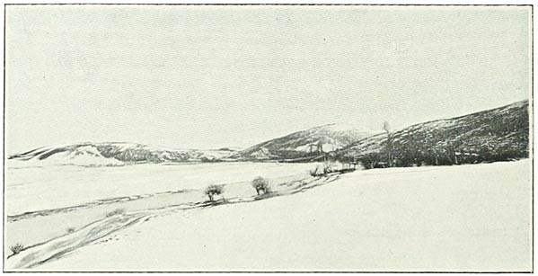
Fig. 172. On the Banks of the Chorokh above Baiburt.
I do not propose to follow in detail the further stages of our journey to the coast of the Black Sea. But I have not yet taken my reader to the extreme geographical limits of the country which in the present work I am endeavouring to describe. From Maden Khan it was still a ride of one and a half days to the pass where you bid farewell to the Armenian plains. This northerly extension of the highlands of Armenia is watered by the Upper Chorokh.
February 8.—Leaving the cluster of wayside hospices in which we had passed the night, our course was directed westwards down the stream. On either bank rose hills of marble with no great relative elevation, covered, like the valley, with deep snow. The current sometimes flowed in an open channel, and as often plunged beneath a continuous crust of ice. Not a single tree, nor even a bush, was visible in the landscape. A little further down the hills opened, and gave place to a stretch of plain (Fig. 172). At the western end of this expanse they again circled inwards, and the valley took an abrupt turn towards the east. At the mouth of this passage is situated the castle and town of Baiburt, barring the approach to these uppermost reaches of the Chorokh.
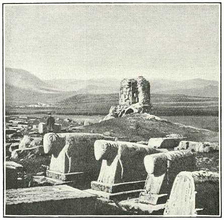
Fig. 173. Armenian Cemetery at Varzahan.
It was towards those dividing heights that we set out on the 9th of February from the lonely station of Khadrak in the valley of Balakhor. The stream which waters this valley and finds its way to the plain of Varzahan was buried beneath a continuous canopy of snow. The heights on either side were of insignificant elevation, relative to the general level of the ground. In half an hour a way diverged, well beaten by traffic, leading to Kelkid and Erzinjan. It branched off on the left hand; we were at the head of the valley, surrounded by an amphitheatre of hills. Our course was directed to the wall upon our right; and in another ten minutes we had gained the eminence. We were standing not exactly on a ridge, but on the face of an upland, over which the winds sweep in stormy weather with considerable force. Yet another half-hour brought us to an elevation of 6468 feet, the saddle of the Vavuk Pass. We had arrived upon the boundary line between two vilayets, of Erzerum and of Trebizond.
I was informed that quite recently a Tartar horseman had met his death while carrying the post across this pass. He was overtaken and overwhelmed by a tipe or blizzard before he could reach the shelter of the valleys on either side. Indeed the loss of life to beasts of burden is considerable along this road. No more eloquent evidence could be furnished of the want of humanity in the natives than the callous indifference to the sufferings of dumb animals which day by day is displayed upon these passes. Such a habit of cruelty at once argues a lapse into barbarism, and explains the perpetration of the nameless horrors which so often shock the conscience of the West. We kept passing strings of heavily-laden quadrupeds, which with their dull eyes, drooping heads, and fleshless bodies, covered with sores, had lost the distinctive qualities of the horse. None of them had any thighs to enable them to breast the ascents, and most were incurably lame. Their hocks were bent with curbs or swollen by spavins; one poor beast was dragging his hind legs behind him, and another had one of his forelegs bent almost double. Neither—it could not be doubted—were destined to reach Trebizond. So they crawl over the ground, from year’s end to year’s end, until they close their miserable existence by sinking exhausted on a pass. Even at the moment of liberation they are doomed to a prolonged agony; and, having been martyred all their life by the barbarity of the human animal, they become victims of his perverse humanity in their death. You will see them prone upon the road, where their drivers have abandoned them to kick out their life in the snow. Religious scruples prevent these misguided monsters from giving them the despatch. We were sickened on one occasion by the spectacle of a wretched horse which, with glazed eyes, continued to paw in a convulsive manner a space of ground which in his agony he had cleared of ice. At the end of my revolver I compelled one of the drivers to sever his jugular vein.
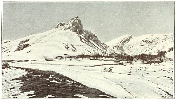
Fig. 174. Castle of Kalajik, Upper Kharshut.