APPENDIX.
Reading edition
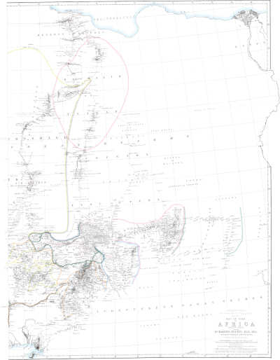
DR. BARTH’S TRAVELS IN NORTH AND CENTRAL AFRICA Sheet No. 15. MAP OF PART OF AFRICA (EASTERN SHEET) showing DR. BARTH’S ROUTES, 1850-1855 between and native itineraries collected by him. Constructed and drawn by A. Petermann. Engraved by E. Weller, Duke Strt. Bloomsbury. London, Longman & Co.
APPENDIX I.
COLLECTION OF ITINERARIES ILLUSTRATING THE WESTERN HALF OF THE DESERT, ITS DISTRICTS, AND ITS INHABITANTS, AND THE COURSE OF THE UPPER NIGER.
A.—Eastern Route from Tawát to Mabrúk, and thence to Timbúktu.
N.B.—The route proceeds from Aúlef in Tidíkelt, which is situated one short day from Ákabli (this is the right accent), and three days from Ínsala or ʿAín Sálah, the distance between Ákabli and the latter place being about the same.
2nd day. Teríshumín, a well.
4th. Derím.
7th. Ínzíze, a well. As far as this point, the route follows a course a little E. of S. (evidently in the direction of Gógó), but from this point onwards S.W.—The syllable “ín,” or “ʿin,” seems to be the old Berber-Semitic form for “ʿaín.”
14th. Índenán, a well, having crossed the desert tract called Tanezrúfet.
17th. Ín-tabórak; the last stage is only half a day’s march.
19th. Moila.
22nd. Taunant; the last stage is half a day’s march.
24th. Mabrúk.
The ordinary and general road from Mabrúk to Timbúktu leads by Árawán:—
2 days. Mʿamún. ⎫ ⎬ ⎭ I shall speak about these places in the general account of Ázawád.
2. Bú-Jebéha.
2. Árawán.
4. Tenég el haye, or Tenég el háj.
1½. Timbúktu.
Between Tenég el háj and the town there are the following localities:—El Áriye, El Ghába, El Meréra, Áthelet el Megíl, Éllib el Ághebe, Tiyáre el Jefál, Tiyáret el Wása.
Route from the hillet e’ Sheikh el Mukhtár, generally called “el hilleh,” (see the itinerary from Timbúktu to the hilleh, Vol. IV. p. 454) to Tósaye, in long days’ marches; direction, as my informant supposes, exactly S.:—
1st day. Núr, a mountain without water.
2nd. A locality on this side of a place called Dergel.
3rd. Kazúft, a large pond of water in the rainy season.
5th. Tósaye, or Tósé, the great narrowing of the river, (see the journal).
From the hilleh to Gógó is reckoned a distance of eight days.
B.—Route from Ínzíze to Gógó.
4th day. Tímmísau (hasi Músa? I think, it cannot be the well of that name on the direct road from Tawát to Mabrúk, which would give this whole route a far more westerly direction). Near the well is a rocky eminence like a castle, and famous on account of the tale of the footprint of Moses’ horse, a story also attaching to the other well which I mentioned. It appears, from this route, that the arid desert, the Tanezrúfet, becomes narrower and more contracted towards the east.
7th. Ín-azál; the last march but half a day.
9th. Súk, or “e’ Súk” (Essúk), the ancient dwelling-place of the Kél e’ Súk, now without settled inhabitants, situated between two “kódia,” or hilly eminences, one lying towards the E. and the other towards the W., just as the ancient city of Tademékka is described, with which it was evidently identical (see the journal). The town was destroyed by the Songhay conqueror, Sonni ʿAlí, in the latter half of the fifteenth century. The vale is said to be rich in trees.
11th. Gúnhan, another site of an ancient dwelling-place, and once the residence of the Kel-gúnhan, with a hilly eminence.
13th. Takerénnat, another site.
14th. Tel-ákkevín (or Tin-ákkevín), a well.
16th. Tin-óker; the last stage half a day’s march.
18th. Gógó, or Gágho, the last day again a short one.
C.—Western Road from Aúlef to Mabrúk.
1st day. Dháhar el hamár, a hilly chain called the ass’s backbone.
3rd. El Immerághen.
5th. Wallen, a well.
12th. Ám-rannán, a well, two days W. from Ín-denán, having crossed the arid desert Tanezrúfet. In summer you travel here by night. In winter, travelling night and day, with only short halts, you may accomplish this march in four days.
17th. Ín-asserér, perhaps “the well of the stony tract,” or hammáda, “serír,” being the proper term for such a region.
20th. Tin-hekíkan, a well, in former times the common settlement of the tribe, which thence has received the name Kel-hekíkan. It is W. or S.W. of the well, called Taunant (see p. 457).
22nd. Mabrúk; the last day’s march a short one.
D.—A few particulars with regard to the region called Ázawád, and the adjoining districts.
The name Ázawád is a corruption due to the Arabs of the Berber name Ázawágh (pronounced Ázawár), which is common to many desert tracts. But the district which has become known to the Europeans under the name Ázawád, comprises an extensive tract of country to the N. of Timbúktu, stretching north-westward as far as “El Júf,” the great sink or “belly” of the desert, full of rock-salt, and to the N.N.E., a little to the N. of Mabrúk, while its southern part, extending from the distance of one day’s march from Timbúktu, to about three days northward, is more properly called Tagánet. I will only add, that Caillié mistook the name Ázawád, which he writes Zawát, for that of a tribe. (Vol. II. p. 97, and elsewhere.)
The tract of Ázawád, although appearing to us a most sterile tract of country, and thus characterized already by Arab travellers from the N., as Ébn Batúta and Leo Africanus, is a sort of paradise to the wandering Moorish Arab born in these climes. For in the more favoured localities of this district he finds plenty of food for his camels, and even for a few heads of cattle, while the transport of the salt of Taödénni to Árawán and Timbúktu affords him the means of obtaining corn, and anything else he may be in want of. There are four small towns or villages in Ázawád, the most considerable of which is Árawán, a town small in extent, such as described by Caillié[60], the number of its inhabitants scarcely exceeding 1500, but a very important place for this part of the world, and where a great deal of business is transacted, principally in gold, as I have described on a former occasion (p. 22 et seq.). On account of this trade, several Ghadámsíye merchants are established here. It is a fact which was unknown before, but which is indisputable, that the original inhabitants of this place, as well as of the whole of Ázawád, belong to the Songhay nation, the Songhay-kiní, even at the present day, being the favoured idiom of which all the inhabitants, including the Arab residents, make use. The present chief or headman of the town is Sídi Mohammed, a younger son of the notorious chief El Habíb Weled Sídi Áhmed Agáde, who died the year previous to my arrival in Timbúktu. The younger son gained the precedence over his elder brother Óba, who has performed a pilgrimage to Mekka, solely on account of his mother being the sister of Hámed Weled ʿAbéda Weled Rehál, the chief of the Bérabísh, and the murderer of Major Laing. The family of El Habíb belongs to the Ígelád, forming at present a small section of the large group of the Áwelímmiden. They are now only distinguished by their learning, but formerly they were very powerful, and, together with the Imedídderen, were the most ancient inhabitants of the locality of Timbúktu. The inhabitants of Árawán pay an annual tribute of sixty mithkál of gold to the Hogár, in order not to be molested by their continual predatory incursions.
The three other small towns, or permanent dwelling-places in Ázawád, viz. Bú-Jebéha, Mʿamún and Mabrúk, all lying in a line N.N.E. from Árawán, almost at the equal distance from each other of two days’ easy travelling with camels, are much smaller and less considerable than Árawán. Of rather more importance at present than the two others is Bú-Jebéha, which is principally inhabited by Kél e’ Súk, and has a little commerce; but Mabrúk seems to have been of great importance in former times, when it was inhabited by Songhay people, had a Songhay name,—Mabrúk being a comparatively modern name given to it by the Arabs,—and was the market of Waláta. In some respects this place might seem to have a right to be identified with the ancient Aúdaghost; and there are certainly the sites of some former dwelling-places in the neighbourhood, especially Tel-Aröást, two days N.E. either from Mabrúk or from the hilleh, but in another place I have explained (Vol. IV. p. 581) why we have to seek the site of Aúdaghost in quite a different locality. There are some valleys clad with palm-trees to the east of Mabrúk (see Vol. I. Appendix, p. 570), especially the valley called Tesillíte, which produces two different kinds of dates, viz. the tíssagín and the tin-áser. The names of the respective chiefs of the three places are—Mohammed Weled Sídi ʿOmár, the chief of the tribe of the Ergágeda in Mʿamún; Najíb Weled el Mústapha el Kél e’ Súki (the same who signed the letter of Áwáb, the chief of the Tademékket, giving a complete imána to the English in the territory comprised between Gúndam, Bamba, Timbúktu, Árawán, and Bú-Jebéha), together with ʿAzízi in Bú-Jebéha, and Méni Weled Sídi ʿOmár in Mabrúk.[61]
There was formerly, in Ázawád, another place with a permanent settlement, called “El Hilleh,” or “Hillet e’ Sheikh Sídi Mukhtár,” which I have mentioned in a former place (Vol. I. p. 560, and Vol. IV. p. 454), two days east of Mʿamún[62], and about the same distance from Mabrúk, but this place was deserted a few years ago, on account of the well Bú-Lanwár, which is stated to have had a depth of forty fathoms, having fallen to ruins. The hilleh was situated in the “batn,” or valley, at the northern foot of a black rocky chain of hills called “Ellib el Hejar.” To the north is another chain or ellib east of the hilleh; but, on this side, still in the batn, is a locality called “El Mádher,” with good pasturage for horses. Other well known localities thereabouts are, Shirshe el Kebíra, and Shirshe e’ Seghíra.
Of the wells of Ázawád, the following are the most notorious: first, in the southern part of the district, towards Tagánet, Mʿamún, different from the place of the same name; Énnefís, a copious well, two hours S.W. from Mʿamún, and situated in a hilly district, thickly clad with underwood, and containing quarries of a beautiful black limestone, from which the Tawárek manufacture their heavy arm-rings, or áshebe; Meréta, Makhmúd, Shíker, Gír, Kartál, a very copious well, ʿEn-filfil, and others. Further to the N. and N.W. are the wells, Halúl, El Hóde, Shébi, Temandórit, Tékarát, Aníshay, Áshorát, a well where the Sheikh Áhmed el Bakáy, in the early part of his life, resided for a long time, Ánnazau, to the north of Mabrúk; Alibáda (ʿAlí Bábá?), Bú el Meháne, or Bel Mehán, the well mentioned in the itinerary (Vol. IV. p. 454), as distant about ten miles from the hilleh, Belbót, south of Bel Mehán; Írakshíwen; Merzáhe, south of the latter; Megágelát, two days south of the hilleh, and others.
The most famous wells in the district called Tagánet, are—Wén-alshín, situated at the distance of four days from Timbúktu, and three from the hilleh, where Mohammed e’ Seghír, El Bakáy’s elder brother, usually encamps part of the year; Tin-tatís, half a day S.W. from the former; ʿEn-óshif, Ímmilásh, ʿEn-gíbe, ʿEn-séek, ʿEn-odéke, a well where Bábá, a younger brother of El Bakáy, has his encampment, three days south from Mʿamún, four days N.E. from Timbúktu; Ámenshór, Árrazaf, ʿArúk, El Makhmúd, different from the well of the same name mentioned above; Igárre, Mérizík, Twíl, Waruzíl.
Towards the north, the district of Ázawád is separated from the dreary and waterless desert known by the general Berber name of Tanezrúfet (meaning “arid hammáda”) by the two small districts called “Afeléle” (meaning the little desert, or “afélle”), and north of it Áherér. Afeléle is a highly favoured region for the breeding of camels, and contains some famous valleys, or “wádián,” such as Tekhatímit, or Teshatímit, Afúd-énakán or Afúd-n-akán, Tadulílit, ʿAbatól, Shánisín, Agár, and others. Áherér, likewise, is considered by the Arabs as a fine country diversified by hill and dale, with plenty of wells, and even temporary torrents. This is the district, in one of the valleys of which, “Wádí Áherér,” Major Laing was attacked and almost killed by the Tawárek.
Towards the east, the districts of Ázawád and Tagánet are limited by several smaller ones, where the Arab population is greatly mixed with the Berber or Tawárek element, especially the Ífoghas. At the same time, these districts separate Ázawád from Áderár, the fine hilly country of the Awelímmiden, which is excellent not only for the breed of camels, but also for that of cattle. These intermediate districts are—Ím-eggelála, a district of about two days’ extent in every direction, consisting of black soil, and furnished with shallow wells; E. and E.N.E. of Tagánet, is Tilímsi, a district rich in food for the camel; E.N.E. of the hillet e’ Sheikh el Mukhtár, is another district called Timitrén, with many wells and a few villages; and E.N.E. of the latter, the district called Tirésht, or Tighésht, bordering on Áderár.
Of Arab tribes in Ázawád and the adjoining districts, I have first to mention several sections of the great tribe of the Kunta, who are distinguished by their purer blood and by their learning above almost all the tribes of the desert.
The Kunta are divided into the following sections:—
The Ergágeda, who were formerly regarded as the Welaye, or the holy tribe.
The Welád el Wáfi, at present the Welaye, with the Sheikh Áhmed el Bakáy as Welí, while his elder brother, Sídi Mohammed, exercises great authority over the whole of Ázawád. The Welád el Wáfi cultivate the friendship of the Hogár, while the Welád Sídi Mukhtár are the deadly enemies of the latter. They are subdivided into three divisions, called—
El Mesádhefa, Welád ben Haiballa, and Welád ben ʿAbd e’ Rahmán.
The Welád Sídi Mukhtár.
El Hemmál.
The Togát also are said to belong to the Kunta.
The Berabísh (singl. Berbúshi), a tribe less numerous than the Kunta, mustering about 260 men armed with muskets, and 180 horsemen, and not spread over so wide a tract, being concentrated in the district between Árawán and Bú-Jebéha. They pay a tribute of 40 mithkál of gold to the Hogár, and are molested by continual incursions of the Welád ʿAlúsh. The Berabísh, who probably are identical with the Perorsi of the ancient geographers, have migrated southwards since that time, and are of very mixed blood. They lived formerly in El Hódh, and are mentioned by Marmol Carvajal, who wrote in the seventeenth century, as visiting the market of Ségo; in the beginning of the sixteenth century, they lived still further to the W., and visited especially the market of Jinni.[63] The Berabísh are divided into two groups, the principal of which is ruled by the chief Hámed Weled ʿAbéda Weled Rehál, and consists of the following sections:
The Welád Slímán, the Shiúkh, that is to say, the tribe to whom the Sheikh belongs, and who have based their power and wealth upon the ruin and spoil of the Welád Ghánem.
The Welád ʿEsh.
The Welád Bú-Hinde.
El Gwanín el kohol.
El Gwanín el bédh.
Welád Áhmed.
These are the free tribes of this group; the following are the degraded and servile tribes, the “lahme” or “khoddemán”:—the Yadás, the Ládim, or rather only a small portion of that tribe, the Árakán, the Áhel ʿAísa Tajáwa, El Ússera.
The second group of the Berabísh as a whole, bears the remarkable name of “Botn el jemel,” on account of its being composed of heterogeneous elements, brought together by chance, just as is the case with various kinds of food in the “stomach of the camel.” It is ruled by a chief of the name of Hamma, and consists of the following tribes:—Welád Relán; Welád Derís, originating from Tafilélet; Welád Bú-Khasíb; Welád Ghánem, and the Turmus, the latter being the tribe of which I have spoken on a former occasion.
E.—Route from Bóne or from Hómbori, by way of Konna, to Hamda-Alláhi.
Dalla the chief place of the province of the same name, is of considerable size, and the residence of a governor. Módi Bóle, who was a man of some note, died a short time before the period of my journey. The place is mostly inhabited by Tombo, only a small portion of the inhabitants being Songhay. The mountains are inhabited by the Sána, probably a section of the Tombo who have still preserved their independence. The town of Dalla is two good days’ journey from Hómbori, and one from Bóne.
1 day. Dwentsa, a considerable place, said to be as large as Kúkawa, and important as a market-place. The road traverses a mountainous region, described as being supplied with running streams (in the rainy season?), and to be richly clad with trees.
1 day. Dúmbará, large place, seat of a governor, but destitute of any handicraft. Country mountainous.
1 day. Nyimi-nyába, a middle-sized place. Country a little mountainous.
1 day. Boré, a large town, seat of a governor. Country mountainous, intersected by channels for irrigating the kitchen gardens. Cotton, rice, and corn is cultivated. All these appear to be very long days’ marches.
2 days. Timme, a large town, seat of a governor. On the road you see the Dhiúliba, or rather its floods, on your right, at least during part of the year. Cultivation of rice exclusively.
2 days. Karí or Konna (as the Songhay call it), seat of a governor, and important as a market-place. All the black inhabitants of the town speak the Songhay language. The town is also called Benne-n-dúgu or Bana-n-dugu, the tribe of that name, the Benni, having probably extended much farther to the N. in former times. See Caillié ii. p. 16.
2 days. Niakóngo, seat of a governor of the name of Háj Módi, brother of Háj ʿOmár. After the rainy season, the floods of the river closely approach the town.
1 day. Hamda-Alláhi.
F.—From Timbúktu by Gúndam to Yówaru, and from Yówaru to Hamda-Alláhi.
3rd day. Gúndam. There are no settled halting places between Timbúktu and Gúndam. People generally perform the distance in two days and a half. The following is a list of the names of localities between these two places:—Téshak, Finderíye, El Hándema, Aristoremék, Egéti, Tin-getán, Tin-réro, Timbarágeri, two villages of the name El Meshra, Takémbaut, Tenkeríye, Naudis, Gámmatór.—Gúndam is a walled town (ksar or koira), the chief place of the district Aússa, and of considerable size, its population consisting of Songhay, Rumá, and Fúlbe or Fullán. The town has a suburb on its W. side, where live the Tóki, a tribe of the Fullán, and another suburb on the water-side, where live the Erbébi. On the N. side there is a black hill, full of fernán. Also to the S. an eminence is seen presenting the same appearance. The town is situated on the N. side of a large khálij or rijl (branch of the river) coming from Dire and turning towards Rás el má, the celebrated “head of the waters,” distant from here two days, either by land or by water, W. a little N. Another creek runs from Gúndam to Kábara; but during the highest level of the inundation the whole country presents almost one uninterrupted sheet of water. On the east side of Gúndam is a dry creek called Aráshaf, one day long, and half an hour wide. At its eastern border, E.S.E. from Gúndam, is the place called Waye e’ semen, with a creek adorned with the tree called táderes.
4th. A walled village (koira) of Imóshagh and Songhay on the trunk of the river, having passed in the morning the branch on which Gúndam is situated.
5th. Arabébe, a village inhabited by Fúlbe.
6th. Nyafúnke, a large village, inhabited in former times by Imóshagh, but at present peopled by Fúlbe.
7th. Íketáwen. Having passed in the morning close behind Nyafúnke, a large branch of the river, halt at noon in a village called Sherífikoira.
8th. Átará, a large village of Fúlbe, on the east side of a considerable branch of the river going to Gasí Gúmo.
9th. Fadhl-Alláhi a Fúlbe village.
10th. Yówaru. Yówaru is one of the two chief places of Fermágha, and although consisting entirely of reed huts, is said to be little inferior in the number of its inhabitants to the town of Timbúktu. The importance of the place is clear enough from the annual amount of tribute which it pays, amounting altogether (zekʿa and modhár taken together) to 4000 head of cattle. During the inundation Yówaru lies at the border of lake Débu, which, at that season, extends from Sʿa to Yówaru, but during the dry season, it is about one mile distant from the small branch. Close to the latter lies a suburb where the Surk or Kórongoy, a degraded section of the Songhay, dwell.[64] In Yówaru and the neighbourhood live a great number of Fúlbe or Fullán belonging to the following tribes:—the Sonnábe, Yalálbe, Feroibe, Yówarunkóbe and Jawámbe, or Zoghorán or Zoromáwa.
G.—From Yówaru to Tenéngu.
1st day. Urungíye, an important place.
2nd. Máyo, a village so called from a small creek, the Máyo Sórroba, on which it lies. Between Urungíye and Máyo seem to lie the villages Séri and Nyamihára, the former inhabited by Songhay, the latter by Fúlbe.
3rd. Ganga.
4th. Kógi or Jógi, having passed several hamlets, one of them called Gínnewó, a hamlet of cattle breeders with a ksar, then Dokó, Ngúdderi, Jóñeri, Sabáre, and Burlul.
5th. Kora.
6th. Konna.
7th. Tenéngu. The distance between Urungíye and Tenéngu can, however, be performed in two days good travelling.
Between Urungíye and Móbti lie the following places:—Úro-Módi, Káram, a Songhay village; Rogónte, a hamlet of Fúlbe, Yerére, a hamlet inhabited by slaves of the Fúlbe, Wálo on the Máyo Fenga; Kaya, a village inhabited by Aswánek, and finally, Sáre-méle and Sáre-béle, the river probably forming a great bend near Wónyaka, so that these latter towns are touched at in coming from both sides, either the N. or the S.
H.—From Yówaru to Hamda-Alláhi.
1st day. Dógo, on a small creek.
2nd. Shay, probably meaning the place of embarkation, on the N.W. side of the river, which is very wide in this spot. Pass on the road one or two branches of stagnant water, which you must cross in a boat. Perhaps one of these branches is the same on which the village Máyo lies.
3rd. Encamp on the bank of a smaller creek (Máyo dhannéo?)
4th. Niakóngo.
5th. Berber, a very short march.
6th. Síye, in the morning.
7th. Hamda-Alláhi, the capital of the kingdom of Másina.
I.—List of towns and villages situated along the bank of the chief trunk of the river Ísa-bére or Máyo-mangho, from Dire upwards to Sansándi. This branch is the north-westerly one; the other, which Caillié navigated, is the south-easterly, and is called Bara-Ísa.
Dire, a very important place, one of the eldest settlements of the Songhay in this quarter, situated at the point of junction of two branches which have separated from each other in the lake Débu.[65]
Tindírma, one of the original seats of the Songhay, by some regarded as the original seat of the whole tribe. That portion of them called Sáhena were especially settled here. It is now principally the residence of the Chóki, who formerly were settled in Gúndam. With regard to its importance in former times as the capital of the province of Kúrmina, see Vol. IV. p. 420. A little distance from the bank of the river lies Gitigátta, and on the island in the river the locality called “Al Mohalla,” probably from having been once the spot where part of the Mohalla, or the army of the Moroccains, remained encamped. At Tindírma, the branch of Gúndam separates from the main trunk of the river.
Hamma-koira.
Nyafúnke.
Síbo. This is evidently the town Seebi where Mungo Park is said to have made some stay on his voyage from Jenni to Timbúktu. (Clapperton’s Second Journey, Appendix, p. 334.)
Dháhabi-koira, called after a sheríf belonging to the family of Muláy el Dhéhebi.
Gúmmo.
Átara.
Tongomáre.
Úro.
Yówaru. In crossing from Yówaru the next branch, and leaving Gúram on one side, you reach Zinzo or Jinjo, or Gíjo, as it is called, in four or five hours. This is another of the eldest seats of the Songhay, and probably the place from whence Islám spread in this quarter, there being here the sepulchre of a venerated saint called Mohammed el Káberi, belonging to the Idaw el Háj. It is not impossible that this is the place of pilgrimage to which Scott the sailor went as a captive by way of the Giblah, crossing the lake.[66] In the neighbouring hamlet, Togga, also, is the tomb of a holy man called Morimána Báka. There is another tradition current in Zinzo, of a saint of the name of Elfa Zakkaríyá, who is said to have visited this place at a time when no village existed, nothing but a cavern being then inhabited.
S.E. of Zinzo, at some little distance from lake Débu lies Áwi. The Débu is so shallow during the dry season, that the native boats can only proceed with great difficulty along the main channel, and often stick fast entirely. In the dry season the natives ford it by wading through the water. Where the main branch, called by the Fúlbe Máyo balléo, reaches the lake, at least during the rainy season, it divides into a net of smaller branches, thus increasing the difficulty of the navigation. On the contrary, the advantage of the smaller branch, the Bara-Ísa, or river of Bara, called by the Fúlbe Máyo dhannéo, consists in preserving one unbroken volume of water. This was the reason probably why the party with whom Caillié went down the Niger from Jinni followed this branch. Besides the Máyo balléo and dhannéo, the chief creeks which join the Débu are the Máyo Píru and the Máyo Jóga, not inconsiderable during the rainy season, but very small during the dry one.
The lake, besides fish, contains numbers of that curious animal called ayú (manatus).
From the lake upwards, there lie along the principal branch of the river the following places:—
Búri.
Bánghida.
Waládu.
Ingárruwe.
Mányata.
Kossanánna.
Tánnare.
Bówa.
Kirrínkiri.
Gánde-Táma.
Sarbére.
Kára, an important place, after which the river is sometimes called “the river of Kára.”
Ingánshi.
Dággada.
Kumáy, a place of some importance, distant two days from Yá-saláme[67], which is about three days from the considerable market-place Tenéngu (p. 469), both W. from the river.
Júgi.
Nyásu.
Kóliñango.
Sabáre.
Búrruwé.
Fenga, a middle-sized place, after which this whole branch of the river is also called “Máyo Fenga,” about two hours E. from Tenéngu, and one good day’s march from Fáfarák.
We now proceed along the south-eastern shore of the Débu and along the Máyo dhannéo.
Gúram, a considerable place, situated round a large rocky eminence, kódia, as the Arabs call it, or “haire,” as it is called by the Fúlbe, who celebrate it highly as the “haire maunde Gúram.” The mount is so conspicuous in the flat alluvial level, that it is visible from Yówaru. Caillié saw it at the distance of three or four miles (ii. p. 18); and again, further on, where he calls it St. Charles’ Island (ii. p. 20). The village is separated into three distinct groups, one of which is called Gúram Fúlbe, lying at the northern foot of the kódia; the other, Gúram Hábe, inhabited by Songhay; further on and finally, Gúram Súrgube, inhabited by (degraded?) Tawárek or Surgu.
Méro ⎱ ⎰ Both inhabited by Kórongoy.
Bang
Sóba.
Sórroba, situated at the foot of another smaller rocky eminence called “haire Sórroba,” lying opposite to Gúram on the S. side of the river, which seems to make here a great bend. It is mentioned by Mohammed el Másini (Appendix to Clapperton’s Second Journey, p. 331). Caillié gave it the ridiculous name of “Henry Island.”
Jantaye, a considerable place.
Máyo Tína, a place close to the former, inhabited by Tawárek.
Kóbi. (Compare Caillié’s account, ii. p. 16.)
Nye.
Batamáne.
Sáyo, distant half a day’s journey from the Batamáne, towns close to the bank of the river becoming here more rare.
Wáñaka, where the two branches unite, being joined besides by a small westerly creek, called by some Máyo Fenga.
Hombólbe, the principal seat of the Kórongoy or Surk, who also constitute the chief inhabitants of the places Ngárruwe and Toy.
Karashíru.
Kara-úra.
Neménte, and not far from it inland, the village called “rúgga Bóde.”
Náta.
Kammi.
Móbti or Isáka, situated at the point of junction of the two branches of the river, which have divided at Jafarábe, a low point of land, as it seems, separated by the river into a group of six islands, where all the boats coming from Hamda-Alláhi and the lower river, and proceeding to Sansándi, are obliged to disembark their merchandise, which, henceforward has to be transported on the back of donkeys to the place of its destination. Of these two branches the north-western[68] one bears also the name of Máyo Jágha, from a very important place, the celebrated Zágha of the Arab geographers, which on account of its situation out of the great commercial track is at present not very generally known in those quarters. The original form of the name both with Songhay and Fúlbe, seems to be Jáka or Jágha; but the letters Z and J are continually interchanged. The town is said to lie at the distance of one and a half day S.W. from Sáre-dína, “the city of the (Mohammedan) religion,” and only half a day N.E. from Jafarábe[69], and is still celebrated on account of its excellent “tári” or “leppi.”
I here add a short list of the towns and villages between Kúna, the place where the river is ordinarily crossed in proceeding from Sofára to the island of Másina Proper, and Móbti:—From Kúna, about six miles E., is Néma, situated on the E. side of the river; from Néma, Tikkétiá, on the W. side of the river; Sáre-béle, on the E., Sáre-méle, on the W. of the river, N. of Tikkétiá; Gómi, a large town on the bank of the river; Móbti, on the E. side, with large fortifications, if I have understood right, of an ancient date, where the two branches join; Nymitógo, on the E. side of the river.
The distance from Tenéngu, is also a day and a half, and between them lie the following places, beginning with Tenéngu:—Takanéne, Chúbe, a hamlet inhabited by slaves, Kumbel, Ingelléye, Taíkiri, Kóllima, and Warángha.
From Jafarábe upwards along the river, are situated the places:—
Kongunkoro, “old Kongu.”
Kóno.
Jóru.
Síbila.
Maddína.
Sansándi (this is the Songhay form), or Sansánne (the Mandingo form), the well-known starting point of Mungo Park’s voyage down the river. Mr. Cooley supposes that “di” is a contraction of ding, meaning “little.”
K.—From Hamda-Alláhi to Kábara by land by way of Sʿa.
1 day. Niyakóngo, a large town at a considerable distance from the river; much cultivation.
1 day. Denéngu (?), a place inhabited by Fúlbe and Songhay, the latter being more numerous than the former; near the bank of the river.
1 day. Úro-Búlo, a place inhabited by Fúlbe on the E. side of the Débu.
1 day. Sʿa, a large place, inhabited chiefly by Bámbara, the seat of a governor, as was also the case in former times, on the E. side of the Máyo dhannéo or Bara-Ísa. Many dúm-palms, or rather deléb-palms, grow in this neighbourhood, from whence Timbúktu is supplied with rafters. The floods of the lake and the various branches or creeks are so considerable during the rainy season, that at that period of the year, a person cannot reach Hamda-Alláhi in less than six days.
1 day. Kóma, a small town of Bámbara, at a considerable distance E. from the river.
1 day. Chiay, close to the bank of the Máyo dhannéo.
1 day. Sáre-feréng, a Bámbara place. The road leads all the way along the S.E. bank of the river.
1 day. Jangináre, a Bámbara place.
1 day. Árkoja, a town partly inhabited by Bámbara, partly by Songhay, the former prevailing.
1 day. Dári, a large place of Fúlbe, who call it Dár e’ Salám. No Bámbara inhabitants.
1 day. Bongesémba, a village inhabited by Fúlbe Sudúbe, close to the point of junction, called Ísofay, of the two branches of the Dhiúliba, the white (dhannéo) and the black (balléo), the quality of their waters being totally different, one being full of crocodiles, hippopotami, and fish, and the other containing nothing of the kind, just as is the case with the Tsád. The water of the black river overwhelms the white water of the dhannéo. Cross the river.
1 day. Tindírma, a large Songhay place. A long day.
1 day. Dire, one of the eldest places of the Songhay.
1 day. Dongoy, inhabited by Songhay, no Fúlbe; on the E. side of the river.
1 day. Tóyai, a Songhay village; the Tademékket rove in this neighbourhood. Country level and without trees, being temporarily flooded.
2 days. Kábara, keeping close along the river, and crossing a small rivulet or creek.
L 1.—From Hamda-Alláhi to Káñima.
1st day. Síye.
2nd. Niyakóngo, having passed the heat in the hamlet called Berber.
3rd. Benne-ndúgu or Konna, having passed the heat in Nʿamet-Alláhi (a long day’s, if not two days’, journey).
4th. Toy. Arrive before noon.
5th. A Songhay village or ksar.
6th. Konsa, a Fúlbe village.
7th. A village inhabited by Fúlbe, Songhay, and Bámbara.
8th. Takóti.
9th. Sambejeráhit.
10th. Ungúma.
11th. Káñima, on a branch of the river coming from Bámbara (see Vol. IV. p. 361), and at a day’s march from the latter place.
L 2.—Another short Itinerary from Káñima to Hamda-Alláhi.
1st day. Lábo.
2nd. Dóra, a rúmde, or slave hamlet.
3rd. Takóti, or Jengináre, both on the Bara-Ísa, Jengináre lying a little to the S.W. of the former.
4th. Another town on the Niger, the name of which informant has forgotten, probably Sáre-feréng.
5th. Gulúmbu, on the widening of the creek Débu or Dóbu. (Another road leads from Káñima by Lábo, Langóma, Konse, and another place to Gulúmbu).
6th. Doy or Toy, a large Songhay place.
7th. Karri, Konna, or Benne-ndúgu, all names of the same place. On your way you pass Kori-ántsa, a large Púllo village.
8th. Nʿamet-Alláhi, a town of the Feroibe.
9th. Fatóma, the market place (the market being held every Saturday) of Konári, not a large place.
10th. Hamda-Alláhi, a good day’s march of ten hours.
M.—List of towns in Jimbálla, Zánkara, and Aússa.
(A.) Towns in Jimbálla, the district S. of the river W. from the district Kíso:—
Ayún, Kúfa, Sáre-feréng (the town mentioned p. 470), probably the seat of government under the empire of Melle, Tési, Árkoja, Hóre-ayé, Dangal, Bória, Ngorko or Goroñya, a considerable market place between Zánkara and San-koré, and distant one and a half day’s journey S. from Dári, Kúle-songho, Guddunga. The following places lie in the central region of Jimbálla:—Tórobe, Gmoy, Gunki, Gúngare, Íchi al Hábe, Séri, Segúl, Bugo-linchére, Gnórija.
It is a very remarkable fact, that three places to which the origin of the Bámbara nation is referred, are said to be the oldest places in Jimbálla, viz. Kanembúgu, Jéngenabúgu, and Tsorobúgu.
The following are the tribes of the Fúlbe in Jimbálla:—Fíttobe, Sangho, Uralífoná, Búsurá, Kaya, Úro-Módi, Dugurábe, Tongábe in Séri, Zukkáre, Toródi (probably settled in the locality called Tórobe) Nar-hau, Yaffóli. There is besides a tribe of Fúlbe called Dóngo, mixed with Rumá, settled in four places of Jimbálla, viz. Kurúm on the Máyo balléo, Sébi, Wáki and Gong. In Sébi, the place mentioned p. 470, resides a chief of the Rumá, who formerly commanded the whole communication along the river, and with whom therefore Park had some business to settle—this evidently being indicated by the words wrongly translated by Mr. Silame, “that they might cross the way of the river.”
South of Jimbálla is the district Sákkeré, under the dominion of the Fúlbe, but chiefly inhabited by Zoghorán. Chief place Dóko, one day from Koisa, and not far from Úro-Búlo.
(B.) Zánkara the district S. of the river, enclosed between the latter and the districts of Kíso and Jimbálla:—
Tomme, Chángará, Manjebúgo, Ánjau, Jebár, Báko, Bánikan, Jú, Jú-kárimá, Wáki, Tondo, Jindigatta, Wabango, Kúgu, Bádi, Gom. The capital of this province is Dári, or Dár e’ Salám, residence of the governor ʿAbd-Alláhi, son of Sheikh Áhmed. S.E. from Dári is Gannáti, a considerable market-place.
(C.) In Aússa (the province north of the river between Timbúktu and Fermágha):—
Tomba, Mékore near Gúndam, Bankoríye, Jango, Akoire-n-éhe, Hammakoire, Kamba-dumba, Ungurúnne, Nyafúnche, Hardánia or Béllaga, Gnóro, Baba-danga, Báñaga, Tóndi-dáro, Gubbo, Dháhabi-koire, Síbo, Alwéli-koira, Gombo, Tommi, Gaudel, Kurbal, Kattáwen, Fadhl-illáhi, Áttora, Núnu, Nyódogu, Gaude, another Mékore near Kurbal, Kábara-tanda, Duwé-kiré near Dongoy, Tásakál, Mánkalá-gungu between Dongoy and Kábara, Telfi, Koddi-sabári; Sobónne, I think, is not the name of a place but of a section of the Fúlbe settled here.
I also think this a fit place to insert some lists of towns lying along various routes traversing the territories of Fermágha, the province to which Yówaru belongs, and Bergu, the province bordering on the former towards the S., although I cannot fully testify to the accuracy of the order in which the towns are mentioned. I will here also add, that this district Bergu, as it is called by some of the natives, the original form of the name being probably Marka, and of which Yá-saláme is the chief place, is a very flat country almost destitute of trees and producing no crops, but on account of its ample supply of water affording fine pasture grounds. Fermágha, on the contrary, is a well timbered province. My informant is Dáúd, the brother of the Púllo chief Mohammed ben ʿAbd-Alláhi, whom I have mentioned in my journal.
Between Yówaru and Yá-saláme, along the western road, are said to lie the following places, beginning with the former: Bánghita, a village of learned men, or mʿallemín, Sáredína, Dógo, the place touched at in going from Yówaru to Niyakóngo, by way of Shay, Urúnde, Gogórla, Launyánde, Launérde, Meré-únuma, Urungíye (1st day)—(Urungíye in the dry season is at half a day’s distance from the river; it is still reckoned by some as belonging to Másina);—Tanna, Kánguru, having crossed between these two villages a small creek, Heráwa, Bandáre, Chúki, Kalaségi, Gachi- (or Gasi-) lúmo, Nanka, Kárangérre, Surángo, Kúru (2nd day); Módi Masanáre, Kunába, Júre, Ikáre, Búrburankóbe, Nyóji, Diggesíre, Yá-saláme, a considerable town inhabited by Aswánek and Fúlbe (3rd day).
Between Yówaru and Yá-saláme, along the western road by Urungíye. After having passed Urungíye: Alamáye, Ucha-malángo, Ukánnu, Jowengéña, a village called Almáme, another called Fíttobe, Doroy, Sáre-yáru, Diggesíre, Yá-saláme.
Between Yá-saláme and Saredína, a journey of three days: Kóra, Túguri, Jappéje, Sendekúbi, a hamlet inhabited by slaves of the Fúlbe and Jáka, Sende-kórrobe, Chúbe, Bú-deráje, Gánda, Gauye, Nomárde, Saredína. This road probably passes at no great distance W. of Tenéngu.
Between Yá-saláme and Konári, a journey of three days: Burtupédde, Geléji, Dóko, not the one mentioned above, Jónyori (1st day); Kóle, Wandebúte, Kollekómbe, Salsálbe (2nd day); Únguremáji, Konári.
Between Basikúnnu and Yá-saláme: Kussumáre, Jáfera, Jerri-Jáfera, a village inhabited by slaves (1st day, short march); Bínyamús, a place inhabited by Arabs, Terebékko, Sorbára, Kóllima, Túgguri (2nd day); Túre-sangha, a place at present inhabited by Arabs (formerly by Songhay? túri = Mohammedan Máleki?), Kójole, Páche, Batáwa, a place inhabited by hárratín, Káre (residence of?) Búgoné, chief of the Bowár, Búburankóbe, Um-muswéle, Yá-saláme.
Between Basikúnnu and Yówaru, a journey of five and a half days: Barkánne or Barkánnu (1st day); another road goes by Jéppata; Shám, Lére (2nd day); Nimmer, a creek called by the Arabs, “el má hammer,” “the red water,” where you pass the heat, Dogoméra, Nyenche, Báya (3rd day); Karúnna, Gungu, Saléngurú, Chíllunga, Gasi-lúmo (leaving Gasi-Jerma towards the N. (4th day); Kalasége, Chúki (5th day); Yówaru.
Between Ikánnu, a town lying one day W. of Urungíye and the town of Gúndam: Séda, Bundúre, Sabére-lóde, Tánuma, Jamwéli, Tómoró (both of these villages inhabited by Songhay and Aswánek conjointly), Surángo, Jábatá, Lére, Gasi-Jerma, Nósi, Káti, Kábara, situated to the east of a large pond or dhaye, Kokónta, a Songhay village, Katʿawó, Sumpi, Tákají, Nyódogó, Hóro, Téle, Gundó or Gúndam.
N.—Route from Timbúktu to Sansándi by way of Basikúnnu, from the information of Shékho Weled Ámmer Waláti.
2nd day. Gúndam, having passed by Kábara (not necessary, but most people do so); Tásakant, or Tásakalt, another village or ádabay, a village called Duwékiré, and Dunge, a village inhabited by Rumá.
3rd. Téle, a creek or rijl, with many villages.
4th. Térijít, a village on a creek of the river.
5th. Katʿawó, another village inhabited originally by Tawárek.
6th. Kábara, or to distinguish it from the other village of the same name, Kábara Tanda, inhabited by Songhay.
7th. Janga, a place inhabited by Aswánek.
8th. Lére.
9th. Barkánni, a well, frequented by Arabs; a long day’s march.
10th. Basikúnnu, a middle-sized place or ksar, inhabited by Arabs, especially the Welád ʿAlúsh, a very warlike tribe, mustering about 700 armed people; but the chief part of the inhabitants consists of the slaves of the latter. Basikúnnu lies in the district called Eríggi, and is distant nine or ten days from Kasambára.
14th. Kíri, a well not far from the town of Kála, which informant intended to avoid; the direct road passing close along the western side of the wall of that town.
15th. Saradóbi, a deserted place.
16th. Falambúgu, a place inhabited by Bámbara.
17th. Swéra, a considerable place.
18th. Sansándi.
O.—Route from Sansándí to Timbúktu, deviating a little from the general track for fear of the Fullán. Informant, Sídi Áhmed el Mazúki el Bágheni.
1st day. Asér (probably identical with Swéra, the latter being the diminutive form), a village inhabited by Bámbara. You arrive a little after sunset, having started from Sansándi in the afternoon.
2nd. A place with a dhaye or tank. Pass the heat of the day in a deserted place, leaving Karadúgu a little to the E. This whole country is pillaged and laid waste by continual forays owing to the feud between the Benáber or Bámbara and the Fullán.
3rd. Akór, a deserted place or ksar.
4th. Encamp in a spot in the wilderness, having passed the heat of the day in a place called by the Arabs Akúmbu jemel; leave the considerable place Kála, inhabited by Bámbara, to the W.
5th. Encamp in the wilderness.
6th. Sáre-bála, a place formerly inhabited by the Welád ʿAlúsh and the Idélebó, but at present deserted.
7th. Gello, a village in the neighbourhood of a large “dhaye,” or pond, two days from Yówaru, at present inhabited by the Teghdaust.
8th. Bír el Háj ʿOmár, a well with an occasional encampment of the Zuwaye. The road, which in the first part of the journey was almost from S. to N., here turns more to the east.
9th. Lére, a village, or ksar, of the Welád Zayem, an Arab tribe dependent on the Fullán. A branch of the river skirts its east and south side. Even in the dry season, immense sheets of water are here collected, as is the case with the whole of Fermágha. The latter, which comprises this whole tract of country, is a larger province, and better inhabited than Aússa.
10th. Gasi e’ Sáheli, or Gasi-Jerma, distant one and a half day’s march to the north from the more important place, Gasi-Ghúma or Gasi-Lúmo, the great market-place of the “killa,” or coarse coloured stuff of mixed cotton and wool, and the second place of the province of Fermágha, next to Yówaru. Gasi-Ghúma lies on the backwaters of the river, running parallel with the main branch between Lake Débu and Gúndam, and joining the river near Salga, while a branch runs from here to Gasi-Jerma, and thence to Lére. Gasi-Jerma has no great commercial activity, but a good supply of corn; shells are not current. It is inhabited by Songhay and Zoghorán, and is distant five days from Basikúnnu, towards the east.
11th. Sunfi, a place inhabited by Songhay, and belonging to Aússa. You pass the heat of the day in the ksar Nyeddúgu.
12th. No place.
13th. A village, or ksar, on a branch of the river. You pass the heat of the day near the dhaye Hór, and then keep along this sheet of water, which is a branch of the Rás el má, and, according to my informant, extends as far as Gasi-Ghúma.
14th. Gúndam.
N.B.—Perhaps one station has been left out, viz. Télé.
17th. Timbúktu.
P.—Route from Timbúktu to Waláta.
1st day. Farsha, a locality at the foot of a hill.
2nd. Mújerán, a lake in connection with the river, by means of the branch which separates from the latter between Betagúngu and Toga-bango, and encircled by hills. A short day’s march. Gúndam from here S.S.W. The Kél-antsár of the Ígelád, whose chief is Tháher, encamp here.
3rd. Geléb el Ghánem, a fertile locality, with a high mount seen from Gúndam, situated on the bank of a branch of the river. You pass between nine and ten o’clock in the morning Abánko, a small place, inhabited by slaves and a few Songhay.
4th. Ám-gunnán, a favoured spot, where slaves of the Tawárek cultivate the ground.—“Ám” is not pure Arabic, but of Semitic origin.
5th. Rás el má, (“the head of the water,”) called “Áraf-n-Áman” by the Tawárek, or Ímóshagh, the outlying creek, where the traveller from the north, on his way to Waláta, seems formerly to have first reached the river. This creek is stated by tradition to have been dug by the Bashá Jódar and his musketeers, or “ermá.” On the south side of this basin, already mentioned by El Bekrí[70], there are small villages, or “ádabay,” (pl. “tadebít,”) inhabited by the Ídélebó, a poor Moorish tribe, said to be related to the Shemman-Ámmas. It is an important fact, that all the wheat consumed in Timbúktu is cultivated round the Rás el má, and not brought from the north, as Caillié stated (Travels to Timbuctoo, vol. ii. p. 20.).
From Rás el má, which appears to be a little S. from W. of Timbúktu, the direct road to Waláta leaves the basin of the river and reaches that place in seven good days’ marches, or even in travelling as a courier in five, direction a little N. from W. In the dry season there is no water along this road, but in the rainy season plenty of tanks, or “dhaye,” are met with, so that at that time of the year some people prefer travelling at their leisure, performing the distance in ten or twelve days.
Our road keeps at some distance from the outlying backwaters of the river and reaches, with a long march.
6th day. Ulákiás, a very deep well, about twenty fathoms deep. On the way, you pass the locality “Tádemét,” called by this name from a group of “tédumt,” as the baobab is called by the people of Timbúktu.
7th. Ádar, a well, with a small dwelling-place, or “ksar,” inhabited by Songhay, and slaves of the Ídélebó.
8th. Bír e’ Selem, a well.
9th. Bú-Seríbe, a well; a long day’s march. You pass another well called Zegzíg.
10th. Basikúnnu.
15th. Waláta, as the town is called by the Arabs and Tawárek, or Bíru, as it is called by the blacks, especially the Azér, a section of the Aswánek, who are the original inhabitants of the place. It is a considerable town, consisting of houses built carefully of a good species of clay, with a rough-cast of plaster, as it would seem. But the situation of Waláta, at the eastern border of the district El Hódh, at the foot of a range of hills called “Dháhar Waláta,” which encircle it on this side, and a large valley, richly clad with trees, skirts the north and east side, is considered as extremely unhealthy, and on this account is called “kháneg el haye,” “the throat of the snake,” the district El Hódh being considered as the snake. Thus, in this respect, Waláta entirely resembles Ghánata, or the capital of the empire; but besides being a hotbed of disease, the town is now also the seat of poverty and misery, which Ghánata, at least during its prime, certainly was not. For, as we have seen (Vol. IV., Chronolog. Tables, p. 594), in the course of the fifteenth century, all the commercial importance of that place was transferred to Timbúktu, and nothing remained except the trade in provisions, especially Negro-corn, or “éneli.”
The inhabitants of Waláta are a mixed race of blacks and whites. The former, at present greatly reduced in numbers and their moral standard considerably lowered, belong to the widely scattered nation of the Swanínki or Azér, the whites are Berbers and Arabs, the Arabs belonging to various tribes, but especially to the tribe of the Méhajíb, who even among themselves make use almost exclusively of the Azéríye idiom, this being the indigenous language.
About one mile west from Bíru, are the ruins of an ancient place called Tezúght, formerly inhabited by the Berber tribe of the Idáw el Háj, who were the chief propagators of Islám over these parts of Negroland, and ruled them for a long time. Among the ruins much gold is said to be found occasionally at this very day. At that time Bíru was only inhabited by the native blacks. All circumstances taken into account, although the whole district called El Hódh was once thickly covered with towns, or “ksúr,” it cannot be denied, that the double town of Tezúght-Bíru is more fully entitled than any other place to be identified with the celebrated capital of the Ghánata empire.[71] The distance of Ghánata from Rás el má—the five days being taken at the rate of a courier—and that from Amíma, or Míme, or, as the name is generally pronounced, Maima, a locality still bearing this name, although the place is at present deserted, a little to the west of Lére, correspond exactly; the distance of three days from that place to the river (at Safnakú or Safekú) does not harmonize exactly with the present state of the country, the smallest distance of Waláta from the river being five days; but it is not impossible that the outlying creeks, eight centuries ago, approached a little closer the site of Waláta.
As for the distance of twenty days between Ghánata and Silla, which is certainly the town on the bank of the Niger visited by Mungo Park, it is to be considered at the rate of marching with loaded caravans. Silla was a very important place, and gave its name to the Sillát, that section of the Swanínki, or Aswánek, which is most distinguished on account of the antiquity and purity of its Islám, but the town has recently been destroyed in the wars between the Bámbara and Fullán.
There is a spacious mosque in Waláta, of high antiquity, but certainly wrongly attributed to Sídi ʿUkba el Mústajáb.
Between Waláta and Árawán ten days are counted, in an east-north-easterly direction, through the “Ákela,” the very name given to a portion of the old Ghánata, Ákela being nothing but another form of the name Aúkár, a district consisting of light isolated sandhills, full of excellent shrubs for the camel, but entirely destitute of water, the tribe of the Kóbetát, who are wandering hereabout, not less than their camels, subsisting entirely on water-melons, which grow here in great plenty, and contain a sufficient supply of the aqueous element.
Q 1.—Routes from Waláta to Sansándi.
Most people who undertake this journey, go from Waláta to Basikúnnu, and thence to Sansándi, along the track described above; for the direct route which I am now about to communicate, according to the statements of my two informants, leads through a district much frequented by Arabs from El Hódh, whom peaceful travellers endeavour to avoid. I first give the route according to Shékho Weled Ámmer Waláti.
1st day. Simberínne, a spot in the sandhills only a short, or rather half a day’s march.
2nd. Ríni, a well.
3rd. E’ Shemín, a well of great depth.
4th. Sigánneját, a group of shallow wells, dry in summer.
5th. Dendáre, a large tank or dhaye, site of a former ksar, with an extensive forest, or “ghába.”
6th. Kork, a wooded and hilly locality.
7th. El Barúk, a well.
8th. Búgla, a deep well, surrounded by fine groups of the tédum, or baobab. You pass, on the road, the wells El Ghánimát and Jellúk.
9th. El Tréik, a well, or El Mákrunát, a little further on.
10th. Atwél, a well to the east of Sinyáre, or you may make a long march, and go to Farabúgu, a Bámbara village.
11th. Kála, a large town of Bámbara, only two or three hours from Farabúgu. It is no doubt the same Kála which once constituted a small kingdom of itself, and of which Áhmed Bábá speaks so repeatedly.[72] In course of time it constituted one of the three great divisions of the empire of Melle, the two others being Benne-ndúgu and Sabardúgu.
12th. Sara-dóbú, or Sara-dúgu.
13th. Falam-búgu.
14th. Swéra.
15th. Sansándi.
Q 2.—Same Route according to El Beshír.
N.B.—Informant proceeded on this route with a caravan of camels and pack-oxen, the former travelling from morning till about four o’clock in the afternoon; the latter resting during the heat of the day, and following in the evening.
1st day. Aréni (evidently identical with Ríni), or another group of wells called Ájel el Áhmar.
2nd. Arék, sandhills, having passed the heat of the day at the Bír Áshim-mén (E’ Shemín).
3rd. Ajábi, or, if you proceed a little further, and keep more to the east, Tenwakkar.
4th. El Ghánimát, a well with a pond, or “dhaye.”
5th. Encamp at the foot of a conspicuous eminence, “e’ sín,” of the chain called “Dháhar Waláta,” which encircles El Hódh on the east side, and which is here crossed.
6th. Encamp without water.
7th. Sinyáre, a village, or ksar, of the Swánínki or Aswánek.
8th. Kála, as above. My informant states, that this town, like the last station before Sansándi, is called Swéra by the Aswánek.
9th. Falambúgu, a few miles to the west of Karadúgu.
10th. Swéra.
11th. Sansándi, a short march.
R.—Route from Kasambára to Waláta.
Kasambára is regarded as the chief town in Bághena, and is often the residence of the chief of the Welád Mebárek.
1st day. Lombo-tendi, a rather long day. Lombo-tendi is the name of a well, and a ksar or village of clay huts, inhabited by Rumá, or Ermá (see Vol. IV. p. 431). Besides Lombo-tendi, there are two other ksúr in Bághena inhabited by this remarkable set of mulattoes, both of them called Barasáfa, the one situated at no great distance S.E. from Lombo-tendi, the other lying near Bisága, to the N.E. These three villages together form the group called in Bághena “Ksúr e’ Rúmme.”
2nd. Tamára, a tank or dhaye.
3rd. Agámmu, a well and tank.
4th. Bú-Lawán, a well.
5th. Nʿama, a pretty ksar, or small town, built about fifty years ago by a grandson of Múláy Ismʿaáíl, in consequence of a civil war which had broken out amongst the Shurfa residing in Waláta. The village is inhabited by Shurfa, Méhajíb, and by Ídélebó. The houses are built of clay and stone; the west side of the village is skirted by a valley which contains some hundreds of palm-trees, and where some tobacco is grown. Nʿama is situated at the foot of the hilly chain which encircles the whole of El Hódh, or the basin. You arrive early in the morning.
8th. Waláta.
S.—From Kasambára to Jawára, from the information of Sídi Áhmed el Mazúki el Bágheni.
1st day. Encamp in the wilderness, having rested two or three hours in Bisága.
2nd. Retánne, a group of shallow wells, or hasián. You pass the heat in Benón, at present a ksar inhabited by Aswánek, but evidently identical with the place of encampment of the chief of the Ludamar (Welád ʿOmár, pronounced Ámmer), where Mungo Park suffered so much. Another road leads from Bisága to Benón, by a place called Dúnu.
3rd. Jawára, called by the Fúlbe, or Fullán, Jára Melle, once the capital of the empire of Melle, at present deserted; during the latter period of its existence inhabited by Rúmme (Rumá), and Gurmábe.
Jawára is distant one and a half day N.N.E. from Jebéga, and two days from Samakéde, passing one night in Melléri, a ksar inhabited by the Welád Dábo (the name given by the Arabs to one section of the Aswánek, or Wákoró), and passing the heat in a place called Arjóga. It is after this town, Jawára, or Jaura, that the Fúlbe call the Swánínki, or Sébe, as they style themselves (the noblest section of the Aswánek), by the name of Jaura-n-kóbe.
At a short distance from Melléri, S., lies the ksar Jemjúmmu, and W. of it, Sára.
T.—From Kasambára to Bú-Jedúr or Bakel.
1st day. Bisága, a ksar of Aswánek, having passed the heat of the day in Jóga.
2nd. Joróni, a ksar of Aswánek. In the morning, not far from Bisága you pass Medína, a large place, and further on Demmundáli, and rest during the heat of the day in Ágwenít, a considerable ksar, likewise inhabited by Aswánek.
3rd. Túreghámme, another ksar of Aswánek, having passed the heat in a place called Kurche.
4th. Jebéga, a ksar of Aswánek. The traveller enters Kaarta, and the roads divide. Jebéga is said to be two days S.E. of Mesíla.
5th. Samankéde, a place inhabited at present by Bámbara. You pass the heat in a village called Aréri, and leave the village Chencha on one side.
6th. El Káb, a ksar of Aswánek, having passed another place called Bú-Swéde, and rested during the greatest heat in Kórkoró.
7th. Brenta, one of the chief places of the Aswánek. You pass the heat in Yóri, another place of the Aswánek.
8th. Tenge, a village inhabited by Bámbara, and dominating a mountain pass. You halt during the hot hours of the day in Kása, a village inhabited by Bámbara people.
9th. Mámuru, the residence of a chief called Dembo Weled Músa Korbo, situated in a wide valley. You rest during the heat in Mowedína, a town inhabited by Bámbara and governed by a chief of the name of Hassan Bébelé.
10th. Lewána, a large place, and residence of a governor dependent on the King of Ségo. You rest at noon in a village inhabited by slaves of the Bámbara.
11th. Gúri, the chief place of Jáfunu (evidently identical with Raffenel’s Kóghi[73]), a considerable town built of clay, and containing, according to the statements of informants, not less that sixty msíd, or places of worship. The inhabitants are Aswánek, forming a particular stock, called by the Fúlbe “Jáfunankóbe.” The population of the country of Kajága or Gejága S. of Jáfunu is said to consist likewise of Aswánek, forming another tribe, called Hairankóbe by the Fúlbe. You rest at noon in Cháma, a place inhabited by Bámbara, and governed by a son of Morbo; and beyond that place you enter Jáfunu, Jáfuna, or, as the name is pronounced by the Arabs, Jáfena.
15th. Bú-Jedúr, as the French settlement Bakel, to the S.S.E. of Bot-hadíye, is universally called by the Arabs. There are many towns and villages on the road, the names of which informant had forgotten. You enter the province of Fúta on the 12th day.
U.—Route from Kasambára to Mesíla.
1st day. Bisága. From Bisága to Benón is one day’s march from morning till sunset, halting at noon in Dúnu.
2nd. In the wilderness.
3rd. Ferénni, a ksar inhabited by Aswánek. It is the westernmost ksar of Bághena, being situated about six miles N.N.W. from Benón.
4th. Gógi, a shallow well, or hasi, belonging to Termessa, a district of El Hódh. Arrive about noon.
5th. Beyond a well named Talli, rich in water and adorned with small trees, where you pass the heat and proceed on your journey.
6th. Bowár, a copious well, constituting the W. frontier of El Hódh, and frequented by the tribes of the Zenágha or Senhája, Henún, and Fáta.
7th. Mesíla, a group of shallow wells, the first of which is called Akerúd. With regard to plants, the “dirs” is almost exclusively found here.
V.—Route from Kasambára to Nyámina.
1st day. Nʿama, a ksar of the Welád Mazúk. Rest during the heat of the day in a village called San-fága.
2nd. Dýnnia, a large and wealthy town of the Welád Yággeré, residence of a governor called Músa Nájem, son of Bankóro, and dependent on the king of Bámbara. The town is rich in horses. You pass the heat in a place called Séredú, inhabited by Aswánek and Bámbara. Dýnnia is distant one day’s march W. from Alássa, resting at noon in a ksar called Wésat, inhabited by Bámbara.
3rd. Jóre, belonging to the district of Dýnnia. You pass the heat in Wáteré, a large Bámbara place.
4th. Debála, a Bámbara town, belonging to the north-western province of the Bámbara empire called Kéche. Rest during the heat in Delánga, a place distant only six or eight miles from Jóre.
5th. Mekoye, a large place, residence of the governor of Kéche. Pass Kasambúgu, a large place inhabited by Arabs and Bámbara.
13th. Nyámina, a considerable town and well-furnished market-place on the N. side of the Dhiúlibá. The market of Nyámina excels that of Sansándi in many respects, and supplies a great proportion of the inhabitants of the Western desert. The district intervening between Mekoye and Nyámina is densely inhabited, but informant does not remember the names of the places where he slept. Not far W. from Nyámina a very considerable creek or backwater separates from the river, opening an extensive inland navigation. It divides itself into two branches, the eastern one of which follows an almost northerly direction, approaching close to Tumbúlle, a ksar in the country of the Áhel Yággeré, distant a day and a half S.S.W. from Dýnnia, and thence going to Jungúnta, situated at the same distance S. from W. of Dýnnia (starting from Dýnnia, pass the heat in Farku, sleep in Sillintíggera, arrive in the morning in Jungúnta), after which the creek turns S. from W. to the country of Áhel Mása.
W.—From Kasambára to Nyámina by way of Murja, and from Murja to Mekoye.
1st day. Dáli, one of the chief places of the Aswánek. Pass on the road the villages Zeghéri, probably identical with the زغاري of the Arab traveller Ébn Batúta (Journal As. Soc., 1852, p. 50.); farther on Serére, then Bʿaínbála, where you pass the heat of the day. E., at no great distance from Dáli, was formerly the ksar called Debbús. At a short distance E. of Bʿaínbála is the village Kóshi. Direction S.E., or rather E.S.E.
2nd. Alássa, a ksar of the tribe of the Teghdaust of mixed Aswánek and Arab blood, once very powerful and widely scattered, at present degraded to the condition of “lhame,” or “khóddemán,” serfs or tributaries, but still distinguished on the score of their learning. The town of Alássa itself is very remarkable on account of its palm trees, there being besides these no palm trees in the whole of Bághena, with the exception of two trees in Kasambára, where there were formerly four. About six miles S.S.E. from Alássa lies Safantára, a large Bámbara place. Direction, E. of S. You halt during the heat in Yengót. Here you also pass the heat of the first day in going from Alássa to Jawára in very short marches; sleep in el Awéna; halt the second day in Seghálli, sleep in Jurni (Joróni); third day sleep in Kúrche; fourth day sleep in Torangúmbu (Turaghamme); fifth day reach Jawára.
From Alássa to Akúmb is two and a half days’ march S.E. First day Raranrúlle, making a short halt at noon in Tambebógo; second day Rullúmbo, passing the heat in Fúgti; third day Akúmb; distance the same as that between Kábara and Timbúktu. A short distance N. from Akúmb is Díggena, with a mixed population of Bámbara, Aswánek, and Fullán.
3rd. Tambe-bógo, a ksar of Bámbara. Rest a couple of hours during the heat of the day in Gala-bógo, likewise inhabited by Bámbara.
4th. Nyáme-bógo, another Bámbara place, about noon.
5th. Sleep in the wilderness, having rested at noon in Dambar- (or Damboy-) keséba.
6th. Murja, in the morning.
In going from Murja to Nyámina.
1st day. Khersanáne, a Bámbara place; arrive between three and four o’clock, without having halted on the road.
2nd. Manzánne.
3rd. Kanú, a Bámbara place, about three o’clock P.M.
4th. Ksér (diminutive form of “ksar”) el Mʿallemín, a place inhabited by Aswánek students, and therefore so designated by the Arabs.
5th. Nyámina, before noon.
From Murja to Mekoye.
1st day. Gellu, a considerable place. It was formerly dependent upon Murja, but it has succeeded in making itself independent, while the latter place lay deserted and waste for nearly four years, and it has also preserved its independence since the rebuilding of Murja in 1852-3. Several towns or villages in the neighbourhood belong to Gellu.
2nd. Debála. Pass on the road many ksúr or small towns.
3rd. Mekoye. A long day.
I here add a few less distinct data with regard to this region from the information of Dáúd.
Between Marikoire (probably identical with Mekoye) and Debála, the following towns and villages: Belála, Dundé, Síde, Nawelénna, Kalúmbu, a Bámbara place, Debála.
Between Debála and Dinga, on a route of a little more than a day’s journey, are the following places: Wálteré, Marénna, Sírankóro, Tówa, Dócheré, Dinga. Dinga is said by this informant to be the abode of the Áhel Yéggara, a tribe of Bámbara.
Between Marikoire and Danfa, in a direction from west to east, two and a half days’ fast, or four days’ slow travelling: Búle, Tolókkoró, Séle, Búlo, Báne, Túnturubále, Kóssa, Barakóro, Bássala, two considerable villages or ksúr, inhabited by Bámbara people, Bankorondúgu, Danfa.
Between Danfa and Debála, a two days’ journey north, lie the following places: Dogoye, Ársa, Marénna, Námbara, Babanúru, Mariam-Babanúru, Jeraudu, Bóngel, Debála.
Between Yá-saláme and Sókolo, a three days’ journey: Nyenchélle, Nyarinyarínde, Káre (see below), Urlí, Sókolo; a long uninhabited tract intervening between the last two stations.
X 1.—Route from Kasambára to Kóla direct.
1st day. Chappáto, a ksar of the Bámbara, a few miles west from Dáli. Halt at noon in Bʿaínbála.
2nd. Jibónfo, a town inhabited by Fúlbe. Pass the heat in Úm el ʿArúk. One day from Úm el ʿArúk is Musáwelí, a considerable ksar of the Aswánek, about two hours north of Kolí. Another road from Musáwelí to Kasambára leads, 1st, to Úm el ʿArúk; on the 2nd day, by Kúsh to Kóla; on the 3rd, to Serére; on the 4th, to Kasambára. One day and a half from Jibónfo is Tangenágha. Halt at noon in Raranrúlle, a Bámbara village; sleep at Fúrti or Dambo-selli; reach at noon, the next day, Jibónfo.
3rd. Kolí, a considerable place; arrive about three o’clock P.M. It is two hours south from Musáwelí.
4th. Encamp in the open country, having halted during the heat in Kúmba, which is not farther distant from Kolí than Kábara from Timbúktu, and consists of two villages, separated from each other by a valley, where the market is held; the northern village being called Ferbága, and the southern one, Lellága.
5th. Kóla, a Bámbara place, distant two days north-west from Kála, and six from Sansándi. Arrive before noon.
X 2.—Zigzag route from Sansándi to Kasambára, according to the Idésan El Mukhtár.[74] Slow rate with camels.
2nd day. Karandúgu, dependent upon Bámbara. Country level; all the houses clay; no reed huts.
4th. Denfó, a large walled place, under the dominion of Bámbara; residence of a governor; abundance of trees, rice; horned cattle, sheep; much cotton. The natives, dressed in tobes, take their supply of water from wells. In Karandúgu informant changed his north north-easterly direction for one going west.
5th. Salákoró, a small village of Bámbara, densely inhabited. Country well cultivated. Arrive at sunset.
6th. Bernínkoró, a small village, but well inhabited. Even the smaller towns and villages in this quarter are constructed of clay. Grain in abundance; much honey and butter.
7th. Murja, a large walled place; residence of a governor called Mamári, and nicknamed by informant Elli-Bú-seruwál. The inhabitants, including the governor, all idolaters, but dress well; like all the Bámbara people, they have a golden stud in the right ear. A great portion of them speak Arabic. They are armed with muskets and arrows. The country is perfectly level; no valleys, only wells.
8th. Encamp at sunset in the open country. The country here intersected by sandy ridges, nebák or erreg rendering the passage difficult. No cultivation, but tall trees; no water.
9th. Kumba, first town of Bághena, separated by a ravine into two distinct quarters, each ruled by a governor of its own. In the ravine or valley the market is held. The inhabitants are all Mohammedans; speak Bámbara. Informant, from some cause or other, did not take the direct road from Murja to Kasambára by way of Alássa.
10th. Kolí, at sunset; a large walled town, half clay, half reed. The whole country is under cultivation; cattle and sheep; wells; no running water. The Welád e’ Rahmún, the Shébahín, besides the Aswánek, have villages on the road. There are also the Fúlbe tribes, the Bowár, with the chief Bú-genó, and the Hásinibóro, with the chief Sumbúnne, but acknowledging the supremacy of Bághena.
11th. Rorínga, a temporary dwelling-place of the roving tribes, including the Idésan. Arrive at four o’clock P.M., having rested at noon.
12th. Úm el ʿArúk, a large village, with shallow wells. Much cotton and indigo. Arrive about noon.
13th. Chapáto, a place inhabited by Sellát, a section of Aswánek, Mohammedans; many temporary settlers. Early in the morning.
14th. Kúsh, a large place, residence of the Helbúbu Welád Mahbúb, who have no handicraft or market; make war in company with the Arabs; are armed with muskets; their idiom Bámbara, Aswánek, and Arab; all clay dwellings.
15th. Tónorár, small place; as usual, consisting of clay dwellings; residence of the Arúsíyín, with their chief Sídi Sála; herds of cattle; no camels; much honey.
16th. Kserát Shigge (probably meaning “the manufacturing or weaving towns,” shigge being generally the name given to cotton in these quarters). At present the Kesíma, a section of those in Sús, dwell here. Arrival in the morning early.
17th. Kasambára, large place; clay and reed; residence, at the time of informant’s journey, of Mukhtár, son of Mohammed, whom my informant believed able to bring into the field from 6000 to 7000 cavalry, but only a few infantry.
Y.—A few Notes on the present State of Bághena.
The name of Bághena, as it comprises part of the ancient territory of Ghánata, has evidently also supplanted the ancient name. At present it does not comprise a country naturally or politically united; for, naturally considered, Bághena forms part of the district El Hódh, at least that portion of it which is most favoured by nature; and in a political point of view it consists of the most heterogeneous elements, comprising districts inhabited by Aswánek, Arabs, and Fullán. The former, even at the end of the last century, were very powerful, when they became known to Venture under the name of Marka[75], through the medium of those two Moroccain merchants who visited Paris at that time. This name is given to them by the Bámbara, who call their country Marka-kanne or kanda, and are greatly intermixed with them. The Fullán hereabouts also formerly had great power, and have become famous under the name Kowár.
The Aswánek, Swánínki, Sébe, or Wákoré, were the original inhabitants of the country, and once formed the principal stock in the vast and glorious empire of Ghánata, the ruling class not improbably belonging to the Púllo stock, the Leukæthiopes, who were settled in this very region since the time of Ptolemy, till they were overpowered by the nearly related tribe of the Mandingoes or Júli, who, on the ruins of the empire of Ghánata, founded a new empire, extending its influence over the whole middle course of the great river. This new empire was called “Melle,” from melle, a word meaning “free,” “noble,” as the dominating tribe of the Mandingoes called themselves, in opposition to their oppressed brethren, the Aswánek, just in the same manner as the free, roving portion of the Berbers from ancient times seem to have called themselves Mázigh, Imóshagh, in opposition to the degraded settlers in the towns. The feeble remains of the empire of Melle, which had been nearly annihilated by the Songhay, were extinguished, as it seems, in the beginning of the reign of Múláy Ismʿaíl, when the Arabs on the one side, and the Bámbara on the other, began to take the lead in those quarters, while the Fúlbe or Fullán appeared in the background.
The catastrophe of the extinction of this last remnant of the empire of Melle is not without interest in the modern history of the western part of Central Africa. For a civil war having arisen between the royal princes Dábo and Sagóne, sons of Feréngh Mahmúd, the late king or ruler of Melle, (the title “Feréngh,” instead of the more exalted one of Mansa, showing his reduced state of rank,) all the most powerful tribes in that part of the continent took part in the quarrel: one faction being formed by the Bámbara, who, in the meantime, had won Ségo from their masters and near relations the Mandingoes, the Welád Mazúk, the noblest portion of the Welád Mebárek, and the Áhel Sembóru, that is to say, a section of the Fullán, who meanwhile had settled in these quarters; while the opposite party consisted of the Rumá, or Ermá, the Moroccain conquerors of Songhay, who had settled down in certain places of that vast empire, and intermarried with the natives; the Zenágha; the Welád ʿAlúsh, a very warlike tribe, mentioned above; and the Áhel Mása, or Sáro, a section of the Wákoré. In this struggle the capital of Melle was destroyed; and while the people of Bámbara took possession of the south-western portion of its dominions, the Welád Mebárek, with their friends the Welád Mazúk, rendered themselves masters of its north-eastern districts. For Hennún, the son of Bóhedel, son of Mebárek, who had led this tribe in the sanguinary and long-lasting war, received from the hands of Muláy Ismʿaíl, the energetic emperor of the Gharb, as a sort of feudal dominion, the lordship of Bághena; and his successors have at least partly retained it up to this day. I here give a list of these chiefs, adding the length of their reigns, wherever I was able to make it out:—
ʿOmár (Ámmer) Weled Hennún, a powerful chief, who has given his name to the ruling tribe, which, after him, is called Welád ʿOmár (Ámmer), a name corrupted by Park into Lúdamar.
ʿAlí Weled ʿOmár ruled almost forty years; was visited by Park shortly before his death.
ʿOmár Weled ʿAlí, ruled about thirteen years.
Mohammed Weled ʿOmár was chief about the same number of years.
ʿAlí Weled Mohammed was chief seven years.
Hennún Weled Mohammed murdered his brother ʿAlí, but was chief only four months, being murdered in his turn by
Mukhtár, a near relative of his, who was chief for about twelve years.
Babúne succeeded him. Between this chief and Hámed Weled ʿAlí e’ Sheikh Weled Hennún Weled Bóhedel, there arose a civil war, which lasted seven years, devastating all Bághena, and weakening especially the power of the Arabs. At the end of seven years, Hámed died, Babúne, who altogether ruled about nine years, surviving him by one year. He was succeeded by
ʿAlí Weled el Mukhtár, the present chief of the Welád Mebárek, who in 1853 had ruled two years.
As for the Fullán, or Fúlbe, they had become very numerous in Bághena, and were in possession of several ksúr, principally Dáguní, Jibónfo, Kemeñyómo, Nara, Kebda, Barréu, and Gurúnge, till they were driven out of these places by ʿOmár Weled Hennún, when most of the ksúr remained deserted. But the policy of the Fullán of Bághena became entirely changed when their brethren on the other side of the river, led on by the fanatical and energetic chieftain Mohammed Lebbo, raised the standard of the Jihád in the year 1821. Jealous of their political independence, which thus became threatened, they then joined the Arabs in their struggle against the new empire of Hamda-Alláhi, and supported them. Nevertheless, favoured as he was by the civil war amongst the latter, the chief Áhmedu, son of Mohammed Lebbo, made considerable progress in Bághena, which was not arrested until recently. At present Sumbúnne, son of Bú-Bakr, the present emír of the Fullán in Bághena, has built a new ksar, the place El Imbedíye mentioned above, situated a few miles east from Lombo Tendi, and to the north of another ksar called Gurúnge. There is also a Pullo emír in Bághena, of the name Ábú El Háji Ibrahíma, who seems to enjoy considerable authority.
As for the Aswánek of Bághena, who, as will have been gleaned already from the itineraries, are masters of many ksúr, their present policy is said to consist in keeping prudently in the background, and economising their strength for some great exertion in favour of their own independence. I here insert a list of the several sections into which the Aswánek are divided, as far as I have become acquainted with them:
The Kométen, in Sansándi or Sansánni, which originally was an Aswánek town.
The Síse, not unlikely related with the Súsu.
The Sása.
The Konne.
The Berta.
The Berre.
The Dúkkera, or Dúkerát.
The Silláwa, or Sillát.
The Kágorát, a very remarkable tribe, distinguished by a lighter hue, and, according to report, even by a peculiar idiom, while in other respects, especially by the three cuts which they make along both cheeks, they approach closer to the customs of the Bámbara and Áhel Mása.
The Kúnnatát.
The Jáwarát, speaking nothing but the pure Aswánek language, and divided into the two sections of the Welád Dábo and the Swági, the latter especially being very numerous and warlike.
The Fófanát.
The Dárisát.
The chief of the Aswánek in Bághena is Músa, son of Benédik, who resides in Ershán, at no great distance W. from Bisága.
Related to the Aswánek are also the Sáro, whose seats are one day S. from Jinni, and who, together with the Bámbara, fight against the Fúlbe. Their former chief was Chong Weled Músa.
The hostilities carried on between the inhabitants of the northern banks of the Niger, or Dhiúliba, as a whole, on the one side, and the Fúlbe of Hamda-Alláhi on the other, exercise their influence also upon the relation which exists between the Arabs of Bághena and the Bámbara, which therefore at present cannot but be a friendly one.
On the whole, the country of Bághena, which well deserves the attention of Europeans, is not less capable of fixed settlements, than it is fit for rehála life, or nomadic wandering, although it is not suited for the camel. Besides cultivation of dukhn, or, as it is here called, bíshen, or héni, and dhurra or sába, wild rice is procured from the numerous swamps formed in the rainy season, as is also the case in the whole of El Hódh. The trees most common in Bághena are the tédum or baobab, at least in the southern districts, the róma or líyene, the chígfit, the baferéwa, and the aúrnal; of the date-tree I have spoken above.
Z.—Route from Kasambára to Tishít, or Shétu, from the information of El Imám, a native of the latter place.
1st day. Mabrúk, a large well, or hasi.
5th. Ajwér, a large and much frequented well, distant a long day’s journey W. from the celebrated well “Bir Nwál.”
As far as Ajwér, the direction is almost N., but here it becomes N.W.
10th. Agérijít, in former times nothing but a well, but in the year 1850, owing to a civil war having broken out in Tishít, one section of the Welád Bille left their home and settled near this well, where they built a small ksar or village. Here the direction of the road changes to the W.
11th. Tishít, or as the place is called by its original inhabitants, Shétu. These indigenous inhabitants of Tishít are the Másina, a section of the Aswánek, or Azér, consisting of two divisions, one of darker, and the other of lighter colour. These Másina are the founders of the kingdom of Másina, or Másín, whose centre was the island, or rúde, formed by the Máyo Balléo and the Máyo Rannéo, with Tenéngu as its chief place. It is still an important market-place. Tishít is said by the Arabs to have been founded by ʿAbd el Múmen about the fifth century of the Hejra; but that means only that about the period indicated the Berbers took possession of the town, the original name of which they thus changed into Tishít. At present there live in the town, intermixed with the Másina, the Welád Bille, who about two centuries ago formed an extremely rich and powerful tribe, but part of whom, as stated before, have at present emigrated. The consequence is, that the town has decayed greatly, and seems scarcely to contain at present more than about 3000 inhabitants. Besides the Welád Bille, there live also in Tishít a certain number of Zuwaye or Tolba, especially the Áhel Hindi Nislim.
Tishít lies not far from the southern foot of the Kódia, which encircles El Hódh, and there is, at no great distance from it, a sebkha, where an inferior kind of salt is obtained. The only produce of the place are dates of various quality, the names of which are as follows:—Básebúrk, Dérmakúl, Dérmasúggin, Batáye, Mandínga, Géti, Habbes, Getfáf, Dáram, Birkeráwi, Zengít, Tamaraníye. All other articles of food are brought from Nyámi, which forms the great market-place of Tishít and the surrounding country.
There is another more westerly road, leading from Kasambára to Tishít, and reaching on the 4th day the well called “bir Fóg,” or, perhaps, “fók,” meaning “the upper well;” on the 8th, another well or hasi, called “Ájwe,” and bringing the traveller to Tishít on the 10th before noon.
AA.—List of Stations between Tishít and Waláta.
1 short march. Ágerijít, the well where the road from Kasambára joins.
1 short march. Tuwéjínit.
1 long march. Bottat el abés.
1 short march. Áratán.
1 short march. ʿImód elán, hills or columns of sand, one of them called ʿAmad el Abiadh. This station is very important, as it is the point where the direct road from Wadán to Waláta joins this track. See lower down.
½ day. Bú-mehaye.
1 day. Íghelád Timasóra.
½ day. Shebbi, “mʿaden sheb abiadh,” mines of white
alum.
1 long day. Ojáf.
1 day. Tagoráret.
½ day. El ʿAyún Khanfóreten Aísa.
1 day. Wádi Níti, with wells (hasián) and íghelád.
1 day. Waláta.
BB.—Route from Tishít to Bot-hadíye.
3rd day. Týggebo, a ksar, or village, inhabited by the Teghdaust, a very remarkable tribe about whom I shall say more farther on, and by the Tájakánt. The village belongs to the district called Erkíz, perhaps identical with what others call Taskast. About ten miles west from Týggebo there is an ancient place called Nyadásh, inhabited likewise by the Teghdaust.
4th. Ergébe, or rather a resting place in the hilly district called by that name. In another part of this hilly tract, on the frontier of Afólle, a party of Zuwaye have recently built a ksar, or small town of the name of Makámet.
5th. Énwasár, a shallow well or hasi.
10th. Bú-bothá, a well or hasi, evidently near a bothá or swampy depression. Between Énwasár and this place there are other watering places, but informant has forgotten their names.
11th. Jók, a well or hasi.
14th. Limódu, a ksar or village inhabited by the Medrámberín, a tribe of the Kunta.
16th. Jígge, a valley with plenty of water in the rainy season.
17th. El Mal, a small island in a lake of fresh water, and not even drying up during the dry season.
19th. Krá el ásfar, a creek of the bahr Fúta or Senegal, so called by the Arabs.
21st. Bír el Ghála, a well.
22nd. Testaye, a well.
23rd. Bothádíye or el Bot-há, as Fort St. Joseph seems to be called by the Arabs.
CC.—Stations on the route from Wadán to Tishít.
5 days. Bú-Sefíye.
½ day. Khat el Moina or Shwékh.
1 day. Lobér.
1 long. Tin-tét or Ghaléb e’ dál.
1 day. Felísh el milha.
1 day. Kátib.
1 day. El Badiyát.
1 day. El Jerádiyát.
1 day. Ganeb, a well or hasi, with date palms.
1 day. Dikil gháleb.
1 day. Tishít.
From Wadán to the sebkha Íjil, a salt basin at the foot of a considerable mountain, is ten days’ journey with laden camels, and seven with unladen ones going at a swift rate.
1 day. Tagálift, on the northern side of the valley.
½ day. Úm el bédh.
2 days. Aushísh, in the district called Maghtér, consisting of high sandy downs.
½ day. Bot-há el haye.
1½ day. El Argíye, the nearest well to the salt lake.
One day S. from the sebkha is the high mount Íjil.
DD.—Stations on the route between Wadán and Waláta.
3½ days. Warán.
1 short. Tésserat-ú-Láhiat.
1 long. Temnakarárit.
1½ day. Ijúfa, all sandy downs.
1¼ day. Akáratín e’ sbot and Akáratín el had.
1 day. El Mehámer.
½ day. El Ksar-rawát.
1 day. Engéwel.
1 day. Agamíyirt.
1 day. Imódhelán; here this route joins the former one.
1 day. Bú-meháye.
1 short. Begére, a dhaye.
½ day. Shebbi.
½ day. Keddámu.
½ day. Warásh.
1 short. El Atilt (El Ethelet?) seráye.
1 short. Rek Érdhedhír.
1 long. El Ogúdh el himmál.
1 day. Rodh el hamra.
1 day. El Felísh.
1 day. El Derrúmbekát.
½ day. Waláta.
EE.—Stations between Wadán and El Khat, by a circuitous route.
1 short day. Tanúshirt, a hasi, with date trees. “Tanú” means vale.
1 day. Áherúr.
4 days. Áwakan. This part of the road passes through a desert tract without wells, called Táyarát Idáw el Háj.
1 day. Sharaníye.
1 day. Hasi el harka.
1 day. Itílen, a mound.
1 day. El Khat, having passed the heat in Bú-Sefíye. El Khat, is a rich valley which I shall say more about in the general account of El Hódh, and a very important locality where most of the routes traversing this region join. Áwakan, which will be mentioned in a following itinerary, is thus tolerably well determined.
FF.—From Wadán to Rashíd, by way of El Khat.[76]
1 day. Roj, a well.
1 day. Shingít, an ancient town which has become very famous in the whole of the east on account of its having given its name to all the Arabs of the west. The reason of this is said to be, that a distinguished man, a native of this place of the name of ʿAbd e’ Rahmán visited the court of Harún e’ Ráshid. I shall say more about this place further on.
1 day. Encamp beyond the Ákela without a well.
1 day. Hawéshi.
1 day. Awázgar, (identical with Áwakan?) with a hasi at the foot of the kódia, leaving the small town of Átar eastward.
1 day. Tákenus and el Khósa.
1 day. El Sharaníye, a hasi, or well, belonging to the Welád el Wáfi, and still forming part of Áderér e’ temar.
1 day. El Khat Smirár, a tract with many wells, but, as it seems, on high ground, from whence Tejígja, Ksar el Barka, Rashíd, and even Tisígi, may be seen.
1 day. Tagánet el bédha.
1 day. Rashíd.
GG.—From Átar to Tejígja, or Rashíd.
N.B.—Átar is two days E. of Shingít and Ojúft, another ksar or village which is two days S.E. of Shingít, and one day S.S.W. of Átar. (These data I had not made use of in my map.)
1 day. Tozarótín, with a well or hasi.
1 short. Zeríbe, a dhaye or pond.
1 day. Áús, difficult march, high kódia.
1 day. A locality a short distance to the south of Shingít.
3 days through the Ákela, without a well; then reach Kíder Wámu, a well three days from Shingít.
1 day. Áwakan, the above-mentioned well.
1 day. Hasi il harka.
1 day. Shwékh, or Khat el Moina, on the south side of the Khat.
1 day. El Laye, a well.
½ day. Tanúshight.
1 short. Atwél and Awén Tisba.
1 day. E’ Nwalík Warzák.
½ day. Either Tejígja or Rashíd, two villages in Tagánet, the distance of both these places being the same. Tejígja is a place of considerable renown.
HH.—From Tejígja to Jáfena or Jáfunú.
2 days. Wedán, with a large dhaye or pond.
1 short. Adírg el Mejúj.
1 day. Dhú el Rodíye, passing by Daúdad.
1 day. E’ Nugga.
½ day. Korkol, a kódia or hill at the frontier of Tezízzay, between Aúkár and El Kódia.
½ day. Gárrugát.
1 short. Agúrsh Gasámu.
1 day. Gundége nwamélen (wan mellen?) two mountains with hasián.
1 day. Kífa, a well or hasi.
1 day. Úm el Ákhseb, a dhaye or tamurt, surrounded by baobab trees.
1 day. Samba-sandíggi, a well, with plenty of sgillem (the dúm-bush) and deléb palms.
1 day. Isíl, a dhaye.
1 day. Gár-allah, a large dhaye. The district Asába is south from here.
1 day. Erísh.
1 day. Elgílte el Khaddra, a large dhaye or pond full of fish.
1 day. Encamp in the open country.
1 day. Jáfena or Jáfunu, or rather Gúghi or Gúri, the capital of that province, which is four or five days south of Bowár or ʿAkerút, a well in Mesíla.
II.—Route from Kasr el Barka. — Bú-télimít.
Kasr el Barka is one short day south-west from Rashíd.
1st day. Gébbu, a tamurt or dhaye, where sába or dhurra and wheat is cultivated by the Welád Sídi Haiballa, who usually encamp here.
2nd. Tisígi, a short well at the foot of a kódia, from whence the passes crossing the range of sandhills towards the south are seen.
3rd. El Júwelát e’ Twáma, two of these passes, either of which you may choose.
4th. Úm e’ dér, a hasi or well belonging to the district Agán.[77]
5th. El ʿAíní, a hasi or well.
6th. Titárikt or Ásabay, a well about thirty-five fathoms in depth, and the most eastern of “El Ábiár,” or the deep wells, which have given their name to the whole district called “El Ábiár.”
Besides the wells here mentioned, the most famous wells of “El Ábiár” are the following, all lying west of Aftót:—Ár-éddeke, Bú-Telehíye, Rézelán, Bír el Barka, Dukhn, Bú-Tweríge, Yáre, Bú-Tumbúski. Further to the north-west from Aftót, and at the distance of about two days north from Bú-Tweríge, is a famous well called Bú-télimít, but not to be confounded with the well of the same name mentioned hereafter. In the district of Aftót there are only shallow wells.
7th. El Wastha, a deep well, dug in stony ground.
8th. Twersát, a group of shallow wells.
9th. A well, being the property of a man called E’ Sheikh el Kádhi, with an encampment of the Ijéjebó.
10th. Tin-dámmer Abél, a well.
11th. Bú-télimít, a large well or hasi near the camping grounds of the Brákena, much frequented. From here Bot-hadíye is said to be only one day and a half distant. If that is the case, the latter must be identical with some place in the “Ile de Morfil.”
KK.—Route from Kasr el Barka to Kahaide.
2nd day. Tésigí, the locality mentioned above.
3rd. Létfatár, a large tamurt or pond.
4th (long), Agáyar, a well or hasi.
5th. Gímí, a hasi, belonging, like the foregoing one, to the district Aftót.
6th. Keréni, a hasi.
7th. El Wád, a valley without water.
8th. El Árruwa, a hasi.
9th. Encamp in the wilderness without water.
10th. Shemmáma, a name which is given by the Arabs to the whole district along the north side of the Senegal. You arrive at the river opposite two villages called (by the Arabs) Gúru ’l hajar. It seems not to be identical with the Gúri ’l haire of the Fúlbe, as that is one short day from Bakel, while our route evidently follows a far more westerly course, even west of the one which I am about to give.
LL.—Route from Kahaide to the frontier of Tagánet, direction N.N.E., according to Háj Íbrahím from Kahaide.
1st day. Énjekúdi, or Tisílit Táleb Mahmúd, a well with an encampment of Arabs, called collectively by my informant, Shénagít, and Limtúna.
2nd. Monge, a village of the Limtúna, consisting of tents made of camels’ hair.
3rd. Moyet, another village of the Limtúna, or rather two sections of this once powerful but now degraded Berber tribe, the Dagebámbera (this is probably not their proper name), and the Welád e’ Shefága.
4th. Basengíddi, a village inhabited by the Limtúna, the Twabér (a section of the former), El Hejáj, the Rehála, El Héba, and the Welád ʿAbd-Allah. The country rather hilly.
5th. Wanja, or Jenúr, as you choose, both of them being settlements of Arabs and close to each other. Here live the Tagát, the Idáw el Hassan, the Welád Biyéri, and the Jéjeba; the food of these people consisting of sour milk, dhurra, and fruits. From this spot you obtain a view of the mountains of Tagánet and Asába.
6th. Marde, a well with an encampment of the same tribes as Wanja. The country is hilly and rich in herbage, the mountains or vales being adorned with plenty of trees.
7th. Téri, a pool of stagnant water in the rainy season, while during the dry season only a well is to be found here. The country rather hilly.
8th. Ásherám, a settlement of different tribes. The mountains of Tagánet seem to be quite near.
9th. Tisílit Akerárer, a wádí in a mountainous tract with scattered groups of tents inhabited by Arabs.
10th. Dwenki, a mountain with a pool of stagnant water at its foot, but only in the rainy season; during the dry season only a well is found.
11th. Yogbáshi, a mountain with temporary inhabitants. Few trees.
12th. Nufni, a mountain pass, “the entrance or gate of Tagánet,” the mountains being very high.
From Nufni to Kasr el Barka is a march of two days.
MM.—Route from Bakel to the frontier of Tagánet by way of Asába.
1st day. Samba-rainji, a considerable place inhabited by Aswánek, and situated in a level tract enclosed between the foot of the mountains and the river.
2nd. Hasi Weled ʿAlí Bába, a well lying in the vale or depression enclosed between the two mountain ranges, along which your road winds. Kómandó, a considerable Aswánek village lies on a more easterly road.
3rd. Hasi Shagár, another well with a camp of Arabs in the dry season.
4th. Tektáke, as the place is called by the Arabs, or Bú-túmke, as it is called by the Aswánek and Fullán or Fúlbe, the population consisting chiefly of Aswánek. The village lies in the midst of the mountains; the houses are built of clay, and a few gardens are cultivated in the neighbourhood, for although there is no running stream, water is said to be found at the depth of only one foot under ground, and the mountains or “gidé,” as they are called in Aswánek, are full of trees. The country nominally under the dominion of Fúta.