Front matter (continued 5)
Reading edition
Tundup Sonam and Ishe were my boatmen, and we set out at half-past five o’clock. We were at first in the lee of a promontory, but when we had passed it the whole lake came down upon us with rolling, foaming billows, showers of spray, and threatening surge. The waves were crowded together in the narrows to leeward, and assumed curious irregular forms. Among them tossed masses of water-weed; the water was bright green and as clear and sweet as that of Tso-mavang. We are a little beyond the promontory; would it not be better to turn back? No; never turn back, never give in; still forwards! We were wet, but we kept our equilibrium and parried the cunning assaults of the rolling waves. “Row hard and we shall soon get into the shelter of the great point on the western shore.” I even managed to take soundings, and found that the greatest depth was 54½ feet; the lake bottom was almost level. We had fought with the waves for four hours before we landed on the north side of the promontory, where we were sheltered from the wind.
Here we draw the boat to land and reconnoitre. The cape runs north-eastwards, and is covered with driftsand which is in constant motion. On the shore plain to the south-west yellow sandspouts move about, whirling like corkscrews in the direction of the wind, and our promontory receives its share of this load of sand. On the north the dune is very steep; from time to time fresh sand falls down the slope and slips into the lake, where the waves sweep it away. From the sharp ridge of the dune the driftsand is blown like a dense plume to the lake, and the water is tinged with yellow for quite 200 yards in the direction of the wind by myriads of grains of sand, which fall to the bottom and build up a foundation under water on which the promontory can extend out into the lake. The wind has been strong, and now we have a storm. Patience! We cannot go back. The driftsand now floats so thickly over the lake that the eastern and northern shores are invisible; we might be sitting on a dune in the heart of the Takla-makan desert.
We slipped down to the sheltered side of the dune, but here, out of the wind, it was still worse. We were enveloped in clouds of sand which penetrated everywhere, into our eyes, ears, and noses, and irritated the skin where it came into contact with the body. The moaning howl of the storm was heard above and around us. My oarsmen slept or strolled about, but their footprints were at once obliterated by the wind. I played with the sand like a child—let it roll down the lee-side, built a small peninsula, which was immediately destroyed by the waves, and a harbour mole, which the sea beat over and broke up—and watched how new layers and clumps of dead seaweed appeared on the sand slope, and how the dry sand formed falls and cascades as it rolled down. But the storm did not abate.
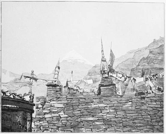
265. Kailas behind Nyandi-gompa.
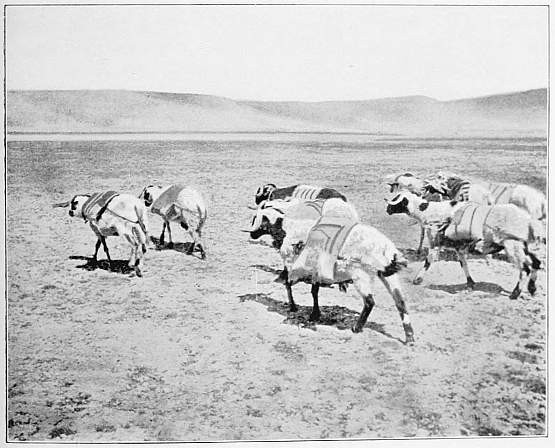
266. My Pack-Sheep.
We lay waiting there for four hours. On the eastern shore our men had moved the camp a little farther south. We saw the tents quite plainly. Should we venture to creep along the shore southwards so as to reach a point opposite the camp? Out beyond the promontory the dark-green lake ran uncomfortably high, but we were a match for the waves—the men had only to put their weight on to the oars. So we crept along the shore, where we got some shelter, but we had to be careful that we were not carried out into the heavy seas. After rowing round two points we landed on the lee-side of a third, where the boat was drawn ashore again. Heavy seas with thundering, towering waves dashed against the southern side of the point, so that we could go no farther, for no pilot would encounter such billows in a canvas boat. I stood on the top of the promontory and enjoyed the fine spectacle. Robert’s tent shone brightly in the setting sun. We saw the men, the horses grazing on the bank, and the smoke of the camp-fire beaten down by the storm. The crossing would barely take an hour, but between us and them yawned the dark-green abyss of tyrannical, all-conquering waves.
The sun sets and we still sit and wait, confused by the rush of the spirits of the air and water. This time they have played us a pretty trick, and we have been caught. To the north rises Kang-rinpoche, lofty and bright as a royal crown. Its summit is like a chhorten on the grave of a Grand Lama. Snow and ice with vertical and slightly inclined fissures and ledges form a network like the white web of a gigantic spider on the black cliffs.
And the day, a long day of waiting, neared its inevitable close. Shadows lengthened out over the foaming waves, the sun set, and the Pundi mountain, our old friend of Tso-mavang, glowed like fire in the sunset. Clouds of a deep blood-red colour, with edges of orange, and tinted above with reddest gold, hovered over its summit. It was as though the earth had opened and volcanic forces had burst forth. The hours passed by, the glow died out, the outlines of Pundi became indistinct and were at length swallowed up in the darkness. We were in the dark while the camp-fire blazed on the eastern shore. Our hopes were now centred on the night and the moon. The storm had raged thrice twenty-four hours, and it must end some time; but it was just as strong. And as it was useless to wait, and I could not appease my gnawing hunger with a piece of bread and a cup of tea, I wrapped myself in the sail, burrowed into the sand, and fell into a sound sleep.
The rain pelting down on the sail woke me twice, and about four o’clock in the morning the cold thoroughly roused me. A dreary, grey, rainy outlook. But Ishe proposed that we should try to get over, for the storm had slightly abated in consequence of the rain. We first made sure that the tackle was in good order, and then stepped into the boat and rowed out along the sheltered side of the promontory. But scarcely had the nose of the boat passed beyond the point when it received a shock that made all its joints crack. “Row, row as hard as you can,” I yelled through the howling storm; “we shall get over before the boat is full. It is better to be wet than suck our thumbs for twenty-four hours more.” To the south, 52° E., the tent canvas shone white in the morning grey. We strayed far out of our course, but cut the waves cleanly, and steered towards the surf. We just managed to get over. We were received on the other side by our men, who helped us to draw the boat ashore and had fire and breakfast ready for us.
Namgyal had returned from Parka and brought news that the Gova threatened to drive away my men in order to force me to leave Langak-tso. Bluff, however, has no effect on me. A more serious matter was that Puppy had not been seen for forty-eight hours, and that Shukkur Ali, who had gone the morning before to Chiu-gompa in search of her, had not been heard of since. Puppy at length found her way into camp herself, and then it was Shukkur Ali who was missing.
On the 28th the storm continued. We afterwards heard from Tibetans that stormy weather frequently prevails on Langak-tso, and the lake is agitated, when Tso-mavang is smooth and calm. Tundup Sonam concluded that Tso-mavang was a pet of the gods, while demons and devils ruled over Langak-tso. We had heard a tale in Gossul-gompa that the preceding winter five Tibetans, armed with swords and guns, had crossed the ice to reach Parka by a shorter way, but in the middle of the lake the ice had given way, and all five were dragged down by the weight of their weapons to the bottom.
I wished for fine weather that I might be able to cross over the lake to the islands. As, however, we were obliged to give up all thoughts of a voyage, I determined to pass round the lake and at any rate draw an outline map of it. We commenced, then, with the eastern shore, which makes a regular curve towards the east. The white mule from Poonch carried the boat. Some Ovis Ammons were seen on the rocks, which Tundup Sonam stalked unsuccessfully. Shukkur Ali turned up again as cool as a cucumber, having searched in vain for Puppy, which was snoring in my tent in most excellent condition.
August 29. We go to sleep amidst the roaring of the waves and the howling of the storm, and awake again to the same uproar. It is always in our ears as we ride along the shore. We might be at the foot of a waterfall. Now we follow the south shore westwards. Here the cliffs are almost everywhere precipitous, and the rocks are porphyry, granite, and schist; the shore strip is extremely narrow and steep, and is divided into sharply marked terraces. It descends right down to great depths, and shallow, gradually sloping places are not to be found. A human skull lay in a bay bobbing up and down in the waves, and not far off were other parts of a skeleton. Was it one of the men who had been drowned in the winter? At this discovery my men conceived a still greater aversion to Langak-tso, which even took human life. I perceived that they were wondering what further foolhardiness I might indulge in.
A sharp-pointed peninsula running north-westwards delayed us. On the bay beyond a caravan was camping, and we were glad to meet Tibetans again when all others had withdrawn from us; and they were glad to meet a European who had been at the Luma-ring-tso, their home. But they could not understand why we passed round all projections and went right round all the bays, instead of following the direct road running a little farther to the south. One of them held out his hands towards me with the fingers spread out, and said that the south shore of the lake had as many indentations. When I told him that I wished to draw a map of the lake, he said that it was of no consequence what the shore was like, as only egg-gatherers came there.
When we had passed two projecting points we encamped at the extremity of the cape which lies in a line with the southernmost island. It was stormy, but here we found shelter under a cliff with a streamer pole on the top. Stone walls, rags, and eggshells were evidence of the visits of men. On the east and west of the cape were open bays with heavy seas, and to the north, 19° E., we saw the southern point of the island—a dark precipitous rock, rising like a huge roll of bread from the waves. We had already heard of this island, Lache-to, on which the wild-geese lay their eggs in May, and are robbed of them by men from Parka who come over the ice. I could not therefore omit to visit it. The island lay quite near. We would return immediately, and Adul might begin to roast the wild-goose which Tundup had shot on the march. We wanted no provisions, but Robert advised Ishe to take a bag of tsamba with him, lest he should have to wait too long for his dinner.
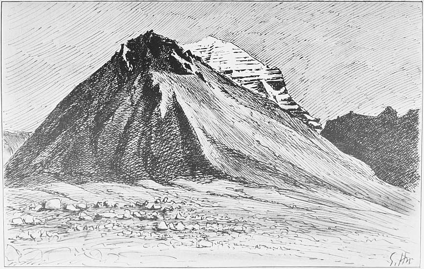
267. Part of Kailas. Sketch by the Author.
These two men took the oars when we put off. The shelter of the cape was deceptive. Two minutes from the bank I tried to take a sounding, but the line made a great curve before it reached the bottom, for the storm drove the boat northwards. Then we fell upon another device: the boatmen had only to hold their oars in the air and let the wind carry the boat along. But a little farther out we could not sail so easily, for the wave system of the eastern open part of the lake came into collision with that from the west. Here the waves rose into hillocks and pyramids, and had to be negotiated with the oars. We rapidly drew near to the island, and its rocks became higher and looked threateningly dark and dangerous. When we were close to the southern point I perceived that it was impossible to land there. The bank of rubbish and blocks was very steep, and we and the boat would have been dashed in pieces in the foaming breakers. The situation was critical. Robert wished to land on the lee-side of the northern point, but that would have been risky, for the storm swept unchecked along the sides of the island, and if we did not get under the land at the right moment we should be driven out into the open lake at a distance of two days’ voyage from the northern shore. We rocked up and down on soft green crystal. I steered close to the eastern bank, where the waves were just as high. Here we had no choice. I turned the bow towards the land, and the men rowed for all they were worth. A nasty billow threw us ashore. Robert jumped out, slipped, and got a ducking. Ishe hurried up to help him. Three billows broke over me before I got to land. We were all three drenched, but we were glad to have firm ground under our feet, and to have reached the island safely in spite of the treacherous storm which might have driven us past this open roadstead.
Then Robert and I went round the island while Ishe collected fuel. Though we could only walk slowly over the detritus, we took but twenty-five minutes to go round the island and ascertain its form by compass bearings. It is longish, runs from north to south, and consists of a single rock falling on all sides steeply to the water. During our walk the wind dried us. Then I drew a panorama of Gurla Mandatta, and after that the spot of earth to which fate had led us prisoners was subjected to a closer investigation. At the north-eastern foot of the elevation is a rather flat pebbly plateau. Here the wild-geese breed in spring, and here lay still several thousand eggs, in twos, threes, or fours, in a nest of stones and sand.
That was a discovery. Ishe had a bag of tsamba, but that was all. There was every probability that we should have to stay the night here, and now we had a quite unexpected store of provisions to last for months. And some time this persistent wind must cease. We played at Robinson Crusoe, and found our situation very advantageous. But the egg-collecting was the most interesting. The eggs were pretty and appetizing as they lay half embedded in the sand, and I pictured to myself the happy cackling that must go on in the spring when the goose mothers sit with expectant hearts on the hard nests, and the sun floods Gurla Mandatta with a sea of light.
We broke two. They were rotten. We tried others which lay in the shade and deeper in the sand. They gave out a horrible stench when the shell broke with a crack on a stone. But of about 200 eggs we broke, we found eight which were edible, and we did not want more. We helped Ishe to collect dry plants lying on the slopes, and at sunset we had a huge heap which we had piled within a small ring fence. In the middle the fire was lighted, and we sat leaning against the wall which sheltered us from the wind. We were warm and comfortable, and our satisfaction reached its height when Ishe’s store of tsamba was divided into three equal portions, and was eaten out of a wooden bowl with the hand in place of a spoon. The greatest inconvenience was that we had no other vessel but Ishe’s small wooden bowl, and therefore whenever one of us wanted a drink he had to tramp down to the shore.
The storm still howled over the rock and through the holes and crannies of the wall. Then the thought shot through my mind: “Is the boat moored securely? If it should be carried away! Then we are lost. Ah, but it may be cast ashore on the northern bank, and our men may fetch it and come across to the island. No, it will be filled with water, and be sunk by the weight of the zinc plates of the centre-boards. But then we can mount in the morning to the southern point and make our people understand by signs that we want provisions. We have drifted to the island in eighteen minutes. They can make a raft with the tent poles and stays, load it with provisions, and let it drift with the wind to the island. And we may find more fresh eggs.”
Such were the thoughts that Robert and I exchanged while Ishe was feeling about in total darkness at the landing-place. “What if we have to stay here till the lake freezes over, four months hence?” I said. But at this moment we heard Ishe’s steps in the sand, and he calmed us with the assurance that both the boat and the oars were safe.
Then we talked together again and kept up the fire. The storm had abated, but sudden gusts came down from all quarters. We inspected the water, and found that we could make for the mainland without danger. But first we took all the remaining fuel and piled it up into a blazing bonfire, which shone like a huge beacon over the lake. If any Tibetan saw it, he must have thought that an enchanted fire was burning on the desolate island.
The moon was high when we put off and the lake was still rough. But soon the black cape where our camp stood was seen on the southern shore against the dim background of mountains. In the middle of the sound the depth was 113 feet. We shouted with all our might, and were soon answered by a fire on the point, to which our people had come down. And the roasted wild-goose, which had waited so long for us, and a cup of hot tea tasted delicious in the early hours of morn. And still more delightful was it to creep into bed after our short visit to the goose island, which raised its dark, mysterious, dolphin-like ridge in the moonlight. Never again would my foot tread its peaceful strand.

CHAPTER L
THE SOURCE OF THE SUTLEJ
We had scarcely dressed in the morning before the storm raged again. Galsan and a gova from Parka overtook us here. The former brought provisions, the latter had strict orders from his chief, Parka Tasam, to tell me that if I did not at once betake myself to Parka, he would send off all my baggage to Langak-tso, and force me to move on to Purang. But the gova himself was a jovial old fellow, and he received my answer that if Parka Tasam ventured to meddle with my boxes, he should be immediately deposed. If he kept quiet a couple of days, I would come to Parka, and the rather that I found it impossible to navigate the lake at this season of the year.
Then we marched on westwards, in and out of the bays and round all the projections produced by a mountain elevation north of Gurla, which prolongs its ramifications to the lake. The constantly changing views, as we wind in and out and wander between land and water, are indescribably beautiful and charming. The two large islands lying far out in the lake we see wherever we may be. One is named Dopserma; other water-birds breed there, but no geese. In winter yaks and sheep are driven over the ice to the island, where there is good pasturage. When cattle disease rages in the country the animals on Dopserma do not suffer.
We passed round the sharp-pointed westernmost bay in a furious storm and blinding clouds of sand, and encamped on the shore again. The same agreeable weather continued also on the last day of August as we travelled north-eastwards and saw the Langak-tso in a new and beautiful aspect. The air was now clear, Kang-rinpoche and Gurla Mandatta were unclouded, and stood as sentinels above the lakes. We passed the point where Tundup Sonam, Ishe, and I had waited so long, and by the sand-dune where we had lain four hours.
At the north-western bay we cross the old bed of the Sutlej, consisting of treacherous, quaking bog or dry, hard clay; it is broad, has no terraces, and has been much degraded and smoothed down by deflation and driftsand in later times. Two springs rise up in the middle, and flow in the direction of the lake. Westwards the bed seems quite level, but actually it rises slowly and evenly to a flat culmination, on the other side of which it dips down towards the Indus.
Now it had become dark, and we rode hour after hour among low hills and dunes and over meadows and water channels. I thought we had lost our way, when the bells of grazing cattle were heard, a fire appeared, and Rabsang came to meet us with a lantern in order to lead us to the village Parka, where my tent was set up in a courtyard.
During the much-needed day of rest we allowed ourselves in Parka, I negotiated now and then with the govas of the neighbourhood. They asked me to set off definitely for the west next day, and I promised to do so, but on the condition that I might stay three days in Khaleb, half a day’s journey to the west. They consented without inquiring into my further intentions. I wished, be it known, to pass round the holy mountain by the pilgrim road, but saw that the authorities would never grant their permission. It could be done only by stratagem.
Here I received a second very kind letter from Mr. Cassels, who happened to be in Gyanima on official business. Unfortunately the force of circumstances prevented us meeting. He gave me a pleasant surprise with three packets of tea, which were the more welcome as I had latterly had to put up with brick-tea.
Here also the truth of the report that had so long followed us, that six Chinese and Tibetan officials from Lhasa had been sent to bring me to reason, was at length made clear. The report was certainly true, but when the gentlemen on reaching Saka-dzong heard that I had marched on westwards some time before, they simply turned back again.
I obtained all kinds of information about the two lakes and their periodical outlets, from Tibetans who had long lived in the country. Four years before some water had flowed from Tso-mavang to Langak-tso, which confirms Ryder’s statement. Twelve years ago the outflow had been so abundant that the channel could not be passed except by the bridge. The channel is sometimes called Ngangga, sometimes Ganga. The water of Langak-tso is said to drain off underground, and to appear again at a place in the old bed called Langchen-kamba, and this water is said to be the true source of the Sutlej, and to find its way to the large streams which form this river, called in Tibetan Langchen-kamba. Twelve years and forty-eight years ago the spring in the old bed is said to have emitted much more water than now. Sherring collected similar data in 1905.
Langak-tso is said to have been so poisonous in former times that any one who drank of its water died, but since the holy fish broke through the isthmus and passed into the lake, the water has been sweet. Langak-tso freezes in the beginning of December, half a month sooner than its eastern neighbour, and the freezing proceeds slowly and in patches, whereas Tso-mavang freezes over in an hour. Langak-tso also breaks up half a month before Tso-mavang. Both have ice 3 feet thick. In winter the surface of Tso-mavang falls 20 inches beneath the ice, which consequently is cracked and fissured, and dips from the shore; but Langak-tso sinks only one or two thirds of an inch. This shows that it receives water constantly from the eastern lake, but only parts with a trifling quantity in winter.
With regard to the goose island, I was told that three men are commissioned by the Devashung to settle on the island as soon as the wild-geese arrive, to protect them from wolves and foxes. They receive 8 rupees, a sheep, and a lump of butter as wages. At this time, in May, the ice is still two feet thick, but the egg-gatherers must take care that they are not cut off from the mainland by a storm. Some years ago it happened that two watchmen were isolated on the island in this way. They lived there eight months, subsisting on eggs and green food, and returned over the ice next winter as soon as the lake was frozen over. But one of them was so enfeebled that he died on reaching Parka.
After a lively feast held by the Ladakis in the evening, we rode on September 2 north-westwards, accompanied by an old grey-headed gova, who had become a particular friend of mine. The weather was fine, but we now felt biting cold in the morning, much as at home on the islets off the coast when the yellow leaves have fallen and a thin sheet of ice has spread over the inlets. All Parka was on foot to witness our departure. With us set out a high lama whom I had known in Leh. His retinue looked well in their yellow dresses against the grey and green ground. He had been in Shigatse, and had lately made the circuit of the holy mountain. During the march we waded through the rivers Dam-chu, Sung-chu, La-chu, and Khaleb, which together carried about 350 cubic feet of water per second to Langak-tso.
The nearer we came to the holy mountain, the less imposing it appeared; it was finest from Langak-tso. In form it resembles a tetrahedron set on a prism. From the middle of its white top a belt of ice falls precipitously down, and below it stands a stalagmite of ice, on to which a thick stream of water pours from above. The stream splits up into glittering drops of spray and thin sheets of water—a grand spectacle, which one could watch with pleasure for hours.
Our camp on the Khaleb moor had the advantage of being far from the haunts of men—a very necessary condition, for here I contrived to make three excursions without permission. The second of these took a whole day, September 6, and its aim was the old bed of the Sutlej. Where we reached it, the bed seemed to contain stagnant water both to the east and west, and the ground was quite level. At the place which seemed highest, we tested it with the boiling-point thermometer and found that it stood about 30 feet above the lake. Following the bed westwards we come first to a large pool of sweet water with large quantities of ducks and water-weeds, then to a series of freshwater swamps connected by channels, and at length to a brook, which flows slowly south-westwards. The brook pours into a large freshwater pool, No. 2, which has no visible outlet. But when we proceed farther west to the point where the bed is contracted between walls of solid rock, we come upon two springs forming a new brook, which flows through a clearly marked valley to the south-west. I am convinced that this water filtrates underground from Langak-tso. A year later I followed the old bed a day’s march farther west, and found at Dölchu-gompa permanent springs of abundant water, which likewise well up on the bottom of the bed. From here and all along its course through the Himalayas the Tibetans call the Sutlej Langchen-kamba, the Elephant river; the hill on which the convent Dölchu-gompa is built is supposed to bear some resemblance to an elephant, and hence the name. The spring at Dölchu is called Langchen-kabab, or the mouth out of which the Elephant river comes, just as the Brahmaputra source is the Tamchok-kabab, or the mouth out of which the Horse river comes, and the Indus source is the Singi-kabab, or the mouth from which the Lion river comes. The fourth in the series is the Mapchu-kamba, the Peacock river or Karnali. The Tibetans assert that the source of the Sutlej is at the monastery Dölchu, not in the Himalayas or the Trans-Himalaya, from which, however, it receives very voluminous tributaries. They are also convinced that the source water of the Langchen-kamba originates from Langak-tso. And I would draw particular attention to the fact that the first of the two holy springs which pour their water into the Tage-tsangpo is also called Langchen-kamba (see p. 105), a proof that in old times the source was supposed to lie to the east of Tso-mavang.
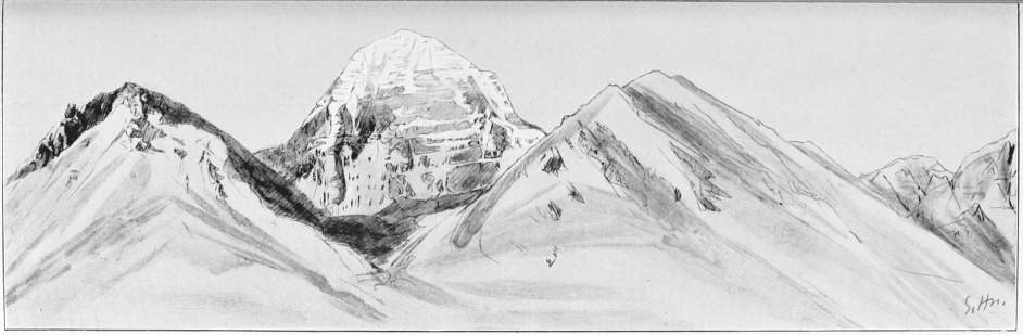
268. Kailas from Diri-pu.
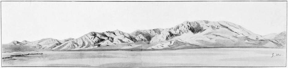
269. Confluence of the Two Arms of the Indus. Sketches by the Author.
Now I advise any one who takes no interest in the source of the Sutlej to skip the following quotation. During my stay in Kioto in December 1908, Mr. Ogawa, Professor of Geography in the University there, showed me a collection of Chinese books. One of them, Shui-tao-ti-kang, or The Elements of Hydrography, is a compilation of the author Chi Chao Nan in the 26th year of the Emperor Kien Lung, that is, the year 1762, and in this work, Book 22, is the following communication concerning the source of the Sutlej, which Professor Ogawa was kind enough to translate for me literally:1
The Kang-ka-kiang comes out from Kang-ti-ssu-shan, on the south-east of which there stands Lang-chuan-ka-pa-pu-shan (= Langchen-kabab), magnificent like an elephant. The relief is gradually accentuated more and more towards the south-western frontiers, and culminates at Kang-ti-ssu-shan (= Kailas). The mountain has a circumference of more than 140 li. On all sides the mountain forms precipitous walls more than 1000 feet high above the surrounding mountains, and accumulated snow seems as if hung on cliffs. Hundreds of springs pour down from the top, but flow under the ground on the foot of the mountain. It is situated in the extreme west of the Tsang region, 310 li north-east of Ta-ko-la-cheng in A-li, more than 5590 li south-west of Si-ning-fu in Shensi province. Its longitude is 36° 4’ W., and its latitude 30° 5’ N. In olden times the place was unknown, but can be doubtfully identified with A-nok-ta-shan in the annotation of Shui-ching. In the neighbourhood there are four high mountains, of which the southern is called Lang-chuan-ka-pa-pu-shan, lying 250 li south-by-east of Kang-ti-ssu-shan, and 270 li east of Ta-kola-cheng. The natives call it so, because the form of the mountain resembles an elephant. On the east of this mountain there stands Ta-mu-chu-ko-ka-pa-pu-shan (= Tamchok-kabab), which is the source of the Ya-lu-tsang-pu river (= Yere-tsangpo or Brahmaputra). Springs come out from the northern foot of the mountain, and accumulate into a lake (35° 5’ W., and 29° 1’ N.). The water flows north-westwards for 70 li, and receives a stream coming from the north-east. The stream lies in the mountains 80 li north-east of Lang-chuan-ka-pa-pu. Two streams flow westwards from the mountain and turn north-westwards after their junction. It now takes a sinuous course for 60 li, turns south-westwards, and joins the main river. This is a source.
The river flows further to the west-by-north for 40 li, then to the north-east, to be met by the water of lake Kung-sheng (= Gunchu-tso), which sinks under the ground of the lake basin, but which, after reappearing, and after receiving three northern affluents, runs south-westwards to the river.
The lake of Kung-sheng-o-mo has two sources—one coming from the north-east, from Ta-ko-la-kung-ma-shan, and flowing 150-160 li; the other from the east, from the western foot of Ma-erh-yo-mu-ling (= Marium-la) in the western frontiers of Cho-shu-tê. This last-mentioned mountain forms the eastern boundary of A-li, and is the chief range going south-eastwards from Kang-ti-ssu. The water (of the lake Kung-sheng) flows westwards for more than 50 li, and forms another lake, 80 li wide, and without an outlet. However, more than 10 li farther to the west there is a third lake with a subterranean source and with a length of 30 li. A stream comes from the north to the lake. The river now flows south-westwards for 60 li, and receives a stream coming from the north-east. 40 li farther south-westwards it receives a stream coming from the northern mountains; farther south-westwards the river meets the water from Lang-chuan-ka-pa-pu-shan.
The water forms the lake Ma-piu-mu-ta-lai (= Tso-mavang). From south to north it is 150 li long, from east to west 80 or 100 li wide, and has a circumference of more than 200 li. On the northern side of the lake there are two streams coming from the north. The lake is situated 120 li to the south of Kang-ti-ssu. The water flows out from the west of the lake into the lake Lang-ka (= Lan-gak-tso) at a distance of 60 li. The latter lake receives a stream coming from the north-east. Lake Lang-ka has a narrow rectangular shape, pointed and elongated, the length from south to north being 170 li, and the width from east to west 100 li. Its northern pointed corner has the stream coming from north-east. There are three sources on the southern foot at a distance of 70 li from a southern branch of Kang-ti-ssu; they flow southwards, unite into one stream, which takes a south-westerly course for 150-160 li before entering the lake. The lake is the same in circumference and area, but different in outline.
The water (of lake Lang-ka) flows out from the west, and after running westwards for more than 100 li it turns to the south-west, and is now called the Lang-chu-ho, and takes a sinuous course for more than 200 li. Then it receives the Chu-ka-la-ho coming from the north-east.
This description of the position of the source of the Sutlej is of such extraordinary interest that I do not like to reserve it for my scientific work, and the less so that it supports the theory I expressed when in India, that the Tage-tsangpo is nothing but the uppermost section of the course of the Sutlej, or, in other words, that the source of the Tage-tsangpo is also that of the Sutlej. Many quotations have been looked up during the discussion that has arisen on this problem, but they cannot compare in importance with the one just cited, which, moreover, is sixty years older than the oldest of the others, namely, Gerard’s opinion that the Gunchu-tso is the source of the Sutlej.
The description in Chi Chao Nan’s Hydrography is distinguished by the same careful conformity with the truth and conscientiousness as all other Chinese geographical descriptions. Compare the description of Kailas (Kang-rinpoche) with what I have already said about it.
Lang-chuan-ka-pa-pu is the Chinese translation of the Tibetan Langchen-kabab, which literally means the “Source of the Sutlej.” When the Chinese author informs us that east of Langchen-kabab lies Tamchok-kabab, which is the source of the river Yere-tsangpo (Brahmaputra), we must admit that his description is quite in accordance with the truth, as I, the first European to visit this country, have myself discovered; for on the Tamlung-la I stood on the pass which parts the water between the Brahmaputra and Sutlej, and immediately to the south of the pass I saw Gang-lung-gangri and the glacier from which the Tage-tsangpo takes its rise, and in which the source of the Sutlej lies.
It is further said that the lake Gunchu-tso has two source streams—one from the north-east, from the mountain Ta-ko-la-kung-ma, which is evidently identical with D’Anville’s Tacra-concla; the other from the west side of the pass Marium-la: an account which agrees with Ryder’s map in all particulars. At present the Gunchu-tso is completely cut off and is salt; it therefore is no longer connected with the Sutlej system. But 147 years ago it had an outlet which ran partly underground, and then, rising up again, joined the Langchen-kamba or Tage-tsangpo. And that the Tage-tsangpo was at one time considered by the Tibetans to be the headwater of the Sutlej is apparent from the fact that its name, Langchen-kamba, is still applied to the upper of the two sacred source streams in the valley of the Tage-tsangpo.
And, again, it is said: This water, that is, the water of the Langchen-kabab, or the headwater of the Sutlej, forms the lake Ma-piu-mu-ta-lai, the Tso-mavang or Tso-mavam, as the name is also pronounced; on D’Anville’s map (Map 2) it is written Ma-pama Talai, and D’Anville explains that Talai signifies lake. He might have added that it is the same word as in Dalai Lama, the priest, whose wisdom is as unfathomable as the ocean; for the Chinese word Talai or Dalai means ocean. By the use of this word the Chinese author wished to imply that Tso-mavang is much larger than the other lakes mentioned in his text.
The surplus water, as there is every reason to assume, flowed in the year 1762 from Tso-mavang through the channel to Langak-tso. The length of the channel was 60 li, which corresponds to my 5½ miles. All the northern tributaries which flow into the two lakes from the valleys of the Trans-Himalaya are correctly noted. The lake Langak is called Lang-ka. On D’Anville’s map, the material for which was supplied by the Jesuits who lived in Pekin in the time of the Emperor Kang Hi (at the beginning of the eighteenth century), the lake is named Lanken. On the same map the river flowing thence westwards is called Lanc-tchou (Sutlej), but it is suggested, absurdly enough, that it is the upper course of the Ganges. D’Anville names the mountains south of Tso-mavang Lantchia-Kepou, which is Langchen-kabab, and the mountains lying to the south-east of them Tam-tchou, that is, Tamchok, in which he quite correctly places the origin of the Yarou Tsanpou, the Brahmaputra. The material for the map of the whole Chinese Empire, which the Jesuits presented to the Emperor Kang Hi in the year 1718, was collected between the years 1708 and 1716, and the Emperor procured information about Tibet through natives, who were prepared for their work by the Jesuits, just as in later times English topographers have trained Indian pundits.
From D’Anville’s map we learn that 200 years ago the Sutlej flowed out of Langak-tso through the bed I have already described. Professor Ogawa’s translation of the Chinese text shows us that even in the year 1762, or perhaps some years before, the river still emerged from the Langak-tso. And it is expressly said that the river Chu-ka-la-ho (Chu-kar, which, however, is said to descend from the north-east instead of the south-east) is only a tributary.
In the year 1846 Henry Strachey found no visible outlet, but he says that there is one underground, and considers it probable that the channel also may carry water when the lake has risen after heavy rains.
On July 30, 1908, I heard from the chief lama of the monastery Dölchu-gompa, who was born in the neighbourhood and was then fifty-five years old, that when he was quite young, water occasionally flowed out of the lake. But when he was ten years old, that would be in the year 1863, this water had failed, and since then no more had been seen. On the other hand, the springs in the bed are constant both in winter and in summer, and are independent of the precipitation. The monks believe that the water comes from Langak-tso, but nevertheless they call it the Langchen-kabab, the river which flows out of the mouth of the elephant.
My investigations on the spot, as well as the Chinese quotation, prove that Colonel S. G. Burrard is quite right in his masterly description of the rivers of the Himalayas and Tibet (Calcutta, 1907), when he includes Tso-mavang and Langak-tso and all their affluents in the drainage basin of the Sutlej, and therefore I will here cite two sentences of Colonel Burrard:
The connection between the two lakes may be taken as established, but that between the western lake and the Sutlej basin is still open to question. If the water from Rakas-tal flows into the Sutlej once a century, and then only for such a short period as to be observed by no one, we shall still be justified in including the lakes in the catchment area of the river.
And in this connection I would point out that the water-level of Tibetan rivers and lakes is subject to periodical fluctuations, dependent on the precipitation, of the same kind as the Brückner periods. The level in the two lakes varies from year to year. At the present time they are very low, but there is nothing to prevent them rising gradually in a more or less distant future. Tso-mavang may rise so that its water may again flow through the channel to Langak-tso, and this lake at length may discharge its surplus water, as formerly, through the dry bed of the Sutlej. It is more probable, however, that Langak-tso is approaching a time when it will lose its subterranean outlet also, and be quite isolated, like Gunchu-tso and Panggong-tso, and consequently become salt in time. But after it has lost its outlet it may be a long time, as Professor Brückner informs me, before the lake becomes noticeably salt. The next step in the development will be that Tso-mavang will be cut off from Langak-tso and likewise become salt.
However, we need not plunge into speculations and prognostications of the future, which may have surprises in store about which we can form only more or less probable conjectures. It is our duty to rely solely on fact and observation.
And now that we are agreed that the two lakes belong to the drainage area of the Sutlej, the question is: Which of the rivers debouching into Tso-mavang is the headwater of the Sutlej? Naturally, the longest and the one which carries most water. The river which once flowed out of Gunchu-tso has no claim to this honour, and the Gunchu-tso must be rejected as the source of the Sutlej. The Tage-tsangpo discharged 388 cubic feet of water per second, while all the other streams entering Tso-mavang carried at most 100 cubic feet each. The source of the Tage-tsangpo in the front of the Gang-lung glacier is therefore the source of the Sutlej.
1 I have only omitted a couple of sentences, which have no immediate connection with the problem.
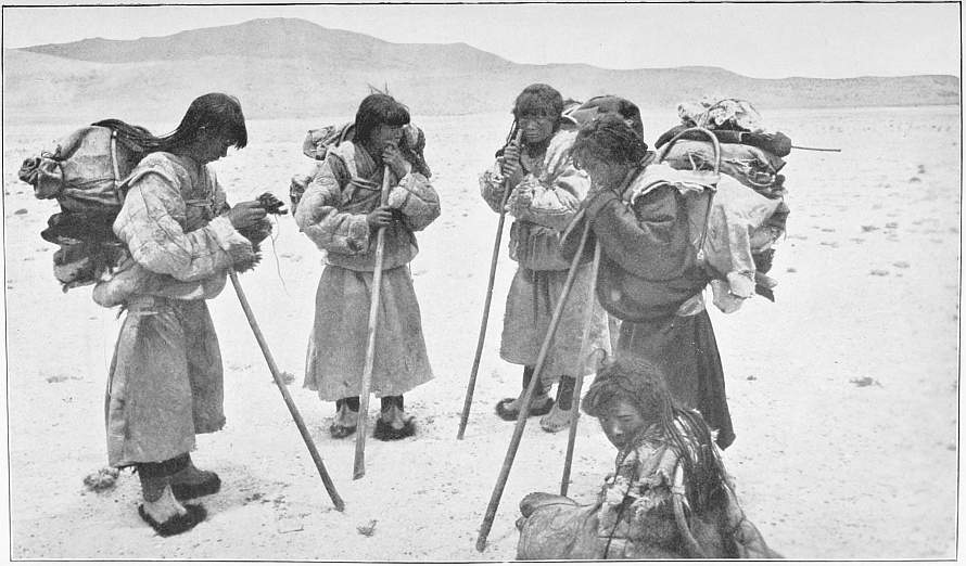
270. Tibetan Female Pilgrims at Kailas.
CHAPTER LI
A PILGRIMAGE ROUND KANG-RINPOCHE
We are again on the Khaleb moor and the day is September 3, on which we are to begin the circuit of the holy mountain. The head Gova of Parka is with us to hold me in check, but I take very good care not to betray my plans. Tsering, Rabsang, Namgyal, and Ishe are to go with me; they are Lamaists, and are glad of the opportunity to come nearer the gates of salvation by wandering round the holy mountain. We take provisions for three days, the absolutely necessary instruments, sketch- and note-books. The stand of the large camera and one of the boat’s tarpaulins are to serve as a tent. The whole baggage is only a light load for a horse. I ride my small grey Ladaki and the four men march on foot, for no one may ride round the holy mountain unless he is a heathen, like myself. The rest of the caravan is to wait for us in Khaleb, and my tent is to be left untouched that the Tibetans may think that I am expected back in the evening.
Tsering, Namgyal, and Ishe start early, and Rabsang and I a little later. The Gova and his men come to ask what it all means and whither I am going, but I answer only, “I shall soon be back again,” and ride off to the north, 30° E., to the mouth of the Dunglung valley.
The others wait for us among the first moraines, and then we proceed in close column up and down among old moraines which have been thrust down by vanished glaciers. A party of pilgrims from Kham in the distant east are resting on the bank of the Dunglung river. They have pitched their tents, and their horses are grazing on the fresh grass. From the top of the moraine is seen the northern part of our stormy Langak-tso.
We ride up the valley and soon have on both sides solid rock of hard green and violet conglomerate, with huge cones of detritus at the foot of the slopes. Enormous boulders of conglomerate have fallen down here. On the left bank of the river, where the road comes up from Tarchen, stand a small cubical house and several manis and chhortens in long rows: it is a sacred road, the road of pilgrims round Kang-rinpoche.
The cliffs assume ever wilder forms, falling perpendicularly to terraces and pebble screes, forming steps and ledges, fortifications, battlements and towers, as though built by human hands. They consist of sandstone and conglomerate, and the strata dip 10° to the south, and to the eye appear horizontal. A small bridge spans the river. A party of pilgrims behind us is just crossing it. But we are on the right bank, and above us Nyandi-gompa is perched on its terrace. Above it rises the vertical wall of a huge mountain mass, a dangerous background for the monastery. Up on a ledge dwells a hermit, and quite at the top stands a streamer pole named Nyandi-kong. Five years ago a huge block fell down upon the monastery and laid half of it in ruins. The block still lies in the inner court. It was early in the morning after long-continuous rain; no one was hurt, but the monastery had to be rebuilt.
Two monks, two old women, and a boy received us kindly, and said it was the first time they had seen a European in Nyandi. The monastery, as well as the three others on Kailas, is under Tarchen-labrang, which is situated on the southern foot of the mountain, where the pilgrims begin and end their circuit. Curiously enough, these monasteries belong to Tongsa Penlop, the Raja of Bhotan. The preceding year, 1906, was a year of the fire horse, and the year 1918 will be a year of the earth horse; every twelfth year is a horse year, in which wood, fire, earth, iron or water is prefixed to the name horse; the Tibetan cycle (the period of time which is the base of the reckoning) extends over sixty years with the names of twelve different animals. Every horse year, and accordingly every twelfth year, crowds of pilgrims come to Kailas. The monks said that they cannot be counted, but they knew that in the year 1907 more than 5000 pilgrims had been at Nyandi, of whom the greater part came from Ladak.
The lhakang, or hall of the gods, is very original. Four pillars support the roof. The altar, like a Chinese kiosque of wood painted in colours, stands alone and in deep shadow, but so many votive lights are placed in front that they seem like a festival illumination. An especial lamp hangs before the image of Sakya-muni, which stands against a wall. In front of the altar is a huge copper vessel with a cover, which is called Tosungjön. It is said to have flown in old times from India through the air. In winter it is filled with butter, in summer with chang. A lama with a brass ladle poured the consecrated beverage into the bowls of my men, and out of the silver bowls with peacocks’ feathers he poured holy water into the hollow of their hands; they drank of it and besmeared their faces with the rest. All, except Rabsang, paid due reverence to the statues and prayed, and Tsering had murmured his prayers all the way along and let the beads of his rosary slip through his fingers. Two fine elephant’s tusks (langchen-sala-rapten) were set up before the altar.
In the Tsenkang hall is a figure of Hlabsen clothed in gold brocade and kadakhs, the god of Kang-rinpoche and Tso-mavang. In the ante-chamber is a whole arsenal of guns and swords and wooden and leathern shields, each with four iron bosses. On the outside of the monastery, which fronts the holy mountain, rows of artistically sculptured slabs are affixed. On six of them each of the holy characters is incised, and each of the gigantic characters is again filled in with the invariable alpha and omega of Lamaism, “Om mani padme hum.” On other flagstones gods are carved with wonderful dexterity, and one feels a vain desire to buy one or two of them.
The view from the roof is indescribably beautiful. The icy summit of Kang-rinpoche rises amid fantastic fissured precipitous rocks, and in the foreground are the picturesque superstructure of the monastery and its streamers (Illust. 265).
But time flies. After spending three hours in Nyandi, we say farewell to the monks, descend the steep path zigzagging among rubbish and boulders, and continue our journey to the north-north-east along the right bank of the river. At every turn I could stand still in astonishment, for this valley is one of the grandest and most beautiful in its wildness that I have ever seen. The precipice on the right side of the valley is divided into two stages with a terrace between them, and in the midst gapes a dark ravine. On the left side the rock forms a single vertical wall, and here the eyes fall on a succession of singular forms of relief, rocks like congealed cascades, citadels, church towers, and embattled fortifications, separated by cañon-like hollows. Water from melting snowfields pours down the steep slopes. One such jet of water is quite 800 feet high and white as milk; the wind turns it into spray, but it collects again, only to be split up against a projection. The rock around it is wet and dark with spurted drops. A natural rock bridge crosses a small cleft with vertical walls.
Immediately beyond the monastery the summit of Kailas is lost to view, but soon a bit of it is seen again through a gap. We passed twelve pilgrims, and soon after a second party resting on a slope. They put on solemn faces and do not talk with one another, but murmur prayers, walking with their bodies bent, and leaning on a staff—frequently, too, without a staff. How they have longed to come here! And now they are here and walk round the mountain, which is always on their right. They feel no weariness, for they know that every step improves their prospects in the world beyond the river of death. And when they have returned to their black tents in distant valleys, they tell their friends of all the wonders they have seen, and of the clouds, which sail like the dragon ships of old below the white summit of Gangri.
Small conical cairns are everywhere. Tsering never omits to take up a stone from the margin of the road and lay it as his contribution on every such votive pile, and thereby he does a good deed, for he makes the way less rough for those who come after him. The sun looks out through a gap, and throws a bright yellow light into the valley, which otherwise is in shadow. The icy peak again appears much foreshortened. Several tributaries come in from the sides, and towards evening the river rises, containing quite 280 cubic feet of water.
A man from Gertse has been going round the mountain for twenty successive days, and now has just accomplished his tenth circuit. Dunglung-do is a very important valley junction, where three valleys converge—the Chamo-lung-chen from the north, 70° W., the Dunglung from the north, 5° W., and the third, called in its upper course Hle-lungpa, which we ascend. We now have granite on both sides. Kailas turns a sharp edge to the north, and from here the peak resembles a tetrahedron more than ever. Again the mountain is concealed by an elevation of the ring which girdles it as Monte Somma encircles Vesuvius. The main river swells up towards evening; the other two are spanned by bridges. Numbers of boulders lie all about. All is granite, and therefore the mountain forms are rounder and more lumpy (Illust. 267).
At length we see the monastery Diri-pu in front of us, standing on the slope on the right side of the valley. A huge block of granite beside the path up to it bears the usual sacred characters, and there also are long manis, streamers, and cairns. All the pilgrims we have overtaken in the course of the day turn into the monastery, where they can pass the night free of charge. The convent is crammed full after the arrival of a party of pilgrims belonging to the Pembo sect. These, of course, wander round the mountain in the reverse direction, and the orthodox cast contemptuous glances at them when they meet. I prefer to pitch my tent on the roof, where the luggage of the pilgrims is piled up. Here also there is a fine view of Kailas, raising its summit due south. With a temperature of 40° at nine o’clock it is cold and disagreeable, for a strong wind blows, and my tent, consisting only of the camera-stand covered with a linen cloth, is too small to allow of a fire being lighted (Illust. 268).
Since I had been successful in fixing the positions of the sources of the Brahmaputra and Sutlej, my old dream of discovering the source of the Indus was revived, and all my aspirations and ambition were now concentrated on this object. When I now learned from the monks that the point where the famous river issues forth from the “Mouth of the Lion” was only three days’ journey to the north-east beyond a lofty pass, everything else seemed of trifling consequence compared to an advance into the unknown country in the north. We held a council of war; we had provisions only for two days more, and we had not brought enough money with us, and, moreover, the state of affairs in Khaleb was too uncertain to allow of greater hazards. I therefore decided to carry out my original plan in the meantime and complete the pilgrimage, and afterwards make the source of the Indus the object of a fresh excursion from Khaleb, or, if the worst came to the worst, from Gartok.
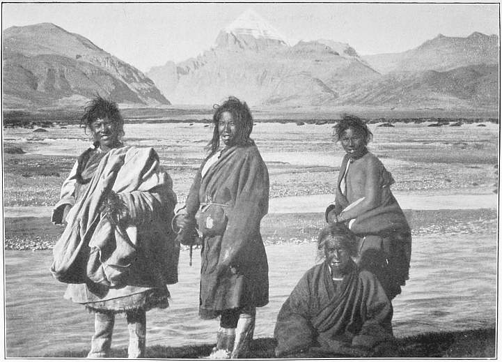
271. The Gova by whose Help the Source of the Indus was discovered (seated) and Tibetans at Kailas.
On September 4 we take leave of the monks of Diri-pu, cross by a bridge the river which comes down from the pass Tseti-lachen-la in the Trans-Himalaya, from the other side of which the water flows to the Indus, and mount in an easterly direction over rough steep slopes thickly bestrewn with granite boulders. On our right is the river which is fed by the glaciers of Kailas; it is quite short, but is very full of water. The path becomes still steeper, winding among immense blocks of granite, and leads up to the first hump, after which the ground is a little more even to the next break. Here we have a splendid view of the short truncated glacier which, fed from a sharply defined trough-shaped firn basin, lies on the north side of Kailas. Its terminal, lateral, and medial moraines are small but distinct. Eastwards from Kailas runs off an exceedingly sharp, pointed, and jagged ridge, covered on the north side with snow, and belts of pebbles in the snow give all this side a furrowed appearance. From all corners of the ice mantle and the snowfields foaming brooks hurry down to the river. On our left, northwards, the mountains consist of vertical fissured granite in wild pyramidal forms. Kailas is protected on the north by immense masses of granite, but the mountain itself is in all probability of conglomerate, as shown by the nearly horizontal bedding plainly perceptible in the projecting ledges, sharply marked snow-lines, and belts of ice. The summit rises above this sea of wild mountains like a mighty crystal of hexagonal form.
A party of poor women and children climbed wearily up to the pass. An elderly man, who was now making his ninth circuit, made no objection to join our party; he knew the country and could give information about it. On another rise in the ground, called Tutu-dapso, we saw hundreds of votive cairns, 3 feet high—quite a forest of stone pyramids—like innumerable gravestones in a churchyard (Illust. 270).
Slowly and laboriously we climbed up this arduous pass, one of the most troublesome on the whole journey. Thicker and thicker lay the boulders, exclusively of granite in all possible varieties, some pink and some so light a grey as to be almost white. Between two boulders lay a suspicious-looking bundle of clothes. We examined it, and found that it contained the body of a man who had collapsed in making the tour of the mountain of the gods. His features were rigid, and he seemed poor and emaciated. No one knew who he was, and if he had any relations they would never learn that his pilgrimage had launched him into new adventures among the dark mazes of the soul’s migrations.
Our old man stops at a flat granite block of colossal dimensions, and says that this is a dikpa-karnak, or a test-stone for sinners. A narrow tunnel runs under the block, and whoever is without sin, or at any rate has a clear conscience, can creep through the passage, but the man who sticks fast in the middle is a scoundrel. I asked the old man whether it might not happen that a thin rogue would wriggle through while a fat, honest fellow might stick fast; but he answered very seriously that stoutness had nothing to do with the result of the trial, which depended only on the state of the soul. Evidently our honest Ishe was not certain which way the balance of his conscience inclined, for, before we were aware, we saw him disappearing under the block, and heard him puffing, panting, and groaning, scratching with his hands and trying to get a foothold behind. But when he had floundered about inside long and vigorously, he was at last obliged to call for help in a half-strangled voice. We laughed till we could hardly keep on our feet, and let him stay a while in his hole because of his manifest sinfulness. Then the two other men dragged him out by the legs, and he looked extremely confused (and dusty) when he at length emerged again into the outer world, an unmasked villain. The old man told us that a woman had become so firmly fixed that she had actually to be dug out.
Some 200 paces farther in this maze of granite boulders, among which we wandered as in lanes between low houses and walls, stands a test-stone of another kind. It consists of three blocks leaning on one another, with two hollows between them. The task is to creep through the left passage and return by the right, that is, in the orthodox direction. Here Ishe made up for his previous discomfiture by crawling through both holes. I told him frankly that there was no skill required here, for the holes were so large that even small yaks could go through. However, the sinner had in this second stone an opportunity of preserving at least a show of righteousness.
Our wanderings round Kang-rinpoche, the “holy ice mountain” or the “ice jewel,” is one of my most memorable recollections of Tibet, and I quite understand how the Tibetans can regard as a divine sanctuary this wonderful mountain which has so striking a resemblance to a chhorten, the monument which is erected in memory of a deceased saint within or without the temples. How often during our roamings had I heard of this mountain of salvation! And now I myself walked in pilgrim garb along the path between the monasteries, which are set, like precious stones in a bangle, in the track of pilgrims round Kang-rinpoche, the finger which points up to the mighty gods throned like stars in unfathomable space.
From the highlands of Kham in the remotest east, from Naktsang and Amdo, from the unknown Bongba, which we have heard of only in vague reports, from the black tents which stand like the spots of a leopard scattered among the dreary valleys of Tibet, from Ladak in the mountains of the far west, and from the Himalayan lands in the south, thousands of pilgrims come hither annually, to pace slowly and in deep meditation the 28 miles round the navel of the earth, the mountain of salvation. I saw the silent procession, the faithful bands, among which all ages and both sexes are represented, youths and maidens, strong men with wife and child, grey old men who would before their death follow in the footsteps of countless pilgrims to win a happier existence, ragged fellows who lived like parasites on the charity of the other pilgrims, scoundrels who had to do penance for a crime, robbers who had plundered peaceful travellers, chiefs, officials, herdsmen, and nomads, a varied train of shady humanity on the thorny road, which after interminable ages ends in the deep peace of Nirvana. August and serene Siva looks down from her paradise, and Hlabsen from his jewelled palace, on the innumerable human beings below who circle, like asteroids round the sun, in ever fresh troops, round the foot of the mountain, going up through the western valley, crossing the Dolma pass, and descending the eastern valley.
We soon discover that most of these simple pilgrims have no clear idea of the benefits their journey is supposed to confer on them. When they are questioned, they usually answer that after death they will be allowed to sit near the god of Gangri. But what they all believe most firmly and obstinately is that the pilgrimage will bring them a blessing in this world. It will ward off all evil from their tents and huts, will keep away sickness from their children and herds, protect them from robbers, thieves, and losses, will send them rain, good pasturage, and increase among their yaks and sheep, will act like a talisman, and guard themselves and their property as the four spirit kings protect the images of the temple halls from demons. They march with light elastic step, they feel neither the icy-cold cutting wind nor the scorching sun; every step is a link in a chain which cannot be broken by the powers of evil which persecute and torment the children of men. They start on their way from Tarchen-labrang, and every new turn in the road brings them a step nearer to the point where the ring closes. And during the whole peregrination they pray “Om mani padme hum,” and every time this prayer is uttered they let a bead of the rosary pass through the fingers. The stranger also approaches Kang-rinpoche with a feeling of awe. It is incomparably the most famous mountain in the world. Mount Everest and Mont Blanc cannot vie with it. Yet there are millions of Europeans who have never heard of Kang-rinpoche, while the Hindus and Lamaists, all know Kailas, though they have no notion where Mont Blanc lifts up its head. Therefore one approaches the mountain with the same feeling of respect as one experiences in Lhasa, Tashi-lunpo, Buddh Gaya, Benares, Mecca, Jerusalem, and Rome—those holy places which have attracted to their altars countless bands of sin-burdened souls and seekers after truth.
Our volunteer guide said that he was on his ninth circuit of the mountain. He took two days to each, and intended to go round thirteen times. He called the track Kang-kora, the Gangri circle. Many years before, he had performed the meritorious feat called gyangchag-tsallgen, which consists in measuring the length of the way by the length of the pilgrim’s body. One such pilgrimage is worth thirteen ordinary circuits on foot. My pilgrimage was of no value at all, because I was riding, the old man said; I must go on foot if I wished to derive any benefit from it.
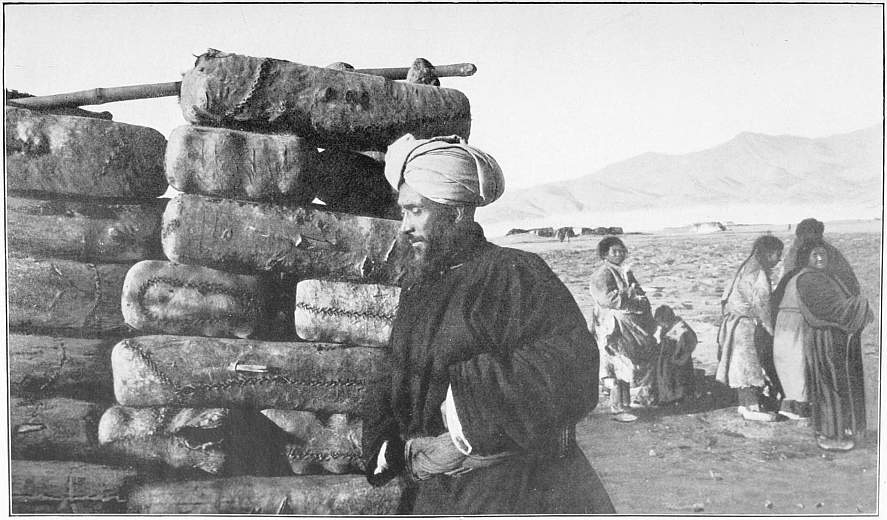
272. Gulam Razul beside Bales of Chinese Brick-Tea.
When we came a second time to Diri-pu some days later, we saw two young lamas engaged in the prostration pilgrimage round the mountain. They were from Kham, and from that part of the country “where the last men dwell,” and had been a year on the way to Kailas. They were poor and ragged, and had nothing to carry, for they lived on the alms of the faithful. They had come in nine days from Tarchen to Diri-pu, and reckoned that they had still eleven days to finish their round. I accompanied them for half an hour on foot to observe their procedure. This consisted of six movements. Suppose the young lama standing on the path with his forehead held slightly down and his arms hanging loosely at his sides, (1) He places the palms of his hands together and raises them to the top of his head, at the same time bending his head a little down; (2) he lays his hands under his chin, lifting up his head again; (3) he kneels upon the ground, bends forwards and lays himself full length on the ground with outstretched arms; (4) he passes his hands laid together over his head; (5) he stretches his right hand forwards as far as it will reach, and scratches a mark in the soil with a piece of bone, which shows the line which must be touched by his toes at the next advance; and (6) he raises himself up with his hands, makes two or three strides up to the mark, and repeats the same actions. And thus he goes round the whole mountain.
It is slow work and they do not hurry; they perform the whole business with composure, but they lose their breath, especially on the way up to the pass. And on the way down from the Dolma-la there are places so steep that it must be a gymnastic feat to lie down head foremost. One of the young monks had already accomplished one round, and was now on the second. When he had finished, in twelve days, he intended to betake himself to a monastery on the Tsangpo and be there immured for the rest of his life. And he was only twenty years old! We, who in our superior wisdom smile at these exhibitions of fanaticism and self-mortification, ought to compare our own faith and convictions with theirs. The life beyond the grave is hidden from all peoples, but religious conceptions have clothed it in different forms among different peoples. “If thou lookest closely, thou wilt see that hope, the child of heaven, points every mortal with trembling hand to the obscure heights.” Whatever may be our own convictions, we must admire those who, however erroneous their views may be in our opinion, yet possess faith enough to remove mountains.
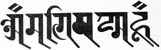
OM MANI PADME HUM
CHAPTER LII
OM MANI PADME HUM
Now begins the last very steep zigzag in the troublesome path among sharp or round grey boulders of every form and size, a cone of blocks with steps in it. Dung-chapje is the name of a round wall of stone, in the midst of which is a smaller boulder, containing in a hollow depression a round stone like the cleft hoof of a wild yak. When the faithful pilgrim passes this spot, he takes this stone, strikes it against the bottom of the hollow and turns it once round like a pestle. Consequently the hollow is being constantly deepened, and one day it will be lowered right through the block.
We mount up a ridge with brooks flowing on both sides. On every rock, which has a top at all level, small stones are piled up, and many of these pyramidal heaps are packed so closely that there is no room for another stone. Thanks to these cairns the pilgrim can find his way in snowstorm and fog, though without them he could not easily find it in sunshine.
At length we see before us a gigantic boulder, its cubical contents amounting perhaps to 7,000 or 10,000 cubic feet; it stands like an enormous milestone on the saddle of Dolma-la, which attains the tremendous height of 18,599 feet. On the top of the block smaller stones are piled up into a pyramid supporting a pole, and from its end cords decorated with rags and streamers are stretched to other poles fixed in the ground. Horns and bones, chiefly shoulder-blades of sheep, are here deposited in large quantities—gifts of homage to the pass, which is supposed to mark the half-way point of the pilgrimage. When the pilgrim arrives here, he smears a bit of butter on the side of the stone, plucks out a lock of his own hair and plasters it into the butter. Thus he has offered up some of himself and some of his belongings. Consequently the stone resembles a huge wig-block, from which black locks of hair flutter in the wind. In time it would be completely covered with Tibetan hair, were it not that the locks occasionally fall off and are blown away by the wind. Teeth are stuck in all the chinks of the Dolma block, forming whole rosaries of human teeth. If you have a loose tooth, dedicate it to the spirits of the pass. Tsering unfortunately was toothless, or he would gladly have conformed to this regulation.
Heaps of rags lie all around, for the pilgrim has always a spare shred to hang on a string or lay at the foot of the block. But he not only gives, but also takes. Our old man took a rag from the heap and had a large quantity of such relics round his neck, for he had taken one from every cairn.
The view is grand, though Kailas itself is not visible. But one can see the sharp black ridge lying quite close on the south side with a mantle of snow and a hanging glacier, its blue margin cut off perpendicularly at the small moraine lake on the eastern side of the pass.
While I sat at the foot of the block, making observations and drawing the panorama, a lama came strolling up leaning on his stick. He carried a book, a drum, a dorche, and a bell, and likewise a sickly-looking child in a basket on his back. The parents, nomads in the valley below, had given him tsamba for two days to carry the child round the mountain, whereby it would recover its health. Many pilgrims gain their livelihood by such services, and some make the pilgrimage only for the benefit of others. The lama with the child complained that he had only made the circuit of the mountain three times, and did not possess money enough to go round thirteen times. I gave him alms.
Then he sat down on the pass, turned his face in the direction where the summit of Kang-rinpoche was hidden, placed his hands together, and chanted an interminable succession of prayers. After this he went up to the block and laid his forehead on the ground—how many times I do not know, but he was still at it when we descended among boulders to the tiny round lake Tso-kavála. We followed its northern shore, and our old friend told me that the ice never breaks up.
But time slips away and we must hasten on. We walk, slide, and scramble down steep slopes where it would be easy to tumble down head over heels. The old man is sure-footed, and these slopes are old acquaintances. But woe betide him if he turned round and went in the reverse direction. At length we reach the main valley, called in its upper part Tselung, and in its lower Lam-chyker. Through the large valley, which enters the main valley on the right side, and is called Kando-sanglam, we now look eastwards upon the highest pinnacle of the summit of Kailas, which has a sharp edge towards the north-east, and still looks like a crystal. At two manis erected side by side we pass the border of the granite and the conglomerate, which now appears again. The further we proceed the more numerous are the boulders of this kind of rock, while those of granite at length occur no more. We march south-west and bivouac on the roof of the monastery Tsumtul-pu. All day long, at all the cairns and all the resting-places, I have heard nothing but an endless murmur of the words “Om mani padme hum,” and now, as long as I am awake, “Om mani padme hum” sounds in my ears from all nooks and corners.
The temple had no other curiosity but a statue of Duk Ngavang Gyamtso, 5 feet high, sitting as at a writing-desk, two not very large elephant’s tusks, and a five-branched chandelier from Lhasa. Our visit, therefore, did not last long, and we rode down the valley in which the river gradually increased in size. Here, too, manis and chhortens are erected, and at the end of the valley, where again numbers of granite boulders are accumulated, we see once more Langak-tso and the grand Gurla group.
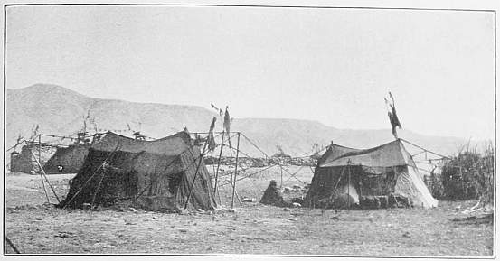
273. Tibetan Tent.
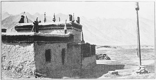
274. Monastery of Gar-gunsa.
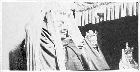
275. Images at Chushut.
At Tarchen-labrang we reached the termination of the pilgrimage. Here twenty-three tents were pitched, and we received the greatest attention, were refreshed with milk and chang, and rested two hours. Then we left the pilgrim road to the right, and came into sight of the fourth monastery, perched high up on a terrace in the valley below the holy peak. A curious local wind at the north-west corner of Langak-tso raised up clouds of dust like the smoke of a burning town. A short while after, we lay peacefully among our men in the camp on the Khaleb moor.
By this pilgrimage round the holy mountain, which I had been able to accomplish by an unexpected lucky chance, I had gained an insight into the religious life of the Tibetans. It had also been, as it were, a revisal of all the experiences I had already collected in this connection.
Our knowledge of Tibet is still defective, and some future traveller will find sufficient material to show on a map of the whole Lamaistic world all the great pilgrim routes to innumerable sanctuaries. On such a map numerous roads would converge, like the spokes of a wheel, to Da Kuren, the temple of Maidari in Urga. Still closer would the rays from every inhabited spot of the immense territory of Lamaism run together to their chief focus, Lhasa. Somewhat less thickly they would unite at Tashi-lunpo. Innumerable winding roads and paths would start from the farthest border countries of Tibet, all tending towards the holy Kailas. We know that they exist, and no great imagination is required to conceive how they would look on a map. But it is with the routes of pilgrims just as with the flight of the wild-geese: we know nothing of their precise course. Besides, among the principal foci are scattered a number of smaller centres whence radii diverge to a sanctuary, a lake, or a spring, and from the heart of all these wind-roses peals out a cry to the faithful, similar to the exhortation of Isaiah: “Look upon Zion, the city of our solemnities: thine eyes shall see Jerusalem” (Isa. xxxiii. 20).
In the ears of the Tibetan another saying rings, the mystical formula “Om mani padme hum,” not only on his wanderings to the goal of his pilgrimage, but throughout his life. Concerning this Waddell makes, among others, the following remarks: “Om-ma-ṇi pad-me Hūṃ, which literally means ‘Om! The Jewel in the lotus!’ Hūṃ!—is addressed to the Bodhisat Padmapāṇi, who is represented like Buddha as seated or standing within a lotus-flower. He is the patron-god of Tibet and the controller of metempsychosis. And no wonder this formula is so popular and constantly repeated by both Lāmas and laity, for its mere utterance is believed to stop the cycle of re-births and to convey the reciter directly to paradise. Thus it is stated in the Māṇi-kah-bum with extravagant rhapsody that this formula ‘is the essence of all happiness, prosperity, and knowledge, and the great means of deliverance,’ for the Om closes re-birth amongst the gods, ma among the Titans, ṇi as a man, pad as a beast, me as a Tantalus, and Hūṃ as an inhabitant of hell. And in keeping with this view each of these six syllables is given the distinctive colour of these six states of re-birth, namely: Om, the godly white; ma, the Titanic blue; ṇi, the human yellow; pad, the animal green; me, the ‘Tantalic’ red; and Hūṃ, the hellish black” (The Buddhism of Tibet, 148-9).
Köppen and Grünwedel translate the four words: “O, Jewel in the lotus-flower, Amen.”
Wherever one turns in Tibet, he sees the six sacred characters engraved or chiselled out, and hears them repeated everywhere. They are found in every temple in hundreds of thousands of copies, nay, in millions, for in the great prayer mills they are stamped in fine letters on thin paper. On the monastery roofs, on the roofs of private houses, and on the black tents, they are inscribed on the fluttering streamers. On all the roads we ride daily past wall-like stone cists covered with slabs, on which the formula “Om mani padme hum” is carved. Seldom does the most lonely path lead up to a pass where no cairn is erected to remind the wanderer of his dependence all his life long on the influence of good and bad spirits. And on the top of every such lhato or lhadse is fixed a pole or a stick with streamers, every one proclaiming in black letters the eternal truth. At projecting rocks cubical chhortens or lhatos stand beside the road in red and white. On the sides of granite rocks polished smooth by wind and weather figures of Buddha are frequently cut, and below them, as well as on fallen boulders, can be read in gigantic characters “Om mani padme hum.” On the piers between which chain bridges are stretched over the Tsangpo or other rivers, heaps of stones are piled up, and on all these innumerable votive cairns lie yak skulls and crania of wild sheep and antelopes. Into the horns and the bleached frontal bones of the yak the sacred formula is cut, and the incised characters are filled in with red or some other holy colour. We find them again in innumerable copies and in many forms, especially on the high-roads which lead to temples and pilgrims’ resorts, as well as at all places where there is danger, as on mountain passes and river fords. And even the ferry boats of hide are decorated with blessed streamers.
In every caravan one man at least, and usually several, has a prayer-mill in his hand. This is rotated by means of a weight round the axle of the handle, and is stuffed full of paper strips bearing the holy formula in many thousands of impressions. All day long, whatever the duration of the journey, the believer turns his prayer-mill and babbles in chanting tones “Om mani padme hum.” The militia who are called out to catch a robber band have on their ride more confidence in their prayer-mills than in their guns and sabres, and, sad to say, there are some even among the robbers who rattle off their Om and Hum in order to make their escape. Among the escorts which accompanied me on various occasions there were always one or two horsemen armed with a mani machine. One always sees this convenient praying instrument in the hands of the people one meets. The herdsman murmurs the six syllables beside his herd, his wife when milking the sheep, the merchant as he goes to market, the hunter as he stalks the wild yak on untrodden paths, the nomad when he sets out to move his tent to another pasture, the artisan as he bends over his work. With these words the Tibetan begins his day, and with them on his tongue he lies down to rest. The Om and Hum are not only the Alpha and Omega of the day, but of his whole life.
The mystic words rang constantly in my ears. I heard them when the sun rose and when I blew out my light, and I did not escape them even in the wilderness, for my own men murmured “Om mani padme hum.” They belong to Tibet, these words; they are inseparable from it: I cannot imagine the snow-capped mountains and the blue lakes without them. They are as closely connected with this country as buzzing with the bee-hive, as the flutter of streamers with the pass, as the ceaseless west wind with its howling.
The life of the Tibetan from the cradle to the grave is interwoven with a multitude of religious precepts and customs. It is his duty to contribute his mite to the maintenance of the monasteries and to the Peter’s pence of the temples. When he passes a votive cairn he adds a stone to the pile as an offering; when he rides by a mani, he never forgets to guide his steed to the left of it; when he sees a holy mountain, he never omits to lay his forehead on the ground in homage; in all important undertakings he must, for the sake of his eternal salvation, seek the advice of monks learned in the law; when a mendicant lama comes to his door he never refuses to give him a handful of tsamba or a lump of butter; when he makes the round of the temple halls, he adds his contribution to the collection in the votive bowls; and when he saddles his horse or loads a yak, he again hums the everlasting “Om mani padme hum.”
More frequently than an Ave Maria or a Paternoster in the Catholic world, “Om mani padme hum” forms an accompaniment to the life and wanderings of humanity over half Asia. The boundless vista opened out by the six holy syllables is thus expressed by Edwin Arnold in the concluding lines of his poem, The Light of Asia:
The dew is on the lotus. Rise, Great Sun! And lift my leaf and mix me with the wave. Om mani padme hum, the sunrise comes. The dewdrop slips into the shining sea.
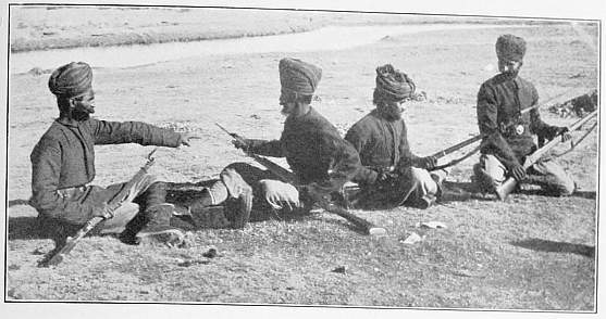
276. The Policemen from Simla.
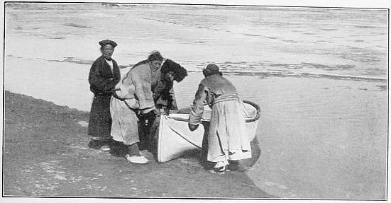
277. My Boat on the Indus.
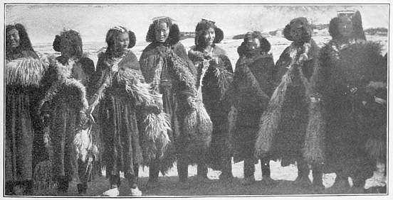
278. Ladaki Women.
CHAPTER LIII
THE DISCOVERY OF THE SOURCE OF THE INDUS
Immediately on my arrival in Khaleb I told the old gova, who had the hopeless and thankless task of watching my proceedings, that I now intended to take the road past Singi-kabab, or the source of the Indus.
“If you go thither, Bombo,” he answered, “I shall at once send a courier to the Garpuns, the two chiefs in Gartok.”
“I do not think that the Garpuns will have any objection to my taking a more northerly route.”
“Oh yes, the Garpuns received orders from Lhasa five days ago to watch carefully that you followed no other way but the great high-road to Gartok. The Garpuns straightway sent couriers to twelve different places—Parka, Misser, Purang, Singtod, and others—to make it known that you were not permitted to travel on byroads. If this letter had not reached me, I would willingly have let you march northwards, but now I dare not for my own sake.”
“What would you do if I quietly disappeared one night? I can buy yaks in Tarchen, and then I shall not be dependent on those I have from you.”
“Yes, of course. A man lives in Tarchen who has sixty yaks, and will sell them as soon as he sees silver money. But I shall at once send word to the Garpuns, and they will send men after you and force you to come back. To buy yaks would therefore be useless waste of money. However, if you like to let the main part of your caravan follow the high-road, and make yourself an excursion of a couple of days northwards to the Singi-kabab, and then join your caravan again, I will put no obstacles in your way. But you do it at your own risk, and you will most certainly be caught before you reach the source of the Indus.”
I was as much astonished as delighted by this sudden change in the attitude of the gova, and arranged with Robert that he should lead the main caravan in very short day’s marches to Gartok, while I made as rapidly as possible for the source of the Indus. I took only as many things as a small leathern trunk would contain, and as companions only five men, among them Rabsang as interpreter and Adul as cook, with our own six animals and three dogs, one of which, a new purchase, ran away on the first day. I had Robert’s small tent, and our arsenal consisted of two guns and a revolver, for robbers were said to make the country very unsafe. I could not find a guide, but on the way to Diri-pu, where I encamped once more, I came across an old man from Tok-jalung, who wished to make the round of Kailas thirteen times, and gave me much valuable information. But no money could induce him to accompany us farther.
On the 8th we continued our way through the valley that runs north-north-eastwards from Diri-pu to the Tseti-la. The stream, divided into many arms, was covered in the night by a thin coating of ice, smooth as glass, where the water had run off, but it disappeared when day came. The valley is broad, and the road showed traces of considerable traffic, though we did not meet a soul. The marmots whistled in front of their holes; the summer would soon be over for them. Kang-rinpoche can be seen from many places, and here pilgrims from the north have piled up cairns. Granite predominates everywhere, but crystalline schists occur here and there. We followed the fresh tracks of three horsemen. The gradient became steeper and the scenery assumed more of an alpine character. We mounted up among huge cones of detritus with babbling brooks of melted snow to the pass, which lay at a height of 18,465 feet. Its plateau is singularly flat. On its northern side camp No. 234 was pitched.
In the evening Rabsang reported that our fuel-gatherers had heard whistles, and that these signals had been answered from the other side. The men believed that there were robbers here, and did not dare to sit outside by the fire lest they should be good marks for shots out of an ambush. I quieted them with the assurance that no robber would venture to attack a European, but gave orders to the watchmen to keep an eye on our animals.
The night passed quietly and the minimum temperature went down to 16.2°; autumn was come again into dreary Tibet. I had supposed that the Tseti-la was the pass on the main divide, but we had not gone far when we saw its brook, which flowed northwards, make a bend to the west, and descend through a well-defined valley to the Dunglung. It therefore belongs to the catchment basin of the Sutlej and not to the Indus, and the Tseti-la is a pass of secondary order. But we soon reached the actual pass, an extremely flat threshold. Here lies a small muddy lake drained by a brook issuing from its eastern side, which we followed all day. This pass is the Tseti-lachen-la, and it is a water-parting between the Sutlej and the Indus. Its height is less than that of the Tseti-la, for it is only 17,933 feet; it lies on the main chain of the Trans-Himalaya. Kailas, therefore, lies a good day’s journey south of the watershed of the two rivers, and belongs entirely to the basin of the Sutlej.
From the lake we follow the little affluent of the Indus northwards. The ground is marshy and rough. Here and there are seen three hearthstones. A dead horse lies among the luxuriant grass. It is singular that no nomads are encamped here. At length we see at a far distance quite down in the valley men going downstream with large flocks of sheep. Tundup Sonam and Ishe are sent after them, and by degrees the rest of us come up with the party. They are nomads from Gertse, who have taken salt to Gyanima and are now transporting barley on their 500 sheep. All the valley is dotted over with white sheep, which trip along actively, plucking the grass as they go. In front of us rises a steep purple mountain chain, and along the flank turned towards us the Indus is said to flow. We joined the men of the sheep caravan and camped together with them. There were five of them, all armed with guns, and they said that the district was frequently haunted by robbers, who at times seemed to vanish altogether, and then suddenly came down like a whirlwind, and no one knew whence they came.
Our camping-ground on the bank of the Indus (16,663 feet) is called Singi-buk. Eastwards the valley is broad and open, but the Indus itself is here an insignificant stream. I was therefore not astonished when I heard that it was only a short day’s journey to the source, which, I was told, does not proceed from snow or a glacier, but springs up out of the ground. The men called the river the Singi-tsangpo, or Singi-kamba, and the source itself Singi-kabab, though we afterwards heard the word pronounced Senge more frequently than Singi.
It turned out that one of the five men knew all about us. He was a brother of the Lobsang Tsering on the Dungtse-tso who had sold us three yaks the winter before (see Chapter XV.). It was a singular chance that we should fall in with him. He said he had heard how well we had treated his brother, and offered us his services—for a good reward, of course. As he had travelled several times through this region, quite unknown to Europeans, and was acquainted with all the passes, roads, and valleys, I thought he would be very valuable to me, and I proposed to give him 7 rupees a day, that is about half a month’s pay of one of my Ladakis. Of course he accepted the terms at once and soon became our intimate friend.
But these business matters were not yet settled. The man had a quantity of sheep and barley. He consented to let us eight sheep on hire, and sell us their loads, which would last our horses for a week. He was to receive a rupee for the hire of each sheep, which was high, for a sheep is worth only 2 to 3 rupees. The old man would therefore receive 18 rupees every evening as long as he was with us; but it was cheap after all, for the discovery of the source of the Indus was involved.
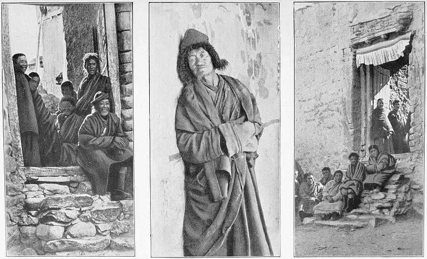
279, 280, 281. At the Monastery Door in Tashi-gang between Gartok and Ladak.
The large sheep-caravan had already started on September 10, when we, with our new guide, whose own tsamba was carried on a ninth sheep, followed in its track. After an hour’s march we crossed a tributary, the Lungdep-chu, which comes from a valley in the south-east, with flattish mountains in the background.
A little farther up the Singi-kamba expands into a basin containing an abundance of medium-sized fish. As we passed, the fish were darting upstream in compact shoals, and passed a very shallow place with slight swirls. Here Rabsang attacked them, but all his catch was only one small miserable fish. Then we threw up a dam by the bank, with an opening on one side, and the men went into the water and drove in the fish with shouts and splashing. Then the entrance was built up. After we had repeated this diversion three times, we had procured thirty-seven fine fish, and I was eager for my dinner, which I usually looked forward to with some loathing, for the hard dried mutton had become thoroughly distasteful to me. Our old man, who sat and watched us, thought that we had taken leave of our senses. Farther up, the fish were so crowded in a quiet pool that they made the water seem almost black with their dark backs.
We rode up the valley, leaving on our right a red, loaf-shaped mountain called Lungdep-ningri. Opposite, on the northern side of the valley, were seen two fine Ovis Ammon sheep feeding on a conical elevation. They bore splendid horns, and carried their heads royally. They soon perceived us, and made slowly up the slope. But they paid too much attention to our movements, and did not notice that Tundup Sonam, with his gun on his back, was making a detour to stalk them from the other side of the hill. After a while we heard a shot, and a good hour later, when the camp was pitched, Tundup came back laden with as much of the flesh of his victim as he could carry. Thus we obtained a fresh addition to our somewhat scanty rations, and Tundup’s exploit enhanced the glory of this memorable day. In the evening he went off again to fetch more meat, and he brought me the head of the wild sheep, which I wished to preserve as a memento of the day at the source of the Indus.
The ground rises exceedingly slowly. Singi-yüra is a rugged cliff to the north, with a large hole through its summit. Singi-chava is the name of a commanding eminence to the south. Then we wade through the outflow of the Munjam valley running in from the south-east. Above this the Indus is only a tiny brook, and part of its water comes from a valley in the south-east, the Bokar. A little later we camp at the aperture of the spring, which is so well concealed that it might easily be overlooked without a guide.