Part II History of the Industry (continued 3)
Reading edition
Toussaint Louverture, a negro of marked military ability, was appointed commander-in-chief by the directory, and by 1801 he succeeded in restoring order. Unfortunately, the measures that he endeavored to put into effect aroused the suspicions of Napoleon, who sent out an army to subdue him and to restore slavery. This expedition met with such determined resistance that the commander, General Leclerc, opened negotiations and Toussaint was induced by solemn promises to lay down his arms. He was treacherously seized and taken to France, where he died in 1803. The blacks immediately renewed hostilities under Jean Jacques Dessalines, and in November, 1803, the French withdrew completely. In the following year the independence of the island was declared and its ancient name of Haiti was restored. Dessalines was first made governor for life and in October, 1804, he proclaimed himself emperor. He was assassinated in 1806. From that time to the present the country has been in a state of turmoil and the end is not yet. In 1844 the people of the eastern end of the island seceded and formed the republic of Santo Domingo. Ever since then there have been two distinct governments in the island, with the strongest political antipathy existing between them.
But little sugar cane is raised in Haiti, and the most of this small quantity is either consumed as cane or made into a beverage called tafia.
The sugar plantations of Santo Domingo are found on the southern coast, in the level stretches of Arua and Romana, in the valleys near the city of Santo Domingo and in the region near San Pedro de Macoris. No sugar is grown in the interior. While most of the factories are land owners and cultivate cane, they do not grow all that they grind. A good deal is raised by colonos under the following conditions: The factories assign parcels of land to the colonos rent-free and in addition allow them the use of draft cattle and farming implements. When necessary a certain amount of actual cash is advanced. The colonos plant and till the land, furnish their own labor and deliver the cane at the point where it is loaded on the railway cars. The field hands are either natives or negroes brought from nearby islands, and their pay ranges from 50 to 75 cents gold per day.
The ground is tilled in an indifferent fashion and no fertilizing whatever is done. When virgin soil is planted, the seed is put in at seven-foot intervals, sometimes greater, without any holes or furrows having been made; the cuttings are simply stuck in the ground and partly covered with earth. The cane ripens in fourteen months or more. Ratooning follows until the yield gets so small that replanting is necessary. When this time comes, the old roots are ploughed up and furrows from four to six inches in depth are made about five or six feet apart. The seed cane is planted in these furrows at four- or five-foot intervals. The yield from virgin soil is very heavy and has been known to reach ninety tons to the acre, but the sugar content of such crops is low, whereas the subsequent ratoons with a decreased tonnage of cane per acre give juice of a better quality. A fair average production on a plantation having 4000 acres in cane would be about twenty-four tons to the acre. Naturally this estimate would be affected by the relative proportions of plant cane and ratoons, as well as by the character of the soil. Planting is generally done in June and October, while the harvesting begins in December and continues until April.
Manufacturing methods in Santo Domingo admit of much improvement. Single crushing is the method employed for the most part, so that the loss in extraction is considerable. The juices are treated and the suspended impurities allowed to settle at the bottom of the tanks. Filter presses are the exception rather than the rule, and for want of them the sugar in the resultant mud is lost. The clear juices are then concentrated and boiled to grain in vacuum pans. First sugars generally polarize between 95 degrees and 97 degrees, seconds about 86 degrees. The molasses is either made into rum or permitted to run to waste. Notwithstanding the crude character of the factories and machinery, the recovery of sugar is generally good, the average being between 9 per cent and 11 per cent of the weight of the cane, with single crushing.
Almost all of the factories are managed by Americans, but, as has been said, the equipment they have to work with is by no means modern, and under the extremely uncertain political conditions that prevail there is scant encouragement for outside capital to come in and improve matters. Just when a change for the better will come is impossible to say.
Messrs. Willett & Gray give the yearly figures since 1903 in long tons, as follows:
1903-04 47,000
1904-05 47,000
1905-06 55,000
1906-07 60,000
1907-08 62,235
1908-09 69,483
1909-10 93,003
1910-11 89,979
1911-12 96,046
1912-13 84,661
1913-14 105,778
1914-15 108,267
1915-16 120,000
GUADELOUPE AND MARTINIQUE
GUADELOUPE
The French West Indian colony of Guadeloupe consists of two islands that lie in the middle of the Leeward group between 15 degrees 57 minutes and 16 degrees 31 minutes north latitude and 61 degrees 10 minutes and 61 degrees 49 minutes west longitude. They are separated by a channel from one hundred feet to four hundred feet wide, called Rivière Salée.
Basse-Terre, the western island, is twenty-eight miles long, from twelve to fifteen miles wide and its area is 364 square miles. It presents a rugged surface, broken by hills and highlands, and a backbone of mountains runs through it from north to south. It is of volcanic origin, having been thrown up by four volcanic centers, Grosse Montagne (2590 feet), Les Mamelles (2536 feet and 2368 feet), Morne sans Toucher (4855 feet), and La Soufrière (4868 feet). The last-named volcano was in eruption in 1797, and in 1843 its disturbances wrecked several towns; today, however, the only evidences of life are a few hot springs and the emission of sulphurous vapors at certain points.
Basse-Terre is watered by a number of streams that become swollen and turbulent during the rainy season.
Grande-Terre, the eastern island, is low and level, the greatest elevation being only 450 feet. It consists of a plain of limestone formation with a conglomerate of sand and broken shells. It is about twenty-two miles long from north to south and its area is 255 square miles. The population is 190,273, chiefly negroes and mulattoes. For water supply it is dependent upon ponds and cisterns, as, owing to the porosity of the soil, no rivers or streams exist.
The climate is warm and humid. The mean yearly temperature is 78 degrees Fahrenheit, the minimum 61 degrees and the maximum 101 degrees. The wet season is from July to November, and on the coast the annual rainfall is about eighty-six inches, with a great deal more in the interior. Terrific storms visit the island and hurricanes have wrought much destruction.
The soil is fertile and rich and the principal crop is sugar cane, which is grown on over half the total cultivated area. The principal sugar centers are Point-à-Pitre, St. Anne and Le Moule in Grande-Terre, all of which have well-appointed usines. There is also a large usine in Basse-Terre.
Guadeloupe was discovered by Columbus in 1493. One hundred and forty-two years afterward l’Olive and Duplessis took possession in the name of a French company called the Compagnie des Iles d’Amérique. The native Caribs did not long survive the cruel treatment accorded them by l’Olive, and efforts at colonization were the reverse of successful, in fact four chartered companies were ruined in the attempt. In 1674 the islands passed into the possession of the French crown and they were governed from Martinique for a long time. In 1759 they were captured by the British, in whose hands they remained for four years. The British again occupied them in 1794, but were driven out the following summer by Victor Hugues with the help of liberated slaves. The last British occupation took place during the Hundred Days of 1815, and they finally withdrew in 1816. Slavery in Guadeloupe was abolished in 1848.
MARTINIQUE
The French colony of Martinique is the most northerly of the Windward islands. It is situated between 14 degrees 55 minutes and 14 degrees 23 minutes north latitude and 60 degrees 48 minutes and 61 degrees 16 minutes west longitude. Its area is 381 square miles, its greatest length from northwest to southeast 36 miles, and its extreme width 18 miles. The population, negroes and half-castes for the most part, numbered 190,000 in 1913.
The surface is mountainous, the highest peak being Mt. Pelée, which rises 4428 feet above sea-level. The appalling eruption of this volcano in May, 1902, was one of the greatest disasters of modern times and cost the lives of 40,000 people. About one-third of the island’s surface consists of extensive plains, most of them occurring in the south. The soil of the northern part is of volcanic formation, while in the south it is composed of clay. There are a number of streams, some of them of considerable size.
Near the coast the average temperature for June is 83 degrees, and for January 77 degrees, the mean for the year being about 80 degrees Fahrenheit. The wet season extends from June to October and the total yearly rainfall approximates 87 inches. August is the wettest month and March the driest. In the low region of the sea coast the climate is not healthful for Europeans during the hot period, but a more salubrious atmosphere and a temperature 10 degrees lower is found in the wooded uplands, 1500 feet above the sea. Fresh, dry northerly winds prevail from November to February, easterly winds from March to June, and damp, warm southerly winds from July to October. Earthquakes are frequent, but hurricanes seldom visit the island.
Martinique was discovered by Columbus on June 15, 1492, and the French Compagnie des Iles d’Amérique took possession of it in 1635. It was settled in the same year by Pierre Belain, captain-general of the island of St. Christopher, and in 1674 it became the property of the crown.
Sugar culture was begun in 1650, and a few years later the aboriginal Caribs were exterminated, their place being filled by negro slaves, of whom there were 60,000 in the island by 1736. Slavery was abolished in 1848.[71]
During the seventeenth century Martinique was attacked several times by the British and the Dutch. It was captured in 1762 by the British under Admiral Rodney, but restored to the French in the following year. It was held by the British from 1793 to 1801 and also between 1809 and 1814.
The capital of the island is Fort de France, on the west coast. It is situated upon a fine harbor and has 18,000 inhabitants. Besides the chief product, sugar, the colony raises coffee, cocoa, tobacco and cotton.
GUADELOUPE AND MARTINIQUE
Sugar planting in these islands dates from 1635, the year in which they were first occupied by the French, and the industry grew apace, so that much sugar was exported to France during the latter half of the seventeenth century. The import duties levied by France in 1664 shut out foreign raw sugars from that country, while protecting raw sugars from her colonies; but at the same time the tariff laws excluded white sugar produced in the colonies. This was a death blow to the refineries of Martinique. A decree entirely prohibiting the refining of sugar in the colonies and the exportation of raw sugar to foreign countries was issued in 1669, while an export duty was imposed upon the raw sugar shipped to France. The tax upon raw sugar was removed in 1682, but the duty on refined was increased. The colonial planters then turned their attention to the manufacture of clayed sugars, which they sold in North America and southern Europe.
In 1717 France established relations with her colonies that were almost tantamount to free trade. No duties were assessed upon French goods going into the colonies, and commodities produced in the colonies entered the mother country without duty. As a result of this policy, the sugar industry grew until the production of Guadeloupe, Martinique and Saint Dominique was more than France could consume, and a law was passed permitting the sale of the surplus in other countries.
During the closing years of the eighteenth century, the war between England and France crippled the trade of the French West Indies, but when peace was finally restored the sugar industry revived and continued to flourish until the abolition of slavery in 1848.
When the slaves were freed, the planters cast about them to find laborers, and India was one of the first sources of supply. Over ten thousand Hindus were brought to Martinique between 1852 and 1862, and with very few exceptions they remained in the island after their five-year contract expired. During the twenty-two years that followed 1862, 25,500 laborers came to Martinique from Pondicherry, Yanaon, Karikal and Calcutta with the permission of the Indian authorities, but emigration from that country under government auspices was discontinued in 1885. In addition to Hindus, free African negroes, Chinese and Annamese were brought in.
The sugar plantations of Guadeloupe and Martinique are situated on the low, alluvial lands around the coast, although some are found in the interior. The hilly character of the latter, however, is not favorable to cane culture, as the heavy rains wash the arable soil down the slopes, thus interfering with the growth of the cane.
The ground to be planted in cane is first cleared and then ploughed. Furrows about two feet deep and four and one-half feet apart are then made and the seed cane is planted in holes five inches deep. Three weeks afterward the cane is banked and fertilizer applied. The soil between the canes is loosened from time to time and the crop is cut after a year’s growth. As a rule, ratooning is limited to two years, one crop being produced each year. The land is then allowed to rest for a time, after which planting is begun anew.
Bourbon cane is the variety principally grown, although seedling canes have been brought in from Barbados and British Guiana of late years. The average yield per acre of plant cane is twenty-four tons; first ratoons give sixteen tons and second ratoons about eight tons. After the cane is cut it is loaded on large carts and taken to the factories. Some estates are equipped with field railways, the cars being drawn by mules or locomotives.
As mentioned in the chapter on Jamaica, the early sugar producers of Saint Dominique, Guadeloupe and Martinique excelled the manufacturers of the other West Indian islands in the preparation of the commodity. The result was that their lead was gradually followed by the others, and a brief description of the methods they employed will be of interest.
The cane juice was boiled in a series of five or six copper kettles placed over a furnace fed by bagasse and wood. These kettles were of different sizes, the largest being farthest from the fire and the size of each decreased as the furnace door was approached, the smallest being directly above the fire. The kettle next to the largest was set a little higher than the largest one, the third higher than the second and so on until the last and smallest, which was the highest of the series. Clarification was done with lime and wood ashes, and sometimes a little crude antimony. As soon as the raw juice reached the first and largest kettle the clarifying material was thrown in and the boiling began. The scum was removed as soon as it formed, and when the juice became sufficiently clear it was quickly transferred to the second kettle; a small amount of alkali was mixed with it and further boiling and skimming was done. The liquor was then ladled into kettle number three, potash lye and an extract of herbs were added, and after being boiled for a time it was passed to kettle number four, and finally concentrated in the last and smallest kettle immediately above the fire. When the required consistency was reached, the massecuite was put into vessels to cool, at the same time being kept in motion by stirring until the grains began to form. It was then placed in moulds, and after having become thoroughly cool it was dumped into hogsheads that had perforated bottoms. These hogsheads stood on racks, beneath which there was a receptacle to catch the molasses as it drained on through the holes in the bottom. The draining was allowed to continue until about one-half the weight of the contents of the hogshead was crystallized sugar. The holes were then plugged up and the sugar was ready for shipment. The molasses was manufactured into rum.
A superior grade, called sucre terré, or clayed sugar, was also made. In its preparation, juice from the best and ripest cane was taken and as little lime as possible was used in clarification. Antimony was excluded entirely, on account of its tendency to darken the color of the juice. As the juice was transferred from kettle to kettle during the various boilings, it was strained through a cloth each time, instead of being ladled direct from one kettle to the next. When the syrup was concentrated it was put into earthenware sugar-loaf moulds that held between thirty and thirty-five pounds of massecuite apiece. These moulds had perforations in the bottom that were stopped up before the mass was put in. In filling a mould, one quarter of its capacity was put in at one time, making four operations. Fifteen minutes after the last lot of massecuite was put in the mould, a layer of crystals formed on the surface, and this was thoroughly stirred into the mass, which was then left to cool. A couple of days later the plugs were removed so that the molasses might drain from the mould. In case it did not run off properly, the massecuite was remelted, but if the drainage was satisfactory, the next step was the claying of the sugar. If the top of the loaves was uneven or dark-colored, it was scraped smooth and covered with a layer of crushed sugar. The surface was then hammered level and even. A special kind of clay brought from Rouen was mixed with water and the mould was filled to the top with this mixture. Windows and doors were shut to prevent evaporation of the moisture, and the water draining from the clay gradually passed down through the sugar crystals, washing the syrup from them. After ten days had elapsed, the clay, then thoroughly dried, was removed, the surface of the sugar-loaf was cleaned, another layer of wet clay was applied and allowed to remain as long as the first. When this second layer was taken off, the loaves were removed from the moulds and allowed to dry in the air for a time. Further drying was done in a drying room, heated for the purpose, and the sugar, when all the moisture had been driven from it, was crushed by wooden pestles. Refined sugar was packed for shipment in casks containing between 600 and 700 pounds. The first molasses was made into rum or boiled into second sugar, and the syrup washed from the loaves was made into a sugar called cassonade.
This primitive method of manufacture has been entirely supplanted by newer processes and appliances. As a rule, today cane is crushed twice and maceration is often employed. The juice is treated with sulphur while still cold, and it is then pumped into defecation tanks, where powdered lime is added; after this is done heat is applied. As soon as the scum cracks, the steam is turned off and the clear juice is separated from the sediment by a siphon and run to the evaporators, while the muddy precipitate goes to the filter presses.
Concentration of the juice takes place in double, triple or quadruple effects of rather an old type, which means lack of economy in steam and consequent large fuel consumption. As the quantity of bagasse available does not afford sufficient fuel to generate all the steam that is required, a considerable amount of wood and coal is used in addition for the purpose. The unwise and short-sighted policy of denuding the hillsides of their timber has had the effect of lessening the rainfall, a condition that has brought great injury to the planter.
The vacuum pans are small and of old style; the centrifugal machines, too, are of obsolete design and slow to operate. After the liquor has been boiled to grain in the pans and the sugar crystals have been separated from the mother liquor in the centrifugals, the sugar is dried and packed for the market in barrels or bags. The first molasses is reboiled and the resulting massecuite sent through the centrifugals. After this operation has been repeated three or four times, the final molasses is made into rum.
Today there are eighteen factories in Guadeloupe and fifteen in Martinique. The average extraction of sugar is 9.70 per cent of the weight of the cane, the loss of sugar in the bagasse is 2.15 per cent, the mechanical loss in manufacture is .90 per cent, and the percentage of sugar not recovered from the molasses is 1.75. This gives an average total of 14.50 per cent of sugar in the cane.
The manufacturers are dependent upon the small farmers for their raw material, and the price paid for the cane is determined by a very complex agreement, which nevertheless seems to be entirely satisfactory to both buyer and seller.
The outlook for the sugar industry in Guadeloupe and Martinique is far from bright. There is labor in abundance, but the natives are averse to working steadily, and consequently are unreliable. There are great possibilities for improvement, but little can be expected under the circumstances that prevail at the present time.
Since 1894 the production of the two islands in long tons has been as follows:
MARTINIQUE GUADELOUPE
1894 36,353 42,395
1895 28,777 29,394
1896 33,886 42,616
1897 34,185 39,493
1898 30,971 36,550
1899 31,165 39,259
1900 33,234 27,895
1901 39,121 38,086
1902 38,905 39,995
1903 28,578 37,891
1904 23,561 35,348
1905 29,986 26,905
1906 42,231 42,535
1907 36,764 38,345
1908 35,943 35,485
1909 37,757 24,812
1910 39,950 44,289
1911 35,438 38,384
1912 39,433 39,368
1913 40,000 32,000
1914 38,730 39,920
1915 40,000 40,000
1916 40,000 40,000
MEXICO
The United States of Mexico lie between 14 degrees 30 minutes and 32 degrees 42 minutes north latitude and 86 degrees 46 minutes and 117 degrees 7 minutes west longitude. On the north the boundary is the United States of America; on the east the Gulf of Mexico, the Caribbean sea, British Honduras and Guatemala; on the south British Honduras and the Pacific ocean, and on the west the Pacific ocean. The superficial area of the country is 765,537 square miles. Its greatest length is 1942 miles and its greatest width is 762 miles. It has a coast line of 5486 miles, of which 1603 miles are on the Gulf of Mexico and the Caribbean sea and 3883 miles on the Pacific ocean and the Gulf of California.
The surface of Mexico rises sharply from the seacoast levels by a series of terraces to a central plateau, that varies in height from 4000 to 8000 feet and runs northwest and southeast. This tableland has been formed by the material deposited during the gradual erosion of the mountains and by matter thrown up by a great number of volcanoes. In this manner the original valleys became completely filled up and those that now exist are of later formation. To illustrate this filling process, buried mountains whose peaks appear above the surrounding mass are found in the higher parts of the plateau, while elsewhere they are met with as continuous ridges. The eastern coast is low and sandy, except in a few places where the mountains come down close to the shore. The Pacific coast lands are also low, but occasionally broken by mountain spurs. Owing to the terraced character of the country, very little river navigation is possible, but on the other hand an enormous amount of power can be developed from the numerous waterfalls. Two high mountain ranges, one on each coast, run parallel to the sea the entire length of Mexico. The eastern chain is about ten miles inland, while on the west there is only a narrow shelf of land between the sea and the cordilleras. This western range has several branches that run in different directions, the most important being the Sierra Madre Occidental. In Mexico the highest mountains are volcanoes. On the Pacific side and west of the plateau are found the Volcán de Colima (12,750 ft.) and the Nevado de Colima (14,354 ft.). Southwest of the City of Mexico is the Nevado de Toluca (16,610 ft.) and to the south and east are the snow-crowned giants Popocatepetl (17,540 ft.) and Ixtaccihuatl (15,705 ft.). Still farther east are Orizaba (16,176 ft.) and Cofre de Perote (14,309 ft.). Popocatepetl and Orizaba may be classified as dormant cones, for the reason that aqueous and sulphurous vapors are constantly being emitted from their perfectly formed craters. One of the highest lakes in the world is found in the crater of the Nevado de Toluca. Colima has been in eruption continuously for many years and is still active. The snow never leaves the summits of Orizaba, Popocatepetl and Ixtaccihuatl, and on the last the ice cap attains a development sufficient to form true glaciers.
On the western coast the principal ports are Guaymas, Mazatlan, Topolobampo, Acapulco, La Paz and Salina Cruz; on the eastern seaboard, Tampico, Vera Cruz, Puerto Mexico, Campeche and Merida. Of the numerous rivers, the most important is the Rio Grande, 1550 miles long, which forms a natural boundary between Mexico and the United States from El Paso to the Gulf. However, the conformation of the country does not admit of river navigation to any extent.
According to the census of 1910, the population was 15,063,207, of which 20 per cent were whites, 43 per cent of mixed blood and the remainder of Indian extraction.
In Mexico there are three distinct climates and a wide range of temperature. The hot country, tierra caliente, extends from the seacoast inland to an altitude of about 3000 feet. Here the mean annual temperature is between 80 degrees and 88 degrees, and the highest between 100 degrees and 105 degrees Fahrenheit. In this region the winter climate is delightful, except when severe gales sweep down from the north. In summer the extreme heat is not so great as in New York, because of the moderating effect of cool breezes.
The temperate region, tierra templada, extends from 3000 to 6500 feet above sea-level, and it is here that the ideal climate of Mexico is found, the mean annual temperature being between 73 and 77 degrees Fahrenheit, with a total variation of possibly not over 6 or 8 degrees during a season. In this dry, clear atmosphere the hygienic disadvantages of the seacoast, the sharp, cold winds of the upper altitudes, sudden changes in temperature, heavy frosts, extreme humidity and harmful insects are unknown, and in the dry season there is no malaria.
Tropical and semi-tropical growths flourish side by side, and there are estates on which wheat and sugar cane are raised almost in touch of each other.
The cold country, tierra fria, extends from the 6500-foot level to the snow line, but here the term cold is used in a comparative sense, as distinguished from the heat of the seacoast. The average temperature runs between 59 degrees and 62 degrees Fahrenheit, with slight variations. At times, however, a norther will drive the mercury down to 40 degrees or 35 degrees and sprinkle the streets of Mexico City with white.
As a rule, in Mexico the rainy season begins in May or June and ends in October. The annual rainfall varies greatly according to locality, ranging all the way from fifteen to fifty inches. Earthquakes are of common occurrence, especially on the western coast.
Sugar cane was brought to Mexico by the Spanish conquistadors. Prescott, in his “Conquest of Mexico,”[72] says that the sugar cane was transplanted from the neighboring islands to the lower level of the country, and that, together with indigo, cotton and cochineal, it formed a more desirable staple for the colony than its precious metals. He also states that it was Hernan Cortés himself who introduced the cane from Cuba. This famous soldier established the Atlacomulco plantation, which lies an easy hour’s ride distant from Cuernavaca in the state of Morelos, and there, in 1520, a hundred years before the landing of the Pilgrim Fathers at Plymouth, he erected the first sugar mill in Mexico. This mill is owned by the descendants of Cortés and is still in operation.
Thirty years later sugar was shipped from Mexico to Peru and Spain, and the production of the commodity was maintained steadily until 1791. In that year all the cane-growing countries of western America received a stimulus from the wholesale destruction of the plantations and mills of Santo Domingo.
In Mexico natural conditions are very favorable to sugar culture, but the growth of the industry has been retarded by the primitive methods in vogue, the inadequacy of transportation facilities and political disturbances. In the seaboard states the sugar plantations are found chiefly in the rich lowlands bordering on the Pacific ocean and the Gulf of Mexico. In the Gulf states the rainfall is ample to insure good crops. The largest sugar producer, however, is the inland state of Morelos, and there, as well as on the west coast, irrigation is necessary. The higher levels do not give such good crops as the lowlands; on the latter the yield is between forty and sixty tons to the acre, and on the former it runs between twenty-five and forty-five tons to the acre. Sugar beets have been grown on the plateau with marked success. In the low, tropical regions seven or eight crops of ratoons can be raised, but on the higher lands replanting must be done every two or three years. The best-known plantations are situated on large estates that have been owned by the same families for many generations. For instance, in Morelos, where about sixty per cent of Mexico’s crop is produced, the estates are owned by non-resident families and, as a rule, managed by Spaniards. Labor is cheap and abundant, the cane is rich in juice and the sugar content is high, but the extraction in the small, crude mills is poor, the recovery of sugar, as a rule, not exceeding six per cent of the weight of the cane. There are a few large factories in Mexico where the methods and results should be more closely in accordance with modern practice.
The nineteenth century saw the industry maintained on a fairly even basis, but about 1900 an improvement was noted, as the following table will show:
1899-1900 75,000 tons
1900-1901 95,000 ”
1901-1902 103,000 ”
1902-1903 112,000 ”
1903-1904 107,000 ”
1904-1905 107,000 ”
1905-1906 107,500 ”
1906-1907 119,000 ”
1907-1908 123,000 ”
1908-1909 143,000 ”
1909-1910 148,000 ”
1910-1911 161,602 ”
1911-1912 151,735 ”
1912-1913 148,672 ”
1913-1914 130,000 ”
1914-1915 110,000 ”
1915-1916 75,000 ”
The effects of the internal disturbances in Mexico are plainly reflected in the crop figures. In addition to the sugar tonnage shown, about 50,000 tons of piloncillo or panela (concrete sugar) are turned out annually by the small mills and the production of molasses is large. A considerable amount of the latter is used in the manufacture of rum and alcohol.
As regards the future of sugar in Mexico, there is much to justify belief in ultimate expansion and prosperity. Labor is cheap and plentiful, there are vast tracts of rich virgin land awaiting cultivation, irrigation possibilities are great, and when the present political disorders shall have been quieted and stable conditions established, a movement forward will surely follow.
PERU
Peru is situated on the west coast of South America and extends from 3 degrees 21 minutes to 18 degrees south latitude and from 70 degrees to 81 degrees 40 minutes west longitude. Its area, including certain disputed territory, is 676,638 square miles. Physically, it is divided into three distinct regions, the coast, the sierra and the montaña. In the first, or the dry side of the Andean slope, spurs run out from the main range of mountains toward the ocean, forming extensive valleys, some of which are well watered and very fertile. The spaces that lie beyond the life-giving influence of the rivers have the appearance of sandy deserts, but they only need water to make them productive. The Andes proper occupy the sierra region, which abounds in plateaus, deep ravines, rich sheltered valleys and snow-capped mountains of stupendous height. East of the Andes lies the montaña, or wet side. It is traversed by broad navigable rivers and embraces the sub-tropical forests in the ravines and on the eastern slopes of the Andes, as well as the dense tropical forests of the wide valley of the Amazon.
According to the 1915 edition of the Century atlas, the population is 4,609,999. About 57 per cent of the inhabitants are Indians, 13 per cent whites, 2 per cent Asiatics, 2 per cent negroes, the remainder being mixed races.
The sugar plantations are found on the west or dry side in the coast region.
The valleys of this coast country have been upraised from the ocean at a comparatively recent geological period, and the fertile soils of these valleys are the result of erosion and deposit through the agency of mountain torrents.
The most important cane-growing districts lie seven or eight degrees south of the equator, and yet the climate of that section cannot be called really tropical. It is influenced by the cold antarctic currents and the steady winds that sweep northward. Observations on the Cartavio plantation during the period 1904-1907 showed the highest maximum temperature to be 95.5 degrees and the lowest minimum to be 52 degrees Fahrenheit. In the coast territory the rainfall is limited and the cane crops depend upon irrigation.
The soils of the coast valleys range from silt to an extremely fine sandy loam, and vary in thickness. As a rule they are deep, retentive of moisture, well drained, rich in plant food, easy to cultivate and, with intelligent treatment, very productive.
Ricardo Palma, in his work, “Tradiciónes Peruanas,” sets forth that sugar cane was not known in Peru when Francisco Pizarro and his followers first landed there in 1527, but that it was brought in a short time afterward. The first plantation was established in 1570 and the first factory was erected on an estate in the valley of Huanuco. Meanwhile, the sugar used in Lima came from Mexico, and the owner of the Huanuco mill, realizing that his product could not compete with Mexican sugar, had recourse to a clever stratagem. He loaded a vessel with sugar and sent her to Mexico. The ruse was successful, for the Mexican manufacturers at once concluded that if sugar could be shipped from Peru to Mexico, the production must be large and the cost very low. Consequently, they discontinued their shipments from Acapulco to Peru, much to the advantage of the astute factor of the Huanuco valley. In the beginning, the estates were worked by slaves, and, as happened in other sugar countries, after the abolition of slavery the plantation owners were compelled to look abroad for their laborers. As many as 90,000 Chinese were imported from Macao[73] between 1849 and 1874, but so many of them succumbed to the severe treatment they received that the Macao authorities put a stop to the labor traffic altogether. The Chinese living in Peru at the present time are tradespeople and the work on the sugar plantations and in the mills is done by the native Indians.
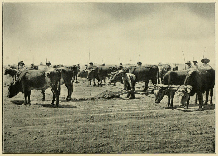
LEVELING A CANE FIELD, PERU
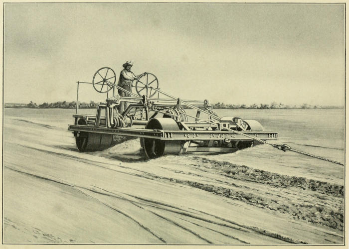
LEVELING GROUND BY STEAM, PERU
The year 1860 marked an important change in the industry, which up to that time had been carried on in a very primitive manner. A large amount of fresh capital was put into sugar enterprises, new mills were built, the most approved machinery was installed and the factories were equipped with the best appliances that money could buy. The apparatus for some of the plants was brought from the United States, while that for others was supplied by European countries, so that the methods and workmanship of various nationalities are found in the Peruvian factories. No expense was spared in any department and all went well so long as the price of sugar kept up; what was easily made was liberally administered, but when in 1875 the market dropped, severe competition drove many operators into difficulties and a number of them went under entirely. The war with Chile in 1878 and the subsequent revolutionary disturbances impeded the progress of the industry, but a restoration of tranquillity came in 1895, and since then the sugar business of Peru has prospered and increased in volume.
An experiment station was established near Lima in 1906 for the study of cane cultivation, irrigation problems and the improvement of yield and quality by the introduction of new varieties of cane. The manufacturing side of the question has also been gone into with great care, and much is being done to increase efficiency in that direction.
Today there are 47 modern factories in Peru and 125,000 acres planted in sugar cane. Outside of these modern plants, crushing is also done in a crude manner in wooden-roller mills on small plantations that are scattered throughout the interior. The juice obtained in this way is worked up to chancaca[74] or panela or made into an alcoholic beverage called cañaso or chacta.
As the plantations do not depend upon any special season of rainy or dry weather, planting and harvesting may be done at any time. In Peru the land upon which sugar cane is grown is generally gently sloping. On the large haciendas, when preparing virgin soil for planting, the brush is first cleared away and the holes filled. The ground is then ploughed and cross-ploughed by steam-ploughs and broken fine by clod-crushers; roadways and drainage ditches are laid out, forming squares or rectangles, and furrows are made at intervals of three to four feet. This done, the ground is ready for planting. The cane tops used for seed are cut during harvesting, loaded on cars and sent to the field that is to be planted. The seed cane is placed horizontally in the furrow and covered with a few inches of earth, and as soon as the whole field is planted in this manner, water from the irrigation ditch is turned in and the cane left to grow. The first weeding is done when the cane shoots are a foot high, and it is continued at intervals until the cane leaves become large enough to shade the ground and prevent weed growth. The cane matures in from eighteen to twenty-four months, according to location, soil and weather conditions. Some weeks before harvesting, irrigation is discontinued in order to allow the cane to ripen.
In cultivating the first ratoons, when the cane gets to be a few feet high the crest of the furrow is thrown down into the furrow so that the irrigation water passes between the rows of cane instead of along the furrows, as in the case of plant cane.
Ratooning is kept up until it ceases to be profitable. At the Hacienda Cartavio, four ratoon crops have been grown in some places, and as many as seven in others, with good results.
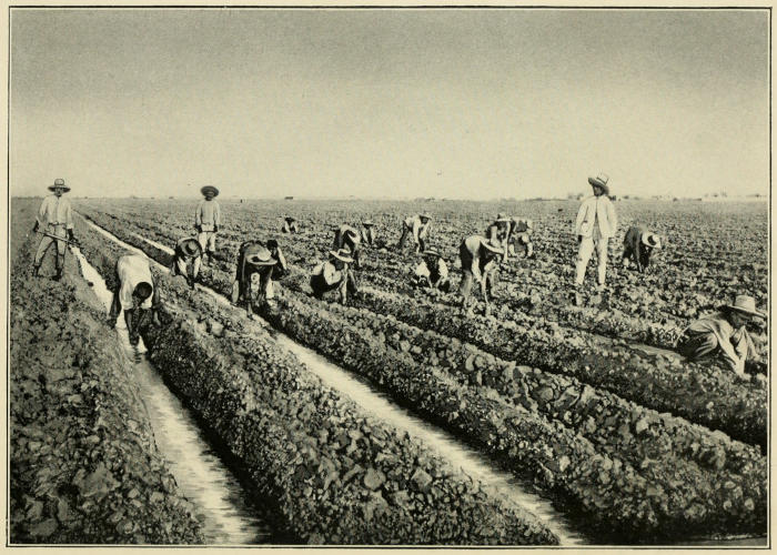
PLANTING CANE, PERU
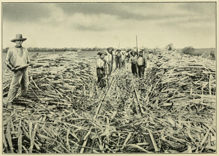
PORTABLE BRANCH LINE OF FIELD RAILWAY AND CANE CUTTERS, PERU
The principal ingredient of the fertilizer used is guano, which is mixed with lime, nitrate of soda, potassium sulphate, or ashes from the bagasse furnaces, and it is applied in various ways. Some planters throw it in the furrows with the seed cane and allow it to remain there a time before turning on the water; others place it in the furrows a few months after the planting and cover it immediately, while still another method is to apply it and turn on the water at the same time. On certain plantations the fertilizer is ground and spread over the entire field just before replanting.
Water for irrigating is obtained from the mountain streams, which are dammed at certain points, and but little is pumped from wells. The quantity needed is far less than in Hawaii, owing to the nature of the soil and the presence of underground moisture close to the surface. A fixed amount is assigned to each estate by the government and this is never exceeded during the dry season. In flood time, however, the regulations are somewhat relaxed, as there is then enough for all and to spare.
The water is brought on the land by large ditches, and thence to the cane fields through smaller ones. From these field ditches it flows directly into the cane rows at the upper end of the field or section, and, owing to the slight slope of the land, it passes freely through the parallel rows from the upper to the lower end of the section. It is retained in the furrow by means of a dam at the lower end. Other ditches are made at the lower ends of the sections for drainage purposes. The amount of irrigating done varies according to the nature of the land; in some cases water is applied only once during the season, in others as many as twenty-four times. The average number of waterings is five.
When the cane is ripe it is cut by laborers with heavy knives, or machetes, and loaded by hand into cars that run through the fields on portable tracks. These cars, which hold from two to ten tons each, are made up into trains and drawn by a locomotive to the mill. The average yield per acre in 1912 was about 34 tons, but the planters are seeking for better results through improved field methods and new varieties of cane. Pests and disease do little damage in Peru, although the borer gives some trouble. Owing to the long period of growth in a dry climate, Peruvian cane is high in fiber and low in juice, but the juice is rich and very pure; this combination of high fiber content and high percentage of sugar in the juice, however, brings about an unusual loss of sugar in the bagasse.
Nearly all of the sugar manufactured is a coarse-grained centrifugal raw, polarizing about 96.5 degrees and known to the trade as “Peruvian crystals.” Part of it is marketed in the United States and the rest goes to Great Britain, while the second and third sugars are sent to Chile to be refined there. A certain amount of white sugar for home consumption is made by washing the brown centrifugal sugar.
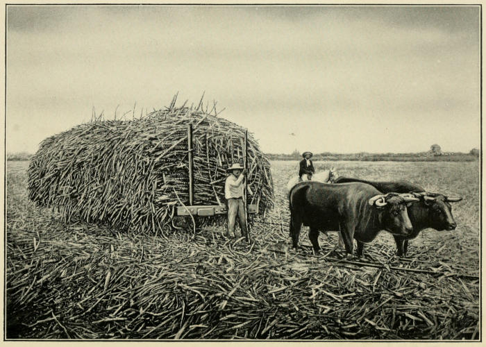
HAULING CANE-LADEN CARS WITH OX-TEAM, PERU
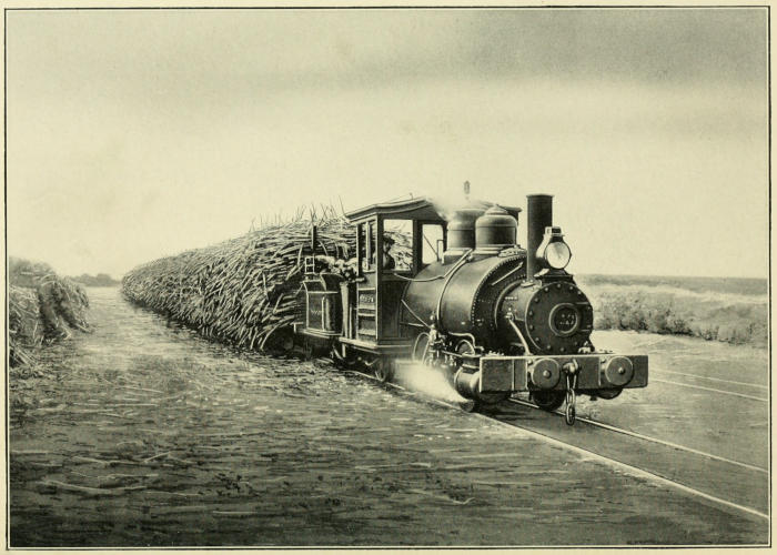
TRAIN-LOAD OF CANE EN ROUTE TO THE FACTORY, PERU
At the beginning of the Chilean war the output was approximately 80,000 tons. In 1905 the production of sugar and molasses was 159,294 long tons, and 132,222 tons of this were exported.
The following table gives the outturn in long tons since 1905:
YEAR CONSUMPTION EXPORTS TOTAL
1905 27,077 132,136 159,213
1906 32,178 134,592 166,770
1907 30,110 108,886 138,986
1908 31,895 122,940 154,836
1909 29,173 123,393 152,567
1910 29,189 119,744 148,933
1911 31,988 121,758 153,745
1912 36,129 145,106 181,236
1913 34,976 140,669 175,645
1914 32,555 173,910 206,465
1915 40,000 208,487 248,487
The possibilities for expansion in Peru’s sugar industry are large. Further impounding and conservation of the flood waters from the mountains would bring under cultivation many thousands of acres that are now unproductive. Good flowing wells have been sunk on some estates, and it is likely that many more will be found, thus adding substantially to the present water supply. As to cost, it would seem that Peru should be able to compete successfully with other cane-growing countries. The plantation lands are level or slightly sloping, so that cultivating machinery may be used to good advantage. Grinding can be carried on without interruption throughout the year, which means economical factory capacity and an even distribution of labor. The cost of labor, too, is reasonable, and great quantities of fertilizers lie close at hand. In short, Peru enjoys many advantages, and if her planters and refiners keep pace with scientific development, she will take a prominent place among the cane-sugar countries of the world.
BRAZIL
Brazil is the largest political division of South America. Its area is 3,270,000 square miles, or slightly greater than that of the United States, excluding Alaska. From Cape Orange, in 4 degrees 21 minutes north latitude, it extends 2629 miles southward to the river Chuy, in 33 degrees 45 minutes south latitude, and from Olinda 2691 miles west to the Peruvian border, between 34 degrees 50 minutes and 73 degrees 50 minutes west longitude. According to the latest census returns at hand, the population numbers 20,515,000.
Speaking generally, Brazil is a tropical country with sub-tropical and temperate regions in the south and in a large part of the high central plateau. The sugar-producing states are Maranhão, Rio Grande do Norte, Parahyba, Pernambuco, Alagoas, Sergipe, Bahia, Minas Geraes, Rio de Janeiro and São Paulo. The plantations themselves lie between 4 degrees and 21 degrees south latitude, and being swept by the moisture-laden eastern trade winds, they receive a fair amount of rain during the wet season, that is, from January to May.
Traces of a vanished civilization had already given rise to the belief that the history of Brazil, like that of Mexico and Peru, extended far into remote ages, when, in 1845, the discovery in the interior of the country of the ruins of a large and very ancient city, with magnificent buildings bearing inscriptions in unknown characters, confirmed this opinion.
Nevertheless, the known history of Brazil dates only from the end of the fifteenth century. It was discovered in February, 1499, by Vicente Yañez Pinzon, a companion of Columbus. The following year it was annexed to Portugal by Pedro Alvares Cabral, but the new territory received little attention from the Portuguese monarchs until 1531, when an attempt at colonization was made. Shortly afterward a sugar mill was erected in São Vicente Piratininga, now São Paulo, and as the soil and climate of that part of the country were well adapted to cane culture, the industry grew and other factories were built. In 1580 there were 120 mills, the greater number being in Bahia and Pernambuco. That same year Philip II of Spain usurped the crown of Portugal, and Brazil, with the rest of the Portuguese possessions, came under Spanish rule. Under the new régime she was exposed to attack by powerful foes. Dutch forces occupied Bahia in 1624, only to be expelled by the Spaniards a year later; in 1629, however, they obtained a foothold in Pernambuco. They took Olinda and its port, but were unable to extend their influence beyond the borders of the town until the arrival of the newly appointed governor, Count John Maurice of Nassau-Siegen, in 1636. This able executive carried the Dutch dominion along the coast from the mouth of the São Francisco to Maranhão, and an expedition sent out by him captured Angola and São Thomé on the west African coast, thus securing a supply of negro slaves, while depriving the enemy of them. He did much to build up the sugar industry, so severely crippled by the war, and when in 1644 he resigned his post, the importance of Brazil as a sugar-producing country had been re-established. The Portuguese threw off the yoke of Spain in 1640 and immediately set about to retake their former colony, Brazil. After years of fighting, the Dutch were finally overcome and in 1655 a government decree drove them from the country. This banishment deprived Brazil of the Dutch sugar planters, with their slaves, their capital, their practical knowledge and skill. From the time of their exodus the Brazilian sugar industry began to decline. The greater number of these refugees established themselves in the West Indies, where they again engaged in sugar planting with marked success.
Brazil became an independent power in 1825 as an empire, with Dom Pedro I, son of the Portuguese king, on the throne. This monarch abdicated in 1831 in favor of the five-year-old heir apparent, who took the name of Dom Pedro II and reigned until 1889, when the empire gave way to a republic. The wars carried on by Brazil against her neighbors between 1851 and 1870 brought her provinces into touch with each other, as well as with the outside world.
In 1826 she pledged herself to Great Britain that, beginning with 1830, she would suppress the traffic in African negro slaves. This promise, however, she failed to keep, so the British parliament passed an act directing the seizure of all slave ships found in Brazilian waters. In every instance the slaves were liberated and the slave dealers brought before British tribunals. Complete suppression of the importation of slaves was the result. In 1871 children born of slave parents were declared free by law, and the movement in favor of emancipation continued until 1888, when slavery was entirely abolished without any indemnity to the slave owners.
The long reign of Dom Pedro II was marked by progress and prosperity. The emperor had the best interests of his people always at heart and concerned himself more with economic development than with political activities. Broad and liberal in his views, he made no attempt to prevent the spread of socialistic doctrines, which, about the year 1880, began to seriously affect the thought of the educated classes. The feeling of unrest and the desire for change engendered in this way culminated in the military conspiracy of 1889, and, as was only natural, the former slave owners, smarting under their losses, took sides against the emperor. The monarchy fell and was replaced by a republican form of government, which, despite several attempts to restore the empire, has endured to the present day.
In the sugar-growing regions of the north and center methods of cultivation do not show much improvement over the practice of early times. Cane is planted in holes about nine inches deep and five feet apart, no fertilizer being used. Some five weeks later the soil is turned up and after fifteen months’ growth the cane matures. In São Paulo, however, the planters work on more scientific lines, and ploughing, furrowing, tilling, fertilizing and weeding are done in a thorough manner. The crop depends upon rainfall entirely, and in a normal season ripens in from fourteen to sixteen months. As soon as the cane is cut the dry cane leaves are burned and ploughing begins. The plough passes close enough to the cane roots to tear them more or less, thus helping the new growth. Shortly after the new cane shoots appear, the ground is spaded up or ploughed, just as in the case of plant cane. Ratoons ripen in twelve or fourteen months, and as a rule four to six ratoon crops are grown before replanting is done.
The yield of cane varies with the rainfall and the richness of the soil, and ranges from 20 to 30 tons per acre for first ratoons, diminishing with succeeding crops. The sugar content frequently reaches 18 per cent.
Cane is grown either by colonos or by indentured laborers. In the colono system a tract of land from 9 to 36 acres in size and planted to cane is assigned by the estate to a group of colonos according to their number. The colonos care for the cane during its period of growth and harvest it when ripe. For this they receive the equivalent of $12.50 American gold per acre. Assuming that the yield per acre is 20 tons, the cost to the owner of the estate of cultivating and harvesting a ton of cane is 62½ cents. The colono is given pasture land for his cattle, fuel and house rent free.
The indentured laborers are allotted a certain amount of untilled ground, which they prepare, plant and cultivate. Seed cane, houses and pasturage are furnished gratis, and when the cane is ripe they harvest it. The amount paid the indentured laborers for cane raised in this way fluctuates according to the market value of sugar. For example, in São Paulo when the price of sugar is $4.41 gold per hundredweight, the laborer gets $2.23 per ton for his cane; when the price exceeds $4.41 and is less than $5.90 per hundredweight, he receives $2.55 per ton; when sugar sells between $5.90 and $8.60 per hundredweight, his share is $3.18 per ton; should the price go over $8.60, he gets $3.82 per ton.
The practice in Bahia is somewhat different. Taking as a basis a price of $2.939 gold per hundredweight for sugar, the cane brings $1.646 per long ton, and for every .147 cent (⅐ cent) per pound fluctuation in the price of sugar, the value of cane changes 9.88 cents per ton up or down as the case may be.[75]
In the small factories the methods of manufacture are very old-fashioned. The cane is crushed between rolls of hard wood, and the juice, after being strained to remove the suspended impurities, is boiled to grain in copper kettles. The magma is then run into large wooden moulds having cone-shaped, perforated bottoms. The holes in the bottom of these moulds are closed when the hot massecuite is dumped in, but as soon as it cools the plugs are taken out and the molasses allowed to drain off. A layer of very wet clay is then spread over the top of the sugar, and as the water slowly drains from the clay it passes through the sugar crystals, carrying the mother liquor with it. After this washing process has gone on for some time, the sugar is removed from the moulds, and the upper portion is found to be white, or nearly so, while underneath the color deepens into yellow and from that to brown as the bottom is reached. The sugars are carefully separated according to their color, then dried and packed in bags containing 60 kilograms or about 132 pounds each.
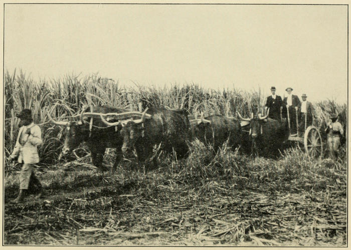
SUGAR PLANTATION BETWEEN RIO DE JANEIRO AND SÃO PAULO, BRAZIL
It will readily be seen that the loss in extraction by such means is very great. In fact, from cane having a sugar content of 15 per cent, sometimes not more than between 5 per cent and 6 per cent of sugar is recovered. The best results are naturally obtained in the large factories, or usines, but even there, owing to poor crushing, 9 per cent of the weight of the cane in sugar is considered satisfactory.
In the usines the juices are treated with sulphur and neutralized with lime. They are then allowed to settle, after which they are boiled to grain and the crystals separated from the mother liquor in centrifugal machines. The sugar is dried and the remaining liquor is returned to the pans for reboiling.
The various grades produced are:
Cristaes blancos (white washed sugar)
Cristaes amarellos (first yellow, termed Demerara)
Mascavinhos (second yellow, fine grain)
Mascavos (dark brown sugar, final product)
The greater portion of the sugars made in Brazil is refined, but a certain amount goes directly into consumption in its raw state. Refining on a large scale according to European methods has been tried at various times, but, owing to the high cost of labor, fuel and transportation, all these attempts have proved unsuccessful. Then again, the demand for sugar prepared in the European way is not great, the Brazilians preferring the moist fine-grained sugar made in the small refineries. This sugar has a molasses taste, polarizes about 91 degrees and carries about 2 per cent of glucose. In manufacturing the white grade, a liquor of 31 degrees Baumé[76] is first made from raw sugar. This is clarified with ox-blood and filtered through bone-char, after which the clear liquor is boiled at a temperature of 266 degrees Fahrenheit over an open fire until only about 4 per cent of water remains. It is then removed from the fire, a small quantity of dry granulated sugar is added and the mass is stirred with a wooden paddle. Cool, dry, fine-grained sugar is the result. The yellow grade, or terzira, as it is called, is made in exactly the same manner, except that no clarifying or filtering is done. The rich molasses odor and taste of this sugar please the popular palate to such an extent that it commands a higher price than white granulated sugar refined by the most modern processes. In fact nearly 75 per cent of the sugar consumed in Rio de Janeiro is terzira. Its manufacture does not require expensive equipment or any great amount of technical skill, hence it appeals to the native merchants and confectioners.
Recently the government has put forth some effort to encourage and improve the sugar industry, but so far without much success. A law was passed in 1875 guaranteeing a return of 7 per cent upon the money expended in constructing central factories, a given number being allowed each state. This act was modified some years later and the rate of interest reduced to 6 per cent, but as the refunding period was longer it met with more favor than the first and a number of concessions were granted. In 1889 the state of Pernambuco appropriated a sum equal to $135,000.00 gold to be divided among forty factories, with the understanding that repayment was to be begun after the harvesting of the third crop and extended over a period of twenty years. All this legislation had no definite result.
A few years ago, a combination of the producers was formed for the purpose of maintaining a high price for domestic sugar by setting aside a certain fixed amount for export. At first this was 20 per cent, but it was afterward increased to 40 per cent. The plan, however, was ineffectual. A heavy import duty (about 5.86 cents per pound) prohibits the bringing in of foreign sugars, so that Brazil must provide for her requirements within her own borders.
Accurate information concerning production, distribution and prices is hard to obtain. Bad transportation facilities, diversity of customs regulations between the states, and the vast number of small producers who sell to the consumer direct, make the compilation of dependable data almost an impossibility. The statistics that are submitted, therefore, are approximative.
Brazil’s sugar exports grow less and less. The United States no longer depends upon her for supplies, so that the outlook for the industry in Brazil is not bright at the present time. Modern refining methods are not regarded with favor by the people and any considerable extension in production seems remote.
PRODUCTION IN BRAZIL
1891 185,000 tons
1892 200,000 ”
1893 275,000 ”
1894 275,000 ”
1895 225,000 ”
1896 210,000 ”
1897 205,000 ”
1898 151,500 ”
1899 175,000 ”
1900 256,460 ”
1901 312,957 ”
1902 254,693 ”
1903 187,500 ”
1904 197,000 ”
1905 195,000 ”
1906 275,000 ”
1907 215,000 ”
1908 180,000 ”
1909 248,000 ”
1910 253,000 ”
1911 287,000 ”
1912 235,000 ”
1913 204,000 ”
1914 203,394 ”
1915 240,000 ”
1916 194,000 ”
BRITISH GUIANA
Guiana, in its widest meaning, is the name given to that part of South America that lies between 8 degrees 40 minutes north and 3 degrees 30 minutes south latitude and 50 degrees and 68 degrees 30 minutes west longitude. This vast territory, about 690,000 square miles in area, comprises Venezuelan Guiana, British Guiana, Dutch Guiana (Surinam), French Guiana (Cayenne), and Brazilian Guiana. The first of these divisions is now part of Venezuela and the last is included in Brazil.
The coast of British Guiana is fringed by low, alluvial flats, the result of deposit by the rivers. Beginning at three feet below high-water mark, these flats extend inland 25 or 30 miles, rising imperceptibly about 15 feet. Beyond is a broad, rolling region of sandy clay formation, 150 feet above sea-level, which runs back to the forest-covered hills. Two ranges of mountains traverse the country from west to east and a third chain forms the southern boundary and the watershed between the Essequibo and the Amazon. The highest mountain peak is Roraima on the western border, 8635 feet.
The rivers of British Guiana and their tributaries form a network of waterways throughout the country and they are practically the only transportation routes from the coast into the interior. The most important are the Essequibo, the Demerara, the Berbice and the Corentyn. The Essequibo has its source in the Acari mountains near the equator at 850 feet above the sea, and it flows north about 600 miles, reaching the Atlantic by an estuary 15 miles wide, in which there are a number of large and fertile islands. At one time sugar cane was grown on four of these islands, but today only one, Wakenaam, has a sugar mill.
For the ten months beginning with October and ending in July, the temperature on the coast is even, as the northeast trade winds keep it down to 80 degrees Fahrenheit on an average, but the cessation of the trades in August and September makes the heat oppressive. Hurricanes are unknown and but little damage is caused in the coast regions by earthquakes, owing to the character of the soil. In the interior the year is divided into one wet and one dry season, but in the low-lying coast country, where the sugar plantations are, there are two wet and two dry periods. The long wet season begins about the middle of April and lasts until August; the long dry period is from September to the end of November. The rainfall varies greatly according to locality; on the coast the yearly average is 80 inches. In 1914 the population was estimated to be 304,089; of these 120,000 were negroes, 124,000 East Indians, 11,600 Portuguese, 4300 Europeans of other nationalities, 6500 aborigines and over 30,000 of mixed race.
Guiana was sighted by Columbus in 1498 and by Alonzo de Ojeda and Amerigo Vespucci in the year following. Vicente Yañez Pinzon is credited with having sailed up some of the rivers in 1500 and Sir Walter Raleigh ascended the Orinoco in 1595 in quest of the mythical city El Dorado. Dutch traders reached Guiana in 1598 and by 1613 they had established several settlements on the coast of Demerara and Essequibo. Meanwhile English and French adventurers were endeavoring to obtain a foothold in Surinam and Cayenne, which they succeeded in doing in 1652. The colony of Essequibo was under the administration of the Dutch West India company from 1621 until 1791, when the company was dissolved. A Dutch settlement established on the Berbice river in 1624 was the beginning of the colony of that name, which was taken under the protection of the States-general of Holland in 1732. Demerara, formerly a dependency of Essequibo, became a separate colony in 1773. In 1781 the three colonies, Essequibo, Demerara and Berbice, were captured by British privateers. The following year they were taken by France, and restored to Holland in 1783. The British took possession a second time in 1796, retaining them for about six years, at the end of which period they passed back into the hands of Holland once more. The British occupied them in 1803 and they were formally ceded to Great Britain in 1815. The three colonies were consolidated into one under the name of British Guiana in 1831.
Essequibo, Berbice and Demerara all produced a considerable amount of sugar during the Dutch régime. The plantations were on coast and river lands that had been diked and drained. Like all sugar-growing countries, this colony was adversely affected by the abolition of slavery, but owing to the success that attended the introduction of coolies from Hindustan, the labor situation never became so acute as it did in many islands of the West Indies. Traffic in African negro slaves was forbidden in 1808. After 1834 the sugar planters sought free laborers in the neighboring islands and in Madeira. Many people who had been deprived of their means of livelihood by the destruction of the vineyards of Madeira by disease settled in British Guiana. The importation of free negroes from British African possessions was sanctioned by the home government in 1840, and between that year and 1865 a large number of slaves taken by British war ships from Cuban and Brazilian slavers were landed in British Guiana, where they found employment as free laborers. This source of labor supply was cut off by the abolition of slavery in Brazil and other countries. In 1867 the importation of free blacks from British Africa was prohibited and the movement to supply laborers from China came to an end. The Chinese experiment was repeated in 1874 and 1878, but never since. The bringing in of British Indians, however, proved a success ever since the time it was first done in 1838. These laborers are indentured for five years, and five years after the expiration of their contract they have the privilege of being taken back to their homes, without charge. During the five years following their contract term they can obtain work as free hands and they may acquire small parcels of land. In fact many of them have become land owners and have settled permanently in the colony. There are also a considerable number who, after having gone back to India, return to British Guiana of their own volition and at their own expense to work as free laborers.
Most of the sugar plantations are found on the seacoast on lands formerly marshy that have been diked and drained either by sluices or by pumping. The plantations along the river banks, too, are on reclaimed lands that have been drained by sluices. In 1911 there were 160,000 acres of reclaimed land in the colony, and 81,000 acres of it were devoted to sugar cane. The plantations are oblong in shape, one end fronting on the sea or the river, as the case may be. Originally they varied in size from 500 to 1000 acres, but in many instances consolidation has taken place. The dike next to the sea is naturally the strongest and most carefully built, while those at the sides and rear are less substantial. As a rule, there is a broad road that runs through the middle of the plantation, with a navigable canal on either side. These canals contain fresh water, salt water and flood waters being kept out by a gate through which excess fresh water may run off at low tide. Short feeder canals run at right angles, and as they are not connected with the drainage canals they may contain salt water if necessary. In crossing a transportation canal, the waters of drainage canals pass underneath through a siphon. Between these transportation canals are the cane fields, from ten to twenty acres in size, and separated from one another by small drainage ditches. The largest transportation canals are between sixteen and twenty feet wide at the top, between twelve and sixteen feet wide at the bottom and four to five feet deep. The smaller transportation canals are twelve feet wide at the top, nine feet wide at the bottom and four to five feet deep. The large drainage canals are fifteen feet wide and four feet deep, and the irrigation ditches are from two to three feet wide and three feet deep.
Before planting cane in virgin soil the trees are cut down, the ground is cleared of grass and weeds, canals are dug, furrows are made at intervals of from six to seven feet, and then the planting is done. A month later weeds are removed, the young shoots are banked and the ground between the furrows is loosened. When five months old the cane is trashed[77] and weeding is done if necessary. After an interval of three months this operation is repeated, and when the cane is a year old the final trashing is done, the harvesting following two weeks afterward.
When the cane has been cut, the ground is loosened once more, the dry leaves are put in the spaces between the furrows and covered with earth, the young cane shoots come up, and in another year the ratoons are ready for harvesting. Two or three ratoon crops are grown on the same land, but as soon as the yield gets too small the ground is left fallow and planting is done elsewhere. Until recently Bourbon cane was the only variety raised in British Guiana. Of late, however, many kinds of seedling cane have been introduced, and today it is estimated that more than one-half of the crop comes from seedling stock. Fertilizing is done with phosphates, guano, potash, sulphate of ammonia and stable manure.
The cane is brought from the fields to the mills by canal in flat-bottomed boats. The equipment in the factories is good, as a whole; crushing is efficiently done and the juices are boiled to grain in vacuum pans.
In addition to 96-degree centrifugals and second sugars, the celebrated “Demerara crystals” are produced. In making the latter the juice is kept acid throughout the process, from one to five per cent being lost through inversion. Chloride of tin is added in the vacuum pan to heighten the yellow color. The greater part of the molasses goes into the manufacture of rum, and a certain quantity, mixed with ground bagasse, finds a market in England as cattle food.
While on virgin soil the yield of cane runs as high as sixty to seventy tons to the acre, the average is about twenty tons per acre, and the extraction of sugar equals 8½ per cent of the weight of the cane. In late years the number of sugar mills has grown less, owing to the merging of many small plants into a few large ones. In 1908 the area planted in cane was 73,471 acres, and there were forty-two plantations, six of them less than 1000 acres, twenty-five over 1000 acres, six over 2000 acres, four over 3000 acres, and one over 7000 acres in size.
Over half of the sugar exported goes to Canada, the remainder being taken by Great Britain and the United States.
As to the future of British Guiana’s sugar industry, early in 1915 a letter was sent by the government secretary of the colony to the West India committee in London in which it is stated that the possible annual crop on suitable sugar lands eastward of the Pomeroon river is not less than 1,000,000 tons, while, if the large virgin alluvial areas to the east of the Pomeroon river and between there and the Venezuelan boundary were brought under cultivation, the maximum total output might reach 2,500,000 tons per annum. This letter was in reply to a communication addressed by the West India committee to the governors of all of the British sugar-growing possessions for the purpose of securing information regarding the possibilities of development of the industry. Hitherto the United Kingdom has been largely dependent upon foreign countries for its sugar supply, and the movement thus set on foot by the West India committee is to urge upon the home government the importance of drawing the entire sugar requirements of the country from its colonies. This of course would mean the establishment of a preferential tariff.
Exports from British Guiana since 1895, in tons of 2240 pounds:
1895-96 101,059
1896-97 107,073
1897-98 100,839
1898-99 96,648
1899-00 84,783
1900-01 94,745
1901-02 105,694
1902-03 120,127
1903-04 125,949
1904-05 101,278
1905-06 121,693
1906-07 120,334
1907-08 99,737
1908-09 117,176
1909-10 101,843
1910-11 108,297
1911-12 83,294
1912-13 83,922
1913-14 103,774
1914-15 113,632
1915-16 110,000 [78]
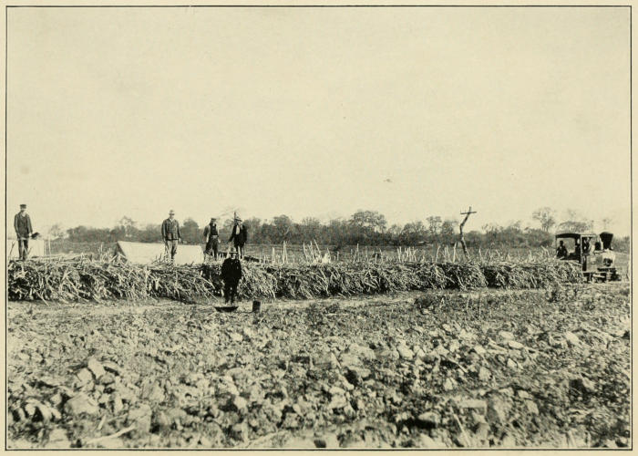
TRAIN-LOAD OF CANE EN ROUTE TO THE INGENIO LA MENDIETA, ARGENTINA
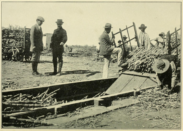
UNLOADING A CAR OF CANE, TUCUMÁN, ARGENTINA
ARGENTINA
The Argentine republic occupies the southeastern extremity of South America, and extends from 21 degrees 55 minutes to 55 degrees 2 minutes south latitude, and from 53 degrees 40 minutes to 73 degrees 17 minutes west longitude. From north to south its length is 2285 miles, and its greatest width is 930 miles. Its area is 1,135,840[79] square miles, and the population, including the nomadic peoples, numbers about 8,000,000.
Physically, the surface of the country comprises three great divisions: the Andes and the high plateaus to the west, the vast plains of the east and the desolate, barren wastes of Patagonia. Only the northern part lies within the latitudes where sugar cane can be grown, and owing to the mountainous character of that region the area available for cane culture is limited. The provinces of Tucumán, Jujuy, Salta, Santa Fé and Corrientes, and the territories of Formosa, Chaco and Missiones produce the entire sugar crop.
Argentina’s great length and the range of altitude within her borders, from the lofty, snow-clad peaks of the Andes eastward to sea-level, give a widely varied climate, upon which the prevailing winds and the mountain barriers exert a further influence. In the extreme north there is a stretch of country extending about ninety miles into the torrid zone and running from the Pilcomayo river, five hundred miles west, to the Chilean border. The eastern part of this region consists of a low, wooded plain where the mean annual temperature is 73 degrees Fahrenheit and the average annual rainfall is 63 inches. The western end is a dry plateau where the temperature drops below 57 degrees Fahrenheit and the rainfall is only about two inches during the year. In the cane-growing district the rainy season is from October to March. At times during the winter the frost is severe enough to partially wither the cane leaves, but it never wholly kills the cane.
Sugar cane was brought to the La Plata region by the Jesuits, and it appears in the records of the Santo Domingo monastery that sugar was manufactured in Tucumán as early as 1670. After the banishment of the Jesuits nearly one hundred years later, the industry quickly declined, in fact as late as 1871 the total production of Argentina did not exceed 1000 tons. Development in Tucumán followed the completion of the railway, which opened outside markets to the planters of the province in 1876. Railway transportation facilities brought in modern factory equipment and machinery. As a result numerous small primitive mills were eliminated and their owners turned to sugar-cane growing.
Stimulated by a heavy protective tariff, the cane-producing area in Tucumán increased from 12,000 to 104,000 acres between 1881 and 1896, and in other provinces the industry made substantial progress. By 1894 the output exceeded the country’s requirements. This led the government to concede an export bounty in 1896, and a syndicate called the Unión Azucarera was formed by the producers, who agreed to deliver to it 60 per cent of their product. From 1896 to 1904 exports of sugar varied from 15,000 to 50,000 tons per annum. Conditions changed, however. The other South American countries would not buy Argentine sugar, the United States had fixed a countervailing duty on all bounty-fed sugars, and Great Britain was contemplating their exclusion entirely. To save the situation, therefore, it was decided to curtail the output, and the following plan was adopted:
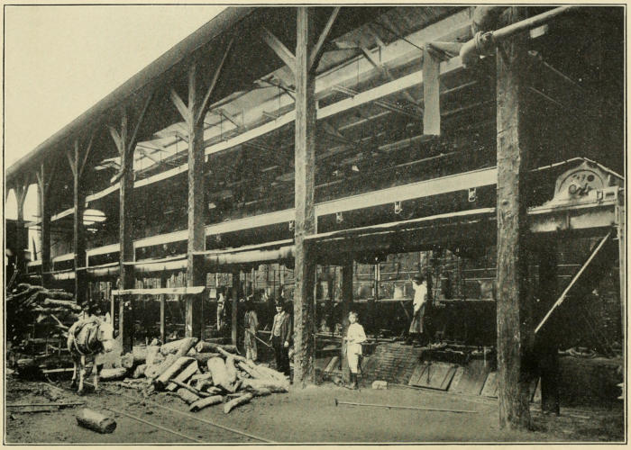
BATTERY OF BOILERS, INGENIO LA TRINIDAD, TUCUMÁN, ARGENTINA
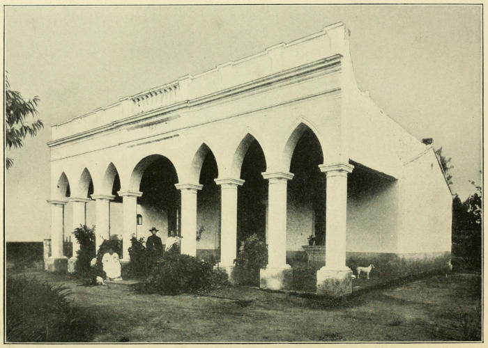
HOME OF SUPERINTENDENT OF A SUGAR PLANTATION, TUCUMÁN, ARGENTINA
An arbitrary amount was fixed as the total production of the factories in operation, and this tonnage was prorated among them according to their capacity. Upon every 100 kilograms (220.46 lbs.) produced in excess of the allotment, a tax equivalent to 48¾ cents[80] was levied, and factories where operations were not started until after the passage of the law were taxed at this rate upon 25 per cent of their output. The fund raised in this way furnished the compensation for the growers who destroyed their cane crops or left them unharvested. A certain sum was applied to the payment of export bounty[81] and the remainder went into the national treasury.
The Brussels convention, by its provision for countervailing duties, nullified the effect of the export bounty and in 1905 the export privileges were withdrawn.
In 1912 the import duty was established at 3.85 cents gold per pound for 96-degree sugars and 2.977 cents per pound for sugars testing under 96 degrees. A yearly reduction of about one-tenth of a cent per pound was provided for until the rate of 96-degree sugars shall reach 3.0645 cents per pound, and that for those under 96 degrees 2.19 cents. Countervailing duties were also imposed on foreign bounty-fed sugars.
Tucumán produces between 80 per cent and 85 per cent of Argentina’s total crop, the remainder coming largely from Jujuy.
From the “Boletin Mensual de Estadistica Agricola,” Buenos Aires, August, 1913, the following figures are taken:
PROVINCES NO. OF FACTORIES RAW SUGAR TONS YIELD PER CENT
Tucumán 28 121,551 6.8
Salta 1 1,290 8.9
Jujuy 3 20,052 7.9
Chaco 3 2,762 5.9
Formosa 1 231 6.0
Santa Fé 2 838 6.3
Corrientes 1 525 6.6
39 147,249 6.9
At the present time, Argentina has over 200,000 acres in sugar cane, and this area can be considerably increased. The present production about takes care of the country’s needs, although a round amount of American refined sugar was imported in the latter part of 1916.
Field methods admit of great improvement. Little care is exercised in the selection of seed cane and disinfection is never practiced. Planting is done in September and October, when the rainy season sets in. Irrigation from rivers and streams is the rule; fertilizers are seldom used, and no preventive measures are adopted to combat diseases of the cane. The yield of cane per acre in poor soil is from nine to fifteen tons, in average soil from eleven to seventeen tons, while on the best lands it is eighteen tons.
Ratoon crops are raised fifteen or more years in succession without replanting, and the period between frosts is too short to admit of the cane reaching maturity.
Grinding is begun about June 1st and usually takes one hundred days, depending, naturally, upon the amount of cane to be crushed.
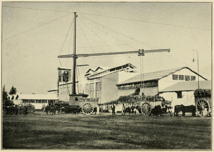
INGENIO NUEVA BAVIERA, TUCUMÁN, ARGENTINA
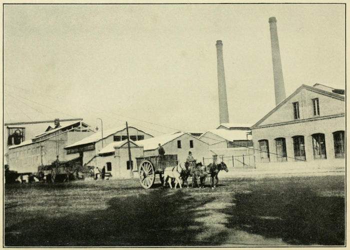
INGENIO NUEVA BAVIERA, TUCUMÁN, ARGENTINA
The factories are modern and equipped with machinery and apparatus of the latest type, but notwithstanding this the recovery of sugar is poor, owing to the quality of the cane. In 1911 the average extraction obtained by the factories of Tucumán was 7.65 per cent. A few factories make white sugar for direct consumption, but the great part of the output consists of raw centrifugal sugar, which is subsequently refined. Most of Argentina’s refined sugar is produced by the Refineria Argentina of Rosario.
Argentina’s sugar industry could not live without a protective tariff, on account of the high cost of production, which even in the best factories is about 4⅓ cents gold per pound. There is no chance to build up an export business now, so, unless conditions change, the production must adjust itself to take care of the consumption and no more.
The statistics from 1906 to 1915 are in long tons:
PRODUCTION RAW IMPORTS
RAW REFINED
1906 114,426 646 1,260
1907 107,694 31,434 11,391
1908 157,845 10,648 24,271
1909 121,891 13,546 5,898
1910 146,472 33,542 22,342
1911 177,211 17,866 33,206
1912 147,731 18,728 10,866
1913 275,834 25,081 49,094
1914 330,460 154 6,250
1915 149,864 1 22
FORMOSA
The Japanese island of Formosa (Taiwan) lies off the coast of China, about two hundred miles north of the Philippines, between 21 degrees 45 minutes and 25 degrees 38 minutes north latitude and 120 degrees 10 minutes and 122 degrees east longitude. It is about two hundred and twenty-five miles long and narrow in shape; its width is seventy-seven miles and its total area 13,504 square miles. A range of mountains runs from north to south, and the highest peak is 13,600 feet. The mountainous region is rugged and well wooded, but in the southwestern part there is a fertile plain which is very productive. Rice, tea and sugar are grown pretty much all along the western portion of the island.
In the west, too, are found the best seaports and bays, also the most important towns. In 1905 Formosa had about 3,000,000 inhabitants, nearly all of whom were Chinese.
The climate is tropical, and at sea-level the average temperature in July, which is the hottest month, is about 72 degrees Fahrenheit, while in February, the coldest month, the mean is 51.6 degrees.
Sugar has been known in the island for a great many years. There is a record of a shipment having been made from there to the Netherlands as far back as 1622, from which time the trade was carried on until the competition of the West Indies closed the European markets to Formosan sugars. Nevertheless, the industry prospered and the production grew until during the last years of Chinese rule it amounted to something between 60,000 and 80,000 tons annually. Nearly all of this was soft brown sugar of fine grain, the remainder being a so-called white sugar, made by purging the brown sugar crystals of their syrup.
The island was seized by Japan in 1895, but the Formosans made a stubborn resistance to the invaders, and it was not until 1898 that they were finally subdued and a stable government established by the Japanese. An insurrection broke out in 1902, but was quickly put down, and since then there has been no further trouble.
In 1895 Formosa had something near one thousand small mills, all driven by buffaloes. The product was a brown clayed sugar, similar to that made in the Philippines, and one-half of it was consumed locally, the other half going to China and Japan.
After the subjugation of Formosa in 1898, the Japanese were not immediately able to set about repairing the damage caused by the war. Two years later, however, they took up the task with characteristic energy and thoroughness, and the sugar industry soon felt the effects of the movement. In 1902 measures were passed providing for the establishment of a sugar station at Tainan and for the investigation of all questions relating to the industry. Young Japanese students were sent to Java, Hawaii and Europe to look into methods employed in the cultivation and manufacture of sugar in those countries and to determine by careful observation and study what would be best suited to Formosan conditions. Seed cane was brought in from other countries and comparisons of results obtained from the different plantings were made at an experiment station built by the government at Daimokko. Striped Tanna and Lahaina canes throve well, but they were rejected because they required an extraordinary amount of irrigation and constant care. The Rose Bamboo, on the other hand, was hardier and did not need so much water, consequently the experts at the sugar station did everything they possibly could to encourage its use.
At the same time the government offered companies starting sugar refineries a bonus of six per cent per annum for five years on the paid-up capital, or a single bonus of twenty per cent of the value of the plant and equipment. Other enterprises were supplied with machinery by the government for five years; in other words, the machinery was bought with government money and the sugar company was given five years in which to reimburse the government. Cane lands could be acquired on very favorable terms, and any planter who was willing to bind himself to raise a crop of cane for five consecutive years was supplied with fertilizer by the government, free of cost. These privileges remained open until the early part of 1911, when they were abrogated.
About the first enterprise to receive the benefit of this special legislation was the Taiwan Sugar company, incorporated in 1900 with a paid-in capital of 500,000 yen, which carried a bonus of 30,000 yen from the government. The company’s intention was to buy the cane from the growers and make it into sugar for the Japanese market. The factory was ready for business by the fall of the following year, but as soon as grinding was begun the Chinese farmers manifested a decided unwillingness to furnish cane. As a consequence, the sugar company determined to grow its own cane, and after increasing its capital to 1,000,000 yen proceeded to carry out this plan. Arrangements were made to turn out 30 tons of sugar per day during the grinding period of 150 days, but the first year’s results were only 1200 tons.
Two factories near Tainan owned by Chinese were started about this time at the instigation of the government, and also with its assistance. Unfortunately, the operators did not understand how to use the modern equipment furnished them by the authorities. Further trouble arose in connection with the buying of the cane and there was constant friction between the factories and the government experts at the sugar bureau. So the venture proved far from profitable either to the factories or the industry.
The Chinese growers continued to cling tenaciously to their crude method of grinding cane in their buffalo-driven mills, instead of selling it to the factories, and they obstinately refused to plant the new and more productive variety of cane, Rose Bamboo, imported from the Hawaiian islands by the government for seed purposes—this in spite of the fact that cane tops for planting could be obtained gratis at the sugar station, and that the substitution of the better cane entitled the farmer to free fertilizer, irrigation privileges and a money bonus.
It was plain that the government would have to take more vigorous action to save its sugar program for Formosa from complete failure, so in 1905 new regulations were framed and made public. Under these rules no one could embark in the business of manufacturing sugar without first securing the official sanction of the director of the sugar bureau. A fixed territory was assigned to the newcomer with the express understanding that no other factory could be established there and that all the cane growers in the territory were obligated to sell their cane to the factory and forbidden to send it out of the district or put it to any other use. The factory owner on his side bound himself to take all the cane grown in his district, even if the supply should be greater than his needs. In order to stimulate modern methods of manufacture, the sugar bureau prohibited the grinding of cane by the growers in their buffalo mills, except by special permission.
In certain sections of the island where there was no cane cultivation, large tracts of land might be granted outright to persons engaging in sugar raising and manufacture. In such cases the capacity of the factory and the period of operation was agreed upon in advance, and as soon as the land was planted to cane, the title to it passed to the factory. If, however, the owners of the factory failed to act in good faith, the undertaking was declared void and the factory dismantled.
By 1911 twenty-nine large factories were in operation and nine others were being built. Every one of these establishments was new and equipped with the latest and most improved machinery.
It was officially announced in November, 1910, that no further charters authorizing the forming of new sugar companies or the extending of the operations of those already in existence would be issued, the reason given being the desire to limit the production to the requirements of Japan until such a time as an outlet could be found in the markets of the world. The measure was regarded as a temporary one.
The opposition of the native farmer to the new order of things was not overcome at once. Cane plantings decreased at first, but when the natives realized that cane paid them better than other crops, they gradually resumed cultivating it on the same scale as formerly, and the government bonus on Rose Bamboo cane helped matters still further.
As long as the manufacturers are far-seeing enough to pay the grower a fair figure for his cane, the supply will be forthcoming. Conversely, if too low a price is offered, the farmer will be driven to raise other crops, and, as the factory cannot purchase cane outside of its own district, lack of material will prevent it from running at full capacity, which means a heavy loss. So there is an excellent reason for maintaining the price of cane at a point which enables the grower to make a profit. Another potent factor, too, is that the price must receive the approval of the government. It is significant that the factories built between 1907 and 1911 have all been put up without government aid.
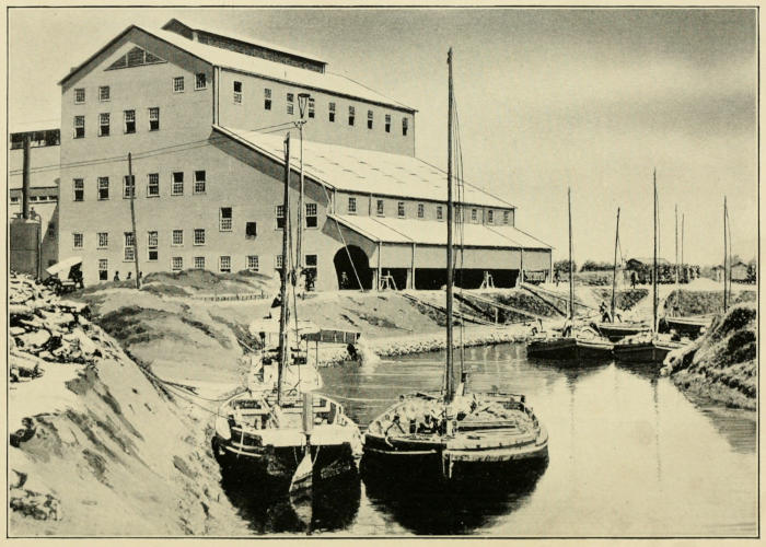
KOHEKIRIN MILL, FORMOSA
Irrigation in Formosa has not been developed to any extent and the crop depends upon the rainfall. In the southern part of the island the monsoons are fairly regular and plentiful rains can be counted upon between June and September, with a dry period from November to April. In the north climatic conditions are not so good, and consequently all of the large sugar enterprises are to be found in the south. Ploughing by the natives is poorly done with wooden ploughs, but the modern plantations use steam ploughs with excellent results. Cane is planted every year and there are no ratoon crops. Grinding usually takes 150 days, beginning in November and ending in May.
The old-fashioned mills turn out a soft brown or yellowish white, open-pan sugar. The modern plants make centrifugal sugar only, practically all of which goes to Japan, although shipments have been made to China, Korea, Hong Kong and even Canada. The molasses is consumed at home.
Just how much of the open-pan brown sugar is used in Formosa itself it is impossible to determine, but Willett & Gray’s figures for the crops, by years, since 1901 clearly show what strides the industry has made:
1901-02 48,381 long tons
1902-03 34,769 ”
1903-04 60,650 ”
1904-05 50,276 ”
1905-06 64,190 ”
1906-07 81,448 ”
1907-08 68,450 ”
1908-09 122,000 ”
1909-10 205,000 ”
1910-11 267,000 ”
1911-12 173,224 ”
1912-13 113,100 ”
1913-14 190,000 ”
1914-15 186,000 ”
1915-16 290,953 ”
1916-17 338,997 ” [82]
The crop of 1911-12 suffered severely from prolonged drought at planting time, and the typhoons of August, 1911, devastated the cane fields. The effect of this disaster was to deter the natives from planting cane the following year, and in consequence the production for that season was cut down more than fifty per cent.
It is obvious that the rapid development in Formosa has been brought about by the paternal policy of the government, without whose powerful aid the industry would in all probability have made but slow progress. The total of Japan’s sugar consumption is about 300,000 tons per annum, and it is perhaps safe to hazard the guess that her statesmen will do everything they can in reason to encourage production in her own territory until this quantity shall have been reached.[83]
JAVA
Java, the seat of the colonial government of the Dutch East Indies, lies in the Indian ocean south of Sumatra and Borneo, between 105 degrees 12 minutes and 114 degrees 35 minutes east longitude, and between 5 degrees 52 minutes and 8 degrees 46 minutes south latitude. It is 622 miles long and 121 miles wide at its greatest breadth, and this narrows to about 55 miles toward the middle of the island. The area of Java proper is 48,504 square miles, Madura comprises 1732 square miles and the smaller islands under Javan jurisdiction cover 1416 square miles.
Of the three general divisions of Java, the east, the middle and the west, each has certain structural features of its own. In west Java the highlands lie to the south and the lowlands to the north. Middle Java takes in the isthmus and part of the wide eastern portion. In the isthmus the mountain barrier on the south is less regular and the northern plains are broken to a certain extent. The eastern division is made up of an intricate confusion of hills and valleys, except on the south coast, where the mountain range forms a continuous barrier. The shore line of the north coast is low everywhere, with morasses, sand dunes and shifting river mouths, but it is of much greater importance than the south coast, which is steep, at intervals rocky and constantly battered by a violent surf.
Java is one of the most distinctly volcanic regions of the world—it has fourteen active volcanoes and one hundred and twenty-five recognized volcanic centers.
Both the north and south coast lines are broken by rivers, the principal ones being on the north. In the dry season they contain little water, but during the rainy monsoon[84] they frequently become rushing torrents that burst their banks and overflow the surrounding country. Such inundations carry with them a considerable amount of disintegrated volcanic rock, part of which is deposited on the plains and swept seaward. In this manner the alluvial plains near the river courses are formed and the shoals in the harbors and at the river mouths as well.
Java enjoys a comparatively even temperature the year round. Ninety-six degrees Fahrenheit was recorded in Batavia in 1877 and that is the highest mark known. The lowest was 66 degrees Fahrenheit, which was experienced in the same place in the same year. The mean annual temperature is 79 degrees Fahrenheit, and the difference between the warmest and the coldest months is 1.8 degrees Fahrenheit. The year is divided into two seasons by the prevailing winds—the rainy period, that of the wet monsoon, from November to March, and the dry period the remainder of the year, when the dry monsoon blows. There is no long unbroken rainfall and no long spell of drought. The average rainfall is much greater on the south coast than on the north: in Batavia it is 72.28 inches yearly, while Majalenka has an annual fall of 175 inches. Wind-storms are rare and hardly ever cyclonic, but thunderstorms are of frequent occurrence. Under an almost vertical sun, the day is of nearly uniform length throughout the year.
The plains vary in fertility according to their geological formation, but with the exception of the regions abounding in marshes, stretches of disintegrated coral, and lakes, they are tillable and productive.
Sugar cane was brought to Java by the Chinese or Hindus in very remote times. The Chinese pilgrim Fa Hien mentions having found sugar there when he visited the island in 424,[85] and as trading was constantly carried on between Arabia, India, China and Java, there is but little doubt that when the secret of boiling the sugar juice to a grain was discovered it became known to all of them at once.
About 1520 the Portuguese established trade relations with the natives and early in the seventeenth century the Dutch influence began to make itself felt. The Dutch East India company built forts and set up trading stations in the coast towns; at first it acquired only small pieces of land in Jakatra (Batavia) and it was some time before its holdings were increased. Finally Jakatra was conquered and the Dutch power in Java firmly established. But little was done at the outset to help the sugar industry, as the policy of the Dutch East India company was to foster trade in the products of the East rather than undertake to raise any of the commodities itself. The sugars that were sent by it to the mother country at the beginning of its operations, therefore, came from China, Formosa, Siam and Bengal, and no Javan sugars reached Holland until after 1637, in which year the company decided to establish sugar mills on its own land near Batavia.