ILLUSTRATED BY THOSE IN THE STATE OF INDIANA.
Reading edition
BY
C. C. ROYCE.
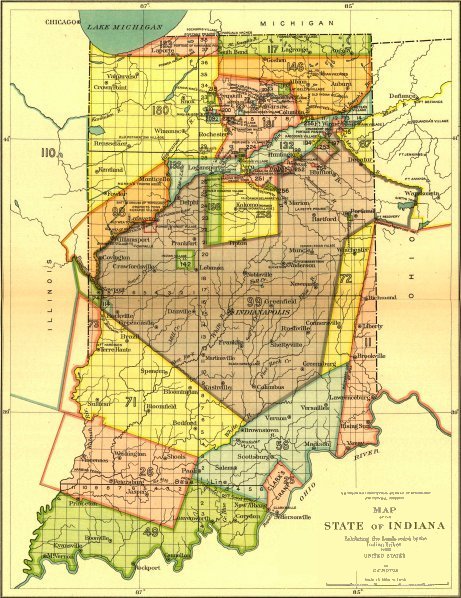
The map included with this paper was taken from a longer article by the same author on the same subject, published in BAE Annual Report 18. The map is identical except for section numbers; the legend was edited in from a monochrome scan of the original, colorized to match. In the relevant part of the text (pages 257ff.), revised numbers are shown in the same way as corrections, with mouse-hover popups. A very large, clickable version of the map is available online at the Library of Congress.
CONTENTS.
Character of the Indian title Page 249
Indian boundaries 253
Original and secondary cessions 256
ILLUSTRATION
Map of the State of Indiana (unnumbered) Facing page 248
Larger View