HABITAT
Reading edition
Location and Area
Seriland, the home from time immemorial of the Seri Indians, lies in northwestern Mexico, forming a part of the State of Sonora. It comprises Tiburon island, the largest and most elevated insular body in Gulf of California, together with a few islets and an adjacent tract of mainland; the center of the district being marked approximately by the intersection of the parallel of 29° with the meridian of 112°. The territory is divided by the narrow but turbulent strait, El Infiernillo. It is bounded on the west and south by the waters of the gulf with its eastward extensions to Kino bay, on the east by a nearly impassable desert, and on the north by a waterless stretch of sandy plains and rugged sierras 50 to 100 miles in extent.
Tiburon island is about 30 miles in length from north to south and 12 to 20 miles in width; its area, with that of the adjacent islets, is barely 500 square miles. The mainland tract held by the Seri is without definite boundary; measured to the middle of the limiting desert on the east and halfway across the waterless zone on the north, its area may be put at 1,500 square miles. To this land area of 2,000 square miles may be added the water area of the strait, with its northern and southern embouchures, and the coastwise waters habitually navigated by the Seri balsas as far as Kino bay, making half as much more of water area. Such is the district which the Seri claim and seek to control, and have practically protected against invasion for nearly four centuries of history and for uncounted generations of prehistory.
Physical Characteristics
Seriland forms part of a great natural province lying west of the Sierra Madre of western Mexico and south of an indefinite boundary about the latitude of Gila river, which may be designated the Sonoran province; it differs from Powell’s province of the Basin ranges in that it opens toward the sea, and also in other respects; and it is allied in many of its characteristics to the arid piedmont zone lying west of the Andes in South America.
In general configuration the province may be likened to a great roof-slope stretching southwestward from a comb in the Sierra Madre to a broad eaves-trough forming Gulf of California, the slope rising steeper toward the crest and lying flatter toward the coast; but the expanse is warped by minor swells, guttered by waterways, and dormered by outlying ranges and buttes. The most conspicuous inequality of the slope (partly because of its coincidence with tide-level) is offered by the rugged ranges of Seriland. These may be considered four in number, all approximately parallel with each other and with the coast; the first is a series of eroded remnants (Cerros Anacoretos) from 600 to 1,200 feet in height; the second is the exceedingly rugged Sierra Seri, culminating in Johnson peak 5,000 feet above tide; the third is Sierra Kunkaak, attaining about 4,000 feet in its highest point; the fourth is Sierra Menor, some 2,000 feet high, with the northern extremity sliced off obliquely by marine erosion. The principal arm of Desierto Encinas lies between the first two ranges, El Infiernillo separates the second and third, while a subdesert valley divides the third from the fourth. The valleys correspond more closely than the ranges; if the land level were 100 feet higher the strait and its terminal bays would become an arid valley like the others, while if the sea-level were 500 feet higher the four ranges would become separate islands similar to Angel de la Guarda and others in the gulf.
The Sonoran province is notably warm and dry. The vapor-laden air-currents from the Pacific drift across it and are first warmed by conduction and radiation from the sun-scorched land, to be chilled again as they roll up the steeper roof-slope to the crest; and the precipitation flows part way down the slopes, both eastward and westward from the Sierra Madre—literally the Mother (of waters) range. A climatal characteristic of the province is two relatively humid seasons, coinciding with the two principal inflections of the annual temperature-curve, i. e., in January-February and July-August, respectively. In the absence of meteorologic records the temperature and precipitation maybe inferred from the observations at Yuma and Tucson,5 which are among the warmest and driest stations in America, or indeed in the world; though it is probable that such points as Caborca, Bacuachito, and Hermosillo are decidedly warmer and perhaps slightly moister than Yuma. The ordinary midday summer temperature at these points may be estimated at about 110° in the shade (frequently rising 5° or 10° higher, but dropping 20° to 50° in case of cloudiness); the night temperature at the same season is usually 50° to 75°, though during two-thirds of the year it is liable to fall to or below the freezing point. The sun temperature is high in comparison with that measured in the shade, the exposed thermometer frequently rising to 150° or 160°, according to its construction, while black-finished metal becomes too hot to be handled, and dark sand and rocks literally scorch unprotected feet. The leading characteristic of the temperature is the wide diurnal range and the relatively narrow annual range; another characteristic is the uniformity, or periodic steadiness, of the maxima, coupled with variability and nonperiodicity of the minima.
The precipitation on the Sonoran province is chiefly in the form of rain; in the winter humid season snow falls frequently on the Sierra Madre and rarely on the outlying ranges; in both humid seasons (and in humid spots at all seasons) dew forms in greater or less abundance. Fog frequently gathers along the coast, especially during the winter and in the midsummer wet season, and sometimes drifts inland for miles. The mean annual precipitation may be estimated at 20 or 25 inches toward the crest and half as much toward the base of the high sierra; thence it diminishes coastward, probably to less than 2 inches; the mean for the extensive plains forming the greater part of the province may be estimated at 3 or 4 inches. The greater part of the precipitation is in local storms, frequently accompanied by thunder-gusts or sudden tempests, though cold drizzles sometimes occur, especially at the height of the winter humid season. Except where the local configuration is such as to affect the atmospheric movements, the distribution of precipitation is erratic, in both time and space; some spots may receive half a dozen rains within a year, while other spots may remain rainless for several years; and the wet spot of one series of years may be the dry spot of the next.
The climatal features of Seriland are somewhat affected by the pronounced topographic features of the district. Snow sometimes falls on Sierra Seri, and probably on Sierra Kunkaak; gales gather about the rugged ranges at all seasons, and sometimes produce precipitation out of season; the extreme heat of midday and midsummer is tempered by the proximity of the tide-swept gulf; and since most of the local derangements tend to augment precipitation and reduce temperature, it would seem safe to estimate the mean annual rainfall of the tract at 4 or 5 inches, and the mean temperature at about 70°, with a mean annual range of some 30° and an extreme diurnal range of fully 80°.
The configuration and climate combine to give distinctive character to the hydrography of the Sonoran province. The melting snows and more abundant rains of the high sierras form innumerable streams flowing down the steeper slopes toward the piedmont plains, or soak into the pervious rocks to reappear as springs at lower levels; sometimes the streams unite to form considerable rivers, flowing scores of miles beyond the mountain confines; but eventually all the running waters are absorbed by the dry sands of the plains or evaporated into the drier air; and from the mouth of the Colorado to that of the Taqui, 500 miles away, no fresh water ever flows into the sea. During the winter wet season, and to a less extent during that of summer, the mountain waterways are occupied by rushing torrents, rivaling great rivers in volume, and these floods flow far over the plains; but during the normal droughts the torrents shrink to streamlets purling among the rocks, or give place to blistering sand-wastes furlongs or even miles in width and dozens of miles in length, while beyond stretch low, radially scored alluvial fans, built by the great freshets of millenniums. Only a trifling part of the rainfall of the plains ever gathers in the waterways heading in the mountains, and only another small part gathers in local channels; the lighter rains from higher clouds are so far evaporated in the lower strata of the air as to reach the earth in feeble sprinkles or not at all; the product of moderate showers is absorbed directly by earth and air; while the water of heavy rains accumulates in mud-burdened sheets, spreading far over the plains, flowing sluggishly down the slopes, yet suffering absorption by earth and air too rapidly to permit concentration in channels. These moving mud-blankets of the plains, or sheetfloods,6 are often supplemented by the discharge from the waterways of adjacent sierras and buttes; they are commonly miles and frequently dozens or scores of miles in width, and the linear flow may range from a fraction of a mile to scores of miles according to the heaviness of the rainfall and the consequent dilution of the mud. Such sheetfloods, especially those produced by considerable rains, are characteristic agents of erosion throughout most of the province; their tendency is to aggrade depressions and corrade laterally, and thus to produce smooth plains of gentle slope interrupted only by exceptionally precipitous and rugged mountain remnants. A part of the sheetflood water joins the stronger mountain-born streams, particularly toward the end of the great storm whereby earth and air are saturated; another part forms ground-water, which slowly finds its way down the slopes toward the principal valleys, perhaps to reappear as springs or to supply wells. These with certain other conditions determine the water-supply available for habitation throughout Seriland and adjacent Papagueria.
Another condition of prime importance arises in a secular tilting of the entire province southwestward. This tilting is connected with the upthrust of the Sierra Madre and the uplifting of the plateau country and the southern Rocky mountain region north of the international boundary. Its rate is measured by the erosion of the Grand Canyon of the Colorado and other gorges; and its dates, in terms of the geologic time-scale, run at least from the middle Tertiary to the present, or throughout the Neocene and Pleistocene. Throughout this vast period the effect of the tilting in the Sonoran province has been to invigorate streams flowing southward, and to paralyze streams flowing toward the northerly and easterly compass-points; accordingly the streams flowing toward the gulf have eroded their channels effectively during the ages, and have frequently retrogressed entirely through outlying ranges; so that throughout the province the divides seldom correspond with the sierra crests.
A typical stream of the province is Rio Bacuache, one of the two practicable overland ways into Seriland (albeit never surveyed until traversed by the 1895 expedition). Viewed in its simple geographic aspect, this stream may be said to originate in a broad valley parallel with the gulf and the high sierra, 200 miles northeast of Kino bay; its half-dozen tributary arroyos (sun-baked sand-washes during three hundred and sixty days and mud-torrents during five days of the average year) gather in the sheetflood plain and unite at Pozo Noriega, where the ground-water gives permanent supply to a well; then the channel cleaves a rocky sierra 3,000 feet high in a narrow gorge, and within this canyon the ground-water gathered in the valley above seeps to the surface of the sand-wash and flows in a practically permanent streamlet throughout the 4 or 5 miles forming the width of the sierra; then the liquid sinks, and 25 miles of blistering sand-wash (interrupted by a single lateral spring) stretch across the next valley to Pueblo Tiejo, where another sierra is cleft by the channel, and where the water again exudes and flows through a sand-lined rock-bed (figure 2). In the local terminology this portion alone is Rio Bacuache, the upper stretches of the waterway bearing different names; it supplies the settlement and fields of Bacuachito, flowing above the sands 5 to 15 miles, according to season; then it returns to the sand-wash habit for 50 miles, throughout much of which distance wells may find supply at increasing depths; finally it passes into the delta phase, and enters northeastern Seriland in a zone marked by exceptionally vigorous mesquite forests. Normally the 200 miles of stream way is actual stream only in two stretches of say 5 miles each, some 25 miles apart, and the farther of these stops midway between the head of the channel and the open sea toward which it trends and slopes; but during and after great storms it is transformed into a river approaching the Ohio or the Rhine in volume, flowing tumultuously for 150 miles, and finally sinking in the sands of Desierto Encinas, 30 to 50 miles from the coast. Viewed with respect to genesis, Rio Bacuache has responded to the stimulus of the southwestern tilting, and has retrogressed up the slope through two sierras, besides minor ranges and 100 miles of sheetflood-carved plains; while the debris thus gathered has filled the original gorge to a depth of hundreds of feet, and has overflowed the adjacent sheetflood-flattened expanses to form the great alluvial fan of eastern Seriland. The genetic conditions explain the distribution of the water: the product of the semiannual storms suffices to form a meager supply of ground water, which is diffused in the sands and softer rocks of the plains, and concentrated in the narrow channels carved through the dense granites of the sierras; and enough of the flow passes the barriers to supply deep wells in the terminal fan, as at the frontier ranchos Libertad (abandoned) and Santa Ana, just as the subterranean seepage from the Sonora more richly supplies the deep well at San Francisco de Costa Rica. In these lower reaches the mineral salts, normally present in minute quantities, are concentrated so that the water from these wells is slightly saline, while deeper in the desert the scanty water is quite salt.
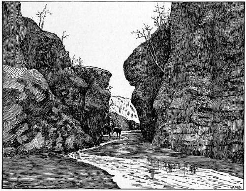
Fig. 2—Gateway to Seriland—gorge of Rio Bacuache.
In Seriland proper the distribution of potable water is conditioned by the meager precipitation, the local configuration (shaped largely by sheetflood erosion), and the disturbance of equilibrium of the scanty ground-water due to the tilting of the province. The most abundant permanent supply of fresh water is that of Arroyo Carrizal, which is fed by drainage and seepage from the broad and lofty mass of pervious rocks forming the southern part of Sierra Kunkaak, the abundant supply being due to the fact that the eastern tributaries are energetically retrogressing into the mass in deep gorges which effectually tap the water stored during the semiannual storms. The arroyo and valley of Agua Dulce are less favorably conditioned by reason of a trend against the tilting of the province and by reason of the narrower and lower mass of tributary rock in the northern part of the range, and the flow is impermanent, as indicated by the absence of canes and other stream plants; yet four explorers (Ugarte, 1721; Hardy, 1826; Espence, 1844; Dewey, 1875) reported fresh water, apparently in a shallow well tapping the underflow, at the embouchure of the arroyo. On the eastern slope of Sierra Kunkaak there are several arroyos which carry water for weeks or even months after the winter rains, and sometimes after those of summer; but the only permanent water—Tinaja Anita—is at the base of a stupendous cliff of exceptionally pervious and easily eroded rocks, so deeply cut that ground-water is effectually tapped, while an adjacent chasm—Arroyo Millard—is so situated that the cliff-faced spur of the sierra above the tinaja absorbs an exceptional proportion of the surface flowage from the main crest. The tinaja (figure 3) is permanent, as indicated by a canebrake some 20 by 50 feet in extent, and by a native fig and a few other trees—though the dry-season water-supply ranges from mere moisture of the rocks to a few gallons caught in rock basins within the first 50 yards of the head of the arroyo. No other permanent supplies of fresh water are known on the island, though there are a few rather persistent tinajas along the western base of Sierra Menor above Willard point.
On the mainland tract there is a cliff-bound basin, much like that of Tinaja Anita, at the head of Arroyo Mitchell and base of Johnson peak, christened Tinaja Trinchera; but the range is narrow and the rocks granitic, and hence the supply is not quite permanent.7 A practically permanent supply of water is found in one or more pools or barrancas at the head of Playa Noriega in Desierto Encinas. The liquid lies in pools gouged by freshets in the bottoms of arroyos coming in from the northward, just where the flow is checked by the spread of the waters over the always saline playa; and, since they are modified by each freshet, they are sometimes deep, sometimes shallow, sometimes entirely sand-filled. When the barrancas are clogged, or when their contents are evaporated, coyotes, deer, horses, and vaqueros obtain water by excavating a few feet in the sand lining the larger arroyos. Commonly the barranca water is too saline for Caucasian palates save in dire extremity, but the salinity diminishes as the arroyos are ascended. An apparently permanent supply of saline and nitrous water is found in a 10-foot well, known as Pozo Escalante, or Agua Amarilla (yellow water), near the southern extremity of Desierto Encinas, reputed to have been excavated by Juan Bautista de Escalante in 1700, and still remaining open; its location is such that it catches the subterranean seepage from both Bacuache and Sonora rivers. The water is potable but not palatable. Among the vaqueros of San Francisco de Costa Rica there is a vague and ancient tradition of a carrizal-marked tinaja or arroyo (Aguaje Parilla) at the eastern base of the southern portion of Sierra Seri; and both vaqueros and Indians refer to one or more saline barrancas about the western base of the same semirange, probably in Arroyo Mariana.
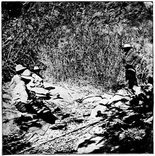
Fig. 3—Tinaja Anita.
In brief, Arroyo Carrizal, Tinaja Anita, and Pozo Escalante are the only permanent waters, and Pozo Hardy, Barranca Salina, and Tinaja Trinchera the only subpermanent waters actually known to Caucasians in all Seriland, though it seems probable that permanent water may exist at Aguaje Parilla and in Arroyo Mariana, and impermanent supplies near Bahia Espence. There may be one or two additional places of practically permanent water in smaller quantity, and a few other places in which saline water might be found either at the surface or by slight excavation, and which may be approximately located by inspection of the map under guidance of the principles set forth in the preceding paragraphs; but this would seem to be the limit of trustworthy water supply. During the humid seasons the waters are naturally multiplied, yet it is improbable that any of the arroyos except Carrizal and Agua Dulce and a few minor gulches along the more precipitous shores shed water into the gulf save at times of extraordinary local flood.8
The geologic structure of the Sonoran province is complex and not well understood. So far as the meager observations indicate, the basal rocks are granites, frequently massive and sometimes schistose, sometimes intersected by veins of quartz, etc. The granitic mass is upthrust to form the nuclei of Sierra Madre and other considerable ranges; it also approaches the surface over large areas of plains. Resting unconformably on the granites lie heavy deposits of shales and limestones, commonly more or less metamorphosed; these rocks outcrop on the slopes of most of the main ranges and form the entire visible mass of some of the lower sierras and buttes, while they, too, sometimes approach the surface of the sheetflood-carved plain. The rocks, both calcareous and argillaceous, combine the characters of the vast Mesozoic limestone deposits of eastern Mexico and the immense shale accumulations of corresponding age in California, and hence probably represent the later half of the Mesozoic. This is the only sedimentary series recognized in the province. Both the granites and the sedimentary beds are occasionally overlain by volcanic deposits, chiefly in the form of much-eroded lava-sheets and associated tuff-beds, which sometimes form considerable ranges and buttes (notably Sierra Kunkaak, of Isla Tiburon); these remnantal volcanic deposits are probably late Mesozoic or early Tertiary. Newer volcanics occur locally, forming mesas, as about Agua Nueva (40 miles northwest of Hermosillo), or even coulees apparently filling barrancas of modern aspect, as in the vicinity of Bacuachito,9 or rising into cinder cones surrounded by ejectamenta, as at Pico Pinacate, in northwestern Sonora. The various rocks are usually bare or meagerly mantled with talus in the mountains; over the greater part of the plains they are commonly veneered with sheetflood deposits, ranging from a few inches to a few yards in thickness; while the central portions of the larger valleys are lined with alluvial accumulations reaching many hundreds of feet in thickness.
The clearly interpretable geologic history began with extensive degradation and eventual baseleveling of a granitic terrane in Paleozoic or early Mesozoic time; then followed the deposition of the shales and associated limestones during the later Mesozoic; next came elevation, accompanied or followed by corrugation, chiefly in folds parallel with the present coast, whereby the granite-based sierras were produced, and accompanied also by the earlier vulcanism to which the volcanic sierras owe their existence. A vast period of degradation ensued, during which the land stood so high as to induce greater precipitation than that of today and to permit the streams to carve channels far below the present level of tide, and during which the present general configuration was developed; then came the southwestward tilting and consequent climatal desiccation, the filling of the deeper valleys, the inauguration of sheetflood erosion, some local vulcanism, and the progressive shifting of the divides.
The geologic structure affects the hydrography, especially that factor determined by subterranean circulation, or ground-water; for the superficial sheetflood and alluvial deposits are highly pervious and many of the volcanics hardly less so, while the shales and limestones are but slightly pervious and the granites nearly impervious. The geologic structure also determines the character of the soil with exceptional directness, since the dryness of the air and the dearth of vegetation reduce rock decay to a negligible quantity. The characteristically precipitous sierras and cerros are of naked ledges, save where locally mantled with a mechanical débris of the same rocks (much finer than the frost product of colder and humider regions); the soil of the normal plains is but the little-oxidized upper surface of sheetflood deposits made up of the mechanical debris of local rocks and varying in coarseness with the slope; while the soil of the valleys is detrital sand and silt, derived from tributary slopes, passing into adobe where conditions are fit, and essentially mechanical in texture and structure save where cemented by ground-water solutions at the lower levels.
Flora
The flora of the Sonoran province affords a striking example of the adjustment of vegetal life to an unfavorable environment. The prevailing vegetation is perennial, of slow growth and of stunted aspect; and it is not distributed uniformly but arranged in separate tufts or clusters, gathering into a nearly continuous mantle in wetter spots, though commonly dotting the plains sparsely, to completely disappear in the driest areas. Nearly all of the plants have roots of exceptional length, and are protected from evaporation by a glazed epidermis and from animal enemies by thorns or by offensive odors and flavors; while most of the trees and shrubs are practically leafless except during the humid seasons. Grasses are not characteristic, and there is no sward, even in oases; but certain grasses grow in the shadow of the arborescent tufts and in the fields of the farmer ants, or spring up in scattered blades over the moister portions of the surface. The arborescent vegetation represents two characteristic types, viz., (1) trees and shrubs allied to those of humid lands, but modified to fit arid conditions; and (2) distinctive forms, evidently born of desert conditions and not adapted to a humid habitat, this type comprising the cacti and related forms, as well as forms apparently intermediate between the cacti and normal arborescent type. The various plants of the district, including those of the distinctive types, are communal or commensal, both among themselves and with animals, to a remarkable degree; for their common strife against the hard physical environment has forced them into cooperation for mutual support. The tufts or clusters in which the vegetation is arranged express the solidarity of life in the province; commonly each cluster is a vital colony, made up of plants of various genera and orders, and forming a home for animal life also of different genera and orders; and, although measurably inimical, these various organisms are so far interdependent that none could survive without the cooperation of the others.10
In Seriland proper, as in other parts of the Sonoran province, a prevailing tree is the mesquite (Prosopis juliflora); on the alluvial fan of Rio Sonora it grows in remarkable luxuriance, forming (with a few other trees) a practically continuous forest 20 to 40 feet in height, the gnarled trunks sometimes reaching a diameter of 2 or 3 feet; over the Rio Bacuache fan and much of the remaining plain surface it forms the dominant tree in the scattered vital colonies; and here and there it pushes well into the canyon gorges. The roots of the mesquite are of great length, and are said to penetrate to water-bearing strata at depths of 50 to 75 feet; its fruit consists of small hard beans embedded in slender woody pods. Associated with the mesquite in most stations are the still more scraggy and thorny cat-claw (Acacia greggii) and ironwood (Olneya tesota), both also yielding woody beans in limited quantity. Similarly associated, especially in the drier tracts, and characteristically abundant over the plains portions of Isla Tiburon, are the paloverdes (Parkinsonia torreyana, etc.), forming scraggy, wide-branching, greenbark trees 5 to 15 feet high, and commonly 3 to 10 inches in diameter of trunk. Over the mountain sides, especially of Sierra Seri and Sierra Kunkaak, grow sparsely the only straight-trunk trees of the region, rooted in the rocks to the average number of a few score to the square mile; this is the palo blanco (Acacia willardiana). Associated with it along rocky barrancas of permanent water supply is a fig tree (Ficus palmeri), which has a habit of springing from the walls and crests of cliffs, and sending white-bark roots down the cliff-faces to the water 50 or 100 feet below, and which yields a small, insipid, and woody fruit. Interspersed among the larger trees, and spreading over the intervening spaces, particularly in the drier and more saline spots, grow a number of thorny shrubs, much alike in external appearance and habit, though representing half a dozen distinct genera (Cassia, Microrhamnus, Celtis, Krameria, Acacia, Randia, Stegnospherma, Frankenia, etc.), while considerable tracts are sparsely occupied by straggling tufts of the Sonoran greasewood, or creosote bush (Larrea tridentata), whose minute but bright green leafage relieves that prevailing gray of the landscape in which the lighter greens of the paloverde and cactus stems are lost.
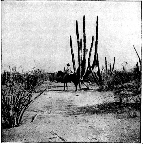
Fig. 4—Beyond Encinas desert—the saguesa.
Intermingling with the woody trees and shrubs in most stations, and replacing them in some, are the conspicuous and characteristic cacti in a score of forms. East of Desierto Encinas, and sometimes west of it, these are dominated by the saguaro (Cereus giganteus), though throughout most of Seriland the related saguesa (Cereus pringleii?) prevails. The saguaro is a fluted and thorn-decked column, 1 foot to 3 feet in diameter and 10 to 60 feet in height, sometimes branching into a candelabrum, while the still more monstrous saguesa (figure 4) usually consists of from three to ten such columns springing from a single root; both are masses of watery pulp, revived and renewed during each humid season, and both flower in a crown of fragrant and brilliant blossoms at or near the top of column or branch, and fruit in fig-like tunas (or prickly pears) during late summer or early autumn. Ordinarily the saguesa, like the saguaro, is sparsely distributed; but there is an immense tract between Desierto Encinas and the eastern base of Sierra Seri in which it forms a literal forest, the giant trunks close-set as those of trees in normal woodlands. Hardly less imposing than the giant cactus is the wide-branching species known as pitahaya (Cereus thurburi?), in which the trunks may be ten to fifty in number, each 4 to 8 inches in diameter and 5 to 40 feet in height; and equally conspicuous, especially in eastern Seriland, is the cina (Cereus schotti), which is of corresponding size, and differs chiefly in the simpler fluting of the thorn-protected columns. Both the pitahaya and the cina flower and fruit like the saguaro, the tunas yielded by the former being especially esteemed by Mexicans as well as Indians. Another important cactus is the visnaga (Echinocactus wislizeni lecontei), which rises in a single trunk much like the saguaro, save that it is commonly but 3 to 6 feet in height and is protected by a more effective armature of straight and curved thorns; it yields a pleasantly acid, pulpy fruit, which may be extracted from its thorny setting with some difficulty; but its chief value lies in the purity and potability of the water with which the pulpy trunk is stored. The visnaga is widely distributed throughout the Sonoran province and beyond, and extends into eastern Seriland; it is rare west of Desierto Encinas and is practically absent from Isla Tiburon, where it may easily have been exterminated by the improvident Seri during the centuries of their occupancy. Most abundant of all the cacti, and less conspicuous only by reason of comparatively small size, is the cholla (an arborescent Opuntia); on many of the sheetflood-carved plains it forms extensive thickets 5 to 8 feet high, the main trunks being 2 to 6 inches in diameter, while dozens or hundreds of gaunt and thorn-covered branches extend 3 to 8 feet in all directions; and it occurs here and there throughout the district from the depths of the valleys and the coast well up to the rocky slope of the sierras. It yields quantities of fruit, somewhat like tunas, but more woody and insipid; this fruit is seldom if ever used for human food, but is freely consumed by herbivores. Much less abundant than the cholla is the nopal, or prickly pear; and there are various other opuntias, often too slender to stand alone and intertwined with stiffer shrubs which lend them support, and many of these yield small berry-like tunas. Another characteristic cactus, widespread as the cholla and abundant in nearly all parts of Seriland save on the rocky slopes, is the okatilla (Fouquiera splendens). It consists of half a dozen to a score of slender, woody, and thorn-set branches radiating from a common root, usually at angles of 30° to 45° from the vertical, and ordinarily reaching heights of 10 to 20 feet.
The pulp masses of the larger cacti, especially the saguaro, saguesa, pitahaya, and cina, are supported by woody skeletons in the form of vertical ribs coincident with the external flutings; within a few years after the death and decay of these desert monsters the skeletons weather out, and the vertical ribs form light and strong and approximately straight bars or shafts, valuable for many industrial purposes; while the slender arms of okatilla are equally valuable, in the fresh condition after removal of the spiny armament, and in the weathered state without special preparation.
On many of the higher plain-slopes, especially in eastern Seriland, there are pulpy stemmed shrubs and bushes, sometimes reaching the dignity of trees, which present the normal aspect of exogenous perennials during life, but which are so spongy throughout as to shrink into shreds of bark-like debris shortly after death. These are the torotes of the Sonoran province—common torote (Jatropha cardiophylla), torote amarillo (Jatropha spathulata), torote blanco (Bursera microphylla), torote prieto (Bursera laxiflora), torotito (Jatropha canescens?), etc. These plants grow in the scattered and scraggy tufts characteristic of arid districts (a typical torote tuft appears in left foreground of figure 4); they are protected from evaporation by the usual glazed epidermis, and maintained by the water absorbed during the humid seasons; but they are thornless and are protected from animal enemies by pungent odors, and at least in some cases by toxic juices. Like various plants of the province they are measurably communal—indeed, the torotito appears to be dependent on union with an insect for reproduction, like certain yuccas, and like the cina and (in some degree at least) the saguaro and other cacti.
Along the lower reaches of Rio Bacuache, and in some of the deeper gorges of Sierra Seri and Sierra Kunkaak, grow a few veritable trees of moderately straight trunk and grain and solid wood, such as the guaiacan (Guaiacum coulteri) and sanjuanito (Jacquinia pungens); both of these fruit, the former in a wahoo-like berry of medicinal properties, and the latter in a nut, edible when not quite ripe and forming a favorite rattle-bead when dry. On the flanks of such gorges the slender-branched baraprieta (Cæsalpinia gracilis) grows up in the shelter of more vigorous shrubs, its branches yielding basketry material, while its fruit is a woody bean much like that of the cat-claw. In like stations there are occasional clumps of yerba mala or yerba de flecha (Sebastiana bilocularis), an exceptionally leafy bush growing in straight stems suitable for arrowshafts, and alleged to be poisonous from root to leaf—with inherent probability, since the plant is without the thorny armature normal to the desert. Along the sand-washes, especially about their lower extremities wet only in floods, springs a subannual plant (Hymenoclea monogyra) which shrinks to stunted tussocks after a year or more of drought, but flourishes in close-set fens after floods; though of acrid flavor and sage-like odor, it is eaten by herbivores in time of need, and it yields abundant seeds, consumed by birds, small animals, and men. About all of the permanent waters not invaded by white men and the white man’s stock there are brakes of cane or carrizal (Phragmites communis?); the jointed stems are half an inch to an inch in thickness and 8 to 25 feet in height; the seeds are edible, while the stems form the material for balsas and afford shafts for arrows, harpoons, fire-sticks, etc., and the silica-coated joints may be used for incising tough tissues.
The coasts of Seriland, both insular and mainland, are skirted by zones of exceptionally luxuriant shrubbery, maintained chiefly by fog moisture. Along the mountainous parts of the coast the zone is narrow and indefinite, but on the plains portions it extends inland for several miles with gradually fading characters; this is especially true in the southern portion of Desierto Encinas, where the fog effects may be observed in the vegetation 12 or 15 miles from the coast. Most of the fog fed species are identical with those of the interior, though the shrubs are more luxuriant and are otherwise distinctive in habit. On the Tiburon side of gale-swept El Infiernillo, and to some extent along other parts of the coast, some of these shrubs (notably Maytenus phyllanthroides) grow in dense hedge-like or mat-like masses, often yards in extent and permanently modeled by the wind in graceful dune-like shapes. Somewhat farther inland the flatter coastwise zones of Tiburon are rather thickly studded with shrubby clumps from 6 inches to 2 feet high, made up of Frankenia palmeri with half a dozen minor communals; while still farther inland follows the prevailing Sonoran flora of mesquite, scrubby paloverde, and chaparral (Celtis pallida), etc., only a little more luxuriant than the normal.
Throughout Seriland proper, and especially in the interior valleys of Tiburon, grasses are more prevalent than in other portions of the Sonoran province, their abundance doubtless being due to the rarity of graminivorous animals during recent centuries.
Fauna
Considered collectively, the fauna of the Sonoran province is measurably distinctive (though less so than the flora), especially in the habits of the organisms. The prevailing animals, like the plants of extraneous type, evidently represent genera and species developed under more humid conditions and adjusted to the arid province through a long-continued and severe process of adaptation; and no fundamentally distinct orders or types comparable with the cacti and torotes of the vegetal realm are known. The prime requisite of animal life in the province is ability to dispense with drinking, either habitually or for long intervals, and to maintain structure and function in the heated air despite the exceptionally small consumption of water; the second requisite is ability to cooperate in the marvelously complete solidarity of animal and vegetal life characteristic of subdesert regions. No systematic studies have been made of special structures in the animal bodies adapting them to retention of liquids, either by storage (as in the stomach of the camel) or by diminished evaporation, though the prevalence of practically nonperspiring mammals, scale-covered reptiles, and chitin-coated insects suggests the selection, if not the development, of the fitter genera and species for the peculiar environment. Much more conspicuous are the characters connected with cooperation in the ever severe but never eliminative strife for existence in the sub-desert solidarity; the mammals are either exceptionally swift like the antelope, exceptionally strong like the local lion, exceptionally pugnacious and prolific like the peccary, or exceptionally capable of subsisting on waterless sierras like the bura and mountain goat; the reptiles are either exceptionally swift like the rainbow-hued lizards, exceptionally armed like the sluggish horned toads, exceptionally venomous like the rattlesnake, or exceptionally repulsive, if not poisonous, like the Gila monster; even the articulates avoid the mean, and are exceptionally swift, exceptionally protective in form and coloring, exceptionally venomous like the tarantula and scorpion and centipede, or exceptionally intelligent like the farmer ant and the tarantula-hawk; while there is apparently a considerable class of insects completely dependent on the cooperation of plants for the perpetuation of their kind, including the yucca moth and (undescribed) cactus beetle. Among plants the intense individuality (which is the obverse of the enforced solidarity) is expressed in thorns and heavily lacquered seeds and toxic principles; among animals it is expressed by chitinous armament, as well as by fleetness and fangs and deadly venom.
The larger land animals of Seriland proper are the mountain goat in the higher sierras, the bura (or mule-deer) and the white-tail deer on the mid-height plains and larger alluvial fans, with the antelope on the lower and drier expanses. Associated with these are the ubiquitous coyote, a puma, a jaguar of much local repute which roams the higher rocky sites, and a peccary ranging from the coast over the alluvial fans and mid-height plains of the mainland (though it is apparently absent from Tiburon). Of the smaller mammals the hare (or jack-rabbit) and rabbit are most conspicuous, while a long-tail nocturnal squirrel abounds, its burrows and tunnels penetrating the plains of finer debris so abundantly as to render these plains, especially on Tiburon, impassable for horses and nearly so for men. The California quail and the small Sonoran dove are fairly common; a moderate number of small birds haunt the more humid belts, and there is a due proportion of Mexican eagles and hawks of two or three forms, with still more numerous vultures. Ants abound, dominating the insect life, while wasps and spiders, with various flies and midges, gather about the vital colonies of the drier plains and swarm in the moister belts. Horned toads and various lizards—bright-colored and swift, or earth-tinted and sluggish—are fairly abundant, while black-tail rattlesnakes haunt the more luxuriant vegetation of fog zones, permanent waters, and cienegas. On the whole, the land fauna of Seriland is much like that of the province in general, though the various forms of life are less abundant than the average, since all (except the abounding squirrel) are sought for food by the omnivorous Seri; and the distribution, even when relatively abundant, is woefully sparse, as befits the scant and scattered vegetal foundation for the animal life.
Strongly contrasted with the meagerness of the land fauna is the redundant aquatic fauna of that portion of the gulf washing the shores of Seriland. Tiburon island is named from the sharks, said by some explorers to have been seen by thousands along its coasts; these voracious feeders find ample food in literal shoals and swarms of smaller fishes; a not inconsiderable number of whales have survived the early fisheries (one, estimated at 80 feet in length, was stranded in Rada Ballena about 1887); while schools of porpoises play about Boca Infierno and elsewhere, making easy prey of slower swimmers caught in the tide-rips and gale-swept breakers. Proportionately abundant and varied is the crustacean life; littoral mollusks cling to the ledges exposed along all the rocky coast stretches, and the entire beach from Punta Antigualla to Punta Ygnacio is banded by a practically continuous bank of wave-cast molluscan shells, the shell-drift being often yards in width and many inches in depth. Common crabs abound in many of the coves, and a large lobster-like crab frequently comes up from deeper bights and bottoms; oysters attach themselves to rocks and to the roots of shrubby trees skirting protected bays like Rada Ballena, while clams are numerous in all broad mud-flats, such as those of Laguna la Cruz; and the pearl oyster was fished for centuries toward Punta Tepopa, until the ferocity of the Seri put an end to the industry. Especially abundant and large are the green turtles on which the Seri chiefly subsist, leaving the shells scattered along the shore and about rancherias in hundreds; while two land tortoises (Gopherus agassizii and Cinosternum sonorense) range about the margins of the lagoons, and one of these is alleged to enter the water freely.
The abundance of water-fowl is commensurate with that of the submarine life. The pelican leads the avifauna in prominence if not in actual numbers, breeding on Isla Tassne (Pelican island), and periodically patrolling the whole of Bahia Kunkaak and El Infiernillo in lines and platoons of military regularity; gulls are always in sight, and the cormorant is common; while different ducks haunt several of the islets, and the shores are promenaded by curlews, snipes, and other waders. There is a corresponding wealth of plankton, which at low spring tide with offshore gale covers acres of shallow littoral with squirming or inert but always slimy life, the substratum for that of higher order; and jellyfish and echinoids are cast up by nearly every wave, while at night the surf rolls up the smooth strands in shimmering lines of phosphorescent light. On the whole, the aquatic life teems in tropic luxuriance and more than ordinary littoral variety; for the waters of the gulf are warmed by radiation and conduction from its sun-parched basin, while the concentrated tides distribute and stimulate the species and keep the vital streams astir.
Local Features
Considered as a tribal habitat, Seriland comprises four subdivisions of measurably distinct character, viz., (1) the broad desert bounding the territory on the east; (2) the mountainous zone of Sierra Seri; (3) Tiburon island and the neighboring islets; and (4) the navigable straits and bays contiguous to island and mainland.
1. So far as its marginal portions are concerned, Desierto Encinas is a typical valley of the Sonoran province, sparsely dotted with vital colonies of the prevailing type and variegated by the exceptionally luxuriant mesquite forests of the Bacuache and Sonora fans; but the interior of the valley is rendered distinct by the fact that it lies near, if not below, the level of the sea.11 The central feature is Playa Noriega—a film of brackish water for a few days after each considerable semiannual freshet, a sheet of saline mud for a few weeks later, and for the greater part of the year a salt-crusted sherd 20 square miles in area, level as a floor and unimpressionable as a brick pavement. The playa is rimmed by dunes 10 to 40 feet in height, and about these and along the arroyos which occasionally break into it there is some aggregation of salt-enduring shrubs, evidently sustained in part by the semiannual freshet with its meager vapors and fogs. Outside this rim the surface is exceptionally broken; low dunes and irregularly wandering banks of soft and dust fine sand are interspersed with meandering salt flats much like the central playa, ranging from a few feet in width and a few yards in length up to mappable dimensions, as in the lesser playa lying east of the great one; and many of the dustbanks are honeycombed with squirrel burrows. This annulus of broken surface is narrow on the west, soon passing into okatilla scrub and then into the saguesa forests of the eastern base of Sierra Seri; on the east it is miles in breadth, passing gradually into the normal Sonoran plain; on the south it widens still farther, stretching all the way to Arenales de Gil and Pozo Escalante, and merging into the playa-like mud-flats bordering Laguna la Cruz, into which the gulf waters are sometimes forced by southwesterly gales at high spring tides. Throughout this portion of the desert, marine shells are scattered over the playa-like flats or lodged in the adjacent banks, sometimes in great beds; the vegetation is scantier than usual and largely of salt-loving habit; the mud-flats are usually coated with saline and alkaline crusts, while the dunes are soft and fluffy, and expand into broad belts perforated with the tunnels of the surprisingly abundant rodents. Across this plain of bitter sand-dust lie the two hard land routes to Seriland—the supposed Escalante route of 1700, down the fan of Rio Bacuache and thence by Barranca Salina; and the Encinas route, down the northern border of the Rio Sonora fan and thence by Pozo Escalante to the shores of Bahia Kino.12
Desierto Encinas is an impossible human habitat in any proper sense; it is merely a broad and hardly passable boundary between habitats. The hardy stock of the frontier ranchos, pasturing partly on the thorny fruit of the cholla, push far out on the plains, and are sometimes watered for short periods, under strong guards of heavily armed vaqueros, at Barranca Salina; yet the greater part of the expanse is trodden only by the Seri. Two or three ruined frames of Seri jacales and a few graves crown the low knoll near Pozo Escalante, and there are one or two house remnants near Barranca Salina; these are notable not only as the easternmost remaining outposts of Seri occupancy, but because they represent the only known instances in all Seriland of the erection of even temporary houses adjacent to water. Distinct paths, trodden deep by bare Seri feet, radiate from both waters toward the Seriland interior, but no traceable trails extend eastward.
The southern limit of Desierto Encinas is marked either by the broad mud-flats opening into Laguna la Cruz or by the coast of the gulf, the coast cutting the lower portions of the plain being accentuated by a sand-bank 30 or 40 feet high, against which the surf thunders in nearly continuous roar, audible halfway or all the way to Pozo Escalante. A Seri trail skirts the crest of this bank, sending occasional branches into the interior. At Punta Antigualla the bank expands and rises into a great mammillated shell-mound nearly 100 feet high, with several of the cusps occupied by more or less ruined jacales; and occasionally occupied houses occur midway thence to the southernmost point of Sierra Seri, and again at the base of the first spur east of Punta Ygnacio. Beyond Punta Antigualla the sweep of the waves is stronger than in Bahia Kino, and the coastal sand-bank is generally higher. Between the rocky buttresses of Punta Ygnacio and the next spur eastward the sand-ridge rises fully 50 feet above mean low tide, and here, as elsewhere, its verge is protected by a fog-fed chaparral thicket with occasional clumps of okatilla and other cacti. Behind the coast barrier lie lagoon-like basins, generally dry and floored with saline silt-beds, though sometimes occupied by briny pools formed through seepage during southwesterly gales; and there are physiographic indications that the northwestward extension of Laguna la Cruz formerly stretched some miles farther than now and lay in the rear of Punta Antigualla in such wise as to form a source of supply of the clam-shells of which the eminence is built.
BUREAU OF AMERICAN ETHNOLOGY SEVENTEENTH ANNUAL REPORT PL. III
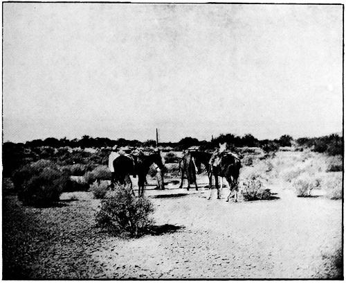
SERI FRONTIER
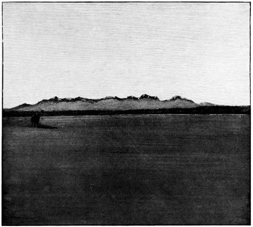
SIERRA SERI FROM ENCINAS DESERT
2. Sierra Seri is a double range, divided mid-length by a broad saddle barely 2,000 feet in height.13 Like other Sonoran ranges, the nucleal portions are exceedingly rugged and precipitous—at least two of its picachos shoot so boldly that they commonly seem to overhang, and have been called leaning peaks. In large part the precipices rise abruptly from a symmetrical dome molded by sheetflooding, much as the insulated buttes rise from the Bacuache fan in northeastern Seriland; so that the tract lying between Desierto Encinas and El Infiernillo is a composite of exceptionally precipitous and exceptionally smooth mountain slopes. One of the Seri trails radiating from Barranca Salina lies across the mid-sierra saddle; others push into several mountain valleys, and the largest leads to Tinaja Trinchera, at the base of Johnson peak, where there are a few low walls of loose-laid rubble, somewhat like those of the trincheras (entrenched mountains) farther eastward—the only structures of the sort seen in Seriland. Toward the southern end of the range lie various trails, the most conspicuous paralleling the coast, either near the shore or over the steep salients, according to the configuration; while here and there ruinous jacales a few yards from the coast attest sporadic habitation. The eastern shore of Bahia Kunkaak from Punta Ygnacio northward reveals a typical geologic section of the Sonoran province: the transgressing waves have carved in the granitic subterrane a broad shelf lying just below mean low tide and usually stretching several furlongs offshore; this shelf is relieved here and there by remnantal crags of obdurate rocks, cumbered by bowlders and locally sheeted with sand and arkose derived from mechanically disintegrated granite; while the inner margin of the shelf is a sea-cliff, usually 30 to 50 feet high, of which the lower half is commonly granite and the upper half unconsolidated and recent-looking mechanical debris collected by sheetflood erosion. Sometimes the granite of the subterrane is replaced by volcanics; sometimes ancient and firmly cemented talus deposits separate the superficial mantle from the subterrane, as shown in the lower part of plate V; sometimes the line of sheetflood planation passes below tide-level, when the waves beat against the unconsolidated deposits in a deep embayment; sometimes the sharply defined planation surface ends abruptly at the sides of subranges or buttes shooting upward in the abrupt slopes characteristic of the sierra proper; yet this 10-mile stretch of coast is a nearly continuous revelation of the structure of sheetflood-carved plains and of modern marine transgression. The debris of the combined processes forms an abundant and varied assortment of bowlders, cobbles, and pebbles, whence the inhabitants readily derive their simple implements without need for studied forethought or manual cunning.
The long sand-spit terminating in Punta Miguel and the shorter one terminating in Punta Arena are the product of geologically recent wave building, and consist of irregular series of V-bars, backed by lagoon-like basins and enclosing considerable bodies of brine in the central portions; and the bars and basins become successively higher outward, in such wise as to attest the secular subsidence of this coast. Several jacales are located on the higher portion of the southern sand-spit, midway between Punta Granita and Punta Miguel, while footpaths traverse the flat and skirt the coast. Toward the terminal portion of the spit the sand is blown into hummocks, held by clumps of salt-enduring and sand-proof shrubbery; but there are no rancherias here, despite the fact that it is a natural point of embarkation—doubtless because no Seri structure could withstand the sand-drifting gales and storm inundations of this exposed spot. The more protected lagoons behind the outer bars harbor abundant waterfowl, within bowshot of shrub-clumps and dunes well adapted to the concealment of hunters, while the mud-flats open to the tide abound in clams and other edible things. The features of the Punta Miguel sand-spit are repeated with variations along the eastern shore of El Infiernillo; and Seri jacales, evidently designed for temporary occupancy, occur here and there, usually on higher banks above reach of the severer storms.
3. Tiburon island itself is apparently the chosen home of the Seri—a habitat to which the mainland tract is at once a dependency, an alternative refuge, and a circumvallation. Its dominant range, Sierra Kunkaak, mates Sierra Seri in its essential features, though the rocks are for the greater part ordinarily obdurate eruptives rather than exceptionally obdurate granites, as in the mainland sierra; accordingly the range is somewhat lower and broader, while the sheetflood sculpture, with its sharp transition into precipitous cliffs, is somewhat less trenchant. Sierra Menor is a third term in the mountain series, in structure and geomorphy as in altitude; while the interior plain is a homologue of that portion of Desierto Encinas lying north of Playa Noriega—i. e., of its (potentially) free-drained portion. Almost the entire perimeter of Tiburon is suffering marine transgression, and is faced with seacliffs overlooking wave-carved shelves; and in both form and structure the greater part of the coast repeats, with minor variations, the features of the mainland coast from Punta Ygnacio northward. Partly because of the superior magnitude and height of its debris-yielding sierra, partly because of protection from the wave-beat of the open gulf, the eastern shore is skirted with a talus-shape slope, usually two to four miles wide; and while there are unmistakable evidences of sheetflood carving in the higher portions of this plane, the coastal cliff commonly reveals nothing but heterogeneous debris, sometimes rising thirty or forty feet above tide. Somewhat the greater part of the volume of this debris is fine—i. e., sand and silt and nondescript rock-matter; but there is always a considerable element of larger rock-fragments, which gather along the shore in a pavement of bowlders and cobbles (upper figure of plate V). These coarse materials—important factors in aboriginal industry—are harmoniously distributed; more conspicuously on the ground than on the map, the coast is set with salients (of which Punta Narragansett is a type), consisting merely of exceptional accumulations of debris from gorges in the sierra and from shallow arroyos, or pebble washes, traversing the coastwise plain. These salients owe their prominence partly to the relative coarseness, partly to the abundant supply, of fragmental material from the heights; and about their extremities the beach is paved with bowlders, which grade to cobbles or even to pebbles along the reentrant shores on either hand. This distribution of cobbles is one of the conditions governing the placement of Seri rancherias; and in many cases the jacales are located, either singly or in groups, where the coastal salients and reentrants meet, and where there is an abundant supply of cobbles of convenient size and wave-tested hardness.
BUREAU OF AMERICAN ETHNOLOGY SEVENTEENTH ANNUAL REPORT PL. IV.
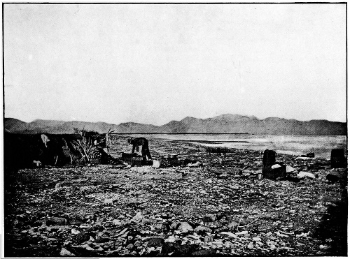
SIERRA SERI FROM TIBURON ISLAND
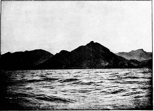
PUNTA YGNACIO, TIBURON BAY
The coastwise plain skirting eastern Tiburon has a few wave-built projections analogous to those east of El Infiernillo; the most conspicuous of these are Punta Tormenta, Punta Tortuga, and Punta Perla with its tide-swept extensions, Bajios de Ugarte. All of these are located primarily by sierra-fed arroyos, but all are greatly extended by wave-borne material laid down along lines determined by the prevailing currents of this best-protected portion of the coast. The long outer face of Punta Tormenta, shaped by the storms of Bahia Kunkaak, is strikingly regular and symmetric; its broad extremity and inner face are diversified by subordinate bars and lagoons, evidently tending to connect with the main coast toward Punta Tortuga, and thereby to transform the whole of Rada Ballena into a lagoon. Already the narrow embayment is so shallow that, although a comfortable haven at high tide, it is mostly mud-flat and sand-waste at extreme low tide—a condition which explains the stranding of an 80-foot whale in this treacherous harbor about 1887. The rada is between two and three miles in length. It abounds in marine life of kinds preferring quieter waters: clams are plentiful in its mud-flats, a sponge lines portions of the bottom toward its inner extremity, oysters cluster numerously on bowlders and on the mangrove-like roots and trunks of a large shrub along the outer shore, and various fishes find refuge here from the fierce currents and the hungry sharks and porpoises of the open strait; these and other creatures form food for innumerable waders and other water-fowl that seek shelter in the quiet bay, which is still further protected by salt-enduring shrubbery on the bars of the point and by the shrubby thickets and wave-cast banks and wind-built dunes on the mainland side.
The combination of conditions renders this portion of the Tiburon coast the optimum habitat of the Seri Indians. There are, indeed, no houses or other traces of permanent habitation on Punta Tormenta itself, which is not only swept by gales but must sometimes be inundated by gale-driven waters at high spring tide; but at the inner end of the long sand-spit, and also on the mainland opposite the outer portion of Rada Ballena, there are extensive and well-kept rancherias, capacious enough to accommodate comfortably thirty or forty Seri families, i. e., 150 or 200 persons. Toward its landward end the sand-spit is built largely of pebbles and cobbles, of which thousands of tons are adapted to industrial use; sea-food is practically unlimited and is readily taken; water-fowl literally crowd the protected rada within arrow-shot of natural cover; the outer slope of the bar is admirably suited for landing and embarking balsas in calm weather, while the bay is an ideal harbor for the portable craft, and the shrub-grown shores give unlimited opportunity for concealing them when not in use; the dunes and banks are high enough to protect the low jacales from storm-winds, while the abundant sponges and turtle-shells afford material for thatching and shingling the more exposed walls and roofs; and finally, it is but a favorite distance (about 4 miles) to the permanent fresh water of Tinaja Anita. From this Seri metropolis well-trod trails radiate toward all other parts of the island; the best beaten leads to the tinaja, sending branches into all the neighboring gorges, in which game is sometimes taken; next best-worn is the trail laid across Sierra Kunkaak to strike Arroyo Carrizal mid-length of its permanently wet portion; others pass northward to rancherias at different points on the coast, and still another skirts the coast southward by several smaller rancherias to the considerable jacal collection near Punta Narragansett—this, like other longshore routes, having alternative trails, the evanescent fair-weather one following the beach, while the permanent path threads the thorn-set thickets marking the crest of the sea-cliff or cuts across the longer salients. The Narragansett rancheria is also a center for radiating trails, the best-beaten of these leading toward the fresh waters of Tinaja Anita and Arroyo Carrizal; and even the rancherias half-way thence to Punta Mashém send their most permanent paths over 15 miles of intervening ranges and spall-strewn valleys toward the same waters. According to Mashém’s cautious statements, there is a minor Seri metropolis at the northwestern spur of Sierra Kunkaak, within reach of Pozo Hardy and Arroyo Agua Dulce, and two or three smaller rancherias along the western shore; but these were not reached by the 1895 expedition.
BUREAU OF AMERICAN ETHNOLOGY SEVENTEENTH ANNUAL REPORT PL. V.
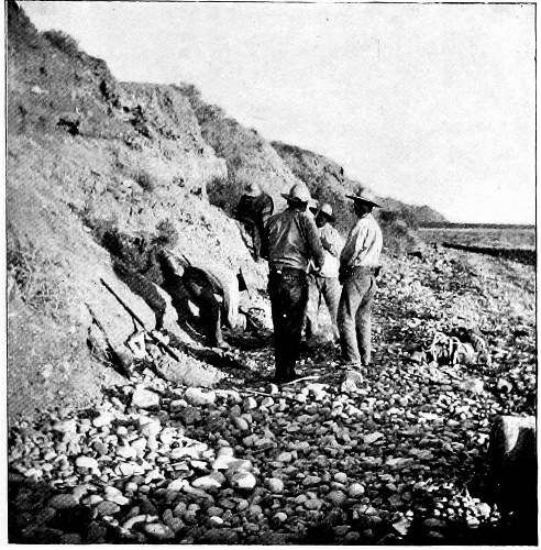
WESTERN SHORE OF TIBURON BAY
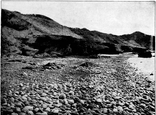
EASTERN SHORE OF TIBURON BAY
4. The seas washing Seriland are notably troubled by tides and winds. Gaping toward the Pacific, and narrowing and shoaling for the 800 miles of its length (measured from midway between Islas de Tres Marias and Cabo San Lucas), Gulf of California approaches Bay of Fundy, Bristol channel, and Broad sound as a tide accumulator; while the semidiurnal sweep of the waters in the upper half of the gulf is conditioned by the constriction of the basin to a fraction of its average cross-section at the narrows between Isla Tiburon and Punta San Francisquito. Toward the head of the gulf the ordinary spring tides range from 20 to 25 feet, and may be much increased by favoring winds; the debacles culminate there, but the currents culminate off Seriland in the great tide-gate half dammed by the islands of Tiburon, San Esteban, San Lorenzo, and Salsipuedes,14 with their marine buttresses, and through the breaches of Pasaje Ulloa, Estrecho Alarcon, and Canal de Salsipuedes flow, four times daily, some two or three cubic miles of water in tremendous tidal floods, probably unsurpassed in vigor elsewhere on the globe. Naturally the islands and the adjacent coasts afford extraordinary examples of marine transgression; and while exceptional wave-work is a factor, the transgression is undoubtedly due mainly to the extraordinary tidal currents in this gateway of the gulf. The fierce currents and the frequent storms of the region condition local navigation, and have undoubtedly contributed to the development of the peculiarly light, strong, and serviceable water-craft of the aboriginal navigators among the islands.
El Infiernillo derives its distinctive characteristics largely from the local character of the tides. Bahia Kunkaak is a funnel-shape embayment so placed as to catch half the volume of the incoming tide and to concentrate the flow into a bore hurtling through Boca Infierno and thence throughout the shoaling strait with greatly accelerated velocity; meantime the body of the tidal stream is diverted around Tiburon, and then enfeebled in its northward flow by the expansion of the gulf above the Tiburon-San Francisquito gateway, so that the entire strait is flooded (to the limit fixed by the capacity of Boca Infierno) before the main tide flows into its head past Isla Patos and through Bahia Tepopa; and with this unobstructed inflow the strait is reflooded with a counterbore, whereby the waters are heaped and pounded into an unstable, swirling, churning mass.15 The flooding is little less than catastrophic in magnitude and suddenness; indeed, the volume of water in the body of the strait between Punta Perla and Boca Infierno is approximately doubled at neap tide and tripled at spring tide twice in each twenty-four hours. Then, as the crest of the main debacle advances into the upper gulf beyond Punta Tepopa, the trough of the ebb is already approaching the Tiburon-San Francisquito constriction; and even before the final flooding of El Infiernillo from the north is completed, the waters of Bahia Kunkaak are receding and a tiderip is tearing through Boca Infierno at a rate sufficient to half empty the reservoir of its accumulated volume before the ebb trough has rounded the island to the head of the strait. Thus the effect of the exceptional tides of the gulf and the peculiar configuration of Seriland is to concentrate and accentuate tidal currents in El Infiernillo, and to convert the channel into a raceway for nearly continuous tide rips. According to Dewey, the spring tides are 10 feet and the neaps 7 feet about the northern end of the strait;16 in December, 1895, the tides about Punta Blanca and Punta Granita were roughly determined as 13 or 14 feet at spring and 7 or 8 at neap, the range varying considerably with the direction and force of the wind; and the consequent current through Boca Infierno was estimated at 4 to 8 miles per hour, the higher velocity of course coinciding with the spring tide. The change in direction of the current is almost instantaneous—indeed, the run is in opposite directions on opposite sides of the narrow strait when the wind sets obliquely—so that the tidal flow is practically continuous. The currents are of course slacker in the body of the strait, but even here suffice to transport coarse sediments; and it is to this agency that the “shoals and sand spits” noted by Dewey17 and the maintenance of a deep channel through Boca Infierno are chiefly to be ascribed. The materials of Punta Tormenta and Punta Tortuga attest the transportation of pebbles up to 3 or 4 inches in diameter by the combined work of waves and tidal currents.
Like other mountain-bound water bodies, the portion of the gulf washing Seriland is exceptionally disturbed by winds of given velocity by reason of the high angle of incidence; and moreover the exceptionally prominent local configuration disturbs the atmospheric currents in a manner somewhat analogous to that in which the tidal currents are disturbed; so that the winds are highly variable but generally strong. Under the combined action of tide and wind the waters are normally ruffled; choppy seas freely flecked with whitecaps are rather the rule than the exception,18 and are replaced less frequently by calms than by steadier billows breaking in continuous surf on sand-beaches (figure 5) and dashing into foam-flecked and rainbow-tinted spray-jets, bathing the rocky cliffs for 50 feet above their bases. Sometimes the wind stills suddenly, when the sea sinks to rhythmic swells, soon extinguished by reaction from the irregular shores and by the interference of tide-currents; but the swell seldom dies away before the gale springs again. The broad valley between Sierras Seri and Kunkaak, bottomed by El Infiernillo, is especially beset by fierce and capricious gales; the general atmospheric drift is disturbed by the leading and lesser sierras, as well as by temperature convection from the gulf, and eddies are developed in such wise as to send air-currents directly or obliquely up or down the valley. These local or sublocal winds are characteristic. Judging from observations covering several weeks, the valley is wind-swept longitudinally for an average of eighteen or twenty hours daily, the winds ranging from strong breezes to gales so stiff as to load the air with sand ashore and spray asea; and even the calms may be broken any minute by sudden gusts and williwaws, passing rapidly as they arrive. Not only waves but wind itself combines with tides to shape the structural features of the valley; nowhere within it do flour-fine sands like those of Desierto Encinas occur, save as a hardly perceptible constituent of the dunes and banks of coarser sand—they have been blown into the sea or beyond the limits of the valley. Throughout the strait so expressively named by its explorers, the capriciousness of the sea culminates, despite the shoalness and the protection from easterly and westerly winds; the storm currents and tide-currents are half the time opposed, raising breakers even when the air is nearly still; eddies and whirls and cross-currents arise constantly, and even at the stillest hours tumultuous waves come and go sporadically, while about the mile-wide boca the choppy sea sometimes takes the form of spire-like jets, spurting 5 or 10 feet high and breaking into aigrettes of glittering spray in most unwaterlike and wholly indescribable fashion. Dewey described the strait as “unsafe for navigation by any except the smallest class of vessels”; it is safe, indeed, only for portable and indestructible craft like the Seri balsas, which may be put off or carried ashore at will by craftsmen willing to wait for wind and tide, and unpossessed of impedimenta of a sort to be injured by wetting. Of such an environment the balsa is a natural product.
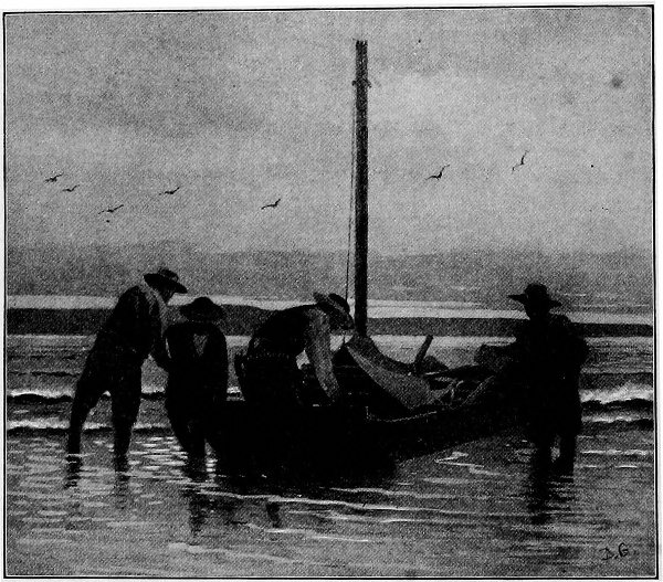
Fig. 5—Embarking on Bahia Kunkaak in la lancha Anita.
The adjunct islets of Seriland are miniatures of Tiburon in all essential respects, save that they are without fresh water. The largest is San Esteban, a somewhat complex butte rising sharply from the waters in a nearly continuous sea-cliff recording vigorous work by storms and tides; it is occasionally visited by the Seri, chiefly in search of water-fowl and eggs. The most important of the series in Seri economy and mythology is Isla Tassne, off the mouth of Bahia Kino; it is a rugged butte some 600 feet high, rising in wave-cut cliffs on the sea side and pedimented by low spits and banks of sand toward the lea; the sand-banks are literally flocked with pelicans, while other fowl cover the flatter ledges and crowd the crannies of the pinnacle. Isla Turner is a somewhat smaller and still more rugged butte, bounded on both sides by precipitous cliffs, while Roca Foca is merely a great rock shelving upward from the storm-swept waters off the most exposed angle of Tiburon; in the crannies of the former birds nest abundantly, while the lower ledges of both are haunted by seals. Isla Patos, north of Tiburon, is a breeding-place for different water-fowl, and is especially noted as a refuge for ducks; it, too, is for the most part a rocky butte, with a sandy shelf at the eastern base. Beyond San Esteban lies the similar but smaller Isla San Lorenzo, while Isla Salsipuedes and a few other islets stretch thence northward half way to the southern point of Isla Angel de la Guarda, the second-largest island of the gulf. San Lorenzo and the smaller islets are occasionally visited by the Seri, partly for a mineral pigment used in face-painting, partly in quest of game; and they sometimes push on to the larger island to enjoy its fairly abundant game, including the easily taken iguana, amid the ruins of an ancient culture apparently akin to that of southern Mexico. Even the most frequented islets, Tassne and Patos, can be reached only by crossing miles of open sea; but in their way the Seri are as canny navigators as they are skilful boat-builders—it is their habit to hug the shore in threatening weather, to await wind and tide for hours or days together, to set out on distant journeys only when all conditions favor, and in emergency to seize inspiration from the storm like the vikings of old, and bend supernormal power to the control of their craft.
Summarily, the prevailing features of Seriland may be said to be characterized by extreme development or intensity, many of them being of such sort as to be adequately described only by the aid of strong comparatives or superlatives. Seriland is the most rugged portion of piedmont Sonora, and is bounded by its most forbidding desert; the territory is nearly if not quite, the most arid and inhospitable of the Sonoran province; the diurnal and sporadic temperature-ranges are apparently the widest, and the gales and other storms apparently the severest of the entire province; the flora is among the most meager and least fruitful, and the mountains are among the craggiest of the continent; the tides are among the strongest and the tidal currents among the swiftest of the world; and, as shown by the limited direct observations and by the extraordinary marine transgression, the waters are among the most turbulent known. At the same time, the waters washing Seriland are among the richest of America in sea-food, so that the habitat is one of the easiest known for a simple life depending directly on the product of the sea. It is but natural that these extreme factors of environment should be measurably reflected in pronounced characteristics on the part of the inhabitants.