RIVERS OF CORNWALL.
Reading edition
The Minor Streams of Cornwall—The TAMAR: Woolley Barrows—Morwellham and Weir Head—Morwell Rocks—Harewood—Calstock—Cotehele—Pentillie—Confluence with the Tavy—Saltash—The Hamoaze. The FOWEY: A Change of Name—St. Neot—Lostwithiel—Fowey. The FAL: Fenton Fal—Tregony—Truro—Tregothnan—Falmouth.
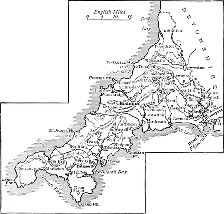
COMPARATIVELY insignificant though they may be, the rivers of Cornwall have peculiar interest alike for the geographer and the geologist, and are rife with the charms of natural scenery which attract every lover of the beautiful. If we except the Camel, which is the only river worthy of mention that flows into the Bristol Channel, the county has a southern drainage, this arising from the fact that the watershed of Cornwall is almost confined to the country contiguous to the north coast. Perhaps it is by way of compensation to the Camel, or Alan, that it has two sources. By Lanteglos and Advent its course runs through a romantic country of wood and vale, and it meets the tide at Egloshayle, thence passing Wadebridge, eight miles below which it falls into Padstow Harbour.
Of the streams possessing something of historic interest and scenic charm, the Looe must be mentioned because of the lovely vale through which it flows between Duloe and Morval and the association of the river with the ancient Parliamentary boroughs of East and West Looe at its mouth. The Seaton, the St. Austell river, the Hayle, the Gannel, and the Hel, each and all have their individuality, owing allegiance to no other river tyrannous of its tributaries; but the three principal streams of the county, the Tamar, the Fowey, and the Fal, which have been selected for special notice here, have a virtual monopoly of interest and attention. The TAMAR possesses, in a singular degree, the more striking characteristics of the Cornish rivers, and is fairly entitled to the distinction of first consideration at our hands. Having its rise at Woolley Barrows, in the extreme east of the westernmost county, a short distance from its source Tamar becomes the boundary between the counties of Devon and Cornwall, and so continues during nearly the whole of its course, some forty miles. Flowing distinctly southward, the river leads a quiet life for at least a league, till, gaining in size and importance, it gives its name to the pretty village and parish of North Tamerton. Thenceforth
“Its tranquil stream Through rich and peopled meadows finds its way.”
At St. Stephen’s-by-Launceston it receives the Werrington stream, and expands into a beautiful lake in Werrington Park. Below the lake the impetuous Attery stream joins the now brimming river, which, passing under Poulston and Greston, reaches Tavistock New Bridge, where we are on the “scientific frontier” of Devon and Cornwall. At this point, too, the Tamar enters upon a new stage of its existence, leaving its lowly moorland birth and quiet ordinary youth behind it, and beginning a career which is henceforth the cynosure of all eyes. Hurrying by Gunnislake, the busy little hamlet of workers in clay and stone, at Weir Head the river literally leaps into fame.
THE RIVERS OF CORNWALL.
From the coaching hamlet it has slided on through a woodland glade of bewitching beauty, which wins a spontaneous outburst of admiration from the visitor who, haply, has chosen to approach the favoured scene by the serpentining sylvan walk from Morwellham to Weir Head. Here its waters break in a pretty cascade over the artificial ridge of rocks that reaches from bank to bank. Then they prettily describe a circle about the islet in mid-stream, gaining new life and movement from the impetus. With the briskness of a waterslide the Tamar rushes on to Morwellham. A charming variety of river-glimpses may be gained through the luxuriant foliage at Weir Head, the views hereabouts having become the objective of the highly popular steamer-trips from Plymouth, Devonport, and Saltash, which have constituted “Up the Tamar” quite a colloquialism in the West.
The winding river gains a new glory from its beautiful and impressive surroundings as it flows at the base of Morwell Rocks, those wonderful examples of Nature’s carvings, set in the midst of luxuriant foliage that here hides their shaggy sides and there throws into bold relief an awe-inspiring pile. The Rocks are unique in their romantic beauty, even though they figure among the many objects of interest in a highly picturesque neighbourhood. The Chimney Rock and the Turret Rock are happier instances of descriptive nomenclature than usual. Bolder still is that most striking specimen of natural architecture, Morwell Rock, the massiveness of which doubtless gained for it the capital distinction. To the giddy height of the topmost rock, above the far-stretching woodland of Morwellham, scarce a sound of the rippling river comes; but the silver thread of its serpentine course may be traced afar through the romantic valley, winding about Okel Tor and the great bend that forms the peninsula between Morwellham and Calstock, and then taking its favoured way through cherry orchard-groves on to the haven under the hill.
The river is navigable to Weir Head, but Morwellham is the highest point reached by the steamers. Pursuing the line of least resistance, the Tamar now makes a tremendous sweep about the hill on which Calstock Church stands. But ere the first view of the “two-faced church” is caught, an interesting riparian residence is skirted—Harewood, the scene of Mason’s play of Elfrida, now the office of the Duchy of Cornwall, but formerly one of the Trelawny properties. Calstock, if it please you, is the centre of the old “cherry picking” district, though to-day its strawberry gardens must rival the orchards in their remunerative return to the industrious population of the quaint little town that seems to have grown away from the water’s edge to the pleasant Cornish country beyond Tamar bank. Still, if you would see Calstock in its daintiest garb and most delightful beauty, come you when the pretty cherry blossom decks the groves by the river, and the tender pink and white clothes the orchard lawns to the uplands.
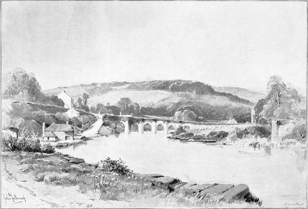
TAVISTOCK NEW BRIDGE (p. 55).
From Calstock on to Cotehele, and thence almost to the junction of the Tamar and the Tavy, the same delightful eccentricity of the river-scenery presents itself—every prominent feature re-appearing in an entirely different aspect, scarce five minutes of the river-trip passing without a variation of the point of view. A last glimpse of Calstock Church, and we are encompassed by woodland. Everywhere a luxuriant living green meets the eye. Apparently, the swelling woods and orchard lawns approach ahead and form a cul-de-sac; but the Tamar makes a sharp detour to the right or to the left, and another glory of the leafy way bursts upon the sight. Again and again the pleasing experience is repeated ere a human habitation relieves a monotony that for once is wholly charming.
Beyond the limekilns of Cotehele appears the lodge gate of Cotehele House, one of the residences of the Edgcumbe family, and a place of some historic interest. By far the most prominent feature in the fine landscape which may be viewed from a tower at the highest point of the grounds is Kit Hill, the loftiest eminence on Hingston Down, which was the scene of a last desperate battle between the Britons of Cornwall and the invading Saxons in the year 835. A beautiful valley near Cotehele, known as Danescombe to this day, is said to have taken its name from the allies whom the Cornish called to their aid in this sanguinary struggle.
Immediately below Cotehele the zig-zag course of the Tamar is most strongly marked, and nowhere are its revelations of new views and fresh charms more entrancing than where it winds about the extensive grounds of Pentillie. Shortly after we have doffed our caps in deference to the pious Sir Richard Edgcumbe, devout worshipper of the Holy Mother, who erected a church by the river-bank to commemorate his miraculous escape from the soldiers of the royal Richard, we catch a fleeting but impressive glimpse of another stately residence of a county family, on a hilly eminence clothed to its crown with thickly grown woods, the castellated mansion emerging from dense leafy environs well towards the crest. All suddenly the coquetting stream swerves to the Devonshire side, as speedily returns to caress the fair meads of Cornwall, and another glorious prospect is disclosed. A nearer view is now to be had of Pentillie Castle, lying embowered in the far-stretching woodland, the Gothic features of the lordly pleasure-house which the late owner, Mr. John Tillie Coryton, built for himself admirably harmonising with its beautiful surroundings.
Below Pentillie, the Tamar, in its ampler waters and wider course, has to be satisfied with less interesting associations. A last big bend in the river, and, past the pretty hamlet of Cargreen, we shortly find ourselves abreast of the church of St. Dilpe, at Landulph, erected very near the river-bank, on the Cornish side. The tower of St. Budeaux Church, whose melodious bells chime cheerily across the water, rises high above the Devon bank. Here the Tavy makes common cause with the Tamar, and the twin rivers flow on by Saltash into the Hamoaze. Nearly opposite the mouth of the Tavy, on the Cornish side, is the ecclesiastical parish of St. Stephen-by-Saltash, with the ruins of Trematon Castle at the summit of a well-wooded hill. The castle is believed to have been built at the period of the Conquest, and was subsequently held by the Earls of Cornwall.
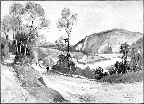
MORWELL ROCKS (p. 55).
At Saltash—as the Western men will not forget to remind the boasting Cockney—the Tamar is wider than the Thames at Westminster. Saltash itself, by the way, was originally (according to Carew) Villa de Esse, after a family of that name, and to this was added “Salt,” on account of its “marine situation.” The busy little waterside town has this great dignity—that its Mayor and Corporation take precedence of those of Plymouth and Devonport. Saltash has gradually, through many generations, built itself up a steep, rocky acclivity until the habitations extend to the summit of the hill at Longstone, from which favoured eminence the prospect is very fine. Here may we see the broadened river where the ebbing tide swirls by the Mount Edgcumbe training-ship, that is swinging round on its tidal pivot just above Brunel’s great bridge; thence, flowing beneath the wondrous iron link of the two westernmost counties with which the engineer spanned the river, here half a mile across, the Tamar, now joined by the Lynher from the West, loses its identity in the all-embracing Hamoaze, with its wood-fringed shores; the river passing unremarked into Plymouth Harbour, from the Harbour to the Sound, and from the Sound to the Channel—forgotten now in the great affairs of navies, and the thrilling stories of the seas on which Drake and Hawkins, Raleigh and Grenville, sailed to fight the Spaniard. From haunts of peace, the Tamar, itself a pleasant stream, has flowed through scenes of rare beauty to these so warlike surroundings, where its current eddies about the decaying hulks on whose decks the old sea-dogs died, where its waters wash arsenal, dock, and victualling yard, and where it oft bears on its broad bosom a mighty fleet of men-of-war.
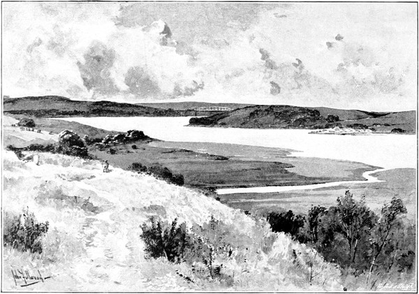
CARGREEN (p. 58).
At the foot of Brown Willy, Cornwall’s highest hill, in the parish of St. Breward, there is an aqueous locality in which the water-finder might exercise his art of divination with the utmost confidence, if, indeed, he did not find his occupation gone by reason of the abundance of the surface water. This is Foy-Fenton, and here the FOWEY rises. As, to this day, Fowey becomes “Foy” in the naming of the boats that boast the prettiest harbour in the county for their port, one may easily discover a close association in the nomenclature of the sites and scenes at the beginning and the end of this very charming stream. In its course, curiously enough, the river changes its name. Where it flows southward through the moorlands between St. Neot and St. Cleer, it is called the Dranes (or Dreynes) river; and fishermen from the “model borough” of Liskeard, who love to flog its pleasant waters for the toothsome trout that they harbour, would be prepared to contend, in the face of the maps and in the presence of geographers, that it is the Dranes river, and no other. In flood-time a strong stream that gives the road-surveyor endless trouble, the Fowey, leaping along its bouldered way, here and there lightening its journey by falling in picturesque cascades, scattering its showers of iridescent spray over the thick foliage that everywhere clothes its banks, runs almost level with the main road to St. Neot—a village noted for its window-pictured legend of St. Neot and the miraculous supply of fish, in the parish church—where it receives a goodly stream of that name. Increasing the beauty and interest of its course with every mile it travels, the river by-and-by glides into the far-stretching woodland of Glynn, the seat of Lord Vivian, and then becomes one of the principal contributors to the scenic charms of the railway-side from Devonport to Par, which Miss Braddon describes as the most delightful of all journeys by rail.
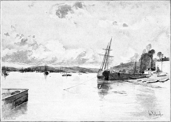
THE HAMOAZE FROM SALTASH (p. 59).
After leaving its moorland haunts, and in order to reach Glynn, the Fowey took a westerly turn, but, Bodmin once skirted, the river runs directly southward again, under Resprin bridge and past Lanhydrock House, the Cornish home of that Lord Robartes who was the leader of the Parliamentarian forces in these parts. The ancient mansion, of the Tudor period, passed through many crises, and, together with modern additions, was practically destroyed by fire in 1881, and rebuilt in 1883–4. The next object of interest seen from the river is the ruin of Restormel Castle, on the summit of a bold headland a mile from Lostwithiel. The building of the castle is ascribed to the Cardenhams, who flourished hereabouts in the reign of the first Edward; and it was once the residence of the Earls of Cornwall.
At Lostwithiel—the Uzella of Ptolemy—the Fowey is crossed by an ancient and narrow bridge of eight pointed arches, erected in the fourteenth century. The bridge is very strongly buttressed, and over each buttress is an angular niche. A silver oar, which is among the insignia of the Corporation, bears the inscription: “Custodia aquæ de Fowey.” The celebrated Colonel Silas Titus, author of “Killing noe Murder,” Member of Parliament for the borough 1663–79, was the donor of the oar. Lostwithiel, where the river meets the tide, at once becoming navigable for small vessels, boasts great antiquity, and in 1664 was the headquarters of the Parliamentarian forces in Cornwall.
Here, below Lostwithiel’s ancient bridge, let us take boat and taste of the ineffable enjoyment which laureates of the Fowey have attributed to a sail or a row down the romantic stream to the mouth of the harbour, where the sailors sing their chanties as they work the merchantmen out between the old towers whence chains were stretched across the harbour in the stirring days when the Spaniard sailed the main. Sing hey, sing ho, for indeed life is worth living when the soft zephyrs blow, and we glide by the prettily placed church of St. Winnow, and catch the musical chiming of its melodious peal of bells. “Youth on the prow, and Pleasure at the helm,” our delight knows no surcease, but rather grows as, something less than three miles below the old Parliamentary borough, the banks open out, and we behold that daydream of scenic beauty, the sunlit reaches of the river winding away toward the sea. One branch of this estuary, by-the-by, flows to St. Veep, which has an interesting church. The Lerrin and St. Cadoc creeks yet further enrich a river which Nature has endowed with charms so abundant. Bodinnoc Ferry is a name to conjure with in yachting circles, since there is not one log among the many of the pleasure-boats that make for the “little Dartmouth” of the Far West in the height of summer but contains some fine compliment to the rare beauty of the view, landward and seaward, from this familiar tacking point. No wonder that Fowey Harbour shares with its Devonshire rival the generous tribute of sportsmen, who have lavished upon each of these picturesque ports effusive praise that has its point in the proud title of the “Yachtsman’s Paradise.” Long ere these pleasure-seeking days was the discovery of Fowey’s possession of a safe and commodious harbour made: “The shippes of Fowey sayling by Rhie and Winchelsey, about Edward the IIIrd tyme, would vayle no bonnet beying required, whereupon Rhie and Winchelsey men and they fought, when Fowie men had victorie, and thereupon bare their arms mixt with the arms of Rhie and Winchelsey, and then rose the name of the Gallants of Fowey.” But Leland knew that they deserved the title long years before, as “the glorie of Fowey rose by the warres in King Edward I. and III. and Henry V.’s day, partly by feats of warre, partly by piracie, and so waxing rich fell all to merchandize.”
Fowey took so naturally and keenly to the practice of piracy that the “gallants” had a little affair at sea with the French on their own account and against the King’s treaty and commandment, in the reign of the fourth Edward, who appears not to have been well pleased, since he took the head of one of their number, imprisoned the captains, and sent men of Dartmouth down to seize their ships and remove the chain then drawn across the mouth of the haven. But the “gallants” were nothing daunted, and in the time of Charles II. their successors beat off eighty Dutch ships of war that, greatly daring, had chased a fleet of merchantmen into Fowey Harbour. St. Finbarrus, first Bishop of Cork, is said to have been buried in the church, which is dedicated to him, and is a handsome structure. Place House, the seat of the Treffry family, besides being a noble mansion, gloriously dight with very fine specimens of Cornish granite and porphyry, is of great historic interest. It was Elizabeth, wife of Thomas Treffry—an ancient statue of whom stands in the grounds—who, in the absence of her husband, headed his men and beat off the French in an assault on Place House in July, 1457.
Along its course of but twenty miles, four of which are tidal, the FAL divides the county into two nearly equal parts. Fenton Fal, in Tregoss Moor, is the birthplace of the stream; and from the moorland it receives the tributary waters of many peaty rivulets before gaining entrance to the romantic vale of Treviscoe, which gives us a foretaste of that feast of the beautiful which the Fal affords in its lower reaches. Compared with what goes before and follows after, the course of the stream by Grampound (the Voluba of Ptolemy), through Creed valley, where it leaves Tregony on its left bank, and on to Ruan, is somewhat lacking in interest, and the river itself is of no great strength. Ere tin-streaming and the sandbanks had done their mischief, you might have reached Tregony on the top of the tide; nowadays the ebb and flow affect the river no farther than Ruan. Yet this has sufficed to gain for the Fal a glorious name. Perhaps the finest compliment ever paid to the river fell from royal lips. When the Queen, accompanied by the Prince Consort, made the trip down the Fal from Truro in 1864, she was visibly impressed with the beauty and splendour of the scenery, and particularly charmed with the view about Tregothnan. Her Majesty was reminded by it of the Rhine, but thought it almost finer where winding between woods of stunted oaks, and full of numberless creeks.
At Truro, the two little rivers, Kenwyn and Allen, flow through the city into a creek of the Fal, known as Truro river; the first-named separates St. Mary’s from St. Paul’s, while the second divides the parish of St. Mary from that of St. John. The little Kenwyn is “personally conducted” through the streets of the cathedral town by the Corporation, in open conduits, and forms a not unpleasant feature of the tiny city in Western Barbary whose inhabitants were once said to have a good conceit of themselves: “The people of this town dress and live so elegantly that the pride of Truro is become a by-word in the county.” The most modern of our English cathedrals is a monument to the pious zeal, marvellous industry, and unquenchable enthusiasm of Dr. Benson, the first Bishop of Truro, afterwards Archbishop of Canterbury. The Prince of Wales laid the foundation stone in 1880, and its consecration took place seven years later. The style is Early English of the thirteenth century, and at present the cathedral but partially realises the ambitious design of the architect, who planned a very imposing edifice, which, in the event of its ultimate completion, must inevitably challenge comparison with the most notable of modern achievements in the Gothic. Already it possesses several splendid windows and many beautiful specimens of modern sculpture.
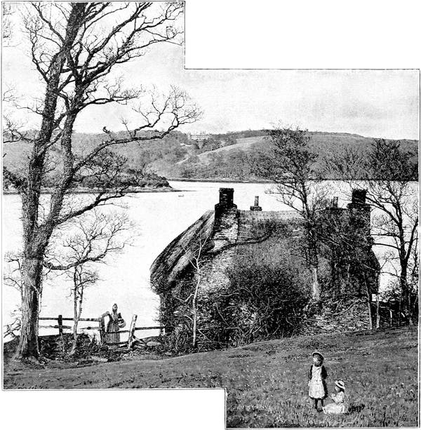
Photo: F. Argall, Truro.
THE FAL FROM TOLVERNE (p. 65).
The prettiest parts of our river lie between King Harry’s Passage and Roseland. Below Tregothnan, where the Fal unites with the Truro river and St. Clement’s creek, both shores are beautifully clothed with wood, and the fine expanse of water at high tide lends a nobility and magnificence to the scene which affords ample occasion for the high-flown descriptions and lavish praise bestowed upon the Fal. On the right are the grounds of Trelissick; and a picturesque glimpse of the stream may be caught near the estuary called Malpas Road, by the ferry at Tolverne. After dividing Mylor from St. Just, the river loses its identity in forming Carrick Road, and shortly expands into the splendid haven of Falmouth Harbour. The inner part, between Trefusis Point, Pendennis, and the town, is called King’s Road. Carrick Road, where the river enters, forms the middle of the harbour, and midway between the entrance—which is from Pendennis Point to St. Anthony’s Head—there lies the ominously-named Black Rock, around which the Mayor of Truro sailed in June, 1709, when he sought to exercise jurisdiction over the port and harbour of Falmouth. But the citizens of the port themselves had had a powerful friend at Court, in the person of King Charles II., who had given Falmouth a charter overriding the ancient claims of Truro, by which the Mayor of the latter town had levied dues on all goods laden or unladen in any part of the Fal, from Truro to the Black Rock; and a trial at law in the same year finally established home rule in Falmouth Harbour.
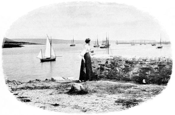
Photo: Frith & Co., Reigate.
FALMOUTH HARBOUR.
Though to-day its prosperity is scarcely commensurate with its natural advantages, the harbour still remains almost unrivalled. First port of call for homeward-bound vessels, with a depth of water and safe anchorage that many another harbour might envy, and sheltered from all the winds that blow save those from the south-south-east, it is so capacious that the whole British fleet could ride at anchor in its waters. Falmouth as a town owes its existence to these striking features of its harbour. Beholding them, it struck the shrewd sons of the House of Killigrew, Lords of Arwenack (there is an Arwenack Street to this day), who flourished in the time of James I., that there was no earthly reason why vessels should go seven miles to Truro, or two miles to Penryn, for a port when an infinitely better one might be created at the very mouth of the harbour. Vested interests, as represented by the communities of Truro, Penryn, and Helston, offered stout opposition. But the silver-tongued Lords of Arwenack prevailed in the argument before King James, and it was not long ere Falmouth was the first port in Cornwall. Its great era of prosperity exemplifies the adage that it’s an ill wind that blows nobody good, for, during our wars with the French, Falmouth became a mail packet station, and flourished exceedingly on “Government service.”
It was the boast of proud Falmouthians that a hundred vessels could ride in the creeks of Falmouth Harbour and yet that no two should be in sight of each other. How this might be may be understood in part when it is explained that, besides many smaller arms, there are five principal creeks. Of these branches not the least is that which was probably the earliest used, to Penryn; there is a second to Restronguet and Perranarworthal; a third, also of ancient use, to Truro and Tresillian Bridge; a fourth running up to St. Mawes and Gerrans; and the fifth and greatest, to King Harry’s Reach, toward Tregony, which is the main stream of our Fal.
HUGH W. STRONG.
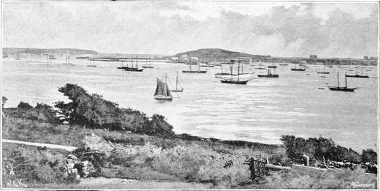
Photo: Frith & Co., Reigate.
FALMOUTH, FROM FLUSHING.
THE ISLE OF ATHELNLY (p. 68).