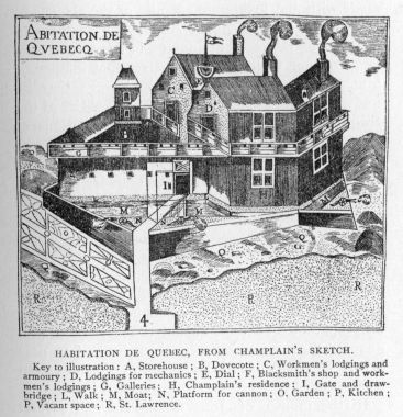
THE STORY OF CANADA.
Reading edition
I.
INTRODUCTION.
THE CANADIAN DOMINION FROM OCEAN TO OCEAN.
The view from the spacious terrace on the verge of the cliffs of Quebec, the ancient capital of Canada, cannot fail to impress the imagination of the statesman or student versed in the history of the American continent, as well as delight the eye of the lover of the picturesque. Below the heights, to whose rocks and buildings cling so many memories of the past, flows the St. Lawrence, the great river of Canada, bearing to the Atlantic the waters of the numerous lakes and streams of the valley which was first discovered and explored by France, and in which her statesmen saw the elements of empire. We see the tinned roofs, spires and crosses of quaint churches, hospitals and convents, narrow streets winding among the rocks, black-robed priests and sombre nuns, habitans in homespun from the neighbouring villages, modest gambrel-roofed houses of the past crowded almost out of sight by obtrusive lofty structures of the present, the massive buildings of the famous seminary and university which bear the name of Laval, the first great bishop of that Church which has always dominated French Canada. Not far from the edge of the terrace stands a monument on which are inscribed the names of Montcalm and Wolfe, enemies in life but united in death and fame. Directly below is the market which recalls the name of Champlain, the founder of Quebec, and his first Canadian home at the margin of the river. On the same historic ground we see the high-peaked roof and antique spire of the curious old church, Notre-Dame des Victoires, which was first built to commemorate the repulse of an English fleet two centuries ago. Away beyond, to the left, we catch a glimpse of the meadows and cottages of the beautiful Isle of Orleans, and directly across the river are the rocky hills covered with the buildings of the town, which recalls the services of Lévis, whose fame as a soldier is hardly overshadowed by that of Montcalm. The Union-jack floats on the tall staff of the citadel which crowns the summit of Cape Diamond, but English voices are lost amid those of a people who still speak the language of France.
As we recall the story of these heights, we can see passing before us a picturesque procession: Sailors from the home of maritime enterprise on the Breton and Biscayan coasts, Indian warriors in their paint and savage finery, gentlemen-adventurers and pioneers, rovers of the forest and river, statesmen and soldiers of high ambition, gentle and cultured women who gave up their lives to alleviate suffering and teach the young, missionaries devoted to a faith for which many have died. In the famous old castle of Saint Louis,[1] long since levelled to the ground—whose foundations are beneath a part of this very terrace—statesmen feasted and dreamt of a French Empire in North America. Then the French dominion passed away with the fall of Quebec, and the old English colonies were at last relieved from that pressure which had confined them so long to the Atlantic coast, and enabled to become free commonwealths with great possibilities of development before them. Yet, while England lost so much in America by the War of Independence, there still remained to her a vast northern territory, stretching far to the east and west from Quebec, and containing all the rudiments of national life—
"The raw materials of a State, Its muscle and its mind."
A century later than that Treaty of Paris which was signed in the palace of Versailles, and ceded Canada finally to England, the statesmen of the provinces of this northern territory, which was still a British possession,—statesmen of French as well as English Canada—assembled in an old building of this same city, so rich in memories of old France, and took the first steps towards the establishment of that Dominion, which, since then, has reached the Pacific shores.
It is the story of this Canadian Dominion, of its founders, explorers, missionaries, soldiers, and statesmen, that I shall attempt to relate briefly in the following pages, from the day the Breton sailor ascended the St. Lawrence to Hochelaga until the formation of the confederation, which united the people of two distinct nationalities and extends over so wide a region—so far beyond the Acadia and Canada which France once called her own. But that the story may be more intelligible from the beginning, it is necessary to give a bird's-eye view of the country, whose history is contemporaneous with that of the United States, and whose territorial area from Cape Breton to Vancouver—the sentinel islands of the Atlantic and Pacific approaches—is hardly inferior to that of the federal republic.
Although the population of Canada at present does not exceed nine millions of souls, the country has, within a few years, made great strides in the path of national development, and fairly takes a place of considerable importance among those nations whose stories have been already told; whose history goes back to centuries when the Laurentian Hills, those rocks of primeval times, looked down on an unbroken wilderness of forest and stretches of silent river. If we treat the subject from a strictly historical point of view, the confederation of provinces and territories comprised within the Dominion may be most conveniently grouped into several distinct divisions. Geographers divide the whole country lying between the two oceans into three well-defined regions: 1. The Eastern, extending from the Atlantic to the head of Lake Superior. 2. The Central, stretching across the prairies and plains to the base of the Rocky Mountains. 3. The Western, comprising that sea of mountains which at last unites with the waters of the Pacific. For the purposes of this narrative, however, the Eastern and largest division—also the oldest historically—must be separated into two distinct divisions, known as Acadia and Canada in the early annals of America.
The first division of the Eastern region now comprises the provinces of Nova Scotia, New Brunswick, and Prince Edward Island, which, formerly, with a large portion of the State of Maine, were best known as Acadie,[2] a memorial of the Indian occupation before the French régime. These provinces are indented by noble harbours and bays, and many deep rivers connect the sea-board with the interior. They form the western and southern boundaries of that great gulf or eastern portal of Canada, which maritime adventurers explored from the earliest period of which we have any record. Ridges of the Appalachian range stretch from New England to the east of these Acadian provinces, giving picturesque features to a generally undulating surface, and find their boldest expression in the northern region of the island of Cape Breton. The peninsula of Nova Scotia is connected with the neighbouring province of New Brunswick by a narrow isthmus, on one side of which the great tides of the Bay of Fundy tumultuously beat, and is separated by a very romantic strait from the island of Cape Breton. Both this isthmus and island, we shall see in the course of this narrative, played important parts in the struggle between France and England for dominion in America. This Acadian division possesses large tracts of fertile lands, and valuable mines of coal and other minerals. In the richest district of the peninsula of Nova Scotia were the thatch-roofed villages of those Acadian farmers whose sad story has been told in matchless verse by a New England poet, and whose language can still be heard throughout the land they loved, and to which some of them returned after years of exile. The inexhaustible fisheries of the Gulf, whose waters wash their shores, centuries ago attracted fleets of adventurous sailors from the Atlantic coast of Europe, and led to the discovery of Canada and the St. Lawrence. It was with the view of protecting these fisheries, and guarding the great entrance to New France, that the French raised on the southeastern shores of Cape Breton the fortress of Louisbourg, the ruins of which now alone remain to tell of their ambition and enterprise.
Leaving Acadia, we come to the provinces which are watered by the St. Lawrence and the Great Lakes, extending from the Gulf to the head of Lake Superior, and finding their northern limits in the waters of Hudson's Bay. The name of Canada appears to be also a memorial of the Indian nations that once occupied the region between the Ottawa and Saguenay rivers. This name, meaning a large village or town in one of the dialects of the Huron-Iroquois tongue, was applied, in the first half of the sixteenth century, to a district in the neighbourhood of the Indian town of Stadacona, which stood on the site of the present city of Quebec. In the days of French occupation the name was more generally used than New France, and sometimes extended to the country now comprised in the provinces of Ontario and Quebec, or, in other words, to the whole region from the Gulf to the head of Lake Superior. Finally, it was adopted as the most appropriate designation for the new Dominion that made a step toward national life in 1867.
The most important feature of this historic country is the remarkable natural highway which has given form and life to the growing nation by its side—a river famous in the history of exploration and war—a river which has never-failing reservoirs in those great lakes which occupy a basin larger than Great Britain—a river noted for its long stretch of navigable waters, its many rapids, and its unequalled Falls of Niagara, around all of which man's enterprise and skill have constructed a system of canals to give the west a continuous navigation from Lake Superior to the ocean for over two thousand miles. The Laurentian Hills—"the nucleus of the North American continent"—reach from inhospitable, rock-bound Labrador to the north of the St. Lawrence, extend up the Ottawa valley, and pass eventually to the northwest of Lakes Huron and Superior, as far as the "Divide" between the St. Lawrence valley and Hudson's Bay, but display their boldest forms on the north shore of the river below Quebec, where the names of Capes Eternity and Trinity have been so aptly given to those noble precipices which tower above the gloomy waters of the Saguenay, and have a history which "dates back to the very dawn of geographical time, and is of hoar antiquity in comparison with that of such youthful ranges as the Andes and the Alps." [3]
From Gaspe, the southeastern promontory at the entrance of the Gulf, the younger rocks of the Appalachian range, constituting the breast-bone of the continent, and culminating at the north in the White Mountains, describe a great curve southwesterly to the valley of the Hudson; and it is between the ridge-like elevations of this range and the older Laurentian Hills that we find the valley of the St. Lawrence, in which lie the provinces of Quebec and Ontario.
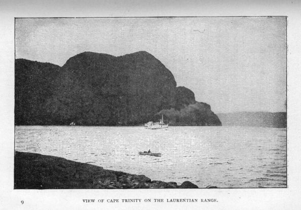
View of Cape Trinity on the Laurentian Range.
The province of Quebec is famous in the song and story of Canada; indeed, for a hundred and fifty years, it was Canada itself. More than a million and a quarter of people, speaking the language and professing the religion of their forefathers, continue to occupy the country which extends from the Gulf to the Ottawa, and have made themselves a power in the intellectual and political life of Canada. Everywhere do we meet names that recall the ancient régime—French kings and princes, statesmen, soldiers, sailors, explorers, and adventurers, compete in the national nomenclature with priests and saints. This country possesses large tracts of arable land, especially in the country stretching from the St. Lawrence to Lake Champlain, and watered by the Richelieu, that noted highway in Canadian history. Even yet, at the head-waters of its many rivers, it has abundance of timber to attract the lumberman.
The province of Ontario was formerly known as Upper or Western Canada, but at the time of the union it received its present name because it largely lies by the side of the lake which the Hurons and more famous Iroquois called "great." It extends from the river of the Ottawas—the first route of the French adventurers to the western lakes as far as the northwesterly limit of Lake Superior, and is the most populous and prosperous province of the Dominion on account of its wealth of agricultural land, and the energy of its population. Its history is chiefly interesting for the illustrations it affords of Englishmen's successful enterprise in a new country. The origin of the province must be sought in the history of those "United Empire Loyalists," who left the old colonies during and after the War of Independence and founded new homes by the St. Lawrence and great lakes, as well as in Nova Scotia and New Brunswick, where, as in the West, their descendants have had much influence in moulding institutions and developing enterprise.
In the days when Ontario and Quebec were a wilderness, except on the borders of the St. Lawrence from Montreal to the Quebec district, the fur-trade of the forests that stretched away beyond the Laurentides, was not only a source of gain to the trading companies and merchants of Acadia and Canada, but was the sole occupation of many adventurers whose lives were full of elements which assume a picturesque aspect at this distance of time. It was the fur-trade that mainly led to the discovery of the great West and to the opening up of the Mississippi valley. But always by the side of the fur-trader and explorer we see the Recollet or Jesuit missionary pressing forward with the cross in his hands and offering his life that the savage might learn the lessons of his Faith.
As soon as the Mississippi was discovered, and found navigable to the Gulf of Mexico, French Canadian statesmen recognised the vantage-ground that the command of the St. Lawrence valley gave them in their dreams of conquest. Controlling the Richelieu, Lake Champlain, and the approaches to the Hudson River, as well as the western lakes and rivers which gave easy access to the Mississippi, France planned her bold scheme of confining the old English colonies between the Appalachian range of mountains and the Atlantic Ocean, and finally dominating the whole continent.
So far we have been passing through a country where the lakes and rivers of a great natural basin or valley carry their tribute of waters to the Eastern Atlantic; but now, when we leave Lake Superior and the country known as Old Canada, we find ourselves on the northwestern height of land and overlooking another region whose great rivers—notably the Saskatchewan, Nelson, Mackenzie, Peace, Athabasca, and Yukon—drain immense areas and find their way after many circuitous wanderings to Arctic seas.
The Central region of Canada, long known as Rupert's Land and the Northwestern Territory, gradually ascends from the Winnipeg system of lakes, lying to the northwest of Lake Superior, as far as the foothills of the Rocky Mountains, and comprises those plains and prairies which have been opened up to civilisation within two decades of years, and offer large possibilities of power and wealth in the future development of the New Dominion. It is a region remarkable for its long rivers, in places shallow and rapid, and extremely erratic in their courses through the plains.
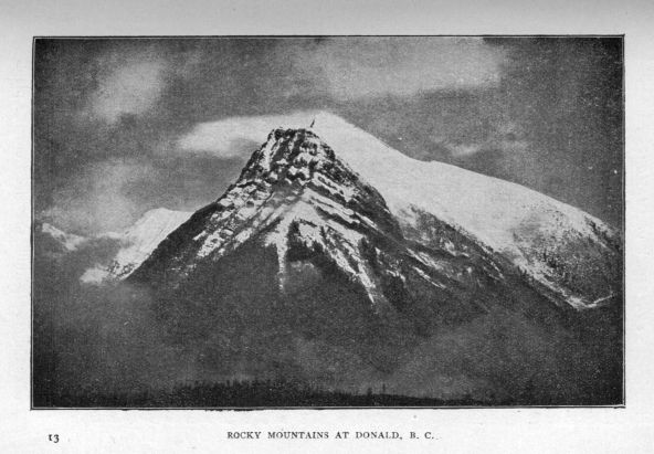
Rocky Mountains at Donald, B.C.
Geologists tell us that at some remote period these great central plains, now so rich in alluvial deposits, composed the bed of a sea which extended from the Arctic region and the ancient Laurentian belt as far as the Gulf of Mexico and made, in reality, of the continent, an Atlantis—that mysterious island of the Greeks. The history of the northwest is the history of Indians hunting the buffalo and fur-bearing animals in a country for many years under the control of companies holding royal charters of exclusive trade and jealously guarding their game preserves from the encroachments of settlement and attendant civilisation. French Canadians were the first to travel over the wide expanse of plain and reach the foothills of the Rockies a century and a half ago, and we can still see in this country the Métis or half-breed descendants of the French Canadian hunters and trappers who went there in the days when trading companies were supreme, and married Indian women. A cordon of villages, towns, and farms now stretches from the city of Winnipeg, built on the site of the old headquarters of the Hudson's Bay Company, as far as the Rocky Mountains. Fields of golden grain brighten the prairies, where the tracks of herds of buffalo, once so numerous but now extinct, still deeply indent the surface of the rich soil, and lead to some creek or stream, on whose banks grows the aspen or willow or poplar of a relatively treeless land, until we reach the more picturesque and well-wooded and undulating country through which the North Saskatchewan flows. As we travel over the wide expanse of plain, only bounded by the deep blue of the distant horizon, we become almost bewildered by the beauty and variety of the flora, which flourish on the rich soil; crocuses, roses, bluebells, convolvuli, anemones, asters, sunflowers, and other flowers too numerous to mention, follow each other in rapid succession from May till September, and mingle with
"The billowy bays of grass ever rolling in shadow and sunshine."
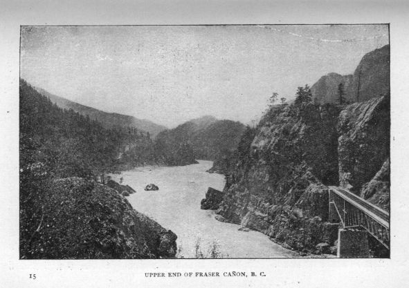
Upper end of Fraser Cañon, B.C.
Ascending the foothills that rise from the plains to the Rocky Mountains we come to the Western region, known as British Columbia, comprising within a width varying from four to six hundred miles at the widest part, several ranges of great mountains which lie, roughly speaking, parallel to each other, and give sublimity and variety to the most remarkable scenery of North America. These mountains are an extension of the Cordilleran range, which forms the backbone of the Pacific coast, and in Mexico rises to great volcanic ridges, of which the loftiest are Popocatepétl and Iztaccíhuatl. Plateaus and valleys of rich, gravelly soil lie within these stately ranges.
Here we find the highest mountains of Canada, some varying from ten to fifteen thousand feet, and assuming a grandeur which we never see in the far more ancient Laurentides, which, in the course of ages, have been ground down by the forces of nature to their relatively diminutive size. Within the recesses of these stupendous ranges there are rich stores of gold and silver, while coal exists most abundantly on Vancouver [Transcriber's note: Island?].
The Fraser, Columbia, and other rivers of this region run with great swiftness among the cañons and gorges of the mountains, and find their way at last to the Pacific. In the Rockies, properly so called, we see stupendous masses of bare, rugged rock, crowned with snow and ice, and assuming all the grand and curious forms which nature loves to take in her most striking upheavals. Never can one forget the picturesque beauty and impressive grandeur of the Selkirk range, and the ride by the side of the broad, rapid Fraser, over trestle-work, around curves, and through tunnels, with the forest-clad mountains ever rising as far as the eye can reach, with glimpses of precipices and cañons, of cataracts and cascades that tumble down from the glaciers or snow-clad peaks, and resemble so many drifts of snow amid the green foliage that grows on the lowest slopes. The Fraser River valley, writes an observer, "is one so singularly formed, that it would seem that some superhuman sword had at a single stroke cut through a labyrinth of mountains for three hundred miles, down deep into the bowels of the land." [4] Further along the Fraser the Cascade Mountains lift their rugged heads, and the river "flows at the bottom of a vast tangle cut by nature through the heart of the mountains." The glaciers fully equal in magnitude and grandeur those of Switzerland. On the coast and in the rich valleys stand the giant pines and cedars, compared with which the trees of the Eastern division seem mere saplings. The coast is very mountainous and broken into innumerable inlets and islands, all of them heavily timbered to the water's edge. The history of this region offers little of picturesque interest except what may be found in the adventures of daring sailors of various nationalities on the Pacific coast, or in the story of the descent of the Fraser by the Scotch fur-trader who first followed it to the sea, and gave it the name which it still justly bears.
The history of the Western and Central regions of the Dominion is given briefly towards the end of this narrative, as it forms a national sequence or supplement to that of the Eastern divisions, Acadia and Canada, where France first established her dominion, and the foundations were laid for the present Canadian confederation. It is the story of the great Eastern country that I must now tell in the following pages.
II.
THE DAWN OF DISCOVERY IN CANADA.
(1497-1525.)
On one of the noble avenues of the modern part of the city of Boston, so famous in the political and intellectual life of America, stands a monument of bronze which some Scandinavian and historical enthusiasts have raised to the memory of Leif, son of Eric the Red, who, in the first year of the eleventh century, sailed from Greenland where his father, an Icelandic jarl or earl, had founded a settlement. This statue represents the sturdy, well-proportioned figure of a Norse sailor just discovering the new lands with which the Sagas or poetic chronicles of the North connect his name. At the foot of the pedestal the artist has placed the dragon's head which always stood on the prow of the Norsemen's ships, and pictures of which can still be seen on the famous Norman tapestry at Bayeux.
The Icelandic Sagas possess a basis of historical truth, and there is reason to believe that Leif Ericson discovered three countries. The first land he made after leaving Greenland he named Helluland on account of its slaty rocks. Then he came to a flat country with white beaches of sand, which he called Markland because it was so well wooded.
After a sail of some days the Northmen arrived on a coast where they found vines laden with grapes, and very appropriately named Vinland. The exact situation of Vinland and the other countries visited by Leif Ericson and other Norsemen, who followed in later voyages and are believed to have founded settlements in the land of vines, has been always a subject of perplexity, since we have only the vague Sagas to guide us. It may be fairly assumed, however, that the rocky land was the coast of Labrador; the low-lying forest-clad shores which Ericson called Markland was possibly the southeastern part of Cape Breton or the southern coast of Nova Scotia; Vinland was very likely somewhere in New England. Be that as it may, the world gained nothing from these misty discoveries—if, indeed, we may so call the results of the voyages of ten centuries ago. No such memorials of the Icelandic pioneers have yet been found in America as they have left behind them in Greenland. The old ivy-covered round tower at Newport in Rhode Island is no longer claimed as a relic of the Norse settlers of Vinland, since it has been proved beyond doubt to be nothing more than a very substantial stone windmill of quite recent times, while the writing on the once equally famous rock, found last century at Dighton, by the side of a New England river, is now generally admitted to be nothing more than a memorial of one of the Indian tribes who have inhabited the country since the voyages of the Norsemen.
Leaving this domain of legend, we come to the last years of the fifteenth century, when Columbus landed on the islands now often known as the Antilles—a memorial of that mysterious Antillia, or Isle of the Seven Cities, which was long supposed to exist in the mid-Atlantic, and found a place in all the maps before, and even some time after, the voyages of the illustrious Genoese. A part of the veil was at last lifted from that mysterious western ocean—that Sea of Darkness, which had perplexed philosophers, geographers, and sailors, from the days of Aristotle, Plato, Strabo, and Ptolemy. As in the case of Scandinavia, several countries have endeavoured to establish a claim for the priority of discovery in America. Some sailors of that Biscayan coast, which has given so many bold pilots and mariners to the world of adventure and exploration—that Basque country to which belonged Juan de la Cosa, the pilot who accompanied Columbus in his voyages—may have found their way to the North Atlantic coast in search of cod or whales at a very early time; and it is certainly an argument for such a claim that John Cabot is said in 1497 to have heard the Indians of northeastern America speak of Baccalaos, or Basque for cod—a name afterwards applied for a century and longer to the islands and countries around the Gulf. It is certainly not improbable that the Normans, Bretons, or Basques, whose lives from times immemorial have been passed on the sea, should have been driven by the winds or by some accident to the shores of Newfoundland or Labrador or even Cape Breton, but such theories are not based upon sufficiently authentic data to bring them under the consideration of the serious historian.
It is unfortunate that the records of history should be so wanting in definite and accurate details, when we come to the voyages of John Cabot, a great navigator, who was probably a Genoese by birth and a Venetian by citizenship. Five years after the first discovery by Columbus, John Cabot sailed to unknown seas and lands in the Northwest in the ship Matthew of Bristol, with full authority from the King of England, Henry the Seventh, to take possession in his name of all countries he might discover. On his return from a successful voyage, during which he certainly landed on the coast of British North America, and first discovered the continent of North America, he became the hero of the hour and received from Henry, a very economical sovereign, a largess of ten pounds as a reward to "hym that founde the new ile." In the following year both he and his son Sebastian, then a very young man, who probably also accompanied his father in the voyage of 1497, sailed again for the new lands which were believed to be somewhere on the road to Cipango and the countries of gold and spice and silk. We have no exact record of this voyage, and do not even know whether John Cabot himself returned alive; for, from the day of his sailing in 1498, he disappears from the scene and his son Sebastian not only becomes henceforth a prominent figure in the maritime history of the period, but has been given by his admirers even the place which his father alone fairly won as the leader in the two voyages on which England has based her claim of priority of discovery on the Atlantic coast of North America. The weight of authority so far points to a headland of Cape Breton as the prima tierra vista, or the landfall which John Cabot probably made on a June day, the four hundredth anniversary of which arrived in 1897, though the claims of a point on the wild Labrador coast and of Bonavista, an eastern headland of Newfoundland, have also some earnest advocates. It is, however, generally admitted that the Cabots, in the second voyage, sailed past the shores of Nova Scotia and of the United States as far south as Spanish Florida. History here, at all events, has tangible, and in some respects irrefutable, evidence on which to dwell, since we have before us a celebrated map, which has come down from the first year of the sixteenth century, and is known beyond doubt to have been drawn with all the authority that is due to so famous a navigator as Juan de la Cosa, the Basque pilot. On this map we see delineated for the first time the coast apparently of a continental region extending from the peninsula of Florida as far as the present Gulf of St. Lawrence, which is described in Spanish as mar descubierta por los Ingleses (sea discovered by the English), on one headland of which there is a Cavo de Ynglaterra, or English Cape. Whether this sea is the Gulf of St. Lawrence and the headland is Cape Race, the south-eastern extremity of Newfoundland, or the equally well-known point which the Bretons named on the southeastern coast of Cape Breton, are among the questions which enter into the domain of speculation and imagination. Juan de la Cosa, however, is conclusive evidence in favour of the English claim to the first discovery of Northern countries, whose greatness and prosperity have already exceeded the conceptions which the Spanish conquerors formed when they won possession of those rich Southern lands which so long acknowledged the dominion of Spain.
But Cabot's voyages led to no immediate practical results. The Bristol ships brought back no rich cargoes of gold or silver or spices, to tell England that she had won a passage to the Indies and Cathay. The idea, however, that a short passage would be discovered to those rich regions was to linger for nearly two centuries in the minds of maritime adventurers and geographers.
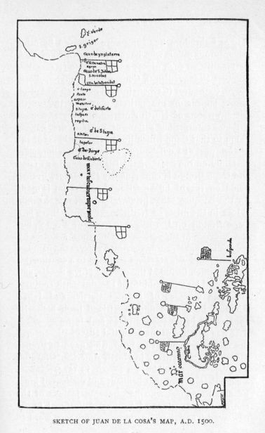
Sketch of Juan de la Cosa's map, A.D. 1500.
If we study the names of the headlands, bays, and other natural features of the islands and countries which inclose the Gulf of St. Lawrence we find many memorials of the early Portuguese and French voyagers. In the beginning of the sixteenth century Gaspar Cortereal made several voyages to the northeastern shores of Newfoundland and Labrador, and brought back with him a number of natives whose sturdy frames gave European spectators the idea that they would make good labourers; and it was this erroneous conception, it is generally thought, gave its present name to the rocky, forbidding region which the Norse voyagers had probably called Helluland five hundred years before. Both Gaspar Cortereal and his brother Miguel disappeared from history somewhere in the waters of Hudson's Bay or Labrador; but they were followed by other adventurous sailors who have left mementos of their nationality on such places as Cape Raso (Race), Boa Ventura (Bonaventure), Conception, Tangier, Porto Novo, Carbonear (Carboneiro), all of which and other names appear on the earliest maps of the north-eastern waters of North America.
Some enterprising sailors of Brittany first gave a name to that Cape which lies to the northeast of the historic port of Louisbourg. These hardy sailors were certainly on the coast of the island as early as 1504, and Cape Breton is consequently the earliest French name on record in America. Some claim is made for the Basques—that primeval people, whose origin is lost in the mists of tradition—because there is a Cape Breton on the Biscayan coast of France, but the evidence in support of the Bretons' claim is by far the strongest. For very many years the name of Bretons' land was attached on maps to a continental region, which included the present Nova Scotia, and it was well into the middle of the sixteenth century, after the voyages of Jacques Cartier and Jehan Alfonce, before we find the island itself make its appearance in its proper place and form.
It was a native of the beautiful city of Florence, in the days of Francis the First, who gave to France some claim to territory in North America. Giovanni da Verrazano, a well-known corsair, in 1524, received a commission from that brilliant and dissipated king, Francis the First, who had become jealous of the enormous pretensions of Spain and Portugal in the new world, and had on one occasion sent word to his great rival, Charles the Fifth, that he was not aware that "our first father Adam had made the Spanish and Portuguese kings his sole heirs to the earth." Verrazano's voyage is supposed on good authority to have embraced the whole North American coast from Cape Fear in North Carolina as far as the island of Cape Breton. About the same time Spain sent an expedition to the northeastern coasts of America under the direction of Estevan Gomez, a Portuguese pilot, and it is probable that he also coasted from Florida to Cape Breton. Much disappointment was felt that neither Verrazano nor Gomez had found a passage through the straits which were then, and for a long time afterwards, supposed to lie somewhere in the northern regions of America and to lead to China and India. Francis was not able to send Verrazano on another voyage, to take formal possession of the new lands, as he was engaged in that conflict with Charles which led to his defeat at the battle of Pavia and his being made subsequently a prisoner. Spain appears to have attached no importance to the discovery by Gomez, since it did not promise mines of gold and silver, and happily for the cause of civilisation and progress, she continued to confine herself to the countries of the South, though her fishermen annually ventured, in common with those of other nations, to the banks of Newfoundland. However, from the time of Verrazano we find on the old maps the names of Francisca and Nova Gallia as a recognition of the claim of France to important discoveries in North America. It is also from the Florentine's voyage that we may date the discovery of that mysterious region called Norumbega, where the fancy of sailors and adventurers eventually placed a noble city whose houses were raised on pillars of crystal and silver, and decorated with precious stones. These travellers' tales and sailors' yarns probably originated in the current belief that somewhere in those new lands, just discovered, there would be found an El Dorado. The same brilliant illusion that led Ralegh to the South made credulous mariners believe in a Norumbega in the forests of Acadia. The name clung for many years to a country embraced within the present limits of New England, and sometimes included Nova Scotia. Its rich capital was believed to exist somewhere on the beautiful Penobscot River, in the present State of Maine. A memorial of the same name still lingers in the little harbours of Norumbec, or Lorambeque, or Loran, on the southeastern coast of Cape Breton. Enthusiastic advocates of the Norse discovery and settlement have confidently seen in Norumbega, the Indian utterance of Norbega, the ancient form of Norway to which Vinland was subject, and this belief has been even emphasised on a stone pillar which stands on some ruins unearthed close to the Charles River in Massachusetts. Si non é vero è ben trovato. All this serves to amuse, though it cannot convince, the critical student of those shadowy times. With the progress of discovery the city of Norumbega was found as baseless as the fables of the golden city on the banks of the Orinoco, and of the fountain of youth among the forests and everglades of Florida.
III.
A BRETON SAILOR DISCOVERS CANADA AND ITS GREAT RIVER.
(1534-36.)
In the fourth decade of the sixteenth century we find ourselves in the domain of precise history. The narratives of the voyages of Jacques Cartier of St. Malo, that famous port of Brittany which has given so many sailors to the world, are on the whole sufficiently definite, even at this distance of three centuries and a half, to enable us to follow his routes, and recognise the greater number of the places in the gulf and river which he revealed to the old world. The same enterprising king who had sent Verrazano to the west in 1524, commissioned the Breton sailor to find a short passage to Cathay and give a new dominion to France.
At the time of the departure of Cartier in 1534 for the "new-found isle" of Cabot, the world had made considerable advances in geographical knowledge. South America was now ascertained to be a separate continent, and the great Portuguese Magellan had passed through the straits, which ever since have borne his name, and found his way across the Pacific to the spice islands of Asia. As respects North America beyond the Gulf of Mexico and the country to the North, dense ignorance still prevailed, and though a coast line had been followed from Florida to Cape Breton by Cabot, Gomez, and Verrazano, it was believed either to belong to a part of Asia or to be a mere prolongation of Greenland. If one belief prevailed more than another it was in the existence of a great sea, called on the maps "the sea of Verrazano," in what is now the upper basin of the Mississippi and the Great Lakes of the west, and which was only separated from the Atlantic by a narrow strip of land. Now that it was clear that no short passage to India and China could be found through the Gulf of Mexico, and that South America was a continental region, the attention of hopeful geographers and of enterprising sailors and adventurers was directed to the north, especially as Spain was relatively indifferent to enterprise in that region. No doubt the French King thought that Cartier would find his way to the sea of Verrazano, beyond which were probably the lands visited by Marco Polo, that enterprising merchant of Venice, whose stories of adventure in India and China read like stories of the Arabian Nights.
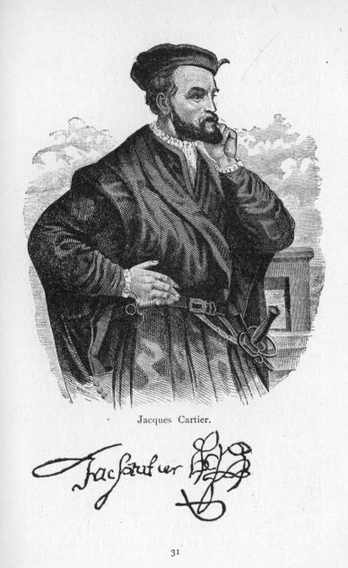
Jacques Cartier
Jacques Cartier made three voyages to the continent of America between 1534 and 1542, and probably another in 1543. The first voyage, which took place in 1534 and lasted from April until September, was confined to the Gulf of St. Lawrence, which he explored with some thoroughness after passing through the strait of Belle Isle, then called the Gulf of Castles (Chasteaux). The coast of Labrador he described with perfect accuracy as extremely forbidding, covered with rocks and moss and "as very likely the land given by God to Cain." In one of the harbours of the Labrador coast he found a fishing vessel from La Rochelle, the famous Protestant town of France, on its way to the port of Brest, then and for some time after a place of call for the fishermen who were already thronging the Gulf, where walrus, whales, and cod were so abundant. A good deal of time has been expended by historical writers on the itinerary of this voyage, the record of which is somewhat puzzling at times when we come to fix Cartier's names of places on a modern map. Confining ourselves to those localities of which there is no doubt, we know he visited and named the isle of Brion in honour of Admiral Philip de Chabot, Seigneur de Brion, who was a friend and companion of Francis, and had received from him authority to send out Cartier's expedition. The Breton saw the great sand-dunes, and red cliffs of the Magdalens rising from the sea like so many cones. It was one of these islands he probably called Alezay, though there are writers who recognise in his description a headland of Prince Edward Island, but it is not certain that he visited or named any of the bays or lagoons of that island which lies so snugly ensconced in the Gulf. We recognise the bay of Miramichi (St. Lunaire) and the still more beautiful scenery of the much larger bay of Chaleur (Heat) which he so named because he entered it on a very hot July day. There he had pleasant interviews with the natives, who danced and gave other demonstrations of joy when they received some presents in exchange for the food they brought to the strangers. These people were probably either Micmacs or Etchemins, one of the branches of the Algonquin nation who inhabited a large portion of the Northern continent. Cartier was enchanted with the natural beauties of "as fine a country as one would wish to see and live in, level and smooth, warmer than Spain, where there is abundance of wheat, which has an ear like that of rye, and again like oats, peas growing as thickly and as large as if they had been cultivated, red and white barberries, strawberries, red and white roses, and other flowers of a delightful and sweet perfume, meadows of rich grasses, and rivers full of salmon"—a perfectly true description of the beautiful country watered by the Restigouche and Metapedia rivers. Cartier also visited the picturesque bay of Gaspé, where the scenery is grand but the trees smaller and the land less fertile than in the neighbourhood of Chaleur and its rivers. On a point at the entrance of the harbour of Gaspé—an Indian name having probably reference to a split rock, which has long been a curiosity of the coast—Cartier raised a cross, thirty feet in height, on the middle of which there was a shield or escutcheon with three fleurs-de-lis, and the inscription, Vive le Roy de France. Cartier then returned to France by way of the strait of Belle Isle, without having seen the great river to whose mouth he had been so close when he stood on the hills of Gaspé or passed around the shores of desolate Anticosti.
Cartier brought back with him two sons of the Indian chief of a tribe he saw at Gaspé, who seem to have belonged to the Huron-Iroquois nation he met at Stadacona, now Quebec, when he made the second voyage which I have to describe. The accounts he gave of the country on the Gulf appear to have been sufficiently encouraging to keep up the interest of the King and the Admiral of France in the scheme of discovery which they had planned. In this second voyage of 1535-36, the most memorable of all he made to American waters, he had the assistance of a little fleet of three vessels, the Grande Hermine, the Petite Hermine, and the Emérillon, of which the first had a burden of one hundred and twenty tons—quite a large ship compared with the two little vessels of sixty tons each that were given him for his first venture. This fleet, which gave Canada to France for two centuries and a quarter, reached Newfoundland during the early part of July, passed through the strait of Belle Isle, and on the 10th of August, came to a little bay or harbour on the northern shore of the present province of Quebec, but then known as Labrador, to which he gave the name of St. Laurent, in honour of the saint whose festival happened to fall on the day of his arrival. This bay is now generally believed to be the port of Sainte Geneviève, and the name which Cartier gave it was gradually transferred in the course of a century to the whole gulf as well as to the river itself which the Breton sailor was the first to place definitely on the maps of those days of scanty geographical knowledge. Cartier led his vessels through the passage between the northern shores of Canada and the island of Anticosti, which he called Assomption, although it has long since resumed its old name, which has been gradually changed from the original Natiscotic to Naticousti, and finally to Anticosti. When the adventurers came near the neighbourhood of Trinity River on the north side of the Gulf, the two Gaspé Indians who were on board Cartier's vessel, the Grande Hermine, told them that they were now at the entrance of the kingdom of Saguenay where red copper was to be found, and that away beyond flowed the great river of Hochelaga and Canada. This Saguenay kingdom extended on the north side of the river as far as the neighbourhood of the present well-known Isle aux Coudres; then came the kingdom of Canada, stretching as far as the island of Montreal, where the King of Hochelaga exercised dominion over a number of tribes in the adjacent country.
Cartier passed the gloomy portals of the Saguenay, and stopped for a day or two at Isle aux Coudres (Coudrières) over fifty miles below Quebec, where mass was celebrated for the first time on the river of Canada, and which he named on account of the hazel-nuts he found "as large and better tasting than those of France, though a little harder." Cartier then followed the north shore, with its lofty, well-wooded mountains stretching away to the northward, and came at last to an anchorage not far from Stadacona, somewhere between the present Isle of Orleans and the mainland. Here he had an interview with the natives, who showed every confidence in the strangers when they found that the two Gaspé Indians, Taignoagny and Domagaya, were their companions. As soon as they were satisfied of this fact—and here we have a proof that these two Indians must have belonged to the same nation—"they showed their joy, danced, and performed various antics." Subsequently the lord of Donnacona, whose Indian title was Agouahana, came with twelve canoes and "made a speech according to the fashion, contorting the body and limbs in a remarkable way—a ceremony of joy and welcome." After looking about for a safe harbour, Cartier chose the mouth of the present St. Charles River, which he named the River of the Holy Cross (Sainte Croix) in honour of the day when he arrived. The fleet was anchored not far from the Indian village of Stadacona, and soon after its arrival one of the chiefs received the Frenchmen with a speech of welcome, "while the women danced and sang without ceasing, standing in the water up to their knees."
Moored in a safe haven, the French had abundant opportunity to make themselves acquainted with the surrounding country and its people. They visited the island close by, and were delighted with "its beautiful trees, the same as in France," and with the great quantities of vines "such as we had never before seen." Cartier called this attractive spot the Island of Bacchus, but changed the name subsequently to the Isle of Orleans, in honour of one of the royal sons of France. Cartier was equally charmed with the varied scenery and the fruitful soil of the country around Stadacona.
It was now the middle of September, and Cartier determined, since his men had fully recovered from the fatigues of the voyage, to proceed up the river as far as Hochelaga, of which he was constantly hearing accounts from the Indians. When they heard of this intention, Donnacona and other chiefs used their best efforts to dissuade him by inventing stories of the dangers of the navigation. The two Gaspé Indians lent themselves to the plans of the chief of Stadacona. Three Indians were dressed as devils, "with faces painted as black as coal, with horns as long as the arm, and covered with the skins of black and white dogs." These devils were declared to be emissaries of the Indian God at Hochelaga, called Cudragny, who warned the French that "there was so much snow and ice that all would die." The Gaspé Indians, who had so long an acquaintance with the religious customs and superstitions of the French, endeavoured to influence them by appeals to "Jesus" and "Jesus Maria." Cartier, however, only laughed at the tricks of the Indians, and told them that "their God Cudragny was a mere fool, and that Jesus would preserve them from all danger if they should believe in Him." The French at last started on the ascent of the river in the Emérillon and two large boats, but neither Taignoagny nor Domagaya could be induced to accompany the expedition to Hochelaga.
Cartier and his men reached the neighbourhood of Hochelaga, the Indian town on the island of Montreal, in about a fortnight's time. The appearance of the country bordering on the river between Stadacona and Hochelaga pleased the French on account of the springs of excellent water, the beautiful trees, and vines heavily laden with grapes, and the quantities of wild fowl that rose from every bay or creek as the voyagers passed by. At one place called Achelay, "a strait with a stony and dangerous current, full of rocks,"—probably the Richelieu Rapids[1] above Point au Platon—a number of Indians came on board the Emérillon, warned Cartier of the perils of the river, and the chief made him a present of two children, one of whom, a little girl of seven or eight years, he accepted and promised to take every care of. Somewhere on Lake St. Peter they found the water very shallow and decided to leave the Emérillon and proceed in the boats to Hochelaga, where they arrived on the second of October, and were met by more than "a thousand savages who gathered about them, men, women, and children, and received us as well as a parent does a child, showing great joy." After a display of friendly feeling on the part of the natives and their visitors, and the exchange of presents between them, Cartier returned to his boat in the stream. "All that night," says the narrative, "the savages remained on the shore near our boats, keeping up fires, dancing, crying out 'Aguaze,' which is their word for welcome and joy." The king or chief of this Indian domain was also called Agouahana, and was a member of the Huron-Iroquois stock.
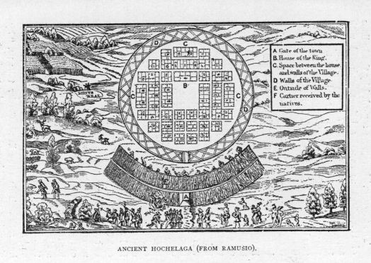
Ancient Hochelaga (from Ramusio).
The French visitors were regarded by the Indians of Hochelaga as superior beings, endowed with supernatural powers. Cartier was called upon to touch the lame, blind, and wounded, and treat all the ailments with which the Indians were afflicted, "as if they thought that God had sent him to cure them."
Cartier's narrative describes the town as circular, inclosed by three rows of palisades arranged like a pyramid, crossed at the top, with the middle stakes standing perpendicular, and the others at an angle on each side, all being well joined and fastened after the Indian fashion. The inclosing wall was of the height of two lances, or about twenty feet, and there was only one entrance through a door generally kept barred. At several points within the inclosure there were platforms or stages reached by ladders, for the purpose of protecting the town with arrows, and rocks, piles of which were close at hand. The town contained fifty houses, each about one hundred feet in length and twenty-five or thirty in width, and constructed of wood, covered with bark and strips of board. These "long houses" were divided into several apartments, belonging to each family, but all of them assembled and ate in common. Storehouses for their grain and food were provided. They dried and smoked their fish, of which they had large quantities. They pounded the grain between flat stones and made it into dough which they cooked also on hot rocks. This tribe lived, Cartier tells us, "by ploughing and fishing alone," and were "not nomadic like the natives of Canada and the Saguenay."
Cartier and several of his companions were taken by the Indians to the mountain near the town of Hochelaga, and were the first Europeans to look on that noble panorama of river and forest which stretched then without a break over the whole continent, except where the Indian nations had made, as at Hochelaga, their villages and settlements. From that day to this the mountain, as well as the great city which it now overlooks in place of a humble Indian town, has borne the name which Cartier gave as a tribute to its unrivalled beauty. As we look from the royal mountain on the beautiful elms and maples rising in the meadows and gardens of an island, bathed by the waters of two noble rivers—the green of the St. Lawrence mingling with the blue of the Ottawa—on the many domes and towers of churches, convents, and colleges, on the stately mansions of the rich, on the tall chimneys of huge factories and blocks upon blocks of massive stores and warehouses, on the ocean steamers on their way to Europe by that very river which Cartier would not ascend with the Emérillon; as we look on this beauteous and inspiriting scene, we may well understand how it is that Canada has placed on Montreal the royal crown which Cartier first gave to the mountain he saw on a glorious October day when the foliage was wearing the golden and crimson tints of a Canadian autumn.
On Cartier's return to Stadacona he found that his officers had become suspicious of the intentions of the Indians and had raised a rude fort near the junction of the river of St. Croix and the little stream called the Lairet. Here the French passed a long and dreary winter, doubtful of the friendship of the Indians, and suffering from the intense cold to which they were unaccustomed. They were attacked by that dreadful disease, the scurvy, which caused the death of several men, and did not cease its ravages until they learned from an Indian to use a drink evidently made from spruce boughs. Then the French recovered with great rapidity, and when the spring arrived they made their preparations to return to France. They abandoned the little Hermine, as the crew had been so weakened by sickness and death. They captured Donnacona and several other chiefs and determined to take them to France "to relate to the king the wonders of the world Donnacona [evidently a great story-teller] had seen in these western countries, for he had assured us that he had been in the Saguenay kingdom, where are infinite gold, rubies, and other riches, and white men dressed in woollen clothing." In the vicinity of the fort, at the meeting of the St. Croix and Lairet, Cartier raised a cross, thirty-five feet in height under the cross-bar of which there was a wooden shield, showing the arms of France and the inscription
FRANCISCUS PRIMUS DEI GRATIA FRANCORUM REX REGNAT.
When three centuries and a half had passed, a hundred thousand French Canadians, in the presence of an English governor-general of Canada, a French Canadian lieutenant-governor and cardinal archbishop, many ecclesiastical and civil dignitaries, assisted in the unveiling of a noble monument in memory of Jacques Cartier and his hardy companions of the voyage of 1535-36, and of Jean de Brebeuf, Ennemond Massé, and Charles Lalemant, the missionaries who built the first residence of the Jesuits nearly a century later on the site of the old French fort, and one of whom afterwards sacrificed his life for the faith to which they were all so devoted.
On the return voyage Cartier sailed to the southward of the Gulf, saw the picturesque headlands of northern Cape Breton, remained a few days in some harbours of Newfoundland, and finally reached St. Malo on the sixteenth of July, with the joyful news that he had discovered a great country and a noble river for France.
IV.
FROM CARTIER TO DE MONTS.
(1540-1603.)
The third voyage made by Cartier to the new world, in 1541, was relatively of little importance. Donnacona and the other Indians of Stadacona, whom the French carried away with them, never returned to their forest homes, but died in France. During the year Cartier remained in Canada he built a fortified post at Cap Rouge, about seven miles west of the heights of Quebec, and named it Charlesbourg in honour of one of the sons of Francis the First. He visited Hochelaga, and attempted to pass up the river beyond the village, but was stopped by the dangerous rapids now known as the St. Louis or Lachine. He returned to France in the spring of 1542, with a few specimens of worthless metal resembling gold which he found among the rocks of Cap Rouge, and some pieces of quartz crystal which he believed were diamonds, and which have given the name to the bold promontory on which stand the ancient fortifications of Quebec.
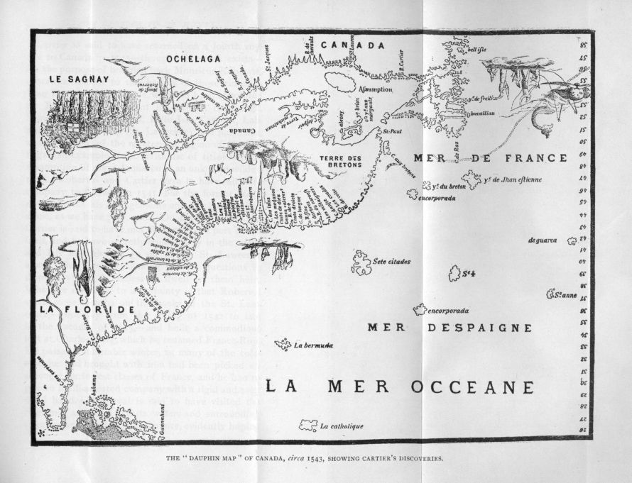
The "Dauphin Map" of Canada, circa 1543, showing Cartier's Discoveries.
Cartier is said to have returned on a fourth voyage to Canada in 1543—though no record exists—for the purpose of bringing back Monsieur Roberval, otherwise known to the history of those times as Jean François de la Roque, who had been appointed by Francis his lieutenant in Canada, Hochelaga, Saguenay, Newfoundland, Belle Isle, Carpunt, Labrador, the Great Bay (St. Lawrence), and Baccalaos, as well as lord of the mysterious region of Norumbega—an example of the lavish use of titles and the assumption of royal dominion in an unknown wilderness. Roberval and Cartier were to have sailed in company to Canada in 1541, but the former could not complete his arrangements and the latter sailed alone, as we have just read. On his return in 1542 Cartier is said to have met Roberval at a port of the Gulf, and to have secretly stolen away in the night and left his chief to go on to the St. Lawrence alone. But these are among historic questions in dispute, and it is useless to dwell on them here. What we do know to a certainty is that Roberval spent some months on the banks of the St. Lawrence,—probably from the spring of 1542 to late in the autumn of 1543,—and built a commodious fort at Charlesbourg, which he renamed France-Roy. He passed a miserable winter, as many of the colonists he had brought with him had been picked up amongst the lowest classes of France, and he had to govern his ill-assorted company with a rigid and even cruel hand. Roberval is said to have visited the Saguenay and explored its waters and surrounding country for a considerable distance, evidently hoping to verify the fables of Donnacona and other Indians that gold and precious stones were to be found somewhere in that region. His name has been given to a little village at Lake St. John, on the assumption that he actually went so far on his Saguenay expedition, while romantic tradition points to an isle in the Gulf, the Isle de la Demoiselle, where he is said to have abandoned his niece Marguérite,—who had loved not wisely but too well—her lover, and an old nurse. This rocky spot appears to have become in the story an isle of Demons who tormented the poor wretches, exposed to all the rigours of Canadian winters, and to starvation except when they could catch fish or snare wild fowl. The nurse and lover as well as the infant died, but Marguérite is said to have remained much longer on that lonely island until at last Fate brought to her rescue a passing vessel and carried her to France, where she is said to have told the story of her adventures.
After this voyage Roberval disappeared from the history of Canada. Cartier is supposed to have died about 1577 in his old manor house of Limoilou, now in ruins, in the neighbourhood of St. Malo. He was allowed by the King to bear always the name of "Captain"—an appropriate title for a hardy sailor who represented so well the heroism and enterprise of the men of St. Malo and the Breton coast. The results of the voyages of Cartier, Roberval, and the sailors and fishermen who frequented the waters of the Great Bay, as the French long called it, can be seen in the old maps that have come down to us, and show the increasing geographical knowledge. To this knowledge, a famous pilot, Captain Jehan Alfonce, a native of the little village of Saintonge in the grape district of Charente, made valuable contributions. He accompanied Roberval to Canada, and afterwards made voyages to the Saguenay, and appears to have explored the Gulf and the coasts of Cape Breton, Nova Scotia, and even Maine as far as the Penobscot, where he believed was the city of Norumbega.
After the death of Francis there came dark days for France, whose people were torn asunder by civil war and religious strife. With the return of peace in France the Marquis de la Roche received a commission from Henry the Fourth, as lieutenant-general of the King, to colonise Canada, but his ill-fated expedition of 1597 never got beyond the dangerous sandbanks of Sable Island. French fur-traders had now found their way to Anticosti and even Tadousac, at the mouth of the Saguenay, where the Indians were wont to assemble in large numbers from the great fur-region to which that melancholy river and its tributary lakes and rivers give access, but these traders like the fishermen made no attempt to settle the country.
From a very early date in the sixteenth century bold sailors from the west country of Devon were fishing in the Gulf and eventually made the safe and commodious port of St. John's, in Newfoundland, their headquarters. Some adventurous Englishmen even made a search for the land of Norumbega, and probably reached the bay of Penobscot. Near the close of the century, Frobisher attempted to open up the secrets of the Arctic seas and find that passage to the north which remained closed to venturesome explorers until Sir Robert McClure, in 1850, successfully passed the icebergs and ice-floes that barred his way from Bering Sea to Davis Strait. In the reign of the great Elizabeth, when Englishmen were at last showing that ability for maritime enterprise which was eventually to develop such remarkable results, Sir Humphrey Gilbert, the half-brother of Sir Walter Raleigh, the founder of Virginia, the Old Dominion, took possession of Newfoundland with much ceremony in the harbour of St. John's, and erected a pillar on which were inscribed the Queen's arms. Gilbert had none of the qualities of a coloniser, and on his voyage back to England he was lost at sea, and it was left to the men of Devon and the West coast in later times to make a permanent settlement on the great island of the Gulf.
The first years of the seventeenth century were propitious for important schemes of colonisation and trade in the western lands. The sovereign of France was Henry the Fourth, the intrepid Prince of Béarn, as brave a soldier as he was a sagacious statesman. Henry listened favourably—though his able minister, Sully, held different views—to the schemes for opening up Canada to commerce and settlement that were laid before him by an old veteran of the wars, and a staunch friend, Aymar de Chastes, governor of Dieppe. Pontgravé, a rich Breton merchant of St. Malo, had the charge of the two vessels which left France in the spring of 1603, but it is a fact that a great man, Samuel Champlain, accompanied the expedition that gives the chief interest to the voyage. Champlain, who was destined to be the founder of New France, was a native of Brouage in the Bay of Biscay, and belonged to a family of fishermen. During the war of the League he served in the army of Henry the Third, but when Henry of Navarre was proclaimed King of France on the assassination of his predecessor, and abjured the Protestant faith of which he had previously been the champion, Champlain, like other Frenchmen, who had followed the Duke of Guise, became an ardent supporter of the new régime and eventually a favourite of the Bernese prince. He visited the West Indies in a Spanish ship and made himself well acquainted with Mexico and other countries bordering on the Gulf. He has described all his voyages to the Indies and Canada in quaint quarto volumes, now very rare, and valuable on account of their minute and truthful narrative—despite his lively and credulous imagination—and the drawings and maps which he made rudely of the places he saw. His accounts of the Indians of Canada are among the most valuable that have come to us from the early days of American history. He had a fair knowledge of natural history for those times, though he believed in Mexican griffins, and was versed in geography and cartography.
In 1603 Pontgravé and Champlain ascended the River St. Lawrence as far as the island of Montreal, where they found only a few wandering Algonquins of the Ottawa and its tributaries, in place of the people who had inhabited the town of Hochelaga in the days of Cartier's visits. Champlain attempted to pass the Lachine rapids but was soon forced to give up the perilous and impossible venture. During this voyage he explored the Saguenay for a considerable distance, and was able to add largely to the information that Cartier had given of Canada and the country around the Gulf. When the expedition reached France, Aymar de Chastes was dead, but two months had hardly elapsed after Champlain's return when a new company was formed on the usual basis of trade and colonisation. At its head was Sieur de Monts, Pierre du Guast, the governor of Pons, a Calvinist and a friend of the King. After much deliberation it was decided to venture south of Canada and explore that ill-defined region, called "La Cadie" in the royal commission given to De Monts as the King's lieutenant in Canada and adjacent countries, the first record we have of that Acadia where French and English were to contend during a century for the supremacy. For a few moments we must leave the valley of the St. Lawrence, where France was soon to enthrone herself on the heights of Quebec, and visit a beautiful bay on the western coast of Nova Scotia, where a sleepy old town, full of historic associations, still stands to recall the efforts of gentlemen-adventurers to establish a permanent settlement on the shores of the Atlantic.
V.
THE FRENCH OCCUPATION OF ACADIA AND THE FOUNDATION OF PORT ROYAL.
(1604-1614.)
In the western valley of that part of French Acadia, now known as Nova Scotia, not only do we tread on historic ground, but we see in these days a landscape of more varied beauty than that which so delighted the gentlemen-adventurers of old France nearly three centuries ago. In this country, which the poem conceived by Longfellow amid the elms of Cambridge has made so famous, we see the rich lands reclaimed from the sea, which glistens a few miles to the north, and every day comes rushing up its estuaries. There to the north is dark, lofty Blomidon—whose name is probably a memorial of a Portuguese voyager—with its overhanging cliff under which the tumultuous tides struggle and foam. Here, in a meadow close by, is a long row of Lombardy poplars, pointing to another race and another country. There, on a slight acclivity, among the trees, is a pile of white college buildings, there a tall white spire rises into the pure blue sky. We see cottages covered with honeysuckle and grapevine; with their gardens of roses and lilies, and many old-fashioned flowers. In the spring, the country is one mass of pink and white blossoms, which load the passing breeze with delicate fragrance; in autumn the trees bend beneath rosy and yellow apples.
We drive through a fertile valley, where runs a placid river amid many meadows, gardens, and orchards, until at last it empties into a picturesque basin, where the landscape shows a harmonious blending of mountain and water, of cultivated fields and ancient forest trees. Here we see a quiet old town, whose roofs are green with the moss of many years, where willows and grassy mounds tell of a historic past, where the bells of ox-teams tinkle in the streets, and commerce itself wears a look of reminiscence. For we have come to the banks of that basin where the French, in the first years of the seventeenth century, laid the foundations of a settlement which, despite all its early misfortunes, has lasted until the present time, though it is the English tongue that is now spoken and the Englishman who is now the occupant.
Early in the leafy month of June, 1604, the French under De Monts sailed into this spacious basin, and saw for the first time its grassy meadows, its numerous streams, its cascades tumbling from the hills, its forest-clad mountains. "This," said Champlain, who called it Port Royal, "was the most commodious and pleasant place that we had yet seen in this country."
It appears that the adventurers left France in the early part of April. When the King had been once won over to the project, he consented to give De Monts and his associates an entire monopoly of the fur-trade throughout the wide domain of which he was to be the viceroy. The expedition was chiefly supported by the merchants of the Protestant town of La Rochelle, and was regarded with much jealousy by other commercial cities. Protestants were to enjoy in the new colony all the advantages they were then allowed in France. The Catholics were appeased by the condition that the conversion of the natives should be reserved especially for the priests of their own church.
The man of most note, after De Monts and Champlain, was Jean de Biencourt, a rich nobleman of Picardy, better known in Acadian history as the Baron de Poutrincourt, who had distinguished himself as a soldier in the civil wars. A man of energy and enterprise, he was well fitted to assist in the establishment of a colony.
De Monts and his associates reached without accident the low fir-covered shores of Nova Scotia, visited several of its harbours, and finally sailed into the Bay of Fundy, which was named Baie Française. The French explored the coast of the bay after leaving Port Royal, and discovered the river which the Indians called Ouigoudi, or highway, and De Monts renamed St. John, as he saw it first on the festival of that saint. Proceeding along the northern shores of the bay the expedition came to a river which falls into Passamaquoddy Bay, and now forms the boundary between the United States and the eastern provinces of Canada. This river ever since has been called the river of the Holy Cross (Sainte-Croix) though the name was first given by De Monts to an islet, well within the mouth of the stream, which he chose as the site of the first French settlement on the northeast coast of America. Buildings were soon erected for the accommodation of some eighty persons, as well as a small fort for their protection on the rocky islet. [1]
While the French settlement was preparing for the winter, Champlain explored the eastern coast from the St. Croix to the Penobscot, where he came to the conclusion that the story of a large city on its banks was evidently a mere invention of the imaginative mind. He also was the first of Europeans, so far as we know, to look on the mountains and cliffs of the island—so famous as a summer resort in these later times—which he very aptly named Monts-Déserts. During the three years Champlain remained in Acadia he made explorations and surveys of the southern coasts of Nova Scotia from Canseau to Port Royal, of the shores of the Bay of Fundy, and of the coast of New England from the St. Croix to Vineyard Sound.
Poutrincourt, who had received from De Monts a grant of the country around Port Royal, left his companions in their dreary home in the latter part of August and sailed for France, with the object of making arrangements for settling his new domain in Acadia. He found that very little interest was taken in the new colony of which very unsatisfactory reports were brought back to France by his companions though he himself gave a glowing account of its beautiful scenery and resources.
While Poutrincourt was still in France, he was surprised to learn of the arrival of De Monts with very unsatisfactory accounts of the state of affairs in the infant colony. The adventurers had very soon found St. Croix entirely unfitted for a permanent settlement, and after a most wretched winter had removed to the sunny banks of the Annapolis, which was then known as the Equille,[2] and subsequently as the Dauphin. Poutrincourt and De Monts went energetically to work, and succeeded in obtaining the services of all the mechanics and labourers they required. The new expedition was necessarily composed of very unruly characters, who sadly offended the staid folk of that orderly bulwark of Calvinism, the town of La Rochelle. At last on the 13th of May, 1606, the Jonas, with its unruly crew all on board, left for the new world under the command of Poutrincourt. Among the passengers was L'Escarbot, a Paris advocate, a poet, and an historian, to whom we are indebted for a very sprightly account of early French settlement in America. De Monts, however, was unable to leave with his friends.
On the 27th July, the Jonas entered the basin of Port Royal with the flood-tide. A peal from the rude bastion of the little fort bore testimony to the joy of the two solitary Frenchmen, who, with a faithful old Indian chief, were the only inmates of the post at that time. These men, La Taille and Miquellet, explained that Pontgravé and Champlain, with the rest of the colony, had set sail for France a few days previously, in two small vessels which they had built themselves. But there was no time to spend in vain regrets. Poutrincourt opened a hogshead of wine, and the fort was soon the scene of mirth and festivity. Poutrincourt set energetically to improve the condition of things, by making additions to the buildings, and clearing the surrounding land, which is exceedingly rich. The fort stood on the north bank of the river—on what is now the Granville side—opposite Goat Island, or about six miles from the present town of Annapolis.
L'Escarbot appears to have been the very life of the little colony. If anything occurred to dampen their courage, his fertile mind soon devised some plan of chasing away forebodings of ill. When Poutrincourt and his party returned during the summer of 1606 in ill spirits from Malebarre, now Cape Cod, where several men had been surprised and killed by the savages, they were met on their landing by a procession of Tritons, with Neptune at their head, who saluted the adventurers with merry songs. As they entered the arched gateway, they saw above their heads another happy device of L'Escarbot, the arms of France and the King's motto, "Duo protegit unus," encircled with laurels. Under this were the arms of De Monts and Poutrincourt, with their respective mottoes—"Dabit deus his quoque finem," and "In vid virtuti nulla est via,"—also surrounded with evergreens.
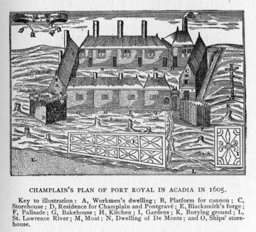
Champlain's plan of Port Royal in Acadia in 1605. Key to illustration: A, Workmen's dwelling; B, Platform for cannon; C, Storehouse; D, Residence for Champlain and Pontgravé; E, Blacksmith's forge; F, Palisade; G, Bakehouse; H, Kitchen; I, Gardens; K, Burying ground; L, St. Lawrence River; M, Moat; N, Dwelling of De Monts; and O, Ships' storehouse.
L'Escarbot's ingenious mind did not fail him, even in respect to the daily supply of fresh provisions, for he created a new order for the especial benefit of the principal table, at which Poutrincourt, he himself, and thirteen others sat daily. These fifteen gentlemen constituted themselves into l'Ordre de Bon Temps, one of whom was grandmaster for a day, and bound to cater for the company. Each tried, of course, to excel the other in the quantity of game and fish they were able to gather from the surrounding country, and the consequence was, Poutrincourt's table never wanted any of the luxuries that the river or forest could supply. At the dinner hour the grandmaster, with the insignia of his order, a costly collar around his neck, a staff in his hand, and a napkin on his shoulder, came into the hall at the head of his brethren, each of whom carried some dish. The Indians were frequent guests at their feasts, especially old Membertou, a famous Micmac or Souriquois chief, who always retained a warm attachment for the pale-faced strangers. Songs of La Belle France were sung; many a toast was drunk in some rare vintage,—the flames flew up the huge chimney,—the Indians squatted on the floor, laughing like the merry Frenchmen. When the pipe went around—with its lobster-like bowl and tube elaborately worked with porcupine quills—stories were told, and none excelled the Indians themselves in this part of the entertainment. At last, when the tobacco was all exhausted, the grandmaster resigned his regalia of office to his successor, who lost no time in performing his duties. Thus the long winter evenings passed in that lonely French fort at the verge of an untamed continent.
Then came bad news from France. Late in the spring of 1607, a vessel sailed into the basin with letters from De Monts that the colony would have to be broken up, as his charter had been revoked, and the Company could no longer support Port Royal. The Breton and Basque merchants, who were very hostile to De Monts's monopoly, had succeeded in influencing the government to withdraw its patronage from him and his associates. Soon afterwards the little colony regretfully left Port Royal, which never looked so lovely in their eyes as they passed on to the Bay of Fundy, and saw the whole country in the glory of mid-summer. The Indians, especially Membertou, watched the departure of their new friends with unfeigned regret, and promised to look carefully after the safety of the fort and its contents.
As soon as Poutrincourt reached his native country he did his best to make friends at the Court, as he was resolved on returning to Acadia, while Champlain decided to venture to the St. Lawrence, where I shall take up his memorable story later. Poutrincourt's prospects, for a time, were exceedingly gloomy. De Monts was able to assist him but very little, and the adventurous Baron himself was involved in debt and litigations, but he eventually succeeded in obtaining a renewal of his grant from the King, and interesting some wealthy traders in the enterprise. Then some difficulties of a religious character threatened to interfere with the success of the expedition. The society of Jesuits was, at this time, exceedingly influential at court, and, in consequence of their representations, the King ordered that Pierre Biard, professor of theology at Lyons, should accompany the expedition. Though Poutrincourt was a good Catholic, he mistrusted this religious order, and succeeded in deceiving Father Biard, who was waiting for him at Bordeaux, by taking his departure from Dieppe in company with Father Fléché, who was not a member of the Jesuits.
The ship entered Port Royal basin in the beginning of June, 1610. Here they were agreeably surprised to find the buildings and their contents perfectly safe, and their old friend Membertou, now a centenarian, looking as hale as ever, and overwhelmed with joy at the return of the friendly palefaces. Among the first things that Poutrincourt did, after his arrival, was to make converts of the Indians. Father Fléché soon convinced Membertou and all his tribe of the truths of Christianity. Membertou was named Henri, after the king; his chief squaw Marie, after the queen. The Pope, the Dauphin, Marguérite de Valois, and other ladies and gentlemen famous in the history of their times, became sponsors for the Micmac converts who were gathered into mother church on St. John's day, with the most imposing ceremonies that the French could arrange in that wild country.
Conscious of the influence of the Jesuits at Court, and desirous of counteracting any prejudice that might have been created against him, Poutrincourt decided to send his son, a fine youth of eighteen years, in the ship returning to France, with a statement showing his zeal in converting the natives of the new colony.
When this youthful ambassador reached France, Henry of Navarre had perished by the knife of Ravaillac, and Marie de' Medici, that wily, cruel, and false Italian, was regent during the minority of her son, Louis XIII. The Jesuits were now all-powerful at the Louvre, and it was decided that Fathers Biard and Ennemond Massé should accompany Biencourt to Acadia. The ladies of the Court, especially Madame de Guercheville, wife of Duke de la Rochefoucauld de Liancourt, whose reputation could not be assailed by the tongue of scandal, even in a state of society when virtue was too often the exception, interested themselves in the work of converting the savages of Acadia. The business of the Protestant traders of Dieppe was purchased and made over to the Jesuits. Thus did these indefatigable priests, for the first time, engage in the work of converting the savage in the American wilderness.
The vessel which took Biencourt and his friends back to Port Royal arrived on the 22nd of July, 1611, off the fort, where Poutrincourt and his colonists were exceedingly short of supplies. His very first act was to appoint his son as vice-admiral, while he himself went on to France with the hope of obtaining further aid about the middle of July.
The total number of persons in the colony was only twenty-two, including the two Jesuits, who immediately commenced to learn Micmac, as the first step necessary to the success of the work they had in hand. The two priests suffered many hardships, but they bore their troubles with a patience and resignation which gained them even the admiration of those who were not prepossessed in their favour. Massé, who had gone to live among the Indians, was nearly starved and smoked to death in their rude camps; but still he appears to have persevered in that course of life as long as he possibly could. About this time the priests had the consolation of performing the last offices for the veteran Membertou, the staunch friend of the French colonists. On his death-bed he expressed a strong desire to be buried with his forefathers, but the arguments of his priestly advisers overcame his superstition, and his remains were finally laid in consecrated ground.
Matters looked very gloomy by the end of February, when a ship arrived very opportunely from France with a small store of supplies. The news from Poutrincourt was most discouraging. Unable to raise further funds on his own responsibility, he had accepted the proffer of assistance from Mme. de Guercheville, who, in her zeal, had also bought from De Monts all his claims over the colony, with the exception of Port Royal, which belonged to Poutrincourt. The King not only consented to the transfer but gave her a grant of the territory extending from Florida to Canada. The society of Jesuits was therefore virtually in possession of North America as far as a French deed could give it away. But the French king forgot when he was making this lavish gift of a continent, that the British laid claims to the same region and had already established a colony in Virginia, which was then an undefined territory, extending from Florida to New France. Both France and England were now face to face on the new continent, and a daring English adventurer was about to strike in Acadia the first blow for English supremacy.
Such was the position of affairs at the time of the arrival of the new vessel and cargo, which were under the control of Simon Imbert, who had formerly been a servant to Poutrincourt. Among the passengers was another Jesuit father, Gilbert Du Thet, who came out in the interests of Mme. de Guercheville and his own order. The two agents quarrelled from the very day they set out until they arrived at Port Royal, and then the colony took the matter up. At last the difficulties were settled by Du Thet receiving permission to return to France.
A few months later, at the end of May, 1613, another French ship anchored off Port Royal. She had been sent out with a fine supply of stores, not by Poutrincourt, but by Mme. de Guercheville, and was under the orders of M. Saussaye, a gentleman by birth and a man of ability. On board were two Jesuits, Fathers Quentin and Gilbert Du Thet and a number of colonists. Poutrincourt, it appeared, was in prison and ill, unable to do anything whatever for his friends across the ocean. This was, indeed, sad news for Biencourt and his faithful allies, who had been anxiously expecting assistance from France.
At Port Royal the new vessel took on board the two priests Biard and Massé, and sailed towards the coast of New England; for Saussaye's instructions were to found a new colony in the vicinity of Pentagoët (Penobscot). In consequence of the prevalent sea-fogs, however, they were driven to the island of Monts-Déserts, where they found a harbour which, it was decided, would answer all their purposes on the western side of Soames's Sound. Saussaye and his party had commenced to erect buildings for the new colony, when an event occurred which placed a very different complexion on matters.
A man-of-war came sailing into the harbour, and from her masthead floated, not the fleur-de-lis, but the blood-red flag of England. This new-comer was Samuel Argall, a young English sea captain, a coarse, passionate, and daring man, who had been some time associated with the fortunes of Virginia. In the spring of 1613 he set sail in a stout vessel of 130 tons, carrying 14 guns and 60 men, for a cruise to the coast of Maine for a supply of cod-fish, and whilst becalmed off Monts-Desérts, some Indians came on board and informed him of the presence of the French in the vicinity of that island. He looked upon the French as encroaching upon British territory, and in a few hours had destroyed the infant settlement of St. Sauveur. Saussaye was perfectly paralysed, and attempted no defence when he saw that Argall had hostile intentions; but the Jesuit Du Thet did his utmost to rally the men to arms, and was the first to fall a victim. Fifteen of the prisoners, including Saussaye and Massé, were turned adrift in an open boat; but fortunately, they managed to cross the bay and reach the coast of Nova Scotia, where they met with some trading vessels belonging to St. Malo. Father Biard and the others were taken to Virginia by Argall. Biard subsequently reached England, and was allowed to return home. All the rest of the prisoners taken at St. Sauveur also found their way to France.
But how prospered the fortunes of Poutrincourt whilst the fate of Port Royal was hanging in the scale? As we have previously stated, he had been put into prison by his creditors, and had there lain ill for some months. When he was at last liberated, and appeared once more among his friends he succeeded in obtaining some assistance, and fitting out a small vessel, with a limited supply of stores for his colony. In the spring of 1614 he entered the basin of Annapolis for the last time, to find his son and followers wanderers in the woods, and only piles of ashes marking the site of the buildings on which he and his friends had expended so much time and money. The fate of Port Royal may be very briefly told. The Governor of Virginia, Sir Thomas Dale, was exceedingly irate when he heard of the encroachments of France on what he considered to be British territory by right of prior discovery—that of John Cabot—and immediately sent Argall, after his return from St. Sauveur, on an expedition to the northward. Argall first touched at St. Sauveur, and completed the work of destruction, and next stopped at St. Croix, where he also destroyed the deserted buildings. To such an extent did he show his enmity, that he even erased the fleur-de-lis and the initial of De Monts and others from the massive stone on which they had been carved. Biencourt and nearly all the inmates of the fort were absent some distance in the country, and returned to see the English in complete possession.
The destruction of Port Royal by Argall ends the first period in the history of Acadia as a French colony. Poutrincourt bowed to the relentless fate that drove him from the shores he loved so well, and returned to France, where he took employment in the service of the king. Two years later he was killed at the siege of Méri on the upper Seine, during the civil war which followed the successful intrigues of Marie de' Medici with Spain, to marry the boy king, Louis XIII., to Anne of Austria, and his sister, the Princess Elisabeth, to a Spanish prince. On his tomb at St. Just, in Champagne, there was inscribed an elaborate Latin epitaph, of which the following is a translation:
"Ye people so dear to God, inhabitants of New France, whom I brought over to the Faith of Christ. I am Poutrincourt, your great chief, in whom was once your hope. If envy deceived you, mourn for me. My courage destroyed me. I could not hand to another the glory that I won among you. Cease not to mourn for me.
Port Royal, in later years, arose from its ashes, and the fleur-de-lis, or the red cross, floated from its walls, according as the French or the English were the victors in the long struggle that ensued for the possession of Acadia. But before we continue the story of its varying fortunes in later times, we must proceed to the banks of the St. Lawrence, where the French had laid the foundation of Quebec and New France in the great valley, while Poutrincourt was struggling vainly to make a new home for himself and family by the side of the river of Port Royal.
VI.
SAMUEL CHAMPLAIN IN THE VALLEY OF THE ST. LAWRENCE.
(1608-1635.)
When Samuel Champlain entered the St. Lawrence River for the second time, in 1608, after his three years' explorations in Acadia, and laid the foundation of the present city of Quebec, the only Europeans on the Atlantic coast of America were a few Spaniards at St. Augustine, and a few Englishmen at Jamestown. The first attempt of the English, under the inspiration of the great Raleigh, to establish a colony in the fine country to the north of Spanish Florida, then known as Virginia, is only remembered for the mystery which must always surround the fate of Virginia Dare and the little band of colonists who were left on the island of Roanoke. Adventurous Englishmen, Gosnold, Pring, and Weymouth, had even explored the coast of the present United States as far as the Kennebec before the voyages of Champlain and Poutrincourt, and the first is said to have given the name of Cape Cod to the point named Malebarre by the French. It was not, however, until 1607 that Captain Newport, representing the great company of Virginia, to whom King James II. gave a charter covering the territory of an empire, brought the first permanent English colony of one hundred persons up the James River in Chesapeake Bay.
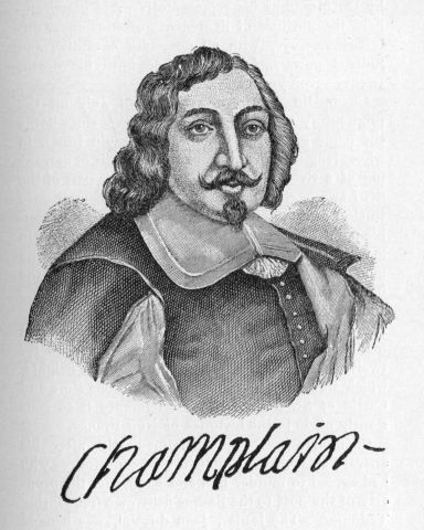
Champlain.
From this time forward France and England became rivals in America. In the first years of the seventeenth century were laid the foundations not only of the Old Dominion of Virginia, which was in later times to form so important a state among the American commonwealths, but also of the New Dominion whose history may be said to commence on the shores of Port Royal. But Acadia was not destined to be the great colony of France—the centre of her imperial aspirations in America. The story of the French in Acadia, from the days of De Monts and Poutrincourt, until the beginning of the eighteenth century when it became an English possession, is at most only a series of relatively unimportant episodes in the history of that scheme of conquest which was planned in the eighteenth century in the palace of Versailles and in the old castle of St. Louis on the heights of Quebec, whose interesting story I must now tell.
When Champlain returned to France in 1607 De Monts obtained from Henry the Fourth a monopoly of the Canadian fur-trade for a year, and immediately fitted out two vessels, one of which was given to Pontgravé, who had taken part in previous expeditions to the new world. Champlain was appointed by De Monts as his representative, and practically held the position of lieutenant-governor under different viceroys, with all necessary executive and judicial powers, from this time until his death, twenty-seven years later.
Champlain arrived on the 3rd of July off the promontory of Quebec, which has ever since borne the name given to it by the Algonquin tribes, in whose language Kebec means such a strait or narrowing of a river as actually occurs at this part of the St. Lawrence. The French pioneers began at once to clear away the trees and dig cellars on an accessible point of land which is now the site of Champlain market in what is called "the lower town" of the modern city. Champlain has left us a sketch of the buildings he erected—habitation as he calls them—and my readers will get from the illustration opposite an idea of the plan he followed. Champlain made one of the buildings his headquarters for twelve years, until he built a fort on the heights, which was the beginning of that famous Fort and Castle of St. Louis to which reference is so constantly made in the histories of New France.
Champlain was obliged immediately after his arrival at Quebec to punish some conspirators who had agreed to murder him and hand over the property of the post to the Basque fishermen frequenting Tadousac. The leader, Jean du Val, was hanged after a fair trial and three of his accomplices sent to France, where they expiated their crime in the galleys. Great explorers had in those days to run such risks among their followers and crews, not affected by their own enthusiasm. Only three years later a famous sailor and discoverer of new seas and lands, was left to die among the waste of waters which ever since have recalled the name of Henry Hudson.