Chapter XX · ACROSS THE SPINE OF ARMENIA
Reading edition
The long and lofty barrier of the Ararat system affords a natural partition of the surface of the Armenian highlands, and, corresponding with the frontier between the Russian and the Turkish empires, divides Armenia into two. The fairest districts of either territory are found on their southern confines; and what the valley of the Araxes is to the Russian provinces, that is to those under Turkish rule the country of Van. Van, with her famous lake and immemorial antiquity, became the next, and not the least alluring objective of the journey which we had planned. A new world lay on the further side of the mountains towards which we now directed our course.
October 22.—During our stay in Kars we had experienced the first spell of cold, bleak weather that the coming winter held in store. On the day of departure the district was visited by a storm of rain which delayed us until afternoon. At a few minutes after one o’clock we were crossing the bridge which spans the river, and taking a last view of the castle and the gorge. Above the entrance to the cleft the stream flows between humbler slopes; but they are still of rock, and the metalled road, which follows the western shore at no great distance, is without a prospect on either side. A few versts are covered among such cheerless surroundings; then the river comes towards you through a nice tract of flat pasture land which opens out upon the right bank. The meadows, brown of hue after the heats of summer, were seen to extend to the cultivated skirts of a hill range, some six miles distant, at the foot of which we were shown the village of Azat. A second settlement, Little Tikma, was nearer to us, in the same direction; and on our side of the water a group of low stone houses were aligned upon the road. We were surprised to hear the German tongue and the mournful sounds of a concertina; the dress, the hymn reminded us that the day was Sunday; and the simple people were delighted to converse with a son of Protestant England in the language of their fatherland. They told me that it was two years since they had left the colony at Tiflis, and migrated to these distant wilds. The soil was rich, and it only needed a small expense of capital to diffuse the river over the adjacent plain. But whence could they draw the money for works of this nature? They harvested their corn in the month of August, but the crops suffered from want of water. Although they possessed no school, they were not without the rudiments of learning; their frank, intelligent faces were a pleasure to see. Petrovka is the name of their settlement, which contains some forty houses. A few versts further we entered the Russian colony of Vladikars. We were crossing an open country which stretched away on either hand to the outlines of low hills. Several of these Russian villages were visible in the landscape, and the brown loam had been exposed by the plough.
Vladikars bears a strong resemblance to Gorelovka—the same white faces and little windows of the neat stone houses, ranged at intervals on either side of the road. The inhabitants, too, display a family likeness to the dwellers in the northern watershed—the men with their lank figures and dull but honest faces, the women with their broad shoulders and massive hips. The feminine members of the colony were especially conspicuous—strapping wenches, as one might call them, attired in the gayest of printed cottons and exhibiting a plainness which was almost repulsive. I entered the oblong and single-storeyed building in which they conduct their services of prayer. A wooden bench along the walls, a few wooden chairs were its only furniture; you saw no pulpit or altar or religious picture; God resided in the living objects of His love. This village as well as its neighbours are peopled by Molokans, a sect of which the doctrine, like that of the Dukhobortsy, represents an extreme and a logical form of the Protestant faith. An old man to whom I turned, and whose striking features I was able to record (Fig. 99), spoke to me with much charm of voice and manner concerning their religious beliefs. They reverence Moses and the prophets and the Holy Gospel, but they practise their religion in their own way. Singing psalms appears to be their principal method of spiritual expression. Infants are not baptized, but are brought to this building; a passage from the New Testament is read in the child’s presence and his name is publicly declared. A similar ceremony consecrates the marriage tie.
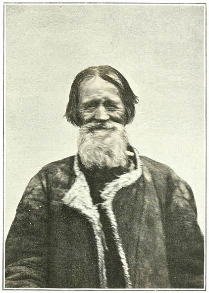
Fig. 99. Molokan Elder at Vladikars.
A little beyond this village—in which is placed the eleventh verst stone—the road bifurcates. The well-metalled and well-maintained chaussée, which we had been following, pursues its course to the confines of the Turkish frontier at the station of Sarikamish. The other branch—which is in places a road, but more often a simple track—stretches off towards the south. Taking the latter direction, we drove for some distance over even ground, where here and there the rich, brown soil had been exposed by the plough. On our left hand rose a grassy and hummock-shaped eminence, scarcely a mile away. Hill ranges of similar appearance circled around us, their summits capped with lowering clouds and strewn with fresh snow. In such surroundings the gay houses of Novo-Michaelovka were a pleasing diversion for the eye. The elaborate fretwork of wooden gables and shutters, the lavish display of vermilion and cobalt, lent an air of festivity to the place (Fig. 100). It was evident that the inhabitants were extremely well-to-do; yet, like all these sectaries, they neither possessed nor appeared to desire a school in which to educate their young. Near this village we had again approached the banks of the river, which had a width of some 20 yards. We now crossed to the right bank.
On our point of course, a little to our left, we held a bold and lofty hill, of which the outline assumes the appearance of two humps. It bears the name of Akh Deve or the white camel; and one can understand how appropriate would be this appellation during the winter months. Snow had not yet rested upon its grassy convexities, which still wore the ochreous hues of autumn, and were flushed in places by a detritus of red, volcanic stone. After losing all prospect for the space of some twenty minutes, during which we crossed a bleak side valley of the sluggish river, and a stream which winds along the base of rocky slopes, we again opened this landmark on the further rim of the amphitheatre, close by the village and station of Chermaly. The post house stands at a little distance from this Armenian village; our tired horses were replaced by a fresh team of four, having covered a stage of 23 versts or 15 miles.
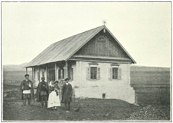
Fig. 100. House at Novo-Michaelovka.
It was half-past four o’clock; we made our way over lofty uplands, of which the moist loam held our carriage-wheels. Or we jolted upon large boulders, embedded in the track. Away on our right rose the slopes of the Akh Deve. Magnificent eagles, with their square shoulders and long plumage, circled round us or observed us from adjacent rocks. We were not long in discovering the bait of this assemblage—the mangled remains of a horse. In three-quarters of an hour we had reached the skirts of the hill mass, whence we commanded an unbroken view towards the north. Vast tracts of idle soil extended to the horizon, except where, here and there, the yellow herbage was interrupted by little carpets of ploughed land. Hills, which appeared little better than hummocks, were set at random in the expanse. Their summits were streaked with snow; from the white linings of their satellite clouds vague lights descended upon the plain. We were standing upon the elevated but imperceptible water-parting between the Araxes and the river of Kars. A gradual descent of some 500 feet brought us to the considerable village of Kemurly, where we passed the night in the posting house. It was the first settlement which we had seen during a stage of 20 versts, or a little over 13 miles.
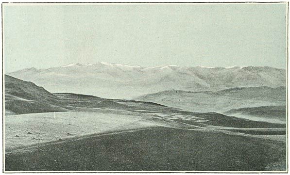
Fig. 101. Aghri Dagh from the Araxes Cañon.
It was not yet eight o’clock when we proceeded in our carriage down the easy gradients of this descent. Beyond a foreground which was choked by a succession of shelving convexities rose the crags and peaks of the Ararat system—that long range to which in a collective sense this name may not be inapplicable, and which, like Ararat, is known to the inhabitants of these districts under the name of Aghri Dagh. Aghri Dagh! These words, with their roughness on the palate, are just as appropriate to express the ruggedness of the barrier which we were fronting, as they are unsuited to reflect the harmony of the giant in the east. The eye, already accustomed to the vaulted eminences of the tableland, is impressed by the contrast of these sharp, precipitous shapes. It seems some invasion of the border ranges into the area of the great plateaux. The sun was touching the summits of the chain, which were softened by a covering of fresh snow. But the underlying rock still asserted its essential character, moulding the snow into an infinite number of facets, which sparkled in the light (Fig. 101). The northern wall of the valley—the heights we were leaving behind us—is composed by the lofty cliffs already described. Their even outline was drawn across the sky into invisible limits, as we made our way over the broken ground to which they decline (Fig. 102).
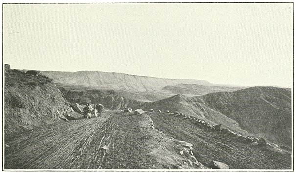
Fig. 102. Cliffs composing Northern Wall of Araxes Cañon.
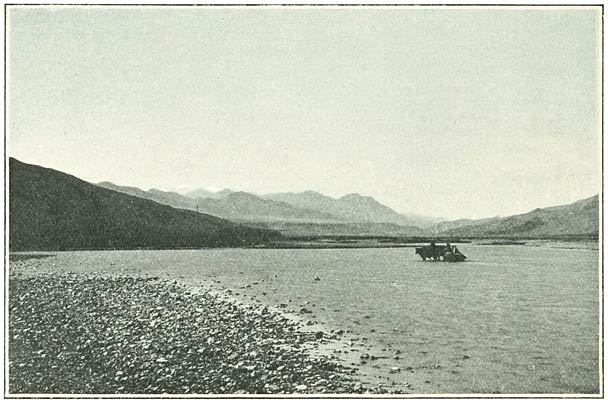
Fig. 103. The Araxes near Kagyzman.
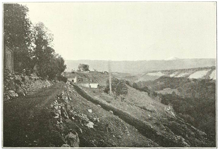
Fig. 104. Looking down the Valley of Kagyzman.
By half-past seven our tiny caravan was in motion, pointing along the base of the mountains a little south of west. We sank by a steep incline to a long valley which follows the Araxes in the relation, as it appeared to us, of a parallel trough. It was filled with hummocks of a red, sandy substance; the slopes on either side screened off the view. Those on our left hand were the more stony, and were tinged in places a greenish hue. In about an hour after starting we opened out the river, flowing at some little distance from the heights upon which we stood. A lateral depression afforded access to the principal valley, which we followed, keeping to the high ground. The Araxes was threading the narrow bottom of a fork, of which the arms rose to thousands of feet above its bed. Close up now, on our left hand, towered the escarpments of the range, fronting the opposite cliffs of the tableland. At a little before nine we turned our backs to the river and rose, on a southerly course, up the mountain side.
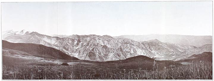
Fig. 106. A Rib or Buttress of Aghri Dagh.
We had reached an elevation of some 5500 feet, when a little village, with a few willows and the ruins of an ancient monastery, broke upon our view (Fig. 105). It is inhabited by Armenians, and bears the name of Kara Vank (the black cloister). The even masonry of hewn stone which composed the crumbling edifice recalled the culture of a forgotten age. What a contrast it presented to the rude and featureless walls of the modern village church! We passed through this little settlement, which contains some thirty houses, and mounted the slopes on the further side. In a valley on our left hand we noticed some sparse brushwood, and bushes of wild rose here and there relieved the rock. We were nearing the level of the opposite edge of the tableland, of which the cliffs were seen descending to the narrow river valley with shelving sides of richly modelled marls. At a quarter before ten we made halt on the neck of a spur, whence we obtained a wide prospect over the more distant scene.
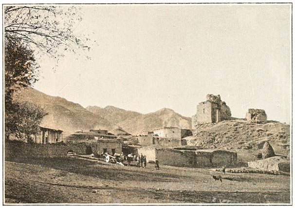
Fig. 105. Kara Vank on Aghri Dagh.
We overlooked the surface of the tableland. Towards the east, the mass of Alagöz could be distinguished from banks of cloud, which clung to the recent snows upon its slopes. Kagyzman was still visible in the trough of the landscape; the two low cones on the cliffs beyond the town were especially prominent, enveloped in a sheet of unbroken snow. Our people identified them with the great and the small Jagluya, and said they were famous for their rich pasture-land. From east to west, in a wide half-circle, land and cloud were woven together, the horizontal outlines always felt and sometimes seen. But in the west these nebulous shapes met the profile of the savage ridges which were seen descending from the range about us, almost at right angles, into the narrows through which the river flows.
From this point we continued during a considerable space of time to skirt these upper slopes. The keen air was full of sun; the prospect was inspiring; we loitered for an hour over our lunch. I focussed the camera upon one of the long meridional parapets which cleave the soft landscape of the west (Fig. 106). I would ask my reader to observe the deep incision of its flanking valley; these valleys extend to the very spine of the mountain system, and, in some places, appear to break it through. We were obliged to descend to the bottom of this particular ravine; a slender stream was rustling over the boulders in the hollow, which had an elevation of some 5800 feet. The rocky escarpments of the opposite parapet were seen to consist of a compound diabase, veined in places with beautiful marbles. Of wood there was little, even within these recesses—a brushwood of beech and willow and fir. The rose bushes were still with us, and the yellow immortelles, which we had not seen since our sojourn on Ararat.
Beyond this valley we rose towards the summits of the chain and made our way through this winter’s snow. We were on the pass at four o’clock (Fig. 107); a grass-grown eminence on our right hand was identified as the Akh Bulakh Dagh. The range was highest on our left; the saddle by which we crossed it has an elevation of some 8600 feet. Half an hour later we had passed into the opposite watershed, and planted our feet upon Turkish soil.
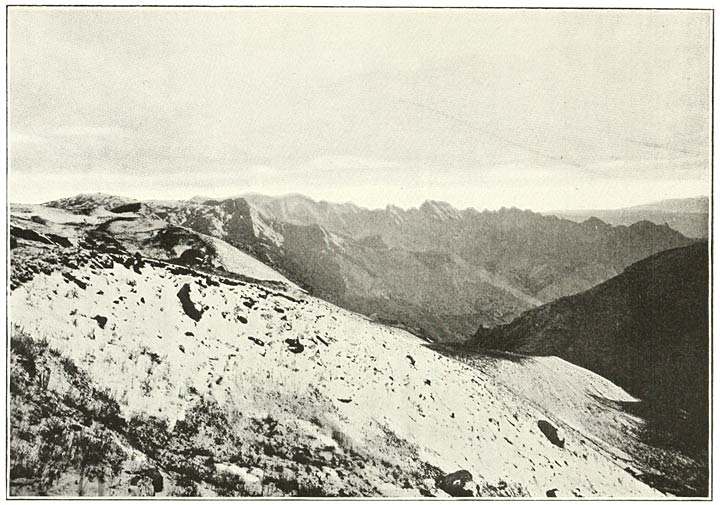
Fig. 107. Pass over Aghri Dagh.
Vast plains lay below us—dim tracts of even soil, broken in places by hummock shapes. The outline of an opposite chain was drawn across the horizon, loftier in the east, where it was crowned with snow, declining in the west to a range of blue-grey hills upon our right. It was the system of the Ala Dagh. Beyond this barrier, the harmonious shape of a single mountain formed a beautiful white presence in the sky. We could not doubt that it was Sipan, nearly seventy miles distant, the goal to which we were directing our steps. A thread of water on the plains reflected the blue heaven, and was recognised as the Murad. We had crossed the spine of Armenia, and were descending to the banks of the Euphrates, to the sources of the streams which issue into the Persian Gulf.