SECTION IV Rhineland Campaign 15 September–15 December 1944[3]
Reading edition
SECTION IV Rhineland Campaign 15 September–15 December 1944[3]
On 15 September 1944 the Allied forces that had invaded southern France came under control of the Supreme Commander, Allied Expeditionary Force. This added the 6th Army Group to the forces opposing the enemy along the German frontier, making a total of forty-eight Allied divisions in the European Theater of Operations. In a little over three months, 6 June-15 September 1944, the Western Allies had carried their offensives from the Normandy beaches to the western borders of Germany. During the next three months little, if any, progress was made. Several factors contributed to this general slowdown. As fall and winter approached, rain, mud, and snow greatly hindered operations and made living conditions extremely trying. The terrain became more difficult since many rivers and streams had to be crossed and rough, wooded, and hilly country was encountered. Enemy resistance stiffened as the Allies reached the German border. But more important than any other single factor was the problem of supplying the large forces which had advanced so rapidly that they had outrun their supplies.
During this period, as the Allies came to the West Wall and the Rhine, severe fighting took place all along the front. Some of the most difficult operations of the war in western Europe occurred during the Rhineland Campaign as battles were fought in the Arnhem area, the Schelde estuary, the Huertgen Forest, the Aachen sector, the Metz and Saar regions, and the Belfort and Saverne Gaps. On 15 December the efforts of the Allies in the Rhineland were interrupted when the enemy broke through the lines in the Ardennes, causing a shift of troops to the Ardennes to reinforce the lines there.
FRANCE
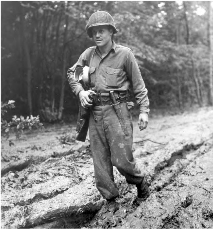
ENLISTED MAN WALKING THROUGH MUD in his bivouac area. The Allied advance was halted at the German border by poor weather conditions, difficult terrain, stiffening German resistance, and, most of all, by lack of supplies. At this time the decision was made to employ the greatest strength in the north to attain flanking bridgeheads across the lower Rhine River beyond the main fortifications of the West Wall. This area was chosen for the drive since the terrain to the south was considered unsuitable for a rapid advance because of the mountainous and forested country.
ENGLAND
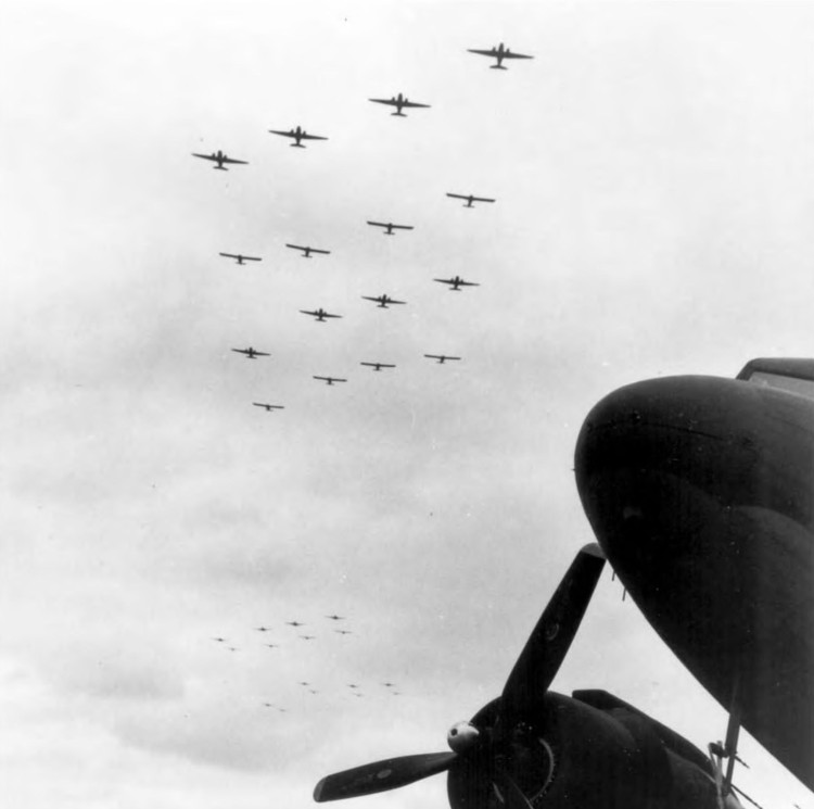
PLANES TOWING GLIDERS take off for the invasion of the Netherlands, 17 September 1944. The First Allied Airborne Army launched its attack to secure a bridgehead across the Rhine in the Arnhem area. Complete surprise was achieved and the drops and glider landings were effective and in most cases were made in the prescribed areas. During the following ten days the fighting was severe with repeated German counterattacks. However, the railroad bridge across the Waal River in the Nijmegen area was captured on 20 September and remained in Allied hands. By the end of September the corridor was widened somewhat and the operation was considered a success even though the Allies were forced to evacuate most of the attacking troops after numerous casualties were suffered.
THE NETHERLANDS AND GERMANY
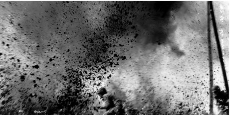
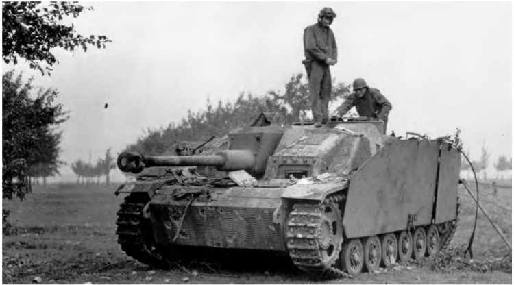
PARATROOPERS ADVANCING UNDER ENEMY FIRE in the Arnhem area (top). A captured German self-propelled assault gun (Sturmgeschuetz 7.5-cm. Stu. K. 40) (bottom). During the entire operation in the Netherlands which lasted for thirty days, from 17 September to 16 October 1944, over 5,500 planes and 2,500 gliders transported 34,000 men, and over 1,900 vehicles, 500 artillery pieces, and 5,000 tons of supplies. The airborne army suffered more than 13,000 casualties in killed, wounded, or missing.
GERMANY
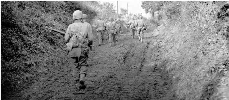
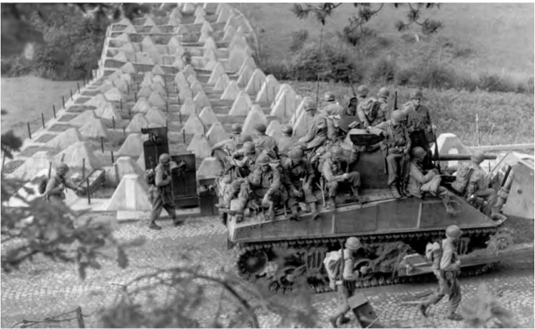
INFANTRYMEN FOLLOWING A TANK during the advance north of Aachen (top). Infantrymen riding on an M4 medium tank-dozer through the West Wall, while others follow on foot (bottom). The last two weeks in September were spent by the First Army in probing the enemy’s defenses along the frontier. On 2 October an attack was launched across the German border about eight miles north of Aachen. Progress during the next two weeks was slow as troops fought their way through six miles of West Wall, or “Siegfried Line,” fortifications.
GERMANY
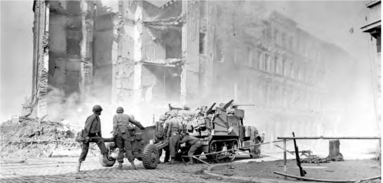
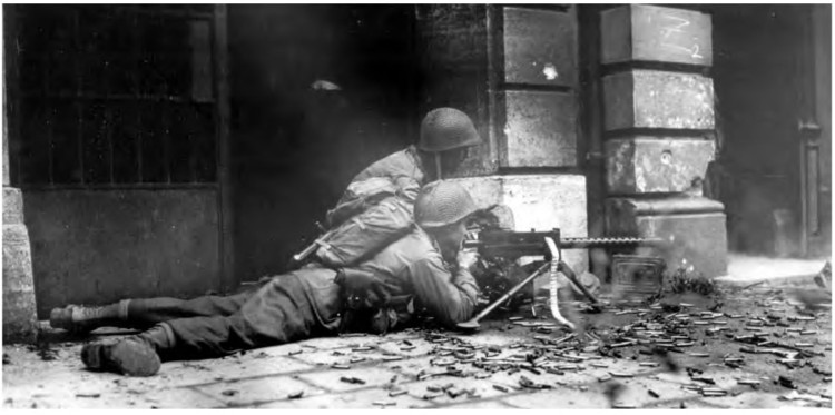
A 57-MM. ANTITANK GUN M1 being unlimbered from a half-track during the street fighting in Aachen (top). A Browning .30-caliber machine gun M1919A4 being fired at the enemy in Aachen (bottom). The German troops in Aachen refused a surrender ultimatum on 11 October 1944, and during the next three days the city was subjected to intense aerial bombardment and artillery fire. Infantrymen entered the city on 13 October and after fierce house-to-house fighting almost completely occupied Aachen by 20 October. The following day the garrison surrendered, making Aachen the first German city to fall to the Allies. The First U. S. Army then began preparations for a drive to the Rhine as soon as supplies and reinforcements should become available.
GERMANY
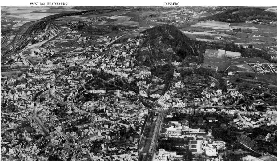
A PORTION OF THE CITY OF AACHEN. During the bitter fighting the Allies found it necessary to use all types of artillery weapons, from the 155-mm. gun to the smaller guns of tank destroyers, at point blank range to reduce the heavily fortified buildings occupied by enemy troops.
FRANCE
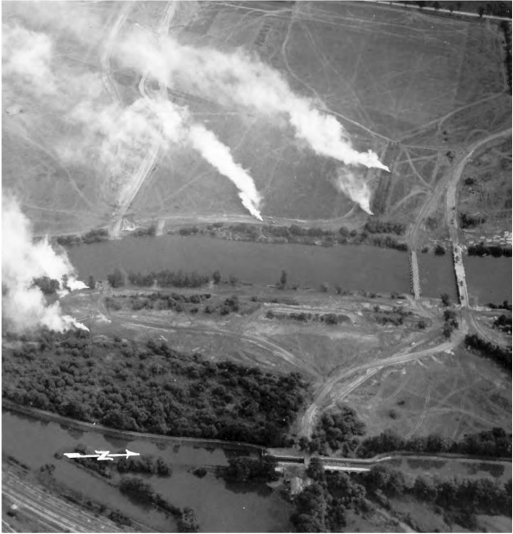
BRIDGEHEAD ACROSS THE MOSELLE south of Metz near Arnaville. While the U. S. First Army was driving toward the Rhine in the vicinity of Bonn and Cologne, the Third Army was holding its positions pending the improvement of the supply situation. The Ninth Army moved up from Brittany and took its position between the First and Third Armies in the Ardennes sector. The battle of Brest ended on 18 September 1944, and except for enemy resistance in the Atlantic coast port cities of Lorient and Saint-Nazaire, the Brittany Peninsula was completely in Allied hands.
FRANCE
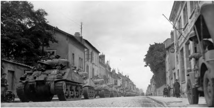
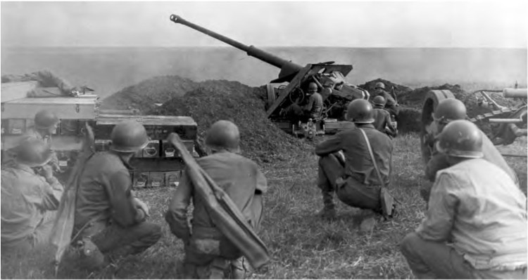
M4 MEDIUM TANKS on a street in Lunéville (top). U. S. troops firing a captured German 88-mm. gun in the vicinity of Metz (bottom). The period from 25 September to 7 November 1944 was the most unproductive phase of the U. S. Third Army’s operations on the Continent. Troops closed in on the Moselle north of Thionville and consolidated their positions east of Nancy. On 18 September the Germans launched a counterattack near Lunéville but were stopped in their tracks. Two other attacks on 22 and 24 September were also stopped and the Germans began to retreat on the night of 1–2 October.
GERMANY
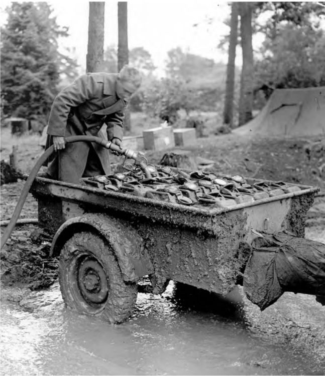
FIVE-GALLON WATER CANS loaded in a quarter-ton trailer being filled at an Engineer water point. The Engineers were responsible for the purification of drinking water and set up water points from which all units located in the area drew their daily supply.
BELGIUM
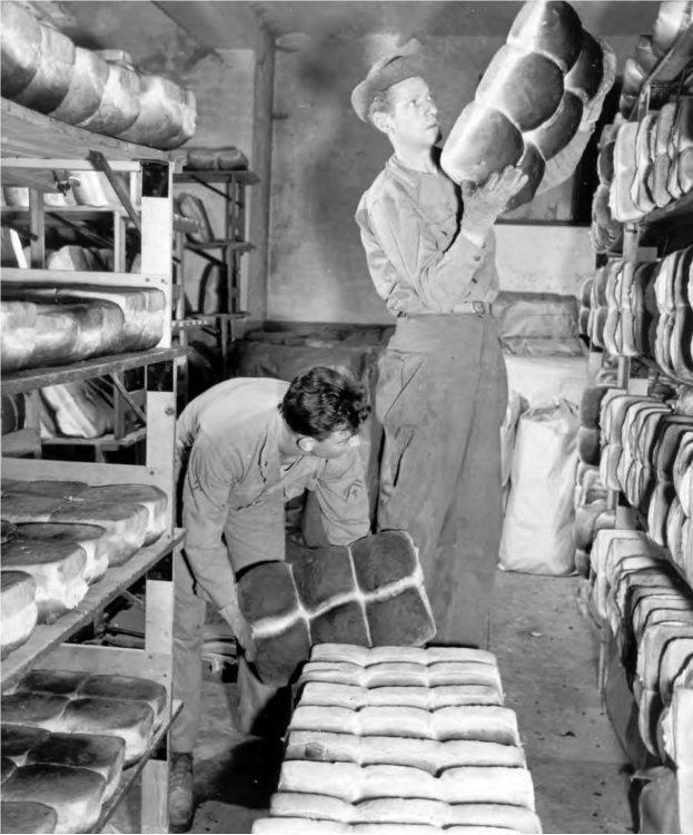
BREAD BEING PLACED ON COOLING RACKS in a Quartermaster bakery after being removed from the ovens.
FRANCE
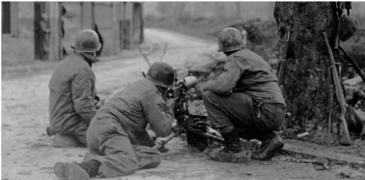
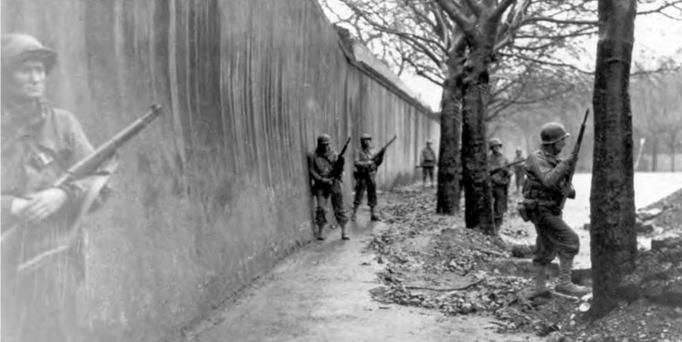
INFANTRY MEN FIRING a .30-caliber Browning machine gun M1917A1 on the outskirts of Metz (top). Infantry patrol entering Metz (bottom). For two months the U. S. Third Army was stalled in the vicinity of Metz, the fortress which would have to be captured before any substantial advance eastward could be made. Metz dominated three invasion routes into Germany from France: the valley of the Moselle through Trier and Coblenz; the Kaiserslautern Pass through Saarbruecken to Mainz and Worms; and the route through the Saverne Gap from Sarrebourg to Strasbourg and the Rhine. Only once in modern times had the fortress of Metz fallen to an attacking army—in 1871 the defending French troops surrendered to the Prussians.
FRANCE
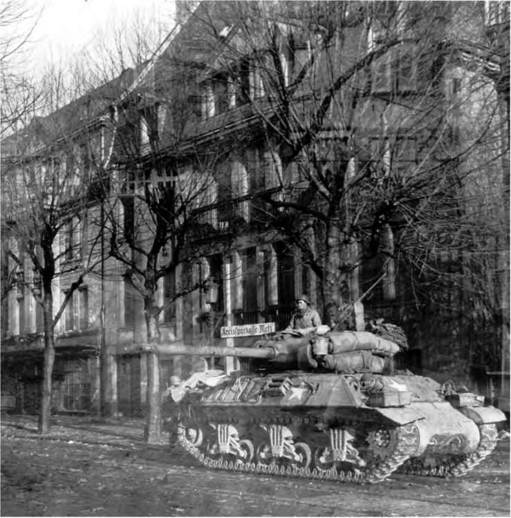
90-MM. GUN MOTOR CARRIAGE M36 in Metz. The capture of Metz was hindered by rain and floods which canceled the heavy air support and made the advance difficult for the ground forces. The attack started on 8 November with only artillery support and it was not until 22 November that the city was finally clear of all enemy pockets of resistance. The last of the forts which ringed the city was taken on 13 December. The Third Army was then confronted by one of the strongest sections of the West Wall, and since its reduction would require a vast amount of artillery support, the attacks were suspended until the necessary ammunition could be brought up.
FRANCE
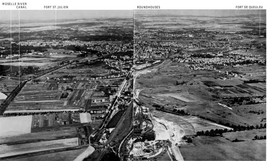
THE CITY OF METZ showing the location of two of the forts which ringed the city. These and other forts presented problems to the assaulting troops.
GERMANY AND FRANCE
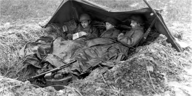
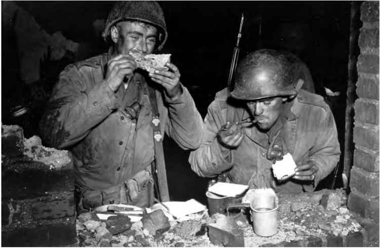
THANKSGIVING DINNER AT THE FRONT. During October and November 1944 the cold, rain, fog, and floods made living conditions of the front-line troops miserable. The battle against the weather was as difficult as that against the enemy.
FRANCE
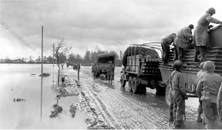
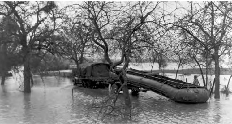
ENGINEERS HAULING BRIDGING EQUIPMENT in flooded areas of the Moselle River. The flooded rivers and smaller streams made the task of bridging extremely difficult during this period of the fighting along the German frontier since, in addition to the wider than normal spans necessary to cross the rivers, the weather was cold and rainy, adding to the hardships of those employed in the task.
GERMANY
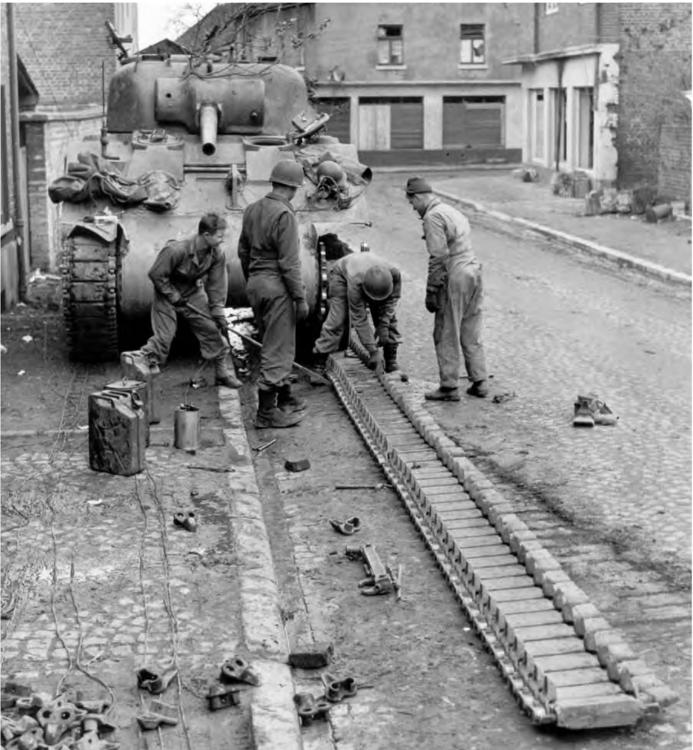
TRACK EXTENSIONS being put on the track of a medium tank. The maneuverability of tanks and other tracked vehicles was greatly hampered by mud along the front lines. Confronted by a problem more serious than anticipated, Ordnance personnel quickly designed and started production of track extensions at the rate of 156 separate pieces for each tank. Civilian manufacturing facilities were utilized in France and Belgium and before the program was completed 1,500,000 extensions had been made and welded to the tank tracks.
FRANCE
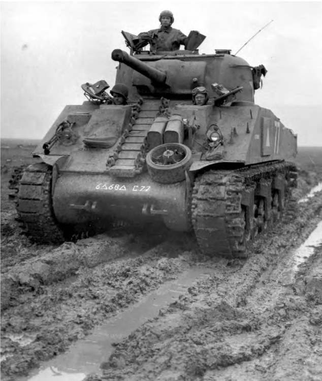
AN M4A3 MEDIUM TANK fitted with track extensions maneuvering through soupy ground. Track extensions were so devised as to give better flotation and traction through the November mud.
GERMANY
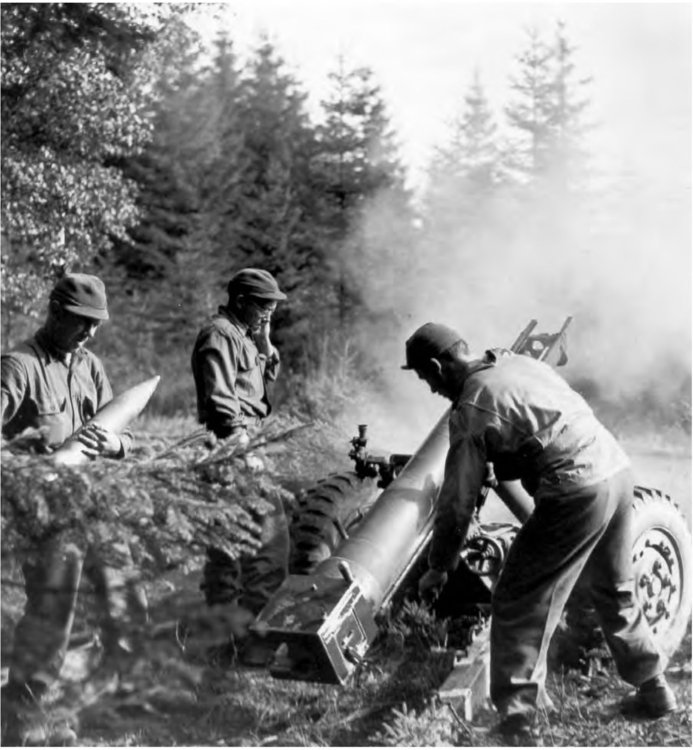
105-MM. HOWITZER M3 shelling enemy positions. After the capture of Aachen the First and Ninth Armies prepared for a new offensive. The initial objectives were to capture bridgeheads over the Roer River in the vicinity of Dueren and make advances toward Juelich. At the same time the defensive positions in the Ardennes area were held. After a four-day delay the weather cleared and planes of the Allied air forces began the attack. Several towns including Dueren and Juelich were reduced to rubble.
GERMANY
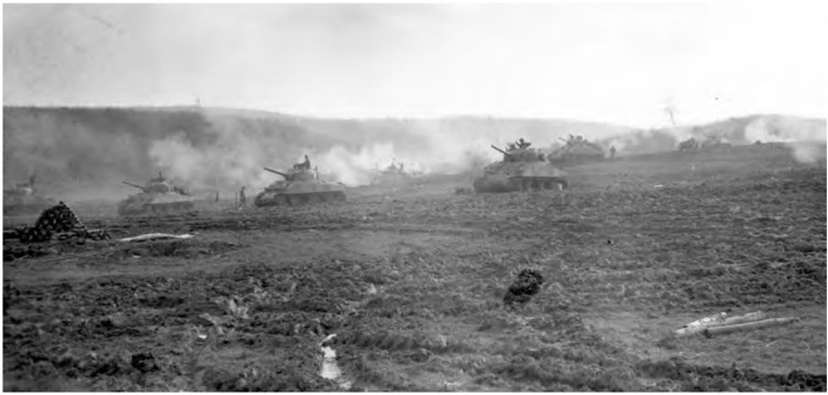
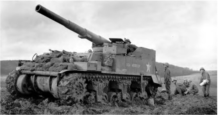
MEDIUM TANKS FIRING during the assault toward the Roer River (top). 155-mm. gun motor carriage M12 firing on enemy held positions (bottom). In spite of the elaborate preparations made for the attack and the great concentration of combat power, progress was extremely slow. Each of the towns was woven into a network in which each house had to be reduced, and each foot of the muddy ground was defended to the last by the enemy troops. The attack plowed on determinedly in the mud and cold and on 3 December 1944 the Ninth Army came to the Roer. The First Army also attacked until the river was reached. (Note the newer type track with cleats on the treads to give better traction.)
GERMANY
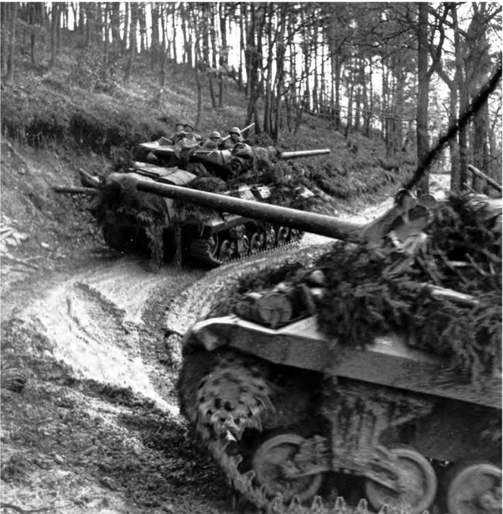
3-INCH GUN MOTOR CARRIAGES M10 move up in the Huertgen Forest area. Troops of the First and Ninth Armies had been fighting their way toward Schmidt since September in one of the most bitterly contested actions of the war. One of the major obstacles in the advance was the Huertgen Forest which covered roughly the triangle of Aachen-Dueren-Monschau. In the vicinity of Schmidt were dams which controlled the level of the Roer River, and while these were still in enemy hands water could be released flooding the valley of the Roer. It was therefore considered necessary to take this area and the dams before the river was crossed by the attacking U. S. forces.
GERMANY
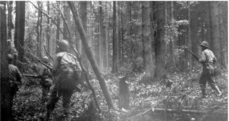
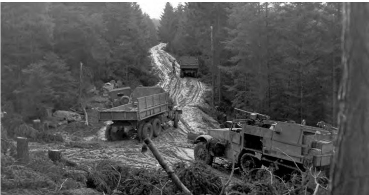
INFANTRYMEN pushing through the Huertgen Forest near Vossenack, Germany (top). Vehicles moving up a muddy road through the forest (bottom). The Germans had strengthened this natural barrier by the clever use of wire, pillboxes, and mines, and the U. S. infantrymen, restricted by the rough wooded terrain, were forced to fight for the most part without the aid of artillery or air support. On 13 December the attack on the dams was renewed but the going was still slow. Casualties to the two armies advancing in this area were high.
GERMANY
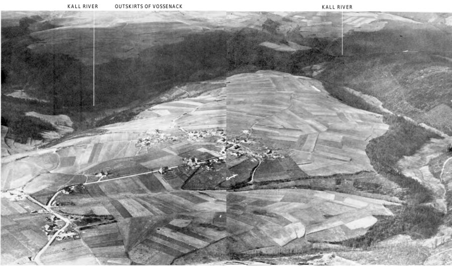
KOMMERSCHEIDT AND THE SURROUNDING AREA. The terrain of the Schmidt and Vossenack areas, like that of the Huertgen Forest, was hilly and wooded. The Roer River dams in this area were important objectives for the Allies during this part of the campaign.
GERMANY
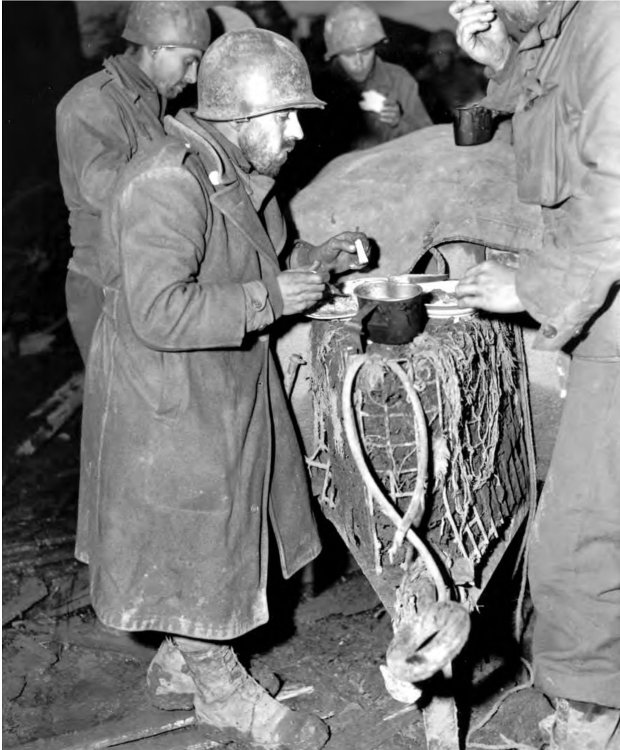
TIRED, DIRTY, HUNGRY INFANTRYMEN eat their first hot meal after fifteen days of siege of the town of Huertgen.
GERMANY
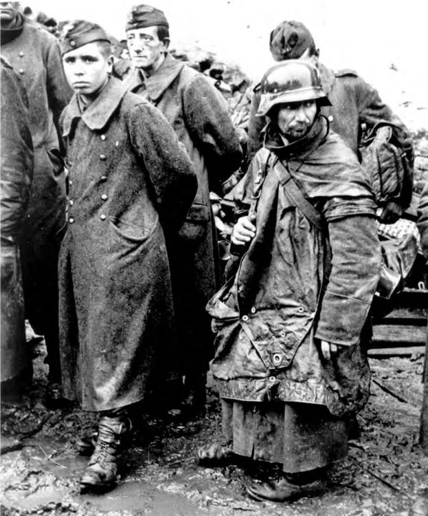
BATTLE-WEARY GERMANS who were among the last to surrender after the battle of the Huertgen Forest which lasted for several weeks.
FRANCE
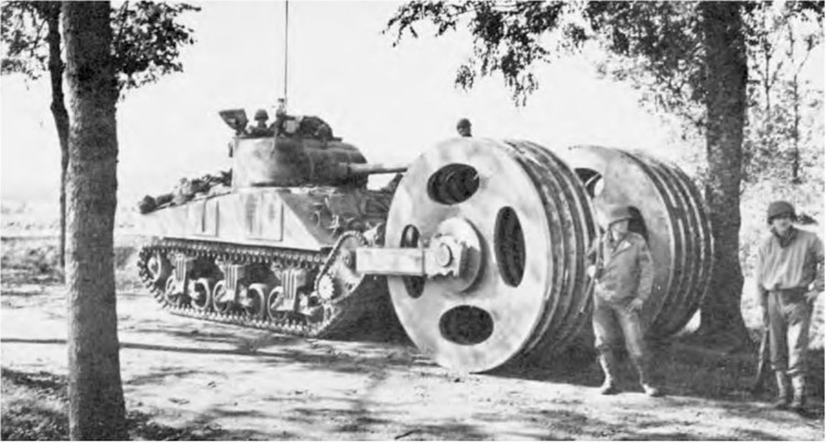
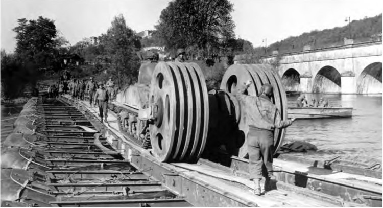
MINE EXPLODER T1E3 attached to a medium tank. This model was an improvement over the earlier one because of its chain-driven exploder disks. On the first models the exploder disks rolled freely and were not power driven. The new model also had a higher degree of indestructibility and greater maneuverability and could be driven in mud eighteen inches deep and across broken terrain. The T1E3 could be driven across a Class 70 military bridge.
GERMANY
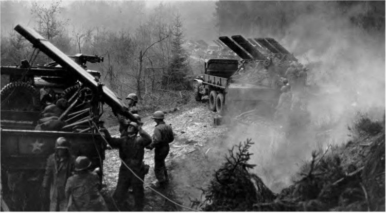
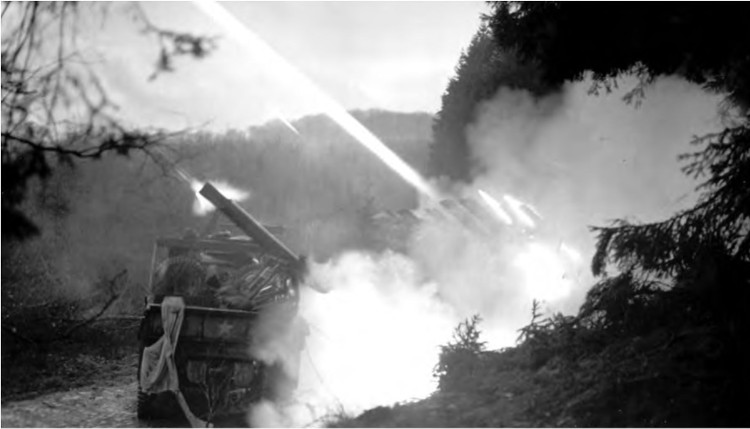
FIRING ROCKETS during the fighting in the Huertgen Forest area. In the above pictures 4.5-inch multiple rocket launchers T27 are mounted on 2½-ton trucks and consist of eight tubes in a single bank. Two banks are mounted on each of the trucks with the rockets being fired at half-second intervals.
FRANCE AND GERMANY
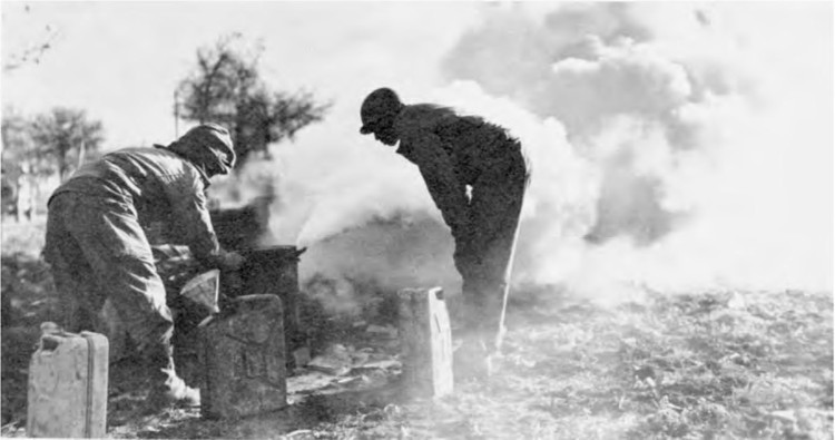
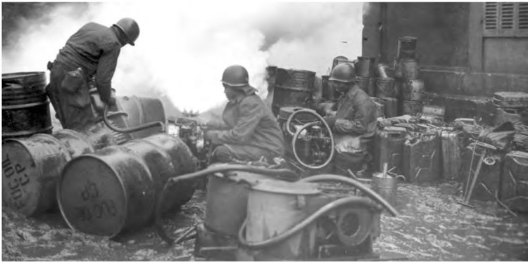
FOG OIL being used to produce a smoke screen to limit observation during river crossings. This function of the Chemical Warfare companies was utilized in covering the activities of troops at ports, airfields, docks, and harbors in addition to concealing vital points from direct enemy air observation during advances and river crossings. When the danger of aerial attack was practically eliminated it was still used against ground observation. By means of a generator the fog oil was converted into a white fog which was used effectively whenever the wind conditions were not strong enough to disperse the screen too rapidly.
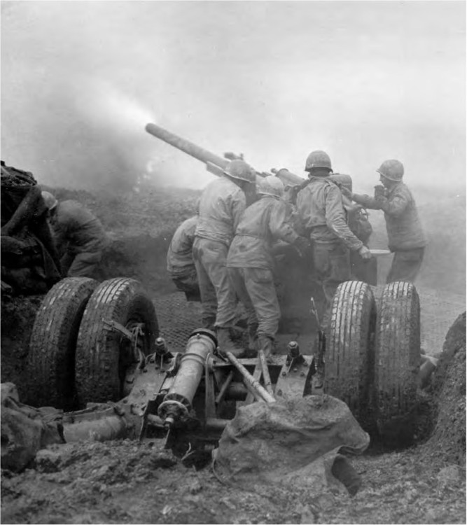
90-MM. ANTIAIRCRAFT GUN M 1 being fired at a German flying bomb passing over Belgium. Liege was subjected to an attack by these robot bombs and suffered considerable damage. Because of the great speed of these weapons it was difficult to combat them, but later with the utilization of the newly developed proximity fuse, the seriousness of the threat of the flying bombs diminished.
FRANCE
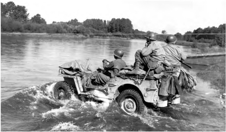
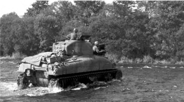
SEVENTH ARMY VEHICLES CROSSING THE MOSELLE. During the later half of September the 6th Army Group’s positions were consolidated, boundaries were adjusted, divisions were shifted into their proper zones, and plans were made for the advance to the Rhine.
FRANCE
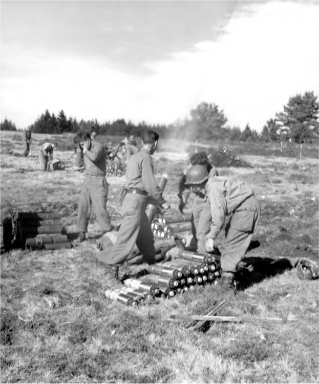
4.2-INCH CHEMICAL MORTAR being fired during the advance of the Seventh Army, October 1944.
FRANCE
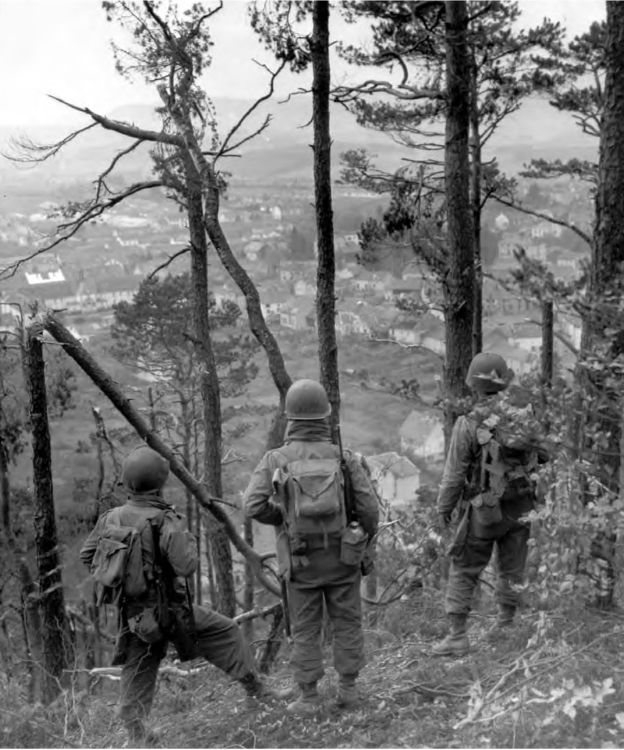
THREE INFANTRYMEN of the Seventh Army looking down on a village in France from a hilltop which has been under heavy mortar and artillery fire.
FRANCE
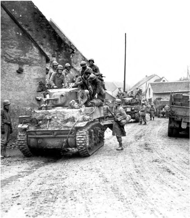
INFANTRYMEN CLIMB UPON AN M 5 LIGHT TANK in preparation for an advance. In November 1944 the Seventh Army was to make the main effort of the 6th Army Group in an advance toward Sarrebourg and Strasbourg. In the south the French First Army was to drive through the Belfort Gap.
FRANCE
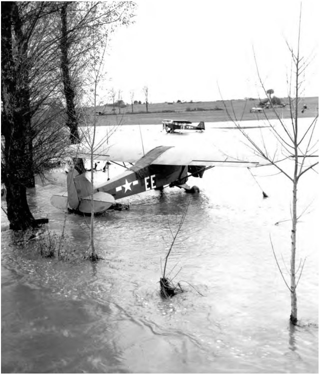
ARTILLERY LIAISON PLANES grounded in the Seventh Army area. In the Vosges mountains snow drifted over the roads, the temperature dropped below freezing, and streams overflowed their banks.
FRANCE
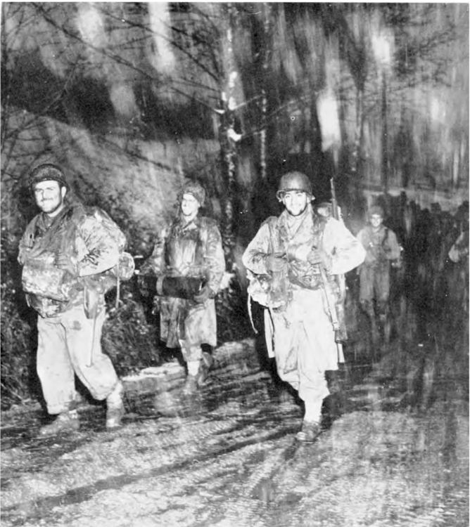
INFANTRYMEN OF THE SEVENTH ARMY advance through snow and sleet. The attack of 6th Army Group was to breach the Vosges mountains whereupon the two armies would join in the Rhine plain to isolate the enemy’s Vosges positions. Short of artillery ammunition, the troops slugged it out with the enemy over difficult terrain and in increasingly bad weather, with the infantry carrying most of the burden.
FRANCE
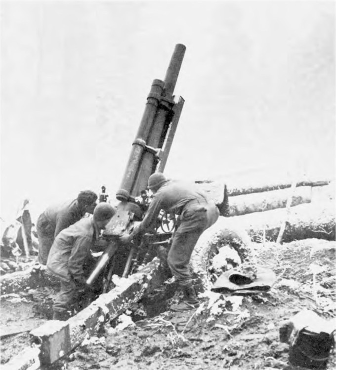
SEVENTH ARMY ARTILLERYMEN loading a 105-mm. howitzer M 2A 1. The attack was launched, after an all-night artillery preparation, in a snow storm on the morning of 13 November 1944. At noon on 14 November the French First Army jumped off in its attack. On 16 November the French broke through the Belfort defenses and on 20 November reached the Rhine. Mulhouse fell on 22 November despite a quickly established enemy defensive line.
FRANCE
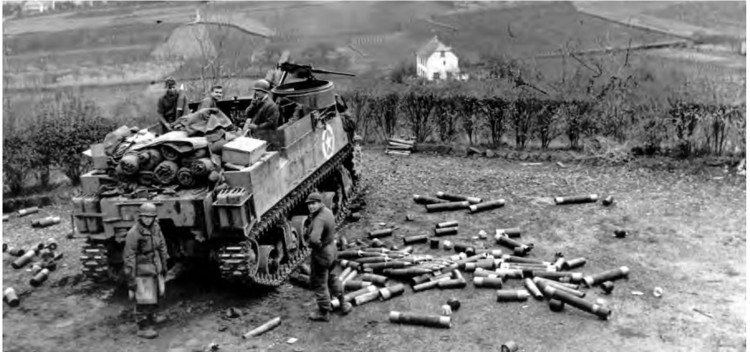
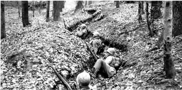
A 105-MM. HOWITZER MOTOR CARRIAGE M 7 being fired on German positions in the Rhine Valley (top). Infantrymen wait in a shallow zig-zag trench before advancing (bottom). On 20 November Sarrebourg was captured and on 22 November Saverne fell. By 27 November Strasbourg and its ring of defending forts had been taken. After the collapse of the enemy positions in the Vosges, the Seventh Army attacked northward and by the middle of December had crossed the German frontier on a 22-mile front and penetrated the West Wall defenses northeast of Wissembourg. In the meantime the German forces which had been driven from the Vosges maintained their bridgehead in the Colmar area, which became known as the Colmar pocket before it was finally liquidated.
GERMANY AND BELGIUM
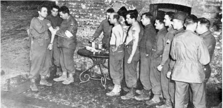
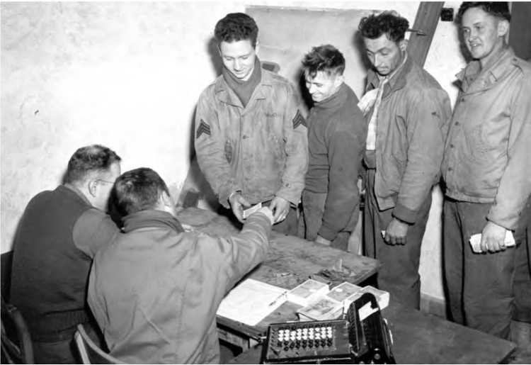
REWARDS FOR STANDING IN LINE: men receiving typhus booster shots (top); men exchanging their French and Belgium francs for German marks (bottom).
BELGIUM AND GERMANY
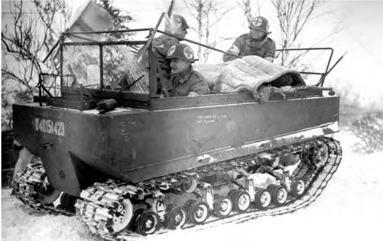
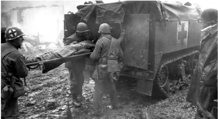
WOUNDED SOLDIERS BEING EVACUATED in tracked vehicles during the winter months. Cargo carrier M 29 (top); half-track personnel carrier M 3 (bottom).
FRANCE
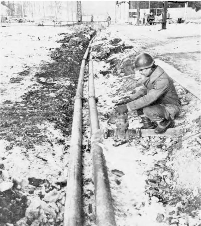
OPENING THE VALVE ON A GASOLINE PIPELINE. The critical fuel situation of September, which had stalled the armored divisions at the West Wall, was materially improved by December. At that time three main pipelines were constructed or under construction: one for the northern armies, one for the central armies, and another for the southern armies.
FRANCE
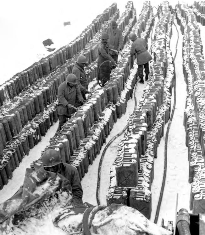
FIVE-GALLON CANS BEING FILLED WITH GASOLINE at a distribution point. On 15 December 1944 the armies had from a five-to nine-day supply of gasoline on hand while the Ninth Air Force had over 600,000 gallons of aviation gasoline and oil stored in the Namur area.
BELGIUM
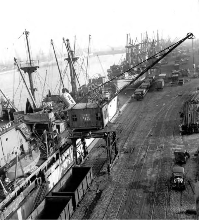
ARMY SUPPLIES BEING UNLOADED at Antwerp. The greatest single factor in the improved supply situation was the port of Antwerp which became operational on 27 November. Despite heavy attacks from the German “V” weapons the port discharged cargo which was badly needed by the forces fighting along the German frontier. Utah and Omaha Beaches ceased operations in November and then only the larger port cities were used as supply ports of entry.
FRANCE
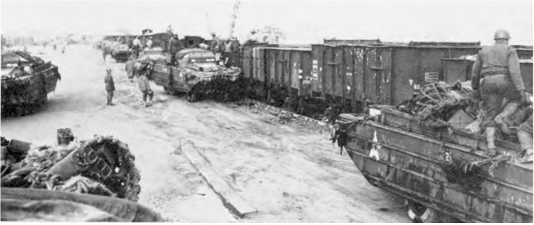
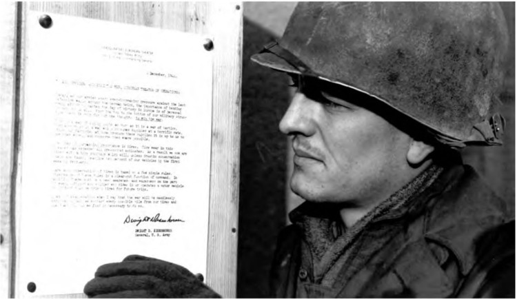
AMPHIBIAN TRUCKS LOADING SUPPLIES into railroad cars after bringing them ashore from ships in the harbor of Le Havre (top). In addition to Antwerp, the major Allied ports were Le Havre, Ghent (opened in January 1945), Rouen, Cherbourg, and Marseille. An enlisted man reading a directive, signed by the theater commander, concerning the conservation of tires, an effort made to curtail the wasteful use of equipment and supplies (bottom). While in general the supply situation was much improved over that in September there were still critical shortages in a wide variety of items including antifreeze, tires, post exchange rations, miscellaneous signal equipment, and some winter clothing.
BELGIUM
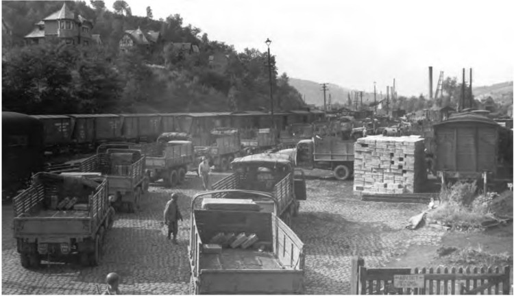
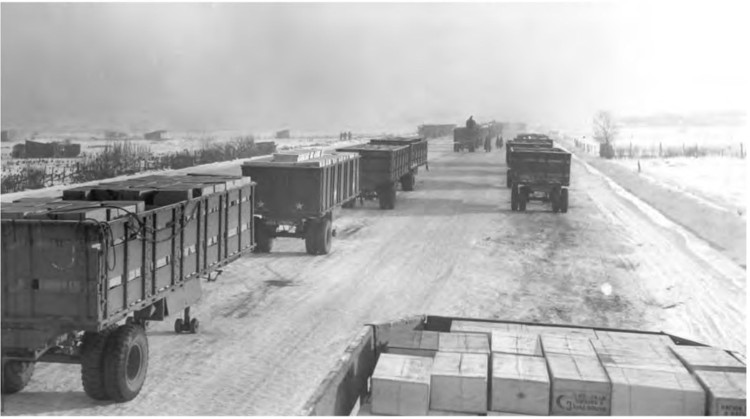
2½-TON TRUCKS PICK UP RATIONS at a Belgian railhead (top). 10-ton semitrailers loaded with rations at Antwerp, ready to be hauled to the forward depots (bottom). The multiple-drive motor transport vehicles were continuously on the move and made possible the supplying of troops during the rapid advances.
ARDENNES-ALSACE CAMPAIGN