II.—THE SEA (continued 2)
Reading edition
All this time, in accordance with the general law of action and reaction, the moon must be gradually retreating. As the orbit of the moon is gradually enlarging, the time that the moon takes to revolve around the earth must be continually on the increase; from the present month of twenty-seven days the length of the month will gradually augment as the ages roll by until at last when the moon has reached a certain distance the period of its rotation will have become double what it is at present, or indeed rather more than double, and we shall have the day and the month equal, each being about fourteen hundred hours long. When this state of things is reached, the earth will always turn the same face toward the moon, just as the moon at present always turns the same face toward the earth.
We have already explained how the constant face of the moon can be accounted for by the action of tides raised in the moon by the attraction of the earth. Owing to the small size of the moon the tides have already wrought all that they were capable of doing, and have compelled the moon to succumb to the conditions they imposed. Owing to the great mass of the earth and the comparatively small mass of the moon the tides on the earth raised by the moon have required a much longer period wherein to accomplish their effects than was the case when the earth raised tides on the moon. But small though our satellite may be, yet the tides raised on the earth have incessantly tended to wear down the speed of our globe and reduce it to conformity with the law that the two bodies shall bear the same face toward each other. At present the earth turns round twenty-seven times while the moon goes round once, so the tides have still a gigantic task to accomplish. With unflagging energy, however, they are incessantly engaged at the work, and they are constantly tending to bring down the speed of the earth; constantly tending toward that ultimate condition of things in which the earth and moon are destined to revolve in a period of fourteen hundred hours as if they were connected with invisible bonds.
If such a state of things as this were established then it is plain that tides would no longer ebb and flow, that is, at least, if we exclude from our consideration the intervention of any other body. High tides must prevail at some parts of the earth, and low tides at other parts, but the position of these tides will remain fixed. Where it is high tide it will always be high tide; where it is low tide it will always be low tide. When this state of things is reached, the moon will be constantly visible in the same part of the sky from one half of our globe, while the other half of our globe will never be turned toward the moon. In fact, the moon would always appear to us in a fixed position as the earth would always appear to be if viewed by an observer stationed on the moon. If there were any Lunarians whose residence was confined to the opposite side of the moon, they could never see this earth at all, while those who lived on this side of our satellite would always be able to see the earth apparently fixed in the same part of the sky. An observatory located at the middle of the moon’s disk, say near the crater Ptolemy, would always have the earth in its zenith or very near thereto, while the astronomer, let us say, in the Mare Crisium, would always find the earth low down near his horizon.
In order to facilitate our reasoning I have assumed that the moon is the only tide-producing agent; this is, however, not the case. No doubt the ebb and the flow around our coasts is generated mainly by the attraction of the moon. It must not, however, be forgotten that a portion of the tide is originated by the attraction of the sun. These solar tides will still continue to ebb and flow quite independently of the lunar tides, so that even if the accommodation between the earth and the moon had been completed some further tidal disturbance would not be wanting. The effect of the solar tides will be to abate still further the velocity with which the earth turns round on its axis, and consequently a time must ultimately arrive when the length of the day will be longer than the time which the moon takes to revolve around our earth.
THE GULF STREAM —Lord Kelvin
I mean by the Gulf Stream that mass of heated water which pours from the Strait of Florida across the North Atlantic, and likewise a wider but less definite warm current, evidently forming part of the same great movement of water, which curves northward to the eastward of the West Indian Islands. I am myself inclined, without hesitation, to regard this stream as simply the reflux of the equatorial current, added to no doubt during its northeasterly course by the surface-drift of the anti-trades which follows in the main the same direction.
The scope and limit of the Gulf Stream will be better understood if we inquire in the first place into its origin and cause. As is well known—in two bands, one to the north and the other to the south of the equator—the northeast and southeast trade-winds, reduced to meridional directions by the eastward frictional impulse of the earth’s rotation, drive before them a magnificent surface current of hot water 4,000 miles long by 450 miles broad at an average rate of thirty miles a day. Off the coast of Africa, near its starting-point to the south of the Islands of St. Thomas and Anna Bon this “equatorial current” has a speed of forty miles in the twenty-four hours, and a temperature of 23° C.
Increasing quickly in bulk, and spreading out more and more on both sides of the equator, it flows rapidly due west toward the coast of South America. At the eastern point of South America, Cape St. Roque, the equatorial current splits into two, and one portion trends southward to deflect the isotherms of 21°, 15°.5, 10°, and 4°.5 C. into loops upon our maps, thus carrying a scrap of comfort to the Falkland Islands and Cape Horn; while the northern portion follows the northeast coast of South America, gaining continually in temperature under the influence of the tropical sun. Its speed has now increased to sixty-eight miles in twenty-four hours, and by the union with it of the waters of the river Amazon, it rises to one hundred miles (6.5 feet in a second), but it soon falls off again when it gets into the Caribbean Sea. Flowing slowly through the whole length of this sea, it reaches the Gulf of Mexico through the Strait of Yucatan, when a part of it sweeps immediately round Cuba; but the main stream, “having made the circuit of the Gulf of Mexico, passes through the Strait of Florida; thence it issues as the ‘Gulf Stream’ in a majestic current upward of thirty miles broad, two thousand two hundred feet deep, with an average velocity of four miles an hour, and a temperature of 86° Fahr. (30° C.).” The hot water pours from the strait with a decided though slight northeasterly impulse on account of its great initial velocity. Mr. Croll calculates the Gulf Stream as equal to a stream of water fifty miles broad and a thousand feet deep flowing at a rate of four miles an hour; consequently conveying 5,575,680,000,000 cubic feet of water per hour, or 133,816,320,000,000 cubic feet per day. This mass of water has a mean temperature of 18° C. as it passes out of the gulf, and on its northern journey it is cooled down to 4°.5, thus losing heat to the amount of 13°.5 C. The total quantity of heat therefore transferred from the equatorial regions per day amounts to something like 154,959,300,000,000,000,000 foot-pounds.
This is nearly equal to the whole of the heat received from the sun by the Arctic regions, and, reduced by a half to avoid all possibility of exaggeration, it is still equal to one-fifth of the whole amount received from the sun by the entire area of the North Atlantic. The Gulf Stream, as it issues from the Strait of Florida and expands into the ocean on its northward course, is probably the most glorious natural phenomenon on the face of the earth. The water is of a clear crystalline transparency and an intense blue, and long after it has passed into the open sea it keeps itself apart, easily distinguished by its warmth, its color, and its clearness; and with its edges so sharply defined that a ship may have her stem in the clear blue stream while her stern is still in the common water of the ocean.
Setting aside the wider question of the possibility of a general oceanic circulation arising from heat, cold, and evaporation, I believe that Captain Maury and Dr. Carpenter are the only authorities who of late years have disputed this source of the current which we see and can gauge and measure as it passes out of the Strait of Florida; for it is scarcely necessary to refer to the earlier speculations that it is caused by the Mississippi River, or that it flows downward by gravitation from a “head” of water produced by the trade-winds in the Caribbean Sea.
Captain Maury writes that “the dynamical force that calls forth the Gulf Stream is to be found in the difference as to specific gravity of intertropical and polar waters.” “The dynamical forces which are expressed by the Gulf Stream may with as much propriety be said to reside in those northern waters as in the West India seas: for on one side we have the Caribbean Sea and Gulf of Mexico with their waters of brine; on the other the great polar basin, the Baltic and the North Sea, the two latter with waters which are little more than brackish. In one set of these sea-basins the water is heavy; in the other it is light. Between them the ocean intervenes; but water is bound to seek and to maintain its level; and here, therefore, we unmask one of those agents concerned in causing the Gulf Stream. What is the power of this agent? Is it greater than that of other agents? and how much? We can not say how much; we only know it is one of the chief agents concerned. Moreover, speculate as we may as to all the agencies concerned in collecting these waters, that have supplied the trade-winds with vapor, into the Caribbean Sea, and then in driving them across the Atlantic, we are forced to conclude that the salt which the trade-wind vapor leaves behind it in the tropics has to be conveyed away from the trade-wind region, to be mixed up again in due proportion with the other water of the sea—the Baltic Sea and the Arctic Ocean included—and that these are some of the waters, at least, which we see running off through the Gulf Stream. To convey them away is doubtless one of the offices which in the economy of the ocean has been assigned to it.”
Dr. Carpenter attributes all the great movements of ocean water to a general convective circulation, and of this general circulation he regards the Gulf Stream as a peculiarly modified case. Dr. Carpenter states that “the Gulf Stream constitutes a peculiar case, modified by local conditions,” of “a great general movement of equatorial water toward the polar area.” I confess I feel myself compelled to take a totally different view. It seems to me that the Gulf Stream is the one natural physical phenomenon on the surface of the earth whose origin and principal cause, the drift of the trade-winds, can be most clearly and easily traced.
The further progress and extension of the Gulf Stream through the North Atlantic in relation to influence upon climate has been, however, a fruitful source of controversy. The first part of its course, after leaving the strait, is sufficiently evident, for its water long remains conspicuously different in color and temperature from that of the ocean, and a current having a marked effect on navigation is long perceptible in the peculiar Gulf Stream water. “Narrow at first, it flows round the peninsula of Florida, and, with a speed of about 70 or 80 miles, follows the coast at first in a due north, afterward in a northeast direction. At the latitude of Washington it leaves the North American coast altogether, keeping its northeastward course; and to the south of the St. George’s and Newfoundland banks it spreads its waters more and more over the Atlantic Ocean, as far as the Azores. At these islands a part of it turns southward again toward the African coast. The Gulf Stream has, so long as its waters are kept together along the American coast, a temperature of 26°.6 C.; but, even under north latitude 36°, Sabine found it 23°.3 C. at the beginning of December, while the sea-water beyond the stream showed only 16°.9 C. Under north latitude 40-41° the water is, according to Humboldt, at 22°.5 C. within, and 17°.5 C. without the stream.”
Opposite Tortugas, passing along the Cuban coast, the stream is unbroken and the current feeble; the temperature at the surface is about 26°.7 C. Issuing from the Strait of Bemini the current is turned nearly directly northward by the form of the land; a little to the north of the strait, the rate is from three to five miles an hour. The depth is only 325 fathoms, and the bottom, which in the Strait of Florida was a simple slope and counter-slope, is now corrugated. The surface temperature is about 26°.5 C., while the bottom temperature is 4°.5; so that in the moderate depth of 325 fathoms the equatorial current above and the polar counter-current beneath have room to pass one another, the current from the north being evidently tempered considerably by mixture. North of Mosquito inlet the stream trends to the eastward of north, and off St. Augustine it has a decided set to the eastward. Between St. Augustine and Cape Hatteras the set of the stream and the trend of the coast differ but little, making 5° of easting in 5° of northing. At Hatteras it curves to the northward, and then runs easterly. In the latitude of Cape Charles it turns quite to the eastward, having a velocity of from a mile to a mile and a half in the hour.
A brief account of one of the sections will best explain the general phenomena of the stream off the coast of America. I will take the section following a line at right angles to the coast off Sandy Hook. From the shore out, for a distance of about 250 miles, the surface temperature gradually rises from 21° to 24° C.; at 10 fathoms it rises from 19° to 22° C.; and at 20 fathoms it maintains, with a few irregularities, a temperature of 19° C. throughout the whole space; while at 100, 200, 300, and 400 fathoms it maintains in like manner the respective temperatures of 8°.8, 5°.7, 4°.5, and 2°.5 C. This space is, therefore, occupied by cold water, and observation has sufficiently proved that the low temperature is due to a branch of the Labrador current creeping down along the coast in a direction opposite to that of the Gulf Stream. In the Strait of Florida this cold stream divides—one portion of it passing under the hot Gulf Stream water into the Gulf of Mexico, while the remainder courses round the western end of Cuba. Two hundred and forty miles from the shore the whole mass of water takes a sudden rise of about 10° C. within 25 miles, a rise affecting nearly equally the water at all depths, and thus producing the singular phenomenon of two masses of water in contact—one passing slowly southward and the other more rapidly northward, at widely different temperatures at the same levels. This abutting of the side of the cold current against that of the Gulf Stream is so abrupt that it has been aptly called by Lieutenant George M. Bache the “cold wall.” Passing the cold wall, we reach the Gulf Stream, presenting all its special characters of color and transparency and of temperature. In the section which we have chosen as an example, upward of 300 miles in length, the surface temperature is about 26°.5 C., but the heat is not uniform across the stream, for we find that throughout its entire length, as far south as the Cape Canaveral section, the stream is broken up into longitudinal alternating bands of warmer and cooler water. Off Sandy Hook, beyond the cold wall, the stream rises to a maximum of 27°.8 C., and this warm band extends for about 60 miles. The temperature then falls to a minimum of 26°.5 C., which it retains for about 30 miles, when a second maximum of 27°.4 succeeds, which includes the axis of the Gulf Stream, and is about 170 miles wide. This is followed by a second minimum of 25°.5 C., and this by a third maximum, when the bands become indistinct. It is singular that the minimum bands correspond with valley-like depressions in the bottom, which follow in succession the outline of the coast and lodge deep southward extensions of the polar indraught.
The last section of the Gulf Stream surveyed by the American hydrographers extends in a southeasterly direction from Cape Cod, lat. 41° N., and traces the Gulf Stream, still broken up by its bands of unequal temperature, spreading directly eastward across the Atlantic; its velocity has, however, now become inconsiderable, and its limits are best traced by the thermometer.
The course of the Gulf Stream beyond this point has given rise to much discussion. I again quote Professor Buff for what may be regarded as the view most generally received among physical geographers:
“A great part of the warm water is carried partly by its own motion, but chiefly by the prevailing west and northwest winds, toward the coast of Europe and even beyond Spitzbergen and Nova Zembla; and thus a part of the heat of the south reaches far into the Arctic Ocean. Hence, on the north coast of the Old Continent, we always find driftwood from the southern regions, and on this side the Arctic Ocean remains free from ice during a great part of the year, even as far up as 80° north latitude; while on the opposite coast (of Greenland) the ice is not quite thawed even in summer.” The two forces invoked by Professor Buff to perform the work are thus the vis à tergo of the trade-wind drift and the direct driving power of the anti-trades, producing what has been called the anti-trade drift. This is quite in accordance with the views here advocated. The proportion in which these two forces act, it is undoubtedly impossible in the present state of our knowledge to determine.
Mr. A. G. Findlay, a high authority on all hydrographic matters, read a paper on the Gulf Stream before the Royal Geographical Society, reported in the 13th volume of the Proceedings of the Society. Mr. Findlay, while admitting that the temperature of Northern Europe is abnormally ameliorated by a surface-current of the warm water of the Atlantic which reaches it, contends that the Gulf Stream proper—that is to say, the water injected, as it were, into the Atlantic through the Strait of Florida by the impulse of the trade-winds—becomes entirely thinned out, dissipated, and lost opposite the Newfoundland banks about lat. 45° N. The warm water of the southern portion of the North Atlantic basin is still carried northward; but Mr. Findlay attributes this movement solely to the anti-trades—the southwest winds—which by their prevalence keep up a balance of progress in a northeasterly direction in the surface layer of the water.
Dr. Carpenter entertains a very strong opinion that the dispersion of the Gulf Stream may be affirmed to be complete in about lat. 45° N. and long. 35° W. Dr. Carpenter admits the accuracy of the projection of the isotherms on the maps of Berghaus, Dove, Petermann, and Keith Johnston, and he admits likewise the conclusion that the abnormal mildness of the climate on the northwestern coast of Europe is due to a movement of equatorial water in a northeasterly direction. “What I question is the correctness of the doctrine that the northeast flow is an extension or prolongation of the Gulf Stream, still driven on by the vis à tergo of the trade-winds—a doctrine which (greatly to my surprise) has been adopted and defended by my colleague, Professor Wyville Thomson. But while these authorities attribute the whole or nearly the whole of this flow to the true Gulf Stream, I regard a large part, if not the whole, of that which takes place along our own western coast, and passes north and northeast between Iceland and Norway toward Spitzbergen, as quite independent of that agency; so that it would continue if the North and South American Continents were so completely disunited that the equatorial currents would be driven straight onward by the trade-winds into the Pacific Ocean, instead of being embayed in the Gulf of Mexico and driven out in a northeast direction through the ‘narrows’ off Cape Florida.” Dr. Carpenter does not mean by this to indorse Mr. Findlay’s opinion that the movement beyond the 54th parallel of latitude is due solely to the drift of the anti-trades; he says, “On the view I advocate, the northeasterly flow is regarded as due to the vis à fronte originating in the action of cold upon the water of the polar area, whereby its level is always tending to depression.” The amelioration of the climate of northwestern Europe is thus caused by a “modified case” of the general oceanic circulation, and neither by the Gulf Stream nor by the anti-trade drift.
Although there are, up to the present time, very few trustworthy observations of deep-sea temperatures, the surface temperature of the North Atlantic has been investigated with considerable care. The general character of the isothermal lines, with their singular loop-like northern deflections, has long been familiar through the temperature charts of the geographers already quoted, and of late years a prodigious amount of data have been accumulated.
In 1870, Dr. Petermann, of Gotha, published an extremely valuable series of temperature charts, embodying the results of the reduction of upward of 100,000 observations.
Dr. Petermann has devoted the special attention of a great part of his life to the distribution of heat on the surface of the ocean, and the accuracy and conscientiousness of his work in every detail are beyond the shadow of a doubt.
In the North Atlantic every curve of equal temperature, whether for the summer, for the winter, for a single month, or for the whole year, instantly declares itself as one of a system of curves which are referred to the Strait of Florida as a source of heat, and the flow of warm water may be traced in a continuous stream—indicated when its movement can no longer be observed by its form—fanning out from the neighborhood of the Strait across the Atlantic, skirting the coasts of France, Britain, and Scandinavia, rounding the North Cape, and passing the White Sea and the Sea of Kari, bathing the western shores of Nova Zembla and Spitzbergen, and finally coursing round the coast of Siberia, a trace of it still remaining to find its way through the narrow and shallow Behring’s Strait into the North Pacific.
Now, it seems to me that if we had only these curves upon the chart, deduced from an almost infinite number of observations which are themselves merely laboriously multiplied corroborations of many previous ones, without having any clew to their rationale, we should be compelled to admit that whatever might be the amount and distribution of heat derived from a general oceanic circulation—whether produced by the prevailing winds of the region, by convection, by unequal barometric pressure, by tropical heat, or by arctic cold—the Gulf Stream, the majestic stream of warm water whose course is indicated by the deflections of the isothermal lines, is sufficiently powerful to mask all the rest, and, broadly speaking, to produce of itself all the abnormal thermal phenomena.
The deep-sea temperatures taken in the Porcupine have an important bearing upon this question, since they give us the depth and volume of the mass of water which is heated above its normal temperature, and which we must regard as the softener of the winds blowing on the coasts of Europe. In the Bay of Biscay, after passing through a shallow band superheated by direct radiation, a zone of warm water extends to the depth of 800 fathoms, succeeded by cold water to a depth of nearly two miles. In the Rockall channel the warm layer has nearly the same thickness, and the cold underlying water is 500 fathoms deep. Off the Butt of Lewis the bottom temperature is 5°.2 C. at 767 fathoms, so that there the warm layer evidently reaches to the bottom. In the Faroe channel the warm water forms a surface layer, and the cold water underlies it, commencing at a depth of 200 fathoms—567 fathoms above the level of the bottom of the warm water off the Butt of Lewis. The cold water abuts against the warm—there is no barrier between them. Part of the warm water flows over the cold indraught, and forms the upper layer in the Faroe channel. What prevents the cold water from slipping, by virtue of its greater weight, under the warm water of the Butt of Lewis? It is quite evident that there must be some force at work keeping the warm water in that particular position, or, if it be moving, compelling it to follow that particular course. The comparatively high temperature from 100 fathoms to 900 fathoms I have always attributed to the northern accumulation of the water of the Gulf Stream. The amount of heat derived directly from the sun by the water as it passes through any particular region, must be regarded, as I have already said, as depending almost entirely upon latitude. Taking this into account, the surface temperatures in what we were in the habit of calling the “warm area” coincided precisely with Petermann’s curves indicating the northward path of the Gulf Stream.
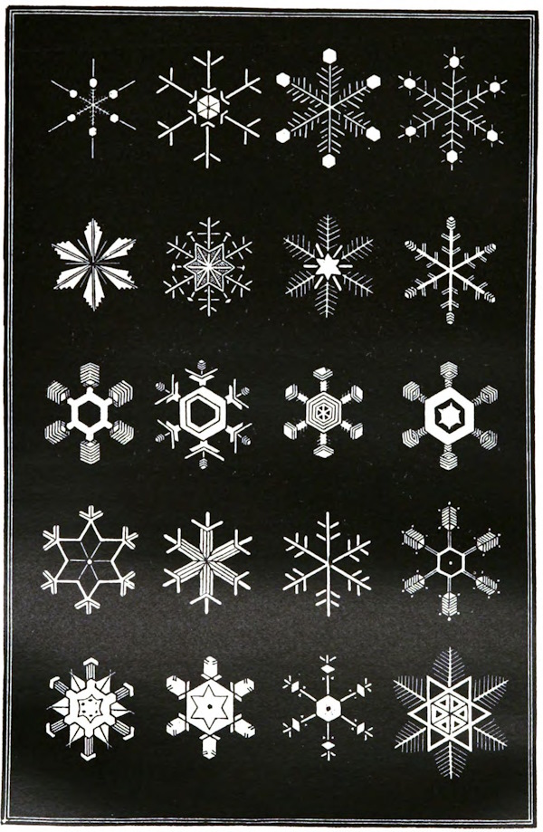
Typical Forms of Snowflakes
Showing the Tendency to take the Form of Six-Pointed Figures
The North Atlantic and Arctic seas form together a cul de sac closed to the northward, for there is practically no passage for a body of water through Behring’s Strait. While, therefore, a large portion of the water, finding no free outlet toward the northeast, turns southward at the Azores, the remainder, instead of thinning off, has rather a tendency to accumulate against the coasts bounding the northern portions of the trough. We accordingly find that it has a depth off the west coast of Iceland of at least 4,800 feet, with an unknown lateral extension. Dr. Carpenter, discussing this opinion, says: “It is to me physically inconceivable that this surface film of lighter (because warmer) water should collect itself together again—even supposing it still to retain any excess of temperature—and should burrow downward into the ‘trough,’ displacing colder and heavier water, to a depth much greater than that which it possesses at the point of its greatest ‘glory’—its passage through the Florida Narrows. The upholders of this hypothesis have to explain how such a recollection and dipping-down of the Gulf Stream water is to be accounted for on physical principles.” I believe that, as a rule, experimental imitations on a small scale are of little use in the illustration of natural phenomena; a very simple experiment will, however, show that such a process is possible. If we put a tablespoonful of cochineal into a can of hot water, so as to give it a red tint, and then run it through a piece of India-rubber tube with a considerable impulse along the surface of a quantity of cold water in a bath, we see the red stream widening out and becoming paler over the general surface of the water till it reaches the opposite edge, and very shortly the rapidly heightening color of a band along the opposite wall indicates an accumulation of the colored water where its current is arrested. If we now dip the hand into the water of the centre of the bath, a warm bracelet merely encircles the wrist; while at the end of the bath opposite the warm influx, the hot water, though considerably mixed, envelops the whole hand.
The North Atlantic forms a basin closed to the northward. Into the corner of this basin, as into a bath—with a northeasterly direction given to it by its initial velocity, as if the supply pipe of the bath were turned so as to give the hot water a definite impulse—this enormous flood is poured, day and night, winter and summer. When the basin is full—and not till then—overcoming its northern impulse, the surplus water turns southward in a southern eddy, so that there is a certain tendency for the hot water to accumulate in the northern basin, to “bank down” along the northeastern coasts.
It is scarcely necessary to say that for every unit of water which enters the basin of the North Atlantic, and which is not evaporated, an equivalent must return. As cold water can gravitate into the deeper parts of the ocean from all directions, it is only under peculiar circumstances that any movement having the character of a current is induced; these circumstances occur, however, in the confined and contracted communication between the North Atlantic and the Arctic Sea. Between Cape Farewell and North Cape there are only two channels of any considerable depth, the one very narrow along the east coast of Iceland, and the other along the east coast of Greenland. The shallow part of the sea is entirely occupied, at all events during summer, by the warm water of the Gulf Stream, except at one point, where a rapid current of cold water, very restricted and very shallow, sweeps round the south of Spitzbergen and then dips under the Gulf Stream water at the northern entrance of the German Ocean.
This cold flow, at first a current, finally a mere indraught, affects greatly the temperature of the German Ocean; but it is entirely lost, for the slight current which is again produced by the great contraction at the Strait of Dover has a summer temperature of 7°.5 C. The path of the cold indraught from Spitzbergen may be readily traced by the depressions in the surface isothermal lines, and in dredging by the abundance of gigantic amphipodous and isopodous crustaceans, and other well-known Arctic animal forms.
From its low initial velocity the Arctic return current, or indraught, must doubtless tend slightly in a westerly direction, and the higher specific gravity of the cold water may probably even more powerfully lead it into the deepest channels; or possibly the two causes may combine, and in the course of ages the currents may hollow out deep southwesterly grooves. The most marked is the Labrador current, which passes down inside the Gulf Stream along the coasts of Carolina and New Jersey, meeting it in the strange abrupt “cold wall,” dipping under it as it issues from the Gulf, coming to the surface again on the other side, and a portion of it actually passing under the Gulf Stream, as a cold counter-current, into the Gulf of Mexico.
Fifty or sixty miles out from the west coast of Scotland, I believe the Gulf Stream forms another, though a very mitigated, “cold wall.” In 1868, after our first investigation of the very remarkable cold indraught into the channel between Shetland and Faroe, I stated my belief that the current was entirely banked up in the Faroe Channel by the Gulf Stream passing its gorge. Since that time I have been led to suspect that a part of the Arctic water oozes down the Scottish coast, much mixed, and sufficiently shallow to be affected throughout by solar radiation. About sixty or seventy miles from shore the isothermal lines have a slight but uniform deflection. Within that line types characteristic of the Scandinavian fauna are numerous in shallow water, and in the course of many years’ use of the towing net I have never met with any of the Gulf Stream pteropods, or of the lovely Polycystina and Acanthometrina which absolutely swarm beyond that limit. The difference in mean temperature between the east and west coasts of Scotland, amounting to about 1° C., is almost somewhat less than might be expected if the Gulf Stream came close to the western shore.
While the communication between the North Atlantic and the Arctic Sea—itself a second cul de sac—is thus restricted, limiting the interchange of warm and cold water in the normal direction of the flow of the Gulf Stream, and causing the diversion of a large part of the stream to the southward, the communication with the Antarctic basin is as open as the day; a continuous and wide valley upward of 2,000 fathoms in depth stretching northward along the western coasts of Africa and Europe.
That the southern water wells up into this valley there could be little doubt from the form of the ground; but here again we have curious corroborative evidence in the remarkable reversal of the curves of the isotherms. The temperature of the bottom water at 1,230 fathoms off Rockall is 3°.22 C., exactly the same as that of water at the same depth in the serial sounding, lat. 47° 38′ N., long. 12° 08′ W. in the Bay of Biscay, which affords a strong presumption that the water in both cases is derived from the same source; and the bottom water off Rockall is warmer than the bottom water in the Bay of Biscay (2°.5 C.), while a cordon of temperature soundings drawn from the northwest of Scotland to a point on the Iceland shallow gives no temperature lower than 6°.5 C. This makes it very improbable that the low temperature of the Bay of Biscay is due to any considerable portion of the Spitzbergen current passing down the west coast of Scotland; and as the cold current to the east of Iceland passes southward considerably to the westward, as indicated by the successive depressions in the surface isotherms, the balance of probability seems to be in favor of the view that the conditions of temperature and the slow movement of this vast mass of moderately cold water, nearly two statute miles in depth, are to be referred to an Antarctic rather than to an Arctic origin.
The North Atlantic Ocean seems to consist first of a great sheet of warm water, the general northerly reflux of the equatorial current. Of this the greater part passes through the Strait of Florida, and its northeasterly flow is aided and maintained by the anti-trades, the whole being generally called the Gulf Stream. This layer is of varying depths, apparently from the observations of Captain Chimmo and others, thinning to a hundred fathoms or so in the mid-Atlantic, but attaining a depth of 700 to 800 fathoms off the west coasts of Ireland and Spain. Secondly, of a “stratum of intermixture” which extends to about 200 fathoms in the Bay of Biscay, through which the temperature falls rather rapidly; and, thirdly, of an underlying mass of cold water, in the Bay of Biscay 1,500 fathoms deep, derived as an indraught falling in by gravitation from the deepest available source, whether Arctic or Antarctic. It seems at first sight a startling suggestion, that the cold water filling deep ocean valleys in the Northern Hemisphere may be partly derived from the southern; but this difficulty, I believe, arises from the idea that there is a kind of diaphragm at the equator between the northern and southern ocean basins, one of the many misconceptions which follow in the train of a notion of a convective circulation in the sea similar to that in the atmosphere. There is undoubtedly a gradual elevation of an intertropical belt of the underlying cold water, which is being raised by the subsiding of still colder water into its bed to supply the place of the water removed by the equatorial current and by excessive evaporation; but such a movement must be widely and irregularly diffused and excessively slow, not in any sense comparable with the diaphragm produced in the atmosphere by the rushing upward of the northeast and southeast trade-winds in the zone of calms. Perhaps one of the most conclusive proofs of the extreme slowness of the movement of the deep indraught is the nature of the bottom. Over a great part of the floor of the Atlantic a deposit is being formed of microscopic shells. These with their living inhabitants differ little in specific weight from the water itself, and form a creamy flocculent layer, which must be at once removed wherever there is a perceptible movement. In water of moderate depth, in the course of any of the currents, this deposit is entirely absent, and is replaced by coarser or finer gravel.
It is only on the surface of the sea that a line is drawn between the two hemispheres by the equatorial current, whose effect in shedding a vast intertropical drift of water on either side as it breaks against the eastern shores of equatorial land may be seen at a glance on the most elementary physical chart.
The Gulf Stream loses an enormous amount of heat in its northern tour. At a point 200 miles west of Ushant, where observations at the greatest depths were made on board the Porcupine, a section of the water of the Atlantic shows three surfaces at which interchange of temperature is taking place. First, the surface of the sea—that is to say, the upper surface of the Gulf Stream layer—is losing heat rapidly by radiation, by contact with a layer of air which is in constant motion and being perpetually cooled by convection, and by the conversion of water into vapor. As this cooling of the Gulf Stream layer takes place principally at the surface, the temperature of the mass is kept pretty uniform by convection. Secondly, the band of contact of the lower surface of the Gulf Stream water with the upper surface of the cold indraught. Here the interchange of temperature must be very slow, though that it does take place is shown by the slight depression of the surface isotherms over the principal paths of the indraught. But there is a good deal of intermixture extending through a considerable layer. The cold water being beneath, convection in the ordinary sense can not occur, and interchange of temperature must depend mainly upon conduction and diffusion, causes which in the case of masses of water must be almost secular in their action, and probably to a much greater extent upon mixture produced by local currents and by the tides. The third surface is that of contact between the cold indraught and the bottom of the sea. The temperature of the crust of the earth has been variously calculated at from 4° to 11° C., but it must be completely cooled down by anything like a movement and constant renewal of cold water. All we can say, therefore, is that contact with the bottom can never be a source of depression of temperature. As a general result the Gulf Stream water is nearly uniform in temperature throughout the greater part of its depth; there is a marked zone of intermixture at the junction between the warm water and the cold, and the water of the cold indraught is regularly stratified by gravitation; so that in deep water the contour lines of the sea-bottom are, speaking generally, lines of equal temperature. Keeping in view the enormous influence which ocean currents exercise in the distribution of climates at the present time, I think it is scarcely going too far to suppose that such currents—movements communicated to the water by constant winds—existed at all geological periods as the great means, I had almost said the sole means, of producing a general oceanic circulation, and thus distributing heat in the ocean. They must have existed, in fact, wherever equatorial land interrupted the path of the drift of the trade-winds. Wherever a warm current was deflected to north or south from the equatorial belt a polar indraught crept in beneath to supply its place; and the ocean consequently consisted, as in the Atlantic and doubtless in the Pacific at the present day, of an upper warm stratum and a lower layer of cold water becoming gradually colder with increasing depth.
I must repeat that I have seen as yet no reason to modify the opinion which I have consistently held from the first, that the remarkable conditions of climate on the coasts of Northern Europe are due in a broad sense solely to the Gulf Stream. That is to say that, although movements, some of them possibly of considerable importance, must be produced by differences of specific gravity, yet the influence of the great current which we call the Gulf Stream, the reflux of the great equatorial current, is so paramount as to reduce all other causes to utter insignificance.
THE PHOSPHORESCENCE OF THE SEA —G. Hartwig
He who still lingers on the shore after the shades of evening have descended not seldom enjoys a most magnificent spectacle; for lucid flashes burst from the bosom of the waters, as if the sea were anxious to restore to the darkened heavens the light it had received from them during the day. On approaching the margin of the rising flood to examine more closely the sparkling of the breaking wave, the spreading waters seem to cover the beach with a sheet of fire.
Each footstep over the moist sands elicits luminous star-like points and a splash in the water resembles the awakening of slumbering flames. The same wonderful and beauteous aspect frequently gladdens the eye of the navigator who plows his way through the wide deserts of ocean, particularly if his course leads him through the tropical seas.
“When a vessel,” says Humboldt, “driven along by a fresh wind, divides the foaming waters, one never wearies of the lovely spectacle their agitation affords; for, whenever a wave makes the ship incline sidewise, bluish or reddish flames seem to shoot upward from the keel. Beautiful beyond description is the sight of a troop of dolphins gamboling in the phosphorescent sea. Every furrow they draw through the waters is marked by streaks of intense light. In the Gulf of Cariaco, between Cumana and the peninsula of Maniquarez, this scene has often delighted me for hours.”
But even in the colder oceanic regions the brilliant phenomenon appears from time to time in its full glory. During a dark and stormy September night, on the way from the Sealion Island, Saint George, to Unalashka, Chamisso admired as beautiful a phosphorescence of the ocean as he had ever witnessed in the tropical seas. Sparks of light, remaining attached to the sails that had been wetted by the spray, continued to glow in another element. Near the south point of Kamtchatka, at a water temperature hardly above freezing point, Ermann saw the sea no less luminous than during a seven months’ sojourn in the tropical ocean. This distinguished traveler positively denies that warmth decidedly favors the luminosity of the sea.
At Cape Colborn, one of the desolate promontories of the desolate Victoria Land, the phosphoric gleaming of the waves, when darkness closed in, was so intense that Simpson assures us he had seldom seen anything more brilliant. The boats seemed to cleave a flood of molten silver, and the spray, dashed from their bows before the fresh breeze, fell back in glittering showers into the deep.
Mr. Charles Darwin paints in vivid colors the magnificent spectacle presented by the sea while sailing in the latitude of Cape Horn on a very dark night. There was a fresh breeze, and every part of the surface, which during the day is seen as foam, now glowed with a pale light. The vessel drove before her bows two billows of liquid phosphorus, and in her wake she was followed by a milky train. As far as the eye reached, the crest of every wave was bright, and the sky above the horizon, from the reflected glare of these livid flames, was not so utterly obscure as over the rest of the heavens.
While La Venus was at anchor before Simon’s Town, the breaking of the waves produced so strong a light that the room in which the naturalists of the expedition were seated was illumined as by sudden flashes of lightning. Although more than fifty paces from the beach when the phenomenon took place, they tried to read by this wondrous oceanic light, but the successive glimpses were of too short duration to gratify their wishes.
Thus we see the same nocturnal splendor which shines forth in the tropical seas and gleams along our shores burst forth from the Arctic waters, and from the waves that bathe the southern promontories of the Old and the New Worlds.
But what is the cause of the beautiful phenomenon so widely spread over the face of the ocean? How comes it that at certain times flames issue from the bosom of an element generally so hostile to their appearance?
Without troubling the reader with the groundless surmises of ancient naturalists, or repeating the useless tales of the past, I shall at once place myself with him on the stage of our actual knowledge of this interesting and mysterious subject.
It is now no longer a matter of doubt that many of the inferior marine animals possess the faculty of secreting a luminous matter, and thus adding their mite to the grand phenomenon. When we consider their countless multitudes, we shall no longer wonder at such magnificent effects being produced by creatures individually so insignificant.
In our seas it is chiefly a minute gelatinous animal, the Noctiluca miliaris, most probably an aberrant member of the infusorial group, which, as it were, repeats the splendid spectacle of the starry heavens on the surface of the ocean. In form it is nearly globular, presenting on one side a groove, from the anterior extremity of which issues a peculiar curved stalk or appendage marked by transverse lines, which might seem to be made use of as an organ of locomotion. Near the base of this tentacle is placed the mouth, which passes into a dilatable digestive cavity, leading, according to Mr. Huxley, to a distinct anal orifice. From the rather firm external coat proceed thread-like prolongations through the softer mass of the body, so as to divide it into irregular chambers. This little creature, which is just large enough to be discerned by the naked eye when the water in which it may be swimming is contained in a glass jar exposed to the light, seems to feed on diatoms, as this loricæ may frequently be detected in its interior. It multiplies by spontaneous fission, and the rapidity of this process may be inferred from the immensity of its numbers. A single bucket of luminous sea-water will often contain thousands, while for miles and miles every wave breaking on the shore expands in a sheet of living flame. It was first described by Forster in the Pacific Ocean; it occurs on all the shores of the Atlantic; and the Polar Seas are illumined by its fairy light. “The nature of its luminosity,” says Dr. Carpenter, “is found by microscopic examination to be very peculiar; for what appears to the eye to be a uniform glow is resolvable under a sufficient power into a multitude of evanescent scintillations, and these are given forth with increased intensity whenever the body of the animal receives any mechanical shock.”
The power of emitting a phosphorescent light is widely diffused, both among the free-swimming and the sessile Cœlenterata. Many of the Physophoridæ are remarkable for its manifestation, and a great number of the jelly-fishes are luminous. Our own Thaumantias lucifera, a small and by no means rare medusid, displays the phenomenon in a very beautiful manner, for, when irritated by contact of fresh water, it marks its position by a vivid circlet of tiny stars, each shining from the base of a tentacle. A remarkable greenish light, like that of burning silver, may also be seen to glow from many of our Sertularians, becoming much brighter under various modes of excitation.
Among the Ctenophora the large Cestum Veneris of the Mediterranean is specially distinguished for its luminosity, and while moving beneath the surface of the water gleams at night like a brilliant band of flame.
The Sea-pens are eminently phosphorescent, shining at night with a golden-green light of a most wonderful softness. When touched, every branchlet above the shock emits a phosphoric glow, while all the polyps beneath remain in darkness. When thrown into fresh water or alcohol, they scatter sparks about in all directions, a most beautiful sight; dying, as it were, in a halo of glory.
But of all the marine animals the Pyrosomas, doing full justice to their name (fire bodies), seem to emit the most vivid coruscations. Bibra relates in his Travels to Chili that he once caught half a dozen of these remarkable light-bearers, by whose phosphorescence he could distinctly read their own description in a naturalist’s vade-mecum. Although completely dark when at rest, the slightest touch sufficed to elicit their clear blue-green light. During a voyage to India, Mr. Bennett had occasion to admire the magnificent spectacle afforded by whole shoals of Pyrosomas. The ship, proceeding at a rapid rate, continued during an entire night to pass through distinct but extensive fields of these mollusks, floating and glowing as they floated on all sides of her course. Enveloped in a flame of bright phosphorescent light, and gleaming with a greenish lustre, the Pyrosomas, in vast sheets, upward of a mile in breadth, and stretching out till lost in the distance, presented a sight the glory of which may be easily imagined. The vessel, as it chased the gleaming mass, threw up strong flashes of light, as if plowing through liquid fire, which illuminated the hull, the sails, and the ropes with a strange, unearthly radiance.
In his memoir on the Pyrosoma, M. Péron describes with lively colors the circumstances under which he first made its discovery, during a dark and stormy night, in the tropical Atlantic. “The sky,” says this distinguished naturalist, “was on all sides loaded with heavy clouds; all around the obscurity was profound; the wind blew violently; and the ship cut her way with rapidity. Suddenly we discovered at some distance a great phosphorescent band stretched across the waves, and occupying an immense tract in advance of the ship. Heightened by the surrounding circumstances, the effect of this spectacle was romantic, imposing, sublime, riveting the attention of all on board. Soon we reached the illuminated tract, and perceived that the prodigious brightness was certainly and only attributable to the presence of an innumerable multitude of largish animals floating with the waves. From their swimming at different depths they took apparently different forms—those at the greatest depths were very indefinite, presenting much the appearance of great masses of fire, or rather enormous, red-hot cannon-balls; while those more distinctly seen near the surface perfectly resembled incandescent cylinders of iron.
“Taken from the water, these animals entirely resembled each other in form, color, substance, and the property of phosphorescence, differing only in their sizes, which varied from three to seven inches. The large, longish tubercles with which the exterior of the Pyrosomas was bristled were of a firmer substance, and more transparent than the rest of the body, and were brilliant and polished like diamonds. These were the principal scene of phosphorescence. Between these large tubercles, smaller ones, shorter and more obtuse, could be distinguished; these also were phosphorescent. Lastly, in the interior of the substance of the animal, could be seen, by the aid of the transparency, a number of little, elongated, narrow bodies (viscera), which also participated in a high degree in the possession of phosphoric light.”
In the Pholades or Lithodomes, that bore their dwellings in hard stone, as other shell-fish do in the loose sands, the whole mass of the body is permeated with light. Pliny gives us a short but animated description of the phenomenon in the edible date-shell of the Mediterranean (Pholas dactylus):
“It is in the nature of the pholades to shine in the darkness with their own light, which is the more intense as the animal is more juicy. While eating them, they shine in the mouth and on the hands, nay, even the drops falling from them upon the ground continue to emit light, a sure proof that the luminosity we admire in them is associated with their juice.”
Milne-Edwards found this observation perfectly correct, for, wishing to place some living pholades in alcohol, he saw a luminous matter exude from their bodies, which, on account of its weight, sank in the liquid, covering the bottom of the vessel, and there forming a deposit as shining as when it was in contact with the air.
Several kinds of fishes likewise possess the luminous faculty. The sunfish, that strange deformity emits a phosphoric gleam; and a species of Gunard (Trigla lucerna) is said to sparkle in the night, so as to form fiery streams through the water.
With regard to the luminosity of the larger marine animals, Ermann, however, remarks that he so often saw small luminous crustacea in the abdominal cavity of the transparent Salpa pinnata that it may well be asked whether the phosphorescence of the larger creatures is not in reality owing to that of their smaller companions.
According to Mr. Bennett—Whaling Voyage Round the Globe—a species of shark first discovered by himself is distinguished by an uncommonly strong emission of light. When the specimen, taken at night, was removed into a dark apartment, it afforded a very interesting spectacle. The entire inferior surface of the body and head emitted a vivid and greenish phosphorescent gleam, imparting to the creature by its own light a truly ghastly and terrific appearance. The luminous effect was constant, and not perceptibly increased by agitation or friction. When the shark expired (which was not until it had been out of the water more than three hours), the luminous appearance faded entirely from the abdomen, and more gradually from other parts, lingering longest around the jaws and on the fins.
The only part of the under surface of the animal which was free from luminosity was the black collar round the throat; and while the inferior surface of the pectoral, anal, and caudal fins shone with splendor, their superior surface (including the upper lobe of the tail fin) was in darkness, as were also the dorsal fins and the back and summit of the head.
Mr. Bennett is inclined to believe that the luminous power of this shark resides in a peculiar secretion from the skin. It was his first impression that the fish had accidentally contracted some phosphorescent matter from the sea, or from the net in which it was captured; but the most rigid investigation did not confirm this suspicion, while the uniformity with which the luminous gleam occupied certain portions of the body and fins, its permanence during life, and decline and cessation upon the approach and occurrence of death, did not leave a doubt in his mind but that it was a vital principle essential to the economy of the animal. The small size of the fins would seem to denote that this fish is not active in swimming; and, since it is highly predaceous and evidently of nocturnal habits, we may perhaps indulge in the hypothesis that the phosphorescent power it possesses is of use to attract its prey, upon the same principle as the Polynesian islanders and others employ torches in night-fishing.
Some of the lower sea-plants also appear to be luminous. Thus, over a space of more than 600 miles (between lat. 8° N. and 2° S.), Meyen saw the ocean covered with phosphorescent Oscillatoria, grouped together into small balls or globules, from the size of a poppy-seed to that of a lentil.
But if the luminosity of the ocean generally proceeds from living creatures, it sometimes also arises from putrefying organic fibres and membranes, resulting from the decomposition of these living light bearers. “Sometimes,” says Humboldt, “even a high magnifying power is unable to discover any animals in the phosphorescent water, and yet light gleams forth wherever a wave strikes against a hard body and dissolves in foam. The cause of this phenomenon lies then most likely in the putrefying fibres of dead mollusks, which are mixed with the waters in countless numbers.”
Summing up the foregoing in a few words, it is thus an indisputable fact that the phosphorescence of the sea is by no means an electrical or magnetic property of the water, but exclusively bound to organic matter, living or dead. But although thus much has been ascertained, we have as yet only advanced one step toward the unraveling of the mystery, and its prominent cause remains an open question. Unfortunately, science is still unable to give a positive answer, and we are obliged to be content with a more or less plausible hypothesis.
We know as little of what utility marine phosphorescence may be. Why do the countless myriads of Mammariæ gleam and sparkle along our coasts? Is it to signify their presence to other animals, and direct them to the spot where they may find abundance of food? So much is certain, that so grand and widespread a phenomenon must necessarily serve some end equally grand and important.
As the phosphorescence of the sea is owing to living creatures, it must naturally show itself in its greatest brilliancy when the ocean is at rest; for during the daytime we find the surface of the waters most peopled with various animals when only a slight zephyr glides over the sea. In stormy weather, the fragile or gelatinous world of the lower marine creatures generally seek a greater depth, until the elementary strife has ceased, when it again loves to sport in the warmer or more cheerful superficial waters.
In the tropical zone, Humboldt saw the sea most brilliantly luminous before a storm, when the air was sultry and the sky covered with clouds. In the North Sea we observe the phenomenon most commonly during fine, tranquil autumnal nights; but it may be seen at every season of the year, even when the cold is most intense. Its appearance is, however, extremely capricious; for, under seemingly unaltered circumstances, the sea may one night be very luminous and the next quite dark. Often months, even years, pass by without witnessing it in full perfection. Does this result from a peculiar state of the atmosphere, or do the little animals love to migrate from one part of the coast to another?
It is remarkable that the ancients should have taken so little notice of oceanic phosphorescence. The Periplus of Hanno contains, perhaps, the only passage in which the phenomenon is described.
To the south of Cerne the Carthaginian navigator saw the sea burn, as it were, with streams of fire. Pliny, in whom the miracle (miraculum, as he calls it) of the date-shell excited so lively an admiration, and who must often have seen the sea gleam with phosphoric light, as the passage proves where he mentions in a few dry words the luminous gurnard (lucerna) stretching out a fiery tongue, has no exclamation of delight for one of the most beautiful sights of nature. Homer also, who has given us so many charming descriptions of the sea in its ever-changing aspects, and who so often leads us with long-suffering Ulysses through the nocturnal floods, never once makes them blaze or sparkle in his immortal hexameters. Even modern poets mention the phenomenon but rarely. Camoens himself, whom Humboldt, on account of his beautiful oceanic descriptions, calls, above all others, the “poet of the sea,” forgets to sing it in his Lusiad. Byron in his Corsair has a few lines on the subject:
“Flash’d the dipt oars, and, sparkling with the stroke, Around the waves phosphoric brightness broke;”
but contents himself, as we see, with coldly mentioning a phenomenon so worthy of all a poet’s enthusiasm. In Coleridge’s wondrous ballad of The Ancient Mariner we find a warmer description:
“Beyond the shadow of the ship I watch’d the water-snakes: They moved in tracks of shining white, And, when they rear’d, the elfin light Fell off in hoary flakes. “Within the shadow of the ship I watch’d their rich attire— Blue, glossy green, and velvet black: They coiled and swam, and every track Was a flash of golden fire.”
These, indeed, are lines whose brilliancy emulates the splendor of the phenomenon they depict, but, even they are hardly more beautiful than Crabbe’s admirable description:
“And now your view upon the ocean turn, And there the splendor of the waves discern; Cast but a stone, or strike them with an oar, And you shall flames within the deep explore; Or scoop the stream phosphoric as you stand, And the cold flames shall flash along your hand; When, lost in wonder, you shall walk and gaze On weeds that sparkle, and on waves that blaze.”
Or the graphic numbers of Sir Walter Scott:
“Awak’d before the rushing prow, The mimic fires of ocean glow, Those lightnings of the wave; Wild sparkles crest the broken tides, And dashing round, the vessel’s sides With elfish lustre lave; While, far behind, their vivid light To the dark billows of the night A blooming splendor gave.”
THE SEASHORE —P. Martin Duncan
The seashore is the debatable ground where the sea is constantly striving to wear away the land. It is the present limit to the ocean and sea, and a little beyond, for it reaches inland further than the wildest waves and the highest tides can attain.
Where the seashore begins and ends is a matter of opinion; but all of it is influenced in some way or other by the sea. In some places, high cliffs or rocks keep the sea from driving in upon the land; they are lofty, and may reach for miles along the coast. The high tide comes up their steep faces for many yards, and when it retires a rocky strip is seen at their feet, and thence a breadth of rock, shingle, or sand leads down with a greater or less slope to the water’s edge. Here there can be no doubt how far the shore reaches inland, for the cliffs limit it. In other parts of our own and other maritime countries, there may be no high land on the coast; but marshes and low lands, with, or without sand-hills, form barriers to the incursion of the sea. The highest tides have their limit in those places, but the wash of the sea and the spray, together with the drainage of the sea into the land, make the water saltish for some distance inland, and the earth close by is sodden with salt. Then, long stretches of mud or of sand form the slope, over which the sea rolls up to the land, and which is exposed and remains more or less wet at low tide.
In these low-lying parts of the coast the shore is not very distinctly separated from the land, and often miles of swamp, marsh, and sand-banks are invaded by the sea during storms and very high tides. The ditches near the sea contain salt or brackish water, and the whole of this kind of coast-line has a peculiar and desolate appearance. If these two kinds of coast are taken as the extremes, all the varieties of seashores will fit in between them; but still it will appear that while in some the limit between the land and the sea is very decided, in others it is not so.
Seaward the shore is very variable in its extent. In some places it may barely exist, or may only be a ledge of rock, between the cliff, the high land, and the water; and in others, miles of sand, shingle, and mud may be between the furthest reach of the waves and the limit of the low tide. The commonest examples of shores are those which are between these extremes. Some seashores slope very gradually to the sea and their extent is then usually great; and others, which are limited in their breadth, are more precipitous. Perhaps it is best to say that a seashore is the part of a coast which, at some time or other, is covered or uncovered by the sea; and that it has an extension inland, where the spray and wind are felt and act on the land, and also seaward, where some shore is only uncovered during excessively low tides. According to this view, it is possible to portion out a seashore into a greater or less number of breadths, which may be placed, side by side, from the land to the sea. First, a breadth will pass along the coast, and will contain the marshy, swampy land, or the hard rock down to the edge of the highest tide-mark. It may be miles across, or only a few feet in extent. Secondly, a breadth will be found between this last and the sea, where it is highest during common tides and storms. Thirdly, a breadth will exist four times in the twenty-four hours as dry land, and for the rest of the time it will be beneath the waves, and this is situated between ordinary high and low-tide marks. Finally, a breadth will be between this last and the everlasting sea; it is narrow, and is only uncovered for a few hours, in the months of the year when there are what are called “low spring tides.” These four breadths are termed zones, or belts; and in common language the first is the beach and coast-line, the second is the shore, the third is the tide-shore, and the fourth is “low spring shore.”
Differing in their extent, and in the nature of their surface, in every few miles of the coast of a maritime country like Great Britain, the zones have their peculiar animals and plants, and waifs and strays—the wreckage of the sea, of its floor, and of the coast-line. When the whole of the shore slopes very rapidly to the sea, the third and fourth zones are small in extent, but when the slope is gradual, they are large. And when the tide rises much and falls correspondingly, the third zone is usually uncovered but for a short time. The tide usually moves along the shore, and does not simply come in on to the land and recede; for one tide moves in one direction and the next in the opposite. Thus floating substances are carried along the coast for miles by the rising tide, and come back again, more or less, with the falling tide.
Tide, wind, and wave forever act on the surface of the zones, but their action is the greatest on those which are landward. There are other wreckers of the coast; for the heat of the sun, the winter’s frost, the rain, and the chemical action of the air, one and all crumble and break off pieces of rock or earth. These fall on to the tidal shore, and are rolled here and there, and up and down, to be turned into mud, sand, and pebbles. The cliffs and bold headlands are worn year by year, and during centuries they lose much, and retire landward. Needles and “no man’s lands” stand out on the shore, or out at sea, testifying to the former extension of the land; and shore exists where there was once high solid rock. The shore consists of the worn surface of the old land, rock, or earth, and this is usually hidden by stone or stuff which has fallen from the cliffs, and by sand, or mud, or pebble and stone, which the tide has swept along. But often the jagged or rounded remains of the former rock project out of the sand, mud, and stone on the shore, and they may be bare, or covered with sea-weed. In other spots, the hard rock is hollowed out into places which let the water stand in them like so many puddles, pools, and ponds, when the tide has gone down. These are often crowded with marine plants and animals of the shore. The rolling stones, the wash of the tide, and the rush and drawback of the waves, are ever wearing off the surface of the shore and grooving it, or planing it flat, and in some places where the stones do not collect, this is very evident; but where they form great masses of pebbles or shingle, it can not be readily seen.
There are many shores around Great Britain, where the rock is hard, which are rarely covered with pebbles, bowlders, and sand; and the sea-weed grows on them and protects them against the sea. But usually the rock is only exposed here and there, and the stones which collect and cover much of it come from a distance, and are on the move at every tide. In some places, where the coast is composed of clay or soft sandstone, the shore is muddy, soft, and may be uncovered or covered by stones.
The wear of the sea is but little seen in such places as this, and still less so where the coast is low and flat, and the shore is very extensive and the water is shallow for a long distance. In fact, on many of these flat shores, instead of erosion taking place, the sea is adding to the land by depositing. This is particularly the case at the entrance of great, and of many small rivers. Their mud collects in the shallows at their mouths, and is added to by sand and shingle, so that land grows seaward, instead of the reverse. The seashore is then, usually, uninviting and often consists of large mud flats. Again, in some localities, where much sand collects on the surface of the rock forming the seashore, it may be “quick” in many places. The rising tide gets under the sand, which suddenly becomes like so much sand and water, and the falling tide leaves it hard for a while. The ordinary condition of a sandy shore is either that of a number of very slightly rounded stretches of sand, with drainage-streams between them, or it is pretty hard, readily dug into, and marked on the surface by ripples. The ripple-mark on sand always strikes the observer; it represents little ripple-like waves, wonderfully regular, and each has a ridge and a valley. They are very lasting, but disappear on the slightest movement of the wet sand as the tide comes in. These little ridges and valleys are not found when the water covers the sand at a considerable depth, but they are especially seen between high and low spring-tide limit. Such marks can be made, artificially, with sand, for instance, on the bottom of a large basin. If some sand is placed on the bottom, and water be poured in, and the edge of the basin be pushed, a to-and-fro movement of the water will occur, and it will be continued down to the sand. As the motion ceases, the sand will be seen to collect in ridges, side by side, and they will be perfect when the motion stops. Motion of the sea-water in one direction over soft sand will not produce ripple-mark well, but a slight to-and-fro movement will do it to perfection. Infinitely more wonderful than these ripples are the pebble beaches, for they often extend for many miles, and have a very considerable thickness. Worn, in the first instance, from distant rocks, born of huge bowlders, which the mighty waves laden with rolling stones have broken down, the pebble is formed by rolling against others, and the result of its wear and tear is carried off in the form of sand. They travel miles and miles along the coast with the tide, and therefore it is very common to find one kind of rock forming the coast-line, and the shore close by having pebbles made up of stone which is not known to be near at hand. Thus, on the coast of South Devon, the red rocks form the coast-line; they are sandy, and are covered in some places by a beautiful green vegetation. The sea is often of the brightest blue, or gray, when the sky is not much tinted with color. But the sea covering the shore at high tide looks whitish, and this is produced by the white and light slate-colored pebbles which reach up close to the red rocks. They are not made up of red sand; on the contrary, they are of gray and bluish limestone, and come from rocks which are situated miles to the west. Further east, the Chesil Bank is seen, and it is an enormous shore of pebbles, which have been carried along the coast and have found an uncertain resting-place there. Every tide makes more sand out of the hardest pebbles, as they knock one against the other and wear away, and the sand already made scrubs them as it is hurried hither and thither by the waves. In some places where the sea is giving up rather than taking off land, the sand which is cast up may be the result of the wear of distant pebble-making, or it may be composed of myriads of broken tiny shells which once lived in shallow water.
It has been already stated that the sea is encroaching on the land in some parts of England, and that it does not do so in others, while it appears to be giving place to land elsewhere. In the first instance, the seashore must grow, as it were, must increase landward, and it really does so at different rates, in different parts of the country. In some parts of the coast a yard is lost every year and the sea comes in on the land so much the more. But all the space once occupied by cliff and rock is soon worn by the sea and is covered gradually by the tide, and after years have elapsed this fore-shore is deepened seaward by the rolling stone and rushing waves, so that the visible beach or shore diminishes in size, unless a corresponding landward extension takes place. Although the cliffs and rocks fall, and their remains are swept away from the level of the shore, by currents, tides, and waves; yet, as has already been noticed, much of the ruined surface, leveled down as it has been, is covered up by relics of their wear and tear or by stone brought from a distance. It is only after some severe gale of wind, accompanied by a very high tide, that these stones and covering-up relics are swept away and the old rock-surface comes in view. All these matters are of importance, for the living creatures of the seashore depend upon the state of things, in each of the zones, for their ability to exist and flourish.
Where the coast has been low and the sea has gradually encroached, the remains of stumps of trees are often exposed after a gale. Then what is called part of a submarine forest is opened to the sight. There are many of them around England and especially on the coast of Norfolk and Essex, on the east; in many places on the south coast as far as Torbay; and on the west they are found in the Bristol Channel, and about Holyhead and the river Mersey. Sometimes it appears that the sunken forest has not been altogether produced by the encroachment of the sea on the land, and that sinking of the coast, or slipping of part of it, has caused the event. When the sea comes in on the land, it wears everything before it, and any forest land would in most instances be completely wrecked and the roots of the great trees would be worn and torn out of the soft earth and carried off to sea by the waves, tides, and currents. On looking at some smaller forests which are laid bare at very low tides, it is found that they consist of stumps of trees of great size, whose roots are still in the clay in which they grew, and a quantity of mud and sand is between the stumps and protects them from the usual action of water on submerged land. It appears that some movement of the earth’s crust had caused the coast to sink down, and then the sea invaded without wearing off the land. The trees were ruined by the sea-water, and broken off, and the mud, sand, and stone collected around the stumps.
It is not uncommon to see collections of stone and shells high up on the face of a rock or cliff, and when they are carefully examined they are found to resemble a bit of a shore or a piece of the beach, hoisted up many feet above the present line of the waves and tides.
They are called raised beaches, and they were formed by an upheaval of part of the coast with its shore during movements in the crust of the globe. There was a shore and a cliff, as there may be now, and the whole was pushed up some twenty, thirty, or more than a hundred feet beyond the reach of the highest tides and waves. In years past the waves broke upon the cliff beneath the upraised portion, and wore it away bit by bit; and then the air and sun acted with the rain in wearing it, and now only a portion remains.
Every coast-line is subject to these sinkings-down and upheavals, and of course a seashore is produced rapidly, and is made broad and shallow during the first kind of occurrence, and is stopped and has to be formed afresh during the last. As these remarkable movements of the outside of the globe are not universal, and affect some parts of a coast more than others, they will tend to give great variety to the seashores of a country. Together with the varying action of the tides, waves, and currents upon cliffs and rocks of different stones and earths, and of many hardnesses, these movements have made the shores of Great Britain very curiously varied in their size and character.
It must be remembered that as new shores are formed, or old ones are extended, the zones are kept within their bounds, and that as one zone creeps in on the land, those to the seaward move up also; so that where there was once a between-tide zone there may now be deep water. This change in the position of zones is very important; for certain animals and plants of the shore only live in certain zones, and their increase or decrease in numbers depends upon the corresponding state of their special locality.