PART III. LOCAL DESCRIPTION OF THE WORKS.
Reading edition
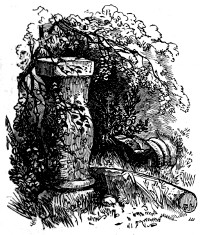
Little did the Romans dream, when they fixed the eastern termination of their Wall at Segedunum, of the world-wide celebrity which its subsequent cognomen—Wallsend—would attain. Even Horsley, writing in 1731, and in what he lovingly terms 'my own county,'[54] did not foresee the extensive mining operations which shortly after his day were to take place 104in its immediate vicinity. In order to mark the site of the station, he fixes upon Cousin’s House, which is at some distance from the spot, whereas, the principal shaft of the celebrated mine is close beside its western rampart.
105SEGEDUNUM, Wallsend, is admirably selected as the site of a Roman station, and as the eastern terminus of the Wall. Without being so much|SEGEDUNUM.| elevated as to give it a painful exposure to the blasts of the north and of the east, it commands a 106view, in every direction, of the adjacent country. The ground, in front of it, slopes rapidly down to the river’s brink, and has a full exposure to the mid-day sun. The beauty of its situation is considerable now; what must it have been when aged oaks crowned the contiguous heights, and the Tyne rolled by in the brilliancy and exuberance of its youth!
WALLSEND.
Eastward of Wallsend, the river acquires a sufficient magnitude to make it a barrier quite formidable enough to prevent the ready passage of a foe, and to render the erection of a wall unnecessary. Frequently, however, would it be needful for the watchful eye of the Roman prefect at Segedunum to 107traverse the expanse which lay between him and the sea. This he could easily do. The station stands upon a bend of the river, formed by two of the longest ‘reaches’ which it makes in the whole of its course. The Long-reach extends downwards as far as the high end of South Shields, and the Bill-reach stretches nearly two miles up the water. In both directions, therefore, any operations conducted on the river would be easily discerned from the station.
SEGEDUNUM.
Although it was not thought requisite to extend the Wall further along the northern bank of the Tyne than Wallsend, special precautions were taken to secure the mouth of the river from hostile occupation. 108A camp at Tynemouth, and another at North Shields, were garrisoned by troops from the head quarters at Segedunum; these frowned over the northern shore of the estuary. A subsidiary station at Tyne Lawe, near South Shields, and another at Jarrow, guarded its southern bank, whilst one at Wardley, opposite Wallsend, would effectually support, on that side of the river, the operations of the garrison in the principal encampment. All of these will be examined afterwards.
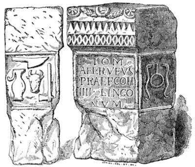
The evidence by which Wallsend is identified with the Segedunum of the Notitia is not so direct as could be desired. First in the list of officers ‘along the line of the Wall,’ the Notitia places the Tribune of the fourth cohort of the Lergi at Segedunum. Now, no inscription has been found in Britain mentioning the Lergi, but inscriptions have been found which mention the second and fourth cohorts of the Lingones; on the other hand, the Lingones never occur in the Notitia, but the cohorts of the Lergi which are there recorded, are the second and the fourth. This being the case, and the difference in the form of the Latin words Lergorum and Lingonum being very slight, the probability is, as Mr. Thomas Hodgson, in an able paper in the Archæologia Æliana, conjectures, that some early transcriber of the Notitia has written the one in mistake for the other. Within the precincts of Tynemouth Castle, in the year 1783, an altar was found, which formed part of the foundation of an ancient church. It is now in the possession of the Society of Antiquaries 109of London. The adjoining wood-cut accurately delineates it. The inscription may be read as follows:
I[OVI] O[PTIMO] M[AXIMO]
AEL[IVS] RVFVS
PRAEF[ECTVS] COH[ORTIS]
IIII LINGO
NVM.
To Jupiter the best and greatest,
Ælius Rufus,
The Prefect of Cohort the
Fourth of the Lingo-
nes.
On the supposition, which is a natural one, that Tynemouth was a station subsidiary to Wallsend, this altar gives satisfactory proof that the first of the stations at the eastern extremity of the Wall is the Segedunum of the Notitia. On some occasion, when the prefect who commanded the estuary of the Tyne, was on a visit to this out-post, he erected to Jupiter, whom he ignorantly worshipped, the altar which still remains.
ORIGIN OF THE NOTITIA NAMES.
110The etymology of the names of the stations is an interesting, but intricate subject. The new occupants of a country usually adopt the appellations bestowed by their predecessors upon its more prominent features. Thus, though in England the ancient Briton, Roman, Saxon, Norman, and modern English, have successively prevailed, many of our most familiar rivers, as the Thames, the Isis, and the Avon, have borne, as Whitaker shows, through each successive change, their present names. The appellations of cities are much more variable, but some even of these are indelible. Strange as a painted Briton of the first century would feel himself in the streets of modern London, its name would fall on his ear as an accustomed sound.
The Romans were a minority in Britain; and, in their intercourse with the natives, would be compelled to adopt the nomenclature of the people. We may, therefore, expect to find that the names of the stations are essentially British, though somewhat altered by the imperfect pronunciation of the strangers, and by a ceaseless effort to recast the words in the mould of their own tongue. The change most frequently introduced consists in the addition of Latin terminations. The names given by the aborigines of a country are usually descriptive of the object to which they are attached: they are epithets changed into proper names. Accordingly, we find that the names of the stations, so far as they have been deciphered by the assistance of those modern representatives of the ancient British tongue—the Gaelic and native Irish—are descriptive of the locality.
ETYMOLOGY OF SEGEDUNUM.
111Segedunum is an unfortunate example to begin with. There was a Segedunum in Aquitania, the modern Rodez—a Segodunum in Northern Germany, the modern Siegen. The camp at Wallsend may have received its name from some resemblence to one of these. Still the question remains, What was the common origin of the term? Wallis thinks it is derived from the Latin seges, corn, and the Celtic dunum, a hill; but, excepting in extreme cases, an etymology dependent upon two languages can scarcely be admitted. A more consistent derivation is found in the Celtic sech, (the root of the French sec) dry, and dun, a hill. The final syllable is a Latin affix. The elevation of the spot, and its rapid slope to the river, would render it comparatively free from moisture.[55]
VILLAGE OF WALLSEND.
Whatever doubt may hang over the Roman name of this station, none attaches to the modern—Wallsend
... Ab illo
Dicitur, æternumque tenet per sæcula nomen.
The number of places along the course of the Wall which have derived their names from this great work, is very striking, and proves the importance that has 112been attached to it. Without examining a map, and simply drawing upon the resources of my own memory and note-book, the following examples occur: In Northumberland, we have Wallsend, Walker, Wall-knoll in Newcastle, Benwell, Wallbottle, Heddon-on-the-Wall, Welton, Wall-houses, Wall, Walwick, Shields-on-the-Wall, Wall-mill, Walltown, Thirlwall, and Wall-end; in Cumberland, we have Walton, Wallbours, Old-Wall, High Wallhead, Middle Wallhead, Low Wallhead, Wallby, and Wallfoot.
The present village of Wallsend is about half a mile distant from the station, a little to the north of the turnpike road. It is, however, of modern erection. Brand says that ‘an old woman, still living, remembers when the site of the present Wallsend was an empty field.’ The traditional account of its erection is, that a plague having desolated the original town, which stood upon the site of the camp, and was built out of its ruins, the terrified inhabitants forsook the spot, and sought shelter in the new locality.
PLATE IV.
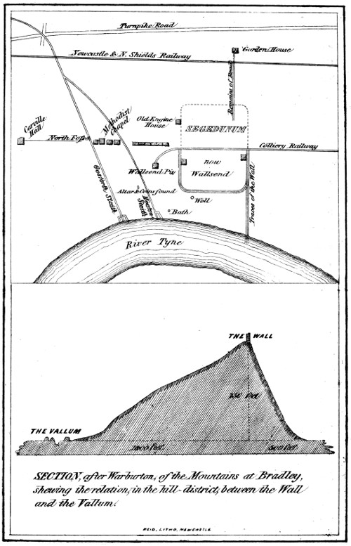
SECTION, after Warburton, of the Mountains at Bradley, shewing the relation, in the hill-district, between the Wall and the Vallum. REID. LITHO. NEWCASTLE.
WALLSEND.
A person unaccustomed to examine the remains of Roman forts, will probably be disappointed to find the ramparts of Wallsend so feebly marked; but one who brings to the task a practised eye, will give a good account of the land, and express his surprise 113that so much of the camp is left. The station, it must be remembered, is situated on the edge of a river the scene of an immense commerce, in the vicinity of a large town, and in the centre of a great mining district.
SEGEDUNUM.
The station of Segedunum has occupied an area of three acres and a half. The Wall, coming from the west, has struck the north cheek of its western gateway, and there terminated. The walls of the station would be a sufficient protection to the garrison against attack from the north or other quarters, but to prevent the enemy getting within the barrier, by passing between the station and the river, the eastern wall of the station has been brought down to the river, and continued into it to low-water mark.[56]
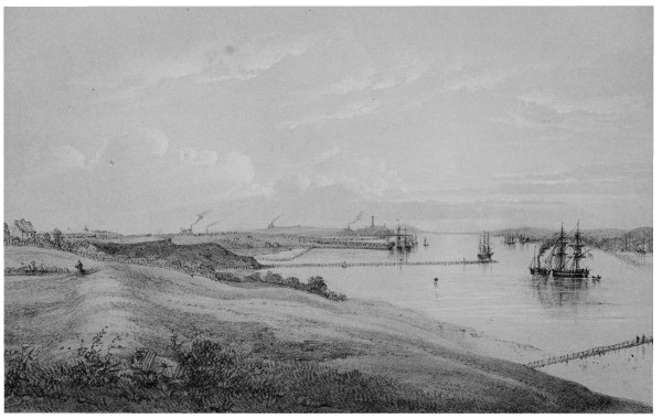
Drawn & Lithographedby John Storey WALLSEND, LOOKING EAST.
WALLSEND.
In tracing the outline of the station it will be well to begin at Carville-hall, the 'Cousin’s-house,'[57] of 114Horsley. Between it and the Gosforth ‘waggon-way,’ the north fosse of the Wall is very distinct, a gravelled path, for some distance, occupies the site of the Wall.[58] Behind the Methodist-chapel the ditch may still be traced, but after that it disappears. The row of houses between the chapel and the station is manifestly very close upon the line of the Wall. The old engine-house, which Brand tells us was six yards north of the Wall, still remains. The whole of the ramparts of the northern section of the station are gone; the walls of the southern portion of it may, however, be traced rising in the form of a grassy mound above the general level of the soil. The continuation of the eastern wall of the station down the bank to the river’s edge, may also be recognised, not only by the gentle mound which it forms, but by the fragments of Roman mortar, Roman tile, and coarse-grained sandstone, not proper to the district, which may be picked up on it. This river-wall joins the Tyne at the spot where a jetty has recently been formed. Numerous swellings in the ground to the south, and to the east of the station, indicate the ruins of suburban buildings. These seem to have been invariable concomitants of 115stationary camps. Officers wishing to have more space than the fort allowed, the families of the soldiers, the camp followers, and others, who sought the protection of a fortified post, would occupy such dwellings. The sunny exposure of the streets on the south of the camp, would render them peculiarly acceptable to the Lingones who came from that part of Gaul where the Meuse and Marne have their source.[59] The fosse which protected the eastern rampart, is still distinctly visible, and generally contains a little water. The accompanying lithographic view is given chiefly with the intention of showing the extensive command which the station had of the river below it; the south-east angle of the rampart may be traced upon it, as well as the fosse beyond. The altar, represented in the foreground, was found in the vicinity of the station a few years ago, and is still preserved upon the spot, it is without an inscription, but has a hole drilled through its centre, which it had when found. An extensive natural valley protected the western side of the camp, which some years ago was partially filled up, in order to form the waggon-way. The house occupied by the late Mr. John Buddle, the eminent colliery viewer, is just within the western wall of the station, and that, formerly occupied by Mr. John Reay, is just within the eastern rampart. The waggon-way leading from the Wallsend pit seems to enter the station by its western portal, and to leave it 116by its eastern, and thus exactly traverses the via principalis of the camp. The only trace of the northern division of the station that remains, consists |SEGEDUNUM.|of the road which has apparently led from Segedunum to the out-posts at Blake-chesters and Tyne-mouth. This causeway extends from the station to the north of the Shields railway; it is formed of a mass of rubble, about two feet deep, and is eleven yards wide. It cannot be ploughed, and nothing that requires any depth of earth will grow upon it.
Numerous proofs of Roman occupation have been discovered at various times in the station and its vicinity. Brand says, ‘I found a fibula, some Roman tegulæ, and coins, a ring, &c. Immense quantities of bones and teeth of animals are continually turning up. Stones with inscriptions were found, but the incurious masons built them up again in the new works of the colliery.’ Dr. Lingard was told, that in digging a cellar under the dining room of Mr. Buddle’s house, a deep well was found. I have been informed by Mr. John Reay, that another was discovered outside the station, at the spot shown on the plan of the station, Plate IV. A structure, which was conceived to be a bath, was struck upon about the same time, near the river’s brink; it was immediately removed, but its site is marked on the plan. Many coins have been found, but most of them in a very corroded state. A beautiful piece of Samian ware was got in sinking the shaft of the colliery, which is now in possession of the Society of Antiquaries of Newcastle-upon-Tyne; it is figured in a subsequent Plate.
WALLSEND TO NEWCASTLE.
117Leaving Wallsend, and proceeding westward, the Wall is chiefly to be traced by the presence of its north fosse. This is very distinctly marked nearly all the way to Byker. In front of Stote’s-houses, the Beehouses of Horsley, it forms a pond, which is used for farm purposes. Some traces of the foundation of the Wall may be seen, but they are faint. Thirty years ago the Wall was standing, for a considerable distance, three and four feet high, covered with brushwood of hazel, oak, and alder. The tendency of the half-ruined Wall to give lodgement to the roots of these plants, is very remarkable; wherever the Wall is undisturbed they are found, and in regions where the hazel does not occur elsewhere, as in the neighbourhood of Bowness, it is to be met with abundantly upon the Wall.
A mound, a little more elevated than the neighbouring ground, near to Stote’s-houses, points out the site of the first mile-castle west of Wallsend. The tenant of the farm told me that he had got a great quantity of stones from it. In Horsley’s time, there were ‘two distinct tumuli remaining near the Bee-houses’; what I take to be the rudiments of them may yet be traced; one of them is just behind the stack-yard of the farm, the other, the least marked of the two, a little to the west of it.
The road that is seen stretching in a straight line up the hill to Byker indicates the direction of the Wall, and though the first, it is by no means the most remarkable instance that we shall meet with, of the unflinching and straightforward tendencies of this 118remarkable structure. The Wall stood on the south side of the present road. The facing-stones having already been removed, and it being desirable to have the rocky remnant entirely cleared away, the ground was let to parties without rent for a short term of years, on condition of their clearing it, and bringing it into cultivation. It is on this account that the site of the Wall and fosse, even yet, is portioned out in long narrow slips, which are, for the most part, used as potato gardens.
From the top of Byker-hill, an interesting view is obtained of the Tyne and the numerous hives of busy men which bestud its banks. This would be an important post for the Roman soldier, who could easily see from it the stations on either hand—Segedunum and Pons Ælii—and all that was going on between them.
Between Byker and Newcastle, all traces of the Wall are now nearly destroyed. In 1725, it was, however, standing in a condition of imposing grandeur, as appears from Stukeley’s ‘Prospect’ of it in the Iter Boreale. He was induced to make this drawing because ‘the country being entirely undermined’ by colliery excavations, it might ‘some time or other sink, and so disorder the track of this stately work.’ He dreaded an imaginary evil, and overlooked a real one.
The north fosse was, till recently, very distinct within the wall of Heaton-park; it is now filled up; many of the stones in the park-wall, are to all appearance, Roman. Before descending the hill, 119a portion of it, boldly developed, may yet be seen at the end of a small row of houses called Howard-street.
COURSE THROUGH NEWCASTLE.
At the head of the bank overlooking the Ouse-burn stood a mile-castle, as was usual in such situations, to guard the pass. Two stones which, I am persuaded, formed part of the entrance gateway of this mile-tower, now stand upon the stairs leading to the grand entrance of the keep of the Castle of Newcastle-upon-Tyne. They measure two feet by one, and are of the form usually employed in the portals of mile castles. One of them bears a rude, and almost unintelligible, inscription. These stones were found built up in a structure on the west bank of the Ouseburn, were thence taken to Busy Cottage, afterwards removed to Heaton, and finally presented to the Society of Antiquaries of Newcastle-upon-Tyne.
The Wall crossed the Ouse-burn very near the ancient bridge which is about a hundred and fifty yards south of the railway viaduct. In preparing the foundations of Mr. Beckinton’s steam-mill about the year 1800, the workmen came upon the Wall, and, with great good taste, built into the opposite quay three of the largest stones they met with, in order to mark its site; they may yet be seen at low water, and are evidently mile-castle stones.
COURSE THROUGH NEWCASTLE.
It is not possible to trace the Wall with minute accuracy through Newcastle, a town which has been the seat of a large and active population ever since the days of Roman occupation. In endeavouring to follow its route, I shall mainly depend upon the 120investigations of Mr. George Bouchier Richardson, who has for several years past made the antiquities of ‘the Metropolis of the North’ his especial study, and whose paper upon this subject, recently read before the Society of Antiquaries of this town, will doubtless speedily appear in the Archæologia Æliana.
NEWCASTLE-UPON-TYNE.
Rising from the western bank of the Ouse-burn, it traversed the north side of Stepney-bank, passed through the gardens at the Red Barns, along the site of the present Melbourne-street, and, proceeding behind the Keelmen’s Hospital, came to the Sallyport. This, which was one of the gates of the town, is sometimes described as a Roman building, but is of mediæval origin. Thence, the Wall went over the crest of the hill still called the Wall-knoll, where the foundations of it were turned up about the middle of the last century. It crossed Pandon-dean on the north side of the locality called the Stock-bridge, and, in its western course, ascended the steep hill, on the summit of which stands All Saints’ church. Brand tells us that the crypt of the old church had plainly been built of stones plundered from the adjacent Wall. A well of Roman masonry is said to have been discovered near the church when the foundations of the new building were prepared. Crossing Pilgrim-street a little above Silver-street, the course of the Wall is indicated by the present narrow street called the Low bridge. Until a comparatively recent period, the site of Dean-street formed the unenclosed bed of the Lort-burn, and was spanned by an arch called the 121Low-bridge. At the point where this mediæval viaduct stood, its Roman predecessor carried the Wall, with its attendant military way, across the gully. The church of St. Nicholas, according to Leland, whose statement is confirmed by subsequent writers, ‘stondithe on the very Picts Waulle.’ The Wall, leaving the church, crosses Collingwood-street in an oblique direction, and passing by St. John’s church, the Vicarage-house, and the Assembly-rooms, makes for the Town-wall somewhat to the north of the site of the West-gate. There can be little doubt that in its exit from the town, the Wall occupied the elevation on which Cumberland-row now stands.
PONS ÆLII.
PONS ÆLII.—Having tracked the Wall in its passage through the modern town, the site of the ancient station of Pons Ælii next demands attention.
Horsley is the only writer who has attempted to define its limits, and he had but slender evidence to guide him. He takes, as his data, the three following facts:—1. The course of the Wall westward, which he conceives, and no doubt correctly, would form the northern boundary of the station; 2. The direction of the Vallum, some portions of which remained, in his day, just outside the West-gate; 3. 'A traditionary account of the Wall having passed through St. George’s porch, near the north-west corner of St. Nicholas’-church.' As this porch stands a little to the south of the line of the great Wall, as laid down by him, he conceives that this traditionary wall must have been the east wall of the station, and draws it upon 122his plan accordingly.[60] The western wall now only remained to be determined, and this point was easily settled, by supposing the station to have been square. According to the line assigned by him to the Vallum, six chains is the distance which would intervene between it and the Wall; he therefore places the western rampart of the station at the corresponding distance of six chains from the eastern, and encloses altogether an area of little more than three acres.
It may well be doubted whether the important station of Pons Ælii would be subjected to the ordinary rules of castrametation. I am strongly disposed to think, that it would partake of the features of a commercial as well as of a military capital, and that its walls would not only embrace a wider range than ordinary camps, but would be allowed to adapt themselves more freely to the nature of the ground.
The wants of the immense body of troops required to garrison the Wall, and man its out-posts, would create a considerable amount of commerce. The inhabitants of Italy, Gaul, and Spain, would be unwilling all at once to forego the comforts and luxuries of their sunny climes, and to be entirely cut off from intercourse with the land of their nativity. The fragments of amphoræ, which are so 123abundantly met with on the line of the Wall, shew that the soldiers sometimes gladdened their hearts with the wine of their native hills; and the innumerable sherds of Samian ware, which usually bestrew the camps of Roman occupation, prove that a continual intercourse was kept up with the continent. To the sea, as a means of communication between many of the stations of Roman Britain, frequent recourse would be had.
The exports from this island to the continent were considerable. Camden tells us, that every year not less than eight hundred vessels laden with corn alone were sent out of it. Certain it is, that the imperial government would expect an adequate return for the expenditure occasioned by the troops in this country, and that the commodities of the continent would not be transmitted to the occupants of the Wall from motives of mere benevolence. Lead, which is now so abundant in the three northern counties, would probably form one article of export, and corn another. Those who have noticed the fertility of some portions of the region watered by the Tyne, will be able to conceive how luxuriant were the harvests which its alluvial soil produced when first turned up by the plough. It is certain that coal has been wrought to some extent in Roman times, and some of it may have been exported.
No place in the north of England was so well fitted as Newcastle to be the emporium of the commerce of the North. Situated upon a noble river, at about ten miles from its mouth, it combined the naval advantages 124of the coast, with the security of an inland situation. The wealth arising from the commerce of the port would increase its importance, and the facility with which foreign news and foreign luxuries could be obtained, would render it the frequent resort of those prefects and tribunes whose usual posts were in bleaker and more inhospitable regions. The fact that the river was at this part spanned by a bridge of many arches, is a striking indication of the importance of the place even in the days of the emperor Hadrian.
No account has come down to us of the state of Newcastle in the days of Roman occupation, but if, after it had been deprived of the advantages which the residence of the mural garrison conferred upon it, the venerable Bede calls it 'an illustrious royal city'—'vico regis illustri'—we must conclude that it was a place of considerable importance. The natural advantages of the situation struck the eye of Camden; ‘Now’, says he, ‘where the Wall and Tine almost meet together, Newcastle sheweth itself gloriously the very eye of all the townes in these parts.’
Under these circumstances, there seems to be no reason why the walls of Pons Ælii should form the usual military parallelogram any more than Roman Rochester, or Pompeii, or Rome itself, much less that the station should occupy an area of little more than three acres.
The contour of the ground on which the modern Newcastle stands, is peculiar. It consists of three tongues of land, separated by natural valleys permeated 125by rivulets. The westernmost of these presents the boldest front to the river, and is that on which the Castle stands; the Skinner-burn bounds it on the west, and the valley of the Lort-burn, the present Dean-street, on the east. The contiguous tongue lies between the Lort-burn and Pandon-dean; and that still further removed, has for its eastern boundary the Ouse-burn. The same natural advantages which recommended the heights of the most westerly of these strips of ground to the Normans for the erection of their stronghold, would no doubt previously induce the Romans to select it as their chief position. They probably enclosed nearly the whole of it within their walls. Horsley, indeed, places his camp in this division, but in the least advantageous part of it, whether considered in a military or in a commercial point of view. The Romans would surely not overlook the importance of the ravine of Dean-street as a defence on the east, especially at a time when the tide flowed up it as far as the Painter-heugh, and of the cliff that descends from the Castle to the river on the south. The necessity of defending the bridge, and commanding the Tyne would not be forgotten. Taking all these things into account, we may fairly suppose the walls of Pons Ælii to have been thus defined:—The Wall, passing through the site of St. Nicholas’-church, would, of course, be its northern boundary; a line coming from the church, and adapting itself to the crest of the hill that overhangs Dean-street, crossing the Head-of-the-Side and stretching as far as the elevated angle on which the County-courts 126now stand, will probably mark its eastern boundary; the southern rampart would run from this angle along the edge of the cliff overhanging the Close, as far as the site of the White-friar-tower, which stood at the head of the present Hanover-street; the western wall may have run in the line of the Town-wall as far as Neville-tower, and then have struck up in a straight line to meet the great Wall. Westward of this boundary, the ground slopes down to the Skinner-burn. If these lines are correctly drawn, Roman Newcastle would contain upwards of sixteen acres.
Although the camp of Pons Ælii occupied this tongue of land, there is no reason to suppose that suburban buildings were not erected on the other two, both of which are well protected by their natural situation. There is good ground to believe that Pandon, which was formerly a separate town from Newcastle, and is seated on the middle strip, was of Roman origin. Villas and gardens probably extended as far as the Ouse-burn.
In order to render the preceding description intelligible to persons unacquainted with the topography of Newcastle, a plan of the town (Plate V.) and a lithographic view of Pons Ælii are appended. In the plan of the town, Horsley’s demarkation of the station, as well as the one here proposed, is laid down. For the view of Pons Ælii, the frontispiece, I am indebted to the pencil of Mr. G. Bouchier Richardson; the contour of the ground is very accurately delineated, and the probable outline of the 127station marked; the details of the picture are of course filled up according to the artist’s fancy—a fancy regulated by his antiquarian knowledge.
PLATE V.
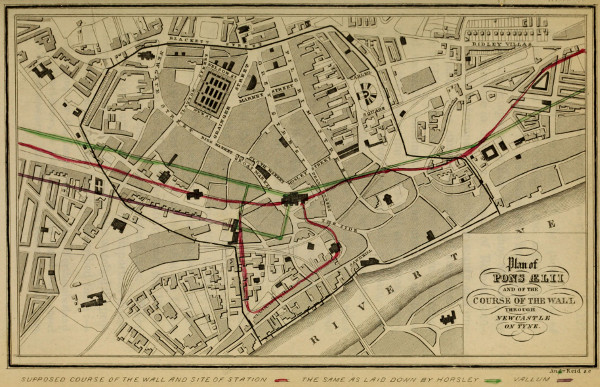
Plan of PONS ÆLII AND OF THE COURSE OF THE WALL THROUGH NEWCASTLE ON TYNE. Andw. Reid s.c.
NEWCASTLE-UPON-TYNE.
Roman antiquities, which, when they abound, are so serviceable in defining the seat of Roman occupation, are unfortunately here rather scanty and unimportant. This cannot be matter of surprise. In the middle ages, Newcastle abounded in churches and monastic buildings. To the erection of these and of the Castle, the Town-wall, and Gates, every stone whether lettered, sculptured, or plain, that could easily be obtained, would be appropriated.
PONS ÆLII.
The precincts of the Castle have afforded the most important discoveries of this kind. The present County-courts occupy the site of a building which used to be called the Half-moon-battery. This was probably the position of the south-east angle of the station of Pons Ælii, and some of the lines of the octagonal face of the battery presented no doubt the actual curve of the station. To a certain extent the Norman builders may have converted to their own uses a portion of the labours of their imperial predecessors; appearances seemed to shew that the Castle wall between the Half-moon-battery and the Black-gate had rested upon a Roman foundation. When the County-courts were built, some important discoveries were made. Mr. Hodgson, who watched the progress of the excavations, has thus described them:—
In digging for the foundations for the Northumberland County Court-house, in 1810, a well was found finely cased with Roman masonry. It still remains below the centre part 128of the present court-house. It had originally been a spring, or sunk low down on the river bank, and its circular wall, raised within another strong wall in the form of a trapezium to the height of the area of the station, and the space between them traversed with strong connecting beams of oak both horizontally and perpendicularly, and then tightly packed up with pure blue clay. Some beams of this timber were taken up and formed into the judges’ seats, and chairs for the grand-jury room, now in use. Two of the perpendicular beams had very large stags’ horns at their lower end, apparently to assist in steadying them till clay sufficient was put around them to keep them upright. On the original slope of the bank next the outer wall, there was a thick layer of ferns, grasses, brambles, and twigs of birch and oak, closely matted together, and evidently showing that before these works were constructed, man had not tenanted the spot.[61] Here also were exposed large remains of the foundations of other very thick and strong walls, one of which rose into the eastern wall of the Old Moot-hall, which was of exactly the same breadth, bearing, and style of building, and doubtless of the same date as the Roman foundations of which it was a continuance.
ANTIQUITIES OF PONS ÆLII.
The whole site of the Court-house, for several feet above the original surface of the earth, was strewn with a chaos of Roman ruins. I was frequently on the spot while the excavations were carrying on, and saw dug up large quantities of Roman pottery, two bronze coins of Antoninus Pius, parts of the shaft of a Corinthian pillar, fluted, and of the finest workmanship; besides many millstones, and two altars, one bearing an illegible inscription, and the other quite plain. The altars were found near the north-east corner of the Court-house, and near them a small axe, and a concave stone, which bore marks of fire, was split, and had thin flakes of lead in its fissures. The broad foundation walls were firm and impenetrable as the hardest rock. On Aug. 11, 1812, when the foundations 129of the north portico were sinking, a Roman coin was found (of what Emperor I have no minute,) and the original surface of the ground was covered with a thick stratum of small wood, some parts of which were wattled together in the form of crates or the corfs of collieries, but in a decayed state, and cut as easily with the workmen’s spades, as the brushwood found in peat mosses does. As there was much horse or mules’ dung near them, and some mules’ shoes amongst it, I thought they had been fixed there as crates or racks to eat fodder out of.
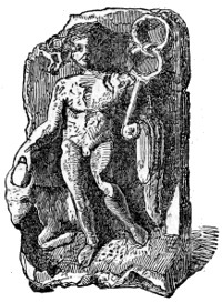
Since that period, few important discoveries have been made. In cutting the crest of the hill in front of the Castle for one of the piers of the Railway viaduct, a small stone figure of Mercury, represented in the adjoining wood-cut,[62] was found. It is preserved, among other antiquities, in the Museum in the Castle.
Between the years 1840 and 1844, the White-friar-tower and the contiguous portions of the Town-wall of Newcastle were removed. Two Roman altars were discovered, which are now in the possession of the Society of Antiquaries, Newcastle-upon-Tyne. One of them is destitute of an inscription, and the other seems to bear the word SILVANO. Several coins of the Roman and mediæval age were picked up in its immediate vicinity. The Roman coins were of both the upper and the lower empire.
130From the manner in which the pieces of the middle and ancient periods were commingled, a thing of rare occurrence, it may be inferred that the tower was formed out of Roman materials, and that the Roman coins were re-imbedded without being noticed, whilst the workmen inadvertently added Nuremberg tokens and other contemporary pieces to the numismatic treasures of the spot.
But, perhaps, the structure which gave name to Pons Ælii affords the most interesting foot-prints of Roman occupation in Newcastle.
THE BRIDGE OF ÆLIUS.
Horsley received sufficient evidence to convince him, that a Roman road had gone from the south bank of the Tyne to Chester-le-street, and thence to the south of England. A bridge was necessary to conduct the road across the river. In 1771, a flood having carried away several of the arches of the bridge which then existed, and materially damaged the rest of the structure, it was found necessary to erect a new one. In removing the old piers the distinguishing characteristics of Roman masonry were observed; and the workmen were led to believe that the arches of the mediæval structure had been placed upon the foundations which Hadrian laid. Several piles of fine black oak, which had supported the foundation, were drawn out of the bed of the river, and found to be in a state of excellent preservation.[63]
COINS FOUND IN THE BRIDGE.
131The coins that were found imbedded in the piers give decided evidence of the Roman origin of the structure. To some of these, in the possession of George Rippon, esq., of Waterville, North Shields, I have had access; they are here represented.

Obv.—HADRIANUS AUGUSTUS, CONSUL TERTIUM. PATER PATRIÆ. Bare head of Hadrian.
Rev.—GERMANIA. The province personified as a female standing. In her right she holds a lance; her left hand rests upon a German-shaped shield.

Obv.—IMPERATOR CÆSAR TRAJANUS HADRIANUS AUGUSTUS. Laureated head of Hadrian.
Rev.—PONTIFEX MAXIMUS TRIBUNITIA POTESTATE CONSUL TERTIUM. A female figure, with helmet, standing, holding a lance in her left hand, and in her right a patera, under which is an object that appears to be an altar.

Obv.—Same as the former; but CONSUL SECUNDUM.
Rev.—Legend same as the former, but in the exergue JUSTITIA. A female seated; in her right hand a patera, in her left a spear.

Obv.—Same as the two former.
Rev.—Same as in the former, but in the exergue. FEL PR (Felicitas Populi Romani). A female seated; in her right hand a caduceus, in her left a cornucopia.
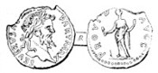
Obv.—SEVERUS AUGUSTUS PARTHICUS MAXIMUS. Laureated head of the emperor.
Rev.—PROVIDENTIA AUGUSTORUM. The figure of a female standing, with a globe at her feet.
The coins of Hadrian are remarkably bold and sharp, and cannot have been long in circulation before being 132deposited in the bed where sixteen centuries of repose awaited them; that of Severus is a good deal corroded. Besides these, other coins have been found. Brand had one of Trajan, and he engraves a copper coin of Hadrian; he also had in his possession one of Antoninus Pius. Pennant describes, amongst others, a coin of Faustina the Elder, and one of Lucius Verus. Hodgson saw coins of Gordian and Magnentius, all of which had been obtained from the same spot.
The coins posterior to the time of Hadrian were probably deposited during the repairs and alterations which the bridge received after its original construction in A.D. 120.
CHARACTER OF THE BRIDGE.
It is probable that the ancient bridge had no stone arches, but was provided with a horizontal road-way of timber. Pennant[64] who derived his information from the workmen, says, that ‘the old piers seem originally to have been formed without any springs for arches. This was a manner of building used by the Romans; witness the bridge built over the Danube by Trajan, at Severin, whose piers, I believe, still exist.’
The foundations of the piers of three Roman bridges in the region of the Wall, still remain—one across the Tyne, at Corstopitum, one across the North Tyne, at Cilurnum, and another across the Reed-water, at Habitancum; an examination of these has induced me to believe that they, at least, had no arches. The piers are of a size and strength 133sufficient to withstand the thrust of the waters without the aid of an arch; and in one at least of these cases, the requisite spring of the arch would have raised the road to an inconvenient height. An experienced mason who examined carefully the ruins of the bridge at Habitancum told me that he observed that all the stones which encumbered the spot were square, none of them having the shape of stones used in building arches. It is certain that in the mediæval period the Newcastle bridge had a road-way of timber; for Matthew of Paris tells us that, A.D. 1248, it, and the greater part of the town were destroyed by fire.
SUPPOSED MEDAL OF THE BRIDGE.
Brand, misled by the early numismatists, conceived that the bridge across the Tyne had been honoured by a commemorative medal. He says—
Two coins appear to have been struck upon the building of two bridges by this emperor; one is doubtless to be referred to that of Rome; may not the other have been intended to commemorate the work we are now considering? One of the bridges marked on these coins has seven, the other five arches. The Tiber being a very inconsiderable river, when compared with the Tyne, we must therefore claim that with seven arches—especially as we find a view of the Pons Ælius at Rome in Piranesi’s collection, without the modern ornaments, where it is represented as consisting of exactly five arches.[65]
Alas! for a theory so beautiful and so grateful to the feelings of Newcastle antiquaries! Mr. Akerman, in his work on rare and inedited Roman coins, has pronounced the relentless verdict—‘The 134medallion with the Pont Ælius, quoted by the early numismatic writers, is a modern fabrication.’
It is perhaps too much to suppose that all the arches of the mediæval bridge rested upon Roman foundations, but it is more than probable that the piers of the original structure would be at least as numerous as those of its successor. The mediæval bridge had twelve arches.
ORIGIN OF THE NAME PONS ÆLII.
No altar or other inscribed stone has been found to confirm the opinion that Newcastle was the ancient Pons Ælii. Brand was ‘of opinion that the inscriptions belonging to the station of Pons Ælii are all built up in the old keep of the Castle, and that a rich treasure of this kind will some time or other be discovered, lurking in its almost impregnable walls, by future antiquaries.’ May the antiquary never be born that shall behold this treasure! Such evidence is, however, scarcely needed to lead us to the ancient designation of the place. The fact that Pons Ælii occurs in the Notitia between Segedunum and Condercum, and that Newcastle lies between the modern representatives of these two stations, Wallsend and Benwell, is strong presumption in favour of the theory, and the fact that a Roman bridge here crossed the Tyne, renders it almost indubitable. This structure took the name of the Bridge of Ælius, after Hadrian,[66] who was of the 135Ælian family, and the bridge gave name to the station. The Notitia informs us that Pons Ælii was governed by the tribune of the cohort of the Cornovii, ‘a people,’ says Hodgson, ‘whose name is unnoticed by all the ancient geographers I have access to.’
THE CASTLE OF NEWCASTLE-UPON-TYNE.
Before leaving the station of Pons Ælii, a reference to the mediæval structure—the Norman keep—which gives the town its modern name, may be allowed. It is the most perfect specimen of Norman castrametation in the kingdom; and a careful examination of its structure will yield a more correct view of the mode of warfare adopted at the time of its erection, and of the mournful condition of society then existing, than the fullest verbal description could give. Within a recent period its passages have been cleared and its portals opened, so as to afford the antiquary an opportunity of examining it thoroughly. The Corporation of Newcastle, whose property it is, have, in this respect, set an example which might with advantage be followed by the national government. To the student of the Wall, however, the collection of Roman antiquities which the castle contains, will be the object of greatest interest. In the number and importance of its altars and inscribed stones, it excels every other museum in Britain. As the Castle contains so many of the spoils of the Wall, it is much to be wished that it could be made the depository of all that have been discovered on the line. Numerous individual objects of interest are scattered over the country, and he who would examine them all 136must travel several hundred miles, and propitiate the favour of many private gentlemen, as well as public bodies. Documents illustrative of the history of a country may be regarded as the property of the country, so far at least, as to be made easily accessible to all. Pons Ælii is the fitting place to deposit those antiquities of the Wall which cannot be carefully preserved on the spot where the Romans originally placed them.
ROAD TO BENWELL.
The reader will probably now be glad to disentangle himself from the intricacies of Pons Ælii, and to pursue with rapid steps the course of the Wall westward.
Between Newcastle and Benwell-hill, the traces of the works are faint but interesting. The turnpike road runs upon the bed of the prostrate Wall, so that, except occasionally in a neighbouring building, not one stone of it is to be seen; its constant companion, the north fosse, may, however, be recognized in a kind of depression or slack, which runs nearly all the way parallel with the road on the traveller’s right hand. On his left, he will sometimes be able to discern with tolerable certainty the course of the Vallum. A small, but well defined portion of it, is met with immediately after leaving the town, behind a row of houses, appropriately termed Adrianople. Though the stone wall has perished, this humble earth-work has survived the accidents of seventeen eventful centuries! Its days, however, are now 137numbered; a contiguous quarry is making rapid encroachments upon it.
CONDERCUM.
CONDERCUM.—About two miles from Newcastle, and near the modern village of Benwell, stood the third station of the line, Condercum.
The present turnpike road runs through it, occupying, in all probability, very nearly the site of its ancient via principalis. So feeble, however, are the traces of it which remain, that the wayfarer who does not scrutinize the spot very narrowly, will pass on his journey without knowing that he is treading ground once jealously guarded by imperial power—the scene, for centuries, of a crowded city’s joys and fears.
The situation of the camp is good; without being much exposed, it commands an extensive prospect in every direction. Northwards, looking over the grounds of Fenham, the Simonside hills appear in the distance, and still more remote, is the lofty range of Cheviot. To the south is the vale of Ravensworth, which is exceeded by the vale of Clwyd only in magnitude, not in beauty, and to the south-west, the lordly Tyne threads its way through the richest of landscapes.
The sunny slope, south of the station, was favourable for the erection of the suburban buildings of the occupants of the camp, the foundations of several having been discovered.
In Horsley’s days, the ramparts were large and distinct; now, their surface is chiefly marked by a 138general elevation, occasioned probably by the accumulated ruins of the ancient fort. It contains in all a space of nearly five acres. Gordon conceived that the Wall was continued right through the station. This would have divided it into two distinct parts. As Horsley and Brand prove, the Wall came up to its eastern and western ramparts, but did not pass through it. The northern wall of the station itself was a sufficient defence in that quarter. About a third of the station was to the north of the line of the Wall, the remaining two-thirds were within it. The Vallum, Horsley tells us, fell in with the southern rampart.
The portion north of the turnpike road is at present under tillage. In Brand’s days it was covered with a plantation. The man who first ploughed it told me that in doing so, his horse, on one occasion, sank up to its middle in traversing some chambers that had been insecurely covered. The quantity of Roman pottery which is found in this portion of the camp is remarkable. Fragments may be seen at every step. The peculiar character of the Roman earthenware, especially of the coral-coloured kind, denominated Samian, renders this an interesting evidence of Roman occupation.
The larger portion of the station, that to the south of the road, is enclosed within the walls of Benwell-park. The inequalities of its grassy surface indicate the lines of its streets, and the position of some of its principal buildings. Near its centre is a large mound, which would probably reward examination. 139The southern rampart, with its fosse, is very distinct.
BENWELL.
Two hypocausts have been discovered in connexion with this station; one within its walls, close to the south side of the road, and between forty and fifty yards from the eastern rampart, the other without them, and about three hundred yards to the south-west. Of the latter building a plan is given by Brand. It contained eight or nine apartments, five of which had floors supported upon pillars. The floors consisted of ‘flags covered with a composition of various hard ingredients, about eighteen inches thick, such as small pieces of brick and blue and red pots, mixed up with run lime.’ The pillars were all of stone, and were so arranged as to allow hot air to circulate beneath the apartments. The idea generally entertained of these arrangements is, that they were intended for hot baths and sudatories. In pursuance of this opinion, Mr. Shafto, who discovered this hypocaust, says: ‘Here were found many square bricks with holes in the middle, which were probably joined together by way of pipes, to conduct the water from the top of the hill, where there was also the appearance of other baths, and where, probably, springs had been, but since drained by the colliery.’ However much the Romans in their own luxurious city may have been addicted to the indulgence of the hot-bath and the sweating-room, it may well be doubted, whether, in this cold climate, they would have any great desire for it, or if they had, whether the dread realities of war would allow them to make, on an enemy’s frontier, erections so extensive 140as this has been, for such a purpose. Next to food, warmth would be their most urgent demand, and a more effectual mode of maintaining a uniform temperature in their dwellings could not be devised than that which the hypocaust supplied.
Brand tells us that great conduits or sewers, composed of large wrought stones, were discovered in the north part of the station at the depth of about a yard and a half.
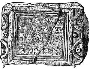
Several inscribed slabs and small altars have been found in the station. The most important one of these, which is preserved in the parsonage at Ryton, is here represented. By comparing it with the Notitia, we learn the ancient name of the station, and the locality of its original occupants.
MATRIBVS CAMPEST[RIBVS]
ET GENIO ALÆ PRI[MÆ] HISPANORVM
ASTVRVM [OB VIRTVTEM]
[APPELLATÆ] GORDIANÆ TITVS]
AGRIPPA PRÆ[FECTVS] TEMPLVM A S[OLO]
[RES]TITVIT.
To the Campestral Mothers,
and to the Genius of the first wing of Spanish
Astures, on account of their valour,
styled Gordiana, Titus
Agrippa, their prefect, this temple, from the ground,
rebuilt.
141The Notitia records that the præfect ‘alæ primæ Astorum’ was stationed at Condercum. This slab, reads Asturum, not Astorum. At two other stations the same people resided; at Cilurnum, the Notitia places the præfect ‘alæ secundæ Astorum,’ and at Æsica, the tribune ‘cohortis primæ Astorum.’ At both these forts, as well as in the case immediately before us, inscriptions have been found which are written Asturum; the probability, therefore, is, that a clerical error has crept into the Notitia, and that it was the Astures, not the Asti (a people of Liguria), who garrisoned these posts. The Astures were a people from the eastern part of the modern Asturias, in Spain. 'Under the empire, the term ala was applied to regiments of horse, raised, it would seem, with very few exceptions, in the provinces.'[67] This fractured slab, therefore, furnishes us with the information that the camp at Benwell was anciently named Condercum, and that it was garrisoned by a Spanish cavalry regiment. It supplies other facts. This regiment was styled, probably on account of some illustrious achievement, Gordiana. The emperor Gordian, from whom this title is derived, began his reign in the year 238. We have thus a proof of the continued occupation of the camp until a date subsequent to this period. The event recorded by the inscription is to the same effect. A temple which had been erected, probably at the first formation of the station, had through time 142or the chances of war, become so entirely dilapidated, as to require rebuilding, and Titus Agrippa accomplished the work. The Romans, although they had at this time been long in the occupation of the isthmus, had then no thoughts of relinquishing it. The woodland deities, to whom the temple was dedicated, will require separate discussion afterwards.
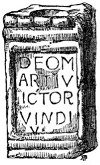
To the same occasion will be referred a remarkable altar inscribed to the three Lamiæ, which was discovered at this station. Two altars[68] of less importance, which were found here, may at once be disposed of. They are dedicated to one of the favourite deities of Rome—Mars. The focus, or place for burning the offering, is deep and well marked in each of them. They are small domestic altars, before which the soldier would perform his private devotions. As such, they give us a little insight into the heart and feelings of the worshipper.
DEO M
ARTI V
ICTOR[I]
VINDI[CI]
V[OTVM]
To the god
Mars
The Conqueror and
Avenger
In performance of a vow.
Along with this altar, as Brand tells us, were found two stones resembling pine-apples. This is by no 143means an unusual ornament of the works along the line. The pine-apple ornament is frequently introduced in the stained-glass works of the middle ages. As the fruit to which it bears a resemblance could not be known in Europe until after the discovery of America, the origin of the figure is an interesting speculation. I am disposed to think it is of Mithraic origin, and that the prototype of it was a mass of flame proceeding from the torch usually represented in the statues of that deity. The other altar, here given, is inscribed—
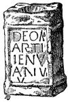
ARTI
IENV
ANIV[S]
V[OTVM]
To the god
Mars
Jenu-
anius erected this
In performance of a vow.
Besides these and some other inscribed stones, many coins have been found here; amongst them, Brand mentions denarii of Trajan, Hadrian, Faustina senior, and Domitian; brass coins of Valentinian, Gratianus, Diocletian, Faustina, and Maxentius, with many others not legible. Obscene figures are frequently found in Roman stations. They were worn by females as a religious charm. Benwell has furnished one such example of a very remarkable kind. Before leaving the station, the inquiring traveller will do well to examine the stones of the park-wall. He will soon detect many of Roman mould, whose faces have been scarred by the blasts 144of many centuries. The larger ones have been derived from the Wall—the smaller, from the curtain wall of the station, or the dwellings erected within it.
CONDERCUM.
The pleasant village of Benwell lies a little to the south-west of the station. ‘The old tower of Benwell-hall,’ says Bourne, 'was the place where the prior of Tynemouth resided some part of the summer, and the chapel, which Mr. Shaftoe opens and supplies for the good of the people of his village, was the prior’s domestic chapel.' Who that visits the spot will say that the prior who made the selection was not a man of taste? Benwell, as Horsley remarks, is not improbably thought to have its name from the northern word ben, (Saxon binnan) signifying within, and well for wall, as being seated within, or on the south side of the Wall.[69] Whitaker derives the Roman name of the station, Condercum, from the Celtic Cond ar gui, the height upon the water.[70] The river being near, the description is apposite.
Leaving Condercum, we again pursue our journey westward. The road for several miles running upon the base of the Wall, the facing stones may not unfrequently 145be seen for some distance together, protruding through the ‘metal.’ This used to be more the case formerly than at present, for since the diversion of the traffic from the road to the rail, motives of economy have induced the road surveyors to quarry, in some places, the last remnants of this great work of antiquity, for materials with which to repair the highway. The north fosse, as we pursue our journey, becomes more distinct on the right of the road.
THE WALL AT DENTON.
Descending Benwell-hill, the village of East Denton is reached. Here we meet for the first time with a fragment of the Wall. The accompanying wood-cut exhibits its present state. William Hutton describes the interesting relic with becoming reverence.
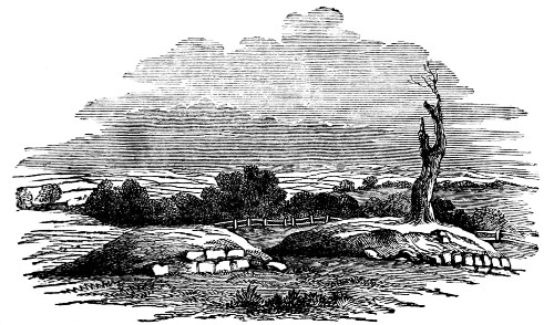
At Denton Dean, situated at the bottom of Benwell-hill, the great road veers a few yards to the right, that is into Severus’ ditch, and gives us for the first time a sight of that most venerable piece of antiquity, The Wall, which is six 146yards south of the road, and twenty short of the brook I am going to pass. The fragment is thirty-six feet long, has three courses of facing stones on one side, and four on the other, and is exactly nine feet thick. An apple tree grows on the top.
It has lost a course of facing-stones since Hutton saw it, and the apple tree is but the shadow of what it was.
The turnpike road, which usually runs upon the site of the Wall, uniformly swerves to the right when passing a village. The truth is, nearly every house and hamlet in the district has sprung out of the Wall. In many instances a mile-castle, slightly added to, has formed a mediæval dwelling of some strength. The nucleus thus provided, became, in the course of time, clustered round with contiguous habitations, so that when, after the last season of strife with which the borders were visited, the road came to be constructed, motives of economy required that these spots of increased value should be avoided.
Beyond the burn, the ground again rises, and the Wall, stretching onwards in a line with the road, forms a distinct, but turf-covered mound. At the distance of a field to the south of it, the Vallum is seen in greater distinctness than before. Both of the aggers and the intervening fosse may be clearly made out. Some young ash-trees grow in the ditch.
DENTON HALL.
Advancing a little further, we have Denton-hall, formerly the seat of the literary Mrs. Montague, on the right; attracted by her influence, many of the great spirits of the age were occasionally found to 147be assembled within its walls. Very nearly opposite the hall, a larger mass of ruin than usual betokens the site of a mile-castle.
Ascending the hill from West Denton, the fosse of the Murus is very distinctly seen. The road is elevated two or three feet above the natural level of the ground, the Wall, probably some courses high, forming its nucleus.
On the left hand, the lines of the Vallum are feebly indicated, but by extending our glance some distance backwards and forwards, we can, with tolerable certainty, distinguish the artificial mounds from the natural heavings of the surface.
CHAPEL-HOUSE.
Passing the fourth mile-stone, we arrive at Chapel-houses. This name is of sufficiently frequent occurrence along the line to suggest a momentary inquiry into its origin. In the early ages of Christianity, a mile-castle may have occasionally been the resort of the worshippers of the true God; or in the ‘troublesome times’ of border warfare, when the church not unfrequently shared in the general devastation, it may have been set apart as a place for the confirmation of matrimonial vows, and for the performance of religious rites.
From the crown of this hill we have one of the finest views which Northumberland can afford. The Tyne, in all its glittering beauty, stretches far before us. Its southern bank is crowned by the pretty village of Ryton, its left is variegated with the once beautiful, but now furnace-fuming, Wylam. An 148amphitheatre of hills shuts in the distant scene.[71]
Horsley describes some ruined ramparts, called the Castle-steads near Chapel-houses, to the south of both Vallum and Wall. They were probably temporary encampments and have now disappeared.
WALBOTTLE-DEAN.
Before crossing Walbottle[72]-dean, the Vallum, which is very distinct, and the Wall (i. e. the road) approach each other, apparently for mutual support. There are no traces of a bridge across the ravine.
As we ascend the next hill, and pass Throckley,[73] we have, for the most part, the fosse on the right hand, and the mounds of the Vallum on the left, very boldly developed. By the time the traveller has advanced thus far, he will have learnt the necessity of bearing in mind that he is in a mining district. If he overlook this circumstance, he will be in danger of mistaking the track of some old ‘waggon way’ for the terraced lines of Roman cultivation, or an old ‘pit-heap’ for an indubitable British barrow.
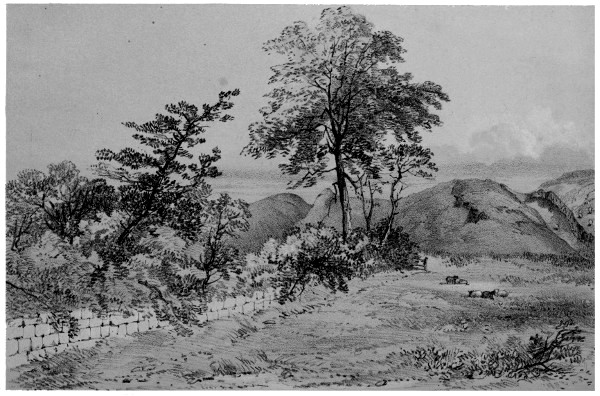
Chas Richardson, Delt.John Storey. Lith. THE WORKS AT HEDDON-ON-THE WALL
149After passing Throckley, just where a gate on the left hand enters the field from the road, a mound covered, in winter at least, with greener herbage than the contiguous ground indicates the site of a mile-castle. A little further on, a range of houses of peculiar appearance, called the Frenchman’s-row, attracts the eye. It was the residence, after the first French revolution, of a number of refugees. The dial which ornaments the Row is of their fabrication. The building is now used as a poor-house.
HEDDON-ON-THE-WALL.
On the top of the little eminence, at which we arrive before reaching Heddon-on-the-Wall, the north fosse is deeper and bolder than it has hitherto appeared; it must be nearly in its original perfection. The works of the Vallum, about fifty yards to the south, are also finely developed. The ditch, in both cases, is cut through the free-stone rock. Here, also, if the traveller will forsake the turnpike, for the road, as usual, diverges to the right in order to avoid the village, he may see a fragment of the Wall much longer and somewhat higher than the one at Denton. Its north face is destroyed, but about five courses of the southern face are perfect. The accompanying lithograph shews the present state of the Barrier here. The Wall is in the foreground, while in the distance (looking eastward) the section of the north fosse, and of the works of the Vallum, is distinctly seen.
About a mile north of the village is a striking prominence called Heddon-law. Horsley remarks—‘Not far from Heddon-on-the-Wall have been some remarkable tumuli.’
150The ditch of the Vallum cuts right through the village, its lowest dip forming the village pond; it is rather remarkable that in such a situation, it should not long ago have been obliterated.
Descending the hill on which Heddon-on-the-Wall stands, the lines of the Barrier keep close together, and not without reason. The crag on the south, now the scene of extensive quarrying operations, completely commands them. Surely a post must have been maintained on this eminence in the days of Roman occupation, though it had only been for the sake of a look-out.
Passing the eighth mile-stone, where the Vallum is in good condition, we approach the fourth great station of the Barrier. A road, crossing the turnpike at right angles, is close to its east rampart.
VINDOBALA.
VINDOBALA.—The station now called Rutchester, stands on flat ground, but commands a considerable prospect. The Notitia places here the tribune of the first cohort of the Frixagi, a people |RUTCHESTER.| whose country does not seem to be mentioned by any ancient geographer. The inside dimensions of this station, from north to south, are 178 yards, and from east to west, 135; it consequently contains nearly five acres. The Wall started each way from the north side of its east and west gates; so that a a greater portion of the station lay on the north than on the south side of it, as is shewn in the plan of it, Plate II. At present, the turnpike road runs between these portions; that on the north has been 151all ploughed, and three of its sides sloped into the ditch; its general outlines may, however, be distinguished; the southern part is irregular in its surface, with heaps of ruins, still covered with sward.[74] In Horsley’s time, the northern part was sufficiently perfect to enable him to discern six turrets in it, 'one at each corner, one at each side of the gate, and one between each corner, and those adjoining to the gate.'[75] The Vallum seems to have joined the station in a line with its southern rampart. The ditch on the western side is still tolerably distinct. The suburbs have been to the south of the station, but their site has recently been disturbed by the opening of an extensive quarry which has supplied large quantities of the stone used in carrying the railway over the Tyne, and through Newcastle.
On the brow of the hill, just west of the station, there is still to be seen, hewn out of the solid rock, what Wallis calls a coffin. It has more the appearance of a cistern. It is twelve feet long, four broad, and two deep, and has a hole close to the bottom at one end. When discovered, it had a partition of masonry across it, three feet from one end, and contained many decayed bones, teeth and vertebræ, and an iron implement resembling a three-footed candlestick. In the immediate vicinity of this spot, three fine Roman altars were discovered in 1844; they are now in the possession of Mr. James, of Otterburn, and are described in the Archæologia Æliana, iv. 5.
VINDOBALA.
152The etymology of the name of this station seems to be tolerably plain. ‘Vindobala,’ says Whitaker, ‘signifies merely the fort upon the heights. Bala remains, to the present period, the Welsh and Irish appellation of a town.’ I have received a similar account of the word from those acquainted with the Gaelic language. The station, however, though possessing the advantage of a gentle elevation above the contiguous ground, does not stand upon a lofty eminence.
No inscriptions have been found here mentioning the first cohort of the Frixagi, which, according to the Notitia, was quartered in Vindobala. This is of little consequence; the names of the contiguous stations both east and west having been ascertained, the order of the stations in the Notitia is sufficient evidence as to the identity of this with the ancient Vindobala.
The farm-house at Rutchester partly consists of an ancient building, possessing great strength of masonry. A gothic carving on the interior wall of its principal apartment shews that it is not of Roman construction. It was probably a mediæval stronghold, made out of the ruins of the station. It contains a well, now boarded over, which may be of Roman date.
Most of the stones of the farm buildings and adjacent fences are Roman, and one or two fragments of Roman inscriptions built up in the stables, besides some small altars preserved on the premises, give interest to the place.
MURAL HOSPITALITY.
153Mr. Hutton is usually very particular in giving a detail of the kind of entertainment he met with at the various points of his journey. The recital of his reception at Rutchester kindles into poetry:
I saw old Sir at dinner sit,
Who ne'er said, "Stranger, take a bit,"
Yet might, although a poet said it,
Have saved his beef, and raised his credit.
His own appearance, he tells us, was a little peculiar, and archæological pursuits not being in vogue in that day, the farmer probably had grave doubts as to the propriety of tempting the enthusiastic old man to prolong his stay.
It has frequently been my lot to receive the kindly attentions of the inhabitants of the mural region. Often have my eyes, bedimmed with fatigue, been ‘enlightened’ by partaking of the barley cake of the cottager, (excellent food for a thirsty climb) as well as the costlier viands of the farm tenant, or proprietor. Never shall I forget visiting, on one occasion, a frail tenement near Chesterholm. Its only inmate, an old woman, in the spirit of regal hospitality, asked me to join with her in partaking of her only luxury—her pipe. I recently observed with regret, that the cottage was tenantless.
NORTHUMBRIAN YEOMEN.
The inhabitants of that part of the district which is remote from towns, do not affect the dress, or the speech, or the manners of polished citizens. They like to know a person before they welcome him, and make their approaches cautiously. But if slow in 154grasping the hand, they do it heartily and sincerely. There is scarcely a latch in the wilder regions of the country, that I would not freely lift in the assurance of a smiling welcome. Often as I have groaned under the toils to which my present undertaking has exposed me, I have reason to rejoice, that the Barrier of the Lower Isthmus has been the means of making me acquainted with many of the true-hearted and intelligent yeomen, both of my own county, and of Cumberland, whom I should not otherwise have known. Although their dialect may sound strangely to a southern ear, yet it is English in its native purity and strength; a great authority, Mr. Thorpe, having said, 'I believe the genuine Anglian dialect to be that which is usually denominated the Northumbrian.'[76]
Proceeding, now, after this long digression, on our journey, we pass, on the left hand side of the road, an inn generally called the Iron-sign. Some of the buildings are entirely composed of Roman stones. In the erection nearest the road are three centurial stones. One has on it COH VIII, another has the word LVPI, probably to announce the fact, that the portion of the Wall in which it was originally inserted had been built by the troop under the command of the centurion Lupus; the third is illegible.
HARLOW-HILL.
Passing the ninth milestone, we stand upon the top of an eminence from which there is a good view of Harlow-hill, and of the adjacent country. The Wall here slightly changes its course for the purpose 155of ascending the summit before it. The Vallum keeps company with the Wall for a short distance, but eventually swerves to the south with the design of passing along the base of the hill; it rejoins the Wall on the other side. This is an arrangement which we should not have encountered had the Vallum been intended for an independent barrier against a northern foe. The north fosse is here very distinct, forming a deep groove on the left of the road all the way to Harlow-hill.
Just before entering the village of Harlow-hill, some portions of the heart of the Wall may be seen, and a careful scrutiny will enable us to ascertain its course through the village, a part of its foundation, of the full width (nine feet), yet remaining. As usual, in passing through the village, the turnpike road leaves the Wall for a short distance. There was a mile-castle at Harlow-hill, which, Horsley says, had a high situation, and a large prospect; all traces of it are now gone. A field, about half a mile north of Harlow-hill, bears the ominous name of Grave-riggs; the traditionary account of its origin being, that after a bloody battle in ‘the troublesome times,’ it became the resting-place of slaughtered multitudes.
The village and ancient stronghold of Welton (a corruption no doubt of Wall-town) is about half a mile to the south of the road. The fortlet is entirely built of Roman stones. The adjoining mansion, at present occupied by the farm tenant, bears the date of 1616. Its large hall, with ample 156hearth and spacious bow-windows, is redolent of ancient hospitality. In the memory of the villagers, the freaks of a benevolent ghost, named Silky, which frequented the old tower, and the feats of strength performed by William of Welton, still survive the weekly intrusion of the newspaper.
WALL-HOUSES.
At Wall-houses, on the south side of the road, traces of a mile-castle are obscurely visible; between this point and the fourteenth mile-stone all the lines of the Barrier are developed in a degree that is quite inspiriting. The north fosse is, for a considerable distance, planted with trees, which will for some time save it from the envious plough.
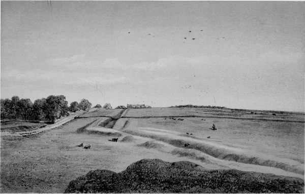
H. Burdon Richardson, Delt.John Storey, Lith. THE WORKS NEAR CARR HILL.
THE VALLUM AT DOWN-HILL.
Immediately after passing the farm house of Carr-hill, an appearance of great interest presents itself. The works of the Vallum are coming boldly forward in company with the Wall, when suddenly, and at a decided angle, they change their course, evidently to avoid mounting a small barrow-like elevation, called Down-hill.[77] The Wall pursues its course straightforward. The view, exhibited on the opposite page, taken from the edge of the hill, looking eastward, shews this arrangement. The road, with the ditch on its north side, is the representative of the Wall. The Vallum and Wall again converge as they approach Hunnum. These appearances strongly corroborate the opinion that all the 157lines of the Barrier are but parts of one great engineering scheme. If the Vallum had been constructed as an independent defence against a northern foe, and nearly a century before the Wall, we cannot conceive that an elevation, which so entirely commands the Vallum, would have been left open to the enemy; especially as it would have been just as easy to take the Vallum along the north flank of the hill as along the south. Horsley, who advocates the opinion that the north agger is Agricola’s Military Way, that the southern aggers were the work of Hadrian, and that the Wall was not erected till the time of Severus, is rather at a loss to account for these appearances. He says:—
Before we come to Halton-chesters, somewhat appears that is pretty remarkable. Hadrian’s Vallum running full upon a little hill, turns at once round about the skirt of it, leaving the hill on the north, and thereby, one would think, rendering the Vallum itself a weak defence at that part. The north agger goes close to the south side of this hill; so that they were also obliged to carry the Vallum round the hill in order to preserve the parallelism. If the north agger was the Old Military Way, and prior to the Vallum, there was nothing improper in carrying it on the south skirts of the hill; and then when the Vallum came afterwards to be built, (for a defence, or place of retreat) they were under a kind of necessity to form it after this manner.
Since so able a man as Horsley can devise no better defence of his theory, it may well be abandoned altogether. It cannot be conceived that, under a rule so vigorous as Hadrian’s, the builders of the Barrier would be allowed to give the enemy 158a material advantage, in order to save themselves the trouble of reconstructing the Military Way for a short space.
Down-hill bears marks of having been quarried at some distant period for its limestone. A little to the south of the Vallum are some circular lines, which an experienced observer tells me, are the remains of ‘sow-kilns.’ It would, perhaps, be rash to claim for them a primeval date, though in their appearance there is nothing inconsistent with the supposition.
HALTON RED-HOUSE.
Halton Red-house is next passed on the right hand. It is entirely built of stones taken from the neighbouring station; they have, however, been fresh dressed. In the farm-yard is a rectangular stone trough, which was found in the station, and which its owner describes as a ‘smiddy trow,’ and shews upon the edge the place which had been worn away by the attrition of the blacksmith’s irons. It might, indeed, serve very well for such a purpose, but troughs of this kind are of too frequent occurrence in the buildings along the line to allow us to suppose that this was their usual application. They are generally very rudely carved both outside and in, and not unfrequently are formed of an irregular unsquared block of stone. I think that they were used for domestic and culinary purposes. There is a fragment of one lying in the hypocaust at Chesters, the edge of which is worn down by the sharpening of knives upon it.
We now approach the fifth station of the line,
Hunnum.
159HUNNUM.—This ancient abode of Rome’s warriors, with its walls, streets, temples, markets, and aqueducts, is nearly one unbroken sweep of luxuriant vegetation. The traveller may readily pass by it, as Hutton did, without discerning symptoms of Roman occupation. A small, half-ruined hut stands within its area, a fitting emblem of the surrounding desolation. It is almost needless to name a city, which has no existence, but for convenience sake,|HALTON-CHESTERS.| Horsley conferred upon it the style and title of Halton-chesters. The castle of Halton is close by.
The form of the station is peculiar, as is shewn in the plan of it, Plate II. The Wall joins the station at about one-third the distance between its northern and southern extremity. The portion of the station which is to the north of the Wall is not so broad as the part to the south of it. The only reason which has been assigned for this is, that, as Horsley observes, 'there is a descent or hollow ground joining to the west side of this part, so that the work could not be carried on any farther that way without much trouble and expense; though, it must be owned, the Romans don't usually seem to have valued either the one or the other'. It is remarkable that in adapting the station to the ground, they have not given to the wall, at the north east corner, a slanting direction, as would have been most convenient, but have, as usual, adhered to the rectangular form.
The turnpike road, keeping the line of the Wall, crosses the station from the site of the eastern to that of the western gateway. The section north of 160the road was brought under cultivation about twenty years ago, when immense quantities of stones were removed. It is now called the ‘Brunt-ha’penny field’ in consequence of the number of corroded copper coins which were found in it. The portion south of the road has a gentle slope and a fair exposure to the sun. It has not recently been ploughed, and consequently exhibits, with considerable distinctness, the lines of the outer entrenchments and ditches, as well as the contour of the ruined buildings and streets of the interior. The suburbs have covered a fine tract of pasture-ground to the south. The valley on the west side of the station would materially strengthen the position in this quarter.
The excavations made in the northern section, a few years ago, revealed several points of interest. The careful manner in which the stones, even of the foundation, were squared and chiselled, struck beholders with surprise. The thickness, of one part at least, of the west wall of the station I have been assured, by a person who superintended the work, was nine feet.[78] In the angle of the north-west 161portion of the station, just outside the Wall, was a large heap, containing numerous fragments of Roman pottery, the bones of animals, the horns of deer, and other refuse matter—it must, in short, have been the dung-hill of the camp. Even now, although the plough has passed repeatedly over it, its position is shewn by the darkness of the soil. On the same occasion, there was laid open an aqueduct of about three quarters of a mile in length, which seems to have conducted water from a spring or burn in the high ground north of the place where Stagshawbank fair is held. My informant, who traced it for between two and three hundred yards, says, that it was formed of stone, and was covered with flags.[79] In crossing the valley to the west of the fort, it must have been supported on pillars, or a mound. The most remarkable circumstance to be noticed respecting this water-course is, that it was on the north, or the enemy’s side of the Wall. It is scarcely probable that the Romans would depend for that portion of their daily supply, which was required for drinking and culinary purposes, on so precarious a source; but it is not unlikely that the water so introduced was meant to fill the fosse to the north of the station, and thus to give the additional security of a wet ditch to a portion of the camp, which, though much exposed, possessed no natural strength 162of situation.[80] Crossing the station diagonally from below the eastern gateway to the north-west angle, a sewer or drain was found, of considerable dimensions. My informant crept along it for about one hundred yards. The bottom of it was filled with hardened mud, imbedded in which, were found a lamp and many bone pins, such as those with which the Romans fastened their woollen garments.
The most interesting discovery made on this occasion, however, was a suite of apartments, which have been usually supposed to be ‘the Baths.’ The building was one hundred and thirty-two feet in length, and contained not fewer than eleven rooms. The first of these was forty-three feet long, and twenty wide, and was the place, it has been conjectured, ‘where the bathers waited, and employed themselves in walking and talking, till their turn came to bathe.’ The others beyond are supposed to have been set apart for the purposes of undressing, taking the cold, the tepid, and the hot-bath, sweating, anointing, and robing. If the Roman prefects allowed the most important buildings of their frontier camps to be devoted to the enjoyment of the bath in all its elaborate details, they were more indulgent than some modern generals would be. That one or two of the smaller rooms have been devoted to ablution is not unlikely, this range of buildings having contained two carefully constructed cisterns which may have been 163used as baths. Several of the rooms had hanging floors, with flues beneath; pipes of burnt clay, fixed to the walls by T-headed holdfasts, communicated with the flues below, and conveyed the hot air up the sides of the apartments. But no provision for heating large quantities of water was discovered, such as we might have expected to find, if the whole building had been used for bathing.
The whole of this interesting structure was removed as the process of exhumation proceeded. Our only consolation is, that a minute and able description of it has been left us by Mr. Hodgson.
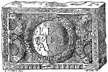
Several inscribed and sculptured stones have been discovered here. Camden, in 1600, found a monumental slab, erected to the memory of a soldier of the Ala Sabiniana; the regiment which the Notitia represents as being quartered at Hunnum. A stone, bearing the inscription, LEG. II. AVG. F., Legio secunda Augusta fecit, is at Alnwick castle, and belongs, I think, to this station. Wallis says 'as some labourers were turning up the foundations here, for the sake of the stones to mend the road, they met with a centurial stone with the above inscription, within a civic garland, the crest of the imperial eagle at each end, 164and that it was taken into the custody of Sir Edward Blackett. The one here shewn, though not a centurial stone, must be the one in question.[81] It is one of the most elegantly carved stones that have been found upon the line, and closely resembles the style of those erected by the same legion in the Barrier of the Upper Isthmus. The ornament in the upper margin, and at the sides, has probably formed the type of one that prevailed in the Transition Norman and Early English styles.
Several busts of emperors and empresses, preserved about the house and grounds of Matfen, shew the attention which the ancient inhabitants of Hunnum have paid to the decoration of the camp.
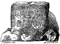
A little to the west of the station, not far from the gateway, was recently found the slab which is here figured. Although the inscription is not deeply cut, it is very legible, and doubtless means—The lightning of the gods. When any spot was struck with lightning, it was immediately deemed sacred, and venerated as such by the Romans, being surrounded by a breastwork of masonry, similar to that put round the mouth of a well. Conscious guilt makes cowards of the most dauntless warriors! Perhaps some member of the 165Sabinian ala, hastening for shelter, and beseeching meanwhile the protection of Jupiter Tonans, was here arrested on life’s journey, and summoned to his great account.
Among the minor antiquities found at this station was a particularly massive finger ring of pure gold, set with an artificial stone, on which a full-length figure was engraved. It was stolen from lady Blackett, to whom it belonged, together with the rest of her jewellery.
An intelligent observer informs me, that an ancient road of Roman construction went direct north from Hunnum. It, no doubt, soon joined the eastern branch of the Watling-street which Horsley lays down, part of whose course is represented in the map accompanying this volume.
HALTON-CHESTERS.
Halton-castle is to the south of the station. It is entirely composed of stones taken from the Roman Wall. In the farm-buildings attached to it, are some Roman mouldings, and a weathered figure of primeval aspect.
No probable etymological account of the word Hunnum has yet been offered. If the word Halton can be supposed to have any affinity with Hunnum, besides the initial breathing, this is one of the few instances in which there is any resemblance between the ancient and modern name of the stations.
Leaving Hunnum, we soon reach Stagshawbank-gate, where the ancient Watling-street crosses the road at right-angles. This Roman Way was 166probably first constructed by Agricola, as a means of keeping up a communication with the garrisons in South Britain, while he was forcing his way into Scotland. A fort formerly stood here to guard the passage through the Wall; no trace of it now remains.
VALLUM NEAR ST. OSWALD’S.
The earth-works between this point and the crown of the hill descending to the North Tyne are remarkably perfect. The description which Hutton gives of them happily holds good at the present moment—
I now travel over a large common, still upon the Wall, with its trench nearly complete. But what was my surprise when I beheld, thirty yards on my left, the united works of Agricola and Hadrian, almost perfect! I climbed over a stone wall to examine the wonder; measured the whole in every direction; surveyed them with surprise, with delight; was fascinated, and unable to proceed; forgot I was upon a wild common, a stranger, and the evening approaching. I had the grandest works under my eye of the greatest men of the age in which they lived, and of the most eminent nation then existing; all of which had suffered but little during the long course of sixteen hundred years. Even hunger and fatigue were lost in the grandeur before me. If a man writes a book upon a turnpike road, he cannot be expected to move quick; but, lost in astonishment, I was not able to move at all.
The first time I visited the spot, this passage, through which there runs so fine a vein of youthful enthusiasm, was fresh in my recollection. The shades of evening were beginning to gather round me, and the blackness of the furze which covered the ground, gave additional solemnity to the 167scene. I looked for the venerable old man, as if expecting still to find him fixed in his enthusiastic trance; but he was not there. After all, he had moved on; and a few years more removed him from this scene, to sleep in the church-yard under a humbler and less durable mound than his favourite general and emperor had here raised!
The section given in page 52, exhibits the state of the works at this place. The north fosse is very boldly developed between the sixteenth and eighteenth milestone: the whole of its contents lie strewed on its outer margin. Near the eighteenth milestone, on the left of the road, is a mound, which I take to be the remains of a mile-castle. In one part near here, the Wall, as seen in the road, measures ten feet wide, but it speedily becomes narrower.
ST. OSWALD’S CHAPEL.
Where the ground begins to dip strongly to the North Tyne, St. Oswald’s chapel stands. On the north side of the road, is a field called Mould’s-close, in which a number of bones and implements of war have from time to time been turned up, and which is supposed to be the site of a battle. The tradition runs, that from the fight which was won here, England dates her advancing greatness, and that, from the fatal results of a conflict to be lost on the same ground, she will date her decline. |BATTLE OF HEAVEN-FIELD.|Hodgson says, ‘Was this the site of part of the battle of Heaven-field, which Bede says was fought just north of the Roman Wall, and in memory of which the chapel of St. Oswald was built?’ That it 168was, the narrative of the venerable historian will probably shew—
The place is shewn to this day, and held in much veneration, where Oswald (A.D. 635), being about to engage (with the ferocious British king Cadwalla), erected the sign of the holy cross, and on his knees prayed to God that he would assist his worshippers in their great distress. It is further reported, that the cross being made in haste, and the hole dug in which it was to be fixed, the king himself, full of faith, laid hold of it, and held it with both his hands, till it was set fast by throwing in the earth; and this done, raising his voice, he cried to his army, ‘Let us all kneel, and jointly beseech the true and living God Almighty, in his mercy, to defend us from the haughty and fierce enemy; for He knows that we have undertaken a just war for the safety of our nation.’ All did as he had commanded, and accordingly advancing towards the enemy with the first dawn of day, they obtained the victory, as their faith deserved. In that place of prayer very many miraculous cures are known to have been performed, as a token and memorial of the king’s faith; for even to this day, many are wont to cut off small chips of the wood of the holy cross, which being put into water, men or cattle drinking of, or sprinkled with that water, are immediately restored to health. The place in the English tongue is called Hefenfeld, or the Heavenly Field.... The same place is near the Wall with which the Romans formerly enclosed the island from sea to sea, to restrain the fury of the barbarous nations, as has been said before. Hither, also, the brothers of the church of Hagulstad (Hexham), which is not far from thence (it is in the valley directly below), repair yearly on the day before that on which king Oswald was afterwards slain, to watch there for the health of his soul, and having sung many psalms, to offer for him in the morning the sacrifice of the holy oblation. And since that good custom has spread, they have lately built and consecrated a church there, which has attached additional sanctity and honour to that place.[82]
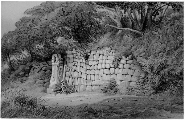
H. Burdon Richardson, Delt.John Storey, Lith. THE WALL AT BRUNTON.
169A little to the south of the road, at St. Oswald’s-hill-head, is Fallowfield-fell, where the Written-rock, of which an engraving is given, page 102, may yet be seen. The face of the rock occupied by the inscription is four feet long; the letters are distinct.[83] Continuing to descend the hill, we come to Plane-tree-field, where on the left of the road, a conspicuous piece of the Wall remains. It is about thirty-six yards long, and has, in some places, five courses of facing-stones entire; the grout of the interior which rises still higher, gives root to some fine old thorns. This sight may be rendered more interesting by the antiquary’s carrying his eye forward, and tracing the Wall in its onward course; in its modern representative, the turnpike road, it is seen, (having crossed the North Tyne, and passed the station of Cilurnum,) bounding up the opposite hill in its usual unflinching manner, and making for the wastes and mountains which it is speedily to traverse.
THE WALL AT BRUNTON.
In the grounds of Brunton, a little below this, a small piece of the Wall is to be seen in a state of very great perfection. It is seven feet high, and presents nine courses of facing-stones entire. The mortar of the five lower courses is good; the face of the south side is gone. The ditch also is here well developed. The opposite lithograph gives an accurate 170representation of what Hutton calls ‘this grand exhibition.’ The altar which, at present, stands as it is placed in the drawing, formerly discharged the office of a gate-post at the entry of the yard of St. Oswald’s chapel.
BRIDGE OVER THE NORTH TYNE.
For some reason, which it is hard to divine, the turnpike road now recedes from the Wall, and crosses the river at Chollerford, nearly half-a-mile above the spot where the Roman bridge spanned it.
PLATE VI.
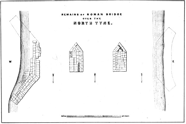
REMAINS OF ROMAN BRIDGE OVER THE NORTH TYNE. Reid Lith.
PLATE VII.
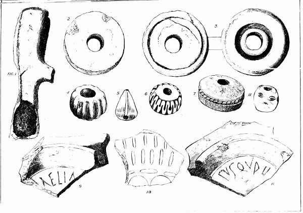
Miscellaneous Antiquities, Chesters, Cilurnum
The remains of this bridge may yet be seen when the water is low, and the surface smooth. There seem to have been three piers of considerable size and solidity, set diagonally to the stream. The stones composing them are large, regularly squared, and fastened with metallic cramps.[84] Luis-holes, indicating the mode in which they have been lowered into their bed, appear in several of them. The firmness with which these foundation courses still retain the position assigned to them by the soldiers of Hadrian is very remarkable; the rolling floods of sixteen hundred winters seem to have spent their rage upon them almost in vain. As the eastern side of the river 171is frequently overflowed, the Vallum is here obliterated, but probably both works approached the bridge in close companionship. On the western side, appearances still bear out Horsley’s statement, that the 'Wall falls upon the middle of the fort, and Hadrian’s Vallum, as usual, falls in with the south side of it.'
A plan of Cilurnum, and adjoining works, as figured by Warburton, is given in Plate II. Probably, few who examine it attentively will question the justness of the conclusion to which he has arrived, that the Wall, Vallum, stations, castles, and turrets, ‘by their mutual relation to one another, must have been one entire, united defence, or fortification.’
We are now arrived at the station called in the locality, Chesters, but by Horsley named, for the sake of distinction, Walwick-chesters. An attentive examination of it will well reward the antiquary.
CILURNUM.
CILURNUM.—This station has, as usual, the form of a parallelogram, the corners being slightly rounded off. It contains an area of fully six acres. In the latter part of the last century, when the mansion and estate of Chesters came into the possession of the family of Clayton, this area was covered with the ruins of buildings which had apparently stood in strait, narrow streets, and although the surface of the station has since been levelled and made smooth, in order to fit it for its use as part of the park, yet its ramparts and fosse, the Wall and Vallum as they approach and leave it, and the road leading to the river, may all be distinctly 172discerned; even the ruined dwellings of the interior area, as if dissatisfied with their lowly condition, struggle to rear themselves into notice. A portion of the Wall, near the north-west angle, has been freed from the encumbering soil; it is five feet thick, and exhibits four courses of masonry in excellent preservation.