Group I. THREE RIVAL CIVILIZATIONS. (continued 2)
Reading edition
The characters of these sovereigns may be summed up as follows: Charles V. was a great general and great king. Philip II. was a king only. Philip III. and Philip IV. were not even kings. Charles II. could hardly be called a man. This dotard, at thirty-nine, passed his time in making and destroying his will. Choosing rather to ally his house with France than Germany, Charles made a French prince his heir. It was to this prince that Louis XIV., in embracing him, made use of the memorable words, "There are no longer any Pyrenees."
It was then, as we have said, the age of Louis XIV. and of French supremacy in continental affairs.
In our continent Spain was already playing a secondary part. A more vigorous hand had seized the standard of discovery, and was now bearing it onward to victory.
It had gone all the way from the humble Jesuit mission at the foot of Lake Superior to France, that the greatest river of America was as good as found,—the greatest, because all admitted that only its head streams could have been touched, while it was seen that its course must of necessity lie on one or the other side of the mountains of New Mexico,—toward the Gulf of Mexico or the Vermilion Sea. But on which side they could not tell.
Of course there were two opinions. Some favored one, some the other, but either belief announced the river of the continent. Whoever should first plant themselves at its mouth, would inevitably control its whole course. And so the idea took root in the minds of the statesmen and geographers of the time, who set about trying to map out the destiny of the future empire.
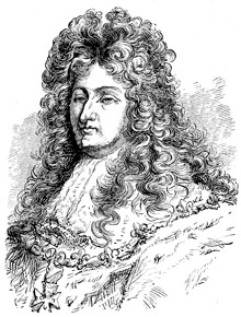
LOUIS XIV.
The shrewdest among the French explorers did not believe that the Mississippi and Colorado could be the same, or that the great river flowed into the South Sea. Father Allouez, as we have seen, thought otherwise. In any case an incentive had been found for more earnest effort, with more definite aims. There began to be, in America, a really national question.
So it was that step by step that great mysterious river which had so long flowed through men's brains, grew at last into definiteness, though still waiting for the veil of centuries to be lifted.
So far America had been the orange to be squeezed by whoever should possess it. Louis, like the rest, no doubt looked more to the revenue he hoped to get from New France, than to the mere glory of extending his dominions in that quarter, though he was also ambitious of doing this. Yet for either purpose he must have suitable agents, while his political aims in Europe would be furthered by crippling the English and Spanish colonies in America. The English were to be hemmed in on the seaboard, while the Spaniards would find themselves checked from advancing beyond the limits they already occupied.
When the royal arms of France were raised at Sault St. Marie, New England was pushing out toward the east, not the west. No English could be found west of the Hudson. No word of English had been heard beyond Lake Ontario. There was not yet a Pennsylvania. Virginia lay east of the Blue Ridge; the Carolinas were but recently settled; Florida was hardly more than a Spanish military post.
In all times large views demand large men for their execution. In looking about him for a governor who ought to be more of a soldier than politician, less a courtier than a man of action, though something of both, the king's eye fell upon Count Frontenac, whose rule somewhat resembled that of his august master, in the attempted concentration of all power in himself.
In 1672 Colbert, the prime minister, wrote to the intendant of Canada that his majesty wished him to give his attention to the discovery of the South Sea. The wish being the same as a command, the intendant sought for a fitting agent to carry it into effect.
COUNT FRONTENAC.
Louis de Buade, Compte de Frontenac, showed little loss of physical or mental vigor outwardly, though at seventy incessant wear and tear had begun to tell on a constitution and will of iron. His eye had not lost its fire, nor his step its elasticity, but a deep crease between the brows gave a look of care to his face, and bespoke the power and habit of concentrated thought. His complexion was florid, his moustache, imperial, and eyebrows, white as snow. Notwithstanding a certain cast of sensuality there, the face, if not noble, had that decided distinction about it which impressed the beholder with the idea that he was in the presence of no ordinary man. Men called him the savior of Canada, for he had been sent at a most critical moment to retrieve, if possible, the blunders, the incapacity of his predecessor, Denonville. Crafty, supple, acute, he was the very man to comprehend Indian diplomacy, to penetrate or baffle Indian duplicity, or by a politic act to disarm the hostility of these wily adversaries. At the same time, he not only knew when and where to strike the most deadly blows, but how to draw from success in war the most important, the most fruitful results. The Iroquois, who waged incessant and destructive warfare against Canada, called him the great Onontio. He had not disdained to join an Indian war-dance, in which he was the first to strike the war-post with his hatchet. He harangued his savage allies in their own sententious and highly imaginative rhetoric, imitated their own methods of war, and even their atrocities in roasting prisoners alive,—to the end, perhaps, that the Indians might admire in him the qualities which they most valued in themselves.
JOLIET AND MARQUETTE.
"Peace hath her victories no less renowned than war."
In Louis Joliet,[1] Talon, the intendant,[2] found the man he wanted. Joliet promised to see the mouth of the Mississippi before he came back to give an account of himself, and being already a veteran explorer, no less was expected of him than that he would keep his word.
We remember that exploration and conversion were now always to go hand in hand. One of the Jesuit missionaries at the Lakes was therefore named by his superior to go along with Joliet. This was Father James Marquette. Father Marquette was then in charge of the mission at Michilimackinac, where Joliet found him impatiently expecting his coming, for ever since Marquette had heard the Indians talk about the great river, the wish to make a pilgrimage to it had lain next his heart. He prayed the Virgin to obtain for him this boon, and his prayer had been granted at last. Marquette had also heard of the Missouri, and the natives who dwelt in prodigious numbers along its banks. All these things he was anxious to see with his own eyes in order to know how far the truth would agree with what had been told him. He was impatient to carry the gospel among all these lost tribes, to whom he felt himself called by special appointment of Heaven.
The explorers set out from Mackinac[3] in May, 1673, in two canoes. They were seven men in all. Coasting Lake Michigan[4] till they came to Green Bay, they entered Fox River, crossed Lake Winnebago, and on the 7th of June reached the Mascoutin Village, where to Marquette's great joy a cross[5] was standing unharmed among the wigwams to signify that Christians had already been there.
They had now reached the farthest limit of previous exploration. So far as known no traveller had gone beyond this spot.
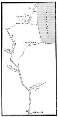
MARQUETTE'S MAP.
At this place the explorers took Indian guides. Setting out again on the 10th, they forced the canoes slowly along through shallow waters, choked with wild rice, which grew so tall about them as almost to meet above their heads, till they could go no farther. Then lifting the canoes from the water, the explorers bore them on their shoulders across the prairie to the Wisconsin, upon which they again launched them.
"They glided calmly down the tranquil stream, by islands choked with trees and matted with entangling grape-vines, by forests, groves and prairies, the parks and pleasure-grounds of a prodigal Nature; by thickets and marshes and broad bare sandbars; under the shadowing trees, between whose tops looked down from afar the bold brow of some woody bluff. At night the bivouac—the canoes inverted on the bank, the flickering fire, the meal of bison flesh or venison, the evening pipes, and slumber beneath the stars; and when in the morning they embarked again, the mist hung on the river like a bridal veil, then melted before the sun, till the glassy water and the languid woods basked breathless in the sultry glare."
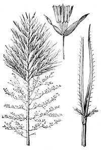
WILD RICE.
On the 17th of June, Marquette and Joliet reached the site of Prairie du Chien. Here the Wisconsin was swallowed up in the broad current of a mightier stream whose dark waters swept by without pause, like something conscious of its power. No sooner had they looked than the eager explorers knew it for the object of their hopes and prayers. A few vigorous strokes of the paddles, and they were floating on its majestic tide lost in wonder and praise, for the half had not been told them. There could be no mistake. The long-sought Mississippi had been found again.
With cautious strokes and watchful eyes the canoes were steered southward. Sometimes sailing in the dark shadows of overhanging forests where danger might lurk unseen, again gliding on through sunny prairies, unfolding vistas of quiet beauty to the view, the delighted explorers kept on their venturous course. It was a voyage which threw around them the charm of an exceeding loveliness.
Now and then the party would land to cook a hasty meal, but not knowing what sort of people they might meet with, they dared not sleep on shore. So at nightfall the canoes were anchored off in the stream. For a whole week they floated on in a primeval solitude. No sign of the hand of man was to be seen about them. No human voice was raised in welcome or in warning. All was silent as at the creation. Herds of bison, grazing along the banks, raised their shaggy heads to gaze in wonder at the passing travellers, but in all this time nothing in human form appeared to molest them.
One day the explorers saw footprints upon the shore. Consulting together, they resolved to follow them. Leaving the canoes in charge of their men, Joliet and Marquette set out. The path led to a village whose inhabitants sallied forth at the strange white men's halloo, amazed to see them there. The chief men offered the peace-pipe. Marquette asked them what people they were.
"We are the Illinois," was the ready reply. Then the two Frenchmen knew they were among friends[6] who would tell them what they wanted to know about the river below—what people they were likely to fall in with, and whether friendly or not. The Illinois feasted the strangers, and spread buffalo-robes for them to sleep on, but urged them not to think of descending the river farther on account of the demon which guarded the passage.
Going back to their comrades, with the whole village for an escort, the explorers pushed off again on their voyage. First they passed the Illinois, with its remarkable rocks. Next the Missouri,[7] child of the mountains, poured its turbid flood into the clear waters of the Mississippi with such impetuous force as to cut its way through to the opposite bank, so giving its own dull hue to the whole stream.
ILLINOIS.
Getting clear of all dangers, the adventurous voyagers next passed the mouth of the Ohio, or Beautiful River. Day after day they floated on between forests of cypress, only once meeting with Indians by the way, till they had descended as far as the mouth of the Arkansas, when suddenly a fleet of war canoes was seen putting off from the shore to cut them off. In vain Marquette waved the calumet,[8] which the Illinois had given him to be his safeguard, and which among savages is the symbol of peace. The young warriors fitted their arrows and bent their bows. In another moment the explorers would have been riddled with arrows, but for the timely arrival of the elders who called out to the young men to stay their hands. With these the French now held a parley, and having made known their pacific intentions, were suffered to land and were kindly treated.
With the help of one among them who understood a little of the Illinois tongue, Marquette was able to make his purpose to reach the sea understood. He now learned that this was not the principal town of the Arkansas nation. That was eight or ten leagues farther down the river. So the next day the Frenchmen went on to the greater town,[9] where they hoped to learn all they wished to know.
Strangely enough, the explorers had now reached the very point made memorable by the coming of De Soto a century and a half earlier. And as if his fate had cast a spell over the spot where they stood following the course of the great river with their eyes till it was lost in the distance, neither Joliet nor Marquette was destined to pass beyond it.
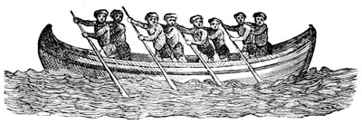
WAR CANOE, FROM LA HONTAN.
Here the Indians gave the explorers a feast, while holding a council upon the question whether they could or could not proceed with safety. In return the whites distributed gifts among the Indians. These Indians had little food except corn, of which they raised three crops each year. In addition to this, they gave their visitors dog's flesh to eat, as a mark of honorable treatment. Although they had knives and hatchets of European make, and could mould rude earthenware pots and jars to cook their food in, these people were of lower condition than those who lived higher up the river, although from symmetry of form they were known as the "handsome men." The men went entirely nude; the women wore skins about their loins.
They told Marquette that the people lower down would never let him pass through their country; that they were a people who had fire-arms and knew how to use them. This made them so formidable to their neighbors, that these Arkansas dared not hunt the buffalo in that country, though the plains there were alive with them.
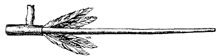
THE CALUMET.
Such ill reports touching the obstacles in the way of further progress decided the explorers to turn back, although the Indians said the sea was only ten journeys distant. They were too few to fight. Their capture would most surely frustrate the whole purpose of the expedition. All felt that this chance should not be risked. They had at least gone far enough to settle the vexed question about the outlet to the sea. All indications pointed to the Gulf of Mexico.
It is evident that the explorers took counsel of their own wishes, perhaps of their own fears, in making their decision to go back. Be that as it may, Joliet had not kept his promise to Talon.
On the 17th of July the explorers began their long journey homeward. They were weeks making their way back to the Illinois, into which they turned their canoes, knowing it would shorten the journey. Ascending this river to the Indian town of Kaskaskia, the party procured guides who conducted them to Lake Michigan.
FOOTNOTES
THE MAN LA SALLE.
"Eagles fly above, but sheep flock together."—Spanish.
The Mississippi had now been struck at two points. Its course had been explored for six hundred miles, glimpses of its greatness had been caught, its mysteries partly solved. A man of greater mark now put his hand to the completion of what Marquette and Joliet had left unfinished.
Robert Cavelier de la Salle[1] was no simple explorer, having some little education, like Joliet, or pious missionary, whose sole object was to make proselytes, like Marquette.
La Salle was a man of far different mould. In him the man of brains, of ideas, of resources, of unbending will, were all joined in one. He was a serious man,—a man of heroic patience, whose highest qualities shone forth brightest in moments of supreme trial. Disaster, calumny, treachery, disease, assailed by turns, but could never crush his indomitable spirit. Whether he stood alone amid the wreck of his projects, or was confronted by unforeseen perils, his fortitude never forsook him. Although rather stern than indulgent toward his men, there was that in him which commanded respect and obedience; more, La Salle did not desire. He was the master-spirit of his own enterprises—the originator and executor of them—not the simple agent of other men's schemes. From a study of the man, in the light of what he aimed to do and what he actually achieved, we should say that, "Where there's a will there's a way," was the inspiration of La Salle's efforts, and unique maxim of his career.
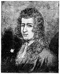
CAVELIER DE LA SALLE.
But La Salle had his drawbacks also. Naturally thoughtful and reserved he lived too much apart, in himself, to be a good companion in the wandering republic of which he was the head, though his followers learned to look up to him if they could not love him. He could not unbosom himself to his inferiors, nor could they understand that mixture of pride and reserve which wrapped him about like a garment. What they took for austerity of manner was the absorption of the man in himself. Those who knew him best would have followed him to the end of the world, but La Salle was so constituted that few could know him. Of all this La Salle, himself, was unconscious. His responsibilities were too great, his cares too many, for indulgence in trivial things. With minds like Louis XIV., Colbert or Frontenac, the case was different. La Salle impressed them as no ordinary man could. So when the possibility of getting control of our continent by stretching a chain of French posts from Quebec to the St. Lawrence unfolded itself to his mind, in its grandeur, the King at once saw in La Salle the fittest man for the work. And La Salle knew no such word as fail.
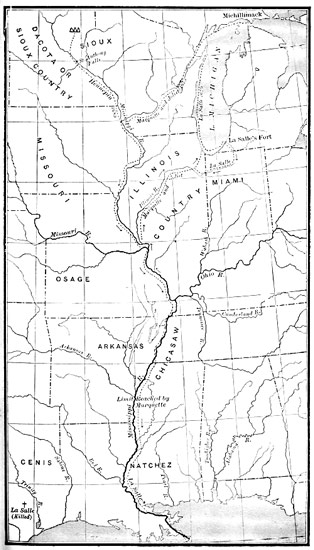
MAP SHOWING LA SALLE'S EXPLORATIONS
La Salle was one of those who in the beginning believed the Mississippi flowed into the Vermilion Sea. If we may put faith in appearances, his original idea was not so much to descend the great river to its mouth, as to make his way across the continent to the great South Sea, and so to reach China and Japan. And the name of La Chine,[2] which La Salle gave his own residence, at Montreal, really seems an indication of what was then uppermost in his mind.
This is instructive as showing how slowly geographical knowledge of the westward half of the continent unfolded itself.
As we have said, Cavelier de la Salle was a man of one idea, practical in some things, visionary in others, but in pursuit of a purpose as steadfast as fate.
In 1666, at twenty-three, he found himself in Canada. He took up his residence at the upper end of the island of Montreal, where the St. Lawrence is broken up into rapids which to this day bear the name of La Salle's residence, La Chine.
Here La Salle quietly spent three years, hearing the while from the Indians who came to La Chine, all sorts of strange stories about the vast region toward the setting sun, and the people who lived in it.
We have seen the missions already firmly established on the Great Lakes. Joliet and Marquette had reached the Mississippi by one route and returned by another and different one, leading them through the heart of the great Illinois nation, to whom Marquette believed himself specially called. His labors among this people had left an impression highly favorable to those who might come after him.
It was from the Iroquois, who came to visit him at La Chine, that La Salle first heard of the Ohio. The passion for discovery seems to have found swift and intense development in him. He was young, ambitious and eager for adventure. La Salle was only twenty-six when he resolved to go in search of the Ohio.
Immediately he sold La Chine to procure an outfit. In the summer of 1669 he set out for the Iroquois country where we lose sight of him altogether. Yet, while no itinerary of his journey remains extant, his claim to have discovered the Ohio is conceded by his rival, Joliet.
Meanwhile, Frontenac, that man of action, was not idle. He was bent on opening the direct road to the western lakes, peaceably if he could, forcibly if he must, but at any rate to open it. To this end he now showed the Iroquois that he was not afraid of them by building a fort at Kingston,[3] which was called, in his honor, Fort Frontenac. This post gave the command of Lake Ontario to the French. It was at once a check and a menace to the Iroquois, who saw the mastery of the lakes slipping away from them but could not prevent it. Through his favor with Frontenac, La Salle secured from the king a grant of Fort Frontenac, which, in his hands, became not only an important trading-post, but the base of future contemplated discoveries. Here La Salle brooded over the projects which were to make him famous not for a day, but for all time.
For ten years more La Salle is found repairing his fortunes, maturing his plans, acquiring information, or studying Indian dialects. The Gulf of Mexico was to be reached, and a French port and colony established there into which all the trade of the river should flow. Thus the Mississippi, in French hands, was to be a wedge dividing the Spaniards in Florida from the Spaniards in New Mexico. Possessed of the two great waterways of the continent—the St. Lawrence and Mississippi—France was to take the first place in America. When all was ready La Salle laid his plans before the King.
In his memorial La Salle forcibly contrasts the barren soil, dense forests and harsh climate of Canada, with the fertile soil, sunny prairies and genial climate of the West. He describes it as being a country possessed of every thing requisite for planting flourishing colonies; and as one thoroughly familiar with it. Its native products, its abundance of fish and game, its pleasant streams, are all dwelt upon without the exaggeration with which explorers usually embellish their reports. In La Salle's view the facts were all-sufficient for his purpose.
In thus seeking the enlargement of French empire at the expense of Spain, La Salle had found a congenial field for his talents—a purpose which lifts him above the rank of a mere explorer or trader. It is true he expected to find riches and honor for himself, yet these were things which, of necessity, hinged upon the success of the scheme as a whole, not of a part.
Impressed by La Salle's representations, Louis granted him a patent for those regions he proposed to discover, with power to build forts and govern therein for the term of five years. La Salle was to do all this at his own cost, looking to his monopoly of trade to reimburse himself. So he set about borrowing money right and left. Never generous, the King limited himself to giving La Salle the opportunity he asked for.
While in Paris, on the business of the patent, La Salle became acquainted with an Italian officer, named Tonty, who afterward served him with rare fidelity in his various expeditions. Upon La Salle's return to Quebec, Father Louis Hennepin, a Franciscan friar, sought and obtained leave to join him. And thus matters stood in September, 1678.
FOOTNOTES
LA SALLE, PRINCE OF EXPLORERS.
La Salle's plans included the following details. A vessel had been built at Frontenac for the navigation of Lake Ontario, so doing away with the tedious canoe voyages of the past. This brought the western missions one step nearer Montreal. Next, the Niagara River was to be seized upon and held, as Frontenac had been, by building a fort at its mouth. The next step would be the construction of a vessel, above the falls, to navigate the western lakes. With this done the real point of departure for the Mississippi would be removed to Lake Michigan, and the delay and fatigue of previous expeditions saved to the present one. Such were the essential features of La Salle's plan.
Accordingly La Salle set about building the fort at Niagara[1] and the vessel above the falls, during the winter of 1679. In a word, he was perfecting his communications as he went along.
In August La Salle embarked on board his new vessel and hoisted sail. It was the first which had ever ploughed the waters of Lake Erie. In due season he reached Michilimackinac, whence, after some stay, he again sailed for Green Bay. Here La Salle landed his people and goods. The Griffin was sent back to Niagara, for the supplies La Salle wanted, with order to return without delay to the rendezvous. With fourteen men La Salle then started in canoes on his journey to the Mississippi.
Various adventures signalled the progress of the explorers along the shores of Lake Michigan, as far as the mouth of the St. Joseph, which had been chosen for the final point of departure. The autumn season was well advanced. Already the north wind blew keen and cold across the lake. The canoes were tossed about on a stormy sea, which broke with violence against the inhospitable coast, threatening shipwreck if they approached it. Often the canoes would be swamped in the surf when the rising sea made it dangerous to keep the lake. Often the explorers threw themselves on the frozen ground at night, wet to the skin and famishing with hunger.
Reaching the St. Joseph, La Salle set his men to work building a fort, while he anxiously waited the coming of Tonty, who had been ordered to join him at this place. At last Tonty came. Winter had now set in. In the first days of December the united party paddled up the St. Joseph, crossed over the portage to the Kankakee, descended it to the Illinois, reaching at length the great Illinois town,[2] numbering, by actual count, four hundred and sixty lodges.
To their great disappointment the town was deserted, all the Illinois having gone to hunt the buffalo, as their custom was at this season of the year. It was a heavy blow to La Salle, who had expected to get guides and a supply of food here, as well as to recruit his men. The explorers however obtained a supply by opening the caches[3] in which the Illinois kept their winter store.
Somewhere below Peoria Lake, La Salle fell in with the Illinois, who told him all the fables they could invent in order to prevent his going on, for it seems they had some inkling his doing so would be prejudicial to them in the future.
The Mississippi, they said, was beset by men of fierce aspect who would kill them all, its waters infested with serpents, alligators and like monsters lying in wait to devour them, while the river itself finally plunged into a raging whirlpool in which they and their canoes would be swallowed up.
Although La Salle treated these silly tales with the contempt they deserved, they took effect upon his men, six of whom deserted on the spot. The explorers wintered among these Illinois in a fort which La Salle significantly named Crèvecœur.[4]
The name tells its own story. On the lakes they had been nearly drowned. On the march they had often gone hungry, La Salle with the rest. Treason was with him in his own camp, danger in that of the Illinois. His own men had tried to poison him. And now, to cap the climax of misfortune, no word had come of the Griffin[5]—the Griffin on which hung all hope of successfully continuing their search.
But nothing could shake the resolve of La Salle. Sending Father Hennepin to explore the lower course of the Illinois, the chief left Tonty in charge of Fort Crèvecœur, while he himself set out for Frontenac in order to learn what had become of the Griffin, and bring back the things he must have before it would be possible to stir from Fort Crèvecœur again.
We need not follow him on this remarkable journey, itself no mean exploit.
La Salle had not yet reached the Mississippi. In August, 1680, he again left Montreal with this object. Again he made his way to the Illinois village. This time heaps of charred and blackened rubbish, strewed with mangled bodies, met his eyes. During his absence the Iroquois had wreaked their vengeance upon the Illinois, as already they had done upon the Hurons.
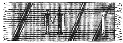
INDIAN WAMPUM BELT.
Where was the faithful Tonty? What had become of him? After La Salle's departure, his men rose against Tonty, plundered the fort of what was worth taking, demolished it, and went off in a body, leaving Tonty to shift for himself.
But where was he? La Salle found Crèvecœur in ruins, and the place a solitude.
In despair La Salle searched the river to its mouth, so reaching the Mississippi at last, but without finding the least trace of his lieutenant. On every side fate seemed conspiring for his defeat.
Still undaunted, for the third time La Salle set out in the autumn of 1681. In a wonderful manner Tonty had made his escape from the Iroquois, and rejoined his chief on the lakes. This time the expedition passed through the Chicago River to the Illinois, and thence down to the Mississippi, which was reached on the 6th of February.
After a short stay here the little fleet of canoes resumed the long voyage before them. On the 24th, the explorers landed near the Third Chickasaw Bluff to hunt. Here they built a stockade which was called Fort Prudhomme.[6]
Few incidents marked the passage of the explorers through the countries of the Arkansas, Tensas[7] and Natchez nations, till the Frenchmen reached the neighborhood of the Quinipissas, when they were shot at from the canebrakes along the banks, though without receiving any hurt.
Knowing he was among a multitude of foes, La Salle prudently refrained from returning the fire.
On the 6th of April, the explorers found the river branching out before them in three streams. Which to take, they knew not. That there should be no mistake about it, La Salle took the westernmost himself, Tonty the middle, and another the eastern branch. Presently some one dipped up a cupful of water to drink. It proved to be brackish to the taste. La Salle knew now he was nearing his goal.
At last the canoes glided past the outermost point of low, reedy land, out upon the broad bosom of the Gulf.
Landing not far above the mouth of the river, La Salle caused the arms of France to be set up at that place, and then and there, on the ninth day of April, 1682, he took formal possession of the country watered by the Mississippi. It was in the name of Louis XIV. that he did so, in whose honor La Salle declared the name of this vast acquisition to be Louisiana.
Yet in no long time we find Louis writing with his own hands words like these: "Like you,"—he is addressing M. de La Barre,[8]—"I am persuaded that the discovery of the Sieur de La Salle is very useless; and it is necessary hereafter to prevent similar enterprises which can have no other result than to debauch the people by the hope of gain, and to diminish the revenue from the beaver."
FOOTNOTES
DISCOVERY OF THE UPPER MISSISSIPPI.
It will be remembered, that, when La Salle found himself so unfortunately stopped among the Illinois, his active mind was promptly casting about for something to be achieved elsewhere. This object he found in the Upper Mississippi, which he determined should be explored in his absence, so interlocking his own discoveries with those of Joliet and Marquette. Two of his people were accordingly sent to perform this duty, with whom went Father Hennepin,[1] the Franciscan missionary before spoken of.
The party set out from Fort Crèvecœur on the last day of February, 1680, while at the same time La Salle was starting northward for Lake Ontario.
As historian of the expedition, Hennepin's vanity has led him to claim the leadership for himself, while he accuses La Salle of meaning to get rid of him,[2] in the same breath. We know, however, from La Salle that neither is true. La Salle was much too good a judge of character not to see through the friar after so long trial of him, though, knowing him to be capable, he gave him the chance of being useful. For the expedition itself, it is certain La Salle had it much at heart. Touching Hennepin's narrative, La Salle dryly says the friar "spoke more according to his wishes than what he knew," or, in the familiar phrase, was in the habit of drawing on his imagination for his facts.
Hennepin himself seems to have been that singular anomaly, seldom met with in real life, a brave braggart, whose self-conceit and arrogant self-assertion stand forth in strong contrast with the modesty and patience always shown by La Salle when he is speaking of his own achievements. And it is further characteristic of the two men, that while one felt he could afford to wait for time to do him justice, the other sought the cheap glory to be had by sounding his own praise abroad, even when exposure was certain to follow. So that nothing Hennepin has written can be accepted as true, without other evidence to substantiate it. The more is the pity! But the exaggerations of all our early chronicles show that they were penned by men influenced by the passions or rivalries of the time, often so distorting what is true as to make it fit the particular end they may have had in view. To this lamentable want of integrity may be attributed the fact that history has so often to be re-written.
For six weeks the explorers plied their paddles against the current of the Mississippi unmolested. One day when they had drawn their canoe on shore to repair it, the Frenchmen were suddenly surrounded by a war party of Sioux[3]—the very people of all others whom they most wished to avoid.
In a moment the whites were made prisoners. The scowling looks and threatening gestures of their captors boded them no good. Hennepin proffered the peace-pipe. It was snatched from his hand. When he began muttering prayers aloud, the Indians angrily signed to him to be silent, thinking he was preparing some charm to overpower them with, but they let him chant the same prayers, he says, thinking there could be no sorcery or medicine in song. Presently the Sioux began their homeward journey, thus making it clear to the Frenchmen that their future discoveries must be made as captives.
In nineteen days the party landed near the site of St. Paul.[4] From here the trail was struck leading to the Sioux villages, which were reached after five days of hard marching and harder usage at the hands of the Sioux warriors.
Here the prisoners were separated, Hennepin going to an aged chief who adopted him as his own son. So they passed the winter among the Sioux.
In the following summer, when the Sioux went on their annual buffalo hunt, they took the three Frenchmen along with them. This was the prisoners' opportunity for regaining their liberty, and they hastened to make use of it. La Salle had promised to send word of himself to them at the mouth of the Wisconsin, and they knew he would not fail them. Telling the Sioux their friends were coming, loaded with gifts, the greedy Sioux were easily induced to let Hennepin and one other go down the river to meet them alone and unguarded. One Frenchman remained behind with the Sioux as a hostage for the others.
The two whites began their descent of the river, carrying their canoe round the Falls of St. Anthony,[5] to which Father Hennepin gave this name, till, after many adventures, Lake Pepin[6] was reached.
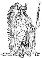
SIOUX CHIEF.
To their consternation, the travellers were overtaken at this point by a party of Sioux who had followed their prisoners so closely, as hardly to lose sight of them, and now pushed on ahead to the Wisconsin. Finding neither traders[7] nor goods there, as they had been led to expect, the Sioux paddled back again in bad humor to the place where the whites had remained. After being soundly rated for the cheat they had practised, the unlucky whites were forced to turn about and go back again as they came.
After some longer stay among the Sioux, the captives were found by some French traders who had made their way from Lake Superior, through the Sioux country, to the Mississippi. Hearing of the three white men, while on the way, these traders had kept on from village to village, till they reached the one in which Hennepin and his companions were detained, and ransomed them out of the hands of the savages.
SIOUX TOTEM.
At the head of the rescuing party was one Du Lhut, or Duluth, for whom the city of Duluth is named, as Lake Pepin is also said to have been named for another of this party. Thus, in St. Anthony's Falls, Lake Pepin, and Duluth we have a group of names commemorating the men of La Salle's exploring party, as well as the exploration itself.
All the Frenchmen now returned to the Sioux villages at Mille Lac together.
They finally made their way back to the French settlements by the Wisconsin and Green Bay route, as Marquette had done before them, and the Sioux[8] also for many generations had travelled to the great lake.
FOOTNOTES
THE LOST COLONY: ST. LOUIS OF TEXAS.
Thus, in 1682, La Salle had secured an empire for France, and at last found a legitimate field for his own ambition. His Louisiana comprised every thing between the Alleghanies and Rio Grande, the Gulf of Mexico and Hudson's Bay. Upon opening the maps of the time we find the English crowded into the comparatively narrow limits extending from the eastern slopes of the Appalachian range to the sea, the Spaniards occupying those between the Rio Grande and Gulf of California, while the whole great heart of the continent, including portions of Carolina and Florida, with its magnificent system of waterways, is covered by the names New France and Louisiana.
But La Salle himself, the man of large and luminous views, had now reached the high-water-mark of his achievements. The wave which owed its impetus to his active brain, expended its force with his life.
Upon his return voyage up the Mississippi the explorer fell sick. He was taken to Fort Prudhomme, the one built by his order on the way down, where he lay for months a helpless invalid, chafing under the inaction thus forced upon him. As soon as he felt strong enough to bear the journey, La Salle proceeded on to Michilimackinac, where he was no sooner arrived than he set about the work of rebuilding the trading-post on the Illinois, in room of the one his treacherous followers had destroyed in his absence.
This was to be his half-way house to the Mississippi. Here he trusted to gather a colony alike capable of drawing to itself all the trade of a vast tributary region, as of defending itself and his allies, the Illinois, against the incursions of the Iroquois.
But La Salle's greater project for securing the results of his discoveries, by planting a colony at the mouth of the Mississippi, henceforth looked to reaching that point by sea and not by land. To transport every thing overland from Quebec to the Gulf was of course impracticable. No one knew this better than La Salle himself, yet he also foresaw the importance of keeping the way to Canada open if the colony at the Gulf was to thrive. To this end the fort on the Illinois, and that at the Chickasaw Bluff, were but incidents.
After establishing himself strongly on the Illinois, La Salle went to France in order to lay his projects before the King.
In consequence of a rupture with Spain he found the court well disposed to listen to his proposals. These contemplated the building of a fort sixty leagues above the mouth of the Mississippi, which La Salle assumed would draw around it, as to a common centre, all the neighbor tribes. Gifts and good usage had already disposed these tribes favorably toward the French, while the Spaniards had already alienated them by harsh treatment. With their help La Salle asserted that the conquest of New Biscay,[1] with its rich silver-mines, would be an easy matter, because there were not more than four hundred Spaniards in all that province.
The plan met instant favor. To enable La Salle to carry it out, four vessels were given him instead of the two he asked for. A naval officer by the name of Beaujeu was assigned to command them at sea. La Salle set himself to work with his usual energy. Soldiers, priests and colonists, arms, munitions and stores, were provided in sufficient number or quantity to put the colony on its feet at once.
Long before the ships were ready to sail from Rochefort, La Salle and Beaujeu had quarrelled. Beaujeu overrated himself, and underrated La Salle. Often betrayed by those he trusted most, La Salle's naturally suspicious nature led him to distrust every one, above all Beaujeu, who constantly ridiculed him and his schemes to his friends. So La Salle's reserve gave offence to Beaujeu, who grew sulky, and was at no pains to conceal his dislike for the whole affair. Here then at the very outset the seeds of disaster were sowed. It was under such unpromising conditions that the fleet set sail in July, 1684, for the Gulf of Mexico.
Three of the vessels reached St. Domingo in two months, with a large number of sick on board, of whom La Salle himself was one. The fourth had been taken at sea by Spanish buccaneers, thus depriving the colonists of the tools and provisions with which she was loaded.
Upon La Salle's recovery from what came near proving a fatal illness, the fleet again put to sea, though it was now November, and much precious time had been lost.
Steering westward into the Gulf, they made their landfall on New Year's Day, but when La Salle went on shore to look about him, he could discover no sign of the great river he was in search of. The colonists were upon a low, flat coast, without natural landmarks to guide them, or knowledge of the longitude of the place they were seeking, or of the currents which the Gulf sets in motion. No wonder, then, that La Salle failed to recognize any part of the inhospitable coast before him.
Finding no trace of the Mississippi, and as the failure to do so was every day productive of disputes between himself and Beaujeu, La Salle resolved to land where he was, notwithstanding his belief that he had gone too far to the westward. He was, in fact, at the time of taking this resolution, on the coast of Texas, more than four hundred miles from the Mississippi.
Almost at the moment of landing, La Salle's storeship, which contained the greater part of his provisions, grounded, and became a wreck; it is said, through the carelessness or treachery of her master, who also was on bad terms with La Salle. Indeed, from first to last La Salle's enemies seem to have exerted themselves to ruin him with a zeal that, if honestly employed, would easily have insured the success of all his plans.
This disaster, taken with the fact that he knew not where he was, would have staggered any one but La Salle. His dispirited people were huddled together on the sands, among the bales and boxes saved from the wreck, out of which they made themselves a temporary intrenchment and shelter, for like vultures who scent their prey from afar, hostile Indians hovered about the encampment, watching their chance to cut off any who should stray away from its protection.
Yet misgiving for the success of an enterprise so disastrously begun, was turned into dread when the colonists learned that they were nowhere near their actual destination. La Salle, indeed, tried to put heart in them by pretending to believe otherwise, but a little time soon dispelled this fallacy. He, however, took the best means of quieting discontent by setting every one at work. Beaujeu had sailed away after promising much, but performing little else. The colonists now had much more to fear from the Spaniards, than the Spaniards from them. Yet for La Salle nothing remained but to make the best of the situation until he should have time to look it fairly in the face.
Meanwhile, the essential thing to be done was to get his people housed in a situation which should admit of their living in some comfort and security, as the place where they first landed was alike destitute of wood, water and comfortable lodging.
He therefore chose a site on the Lavaca River,[2] two leagues above its entrance into Matagorda Bay. To this place the colonists removed themselves and their goods, and under the energetic direction of La Salle, whose previous training now stood him in good stead, they set about building themselves a home in this out-of-the-way corner of the world. As it rose from the soil, the ever-loyal La Salle named it St. Louis,[3] in honor of his sovereign.
The summer was hot and sickly. Death was soon busy among the colonists, those who ate wild fruits imprudently suffering first of all. Now and then the Indians would kill some straggling hunter. Thus, in one or another form, death lurked about them. And beneath these apparent dangers, in which all shared alike, smouldered the embers of unreasoning discontent which certain of La Salle's followers were always fanning into a flame.
Having seen his people comfortably housed, and in condition to defend themselves, the indefatigable La Salle now turned his attention to the prime purpose of his expedition, with the certainty of the needle to its pole, for all he had so far done was merely a step in this direction. There was no time to lose.
Although it is not clear why La Salle should determine to march overland, rather than make search along the shores, the character of the Gulf coast affords a possible clew. This is described by Mr. Cable as follows: "Across the southern end of the State,"—he is speaking now of Louisiana,—"from Sabine Lake to Chandeleur Bay, with a north and south width of from ten to thirty miles, and an average of about fifteen, stretch the Gulf marshes, the wild haunt of myriads of birds and water-fowl, serpents and saurians, hares, raccoons and wildcats, deep-bellowing frogs, and clouds of insects, and by a few hunters whose solitary and rarely frequented huts speck the wide green horizon at remote intervals."
It was now October, 1685. With fifty men La Salle set out for the river he had discovered only to lose again. Those who staid behind, lived on buffalo-meat,[3] turtles, oysters, fish, and wild fowl which the prairies or lagoons around them plentifully supplied in their season.
In March, the exploring party came back unsuccessful and in rags. They had wandered far, but had not found the Mississippi. One crowning disaster now befell these exiles. Up to this time they had kept one little vessel of their fleet with them, which was to take them to the Mississippi so soon as its exact situation should be discovered. This vessel, in which their sole dependence lay, was now lost.
In desperate situations, desperate measures are alone to be availed of. La Salle's resolve was heroic. He determined to make a last effort to reach the Mississippi and the lakes. Indeed, there was now no hope of obtaining relief nearer than Canada, therefore to Canada he must go, leaving the colonists to await his return.
For this purpose La Salle chose twenty men, with whom he again set out from the fort on the 22d of April, 1686. Each man carried his own pack and weapons, and as the little band filed out upon the prairie, the hopes of the lost colony went forth with them in their desperate venture.
But these hopes sunk low when La Salle came back with only eight of the twenty who had gone with him. The explorers had penetrated as far as the country of the Cenis Indians,[4] when sickness and desertion had so crippled their strength as to make further progress hopeless for the time. They, however, procured some horses from the Indians which were brought back to the fort.
No other resource being open, La Salle once more essayed the task before him. In the straits in which he and his people were placed, his splendid qualities for leadership shine out of the gloom like a guiding star. The resources of the colony were nearly exhausted in fitting out previous parties, but the scanty stores were ransacked anew to equip those who were to be the saviors of the rest. The horses which La Salle had brought in were loaded with baggage and ammunition. All was ready. A midnight mass was solemnly said. La Salle spoke a few hopeful words to those who were to endure a suspense perhaps even greater than his own, and then, mastering his own feelings, he turned away to join his followers,—the forlorn hope of the expiring colony.
On the 15th of March, 1687, the hunters who were out killed a buffalo. The party therefore halted till the meat could be brought into camp. Here it was that the hatred, long nursed in secret, openly revealed itself in murder. Misery always begets quarrels, but in this case the sole incitement was revenge. La Salle had the unhappy faculty of making enemies, of whom his worst ones were then close at hand, and plotting for his life. A quarrel about the meat hastened the work on. Those who were faithful to La Salle became the conspirators' first victims. Three of these, whom La Salle had sent over to the hunters' camp, were butchered while they slept.
La Salle himself was encamped six miles distant from the place where these murders were committed. Growing uneasy at the long absence of the men he had sent away, he started with an Indian guide for their camp. A friar named Douay also accompanied him. This friar noted in La Salle's talk and manner the presentiment of coming evil. On reaching a point which he supposed to be near the hunters' camp, La Salle fired his musket as a signal. One of the conspirators showed himself, while the others lay hid in the long prairie-grass unobserved. La Salle fell into the snare thus set for him. While advancing toward the decoy, whose insolent replies angered him, La Salle constantly neared the ambuscade. Suddenly a shot was fired. When the smoke cleared away, La Salle was seen stretched lifeless upon the prairie. He was quite dead.[5] The bullet had gone through his brain.
Thus, in the prime of life, fell Robert Cavelier de La Salle, and thus again must history record its indignant protest in the death of a man of highest intellectual force, whose worth to the world was monumental as compared with that of the vulgar assassin who slew him.
Note.—The Colonists at St. Louis, except three or four who were carried into captivity, were all massacred by the Indians. A Spanish expedition in 1689 found the place a solitude. Those who escaped subsequently related what had occurred. Although this was the first white colony to be founded in Texas,[6] in itself it was an accident, no less productive of results, because it led the Spaniards to occupy the country in order to keep out intruders like La Salle. Geographical knowledge was also remarkably extended.
FOOTNOTES
IBERVILLE FOUNDS LOUISIANA.
Where La Salle had sowed, others were to reap, yet so comprehensive were his plans, so well matured, so entirely feasible withal, that what followed was but the natural result of his efforts. La Salle was like the general who falls in the moment of victory. All honor then to his name![1]
Therefore while we record his failure, individually, to do all he purposed in this, his last expedition, the success which came later was due to the master mind of La Salle. We shall not find, in any explorer of his time, so original a mind united with such rare gifts for doing the work to which he devoted himself.
For a time, the project of colonizing Louisiana[2] quietly slept. It was then revived by a naval officer named Iberville,[3] who thus became, in a manner, heir to La Salle's projects.
Iberville promised to rediscover the mouth of the Mississippi, and hold it afterward by building a fort at its mouth, just as La Salle would have done if he had lived to carry out his schemes.
Although it had slumbered long, the moment the project was renewed by so capable a man as Iberville, every intelligent Frenchman saw its importance. The minister Ponchartrain approved it directly it was broached to him, the more because he knew that if any man could succeed in what he undertook, Iberville would.
Iberville had seen much service in Canada, Hudson's Bay and Newfoundland. Being himself a naval officer of rank, he would command his own ships, and not be hampered by a divided command, or the jealousy of a rival, which had proved such a formidable stumbling-block to La Salle.
As the war was now over, Iberville wished to distinguish himself by some worthy action done in the interests of peaceful conquest.
Two ships were therefore got ready, which sailed from Rochefort in October, 1698, and anchored at St. Domingo[4] in December. Sailing thence they fell in with the Florida coast January 27. A bay opened before them. Iberville wished to put into this port, but on attempting to do so he found it in the possession of three hundred Spaniards from Vera Cruz, whose commander forbade his landing there. This place was called Pensacola.[5]
Fearing the Spaniards were on the same errand[6] with himself, Iberville at once made sail for the westward, hugging the shores as closely as possible in order not to miss the river among the mists which commonly hang over and hide it from view. Finding in Mobile Bay a harbor where his ships could safely ride, while he himself continued the search along the shore in boats, Iberville came to an anchor there.
Very shortly his exploring parties came to the Pascagoula River, where they found many savages living. From this river they pushed on through the intervening lagoons that everywhere intersect this shallow shore, till, on the 2d of March, the Mississippi itself was entered through one of its numerous passes.
Sailing on up the river, Iberville passed first one populous town and then another, receiving everywhere a cordial welcome from the savages, yet doubting within himself whether he was on the true Mississippi, till one day a chief brought him a letter[7] which Tonty had left for La Salle thirteen years before, when, after searching for his chief in vain, this trusty comrade had turned back for the Illinois.
After mentioning that he had found La Salle's cross thrown down, and had set up another in a better place, the letter concludes by saying, "It is a great chagrin to me that we are going back without finding you, after having coasted the Mexican (Louisiana) shore for thirty leagues, and the Florida twenty-five."
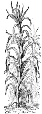
SUGAR PLANT.
This letter having removed all Iberville's doubts, he fell down the river again, and having nowhere found, within sixty leagues of the Gulf, a proper place to begin a settlement on, he turned back to the Bay of Biloxi, where a spot was chosen and the ground marked out for one.
After seeing the establishment at Biloxi well under way, Iberville took ship for France. He was back again early in January, 1701. During his absence an English corvette had sailed twenty-five leagues up the Mississippi to a point where the river sweeps grandly round to the east. At this place her captain was warned back by the French, from which circumstance the bend received the name of the English Turn, which it has ever since borne.
Iberville also learned that English traders from Carolina[8] had penetrated into the Chickasaw country above him. Finding himself menaced both by sea and land, and delay dangerous, Iberville shut up the entrance from sea by mounting some cannon near the mouth of the river.
The century turned noiselessly on its hinges with no other establishments in all this great domain of Louisiana except that planted by La Salle on the Illinois, and the one at Biloxi.
In 1701 Iberville began a settlement at Mobile. The next year he erected storehouses and barracks on Dauphine Island[9] for permanent occupation. In a few years this island became the general headquarters of the Louisiana colony. Nothing worthy of the name, however, existed before 1708. Up to this time the handful of colonists lived on what was sent them from France, or obtained by trading French goods with the savages. They sowed wheat, but found the climate too damp for growing it with success. They also began the planting of tobacco, which did so well that its culture presently became a mainstay of the colony.
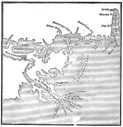
MOUTHS OF THE MISSISSIPPI, AND ADJACENT COASTS.
But while Iberville had thus gained a foothold, in what might be called a good strategic position for approaching the Mississippi, either from sea or through Lake Ponchartrain, he was actually but little nearer than the Spaniards at Pensacola, who kept a watch on all his movements. Never did nature seem more persistently thwarting the schemes of men than in the attempt of these Frenchmen to enter upon what they considered their rightful inheritance.
FOOTNOTES
FRANCE WINS THE PRIZE.
"A soldier, fire, and water, soon make room for themselves."
Iberville died at Havana in 1706, leaving his uncompleted work to his younger brother, Bienville,[1] who set vigorously about it.
Many believed Natchez to be the best point on the river for founding a settlement. Natchez therefore assumed importance to French plans for the future. But Natchez was the principal seat of a powerful nation whose enmity it would be impolitic to arouse by making forcible entry upon their lands. An opportunity soon offered itself, however, which Bienville quickly took advantage of.
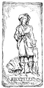
BIENVILLE. FOUNDER OF NEW ORLEANS, 1718.
In the first place some outrages committed by the Natchez upon passing traders gave Bienville the pretext he sought for building a fort at their village, which was promptly done (1714).
These people being overawed, the next step taken was the building of a fortified house at Natchitoches,[2] on the Red River, as a check to the Spaniards, who, already, were working their way east from the Rio Grande toward the Mississippi, partly to overawe the troublesome Comanches, and partly to engross the Indian trade of that region for themselves. Thus early in its history the Mississippi and its commerce were become a bone of contention between English, Spaniards and French.
Again the folly of farming out the trade of a whole country to a single individual, which had been tried in Canada with such bad effects, was repeated here in Louisiana. This monopoly was granted (1712) to Anthony Crozat for twenty-five years. Like all speculators, Crozat aimed to make the most in the shortest time, letting the future of the colony take care of itself. He was to control, absolutely, all that came into the colony or went out of it. Agriculture was neglected and trade only encouraged. And all trade was monopolized by Anthony Crozat. This was the penny wise, pound foolish, colonial system of France, adopted with the purpose of putting a little money into the royal treasury at a nominal saving to it of certain sums required for maintaining its authority in the colony. This policy turned the colony into a trading-post, and the people themselves into dependants of Crozat.
When Crozat entered upon his exclusive privileges there were but twenty-eight families in the whole province, of whom not more than half were actual settlers, the rest being either traders, innkeepers or laborers, who had no fixed residence.
The roving traders, or Coureurs de Bois,[3] bartered French goods with the Indians for peltries and slaves, which were sold in the settlements. It was found that tobacco, indigo, cotton and rice could be profitably cultivated, but none except slaves were employed in tilling the soil, which, indeed, is comparatively worthless in the neighborhood where the colonists first located themselves. Consequently only such things as would help to eke out a subsistence—such as corn, vegetables and poultry—were cultivated at all. In a word, the colony literally lived from hand to mouth. Instead of growing stronger and richer, of its own robust growth, it grew, if possible, weaker and poorer by reason of a policy, or system, under which no colony has ever thrived.
Little inducement was held out for the colonist to identify himself with the country, or feel that he and it must grow up together. He was a sojourner in a strange land. He could never hope to get rich by trade, since every thing must pass through the hands of Crozat's agents, at a price fixed by them.
This was by no means the whole weakness of Louisiana in her infancy. Perhaps the primary evil lay in the fact that so far the French neither controlled access to the Mississippi, in the place where they were, or had formed any settled plan for securing that solid foothold on its banks which alone could render them masters of the situation.
Crozat's failure was, in the nature of things, foreordained. His scheme, indeed, proved a stumbling-block to the colony and a loss to himself. In five years (1717) he was glad to surrender his monopoly to the crown.
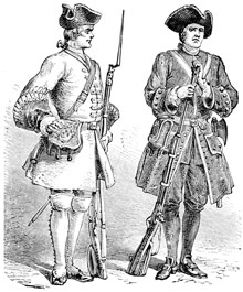
FRENCH SOLDIERS.
From its ashes sprung the gigantic Mississippi Scheme of John Law,[4] to whom all Louisiana, now including the Illinois country, was granted for a term of years. Compared with this prodigality Crozat's concession was but a plaything. It not only gave Law's Company proprietary rights to the soil, but power was conferred to administer justice, make peace or war with the natives, build forts, levy troops and with consent of the crown to appoint such military governors as it should think fitting. These extraordinary privileges were put in force by a royal edict, dated in September, 1717.
The new company granted lands along the river to individuals or associated persons, who were sometimes actual emigrants, sometimes great personages who sent out colonists at their own cost, or again the company itself undertook the building up of plantations or lands reserved by it for the purpose. One colony of Alsatians was sent out by Law to begin a plantation on the Arkansas.[5] Others, more or less flourishing, were located at the mouth of the Yazoo, Natchez and Baton Rouge. All were agricultural plantations, though in most cases the plantations themselves consisted of a few poor huts covered with a thatch of palm-leaves. The earliest forts were usually a square earthwork, strengthened with palisades about the parapet.
The company's agricultural system was founded upon African slave labor.[6] Slaves were brought from St. Domingo or other of the West India islands. By some their employment was viewed with alarm, because it was thought the blacks would soon outnumber the whites, and might some day rise and overpower them; but we find only the feeblest protest entered against the moral wrong of slavery in any record of the time. Negroes could work in the fields, under the burning sun, when the whites could not. Their labor cost no more than their maintenance. The planters easily adopted what, indeed, already existed among their neighbors. Self-interest stifled conscience.
The new company wisely appointed Bienville governor. Three ships brought munitions, troops, and stores of every sort from France, with which to put new life into the expiring colony.
It was at this time (February, 1718) that Bienville began the foundation of the destined metropolis of Louisiana. The spot chosen by him was clearly but a fragment of the delta which the river had been for ages silently building of its own mud and driftwood. It had literally risen from the sea. Elevated only a few feet above sea-level, threatened with frequent inundation, and in its primitive estate a cypress swamp, it seemed little suited for the abode of men, yet time has confirmed the wisdom of the choice.
Here, then, a hundred miles from the Gulf, on the alluvial banks of the great river, twenty-five convicts and as many carpenters were set to work clearing the ground and building the humble log cabins, which were to constitute the capital, in its infancy.
The settlement was named New Orleans,[7] in honor of the Regent, Orleans, who ruled France during the minority of Louis XV.
Up to this time it was supposed that large ships could not cross the bar, at the river's mouth, but upon sounding the channel, enough water was found to float one of the company's ships, which then sailed up to New Orleans. From this day, the river may be said to have been fairly open to commerce with the outside world. As respects the passage up and down, it had practically become an every-day excursion for the Canadian voyageurs who, with the Indians, had so long formed its floating population. These adventurers now drew up their canoes, along the bank, at New Orleans, whose promiscuous assemblage of Indians, habitants, convicts, soldiers and priests, they joined.
Father Charlevoix, the historian of New France, thus describes New Orleans as he saw it in 1721:—
"The most just idea I can give you is to imagine two hundred persons who have been sent to build a city, and who are encamped on its banks. This city is the first which one of the greatest rivers of the world has seen rise on its borders. It is composed of a hundred barracks placed without much order, a large storehouse built of wood, two or three houses which would not adorn a poor village in France, and part of a wretched barrack which they have been willing to lend the Lord, for his service, and of which He had scarcely taken possession when He was thrust out and made to take shelter under a tent."
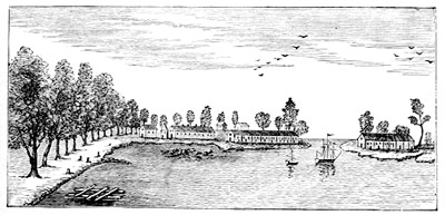
NEW ORLEANS, 1719.
In the cluster of French names,—Louisiana, New Orleans, Ponchartrain, Iberville and Maurepas,—the great personages who bore a conspicuous part in the founding of Louisiana are fittingly perpetuated.
From Quebec to New Orleans, from the St. Lawrence to the Gulf, a line of posts, half-military, half-religious, had sprung up in La Salle's footsteps. France had won the prize.
FOOTNOTES
LOUIS XIV.
Louis XIV. was not only, as Richelieu, powerful, but he was majestic; not only, as Cromwell, great, but in him was serenity. Louis XIV. was not, perhaps, genius in the master, but genius surrounded him. This may lessen a king in the eyes of some, but it adds to the glory of his reign. As for me, as you already know, I love that which is absolute, which is perfect; and therefore have always a profound respect for this grave and worthy prince, so well-born, so much loved, and so well-surrounded; a king in his cradle, a king in the tomb; true sovereign in every acceptation of the word; central monarch of civilization; pivot of all Europe, seeing, so to speak, from tour to tour, eight popes, five sultans, three emperors, two kings in Spain, three kings of Portugal, four kings and one queen of England, three kings of Denmark, one queen and two kings of Sweden, four kings of Poland, and four czars of Muscovy appear, shine forth and disappear around his throne; polar star of an entire age, who, during seventy-two years, saw all the constellations majestically perform their evolutions round him.—V. Hugo. The Rhine.
III. THE ENGLISH.
THE BLEAK NORTH-WEST COAST.
"War with the world and peace with England."—Spanish.
We should expect to find a race of sailors pushing discovery on their own element.
With English mariners of the seventeenth century, the belief in a North-west Passage to India was an inherited faith. Cabot led discovery in this direction. It became, almost exclusively, a field for the brave and adventurous of this nation who, from year to year, spreading their tattered sails to the frozen blasts of the Polar Sea, grimly fought their way on from cape to headland, in desperate venture, lured by the vain hope of finding the open waters of their dreams lying just beyond them. It is a story of daring and peril unsurpassed. Many a noble ship and gallant crew have gone down while attempting to solve those mysteries which the hand of God would seem forever to have sealed up from the knowledge of man.
Among others the brave and ill-fated Henry Hudson,[1] in 1610, sailed through the straits leading into the bay now bearing his name, where his mutinous crew wickedly abandoned him to die of cold or hunger, or both.
Afterward, Hudson's Bay was repeatedly visited by English navigators whose discoveries all went to confirm the prevailing belief in an open polar sea. One of them even took a letter from his own king for the Emperor of Japan. In view of the suffering to which all were alike subject, these "frost-biting voyages" might be said to show more heroism than sound practical wisdom, yet with the riches of the Indies spread out before their fancy, and all England to applaud their deeds, the best of England's sailors were always ready to peril life and limb for the prize. All who came back told the same tale,—of seas sheeted in ice, suns that never set, lands where nothing grew, cold so extreme that all nature seemed but a mockery of the all-wise design of the Creator Himself.
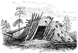
ABANDONED HUT, NORTH-WEST COAST.
Sir Thomas Button followed up Hudson's discoveries in 1612. He wintered at the mouth of Nelson's River, so named by him, after finding farther progress to the westward barred by the coast, where he had hoped to find it opening before him.
It was soon found that the bleak and desolate region enclosing Hudson's Bay was rich in fur-bearing animals, whose skins bore a great price in Europe, and the reports brought back from that far-off land gave a certain Frenchman named Grosselier the idea of planting a fur-trading colony there. He at once went to the minister with his plan. The minister, however, would not listen to him. Grosselier then went to Prince Rupert,[2] who was staying at Paris, to ask for the aid he wanted. Struck with the scheme, the prince became its patron. A ship was sent out, with Grosselier, in 1668, which reached the head of James' Bay,[3] where Fort Charles was built. The next year, Prince Rupert, and seventeen others, were incorporated into a company, with power granted them to make settlements and carry on trade in Hudson's Bay.
In this way the since famous Hudson's Bay Company obtained a monopoly of the fur-trade of all that region, which afterward proved so valuable to it. Its powers were most ample. It could hold and convey land, fit out ships, erect forts, or make war with the peoples of that country, but all this was to be done in its character as a trading-company; and though it had a resident governor, the central authority was kept in the company, in London, who continued to direct its affairs.
In the earlier years of its existence the Hudson's Bay Company had a hard struggle for life. We know that French traders formerly had dealings with the natives of that dreary inland sea. Jealousy now prompted them to try to drive the English thence by force, and so get rid of their rivalry. To this end repeated attacks were made upon the English factories,[4] which were taken and retaken, first by one and then by another assailant. Even in time of peace the French had not scrupled to assault these remote posts, so unwilling were Canadians to see the English gain a foothold in that quarter.
These invasions were quieted at last by the treaty of Utrecht (1713), which left the English in possession of what they had battled with foes of every sort to secure for themselves.
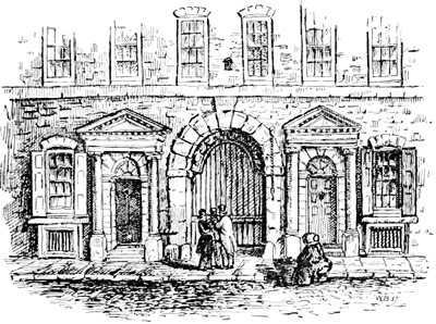
HUDSON'S BAY COMPANY'S HOUSE, LONDON.
Communication had with the natives, who were nomads, taught the English how to make distant journeys, and gradually, with their aid, to penetrate farther and farther into the interior. But to live in the country at all, they had, in a great measure, to adapt themselves to the natives' way of life, and to make journeys they had to adopt the rude conveyances found in use among them.
FOOTNOTES
HUDSON'S BAY TO THE SOUTH SEA.
"Many a shoal marks this stern coast."
The Hudson's Bay Company's grant was meant to promote the discovery of a North-west Passage to India: so the people of England, in giving away such large privileges, expected this would be done without delay.
But the company, at first, made little or no effort in this direction. It was chiefly occupied with making money, and making it from the start. Hence every thing was made to work to that end.
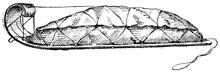
HUDSON'S BAY SLED, LOADED.
England did not know what she was doing when she created this monopoly. Ignorance led to delusion, and delusion to the inconsiderate granting away of an empire. It was thought the company would explore and settle its grant, and thus England would reap the benefits without spending a penny. The company, on the other hand, meant to do nothing of the sort, unless driven to it by popular clamor. Then it would do as little as it could. Colonization was fatal to the fur-trade, and the company was an association of fur-traders, nothing else. Hence, given a warehouse in London, a ship to carry goods back and forth, a port and factory at Hudson's Bay, a score or more of trading-posts scattered here and there over a vast extent of territory, to which the hunters could bring furs and get goods at the company's price, and we have, briefly told, the whole machinery of this giant monopoly. In dealing with the outside world it pursued a policy of Spanish exclusion and silence. It was not making history, but money.
Yet the company was all the time building better than it knew, for even the coming and going of its own traders gradually enlarged geographical knowledge of the country, so smoothing the way for the future.
From time to time the natives who came to the factories showed specimens of copper ore, which they said came from the Far Off Metal River of the North. The English traders consequently named it the Coppermine. It became an object with them to find the mine, or mines, whence these specimens had been taken. The governor accordingly (1769) sent one of his most trusty men into the unknown wilderness in search of them.
Taking with him some Indian guides, and living as they lived, that is to say one day fasting and the next feasting, as game was found plenty or scarce, Samuel Hearne only succeeded in getting to the Coppermine after making three attempts to do so. His story is a wondrous record of persevering endurance. He found the sacred character of the calumet everywhere acknowledged, even by the most degraded tribes. When they had once smoked together the stranger was as safe from injury or insult as in his own house, though nothing could exceed the curiosity which his white skin, blue eyes and light hair, all so different from their own, caused among the Indians he met in his journey.
The Coppermine was found to run into the Arctic Ocean, instead of Hudson's Bay, as Hearne supposed it did when he first set out, but no copper could be discovered worth the taking of such a journey to look for, as his. Hearne came back (1772) at the end of a year and a half, having established the shore line of the northern ocean at a point where land only was supposed to be. This was considered a great geographical discovery. Thus, year by year, a little was added here and a little there toward completing an accurate map of the north coast line.
In 1789, a Scotch trader, named Alexander Mackenzie, had been living for eight years past at Fort Chipewyan.[1] This was a station nearly central between Hudson's Bay and the Pacific. Mackenzie was an explorer by instinct. He determined to cross the continent. Once he had made up his mind, no thought of hardship could deter him. His course through the Slave River and lakes led him to the river now bearing his own name,—the Mackenzie River. Down this stream the intrepid traveller floated in his frail canoe, to its outlet upon the frozen Arctic Sea.
During his trip, Mackenzie questioned the Indians of this river about the unknown country lying beyond the great western wall of mountains, but found they could tell him little except that the people of that country were so exceeding fierce no stranger durst go among them. But Mackenzie knew the Pacific was there, and meant to reach it.
He first moved up from Fort Chipewyan to the east foot of the mountains, so as to get a better start. He wintered here. In the spring (1793), he was ready to set out again. One large, strong canoe, which held all the provisions, and which two men could carry with ease, enabled the travellers to work their slow and toilsome way up the swollen mountain torrents into the highest defiles, from which they sprung. As the explorers advanced, the stream they were ascending became more and more choked up with rocks or fallen trees, and more and more broken by cascades and rapids. It was often necessary to carry the canoe round or drag it over these obstructions, though at the cost of such toil that the men grew disheartened and wished to turn back, thinking the task a hopeless one. Unsparing of himself, Mackenzie put courage into the downhearted, and after a short rest all were ready to go on again.
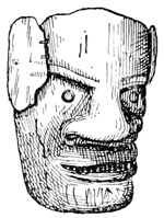
INDIAN MASK, WEST COAST.
Falling, at length, among the Indians who dwelt among the mountains, Mackenzie found that the rest of the journey would be much shortened by leaving his canoes and proceeding by land. He therefore continued his way by land, constantly meeting with natives who lived sumptuously on the salmon that the streams everywhere produced in great abundance and perfection. Mackenzie soon found he had nothing to fear from these people. They fed and sheltered his men in their villages, and willingly helped him on his way. The fatigues and anxieties of the journey were nearly past, for on the 23d of July, 1793, the party of white men arrived on the shores of the Pacific Ocean, near the Straits of Fuca.
Although, in relating the adventures of Mackenzie, we have gone somewhat before our story, the doing so is essential to its design, as subsequent chapters will show.
FOOTNOTE
THE RUSSIANS IN ALASKA.
"Heaven is high and the Czar distant."
Referring to what Drake had done for England, and De Fuca for Spain, the one tacking a name to the coast here, the other there, we find little for more than a century going to show that Europeans thought the discoveries of either worth following up.
What do we then see? Not Spain, not England putting forth a steady hand to grasp the prize each already claimed as its own, but a new power, coming not from the East, but from the West. It is a power hardly known in Europe. It is Russia.
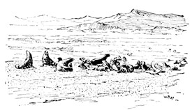
SEALS, ST. PAUL'S ISLAND.
The Czar Peter, Peter the Great in history, determined to know whether the two grand continents, Asia and America, were joined in one, or separated by a northern ocean. Peter died before the orders given for this purpose could be carried out, but Catherine, his empress and successor, sent Captain Behring[1] of the royal navy to execute them.
Sailing from Kamschatka (1728), Behring followed the coast of Asia round to the north-west, finding open water everywhere, and so determining the separation of the continents. In a second voyage (1741) he put out to sea, this time falling in with the American coast, discovering Mt. St. Elias and the Aleutian archipelago.
During this voyage Behring's vessel was thrown upon an island and wrecked, and he himself died miserably there, but some of his sailors built themselves a vessel out of the wreck, in which they succeeded in getting back to Kamschatka, bringing with them the furs of the sea-otters and foxes they had killed and eaten while living upon the desert island.
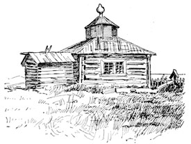
RUSSIAN CHURCH, ALASKA.
From the time of these discoveries, Russian adventurers, who were little better than daring freebooters, crossed over the narrow seas to the Aleutian Isles, to kill the sea-otters for their fur, thus opening between them and Ochotsk, and between Ochotsk and the Chinese frontier, next Siberia, by means of caravans, a trade in the valuable furs for which these islands are so famous.
In time, these roving traders were followed by a few actual colonists, who were brought over from Siberia or Kamschatka to aid in establishing permanent trading-posts[2] at suitable points. But the country possessed no other resources except its fur-trade. The early traders had cruelly oppressed the natives, hence the first colonists were looked upon as enemies, and treated as such by them. Some missionaries of the Greek Church were also sent over to care for the souls of these poor people, who before had no knowledge of Christianity.
There were no elements of thrift in this colony, consequently it could never make healthy progress. At best the people were little better than vassals, while the Indians were hardly more than slaves. The land is too cold for agriculture. The people have but one occupation, that of seal-hunting.
The fur-trade was at first conducted by private persons, but eventually the control passed to one large company, sanctioned by the crown under the form of The Russian American Company, with headquarters first at Kodiak and then at Sitka.[3]
This company claimed the whole coast of America, on the Pacific, with the adjacent islands, from Behring Straits southward to, and beyond, the mouth of the Columbia River.
FOOTNOTES
ENGLAND ON THE PACIFIC.
"Ye mariners of England!"—Campbell.
England's conquest of Canada[1] (1763) put a wholly new face upon the situation in America. She was now, beyond dispute, the foremost power of this continent.
Hardly had the echoes of this conflict died away, when a new power arose to contend with England for what she had just torn from the grasp of France. This was her own American colonies, whose people had now been driven to take up arms (1775) against the mother country, in defence of their dearest political rights. So England gained Canada, but lost her own colonies. She wrested power from France, only to see it snatched from her own grasp in the moment of victory, though, after all, it was no less a victory for the English-speaking race over all her Latin-speaking rivals. It must be seen that events like these would have far-reaching effects in shaping our history.
Yet while the conflict with her colonies was going on, and both parties were in the thick of the actual fighting, England was putting forth efforts to control the commerce of the North-west Coast.
For this purpose it would be essential to have accurate surveys of all important harbors and sounds, in order to select sites for future settlements, and above all of any navigable rivers flowing from the east out upon the coast, that might afford a practicable route into the interior, and so connect this coast with the settlements of the Hudson's Bay Company.
With this end in view, two discovery ships were sent out (1776), in command of Captain James Cook,[2] with orders to search the coast of New Albion for any navigable river north of the forty-fifth parallel. England clearly meant to re-assert her claim to sovereignty,[3] set up so long ago in her behalf by Sir Francis Drake.
On board Cook's ship were two persons with whom our story will have to deal. One was Midshipman Vancouver, the other Corporal Ledyard of the marines.
SNOW SPECTACLES, ALASKA.
Cook first discovered and named the Sandwich Islands.[4] Shaping his course thence for the American coast, he fell in with (1778) and named Cape Flattery.[5] Steering now northward with the coast always in sight, Cook at length found a broad basin, which the Indians called Nootka, and which has since been known as Nootka Sound.[6] The ships lay here all the month of April, refitting, and getting ready for the coming cruise in the arctic seas, which Cook was instructed to explore for the wished-for passage into Hudson's Bay.

INDIAN CARVING.
Except for their propensity to steal, which nothing could control, Cook found the natives of Nootka a friendly people, though they were no longer abashed in the presence of white men, or afraid of their loud-roaring cannon, as in the time of Drake. Many wore brass or silver trinkets. Most of them had tools of iron which they had made for themselves, and could use with skill. Passing ships would therefore seem to have brought these tribes into unfrequent communication with Europeans, so that Cook's coming neither surprised nor intimidated them; while the articles in their possession acquainted him with the fact that other navigators had passed that way before him, perhaps with views similar to his own.
Upon again setting sail, Cook was blown off the coast by contrary winds. When he again saw it, he was far to the north of Nootka. He saw and named Mt. Edgecumbe as he sailed; then Mt. St. Elias rose in solitary grandeur before them, giving Cook notice that he was now crossing the track of the Russian discoverers.
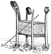
INDIAN GRAVE, NORTH-WEST COAST.
The ships continued to skirt the coast until its westward trend forced them to put about, and steer south-west, along the shores of the Alaskan peninsula. Cook had missed both the Columbia River and the Straits of Fuca, thus losing his one chance for making known to the world the great water systems of the north Pacific.
Getting clear of Alaska, Cook came to Oonalaska, of the Aleutian group, which he doubled. Then, finding the coast beyond him to bend in the desired direction, again he sailed on through Behring's Straits into the Arctic Ocean as far as Icy Cape (70° 29´), at which point his ships were stopped by ice. Finding he could go no farther, he put about and returned to Oonalaska, where, in October, he anchored.
From this anchorage Corporal Ledyard was sent on shore in search of the Russian traders, then known to be living on the island, whom he found, and brought back with him to the ships. Getting little from these people, for want of interpreters, Cook sailed back to the Sandwich Islands, where the natives of Owyhee treacherously killed him while he was on shore.
The furs which Cook's sailors obtained from the natives of Nootka, in exchange for knives, buttons and other trifles, were sold at Canton, China, for more than ten thousand dollars. This was the beginning of a trade between Nootka and Canton, which, during the next decade, was the means of bringing many British vessels to the North-west Coast.
It is instructive to remember that, at the very time when the American colonies were throwing off their allegiance, Cook was quietly exploring the North-west Coast, in the interests of peaceful expansion, which, in the end, was to inure to the benefit of those colonies.
FOOTNOTES
QUEEN ELIZABETH.
Though Elizabeth was so well calculated to govern with ability, and even with that glory and advantage to her people which England had never witnessed under any of its preceding sovereigns;—though her administration was so vigorously and equitably exercised, and all her plans and negotiations so ably and successfully conducted;—though, in short, she was equally revered and obeyed, as a sovereign, at home, and she was feared and respected abroad;—yet was Elizabeth a very weak and silly woman in trifling concerns. She seemed a Goliath in the conduct of the mighty affairs of empires; but dwindled into a very woman, when the color, fancy, or fashion of a dress became the topic. Nor was she free from the little petty vexations, jealousies, and rivalship of beauty, so natural to her sex. Indeed, it appears that she hated and envied her cousin, the beautiful Mary of Scots, less on account of her pretensions to the crown, than for her superior charms. When Mary sent Sir James Melville to London, to endeavor to establish a good understanding with Elizabeth, he was instructed by Mary to sound her cousin on subjects that would interest her rather as a woman than a queen. "He accordingly succeeded so well," says Hume, "that he threw that artful princess entirely off her guard, and made her discover the bottom of her heart, full of those vanities, and follies, and ideas of rivalship, which possess the youngest and most frivolous of her sex. He talked to her of his travels, and forgot not to mention the different dresses of the ladies in different countries; and she took care thenceforth to meet the ambassador every day apparelled in a different habit; sometimes she was dressed in the English garb, sometimes in the French, sometimes in the Italian; and she asked him which became her most? He answered, the Italian,—a reply that he knew would be agreeable to her, because that mode showed to advantage her flowing hair, which he remarked, though more red than yellow, she fancied to be the finest in the world. She desired to know of him what was reputed to be the best color of hair; she asked whether his queen or she had the finest color of hair; she even inquired which of them he esteemed the fairest person,—a very delicate question, and which he prudently eluded, by saying that her majesty was the fairest person in England, and his mistress in Scotland. She next demanded which of them was tallest. He replied, his queen. 'Then she is too tall,' said Elizabeth, 'for I myself am of a just stature.'"
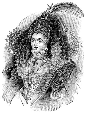
QUEEN ELIZABETH.
It is a saying, that the greatest heroes are not so in the opinion of their valets; and it may with equal truth be said of this celebrated princess, that, however she might appear a great heroine to the world, she was still nothing more than a frail woman in the eyes of those who best knew her private and undisguised thoughts, feelings and actions.—Anon.
INTERLUDE.—WHAT JONATHAN CARVER AIMED TO DO IN 1766.
It so happened, that after the conquest of Canada, an American, and veteran of that war, named Jonathan Carver, conceived the idea of crossing the continent by way of the Great Lakes and tributaries of the Mississippi. After attentively studying the French maps, and reading the accounts of Hennepin and Lahontan, he believed this could be done.
Carver's avowed purpose was, first, to ascertain the breadth of the continent. If successful in reaching the Pacific, he meant to have proposed to the English government the establishment of a permanent port on that coast. He was convinced that this was the true way to the discovery of the North-west Passage, which Drake had attempted so long ago, justly reasoning that it would be easier to sail from the west than from the east, while the loss of time consequent upon the long voyages from England, with the delays and perils incident to Arctic navigation, would be much lessened by having such a dépôt as he proposed. And it would also greatly facilitate communication between Hudson's Bay and the Pacific.
Carver thought further, that a settlement on that side of the continent would not only open up new sources of trade, and, to use his own words, also "promote many useful discoveries, but would open a way for conveying intelligence to China and the English settlements in the East Indies with greater expedition than a tedious voyage by the Cape of Good Hope, or the Straits of Magellan, would allow of."
Whether it originated in his own brain or not, so far as known, Carver was the first boldly to set before the English people the idea of going across the American continent to India,—the idea that has eventually solved the whole problem.
Convinced that his undertaking was practicable, Carver started from Michilimackinac in September, 1766, in company with some traders who were going among the Sioux by the old route leading through Green Bay, Fox River and the Wisconsin. What he could learn about the upper tributaries of the Mississippi seems to have determined Carver to fix his final starting-point somewhere about the Falls of St. Anthony.
These falls were reached on the 17th of November. When Carver came to the point overlooking them, his Indian guide surprised him by beginning to chant aloud an invocation to the spirit of the waters. While doing this he was stripping off first one, then another, of his ornaments, and casting them from him into the stream. First he threw in his pipe, then his tobacco, then the bracelets he wore on his arms and wrists, and lastly his necklace and ear-rings. When he had thus divested himself of every article of value he possessed, the Indian concluded his prayer of adoration with which his propitiatory offerings were so freely joined. Carver's journey, in this direction, ended at the River St. Francis. Returning south he ascended the St. Peter's, or Minnesota River, by his own account, for a distance of two hundred miles, to the villages of the Sioux with whom he passed the winter.
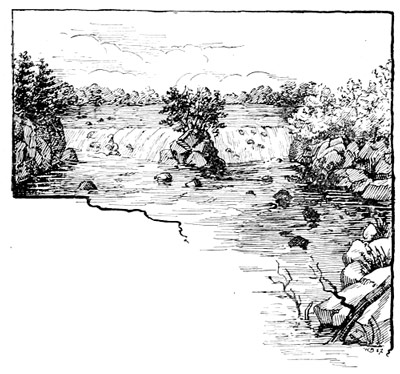
FALLS OF ST. ANTHONY.
But after thus penetrating far into what is now the State of Minnesota, Carver found himself unable to proceed. The gifts that were to be sent after him, and which were essential to securing a safe-conduct among the Indian nations on his route, did not come. No alternative therefore remained but to go back to Prairie du Chien, the great Indian trading-mart of all that region, where the explorer finally gave up the attempt to go west at this time. He then returned to Canada by way of the St. Croix and Lake Superior, bringing with him the information gained by a seven months' residence among the Sioux.