Group II. BIRTH OF THE AMERICAN IDEA.
Reading edition
AMERICA FOR AMERICANS.
"America, is therefore the land of the future."—Hegel.
I. AMERICA FOR AMERICANS.
ACQUISITION OF LOUISIANA.
"I have given England a rival that will humble her pride."—Napoleon.
We have now done with that part of French Louisiana lying east of the Mississippi. It is now blossoming all over with incipient civilization in the form of log cabins, trading-posts, cross-roads, hamlets, and schoolhouses.
From 1793 to 1799 our old ally France, now become a republic, was trying first to cajole, then to bully us into taking up her quarrel with England. She even went to the length of demanding tribute-money from us as the price of peace, and, upon a refusal, of ordering our minister out of her territory. Our remonstrances were treated with disdain, our ships captured, and our flag fired upon at sea, without even the formality of a declaration of war. This conduct drove us into making reprisal. After one or two of her frigates had been beaten in fight by ours, France grew more pacific toward us, and again cultivated friendly relations with a power she had seemed to despise, until the reply "Millions for defence, but not a cent for tribute,"[1] warned her that America would never yield a principle to threats.
Let us now turn to Spain. In 1795 this power had made a treaty which secured to us the right of storing[2] American goods at New Orleans, pending shipment abroad, thus making the river so far free for our commerce.
In 1800 Napoleon had come to the head of the French nation. Ambition to restore the ancient sovereignty of France over Louisiana led him to propose to Spain the exchange of Tuscany for it. Spain accepted the offer, and in 1800-1801 treaties of cession were signed, but not made public, because war with England was probable, and Napoleon wished to make his title good on the spot with the bayonets of his soldiers, before England could know of it. Therefore for the present Spain kept possession of Louisiana in trust for France.
Just here some grave international questions arose. Our rapid growth in the West gave Spain uneasiness. It certainly was putting her possessions in peril. In consequence she showed such an unfriendly spirit toward us as to keep the West in a state of chronic irritation.[3] It even disposed the West to listen to plans for separating her from the East, which Spain would gladly have aided in, and so was fast breaking up the feeling of national unity so essential to keep alive in the Republic.
Suddenly, without previous notice, the Spanish intendant at New Orleans revoked the right of deposit. The act shut the only door by which the people of Ohio, Kentucky, and Illinois could get to the sea. It exasperated them to such a point that they begged the General Government to drive the Spaniards out of the Mississippi for good and all.
In Thomas Jefferson the people of the West found a more sagacious advocate. The cession could not long remain a secret. It was soon known in the United States; but instead of calming the people, the change of masters revived their fears, since it was felt that Napoleon, whose exploits filled Europe with alarm, would prove more difficult to deal with than Spain, whom nobody feared.
Such was the situation presented to Mr. Jefferson. Fortunately for its solution, national pride and national policy do not always go hand in hand.
Our minister, Livingston,[4] a very able man, was told to bring the Louisiana question to Napoleon's attention, and to do it in such a way as to leave no doubt in his mind that the United States could not remain an idle looker-on while New Orleans was being bought and sold. She had too much at stake. Napoleon's army was getting ready to sail for Louisiana. There was no time to lose.
Mr. Livingston did not stop with the suggestion to sell New Orleans to us. He went further, and proposed the cession of all Louisiana above the Arkansas and east of the Mississippi. He did it with true republican frankness, never hesitating to press home upon Napoleon's advisers the dilemma which the possession of Louisiana must offer to their choice. "What will you do with Louisiana? Would you have England wrest it from you? Her navies have driven yours from the seas. Do you wish to force the United States into joining with England, against you? England would gladly give us what we ask, as the price of our help."
France was on the eve of war with England. But for this we should hardly have had Louisiana so easily. There was no assurance felt that the fleet Napoleon destined for Louisiana would ever reach the Balize. Napoleon wanted money. It was true, national pride might be hurt by the sacrifice, but it was most important, at this crisis, not to make an enemy of the United States; and Napoleon foresaw that no foreign power could long hold the mouth of the Mississippi, and have peace with those States. That conviction was decisive in its effects. He declared for the sale of Louisiana, outright, in these words: "I will not keep a possession which would not be safe in our hands, which would embroil our people with the Americans, or produce a coldness between us. I will make use of it, on the contrary, to attach them to me, and embroil them with the English, and raise up against the latter, enemies who will some day avenge us."
Napoleon would not even wait for Mr. Monroe to arrive, after making up his mind, but sent at once for Mr. Livingston, and opened the matter with him on the spot. So little had our ablest statesmen, Mr. Livingston excepted, touched the root of the matter, that, when Mr. Monroe did come, with powers from Congress to treat for the cession of New Orleans and the Floridas only, Napoleon surprised him with this master-stroke of policy which not even Mr. Jefferson had foreseen. And thus a treaty[5] for the whole of Louisiana was concluded on our part without adequate powers.
The price agreed upon was eighty million francs, the equivalent of twenty million dollars. Of this sum sixty were to be paid in money. The remaining twenty were to be retained by the United States as indemnity for damage done to our commerce under the orders of the Directory. In this way the nation became the trustee for what is known as the French Spoliation Fund. The principle was now laid down, that free ships make free goods. When they had signed the treaty, the commissioners arose and shook each other's hands. "We have lived long," said Livingston, "but this is the noblest work of our lives." Mr. Jefferson's efforts to bring about the geographical and political unity of the United States were thus far completely successful.
FOOTNOTES
A GLANCE AT OUR PURCHASE.
Hitherto Louisiana has played the part of a football in European politics. The curtain is now to rise upon a far different scene.
For fifteen millions the United States obtained more territory than the original thirteen had started out with.
As we have shown in a previous chapter, our people had more than enough land already, and few men were wise enough, in that day, to forecast our national greatness in the future; but at last the Mississippi in all its course was ours, and the one question of highest moment to the West was settled in our favor,—settled definitely and forever.
With what actual materials for progress, in nation-building, did the United States set up her rule over Louisiana? The answer will show what the French and Spaniards had done in two centuries or more of intermittent effort.
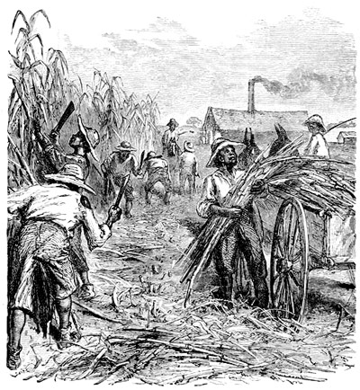
A LOUISIANA SUGAR PLANTATION.
Two rather large towns, twelve hundred miles apart, held about one-third its whole population, and controlled all its trade. The first, New Orleans, was the commercial port for the Mississippi Valley and its products. The second, St. Louis, was a fur-trading post with its chief outlet in Canada. One had a mixed population of from eight thousand to ten thousand, Frenchmen, Spaniards, Americans and blacks; the other did not have more than twelve hundred people, all told, many of whom were boatmen, who passed much of their lives afloat on the rivers or domesticated among roving tribes. In both, the French were most numerous, but taking all Louisiana together, there were nearly, if not quite, as many slaves as white people, although, as compared with the Indians then occupying this vast territory, the whites were only a handful.
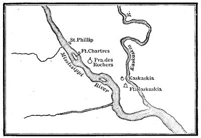
FRENCH SETTLEMENTS: GERM OF ST. LOUIS.
At the date of cession to the United States, New Orleans had perhaps fourteen hundred houses, mostly built of wood and uniformly homely. Two hours would have laid the whole of it in ashes. In the best part, a few houses were built of brick, some one, some two stories high, with the open galleries running round the outside, one is accustomed to see in the tropics; yet though it had been burned over so recently as 1794, New Orleans was little bettered in the rebuilding, showing, as before, a collection of hurriedly built barracks and dwellings, among which the Hotel de Ville and Parochial Church, alone, gave a certain metropolitan character to this city of wood and shingles.
Though spacious, the streets were unpaved, dirty, and ill-kept. No drainage could be had, and every thing was thrown into the street. Summer heats quickly developed epidemic fevers. It followed that New Orleans had the name of being the most unhealthy city in the United States.
Besides the church and Hotel de Ville, or City Hall, there were a military hospital, charity hospital, and nunnery,—all equally inconspicuous in point of architectural design. There was also a theatre in which a company, whom the revolt had driven from St. Domingo, acted plays for the gratification of the Creole population.
Going north, Natchitoches on Red River, and Arkansas Post on the Arkansas, may be considered outposts of the country immediately dependent upon New Orleans. Each tapped the Indian trade of its river. The first was a thriving, the second a poor village. We next come upon a group of settlements, constituting what was known, under French and Spanish rule, as Upper Louisiana, with St. Louis for its emporium. Chief among these were New Madrid,[1] Cape Girardeau, St. Genevieve, Carondelet, and St. Charles. The population, all told, counting from the Arkansas to the Missouri, and including St. Louis, numbered about six thousand, of whom at least a thousand were slaves, with a sprinkling of half-breed French-Indian trappers besides.
St. Louis had arisen out of the transfer of the east bank of the Mississippi to Great Britain. Rather than live as aliens, under English laws, many French settlers went with Pierre Laclede,[2] across the Mississippi, to a place already nicknamed by them Pain Court, where, in February, 1764, they founded a new town with the name of St. Louis, in honor of Louis XV.
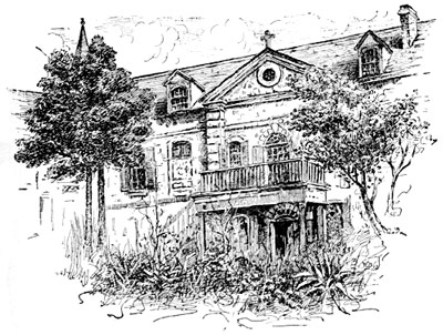
OLD CONVENT, NEW ORLEANS.
These people were mostly French Canadians,—either traders, trappers, or voyageurs, who still kept up their trading connection with Canada,—though a sprinkling of Spaniards and Americans became incorporated with them, so making St. Louis a city of many tongues like New Orleans. In both, an American could fancy himself in a foreign country, among foreigners. But while New Orleans had grown up under the worst conditions, in respect of situation and climate, St. Louis began her career under the best of both. At New Orleans people lived, as it were, on a floating island which the Mississippi might deluge with her floods. St. Louis was laid out on a spacious terrace, elevated above the united floods of the Missouri and Mississippi. Besides its high and healthy situation, the spot chosen by the founders of St. Louis for their future city was the best one to be found next south of the mouth of the Missouri River. That the whole Indian trade of the upper country was destined to be poured into the lap of the infant metropolis, was early foreseen and soon realized by its sagacious founders.
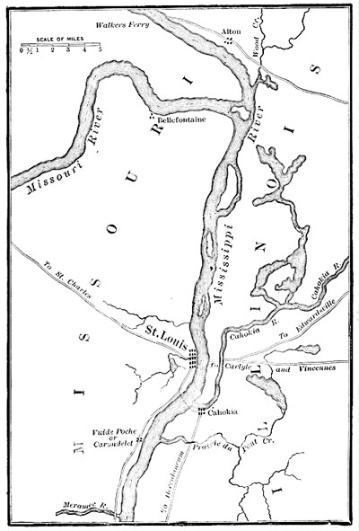
ST. LOUIS AND VICINITY.
Of St. Louis in its infancy we lack adequate description. It was a palisaded village of the pattern so often described in these pages. During the Revolutionary War (1780) it withstood the assault of a marauding party sent against it from the Lakes, but lost some of its inhabitants whom the enemy carried off into captivity. At this time it had one hundred and twenty houses with eight hundred inhabitants, who owned and bred many cattle. While a few houses were of stone, the major part were mean, and the streets narrow and dirty. With the cession it began to grow apace.
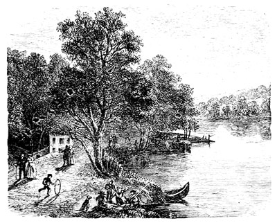
CHOUTEAU'S POND, ST. LOUIS.
When Father Charlevoix, the Jesuit historian of New France, descended the Mississippi in 1721, he found some miners at work on the Meramec, under authority of Law's Company. While searching for silver the miners struck galena ore which from that time began to be a source of wealth to the province, the lead product mostly going down the river to New Orleans.
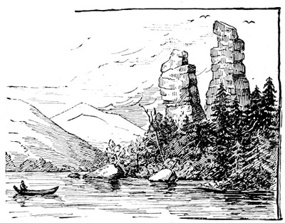
ROCK TOWERS NEAR DUBUQUE.
In that part of the Louisiana purchase comprised within the States of Iowa and Minnesota, the North-west Company[3] of Montreal continued to monopolize the Indian trade till after the cession. It had posts on Sandy Lake and Leech Lake. Prairie du Chien had grown to a hamlet. Julien Dubuque, a French trader, who had first gone there from Canada, obtained permission to work the lead-mines where the city of Dubuque now stands, and had settled there.
FOOTNOTES
II. THE PATHFINDERS.
LEWIS AND CLARKE ASCEND THE MISSOURI.
"To lose themselves in the continuous woods Where rolls the Oregon."
Mr. Jefferson had never forgotten his talk with Ledyard at Paris. It was the key-note of future projects. Even before Louisiana was ours, he began to take steps for having it explored, partly with the view of ascertaining its real value, but chiefly to determine whether the Missouri and Columbia Rivers would afford a practicable overland route for commerce with the Pacific. Should they do so, the discovery of the century would be made. It was the very first step taken to open a road across the continent under national auspices, and, as such, has historic importance, going far beyond the aimless wanderings of a few migratory fur-traders, who, thus far, were the sole geographers of this interesting region.
Except that they took their rise somewhere in the great Rocky Mountain chain, next to nothing was known about the higher sources of the Missouri. Something, indeed, was learned from the French traders who had been making canoe voyages up the Missouri for many years. These adventurers had pushed their way into the Osage, the Kansas, and the Platte. To them we owe the names these streams bear to-day, which are derived, the Platte[1] alone excepted, from the tribes inhabiting their banks. For the same reason the great Missouri[2] itself was given this name by the French explorers because they were ignorant of its existing Indian name.
From their known activity and restlessness of character, we should expect to find evidences of the presence of Frenchmen everywhere in a region they had possessed for centuries. We do find that the most adventurous had ascended not only as high as the Yellowstone,[3] but had even found their way into the Black Hills, so establishing an important landmark for after-comers. Indeed, both the Yellowstone and the Black Hills owe their names to these pioneers.
MOUNTAIN GOAT.
But the knowledge thus gained was, at best, little better than what would be disclosed by the mirage of the prairies themselves. It was vague, mostly inaccurate, and often quite upside down.
Therefore, while an occasional trapper or trader might be met with on the Missouri, no habitation of civilized man existed in all its magnificent valley, if we except the French settlements begun near its mouth. This state of things is all the more striking because it comes within the memory of living men.
Beyond their regular villages, which could be moved at a few hours' warning, the Indians of this valley had no fixed habitations, but roamed the wide, treeless prairies in savage freedom, like wandering Arabs of the desert, carrying their skin-tents on the backs of their shaggy little ponies about with them from camp to camp.
These rovers of the prairies had the same barbaric picturesqueness, the same wild and free manners, the same thieving propensities, as the Arab. Like him, the Indian of the plains set the greatest value on his horse, which, though subdued to his rider's will, was yet as untamed as he.
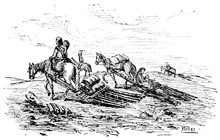
INDIANS MOVING CAMP.
Once a year the whole village struck its tents, and started off on its annual buffalo-hunt. On the eve of departure, a solemn dance was held and offerings made to the god of the chase, without whose help they believed the hunt would be in vain. Their hunting camps were pitched at some favorite spot, where grass grew and water could be had. Here they lived in savage luxury on the buffalo-meat which the hunters brought in from the chase. When enough meat had been obtained for their winter's supply, they rode back to their villages, and with singing and dancing celebrated the success of the hunt. Thus they hunted, ate, slept, and waged continual war with each other. This was all their life.
Of the Columbia[4] nothing certain was known. More was known, even in America, about the Nile. It was thought, however, that its highest streams would be found interlocked with those of the Missouri, about the feet of the same great mountain chain. Should this prove true, a practicable passage from one to the other through these mountains might be discovered; yet while nothing actual was known about them the difficulties were felt to be so uncommon, that none but men of tried courage would be found equal to them. Clearly it was to be no holiday journey. Just what obstacles lay in the explorer's way, what means of living the country would afford, what sort of people would be met with, were questions no one had so far attempted to solve.
Mr. Jefferson set about solving them. He looked about him for the man to do the work. His first choice fell upon his own secretary, Captain Meriwether Lewis,[5] "of courage undaunted," at whose request Captain William Clarke[6] was invited to make one of the party. Clarke accepted the offer with great glee. Both were young men, both had seen service on the frontiers, both were Virginians, and both gave heart and soul to the enterprise in hand.
Though its objects were less scientific than political, the young explorers were commanded to carefully note down every thing of interest about the countries and nations they were going to pass through—what were the natural products of the one, or the numbers, disposition and manners of the other.
It was to be a long voyage to begin with—two thousand miles at the least. The best the Government could do was to provide a keel-boat, fifty-five feet long, drawing three feet, carrying one large square sail and twenty-two oars. A half deck at bow and stern formed forecastle and cabin, the middle being left open for the rowers. This vessel, we see, was but a modification of the galley of ancient times, and quite like those used by the Spaniards in exploring our coasts two centuries before.
Thus equipped the party started down the Ohio on their long journey to the Pacific.
The Spaniards had not yet given up St. Louis to us when the expedition reached there, in the autumn of 1803. It therefore went into winter quarters on the American bank of the Mississippi, opposite the mouth of the Missouri.
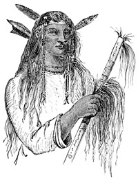
A MANDAN.
It was the middle of May before the voyage up the Missouri could begin. With sail and oars, the deeply laden keel-boat was forced slowly along against a swift yellow tide, which ever and anon hurled floating trees athwart its course, or brought it to a standstill on some hidden sand-bar. Compared with it, the navigation of the Ohio was but a pleasure-trip. The Platte, however, was reached late in July. Not far above, the explorers landed to hold a council with the Otoes, for which reason they gave the place the name of Council Bluff.
In the last days of October, 1804, they halted for the winter at the Mandan villages, sixteen hundred miles from the Mississippi. So far the journey had been only fatiguing. Its real difficulties were just beginning.
The winter was spent in making ready for the coming season's work, in hunting and exploring, and in talks with the Indians, from whom it was now learned that after many days' journey toward the setting sun, the white men would come to a gorge wondrous deep and wild, where the whole river plunged foaming down with thunderous roar. They even spoke with veneration of the solitary eagle which had built her nest in a dead cottonwood tree, among the mists of the cataract itself.
With the early spring (1805) the party again set out in good health and spirits. Before doing so Captain Lewis sent back all but the bravest and strongest men, as he was now about to enter a region roamed over by predatory savages, whose friendship would be best secured by being always ready to fight them, for though brave, they would seldom attack a well-armed party of whites unless the advantage was on their own side.
As they went on, each day found the navigation of the river growing more and more difficult. Sometimes they were forced to drag their canoes slowly along with the aid of towlines, or again to push them over shallow places or through dangerous rapids with poles. Their hunters kept them supplied with venison, bear and buffalo meat, which they were now mostly to live on for months to come.
The Yellowstone was reached and passed. On the 26th of May the party came in sight of the Rocky Mountains,—a long line of snowy summits nestling among clouds. By the end of the month they were skirting the Black Hills, or Côte Noire of the French traders. The river grew swifter now, and its bed thickly sown with rocks. Since leaving the Mandan villages no permanent habitations had been seen, though the travellers often came upon traces of some transient encampment where the ground would be strewed with the remnants of savage feasts. While the men were wearily dragging the boats on at a snail's pace through the river shallows, Captains Lewis and Clarke would be scouting the country in advance, rifle in hand. Whenever a bluff was climbed to gain a wider view, thousands upon thousands of buffaloes would be seen quietly feeding on the prairies, far as the eye could reach. Then at the evening halt, round the camp-fires, the events of the day would be noted down, its difficulties talked over, and the chances for the morrow discussed, over the joints of venison or bear-meat the hunters had brought in. At dark sentinels were posted. Relaxation gave way to discipline. Fresh logs were thrown on the blazing fires. The men stretched themselves on the ground in their blankets, and soon forgot the fatigues of the day. At dawn the camp was again astir.
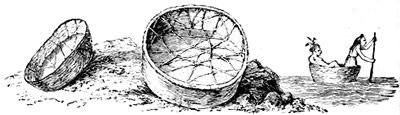
MANDAN SKIN-BOATS.
FOOTNOTES
THEY CROSS THE CONTINENT.
On the 13th of June, while scouting in advance of his party, Captain Lewis saw, in the distance, a thin cloudlike mist rising up out of the plain. To him it was like the guiding column which led the Israelites in the desert. Not doubting that it was the Great Fall, which the Mandans had told him about, and of which he was in search, Captain Lewis hastened toward it. He soon heard it roar distinctly, and in a few hours more stood on the brink of the cataract itself. The Indians had told him truly. Not even the eagle's nest was wanting to make their description complete.
He was the first white man who had ever stood there, and he calls it a sublime sight.
Thirteen miles of cascades and rapids! At headlong speed the Missouri rushes down a rocky gorge, through which it has torn its way, now leaping over a precipice, now lost to sight in the depths of the cañon,[1] a thousand feet below the plain, or again, as with recovered breath, breaking away from these dark gulfs into the light of clay and bounding on again. No wonder the discoverer stood forgetful of all else but this wondrous work of nature!
Much valuable time was lost in getting the boats and baggage round these falls. To pass them was impossible. It was necessary to build carriages on which the boats were dragged by hand a distance of eighteen miles, before they could be launched again.
But after all this had been done the boats were found unsuited to the navigation of the river above them, and so new ones had to be hewed out of the trees growing on the banks, which could better withstand the buffeting of the rocks. In these the party again embarked, and on the 19th of July found themselves just entering a deep gorge of the mountains, five miles long, through which the river wound its way between walls of rock that rose a thousand feet above their heads. They named this awful cañon the Gate of the Rocky Mountains.
Boat navigation was now nearly at an end. Every day the scouts were sent out in search of roving Indians from whom they might get horses and guides to cross the mountains. But no Indians could be found. A well-beaten trail had been followed high up into the hills, but lost again among defiles so narrow and stony, that when the scouts came back they said no horseman could go through them. So these great mountains, which so long had been to them a guide and landmark, now seemed sternly forbidding their farther progress.
Yet at all risks horses and guides must be had. Telling his men he would not come back till he had found them, Captain Lewis set out on his forlorn search, knowing that on him depended the success or failure of the expedition. The men remained encamped where he left them.[2]
While engaged in this search, Captain Lewis, on the 12th of August, reached the highest source of the Missouri. At three thousand miles from its mouth it dwindled to a mountain brook. Passing thence over the dividing ridge, he came upon the waters of what proved to be the Columbia. So within a few hours he drank of the waters of both. Following the stream down the mountain, with fresh hope, it led him to a village of the Shoshones or Snake Indians.[3]
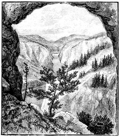
GATE OF THE ROCKY MOUNTAINS.
No shipwrecked wanderer on an unknown sea ever looked with more eagerness on a rescuing sail than Lewis did upon this uncouth and squalid habitation in the wilderness. The Indians would not believe he had crossed the mountains on foot and without guides. At length, however, some of them agreed to go back with him, and these having found his story true, horses and guides were furnished for the white men's use.
Thus equipped, the party began the passage of the mountains, following the obscure windings of a trail known only to the Indians themselves. They found it a hard march. Sometimes it led them through a wild cañon strewed with stones for miles together. Sometimes the caravan would be painfully climbing some slippery height, or skirting the edge of a precipice where a single false step would have flung horse and rider headlong to the bottom of the ravine.
But these active little horses, which the Indians rode without saddle or bridle, unshod and ill-fed as they were, did their work to the admiration of the white men. Though they frequently slipped and fell with their burdens, they would quickly scramble to their feet again with the agility of mountain goats.
Almost a month was thus spent in getting through the mountains. Snow fell, and water froze among those rocky heights. On some days five miles would be the most they could advance. On others they could scarcely go forward at all. The plenty they had enjoyed in the plains gave way to scarcity or worse. Seldom could the hunters bring in any thing but a pheasant, a squirrel, or a hawk, to men famishing with hunger and worn down by a hard day's tramp. The daily food mostly consisted of berries and dried fish, of which every man got a mouthful, but none a full meal. When a horse gave out he was killed and eaten with avidity. The men grew sick and dispirited under incessant labor for which want of nourishing food rendered them every day more and more incapable. In short, every suffering which cold, hunger, and fatigue could bring, was borne by these explorers.
Ragged, half-starved, and foot-sore, but upheld by the courage of their leaders, the explorers came out on the other side of the mountains less like conquerors than fugitives.
Their guides led them on, past many streams, till they came to one on which they were told they might safely embark. It was the Kooskooskee. This was about four hundred miles from the place where they had left their boats on the other side of the mountains. They had struck one of the southern affluents of the Columbia.
Here the party built canoes in which they began to descend the river, leaving their horses with the Nez Percés Indians[4] to keep against their return. In three days this stream led into a larger one to which they gave the name of Lewis River. In seven, they reached the junction of a larger branch coming from the north, which they named the Clarke. They were now fairly afloat upon the great river itself. Down this they paddled till they came to the point where the Columbia in a series of mad leaps breaks through the lofty Cascade chain.[5] These too were safely passed.
It was now late in October. All along the explorers had found camps pitched on the borders of the rivers, for the Indians of this region lived wholly on salmon, like the tribes Mackenzie had fallen in with on Frazer River. Wherever the river was broken by rapids a noted fishing-place would be found, so the travellers were now in a land of plenty; but the farther they fell down, the more squalid the Indians became, and of meaner looks and stature. Had these people shown themselves unfriendly, Lewis and Clarke might never have reached the ocean, for the valley was everywhere very populous.
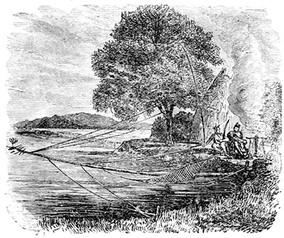
CATCHING SALMON, COLUMBIA RIVER.
Since leaving the cascades, evidences of approach to the sea multiplied. Up to that point no fire-arms had been seen among the Indians. Many now had guns, and showed themselves more and more presuming toward the white men. They traversed the river in great war canoes, having images set up at the stem and stern, like the vikings of old. But our men did not fear them. They were already more than half Indians themselves in dress, looks and habits of life. They had learned to eat dog-meat, and to make their beds wherever the night found them.
Soon the tides were observed. On the 7th of November the roar of the breakers was heard in the distance. They had reached their goal at last.
A most inhospitable welcome awaited the explorers. They had struck the coast in the rainy season. The floods drove them from their first camp on the north side, to the south side of the river, where they set to work building themselves winter quarters. The little clump of cabins was named Fort Clatsop, from the tribe on whose land it stood, with the flag the explorers had brought waving over it. Here the winter was passed.
In March, 1806, the explorers began their journey home. At the Falls of the Columbia they bought horses which took them to the place where their own had been left. From here they travelled on an east line through the mountains till the head of Clarke's River was struck. The party was then divided. One band under Lewis crossed the mountains to the head-waters of the Maria River, while the other, under the lead of Clarke, passed them lower down, so reaching the sources of the Yellowstone, down which they floated to the place of rendezvous.
FOOTNOTES
PIKE EXPLORES THE ARKANSAS VALLEY. PIKE'S PEAK A LANDMARK.
In the course of an expedition made to the Upper Mississippi, in the years 1805 and 1806, Lieutenant Zebulon M. Pike[1] had shown such aptitude for the work of an explorer, that he was immediately chosen to lead another to the sources of the Arkansas. Pike was directed to go through the country of the Osages, with whom the Kansas nation was then at war, and, after effecting a peace between them, "to ascertain the direction, extent, and navigation of the Arkansas and Red Rivers."
In pursuance of these orders Pike left St. Louis in July, 1806, for the Osage villages, in row-boats which made about fifteen miles a day, his men living on the bears, deer, and turkeys killed along the banks. Turning into the Osage River, the Indian villages were reached about the middle of August, and Pike here began mounting his party for the long land journey before him.
Having accomplished this, the party set out for the Pawnee villages on the Platte. Near the Grand Osage Village, Peter Chouteau,[2] a French trader, had a trading-house, which was the last sign of civilization the explorers would see until the Spanish settlements of New Mexico were reached.
Tents were struck Sept. 1. The exploring party rode away in high spirits, accompanied by a numerous train of warriors who, in this way, did honor to those whom they considered their guests.
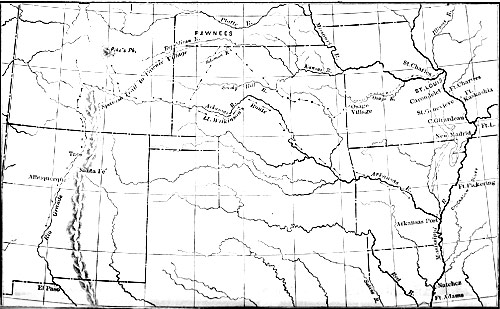
MAP ILLUSTRATING LIEUTENANT PIKE'S EXPLORATIONS.
After following the Osage for some distance Pike struck across the country to the Neosho, a tributary of the Arkansas. As he rode on across the dividing ridge the prairies of Kansas broke on his sight like a scene of enchantment. He seemed discovering a corner of paradise itself.
From the Neosho, Pike passed over to the Smoky Hill Fork of the Kansas, and thence to the Republican, meaning to proffer friendship to the Pawnees, whose evil reputation, however, boded no good to his mission.
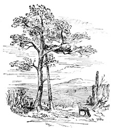
INDIAN BURIAL-PLACE.
When he came to their villages the Pawnees had just been visited by an embassy sent from New Mexico to sow distrust, if not enmity, toward the Americans. The Spaniards had come with three hundred men, by the side of whom Pike's twenty-three looked small indeed, and to the Pawnees indicated the number of warriors each nation had at its command. They were therefore at no pains to hide their disdain.
Pike found them in this temper. Knowing it would never do to show fear, he hoisted his flag in the chief town to let them see that sour looks and uncivil words could not turn him from his purpose of making them show respect for the government of the United States, even if they felt a preference for the Spaniards.
His mission in this quarter having failed, Pike turned back to the Arkansas, which was reached on the 18th of October. At this point Lieutenant Wilkinson was sent down the river, while Pike himself began the work of tracing it to its source. When he had done this, Pike meant to cross over to the head of Red River and then descend it to Natchitoches, so completing the work laid out for him, which, we have seen, was partly diplomatic and partly geographical in its nature; for the government wished to have the natives not only keep peace toward us, but among themselves. So we at least set out in our new purchase with a sound Indian policy.
Thus Pike's explorations would take in all the great central region lying between the waters of the Red and Platte Rivers and the Rocky Mountains, which to-day is perhaps the most fertile and populous of all the Great West.
But Pike's plans were doomed to meet failure, and he himself to sufferings which a man of weaker mould would have sunk under. As it was, they served to bring out those splendid qualities which raised him to the rank of general at the age of thirty-three, and made his name renowned in our military annals.
On the 15th of November he came in sight of the lofty Spanish Peaks. Soon the diminishing river he was following buried itself among the hills, where it was lost to view. Thinking thus to get a better idea of the country round him, Pike set out on a prospecting tour, in the course of which he climbed the elevated peak now so fitly bearing his own name, and saw the matchless view outspread from its summit.
Winter had now set in. Day by day difficulties multiplied. The streams were frozen up or buried in snow-drifts, so that it was next to impossible to follow them into the ravines which gave them birth. Where to look for the sources of Red River, Pike knew not. Decoyed among the hills, till all bearings were lost, his search for it was in vain. Beaten back, but not dismayed, he then spent days in trying to recover the trail made by the Spaniards in going from Santa Fé to the Platte. It was obliterated by frost and snow. Baffled everywhere, his party wandered to and fro like lost men, often without food or shelter, but directed and encouraged to new efforts by their unconquerable leader.
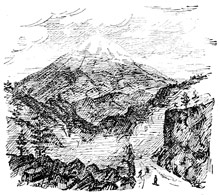
PIKE'S PEAK.
At last, when nearly spent, the party reached the banks of a stream which Pike believed to be the one he was in search of. One can hardly realize to-day this desperate struggle for life as taking place among the pleasure-grounds of Colorado.
Men and animals being broken down with fatigue, and all in danger of perishing for want of the necessaries of life, Pike resolved to send to Santa Fé for the help without which he could not stir from the place where he then was. Dr. Robinson offered himself to go on this errand. He was one of the strongest men of the party, and second only to Pike as a hunter. The hopes of the explorers went with him. When he had gone, all who could still work were set to building a block-house, for shelter or defence.
One day while Pike was out hunting, two strangers rode up to him. They had come from Santa Fé. Robinson had safely arrived, and would soon be heard from. Feeling no mistrust of them, Pike took these strangers back to his camp. To his surprise he then learned that he was but two days' journey from Santa Fé.
These visitors had not been gone many days when a squadron of Spanish horse rode up to the block-house. The officer in command then notified Pike that he was encamped on the Rio Grande, on Spanish ground. It was now clear that the first visitors were sent to spy out Pike's place of retreat, while this force followed on to take the Americans prisoners. It also came to light that they were suspected of having a design to seize the province[3] of New Mexico.
Pike went to Santa Fé to explain why he was found trespassing on Spanish territory, but was held as a prisoner with his men, whose appearance, as he describes it, is the best proof of the hardships they had undergone while lost in the mountains. He says,—
"When we presented ourselves at Santa Fé, I was dressed in a pair of blue trousers, moccasins, blanket-coat, and a cap made of scarlet cloth lined with fox-skins, and my poor fellows in leggings, breech-cloths, and leather coats. There was not a hat in the whole party. Our appearance was extremely mortifying to us all, especially as soldiers; and although some of the officers would frequently say to me, that 'Worth made the man,' yet the first impression made on the ignorant is hard to eradicate; and greater proof cannot be given of the ignorance of the common people here than their asking if we lived in houses, or camps like the Indians, or if we wore hats in our country."
After a brief detention, the explorers were sent back to the United States, under armed escort, by way of El Paso, San Antonio and Natchitoches. Pike's papers were taken from him, so depriving the world of the interesting details which at that time were eagerly sought for, but now had to be supplied largely from memory.
At the same time that Pike was engaged in these explorations, parties were sent up the Red and Washita Rivers, with the view of enlarging the scope of his undertaking.[4]
FOOTNOTES
NEW MEXICO IN 1807.
Although, in its main objects, Pike's expedition seems unfruitful of results, we owe to his capture an interesting account of New Mexico, as he saw it at that time.
"The village of the Warm Springs or Aqua Caliente," he tells us, "at a distance presents to the eye a square enclosure of mud walls, the houses forming the wall. They are flat on top, or with very little ascent on one side, where spouts carry off the water of the melting snow and rain, when it falls, which, we were told, had been but once in two years.
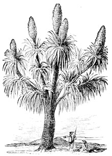
THE YUCCA-TREE: SPANISH BAYONET.
"The houses were all of one story, the doors narrow, the windows small, and in one or two houses there were talc lights. This village had a mill near it, situated on the little creek of the same name, which made very good flour. The population consisted of perhaps five hundred Indians, civilized, but of much mixed blood.
"Here we had a dance which is called the fandango, but there was one other, which was copied from the Mexicans, and is now danced in the first societies of New Spain, and has even been introduced at the court of Madrid.
"The greatest natural curiosity is the warm springs, of which there are two, each affording sufficient water for a mill-seat. They appeared to be impregnated with copper, and were more than 33° above blood-heat. From this village, the Indians drove off two thousand horses at one time, when at war with the Spaniards.
"St. John's (San Juan) was also enclosed by a mud wall, and probably contained one thousand souls; its population also chiefly consisted of civilized Indians, as indeed do all the villages of New Mexico, the whites not forming the one-twentieth part of the inhabitants.
"The house-tops of this village, as well as the streets, were crowded when we entered it. At the door of the public quarters, we were met by the priest. When the officer in charge of my escort dismounted, and embraced him, all the poor creatures who stood around strove to kiss the ring or hand of the holy father. My men were taken to the quarters provided for them, and I went to the priest's, who offered me coffee, chocolate, or whatever else he had, and bid me consider myself at home in his house.
"Santa Fé, the capital, is situated along the banks of a small creek, which comes down from the mountains, and runs west to the Rio del Norte. Although it is but three streets in width, it is about a mile long. Seen from a distance, I was struck with the resemblance to a fleet of flat-boats floating down the Ohio in the spring. There are two churches, whose fine steeples form a striking contrast to the squalid appearance of the houses around them.
"In the centre is the public square, or plaza, one side of which forms the flank of the soldiers' square, which is closed and in some degree defended by round towers in the angles, which flank the four curtains: another side of the square is formed by the palace of the governor, his guard-houses, etc. The third side is occupied by the priests and their suite, and the fourth by the Chapetones who reside in the city. The houses are generally only one story high, with flat roofs, and have a very mean appearance on the outside, though some are richly furnished, especially with plate. The supposed population is four thousand five hundred souls. On our entering the town, the crowd was very great, and followed us to the government house. When we dismounted, we were taken through various rooms, the floors of which were covered with buffalo-robes, bear-skins, or those of other animals, to a chamber where we waited for some time, until his excellency appeared."
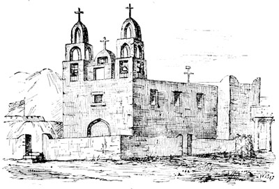
CHURCH, SANTA FÉ, WITH FORT MARCY.
In going down the valley into Texas, Pike gained some insight into the traffic carried on between Old and New Mexico, and of its regulated movements.
"We passed the encampment," he continues, "of the caravan, going out with about fifteen thousand sheep for the other provinces, from which they bring back merchandise. This expedition consisted of about three hundred men, chiefly citizens, who were escorted by an officer and forty soldiers. They come together at Ciboletta in February, and separate there on their return in March. A similar expedition goes out in the autumn. At other times of the year no citizen travels over the road, the couriers alone excepted. At the pass of the Rio del Norte, the couriers meet and exchange packets, when each returns to his own province. We met a caravan of fifty men and probably two hundred horses, loaded with goods for New Mexico.
"Saturday morning, March 21, we arrived at the Paso del Norte, through a mountainous country. We put up at the house of Don Francisco Garcia, who is a wealthy merchant, and planter. He had, in the neighborhood, twenty thousand sheep and one thousand cows. We were received in a most hospitable manner, by Don Pedro Roderique Rey, the lieutenant-governor, and Father Joseph Prado, the vicar of the place. This was by far the most flourishing town we had so far been in."
GOLD IN COLORADO. A Trapper's Story.
Pike found but one American living in Santa Fé. This man had been a trapper, accustomed to the wild and free life of the plains, and this was the story he told.
James Pursley was a Kentuckian who had gone in 1799 to St. Louis, lured by the thirst for adventure for which men of his class willingly give up all the comforts of civilized life. He was one of those men who, like Daniel Boone,[1] thought it time to move on when he could no longer fell a tree so that its top would lie within a few yards of the door of his cabin.
So in advance of the explorer comes the trapper of the West, who, while flying from civilization, is actually paving the way for its coming in spite of himself.
In 1802, with two companions, Pursley left St. Louis, and travelled west to the head of the Osage, where they made a successful hunt. From thence the trappers started for the White River of Arkansas, meaning to go down to New Orleans with their peltries, but while getting ready for the long voyage the Indians stole their horses from them.
The hunters pursued the robbers to their villages. The horses were there, but the Indians would not give them up. Seeing an Indian riding on his horse, Pursley ran up to him, and with his hunting knife ripped open the horse's bowels. The incensed savage instantly ran to his lodge for his gun. It missed fire. Pursley then sprang upon him with his drawn knife in his hand. The Indian took refuge in a lodge filled with children and squaws. The chiefs were so struck with the bravery of the "mad Americans," as they called them, that they gave them back their horses again.
Pursley and his comrades then returned to the place where they had hid their peltry, meaning to go to St. Louis by land, but when they were near the Osage, their horses were again stolen. Hewing themselves a canoe out of a log, they paddled down the Osage without further misadventure till they came to its mouth, when the canoe overset, and the whole year's hunt was lost. They, however, managed to save their powder and guns.
In the Missouri they met a French trader going up to the Mandan country. Pursley at once engaged to go with him for the voyage.
On reaching their destination, Pursley was sent out on a hunting and trading trip with some friendly Paducas and Kiowas, they taking with them a few trading goods. In the ensuing spring, while hunting at the sources of the Platte, they were driven into the neighboring mountains by hostile Sioux. Pursley estimated their number at two thousand, with ten thousand animals. Well was this nation called the Scourge of the Great Plains!
Knowing themselves to be on the borders of New Mexico, it was decided that Pursley, with a few others, should go to Santa Fé in order to learn if the Spaniards would give them good treatment if they came there to trade.
The Spanish governor having promised them good treatment, the Indian deputies went back to their bands, but rather than again risk capture by the cruel Sioux, Pursley thought best to stay where he was, among a civilized people. He arrived at Santa Fé in June, 1805, and had been following the carpenter's trade ever since. Lieutenant Pike describes him as a man of strong natural sense, of dauntless courage, and the first American who had penetrated so far into the wilds of Louisiana.
Among other things, Pursley told Lieutenant Pike "that he had found gold on the head waters of the Platte, and had carried some of the virgin ore about with him in his shot-pouch for months; but being in doubt whether he should ever again behold the civilized world, and having wholly discarded all the ideal value with which mankind has stamped that metal, he threw the sample away; that he had imprudently mentioned it to the Spaniards, who had frequently importuned him to go and show them the place, though, conceiving it to lie in our territory, he had always refused, and was fearful that his doing so might prove an obstacle to his leaving the country."
This man little dreamed that after lying dormant half a century, the discovery of which he thought so little would one day be the making of a great State.
FOOTNOTE
THE FLAG IN OREGON.
We have seen that Mr. Jefferson's plan for securing the commerce of the Great West needed two things for its success. One was a road across the continent. This had been found. The other want was a port on the Pacific. When this had been met, not only would the resources of Louisiana lie open to East and West, but the way to India be found, and the unity of America secured for all time.
As emigration was only just beginning to cross the Mississippi, it scarcely weighed in the balance with commerce, but was as sure to follow it as grass to grow or water run.
Our Government having thus cleared the way, the St. Louis traders were not slow to avail themselves of it. In 1808 they organized the Missouri Fur Company, which immediately sent an agent into the coveted territory, where he set up a trading-house known as Post Henry on the Lewis River.
John Jacob Astor, a merchant of New York, conceived the idea of carrying out the whole scheme as formulated in Mr. Jefferson's mind, not as a monopolist, protected by Government with exclusive privileges, but as a private person, who undertakes an enterprise on his own judgment, and backs it up with his own means.
Mr. Astor was a shrewd and careful merchant who had grown very wealthy from the profits of the fur-trade. He had the money. He knew the price of a beaver or an otter skin in every market of the world. He had the whole A B C of commerce at his fingers' ends. Uniformly successful in whatever he undertook, his judgment inspired confidence in others, as superior business tact is sure to do; hence Mr. Astor had no difficulty in securing partners in his enterprise. It was seen that the key to success lay in the hands of whoever should first occupy the rich fur-bearing valleys of the Columbia River.
There was nothing niggardly about this princely merchant's preparations, once he had made up his mind to embark in the adventure. Every thing was conceived on a most liberal scale, and nothing was left to chance. One company of agents, clerks, and laborers was sent round Cape Horn, with orders to begin a station at the Columbia River, should they first arrive on the ground. Another company, numbering sixty persons, either agents, trappers, guides, or interpreters, went from St. Louis up the Missouri and Yellowstone, and so across the great snowy range into the Columbia basin.
This was in 1810. The next year Mr. Astor despatched a second ship to the Columbia with further supplies of men and means.
The Tonquin, the pioneer ship, arrived in the Columbia before the overland party did. A site was chosen ten miles up the river, on the south side, and the work of erecting a trading-post begun at once, so that when the advance of the overland party reached it (January, 1812), in the utmost destitution, they found relief within its walls.
In honor of its projector the builders called their settlement Astoria. Its history was destined to be brief but eventful. In the first place, the rivalry of the British North-west Company soon made itself felt. Its agents spread themselves out over the upper Columbia waters, so intercepting the Indian trade. Then news was brought to the factory, of the taking of the Tonquin and massacre of her crew by the Indians, with whom she was trading, near the Straits of Fuca.
The ship Beaver, with the third detachment, arrived out in May, 1812. She, too, sailed on a trading-voyage up the coast. A party was sent out from Astoria, at this time, to establish a trading-post on the Spokane River, which, with one already begun at Okonagon, was the second this company had formed in the interior.
In June, 1812, war broke out between England and the United States. It was January before the people at Astoria heard of it. Finding themselves cut off from help on the one side, and threatened with capture on the other, Astor's agents sold the property to the North-west Company, into whose hands it thus passed, not without suspicion of collusion on the part of the sellers. This was in October, 1813.
In this way an enterprise which had been sagaciously planned, backed with abundant means, and had passed through the preliminary stage of trial to assured success, came to an inglorious end because the Government lacked means to protect it. And so Americans were ousted from Oregon, and Englishmen put in possession, which was much like giving the wolf the wether to keep.
LOUISIANA ADMITTED.
Louisiana came into the Union in 1812, so making it the eighteenth State in the order of succession, as it was the first formed of any portion of the territory we had acquired west of the Mississippi. Louisiana is therefore the corner-stone of the new Great West.
Louisiana came in at the beginning of a period of strife and bloodshed. England made a most desperate effort to seize New Orleans, with intent to obtain control of the Mississippi, or at least to gain a vantage-ground from which she could dictate terms to the United States. The fortune of war, however, went against her in the bloodiest battle of the time. Peace was already made when it was fought, so making the effort as useless as it was costly and heroic.
III. THE OREGON TRAIL.
THE TRAPPER, THE BACKWOODSMAN, AND THE EMIGRANT.
Ever since the expedition of Lewis and Clarke, the head waters of the Missouri had been frequented by hunters, trappers, and traders. These men threaded every nook and corner of the wilderness in pursuit of a livelihood, and, rude geographers as they were, the remotest mountain solitudes were fast yielding up to them the secrets they had held since the creation of the world.
Let us begin with a portrait of the trapper as drawn from life by Mr. Irving:—
"When the trade in furs was chiefly pursued about the lakes and rivers, the expeditions were carried on in bateaux and canoes. The voyageurs or boatmen were the rank and file in the service of the trader, and even the hardy men of the North were fain to be paddled from point to point of their migrations.
"A totally different class has now sprung up,—the 'mountaineers,' the traders and trappers that scale the vast mountain chains, and pursue their hazardous vocations amidst their wild recesses. They move from place to place on horseback. The equestrian exercises, therefore, in which they are engaged, the nature of the countries they traverse, vast plains and mountains, seem to make them physically and mentally a more lively race than the fur-traders and trappers of former days. A man who bestrides a horse must be essentially different from a man who cowers in a canoe. We find them, accordingly, hardy, lithe, vigorous and active; extravagant in word, in thought, and deed; heedless of hardship, daring of danger, prodigal of the present, and thoughtless of the future.
"The American trapper stands by himself, and is peerless for the service of the wilderness. Drop him in the midst of the prairie, or in the heart of the mountains, and he is never at a loss. He notices every landmark, can retrace his route through the most monotonous plains or the most perplexed labyrinths of the mountains. No danger nor difficulty can appal him, and he scorns to complain under any privation."
Behind the trapper, though it might be at a great distance, came the backwoodsman. This man was a product of American growth, of continued expansion of territory, but never the voluntary agent of civilization. He was more like the foam blown from the crest of its ever-advancing wave.
The true backwoodsman was one, who, like Daniel Boone, fled at the approach of his fellow-men. He was a recluse from choice. He has always hung on to the skirts of civilization, though he scorned to become part of it, or profit by its advantages or comforts.
This man made a little clearing, built himself a rude cabin of logs, and lived by hunting. When he first heard of a new purchase he hastened to it, but as soon as another was made he shouldered his rifle and his pack, and without regret turned his back upon the home he had scarcely made habitable when this new fit of restlessness sent him forth in search of another. In this manner, his lonely clearing made smooth the way for the coming settler. Thus the backwoodsman's life was passed far from the haunts of men. Free from all desire to better his condition in any ennobling sense, he had no higher aspiration than to live apart, no thought of becoming an instrumentality in the hand of progress. In his habits and way of life he was more like an Indian than a civilized being, for the only school he had been educated in was nature's, and his tastes or instincts led him rather downward than upward in the scale of human effort.
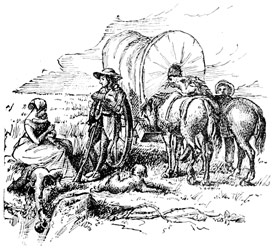
AN EMIGRANT'S CAMP.
Behind the backwoodsman, like the vanguard of an army taking the field, came the emigrant. The tread of his oxen, and print of his wagon-wheels, followed close in the blazed footpath of the departing pioneer. On foot he trudged at the head of his worldly possessions, as light of heart as the birds singing in the forest around him. In the wagon his household utensils would be stowed away, with wife and little ones, while his bronzed and barefooted boys, on foot and in homespun, drove the cows and hogs along the road behind it. At nightfall the wagon would be drawn up by the side of some limpid brook, the animals turned loose to crop the tender grass, while with an armful of fagots, gathered close at hand, the goodwife was soon busy cooking a frugal supper of bacon and potatoes, over the embers of their camp-fire. In this way the emigrant sometimes travelled week after week, and month after month, before finding a place of abode to suit him.
This man had come to stay. When he had found a situation to his mind, he set about felling trees for his cabin. On the Missouri, where the first settlers chiefly came from Tennessee and Kentucky, this dwelling was usually two houses, built a little apart from each other, each containing but one room, and joined together only by the roof, so leaving an opening in the centre, where the family usually sat in the heat of the day. The chimneys were built of sticks, plastered with clay, and stood at the outside of the building, as the fashion is in the Southern States. There was little difference between the dwellings of rich and poor. In these humble abodes the first generation grew up to man's estate to find themselves to-day the founders of an empire.
Unlike the backwoodsman, the settler had come to better his condition,—to grow up with the country, not abandon it with the first token of progress. Here he lived content. He broke up his forty acres of prairie land, fenced and planted it, and from its fertility soon reaped an abundant harvest of corn and potatoes, which with his swine and poultry, furnished more than food enough for his wants. Though the comforts of life were scarcely attainable in a wilderness, he had the necessaries, and could say, with our gracious poet, to the dweller in cities,—
"How canst thou walk in these streets, who hast trod the green turf of the prairies? How canst thou breathe in this air, who hast breathed the sweet air of the mountains?"
LONG EXPLORES THE PLATTE VALLEY.
From the summit of Pike's Peak, Pike, the explorer, had looked down upon regions watered by four great rivers,—the Platte,[1] Arkansas, Rio Grande and Colorado. Into those dark gorges he had recklessly plunged. But he had scarcely done more than confirm the position of the great landmark, which nature has placed at the head of these great rivers.
War with England had put a stop to exploration for a time, but with peace it was determined to know if the Platte would not afford a better route than the roundabout one Lewis and Clarke had followed to the Pacific. It was thought depressions might exist where this river issued from the mountains, so giving access to the country on the other side, by a way less formidable to the traveller than had yet been found.
With this object in view, Major Long[2] was sent to the Missouri in 1819 by President Monroe. As he was a man of scientific attainments, a more thorough and critical report was expected from him than his predecessors had so far furnished.
Long's journey marks a distinct era in the ways of travel; for while Pike had used row-boats, Long ascended the Missouri in a steamboat built for the purpose at Pittsburg, and named the "Western Engineer." In this vessel he made the voyage to Council Bluffs.
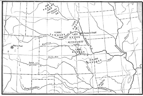
MAP SHOWING LONG'S EXPLORATIONS.
In going up the Missouri, Long found the most populous settlements growing up in the neighborhood of St. Charles, in what is now Callaway County, and in that part lying between the Osage and Chariton. Above the Chariton only a horse-path, called a trace, led northward to Council Bluffs.
In all these primitive settlements superior wealth would be indicated by the number and size of the corn-cribs, smoke-houses, etc., but nothing resembling the barn found on every farm in the Northern States entered into the make-up of these frontier homesteads.
After spending the winter in camp near Council Bluffs, Long passed on his way into the Platte, to the village of the Otoe nation, situated about forty miles above the confluence of the Platte with the Missouri. Going thence he entered the Pawnee country, finding there a more friendly welcome than Pike had met with, but, like him, getting an impression of savage chivalry and independence, the like of which he had found nowhere else. The braves of this nation hung out their war-shields in the village streets, as the cavaliers of old were accustomed to display theirs before their tents, so that every passerby might know who the occupant was by his device.
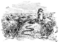
PRAIRIE-DOG VILLAGE.
Long's party turned down the South Fork of the Platte, and reached the mountains in July, 1820, after making a journey of nearly a thousand miles since leaving the Missouri.
In one place this traveller has noted down how they had passed by a large and uncommonly beautiful village of the prairie marmot, covering a grassy plain of about a mile square. As they came toward it, this spot happened to be covered with a herd of some thousands of bisons. On the left were a number of wild horses, and immediately in front twenty or thirty antelopes, and about half as many deer. As it was near sunset the light fell obliquely upon the grass, giving an additional brilliancy to its dark verdure. The little inhabitants of the village were seen running playfully about in all directions, and when the travellers got near them, they sat erect on their burrows, and gave a short, sharp bark of alarm.
A scene of this kind comprised most of what was beautiful and interesting to the passing traveller in the wide unvaried plains of the Missouri and Arkansas.
Before leaving this interesting region, Dr. James, the botanist and historian of the expedition, ascended the high mountain now known as Long's Peak (July 13). Turning south, Long's party soon struck the waters of the Arkansas, near Pike's Peak, from whose summits they saw the great plain they had crossed, "rising as it receded until it appeared to mingle with the sky."
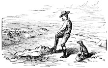
DIGGING IN THE RIVER-BED FOR WATER.
From this point, the explorers descended the valleys of the Arkansas and its largest tributary, the Canadian, to Fort Smith, and from thence through the growing settlements of the territory,[3] to the Mississippi, visiting, by the way, the famous Hot Springs of the Washita. The upper waters of the Arkansas and Platte were reported by them to lie in sandy wastes unfit for occupation by civilized man. Often the explorers would have to dig in the bed of the river to get water, while the arid appearance of every thing around, caused by the disappearance of the rivers[4] beneath their own sands, the want of wood and absence of game, stamped the whole region as one on which nature had set the seal of perpetual barrenness and desolation.
The sum of these discoveries had traced out, as it were, the larger veins through which emigration, the life-blood of the country, was ultimately to flow.
FOOTNOTES
MISSOURI, AND THE COMPROMISE OF 1821.
Far back, when the original States were yet colonies, and while the people of Massachusetts were solemnly deliberating how to deliver themselves from oppression, a letter was read to the body to whom this grave question had been committed, asking it to consider the state of the negro slaves in the province.
These men had just said they were called rebels because they would not be slaves. The dilemma was thus presented to them, either to make good their declaration, or limit its application to themselves. After some debate the matter was dropped, but the plea for a principle had been uttered, the appeal to men's consciences taken, and as some secret cause, working beneath the waters, gives notice of the agitation below by sending up bubbles to the surface, so this question of slavery continued at intervals to prick the conscience of the people, and confront them at every turn with its warning.
The North had got rid of slavery. It had done more. Its voice had excluded slavery from the great North-West. But the South owed its growth to slave labor, and wherever her people went to found new States they carried their slaves with them. It was inevitable, that, whenever free and slave labor should meet on the same ground, a conflict must arise between them, though statesmen were anxious to avert the coming on of strife as long as possible.
It is hard to stay the march of events, or confute the logic of time. Even as far back as the beginning of the Union, men had foreseen the coming storm, with foreboding, yet these men were no wiser than the Massachusetts men of 1774; for at the time of the Union slavery might have been so restricted that it would eventually have died out in the land, or a way provided for the gradual emancipation of the blacks. Such steps were indeed talked of, but not consummated. So the nation was allowed to drift on, and the two opposing systems were left to work out their own results.
In 1819 Missouri asked for admission into the Union. Her doing so, with a constitution recognizing slavery, proved a rock of danger to the Republic, the wisest statesmen found it hard to steer clear of. It provoked violent opposition at the North, and equally vehement support in the South. Under French rule the people of the nascent State held slaves. Those who had since come in were mostly from slaveholding States, and wanted to have slavery recognized as part of their social and political system.
They demanded this, not as a privilege, but as a right guaranteed to them by the Constitution itself, in which property in slaves was distinctly recognized. So they stood firm for what they considered their rights, defending slavery from the charge of immorality, or inhumanity of man to man, as men would the most righteous cause.
The North contended, broadly, that slavery was a crime, discountenanced by Christian people and enlightened thought everywhere, of which the nation should purge itself. It was said that the idea of a nation being free, when it countenanced holding men in bondage, was a mockery of freedom. Many construed the ordinance of 1787 to have forbidden, if not in its letter, at least in spirit, the formation of slave States out of newly acquired territory. But these men did not propose to interfere with slavery in the States where it already existed.
Around these two differing ideas the men of the North and South clustered themselves. Underlying all, and governing all, was the conviction that a check to the extension of slavery meant a check to the political power of the South itself. This view made the South a unit, while in the North public sentiment was divided, for many there deprecated agitation of the question, as the entering wedge which should split the Republic asunder.
When, therefore, Congress took up the bill for the admission of Missouri, the opponents of slavery met it with the condition that no slaves should afterward be brought into the new State, while all children, born in it subsequent to its admission, should be free at the age of twenty-five years. In time this condition would have made Missouri a free State.
The matter was hotly debated. Of the twenty-two States then constituting the Union, ten were slave States. Two ominous phrases began to be heard. One was "State rights," the other "Balance of power." In the violence of party strife, patriotism was lost sight of.
The House of Representatives refused to admit Missouri without the condition; the Senate refused to do so with it. So Missouri was not admitted at this time.
With the two houses thus divided, it was apparent that no new State could be admitted, since the Southern party, having control of the Senate, would not vote to admit a free State so long as Missouri was kept out, and Maine was then ready to come in as a free State.
As neither party would yield, the more moderate, or timid, men of each tried to find some intermediate ground where the factions could come together, each giving up something for the sake of restoring harmony to the country. Finally a settlement was reached. Maine came in a free State. Missouri was admitted with slavery, but with the restriction attached that her southern boundary should thenceforward be the limit north of which no new slave States should be formed. Thus the line between freedom and slavery was first strictly drawn on the parallel of 36° 30´, but with a slave State above it. The first battle between the two warring systems had been fought, and slavery had won. The North had got a line, but the South had won a State.
ARKANSAS ADMITTED 1836.
Arkansas was admitted into the Union in 1836, as a slave State, retaining the name it had been given as a Territory, when formed from the Louisiana purchase,—a name originating with the once powerful nation Marquette found seated on the banks of the Mississippi. Thus three slave States had been made out of French Louisiana.
THOMAS H. BENTON'S IDEA. "There is the East! There lies the road to India."
Lawyer, soldier and politician, but not yet a statesman, Thomas H. Benton went from Tennessee to Missouri after the war with England was over. Though St. Louis was yet only a large village, it was the focus of the activities of the Great West. Mr. Benton saw it was the place for a rising man to grow up in, and accordingly he settled there.
In St. Louis Mr. Benton found an aristocracy of fur-traders, whose attachment for their own usages and old form of government bound them together. They kept their own language and manners. With many it was a point of honor never to learn English at all. In all things they were as distinctively French as the French people of Canada are to-day. Thus this scion of refinement had been grafted on a rude frontier life, but would not assimilate with the coarser elements thrown upon it by emigration from the States.
By the side of this middle-class (bourgeois) aristocracy stood the Catholic clergy, with its traditions of the old régime in Canada, its proud record of discovery and missionary work among the barbarians of these Western wilds, whose every stream and fountain had its story of zeal and heroism to tell.
This was society at the core. The clergy was its rock of support. Boys were taught in the parish school, and girls in a nunnery. So education was as much in the keeping of the Church as religion itself. Nations may change, but the Roman Church never abandons its people or its objects.
Around this foundation was grouped the community of French Creoles, whom the great fur companies employed and who were their dependants. And around them clustered again an increasing population of American adventurers, coming mostly from the Southern States in search of a living, for whom St. Louis was the magnet which attracts to itself the scattered atoms of society far and near.
Outside of St. Louis, Missouri owed her rapid growth to the in-coming of actual settlers. In 1816 only thirty families were found on the left bank of the Missouri, above Callaway County. In three years the number had increased to eight hundred families. Here was the real bone and sinew of the State.
Mr. Benton found the American Fur-Trading Company sending forth its yearly caravans over the great plains to the mountains, and from the mountains, through passes known only to the Indians and fur-traders, into Sonora, New Mexico and Oregon. Since the way was beset by hostile Indians, these caravans went armed to the teeth. The same Indians might fight them one day and trade the next. In time, the passing to and fro of these traders had marked out well-beaten paths up the Arkansas and the Platte, which presently came to be known on the frontier as the Santa Fé Trail and Oregon Trail.[1]
At bottom the St. Louis fur-traders were not more friendly to colonization than the English fur-traders, but they were quite as eager to push their business into Oregon, conceiving they had the best right there, as the English companies were to keep them out of it so that they themselves might reap all the profit; and so there was rivalry and ill blood between them.
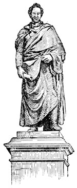
STATUE OF BENTON.
Mr. Benton was energetic, ambitious and self-reliant, qualities which soon identified him with the thought and interests of the people among whom he had cast in his lot in life. Thoroughly Southern in his feelings, he had borne an active part in making Missouri a slave State, and when that result was accomplished the people sent him to the United States Senate as a reward for his zeal in their behalf.
When the war with England was over, our Government wished to have the boundary between our own and the British possessions defined and settled. Though proposed to be run on the forty-ninth parallel it had never been done, and in buying Louisiana we inherited a dispute which, so long as that vast region was unexplored and unknown, had slept, but was now become a source of irritation and danger between England and the United States. The Columbia River and its basin[2] were the bone of contention. Both wanted them. Neither would give them up. Since Astoria[3] had been sold, the Hudson's Bay and North-west Companies had held uninterrupted possession of the whole country, to the exclusion of our own ships and traders, whose interests had suffered in consequence; but as England would not yield her pretensions peaceably, the people of the Atlantic coast were unwilling to go to war about a region so remote, the more so because they were just recovering from the effects of the one lately ended, and felt that they would be the greatest sufferers if war again broke out between the two nations.
So the two countries compromised their differences by agreeing to hold Oregon in common, first for ten years (1818-1828), and afterward from year to year. All this time England was growing stronger in Oregon, and the United States losing the hold her citizens had first obtained there, for though it was neutral ground on paper, the English with their free access by land and sea were able to shut out our traders, and did so.
This state of things was humiliating to the West. It was as though the nation were eating humble-pie rather than offend England. Continual agitation of the question served to keep up a feverish feeling about Oregon, but since Major Long had said it was of no use to think of cultivating the land between the meridian of Council Bluffs and the Rocky Mountains, it seemed settled that nobody but fur-traders would want to cross this desert while so much fertile land remained vacant in the Mississippi and Missouri Valleys. If settlement must stop at the edge of this desert, then the idea of geographical unity vanished, and Oregon would, in truth, be worth little to us. Mr. Benton, himself, was at one time of this opinion.
So when Mr. Benton wanted the Government to take Oregon with an armed force, he was told it was not worth the trouble, for Oregon could never become a State if we did.
There was another element to the dispute, which found much favor in the West. This was Mr. Monroe's declaration that no European power would be allowed to subdue or overturn the independent governments of our continent. This was a notice to England that she could not have Oregon. It has since been known as the Monroe Doctrine,[4] and so Mr. Monroe became the author of a national policy.
Mr. Benton mastered all the details of the vexatious Oregon question. The interests of his constituents were at stake. His patriotism was aroused. He felt equal disgust with the artifices by which England kept us out of Oregon, as with the cautious spirit of the East, which counted the cost of every thing beforehand, less, it seemed to him, in the spirit of statesmanship, than for what it would be worth at the present moment.
It should not be forgotten, however, that New England enterprise had first made known the resources of our possessions on the Pacific.
In fine, Mr. Benton made himself the champion of the growing West. He had already become, in a sense, the trustee of Mr. Jefferson's pet scheme of a great overland highway to India, which, indeed, proved too great for the time that wise man lived in, but only waited for the people to grow up to it. Mr. Benton knew from Mr. Jefferson's own lips what results had been hoped for, but not realized,—how the best-laid plans had been thwarted, or suffered to sleep the sleep of oblivion,—and the Missouri senator had gone away from his memorable interview more than ever impressed with the greatness of the mission he was henceforth to take upon himself as Mr. Jefferson's disciple.
England managed, in one or another way, to delay a settlement just forty-nine years. A few Americans had gone into Oregon, but as yet they were only a handful. In 1832 Captain Bonneville[5] took the first wagon train across the Wind River chain into the Green River Valley, thus proving the mountains were practicable for vehicles. The same year Nathaniel J. Wyeth[6] led a party all the way from New England to Fort Vancouver, after a journey lasting seven months, in which some of his men were killed by the Blackfeet. In 1834 and 1835 some American missionaries[7] were sent out to Oregon, one of whom, Marcus Whitman, was to figure largely in its history. In the following year Dr. Whitman went through to Fort Walla Walla with a wagon, thus doing what had been declared impossible. Yet up to the close of 1841 not quite a hundred and fifty Americans, in all, had settled in Oregon, though the Oregon Trail was largely shorn of its terrors by the intrepidity of these real pathfinders. For his part, Dr. Whitman saw clearly, that, since diplomacy was purposely hindering it, emigration must step in and settle the question who should have Oregon. And Dr. Whitman was not only a man of clear sight, but of action.
FOOTNOTES
WITH THE VANGUARD TO OREGON. "This army does not retreat!"
Emigration was to be our army of occupation in Oregon. In this conviction Mr. Benton was looking about him for the means to set it in motion, when he chanced to meet Lieutenant John C. Fremont, of the topographical engineers, who had just returned from surveying the Upper Mississippi, with Nicollet.[1]
Mr. Benton wanted the Oregon route surveyed in aid of emigration to the Lower Columbia. The subject led to an intimacy between the two men, in the course of which Fremont fell in love with Mr. Benton's daughter Jessie, whom a little later he married, so uniting his fortunes with the distinguished senator's family, as well as his plans.
It resulted in sending Fremont (1842) to find out whether the South Pass[2] of the Rocky Mountains, the usual crossing-place, would best accommodate the coming emigration.
This was the very first step taken by our Government in aid of emigration to Oregon. Hitherto it had reflected the prevailing belief in the worthlessness of Oregon for any such purpose. We were, at this time, thick in the dispute with England about the boundary, and so the expedition was rather assented to, in deference to Western men, than authorized as a Government measure.
St. Louis is no longer to be considered as a starting-point for the mountains. Already this had gone three hundred and fifty miles west. Fremont's journey therefore began at the little village of Kansas,[3] now a city larger than any then existing west of the Alleghanies, but then only a landing for Chouteau's trading-post, ten miles up the Kansas River. From this place, early in June, Fremont's party set out for the mountains. Kit Carson of Taos, a famous hunter, was their guide.
For most of the way Fremont's wagons only followed in the track of those that had gone before them, sometimes with guides, but oftener without them. The road was plain, and led over ground where vehicles pass everywhere with ease, except when gullies or streams cross their path. So Fremont's men journeyed on quite at their ease. At nightfall the wagons were drawn together in a circle, thus forming an enclosed and barricaded camp, in which the travellers pitched their tents.
Fremont went up the Kansas valley as far as the Big Blue, crossing thence over to the Platte, which was now to be his guide for the rest of his journey.
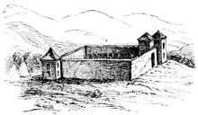
FORT LARAMIE.
Now and then Fremont would come across the abandoned camp of some Oregon emigrants, who thus seemed piloting him on, instead of he them.
At the forks of the Platte the party was divided, Fremont himself going down the South Fork, to St. Vrain's Fort,[4] while the rest kept on up the North Fork, to Fort Laramie,[5] where Fremont presently joined them again.
When firewood grew scarce the men would have to make their fires of dried buffalo-dung, as the Arabs of the desert do with that of the camel.
At Laramie, Fremont learned that the mountains beyond swarmed with Indians, who were out on the war-path, and had declared the road shut to the whites. But Fremont went on to the South Pass, which was found to rise by so gradual an ascent that the exploring party hardly knew when they had reached its summit.
In the valley beyond this pass, the explorers rested. Before turning back, Fremont himself, with a few others, made their way into the mountains and up to the summit of the high peak now known by his name, which rose, the monarch of all in this region, 13,570 feet above the sea. In this way the three greatest landmarks of the Rockies make memorable the names of three explorers, Pike, Long and Fremont.
While Fremont did little that had not been done already, his careful record of distances, fords, camping-places where grass, wood and water could be had, was just what outgoing emigrants needed to know, and so, immediately, they began to go forward with confidence. It was besides a token that Government had taken hold of the matter at last, and would, it was thought, now foster and protect the emigration.
Fremont said it would be necessary to have permanent military posts at Laramie, St. Vrain's and Bent's Fort, to keep the Indians from killing our people, as they passed through their country. Until this should be done the road could not be called safe. But he did the most for emigration in correcting the popular error about the barrenness of the great plains, to which Major Long gave currency, and which everybody to this time had believed. He showed that where the buffalo roamed in such vast herds, and found food, could not be a desert, for the wild grass they lived on would certainly keep the emigrants' cattle, while no man need starve in the midst of such abundance of wild game as constantly roved these plains before their eyes. It was much to have all these things set down in an orderly manner by some friendly hand, and with the seal of Government authority. Fremont did this as it had not been done before.
Fremont's first expedition met with such favor that he was immediately sent on a second (1843), and much more important one. This time he was to begin at the South Pass, and go through the Lower Columbia country. He was well on his way when the War Department suddenly recalled him to Washington, but Mrs. Fremont took the responsibility of suppressing the order until the explorer was too far off for it to reach him.
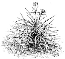
AMOLE, OR SOAP-PLANT OF THE PLAINS.
At the moment of starting from the Missouri, Fremont met a large party of emigrants who were going to California under the lead of J. B. Childs. This party took with them that modern civilizing engine, a saw-mill, ready to be put up on reaching the Sacramento. As Fremont moved west, trains of wagons were seldom out of sight. The great march had begun in earnest.
Fremont decided to explore the mountains in the neighborhood of St. Vrain's Fort to see if they would afford a practicable passage on a more direct east-and-west line than the old way up the Platte. He therefore struck into them, north of Long's Peak, and by following the Cache-à-la-Poudre[6] River came out on the other side, where his journey of the previous year had ended. From here he passed on into the valley of Bear River, and so on to the Great Salt Lake,[7] which he also explored.
From Salt Lake, Fremont went north to the Hudson's Bay Company's post at Fort Hall, striking the Oregon Trail again by the way. The explorers divided here, part going back to the States and part down the river with Fremont. Fort Boisé[8] they found was only an ordinary dwelling-house. Going on they next came to the mission Dr. Whitman had founded among the Nez Percés, near Walla Walla. It then consisted of but one adobe house, though more were going up around it. Its cornfields and potato-patches, which Dr. Whitman had cleared and planted, were a pleasant sight to men worn down with travel and fasting, but not more so to Fremont than the little colony of emigrants now collected here after their long march of two thousand miles,—men, women and children,—all in robust health, and all regaling themselves with Dr. Whitman's potatoes.
Fort Walla Walla marks an important strategic point in the early movement of emigration to Oregon. Situated only nine miles below the junction of the two great branches of the Columbia, it was thus also planted at the meeting of two great trans-continental routes of travel, one coming from the United States by way of the South Pass, the other from Hudson's Bay by way of Lake Athabasca and the mountain passes near it. For such of the emigrants as chose to go on by water, Walla Walla was the end of their long overland journey. Fremont found a large body of emigrants, under the lead of Mr. Jesse Applegate, building bateaux here to go down the river in.
But the British trading-post lay on a sandy plain, where scarce a blade of grass or a shrub grew. Dr. Whitman had chosen a pleasant and fertile nook, not far from the fort, where emigrants might recruit themselves among friends; for at the fort itself every effort was made to turn them back or send them into California. Thus everywhere, except at the missions, emigrants found this Oregon Trail a hard road to travel, for our Government left them to the mercy of the Hudson's Bay Company's agents, who hindered them in every way, or failing to stop them, charged exorbitantly for every thing furnished.
Finding emigration would increase in spite of them, this company chose to save itself by bringing in British emigrants from the Red River of the North. It meant to occupy the best lands, as it had the best trading sites. The first colony was on the Upper Columbia when Dr. Whitman heard of it. If Oregon were to be saved to us, there was not a moment to lose. He instantly started for Washington with the news of this threatened invasion.
Dr. Whitman's ride to St. Louis, by way of Santa Fé, will ever be memorable in the annals of Oregon, as well for its perils as for what it accomplished. He found our Government had just signed the Ashburton Treaty,[9] by which Oregon was still left out in the cold, without a boundary or the protection of our laws or flag. His great energy, however, enabled him to get together on the frontier an emigrants' train of two hundred wagons with which, as the leader of an army, he started back in the spring. It was these people whom Fremont had seen setting out, had tracked a thousand miles on their way, and finally come up with at their journey's end. As the Government would not lead, it now had to follow the people's grand march for the Pacific.
With fresh horses Fremont pushed on down the left bank of the Columbia to the Dalles, Mount Hood towering in the distance. Here the whole river rushes through a long and narrow trough of rock, with so swift a tide that in the season of high water boats cannot stem it.
A few miles below, Fremont emerged from the sterile and inhospitable region through which he had been travelling, upon a green spot in the valley, where, among groves of noble forest-trees, the Methodist mission had reared its two dwellings, its one schoolhouse, and its barn, cleared ground for planting, gathered to it a colony of Indians for instruction in the ways and religion of the whites, and so dropped in the wilderness the seed of Christian civilization.
From the Dalles, Fremont sailed down the river to Vancouver, finding here still more emigrants, most of whom were waiting to cross over into the fertile Willamette Valley, which was then their land of promise.
At this point Fremont's journey ended. His explorations had now connected with surveys conducted by Captain Wilkes from the Pacific coast. Fremont therefore turned homeward again, taking with him the most exact knowledge of the country traversed, so far obtained.
FOOTNOTES
TEXAS ADMITTED.
Mexico threw off her allegiance to Spain in 1821. Not till then did the Spaniards in Mexico abandon their policy of excluding all foreigners from their soil; but the example set them by the United States, with the feeling born of freedom from the Spanish yoke, brought about a change of policy in this regard, and Americans were invited to settle in Texas on the most generous terms. No stronger instance is found of the influence exerted by free institutions from without upon the hereditary prejudices of a whole people. It confessed a failure nobly.
When Texas was thus thrown open to emigration her settlements were few and scattered. Habitual timidity or indolence had restricted them to the neighborhood of fortified posts or missions.[1] The chief ones were San Antonio, Goliad, Refugio and Nacodoches, and around these small parcels of land had been brought under cultivation. But the missions themselves, which had formed the groundwork of Spanish occupation, were fallen into irremediable decay. The Indians who had been gathered into them by the monks had dwindled away until the missions were mostly depopulated. Here, as in California, experience had shown that the natives could not exist under the shadow of the whites. Civilization wasted them away.