II A CENTURY OF GEOLOGY.—THE PROGRESS OF HISTORICAL GEOLOGY IN NORTH AMERICA
Reading edition
By CHARLES SCHUCHERT
Introduction.
The American Journal of Science, “one of the greatest influences in American geology,” founded in 1818, has published a little more than 92,000 pages of scientific matter. Of geology, including mineralogy, there appear to be upward of 20,000 pages. What a vast treasure house of geologic knowledge is stored in these 194 volumes, and how well the editors have lived up to their proposed “plan of work” as stated in the opening volume, where Silliman says: “It is designed as a deposit for original American communications” in “the physical sciences ... and especially our mineralogy and geology” (1, v, 1818)! Not only is it the oldest continuously published scientific journal of this country, but it has proved itself to be “perhaps the most important geological periodical in America” (Merrill). It is impossible to adequately present in this memorial volume of the Journal the contents of the articles on the geological sciences.
Editor Silliman was not only the founder of the Journal, but the generating center for the making of geologists and promoting geology during the rise of this science in America. For nearly three decades, the workers came to him for counsel and help, and he had a kind paternal word for them all. This influence is also shown in the many letters which were addressed to him, and which he published in the Journal. A similar influence, paternal care, and constructive criticism were continued 61by James D. Dana, and especially in his earlier career as editor.
Not including mineralogy, there are in the Journal upward of 1500 distinct articles on geology. Of these, over 400 are on vertebrate paleontology, about 325 on invertebrate paleontology, and 90 on paleobotany. Of articles bearing on historical geology there are about 160, and on stratigraphic geology more than 360. In addition to all this, there are more than 2000 pages of geologic matter relating to books and of letters communicated to the editors Silliman and Dana. We may summarize with Doctor Merrill’s statement in his well-known Contributions to the History of American Geology:
“From its earliest inception geological notes and papers occupied a prominent place in its pages, and a perusal of the numbers from the date of issue down to the present time will, alone, afford a fair idea of the gradual progress of American geology.”
Before presenting a synopsis of the more important steps in the progress of historical geology in America, it will be well to introduce a rapid survey of the rise of geology in Europe, for, after all, American geology grew out of that of England, France and Germany. This dependence was conspicuously true during the first four decades of the previous century. With the rise of the first New York State Survey (1836–1843) and that of Pennsylvania (1836–1844, 1858), American geology became more or less independent of Europe. Finally, this article will conclude with a survey of the rise of paleometeorology, paleogeography, evolution, and invertebrate paleontology.
The Rise of Geology in Europe.
Mineral Geology.—The geological sciences had their rise in the study of minerals as carried on by the German chemist and physician George Bauer (1494–1555), better known as Agricola. Bauer originated the critical study of minerals, but did not distinguish his “fossilia,” the remains of organisms, from the inorganic crystal forms. Mineral geology endured until the close of the eighteenth century.
62Cosmogonists.—Then came the expounders of the earth’s origin, the cosmogonists of the sixteenth to the end of the eighteenth centuries. The fashion of this time was to write histories of the earth derived out of the imagination.
Earliest Historical Geology.—Even though Giovanni Arduino (1713–1795) of Padua was not the first to classify the rocks into three series according to their age, he did this more clearly than any one else before his time. The rocks about Verona he grouped in 1759 into Primary, Secondary, Tertiary, and Volcanic. This three-fold classification came into general use, though modified with time.
Early in the nineteenth century it had become plain that formations of very varying ages were included in each one of the three series. Through the study of the fossils and the recognition of the fact that mountain ranges have been raised at various times, causing younger fossiliferous strata to take on the characters of the Primary, it was seen that these terms of Arduino had lost their original significance.
The first one to describe in detail a local stratigraphic sequence was Johann Gottlob Lehmann (died 1767). In 1756 he published “one of the classics of geological literature,” distinguishing clearly thirty successive sedimentary deposits, some of which he said had fossils, but he did not use them to distinguish the strata.
What Lehmann did for the Permian system, George Christian Füchsel (1722–1773) did even better for the Triassic of Thuringia, in 1762 and 1773. He pointed out not only the sequence, but also how the gently inclined strata rest upon the older upturned masses of the mountains; also that some formations have only marine fossils, while others have only terrestrial forms and thus indicate the proximity of land. The deformed strata he thought had fallen into the hollows within the earth, great caverns that had also consumed much of the oceanic waters and had in so doing greatly lowered the sea-level. It was Füchsel who first introduced the theory of universal formations, and who defined the term formation, using it as we now do, system or period. Even though Lehmann and Füchsel showed that there 63was a definite order and process in the formation of the earth’s crust, their example was barren of followers until the beginning of the eighteenth century.
Wernerian Geology or Geognosy.—We come now to the time of Abraham Gottlob Werner (1749–1817), who from 1775 to 1817 was professor of mining and mineralogy in the Freiberg Academy of Mines. Geikie, in his most interesting Founders of Geology, says that Werner “bulks far more largely in the history of geology than any of those with whom up to the present we have been concerned—a man who wielded an enormous authority over the mineralogy and geology of his day.” “Although he did great service by the precision of his lithological characters and by his insistence on the doctrine of geological succession, yet as regards geological theory, whether directly by his own teaching, or indirectly by the labors of his pupils and followers, much of his influence was disastrous to the higher interests of geology.”
Werner arranged the crust of the earth into a series of formations, as had been done previously by Lehmann and Füchsel, and one of his fundamental postulates was that all rocks were chemically precipitated in the ocean as “universal formations.” For this reason Werner’s school were called the Neptunists. Nowhere, however, did he explain how and where the deep and primitive ocean had disappeared.
According to Werner, the first formed or oldest rocks were the chemically deposited Primitive strata, including granite and other igneous and metamorphic rocks. On these followed the Transition rocks, the earliest sediments of mechanical origin, and above them the Floetz rocks, a term for the horizontal stratified rocks. These last he said were partly of chemical but chiefly of mechanical origin. Last of all came the Alluvial series.
The existence of volcanoes had been pointed out long before Werner’s time by the Italian school of geologists, but as for “the universality and potency of what is now termed igneous action,” all was “brushed aside by the oracle of Freiberg.” Reactions between the interior and exterior of our earth “were utterly antagonistic to Werner’s conception of the structure and history of the 64earth.” To him, volcanoes were “burning mountains” that arose from the combustion of subterranean beds of coal, spontaneously ignited.
The breaking down of the Wernerian doctrines began with two of Werner’s most distinguished pupils, D’Aubuisson de Voisins (1769–1819) and Von Buch. The former in 1803 had accepted Werner’s aqueous origin of basalt, but after studying the celebrated and quite recent volcanic area of Auvergne he recanted in 1804. Here he saw the basaltic rocks lying upon and cutting through granite, and in places more than 1200 feet thick. “If these basaltic rocks were lavas,” says Geikie, “they must, according to the Wernerian doctrine, have resulted from the combustion of beds of coal. But how could coal be supposed to exist under granite, which was the first chemical precipitate of a primeval ocean?”
Leopold von Buch (1774–1853), “the most illustrious geologist that Germany has produced,” after two years spent in Norway was satisfied “that the rocks in the Christiania district could not be arranged according to the Wernerian plan, which there completely broke down. Von Buch found a mass of granite lying among fossiliferous limestones which were manifestly metamorphosed, and were pierced by veins of granite, porphyry, and syenite.” Even so, he was not ready to abandon the teachings of his master. After a study of the mountain systems of Germany, however, “he declared that the more elevated mountains had never been covered by the sea, as Werner had taught, but were produced by successive ruptures and uplifts of the terrestrial crust” (Geikie).
Rise of Geology and Conformism.—Modern geology has its rise in James Hutton (1726–1797) of Edinburgh, Scotland. In 1785 and 1795, Hutton published his Theory of the Earth, with Proofs and Illustrations. His “immortal theory” is his only work on geology. “Fortunately for Hutton’s fame and for the onward march of geology, the philosopher numbered among his friends the illustrious mathematician and natural philosopher, John Playfair (1748–1819), who had been closely associated with him in his later years, and was intimately conversant with his geological opinions.” In 1802, Playfair 65published his Illustrations of the Huttonian Theory of the Earth, of which Geikie says, “Of this great classic it is impossible to speak too highly,” as it is at the basis of all modern geology.
One of Hutton’s fundamental doctrines is that the earth is internally hot and that in the past large masses of molten material, the granites, have been intruded into the crust. It was these igneous views that led to his followers being called the Plutonists. Another of his great doctrines was that “the ruins of an earlier world lie beneath the secondary strata,” and that they are separated by what is now known as unconformity. He clearly recognized a lost interval in the broken relation of the structures, and that the ruins, the detrital materials, of one world after another are superposed in the structure of the earth.
Hutton also held that the deformation of once horizontally deposited strata was probably brought about at different periods by great convulsions that shook the very foundations of the earth. After a convulsion, there was a long time of erosion, represented by the unconformity. Geikie says, “The whole of the modern doctrine of earth sculpture is to be found in the Huttonian theory.”
The Lyellian doctrine of metamorphism had its origin in Hutton, for he showed that invading igneous granite had altered, through its heat and expanding power, the originally waterlaid sediments, and that the schists of the Alps had been born of the sea like other stratified rocks.
Hutton is the father of the Uniformitarian principle, for he “started with the grand conception that the past history of our globe must be explained by what can be seen to be happening now, or to have happened only recently. The dominant idea in his philosophy is that the present is the key to the past.” This principle has been impressed on all later geologists by Sir Charles Lyell, and is the chief cornerstone of modern geology.
The principle of uniformitarianism has underlain geologic interpretation since the days of Hutton, Playfair, and Lyell. However, it is often applied too rigidly in interpretations based upon the present conditions, because in the past there were long times when the topographic 66features of the earth were very different from those of to-day. Throughout the Paleozoic, and, less markedly, the Mesozoic, the oceans flooded the lands widely (at times over 60 per cent of the total area), highlands were inconspicuous, sediments far scarcer, and climates warm and equable throughout the world. Highland conditions, and especially the broadly emergent continents of the present, were only periodically present in the Paleozoic and then for comparatively short intervals between the periods. Therefore rates of denudation, solution, sedimentation, and evolution have varied greatly throughout the geological ages. These differences, however, relate to degrees of operation, and not to kinds of processes; but the differences in degree of operation react mightily on our views as to the age of the earth.
Geologic time had, for Hutton, no “vestige of a beginning, no prospect of an end.” In other words, geologic time is infinite. He did not, however, discover a method by which the chronology of the earth could be determined.
First Important Text-books.—In 1822 appeared the ablest text-book so far published, and the pattern for most of the later ones, Outlines of the Geology of England and Wales, by W. D. Conybeare (1787–1857) and W. Phillips (1775–1828). “In this excellent volume all that was then known regarding the rocks of the country, from the youngest formations down to the Old Red Sandstone, was summarized in so clear and methodical a manner as to give a powerful impulse to the cultivation of geology in England” (Geikie). This book is reviewed at great length by Edward Hitchcock in the Journal (7, 203, 1824).
To indicate how far historical geology had progressed up to 1822 in England, a digest of the geological column as presented in this text-book is given in the following table, along with other information.
A text-book writer of yet greater influence was Charles Lyell (1797–1875), whose Principles of Geology appeared in three volumes between 1830 and 1833. This and his other books were kept up to date through many editions, and his Elements of Geology is, as Geikie says, “the hand book of every English geologist” working with the fossiliferous formations.
67
The Rise of Geology in North America.
The Generating Centers.—In America, geology had its rise independently in three places: in the two scientific societies of Boston and Philadelphia, and dominantly in Benjamin Silliman of Yale College. Stated in another way, we may say that geology in America had its origin in the following pioneers and founders: first, in William Maclure at Philadelphia, and next in Benjamin Silliman at New Haven. Through the influence of the latter, Amos Eaton, the botanist, became a geologist and taught geology at Williams College and later at the Rensselaer School in Troy, New York. Through the same influence Rev. Edward Hitchcock also became a geologist and taught the subject after 1825 at Amherst College.
Silliman was the first to take up actively the teaching of mineralogy and geology based on collections of specimens. He spread the knowledge in popular lectures throughout the Eastern States, graduated many a student in the sciences, making of some of them professional teachers and geologists, provided all with a journal wherein they could publish their research, organized the first geological society and through his students the first official geological surveys, and by kind words and acts stimulated, fostered, and held together American scientific men for fifty years. Of him it has been truly said that he was “the guardian of American science from its childhood.”
The American Academy in Boston.—The second oldest scientific society, but the first one to publish on geological subjects, was the American Academy of Arts and Sciences of Boston, instituted and publishing since 1780. Up to the time of the founding of this Journal, there had appeared in the publications of the American Academy about a dozen papers of a geologic character, none of which need to be mentioned here excepting one by S. L. and J. F. Dana, entitled “Outlines of the Mineralogy and Geology of Boston,” published in 1818. This is an early and important step in the elucidation of one of the most intricate geologic areas, and is further noteworthy for its geologic map, the third one to appear, the older ones being by Maclure and Hitchcock (Merrill).
68
The Geological Column in 1822
Present American classification Conybeare and Phillips 1822 C. & P. orders Wernerian orders Other writers
Psychozoic or Recent Alluvial Superior Order Newest Floetz Class Tertiary Class
Cenozoic Pleistocene Diluvial
Pliocene Neogene Upper Marine formation (Crag, Bagshot sand, and Isle of Wight)
Miocene
Fresh-water formations
Oligocene Paleogene London Clay
Eocene Plastic Clay
Mesozoic Cretaceous Chalk Supermedial Order Primitive Transition and Floetz Classes Primitive Intermediate and Secondary classes
Comanchian 1887 Beds between Chalk and Oolite Series (Chalk Marle, Green Sand, Weald Clay, Iron Sand)
Jurassic 1829 Upper Oolitic division (Purbeck beds, Portland Oolite, Kimmeridge Clay)
Middle Oolitic division (Coral Rag, Oxford Clay)
Lower Oolitic division (Cornbrash Stonesfield Slate, Forest Marble, Great Oolite, Fullers’ Earth, Inferior Oolite, Sand and Marlestone)
Lias
Triassic 1834 New Red Sandstone
Paleozoic Permian 1841 Magnesian Limestone
Coal Measures Medial or Carboniferous Order
Pennsylvanian 1891
Mississippian 1869 Millstone Grit and Shale
Old Red Sandstone
Devonian 1839
Silurian 1835 Unresolved Submedial and Inferior Orders
Ordovician 1879
(=Lower Silurian 1835)
Cambrian 1833
Proterozoic Keweenawan Huronian 1852
Animikian
Huronian
Sudburian
Archeozoic Keewatin Laurentian 1853
Coutchiching
69Early Geology in Philadelphia.—The oldest scientific society is the American Philosophical Society of Philadelphia, started by the many-sided Benjamin Franklin in 1769, and which has published since 1771. Up to the time of the founding of the Journal in 1818, there had appeared in the publications of this society thirteen papers of a geologic nature, nearly all small building stones in the rising geologic story of North America. The only fundamental ones were Maclure’s Observations of 1809 and 1817. Later, in this same city, there was organized another scientific society that came to be for a long time the most active one in America. This was the Academy of Natural Sciences, started in 1812 with seven members, but it was not until 1817 and the election of William Maclure as its first president that the work of the Academy was of a far-reaching character. Here was built up not only a society for the advancement of the natural sciences and publications for the dissemination of such knowledge, but, what is equally important, the first large library and general museum.
William Maclure (1763–1840), correctly named by Silliman the “father of American geology,” was born and educated in Scotland, and died near Mexico City. A merchant of London until 1796, when he had already amassed “a considerable fortune,” he made a first short visit to New York City in 1782. In 1796 he again came to America, this time to become a citizen of this country and a liberal patron of science.
About 1803, single-handed and unsustained by government patronage, Maclure interested himself most zealously and efficiently in American geology. In 1809 he published his Observations on the Geology of the United States, Explanatory of a Geological Map. This work he revised “on a yet more extended scale,” issuing it in 1817 with 130 pages of text, accompanied by a large colored geological map.
Silliman, the Pioneer Promoter of Geology.—In 1806 when Benjamin Silliman (1779–1864) began actively to teach chemistry and mineralogy, all the sciences in America were in a very backward state, and the earth sciences were not recognized as such in the curricula of any of our colleges. Silliman gave his first lecture in chemistry on 70April 4, 1804. In the summer of that year, Yale College asked him to go to England to purchase material for the College, and great possibilities for broadening his knowledge now loomed before him. As Silliman himself (43, 225, 1842) has told the interesting story of his sojourn in England and Scotland, it is worth while to restate a part of it here.
“Passing over to England in the spring of 1805, and fixing my residence for six months in London, I found there no school, public or private, for geological instruction, and no association for the cultivation of the science, which was not even named in the English universities.” In geology “Edinburgh was then far in advance of London.... Prof. Jameson having recently returned from the school of Werner, fully instructed in the doctrines of his illustrious teacher, was ardently engaged to maintain them, and his eloquent and acute friend, the late Dr. John Murray, was a powerful auxiliary in the same cause; both of these philosophers strenuously maintaining the ascendancy of the aqueous over the igneous agencies, in the geological phenomena of our planet.
On the other hand, the disciples and friends of Dr. Hutton were not less active. He died in 1797, and his mantle fell upon Sir James Hall, who, with Prof. Playfair and Prof. Thomas Hope, maintained with signal ability, the igneous theory of Hutton. It did not become one who was still a youth and a novice, to enter the arena of the geological tournament where such powerful champions waged war; but it was very interesting to view the combat, well sustained as it was on both sides, and protracted, without a decisive issue, into a drawn battle....
The conflicts of the rival schools of Edinburgh—the Neptunists and the Vulcanists, the Wernerians and the Huttonians, were sustained with great zeal, energy, talent, and science; they were indeed marked too decidedly by a partisan spirit, but this very spirit excited untiring activity in discovering, arranging, and criticising the facts of geology. It was a transition period between the epoch of geological hypotheses and dreams, which had passed by, and the era of strict philosophical induction, in which the geologists of the present day are trained....
I was a diligent and delighted listener to the discussions of both schools. Still the igneous philosophers appeared to me to assume more than had been proved regarding internal heat. In imagination we were plunged into a fiery Phlegethon, and I was glad to find relief in the cold bath of the Wernerian ocean, where my predilections inclined me to linger.”
71Silliman’s Students and Their Publications.—Silliman’s first student to take up geology as a profession was Denison Olmstead (1791–1859), educator, chemist, and geologist, who was graduated from Yale in 1813. Four years later he was under special preparation with Silliman in mineralogy and geology, and in that year was appointed professor of chemistry in the University of North Carolina. In 1824–1825 Olmstead issued a Report on the Geology of North Carolina, which is the first official geological report issued by any state in America, “a conspicuous and solitary instance,” according to Hitchcock’s review of it (14, 230, 1828), “in which any of our state governments have undertaken thoroughly to develop their mineral resources.”
Amos Eaton (1776–1842), lawyer, botanist, surveyor, and one of the founders of American geology, was a graduate of Williams College in the class of 1799. He studied with Silliman in 1815, attending his lectures on chemistry, geology, and mineralogy. He also enjoyed access to the libraries of Silliman and of the botanist, Levi Ives, in which works on botany and materia medica were prominent, and was a diligent student of the College cabinet of minerals. He settled as a lawyer and land agent in Catskill, New York, and here in 1810 he gave a popular course of lectures on botany, believed to have been the first attempted in the United States.
In 1818 appeared Eaton’s first noteworthy geological publication, the Index to the Geology of the Northern States, a text-book for the classes in geology at Williamstown. The controlling principle of this book was Wernerism, a false doctrine from which Eaton was never able to free himself. This book was “written over anew” and published in 1820.
While at Albany in 1818, Governor De Witt Clinton asked Eaton to deliver a course of lectures on chemistry and geology before the members of the legislature of New York. It is believed that Eaton is the only American having this distinction, and because of it he became acquainted with many leading men of the state, interesting them in geology and its application to agriculture by means of surveys. In this way was sown the idea 72which eventually was to fructify in that great official work: The Natural History of New York. (See 43, 215, 1842; and Youmans’ sketch of Eaton’s life, Pop. Sci. Monthly, Nov. 1890.)
Edward Hitchcock (1793–1864), reverend, state geologist, college president, and another of the founders of American geology, was largely self-taught. Previous to 1825, when he entered the theological department of Yale College, he had met Amos Eaton, who interested him in botany and mineralogy, and between 1815 and 1819 he had made lists of the plants and minerals found about his native town, Deerfield, Massachusetts. Therefore, while studying theology at Yale it was natural for him also to take up mineralogy and geology with Silliman, whose acquaintance he had made at least as early as 1818.
Hitchcock, who was destined to be one of the most prominent figures of his time, was appointed in 1825 to the chair of chemistry and natural history at Amherst College. His first geologic paper, one of five pages, appeared in 1815. Three years later appeared his more important paper on the Geology and Mineralogy of a Section of Massachusetts, New Hampshire, and Vermont (1, 105, 436, 1818). This is also noteworthy for its geological map, the next one to be published after those of Maclure of 1809 and 1817. In 1823 came a still greater work, A Sketch of the Geology, Mineralogy, and Scenery of the Regions contiguous to the River Connecticut (6, 1, 200, 1823; 7, 1, 1824). Here the map above referred to was greatly improved, and the survey was one of the most important of the older publications.
Youmans in his account of Hitchcock (Pop. Sci. Monthly, Sept. 1895) says:
“The State of Massachusetts commissioned him to make a geological survey of her territory in 1830. Three years were spent in the explorations, and the work was of such a high character that other States were induced to follow the example of Massachusetts.... The State of New York sought his advice in the organization of a survey, and followed his suggestions, particularly in the division of the territory into four parts, and appointed him as the geologist of the first district. He entered upon the work, but after a few days of labor he found that he must necessarily be separated from his family, much to his disinclination. 73He also conceived the idea of urging a more thorough survey of his own State; hence he resigned his commission and returned home. The effort for a resurvey of Massachusetts was successful, and he was recommissioned to do the work. The results appeared in 1841 and 1844.”
Oliver P. Hubbard was assistant to Silliman in 1831–1836, and then up to 1866 taught chemistry, mineralogy, and geology at Dartmouth College. James G. Percival was graduated at Yale in 1815, and in 1835 he and C. U. Shepard of Amherst College were appointed state geologists of Connecticut. Their report was issued in 1842.
James Dwight Dana (1813–1895) was undoubtedly the ablest of all of Silliman’s students. Graduated at Yale in 1833, he spent fifteen months in the United States Navy as instructor in mathematics, cruising off France, Italy, Greece, and Turkey. In 1836 he was assistant to Silliman, and in 1837, at the age of twenty-four years, he published his widely used System of Mineralogy. Two years later Dana joined the Wilkes Exploring Expedition as mineralogist, returning to America in 1842; his geological results of this expedition were published in 1849. In 1863, during the Rebellion, he published his Manual of Geology, and through four editions it remained for forty years the standard text-book for American geologists.
First American Geological Society.—The founding in 1807 of the Geological Society of London, the parent of geological societies, undoubtedly had its stimulating effect on Silliman, and with his marked organizing ability he began to think of forming an American society of the same kind. This he brought about the year following the appearance of the Journal, that is, in 1819. The American Geological Society, begun in 1819 (1, 442, 1819), was terminated in 1830 (17, 202, 1830). The first meeting (September 6, 1819) and all the subsequent ones were held in the cabinet of Yale College. The brief records of the doings of this society are printed in volumes 1, 10, 15, and 18 of the Journal. Silliman was the attraction at the meetings, surrounded by his mineral cabinet, and he gave “the true scientific dress to all the naked mineralogical subjects” discussed.
74
Wernerian Geology in North America.
The Father of American Geology.—Historical Geology begins in America with William Maclure’s Observations on the Geology of the United States, issued in 1809. This was the first important original work on North American geology, and its colored geological map was the first one of the area east of the Mississippi River. The classification was essentially the Wernerian system. All of the strata of the Coastal Plain, now known to range from the Lower Cretaceous to Recent, were referred to the Alluvial. To the west, over the area of the Piedmont, were his Primitive rocks, while the older Paleozoic formations of the Appalachian ranges were referred to the Transition. West of the folded area, all was Floetz or Secondary, or what we now know as Paleozoic sedimentaries. The Triassic of the Piedmont area and that of Connecticut he called the Old Red Sandstone, and the coal formations of the interior region he said rested upon the Secondary. The second edition of the work in 1817 was much improved, along with the map, which was also printed on a more correct geographic base. (For greater detail, see Merrill, Contributions to the History of American Geology, 1906.)
Even though Maclure’s geologic maps are much generalized, and the scheme of classification adopted a very broad one, they are in the main correct, even if they do emphasize unduly the rather simple geologic structure of North America. This fact is patent all through Maclure’s description. Cleaveland also refers to it in his treatise of 1816, and Silliman in the opening volume of the Journal (1, 7, 1818) says: “The outlines of American geology appear to be particularly grand, simple, and instructive.” Then, all the kinds of rocks were comprehended under four classes, Primitive, Transition, Alluvial, and Volcanic. It is also interesting to note here that in 1822 Maclure had lost faith in the aqueous origin of the igneous rocks and writes of the Wernerian system as “fast going out of fashion” (5, 197, 1822), while Hitchcock said about the same thing in 1825 (9, 146).
The Work of Eaton.—Amos Eaton, after traveling 10,000 miles and completing his Erie Canal Report in 751824, “reviewed the whole line several times,” and published in 1828 in the Journal (14, 145) a paper on Geological Nomenclature, Classes of Rocks, etc. The broader classification is the Wernerian one of Primitive, Transition, and Secondary classes. Under the first two he has fossiliferous early Paleozoic formations, but does not know it, because he pays no attention anywhere to the detail of the entombed fossils, and all of his Secondary is what we now call Paleozoic. The correlations of the latter are faulty throughout.
Then came his paper of 1830, Geological Prodromus (17, 63), in which he says: “I intend to demonstrate ... that all geological strata are arranged in five analogous series; and that each series consists of three formations; viz., the Carboniferous [meaning mud-stones], Quartzose, and Calcareous.” We seem to see here expressed for the first time the idea of “cycles of sedimentation,” but Eaton does not emphasize this idea, and the localities given for each “formation” of “analogous series” demonstrate beyond a doubt that he did not have a sedimentary sequence. The whole is simply a jumble of unrelated formations that happen to agree more or less in their physical characters.
“I intend to demonstrate,” he says further, “that the detritus of New Jersey, embracing the marle, which contains those remarkable fossil relics, is antediluvial, or the genuine Tertiary formation.” This correlation had been clearly shown by Finch in 1824 (7, 31) and yet both are in error in that they do not distinguish the included Cretaceous marls and greensands as something apart from the Tertiary.
One gets impatient with the later writings of Eaton, because he does not become liberalized with the progressive ideas in stratigraphic geology developing first in Europe and then in America, especially among the geologists of Philadelphia. Therefore it is not profitable to follow his work further.
Early American Text-books of Geology.—The first American text-book of geology bears the date of Boston 1816 and is entitled An Elementary Treatise on Mineralogy and Geology, its author being Parker Cleaveland of Bowdoin College. The second edition appeared in 1822. 76It also had a geologic map of the United States, practically a copy of Maclure’s. To mineralogy were devoted 585 pages, and to geology 55, of which 37 describe rocks and 5 the geology of the United States. The chronology is Wernerian. Of “geological systems” there are two, “primitive and secondary rocks.”
In 1818 appeared Amos Eaton’s Index to the Geology of the Northern States, having 54 pages, and in 1820 came the second edition, “wholly written over anew,” with 286 pages. The theory of the later edition is still that of Werner, with “improvements of Cuvier and Bakewell,” and yet one sees now-a-days but little in it of the far better English text-book. Eaton did very little to advance philosophic geology in America. What is of most value here are his personal observations in regard to the local geology of western Massachusetts, Connecticut, southwestern Vermont, and eastern New York (1, 69, 1819; also Merrill, p. 234).
We come now to the most comprehensive and advanced of the early text-books used in America. This is the third English edition of Robert Bakewell’s Introduction to Geology (400 pages, 1829), and the first American edition “with an Appendix Containing an Outline of his Course of Lectures on Geology at Yale College, by Benjamin Silliman” (128 pages). Bakewell’s good book is in keeping with the time, and while not so advanced as Conybeare and Phillips’s Outlines of 1822, yet is far more so than Silliman’s appendix. The latter is general and not specific as to details; it is still decidedly Wernerian, though in a modified form. Silliman says he is “neither Wernerian nor Huttonian,” and yet his summary on pages 120 to 126 shows clearly that he was not only a Wernerian but a pietist as well.
Unearthing of the Cenozoic and Mesozoic in North America.
The Discerning of the Tertiary.—The New England States, with their essentially igneous and metamorphic formations, could not furnish the proper geologic environment for the development of stratigraphers and paleontologists. So in America we see the rise of such geologists first in Philadelphia, where they had easy 77access to the horizontal and highly fossiliferous strata of the coastal plain. The first one to attract attention was Thomas Say, after him came John Finch, followed by Lardner Vanuxem, Isaac Lea, Samuel G. Morton, and T. A. Conrad. These men not only worked out the succession of the Cenozoic and the upper part of the Mesozoic, but blazed the way among the Paleozoic strata as well.
Thomas Say (1787–1834), in 1819, was the first American to point out the chronogenetic value of fossils in his article, Observations on some Species of Zoophytes, Shells, etc., principally Fossil (1, 381). He correctly states that the progress of geology “must be in part founded on a knowledge of the different genera and species of reliquiæ, which the various accessible strata of the earth present.” Say fully realizes the difficulties in the study of fossils, because of their fragmental character and changed nature, and that their correct interpretation requires a knowledge of similar living organisms.
The application of what Say pointed out came first in John Finch’s Geological Essay on the Tertiary Formations in America (7, 31, 1824). Even though the paper is still laboring under the mineral system and does not discern the presence of Cretaceous strata among his Tertiary formations, yet Finch also sees that “fossils constitute the medals of the ancient world, by which to ascertain the various periods.”
Finch now objects to the wide misuse in America of the term alluvial and holds that it is applied to what is elsewhere known as Tertiary. He says:
“Geology will achieve a triumph in America, when the term alluvial shall be banished from her Geological Essays, or confined to its legitimate domain, and then her tertiary formations will be seen to coincide with those of Europe, and the formations of London, Paris, and the Isle of Wight, will find kindred associations in Virginia, the Carolinas, Georgias, the Floridas, and Louisiana.”
The formations as he has them from the bottom upwards are: (1) Ferruginous sand, (2) Plastic clay, (3) Calcaire Silicieuse of the Paris Basin, (4) London Clay, (5) Calcaire Ostrée, (6) Upper marine formation, (7) Diluvial.
78The grandest of these early stratigraphic papers, however, is that by Lardner Vanuxem (1792–1848), of only three pages, entitled “Remarks on the Characters and Classification of Certain American Rock Formations” (16, 254, 1829). Vanuxem, a cautious man and a profound thinker, had been educated at the Paris School of Mines. James Hall told the writer in a conversation that while the first New York State Survey was in operation, all of its members looked to Vanuxem for advice.
In the paper above referred to, Vanuxem points out in a very concise manner that:
“The alluvial of Mr. Maclure ... contains not only well characterized alluvion, but products of the tertiary and secondary classes. Littoral shells, similar to those of the English and Paris basins, and pelagic shells, similar to those of the chalk deposition or latest secondary, abound in it. These two kinds of shells are not mixed with each other; they occur in different earthy matter, and, in the southern states particularly, are at different levels. The incoherency or earthiness of the mass, and our former ignorance of the true position of the shells, have been the sources of our erroneous views.”
The second error of the older geologists, according to Vanuxem, was the extension of the secondary rocks over “the western country, and the back and upper parts of New York.” They are now called Paleozoic. Some had even tried to show the presence of Jurassic here because of the existence of oölite strata. “It was taken for granted, that all horizontal rocks are secondary, and as the rocks of these parts of the United States are horizontal in their position, so they were supposed to be secondary.” He then shows on the basis of similar Ordovician fossils that the rocks of Trenton Falls, New York, recur at Frankfort in Kentucky, and at Nashville in Tennessee.
“It is also certain that an uplifting or downfalling force, or both, have existed, but it is not certain that either or both these forces have acted in a uniform manner.... Innumerable are the facts, which have fallen under my observation, which show the fallacy of adopting inclination for the character of a class,” such as the Transition class of strata. He then goes on to say that in the interior of our country the so-called secondary rocks are horizontal and in the mountains to the east the 79same strata are highly inclined. “The analogy, or identity of rocks, I determine by their fossils in the first instance, and their position and mineralogical characters in the second or last instance.”
It appears that Isaac Lea (1792–1886) in his Contributions to Geology, 1833, was the first to transplant to America Lyell’s terms, Pliocene, Miocene, and Eocene, proposed the previous year. The celebrated Claiborne locality was made known to Lea in 1829, and in the work here cited he describes from it 250 species, of which 200 are new. The horizon is correlated with the London Clay and with the Calcaire Grossier of France, both of Eocene time (25, 413, 1834).
Timothy A. Conrad began to write about the American Tertiary in 1830, and his more important publications were issued at Philadelphia. His papers in the Journal begin with 1833 and the last one on the Tertiary is in 1846.
The Tertiary faunas and stratigraphy have been modernized by William H. Dall in his monumental work of 1650 pages and 60 plates entitled “Contributions to the Tertiary Fauna of Florida” (1885–1903). Here more than 3160 forms of the Atlantic and Gulf deposits are described, but in order to understand their relations to the fossil faunas elsewhere and to the living world, the author studied over 10,000 species. Since then, many other workers have interested themselves in the Tertiary problems. Much good work is also being done in the Pacific States where the sequence is being rapidly developed.
The Discerning of the Eastern Cretaceous.—The Cretaceous sequence was first determined by that “active and acute geologist,” Samuel G. Morton (1799–1851), but that these rocks might be present along the Atlantic border had been surmised as early as 1824 by Edward Hitchcock (7, 216). Vanuxem, as above pointed out, indicated the presence of the Cretaceous in 1829. In this same year Morton proved its presence before the Philadelphia Academy of Natural Sciences.
Between 1830 and 1835 Morton published a series of papers in the Journal under the title “Synopsis of the Organic Remains of the Ferruginous Sand Formation of 80the United States, with Geological Remarks” (17, 274, et seq.). In these he describes the Cretaceous fossils and demonstrates that the “Diluvial” and Tertiary strata of the Atlantic border also have a long sequence of Cretaceous formations. In the opening paper he writes: “I consider the marl of New Jersey as referable to the great ferruginous sand series, which in Prof. Buckland’s arrangement is designated by the name of green sand.... On the continent this series is called the ancient chalk ... lower chalk,” etc. Again, the marls of New Jersey are “geologically equivalent to those beds which in Europe are interposed between the white chalk and the Oölites.” This correlation is with the European Lower Cretaceous, but we now know the marls to be of Upper Cretaceous age. Although Eaton objected strenuously to Morton’s correlation, we find M. Dufresnoy of France saying, “Your limestone above green sand reminds me very much of the Mæstricht beds,” a correlation which stands to this day (22, 94, 1832). In 1833 Morton announces that the Cretaceous is known all along the Atlantic and Gulf border, and in the Mississippi valley. “The same species of fossils are found throughout,” and none of them are known in the Tertiary. He now arranges the strata of the former “Alluvial” as follows:
Modern Alluvial.
Diluvial.
Tertiary Upper Tertiary (Upper Marine).
Middle Tertiary (London Clay).
Lower Tertiary (Plastic Clay).
Secondary Calcareous Strata Cretaceous group, or Ferruginous Sand series (24, 128).
Ferruginous Sand
Western Cretaceous.—In 1841 and 1843 J. N. Nicollet announced the discovery of Cretaceous in the Rocky Mountain area. Of 20 species of fossils collected by him, 4 were said to occur on the Atlantic border, and of the 200 forms of the Atlantic slope only 1 was found in Europe. Here we see pointed out a specific dissimilarity between the continents, and a similarity between the American areas of Cretaceous deposits (41, 181; 45, 153).
The Cretaceous of the Rocky Mountains was clearly 81developed by F. V. Hayden in 1855–1888 and by F. B. Meek (1857–1876). Other workers in this field were Charles A. White (1869–1891), and R. P. Whitfield (1877–1889). Since 1891 T. W. Stanton has been actively interpreting its stratigraphy and faunas.
Cretaceous and Comanche of Texas.—The broader outlines of the Cretaceous of Texas had been described by Ferdinand Roemer in 1852 in his good work, Kreidebildungen von Texas, but it was not until 1887 that Robert T. Hill showed in the Journal (33, 291) that it included two great series, the Gulf series, or what we now call Upper Cretaceous, and a new one, the Comanche series. This was a very important step in the right direction. Since then the Comanche series has been regarded by some stratigraphers as of period value, while others call it Lower Cretaceous; the rest of the Texas Cretaceous is divided by Hill into Middle and Upper Cretaceous. On the other hand, Lower Cretaceous strata had been proved even earlier in the state of California, for here in 1869 W. M. Gabb (1839–1878) and J. D. Whitney (1819–1896) had defined their Shasta group, which was wholly distinct faunally from the Comanche of Texas and the southern part of the Great Plains country.
Jurassic and Triassic of the West.—In 1864, the Geological Survey of California proved the presence of marine Upper Triassic in that State, and since then it has been shown that not only is all of the Triassic present in Idaho (where it has been known since 1877), Oregon, Nevada, and California, but that the Upper Triassic is of very wide distribution throughout western North America. Jurassic strata, on the other hand, were not shown to be present in California until 1885, while in the Rocky Mountain area of the United States there was long known an unresolved series of “Red Beds” situated between the Carboniferous and Cretaceous. This gave rise to the “Red Bed problem,” the history of which is given by C. A. White in the Journal (17, 214, 1879). In 1869, F. V. Hayden announced the discovery of marine Jurassic fossils in this series, and since then they have come to be known as the Sundance fauna, extending from southern Utah and Colorado into Alaska. 82Above lie the dinosaur-bearing fresh-water deposits, since 1894 known as the Morrison beds. In 1896, O. C. Marsh (1831–1899) announced the presence of Jurassic fresh-water strata along the Atlantic coast (2, 433), but to-day only a small part of them are regarded as of the age of the Morrison, while the far greater part are referred to the Comanche or Lower Cretaceous. The red beds below the Jurassic of the Rocky Mountain area have during the past twenty years been shown to be in part of Upper Triassic age and of fresh-water origin, while the greater lower part is connected with the Carboniferous series and is made up of brackish— and fresh-water deposits of probable Permian time.
Triassic of Atlantic States.—The fresh-water Triassic of the Atlantic border states was first mentioned by Maclure (1817), who regarded it as the equivalent of the Old Red Sandstone of Europe. In this he was followed by Hitchcock in 1823 (6, 39), the latter saying that above it lies “the coal formation,” which is true for Europe, but in America the coal strata are older than these red beds, now known to be of Triassic age.
The first one to question this correlation was Alexandre Brongniart, who had received from Hitchcock rock specimens and a fossil fish which he erroneously identified with a Permian species, and accordingly referred the strata to the Permian (3, 220, 1821; 6, 76, pl. 9, figs. 1, 2, 1823). The discerning Professor Finch in 1826 remarked that the red beds of Connecticut appear to belong “to the new or variegated sandstone,” because of eight different criteria that he mentions. Of these, but two are of value in correlation, their “geological position” and the presence of bones other than fishes. In the Connecticut area, however, the geological position cannot be determined even to-day, and in Finch’s time the bones of dinosaurs were unknown. Finch then goes on to point out the occurrences of Old Red Sandstone in Pennsylvania, but all of the places he refers to are either younger or older in time. Here we again see the fatality of trying to make positive correlations on the basis of lithology and color (10, 209, 1826). In 1835, however, Hitchcock showed that the bones that had been found in 1820 were those of a saurian, and accordingly referred 83the strata of the Connecticut valley to the New Red Sandstone, a term that then covered both the Permian and the Triassic. In 1842, W. B. Rogers referred the beds to the Jurassic, on the basis of plants from Virginia. In 1856, W. C. Redfield (1789–1857), because of the fishes, advocated a Lias, or Jurassic age, and proposed the name Newark group for all the Triassic deposits of the Atlantic border. More recently, on the basis of the plants studied by Newberry, Fontaine, Sturr, and Ward, and the vertebrates described by Marsh and Lull, the age has been definitely fixed as Upper Triassic (see Dana’s Manual of Geology, 740, 1895).
Unearthing of the Paleozoic in North America.
Permian of the United States.—In Europe, previous to 1841, the formations now classed as Permian were included in the New Red Sandstone, and with the Carboniferous were referred to the Secondary. In that year Murchison proposed the period term Permian. In 1845 came the classic Geology of Russia in Europe and the Ural Mountains, by Murchison, Keyserling, and De Verneuil. In this great work the authors separated out of the New Red the Magnesian Limestone of Great Britain and the Rothliegende marls, Kupferschiefer, and Zechstein of Germany, and with other formations of the Urals in Russia, referred them to the Permian system. This step, one of the most discerning in historical geology, was all the more important because they closed the Paleozoic era with the Permian, beginning the Secondary, or Mesozoic, with the New Red Sandstone or the Triassic period. There is a good review of this work by D. D. Owen (1807–1860) in the Journal for 1847 (3, 153).
Owen, though accepting the Permian system, is not satisfied with its reference to the Paleozoic, and he sets the matter forth in the Journal (3, 365, 1847). He doubts “the propriety of a classification which throws the Permian and Carboniferous systems into the Paleozoic period.” This is mainly because there is no “evidence of disturbance or unconformability” between the Permian and Triassic systems. Rather “there is so complete a blending of adjacent strata” that it is only 84in Russia that the Permian has been distinguished from the Triassic. This view of Owen’s was not only correct for Russia but even more so for the Alps and for India, and it has taken a great deal of work and discussion to fix upon the disconformable contact that distinguishes the Paleozoic from the Mesozoic in these areas. In other words, there was here at this time no mountain making. Then Owen goes on to state that because the Permian of Europe has reptiles, he sees in them decisive Mesozoic evidence. “These are certainly strong arguments in favor of placing, not only the Permian, but also the Carboniferous group in the Mesozoic period, and terminating the Paleozoic division with the commencement of the coal measures.” To this harking backward the geologists of the world have not agreed, but have followed the better views of Murchison and his associates.
In 1855 G. G. Shumard discovered, and in 1860 his brother B. F. Shumard (1820–1869) announced, the presence of Permian strata in the Guadalupe Mountains of Texas, and in 1902 George H. Girty (14, 363) confirmed this. Girty regards the faunas as younger than any other late Paleozoic ones of America, and says: “For this reason I propose to give them a regional name, which shall be employed in a force similar to Mississippian and Pennsylvanian.... The term Guadalupian is suggested.”
G. C. Swallow (1817–1899) in 1858 was the first to announce the presence of Permian fossils in Kansas, and this led to a controversy between himself and F. B. Meek, both claiming the discovery. It is only in more recent years that it has been generally admitted that there is Permian in that state, in Oklahoma, and in Texas. This admission came the more readily through the discovery of many reptiles in the red beds of Texas, and through the work of C. A. White, published in 1891, The Texan Permian and its Mesozoic Types of Fossils (Bull. U. S. Geological Survey, No. 77).
85Carboniferous Formations.—The coal formations are noted in a general way throughout the earliest volumes of the Journal. The first accounts of the presence of coal, in Ohio, are by Caleb Atwater (1, 227, 239, 1819), and S. P. Hildreth (13, 38, 40, 1828). The first coal plants to be described and illustrated were also from Ohio, in an article by Ebenezer Granger in 1821 (3, 5–7). The anthracite field was first described in 1822 by Zachariah Cist (4, 1) and then by Benjamin Silliman (10, 331–351, 1826); that of western Pennsylvania was described by William Meade in 1828 (13, 32).
The Lower Carboniferous was first recognized by W. W. Mather in 1838 (34, 356). Later, through the work of Alexander Winchell (1824–1891), beginning in 1862 (33, 352) and continuing until 1871, and through the surveys of Iowa (1855–1858), Illinois (essentially the work of A. H. Worthen, 1858–1888), Ohio (1838, Mather, etc.), and Indiana (Owen, etc., 1838), there was eventually worked out the following succession:
Permian period.
Upper Barren series.
Dunkard group.
Washington group.
Pennsylvanian period.
Upper Productive Coal series. Monongahela series.
Lower Barren Coal Measures. Conemaugh series.
Lower Productive Coal Measures. Allegheny series.
Pottsville series.
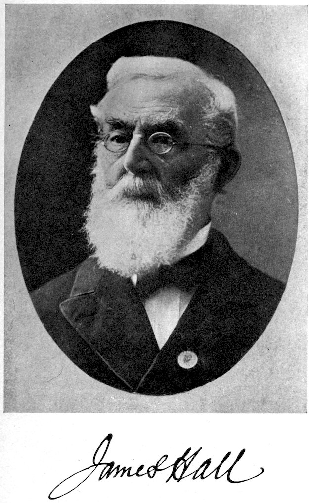
The New York System.—We now come to the epochal survey of the State of New York, one that established the principles of, and put order into, American stratigraphy from the Upper Cambrian to the top of the Devonian. No better area could have been selected for the establishing of this sequence. This survey also developed a stratigraphic nomenclature based on New York localities and rock exposures, and made full use of the entombed fossils in correlation. Incidentally it developed and brought into prominence James Hall, who continued the stratigraphic work so well begun and who also laid the foundation for paleontology in America, becoming its leading invertebrate worker.
This work is reviewed at great length in the Journal in the volumes for 1844–1847 by D. D. Owen. Evidently it followed too new a plan to receive fulsome praise from conservative Owen, as it should have. He remarks that the volumes “are not a little prolix, are voluminous and 86expensive, and do not give as clear and connected a view of the geological features of the state as could be wished.... We are of the opinion that before this work can become generally useful and extensively circulated, it must be condensed and arranged into one compendious volume” (46, 144, 1844). This was never done and yet the work was everywhere accepted at once, and to this end undoubtedly Owen’s detailed review helped much.
The Natural History Survey of New York was organized in 1836 and completed in 1843. The state was divided into four districts, and to these were finally assigned the following experienced geologists. The southeastern part was named the First District, with W. W. Mather (1804–1859) as geologist; the northeastern quarter was the Second District, with Ebenezer Emmons (1799–1863) in charge; the central portion was the Third District, under Lardner Vanuxem (1792–1848); while the western part was James Hall’s (1811–1898) Fourth District. Paleontology for a time was in charge of T. A. Conrad (1830–1877); the mineralogical and chemical work was in the hands of Lewis C. Beck; the botanist was John Torrey; and the zoologist James DeKay.
The New York State Survey published six annual reports of 1675 pages octavo, and four final geological reports with 2079 pages quarto. Finally in 1846 Emmons added another volume on the soils and rocks of the state, in which he also discussed the Taconic and New York systems; it has 371 pages. With the completion of the first survey, Hall took up his life work under the auspices of the state—his monumental work, Paleontology of New York, in fifteen quarto volumes of 4539 pages and 1081 plates of fossils. In addition to all this, there are his annual and other reports to the Regents of the State, so that it is safe to say that he published not less than 10,000 pages of printed matter on the geology and paleontology of North America.
In regard to this great series of works, all that can be presented here is a table of formations as developed by the New York State Survey. Practically all of its results and formation names have come into general use, with the exception of the Taconic system of Emmons and the division terms of the New York system. (See p. 88.)
87The New York State Survey, begun in 1836, was continued by James Hall from 1843 to 1898. During this time he was also state geologist of Iowa (1855–1858) and Michigan (1862). Since 1898, John M. Clarke has ably continued the Geological Survey of New York, the state which continues to be, in science and more especially in geology and paleontology, the foremost in America.
Western Extension of the New York system.—Before Hall finished his final report, we find him in 1841 on “a tour of exploration through the states of Ohio, Indiana, Illinois, a part of Michigan, Kentucky, and Missouri, and the territories of Iowa and Wisconsin.” This tour is described in the Journal (42, 51, 1842) under the caption “Notes upon the Geology of the Western States.” His object was to ascertain how far the New York system as the standard of reference “was applicable in the western extension of the series.” In a general way he was very successful in extending the system to the Mississippi River, and he clearly saw “a great diminution, first of sandy matter, and next of shale, as we go westward, and in the whole, a great increase of calcareous matter in the same direction.” He also clearly noted the warped nature of the strata, the “anticlinal axis,” since known as the Cincinnati and Wabash uplifts and the Ozark dome.
Hall, however, fell into a number of flagrant errors because of a too great reliance on lithologic correlation and supposedly similar sequence. For instance, the Coal Measures of Pennsylvania were said to directly overlap the Chemung group of southern New York, and now he finds the same condition in Ohio, Indiana, and Illinois, failing to see that in most places between the top of the New York system and the Coal Measures lay the extensive Mississippian series, one that he generally confounded with the Chemung, or included in the “Carboniferous group.” He states that the Portage of New York is the same as the Waverly of Ohio, and at Louisville the Middle Devonian waterlime is correlated with the similar rock of the New York Silurian. Hall was especially desirous of fixing the horizon of the Middle Ordovician lead-bearing rocks of Illinois, Wisconsin, and Iowa, but unfortunately correlated them with the Niagaran, while the Middle Devonian about Columbus, Ohio, and Louisville, Kentucky, he referred to the same horizon. The Galena-Niagaran error was corrected in 1855, but the Devonian and Mississippian ones remained unadjusted for a long time, and in Iowa until toward the close of the nineteenth century.
88
The Geological Column of the New York Geologists of 1842–1843, according to W. W. Mather 1842.
Quaternary system Alluvial division.
Quaternary division.
Drift division.
Tertiary system These strata are included in the next lower division.
Upper Secondary system Long Island division. Equals the Tertiary and Cretaceous marls, sands, and clays of the coastal plain of New Jersey. New Red system of Emmons and Hall.
Trappean division. The Palisades
Red Sandstone division.
Coal system of Mather, and Carboniferous system of Hall.
Old Red system of Catskill Mountains of Emmons; Catskill division of Mather and Hall; and Catskill group of Vanuxem.
According to Hall 1843, and essentially Vanuxem 1842.
Erie division [Devonian] Chemung, Portage or Nunda (divided into Cashaqua, Gardeau, Portage), Genesee, Tully, Hamilton (divided into Ludlowville; Encrinal, Moscow), and Marcellus.
Helderberg series [Devonian-Silurian] Corniferous, Onondaga, Schoharie, Cauda-alli, Oriskany, Upper Pentamerus, Encrinal, Delthyris, Pentamerus, Waterlime, Onondaga salt group.
Ontario division [Silurian] Niagara, Clinton, and Medina.
Champlain division [Silurian-Ordovician-Upper Cambrian] Oneida or Shawangunk, Grey sandstone, Hudson River group, Utica, Trenton, Black River including Birdseye and Chazy, Calciferous sandrock, and Potsdam.
According to Emmons 1842, Mather 1843, Vanuxem 1842, Hall 1843.
Taconic System [Ordovician and Lower Cambrian] Granular quartz, Stockbridge limestone, Magnesian slate, and Taconic slate.
Primary or Hypogene system Metamorphic and Primary rocks.
89Correlations with Europe.—The first effort toward correlating the New York system with those of Europe was made by Conrad in his Notes on American Geology in 1839 (35, 243). Here he compares it on faunal grounds with the Silurian system. A more sustained effort was that of Hall in 1843 (45, 157), when he said that the Silurian of Murchison was equal to the New York system and embraced the Cambrian, Silurian, and Devonian, which he considered as forming but one system. Hall in 1844 and Conrad earlier were erroneously regarding the Middle Devonian of New York (Hamilton) as “an equivalent of the Ludlow rocks of Mr. Murchison” (47, 118, 1844).
In 1846 E. P. De Verneuil spent the summer in America with a view to correlating the formations of the New York system with those of Europe. At this time he had had a wide field experience in France, Germany, and Russia, was president of the Geological Society of France, and “virtually the representative of European geology” (2, 153, 1846). Hall says, “No other person could have presented so clear and perfect a coup d’oeil.” De Verneuil’s results were translated by Hall and with his own comments were published in the Journal in 1848 and 1849 under the title “On the Parallelism of the Paleozoic Deposits of North America with those of Europe.” De Verneuil was especially struck with the complete development of American Paleozoic deposits and said it was the best anywhere. On the other hand, he did not agree with the detailed arrangement of the formations in the various divisions of the New York system, and Hall admitted altogether too readily that the terms were proposed “as a matter of concession, and it is to be regretted that such an artificial classification was adopted.” De Verneuil’s correlations are as follows:
The Lower Silurian system begins with the Potsdam, the analogue of the Obolus sandstone of Russia and 90Sweden. The Black River and Trenton hold the position of the Orthoceras limestones of Sweden and Russia, while the Utica and Lorraine are represented by the Graptolite beds of the same countries. Both correlations are in partial error. He unites the Chazy, Birdseye, and Black River in one series, and in another the Trenton, Utica, and Lorraine. Of species common to Europe and America he makes out seventeen.
In the Upper Silurian system, the Oneida and Shawangunk are taken out of the Champlain division, and, with the Medina, are referred to the Silurian, along with all of the Ontario division plus the Lower Helderberg. The Clinton is regarded as highest Caradoc or as holding a stage between that and the Wenlock. The Niagara group is held to be the exact equivalent of the Wenlock, “while the five inferior groups of the Helderberg division represent the rocks of Ludlow.” We now know that these Helderberg formations are Lower Devonian in age. De Verneuil unites in one series the Waterlime, Pentamerus, Delthyris, Encrinal, and Upper Pentamerus. Of identical species there are forty common to Europe and America.
The Devonian system De Verneuil begins, “after much hesitation,” with the Oriskany and certainly with the five upper members of Hall’s Helderberg division, all of the Erie and the Old Red Sandstone. He also adjusts Hall’s error by placing in the Devonian the Upper Cliff limestone of Ohio and Indiana, regarded by the former as Silurian. The Oriskany is correlated with the grauwackes of the Rhine, and the Onondaga or Corniferous with the lower Eifelian. Cauda-galli, Schoharie, and Onondaga are united in one series; Marcellus, Hamilton, Tully, and Genesee in another; and Portage and Chemung in a third. Of species common to Europe and America there are thirty-nine.
The Waverly of Ohio and that near Louisville, Kentucky, which Hall had called Chemung, De Verneuil correctly refers to the Carboniferous, but to this Hall does not consent. De Verneuil points out that there are thirty-one species in common between Europe and America. “And as to plants, the immense quantity of terrestrial species identical on the two sides of the Atlantic, 91proves that the coal was formed in the neighborhood of lands already emerged, and placed in similar physical conditions.”
An analysis of the Paleozoic fossils of Europe and America leads De Verneuil to “the conviction that identical species have lived at the same epoch in America and in Europe, that they have had nearly the same duration, and that they succeeded each other in the same order.” This he states is independent of the depth of the seas, and of “the upheavings which have affected the surface of the globe.” The species of a period begin and drop out at different levels, and toward the top of a system the whole takes on the character of the next one. “If it happens that in the two countries a certain number of systems, characterized by the same fossils, are superimposed in the same order, whatever may be, otherwise, their thickness and the number of physical groups of which they are composed, it is philosophical to consider these systems as parallel and synchronous.”
Because of the dominance of the sandstones and shales in eastern New York, De Verneuil holds that a land lay to the east. The many fucoids and ripple-marks from the Potsdam to the Portage indicated to him shallow water and nearness to a shore.
The Oldest Geologic Eras.—We have seen in previous pages how the Primitive rocks of Arduino and of Werner had been resolved, at least in part, into the systems of the Paleozoic, but there still remained many areas of ancient rocks that could not be adjusted into the accepted scheme. One of the most extensive of these is in Canada, where the really Primitive formations, of granites, gneisses, schists, and even undetermined sediments, abound and are developed on a grander scale than elsewhere, covering more than two million square miles and overlain unconformably by the Paleozoic and later rocks. The first to call attention to them was J. I. Bigsby, a medical staff officer of the British Army, in 1821 (3, 254). It was, however, William E. Logan (1798–1875), the “father of Canadian geology,” who first unravelled their historical sequence. At first he also called them Primary, but after much work he perceived in them parallel structures and metamorphosed sediments, underlain 92by and associated with pink granites. For the oldest masses, essentially the granites, he proposed the term Laurentian system (1853, 1863) and for the altered and deformed strata, the name Huronian series (1857, 1863). Overlying these unconformably was a third series, the copper-bearing rocks. Since his day a great host of Canadian and American geologists have labored over this, the most intricate of all geology, and now we have the following tentative chronology (Schuchert and Barrell, 38, 1, 1914):
Late Proterozoic era.
Keweenawan, Animikian and Huronian periods.
Early Proterozoic era.
Sudburian period or older Huronian.
Archeozoic era.
Grenville series, etc.
Cosmic history.
The Taconic System Resurrected.
The Taconic system was first announced by Ebenezer Emmons in 1841, and clearly defined in 1842. It started the most bitter and most protracted discussion in the annals of American geology. After Emmons’s subsequent publications had put the Taconic system through three phases, Barrande of Bohemia in 1860–1863 shed a great deal of new and correct light upon it, affirming in a series of letters to Billings that the Taconic fossils are like those of his Primordial system, or what we now call the Middle Cambrian (31, 210, 1861, et seq.).
In a series of articles published by S. W. Ford in the Journal between 1871 and 1886, there was developed the further new fact that in Rensselaer and Columbia counties, New York, the so-called Hudson River group abounds in “Primordial” fossils wholly unlike those of the Potsdam, and which Ford later on spoke of as belonging to “Lower Potsdam” time.
James D. Dana entered the field of the Taconic area in 1871 and demonstrated that the system also abounds in Ordovician fossiliferous formations. Then came the far-reaching work of Charles D. Walcott, beginning in 1886, which showed that all through eastern New York and into northern Vermont the Hudson River group and 93the Taconic system abound not only in Ordovician but also in Cambrian fossils. Finally in 1888 Dana presented a Brief History of Taconic Ideas, and laid away the system with these words (36, 27):
“It is almost fifty years since the Taconic system made its abrupt entrance into geological science. Notwithstanding some good points, it has been through its greater errors, long a hindrance to progress here and abroad ... But, whether the evil or the good has predominated, we may now hope, while heartily honoring Professor Emmons for his earnest geological labors and his discoveries, that Taconic ideas may be allowed to be and remain part of the past.”
As an epitaph Dana placed over the remains of the Taconic system the black-faced numerals 1841–1888. That the remains of the system, however, and the term Taconic are still alive and demanding a rehearing is apparent to all interested stratigraphers. This is not the place to set the matter right, and all that can be done at the present time is to point out what are the things that still keep alive Emmons’s system.
In the typical area of the Taconic system, i. e., in Rensselaer County, Emmons in 1844–1846 produced the fossils Atops trilineatus and Elliptocephala asaphoides. S. W. Ford, as stated above, later produced from the same general area many other fossils that he demonstrated to be older than the Potsdam sandstone. To this time he gave the name of Lower Potsdam, thus proving on paleontological grounds that at least some part of the Taconic system is older than the New York system, and therefore older than the Hudson River group of Ordovician age.
In 1888 Walcott presented his conclusions in regard to the sequence of the strata in the typical Taconic area and to the north and south of it. He collected Lower Cambrian fossils at more than one hundred localities “within the typical Taconic area,” and said that the thickness of his “terrane No. 5” or “Cambrian (Georgia),” now referable to the Lower Cambrian, is “14,000 feet or more.” He demonstrated that the Lower Cambrian is infolded with the Lower and Middle Ordovician, and confirmed Emmons’s statement that the former rests upon his Primary or Pre-Cambrian masses. Elsewhere, he writes: “To the west of the Taconic range the section 94passes down through the limestone (3) [of Lower and Middle Ordovician age] to the hydromica schists (2) [whose age may also be of early Ordovician], and thence to the great development of slates and shales with their interbedded sparry limestones, calciferous and arenaceous strata, all of which contain more or less of the Olenellus ... fauna.” He then knew thirty-five species in Washington County, New York (35, 401, 1888).
Finally in 1915 Walcott said that in the Cordilleran area of America there was a movement that brought about changes “in the sedimentation and succession of the faunas which serve to draw a boundary line between the Lower and Middle Cambrian series.... The length of this period of interruption must have been considerable ... and when connection with the Pacific was resumed a new fauna that had been developing in the Pacific was then introduced into the Cordilleran sea and constituted the Middle Cambrian fauna. The change in the species from the Lower to the Middle Cambrian fauna is very great.” He then goes on to show that in the Appalachian geosyncline there was another movement that shut out the Middle Cambrian Paradoxides fauna of the Atlantic realm from this trough, and all deposition as well.
Conclusions.—Accordingly it appears that everywhere in America the Lower Cambrian formations are separated by a land interval of long duration from those of Middle Cambrian time. These formations therefore unite into a natural system of rocks or a period of time. Between Middle and Upper Cambrian time, however, there appears to be a complete transition in the Cordilleran trough, binding these two series of deposits into one natural or diastrophic system. Hence the writer proposes that the Lower Cambrian of America be known as the Taconic system. The Middle and Upper Cambrian series can be continued for the present under the term Cambrian system, a term, however, that is by no means in good standing for these formations, as will be demonstrated under the discussion of the Silurian controversy.
95
The Silurian Controversy.
Just as in America the base of the Paleozoic was involved in a protracted controversy, so in England the Cambrian-Silurian succession was a subject of long debate between Sedgwick and Murchison, and among the succeeding geologists of Europe. The history of the solution is so well and justly stated in the Journal by James D. Dana under the title “Sedgwick and Murchison: Cambrian and Silurian” (39, 167, 1890), and by Sir Archibald Geikie in his Text-book of Geology, 1903, that all that is here required is to briefly restate it and to bring the solution up to date.
Adam Sedgwick (1785–1873) and R. I. Murchison (1792–1871) each began to work in the areas of Cambria (Wales) and Siluria (England) in 1831, but the terms Cambrian and Silurian were not published until 1835. Murchison was the first to satisfactorily work out the sequence of the Silurian system because of the simpler structural and more fossiliferous condition of his area. Sedgwick, on the other hand, had his academic duties to perform at Cambridge University, and being an older and more conservative man, delayed publishing his final results, because of the further fact that his area was far more deformed and less fossiliferous. In 1834 they were working in concert in the Silurian area, and Sedgwick said: “I was so struck by the clearness of the natural sections and the perfection of his workmanship that I received, I might say, with implicit faith everything which he then taught me.... The whole ‘Silurian system’ was by its author placed above the great undulating slate-rocks of South Wales.” At that time Murchison told Sedgwick that the Bala group of the latter, now known to be in the middle of the Lower Silurian, could not be brought within the limits of the Silurian system, and added, “I believe it to plunge under the true Llandeilo-flags,” now placed next below the Bala and above the Arenig, which at the present is regarded as at the base of the Ordovician.
The Silurian system was defined in print by Murchison in July, 1835, the Upper Silurian embracing the Ludlow and Wenlock, while the Lower Silurian was based on the 96Caradoc and Llandeilo. Murchison’s monumental work, The Silurian System, of 100 pages and many plates of fossils, appeared in 1838.
The Cambrian system was described for the first time by Sedgwick in August, 1835, but the completed work—a classic in geology—Synopsis of the Classification of the British Palæozoic Rocks, along with M’Coy’s Descriptions of British Palæozoic Fossils, did not appear until 1852–1855. Sedgwick’s original Upper Cambrian included the greater part of the chain of the Berwyns, where he said it was connected with the Llandeilo flags of the Silurian. The Middle Cambrian comprised the higher mountains of Cærnarvonshire and Merionethshire, and the Lower Cambrian was said to occupy the southwest coast of Cærnarvonshire, and to consist of chlorite and mica schists, and some serpentine and granular limestone. In 1853 it was seen that the fossiliferous Upper Cambrian included the Arenig, Llandeilo, Bala, Caradoc, Coniston, Hirnant, and Lower Llandovery. On the other hand, it was not until long after Murchison and Sedgwick passed away that the Middle and Lower Cambrian were shown to have fossils, but few of those that characterize what is now called Lower, Middle, and Upper Cambrian time.
Not until long after the original announcement of the Cambrian system did Sedgwick become aware “of the unfortunate mischief-involving fact” that the most fossiliferous portion of the Cambrian—the Upper Cambrian—and at that time the only part yielding determinable fossils, when compared with the Lower Silurian was seen to be an equivalent formation but with very different lithologic conditions. He began to see in 1842 that his Cambrian was in conflict with the Silurian system, and four years later there were serious divergencies of views between himself and Murchison. The climax of the controversy was attained in 1852, when Sedgwick was extending his Cambrian system upwards to include the Bala, Llandeilo, and Caradoc, a proceeding not unlike that of Murchison, who earlier had been extending his Silurian downward through all of the fossiliferous Cambrian to the base of the Lingula flags.
Dana in his review of the Silurian-Cambrian controversy states: “The claim of a worker to affix a name to a 97series of rocks first studied and defined by him cannot be disputed.” We have seen that Murchison had priority of publication in his term Silurian over Sedgwick’s Cambrian, but that in a complete presentation, both stratigraphically and faunally, the former had years of prior definition. What has even more weight is that geologists nearly everywhere had accepted Murchison’s Silurian system as founded upon the Lower and Upper Silurian formations. A nomenclature once widely accepted is almost impossible to dislodge. However, in regard to the controversy it should not be forgotten that it was only Murchison’s Lower Silurian that was in conflict with Sedgwick’s Upper Cambrian. As for the rest of the Cambrian, that was not involved in the controversy.
Dana goes on to state that science may accept a name, or not, according as it is, or is not, needed. In the progress of geology, he thought that the time had finally been reached when the name Cambrian was a necessity, and he included both Cambrian and Silurian in the geological record. The “Silurian,” however, included the Lower and Upper Silurian—not one system of rocks, but two.
It is now twenty-seven years since Dana came to this conclusion, at a time when it was believed that there was more or less continuous deposition not only between the formations of a system but between the systems themselves as well. To-day many geologists hold that in the course of time the oceans pulsate back and forth over the continents, and accordingly that the sequence of marine sedimentation in most places must be much broken, and to-day we know that the breaks or land intervals in the marine record are most marked between the eras, and shorter between all or at least most of the periods. Furthermore, in North America, we have learned that the breaks between the systems are most marked in the interior of the continent and less so on or toward its margins.
Hardly any one now questions the fact of a long land interval between the Lower Silurian and Upper Silurian in England, and it is to Sedgwick’s credit that he was the first to point out this fact and also the presence of an unconformity. It therefore follows that we cannot continue to use Silurian system in the sense proposed by 98Murchison, since it includes two distinct systems or periods. Dana, in the last edition of his Manual of Geology (1895), also recognizes two systems, but curiously he saw nothing incongruous in calling them “Lower Silurian era” and “Upper Silurian era.” It certainly is not conducive to clear thinking, however, to refer to two systems by the one name of Silurian and to speak of them individually as Lower and Upper Silurian, thus giving the impression that the two systems are but parts of one—the Silurian. Each one of the parts has its independent faunal and physical characters.
We must digress a little here and note the work of Joachim Barrande (1799–1883) in Bohemia. In 1846 he published a short account of the “Silurian system” of Bohemia, dividing it into étages lettered C to H. Between 1852 and 1883 he issued his “Système Silurien du Centre de la Bohème,” in eighteen quarto volumes with 5568 pages of text and 798 plates of fossils—a monumental work unrivalled in paleontology. In the first volume the geology of Bohemia is set forth, and here we see that étages A and B are Azoic or pre-Cambrian, and C to H make up his Silurian system. Etage C has his “Primordial fauna,” now known to be of Paradoxides or Middle Cambrian time, while D is Lower Silurian, E is Upper Silurian, F is Lower Devonian, and G and H are Middle Devonian. From this it appears that Barrande’s Silurian system is far more extensive than that of Murchison, embracing twice as many periods as that of England and Wales.
About 1879 there was in England a nearly general agreement that Cambrian should embrace Barrande’s Primordial or Paradoxides faunas, and in the North Wales area be continued up to the top of the Tremadoc slates. To-day we would include Middle and Upper Cambrian. Lower Cambrian in the sense of containing the Olenellus faunas was then unknown in Great Britain.
Lapworth, recognizing the distinctness of the Lower Silurian as a system, proposed in 1879 to recognize it as such, and named it Ordovician, restricting Silurian to Murchison’s Upper Silurian. This term has not been widely used either in Great Britain or on the Continent, but in the last twenty years has been accepted more and 99more widely in America. Even here, however, it is in direct conflict with the term Champlain, proposed by the New York State Geologist in 1842.
In 1897 the International Geological Congress published E. Renevier’s Chronographie Géologique, wherein we find the following:
Silurian Period. Upper or Silurian (Murchison, restricted, 1835). Ludlowian (Murchison 1839).
Wenlockian (Murchison 1839).
Landoverian (Murchison).
Middle or Ordovician (Lapworth 1879). Caradocian (Murchison 1839).
Landeilian (Murchison 1839).
Arenigian (Sedgwick 1847).
Lower or Cambrian (Sedgwick, restricted, 1835). Potsdamian (Emmons 1838).
Menevian (Salter and Hicks 1865).
Georgian (Hitchcock 1861).
Regarding this period, which, by the way, is not very unlike that of Barrande, Renevier remarks that it is “as important as the Cretaceous or the Jurassic. Lapworth even gives it a value of the first order equal to the Protozoic era.”
In the above there is an obvious objection in the double usage of the term Silurian, and this difficulty was met later on in Lapparent’s Traité by the proposal to substitute Gothlandian for Silurian. Of this change Geikie remarks: “Such an arrangement ... might be adopted if it did not involve so serious an alteration of the nomenclature in general use.” On the other hand, if diastrophism and breaks in the stratigraphic and faunal sequence are to be the basis for geologic time divisions, we cannot accept the above scheme, for it recognizes but one period where there are at least four in nature.
Conclusions.—We have arrived at a time when our knowledge of the stratigraphic and faunal sequence, plus the orogenic record as recognized in the principle of diastrophism, should be reflected in the terminology of the geologic time-table. It would be easy to offer a satisfactory nomenclature if we were not bound by the law of priority in publication, and if no one had the geologic chronology of his own time ingrained in his memory. In addition, the endless literature, with its accepted nomenclature, bars our way. Therefore with a view of 100creating the least change in geologic nomenclature, and of doing the greatest justice to our predecessors that the present conditions of our knowledge will allow, the following scheme is offered:
Silurian period. Llandovery to top of Ludlow in Europe. Alexandrian-Cataract-Medina to top of Manlius in America.
Champlain (1842) or Ordovician (1879) period. Arenig to top of Caradoc in Europe. Beekmantown to top of Richmondian in America.
Cambrian period. In the Atlantic realm, begins with the Paradoxides, and in the Pacific, with the Bathyuriscus and Ogygopsis faunas. The close is involved in Ulrich’s provisionally defined Ozarkian system. When the latter is established, the Ozarkian period will hold the time between the Ordovician and the Cambrian.
Taconic period. For the world-wide Olenellus or Mesonacidæ faunas.
Paleogeography.
When geologists began to perceive the vast significance of Hutton’s doctrine that “the ruins of an earlier world lie beneath the secondary strata,” and that great masses of bedded rocks are separated from one another by periods of mountain making and by erosion intervals, it was natural for them to look for the lands that had furnished the debris of the accumulated sediments. In this way paleogeography had its origin, but it was at first of a descriptive and not of a cartographic nature.
The word paleogeography was proposed by T. Sterry Hunt in 1872 in a paper entitled “The Paleogeography of the North American Continent,” and published in the Journal of the American Geographical Society for that year. It has to do, he says, with the “geographical history of these ancient geological periods.” It was again prominently used by Robert Etheridge in his presidential address before the Geological Society of London in 1881. Since Canu’s use of the term in 1896, it has been frequently seen in print, and now is generally adopted to signify the geography of geologic time.
The French were the first to make paleogeographic maps, and Jules Marcou relates in 1866 that Elie de Beaumont, as early as March, 1831, in his course in the College of France and at the Paris School of Mines, used 101to outline the relation of the lands and the seas in the center of Europe at the different great geologic periods. His first printed paleogeographic map appeared in 1833, and was of early Tertiary time. Other maps by Beaumont were published by Beudant in 1841–1842. The Sicilian geologist Gemmellaro published six maps of his country in 1834, and the Englishman De La Beche had one in the same year. In America the first to show such maps was Arnold Guyot in his Lowell lectures of 1848. James D. Dana published three in the 1863 edition of his Manual of Geology. Of world paleogeographic maps, Jules Marcou produced the first of Jurassic time, publishing it in France in 1866, but the most celebrated of these early attempts was the one by Neumayr published in 1883 in connection with his Ueber klimatische Zonen während der Jura- und Kreidezeit.
The first geologist to produce a series of maps showing the progressive geologic geography of a given area was Jukes-Brown, who in the volume entitled “The Building of the British Isles,” 1888, included fifteen such maps. Karpinsky published fourteen maps of Russia, and in 1896 Canu in his Essai de paléogéographie has fifty-seven of France and Belgium. Lapparent’s Traité of 1906 is famous for paleogeographic maps, for he has twenty-three of the world, thirty-four of Europe, twenty-five of France, and ten taken from other authors. Schuchert in 1910 published fifty-two to illustrate the paleogeography of North America, and also gave an extended list of such published maps. Another article on the subject is by Th. Arldt, “Zur Geschichte der Paläogeographischen Rekonstructionen,” published in 1914. Edgar Dacqué in 1913 also produced a list in his Paläogeographischen Karten, and two years later appeared his book of 500 pages, Grundlagen und Methoden der Paläogeographie, where the entire subject is taken up in detail.
Conclusions.—Since 1833 there have been published not less than 500 different paleogeographic maps, and of this number about 210 relate to North America. Nevertheless paleogeography is still in its infancy, and most maps embrace too much geologic time, all of them tens of thousands, and some of them millions of years. The geographic maps of the present show the conditions of 102the strand-lines of to-day, and those made fifty years ago have to be revised again and again if they are to be of value to the mariner and merchant. Therefore in our future paleogeographic maps the tendency must ever be toward smaller amounts of geologic time, if we are to show the actual relation of water to land and the movements of the periodic floodings. Moreover, the ancient shore lines are all more or less hypothetic and are drawn in straight or sweeping curves, unlike modern strands with their bays, deltas, and headlands, and the ancient lands are featureless plains. We must also pay more attention to the distribution of brackish- and fresh-water deposits. The periodically rising mountains will be the first topographic features to be shown upon the ancient lands, and then more and more of the drainage and the general climatic conditions must be portrayed. In the seas, depth, temperature, and currents are yet to be deciphered. Finally, other base maps than those of the geography of to-day will have to be made, allowing for the compression of the mountainous areas, if we are to show the true geographic configurations of the lands and seas of any given geologic time.
Paleometeorology.
In accordance with the Laplacian theory, announced at the beginning of the nineteenth century, all of the older geologists held that the earth began as a hot star, and that in the course of time it slowly cooled and finally attained its present zonal cold to tropical climatic conditions. That the earth had very recently passed through a much colder climate, a glacial one, came into general acceptance only during the latter half of the previous century.
Rise.—Our knowledge of glacial climates had its origin in the Alps, that wonderland of mountains and glaciers. The rise of this knowledge in the Alps is told in a charming and detailed manner by that erratic French-American geologist, Jules Marcou (1824–1898), in his Life, Letters, and Works of Louis Agassiz, 1896. He relates that the Alpine chamois hunter Perraudin in 1815 directed the attention of the engineer De Charpentier to the fact “that the large boulders perched on the sides of 103the Alpine valleys were carried and left there by glaciers.” For a long time the latter thought the conclusion extravagant, and in the meantime Perraudin told the same thing to another engineer, Venetz. He, in 1829, convinced of the correctness of the chamois hunter’s views, presented the matter before the Swiss naturalists then meeting at St. Bernard’s. Venetz “told the Society that his observations led him to believe that the whole Valais has been formerly covered by an immense glacier and that it even extended outside of the canton, covering all the Canton de Vaud, as far as the Jura Mountains, carrying the boulders and erratic materials, which are now scattered all over the large Swiss valley.” Eight years earlier, in 1821, similar views had been presented by the same modest naturalist before the Helvetic Society, but it was not until 1833 that De Charpentier found the manuscript and had it published. Venetz’s conclusions were that all of the glaciers of the Bagnes valley “have very recognizable moraines, which are about a league from the present ice.” “The moraines ... date from an epoch which is lost in the night of time.” Then in 1834 De Charpentier read a paper before the same society, meeting at Lucerne. “Seldom, if ever, has such a small memoir so deeply excited the scientific world. It was received at first with incredulity and even scorn and mockery, Agassiz being among its opponents.” The paper was published in 1835, first at Paris, then at Geneva, and finally in Germany. It “attracted much attention, and the smile of incredulity with which it was received when read at Lucerne soon changed into a desire to know more about it.”
Louis Agassiz (1807–1873), who had long been acquainted with his countryman, De Charpentier, spent several months with him in 1836, and together they studied the glaciers of the Alps. Agassiz was at first “adverse to the hypothesis, and did not believe in the great extension of glaciers and their transportation of boulders, but on the contrary, was a partisan of Lyell’s theory of transport by icebergs and ice-cakes ... but from being an adversary of the glacial theory, he returned to Neuchâtel an enthusiastic convert to the views of Venetz and De Charpentier.... With his 104power of quick perception, his unmatched memory, his perspicacity and acuteness, his way of classifying, judging and marshalling facts, Agassiz promptly learned the whole mass of irresistible arguments collected patiently during seven years by De Charpentier and Venetz, and with his insatiable appetite and that faculty of assimilation which he possessed in such a wonderful degree, he digested the whole doctrine of the glaciers in a few weeks.”
In July, 1837, Agassiz presented as his presidential address before the Helvetic Society his memorable “Discours de Neuchâtel,” which was “the starting point of all that has been written on the Ice-age,”—a term coined at the time by his friend Schimper, a botanist. The first part of this address is reprinted in French in Marcou’s book on Agassiz. The address was received with astonishment, much incredulity, and indifference. Among the listeners was the great German geologist Von Buch, who “was horrified, and with his hands raised towards the sky, and his head bowed to the distant Bernese Alps, exclaimed: ‘O Sancte de Saussure, ora pro nobis!’” Even De Charpentier “was not gratified to see his glacial theory mixed with rather uncalled for biological problems, the connection of which with the glacial age was more than problematic.” Agassiz was then a Cuvierian catastrophist and creationist, and advanced the idea of a series of glacial ages to explain the destruction of the geologic succession of faunas! Curiously, this theory was at once accepted by the American paleontologist T. A. Conrad (35, 239, 1839).
The classics in glacial geology are Agassiz’s Etudes sur les Glaciers, 1840, and De Charpentier’s Essai sur les Glaciers, 1841. Of the latter book, Marcou states that it has been said: “It is impossible to be truly a geologist without having read and studied it.” In the English language there is Tyndall’s Glaciers of the Alps, 1860.
The progress of the ideas in regard to Pleistocene glaciation is presented in the following chapter by H. E. Gregory.
Older Glacial Climates.—Hardly had the Pleistocene glacial climate been proved, when geologists began to point out the possibility of even earlier ones. An enthusiastic 105Scotch writer, Sir Andrew Ramsay, in 1855 described certain late Paleozoic conglomerates of middle England, which he said were of glacial origin, but his evidence, though never completely gainsaid, has not been generally accepted. In the following year, an Englishman, Doctor W. T. Blanford, said that the Talchir conglomerates of central and southern India were of glacial origin, and since then the evidence for a Permian glacial climate has been steadily accumulating. Africa is the land of tillites, and here in 1870 Sutherland pointed out that the conglomerates of the Karroo formation were of glacial origin. Australia also has Permian glacial deposits, and they are known widely in eastern Brazil, the Falkland Islands, the vicinity of Boston, and elsewhere. So convincing is this testimony that all geologists are now ready to accept the conclusion that a glacial climate was as wide-spread in early Permian time as was that of the Pleistocene.[3]
In South Africa, beneath the marine Lower Devonian, occurs the Table Mountain series, 5000 feet thick. The series is essentially one of quartzites, with zones of shales or slates and with striated pebbles up to 15 inches long. The latter occur in pockets and seem to be of glacial origin. There are here no typical tillites, and no striated undergrounds have so far been found. While the evidence of the deposits appears to favor the conclusion that the Table Mountain strata were laid down in cold waters with floating ice derived from glaciers, it is as yet impossible to assign these sediments a definite geologic age. They are certainly not younger than the Lower Devonian, but it has not yet been established to what period of the early Paleozoic they belong.