Part II.—The Isles and the Folk.
Reading edition
A SURVEY OF THE ISLANDS.
On Wideford Hill.
There is no better view-point from which to make a general survey of the Orcadian Archipelago than Wideford Hill. It is less than half the height of the Ward Hill of Hoy, but it is at once more central and more easily accessible. The Ward Hill of Orphir exceeds it in height by nearly one hundred and fifty feet, and affords a much finer view to the westward; but Wideford Hill is more isolated from other hills, and from its summit we can obtain a better general outlook over the islands.
Wideford Hill rises to a height of seven hundred and forty feet, and, standing within two miles of Kirkwall, it may be easily approached either from the main Stromness road over the Ayre, or from the old road above the site of the Lammas market. If we choose the right kind of day, when a cool northerly breeze gives us a horizon free from haze, and when thin gray clouds veil the sun only at intervals, we shall see from Wideford a panorama which surpasses in loveliness and in human interest that seen from many a mountain top.
The charm of Orkney scenery lies in its colour rather than its form, in its luminous distances rather than its immediate foreground, in its restfulness rather than its grandeur. The landscape does not overwhelm the beholder with a sense of his puny insignificance, as great mountains are apt to do; it wins his love by suggestions of peace and of home.
But let us look around and note what we see. Far to the southward lies the silvery streak of the Pentland Firth, very innocent now in its summer calm. Beyond it stretch the low shores of Caithness; and in the blue distance we see Morven and the mountains of Sutherland, the “southern land” of the Norsemen. Nearer is the green expanse of South Ronaldsay, much foreshortened to the view, with the lighthouse towers of the Pentland Skerries showing beyond, and the island of Burray at its nearer end. To the right, over Scapa Flow, rises the long brown ridge of Hoy, separated by streaks of shimmering sea from Flotta, Fara, Cava, and its other neighbours. Very stern and solemn look its heath-clad heights as the passing shadows fall across them.
The whole of the East Mainland lies at our feet—Deerness, bright and sunny, with the Moul Head stretching boldly out to sea; nearer is St. Andrews, and Holm, half hidden by the ridge of high ground in the north of that parish; and, nearer still, St. Ola, deeply cut into by the Bays of Kirkwall and Scapa, which look as if they only awaited the next spring tide to join hands across the narrow isthmus, the Peerie Sea lying ready to do its part.
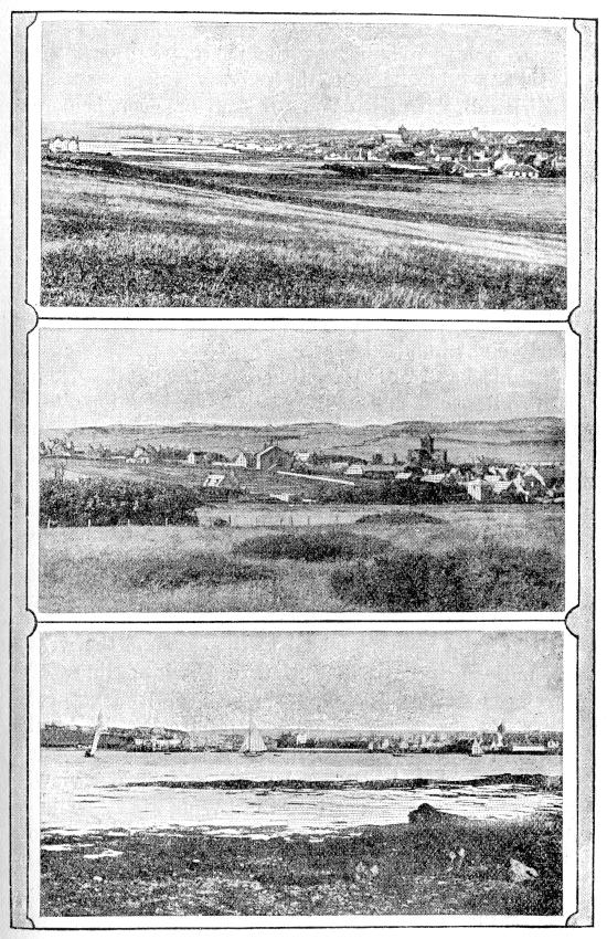
Round about Kirkwall.
Kirkwall, the “Kirk Voe” of the Norsemen, is more worthy of its name to-day than when the little church of St. Olaf was the chief object in the landscape. Approach it how we may, the great Cathedral of St. Magnus arrests our attention. Seen from Wideford Hill the tower does not break the skyline, as it does from the sea; yet the mass of sombre reddish masonry asserts itself, and dominates the pearl-gray cluster of walls and roofs that spreads around, as it has done for nearly eight hundred years.
“Tame” and “uninteresting” are the words often used to describe the appearance of our island capital. It does not seem so to-day. As the eye sweeps down over the purple shoulder of the hill to the green fields below, and passes over the silver gleam of the water with broken reflections of tower and gable beyond, it rests upon a picture filled with many charms of line, mass, and colour, from which the deep cool green of tree and shrub is not wholly wanting. Open to the north and the south by the “Viking path” of the sea, and joined to the east and the west by more modern paths, the thin white lines of curving roadway, Kirkwall shows itself the natural focus of our island commerce and social life, and the centre of a wide and fair landscape.
Northward and westward next we turn our view. Kirkwall Bay opens out into the “Wide Fiord,” which doubtless gave our hill its name, and westward into the “Aurrida Fiord,” or Sea-trout Firth, which first gave its name to the parish of Firth, and then received in exchange its present name, the Bay of Firth. Its shores are low and well cultivated, but to the north rises the dark brown ridge formed by the hills of Firth and of Rendall, which hide from our view most of the parish of Evie and parts of Harray and Birsay.
To the left of this ridge, through the central valley of Firth and Stenness, a charming vista opens out. A rich and fertile sweep of low ground forms the basin of the great lochs, and on the long peninsula between them we can distinguish the Standing Stones rising as needle points against the blue expanse of the Loch of Stenness. The green mound of Maeshowe, too, is clearly visible. Far away, over the cultivated slopes of Sandwick, we see the soft shimmer of the Atlantic, and to the northward the undulating skyline of the Birsay Hills.
Due west from where we stand the view is shut in by the long ridge of the Keelylang Hills and the bold outline of the Ward Hill of Orphir, and the fairest part of the West Mainland, Stromness, with its bays and islets, is beyond our ken. To enjoy a view of these we must take our stand upon the Ward Hill itself, but this will come into the programme of another day.
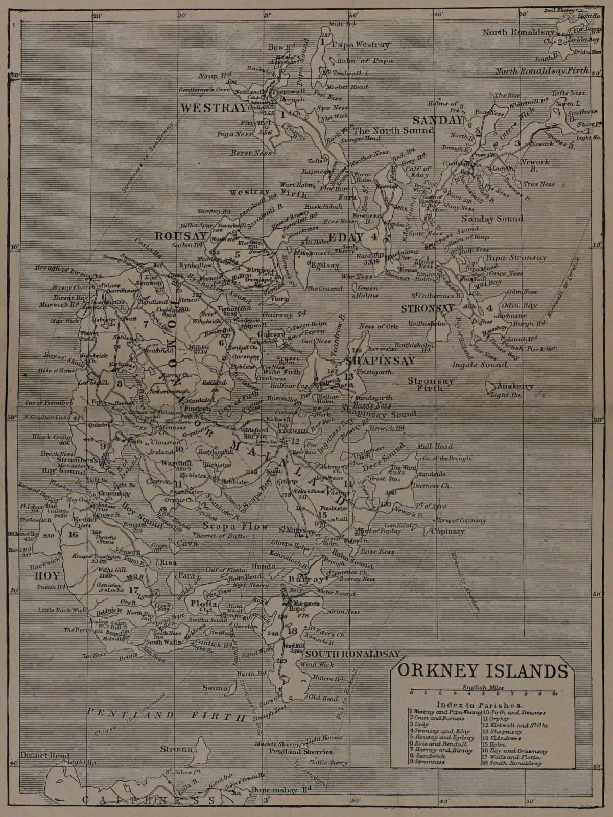
Of the island-studded sea to the north and east we have not yet spoken. We can hardly disentangle the maze of sounds and bays, of holms and promontories, except by the aid of a map, and if we are wise we shall have one in our pocket. With this before us the maze becomes clear. The bold hills of Rousay stand clear of the Mainland to the north, with the lower islands of Gairsay, Wyre or Veira, and Egilsay near at hand. Westray is all but hidden, but the blue ridge of Eday stands boldly forth, shutting out from view the greater portion of Sanday and North Ronaldsay. The tall lighthouse pillar on the Start, however, is clearly seen.
Close to Kirkwall Bay, and protecting it from the eastern sea, lies the fertile island of Shapinsay, with Balfour Castle standing in clear view among its gardens. Beyond we see the bold outline of Stronsay, and to the south of it Auskerry and its lighthouse.
Now we let our eye rest on the horizon, a sharp and clear line where we can trace the smoke of trawlers and other craft which are themselves hidden by the great curve of the ocean plain. There, right over Balfour Castle, something catches our eye. It might be the smoke of a passing steamer, but it does not change its form as we look; it stands clear and sharp, a tiny blue pyramid showing over the horizon. There is only one thing it can be—the Fair Isle, distant some sixty miles from where we stand! Only on rare occasions is this lonely sea-girt rock so free from cloud and mist that its top is thus to be distinguished. Yet if we know where to look for it, we may occasionally see it as we do to-day; and it is useful to remember that from Wideford Hill its bearing is directly over Balfour Castle.
Among the North Isles.
A glance at the map of Orkney will show that most of the important islands lie north of the Mainland. The term “North Isles,” however, is generally used to mean only the more distant of these—Stronsay, Eday, Sanday, North Ronaldsay, and Westray, with the smaller islands adjacent to them. These can be visited by steamer from Kirkwall in one day, with the exception of North Ronaldsay; and at the same time a good view can be obtained of the nearer islands—Shapinsay and Rousay, with the smaller group of Egilsay, Wyre, and Gairsay. North Ronaldsay may also be seen on the far north-eastern horizon.
Leaving Kirkwall pier in the early morning, we sail northwards out of the bay, when the String opens on our right, and Shapinsay is close at hand. There, sheltered by Helliar Holm, we notice the bay of Ellwick, where, in 1263, King Haco moored his hundred ships when on that ill-starred expedition which ended at Largs. West of the bay stands Balfour Castle, the finest specimen of modern domestic architecture in the islands, surrounded by its noted gardens.
The sea to the west of Shapinsay is dotted with shoals and skerries; but as we pass Gairsay on the left and sail round Galt Ness, the north-western point of Shapinsay, we find open water before us, and steer north-east towards Eday, passing the Green Holms on our way.
Eday, the first island at which we call, is hilly and heath-clad, with abundance of peat. Ever since the days of Torf Einar, no doubt, it has yielded a supply of peat for such unprovided islands as Sanday, up to modern times when coal has come into more general use. Even yet the peat industry is considerable, and Eday peats have been recently seen in use for drying malt in a distillery near Edinburgh. The most interesting part of Eday, however, is the north end of the island, where our steamer will call later in the day.
ORKNEY ISLANDS
From Eday we cross to Stronsay, keeping to the north of that island, and then turning southwards to the village of Whitehall in Papa Sound, protected on the north-east by the small island of Papa Stronsay. This sheltered roadstead so near the open eastern sea has long been an important centre of the herring fishery. About the middle of last century as many as four hundred Orkney boats and many from the Scottish mainland found anchorage in Papa Sound. In modern times Stronsay has again risen in importance as a fishing station.
Stronsay is one of the best agricultural districts in Orkney, and is noted for the size and the excellence of its farms. Near Lamb Head, in the extreme south-east of Stronsay, are the remains of a very extensive pier, erected before the time of the Norsemen.
Leaving Whitehall pier, we next sail due north across Sanday Sound to Kettletoft Bay in Sanday. This bay and that of Otterswick in the north afford safe anchorage; but the low, flat island, with its numerous projecting points and skerries, presents many dangers to navigation. As early as 1529 a lighthouse was erected on the extreme eastern point of the island, and was called the Star, from which, it is said, the headland derived its name, Start Point. Long after that time, however, the island was noted for the number of shipwrecks which occurred on its shores.
Sanday is emphatically the “Sand Island.” Its soil is sandy and generally fertile, and its surface is low and flat. Only in the south-west is there any rising ground, where the highest point in the island reaches a height of a little over two hundred feet.
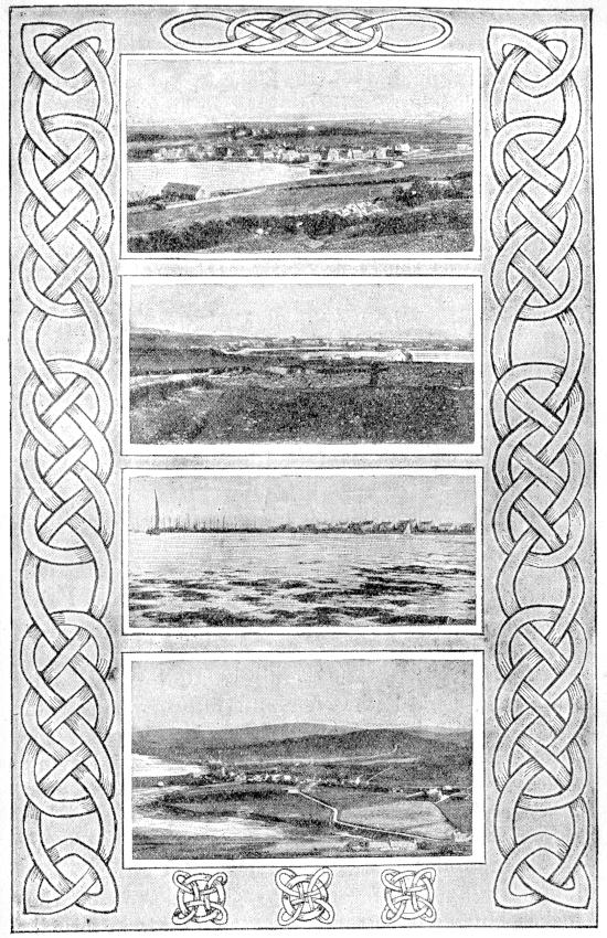
Orkney Villages.—I.
1. St. Margaret’s Hope, South Ronaldsay. 2. Pierowall, Westray. 3. Whitehall, Stronsay. 4. Finstown, Firth.
From Kettletoft pier our course is now south-west, until we double Spur Ness, the most southerly point of Sanday; then turning northwards, we make for Calf Sound, at the north end of Eday. This sheltered channel, between Eday and the Calf of Eday, is memorable as the scene of the capture of the pirate Gow in 1725.
Gow, or Smith, was a native of Stromness, where “Gow’s Garden,” a name given to a patch of ground on the east side of the harbour, afterwards occupied by a shipbuilding yard, seems to mark the site of his father’s house. The name Gow, however, which is the Gaelic equivalent of Smith, indicates a Scottish rather than an Orcadian descent. In 1724 Gow was sailing as second mate on board the George, an English vessel of two hundred tons, mounting eighteen guns, and trading on the Barbary coast. He and several others of the crew mutinied, murdered the captain, and started on what proved to be a very brief career of piracy.
After a few months’ cruising, Gow carried his ship, now named the Revenge, into Stromness to refit; but as he soon made the place too hot for safety, he put to sea in February 1725. Having sailed north round Westray, he turned south towards Eday, and in beating through Calf Sound ran his ship aground on the Calf, opposite Carrick House, then occupied by Mr. James Fea of Clestran. To him Gow applied for help to get his ship off the rocks; but the opportunity was too good to be missed, and Fea by various stratagems succeeded in making prisoners of Gow and his crew. They were handed over to the authorities, and afterwards suffered the penalty of their crimes in London.
Nearly a century later, in 1814, Sir Walter Scott made his memorable visit to Orkney and Shetland, and the legends which he collected regarding Gow formed a centre round which he wove his well-known story, “The Pirate.”
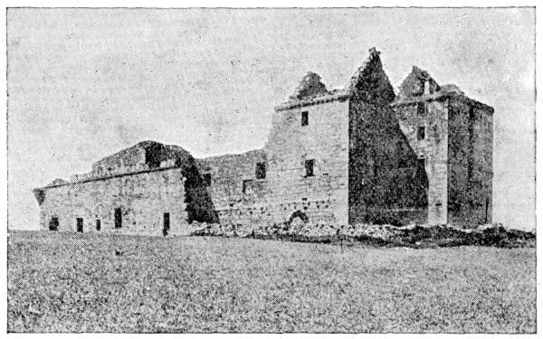
Noltland Castle.
Carrick was at one time the site of a thriving manufacture of salt, but that too is now a tale of the past.
On leaving Carrick our steamer passes out of Calf Sound between the Red Head on the west and the Grey Head on the east, so named from the colour of their sandstone cliffs. The stone of the former has been much in favour for building purposes, as St. Magnus Cathedral can testify, and has on occasion found its way as far south as London.
A north-westerly course now brings us to Pierowall in Westray, our last port of call. The long, low island guarding it on the north-east, fertile and well cultivated, is Papa Westray. Towards its south end is a small lake, on a holm in which are the ruins of a chapel dedicated to St. Tredwall, a place of great sanctity in former days, and a special shrine for such pilgrims as suffered from sore eyes. Long after the Reformation, indeed, we are told that the minister of the island had much difficulty in preventing his flock from resorting thither to pay their devotions to the saint before assembling in the church.
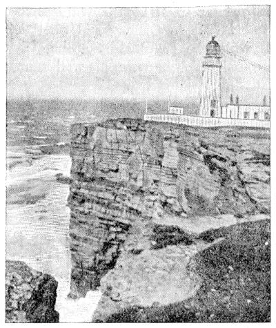
Noup Head Lighthouse.
The chief point of interest in Westray is Noltland Castle, now roofless indeed, but scarcely yet a ruin. It was built early in the fifteenth century by Bishop Tulloch, and afterwards passed into the hands of Sir Gilbert Balfour, Master of the Household to Mary Queen of Scots. After the escape of the unfortunate queen from Lochleven Castle, he was ordered to prepare Noltland for her reception. Had the ill-fated Mary turned northwards instead of southwards when the day went against her at Langside, and had she sought shelter among these northern islands instead of trusting to the tender mercies of her cousin and rival, Queen Elizabeth, what a romantic chapter might have been added to the history of Orkney!
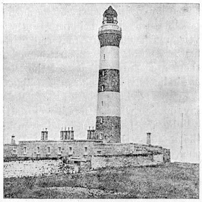
North Ronaldsay Lighthouse.
Westray contains much good arable land, and supports a large population. On the west side the scenery is bold and romantic; and from Fitty Hill, which is over five hundred and fifty feet in height, the view extends to Foula in Shetland and the Fair Isle. The cliffs facing the Atlantic are lofty and picturesque. About a mile south of Noup Head, the western extremity of the island, is the Gentlemen’s Cave, where five Orcadian adherents of “Prince Charlie” are said to have found shelter for several months after the “’Forty-five.”
From Fitty Hill we may obtain a distant view of North Ronaldsay, the most northerly and perhaps the most verdant island of the group. Separated from its nearest neighbour, Sanday, by the wild and stormy North Ronaldsay Firth, the crossing of which in the usual open boat is often dangerous, even when possible, this island impresses the visitor as being very much cut off from the world. But in such matters all depends upon comparison, and doubtless there are many who regard the whole of our islands as similarly remote and inaccessible.
A stone dyke surrounds the island of North Ronaldsay, outside which a number of native sheep pick up a living on the “banks” and even in the “ebb.” On the most northerly point, near Dennis Head, stands one of the finest of our lighthouses; for North Ronaldsay, like Sanday, has been the scene of many a shipwreck.
Our return from Westray to Kirkwall is made direct, and we now keep to the west of Eday, passing Faray and its Holm, and having the heath-clad hills of Rousay clear in view to the westward. Rousay far surpasses the other islands of the northern group in its hill and cliff scenery, its highest elevation reaching eight hundred and twenty feet, and its western shore presenting many romantic effects in stack and cave. Among its other attractive features are the Loch of Wasbister, in the north; the Burn of Westness and Westness House, overlooking the sacred isle of Eynhallow and the tumultuous Roost of Burgar; and the modern mansion of Trumbland, looking out on the calm sound and the green island of Veira or Wyre.
Nearer our course, however, lies the long, low stretch of Egilsay, the “Church Island” of the Norsemen, where the saintly Earl Magnus was done to death. The present ruined church, with its far-seen round tower, though of later date, doubtless occupies the site of that earlier church which was the scene of his murder.
Wyre, too, soon opens out to view, with its ruined chapel, and the mound which marks the traditional site of “Cubbie Roo’s Castle,” the home of the once formidable Kolbein Hruga, whose name is even yet used to terrify into good behaviour some obstreperous youngster, in the awful threat, “Cubbie Roo’ll get thee!”
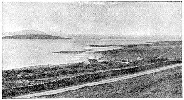
Westness, Eynhallow, and Costa Head.
Gairsay, with its rounded hill over three hundred feet high, next claims our attention, and the name of Sweyn Holm, lying off its eastern shore, recalls to us Sweyn Asleifson and the great drinking-hall which he built on the island when he made it his winter home: the summer home of the stout old Viking was on board his long-ship. But now the tower of St. Magnus rising ahead reminds us that our day’s sail is at an end, and we are shortly alongside Kirkwall pier once more.
Among the South Isles.
For a visit to the South Isles of Orkney, Stromness is our best starting-point. It is the natural centre of communication for this group—or rather for the western division of the group, for South Ronaldsay and Burray may be visited equally well from Kirkwall by way of Scapa Bay. The small steamer which makes the regular round of the islands will serve us for the beginning of our tour, but we must soon branch off from the ordinary route if we are to see much of interest.
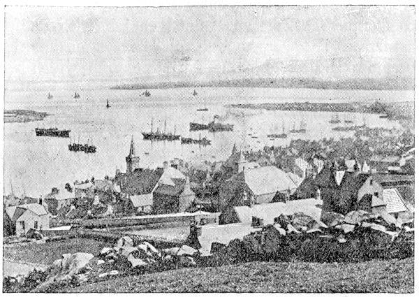
Stromness Harbour.
The green island of Graemsay, with its beach of gleaming white sand, looks very attractive as we sail out of Stromness harbour. Its chief attraction to visitors is the lofty tower of the East Lighthouse, which serves, along with the lower West Lighthouse, to guide ships through the swift tideway of Hoy Sound. The official name, indeed, for these lights is not Graemsay, but Hoy.
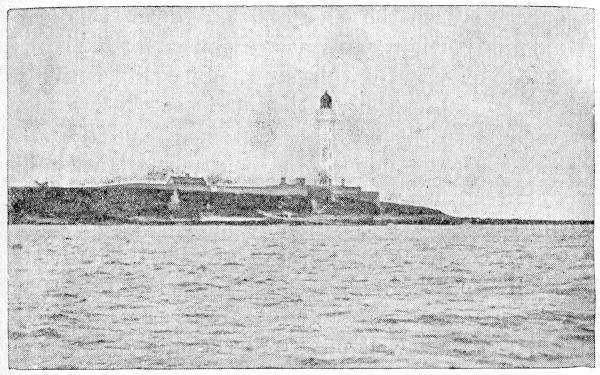
Graemsay East Lighthouse.
Graemsay is separated from Hoy by Burra Sound, and here we shall leave our steamer, landing at Linksness, the best starting-point for the long walk and climb which we have before us. Hoy is next to the Mainland in size, but little of its surface is cultivated, and roads are few and far between. So we strike westward, and, leaving cultivation behind, make for the Meadow of the Kame, keeping the Ward Hill and its neighbour the Cuilags on our left. There is a famous echo here, which we may stop to test before beginning the climb to the Kame itself—a long ridge some twelve hundred feet high, which runs from the Cuilags to the sheer precipice on the north.
The coast-line we now reach is one of the loftiest in the British Isles, rising at St. John’s Head to a perpendicular height of 1,140 feet. With due care we may approach the edge and look down this fearful and giddy height, but it is not a place for foolhardy daring. The view of this stupendous cliff, with the white surges breaking a thousand feet below in a slow and strangely noiseless movement, and the seagulls flitting like midges in their mazy dance midway between us and the blue water, is something which cannot be described and cannot be forgotten.
Beyond St. John’s Head the ground falls to half the height or less, and a couple of miles brings us to the far-famed Old Man of Hoy. This wonderful pillar stands well out from the cliff, on a ledge of rock which connects with the land near sea-level. The height of the pillar is four hundred and fifty feet; that of the cliff on which we stand is about fifty feet less. Tradition tells us that the Old Man of Hoy has suffered considerably from the battering of wind and wave even within recent times. It is said that he formerly stood on two legs, but that many years ago part of the divided base fell before the Atlantic breakers, and left him standing on one leg, as we now see him. Doubtless time and the weather will one day lay him low, but in the meantime he looks fairly solid and durable.
Another mile or more and we reach Rora Head, the most westerly point of Orkney, and turn southeastward towards Rackwick Bay, and now one of the finest views in all the islands meets our gaze. Beyond the deep glen at our feet stretches the great western sea-wall, gleaming red in the sunshine. In the bay below us the rollers are breaking in ceaseless foam over a strip of shining sand and gravel. The little township of Rackwick is a patchwork of green and gold, contrasting strangely with the dark glen and the towering hills behind.
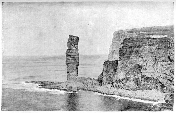
The Old Man of Hoy.
The glen itself, we find as we make the descent into it, is a bit of true highland scenery—the only bit, indeed, which Orkney has to show. Its rugged, lonely grandeur is unique in these islands. Heather and bracken, wild rose and honeysuckle, juniper, dwarf birch, and willow mingle in such luxuriance as to suggest a more favoured latitude. The glen of Berriedale, which opens out of the main valley to the west, is sometimes called the “Garden of Orkney,” but it is a garden of nature’s own.
Hoy is for the most part of a sterner aspect, as we shall quickly find if we cross the valley and dare to attack the Ward Hill. The only risk we shall run in doing so will be that of stiff limbs for several days to come, unless, indeed, a sudden descent of cloud or mist should find us unprovided with a guide who knows the “lay of the land.” The sturdy luxuriance of the heather is likely to be our chief difficulty in the climb.
Standing at last on the summit of the Ward Hill, we find ourselves at a height of 1,564 feet above the sea, on a somewhat bare and stony plateau, and not far from the highest point there is, curiously enough, an excellent spring of water. A very clear day is necessary if we are to enjoy the sight of all that this elevation commands. We shall then see the whole archipelago spread out before us as on a map—a marvellous panorama of sea and land. Even the Fair Isle shows its conical head above the north-eastern horizon. The north coast of Scotland stretches out westward to Cape Wrath, and in the blue distance to the southwards many a peak of the Northern Highlands can be distinguished.
If we descend the hill on its southern slope, we shall find a short though a steep way to the next point of interest in Hoy—the Dwarfie Stone. The description of this curious relic of the industry of some unknown workman has been well given by Hugh Miller, whose name may still be read carved on its bare interior, while the legendary interest may best be gathered from Sir Walter Scott in his notes to “The Pirate.”
South of the valley in which the Dwarfie Stone lies, the ground rises to a long stretch of moorland, broken only by burns and lochs, till it dips down to the fringe of low, cultivated ground round Longhope, in the parish of Walls. This part of the island, however, is too distant to be included in our day’s excursion, and may be visited direct by steamer from Stromness some other day.
Longhope, as we shall then see, is a sheltered bay nearly four miles long and about one mile in average width, and forms a magnificent natural harbour. Before the days of steam as many as a hundred and fifty vessels might be seen at anchor here, sheltered from the westerly gales which barred their passage through the Pentland Firth. The martello towers on either side of the entrance remind us of a time when storms were not the only danger to our shipping. Protection of a kind more necessary to-day is afforded by the strong revolving light on Cantick Head, and on occasion by the Longhope lifeboat, the heroism of whose hardy crew has often shown itself in deeds of noble daring such as no sea-roving Viking of the ancient days could have surpassed.
At the western extremity of Longhope stands the mansion house of Melsetter, with its extensive gardens. On the farther side of the bay is South Walls, a peninsula which is literally “almost an island,” as the waters of Aith Hope almost meet those of Longhope across a narrow “aith” or isthmus.
Opposite the entrance to Longhope, whence we start on our return journey to Stromness, we pass the island of Flotta, the “flat island” of the Norsemen, thriving and well cultivated, especially towards the east, where it curves round Pan Hope. To the south of it lies the green island of Switha, to the north-east the tiny Calf of Flotta, and to the north-west, off Mill Bay, the island of Faray. Farther north, and close to the shore of Hoy, lies Risa, or Risa Little, a favourite nesting-place of many of our sea-birds. The last island we notice on our homeward sail is Cava, a couple of miles eastward of which we see the beacon which marks a skerry known as the Barrel of Butter.
The eastern group of the South Isles is more closely connected with the East Mainland, being divided from Holm by Holm Sound, where lie the two green islets of Lamb Holm and Glims Holm. Immediately to the south is Burray, the Borgarey of the Norsemen, so called, doubtless, from the two brochs or borgs whose ruins still exist in the north of the island. To the west of Burray lies the peat-covered islet of Hunda.
South of Burray, across the narrow channel of Water Sound, lies the large and populous island of South Ronaldsay. At the head of the little bay of the same name stands the neat and thriving village—almost a town—of St. Margaret’s Hope, pleasantly situated among its fertile gardens and fields, and with a substantial pier to accommodate its increasing traffic.
Westward from “The Hope” lies Hoxa, a peninsula cut off by Widewall Bay on the south. On the narrow isthmus or “aith” stands a green mound, the “haug,” or howe, from which the name of Haugseith or Hoxa is derived. On the shores of Widewall Bay at low water we may see the submerged peat-moss and decaying remains of large trees which mark a bygone stage in the climate of the islands, and likewise tell of gradual subsidence of the land.
From south to north, South Ronaldsay measures about seven miles. The surface is well cultivated, and the highest point, the Ward Hill, is only some three hundred and sixty feet high. The bay of Burwick, in the south-west corner of the island, was formerly the landing-place for the south mails, which were carried across the Pentland Firth in an open boat. Some of the rock scenery in the southern part is very fine, especially “The Gloup,” near Halcro Head, an open pit near the shore into which the sea enters by a subterranean channel.
To the south-west we see the lonely, storm-swept island of Swona with its half-dozen or so of houses, and to the south rise the twin lighthouse towers on the Pentland Skerries, only one of which is now used as a light. Here we reach the southern extremity of the county, some forty miles in a straight line from North Ronaldsay, the extreme northern point.
ROUND THE MAINLAND.
First Day.
The best way to see the Mainland, and the only way to appreciate its extent and the variety of its scenery, is to make use of the excellent roads by which it is now traversed and encircled. On this tour the bicycle will be our best conveyance; and if we can secure the company of a congenial friend, we may spend a few days very pleasantly and profitably on a ride round the Mainland.
We shall begin with the East Mainland. Leaving Kirkwall by the Deerness road, we shortly afterwards find ourselves skimming down the long brae of Wideford—not Wideford Hill, but the farm of Wideford, about two miles south-east of the town. On our left is the wide expanse of Inganess Bay, with its beach of sand and shingle, where we can recall seeing on one memorable occasion a school of whales stranded after a great whale hunt: that was in our early school days, now rapidly becoming a part of the time known as “long ago.”
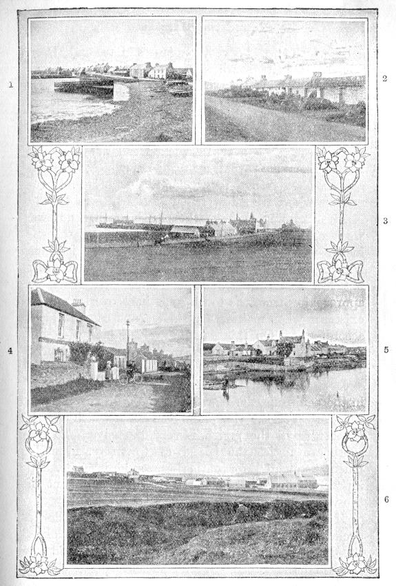
Orkney Villages.—II.
1. St. Mary’s, Holm. 2. Orphir. 3. Kettletoft, Sanday. 4. Finstown. 5. Balfour Village, Shapinsay. 6. Evie.
We next pass the long, low peninsula of Tankerness, which lies between Inganess Bay and Deer Sound. On its south side, between the loch and the shore, stands the Hall of Tankerness, its position marked out by one of those rare patches of dark green which indicate that trees may still be made to grow in Orkney under intelligent fostering care. The cliffs near Rerwick Head are worth a visit. There are several caves, one of which, tradition affirms, gave refuge for weeks to one of the Covenanters who were shipwrecked at Deerness in 1679.
After passing through the parish of St. Andrews, we reach that of Deerness. Deerness is literally a peninsula—very nearly an island indeed. The isthmus which joins it to the Mainland is not only narrow but low and sandy, and in former days mariners approaching from the south sometimes overlooked its existence when making for shelter, and came to grief accordingly. On this narrow neck of land is found an ancient mound or haug, which bears the name of Dingishowe.
Deerness is on the whole flat, the highest point in the peninsula, the Ward, being only 285 feet above the sea. Yet the view from the road, which crosses the centre of the parish, is very extensive. To the south we notice the island of Copinsay, formerly much frequented for gathering sea-birds’ eggs, and its “Horse,” a steep black rock rising high out of the water.
If time permits, it will be worth our while to cycle to Sandside, and thence walk along the cliffs to the Moul Head. The scenery here is fine, and we shall find the Broch, with its ancient ruined chapel, specially interesting. A church existed here before the Norse period, and was doubtless the cause of the name Deir-ness, or the ness of the Culdee priests, being given to the district. Not far distant we see another object which recalls priestly memories—a gray stone pillar erected to commemorate the shipwreck by which two hundred Covenanters lost their lives when on their way to be sold as slaves in the American Colonies or “Plantations.”
The story is a dark and tragic one. There is some reason to believe that the shipwreck was not entirely an accident; it is said that the ship was not even provisioned for so long a voyage, and that the fate designed for the unhappy prisoners was not slavery but death by shipwreck whenever circumstances favourable for such an “accident” should arise.
On returning to the St. Andrews road we may strike off towards the south and make our way homewards through the parish of Holm. The most fertile part of this parish lies in a broad valley sloping towards the south, where the crops ripen early. As we descend into this valley, the mellow light of an autumn afternoon reveals to us a view of rare sweetness and charm.
Amid the river-like tidal stream of Holm Sound lie the green islets of Glims Holm and Lamb Holm or Laman, with Burray and the darker Hunda, and the imposing stretch of South Ronaldsay beyond. To the westward, Hoy rises in deep-blue shadow, reflected in the still surface of Scapa Flow. Over the gleam of the Pentland Firth we see the flat shores of Caithness, while the more distant peaks of the Sutherland mountains rise sharp and clear above the horizon.
But there are a few miles of road yet to cover, so we hold on our way towards the seashore, where the steep-gabled mansion of Graemeshall stands beside its pretty reed-fringed loch. A mile beyond lies the village of St. Mary’s, with its pier and its line of cottages stretching along the beach; and after taking a passing glance at this well-known fishing-station, we turn our faces northwards. We have a long hilly ride in front of us here, and by the time we reach the end of it our interest in the charming views is not so keen as it was. Then comes the welcome change of gradient; we spin down the “Distillery Brae,” and soon our circuit of the East Mainland is completed.
Second Day.
Our second day’s circuit will take us round the central part of the Mainland, which is divided from the East Mainland by the isthmus of Scapa, and from the larger mass of the West Mainland by the lochs of Stenness and Harray and the wide isthmus between the latter and the Bay of Firth.
We leave Kirkwall by the “Head of the Town” and keep to the old Scapa road for about a mile, when we turn sharp to the right and soon begin the long ascent of nearly three hundred feet to Greenigo. This is followed by a corresponding dip down to the valley of Kirbuster, whose loch lies on our right; but as fishing is not our programme at present we keep to the road as it ascends once more, and soon find ourselves entering upon the broad fertile slope which forms the most thickly inhabited part of the parish of Orphir.
Westward we see the road stretching across this well-cultivated district, dotted with houses large and small, which gather here and there in groups and clusters almost ranking as villages. Time does not press, and we are out for the purpose of seeing all we can, so we decide to leave the main road here and take a by-road to the right which skirts the east side of the Ward Hill. It is fairly steep, and the riding cannot be called good, but it has the advantage of bringing us within a mile of the Ward Hill itself, the top of which we shall find a pleasant halting-place.
Orphir.
Leaving our bicycles by the roadside, we face a pretty stiff climb through luxuriant heather and bracken, and soon find ourselves on the highest of a group of hilltops, 880 feet above the sea. If we are favoured with a clear atmosphere, the scene before us will amply repay the labour of our ascent.
The view from the Ward Hill is supplementary to that from Wideford Hill. Parts of the landscape to the east and north are shut out by Wideford Hill itself, by the long Keelylang ridge, and by the broad-backed mass between Harray and Evie. To the south the scene is somewhat similar to that seen from Wideford Hill; to the westward, however, the panorama now before us is unique.
Ireland, or Ayre-land, as it once was, sloping gently downwards to its bay, lies at our feet, a patchwork of farms and fields in varying tints of green and yellow and brown. Beyond it, the picturesque “western capital,” Stromness, fringes its landlocked harbour, secure in the shelter of the protecting hills behind. To the left lies Graemsay with its lighthouses, an “emerald set in a sapphire sea,” and beyond it the frowning cliffs and the purple ridge of Hoy dominate the scene.
Away towards the west the horizon line, more than thirty miles distant as we now see it, cuts sharp and straight against the soft blue sky. If we have a good glass, we may make out on this line, just above the town of Stromness, the Stack of Suleskerry.
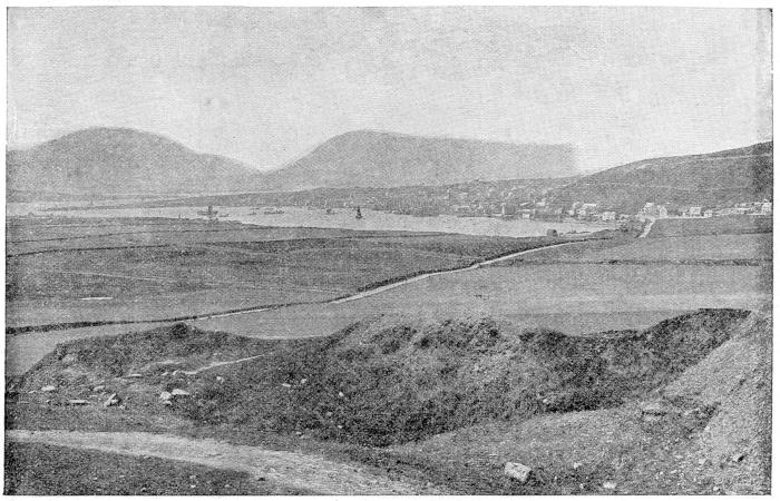
Stromness from the east.
But our day’s ride is yet mostly before us, so we descend from the Ward or “watch-tower,” mount our bicycles, regain the main road, and continue our way through the smiling landscape which lies in front of us. Orphir was an important district in the old Norse days, and a residence of the Orkney Earls stood on the seashore near the parish church; and adjoining that church may still be seen part of a much earlier church, one of the few circular temples in this country which were built in the time of the Crusades on the model of the Church of the Holy Sepulchre at Jerusalem. In the little cove sheltered by the Head and the Holm of Houton, some of King Hakon’s ships found shelter during the winter after the battle of Largs, while the king himself lay dying in the ancient palace at Kirkwall.
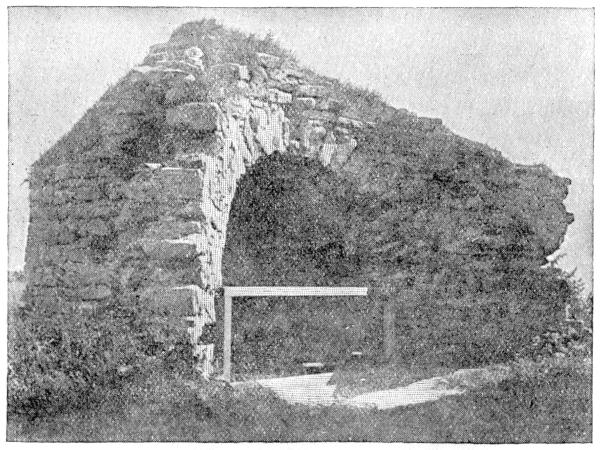
Ruins of circular church, Orphir.
After a particularly stiff ride over Scorriedale, we enter upon a long and somewhat uninteresting stretch of road through Clestran and Ireland, and at last reach the main road from Kirkwall to Stromness, close to the Bridge of Waith, which crosses the narrow strait between the Loch of Stenness and the sea. We can see just above this bridge the traces of a still older one, and the name Waith probably indicates that this was originally a “wading-place” or ford at low tide.
But we are not to cross the bridge to-day; we turn back towards Kirkwall to complete our tour of the Central Mainland. The road runs along the side of the loch, through the pretty district of Clouston, and past the comfortable hotel which has been erected there for the convenience of such summer visitors as are attracted by the trout-fishing of the loch. The largest trout ever seen was caught in the Loch of Stenness, and if the proverb is true that “there are as good fish in the sea as ever came out of it,” the same may yet be proved true of this loch.
We halt only long enough to obtain a welcome cup of tea, and then continue our ride. Less than a mile brings us to the road which leads over the Bridge of Brogar to the Standing Stones, and we decide on making a brief pilgrimage to this the most ancient shrine in the islands—if, indeed, it was a shrine. But as the afternoon is wearing towards evening, and we have been here several times before, we merely sit down on the short heather beside the circle long enough to let the mystery and “eeriness” of the scene sink into our minds and set us wondering silently what it all meant in the far-off days when it was new.
We need not wait here in the hope of finding out, so we ride back past the tall “sentinel” stone and the smaller circle of Stenness to the main road. Another mile brings us abreast of Maeshowe, and with the spirit of the past upon us we stop once more. We obtain the key of this famous chambered mound from the farmhouse opposite, in order that we may spend a few minutes more in “wondering.”
There is nothing about Maeshowe, or even about the Standing Stones, to attract the superficial mind, but to those who “wonder,” and who can see things which vanished from outward view many centuries ago, those places are almost holy ground. They embody and embalm some of the deepest thoughts of a long-vanished people; and though we can hardly guess what these thoughts were, the monuments are sacred relics to us. They are milestones, we may say, marking early stages in the long advance of our race.
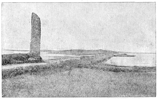
The Sentinel Stone, Stenness.
After leaving Maeshowe we face an incline just heavy enough to recall our thoughts to the present, and soon we are passing through the pretty glen which opens on the Bay of Firth. The patches of shrubbery and trees round Binscarth on our left give a pleasing variety to the scenery, and show us once more the possibilities and the limitations of our islands as regards the cultivation of woods.
The village of Finstown, the half-way house between Kirkwall and Stromness, has a beautiful situation, which can be better appreciated from the hillside above it than from the road, and it is well placed for attracting a share of the ordinary business of the districts around. It has a prosperous look, and its name reminds us that it claims to be more than a mere village.
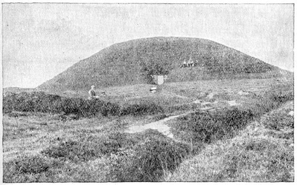
Maeshowe.
Before us on our left lies the wide, shallow Bay of Firth, or “The Firth,” as it might more correctly be called, which gives its name to the surrounding district. To the Norsemen it was the “Sea-trout Firth,” and must have been important for its fishing. In more recent times it had a famous oyster-fishery; but that too has become a thing of the past, though by the exercise of a little foresight and public spirit it could easily be restored.
In the bay lie the Holm of Grimbister and the island of Damsay, or “St. Adamnan’s Isle.” The latter, as its name indicates, was the site of a Culdee monastery, and is mentioned in the later Saga story. Damsay has also its share of the legendary tales which are connected with many of the old ecclesiastical centres in the island.
On our right the old Kirkwall road branches off, passing over the southern shoulder of Wideford Hill; and beside it, on a rising ground, we see the manse of Firth, the home of the soldier-poet Malcolm, whose father was minister of the parish. Soon our road bears to the left to avoid the steep, dark mass of Wideford Hill; we cross the broad stretch of Quanterness, and a bend to the right brings us once more in view of Kirkwall, lying beyond the Peerie Sea, whose still waters mirror the dark mass of St. Magnus, now gleaming with a dusky red in the glow of sunset.
Third Day.
Our third day’s tour is of a different character; we are to make our way through Rendall and Evie to Birsay. As we shall spend the night there, our bicycles must be loaded with a few necessary articles; but old campaigners always march light, and our baggage is reduced to its absolute minimum.
The first stage of our journey takes us to Finstown, along the main Stromness road which we traversed yesterday. Then we turn sharp to the right, and cross the bridge over the mouth of the “Oyce,” which reminds us of the Peerie Sea and its Ayre. The district in front of us, the “North Side” of Firth, consists of a broad slope, almost a plain, fringing the bay, and the steep escarpment of a long range of hills on our left. Most of this range is 500 feet in height, and parts exceed 700 feet.
There is a certain monotony about the road, due to its straightness; but there is really no reason why it should turn either to the right hand or to the left, so we pedal away, mile after mile. When opposite the Bay of Isbister we pass a very pleasing valley, that of Settascarth, through which a road crosses the long ridge into the parish of Harray. Then we reach the parish of Rendall, and find a long ascent in front of us, as the road runs straight up the “dale” whence the name of the parish arises. We pass between the high, steep ridge on the left and a group of hills on the right which lie between us and the sea, forming a broad peninsula between the Bay of Isbister and Woodwick.
When we reach the summit of this rise, we are quite ready to halt for a while and enjoy the new panorama which opens out to the northward. The inner group of the North Isles—Rousay, Egilsay, Wyre, and Gairsay—lie at our feet, as it seems; and the more distant members of the group can be easily made out. Rousay is the dominant feature in the landscape, and its steep brown hills, descending in step-like “hammars,” make an impressive background to the green fringe of farmland and the liquid blue of the sea.
As we resume our way along an undulating road, we pass through a district which, despite its northerly exposure, seems able to support a large population, and numerous tidy cottages cluster here and there along the roadside. By-and-by the cultivated strip becomes narrower, the sandy beach of Aikerness gives place to the rocky shores of Burgar, and the road turns inland with a steep incline to dip down on the other side of the ridge towards the Loch of Swannay.
Here we shall find it well worth our while to make a somewhat longer halt than before, and, leaving our bicycles, we turn to climb Costa Hill, and to view the wild cliffs at Costa Head. From the hill we look down upon the mysterious green islet of Eynhallow, the “Holy Island,” where the ruins of an ancient monastery have been traced, and round which more than the usual crop of legends has sprung up. A fair contrast it offers to the bold, rocky cliffs of Rousay just beyond.
If it happens to be the time of spring tides, and the ebb is running out, we shall see at this place one of the most impressive sights which our coasts present. However calm be the sea, as soon as the tide begins to gather strength, the channels on either side of Eynhallow for some distance out to sea become a mass of heaving, foaming billows, reminding one of the long stretch of boiling rapids below the Falls of Niagara.
And that is just what this “roost” is—rapids on the course of the tidal river which is now sweeping westward through Eynhallow Sound. When we look at our pocket map, we see that on each side of the islet the depth of water is only about five fathoms. In about a quarter of a mile it becomes ten fathoms, and within a mile of the west end of the island twenty fathoms. Thus the tidal river first passes over a ridge on each side of Eynhallow, where it is less than thirty feet deep, and then plunges down a slope which dips nearly one hundred feet in a mile.
If there is a long swell rolling in from the Atlantic, as there often is on our western shores, the turmoil is increased, and the boiling fury of Burgar Roost, as it is called, is a sight which it is worth going far to see. The roost which is formed in Hoy Sound with a strong ebb-tide is due to similar causes but there the dip in the sea-bottom is not so steep. When the tide turns, the change seems almost magical, and in a short time there may be not a ripple on the water to mark the scene of this mad dance of the billows.
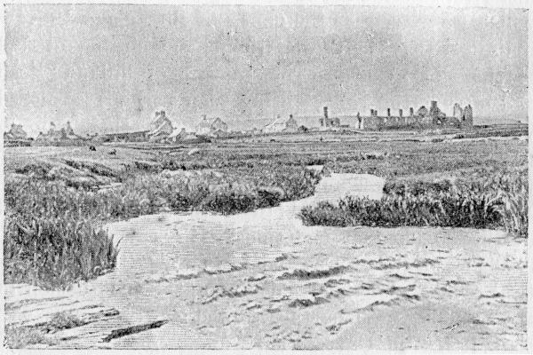
Birsay, the Barony.
The cliffs at Costa Head are the highest on the Mainland, but we can only see them from above, and thus we lose much of their wild grandeur. We enjoy, however, an impressive view of the cave-pierced shores of Rousay, and of the stern ramparts of Noup Head, in Westray, with its sentinel lighthouse.
Sooner or later we must return to our bicycles, and now we coast rapidly down to the Loch of Swannay, sweep round its northern shore, and, crossing the burn, climb the opposite slope towards the part of Birsay quaintly named, “Abune the Hill,” or “Above the Hill,” as the map-makers have it. Instead of following the road which strikes southward through the centre of the parish, we turn towards the west, and by means of an older road make our way to the Barony of Birsay, where we shall find accommodation for the night.
But we have still a long evening before us, and after due rest and refreshment we shall find time to explore our surroundings. The place is full of historical interest. The old name of Birgisharad, in which we may trace the names of Birsay and Harray, indicates that here was the chief hunting-ground of the Norse Jarls. The mixture of hill and loch and stream, the valleys being then perhaps furnished with coverts of brushwood where now there is only pasture or crops, made this northern part of the Mainland the best hunting-ground in the county.
Birsay may be said to have been the capital of the Earldom at one time. It was the favourite residence of the Earls, and it was also the ecclesiastical centre, and the residence of the first bishop of the islands. When the sainted Earl Magnus was slain, it was in Christ’s Kirk in Birsay that his body first found burial. On the Brough we may still see the ruins of a very ancient chapel dedicated to St. Peter.
The Stewart Earls, of dishonoured memory, found Birsay an attractive locality. They raised on the site of its old Norse castle a palace built after the plan of Holyrood in Edinburgh, the ruins of which still form one of the chief features in the landscape. The whole district, in short, is full of those remains which we have called milestones of the past, marking stages in the history of our race.
The shore near the Barony is interesting. We may walk to the Brough at low water, but we must take care not to be caught and imprisoned by the returning tide. The cliffs rise to the southward, and in Marwick Head reach a height of nearly three hundred feet.
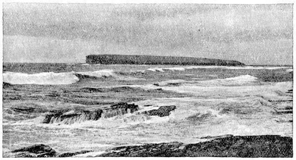
The Brough of Birsay.
The chief attraction for tourists is the Loch of Boardhouse and its trout fishing. This loch receives the drainage of a wide stretch of country, its chief feeder being the Hillside Burn, which rises in the hills between Rendall and Harray, flows north-west for some five miles to the Loch of Hundland, and under the name of the Burn of Kirbuster reaches the larger loch in about another mile. This drainage basin is next in importance and area to that of the “Great Lakes” of Orkney, the Lochs of Stenness and Harray.
If we have time and energy left to climb Ravie Hill, on the south side of the loch, we shall get an excellent idea of the “lay of the land,” and the relation of these two loch basins. We may notice in particular that the Harray basin extends northward almost to the hill on which we stand, and includes a number of small lochs near it which look as if they ought to belong to the Boardhouse or Birsay system.
If scenery rather than geography is our study, we shall be equally well repaid for this walk. From its isolated position, Ravie Hill commands a very extensive view, despite its moderate elevation. The panorama of hill and valley and plain, of land and lake and sea, which is spread out around us, is really one of the finest in Orkney, and we can quite understand how the picturesque Barony came to occupy so important a place in the past. Even at the present day its rich soil and pleasant situation give it some right to be called the “Garden of Orkney.” But meantime we must make our way back to our inn, for the sun is dipping in the western sea, and to-morrow will bring us fresh tasks to perform.
Fourth Day.
Our fourth and last day’s exploration will be confined to the western shore of the Mainland, between Birsay and Stromness. As we leave the Barony and ride along the south side of the loch we are tempted to stop and view once more the landscape from Ravie Hill, before we finally turn our back upon this romantic corner of the Mainland. While we watch the people at work in the fields, and listen to the restful sounds of country life, it is hard to picture the past whose relics stand yonder, plain in our view.
If Birsay were to display before our eyes this morning a pageant of her past history, the procession would be a varied one. The hunting-parties of the Norse Earls, the coming of the first bishop to teach the new faith, the building of the first Norse church, the burial of Earl Magnus, the procession of pilgrims seeking miraculous healing at his tomb, the removal of the sacred relics to the church of St. Olaf at Kirkwall to await the building of a more magnificent shrine, the ruinous favour of the Scottish Earls, the raising of a second Holyrood in the old Barony whose stately splendour was the measure of the robbery and extortion suffered by the people, the passing of this incongruous pomp and the return of welcome obscurity and quiet—truly a long and picturesque procession!
We resume our journey, however, and soon reach Twatt, where the road divides. The branch to the left leads to the important district of Dounby, on the borders of the three parishes of Birsay, Harray, and Sandwick, and then passes through the whole length of Harray to join the Kirkwall and Stromness road.
Harray is an interesting parish. It is the only parish in Orkney which does not touch the sea. Its soil is on the whole fertile, the surface being diversified by moraines brought down by glaciers from the steep hills to the east. The farms are generally small, but the farmers are mostly in the happy position of being owners as well as occupiers, and the number of “lairds” in this parish has long been proverbial in Orkney.
We decide, however, on taking the road to the right, as we wish to see something of the famous “west shore.” Three or four miles brings us to the head of the Harray Loch; but instead of descending to the mill of Rango we turn to the right at the cross-roads, and shortly reach the hamlet of Aith, beside the Loch of Skaill, our charming “Loch in Orcady.” Here we turn once more to the right, following a road which skirts the loch and leads us almost to the shores of the Bay of Skaill, a fine sweep of sandy beach, but exposed to the full fury of the Atlantic.
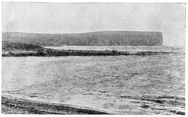
Marwick Head, Birsay.
At its southern corner we examine a large “Pict’s House,” now opened up—the “Weem of Scarabrae.” Then we decide to climb the slope beyond and visit the “Hole o’ Roo,” a famous cave piercing a bold headland, which from the horizontal lie of the rock strata looks as if it had been built of gigantic flagstones by a race of Titans.
We are now entering on the finest stretch of cliff scenery in the islands, with the exception of Hoy, and from here to Stromness, a distance of some eight miles, the walk is one to remember and to repeat. But now for the first time we find our bicycles a hindrance instead of a help, and we are at a loss what to do with them. We may decide to turn back to the main road, ride to Stromness, and, leaving them there, explore the coast on foot, which is the most satisfactory plan. If we decide to take them on with us, we shall find that considerable stretches of the ground are level enough to permit of a rough ride on the turf, and for the last three miles of the distance there is a fair road.
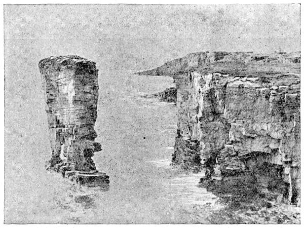
The Castle of Yesnaby.
The next point of interest after leaving Row Head is the Noust of Bigging, sheltered by its Brough, an excellent place from which to watch the Atlantic breakers when a heavy sea is running. A little way to the south is the Castle of Yesnaby, one of those isolated stacks of rock which have withstood the battering of the ocean while the cliffs around have crumbled and fallen. Its slender base, however, proclaims that its fate is only a matter of time.
In another mile and a half, after passing Lyre Geo and Inganess Geo, two impressive examples of how rocks decay, we reach the Castle of North Gaulton, a singularly slender and graceful pillar of rock. Then we cross a stretch of low ground, after which there is a steep climb up to the summit of the Black Craig. The height of the hill is 360 feet, and that of the cliff little less, while its sheer plunge down into the waves makes it look higher than it really is.
As we descend towards the south we pass over a district which is sacred in the eyes of geologists, for it was here that Hugh Miller discovered the fossil remains of the Asterolepis or “star-scale” fish, a monster of the ancient days when the rocks of this hill were being laid down as mud and sand on the bottom of a primeval lake. The great geologist describes this district as “the land of fish,” and the rock strata fairly swarm with fossils.
The shore in front is now low and tame, but the whole district from hill to sea is fertile and well peopled. That it was so in the past also we see sufficient proof. For there, on the shore of Breckness, stand the ruins of a mansion built by Bishop Graeme, who knew well where to build; and a mile beyond it, in the lonely churchyard by the lonely sea, rises a fragment of an ancient church. There stood the church of Stromness in former days, and there also the manse; while the names of Innertown and Outertown doubtless refer to their relative nearness to this centre of parish life.
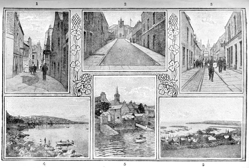
Round about Stromness.
1. Dundas Street. 2. Church Road. 3. Victoria Street. 4. From the South End. 5. From the Harbour. 6. From the Hill.
But times have changed, and it is no longer fertility of soil but convenience for trade which draws men together in close neighbourhood, and so the modern Stromness arose on the shore of that romantic little bay which spreads out beneath us as we cross the ridge to the left. That landlocked sea, and not the rocky hillside, was the source of its life and growth; and as we note the frequent steamships and the clustered fishing-fleet we realize that it is still the sea which brings prosperity to the little gray town.
Here, then, our circuit of the Mainland fitly ends, for in the opinion of many the town of Stromness, the “ness of the tide-stream,” is the fairest spot in all the islands. However this may be, it is indeed fair, and the Stromness boy will wander far and sail over many seas ere he will find a fairer scene than his island home;—fair when it lies before him under the pearl-gray light of its northern sky; fairer still, perchance, when the golden haze of memory gilds the landscape, and the joyous vision of the outward eye has given place to the wistful retrospect of the imagination.
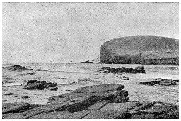
The Black Craig.
SKETCHES BY HUGH MILLER.
The Dwarfie Stone.
We landed at Hoy, on a rocky stretch of shore composed of the gray flagstones of the district. They spread out here in front of the tall hills composed of the overlying sandstone, in a green, undulating platform, resembling a somewhat uneven esplanade spread out in front of a steep rampart. With the upper deposit a new style of scenery commences, unique in these islands. The hills, bold and abrupt, rise from fourteen to sixteen hundred feet over the sea-level; and the valleys by which they are traversed—no mere shallow inflections of the general surface, like most of the other valleys of Orkney—are of profound depth, precipitous, imposing, and solitary. The sudden change from the soft, low, and comparatively tame to the bold, stern, and high serves admirably to show how much the character of a landscape may depend upon the formation which composes it.
A walk of somewhat less than two miles brought me into the depths of a brown, shaggy valley, so profoundly solitary that it does not contain a single human habitation, nor, with one interesting exception, a single trace of the hand of man. As the traveller approaches by a path somewhat elevated, in order to avoid the peaty bogs of the bottom, along the slopes of the northern side of the dell, he sees, amid the heath below, what at first seems to be a rhomboidal piece of pavement of pale Old Red Sandstone, bearing atop a few stunted tufts of vegetation. There are no neighbouring objects of a known character by which to estimate its size. The precipitous hill-front behind is more than a thousand feet in height; the greatly taller Ward Hill of Hoy, which frowns over it on the opposite side, is at least five hundred feet higher; and dwarfed by these giants it seems a mere pavier’s flag, mayhap some five or six feet square by some eighteen inches to two feet in depth. It is only on approaching it within a few yards that we find it to be an enormous stone, nearly thirty feet in length by almost fifteen feet in breadth, and in some places, though it thins wedgelike towards one of the edges, more than six feet in thickness—forming altogether such a mass as the quarrier would detach from the solid rock to form the architrave of some vast gateway or the pediment of some colossal statue. A cave-like excavation, nearly three feet square, and rather more than seven feet in depth, opens on its gray and lichened side. The excavation is widened within, along the opposite walls, into two uncomfortably short beds, very much resembling those of the cabin of a small coasting vessel. One of the two beds is furnished with a protecting ledge and a pillow of stone hewn out of the solid mass; while the other, which is some five or six inches shorter than its neighbour, and presents altogether more the appearance of a place of penance than of repose, lacks both cushion and ledge. An aperture, which seems to have been originally of a circular form, and about two and a half feet in diameter, but which some unlucky herd-boy, apparently in the want of some better employment, has considerably mutilated and widened, opens at the inner extremity of the excavation to the roof, as the hatch of a vessel opens from the hold to the deck; for it is by far too wide in proportion to the size of the apartment to be regarded as a chimney. A gray, rudely-hewn block of sandstone, which, though greatly too ponderous to be moved by any man of ordinary strength, seems to have served the purpose of a door, lies prostrate beside the opening in front.
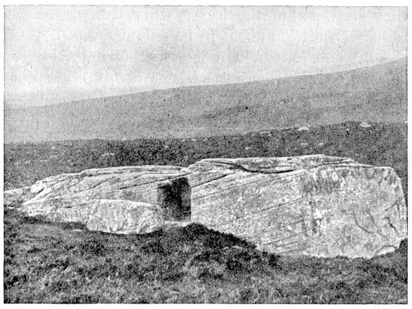
The Dwarfie Stone.
And such is the famous Dwarfie Stone of Hoy, as firmly fixed in our literature by the genius of Sir Walter Scott as in this wide valley by its ponderous weight and breadth of base, and regarding which—for it shares in the general obscurity of the other ancient remains of Orkney—the antiquary can do little more than repeat somewhat incredulously what tradition tells him—namely, that it was the work many ages ago of an ugly, malignant goblin, half earth, half air, the elfin Trolld—a personage, it is said, that even within the last century used occasionally to be seen flitting about in its neighbourhood.
I was fortunate in a fine, breezy day, clear and sunshiny, save where the shadows of a few dense, piled-up clouds swept dark athwart the landscape. In the secluded recesses of the valley all was hot, heavy, and still; though now and then a fitful snatch of a breeze, the mere fragment of some broken gust that seemed to have lost its way, tossed for a moment the white cannach of the bogs, or raised spirally into the air, for a few yards, the light beards of some seeding thistle, and straightway let them down again. Suddenly, however, about noon a shower broke thick and heavy against the dark sides and gray scalp of the Ward Hill and came sweeping down the valley. I did what Norna of the Fitful Head had, according to the novelist, done before me in similar circumstances—crept for shelter into the larger bed of the cell, which, though rather scant, taken fairly lengthwise, for a man of five feet eleven, I found, by stretching myself diagonally from corner to corner, no very uncomfortable lounging-place in a thunder-shower. Some provident herd-boy had spread it over, apparently months before, with a littering of heath and fern, which now formed a dry, springy couch; and as I lay wrapped up in my plaid, listening to the raindrops as they pattered thick and heavy atop or slanted through the broken hatchway to the vacant bed on the opposite side of the excavation, I called up the wild narrative of Norna and felt all its poetry.
The Dwarfie Stone has been a good deal undervalued by some writers, such as the historian of Orkney, Mr. Barry; and, considered simply as a work of art or labour, it certainly does not stand high. When tracing, as I lay abed, the marks of the tool, which in the harder portions of the stone are still distinctly visible, I just thought how that, armed with pick and chisel, and working as I was once accustomed to work, I could complete such another excavation to order in some three weeks or a month. But then I could not make my excavation a thousand years old, nor envelop its origin in the sun-gilt vapours of a poetic obscurity, nor connect it with the supernatural through the influence of wild, ancient traditions, nor yet encircle it with a classic halo borrowed from the undying inventions of an exquisite literary genius.
The pillow I found littered over with the names of visitors; but the stone—an exceedingly compact red sandstone—had resisted the imperfect tools at the command of the traveller, usually a nail or a knife, and so there were but two of the names decipherable—that of an “H. Ross, 1735,” and that of a “P. Folster, 1830.” The rain still pattered heavily overhead, and with my geological chisel and hammer I did, to beguile the time, what I very rarely do—added my name to the others, in characters which, if both they and the Dwarfie Stone get but fair play, will be distinctly legible two centuries hence. In what state will the world then exist, or what sort of ideas will fill the head of the man who, when the rock has well-nigh yielded up its charge, will decipher the name for the last time, and inquire, mayhap, regarding the individual whom it now designates, as I did this morning when I asked, “Who was this H. Ross, and who this P. Folster?”? I remember when it would have saddened me to think that there would in all probability be as little response in the one case as in the other; but as men rise in years they become more indifferent than in early youth to “that life which wits inherit after death,” and are content to labour on and be obscure.
The sun broke out in great beauty after the shower, glistening on a thousand minute runnels that came streaming down the precipices, and revealing through the thin, vapoury haze the horizontal lines of strata that bar the hillsides, like courses of ashlar in a building. I failed, however, to detect, amid the general many-pointed glitter by which the blue, gauze-like mist was bespangled, the light of the great carbuncle for which the Ward Hill has long been famous—that wondrous gem, according to Sir Walter, “that, though it gleams ruddy as a furnace to them that view it from beneath, ever becomes invisible to him whose daring foot scales the precipices whence it darts its splendour.”
The Standing Stones.
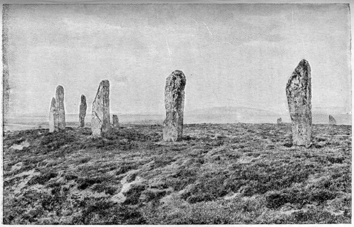
The Standing Stones—The Ring of Brogar.
The Standing Stones—second in Britain, of their kind, only to those of Stonehenge—occur in two groups; the smaller group (composed, however, of the taller stones) on the southern promontory, the larger on the northern one. Rude and shapeless, and bearing no other impress of the designing faculty than that they are stuck endwise in the earth, and form, as a whole, regular figures on the sward, there is yet a sublime solemnity about them, unsurpassed in effect by any ruin I have yet seen, however grand in its design or imposing in its proportions. Their very rudeness, associated with their ponderous bulk and weight, adds to their impressiveness. When there is art and taste enough in a country to hew an ornate column, no one marvels that there should be also mechanical skill enough in it to set it up on end; but the men who tore from the quarry these vast slabs, some of them eighteen feet in height over the soil, and raised them where they now stand, must have been ignorant savages unacquainted with machinery, and unfurnished, apparently, with a single tool.
The consideration, too, that these remains—eldest of the works of man in this country—should have so long survived all definite tradition of the purposes which they were raised to serve, so that we now merely know regarding them that they were religious in their uses—products of that ineradicable instinct of man’s nature which leads him in so many various ways to attempt conciliating the Powers of another world—serves greatly to heighten their effect.
The appearance of the obelisks, too, harmonizes well with their great antiquity and the obscurity of their origin. For about a man’s height from the ground they are covered thick by the shorter lichens—chiefly the gray-stone parmelia—here and there embroidered by the golden-hued patches of the yellow parmelia of the wall; but their heads and shoulders, raised beyond the reach alike of the herd-boy and of his herd, are covered by an extraordinary profusion of a flowing beard-like lichen of unusual length—the lichen calicarus (or, according to modern botanists, Ramalina scopulorum), in which they look like an assemblage of ancient Druids, mysteriously stern and invincibly silent and shaggy as the Bard of Gray, when
“Loose his beard and hoary hair Streamed like a meteor on the troubled air.”
The day was perhaps too sunny and clear for seeing the Standing Stones to the best possible advantage. They could not be better placed than on their flat promontories, surrounded by the broad plain of an extensive lake, in a waste, lonely, treeless country, that presents no bold competing features to divert attention from them as the great central objects of the landscape; but the gray of the morning or an atmosphere of fog and vapour would have associated better with the misty obscurity of their history, their shaggy forms, and their livid tints than the glare of a cloudless sun, that brought out in hard, clear relief their rude outlines, and gave to each its sharp, dark patch of shadow. Gray-coloured objects, when tall and imposing, but of irregular form, are seen always to most advantage in an uncertain light—in fog or frost-rime, or under a scowling sky, or, as Parnell well expresses it, “amid the livid gleams of night.” They appeal, if I may so express myself, to the sentiment of the ghostly and the spectral, and demand at least a partial envelopment of the obscure. Burns, with the true tact of the genuine poet, develops the sentiment almost instinctively in an exquisite stanza in one of his less-known songs. “The Posie,”—
“The hawthorn I will pu’, wi’ its locks o’ siller gray, Where, like an aged man, it stands at break o’ day.”
Scott, too, in describing these very stones, chooses the early morning as the time in which to exhibit them, when they “stood in the gray light of the dawning, like the phantom forms of antediluvian giants, who, shrouded in the habiliments of the dead, come to revisit, by the pale light, the earth which they had plagued with their oppression, and polluted by their sins, till they brought down upon it the vengeance of the long-suffering heaven.” On another occasion he introduces them as “glimmering, a grayish white, in the rising sun, and projecting far to the westward their long, gigantic shadows.” And Malcolm, in the exercise of a similar faculty with that of Burns and of Scott, surrounds them, in his description, with a somewhat similar atmosphere of partial dimness and obscurity:—
“The hoary rocks, of giant size, That o’er the land in circles rise, Of which tradition may not tell. Fit circles for the wizard’s spell, Seen far amidst the scowling storm, Seem each a tall and phantom form, As hurrying vapours o’er them flee, Frowning in grim obscurity, While, like a dread voice from the past, Around them moans the autumnal blast.”
There exist curious analogies between the earlier stages of society and the more immature periods of life—between the savage and the child; and the huge circle of Stennis seems suggestive of one of these. It is considerably more than four hundred feet in diameter; and the stones which compose it, varying from three to fourteen feet in height, must have been originally from thirty-five to forty in number, though only sixteen now remain erect. A mound and fosse, still distinctly traceable, run round the whole; and there are several mysterious-looking tumuli outside, bulky enough to remind one of the lesser moraines of the geologist. But the circle, notwithstanding its imposing magnitude, is but a huge child’s house after all—one of those circles of stones which children lay down on their village green, and then, in the exercise of that imaginative faculty which distinguishes between the young of the human animal and those of every other creature, convert, by a sort of conventionalism, into a church or dwelling-house, within which they seat themselves and enact their imitations of the employments of their seniors, whether domestic or ecclesiastical. The circle of Stennis was a circle, say the antiquaries, dedicated to the sun. The group of stones on the southern promontory of the lake formed but a half-circle, and it was a half-circle dedicated to the moon. To the circular sun the great rude children of an immature age of the world had laid down a circle of stones on the one promontory; to the moon, in her half-orbed state, they had laid down a half-circle on the other; and in propitiating these material deities they employed in their respective enclosures, in the exercise of a wild, unregulated fancy, uncouth, irrational rites.
Hugh Miller (“Rambles of a Geologist.”)
THE CATHEDRAL OF ST. MAGNUS.
You would hardly expect to find an ancient cathedral up in those Orkney Islands that one usually sees huddled away in a spare corner of the map, and made to look even smaller than they are by the exigencies of space. It is curious to think of: once, long ago, strange ships with monstrous figure-heads and painted sides, full of the northern actors of history, crawled with their lines of oars into the sounds and bays of these islands, till for centuries they became the stage for dramatic events and stirring personages. Some of the players bore names that any history book tells of. Harald Hardrada, old King Haco, Bothwell, and Montrose have all played their parts. And there are others, earls and prelates, and northern kings, and old sea-rovers, who were really far better worth knowing than half the puppets with more familiar labels. Then, gradually the lights went out and the audience turned away to look at other things, and the Orkneymen were left to observe the Sabbath and elect a County Council. One by one the old buildings toppled down, and the old names changed, and the old customs faded, till the place of the islands in history became their place upon the map; but time and men have spared one thing—this old cathedral church of St. Magnus in Kirkwall.
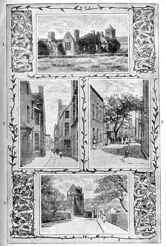
In Kirkwall.
1. Earl’s Palace. 2. Bridge Street. 3. Albert Street. 4. Bishop’s Palace.
On the ancient houses of the little borough and the winding slit of a street, the old red church still looks down benignly, and sometimes (of a Sunday, I think, especially) a little humorously. Over the gray roofs and the tree-tops in sheltered gardens, and the black mites of people passing on their business, its lustreless Gothic eyes see a wide expanse of land and a wider and brighter sweep of sea. The winding sounds and broadening bays join and divide and join again, through and through its island dominions. Backwards and forwards, twice a day, the flood tide pours from the open Atlantic, and each channel becomes an eastward flowing river; and then from the North Sea the ebb sets the races running to the west. Everywhere is the sight or the sound of the sea—rollers on the western cliffs, salt currents among the islands, quiet bays lapping the feet of heathery hills. Out of the two great oceans the wind blows like the blasts of an enormous bellows, and on the horizon the clouds are eternally gathering.
It is over this land of moor and water and vapour that the cathedral watches the people; and though from the difficulty of passing through so narrow a street it has never moved from the spot where it first arose, and has never seen, one would suppose, the greater part of its territories, yet it knows—none better—the stories and the spirit of all the islands. Crows and gulls cruise round the tower familiarly, and perhaps bring gossip; but eyes so long and narrow, and of so inhuman an anatomy, may very likely see through a hill or a heart for themselves.
The country is like a fleet at sea, and the old spirit of the people came from the deep. At first that spirit was only restless and fierce and free; in time it began to think, and at odd moments to be troubled, and they called it pious. Then it looked for a fitting house where it might live when it could no longer find a home in the people. So it built the red cathedral, and there it silently dwells to-day.
There is something in their church that none of the respectable townsfolk have the slightest suspicion of—something alive that vibrates to the cry of the wind and the breaking of the sea, and the little human events that happen in the crow-stepped houses.
On the wild autumn afternoons when the hard north-east wind is driving rain and sleet through the town, the old church begins to remember. The wind and the sleet coming over the sea stir the quick spirit so sharply that every angle is full of sighing noises. As the shortened day draws to an end, and lights begin to twinkle in the town, and the showers become less frequent, and the clouds are rolled up and gathered off the sky, then the people come out into the streets and see the early stars above the gable-ends and high cathedral tower. They think it cold, and walk quickly, but a personage of sandstone takes little note of the temperature. The cathedral merely feels refreshed.
When the clear, windy night draws in, the people go to rest, and one by one the lights are put out till only the stars and the lighthouses are left. Looking over a darkened town and an empty night, with the air moving fresh from Norway, the memories come thick upon the old church which shelters so many bones. It is like digging up the soil of those lands from which the sea has for centuries receded, and where the ribs of ships and the skeletons of sailors lie deep beneath the furrows of the plough.
Kirkwall must have been a strange little town before the cathedral’s memory begins, when there was no red tower above the narrow street and the little houses, in the days when Rognvald, the son of Kol, had vowed to dedicate a splendid minster to his uncle, St. Magnus, should he come by his own and call himself Earl of Orkney; and when the islanders waited to see what aid the blessed saint would furnish to this enterprise.
It is one of the island tragedies—the saga of how the evil Earl Hakon slew his cousin, Earl Magnus, outside the old church of Egilsay with that high round tower that you can see over Kirkwall Bay from the cathedral parapet, and how the grass grew greener where he fell, and miracles multiplied, and they made him a saint in time.
Though all these events happened before a stone of the cathedral was laid, they may help to give the meaning of its story, and on that account they are worth, perhaps, a rough telling here. Earl Hakon had died, and his son Paul ruled in his stead. He was a silent, brave, unlucky man, upright and honourable in his dealings, but the shadow of his father’s crime lay over the land. It brought old age and prosperity and repentance to the doer of the deed; and on his son the punishment fell.
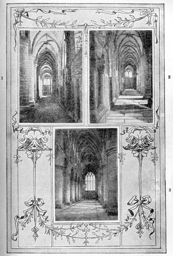
St. Magnus Cathedral, interior.
1. South aisle. 2. North aisle. 3. Nave.
Rognvald claimed the half of the earldom. Paul answered that there was no need for long words, “For I will guard the Orkneys while God grants me life so to do.” And then the contest began. Rognvald attacked from north and south. Paul vanquished the southern fleet, and hurrying north drove his rival back to Norway; and so the winter came on, and the peace that in those days men kept in winter.
All had gone well with Paul, but his luck was to change with a little thing. He was keeping Yule with his friends and kinsmen, when upon a winter’s evening, a man, wet with the spray of the Pentland Firth, came out of the dusk and knocked upon the door. He was hardly the instrument, one would think, a departed saint would choose to build a cathedral with—a Viking with his sword ever loose in its sheath, and his lucky star obscured, coming here for refuge, from the ashes of his father and his home. He was known as Sweyn Asleifson (a name to be famous in the islands), and was welcomed for his family’s sake; they brought him in to the feast, and the drinking went on. In a little while there arose a quarrel over the cups; Sweyn killed his man, and fled into the night again. He was a landless outlaw this time, for the dead man had been high in favour, and the earl was stern. Meanwhile men went on drinking over the hall fires; but Paul’s luck had departed, and St. Magnus had a weapon in his hand. In the spring the war began again, and suddenly in the midst of it Earl Paul disappeared—his bodyguard cut down upon the beach, himself spirited clean away. Sweyn Asleifson had come for him, and carried him to a fate that was never more than rumoured. So Rognvald won the earldom, and the first stones of his church were laid. The saint had certainly struck for him.
That is the true story of the vow and the building of the cathedral, a tale too old for even the venerable church to remember. But all the long history of the seven centuries since it knows; and indeed it has played such a part in scene after scene and act after act, that a memory would have to be of some poorer stuff than hewed sandstone to forget a past so stirring. And who can be so far behind every scene as the house which during men’s lives listens to their prayers, and at last upon a day takes them in for ever?
When it first began to look down from its windows upon those men going about their business in the sunshine or the rain, it saw among the little creatures some that were well worth remembering, though there be few but the cathedral to remember them now. There was Rognvald himself, that cheerful, gallant earl who made poetry and war, and sailed to Jerusalem with all his chiefs and friends, fighting and rhyming all the way, and riding home across the length of Europe, and who, when he fell by an assassin’s hand, was laid at last beneath the pavement of this cathedral he had founded. And then, most memorable of all the great odallers who followed him in war and sat at his Yule feasts, there was the Viking, Sweyn Asleifson, he who kidnapped Paul, and afterwards became the lifelong and, on the whole, faithful friend of Rognvald, and the faithless enemy of almost every one else; the most daring, unscrupulous, famous, and—judging by the way he always obtained forgiveness when he needed it—the most fascinating man in all the northern countries. He was the luckiest, too, till the day he fell in an ambush in the streets of Dublin, exclaiming with his last breath, in most remarkable contrast to the tenor of his life: “Know this, all men, that I am one of the Saint Earl Rognvald’s bodyguard, and I now mean to put my trust in being where he is, with God.” May he rest in peace wherever his bones lie, even though his reformation came something late, the turbulent, terrible old Viking, whom the Saga writers called the last of that profession.
The generation who built it had passed away, when on a summer’s day, after it had weathered nearly a century of storm and shine, the cathedral saw the greatest sight it had yet beheld. Haco of Norway had come with his fleet to conquer the Western Isles of Scotland, the Norse kings’ old inheritance. The pointed windows watched ship after ship sail by with coloured sails and shining shields, bearing the Norsemen to their last battle in southern lands; and then the islands waited for the news that in those days was brought by the men who had made the story.
Month upon month went by; men wondered and rumours flew; the days grew shorter, and the gales came out upon all the seas. At last, when winter was well upon the islands, what were left of the battered ships began to struggle home. They brought back stories that the cathedral remembers, though six centuries have rolled them out of the memories of the people—tales of lee-shores and westerly gales, of anchors dragging under the Cumbraes, and Scottish knights charging down upon the beach where the Norwegian spears were ranked on the edge of the tide; then of more gales and whirlpools in the Pentland, until at length they carried their old sick king ashore, to die in the bishop’s palace at Kirkwall.
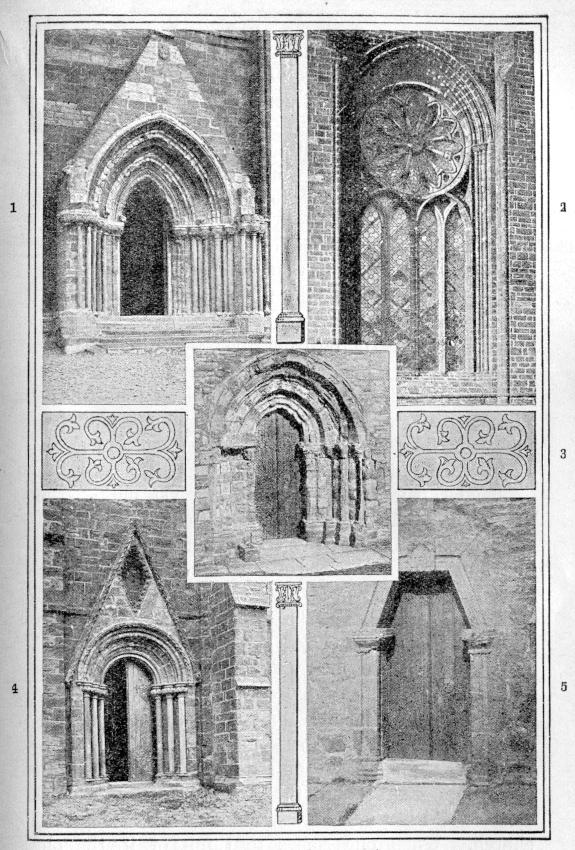
St. Magnus Cathedral, exterior.
1. West doorway, nave. 2. East window. 3. Doorway, south transept. 4. Doorway, north aisle. 5. Doorway, south aisle.
He lay for two months in that ancient building—now a roofless shell, standing just beyond the churchyard wall—his most faithful friends beside him, the restless Orkney wind without, and the voice of the Saga reader by the bed. First they read to him in Latin, till he grew too sick to follow the foreign words; and then in Norse, through the Sagas of the saints, and after of the kings. They had come down to his own father, Sverrir, and then, in the words of the old historian, “Near midnight Sverrir’s Saga was read through, and just as midnight was past Almighty God called King Hakon from this world’s life.” They buried him in the great red church that had stood sentinel over the sick-chamber; and as the race of Vikings died with Sweyn, so the roving, conquering kings of Norway passed away with Haco, and never again came south to trouble the seaboards.
The Orkneys, however, were not yet out of the current of affairs. They cut, indeed, but a small figure compared with the Orkney of the great Earl Thorfinn in the century before Rognvald founded his cathedral—he who owned nine earldoms in Scotland and all the Southern Isles, besides a great realm in Ireland. But there was still a bishop in the palace and an earl with powers of life and death in his dominion, and an armed following that counted for something in war; and the cathedral was still the church of a small country rather than of a little county. The sun cast the shadows of dignitaries in the winding street, and the bones they were framed of were laid in time beneath the flags of St. Magnus’s church. When one comes to think of it, the old cathedral must hold a varied collection of these, for here lie the high and the low of two races, and no man knows how many chance sojourners and travellers.
At last, upon a dark day for the islands, their era of semi-independence and Vikingism and Norse romance came to a most undignified end. A needy king of the north pledged them to Scotland for his daughter’s dowry, as a common man might pledge his watch. East to Norway was no longer the way to the motherland, and the open horizon meeting the clouds, the old highroad, led now to a foreign shore. Henceforth they belonged to the long coast with its pale mountain peaks far away over the cliffs, which had once, so far as the eye could see, belonged to them. It was a transaction intended for a season, but the season has never ran to its limit yet. Now, it is to be hoped, it never will; but for centuries it would have been better for the Orkneys if they had gone the way of some volcanic islet and sunk quietly below the gray North Sea.
One might think that, when they had ceased to be a half-way house between their sovereign and his neighbours of Europe, and were become instead a geographical term applied to the least accessible portion of their new lord’s dominions, their history and their troubles would soon have ceased, and the islanders been left to fish and reap late crops and try to keep out the winter weather. But there was no such good luck for many a day to come. Alas for themselves, they were too valuable an asset in the Scotch king’s treasury. Orkney too valuable! That collection of windy, treeless islands, where great ponds of rain-water stand through the fields for months together, and a strawberry that ripens is shown to one’s friends! The plain truth is that, measured by a Scotch standard of value in those days, it would have been hard to find a pocket not worth the picking. The rental of Orkney was more than twice that of the kingdom of Fife, and Fife, I suppose, was an El Dorado compared with most provinces of its impecunious country. So north they came, Scotch earls and bishops and younger sons, to make what they could before the pledge was redeemed. And to the old cathedral was flung the shame of standing as the symbol of oppression. It was not its fault, and every stone must have silently cried to Heaven for forgiveness. But a cathedral meant a bishop, and an Orkney bishop meant the refinement of roguery and exaction. When these prelates in their turns came to inhabit permanently their minster, and they could at last hear the voice of its spirit that loves the land it watches, demanding an account of their stewardship, what could they say? The old excuse—“We must live”? I can hardly think the church perceived the necessity.
That monument which the old sailors and fighters of the north had built, that they might link a better world with the rough and warring earth, had to stand immovable for century upon century, watching the trouble of their sons. It saw them make their stand at Summerdale in the old fashion, with sword and halbert and a battle-cry on their lips, and march back again to the town in a glimpse of triumph. But that quickly faded, and the weight of new laws and evil rulers gradually broke the high spirit entirely. It saw the proud odallers reduced to long-suffering “peerie lairds,” and all their power and romance and circumstance of state pass over to the foreigner, until after a time it was hard to believe that, some pages further back, there was a closed chapter of history which read quite differently from this.
Down below the parapet of the tower the narrow streets were full of the most splendid-looking people, all in steel and the Stewart arms. Earls Robert and Patrick of that royal name, each, through his scandalous life, made the island the home of a prince’s court; and out among the moors and the islands the old race wondered whose turn it should be for persecution next, and how long Heaven would let these things be.
The downfall of the Stewarts’ rule came at last, violently as was fit, but to the end they used the old church on behalf of the wrong. The tower was wrapped in the smoke of the rebels’ musketry when old Earl Patrick lay by the heels in Edinburgh awaiting his doom as a traitor, and his son held Kirkwall against what might, by comparison, be termed the law, and it was only at the point of the pike that they turned the last Stewart out of the sepulchre of St. Magnus.
Then the long windows watched the shadows of all manner of persons, who are well forgotten now, darken the prospect for a while, and pass away to let other clouds gather; and in all that time there cannot have been many whom a critical edifice can recall with pride.
The bishops were sent about their business, and the Solemn League and Covenant was solemnly sworn. The troopers of Cromwell stalked through the old pillars with their wide hats the firmer set on. The Covenant was unsworn, and the bishops came back and acquired emoluments for a little while longer, till at last they went altogether, and in good, sober Presbyterian fashion the awakened people set about purifying their temple. Poor old church! they did it thoroughly. Away went carving and stained glass, and ancient tombs and bones, and everything that the austere taste of Heaven is supposed by man to dislike. They made it clean with a kind of yellowish whitewash, and divided it by a sanitary deal screen impervious to draught. In this shameful guise the cathedral has watched the advent of quiet days and the slow healing of time. To-day the greatest clamour it hears is made by the rooks. No earl’s men or bishop’s men quarrel in the streets; no one either fears or harries the islanders; the history of Orkney is written and closed and laid upon the shelf. The hands of the clock move evenly round, and the seasons change by the almanac.