Chapter VI
Reading edition
THE MOUNTAINS AND HILLS.
It has been already mentioned (p. 19) that the principal mountain masses are divisible into ten main groups as follows:—
i. The Migif — Hafafit — Nugrus — Hangalia — Zabara group;
ii. The Abu Hamamid — Hamata — Abu Gurdi group;
iii. The Um Gunud — Dahanib — Batoga group;
iv. The Abu Dahr — Orga — Um Tenebda group;
v. The Faraid group;
vi. The Awamtib — Abraq — Dif — Aqab el Negum — Mishbih group;
vii. The Gerf — Korabkansi — Abu Hodeid group;
viii. The Meisah — Adar Qaqa — Is group;
ix. The mountains of the Alaqi basin west of Gebel Adar Qaqa;
x. The Elba — Shendib group;
while there are numerous more or less isolated mountains and hills lying outside these principal masses. In the present chapter a more detailed account will be given of each of the main groups, taking them in order from north to south, the principal outlying hill-masses being considered along with the mountain group to which they are in greatest proximity. It may be remarked that the geographical positions of all the principal peaks are tabulated in Chapter III.
The Migif — Hafafit — Nugrus — Hangalia — Zabara Group.
The highest mountains of the group (see the detailed map on Plate VI) form a close cluster, round Gebel Nugrus (1,505 metres) as a centre, between latitudes 24° 40′ and 24° 55′, while other more or less detached masses are scattered to the north and west. A striking feature of the central cluster is the tendency to extension in a north-west and south-east direction, which is specially marked in the Hafafit and Hangalia ranges.
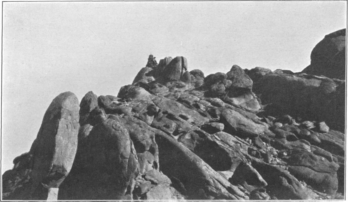
Gebel Nugrus, the central and highest mountain of this northerly group, is a great boss of red granite rising to a height of 1,505 metres among schists and gneisses. It is an almost isolated mass, for though the Hangalia and Hafafit ranges close in on it from either side, there are passes both east and west of it by which a circuit of the mountain can be made. In plan, it is a pear-shaped mass, about fourteen kilometres in length by six kilometres in width, having its long axis north-west and south-east. Gebel Nugrus is on the main watershed; its north parts are drained Nilewards by the Wadi Hangalia and other feeders of Wadi Gerf, while the drainage from its south portion passes by the Wadi Nugrus and Wadai el Nom to the Wadi Gemal and thence to the sea. The ascent of the mountain was made from a camp about four kilometres west of the summit, at the top of the pass leading into the stony head of Wadi Nugrus. The divide here is flat and sandy, at an altitude of 691 metres above sea-level, so that the ascent from camp to summit was 814 metres. Striking eastwards over the lower ridges which flank the main back-bone of the mountain, the summit was reached after a climb of nearly four hours. When ascended from this side, there appear to be two main peaks, of which the further one, marked by a beacon, is the triangulation point; the best way up is between the two peaks, as the passage from one to the other is very rough and steep. Though tiring, the climb is not very difficult. The top of the mountain (see Plate VII) is a mass of great rounded knobs of granite, on which a suitable place for setting up instruments was only found after some searching. The beacon, in latitude 24° 48′ 34″, longitude 34° 35′ 47″, is on a rounded eminence not large enough to receive an instrument, so that eccentric observations were necessary; the distance between the eccentric point of observation and the beacon had to be found by a subtense method, as the roughness of the mountain top rendered any process of chaining or taping impossible. The view from the summit is very fine. To the west, one sees the pinnacles of Migif and the nearer long range of Hafafit; to the north-east is the black cone of Atut; northward, seen over a sea of hills, is Igli; to the east is the high ridge of Hangalia, culminating to the south in Gebel Zabara.
The sea is visible to the north-east and east, but the sea horizon was obscured during the three days I spent on the summit by banks of clouds. These cloud banks simulated the sea horizon very closely, their upper surface appearing perfectly horizontal. They caused a peculiar phenomenon at sunrise, producing the optical effect of two suns rising one after the other owing to the refraction through the cloud. The first thing seen was a blood-red image of the sun rising over the true sea horizon, which was only thus discovered, the sun being seen through the cloud; about three minutes later, when a little more than half the blood-red disc had risen, the true sun rays flashed out from another and much brighter segment appearing over the top of the cloud, so that parts of two sun disks were seen at once, quite separately, one over the other.
Before descending from the mountain, I went along the ridge south-east and north-west of the highest point to get plane-table stations; in either direction progress along the top is extremely difficult. To the north-west it appeared as though the way would be easier by keeping on the east side of the ridge, but in reality this was not so, as the slope was so steep and smooth that some stretches could only be got over by wriggling along with as much as possible of one’s body in contact with the rock. The descent from the north-west end of the ridge to camp was difficult and rather dangerous in places. It is possible that a better way up the mountain could be found from the pass at the head of Wadi Hangalia, on the opposite side to where I started; that pass is 120 metres higher than the west one, so that the total climb would be lessened by that amount, and the horizontal distance is about the same.
Gebel Hafafit is a very long range, chiefly of gneiss, running in a nearly straight line south-eastward for over thirty kilometres. Its highest peaks are at its north end, where they are not very much lower than those of Gebel Nugrus; the heights decrease gradually further south. Half way down the range is a very conspicuous peak called Um Moghar, 860 metres above sea, while another well marked summit, the only one which I climbed, exists near the south end and rises to 744 metres. This last-named point is marked by a beacon, in latitude 24° 35′ 32″, longitude 34° 45′ 22″. On either side of the main back-bone of Hafafit are high flanking ridges. The drainage of Hafafit practically all flows seaward by the Wadi Gemal; the west faces are drained by Wadi Hafafit, and the east ones by Wadi Nugrus.
East of the south part of Gebel Hafafit are some remarkable bosses of granite, of which the chief, Gebel Abu Had, rises to 633 metres above sea, and is a landmark for Bir Abu Had. Another remarkable hill, closer in to Hafafit and the Wadi Gemal, is shaped like a bell with a handle on the top; this hill, which forms a good landmark, is called Gebel Um Regeba, and its summit is 571 metres above the sea.
PLATE VII.
Summit of Gebel Nugrus. (Granite).
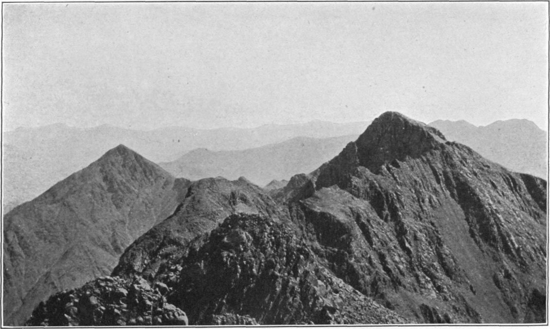
Summit of Gebel Abu Hamamid. (Schists).
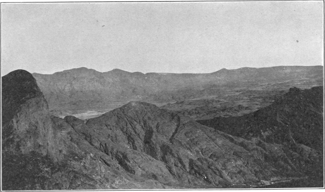
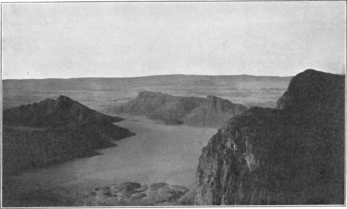
Gebel Migif is a very spiky gneiss mass situated about thirteen kilometres west of Gebel Nugrus. It has several summits of about equal height, fairly close together, but separated by deep clefts. The triangulation beacon is on the western peak, in latitude 24° 47′ 23″, longitude 34° 27′ 30″, 1,199 metres above sea-level. The foliation planes of the rock dip to the north, and the only safe means of ascent is up the resulting north slopes. The south aspect is precipitous. When ascending the mountain, I pitched my camp 2·7 kilometres north of the beacon, in a gully draining into Wadi Shait, west of another gully containing the water holes called Galt Um Karaba, at an altitude of 607 metres above sea-level. The ascent, of 592 metres, took two hours steady climbing, and was not difficult. I kept on the west side of the gorge till near the top, and this is the best way up the mountain, for I found the gorge itself to be steep and abounding in impassable precipices. The view from Gebel Migif is shut in to the east by the high masses of Gebels Hafafit and Nugrus; Gebels Atut and Igli are conspicuous to the north; to the south-east, one overlooks the great sandy basin of Wadi Hafafit; while to the south-west is more open country in which the two remarkable cones of El Nahud, the sharp peak of Gebel Abu Khrug, the ridge of Gebel Hamrat Selma, and closer in the ranges called Gebel Dweig, are striking features. On a clear day, the huge mountains of Hamata and Abu Hamamid, eighty kilometres to the south-south-east, can be discerned. The photographs on Plate VIII will give an idea of the views looking towards Gebels Nugrus and Dweig respectively. In the upper view Gebel Nugrus is seen behind the Hafafit range; in the lower, the masses close in are Gebel Dweig, while in the distance, to the right of the centre, is Gebel Hamrat Selma, and behind it on the horizon the spike of Gebel Abu Khrug. The precipitous nature of the south side of Gebel Migif is evident in both views.
The north and west sides of Gebel Migif are drained by the Wadi Shait, which passes the foot of the mountain; the steep south face drains into Wadi Dweig, a tributary of Shait; while the eastern face, flanked by low hills, is drained by Wadi Hafafit.
Gebel Dweig is a small group of high hills close to the south of Gebel Migif, with which it combines to form a cul-de-sac round the head of Wadi Dweig. Gebel Dweig resembles Gebel Migif in character, except that it is lower; the hill on the south side of the narrow opening by which Wadi Dweig leaves the cul-de-sac is 864 metres above sea, and this is believed to be the highest of the group. The eastern part of the mass is a curiously curved range sweeping round nearly in a semicircle.
Gebel Hamrat Selma is a high ridge rising from the plain about fifteen kilometres south-west of Gebel Migif. I did not approach it closely, but fixed the position of its highest point, which is 761 metres above sea-level, by triangulation.
El Nahud (the breasts) is the name given to two very remarkable conical hills of volcanic rock rising from the plain on the north side of Wadi Natash to the south of Gebel Hamrat Selma. The two hills are about five kilometres apart, one being south-east of the other. The north-eastern cone is the sharper of the two, but they have both the same altitude of 662 metres above the sea and rise about 130 metres above the surrounding country.
Gebel Abu Khrug is a granite hill-mass with a remarkably sharp high peak, about twenty-five kilometres south-west of Gebel Migif. The summit, which is surmounted by a triangulation beacon, in latitude 24° 38′ 57″, longitude 34° 16′ 19″, has an altitude of 870 metres above sea-level. Abu Khrug, from its striking Matterhorn-like shape and its situation in fairly open country, is a conspicuous landmark for great distances. The Arabs who were sent to erect the beacon stated that the ascent was very difficult.
Gebel Sufra is a mass of rather flat-topped high hills, partly of volcanic origin, about eighteen kilometres west of Abu Khrug, on the north side of Wadi Shait. The triangulation beacon on the summit is in latitude 24° 38′ 42″, longitude 34° 4′ 13″, at a height of 690 metres above sea-level, and 340 metres above the well of Um Gubur, which is in the Wadi Shait about three kilometres to the south-east.
Gebels Nazla and Um Serg are moderately high hills lying to the south of Gebels Sufra and Abu Khrug, between the Wadis Shait and Natash.
Gorf el Natash is a syenite hill on the south side of Wadi Natash, about five kilometres south-west of Bir Masur, while Gebels Muktil (470 metres), Derera, and Um Goraf, are prominent hills lying still further south near Wadi Antar.
PLATE VIII.
View from Gebel Migif, looking east, showing the Hafafit and Nugrus Ranges.
View from Gebel Migif, looking south-west, showing Gebel and Wadi Dweig.
Gebel Ras Shait is a group of high rugged-looking reddish hills, probably of granite, at the head of Wadi Shait, near Gebels Nugrus and Migif. Its highest peak rises to 1,019 metres above sea. The west face drains directly into Shait, while the eastern and northern slopes drain into Wadi Gerf, which joins Shait far to the south-west. Between Gebels Migif and Ras Shait is a small range of hills dividing Wadi Shait from the head of Wadi Hafafit; across the south end of this range, which is composed of dark schists with white granite at its western foot, there runs a zigzag pass, fairly easy for camels, to the head of Wadi Nugrus.
Gebel Mudergeg is a high range of reddish hills, which with Gebels Ras Shait and Migif encloses the heads of Wadi Shait. Its highest point is 1,086 metres above sea. To the east of it are several other lower ranges, some of white and others of black aspect, which have not been approached closely.
Gebel Hangalia is a great mountain ridge running south-south-east for about twelve kilometres, from Gebel Ghuel to Gebel Zabara, consisting chiefly of schists. Its highest peak is 1,241 metres above sea-level. Its western faces are drained partly to the Nile by the Wadi Hangalia (a tributary of Wadi Gerf) and partly to the sea by the Wadai el Nom (a tributary of Wadi Nugrus); its eastern faces, which are flanked by high ridges, drain into the various feeders of Wadi Ghadir.
Gebel Zabara, a mountain mass rising to 1,361 metres above sea-level, forms a southward extension of the Hangalia range. The cairn on its summit is in latitude 24° 45′ 21″, longitude 34° 41′ 53″. The mountain is drained on the north and east sides by feeders of the Wadi Ghadir, while its western flanks are partly drained by the Wadai el Nom. Gebel Zabara is chiefly composed of schists of various types. The ancient emerald mines of Zabara are in the north-east part of the mountain, about two and a half kilometres from its summit. A triangulation beacon marks the highest point of the mountain, but this was only used as an intersection point. I ascended some of the flanking ridges near the old mines; these consisted of splintery schists, and though the climbing is steep and rough (see Plate IX), the schists give a good foothold so that the ascent to the top is probably not very difficult. The ruins in the Wadi Zabara, near the old mines, are at 514 metres above sea-level; the climb from them to the summit is thus one of 857 metres. Due south of Gebel Zabara is a high ridge, the north-west end of which is 1,104 metres above sea-level; this ridge is the most conspicuous of a mass of high hills flanking Gebel Zabara to the south, which have not been seen except from a distance, but which are probably drained by the Wadi Nugrus.
Gebel Ghuel, which forms a northward extension of Gebel Hangalia, is likewise composed of schists. Its highest point, the south end of a conspicuous high ridge, is 1,104 metres above sea. Its eastern faces are drained by the Wadis Ghuel and Fegas, both tributaries of Wadi Ghadir, while its western flanks drain into the heads of Wadi Um Khariga. High hills flank the main ridge on both sides, especially the east, and through these the drainage channels form deep gloomy gorges. Wadi Ghuel contains important water holes.
Gebel Um Khariga is the name given to several high hill ranges on either side of the Wadi Um Khariga. Two of these ranges, one on either side of the upper part of the wadi, form like Gebel Ghuel north extensions of the high ridge of Hangalia; the western range can be crossed at a gap by an easy pass, 773 metres above sea-level, which separates the heads of Wadi Gerf from those of Wadi Um Khariga. These two ranges shut in the wadi on either side for some ten kilometres of its northward course, beyond which the country becomes more open and the wadi curves round to the north-east, passing the north end of a third range of high hills which is likewise called Gebel Um Khariga. This third range extends northward for about ten kilometres from Gebel Ghuel, from which it is separated by a pass forming a good road over the head of Wadi Ghadir. Its most conspicuous feature is a twin peak at its north end, 674 metres above sea-level. The main ridge is flanked by high hills, especially on the east side. Only the north and west flanks of this range are drained by Wadi Um Khariga, the eastern side being cut up by feeders of Wadi Sukari. Besides the pass separating it from Gebel Ghuel, there are two other passes, one round its north end into Wadi Sukari, and another at its south end between Wadi Ghadir and Wadi Sukari, so that a complete circuit of this range can be made by camels. Some of the hills composing the mass consist of highly magnetic schists, and compass readings in the region may be disturbed by many degrees.
PLATE IX.
Descending Gebel Zabara. (Schists).
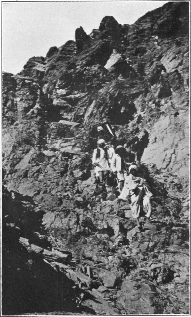
Gebel Igli el Iswid is a rather rugged mountain mass rising among a sea of lower hills, thirty kilometres north of Gebel Nugrus. Its highest point, marked by a triangulation beacon, in latitude 25° 4′ 6″, longitude 34° 36′ 16″, is 975 metres above sea-level. The mountain forms a tripartite watershed between the basins of Wadi Um Khariga (draining the south slopes), Wadi Dabur (draining the north and west slopes), and Wadi Igli (draining the eastern face), each of which three wadis courses separately to the sea. In occupying the triangulation station on the summit, I placed my camp in a gully draining to Wadi Um Khariga, about two kilometres south-south-west of the summit at an altitude of 605 metres above sea. The climb of 370 metres to the top from this camp was not difficult, and occupied only a little over an hour and a half. The mountain consists of very hard grey siliceous rocks, which ring under the hammer, and are probably crushed and devitrified felsites (see p. 281). There are galts in some of the gullies draining from this mountain, hence it is sometimes called Igli el Rayani. At the time of my visit (December 1905) there was said to be a little water in a galt on the west side of the mass; but the rock basins in the gully which I ascended were empty.
Gebel Igli el Ahmar, sometimes called El Atshani, is a lower hill mass of granite some ten kilometres north-east of Igli el Iswid.
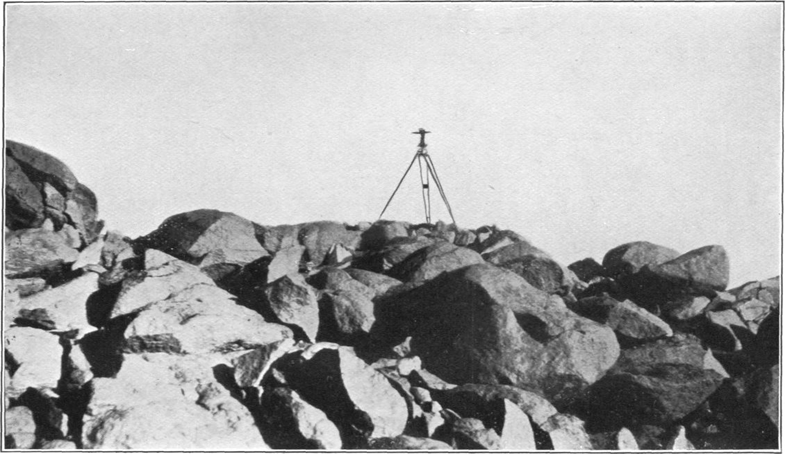
Gebel Atut is a high black conical hill thirty kilometres north-west of Gebel Nugrus. Rising considerably above the hills which immediately surround it, Atut is visible from a great distance from the west, and its conical form renders it easy of recognition. Its summit, marked by a beacon, in latitude 25° 0′ 56″, longitude 34° 23′ 49″, is 908 metres above sea-level and 300 metres above the branches of the Rod el Atut which encircle its base. A camp can be placed close to the foot of the cone, and the ascent is easily made in about an hour. The rock of Gebel Atut is olivine gabbro (see p. 302), of great hardness, and the whole surface of the mountain is formed of great blocks, rounded and boulder-like below, but angular higher up. The blocks have rusty-looking surfaces, but are perfectly sound rock inside, and they ring like bells under the hammer. The upper illustration on Plate X shows a view of the summit of Gebel Atut, from which its blocky nature will be evident. The view from Gebel Atut is a very extensive one. To the west and north (see the lower illustration on Plate X) one can see the peaks of Gebels Muelih, Haggar Dungash, Iteima, Abu Diab, and Hamrat Wogud; to the south-east are the masses of Migif and Nugrus, while eastward one looks over a great expanse of hills towards Gebels Dabur and Um Khariga, with the sea beyond.
The hills of Um el Huetat, the highest of which rise over 200 metres above the wadis round them, are situated about eight kilometres due west of Gebel Atut; they are composed of schists of various types, and contain some old mines, mostly in talc schist. They are drained by the Rod el Farag, a tributary of Wadi Gerf.
On the other side of the Rod el Farag, i.e., further west of Gebel Atut, are numerous scattered hills, the higher of which bear the names of Hamrat Mastura, El Hamra, and Um Himar. These are of granite, gneiss, and schists, with some coarse gabbro and numerous quartz veins.
Still further west is the remarkable ridge called Erf el Fahid, a great quartz vein ten metres wide and two kilometres long, rising nearly one hundred metres above the Wadi Muelih. A beacon on its highest point, 579 metres above sea-level, marks the triangulation station, its position being latitude 25° 0′ 5″, longitude 34° 11′ 52″. South-east of Erf el Fahid is a line of similar but smaller ridges, also formed of great quartz veins rising through diorites and schists. Still further down the Wadi Muelih is a curious horse-shoe-shaped hill of aplite, called Marwot Rod el Ligaia, round which the hills of crushed diorite are penetrated with a network of quartz veins running in various directions.
Gebel Muelih is a great boss of white granite situated close to the north side of Wadi Muelih in longitude 34°. Its summit, marked by a beacon, in latitude 24° 52′ 44″, longitude 34° 0′ 37″, is 707 metres above sea and 350 metres above the wadi which courses round its south flank, and from which it is easily climbed. The upper view on Plate XI gives an idea of its appearance as seen from the base line camp in the wadi six kilometres east of it.
Gebel Hagar Dungash is a great mass of high hills situated north of Gebel Muelih. The beacon on its highest point, in latitude 24° 59′ 12″, longitude 34° 2′ 33″, is 815 metres above sea-level. In the hills which flank the main mass are numerous sharp peaks, one of the most conspicuous of which, eight and a half kilometres south-west of the beacon, is called Gebel Um Dalalil. A ridge five kilometres due east of the beacon bears the name of Erf Rod Um Rashid. The rocks of Haggar Dungash are chiefly dark schists.
PLATE X.
Summit of Gebel Atut.
View from Gebel Atut, looking north-west, showing Gebels Abu Diab and Hamrat Wogud in the distance.
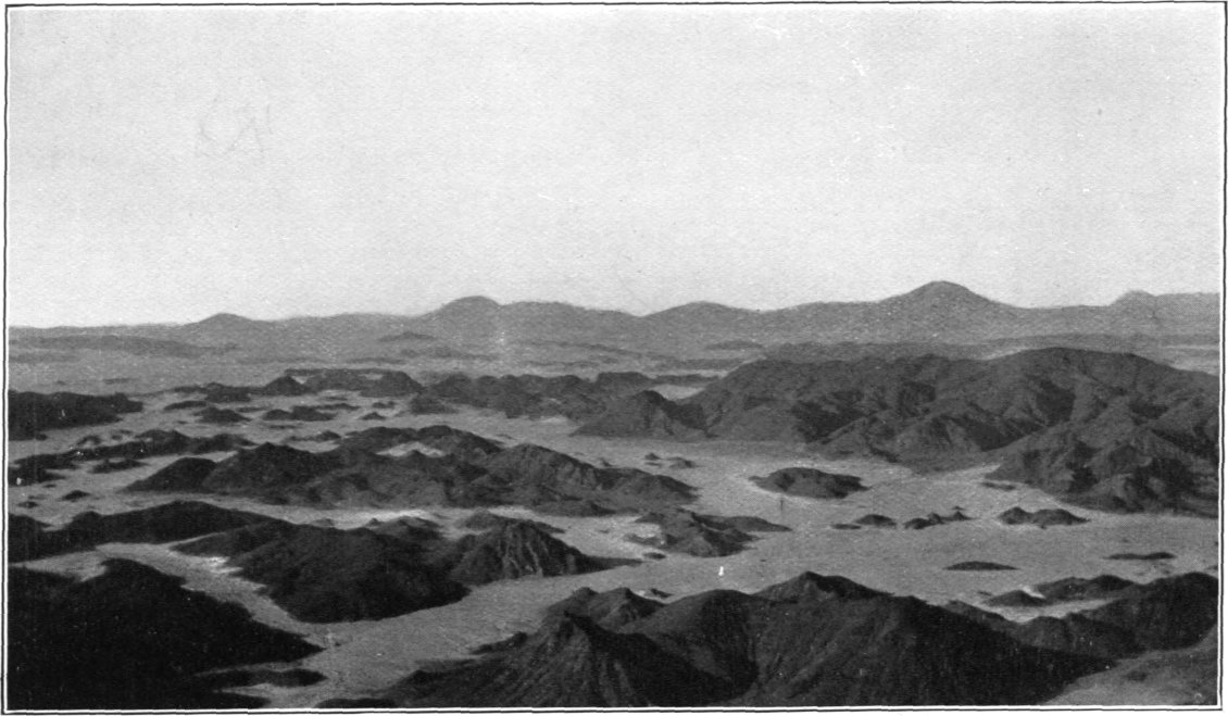
PLATE XI.
View in Wadi Muelih (Base-line Camp). Gebel Muelih in the Distance.
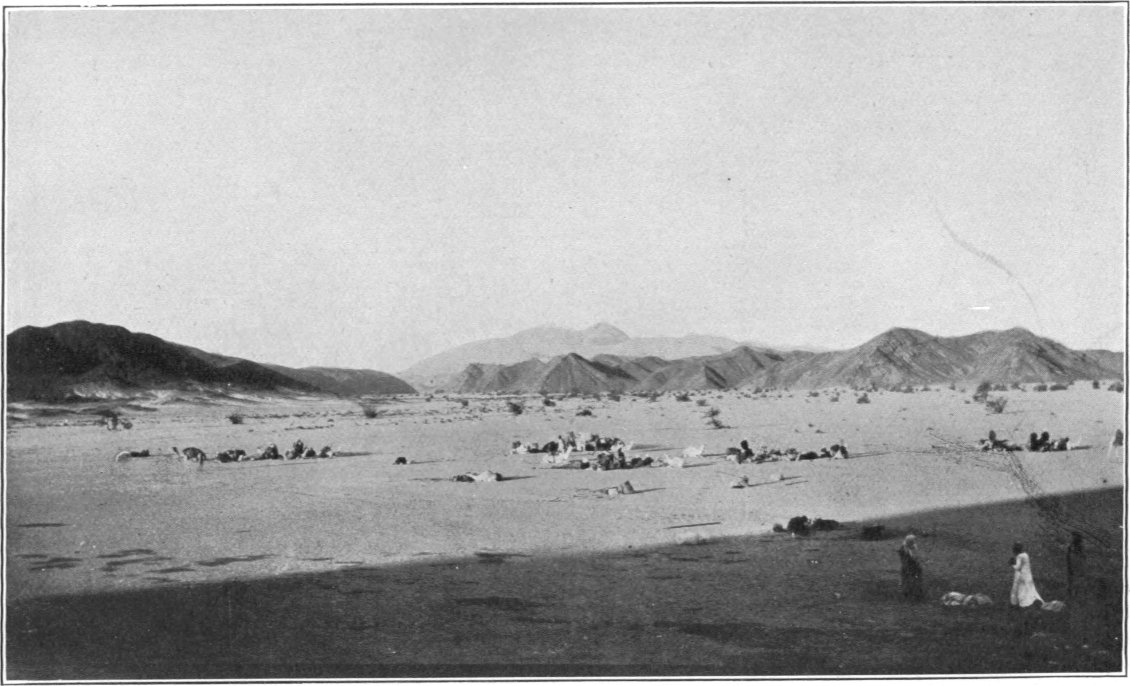
Granite-boss of Gebel Selaia.
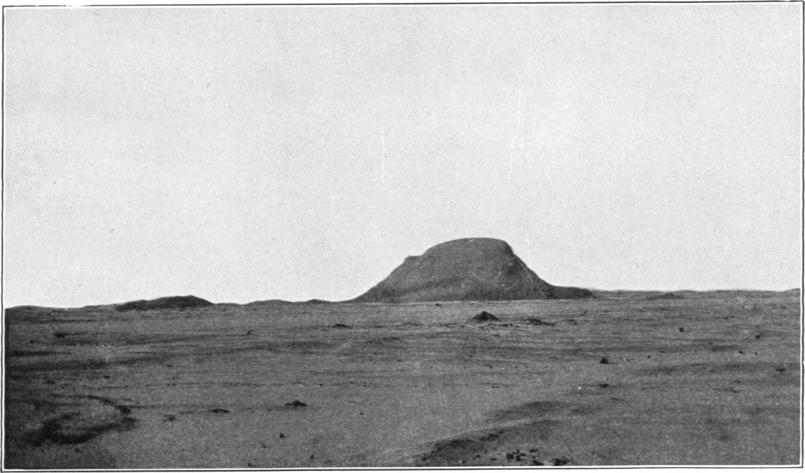
Gebel Iteima is a group of high granite hills rising from the plain fifteen kilometres north of Erf el Fahid. Its highest peak is 849 metres above the sea. It is drained southwards by the Wadi Muelih.
Gebel Hamrat Wogud, which is likewise of granite, is a higher mountain mass fifteen kilometres east of Iteima. Its highest point, marked by a beacon, is in latitude 25° 9′ 34″, longitude 34° 20′ 0″, and 1,103 metres above sea. It is drained southwards by the Rod Um el Farag, a tributary of Wadi Gerf.
Between Gebels Muelih and Mudergeg is a sandy plain with low hills, the more conspicuous of which bear special names; among them are Marwot Rod el Ligah, Erf Sagur, and Khusa el Faraon, the last-named being a group of small but very remarkable black hills eleven kilometres due south of Erf el Fahid. Marwot Rod el Ligah is a triangulation point; its beacon is 514 metres above sea-level.
Gebel Sukari is a very craggy high ridge of granitic rock twenty-two kilometres north of Gebel Zabara. Its highest point, which is at its north end, is 630 metres above sea-level, but the triangulation beacon was erected on a lower part of the ridge further south, in latitude 24° 56′ 50″, longitude 34° 42′ 50″, at an altitude of 476 metres, in order to be near to the extensive old mines and ruins which exist in the locality. Gebel Sukari is drained by various feeders of Wadi Sukari.
Kurdeman is the name of a low hilly district on the east side of Wadi Ghadir, thirteen kilometres north of Gebel Zabara. It is interesting as containing some ancient mines, doubtless worked for gold. A triangulation beacon has been erected on a hill just above the workings, in latitude 24° 52′ 35″, longitude 34° 41′ 35″, at an altitude of 526 metres above sea, or about fifty metres above the wadi.
Gebel Sabahia is a craggy felsite hill five kilometres south-east of Kurdeman, rising to 520 metres above sea, or about ninety metres above the wadi. It is drained by the Wadi Sabahia, a tributary of Wadi Ghadir. In the heads of the Wadi Sabahia, north-east of the hill, are some old gold mines.
Gebel Um Tundeba is a high granite hill near the head of Wadi Um Tundeba. Its summit is 550 metres above the sea. It forms a landmark for the water hole called Galt Um Tundeba, which is situated in a small gully, three kilometres west of the summit of the hill.
Gebel Amba-ut, seven kilometres south of the foregoing, is likewise believed to be of granite; the southern hill of this group is of a red colour and very conspicuous as one passes from Um Tundeba to Ghadir.
Gebel Ghadir, the summit of which, in latitude 24° 50′ 9″, longitude 34° 47′ 22″, and 636 metres above sea, is marked by a triangulation beacon, is thirteen kilometres north-east of Gebel Zabara. I ascended it from a camp 424 metres above sea-level in one of the gullies draining westward to Wadi Ghadir. The ascent is easy. The rocks are greenish serpentines and ophicalcites below, with a white quartz felsite above.
Gebel Allawi, situated on the south side of the Wadi Allawi, is a diorite hill rising to 515 metres above sea. It is best approached by ascending a small feeder of Wadi Allawi, in which a camp can be placed within a kilometre of the summit and 160 metres below it. There are some interesting old gold mines in the quartz veins just below the beacon on the summit of the hill, and a band of graphitic schist crops out near the north foot of the hill. The position of the beacon is latitude 24° 46′ 42″, longitude 34° 49′ 39″.
Gebel Lewewi is a dark craggy hill range eight kilometres east-south-east of Gebel Zabara, between Wadi Allawi and its tributary Wadi Lewewi. Its highest point, marked by a cairn, is 654 metres above sea-level. There are some old mines in the lower hills two and half kilometres south-east of Gebel Lewewi, and others a little further off in the same direction.
Gebel Sikait is a rugged ridge of schists and serpentine situated in the midst of hilly country fourteen kilometres south-east of Gebel Zabara. The triangulation beacon which marks its summit is in latitude 24° 39′ 55″, longitude 34° 48′ 5″, and 771 metres above sea-level, and 330 metres above the wadi which skirts its western foot. Gebel Sikait is of interest from the abundant ruins and old emerald mines which exist near it, as well as from the variety of minerals present in its rocks. It is the Sicily of the Eastern Desert. Beryl, tourmaline, actinolite, various micas, chlorite, talc and crystals of calcite are amongst the commoner minerals found. The serpentine which abounds in its upper parts is highly magnetic, and the compass was found to be disturbed by no less than 40° near the triangulation point. Gebel Sikait is drained from the west by the Wadi Sikait, a tributary of Wadi Nugrus, and from the east by the Wadi Um Gamil. The best place to climb it from is the Wadi Sikait, and the ascent, not a difficult one, is rendered interesting by the ruins and old mines encountered; part of the way one passes over an ancient made road, now broken in many places by the downwash from the hill.
Gebel Ras Um Gamil and Gebel Um Gamil are two high hill ranges south-east of Sikait, which have only been sketched from a distance.
Madaret Um Gamil is a conspicuous double-topped hill on the north side of the Wadi Gemal, seventeen kilometres south-east of Sikait. The beacon which marks its highest point is in latitude 24° 34′ 52″, longitude 34° 56′ 28″, and 454 metres above sea. It is best ascended by a very winding tributary of the Wadi Gemal; this gully, up which there is a road, leads past the south-west foot of the hill, and the climb is only one of some 200 metres. The rocks round Madaret Um Gamil are mostly schists, but the top of the hill is a hard gabbro like that of Gebel Atut, weathered into rusty looking blocks. A good view seawards is obtained from the summit, some very red granite forming a conspicuous feature in the low hills between it and the coast.
The Abu Hamamid — Hamata — Abu Gurdi Group.
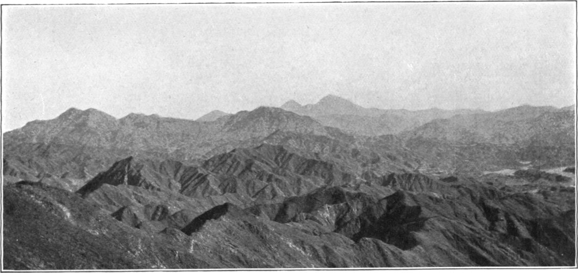
This group of mountains is remarkable both for its extent and for the loftiness of many of its peaks, some of which are among the highest in Egypt. It is a mass of rugged ridges and peaks, covering about a quarter of a square degree of the earth’s surface between latitudes 24° 0′ and 24° 30′, in which the two dominant summits, Abu Hamamid (1,747 metres) and Hamata (1,978 metres) are the most conspicuous features in the west and east portions respectively, while Abu Gurdi (1,562 metres) forms the great terminal peak of a south-easterly extension of the mass. Plate XII shows two typical views in this rugged region.
Gebel Abu Hamamid is a great ridge of hard greenish schists towering above the surrounding mountains to a height of 1,747 metres above sea. Its crest is broken into a number of separate summits, which appear from most aspects of almost a sugar loaf form; the beacon is on the most northerly and highest of these, its position being latitude 24° 14′ 41″, longitude 34° 47′ 38″. The mountain is best ascended from the Wadi Um Semiuki, a tributary of Huluz, which drains its north-east face. By ascending this wadi till camels could go no higher owing to its increasingly rough and stony floor, I was able to pitch a camp at 865 metres above sea-level and two and a quarter kilometres north-east of the summit, leaving an ascent of 882 metres to be made on foot. The ascent, which occupied four hours, was free from difficulty till within about one hundred metres of the top, but the last portion was extremely steep and was only negotiated with considerable trouble; it represents pretty nearly the limit of possibility in getting instruments up difficult places. Once the top was reached, however, the magnificence of the view obtainable, and the excellence of the point as a station for triangulating the principal peaks among the thousands visible, seemed an ample recompense for the trouble of reaching it. The top of the ridge (see Plate VII, p. 166) is very rough and narrow, only a little over a metre wide, and it is difficult to find a spot near the summit where one can spread one’s blankets for the night with even a slight approach to comfort. The eight nights of enforced bivouacking which I was obliged to spend on the top of Abu Hamamid in February 1906, before I could complete my observations, belong to the least pleasant of my experiences in the desert. A little work only was possible the first day, owing to haze obscuring the more distant peaks. On the second day clouds enveloped us in a wet drizzle, and a bitterly cold north wind blew with great violence; a rude rubble shelter which my men built on the summit, covered with a blanket, was a very poor protection, and I found it better to throw a rubble embankment across a steep gully on the lee side, forming a small level platform where we were sheltered from the biting wind. For the next five days, we were alternately wrapped in clouds or left free under a brilliant blue sky with clouds covering all the surrounding country. It was curious on these days to look over the surface of the clouds, as over a boundless level sea, with only the highest peaks projecting sharp and black above the white surface, and to see the sun rise and set exactly as though one were on the ocean. Then at last the clouds began to disappear, and on the first clear day a very large amount of triangulation was accomplished, all the more prominent peaks within a radius of about sixty kilometres being observed. Gebel Abu Hamamid forms a culminating point on the Nile — Red Sea watershed, its eastern parts draining to Wadi Huluz and its western ones to Wadi Abu Hamamid, a tributary of Wadi Kharit.
PLATE XII.
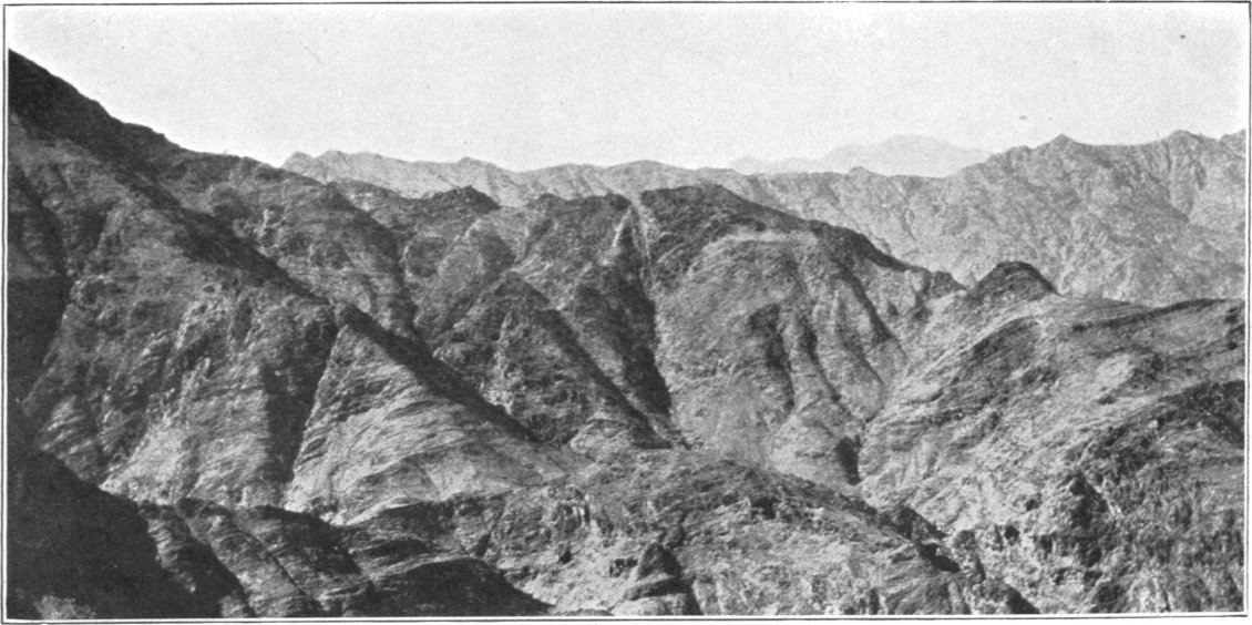
Typical Views among the Mountains of Hamata and Abu Hamamid. (The high peak in the distance in the lower view is Gebel Hamata).
Gebel Um Semiuki is a sharp cone rising to 1,283 metres above the sea among a mass of lower hills three kilometres north-east of Gebel Abu Hamamid. It is of a reddish aspect, due to a film which covers the weathered surface of the green and grey hornfels of which it is composed. It is drained by the Wadi Um Semiuki.
Gebel Abu Argub is a very conspicuous mountain, almost conical in shape, seven and a half kilometres south-south-west of Gebel Abu Hamamid, from which it is separated by lower hills. To the south, Gebel Abu Argub overlooks the plain of Selaia. Its peak, 1,690 metres above sea-level, is a good landmark from the south and west.
Gebel Kahfa is a many-peaked mountain of granite rising abruptly to a height of 1,018 metres above sea from among lower hills of dark schists, nineteen kilometres south-west of Gebel Abu Hamamid. It is detached from the main mountain-mass, being separated from it by the heads of Wadi Um Retba. Its faces are in many places sheer precipices of several hundred metres (see Plate XIII), but the ascent of it from the north is not very difficult. In occupying Kahfa as a station I approached it from Bir Shadli by a well-marked track which skirts the western foot-hills and leads to the Wadi Helie. Leaving this track where it crosses Wadi Um Hargal some six kilometres from Bir Shadli, I ascended the Wadi Um Hargal and crossed the pass at its head into the head of Wadi Um Retba, where I pitched my camp at an altitude of 563 metres, at the foot of Gebel Kahfa 1·3 kilometres north-north-east of the beacon on its summit. The climb of 455 metres from this camp to the top occupied three hours. There is good bivouacking ground close east of the summit, between two ridges. The beacon which marks the triangulation point is in latitude 24° 8′ 18″, longitude 34° 38′ 55″. A walk round the top is full of interest; one can reach many points overlooking tremendous precipices, and the forms assumed by the granite peaks are very remarkable. On the west side of the mountain is a rather large open space forming the head of Wadi Helie, but elsewhere one is surrounded by low hills. The principal drainers of Kahfa are the Wadis Um Hargal and Um Retba (tributaries of Wadi el Sheikh) to the north, and Helie and Abu Hashim (tributaries of Wadi Kharit) to the south.
Gebel Medsus is a small group of high hills rising among lower ones between Gebel Abu Hamamid and Bir Shadli.
Gebel Metawit is a high granite hill rising conspicuously among much lower hills thirteen kilometres north-west of Bir Shadli. A track leading from Bir Shadli to Bir Metawit and other wells further north-west passes close east of the hill. Gebel Metawit is a good landmark for Bir Metawit, which is situated in the wadi of the same name about three kilometres north-west of it. The summit is 741 metres above sea-level or about 295 metres above the wadi floor at the well.
Gebel Hamrat Mukbud is a great red granite mass rising from the plain about twenty-five kilometres west of Bir Shadli. Its isolated character and great altitude (892 metres above the sea and about 450 metres above the surrounding country) render Hamrat Mukbud one of the finest and best known landmarks in this part of the desert. A cairn on its summit marks the triangulation point, in latitude 24° 9′ 53″, longitude 34° 23′ 17″. Its ascent is a matter of some difficulty, owing to its great steepness.
El Hamra is another red granite mass, much smaller than Hamrat Mukbud, lying about half-way between that mountain and Bir Shadli, and separating the Wadi Abu Hamamid from the Wadi el Sheikh.
Gebel Homr Akarim is a hill about thirty-three kilometres west of Gebel Hamrat Mukbud, close to the north of Wadi el Khashab. Its summit, 490 metres above sea, is marked by a triangulation cairn.
Gebel Marasan is a range of mountains north-west of Abu Hamamid. It is cut through by an important pass over the main watershed, 685 metres above sea-level, connecting the Wadis Huluz and Abu Hamamid by their respective tributaries Marasan and Marasani, which drain north-east and south-west from the pass. The highest peak of the mountains south of the pass is 1,261 metres above sea-level, while those to the north are lower. The name Gebel Marasan is, however, commonly given only to the peaks north of the pass, as they rise more abruptly from it, while those to the south are unnamed or regarded as part of Gebel Hamamid because the Wadi Abu Hamamid drains their southern flanks.
PLATE XIII.
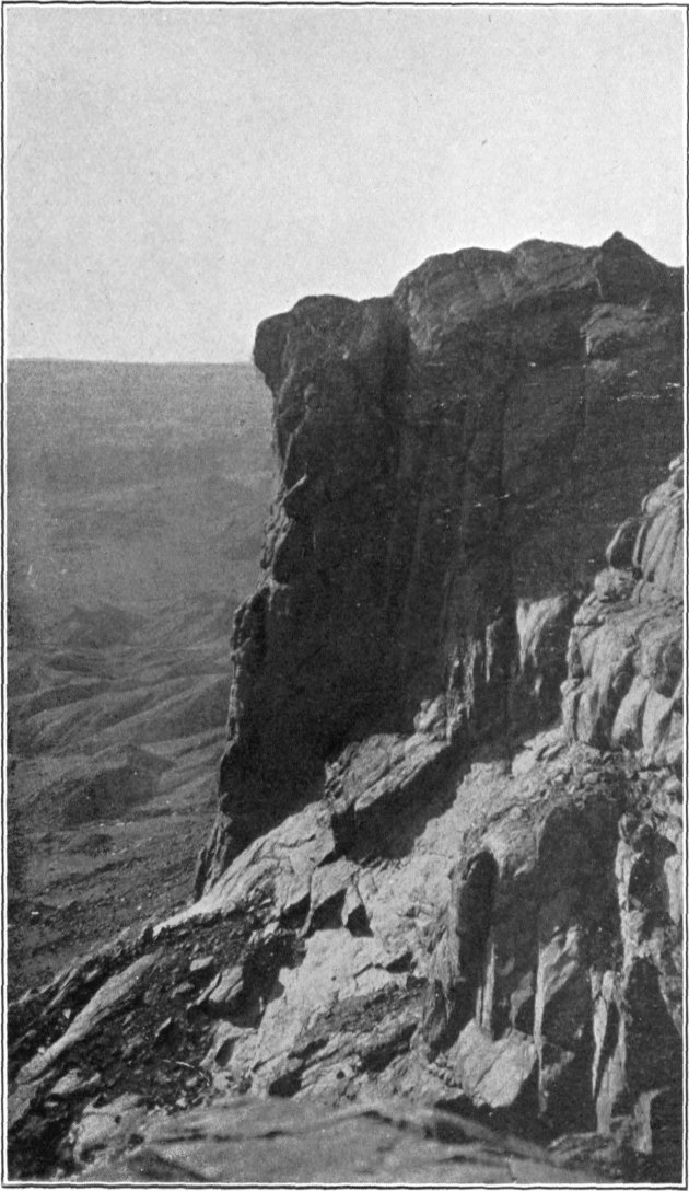
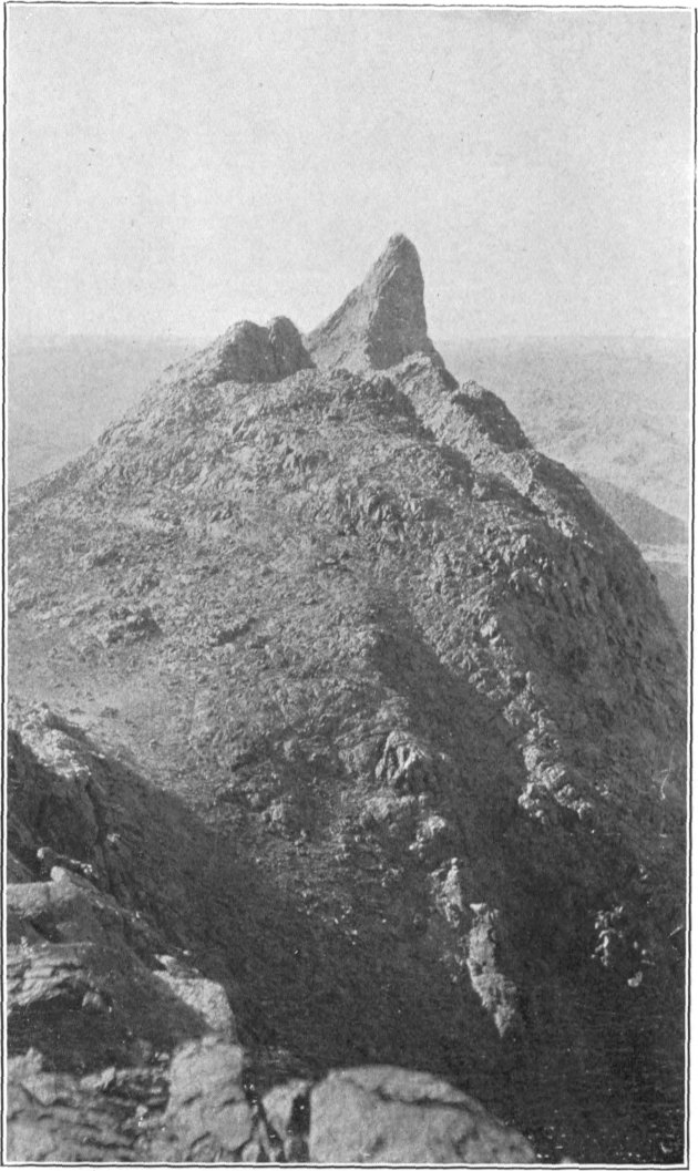
Two Views on Gebel Kahfa. (Granite).
Gebel Khulla is a range lying a few kilometres west of Gebel Marasan from which it is quite separated. Its highest point is 978 metres above sea. It is drained by Wadi Khulla, a tributary of Wadi Abu Hamamid.
Gebel Um Sedri is a remarkable pair of twin peaks on or near the main watershed seventeen kilometres north-west of Gebel Abu Hamamid, and a little to the south of the Wadi Huluz. These peaks, which are 970 metres above sea-level and about 460 metres above the floor of Wadi Huluz, are very conspicuous from the surrounding high country, but they cannot be seen from the Wadi Huluz itself as they lie a little way back from the scarps which bound the gorge. It is the drainage from the hills round Gebel Um Sedri which feeds the water holes of Um Gerifat, in a little gorge opening to Wadi Huluz about two kilometres north-west of the peaks.
Gebel el Heda is a conspicuous hill situated ten kilometres north-north-west of Gebel Metawit, between the Wadis Antar and Khashab. Its highest point is 862 metres above sea-level.
Gebel Nukheira is a group of high hills on or near the main watershed, close to the head of Wadi Antar and about ten kilometres north-north-west of Gebel el Heda. Its highest point is 876 metres above the sea.
Gebel Ras Abu Etl is a lower hill seven kilometres north-east of Gebel Nukheira. As seen from the upper part of the Wadi Gemal it appeared to have a flat top, which is 648 metres above the sea. It is probably drained by the short Wadi Abu Etl, which joins Wadi Huluz to form the Wadi Gemal.
Gebel Um Suerab is a great high ridge of dark looking rocks, surrounded by high flanking hills, rising conspicuously in the hilly country between the Wadis Huluz and Gemal, about twenty-four kilometres north-north-west of Gebel Abu Hamamid. The top of its ridge, which appears to be nearly level for about a kilometre of its length, is 1,024 metres above sea-level. From its neighbourhood drain two wadis in opposite directions; one, called the Wadi Um Suerab lil Gemal, goes northward to join Wadi Gemal, while the other, called Wadi Um Suerab lil Huluz, is the longer and courses southward to join Wadi Huluz.
Gebel Durunkat is another apparently flat-topped hill eight kilometres south-east of Gebel Um Suerab, on the west side of the Wadi Durunkat, about thirteen kilometres above its junction with Wadi Gemal. Its summit is 924 metres above sea-level.
Gebel Abarun is a mountain range situated a short distance north-east of Gebel Abu Argub, from which it is separated by the Wadi Abarun. Its highest peak, almost due east of that of Abu Argub, from which it is separated by the Wadi Abarun, is 1,602 metres above sea, and overlooks the great plain of Selaia to the south.
Gebel Um el Tiur is a range extending south-east from Gebel Abarun, forming a southward prolongation of the mountains. Its highest peak is 1,450 metres above the sea, while the terminal peak southward is 1,080 metres. It is drained on the west by the Wadis el Shel and el Anbat (tributaries of Wadi Kharit) and on the east by the Wadi Um el Tiur (a tributary of Wadi Hilgit lil Kharit).
Gebel el Anbat is a group of lower dark coloured hills forming the south foot hills of Gebel Um el Tiur. Its highest point is 788 metres above sea, while a detached black hill a little west of it on the plain rises to 680 metres above sea, or 175 metres above the plain at its base. These hills are drained by the Wadi el Anbat and other small feeders of Wadi Kharit.
Gebel Um Usher and Um Hasidok are conspicuous peaks on the main watershed ten kilometres east, and twelve and a half kilometres east-south-east respectively of Gebel Abu Hamamid, rising to 1,487 and 1,497 metres above sea-level. They are drained to the south by the Wadi Hilgit lil Kharit, and to the north by the Wadi el Mahali, a feeder of Wadi Huluz.
Gebel el Mahali is a rather high peak of grey porphyry which forms a northerly extension of Gebel Um Usher, close south of the Wadi Huluz. Its top is 1,112 metres above sea, or 330 metres above the adjacent wadi floor.
Gebel Hamata, with one exception[106] the highest mountain in the Eastern Desert of Egypt, is situated on the meridian of 35°, in latitude 24° 12′, thirty-three kilometres from the nearest point of the coast and 213 kilometres from the nearest point of the Nile, and rises to an altitude of 1,978 metres above sea-level; the summit is marked by a triangulation beacon, the position of which is latitude 24° 12′ 17″, longitude 35° 0′ 16″. Gebel Hamata lies some five kilometres east of the main watershed, which curiously enough is not always formed by the highest peaks. It is drained principally by the Wadi Huluz, the heads of which almost encircle it. The Wadi Hamata heads in the eastern face of the high ridge which connects Gebels Hamata and Abu Ghusun, and thus only takes a small portion of the drainage of Gebel Hamata itself. Though surrounded by other high mountains, Hamata towers above them so as to be a very conspicuous feature on the sky line from great distances. Looked at from the north or south, it is like a great, rather flat, cone with a smaller cone east of it. The best way to ascend the mountain is from the head of the Wadi el Abiad, that feeder of Wadi Huluz which drains the north face of it. In proceeding up the Wadi el Abiad from Wadi Huluz, one is shut in by high hills on either side till about six kilometres from the mountain; then the wadi opens into a rough plain with low granite hills, and the imposing mass of Hamata springs suddenly into full view. My camels were coaxed on with their loads up this wadi, which becomes very steep and stony as its head is approached, to within two and a quarter kilometres of the summit, where they actually reached an altitude of 1,025 metres above the sea. The ascent of the remaining 953 metres on foot, though tiring, was fairly easy, and occupied less than four hours. The lower third of Hamata is a whitish granite; this gives place higher up to a hard quartz felsite, which rings under the hammer and weathers into rusty brown blocks. To the east of the main summit the rock changes to a green breccia, which seems to form a considerable portion of that part of the mountain. The view from the summit is a fine one in clear weather, including as it does an extensive prospect of the rugged mountains around, and a large extent of coast-line. But it was on this mountain that I had my first experience of the chronic haze which seems to hang almost perpetually over the coastal regions in the neighbourhood of the tropic, and which is the greatest enemy of the surveyor in these parts. On each of the three days which I spent on Hamata, the morning sun rose over cloud-banks to the east; clouds filled all the wadis and covered the lower country, while the highest peaks stood up clear and sharp above the sea of cloud. Towards 10 a.m., the clouds gradually melted away over the land under the increasing solar influence, but there remained a continuous haze, especially over the coast and out to sea. The explanation of the almost perpetual clouds and haze was soon seen, and is very simple. If the wind blows from the north-west, it is generally cool or even cold in winter. If this north wind is dry and persistent, the air is clear; but should it fail and warm moist breezes set in from seaward, these drop their moisture on reaching the cooler air of the mountains. If the air is still or nearly so, the moisture is evaporated in the sun’s rays during the day, only to precipitate itself again as the air cools by rapid radiation at night. As a consequence, dews on the mountains are extremely heavy, and one soon learns to seek the shelter of an overhanging rock or to improvise a rude tent from a blanket and a few sticks over one’s nightly resting-place.
Gebel Abu Ghusun is a mountain range north of Hamata, with which it is connected by a ridge of lower peaks so as to close in the small rough granite plain north-east of the latter mountain. Its highest peak, eight kilometres north-north-west of Gebel Hamata, is 1,389 metres above sea-level. It is drained on the south by the Wadi el Abiad, the same tributary of Wadi Huluz which drains the north face of Hamata, and on the north by the Wadi Abu Ghusun, which enters the sea separately.
Gebel Um Laham is a mass of lower hills a little west of Gebel Abu Ghusun, forming the side of Wadi Huluz opposite to Gebel el Mahali.
Gebel Tarfawi is a complex mountain range fourteen kilometres north-west of Gebel Hamata. Its highest point, at the north-west end of a ridge, is 1,363 metres above the sea. It is probably drained to the south by the Wadi Tarfawi, a tributary of Wadi Huluz, and to the north by feeders of Wadi Romit.
Gebel Um Heshenib is a great ridge situated twenty-two kilometres north-west of Gebel Hamata. The beacon on its highest point, in latitude 24° 20′ 49″, longitude 34° 50′ 53″, has an altitude of 1,135 metres above the sea. Its lower parts are granite, but the upper third is of dark schists, while the actual ridge on which the beacon stands is a grey porphyrite. Gebel Um Heshenib is drained to the north by the Wadi el Abiad, a tributary of Wadi Gemal, and to the south by tributaries of Wadi Huluz. I ascended it on two occasions from opposite sides. The north approach is the easier road for camels, as they can pass easily up the broad and sandy Wadi el Abiad, while to reach it from Wadi Huluz one has to journey over a rather stony pass and along narrow stony wadis. But the climb is longer from the north side, being one of 635 metres against 380 metres from the south, and the southern climb is easier as well as shorter. It is interesting to note that as the ground south of the mountain lies at an average level of 250 metres higher than that to the north, the plumb-line ought from theoretical considerations to be attracted to the south by several seconds, and this was found to be the case when the mountain was used as a latitude station (see p. 47) There is a very difficult pass east of the mountain from the head of Wadi el Abiad into a tributary of Wadi Huluz; I was told that loaded camels could not possibly get over the pass, and have reason to believe the statement true, as although I did not consent my men were desirous of going over it and volunteered to carry the baggage over themselves to relieve the camels.
Gebel el Abiad is the name given to two distinct ranges of high granite hills on either side of the Wadi el Abiad, north and east of Gebel Um Heshenib. The eastern of these two ranges extends in a north-westerly direction for about twelve kilometres from Gebel Tarfawi to near the place where Wadi el Abiad turns to the north-east. It has numerous peaks, of which the most conspicuous is at the south-east end of a high ridge six and a half kilometres north-east of Gebel Um Heshenib, and rises to 957 metres above sea. This eastern range is drained from the west by the Wadi el Abiad, and from the west by the Wadis Shoab and Romit. The western range is slightly lower and less extensive; one of its most conspicuous peaks, eleven kilometres north-north-east of Um Heshenib, is 892 metres above the sea, and there are numerous other peaks further south of almost equal altitude. This western range is almost entirely drained by the Wadi el Abiad, a feeder of which curves round the south end of the range, thus separating it from Gebel Um Heshenib; the drainage from the north end probably passes into the Wadi Mukhatatat, while a portion of the eastern slopes may be drained by feeders of Wadi Durunkat. It is the coarse white granitic sand resulting from the disintegration of the rocks of these hills which gives its name to the Wadi el Abiad, and the hills take their name from the wadi. The heads of the wadi near Gebel Um Heshenib are, however, blackened by hornblendic downwash from the schists which overlie the granite of that mountain.
Gebel Shoab is a very high white granite hill close to the head of Wadi Shoab, on its north side. It rises to 830 metres above the sea, or about 400 metres above the wadi floor.
Gebel Hefeiri is a very sharp granite peak a little west of the Wadi Abu Ghusun, about fifteen kilometres north of Hamata. Rising to 612 metres above the sea, or about 300 metres above the wadi near it, among lower granite hills, it is a good landmark. There is a smaller very sharp peak two and a half kilometres to the north-east, on the opposite side of the Wadi Abu Ghusun, while to the west are sugar loaf shaped hills.
Gebel Um Sueh is a conspicuous granite hill six and a half kilometres east of the Wadi el Abiad and four and a half kilometres north of the Wadi Shoab, rising to 781 metres above sea. It is probably drained from the north-east by the heads of Wadi Um el Abbas.
Gebel Um el Abbas is a very remarkable granite hill between Gebels Um Sueh and Abu Hegilig. From the north, it looks like a square block with precipitous sides, having a sheer drop of about 200 metres. Its summit is 697 metres above sea. It is drained by the Wadi Um el Abbas, which goes independently to the sea.
Gebel Abu Hegilig is another high granite hill, three and a half kilometres east of Gebel Um el Abbas and twenty-six kilometres north of Gebel Hamata. Its summit, 607 metres above sea, is marked by a beacon, the position being latitude 24° 26′ 16″, longitude 34° 58′ 32″. The hill is drained by feeders of Wadi Um el Abbas. The camp from which I ascended the hill was in one of these feeders 1,200 metres north-east of the beacon and 267 metres above sea-level; the climb of 340 metres was not difficult, and only occupied a little over an hour. The beacon is on a block not large enough to take an instrument, so that observations here were taken from an eccentric point a little way along the ridge and afterwards reduced to centre.
Gebel Sarobi is a small hill-range twenty-two kilometres north-east of Gebel Hamata and some eleven kilometres from the sea coast. The peak at its south end is 471 metres above sea-level. This range has not been closely approached nor well seen, but it must be very conspicuous to any one travelling in the low hill country near the sea.
Gebel Ras el Kharit is a mountain range forming part of the main watershed, running in a nearly east and west line a little south of Gebel Hamata. Its highest peak is extremely sharp, and rises to 1,661 metres above sea-level six kilometres south-south-east of Hamata. Of the many other peaks of the range, the chief is one three kilometres west of the highest point, and six kilometres due south of Hamata; this reaches an altitude of 1,564 metres. The northern face of the range is drained by the heads of the Wadi Huluz, while the southern is drained by the heads of Wadi Kharit, whence the name of the mountain range.
Gebel Khashir, which forms an eastward extension of Gebel Ras el Kharit, reaches an altitude of 1,565 metres above sea-level; its highest peak is nine and a half kilometres south-east of Gebel Hamata. It is drained to the sea by the Wadi Khashir, the heads of which end in the precipitous eastern faces of the mountain.
Gebel Mikbi is a long high ridge on the main watershed, seven kilometres south of Gebel Khashir. Its highest point, at the south end of the ridge, is 1,388 metres above sea-level. Gebel Mikbi is connected with Gebel Ras el Kharit by a lower ridge running north-west and forming the continuation of the watershed across the head of Wadi el Kharit. There is a pass across this ridge into the head of Wadi Mikbi, which drains Gebel Mikbi seawards, but it is a very difficult one for loaded camels owing to the great steepness of the eastern side.
Gebel Zatit is another high ridge about five kilometres east of Gebel Mikbi, on the south side of the head of Wadi Mikbi.
Gebel Egat is a high mountain close to the south-west of Gebel Mikbi, forming the continuation of the watershed. It has two principal peaks, two and a quarter kilometres apart, of which the south-west one is the higher, being 1,422 metres, while the north-east one is 1,277 metres above the sea. The western face of the mass is drained by the Wadi Egat, a tributary of Kharit, while the eastern flanks are cut up by feeders of the Wadi Sefent, a tributary of Wadi Lahami.
Gebels Um Sellim and Gumudlum are high hill ranges forming an eastward extension of the Egat and Mikbi mountains, on the north side of Wadis Sefent and Lahami. The highest point of Gebel Um Sellim is 947 metres above sea, or about 620 metres above the floor of Wadi Lahami. These ranges are flanked by lower hills through which run various small wadis such as Um Khuzuma, Um Ghobasha, and Gumudlum, all feeders of Wadi Lahami. Some of these small wadis contain rock basins or galts which retain large supplies of water for some time after rain has fallen on the hills.
Gebel Abu Gurdi is a great mountain in latitude 24° 0′, forming the terminal peak to the south of the Hamata group. The beacon on its summit, in latitude 24° 0′ 11″, longitude 35° 5′ 17″, is 1,562 metres above sea-level. Though in reality a ridge, Abu Gurdi from most points of view looks like a rather flat cone, surrounded by lower hills. It is on the main watershed, which crossing to the summit from Gebel Egat, continues south-eastward along a narrow ridge descending to the pass at the head of Wadi Lahami. The south-west parts of Abu Gurdi are drained by the Wadis Abu Gurdi and Elemikan, both tributaries of Kharit, while its southern and eastern parts drain into Wadi Lahami by various feeders, of which the chief are the Wadis Um Karaba, Um Rishan, Um Homar, and Sefent. Gebel Abu Gurdi could probably be ascended from the west by following up the Wadi Abu Gurdi, but in occupying the mountain as a triangulation station I descended the Wadi Lahami as far as the point of influx of Wadi Um Karaba and then ascended the latter wadi as far as the camels could get, pitching my camp two kilometres south of the summit at 804 metres above sea-level. The ascent of 758 metres to the beacon on foot from the camp occupied two and a quarter hours of fairly stiff climbing; it presented no serious difficulties, but the rock near the top is much broken up and one has to be careful lest blocks are dislodged under one’s foot. The view from the top of Abu Gurdi on a clear day must be extremely fine, but during the three days I remained there a thin haze spoiled the distant prospect, especially towards the coast; the remarkable shapes of the granite peaks of Gebel Faraid, sixty kilometres to the south-south-east, formed the most striking feature in the scene.
Gebel Derhib, 1,160 metres above the sea, is a mountain separating Wadi Abu Gurdi from Wadi Egat; it is really an extension of Gebel Abu Gurdi, from the beacon on which its summit is six and a half kilometres west.
Gebel Um Goradi is likewise in reality part of the Abu Gurdi mass, forming the end of a spur extending south-eastward for ten kilometres from the main peak. The Wadi Lahami curves round its foot northward, passing between it and Gebel Um Gunud.
Gebel Selaia[107] (the bald head) is a very remarkable rounded granite boss rising from the plain thirty-one kilometres south-south-west of Gebel Hamata. Owing to its peculiar shape, isolated position, and considerable height (its top is 787 metres above sea-level and about 260 metres above the plain), Selaia is a conspicuous landmark for great distances round it. The lower illustration on Plate XI (p. 172) gives an idea of its appearance as seen from the east; from the north or south it appears much steeper.
South-east of Gebel Selaia stretches a line of four smaller granite hills. The first of these, about a kilometre from the great boss, is interesting as having a small spring, called Megal el Selaia, at its foot. The next, one and a half kilometres further on, is larger, while the third is larger still, rising to 623 metres above sea-level. The fourth, five kilometres from Gebel Selaia, is marked by a triangulation beacon, 563 metres above sea-level and about fifty metres above the plain, in latitude 23° 55′ 30″, longitude 34° 54′ 37″.
Gebel el Homur is an isolated mass of granite hills on the plain six kilometres north-east of Selaia. Its highest point is 731 metres above sea and 230 metres above the plain at its foot. It is drained by small feeders of the Wadi Abu Gurdi, which passes north of the mass on its way across the plain to join Wadi Kharit.
Gebel Abu Derega is an isolated mass of higher granite hills thirteen kilometres south-east of Gebel Selaia. Its highest point is 831 metres above sea-level, and about 300 metres above the plain. Gebel Abu Derega is on the Nile — Red Sea watershed, which crosses the plain from east to west in this locality. The northern drainage is to the Wadi Elemikan, which runs between Gebels Abu Derega and Selaia to join Wadi Kharit, while the southern faces of the hills are drained by feeders of the Wadi el Khiua, a tributary of Wadi Um Bisilla, in the basin of Wadi Hodein.
Besides the hills above described, there are many smaller ones scattered at intervals over the great sandy plain of Selaia, but the only others calling for special notice are the three very remarkable white conical hills called Marwot Elemikan, situated twelve kilometres east of Abu Derega. These hills, though small, are conspicuous from considerable distances, owing to the dazzling appearance of the pure milk-white quartz of which they are composed. The highest and most northerly one, with a triangulation beacon on its summit, rises to 648 metres above sea, or 68 metres above the plain, in latitude 23° 54′ 14″, longitude 35° 6′ 8″. The other two lie about two kilometres south-east and south respectively, with a black hill mid-way between them.
The Um Gunud — Dahanib — Batoga Group.
The mountains of this group, occupying the country east of the watershed between Wadi Lahami and Wadi Khoda, are considerably lower than those of the preceding two groups, only a few peaks rising more than 1,000 metres above sea. The north portion of the group is formed by the line of mountain ridges which as seen from the sea near Berenice appears to connect Gebel Kalalat with Abu Gurdi, while the south part spreads further east and west and contains the highest peaks.
Gebel Um Gunud is the northernmost mountain of the range west of Berenice. It is a dark rugged ridge, surmounted by a cairn[108] 989 metres above sea-level, forming the east side of the Wadi Lahami opposite Gebel Abu Gurdi. It is drained from the west by the Wadi Um Gunud, a feeder of Wadi Lahami, and on the east by feeders of Wadi Naait. Gullies in the west flanks of the mountain contain rock basins, called Galt Um Gunud, which hold water supplies for a long time after rain has fallen, and which are fairly easy of access from Wadi Lahami.
Gebel Eidab, the next member of the range to the south, rises to 848 metres above sea. It is drained on the west by the Wadi Eidab, a tributary of Wadi Lahami, and on the east by the Wadi Abu Daba, a tributary of Wadi Mukhit; a rough and steep pass is said to exist from east to west between the heads of these two wadis near the mountain.
Gebel Um Maiat, a long high ridge stretching south-east from Gebel Eidab, has three marked summits near its ends and centre; that at the north end, which is the highest, is 928 metres, while the other two are 870 and 842 metres above sea respectively. Another broken ridge, of similar height, for which I could get no name from my guides, forms a south-eastern prolongation of Um Maiat, and extends to the Wadi Kalalat; this likewise has three well defined summits, rising in order from north to south, to 875, 821, and 627 metres respectively. These ridges are drained to the east by the Wadis Murra (tributary of Abu Daba) and Mindeit. Their western drainage has not been studied in detail, but it all reaches the sea, none of it going Nilewards; part of the drainage is probably taken by each of the Wadis Kalalat, Shut, and El Khiua.
To the east and north-east of the Um Gunud — Eidab — Um Maiat range is a great expanse of lower hill country through which the wadis cut their way eastwards for about fifteen kilometres to the coast plain. The most conspicuous peaks in this lower hill country are Gebels Um Huk, Abu Ghalqa, and Um Hegilig, all situated in its north portion round about Wadis Lahami and Naait. Other low rugged hills fill a triangular tract south-west of the main range.
Gebel Um Huk is a sharp granite peak, surmounted by a cairn,[109] rising to 517 metres above sea-level near the south side of Wadi Lahami, fourteen kilometres north-north-east of Gebel Um Gunud.
Gebel Abu Ghalqa is another high granite hill, also marked by a cairn on its summit, seven kilometres south-south-east of Um Huk. The cairn is 561 metres above sea-level, and is in latitude 24° 1′ 7″, longitude 35° 16′ 47″.
Gebel Um Hegilig in a small rather spiky range of red granite hills situated a little to the north-east of Gebel Um Gunud, near the heads of Wadi Naait.
To the north-west of Berenice are several low hills on the coast plain, which serve as landmarks and bear special names. Grain el Rih is a conspicuous isolated low hill nearly opposite the place where Wadi Naait emerges from the hills on to the plain, thirteen and a half kilometres north-west of Berenice. Khasheib Abu Daba is the name of some low bouldery granite hills at the place where Wadi Abu Daba enters the plain. Sikeit, a landmark for Berenice, from which it lies five kilometres north-west, is a low granite hill, isolated on the plain and very conspicuous; its summit is seventy metres above sea-level, or thirty-eight metres above the plain at its foot.
The Hills on the Peninsula of Ras Benas are sharply marked off into two portions by differences of colour. The most striking are the dazzling white hills of gypseous limestone which form a narrow sinuous broken plateau nearly along the long axis of the peninsula. The highest points of these white hills are 188 metres above the sea. Deep ravines cut up the plateau and separate it into more or less detached hills. The surface of the gypseous rock is very rough, and frequently weathered into knife-like projections which cut one’s hands and boots badly in climbing. Near the tip of the peninsula the gypseous beds contain a little sulphur in places, and there are some shallow pits which seem to have been dug for exploiting that mineral. But the quantity appears far too small to be of any commercial value, and the pits were probably only exploratory trial holes.
The other hills on the peninsula are darker in colour, being chiefly diorite. They form two masses, one near to where the peninsula joins the main land, and the other on the south side of the peninsula twenty kilometres east of Berenice. The highest point of the first-named group is 276 metres, while that of the second is 197 metres, above sea-level. All the hills on the peninsula are quite separated from those of the main land by the broad sandy plain through which Wadi Mukhit courses south-eastwards to the sea.
Gebel Batoga, a granite mountain fifteen kilometres south-east of Berenice, is sharply marked off from the other mountains near it by its light colour. It is a great boss of acid granite seamed with dykes, having two main peaks. The highest (central) peak rises to 802 metres above sea-level; the southern peak, surmounted by a triangulation beacon in latitude 23° 49′ 37″, longitude 35° 21′ 9″, is seventeen metres lower. Gebel Batoga is drained from the north by feeders of the Wadi Kalalat, and from the south by the Wadi Kunserob. There is a good water source, Galt Batoga, at its north-east foot, consisting of a rock basin which holds a good supply of water for a long time after rain, situated in a small gully close to the Wadi Kalalat, the floor of which is here about 160 metres above sea-level.
Gebel Kalalat, situated about six kilometres west of Gebel Batoga, is a mass of ridges, higher and darker in colour than Batoga. Its highest point, marked by a beacon in latitude 23° 49′ 9″, longitude 35° 17′ 36″, is 1,125 metres above the sea, while another conspicuous peak one and a half kilometres north-east of the beacon, rises to 1,080 metres, and there is a third peak three and a half kilometres south-east of the beacon which attains 894 metres. In ascending Gebel Kalalat to occupy the triangulation station, I followed up the Wadi Kalalat to where the little winding Wadi Um Maiat enters it from the south, then turned up the latter wadi and pitched my camp as far up as the camels could go. The camp was three kilometres north-east of the beacon and 300 metres above sea, so that the climb to be made on foot was 825 metres. Though long and tiring, the ascent to the beacon was not dangerous. Further up the head of the wadi than my camp, I came on a line of galts (rock basins) containing rain water, but they were not easy of access to camels, being in a steep and stony gorge. Perched on the east flank of Kalalat is a very remarkable pinnacle rock, well seen in the illustration on Plate XIV. A very good view of the surrounding mountains is obtained from the summit in clear weather, but the top was wrapped in clouds for a great part of two out of the four days I remained on it. Gebel Kalalat is drained from the north by feeders of the Wadi Kalalat, and from the south by the Wadis Gumudlum and Kunserob. Wadi Kalalat curves round the north-west side of the mass, and it is possible that the ascent might be easier by following that wadi as far as possible and climbing up the north-west face of the mountain. A rough steep pass, impracticable for loaded camels, is said to lead from the head of Wadi Kalalat into Wadi Shut.
Gebel Dibag is a high dark ridge five kilometres south of Gebel Batoga, with a peak at each end. The north-west peak is 517 metres, and the south-east one 544 metres above sea-level. The Wadi Kunserob curves round its east and south flanks, while the Wadi Dibag lil Kunserob drains its eastern face into the same channel.
Gebel Shenshef is a mass of high dark hills between the Wadis Shenshef and Gumudlum, close to the Wadi Khoda. On one of its eastern peaks, situated in latitude 23° 44′ 5″, longitude 35° 22′ 40″, on the west side of Wadi Shenshef, and not so high as others further west, a beacon has been erected overlooking the ruins called Hitan Shenshef. There are wells in the wadi a short distance below this hill. The beacon is 290 metres above the sea and 115 metres above the wadi floor at its foot.
Gebel Dahanib is a mountain of dark coloured rocks (diorite and gabbro), situated twelve and half kilometres south-east of Gebel Kalalat and eleven kilometres north of the Wadi Khoda. Its summit, on which is a triangulation beacon, is in latitude 23° 45′ 44″, longitude 35″ 11′ 10″, and 1,270 metres above sea-level. Gebel Dahanib is surrounded by other mountains and hills, and access to it is not very easy. In order to reach it from Gebel Kalalat I had to make a journey down the Wadi Kalalat, along the coast-plain and up the Wadis Khoda and Allawi, a total distance of over eighty kilometres, although the direct distance between the two peaks is only twelve and a half kilometres. By ascending one of the heads of the Wadi Allawi until camels could get no further, I was able to pitch a camp 540 metres above sea-level and three kilometres south-west of the beacon, leaving 730 metres to be climbed on foot. The ascent, though tiring, was free from difficulties or dangers, and occupied two and a half hours. A galt, containing only a small supply of water at the time of my visit, exists a little further up the head of the wadi than where I fixed my camp. There is a good view from the summit, but in the winter months Dahanib, like all the mountains near the coast, is frequently wrapped in clouds for days together. Of seven days spent on the summit in February 1907, three were passed entirely in clouds, while only portions of the other four were free from fog or haze. It was on Gebel Dahanib that I first noticed the curious electric phenomena which may be observed at high stations when electrified clouds are passing close overhead, my attention being first drawn to them by a spark from the eye-piece of my theodolite striking me over the eye. At the same moment a rapid succession of sparks a centimetre or so long passed between my hand and the adjusting screws of the instrument, while both the theodolite and my hair hissed loudly. In this and all other cases of a like kind, I judged it best to suspend operations for a time and descend a little below the summit till the cloud had passed over.
Gebel Dahanib is drained by the Wadis Allawi, Um Tawil, and Shut, all tributaries of Wadi Khoda, which course for a considerable distance through the surrounding hills before reaching the main trunk wadi.
PLATE XIV.
Gebel Kalalat.
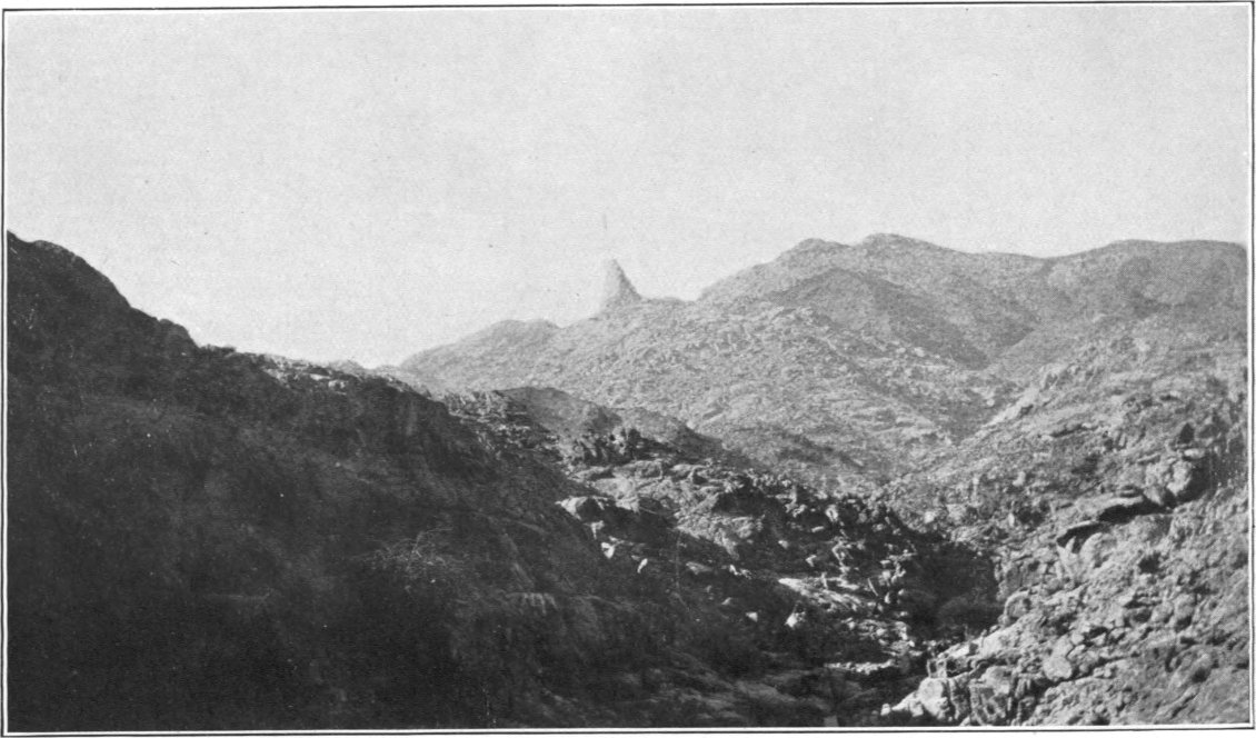
Summit of Gebel Faraid. (Granite).
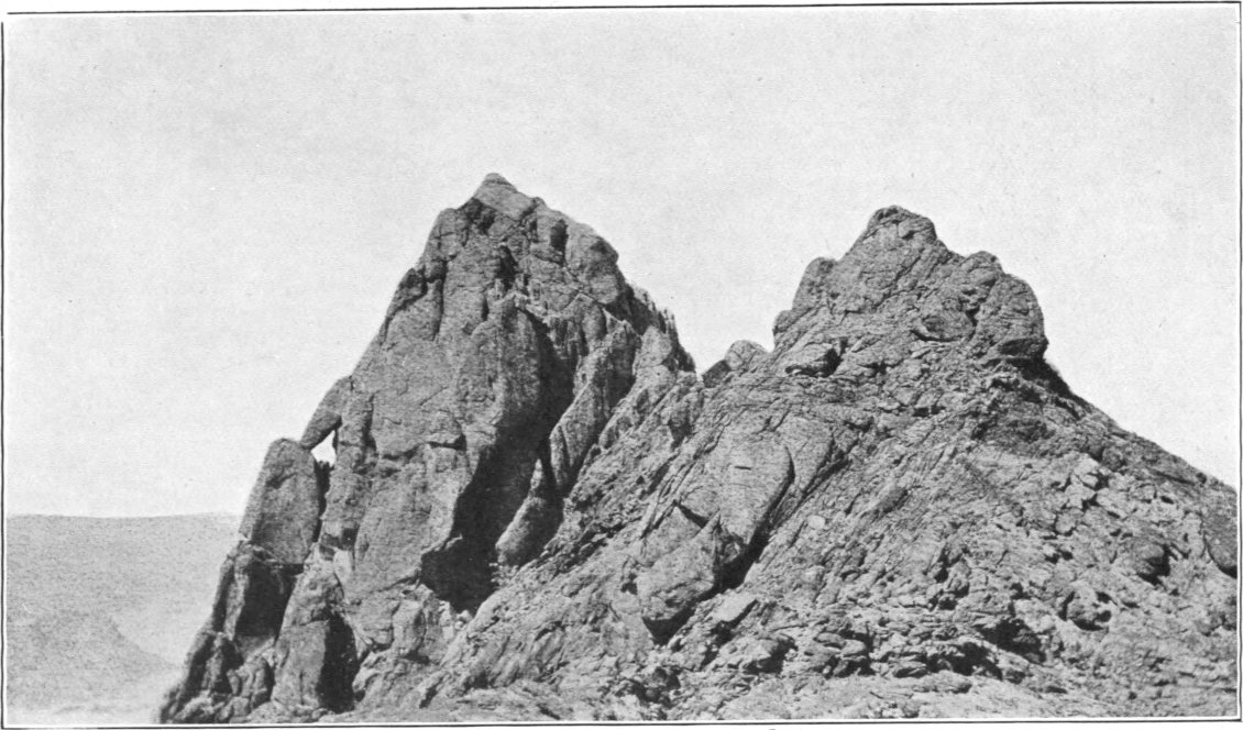
Gebels Um Hegilig, Reyan, and Shut, are high hills situated between the Wadis Shut and Gumudlum, both tributaries of Khoda. Gebel Um Hegilig, a dark peak rising to 966 metres above sea-level, is almost exactly midway between Gebels Dahanib and Kalalat. Gebel Reyan, a little further south-east, is a group of peaks and ridges of which the highest point is 863 metres above sea. Gebel Shut, the most remarkable of the three, is a great cone rising to 930 metres above sea, about five kilometres north of the Wadi Khoda. A very large galt is said to exist among these hills, approachable from Wadi Shut; it is probably in one of the feeders draining westward from Gebel Reyan, which name signifies “the wet mountain.”
Gebel Um Bisilla is a dark mountain of gabbro rising conspicuously among lower hills twenty-two kilometres west of Gebel Dahanib. The triangulation beacon on its summit is in latitude 23° 45′ 34″, longitude 34° 57′ 39″, and 824 metres above sea-level. Gebel Um Bisilla is drained by Wadi Um Bisilla, the head of which encircles its southern half, while the northern flanks are drained by feeders of the Wadi el Khiua, which courses south-west to join Wadi Um Bisilla about ten kilometres west of the mountain. There is an easy passage for camels round the east side of the mountain from the head of Wadi Um Bisilla into a feeder of Wadi Abu Nilih, a tributary of Wadi El Khiua. In ascending the mountain I pitched my camp in one of the gullies draining from it to Wadi Um Bisilla, at an altitude of 513 metres above sea and 1,300 metres south-east of the beacon. The climb of 311 metres from this camp to the summit presented no difficulties, and occupied only an hour and a half.
Erf el Gimal is a high dark ridge surrounded by lower hills ten kilometres west-south-west of Gebel Um Bisilla. Its highest point, the west end of the ridge, is 673 metres above sea. About seven kilometres further west is a conspicuous conical hill called Gebel Abu Shigelat.
Gebel Zergat Naam, sometimes called Hagar el Fil, is a mountain mass on the main watershed thirty kilometres west of Gebel Um Bisilla. It forms a curved range round the head of the Wadi el Kreim, a tributary of Garara. Its northern part is drained partly by the Wadi Abu Had, a feeder of the Rod el Kharuf, and partly by the heads of the Wadi el Fil, which is itself the head of Wadi Naam. The highest peak of the range is a conical one near its south end, 845 metres above sea-level, but the northern peaks are more conspicuous from some points of view, and it is on the highest of these, 823 metres above sea, in latitude 23° 45′ 28″, longitude 34° 40′ 34″, that the triangulation beacon has been erected. My camp at the base was in one of the heads of Wadi el Fil, 527 metres above the sea, and about 700 metres north-east of the beacon. The ascent from here on foot to the beacon was fairly easy. Zergat Naam is a mass of syenite rising through schists, but the northern summits are formed by east and west bands of a very hard quartz felsite. From the summit, looking northwards one sees long lines of north-and-south felsite dykes forming ridges on either side of the head of Rod el Kharuf, while close south of one is the enclosed sloping plain across which run the feeders of Wadi el Kreim. To the south-south-east, a range of lower hills runs north-westward from the end of the main range, and between the two there appears to be a remarkably sudden drop into the head of Wadi Abu Seyal. The Arabs state that there is a very large galt at this point, reached by ascending the Wadi Abu Seyal; the galt is said to hold water for five months after rain. But during my occupation of the station recent rains had filled other smaller rock basins in the gullies to the north, and it was unnecessary to send far from the camp to get supplies. It is interesting to observe from the summit of Zergat Naam the disposition of the rocks forming the lower hills to the south and west; these are of sandstones with marked dips, the area being one of much disturbance by faulting along the Wadi el Kreim.
On the great sandy plain to the north and north-east of Zergat Naam are two extensive groups of low hills, which stand out remarkably owing to their dark colour. One of these groups, twenty kilometres north of Zergat Naam, is called Gebel Geneina Gharbi; it is a mass of hills composed chiefly of dioritic and gabbroid rocks (through there are some schists and granites intermingled) and is drained northward by the Rod el Geneina, a feeder of Wadi Kharit. The other group, called Gebel Geneina Sharqi, is smaller and situated fifteen kilometres further east; I did not visit it, but from its dark colour it is probable that it consists of similar rocks to those above-mentioned. The hills of both groups rise to about 550 metres above the sea, or about eighty to one hundred metres above the plain.
In the low country to the west of Zergat Naam, between the Wadi Garara and the Rod el Kharuf, the most conspicuous hills are Erf el Dubeis, a ridge twenty-six kilometres due west of the beacon, Gebel el Nikeiba, a granite hill marked by a triangulation cairn, 570 metres above sea-level and thirty-four kilometres west-north-west of Zergat Naam; Gebel Felieiti, a sandstone hill, also marked by a triangulation cairn, 500 metres above sea and sixteen kilometres south-west of Gebel Nikeiba; Erf Abu Homur, a ridge at the head of Wadi Abu Homur (a tributary of Garara), about seven kilometres north of Gebel Felieiti; Erf el Mohaib, marked by a triangulation cairn 465 metres above sea-level, about nine kilometres north-west of the last-named hill; and Gebel el Ghar, a hill on the south side of Wadi el Kharit, close to the point where the Rod el Kharuf enters it.
The Abu Dahr — Orga — Um Tenedba Group.
The mountains of this group occupy the tract between the Wadi Naam and Gebel Faraid, and are limited on the south by the Wadi Hodein.
Gebel Abu Dahr, the highest mountain of the group, is a great mass of serpentine, situated in latitude 23° 35′ and about forty kilometres from the coast. Its summit, marked by a triangulation beacon in latitude 23° 36′ 8″, longitude 35° 5′ 46″, is 1,131 metres above sea-level. Its western face is drained by the heads of Wadi Betan, its north-east flanks by those of Wadi Khoda, and its south-east parts by feeders of Wadi Rahaba. Abu Dahr is surrounded by high hills except on the west, where there is low hilly country containing the wells of Betan and the old mining ruins of Um Eleiga (see Plate IV, p. 30). The mountain can be most easily reached either by following up the Wadi Betan to its head, or by ascending the Wadi Salib el Azrak (a tributary of Wadi Khoda) and its feeder the Wadi Um Karaba. There is an easy pass 1,800 metres north of the beacon, between the central mass of Abu Dahr and the high hills north of it, connecting the heads of Wadi Betan and Wadi Um Karaba. A short distance to the south-west of this pass there is a galt in a spur of the mountain which holds water for some time after rain, and which furnished supplies during my stay at the place in 1907. In occupying the triangulation station, I fixed my camp in a small stony wadi draining from the north of the mountain, on the east side of the pass just referred to; the camp was 600 metres above sea-level and 1,200 metres north-north-east of the beacon. The ascent, which occupied three hours, was rather difficult and dangerous, the mountain being not only steep[110] but composed of rotten highly crushed rock which came away in tons at a mere touch. There is a very extensive view from the summit, the striking peaks of Faraid being a marked feature to the east and south-east, while to the south are the great masses of Mishbih, Niqrub and Gerf, with the sandstone plateaux of Dif, Hodein and Abraq limiting the view to the south-west. The rock of Gebel Abu Dahr is highly magnetic, and several pieces which I examined showed strong polarity. The compass needle points in all sorts of directions as one moves about the mountain.
Gebel Abu Dahr and the high hills round it, especially to the south, form an important rain-collecting area, the drainage from which feeds, wholly or in part, the wells of Betan, Rahaba, Abu Reye, Abu Beid, and Gahlia, all of which are within a radius of about fifteen kilometres of the summit of the mountain. The relative abundance of water in this area is caused by two main factors. In the first place, the situation of the mountain on the eastward side of the watershed, only about forty kilometres from the coast, and its considerable height, condition the frequent accumulation of clouds about its summit, with relatively high rainfall as a consequence. And in the second place, the steepness of the slopes, and the fact that the serpentine rocks are not only of an impermeable nature, but are so crushed that the downwash into the gullies around is chiefly composed of smooth faced blocks rather than of absorbent sand, condition a higher ratio of run off to rainfall than exists in the case of most other localities in the Eastern Desert. A similar state of things is found in the case of Gebel Gerf, which, as will be mentioned further on, likewise consists of serpentine and is the centre of a district relatively rich in good wells; while in the case of the mountains of Faraid, which are much higher and closer to the sea, but consist of granite weathering into sand, though the rainfall is probably greater, the absorption by the sand is so rapid that there are no wells known to exist in their neighbourhood.
Between Gebel Abu Dahr and Gebel Um Bisilla there are three remarkable little groups of granite hills. Gebel Abu Arta is a small range of red peaks six kilometres south of Um Bisilla; Gebel Hendusi, five kilometres further south, is a very conspicuous sharp granite peak rising to 678 metres above the sea and forming a good landmark; while Gebel Abu Husenat, four kilometres east of Hendusi, has another well-marked peak rising to 725 metres above sea-level.
Gebel Abu Sieiyil is a many-peaked hill range running north and south for about four kilometres, situated eight kilometres west of the beacon on Gebel Abu Dahr. It has the appearance of being composed of a pink gneiss, but has not been visited. Its central peak, fixed by triangulation, is 833 metres above sea. The Wadi Abu Beid el Azrak runs south-westward past the south end of the range, through a gap between it and a smaller hill range to the east.
Gebel Arais is a considerable range of gneiss peaks situated on the east side of Wadi Naam in latitude 23° 34′. One of the most conspicuous of its many summits is a pair of twin peaks near the south end of the range, rising to 613 metres above the sea. The range is cut through from east to west by the narrow and winding Wadi Arais, a tributary of Wadi Naam. The drainage from the western faces of the range passes by many feeders over a sandy plain to join the Wadi Naam directly.
Gebel Belamhandeit or Erf Um Araka is a long range of granite or gneiss hills north of Gebel Arais. It extends for a length of nine kilometres in a north-and-south direction on the meridian of 34° 50′. It is drained on the north and west by the Wadi Erf Um Araka, a tributary of Wadi Naam, and on the east by the Wadi Belamhandeit, a tributary of Wadi Arais.
To the east of Gebel Belamhandeit are several granite bosses, of which the most conspicuous is called Gebel Um Guruf; it is drained by the Wadi Um Guruf, a tributary of Wadi Arais.
Gebel Orga, eighteen kilometres south by east from Gebel Abu Dahr, is a high dark-looking range which has not been closely approached. Its highest peak, surmounted by a beacon, the position of which has been fixed by triangulation, as latitude 23° 26′ 21″, longitude 35° 8′ 17″, is 682 metres above sea-level. It is drained by the Wadi Orga (a tributary of Wadi Hodein), which contains the well called Bir Orga.
Gebel Um Tenedba is a mass of dark hills of crushed basic rocks situated thirty kilometres south by east from Gebel Abu Dahr and twelve kilometres north of the Wadi Hodein. Its highest point, marked by a triangulation beacon, is in latitude 23° 19′ 48″, longitude 35° 10′ 40″, and 654 metres above sea-level. It is drained by the Wadi Um Tenedba, a tributary of Wadi Hodein. The ascent of the hill is conveniently made in about an hour from a camp in one of the heads of Wadi Um Tenedba, about 1,200 metres south-east of the beacon and 320 metres above sea-level.
Gebel Harhagit is an isolated granite boss rising among schists ten kilometres south-south-east from Gebel Um Tenedba and five kilometres north of the Wadi Hodein. The beacon on its summit is in latitude 23° 14′ 35″, longitude 35° 12′ 52″, at an altitude of 542 metres above sea-level, or 326 metres above the wadi encircling its base. From its isolated character Gebel Harhagit is a conspicuous landmark for considerable distances round the Wadi Hodein.
Gebel el Anbat is conveniently considered here, though it lies on the south side of the Wadi Hodein. It presents a somewhat similar appearance to Gebel Harhagit, from which it lies nineteen kilometres south-east, and like it bears a beacon on its summit. The position of the beacon is latitude 23° 6′ 5″, longitude 35° 19′ 27″. El Anbat is lower than Harhagit, being only 390 metres above sea-level; it consists also of a different rock, being chiefly composed of curious brown and reddish calcareous schists. Gebel el Anbat is practically in the Wadi Hodein, the main channel of which is deviated by its foot-hills so as to pass round the east side of the hill. It is best ascended from the south, where a camp can be fixed about 600 metres south of the beacon and about 255 metres below it; the ascent is easy and occupies less than an hour.
Eastward of Gebel Abu Dahr there extends for some thirty kilometres along the south side of Wadi Khoda a mountainous tract of dark rocks, the principal masses of which, from west to east, bear the names of Gebel Hindia, Gebel Um Akra, and Gebel Um Etli. These mountains have only been seen from a distance, and little is known about them beyond the positions and altitudes of their principal peaks, which have been fixed by triangulation. Gebel Hindia, thirteen kilometres east of Abu Dahr, rises to 873 metres above sea-level, and is drained partly by the Wadi Hindia to the north, and partly by the Wadi Salib el Azrak. Gebel Um Akra, six kilometres further east, is higher, its highest peak, marked by a beacon, being 1,050 metres above the sea, while a ridge a little further south reaches 970 metres; it is drained to Wadi Khoda by the Wadi Um Akra. Gebel Um Etli, which forms the south side of the Wadi Khoda just before that wadi emerges on to the coast-plain, has three main summits, reaching respectively to 844, 795, and 764 metres above the sea. It is a rather extensive mass, drained on the north by the Wadis Buluk and Um Lassaf, tributaries of Wadi Khoda, and on the south by the Wadi Um Etli, which reaches the sea independently.
The Faraid Group.
The mountains of this group cover a tract about forty kilometres in length from north to south, between the Wadis Um Etli and Rahaba and lie closer to the sea than any other mountains in the area described, their peaks being only ten to twelve kilometres from the coast. They consist entirely of granite, weathered into a forest of peaks the forms of which render them in respect of shape the most remarkable mountains in Egypt. There are four main masses in the group, of which the three northern ones are called collectively Faraid, while the southern one, which is smaller than, and separated from, the rest, is called by the diminutive name Fereyid.
The most northern mass of Gebel Faraid is the highest, its principal peak, situated in latitude 23° 33′ 7″, longitude 35° 22′ 10″, being 1,366 metres above sea-level. As seen from the north, this mass appears somewhat like an outspread hand, its western peak seeming to overhang slightly like a thumb, while the higher eastern peaks resemble fingers. The name Mons Pentadactylus given to the mountain in antiquity, and quoted by Ptolemy, would appear to have referred only to this northern mass, and not to the Faraid group as a whole.
The second mass presents from most aspects the form of a nearly flat-topped mountain with a little peak on it and very steep sides. Its highest point, situated in latitude 23° 30′ 53″, longitude 35° 20′ 25″, is 1,259 metres above sea, and forms a main triangulation point; it is too sharp to support an instrument or even a beacon, and observations had to be taken from an auxiliary station a little distance away from the summit and reduced to centre. In ascending this peak as a survey station I approached it from the west by the Wadi el Abiad and Wadi Abu Ribian, placing my camp close under the mountain, on a sandy plain 450 metres above sea-level and one and a half kilometres north-west of the summit. The climb of 800 metres was steep, but not dangerous, and occupied about three hours. The lower illustration on Plate XIV (p. 192) shows the top of the mountain; the lower of the two peaks is the one occupied for triangulation.
The third mass of Faraid is a great expanse of peaks extending over eighteen kilometres north and south and some twelve kilometres east and west. Its highest peak, called “The Bodkin” by the Admiralty surveyors, has the position latitude 23° 28′ 58″, longitude 35° 20′ 35″, and rises to 1,232 metres above sea-level, dominating the rest of the mass both by its height and its singular form; it is a great sharp pinnacle, apparently unclimbable, visible from distances of over 100 kilometres in nearly all directions, and a very conspicuous landmark. South and west of “The Bodkin” are numerous other peaks, some of which have been fixed by triangulation; several of them rise to over 900 metres above the sea, and the whole forms a compact mass across which there appears to be no passage for camels.
Gebel Fereyid, the fourth and most southerly of the masses constituting the Faraid group, is a small spiky range quite detached from the rest, about seven kilometres north of the Wadi Rahaba. It has two main peaks, close together, of which the north-western one is slightly the higher and is surmounted by a beacon, 612 metres above sea-level, in latitude 23° 17′ 29″, longitude 35° 22′ 48″. In occupying this peak as a triangulation station, the camp was fixed in one of the heads of a nameless wadi draining past the north face of the mountain to the sea, at an altitude of 200 metres above sea-level and 850 metres north-north-east of the beacon. The ascent was easy till within about fifty metres of the summit, when it became difficult and rather dangerous, and there is very little room on the top. I had to remain six days on this mountain owing to almost continuous haze and clouds blocking the view.
The drainage from the western faces of the entire Faraid group is taken by the Wadi Rahaba. That from the peaks north of “The Bodkin” is collected by the Wadi el Abiad and its feeders the Rod Elbel and Wadi Abu Ribian, while the more southern parts are drained by various other tributaries of Wadi Rahaba, of which the principal are the Wadis Dagalai lil Rahaba, Abu Had, and el Marafai. The heads of Wadi el Abiad and its feeders cross a sloping sandy plain which flanks the main peaks on the west. Of the eastern drainage, less has been seen; the two principal drainers of the eastern face appear to be the Wadis el Sorubiab and Bint el Kurdum, which unite together in a small lagoon close to the coast in latitude 23° 30′. The head of the Wadi Bint el Kurdum is between “The Bodkin” and the flat-topped mountain to the north of it, and from the summit of the latter it appeared as though there might be a possible pass by it across the range into the heads of Wadi Abu Ribian; but I did not have an opportunity of testing this. The foot-hills are only some five or six kilometres from the coast near the north parts of the range, but as one goes south the width of the coast-plain increases somewhat, and is about twelve kilometres near Gebel Fereyid. Notwithstanding the height of the Faraid mountains, their proximity to the coast, and the clouds they frequently attract, there appear to be no wells in the wadis draining from them; the explanation is probably to be sought in the fact that the weathering of the granite of which they are composed produces large expanses of coarse sand round their feet, in which the rainfall is rapidly absorbed.